RARE! D-Day Operation Neptune Amphibious Landing Craft Navigational Fathom Chart - UTAH, OMAHA, JUNO, GOLD, SWORD


RARE! D-Day Operation Neptune Amphibious Landing Craft Navigational Fathom Chart - UTAH, OMAHA, JUNO, GOLD, SWORD
Comes with hand-signed C.O.A.
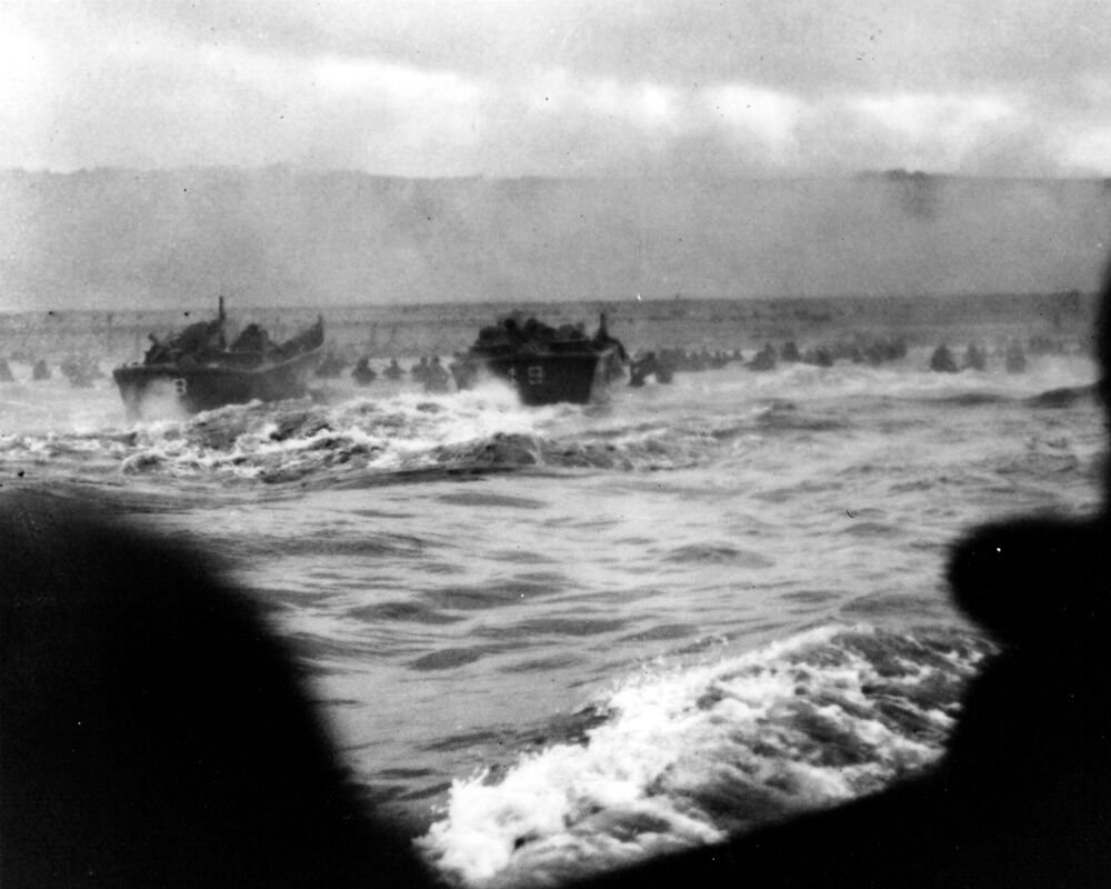
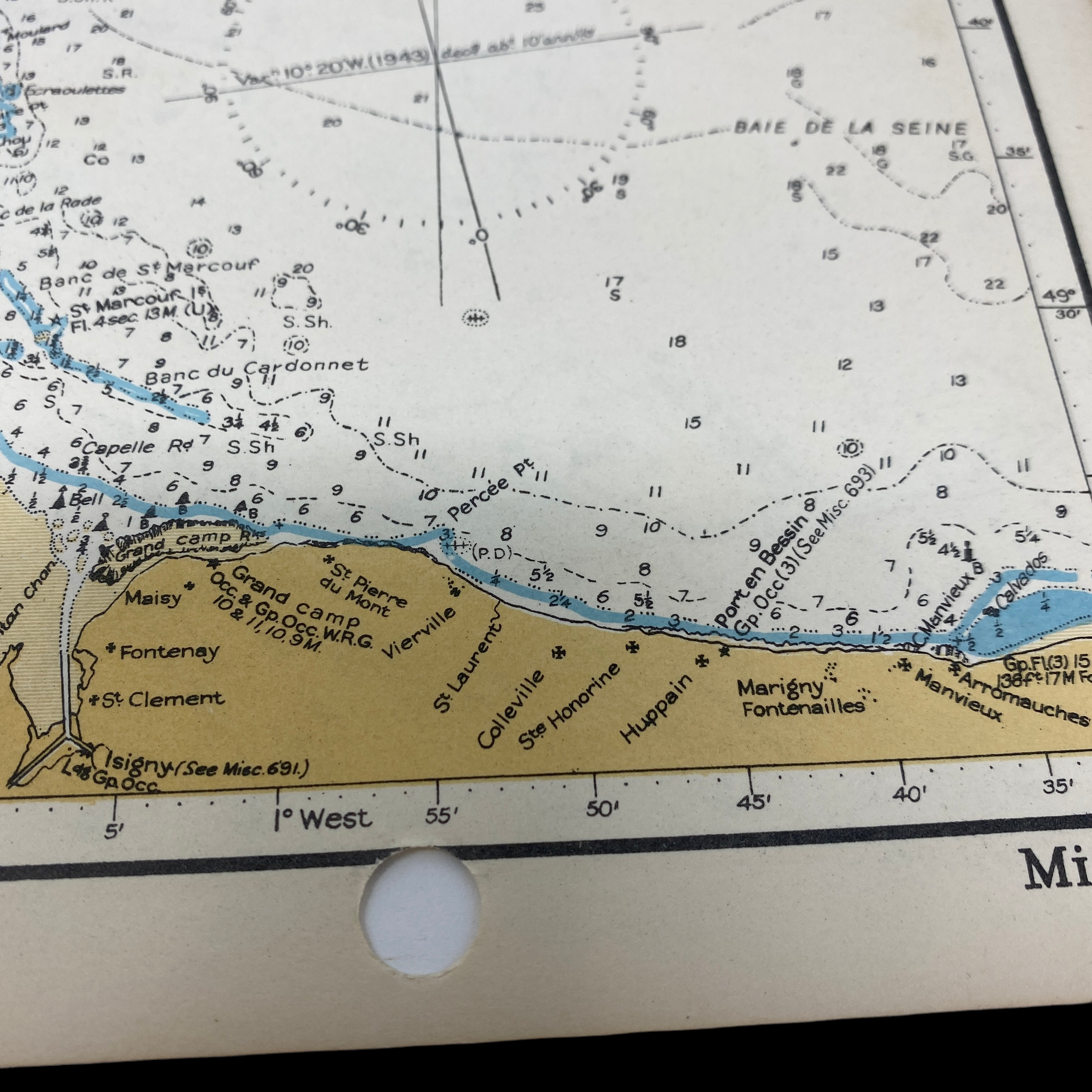
This original, exceptionally rare and museum-grade UTAH, OMAHA, JUNO, GOLD, SWORD Beach D-Day amphibious fathom chart was used for both the planning and carrying out US, Canadian, and British amphibious operations on D-Day (June 6th, 1944).
This fathom map would have been used for the direct navigation onto the beachheads by the LCVP (Landing Craft Vehicle & Personal Higgins), LCI (Landing Craft Infantry), LCM (Landing Craft Medium), and LST (Landing Ship Tank).
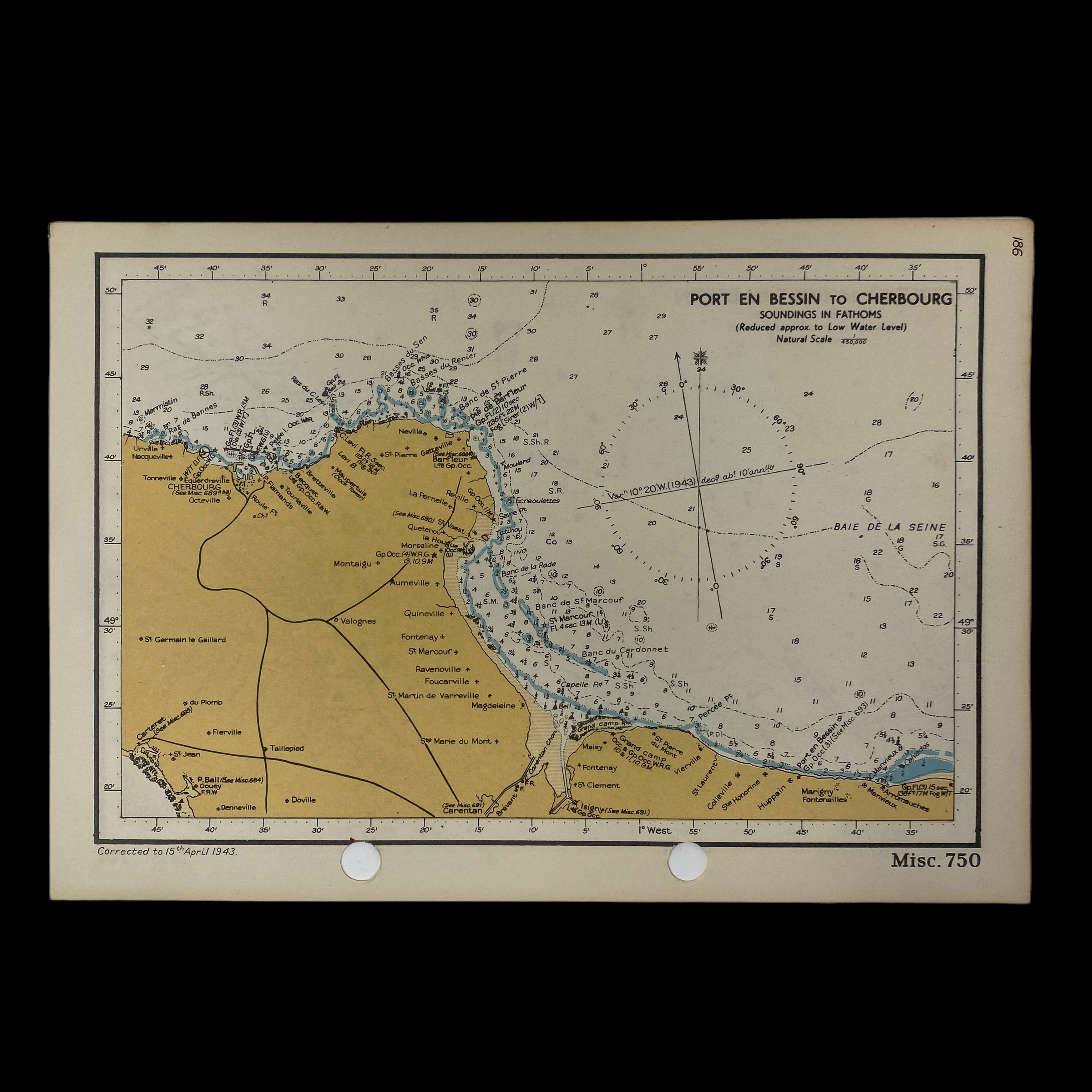
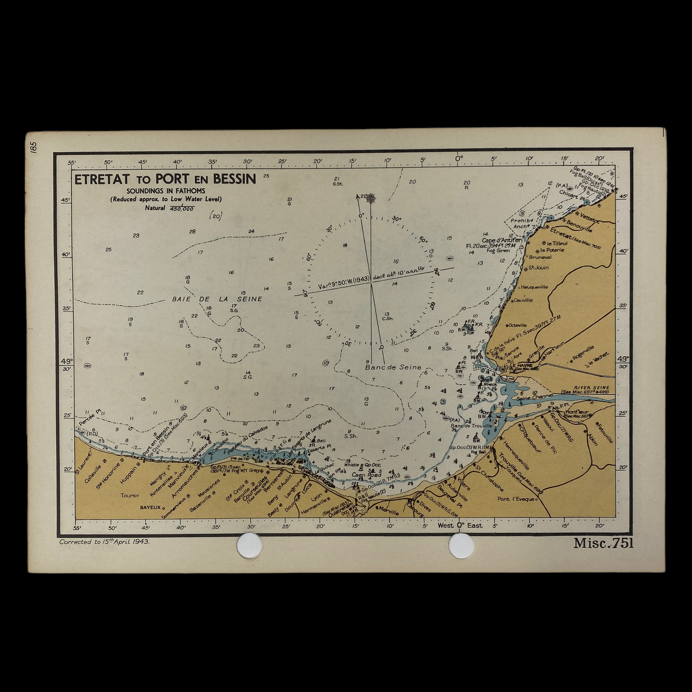
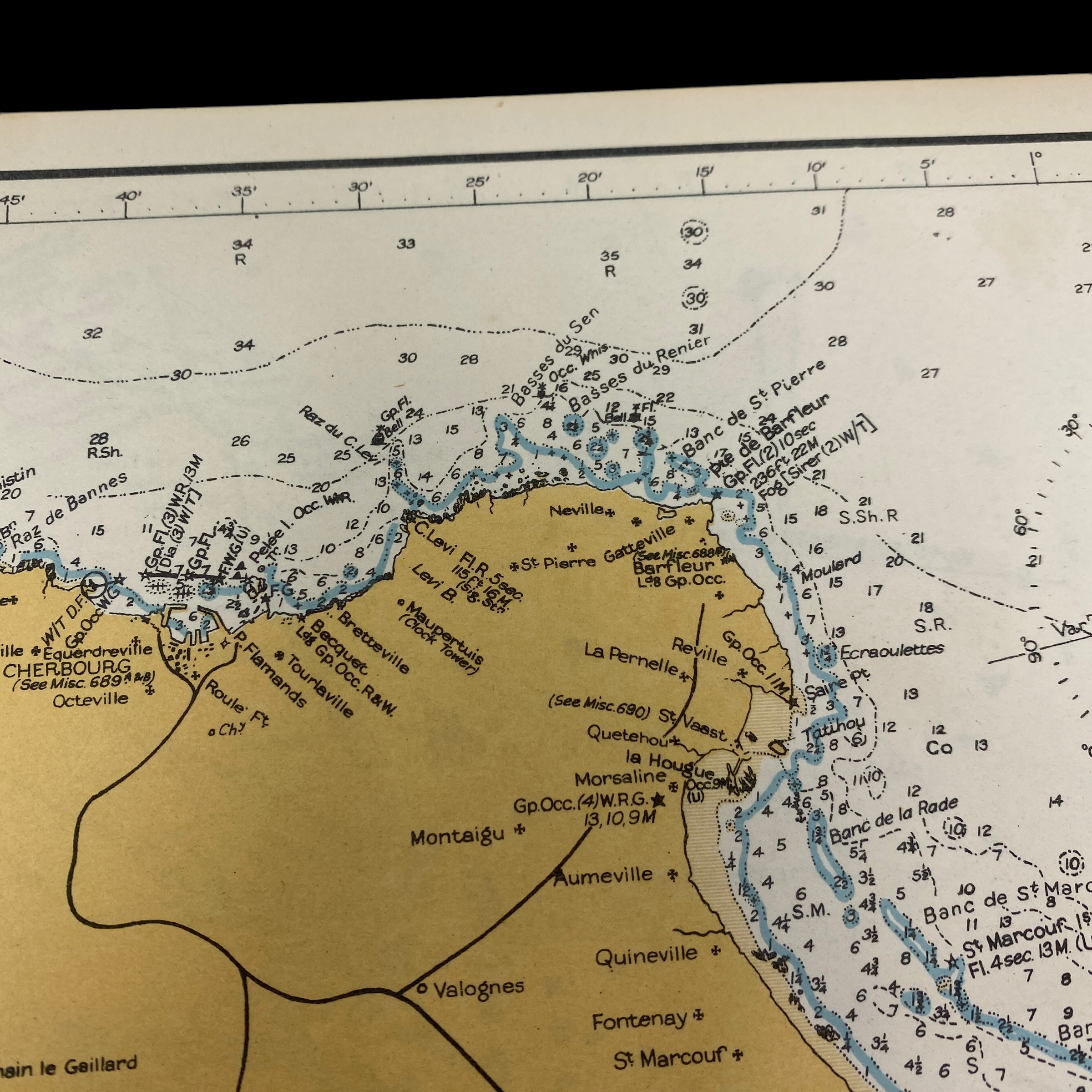
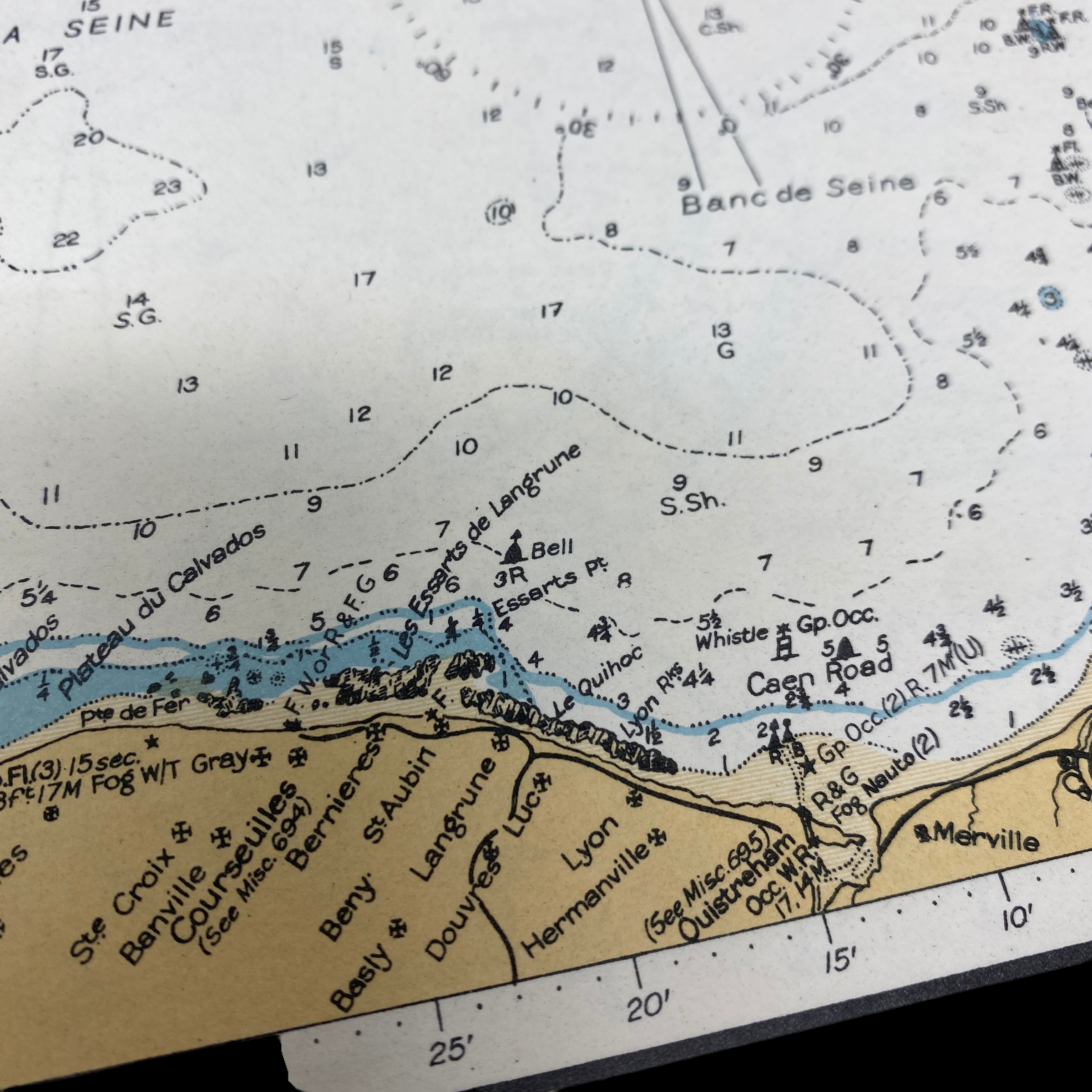
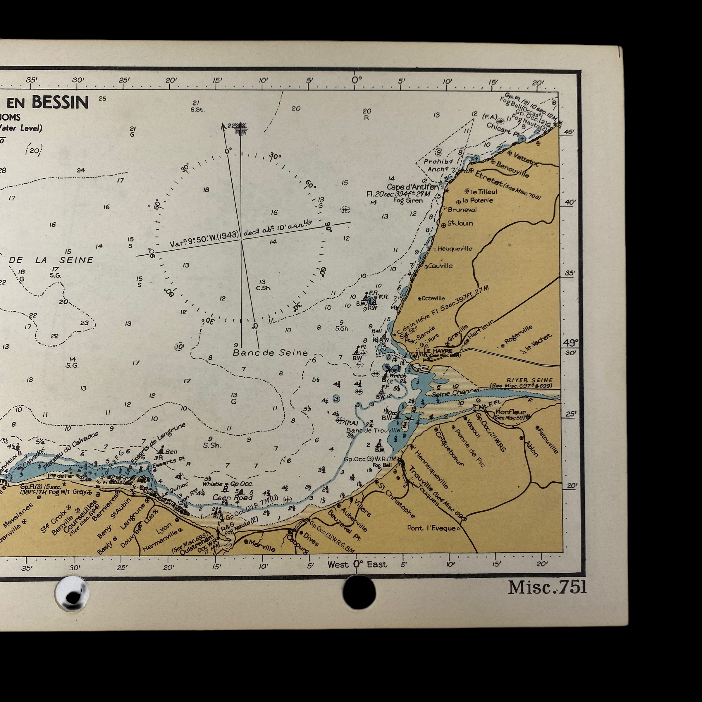
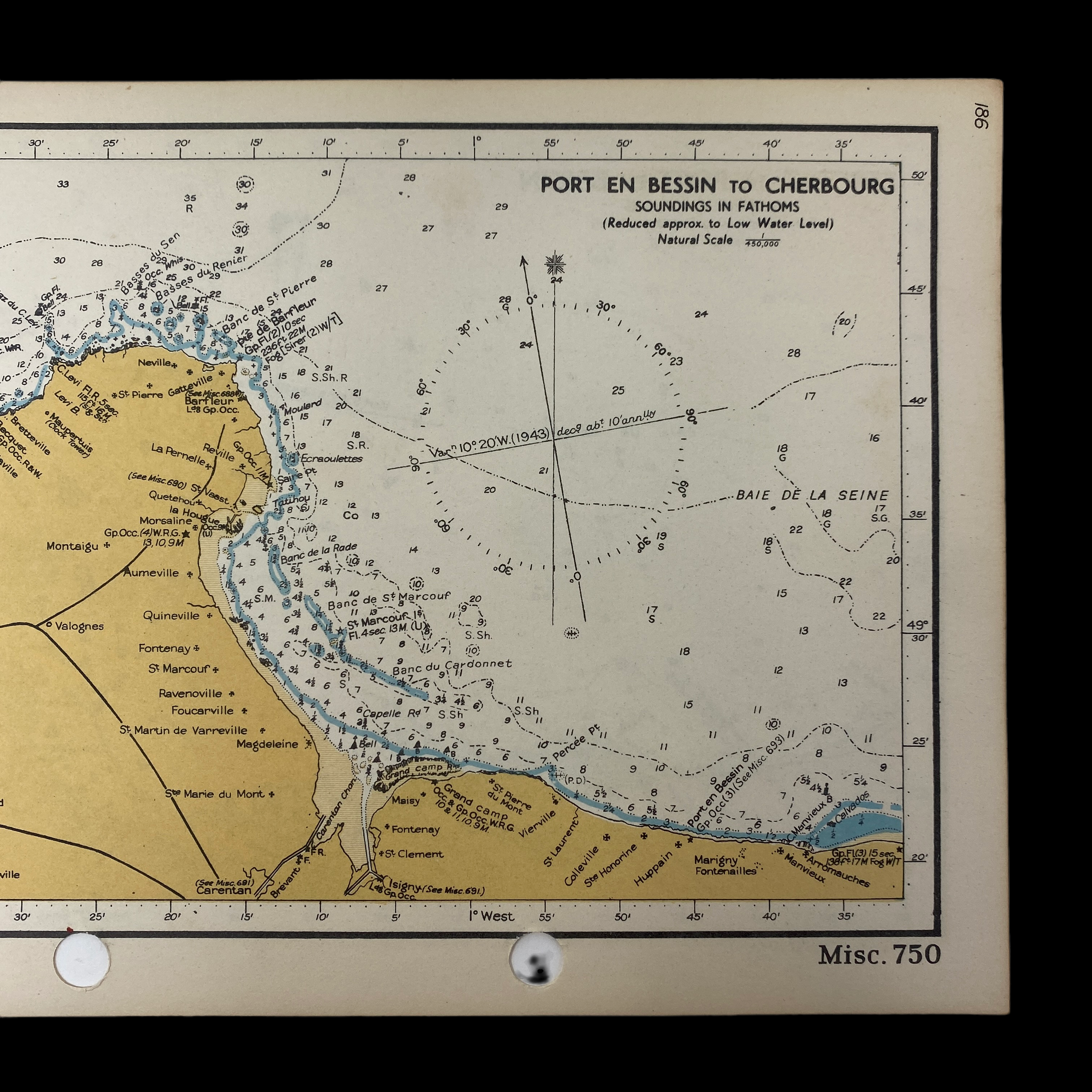
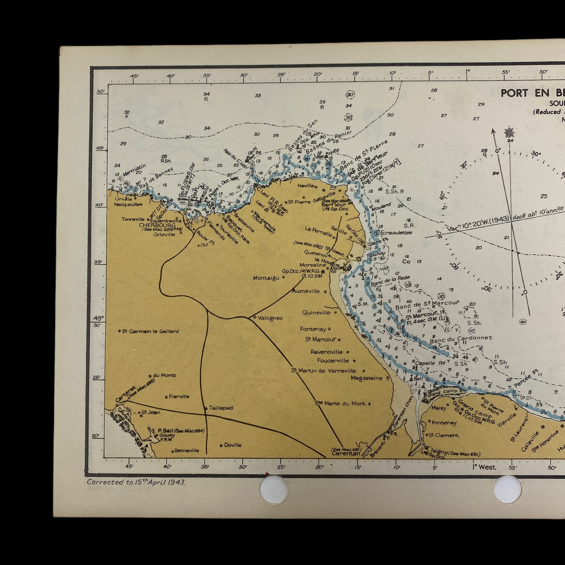
On the front side is shown the very detailed fathom and navigation markers for Utah and Omaha Beach. On the reverse side this Normandy fathom chart shows the other three designated D-Day beachhead of JUNO, GOLD, and SWORD. The fathom marking were vital for the navigation of the various sizes of small, medium, and large ships nagivating during the invasion.
This amphibious beachhead chart vividly illustrates the intensive planning and operational accuracy that was behind Operation Neptune, the largest amphibious seaborne invasion in history. This particular amphibious chart were created under the direction of Vice-Admiral Sir John Edgell. Edgell oversaw all of the mapping projects related to World War II, and paid special attention to the TOP SECRET maps/charts his office prepared for Operation Neptune and Overlord (the larger Allied mission to re-take France).
Their smaller size was intentionally done as they were carried in a waterproof booklet and used a reference guides on the battlefields/landing areas as it even has an area for a compass to be placed for even more accurate navigation to the beach.This map shows the ENTIRE Utah, Omaha, Juno, Gold, and Sword Beach areas and includes all of the specified designated landing area. What makes this map so unique is that it shows very evident use and a ‘salty’ appearance. Other than showing very clear use, this map is in near mint condition given its age and the intensive battle/invasion it was used in.