EXTREMELY RARE! WWII Operation Overlord D-Day Planning April 1944 SECRET Preparation & Planning Normandy Aerial Reconnaissance Mission Photographs


EXTREMELY RARE! WWII Operation Overlord D-Day Planning April 1944 SECRET Preparation & Planning Normandy Aerial Reconnaissance Mission Photographs
Comes with hand-signed C.O.A.
Collection Total: 17
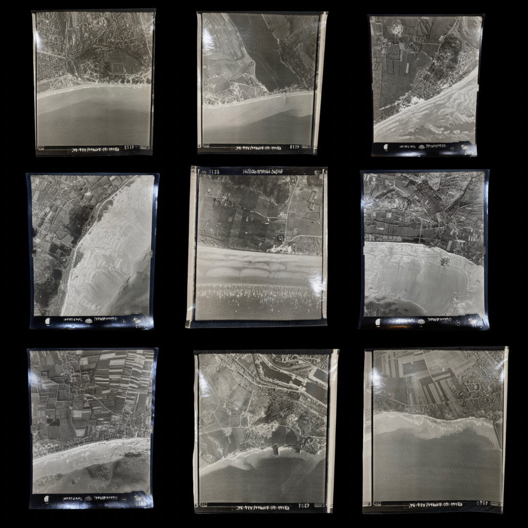
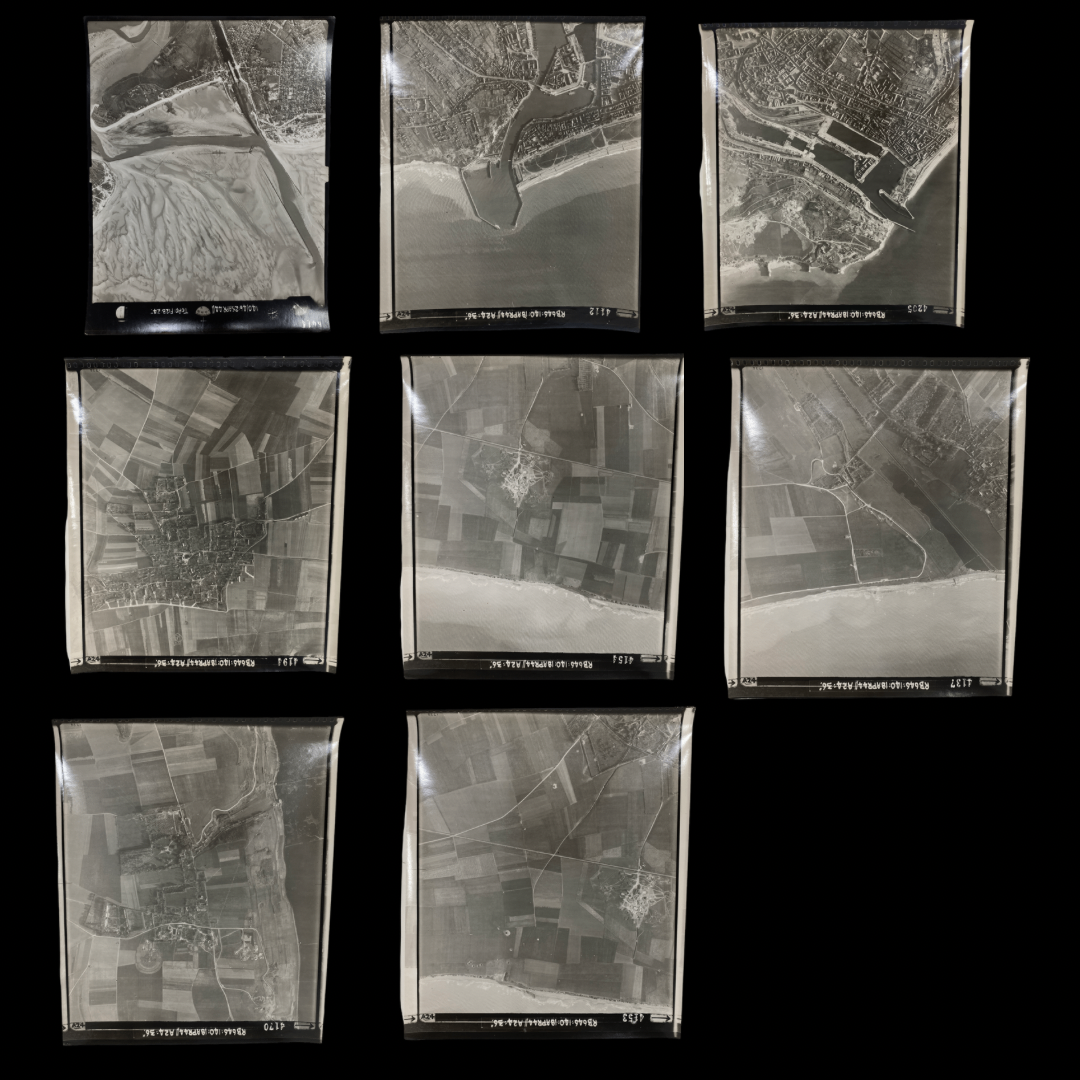
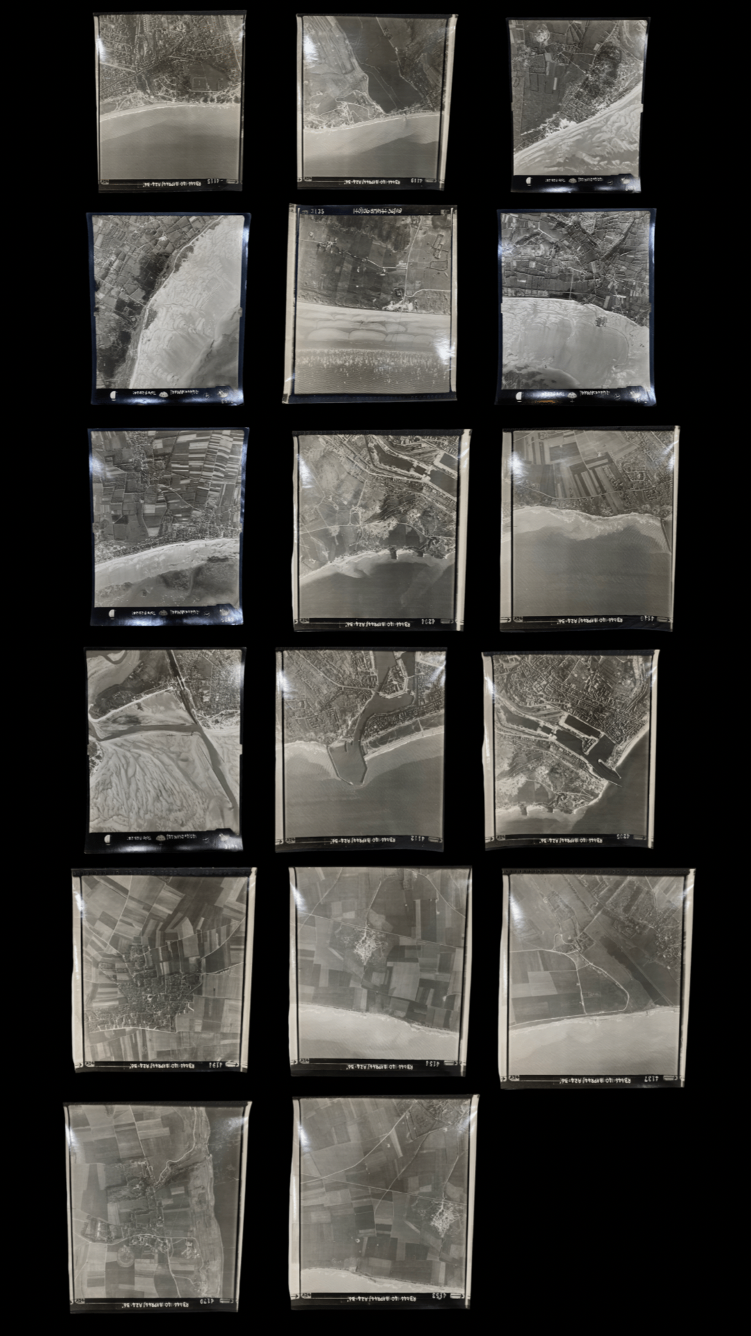
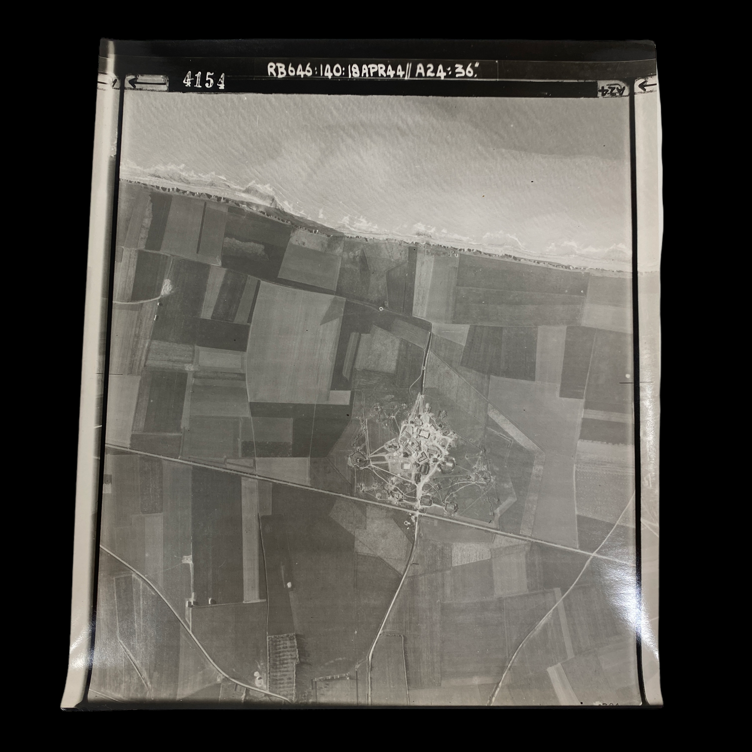
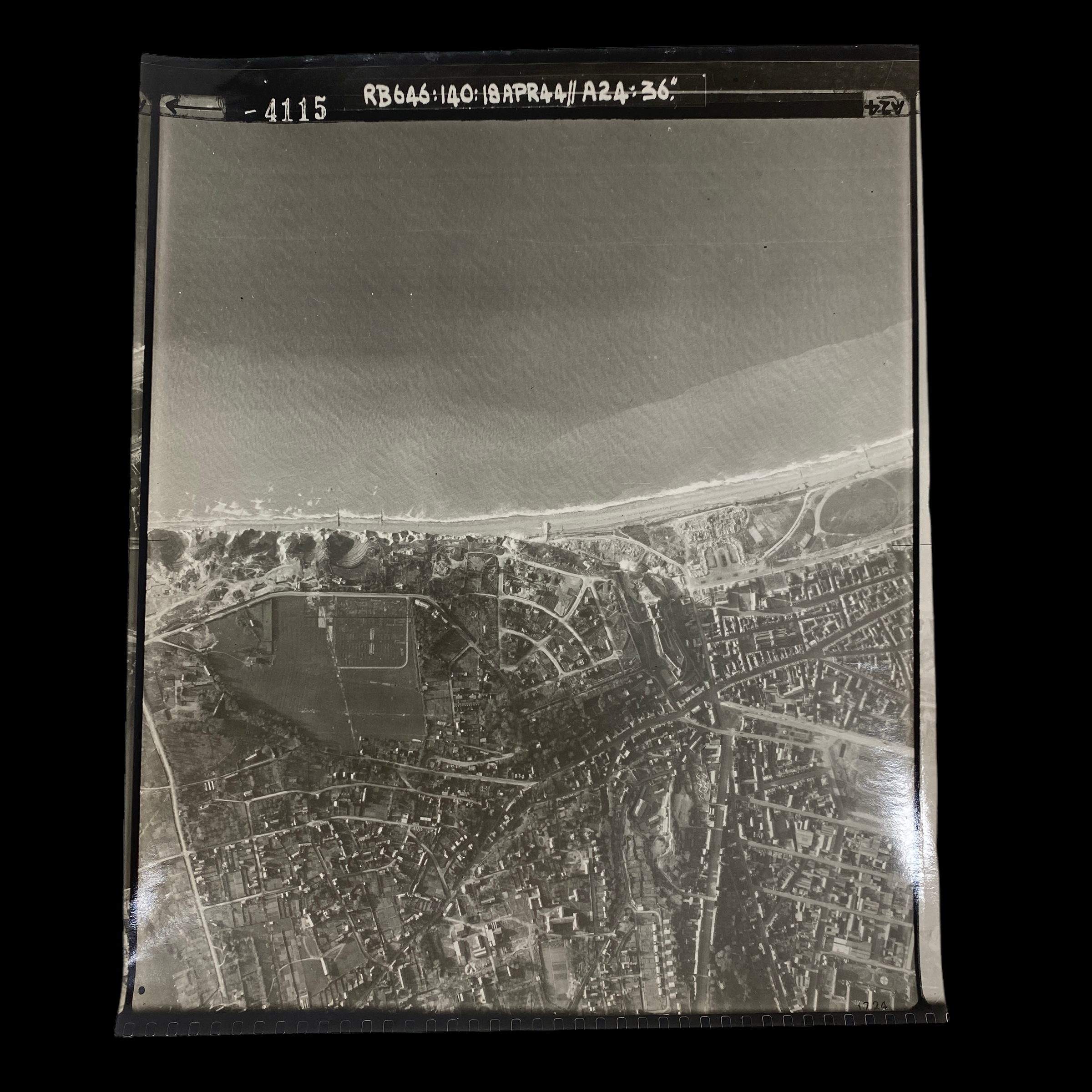
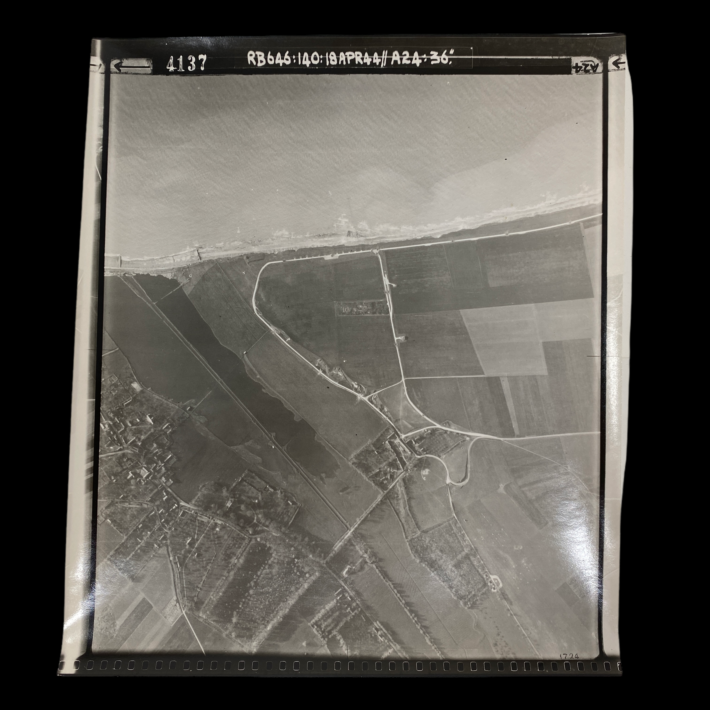
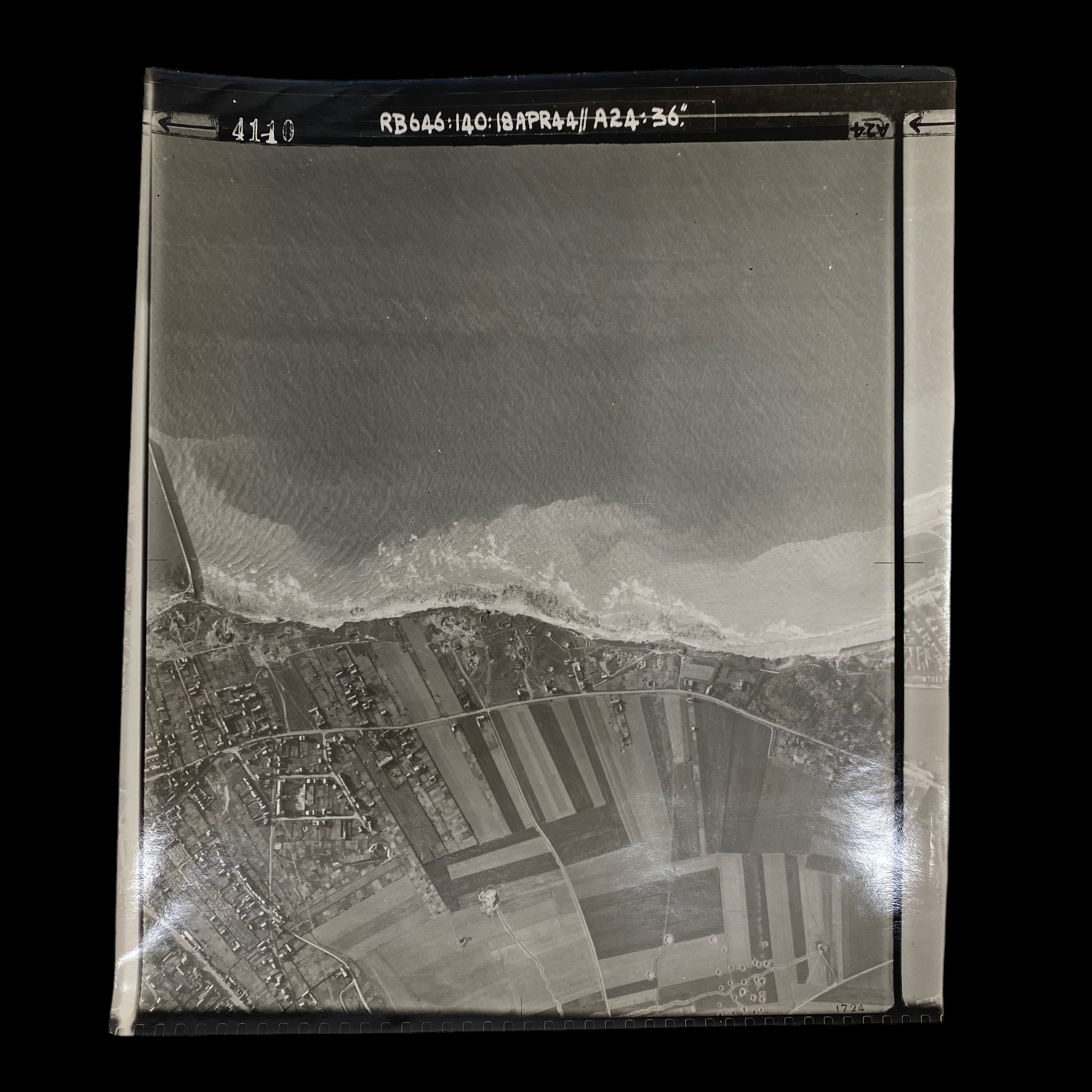
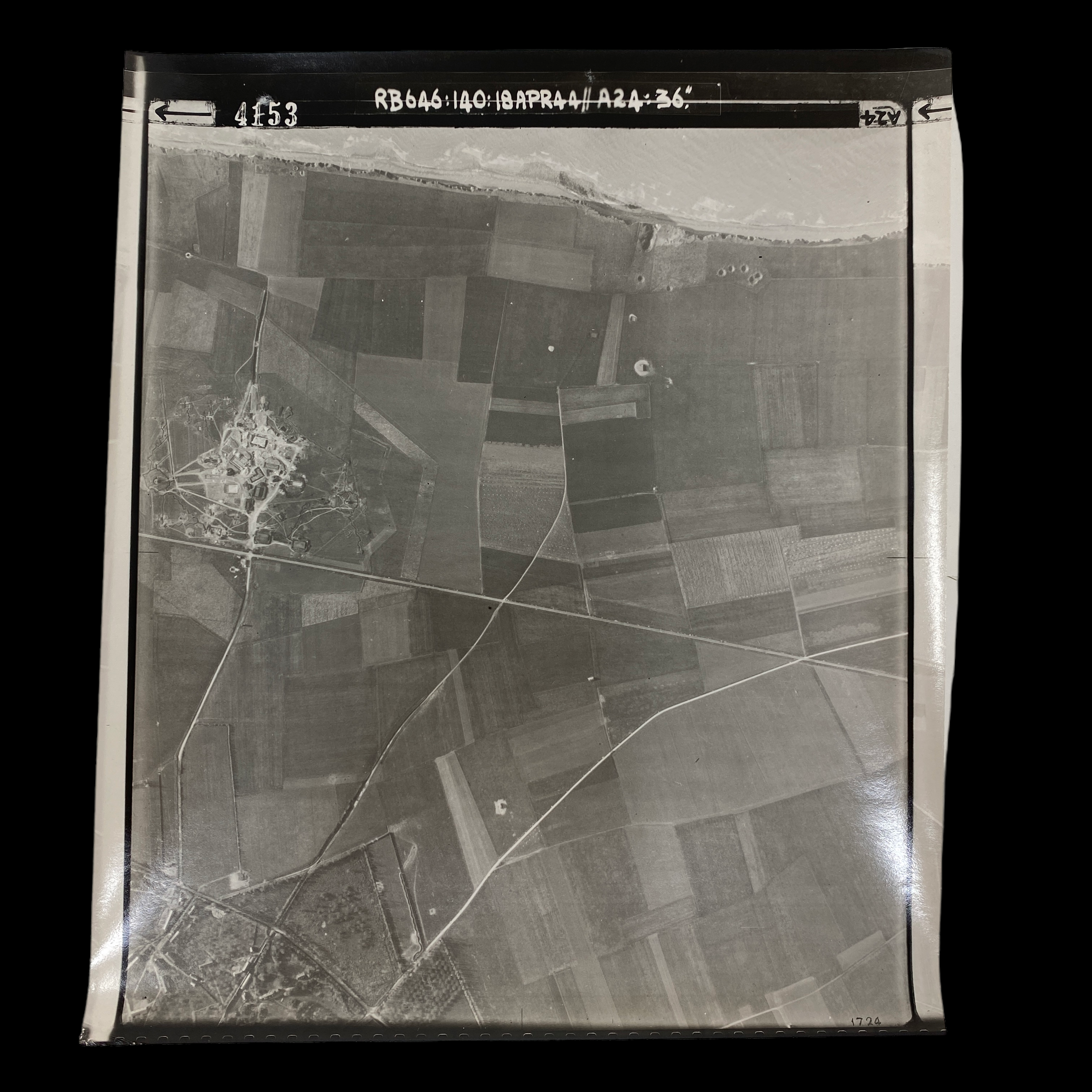
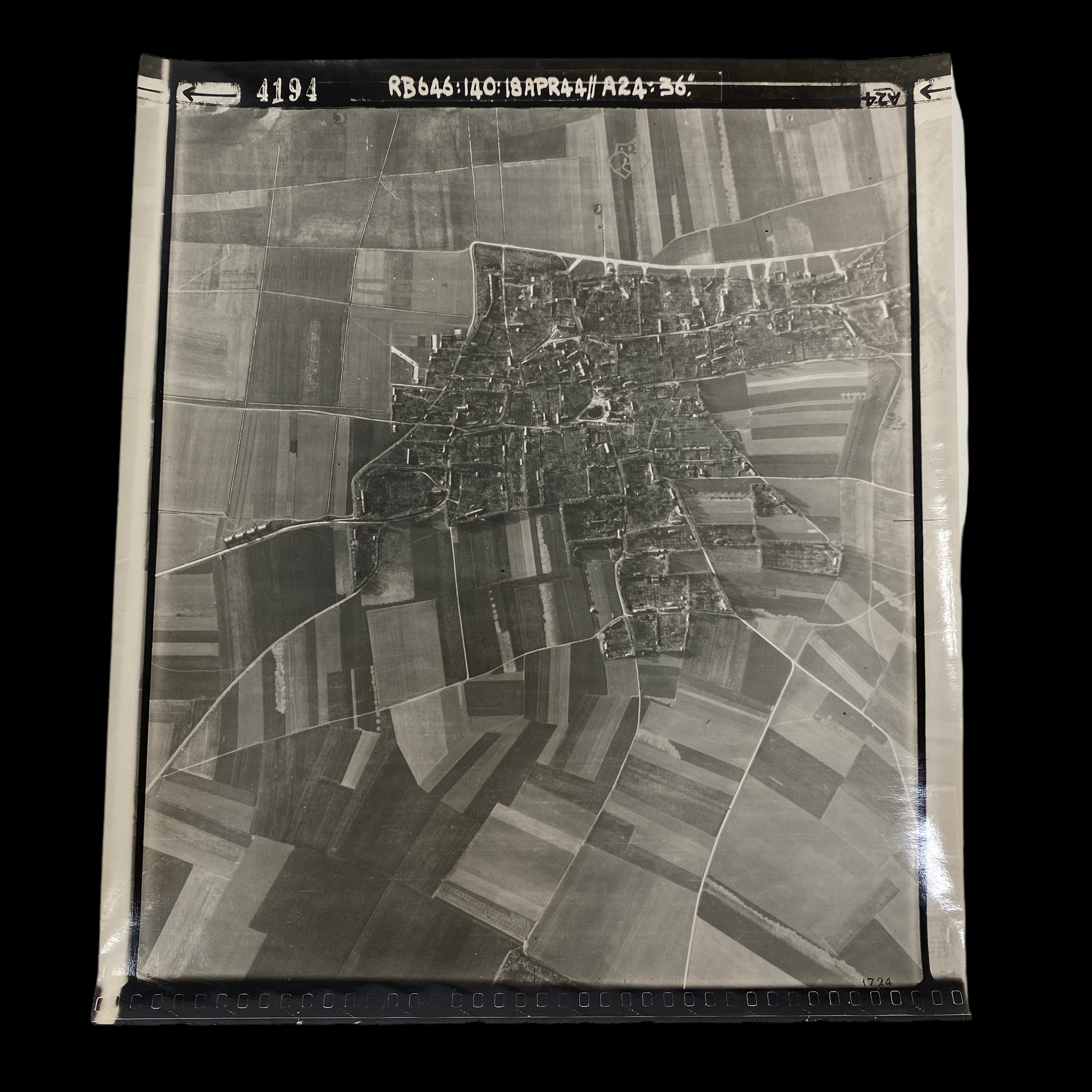
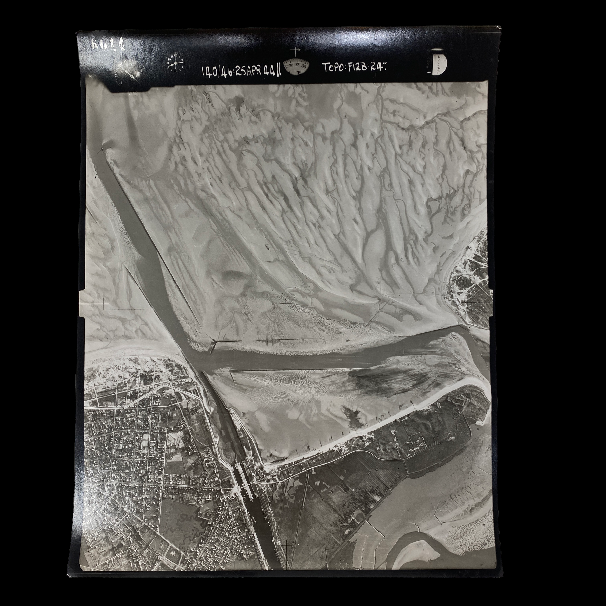
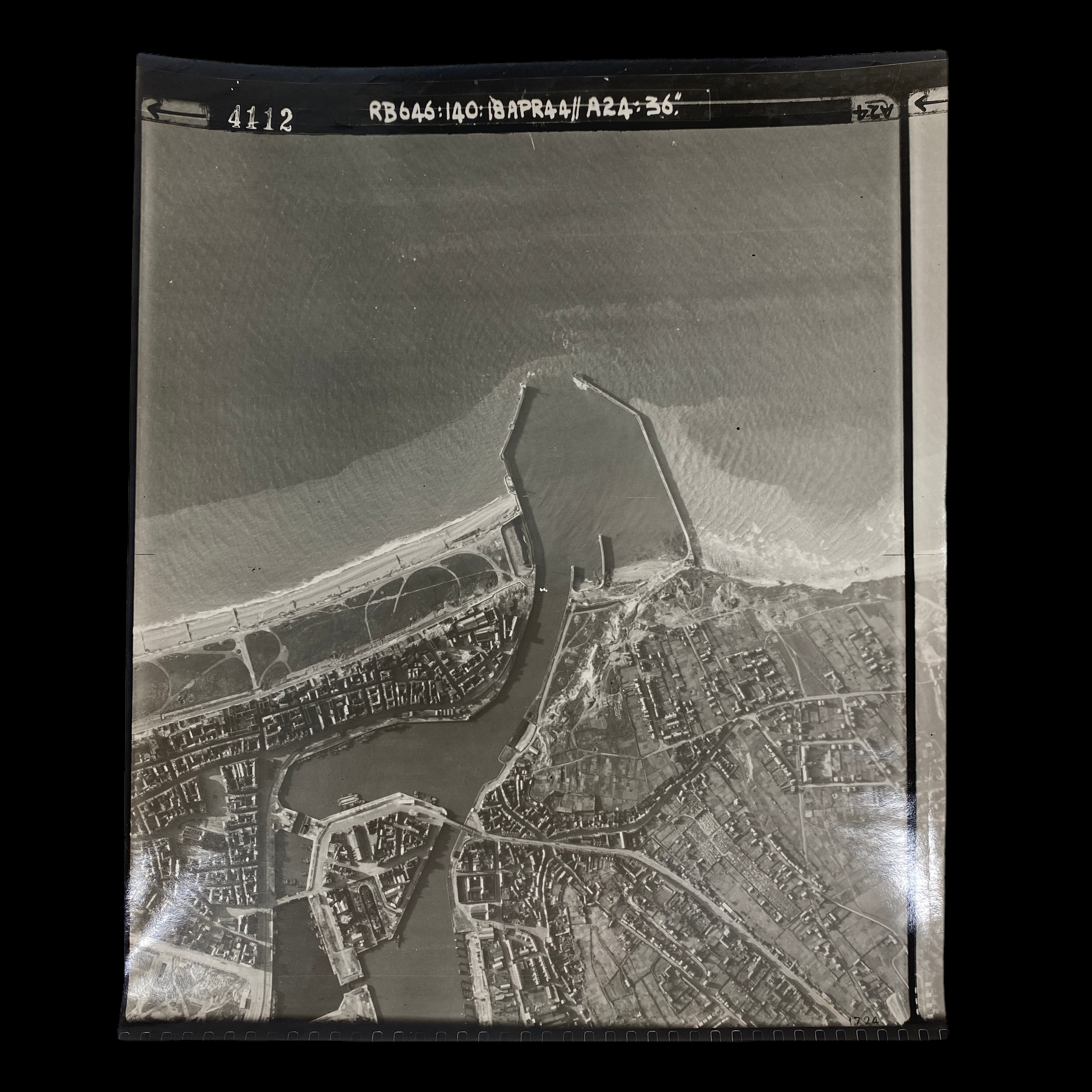
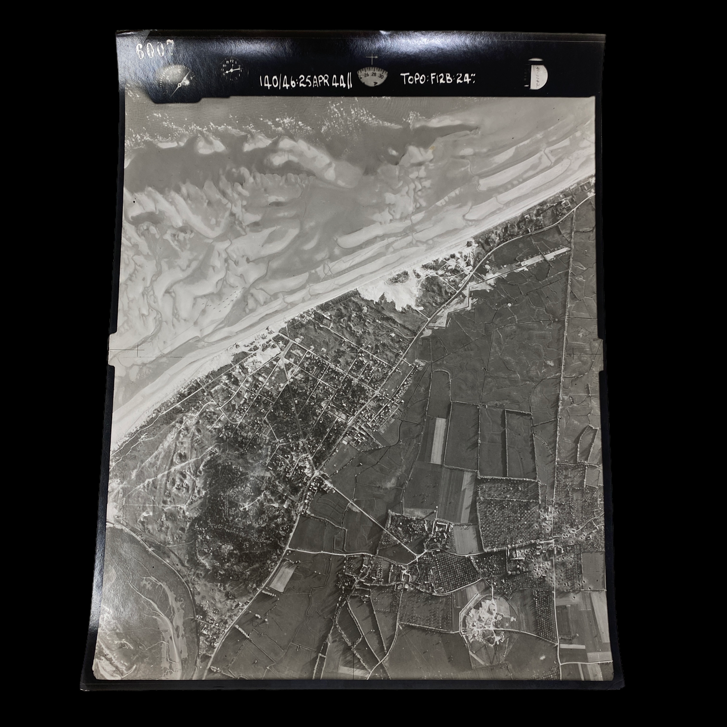
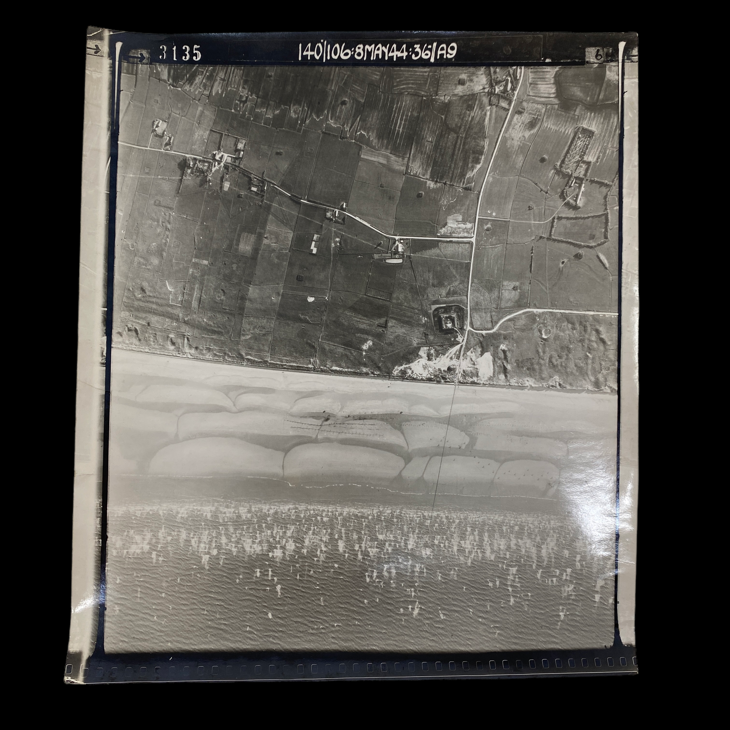
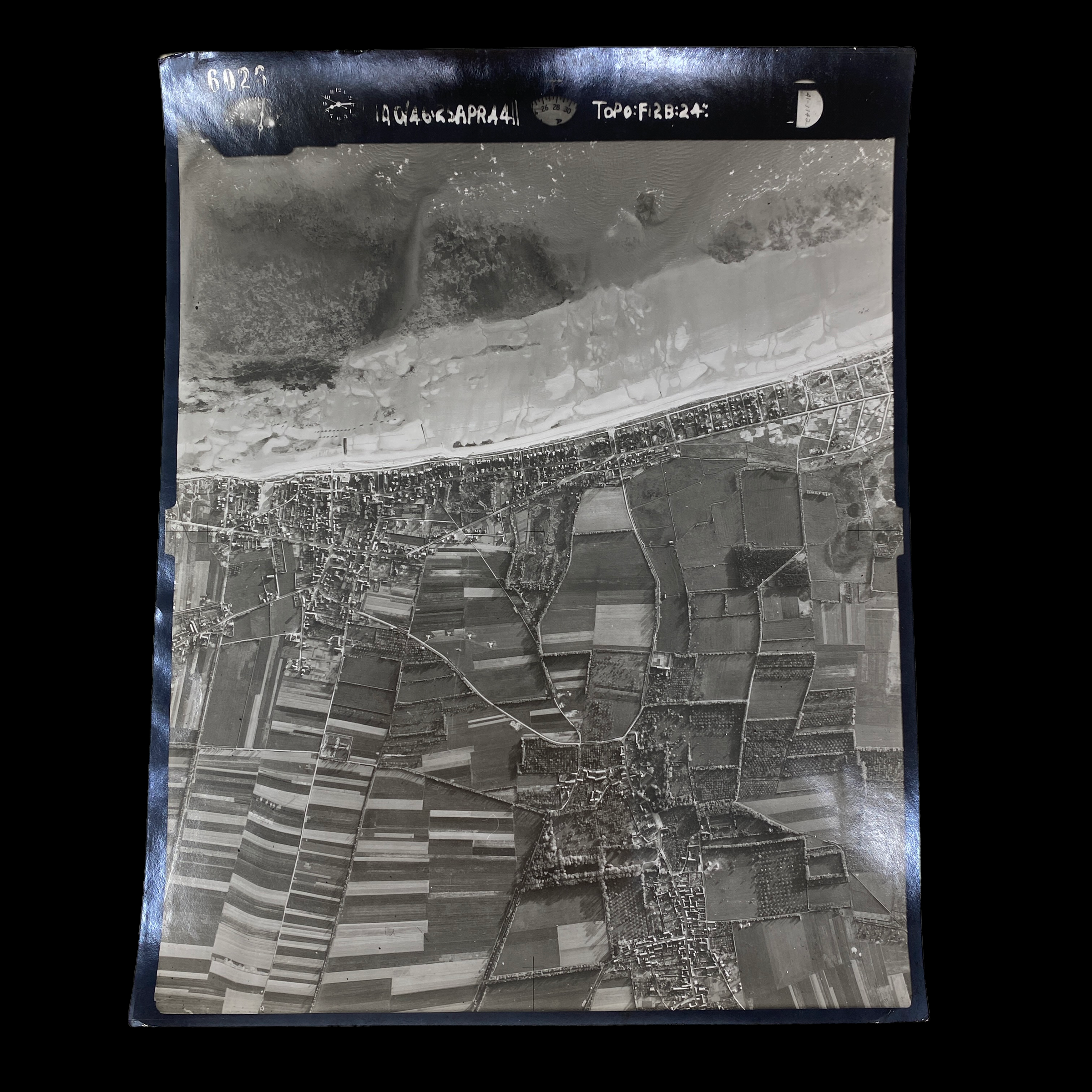
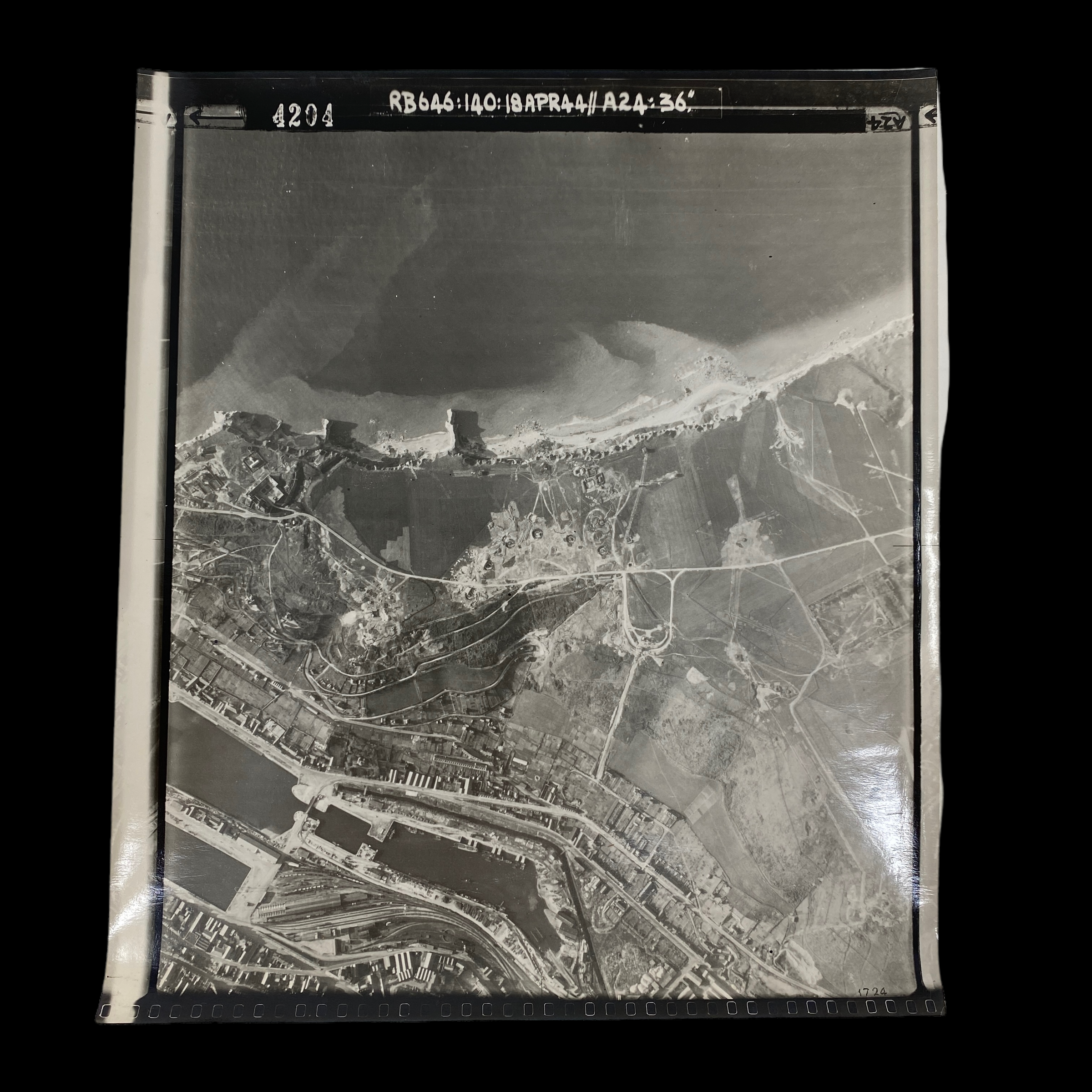
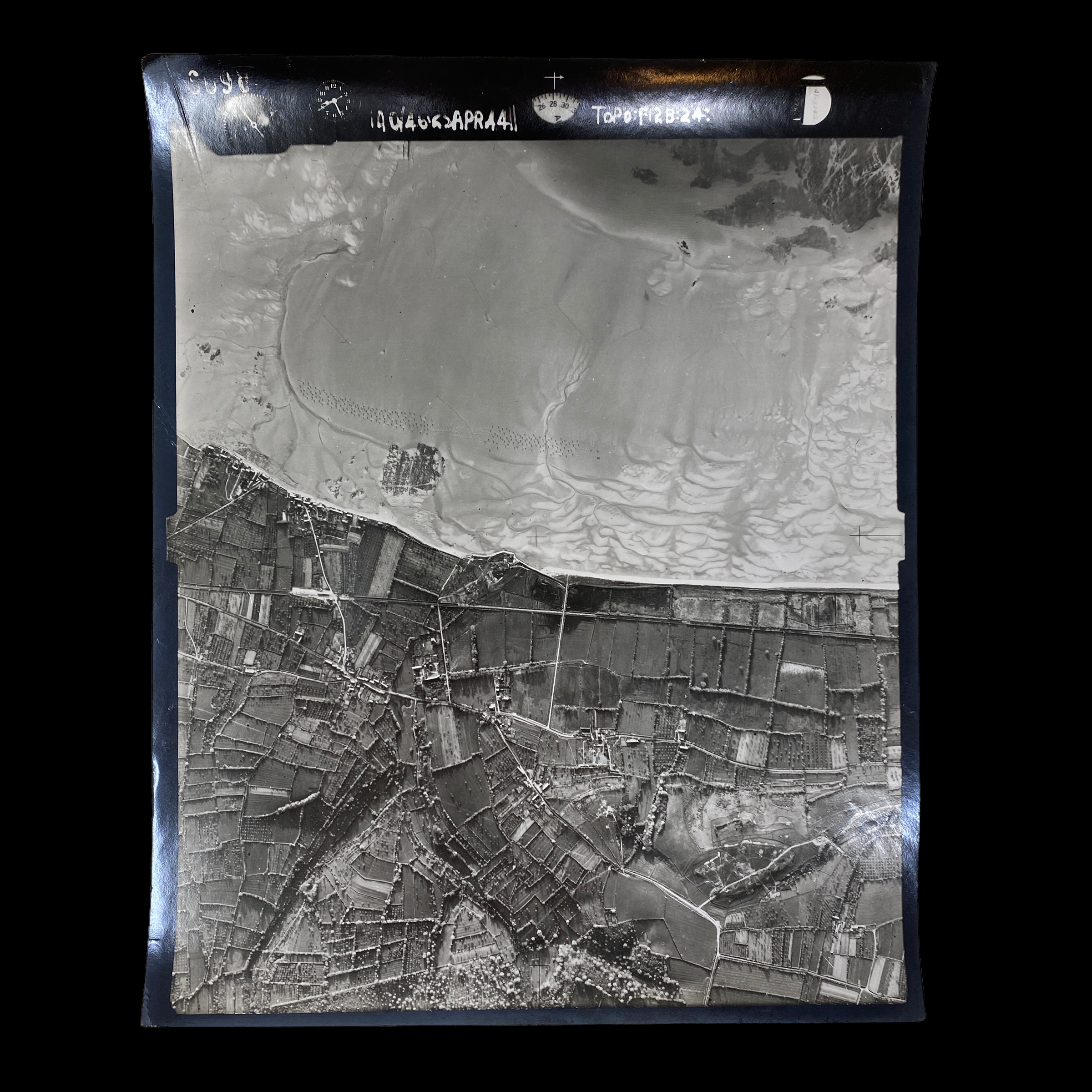
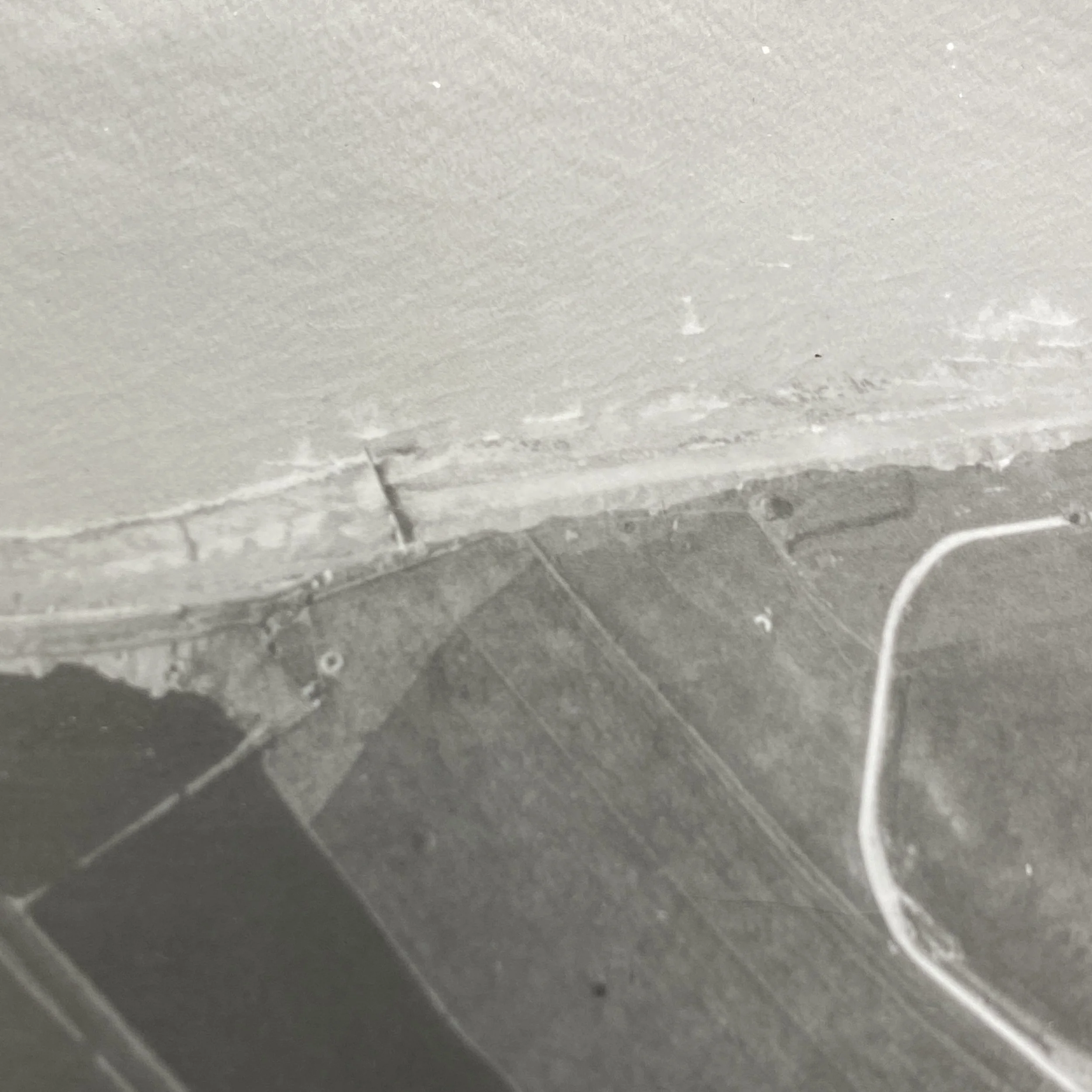
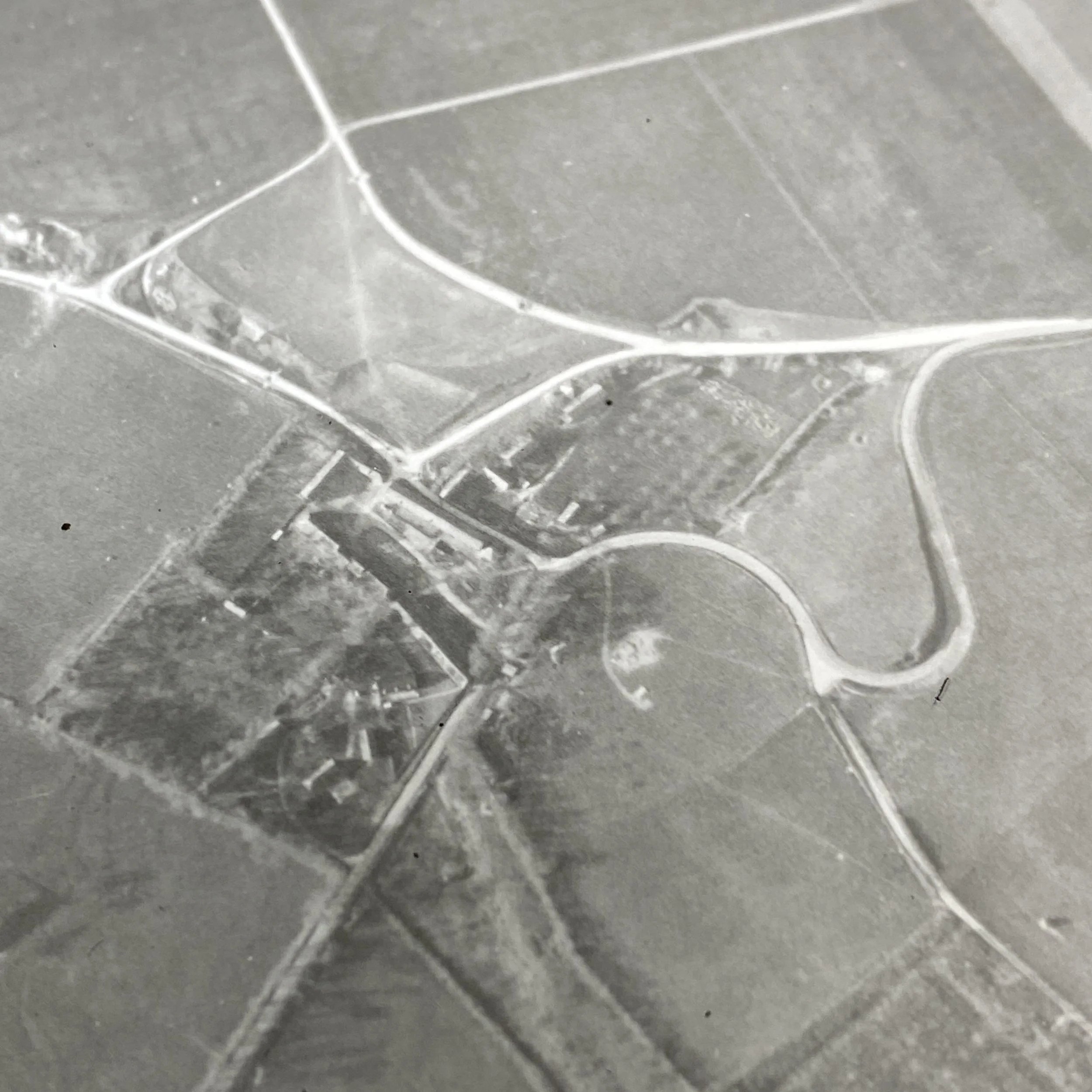
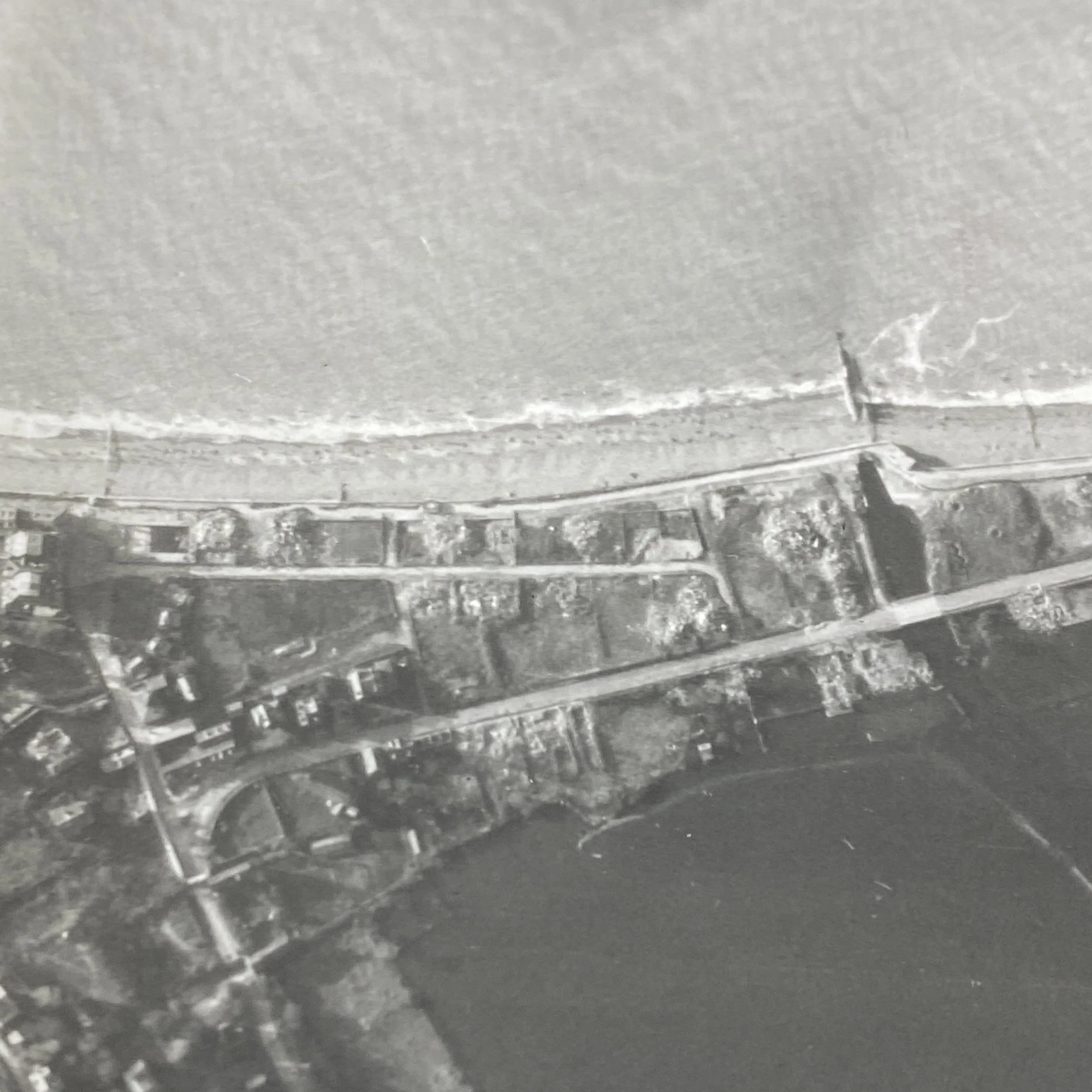
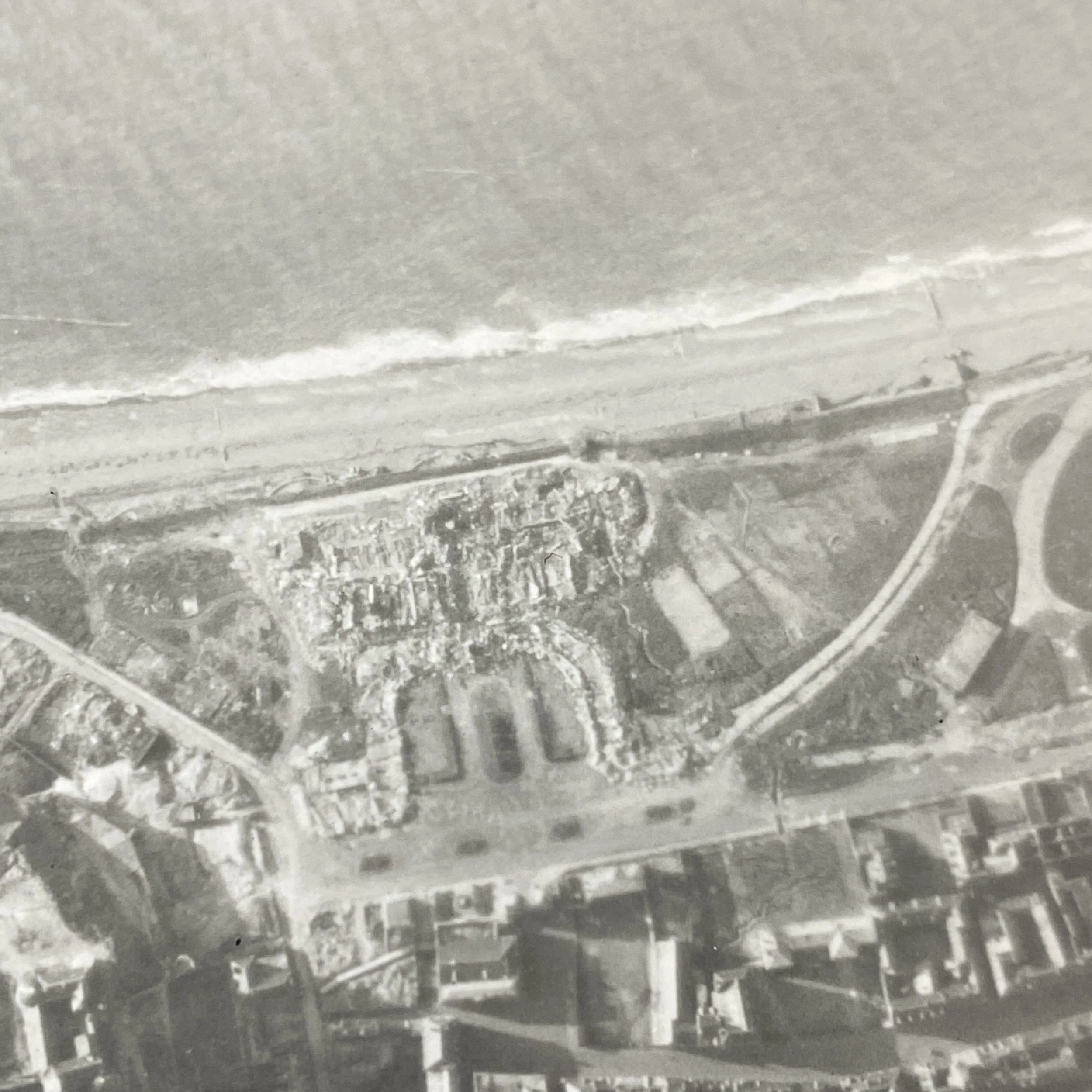
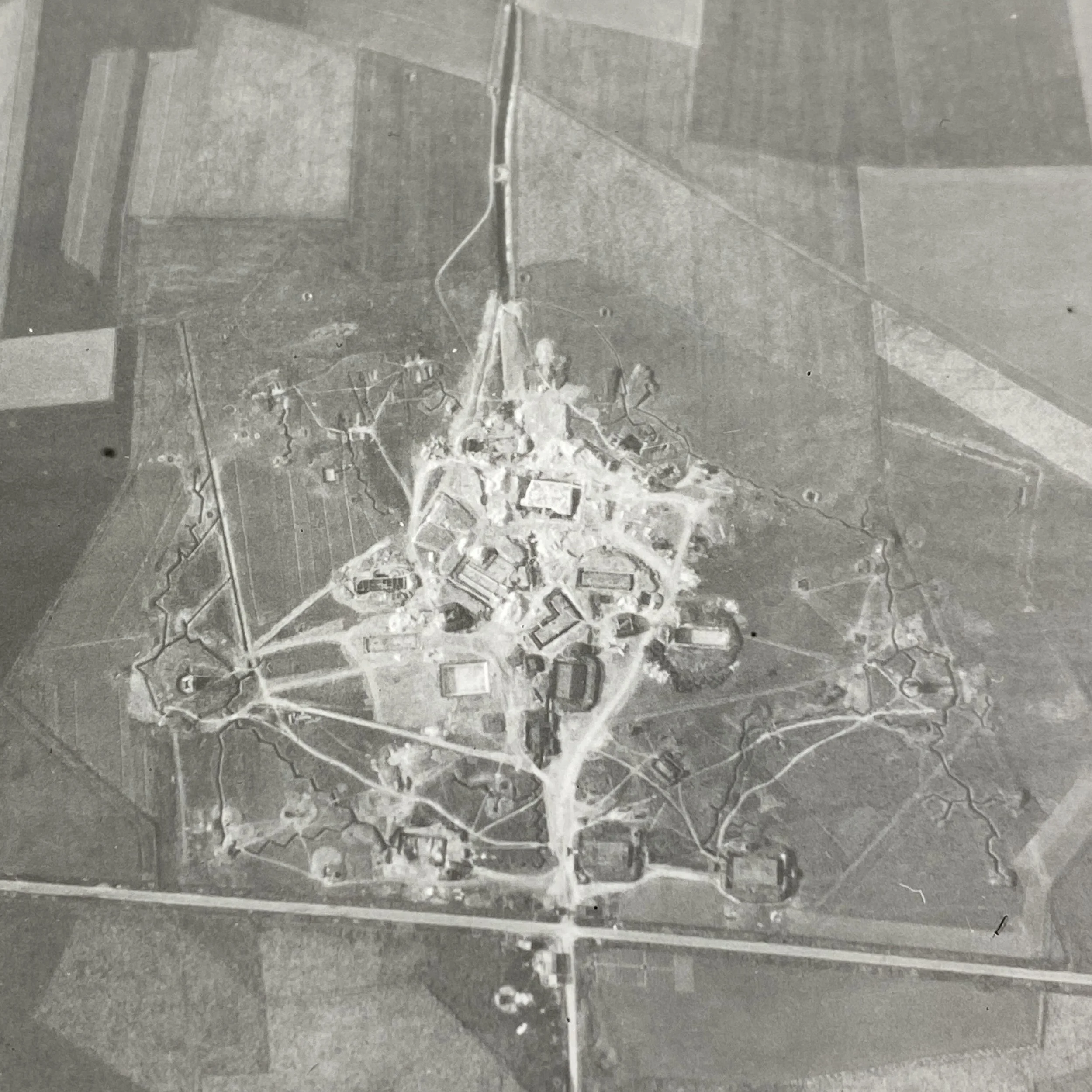
This extremely rare and museum-grade collection of 1944 D-Day Normandy, France coastal beachhead and German fortification aerial reconnaissance mission photographs were taken just 2 months prior to the June 6th, 1944 D-Day landings.
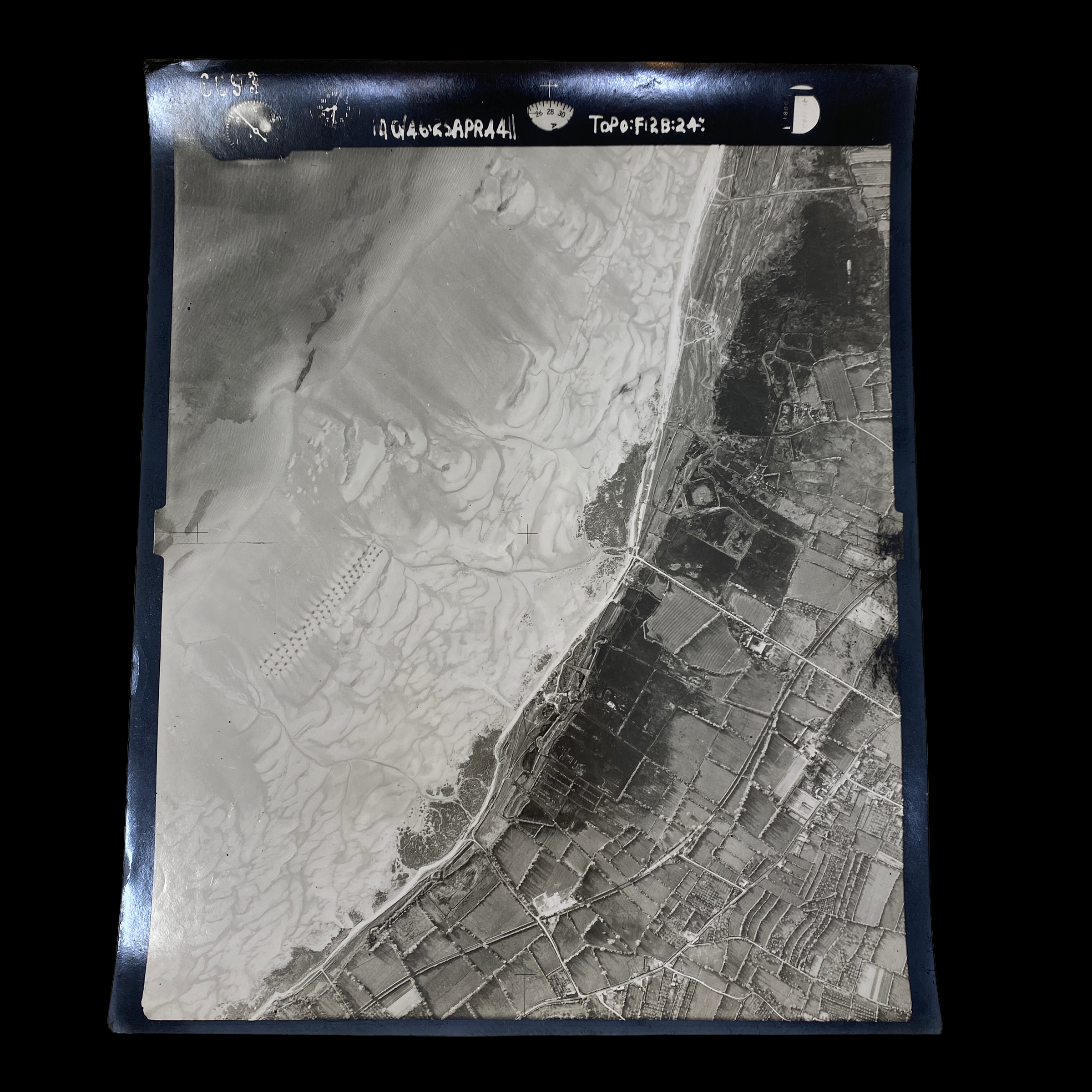
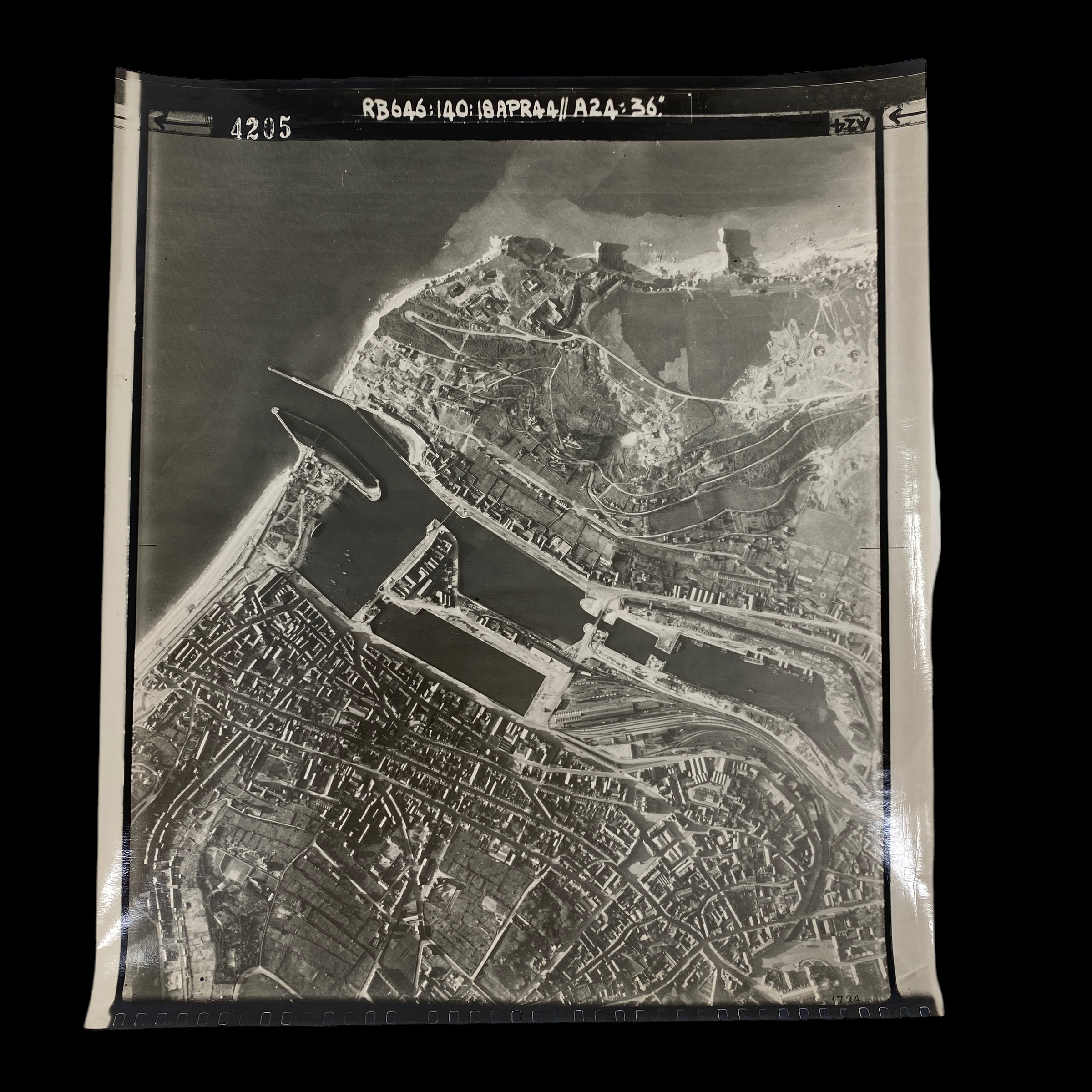
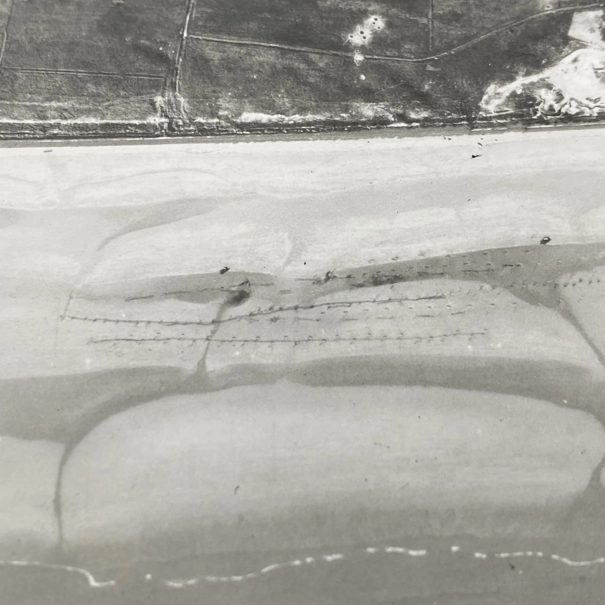
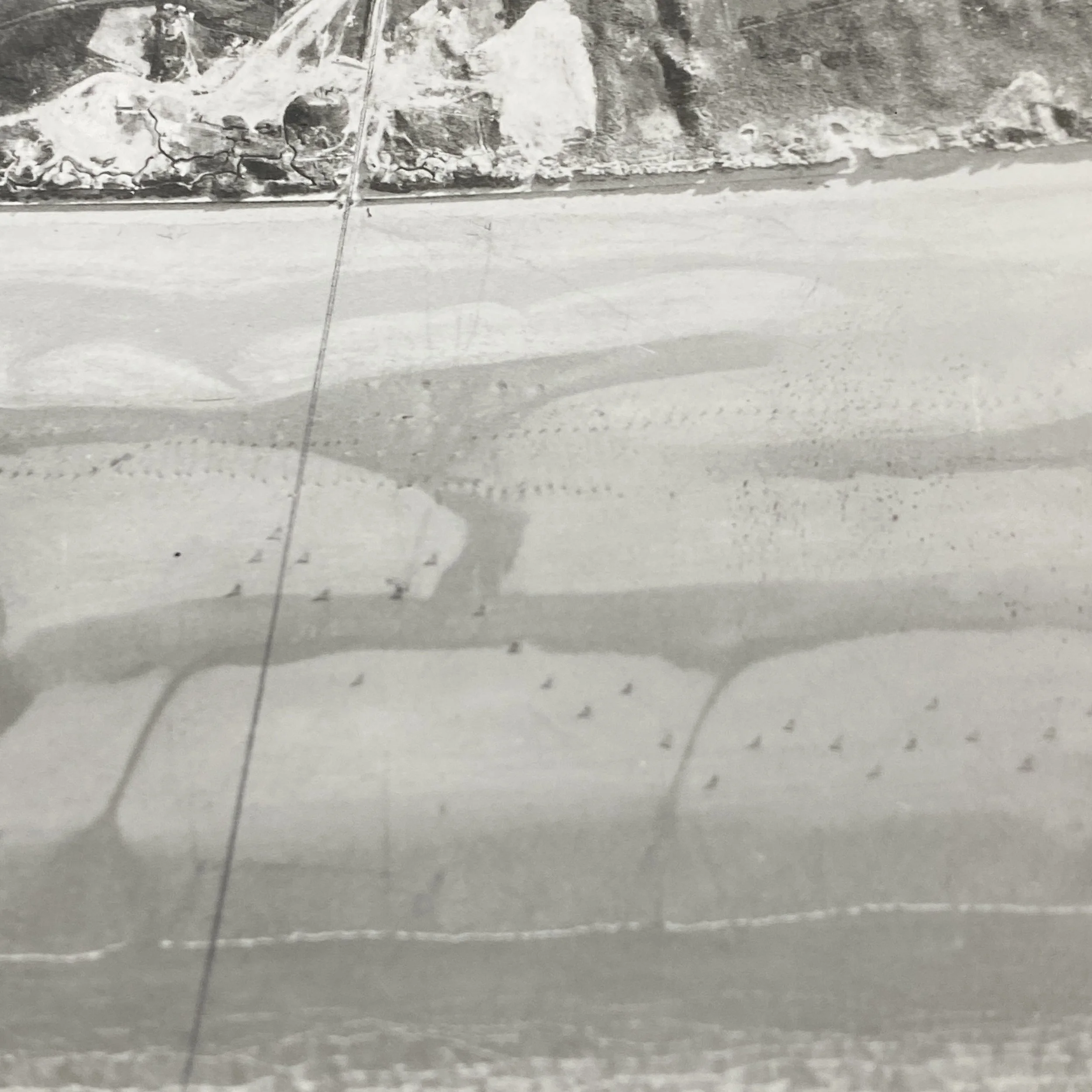
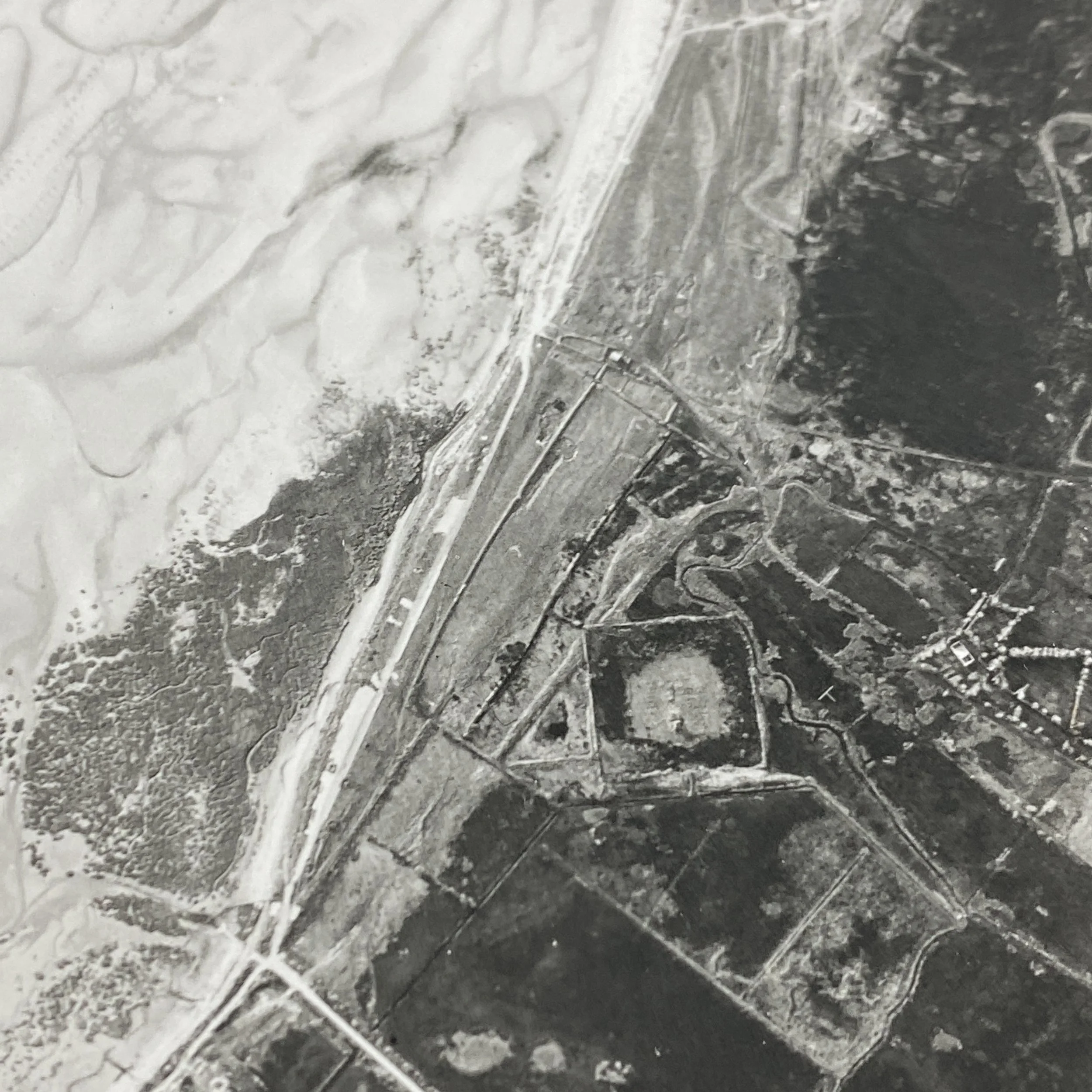
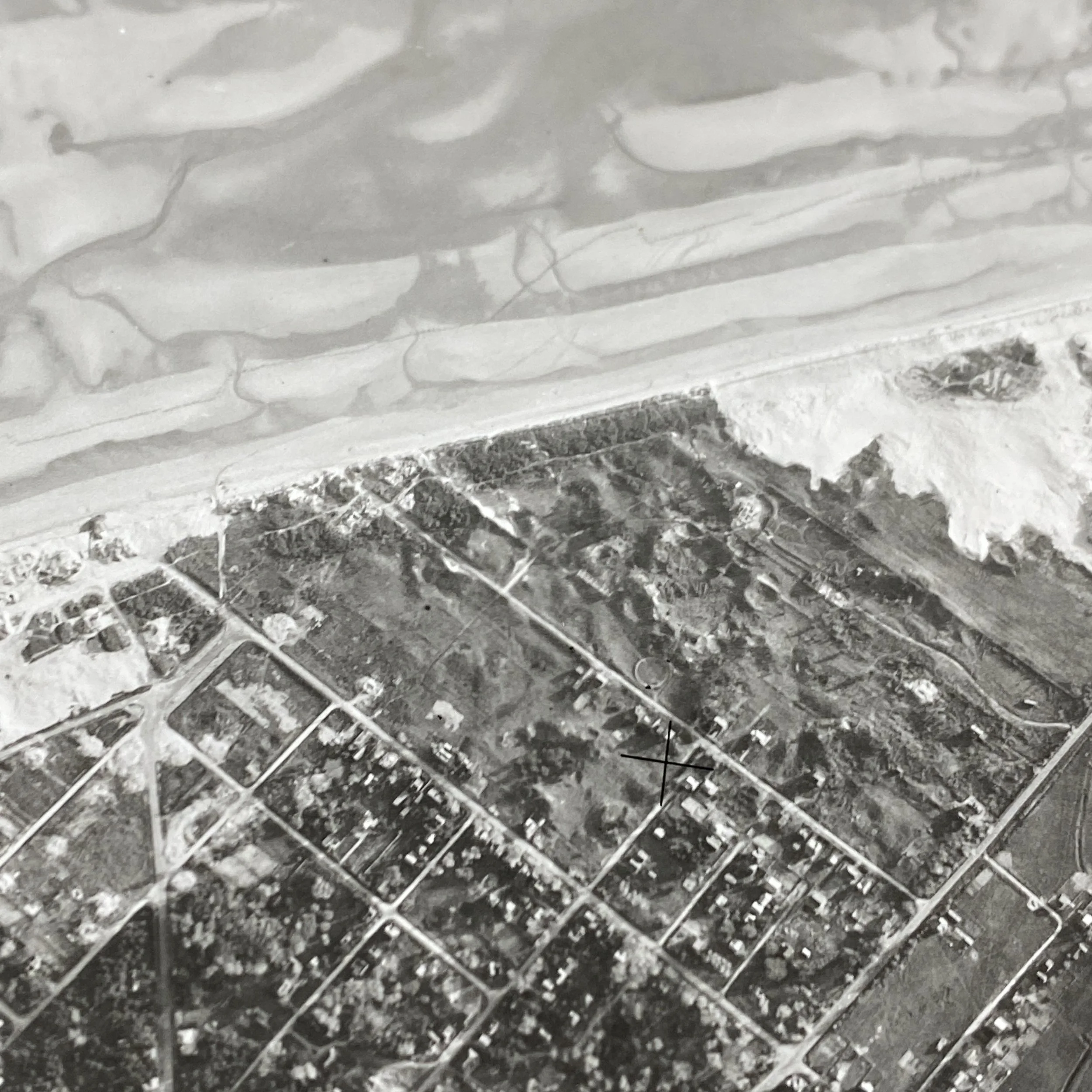
The vast and complex job of planning for the D-Day landings depended heavily on aerial photography. Normandy was chosen as the invasion site, however, using these aerail photographs photo interpreters were able to identify rows of obstacles placed along the beaches by the occupiers to impede an amphibious landing. Many strategic and geographical considerations were evaluated. Using these aerial reconnaissance photographs, a joint effort by both U.S. and R.A.F. reconnaissance squadrons was underway to compile the most photographic aerial intelligence.
Among this information was the nature of the beaches, moon phases and tidal range, sites of airfields, sailing distances from channel harbors, and the selections of ports to be captured. Another major characteristic to research was the strength of German defenses at certain vital points. A dominant German defense along France’s beaches was the Atlantic Wall. The Atlantic Wall was a series of concrete fortifications that Hitler had ordered to be built along the coast. Although the wall was incomplete in 1944, it was still a fierce defensive structure. Normandy was favorable when considering the Atlantic Wall because it had many weak sections.
Another geographical reason for choosing Normandy was its location in proximity to the Isle of Wight. The Isle of Wight had naval ports and railways in southern England that were away from major civilian populations. This allowed an easier route for the movement of troops and supplies while planning for the invasion. The waterways in the area also provided suitable cover to hide the invasion vessels. The beaches of Normandy were geographically close to the port of Cherbourg as well. This city was deemed essential to capturing supply routes that could help further the invasion once the beaches were overtaken.
After the geographical site was decided, the date of the invasion was the next major decision to be made. The date would be based on moon phases and the weather. The most skilled meteorologists were chosen to help decide the appropriate invasion date. The prevalent issue would be the limitations of long-range forecasting, which first came into play during the North African landings in 1942. The Allied army wanted a high tide to shorten the amount of exposed sand as the soldiers stormed the beach. The Allied navy wished for the water to be low, so that items, such as mines, could be identified and cleared. The Allies determined that a full moon would be needed for a successful operation. The meteorologists decided that the desired conditions were only available for about six days each month as well. Based on all the information gathered by the meteorologist and geologist teams, the date of June 5 was initially selected.
Soon enough though, the weather during the projected June 5 landing seemed to show that air support would be useless and the boat landings would be difficult. The meteorologists decided that the weather window after June 5 would allow a thirty-six-hour period of suitable weather. The weather was still not perfect the day of Operation Overlord, but it allowed the Allies to gain the footing they needed on the European mainland.