Original U.S. Department of Commerce "St. Mary River to Sault Ste. Marie" Michigan Navigation and Ocean Fathom Depth Nautical Map*
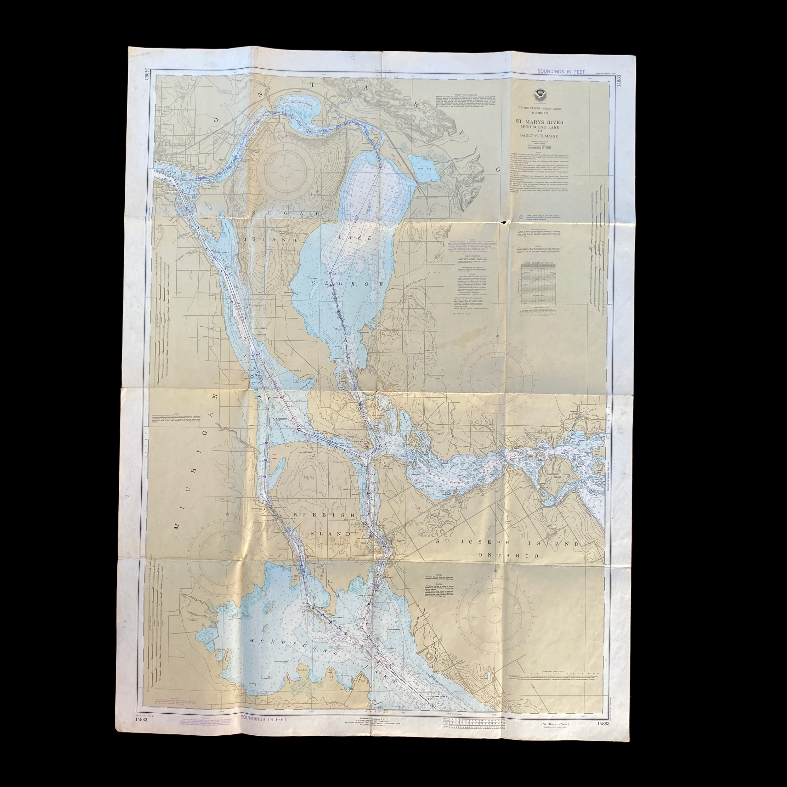


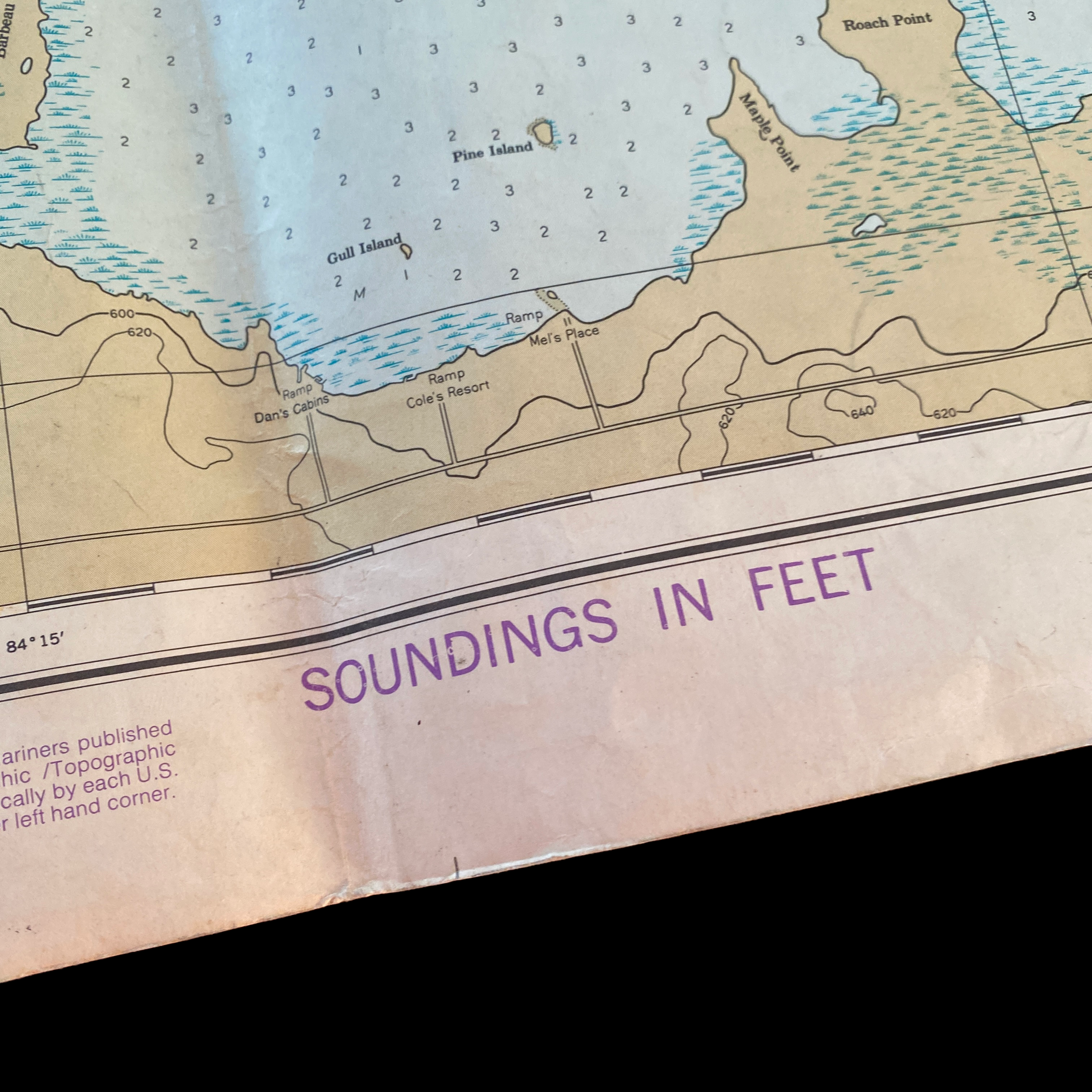
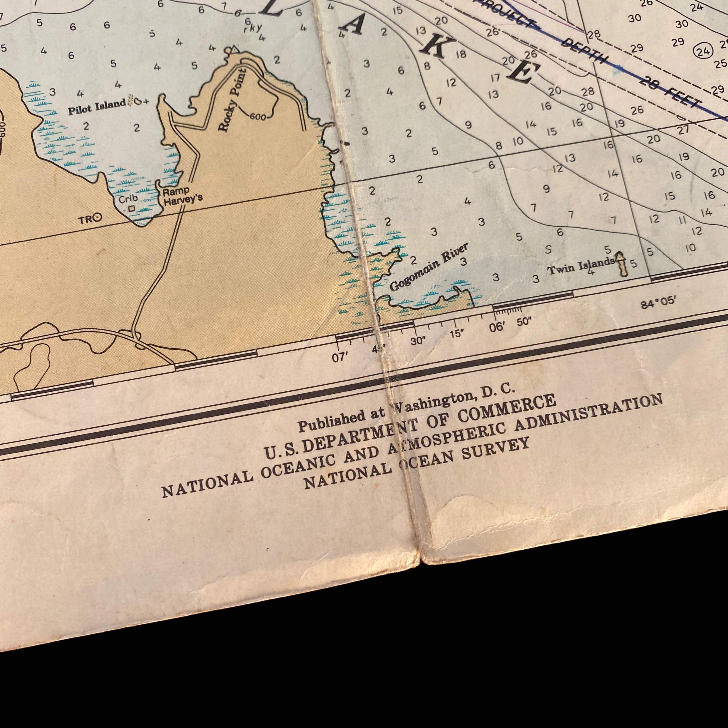
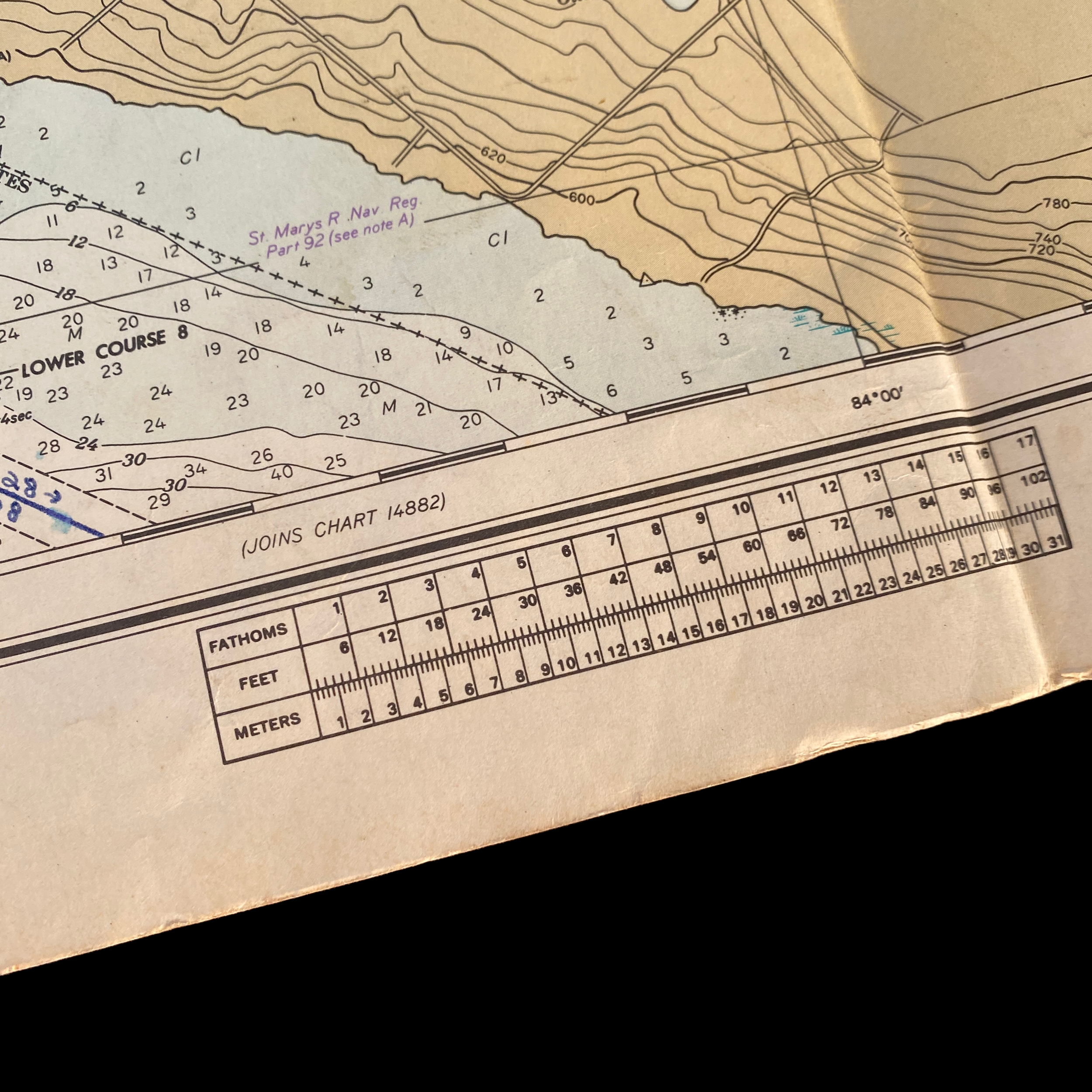


Original U.S. Department of Commerce "St. Mary River to Sault Ste. Marie" Michigan Navigation and Ocean Fathom Depth Nautical Map*
Comes with C.O.A.
Perfect for the historian, seaman, map-lover, the curious or just as a conversation starter. Wonderful and rare. Vintage maps such as these make great gifts.
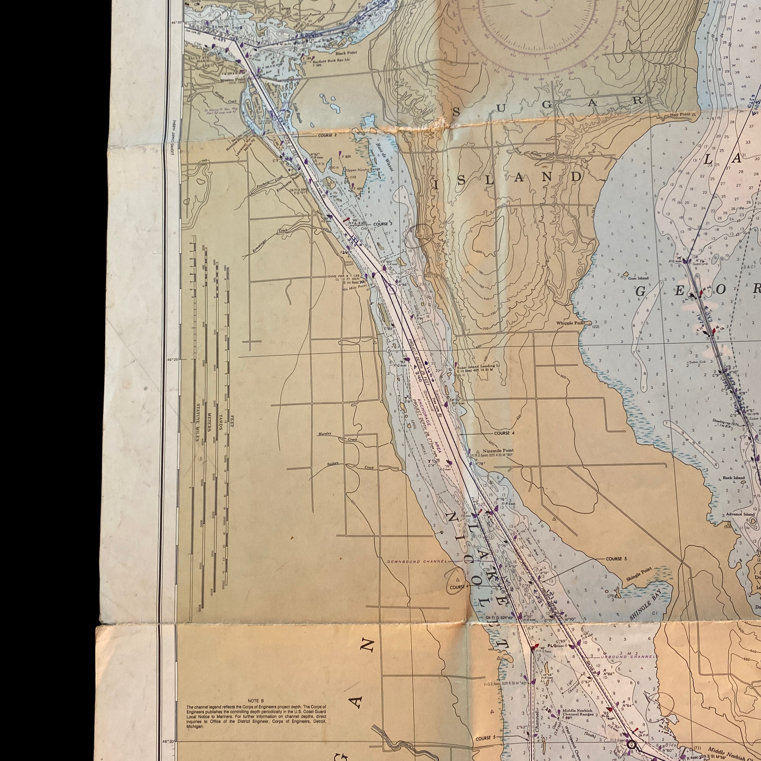
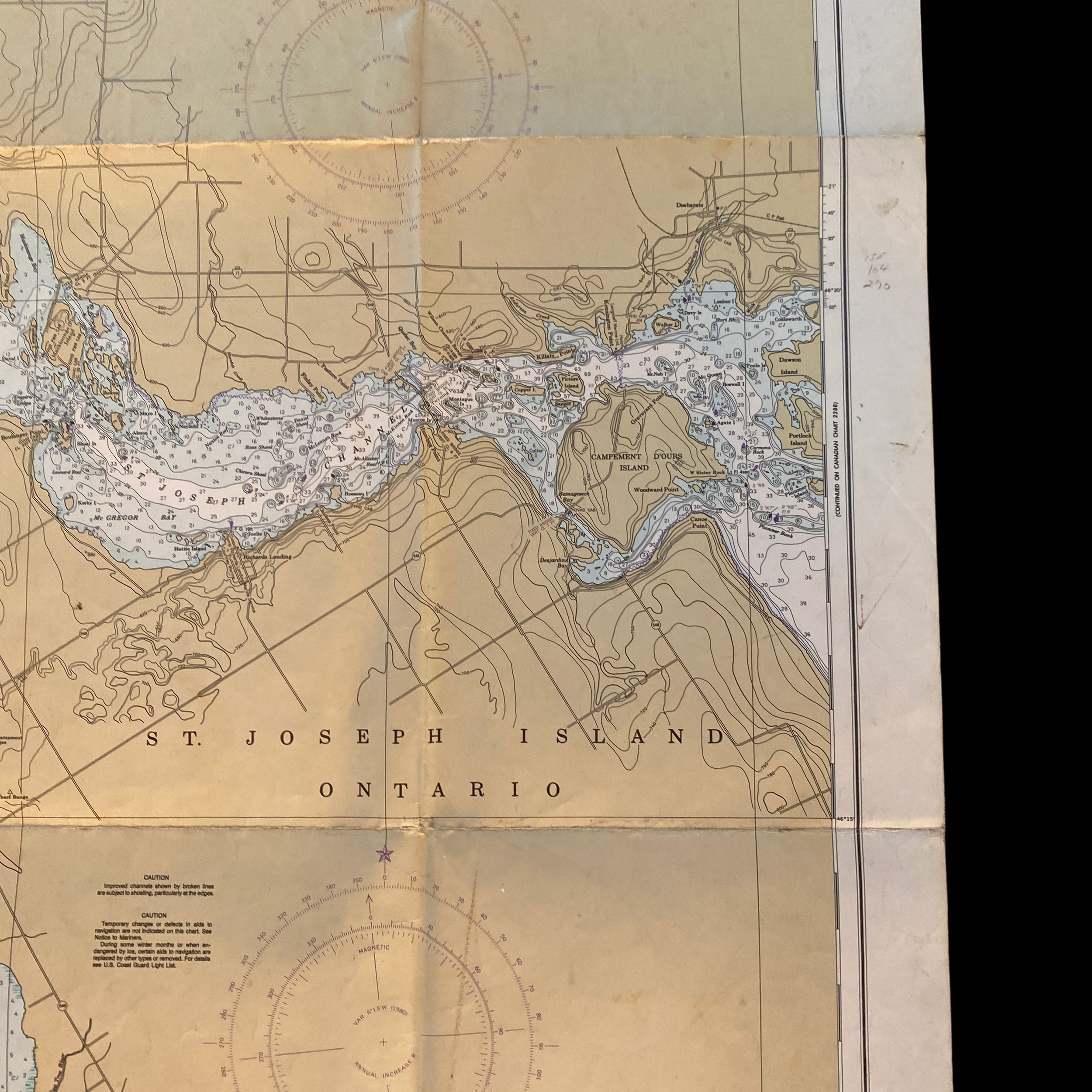
The Great Lakes region of the United States is an expansive and diverse area, encompassing a vast network of waterways, forests, and wetlands that are home to an incredible array of wildlife and plant species. One of the most important features of this region is the vast interconnected system of lakes and rivers that run through it, providing vital routes for commerce, recreation, and transportation. One of the most important maps of this region is the U.S. shipping fathom map of the Great Lakes Michigan, which shows the St. Mary River, Munuscong Lake, and Sault Ste. Marie.
The St. Mary River is a historic and important waterway that flows through the Great Lakes region, connecting Lake Huron and Lake Superior. It is a major commercial waterway, used by shipping vessels and barges carrying a wide range of goods, including raw materials, finished products, and agricultural products. The river is also an important recreational destination, offering excellent fishing, boating, and paddling opportunities to visitors from around the world.
Munuscong Lake is a smaller, but equally important, waterbody located near the St. Mary River. This lake is a popular destination for fishing, boating, and other water-based recreation, and is also an important spawning ground for many fish species. The lake is surrounded by forests, wetlands, and grasslands that are home to a wide range of wildlife, including birds, mammals, reptiles, and amphibians.
Sault Ste. Marie is a city located at the northern end of Lake Huron and is the oldest city in Michigan. It is an important center of commerce and industry, with a rich history dating back to the early fur trade and the construction of the Soo Locks. The city is also a popular tourist destination, offering visitors a chance to experience the history, culture, and natural beauty of the Great Lakes region.
The U.S. shipping fathom map of the Great Lakes Michigan is an essential tool for anyone who needs to navigate the waters of the Great Lakes region. The map provides detailed information on water depths, shoals, and other hazards, as well as information on the location of ports, harbors, and other important landmarks. The map also provides information on the location of lighthouses, buoys, and other navigational aids, making it an essential resource for sailors and boaters.
In conclusion, the U.S. shipping fathom map of the Great Lakes Michigan is an invaluable resource for anyone who is interested in exploring or using the waterways of the Great Lakes region. Whether you are a sailor, boater, fisherman, or simply an admirer of the natural beauty of the Great Lakes, this map is an essential tool for your adventures. Whether you are exploring the St. Mary River, enjoying the recreational opportunities of Munuscong Lake, or visiting the historic city of Sault Ste. Marie, the U.S. shipping fathom map of the Great Lakes Michigan will be a valuable resource for you.