Original GREAT LAKES "De Tour Passage to Waugoshance Point" Michigan Navigation and Ocean Fathom Depth Nautical Map*


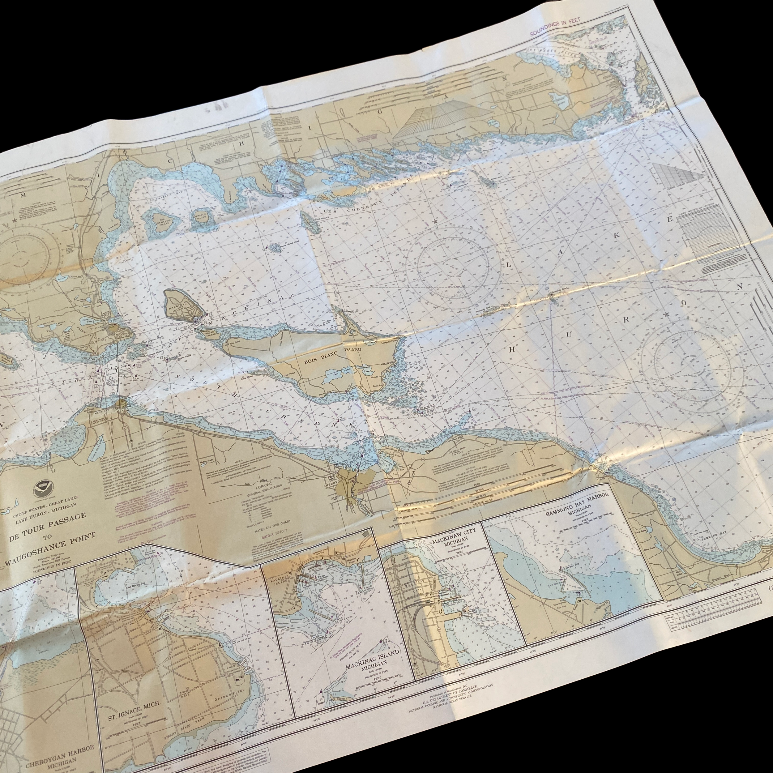


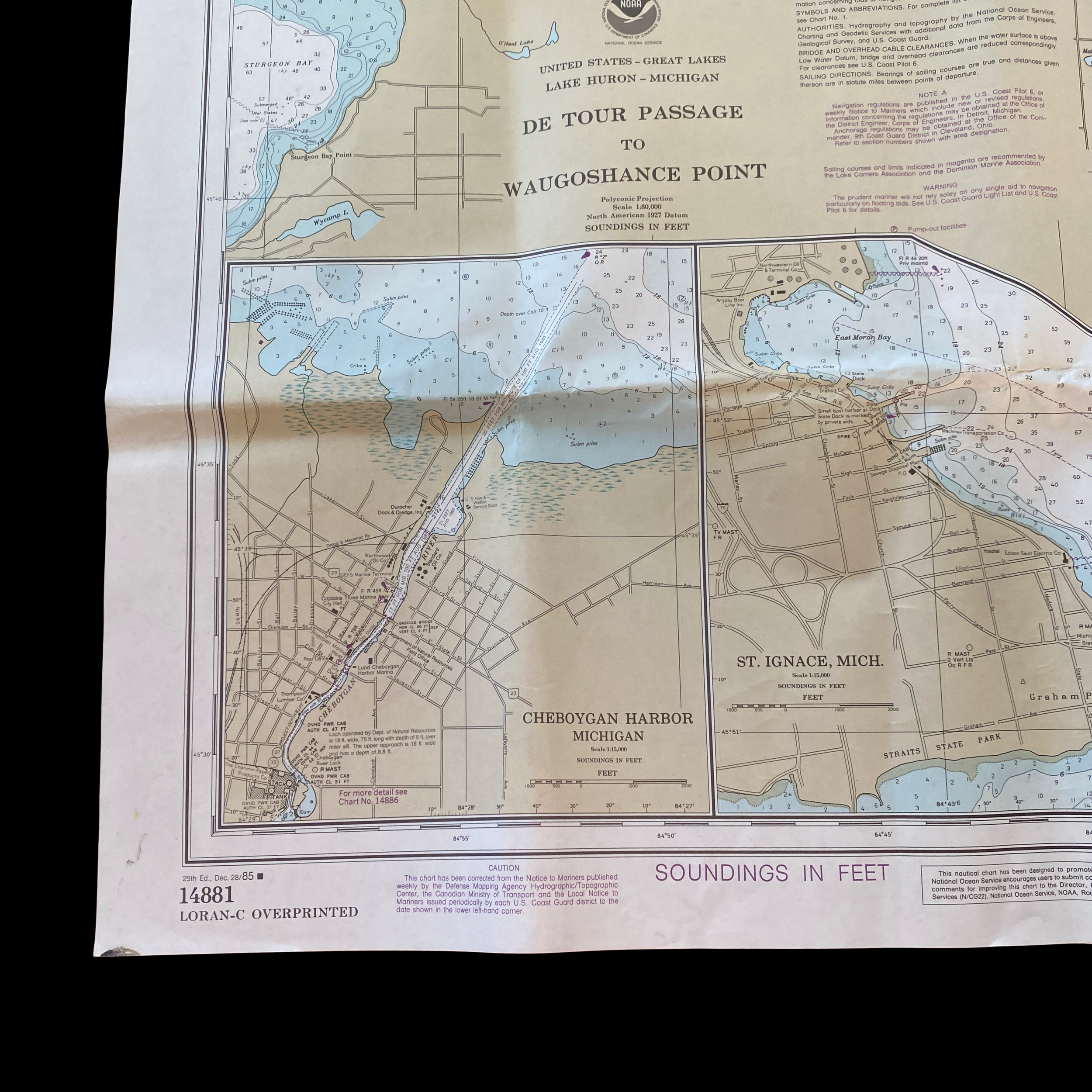


Original GREAT LAKES "De Tour Passage to Waugoshance Point" Michigan Navigation and Ocean Fathom Depth Nautical Map*
Comes with C.O.A.
Perfect for the historian, seaman, map-lover, the curious, or just as a conversation starter. Wonderful and rare. Vintage maps such as these make great gifts.
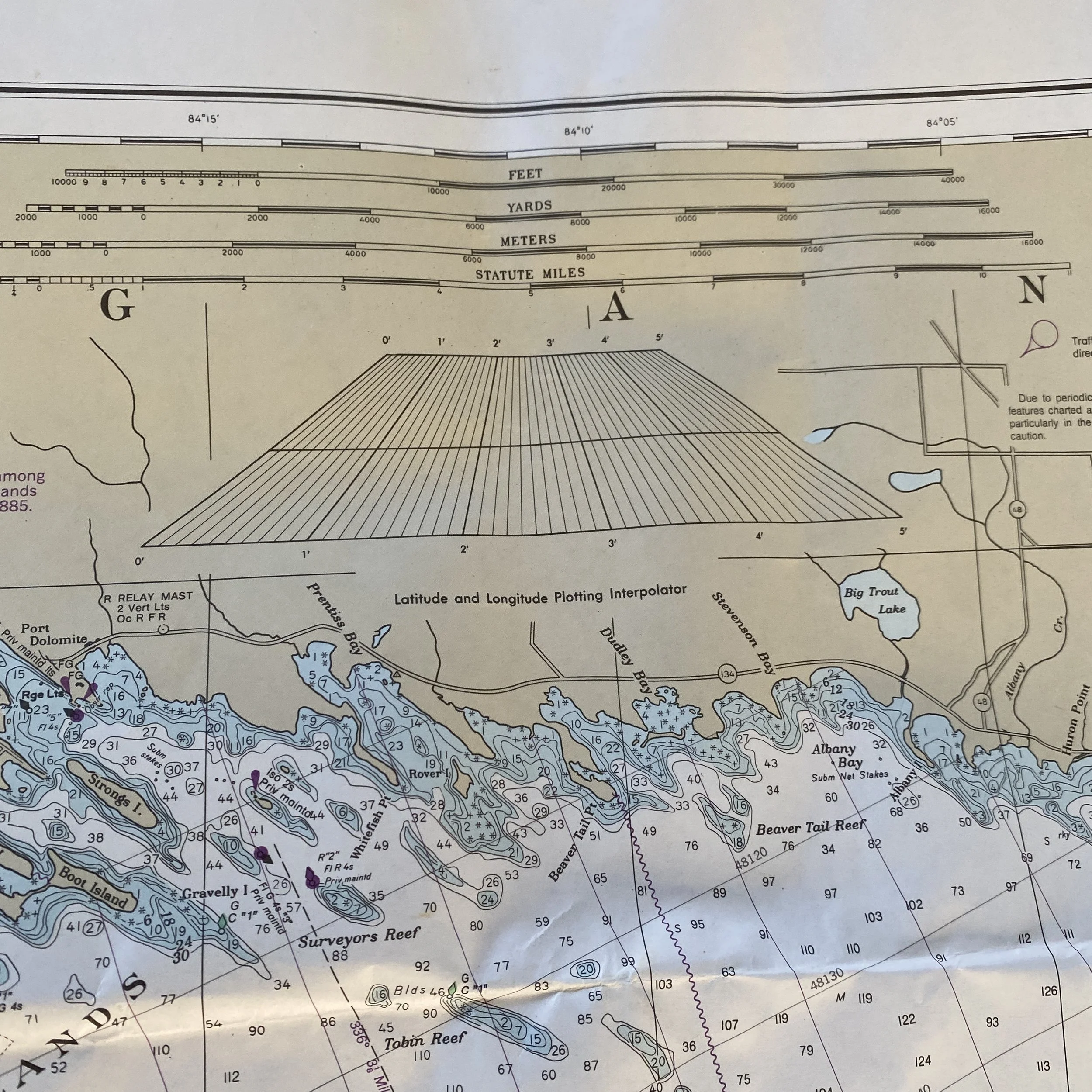
The Great Lakes region of the United States is one of the country's most important and historically significant areas, with a rich history of commerce, transportation, and culture. One important tool for navigating this complex and expansive network of waterways has been the shipping fathom map, which provides detailed information on water depth and other navigational aids for ships traveling through the Great Lakes.
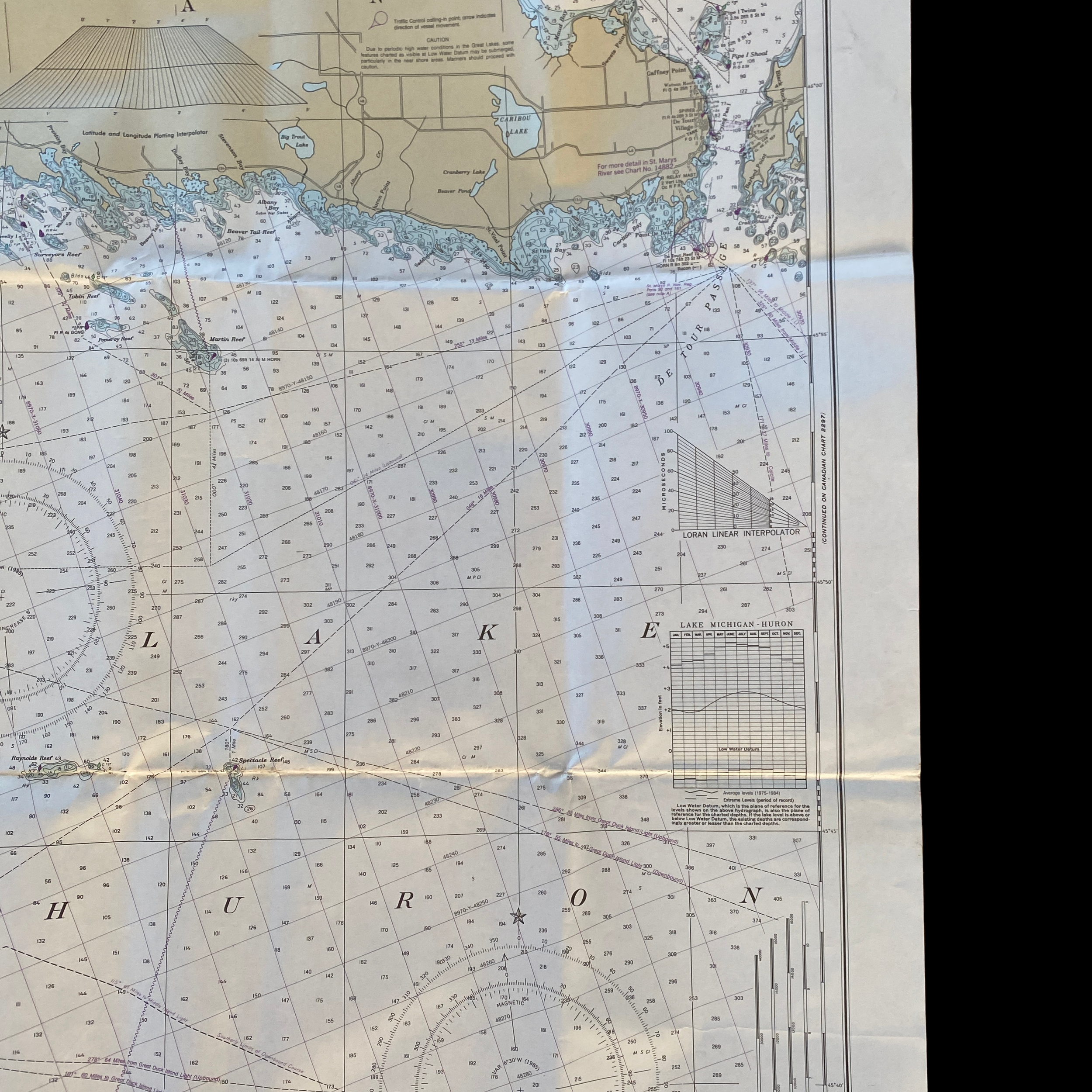
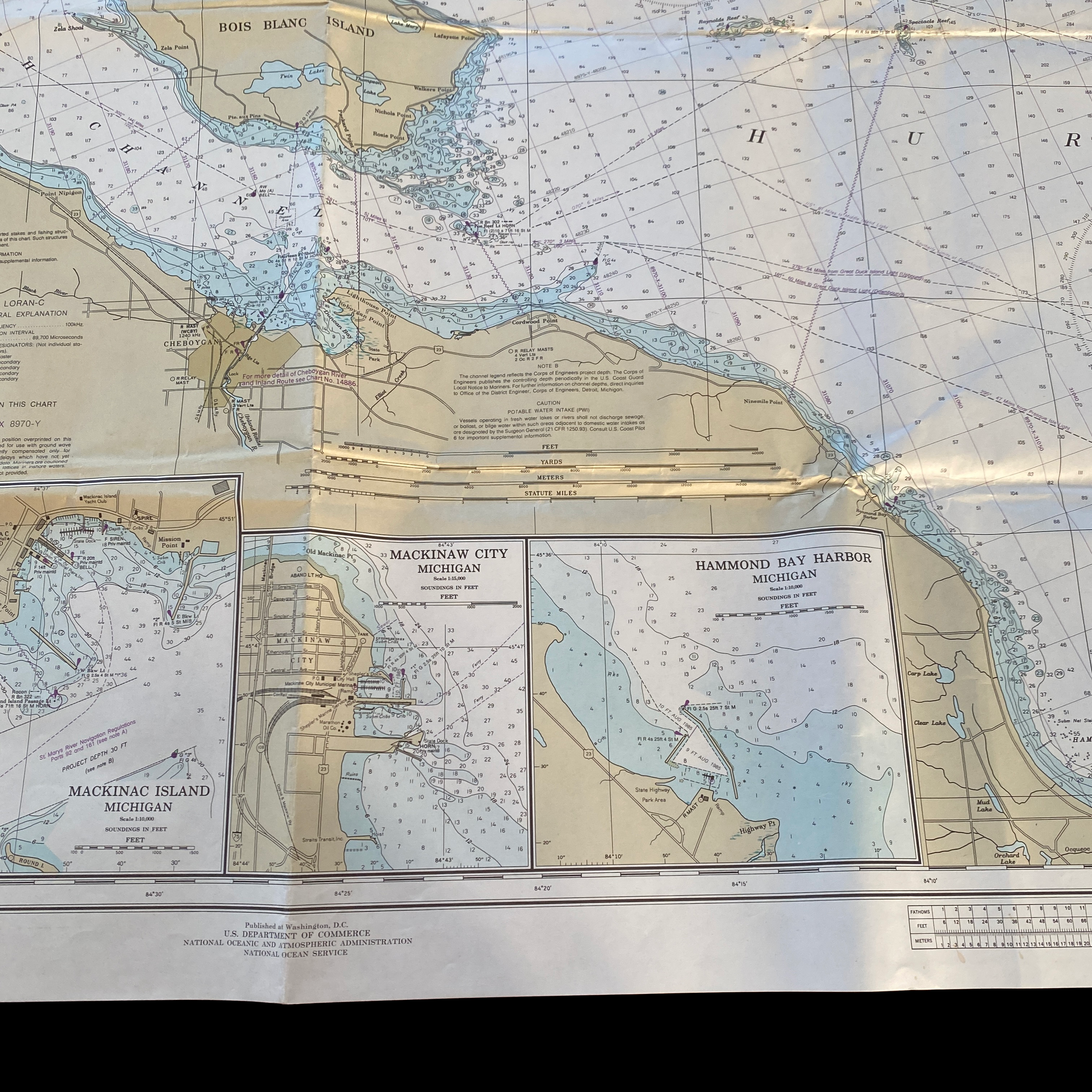
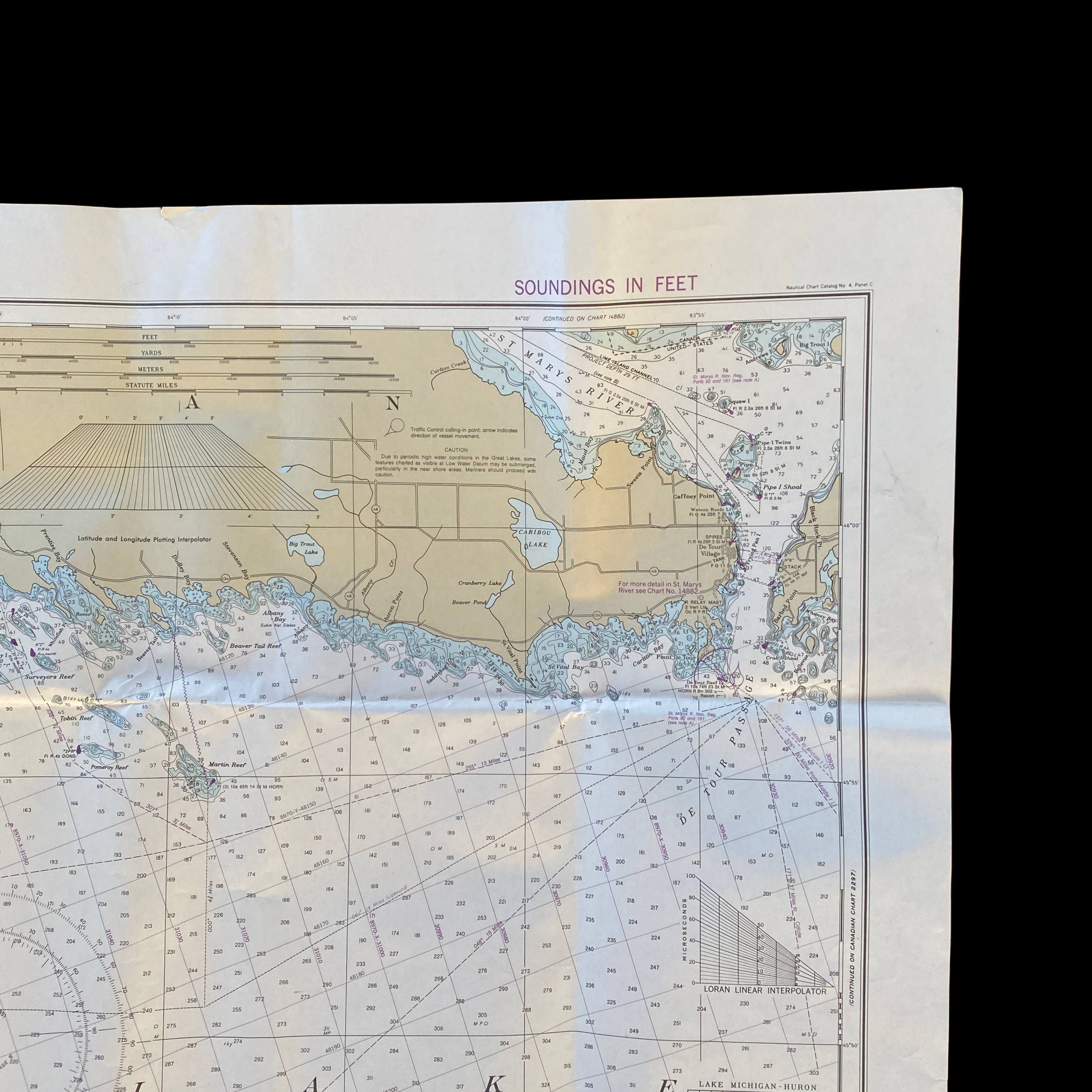
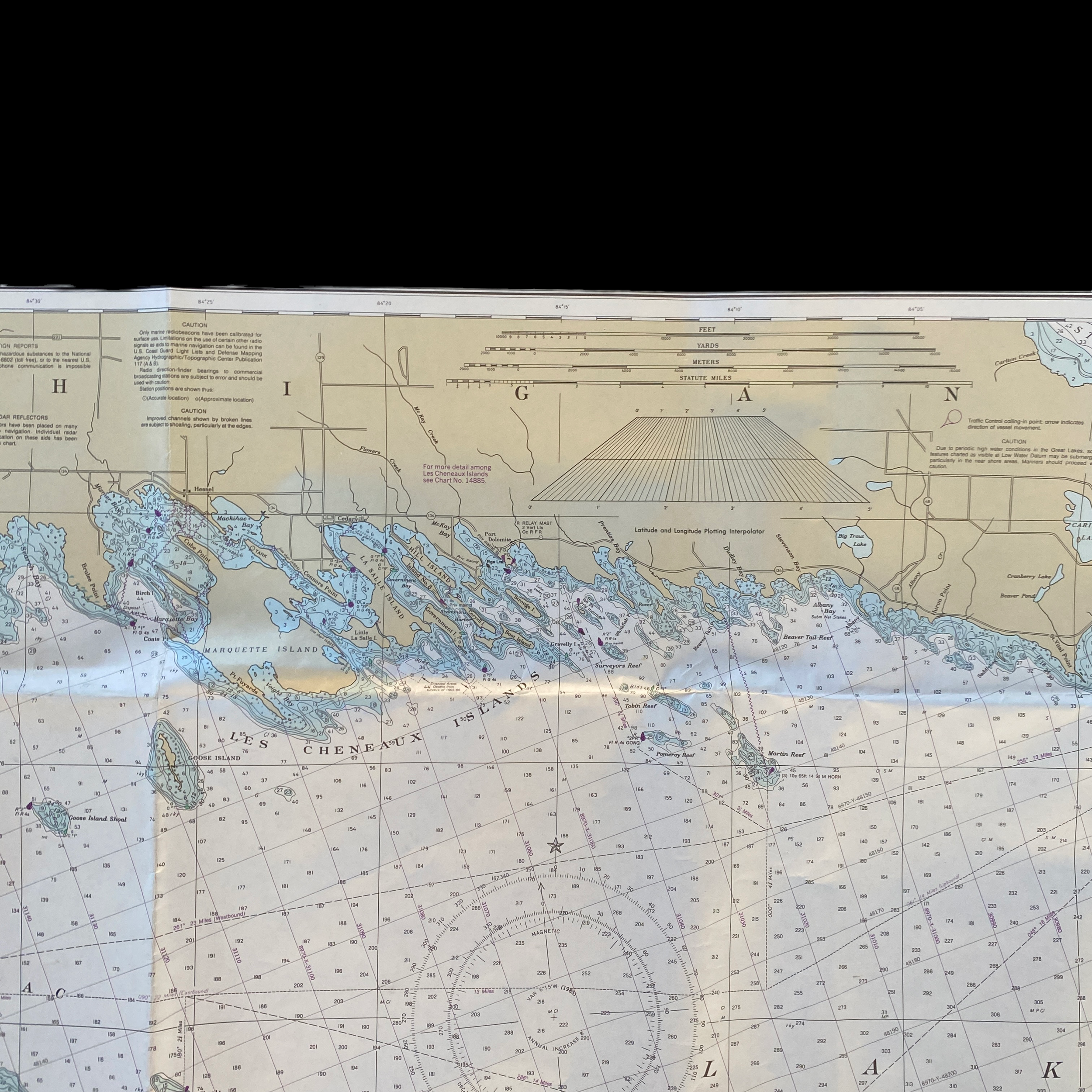
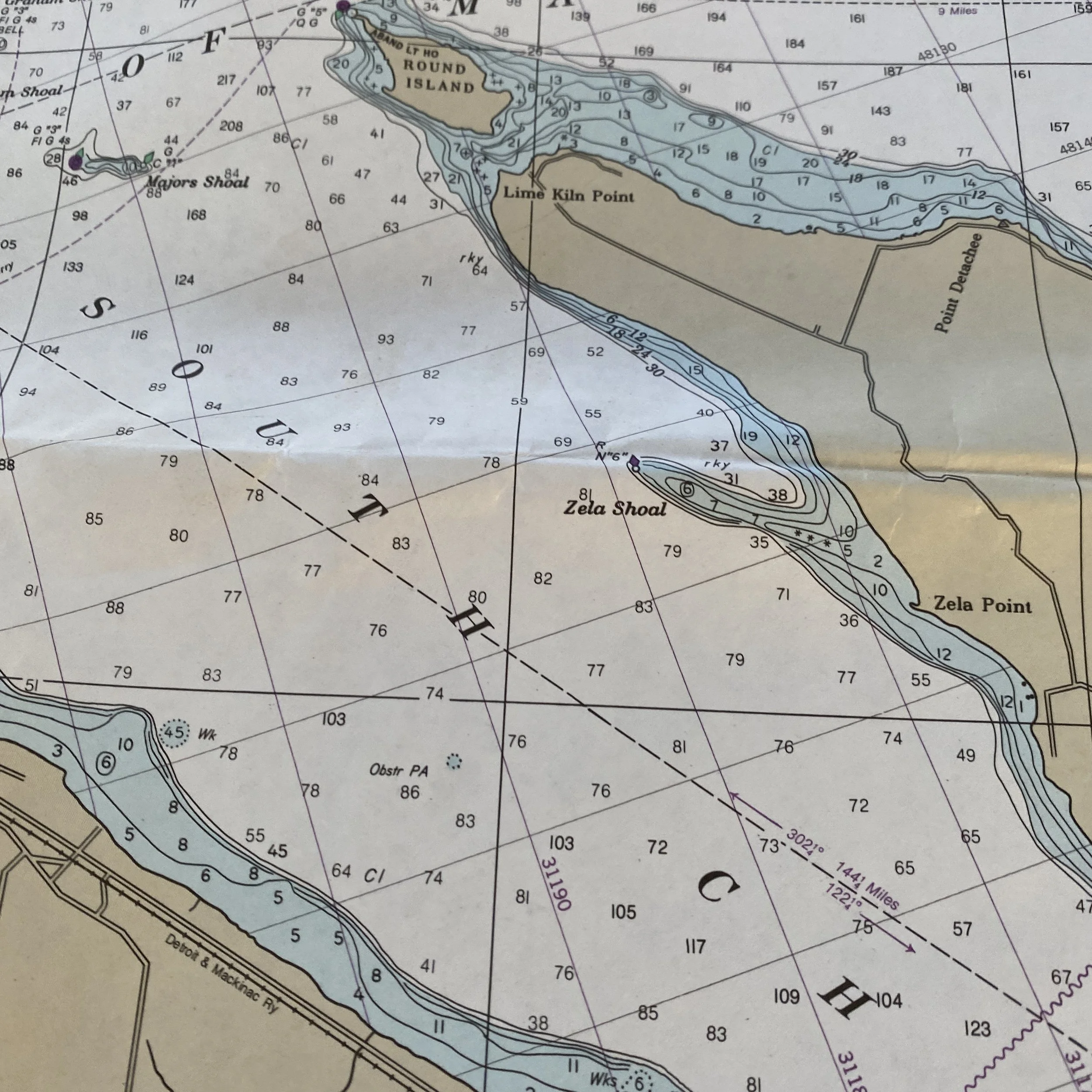
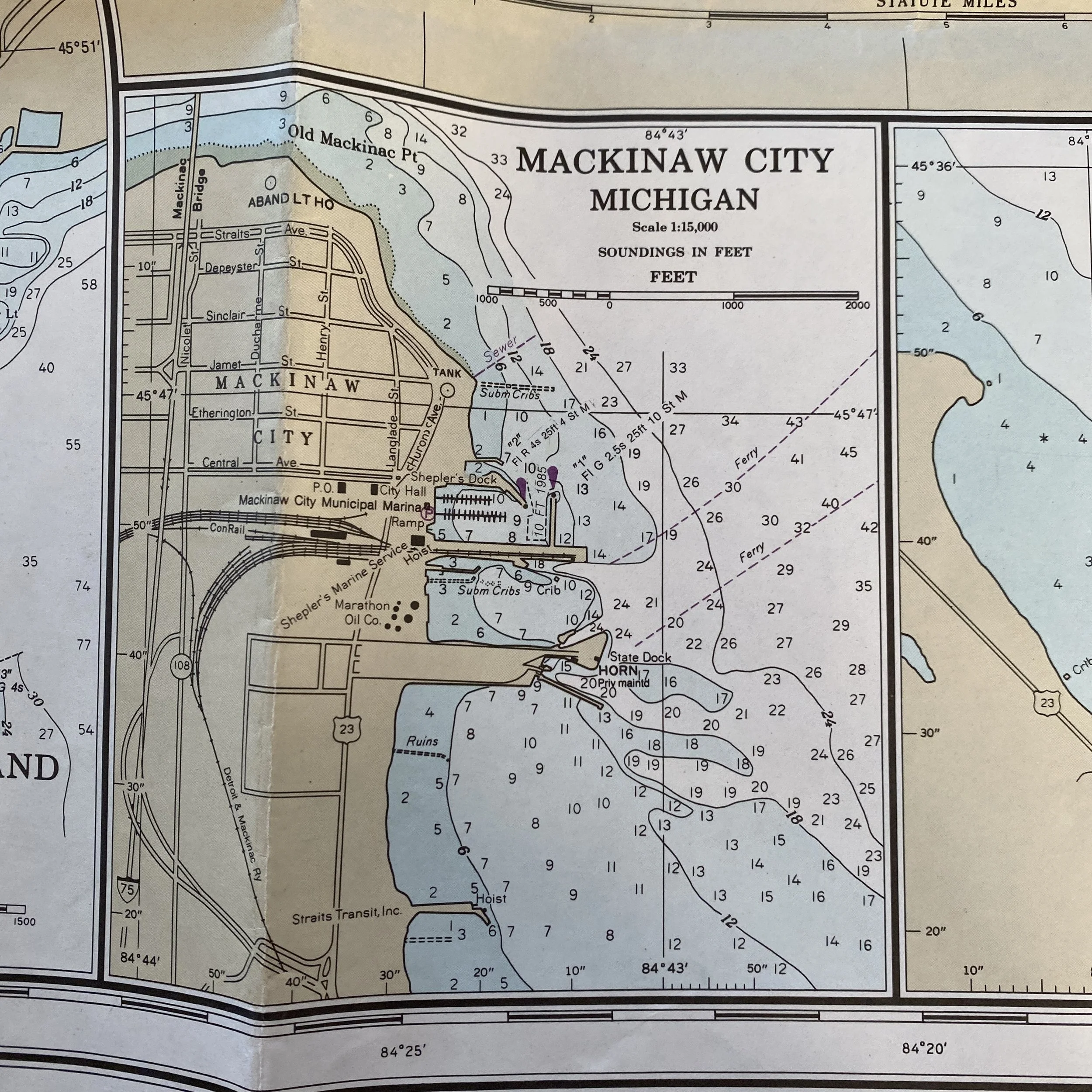
In particular, the U.S. shipping fathom map of Lake Huron, Michigan, from De Tour Passage to Waugoshance Point provides a valuable resource for those who operate vessels in this region. Lake Huron is the third largest of the five Great Lakes and covers an area of over 23,000 square miles. It is also home to numerous ports and harbors, and is an important shipping route for goods and resources from Canada, the United States, and beyond.
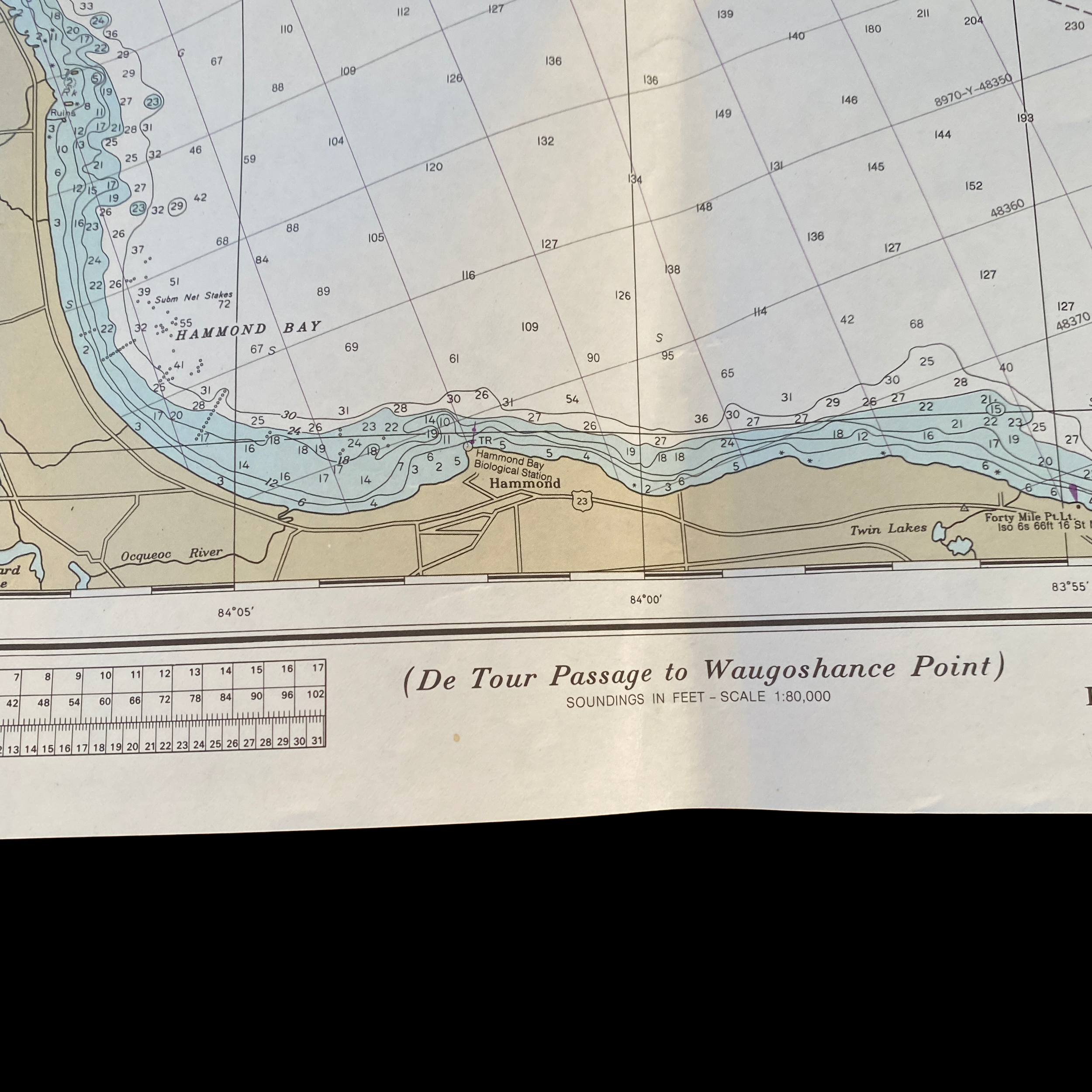
The fathom map of this section of Lake Huron provides detailed information on the depth of the water at various points along the shipping route. This information is crucial for ship captains and navigators, as it helps them to determine the safest and most efficient course for their vessel. The map also includes information on other navigational aids, such as lighthouses, buoys, and beacons, which can help ships avoid dangerous areas or find their way when visibility is limited.
In addition to its practical use for navigation, the U.S. shipping fathom map of Lake Huron is also a fascinating historical document. It provides a snapshot of the Great Lakes region as it existed in a particular moment in time, and gives insight into the shipping industry and the technology used to navigate the waterways. The map also provides a glimpse into the geography and topography of the region, and helps to illustrate the vastness and complexity of the Great Lakes system.
One particularly interesting feature of the fathom map is the inclusion of information on the De Tour Passage, which is a narrow channel that connects Lake Huron and Lake Michigan. This channel is considered one of the most challenging sections of the Great Lakes for navigation, and the map provides detailed information on the depth and navigational aids in this area, making it an essential resource for ships passing through.
The Waugoshance Point area, which is located at the western end of the shipping route covered by the map, is another interesting feature. This area is known for its challenging conditions, including shallow waters and unpredictable weather, making it a particularly hazardous area for shipping. The map provides detailed information on the depth and other navigational aids in this region, allowing ships to navigate this area safely and efficiently.
In conclusion, the U.S. shipping fathom map of Lake Huron, Michigan, from De Tour Passage to Waugoshance Point is a valuable resource for those who operate vessels in this region. It provides important information on water depth and other navigational aids, and serves as a fascinating historical document that provides insight into the Great Lakes region and the shipping industry. Whether you are a ship captain, navigator, or simply interested in the history of the Great Lakes, this map is a must-have resource.