Original 1945 U.S. Department of Commerce "Bay of Fundy to Cape Cod" Navigation and Ocean Fathom Depth Nautical Map*
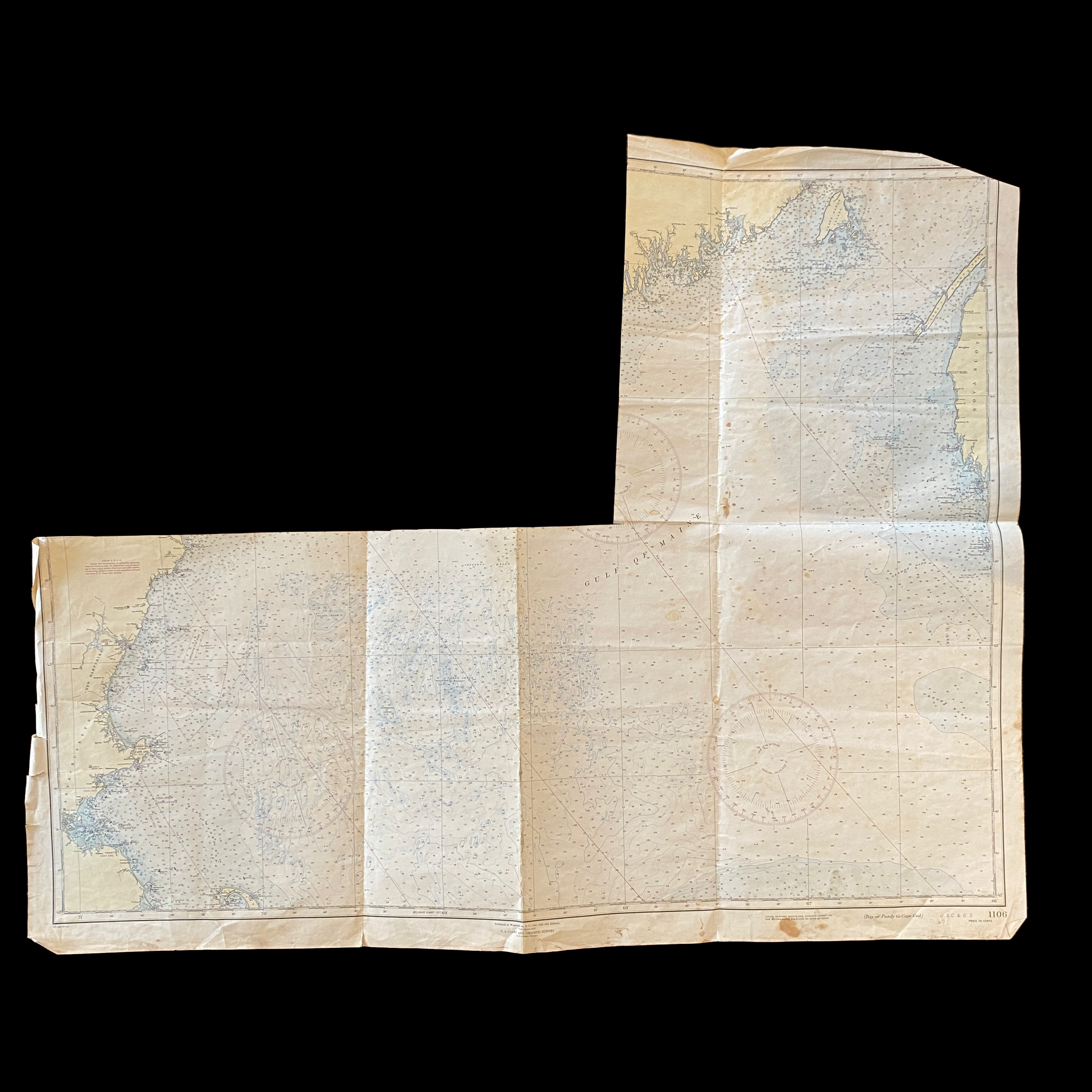

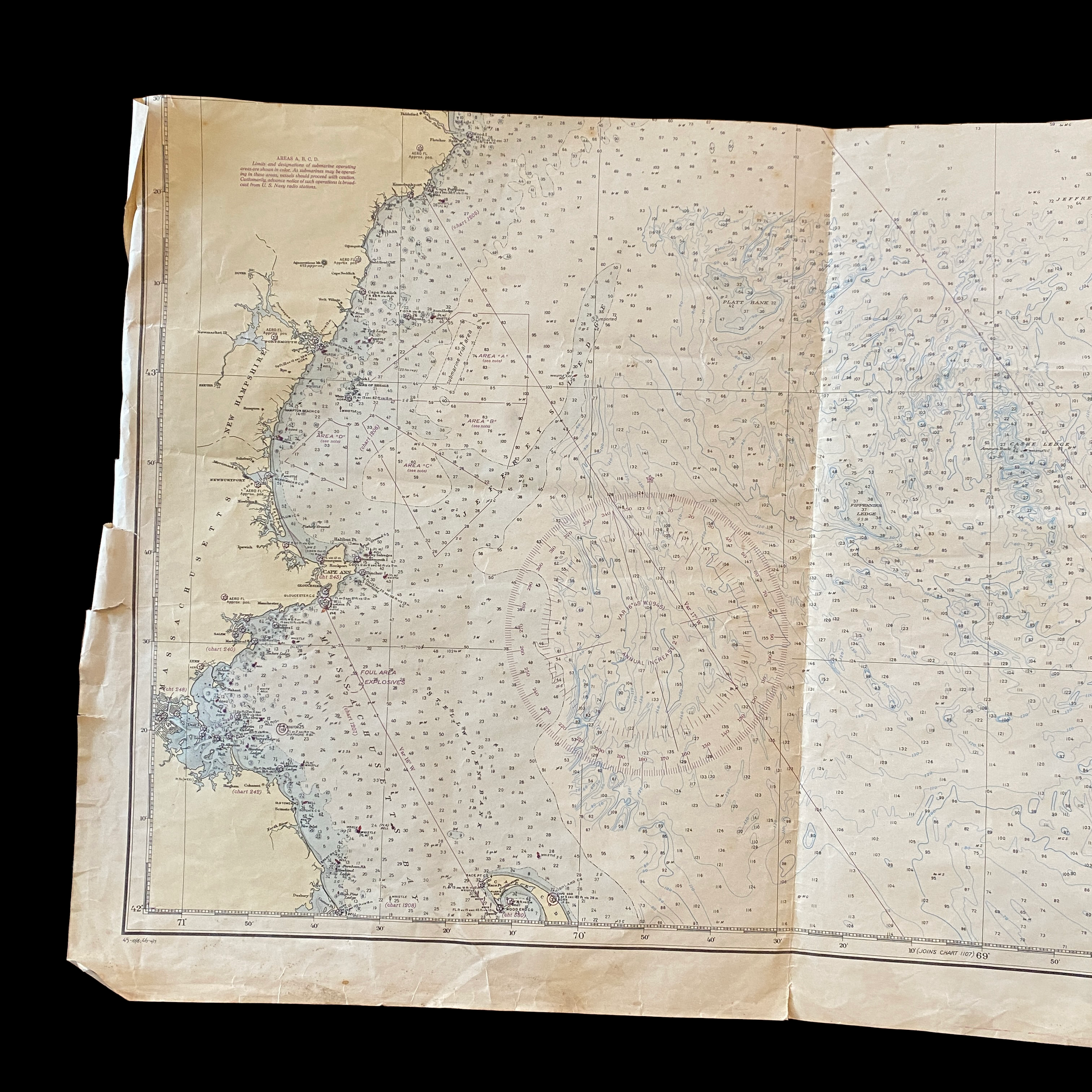
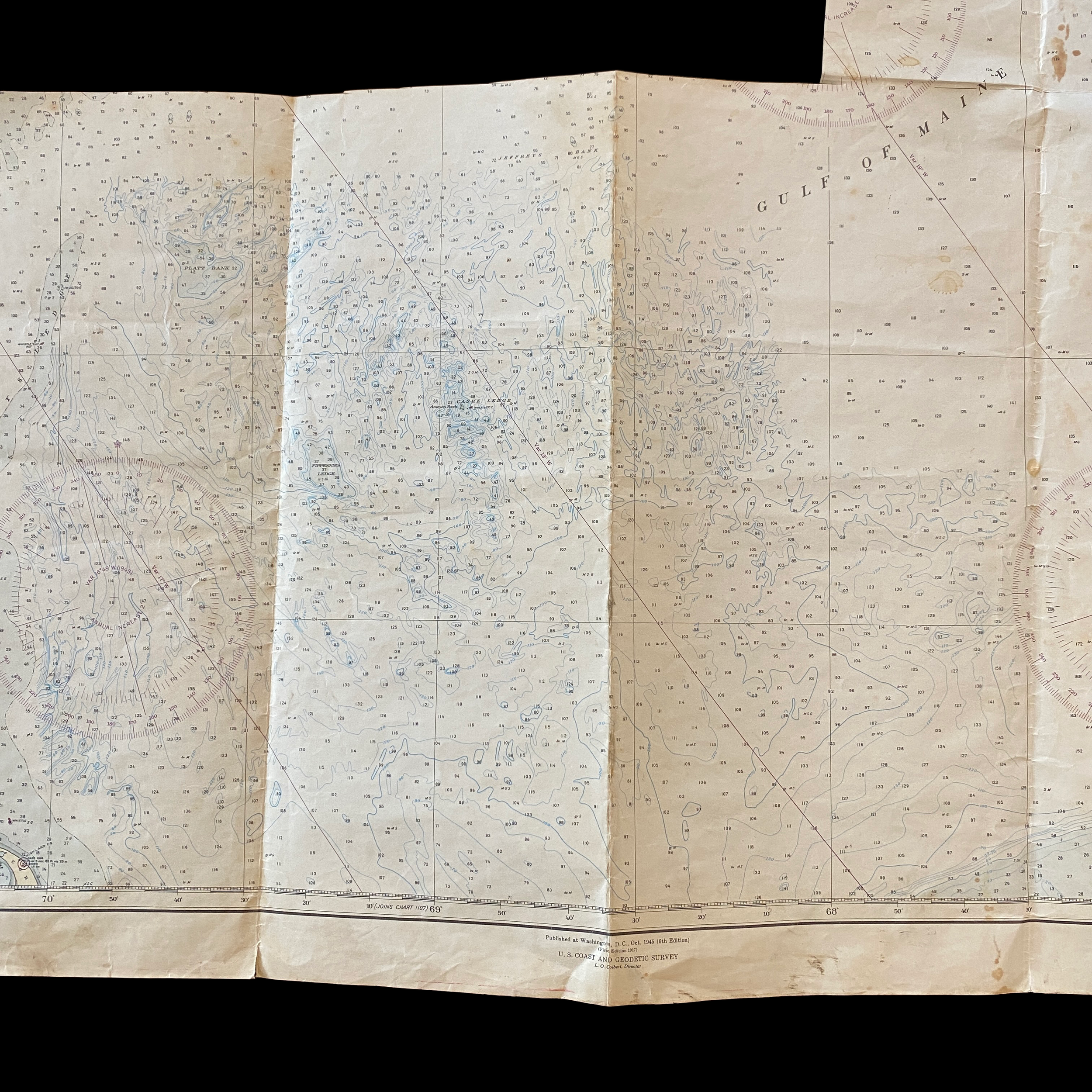

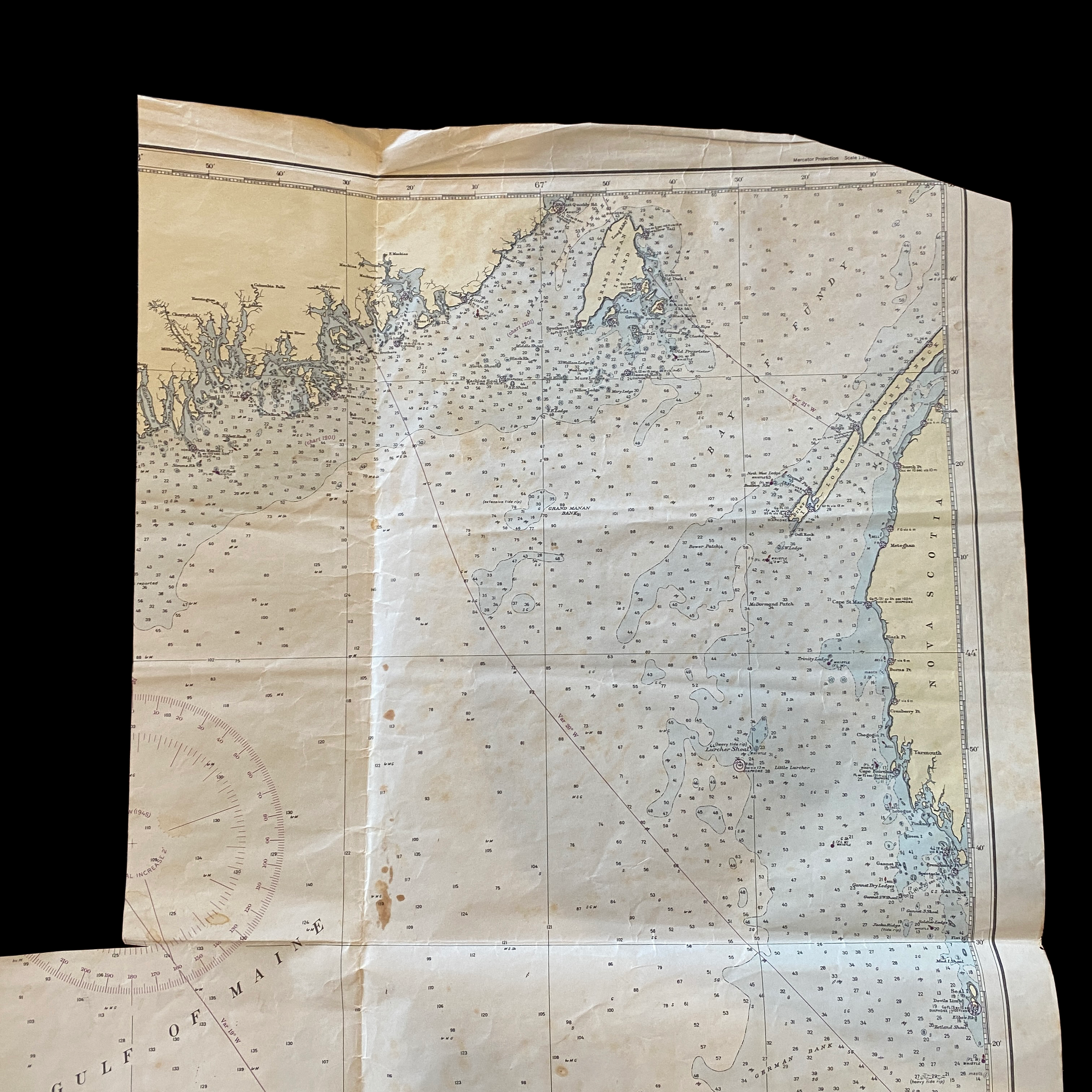


Original 1945 U.S. Department of Commerce "Bay of Fundy to Cape Cod" Navigation and Ocean Fathom Depth Nautical Map*
Comes with C.O.A.
Perfect for the historian, seaman, map-lover, the curious or just as a conversation starter. Wonderful and rare. Vintage maps such as these make great gifts.
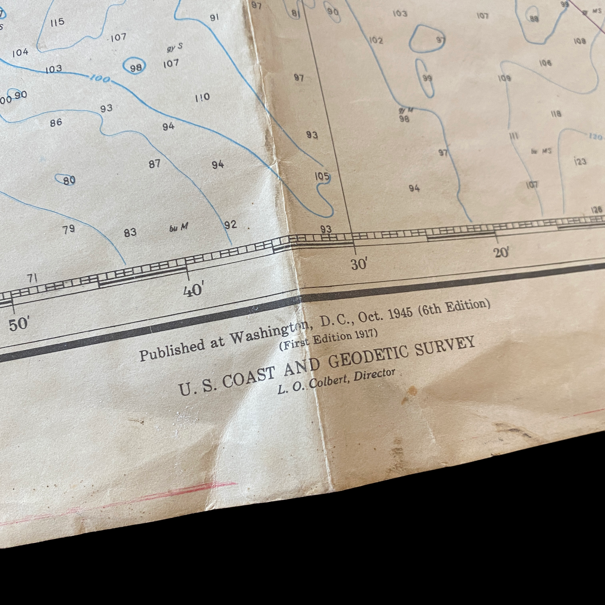
6th Edition printed 1945.
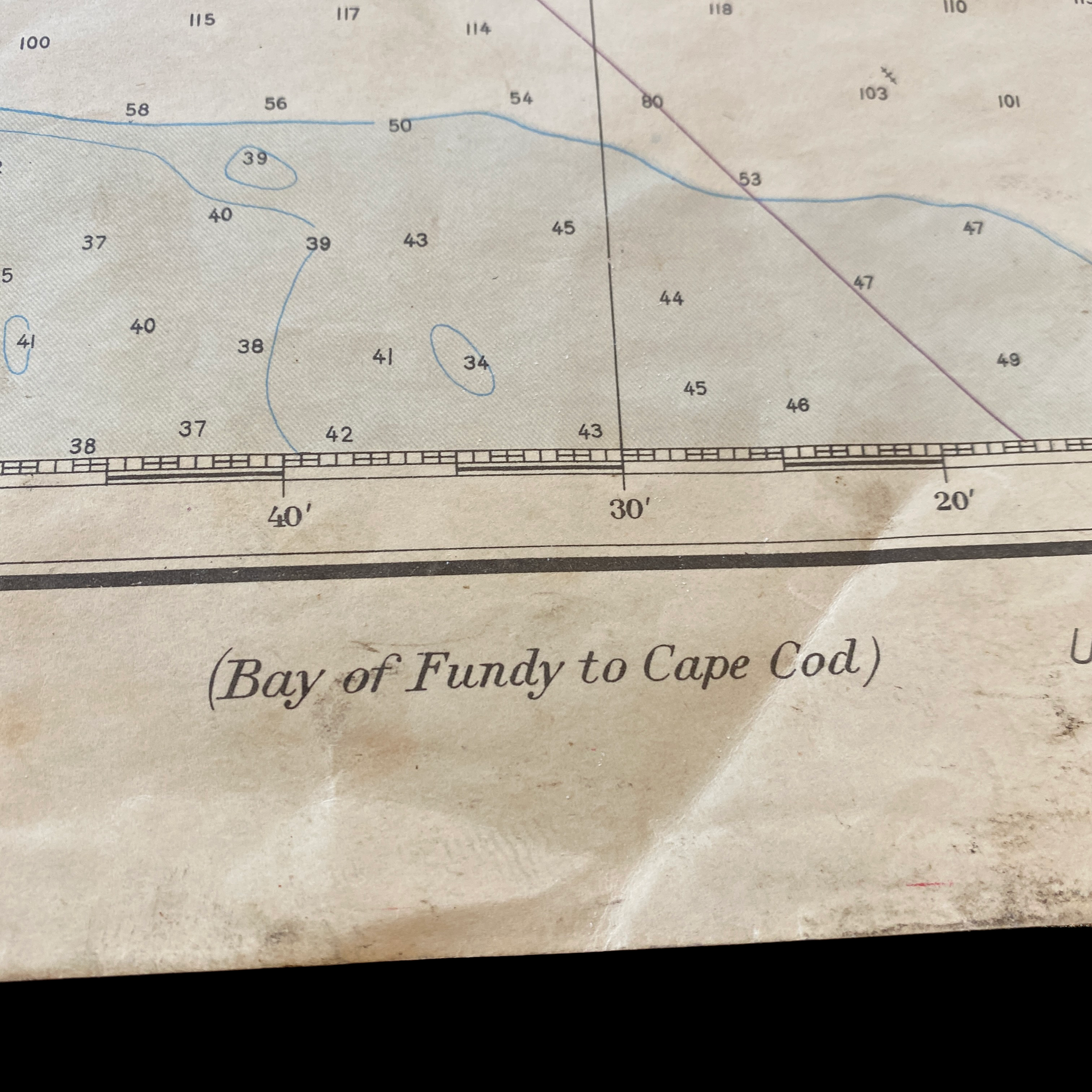
The United States Department of Commerce Fathom and Depth Chart ocean map dated 1945 is a valuable historical document that provides insight into the understanding and mapping of the ocean floor in the mid-20th century. This particular map focuses on the region from the Bay of Fundy to Cape Cod, providing detailed information about the depths and contours of the ocean floor in this area.
The Bay of Fundy is a large bay located on the Atlantic coast of North America, between the provinces of New Brunswick and Nova Scotia in Canada, and the state of Maine in the United States. Known for its large tidal range and unique geology, the Bay of Fundy has long been of interest to oceanographers and cartographers. The 1945 Department of Commerce Fathom and Depth Chart map provides detailed information about the depths and contours of the bay, including information about the location and depth of underwater canyons, valleys, and other features.
Cape Cod, located on the northeastern coast of Massachusetts, is a popular vacation destination known for its beaches, lighthouses, and fishing villages. The 1945 Department of Commerce Fathom and Depth Chart map provides detailed information about the depths and contours of the ocean floor in the waters around Cape Cod, including information about the location and depth of underwater canyons, valleys, and other features.
In the time this map was made, the technology for mapping the ocean floor was still relatively primitive compared to today's standards. The map was created using depth soundings taken from ships, which were then used to create a contour map of the ocean floor. This method was not as accurate as modern techniques such as sonar and satellite imagery, and the map is not as detailed as more recent maps of the area. However, it still provides valuable information about the ocean floor in this region, and is an important historical document.
This map, along with many other historical maps, is an important resource for scientists, historians and others who are interested in the history of oceanography, cartography and the study of the ocean floor. It is a reminder of the progress that has been made in our understanding of the ocean and the technology that has been developed to study it.
In conclusion, the United States Department of Commerce Fathom and Depth Chart ocean map dated 1945 is an important historical document that provides valuable information about the depths and contours of the ocean floor in the Bay of Fundy and Cape Cod region. It is an important resource for scientists, historians and others who are interested in the history of oceanography, cartography and the study of the ocean floor. It is also a reminder of the progress that has been made in our understanding of the ocean and the technology that has been developed to study it.
The United States Department of Commerce played a significant role in the economic and social development of the region from the Bay of Fundy to Cape Cod during the year 1945. This agency, established in 1913, was responsible for promoting the growth and development of American industry and commerce, as well as for collecting and disseminating economic and social information.
In 1945, the United States was in the midst of World War II, and the Department of Commerce played a key role in supporting the war effort through its various divisions. The Bureau of Foreign and Domestic Commerce, for example, helped to increase production of war materials by providing information and assistance to American manufacturers. The Bureau of the Census provided important information on the nation's labor force and industrial production, which was used to plan war production and allocate resources.
In the Bay of Fundy region, the Department of Commerce's Coast and Geodetic Survey (CGS) was responsible for providing accurate and up-to-date nautical charts and other navigational information to support the war effort. The CGS was responsible for mapping the coast and ocean floor, providing data on tides, currents and other oceanographic information. This information was crucial for the safe navigation of ships, both military and commercial, in the Bay of Fundy and in the surrounding waters.
In Cape Cod, the Department of Commerce's Weather Bureau was responsible for providing weather forecasts and warnings to support the war effort. The Weather Bureau's forecasts were used to plan military operations, protect civilian populations, and to support the fishing and shipping industries. The Weather Bureau also provided important information on coastal hazards such as storms and flooding, which helped to protect lives and property.
In addition to its role in supporting the war effort, the Department of Commerce also played an important role in post-war economic and social development in the region. The Bureau of Foreign and Domestic Commerce helped to promote American exports and attract foreign investment, while the Bureau of the Census provided important data on population, labor force, and economic activity. The Coast and Geodetic Survey and the Weather Bureau continued to provide important information and services to support the development of the maritime and coastal industries.
In conclusion, the United States Department of Commerce played a vital role in the economic and social development of the region from the Bay of Fundy to Cape Cod during the year 1945. The agency's various divisions, including the Bureau of Foreign and Domestic Commerce, the Bureau of the Census, the Coast and Geodetic Survey, and the Weather Bureau, provided important information and services to support the war effort and promote post-war economic and social development. These divisions continue to play a vital role in supporting American industry and commerce, and in promoting the economic and social well-being of the nation.