Original 1948 U.S. Department of Commerce "Massachusetts Bay" Navigation and Ocean Fathom Depth Nautical Map*
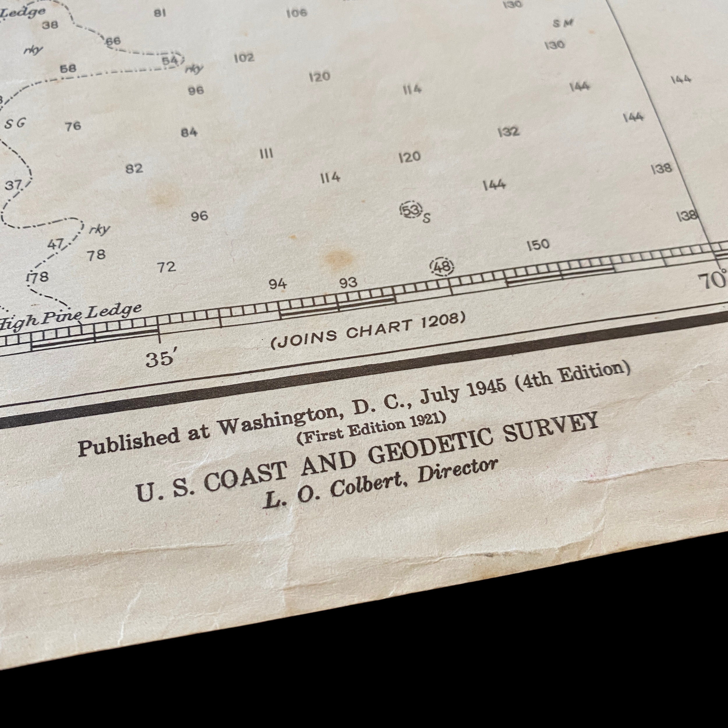
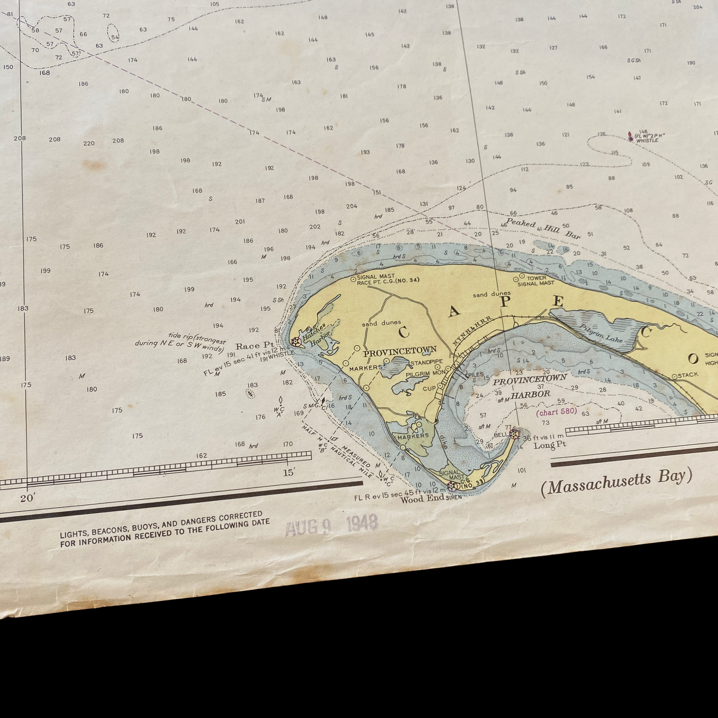

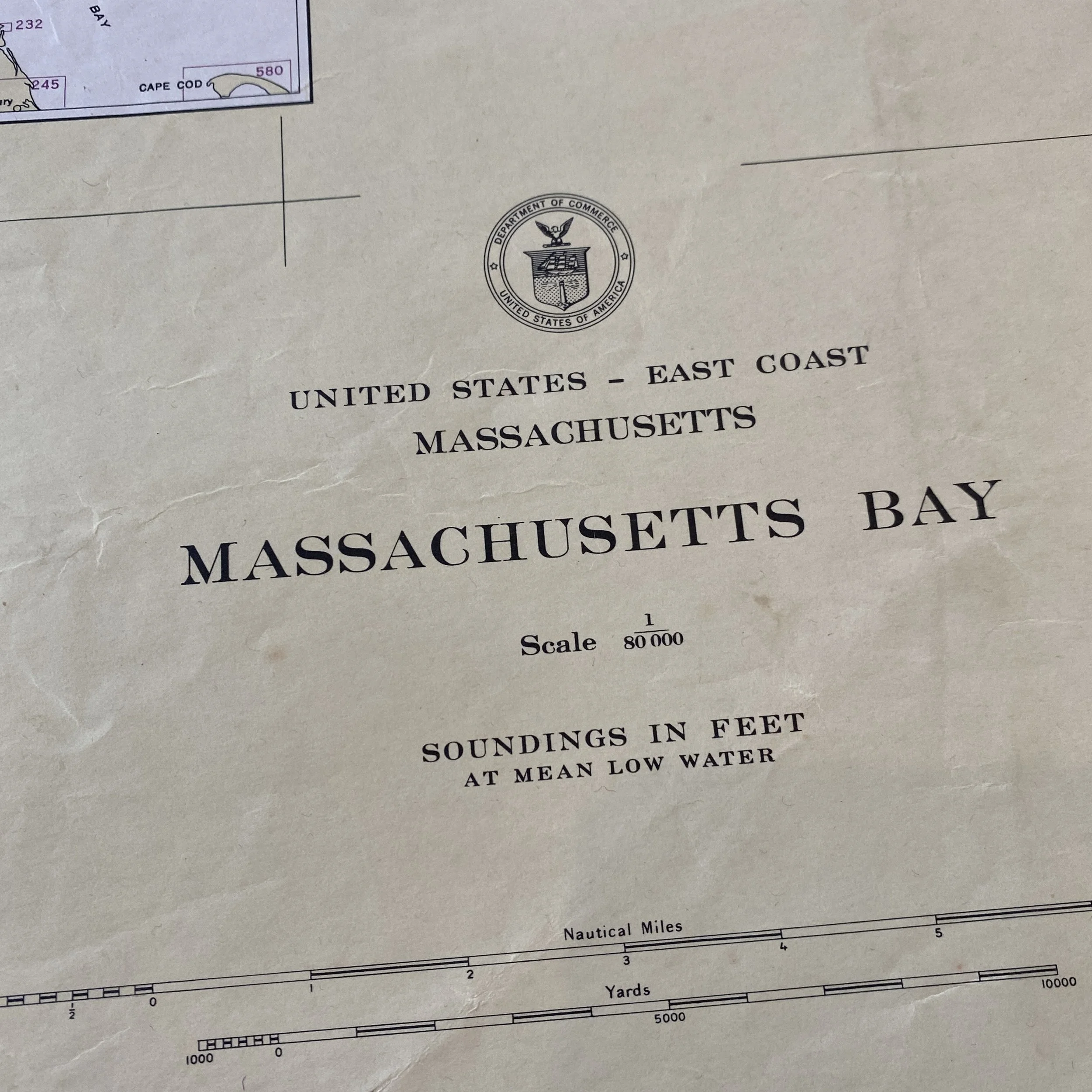


Original 1948 U.S. Department of Commerce "Massachusetts Bay" Navigation and Ocean Fathom Depth Nautical Map*
Comes with C.O.A.
Perfect for the historian, seaman, map-lover, the curious or just as a conversation starter. Wonderful and rare. Vintage maps such as these make great gifts.
Printed 1948.
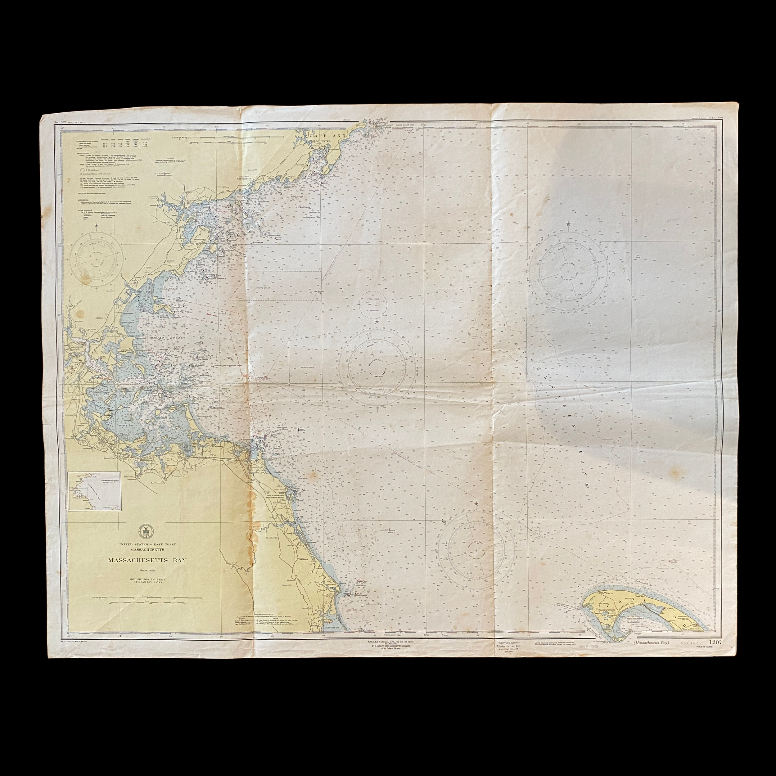
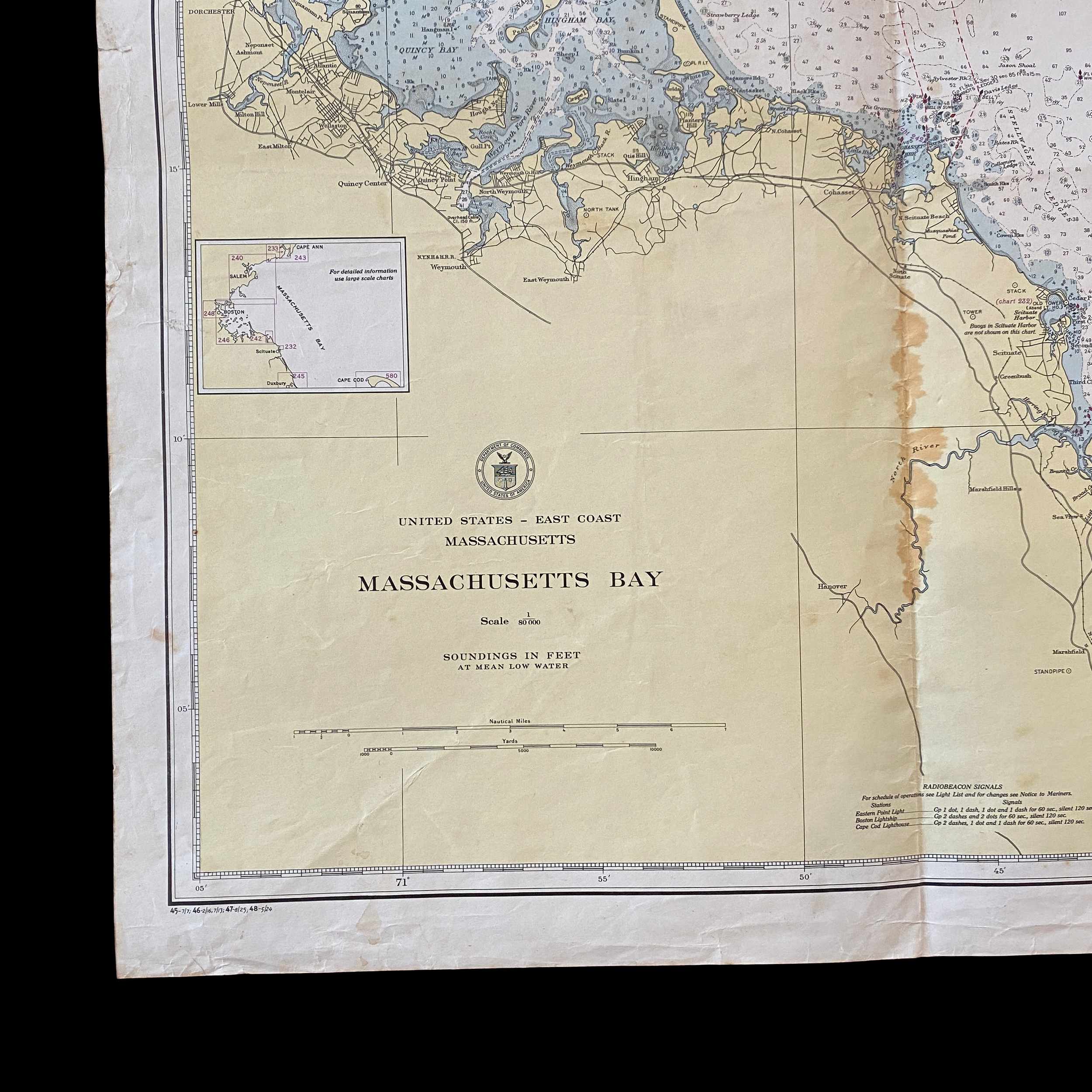
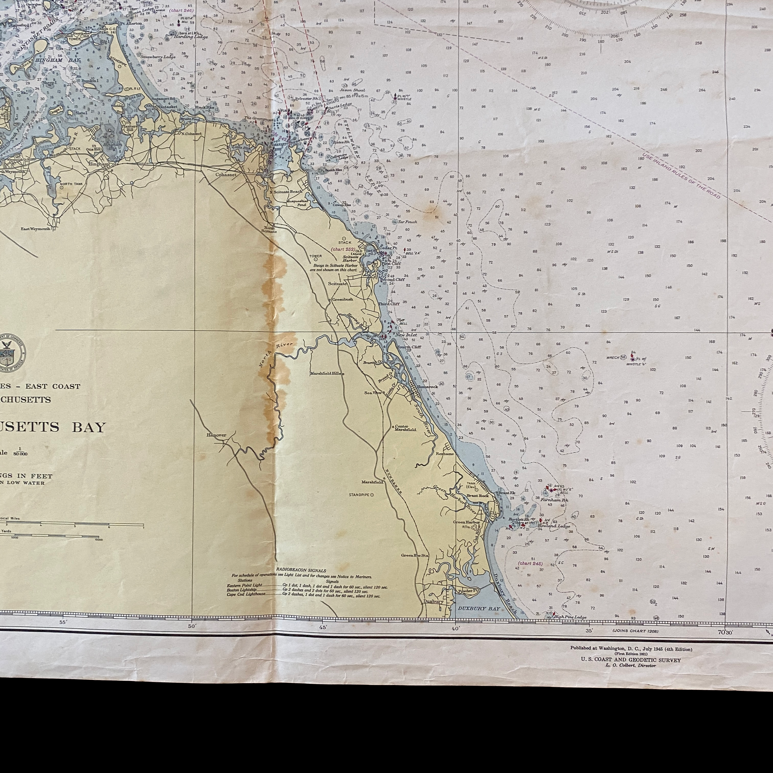
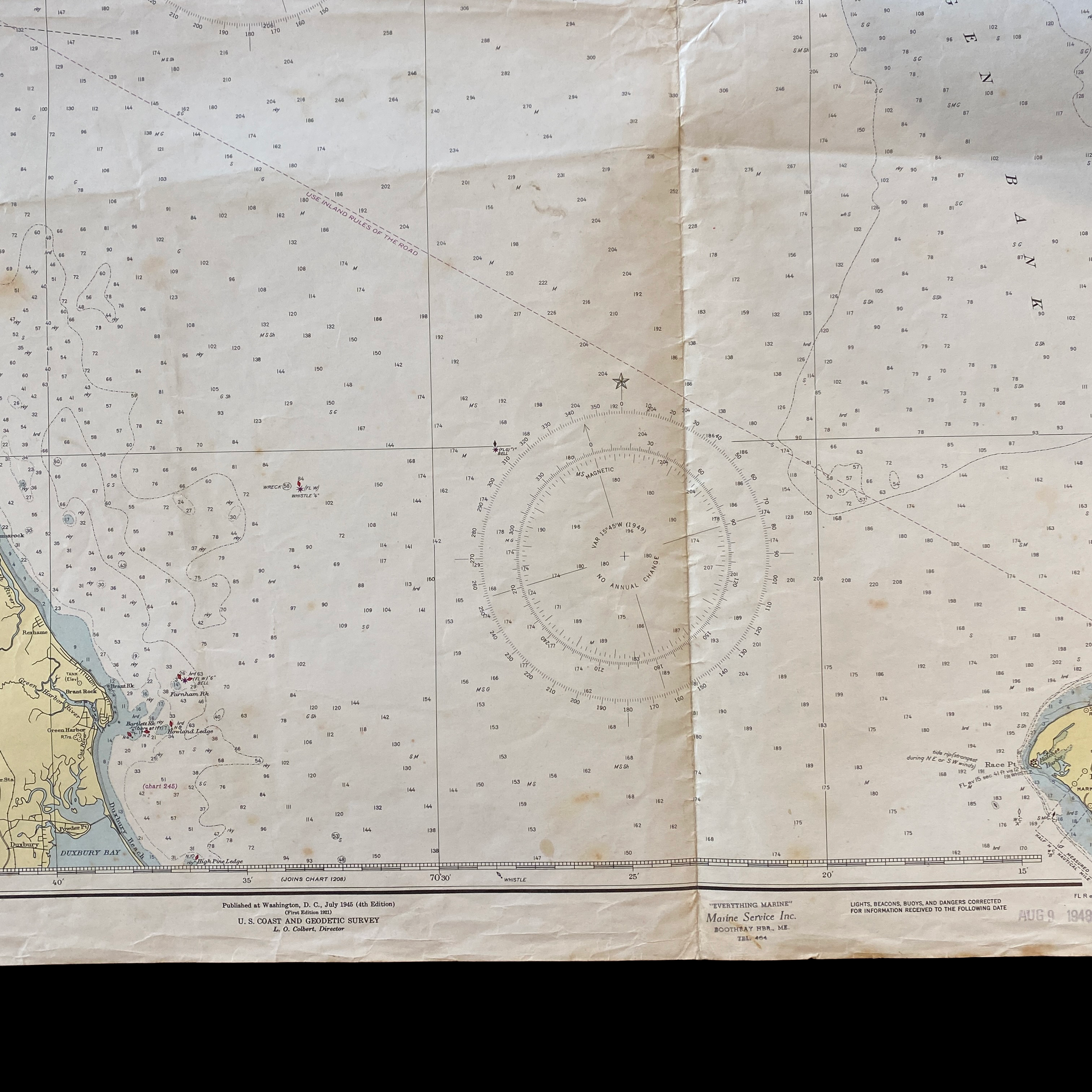
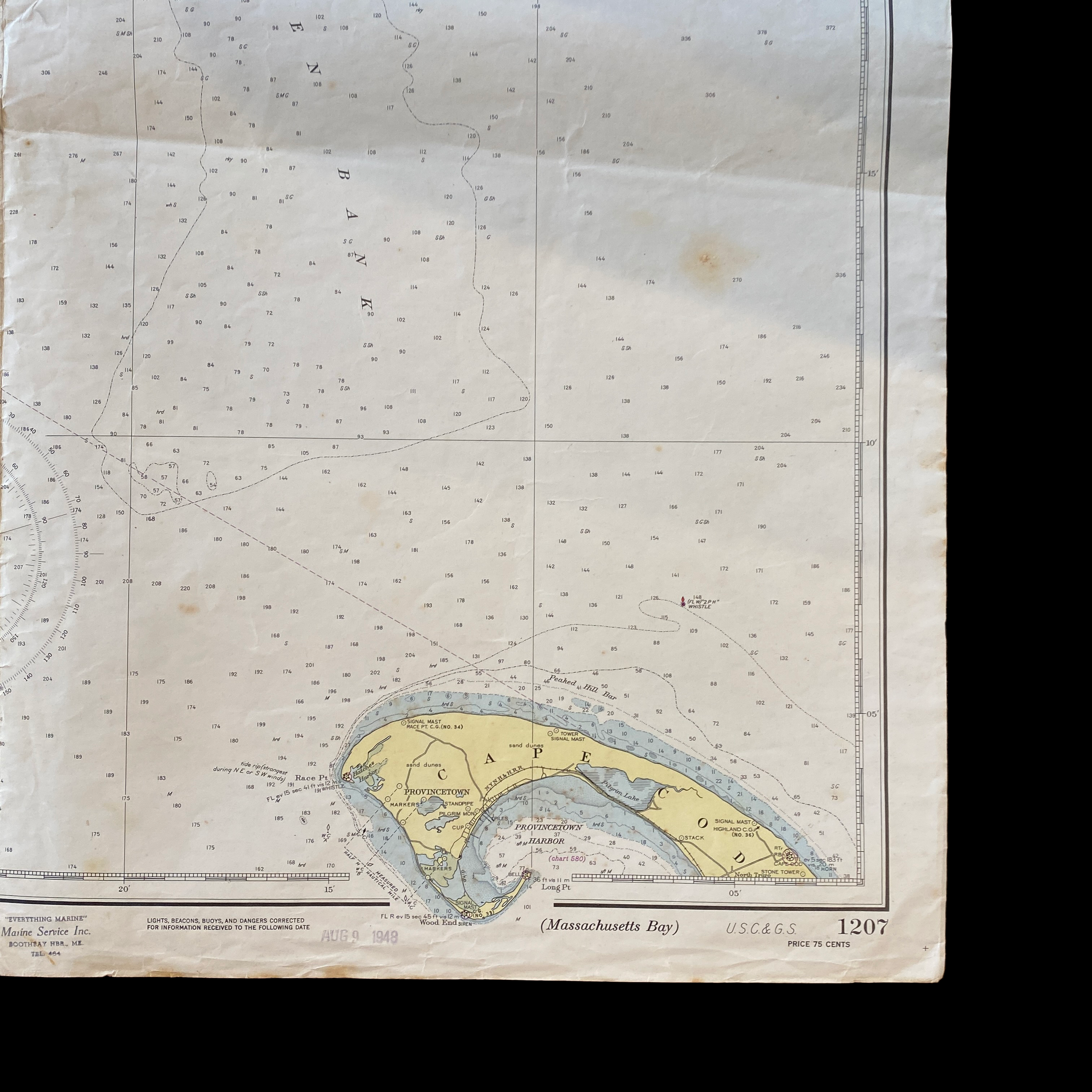
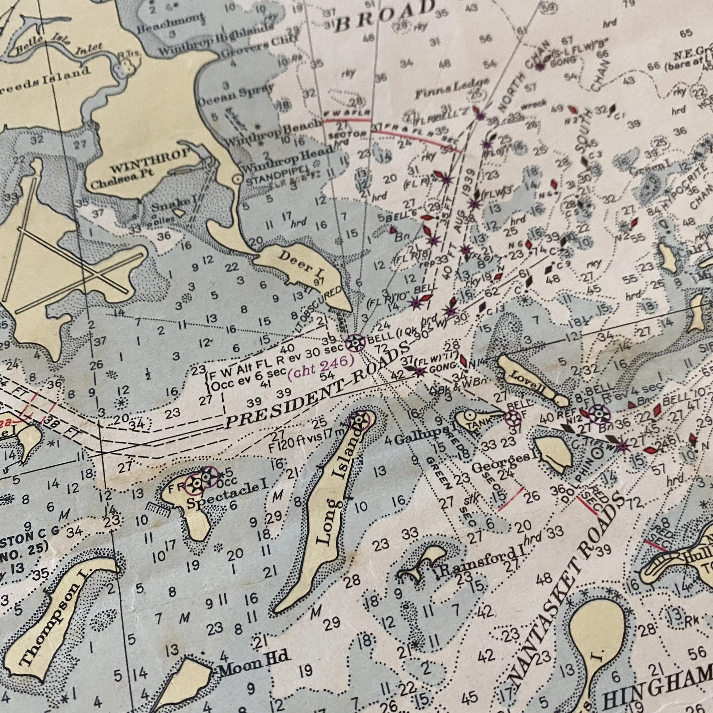
The United States Department of Commerce has a long history of creating and updating ocean maps, including fathom and depth charts. One such map, dated 1948, shows Massachusetts Bay in great detail.
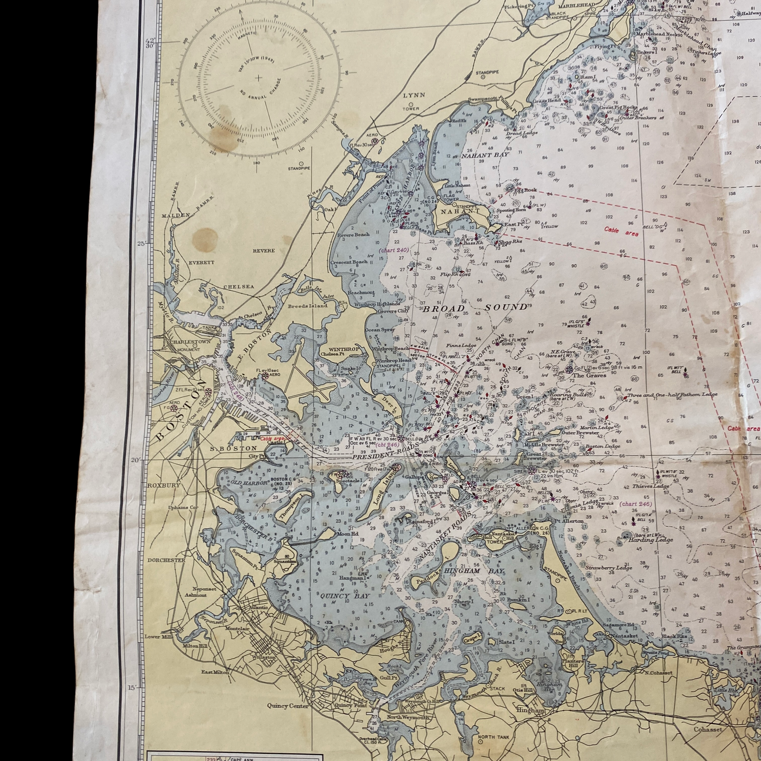
Massachusetts Bay is a large body of water located on the northeastern coast of the United States. It is bordered by the states of Massachusetts, New Hampshire, and Maine, and is a popular destination for boating, fishing, and other water-related activities. The bay is also home to a number of important ports and shipping lanes, making it a crucial area for navigation and commerce.
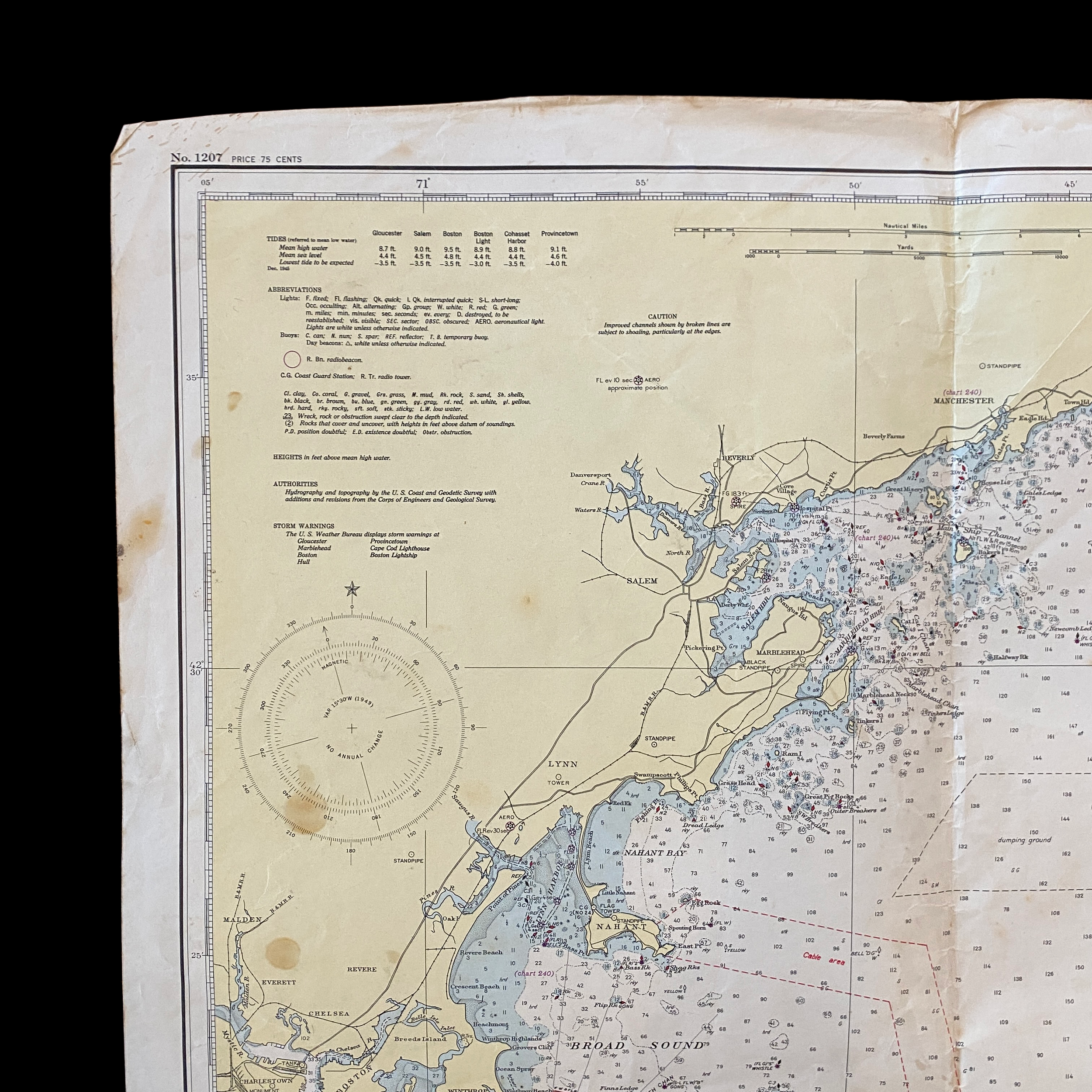
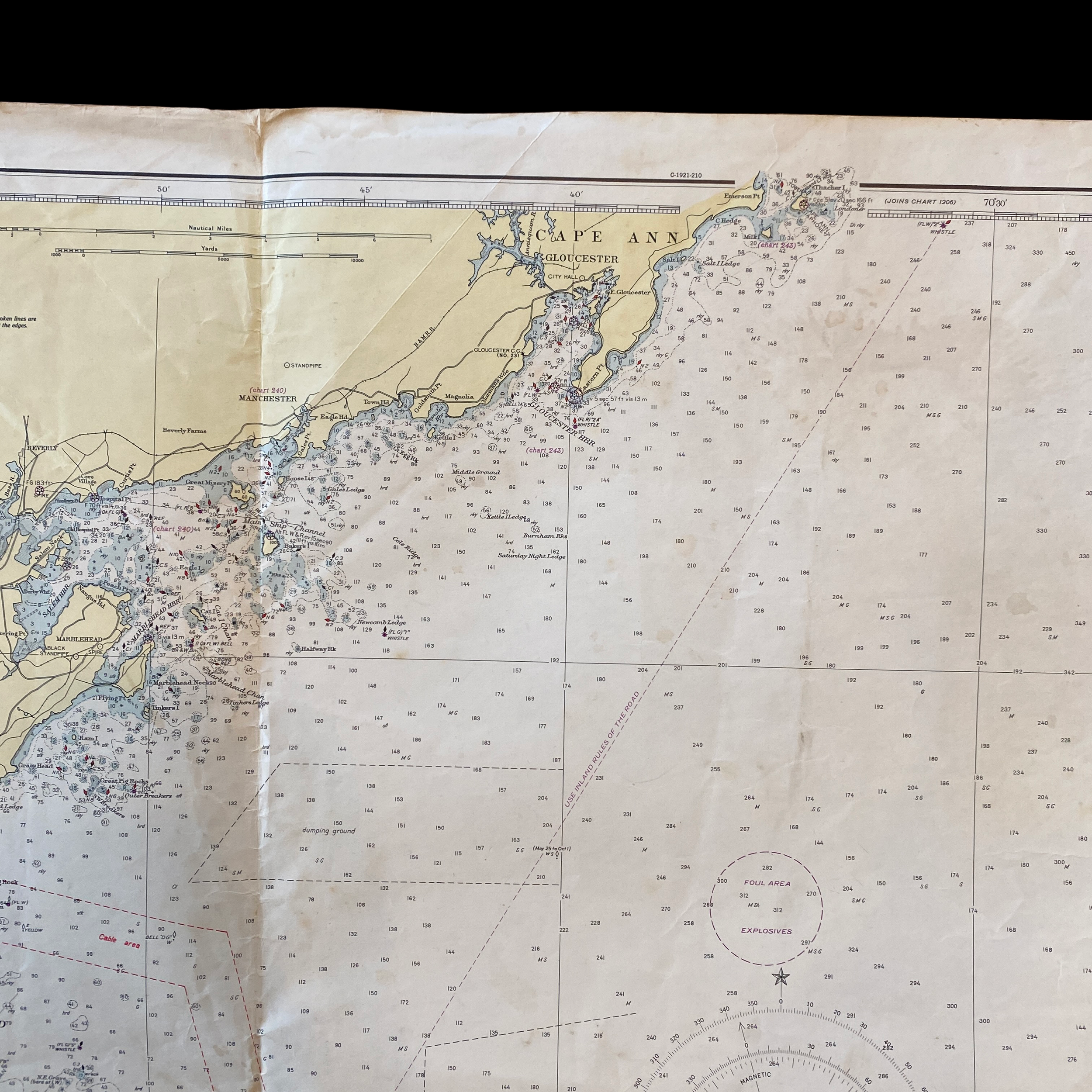
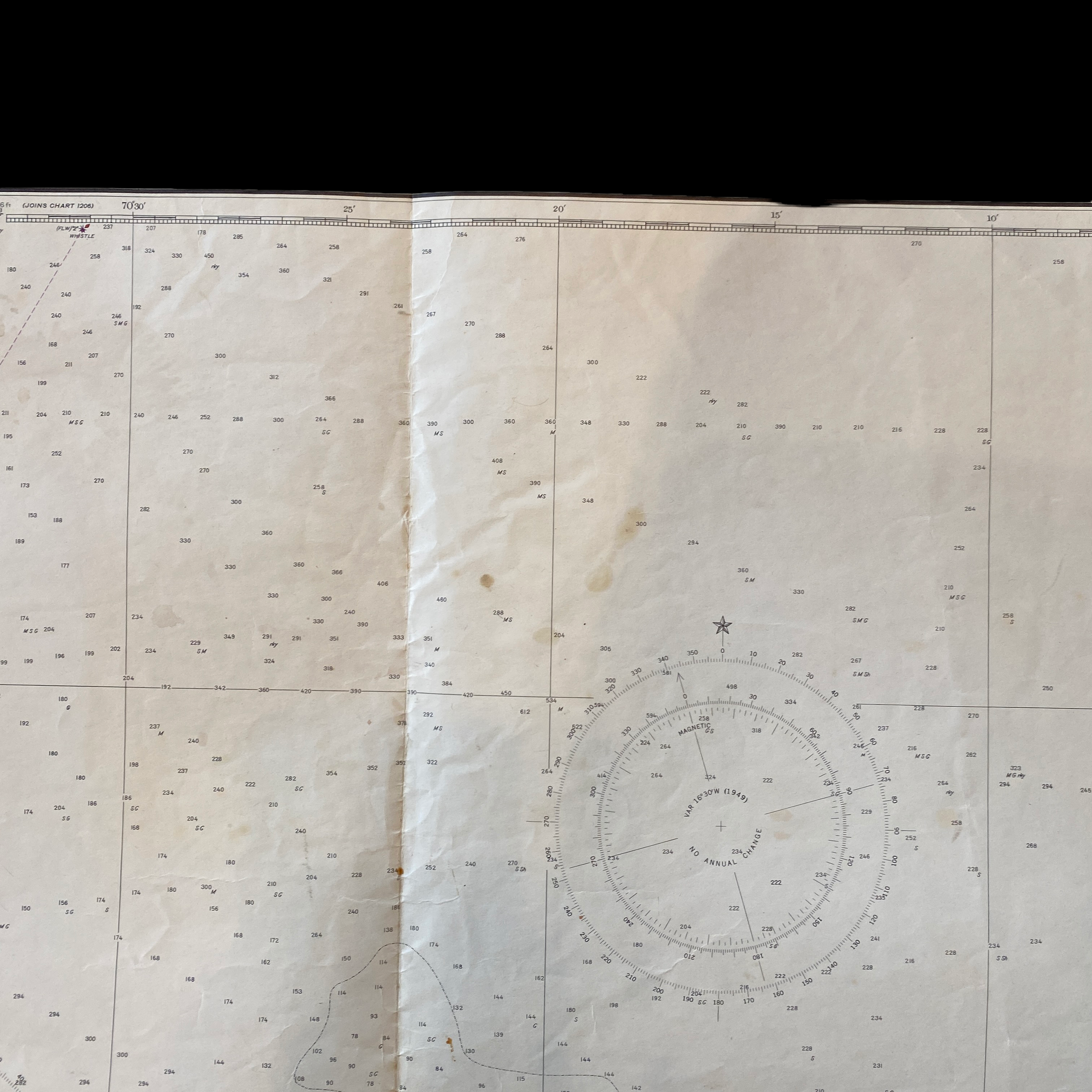
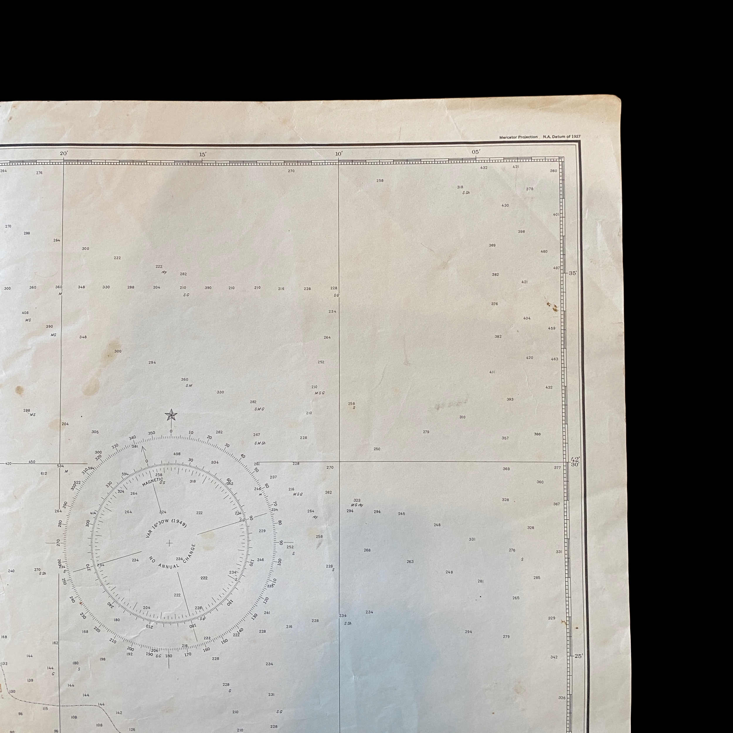
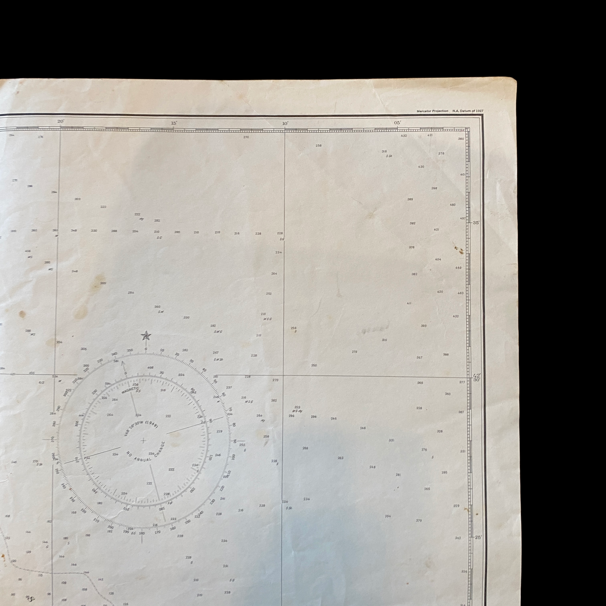
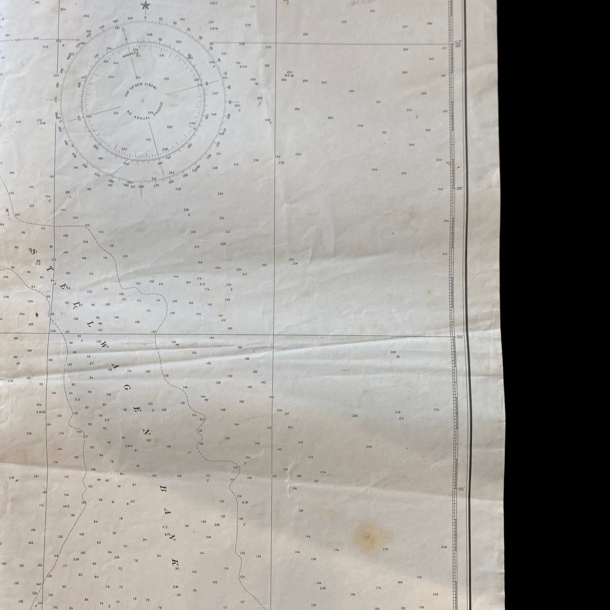
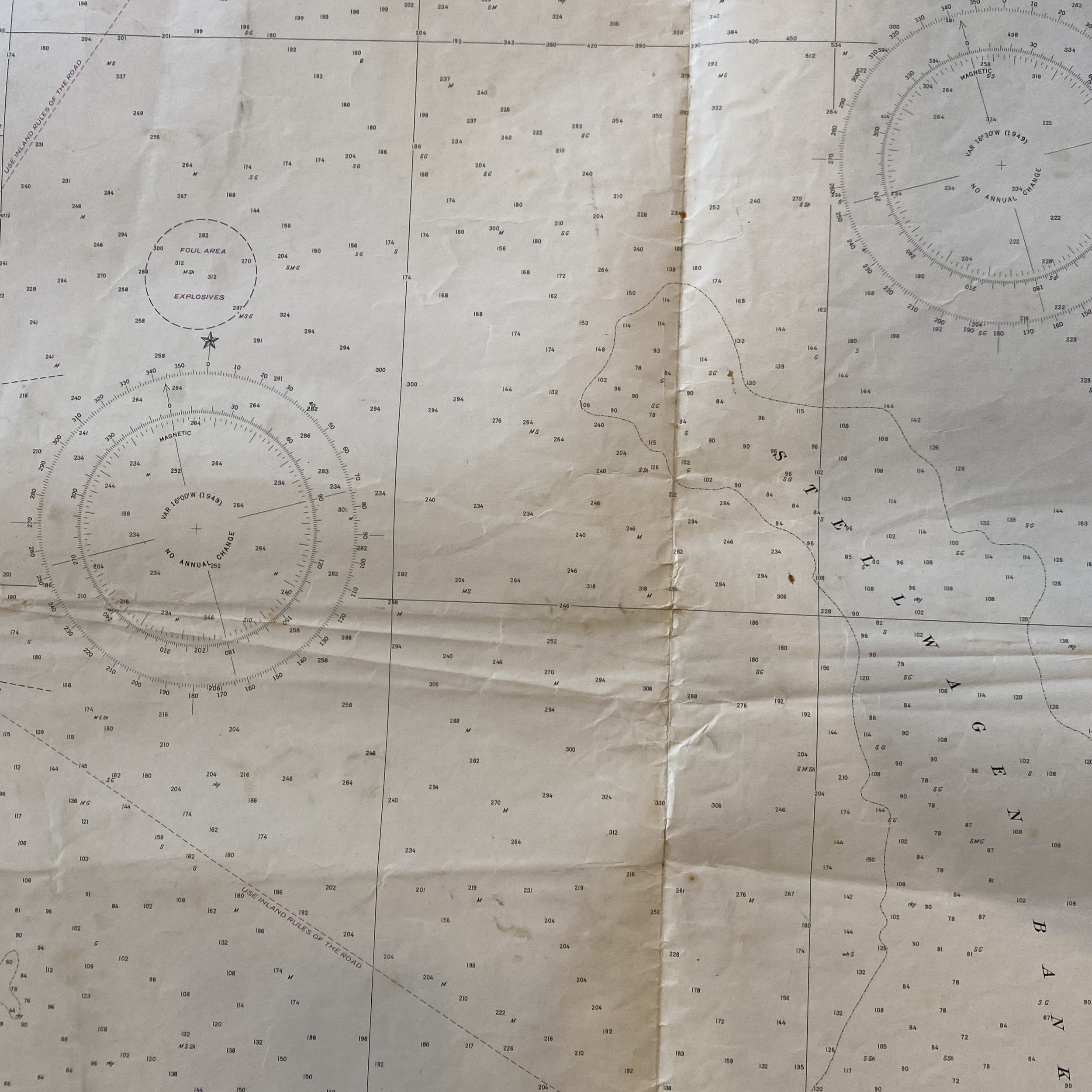
The 1948 fathom and depth chart of Massachusetts Bay is a highly detailed and accurate representation of the bay's underwater topography. It is created using a combination of traditional surveying techniques and more modern technologies, such as sonar and echo sounding. The chart includes information on water depth, as well as the location and characteristics of underwater hazards such as rocks, shoals, and sunken vessels.
One of the key features of this chart is its use of fathom contours, which are lines that connect points of equal water depth. These contours are an important tool for mariners, as they provide a visual representation of the bay's underwater terrain. The chart also includes information on the location of important navigational aids, such as lighthouses and buoys, as well as the locations of ports and harbors.
In addition to its practical use for navigation and commerce, the 1948 fathom and depth chart of Massachusetts Bay is also an important historical document. It provides a snapshot of the bay's underwater landscape at a specific point in time, and can be used to track changes in the bay over time. This can be useful for understanding the effects of human activities, such as dredging and construction, as well as natural processes such as erosion and sedimentation.
Overall, the 1948 fathom and depth chart of Massachusetts Bay is a valuable resource for mariners, scientists, and historians alike. It provides detailed information on the bay's underwater topography, as well as important navigational information. It is an example of the important work done by the U.S. Department of Commerce in creating accurate and useful ocean maps.
The United States Department of Commerce has a long history of playing an important role in the economic development and regulation of the country. In 1948, the Department had several responsibilities and initiatives related to Massachusetts Bay, a large body of water located on the northeastern coast of the United States.
In 1948, the U.S. Department of Commerce's Bureau of Commercial Fisheries had a research station located in Massachusetts Bay. The bureau was responsible for managing and conserving the country's fish stocks, and the research station in Massachusetts Bay was used to study the local fish populations, including groundfish, lobster, and scallops. This research helped the bureau make informed decisions about fishing regulations, including quotas and seasons, to ensure the sustainability of the local fishing industry.
Another responsibility of the U.S. Department of Commerce in 1948 was the operation and maintenance of lighthouses and other navigational aids in Massachusetts Bay. The department's Coast and Geodetic Survey (CGS) was responsible for ensuring the safe navigation of ships in the bay by maintaining and upgrading lighthouses, buoys, and other navigational aids. The CGS also conducted hydrographic surveys of the bay to create accurate nautical charts and publications that were used by mariners to navigate the waters safely.
In 1948, the U.S. Department of Commerce's Bureau of Public Roads was also actively involved in the development of Massachusetts Bay's transportation infrastructure. The bureau was responsible for the construction and maintenance of highways and bridges, and played a key role in the development of the transportation network that connected the cities and towns in the region to the rest of the country. The bureau's work helped to support the growth of the local economy by making it easier for goods to be transported in and out of the area.
Furthermore, the U.S. Department of Commerce's Bureau of Foreign and Domestic Commerce also had a presence in Massachusetts Bay in 1948. The bureau was responsible for promoting American goods and services in foreign markets and encouraging foreign investment in the United States. The bureau's work helped to support the growth of the local economy by helping Massachusetts Bay businesses to expand their export markets and attract foreign investment.
In conclusion, the U.S. Department of Commerce played a significant role in the economic development and regulation of Massachusetts Bay in 1948. Through the work of its various bureaus, the department helped to manage and conserve fish stocks, ensure safe navigation, develop transportation infrastructure, and promote American goods and services in foreign markets. The department's work helped to support the growth of the local economy and improve the lives of the people living in the region.