Original 1944 U.S. Department of Commerce "Blue Hill Bay & Mt. Desert Island" Maine Navigation and Ocean Fathom Depth Nautical Map*
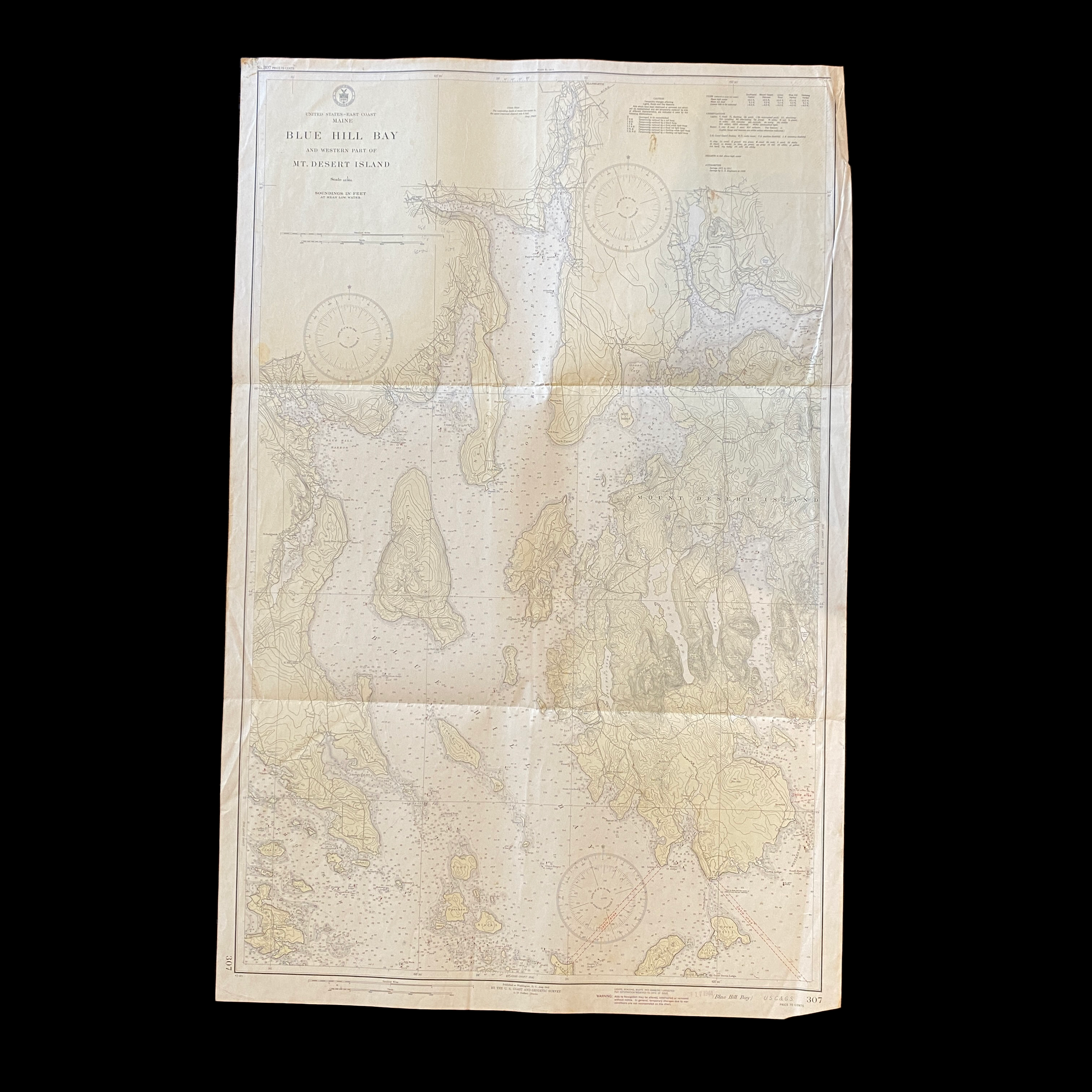


Original 1944 U.S. Department of Commerce "Blue Hill Bay & Mt. Desert Island" Maine Navigation and Ocean Fathom Depth Nautical Map*
Comes with C.O.A.
Perfect for the historian, seaman, map-lover, the curious or just as a conversation starter. Wonderful and rare. Vintage maps such as these make great gifts.
Printed 1944
The U.S. Department of Commerce Fathom and Depth Chart Ocean Map, dated 1944, is a valuable historical document that provides insight into the understanding and mapping of the ocean in the mid-20th century. This particular map focuses on Blue Hill Bay and the Western part of Mt. Desert Island in Maine.
At the time this map was created, the United States was involved in World War II, and the need for accurate navigational charts was crucial for the war effort. The U.S. Coast and Geodetic Survey, a division of the Department of Commerce, was responsible for producing these charts. They used a variety of methods to gather data, including depth soundings from ships, aerial photography, and tide gauge measurements.
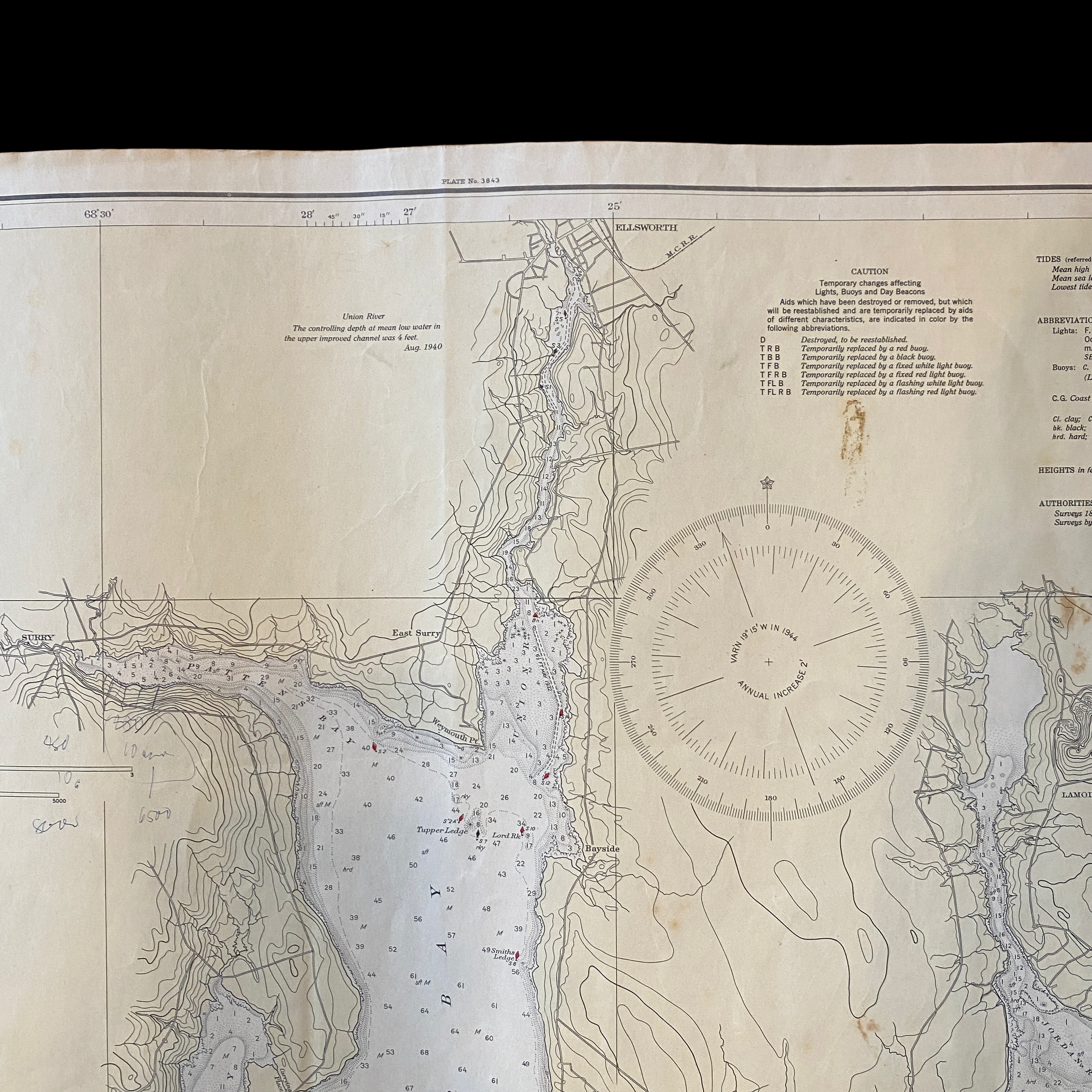
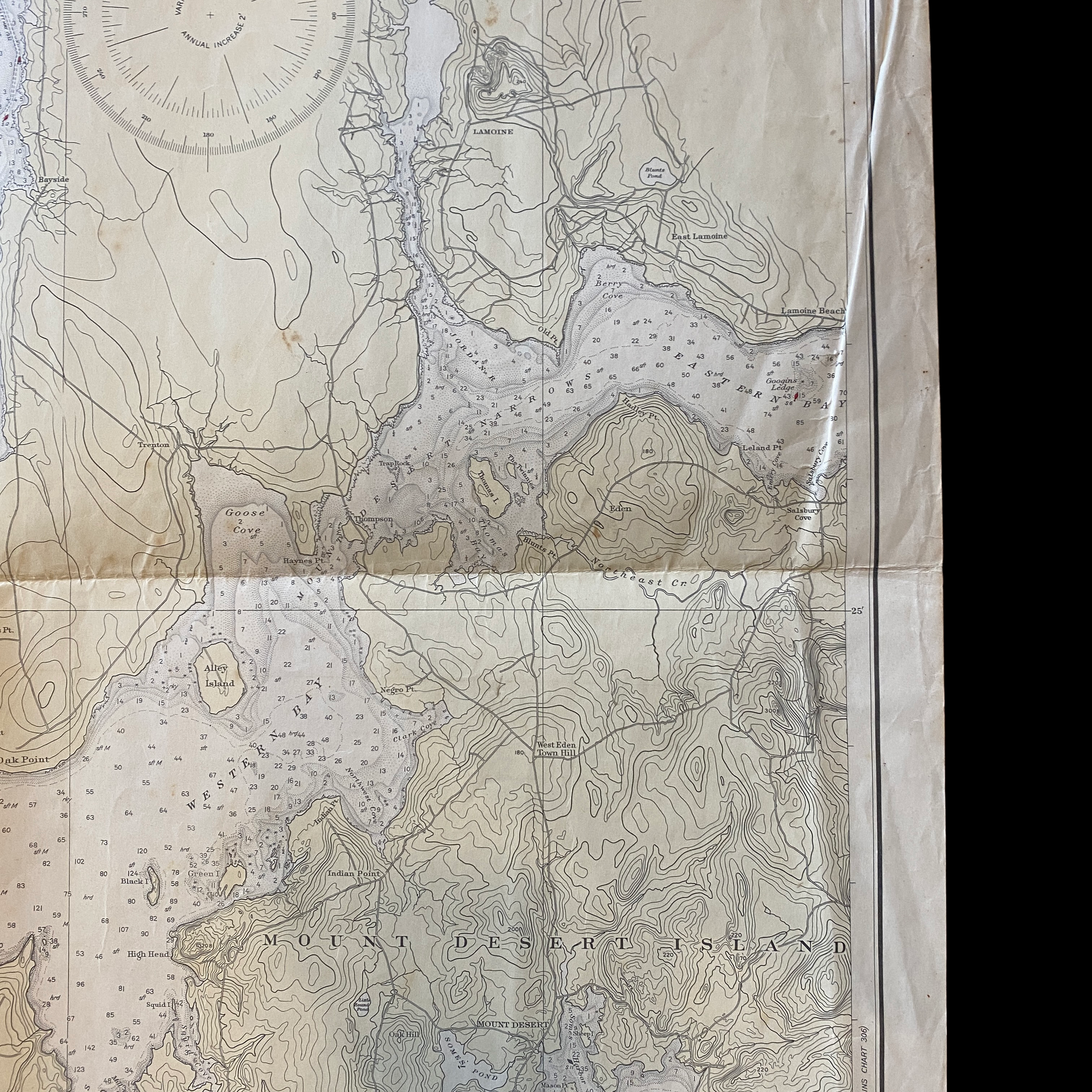
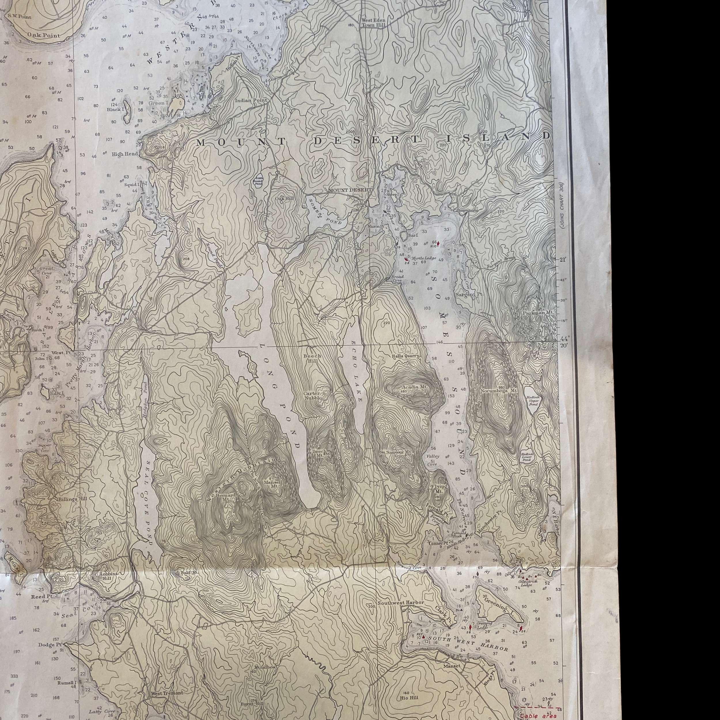
The map itself is highly detailed, with intricate lines and symbols indicating the depth of the ocean floor, the location of rocks and other underwater hazards, and the location of lighthouses and other navigational aids. The use of fathoms, a unit of measurement typically used in nautical contexts, is indicative of the map's intended use by mariners and sailors.
One of the most striking features of the map is the amount of detail provided on the ocean floor. The contour lines, which indicate changes in depth, are closely spaced in some areas and farther apart in others. This shows the level of precision and accuracy that the surveyors were able to achieve at the time.
The map also provides insight into the geography and geology of Blue Hill Bay and Mt. Desert Island. The western side of the island is characterized by rugged cliffs and rocky shores, while the eastern side is more gently sloping with sandy beaches. The map also shows the location of several small islands and offshore rocks in the bay, which are important for navigation.
The map is also important for understanding the human impact on the area. The location of several small fishing villages and harbors is indicated on the map, as well as the location of a number of lighthouses. These structures were crucial for the safety of mariners, and their presence on the map shows the importance of the fishing and shipping industries to the local economy.
Overall, the U.S. Department of Commerce Fathom and Depth Chart Ocean Map, dated 1944, is a valuable historical document that provides insight into the understanding and mapping of the ocean in the mid-20th century. The level of detail and precision on the map, along with the information about the geography, geology, and human impact on the area, make it a valuable resource for anyone interested in the history of the region.
The U.S. Department of Commerce played a vital role in the economic development of Blue Hill Bay and the Western part of Mt. Desert Island, Maine during the 1940s. During this time, the country was in the midst of World War II, and the Department of Commerce was responsible for ensuring the war effort was supported by a strong economy.
One of the main industries in Blue Hill Bay and Mt. Desert Island during this time was fishing. The area was home to a number of small fishing villages and harbors, and the Department of Commerce worked to support this industry by providing funding for the construction of fishing vessels and the expansion of existing harbors. This helped to increase the productivity of the local fishing fleet and ensured a steady supply of fish for the war effort.
Another important industry in the area was shipping. The Department of Commerce worked to improve navigational safety in Blue Hill Bay by funding the construction of lighthouses and other navigational aids. This made it safer for ships to enter and exit the harbor, which helped to support the local shipping industry and the war effort by allowing for the transportation of goods and supplies to and from the area.
The Department of Commerce also played a key role in the development of tourism in the area. The natural beauty of Blue Hill Bay and Mt. Desert Island had long been a draw for visitors, but during the 1940s, the Department of Commerce invested in infrastructure such as roads and accommodations to make it easier for tourists to visit the area. This helped to diversify the local economy and created jobs in the hospitality and tourism industries.
In addition, the Department of Commerce had a division called the U.S. Coast and Geodetic Survey, which was responsible for producing navigational charts and mapping the ocean. The surveyors used a variety of methods to gather data, including depth soundings from ships, aerial photography, and tide gauge measurements. This helped to create accurate navigational charts which was crucial for the war effort and for the safety of mariners in the area.
Overall, the U.S. Department of Commerce played a significant role in the economic development of Blue Hill Bay and the Western part of Mt. Desert Island, Maine during the 1940s. The funding and support provided by the Department helped to improve the productivity of the local fishing and shipping industries, create jobs in the tourism industry, and improve navigational safety in the area. These efforts helped to ensure a strong economy in the region during a time of national crisis and have had a lasting impact on the area.