'Showa' 1942 Dated Japanese Southern Pacific Theater Officer Map - U.S. Captured Bringback
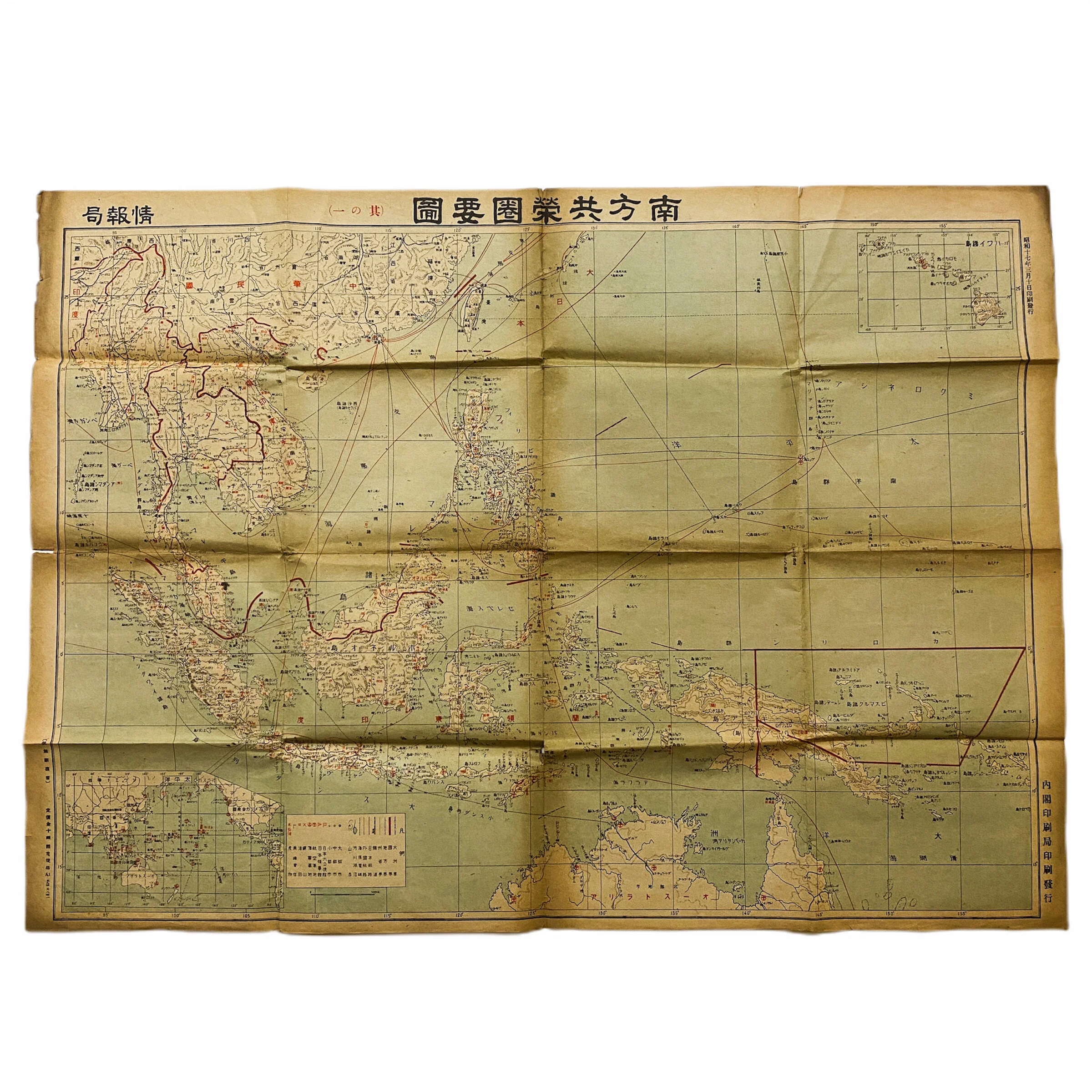


'Showa' 1942 Dated Japanese Southern Pacific Theater Officer Map - U.S. Captured Bringback
Size: 23 x 32 inches
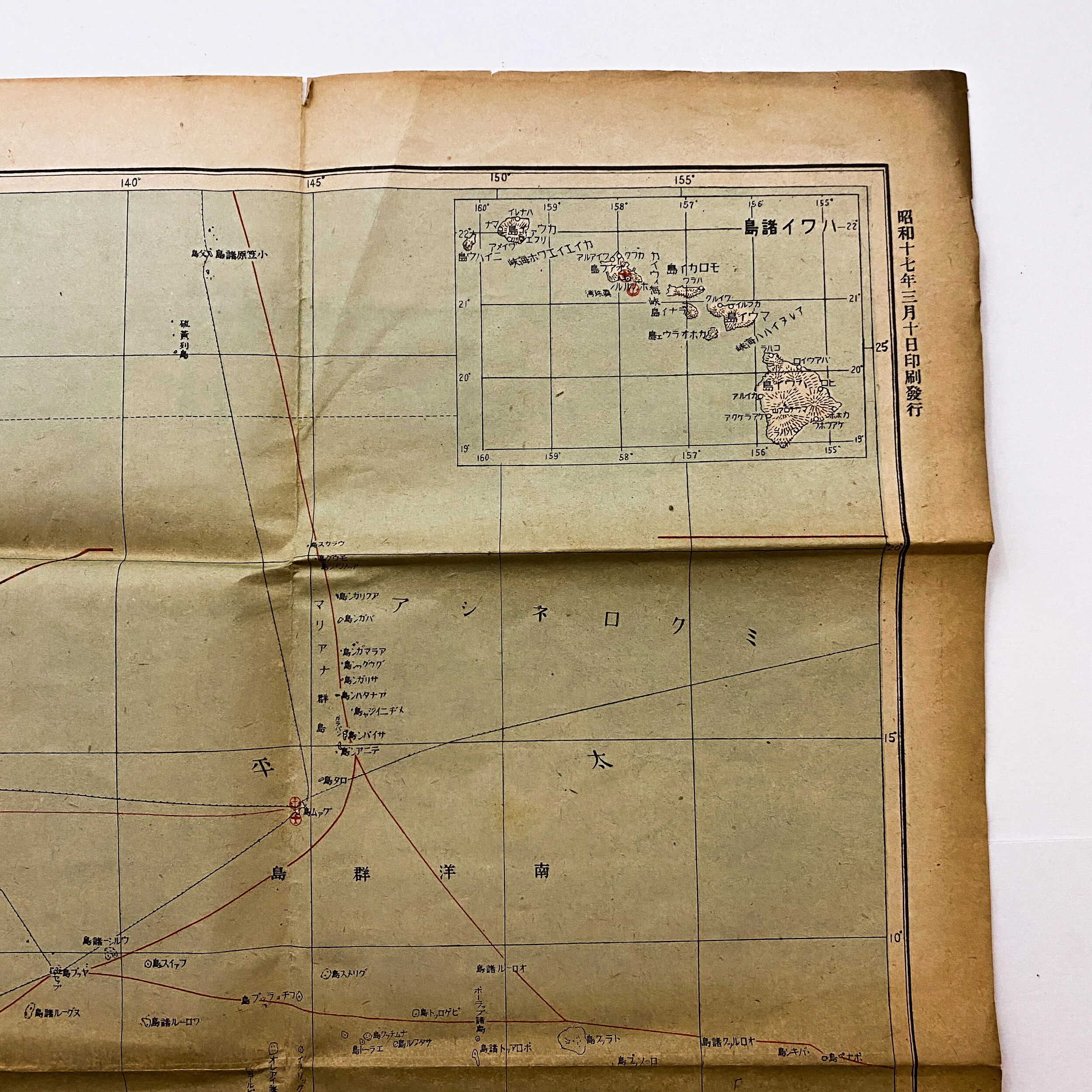
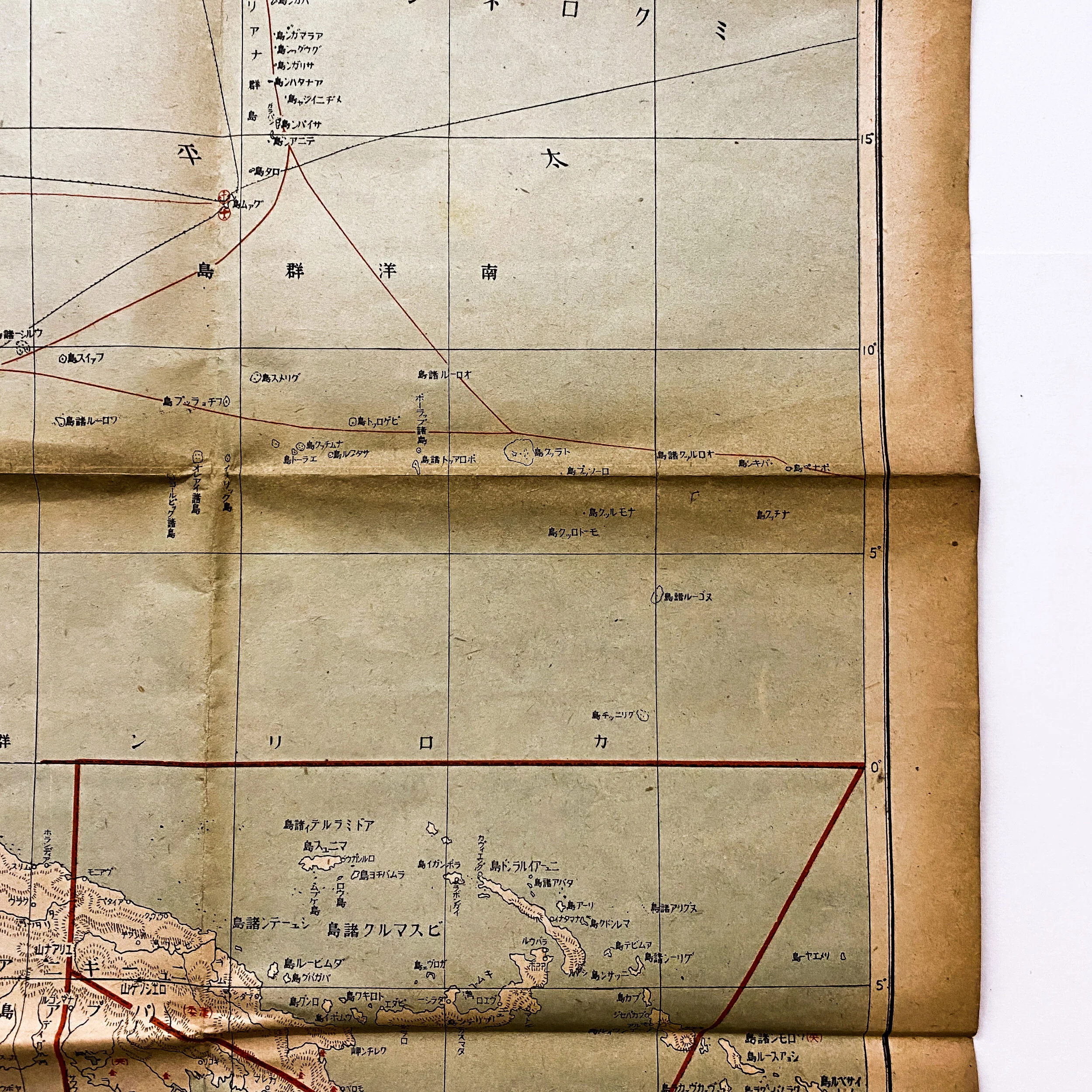
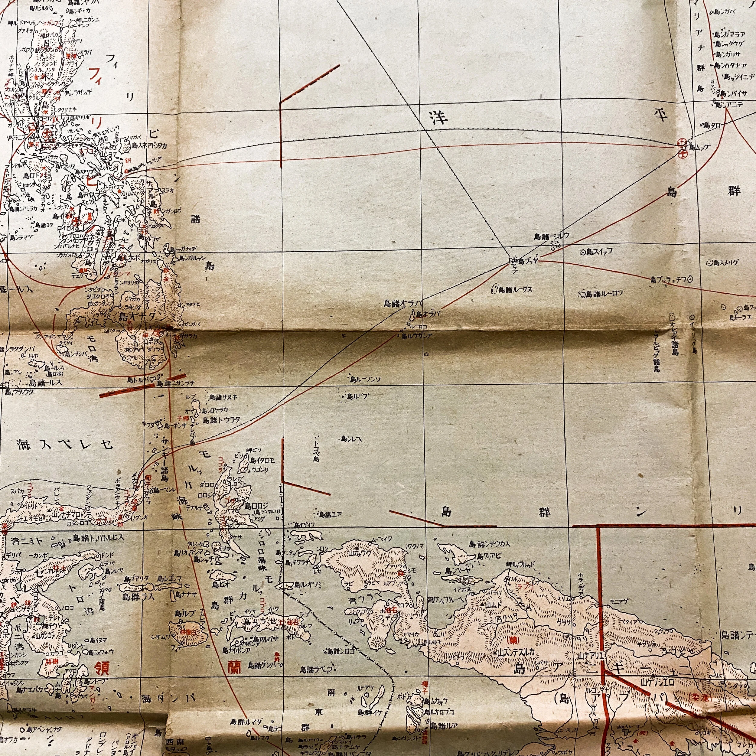
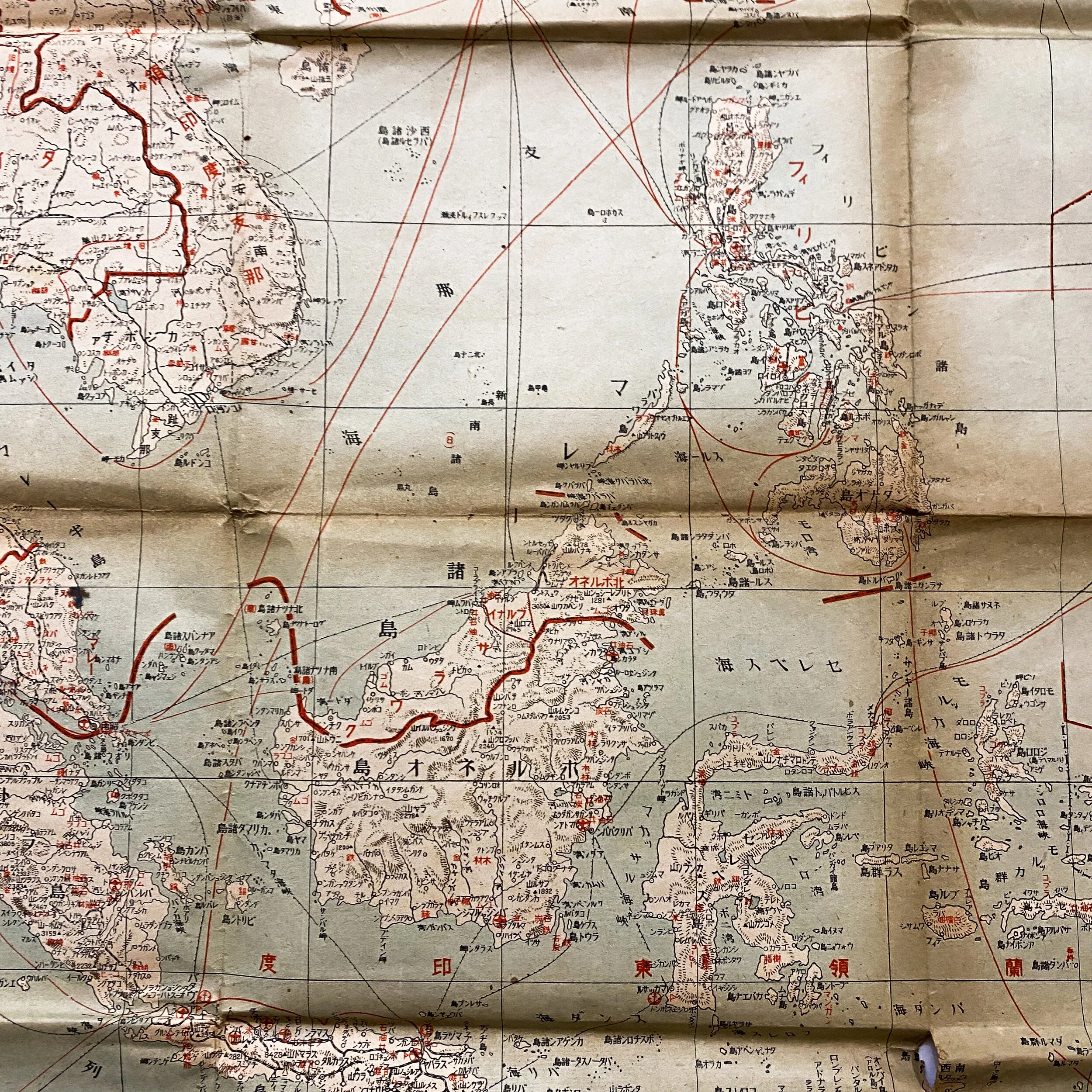
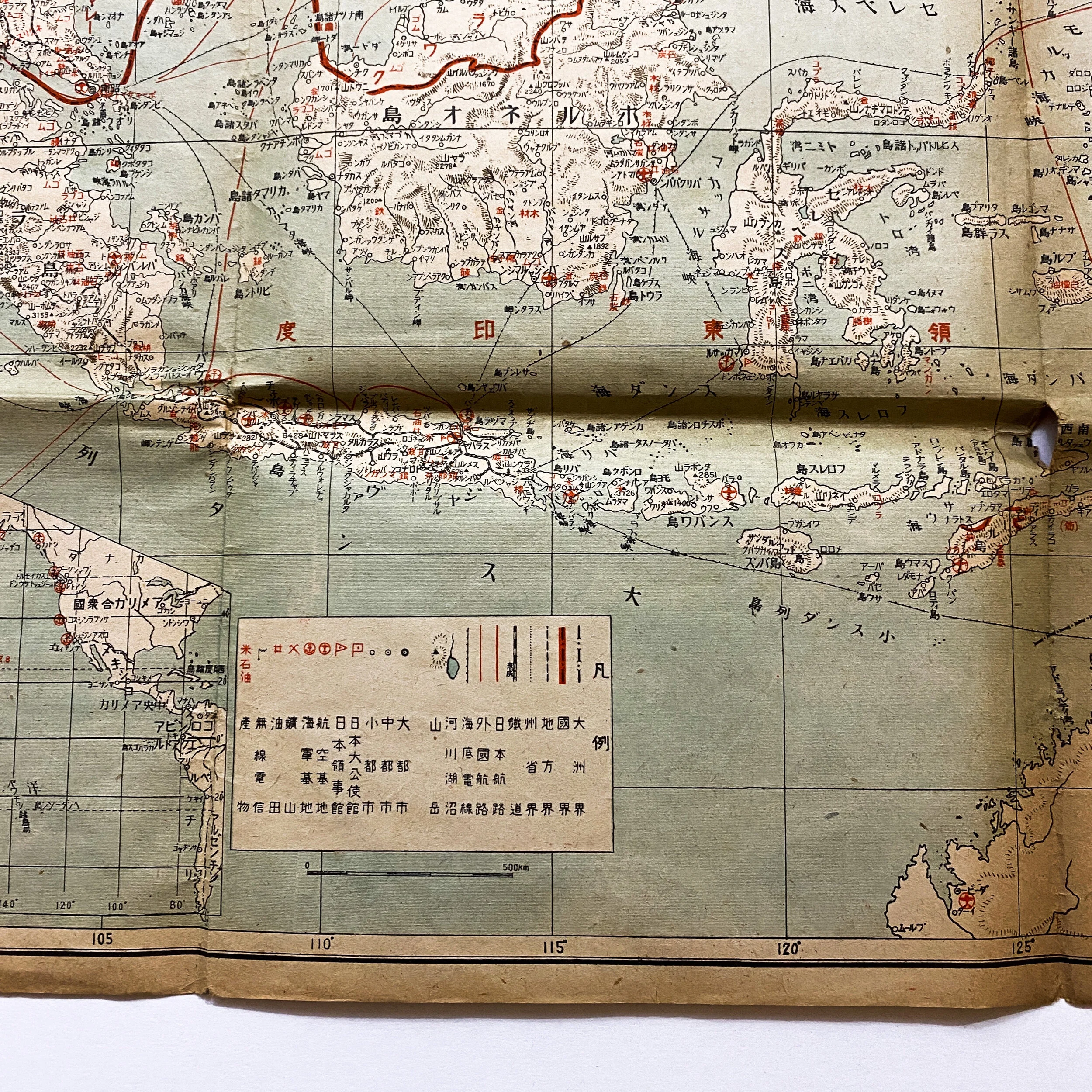
This rare WWII U.S. captured ‘Showa Era’ 1942 dated Japanese map shows the Southern co-prosperity sphere including confidential Japanese air and naval bases as well as confidential Japanese routes from as far south as Allied occupied Australia to as far north the Japanese occupied Philippines Islands and Guam .
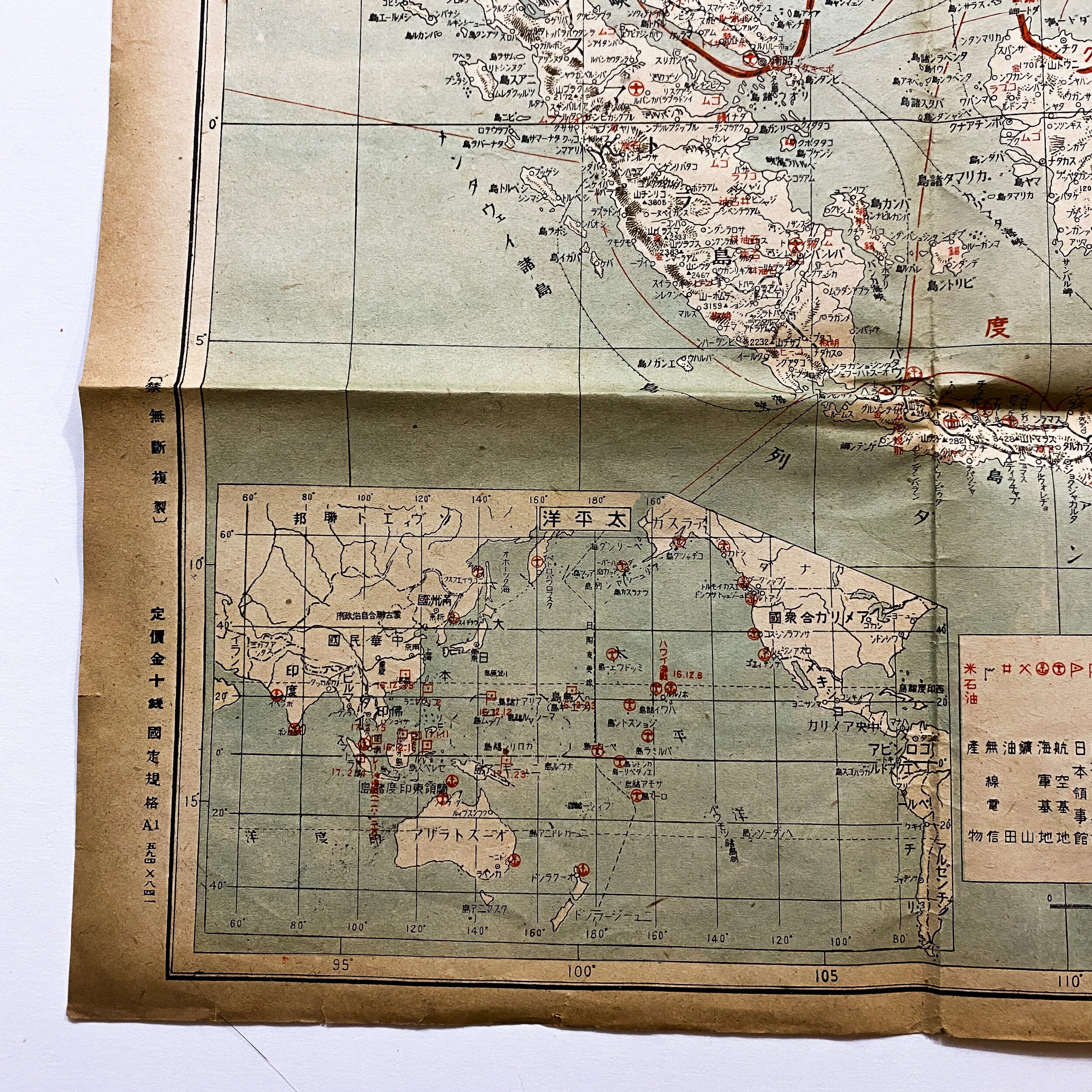
This map is extremely rare in that it shows the US island of Hawaii and is marked in red showing the location of the US air and naval bases on the island of Oahu and Pearl Harbor. While the exact location this map was captured is unknown it was sure to have played a pivotal role in the Japanese forces in the Pacific Theater as they pushed from island to island in the early parts of WWII. The map shows numerous other red airplane and anchor stamps on the Japanese occupied islands in the Southern Pacific Theater. This map also features the a more dynamic drawn out view in the lower left of the Pacific Ocean stretching to the United States showing naval and air bases located on the California Coast as well as parts of Canada and Alaska. The backside of the map also features sets of hand written numbers and math calculations done in graphite pencil and are believed to be done following the capture of this map by U.S. Marine forces as it was used briefly for temporary stretch paper.