EXTREMELY RARE! WWII 1945 Battle of Okinawa (Operation Iceberg) III Amphibious Corps “Japanese DEFENSE INSTALLATIONS" Northern Okinawa SECTOR UMSC Invasion Map*





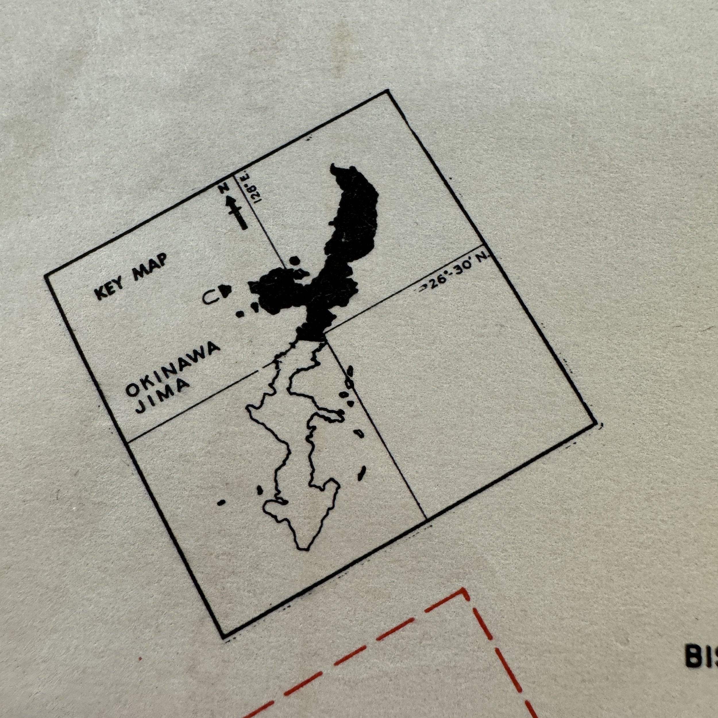
EXTREMELY RARE! WWII 1945 Battle of Okinawa (Operation Iceberg) III Amphibious Corps “Japanese DEFENSE INSTALLATIONS" Northern Okinawa SECTOR UMSC Invasion Map*
Comes with hand-signed C.O.A.
Size: 13 × 14 inches
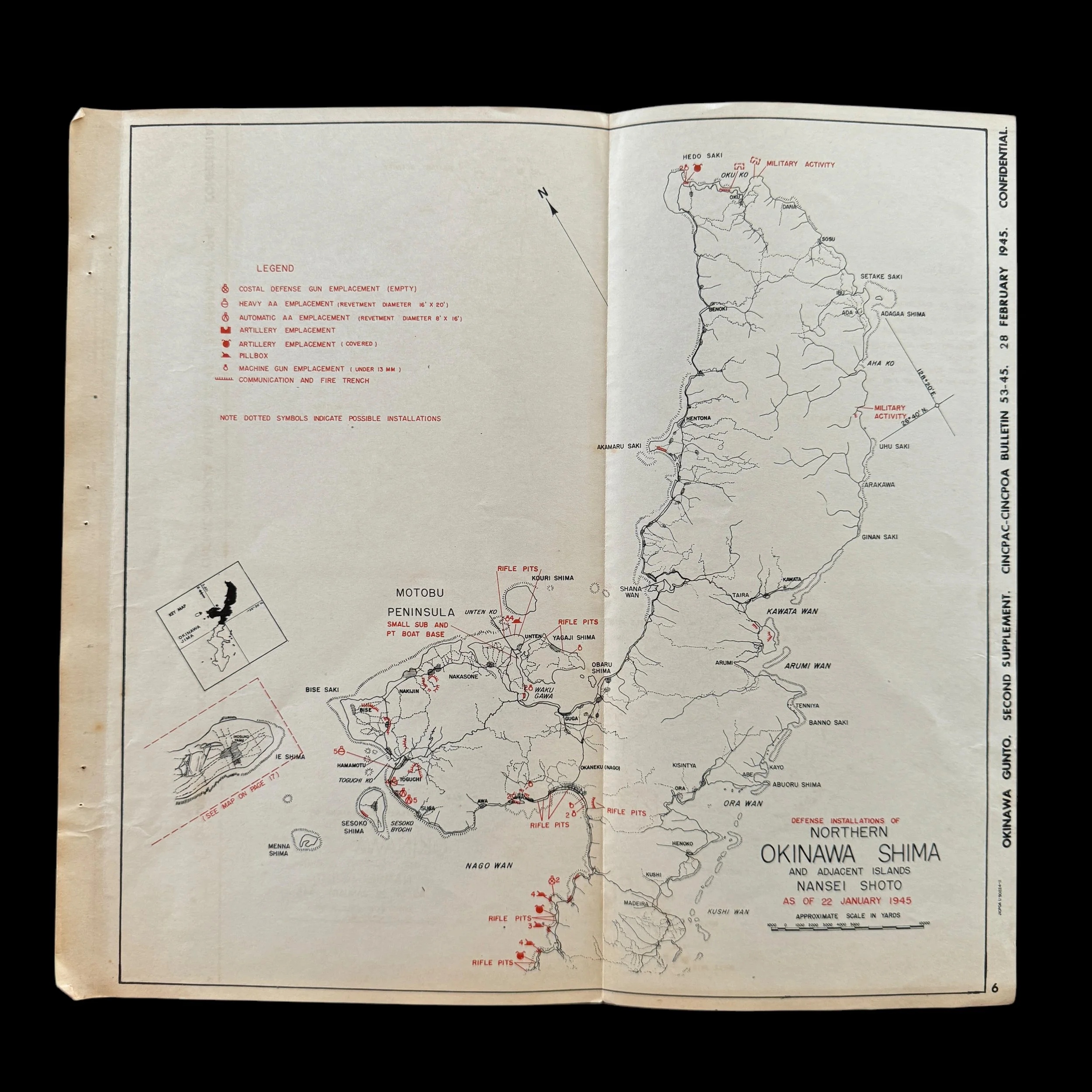
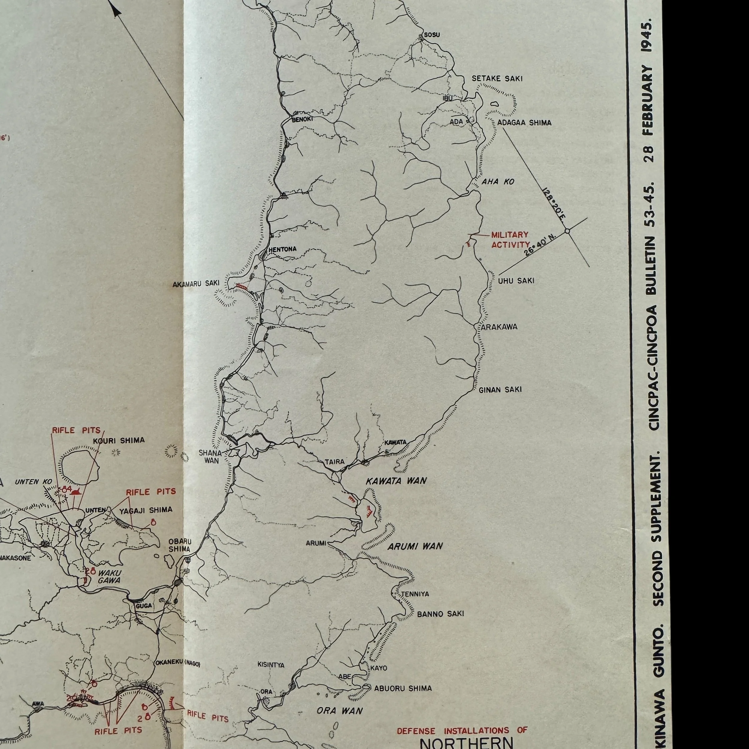
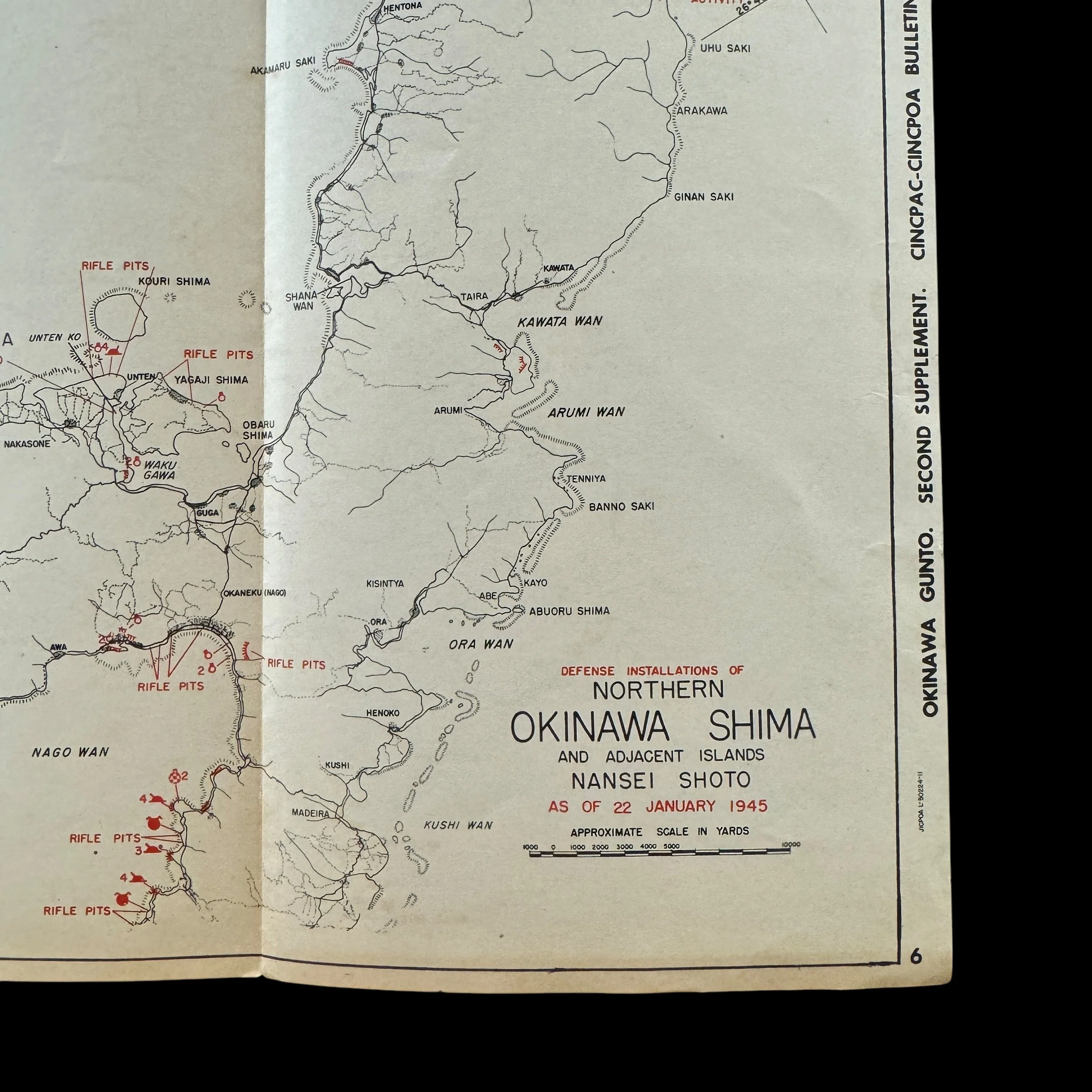
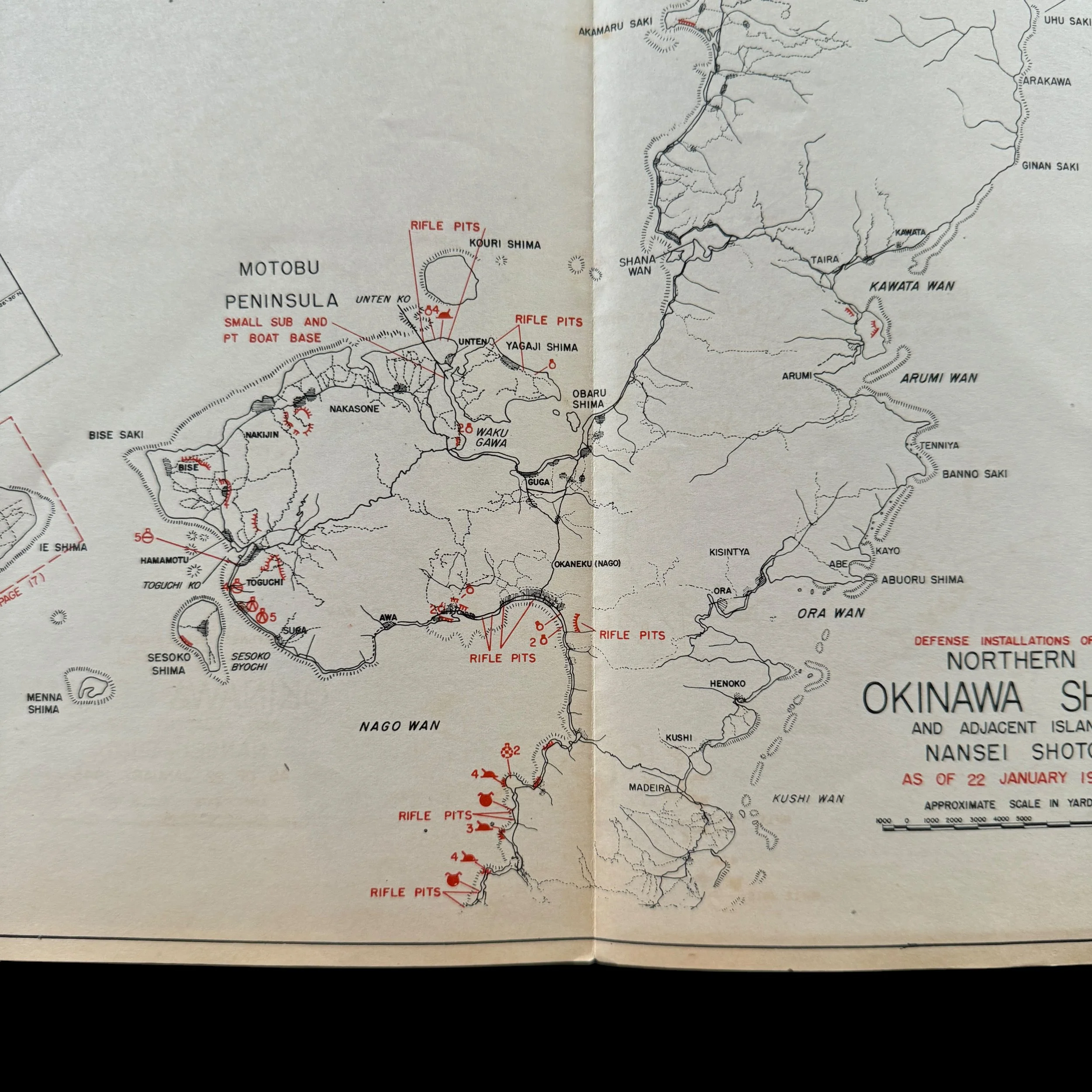
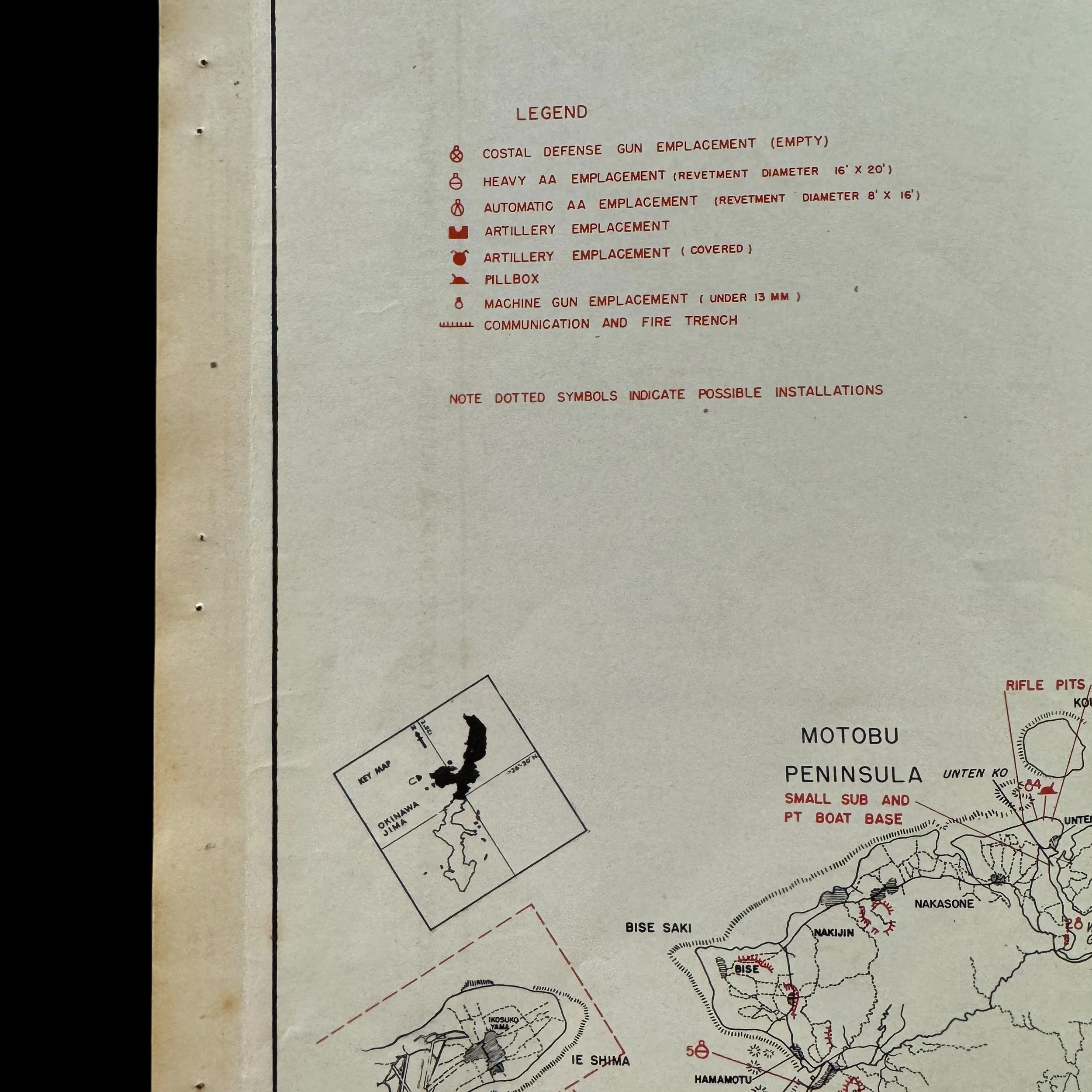
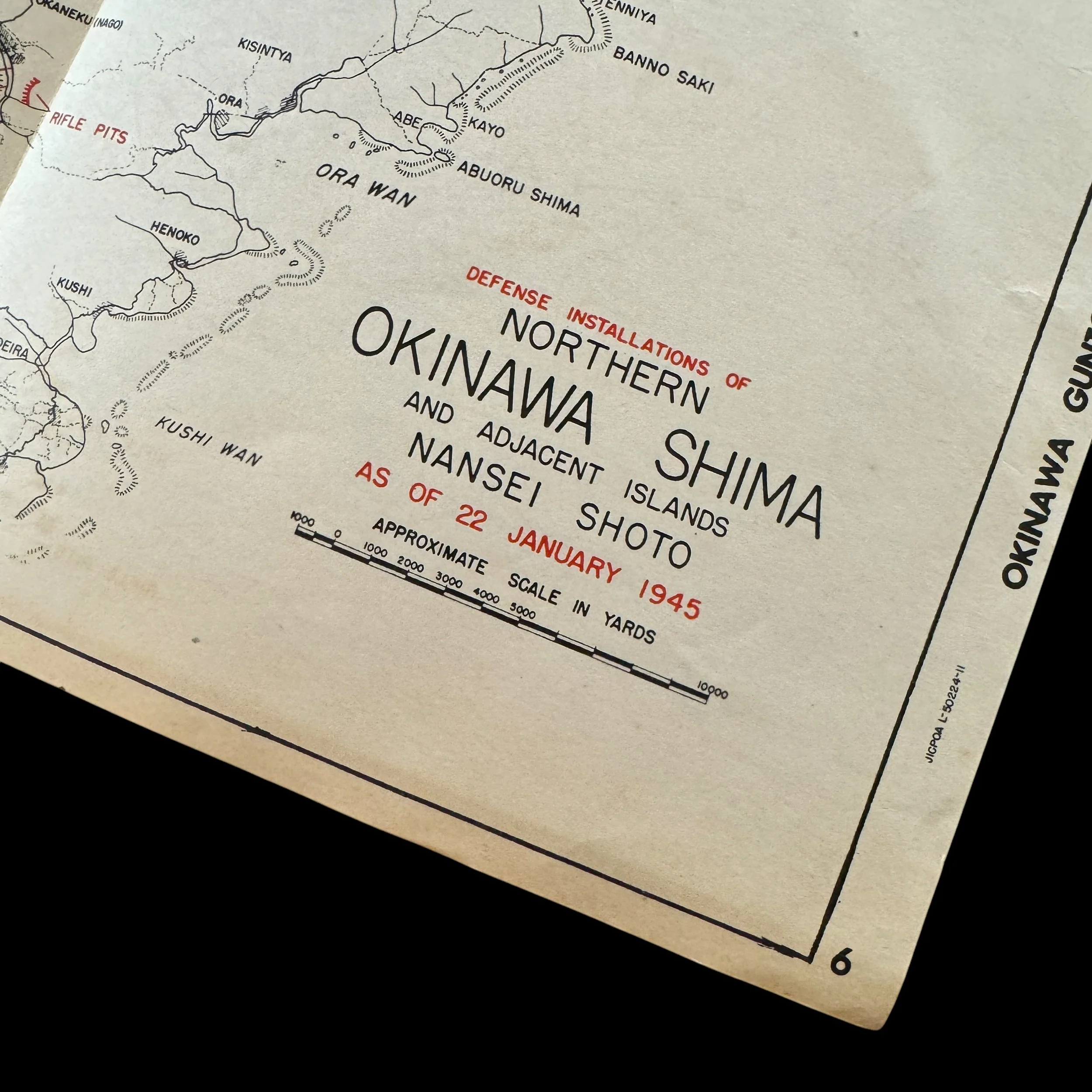
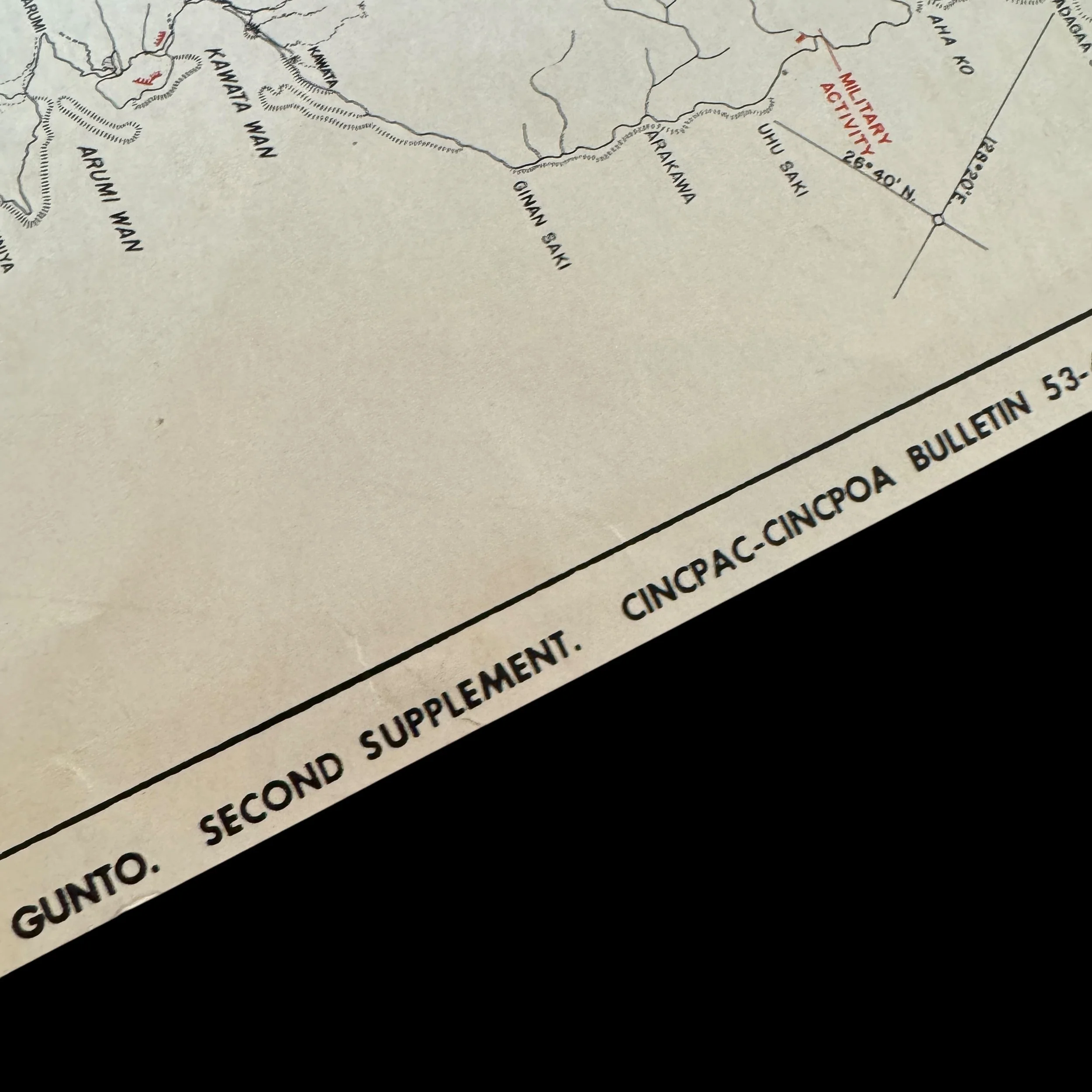
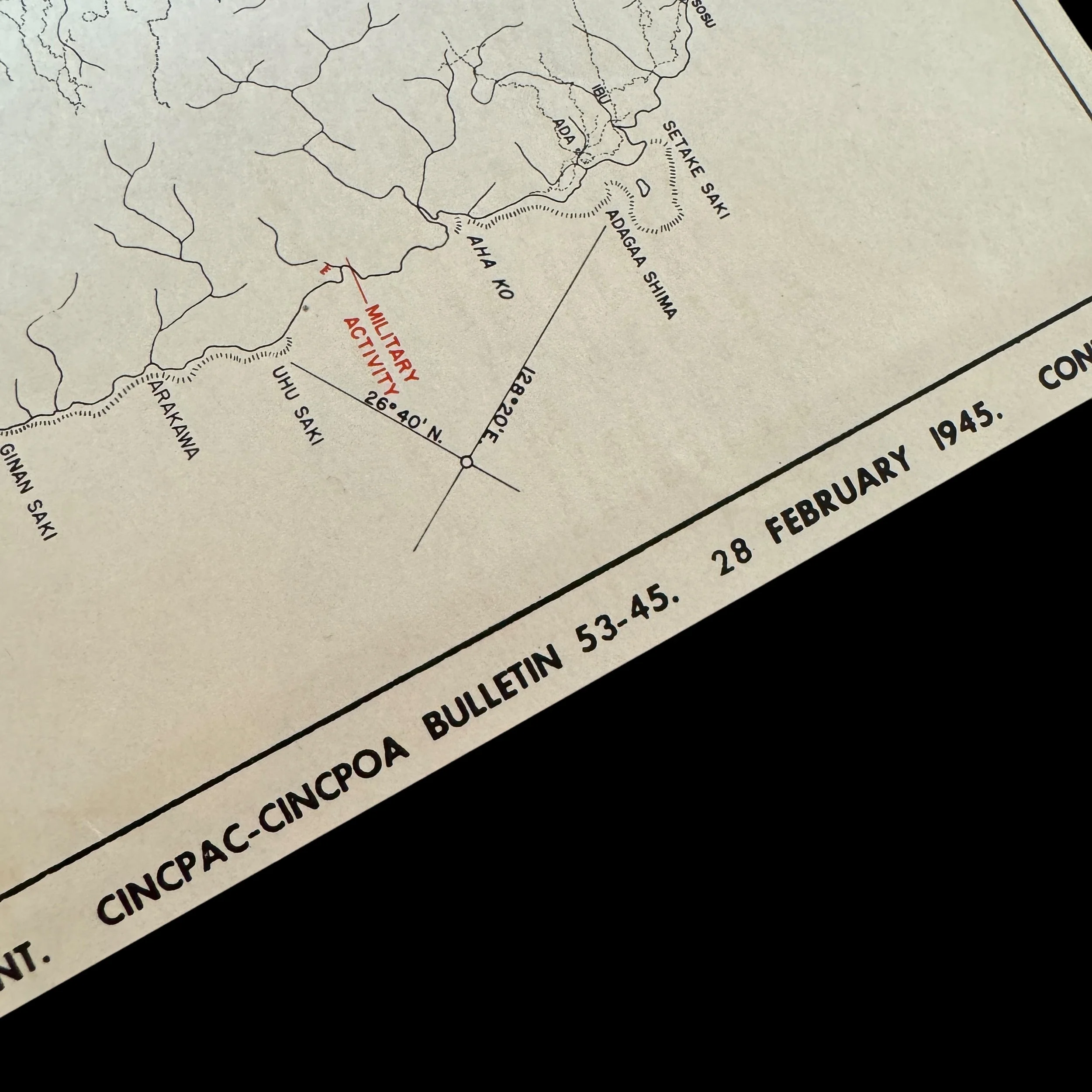
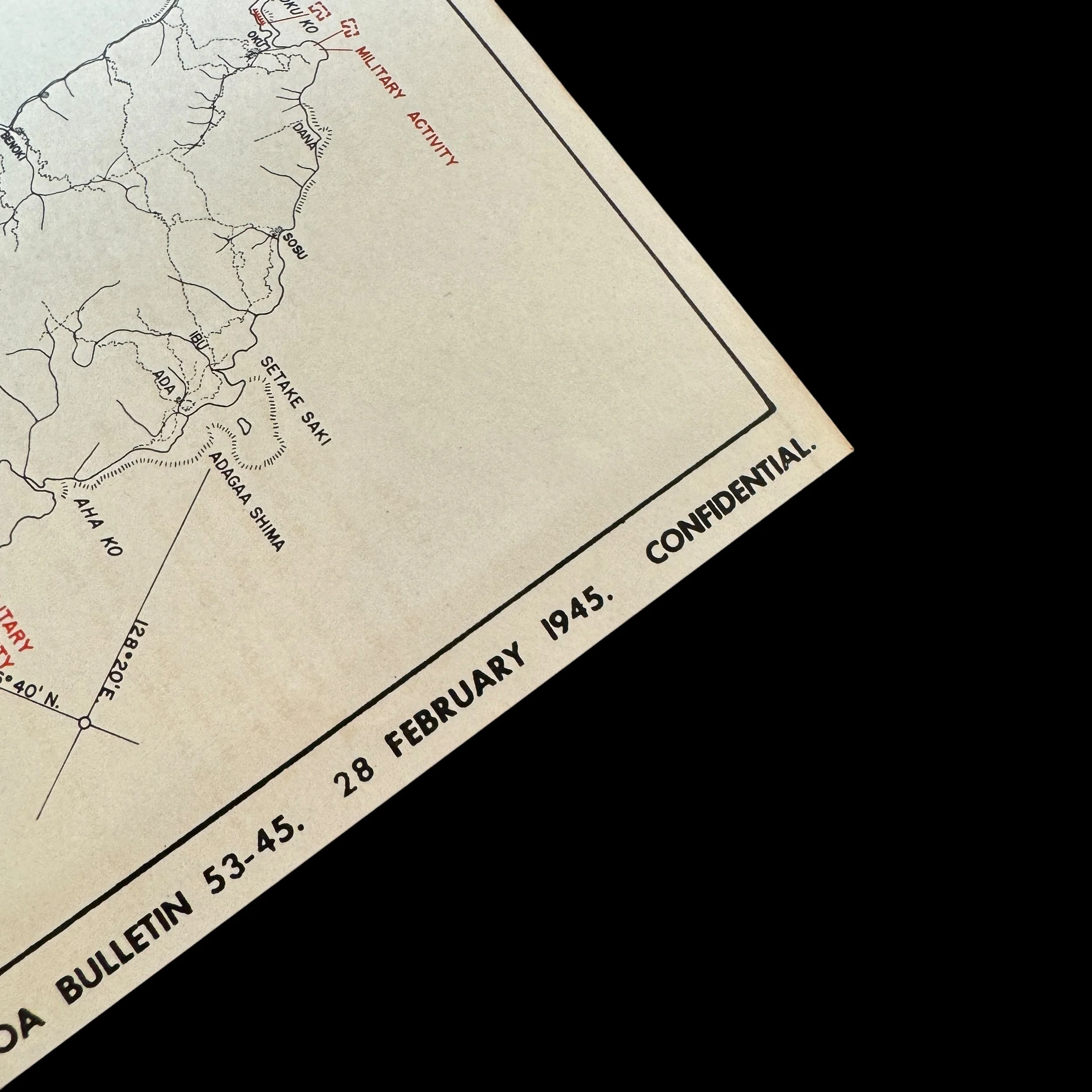
This extraordinary museum-grade artifact is an original CONFIDENTIAL combat map from the 1945 Battle of Okinawa (Operation Iceberg), a rare and invaluable piece of World War II history. Dated February 28, 1945, this invasion map was prepared just one month before the largest amphibious assault of the Pacific Theater, launched on April 1, 1945. Produced by the Commander in Chief, Pacific Fleet Headquarters (CINCPAC), the map incorporates the latest U.S. military intelligence on Japanese defenses and fortifications. Marked CONFIDENTIAL and issued in very limited quantities, it was designed for strategic use by ground units of the Tenth Army’s III Amphibious Corps, which included the elite 1st, 2nd, and 6th Marine Divisions.
The III Amphibious Corps spearheaded the advance on Okinawa’s northern sector, encountering fierce resistance as they fought to secure critical towns and objectives. This rugged and strategically vital terrain included key locations such as Motobu Peninsula, where intense battles raged against entrenched Japanese forces. The corps overcame heavily fortified defensive positions, including caves and ridgelines that were ingeniously adapted by Japanese troops for prolonged resistance. Their relentless push through the northern region helped secure the island, cutting off Japanese supply lines and diminishing their ability to counterattack.
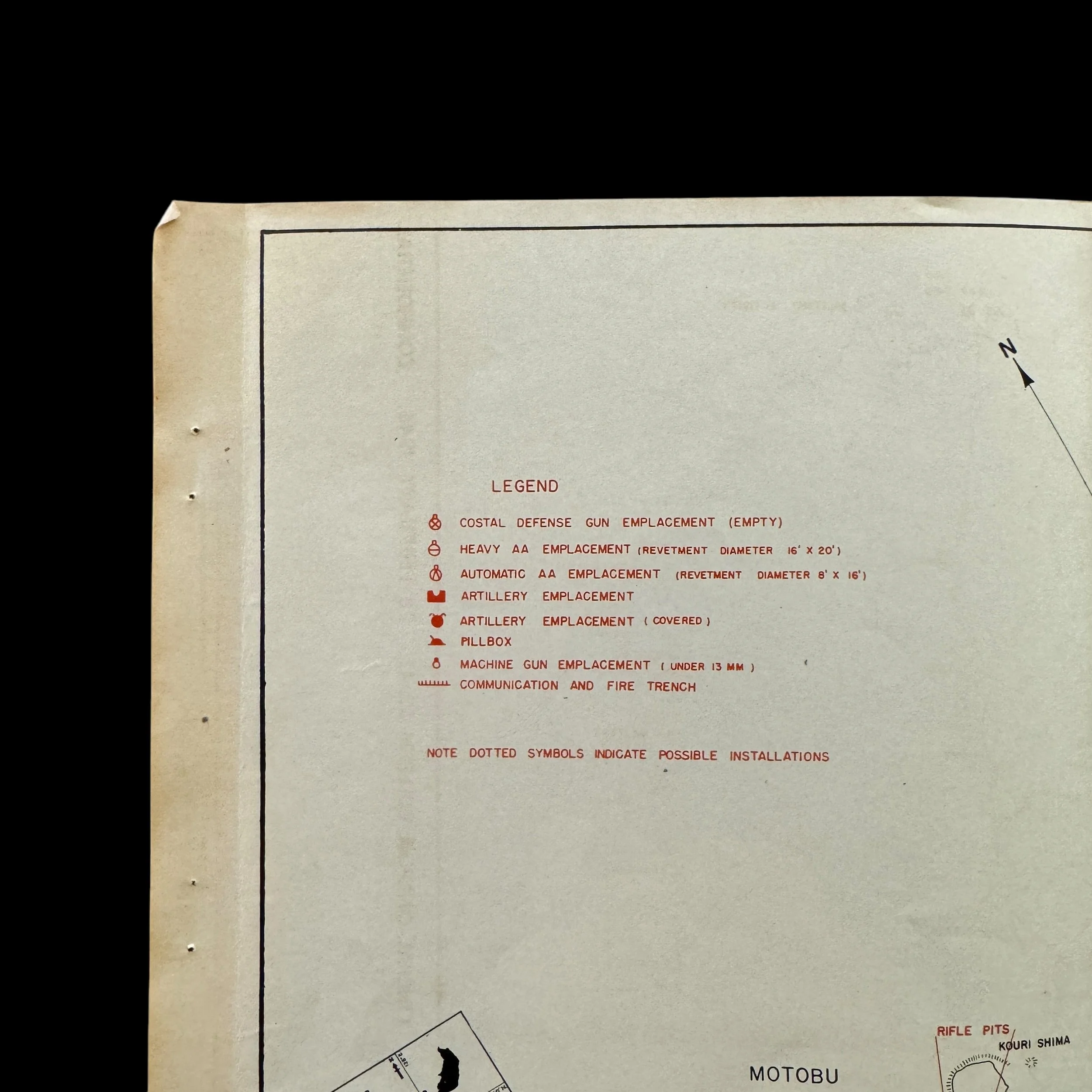
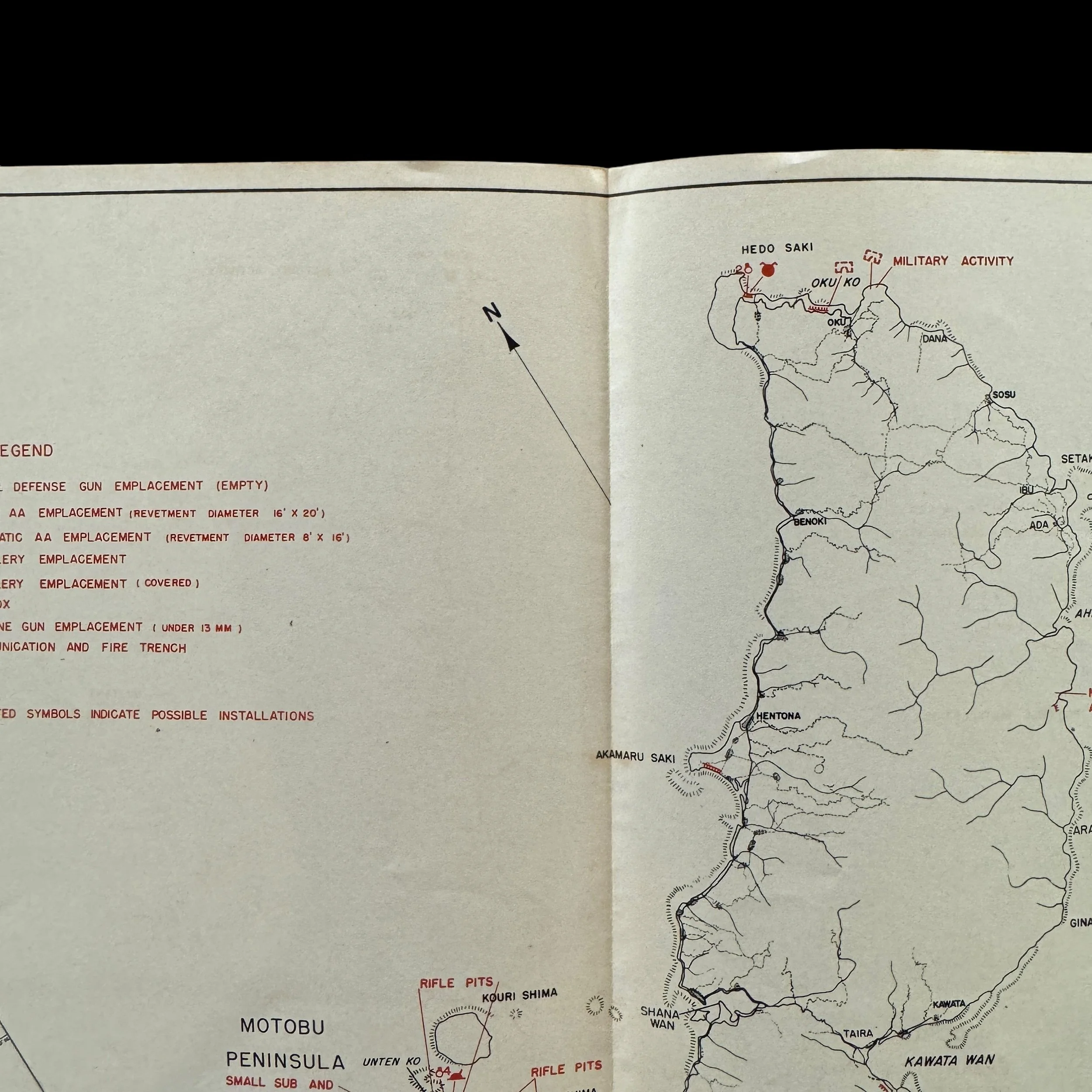
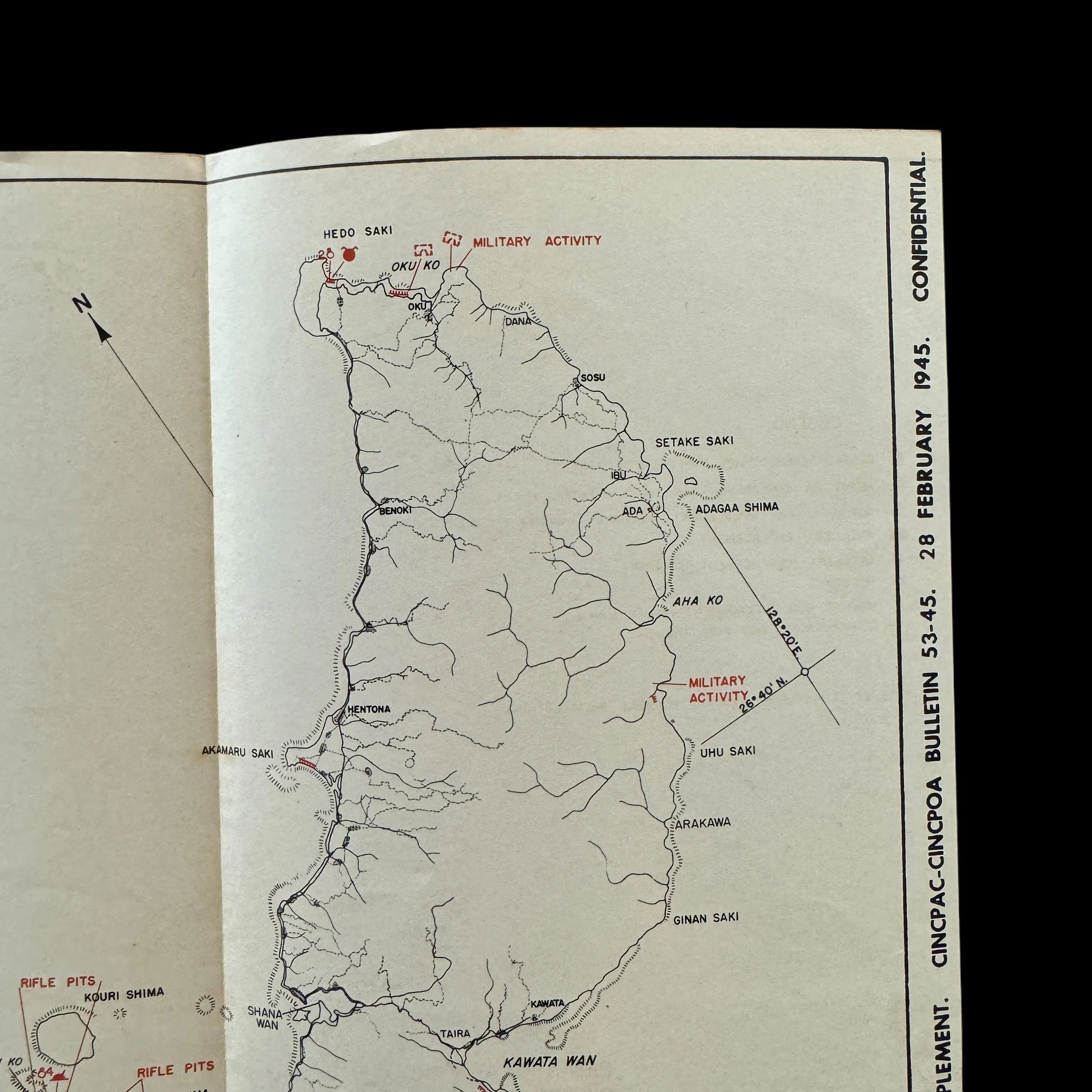
Titled DEFENSE INSTALLATIONS OF NORTHERN OKINAWA SHIMA, this map served as a vital tool for U.S. Marine Corps units during the planning and execution of their advance. It detailed Japanese defensive networks, including fortifications, artillery emplacements, command posts, and other critical military infrastructure. Its precise intelligence allowed commanders to develop strategies that would neutralize these strongholds, ultimately contributing to the success of the campaign.
The northern part of Okinawa played a unique role in the Battle of Okinawa, which raged from April to June 1945. Unlike the southern regions, where the battle was marked by ferocious urban fighting and entrenched defensive positions, the northern part of the island, known as the Motobu Peninsula, presented a different set of challenges for the U.S. forces. This area is rugged, with dense forests and steep hills, making it a natural defensive stronghold.
The main Japanese force in the north was centered around Mount Yae-Take, where Colonel Takehiko Udo led approximately 2,000 troops. These forces utilized the natural terrain to establish fortified positions, engaging the advancing U.S. 6th Marine Division in guerrilla-style warfare. The Marines, accustomed to amphibious assaults and island-hopping campaigns, found themselves facing a new challenge as they had to root out well-hidden defenders in a dense, mountainous environment.
Fighting in the northern sector began on April 6, 1945, and lasted for about two weeks. The capture of the Motobu Peninsula culminated in the battle for Mount Yae-Take, where the Japanese defenders made their last stand. Despite their use of the terrain to their advantage, the Japanese were eventually overwhelmed by superior American firepower and air support. By mid-April, organized Japanese resistance in the north had effectively ceased.
While the northern campaign was significant, it was relatively less costly in terms of casualties compared to the brutal fighting in the southern part of the island around Shuri Castle. However, the capture of the north allowed U.S. forces to secure critical airfields and logistical positions, enabling them to focus their efforts on the heavily defended southern zones. The northern campaign also showcased the adaptability of U.S. forces in dealing with the varied challenges of the Okinawan terrain and set the stage for the final, decisive confrontations further south.
The northern part of Okinawa remains a testament to the strategic importance of geography in the battle and the determination of both American forces and Japanese defenders in one of the Pacific War's most significant and grueling campaigns.
Owning this artifact offers a rare opportunity to connect directly with the pivotal moments of the Battle of Okinawa. This battle marked a turning point in the Pacific War, paving the way for the Allied victory. Its CONFIDENTIAL designation, unparalleled historical significance, and connection to the meticulous planning and execution of this monumental invasion make it a treasure for collectors, historians, and museums dedicated to preserving World War II history.
________________________
Battle of Okinawa (April 1–June 21, 1945), World War II battle fought between U.S. and Japanese forces on Okinawa, the largest of the Ryukyu Islands. Okinawa is located just 350 miles (563 km) south of Kyushu, and its capture was regarded as a vital precursor to a ground invasion of the Japanese home islands. Dubbed “the Typhoon of Steel” for its ferocity, the battle was one of the bloodiest in the Pacific War, claiming the lives of more than 12,000 Americans and 100,000 Japanese, including the commanding generals on both sides. In addition, at least 100,000 civilians were either killed in combat or were ordered to commit suicide by the Japanese military.
Planning and preliminary operations:
As the campaign on Iwo Jima was drawing to a close in March 1945, U.S. commanders marshalled strong army, air, and naval forces in preparation for Operation Iceberg, the invasion of Okinawa. The island, which is about 60 miles (roughly 100 km) long and no more than 20 miles (32 km) across at its widest point, had been thoroughly fortified by a Japanese garrison of some 100,000 men under the command of Lieut. Gen. Ushijima Mitsuru. Acknowledging that the battle for Okinawa would very likely replicate the brutal losses of Iwo Jima on a much greater scale, American planners hoped to overwhelm the Japanese with a massive preliminary bombardment and the largest amphibious landing conducted by the U.S. during the Pacific War.
The air and sea attacks that preceded the invasion had begun as early as October 1944, and Allied air operations carried out in March 1945 by carrier Task Force 58 under Rear Adm. Marc Mitscher destroyed hundreds of Japanese planes. While these losses reduced the Japanese defenders’ ability to challenge the Americans in the skies over Okinawa, the Japanese retained sufficient air power to stage devastating suicide attacks on Allied naval units. On March 26 a preliminary landing was made on the Kerama Islands, about 15 miles (24 km) to the west, where some 350 small boats had been assembled for suicide attacks on the landing force. Another preparatory landing was made on Keise, a collection of coral islets just 11 miles (18 km) southwest of the main invasion beaches. From Keise, American 155-mm Long Tom artillery batteries could provide fire support across most of southern Okinawa.
Invasion:
Over the final days of March, American underwater demolition teams and minesweepers cleared obstacles from the landing beaches. Under the overall leadership of theatre commander Adm. Chester Nimitz, Fifth Fleet commander Adm. Raymond Spruance would oversee the landings and U.S. ground troops would be commanded by Lieut. Gen. Simon Bolivar Buckner, Jr. The invasion was launched on April 1, 1945, when a contingent of U.S. ground troops landed at Hagushi, on the west coast of central Okinawa. Before nightfall, some 50,000 men of the U.S. 10th Army, under the command of Buckner, had gone ashore and established a beachhead about 5 miles (8 km) long.
The Japanese response to the beach landings was deceptively muted, and by April 4, U.S. Army troops and Marines had cut the island in two. The first major Japanese counterattack came on April 6–7 in the form of suicidal raids by more than 350 kamikaze planes and the battleship Yamato. The Japanese had hoped that Yamato might finish off the Allied fleet after it had been weakened by the wave of kamikazes, but, with no air cover, the largest battleship ever constructed was easy prey for Mitscher’s carrier-based planes. The sinking of the Yamato on April 7 conclusively signaled the end of the “all-big-gun” battleship era of naval warfare. Altogether more effective were Japan’s aerial suicide weapons. Baka, essentially a piloted cruise missile, made its debut at Okinawa. Baka claimed its first victim, the destroyer USS Abele, in the seas off Okinawa on April 12.
Elements of the 10th Army drove cautiously to the north and had pacified the entire northern two-thirds of the island by April 22. During this period, U.S. forces suffered perhaps their highest profile casualty of the battle when journalist Ernie Pyle was killed in combat. Pyle, whose coverage of the European conflict had made him one of the most beloved war correspondents of World War II, had accompanied the 77th Infantry Division in an assault on Ie, an island just west of Okinawa. On April 18, while traveling to a forward command post, Pyle was mortally wounded by Japanese machine-G fire.
Intensification and collapse of Japanese resistance:
The elements of the 10th Army that had moved south toward the main population centres of Naha and Shuri encountered the fiercest kind of resistance. As on Iwo Jima, the Japanese fought with great tenacity and succeeded in making the Americans expend heavy casualties for small gains. The Japanese force defending the Naha-Shuri area numbered about 60,000, and by May 1 these troops were confined to an area of about 90 square miles (about 230 square km) at the island’s southern tip. Combat in this sector was positional; both sides used fixed lines, and defenders held the clear advantage of fighting from prepared positions. The Japanese also made extensive use of Okinawa’s caves, which afforded excellent shelter against American bombardment.
Tactically, the Americans relied heavily on the superior quantity and quality of their equipment. Making frontal assaults on enemy positions, U.S. forces advanced in waves by day with heavy artillery support. Flame-throwing tanks led infantrymen against Japanese-held caves, which had to be destroyed one by one. At night, ground activities were limited to patrolling operations and artillery bombardment. As the Japanese neither took prisoners nor generally offered themselves for surrender, close-quarter fighting on Okinawa was savage and waged to the death.
The intensity of the campaign was reflected in the battle for “Chocolate Drop Hill,” a fortified Japanese mound guarding the approaches to Shuri. American forces fought their way to the base of this 130-foot (40-metre) hill three times in five days and were thrown back each time. In one six-hour period, land and naval guns blanketed the hill with 30,000 shells, while bombers showered it with additional tons of high explo. These long-range efforts to dislodge the defenders were futile, however, and ground troops had to destroy each Japanese fortification singly, an operation that was tedious, costly, and dangerous. On one side of the hill alone, the Japanese had some 500 entrances to their underground positions, and dyn. charges were used to seal these openings. The hill was finally taken by U.S. forces on May 16.
The heavily fortified Japanese line, running through Naha on the western coast through Shuri and to Yonabaru on the eastern coast, repelled numerous American attacks. On May 12, however, U.S. forces broke into Naha’s suburbs and proceeded to enter the city, fighting from house to house. Even more intense was the battle for Shuri, keystone of the Japanese fortifications. Shuri fell on June 1, and the important Naha airfield was in U.S. hands by June 6. Despite the breaking of the main Japanese fortified line, opposition did not weaken, and the defenders gave ground grudgingly. However, Japanese manpower was being rapidly exhausted—by mid-June, the largest part of the defending garrison had been killed in action. On June 21 major combat operations ended.
Casualties and legacy:
In the end, the Japanese lost Okinawa simply because they had run out of caves and boulders from which to fight and men to do the fighting. The stiffness of the opposition is reflected in the following timetable: from April 4 to May 26, U.S. forces on southern Okinawa had advanced only 4 miles (6.4 km). It took them from May 26 to June 21 to cover the remaining 10 miles (16 km) to the southern tip of the island.
The Americans regarded Okinawa as one of their greatest victories during the Pacific campaign, but the price paid by both sides was enormous. American casualties numbered some 12,000 killed and 36,000 wounded. Buckner, the U.S. ground commander, was killed in action on June 18 while visiting a forward observation post. He was the highest-ranking U.S. officer killed by enemy fire during World War II.
Kamikaze aircraft, which had first appeared at the Battle of Leyte Gulf in October 1944, made their peak effort against U.S. warships and transports at Okinawa. Strategically, the kamikaze was a last-resort weapon that Japanese planners hoped would cripple the American fleet and forestall the scheduled invasion of the Japanese home islands. U.S. naval officers’ characterizations of the kamikaze attacks had initially minimized their effectiveness. Mitscher declared as late as June 5 that the attacks were not “too serious” and that only 1 percent had reached their targets. This figure proved to be a significant understatement. While other naval officials also belittled the effect of kamikaze attacks, they did admit that the use of this novel weapon by the Japanese would require changes in U.S. tactics and ship design. In fact, the kamikaze had been brutally effective—of the 34 ships sunk in the battle, 26 were the result of suicide attacks. Casualties among naval personnel were also extremely heavy. Of the 12,281 Americans reported killed in the Okinawa campaign, 4,907 were U.S. Navy personnel. This figure outstrips the battle deaths suffered by both the U.S. Army (4,582) and Marines (2,792) who participated in the punishing ground offensive.
The Allied naval blockade had effectively closed the home islands to foreign imports, and Gen. Curtis LeMay’s strategic bombing campaign had reduced many Japanese cities to rubble, but the Japanese military refused to consider surrender. Based on the experience at Okinawa, American planners conservatively estimated that the U.S. would suffer 225,000 casualties during an invasion of the Japanese home islands; more pessimistic assessments pushed this figure to 1,000,000. Upon succeeding to the U.S. presidency after the death of Franklin D. Roosevelt on April 12, 1945, Harry S. Truman was made aware of the Manhattan Project, the top secret U.S. atomic bomb program. Truman told his staff that he hoped that “there was a possibility of preventing an Okinawa from one end of Japan to another,” and this no doubt played a large role in his decision to use the atomic bomb.
In early August 1945 the United States dropped atomic bombs on Hiroshima and Nagasaki, and the Japanese surrendered on September 2, 1945. U.S. forces occupied Okinawa for nearly 27 years, and the island was not returned to Japanese administration until May 15, 1972. Even after the handover, the U.S. maintained sizable military bases on Okinawa into the 21st century. Although the U.S. bases there figured prominently into the shared U.S.-Japanese defense posture in the Pacific, there was significant local opposition to the continued presence of thousands of U.S. troops more than 70 years after the war.