Extremely Rare WWII 1945 Seventh Air Force CONFIDENTIAL B-29 Navigator’s Panoramic Okinawa to Kyushu Flight Map with Handmarked Combat Annotations


Extremely Rare WWII 1945 Seventh Air Force CONFIDENTIAL B-29 Navigator’s Panoramic Okinawa to Kyushu Flight Map with Handmarked Combat Annotations
Comes with a hand-signed C.O.A. and a full historical write-up research document
From: World War II - Pacific Theater
Unit: Seventh Air Force
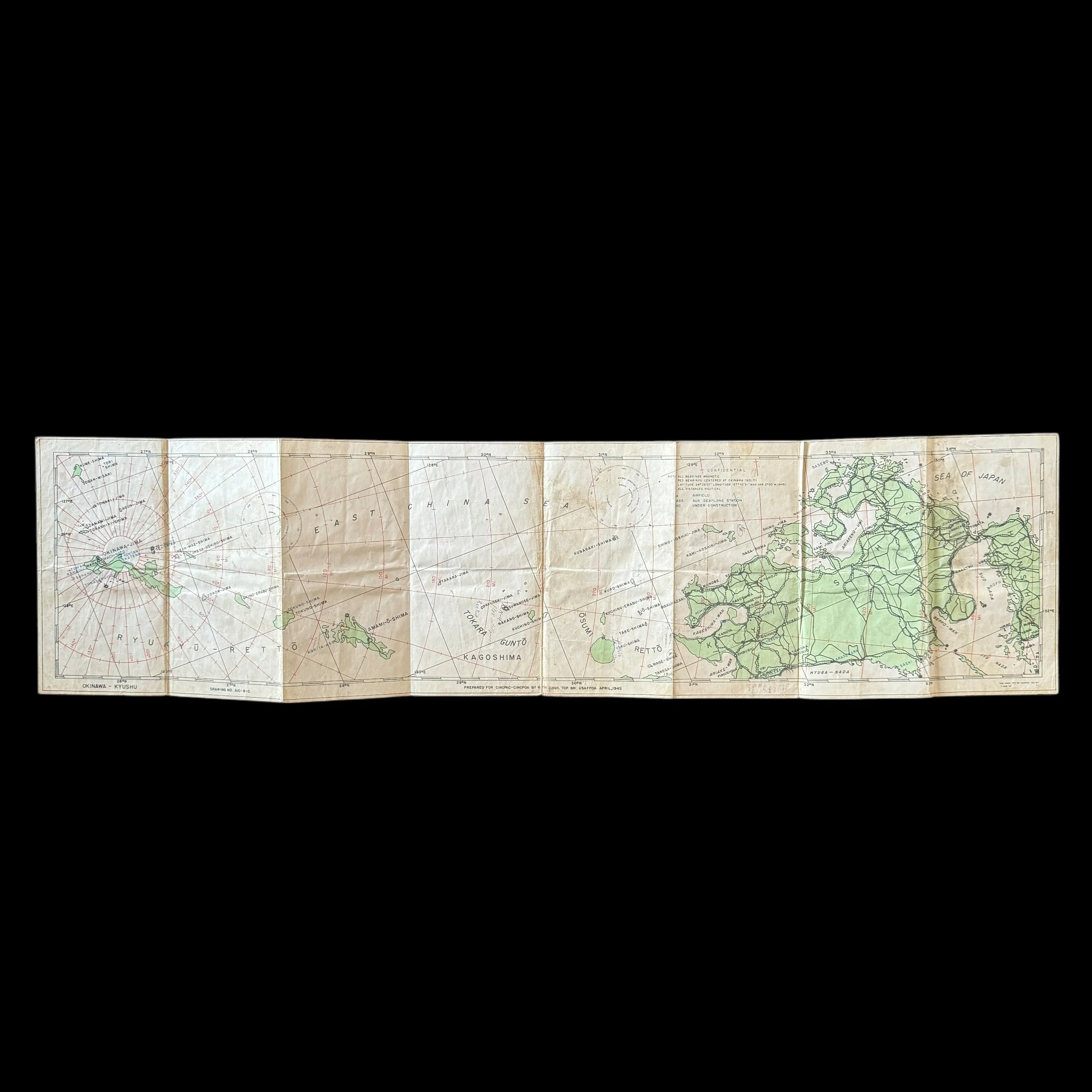
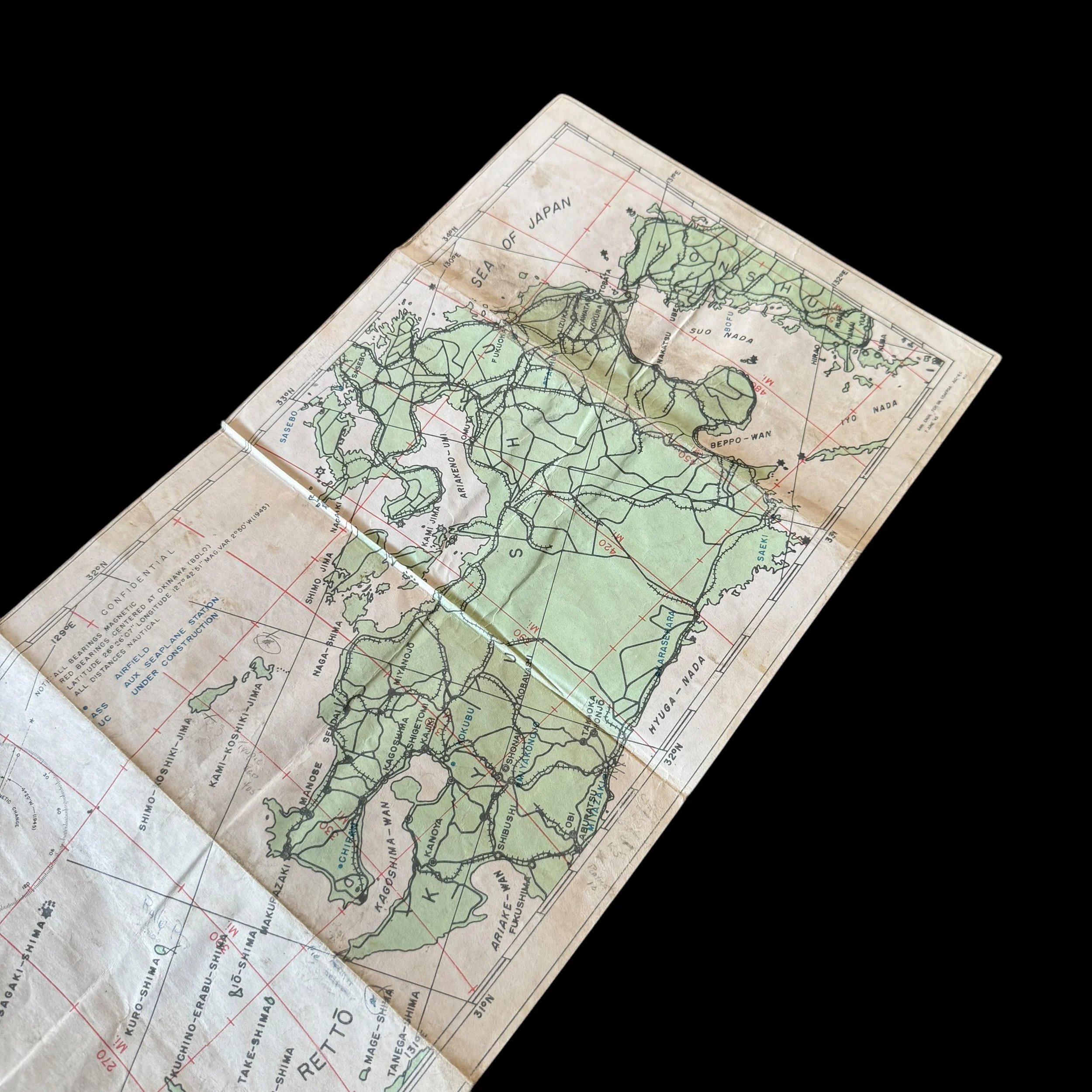
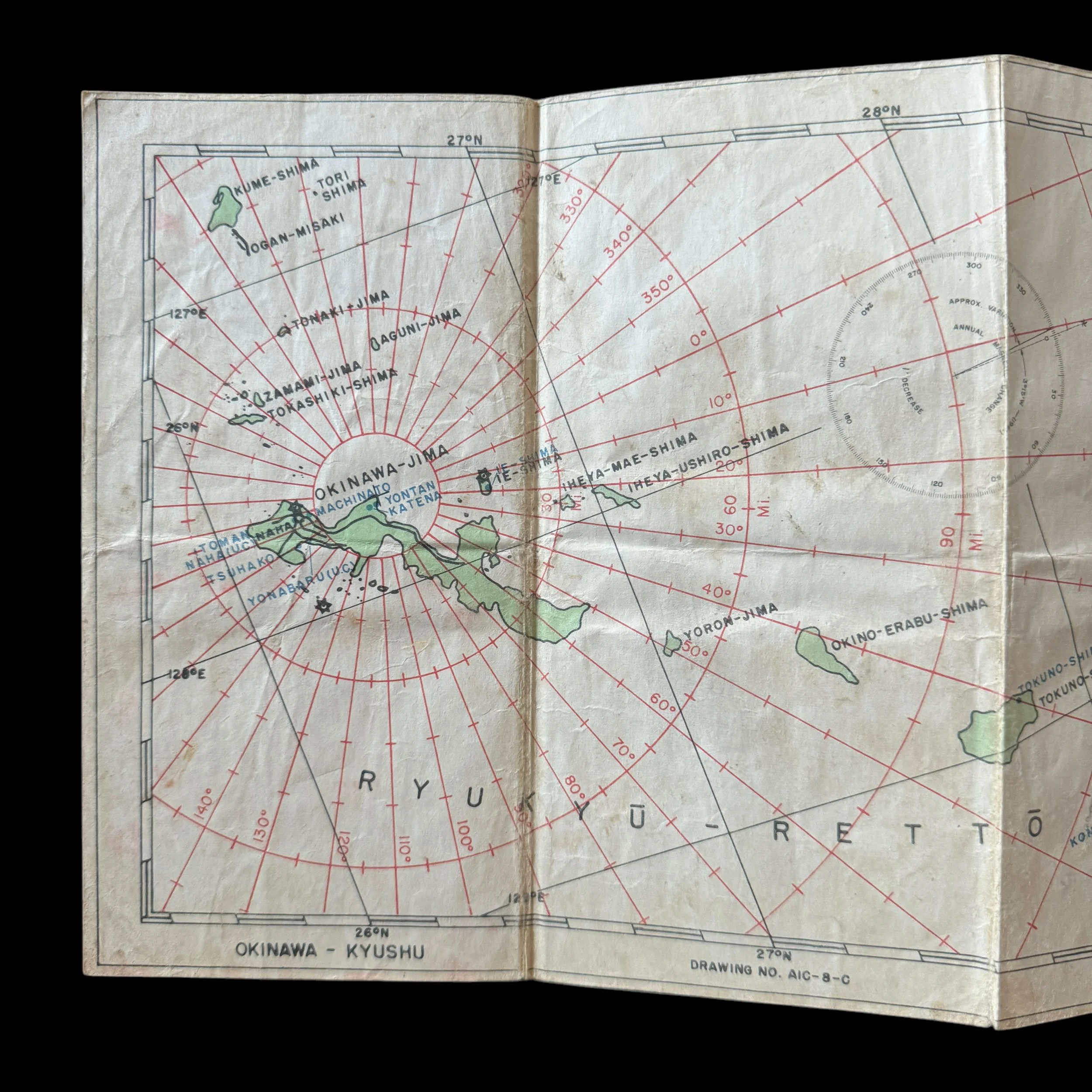
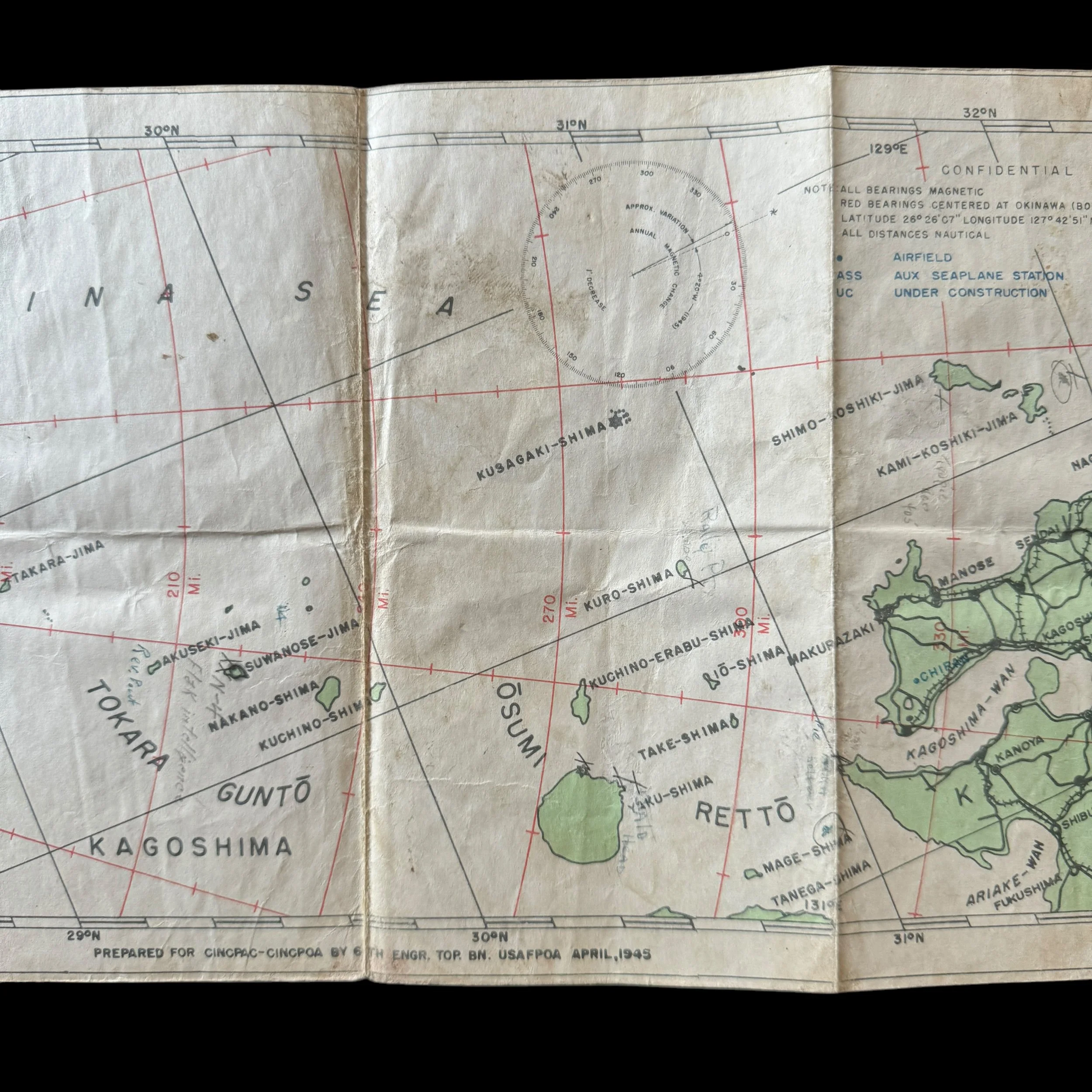
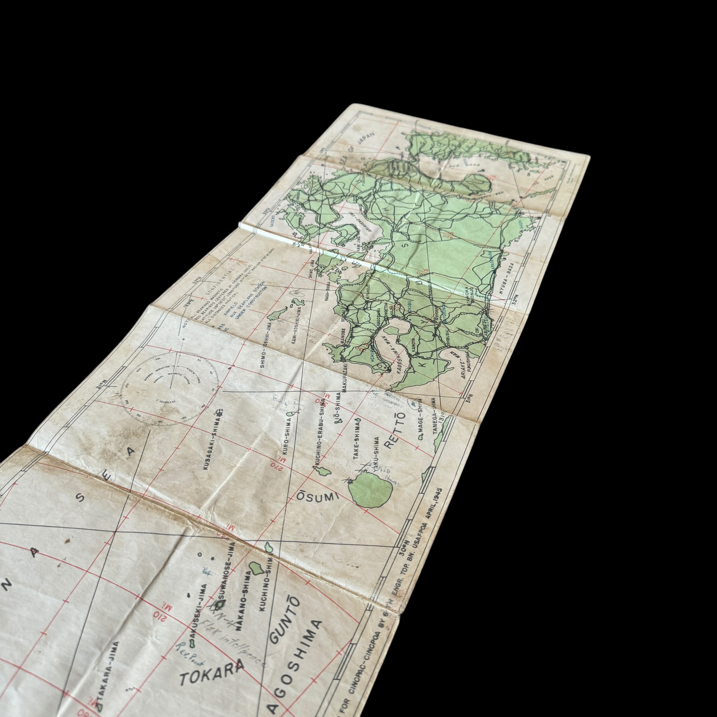
Type: “CONFIDENTIAL” Marked B-29 Superfortress Navigator’s Panoramic Okinawa to Kyushu Flight Map Used During Strategic Bombing Operations On Kyushu, Japan (Contains many handmarked combat annotations)
Size: 8 × 32 inches
Dated: 1945
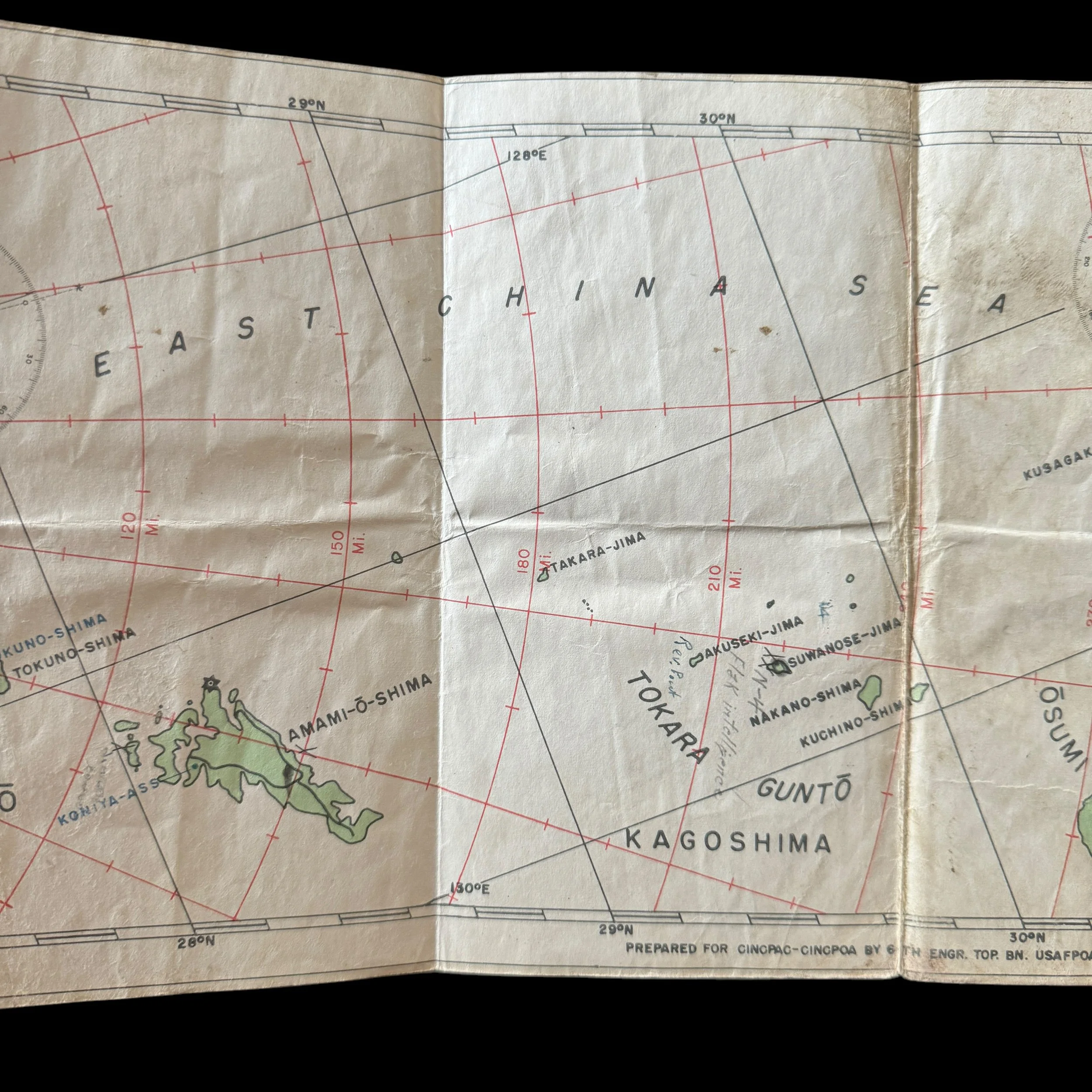
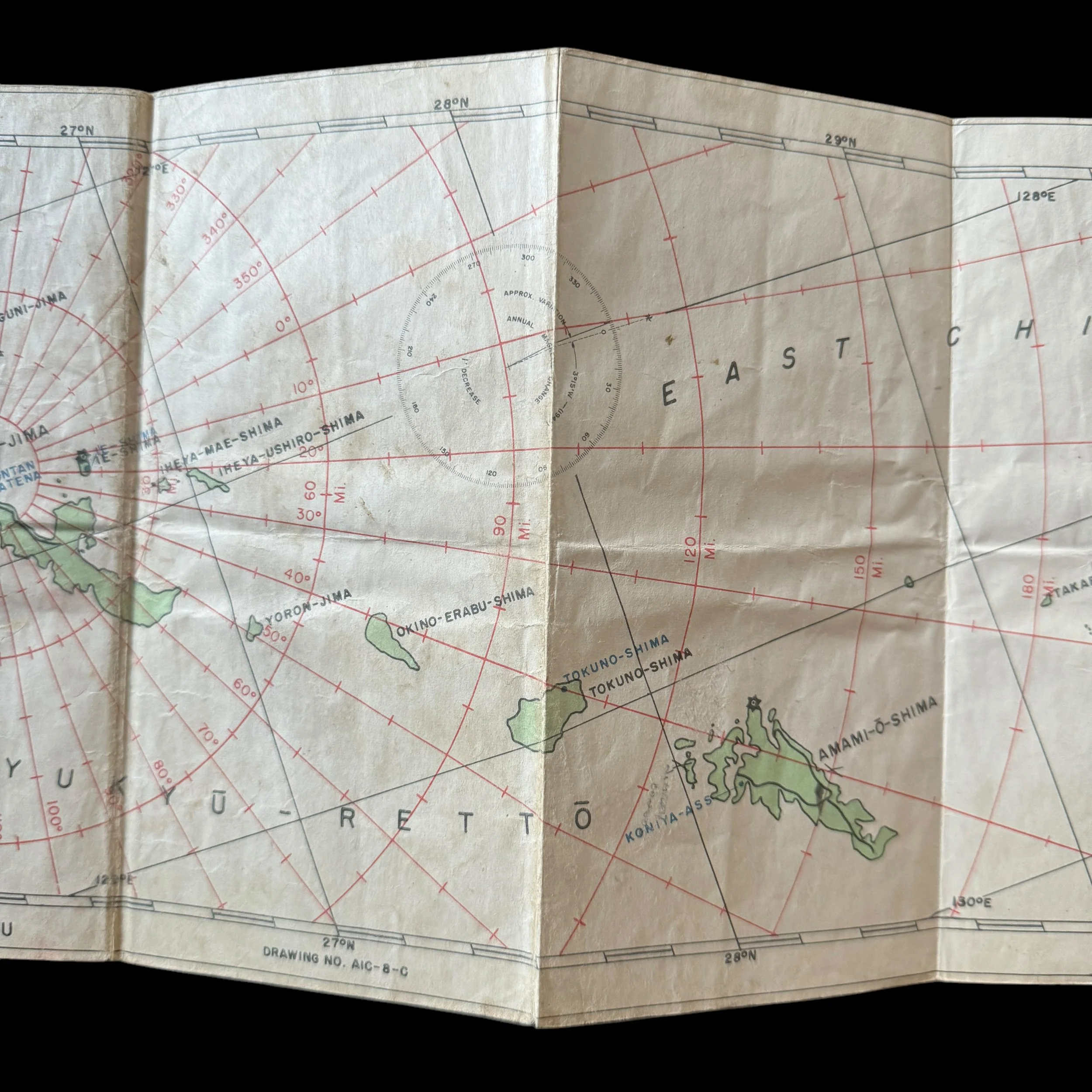
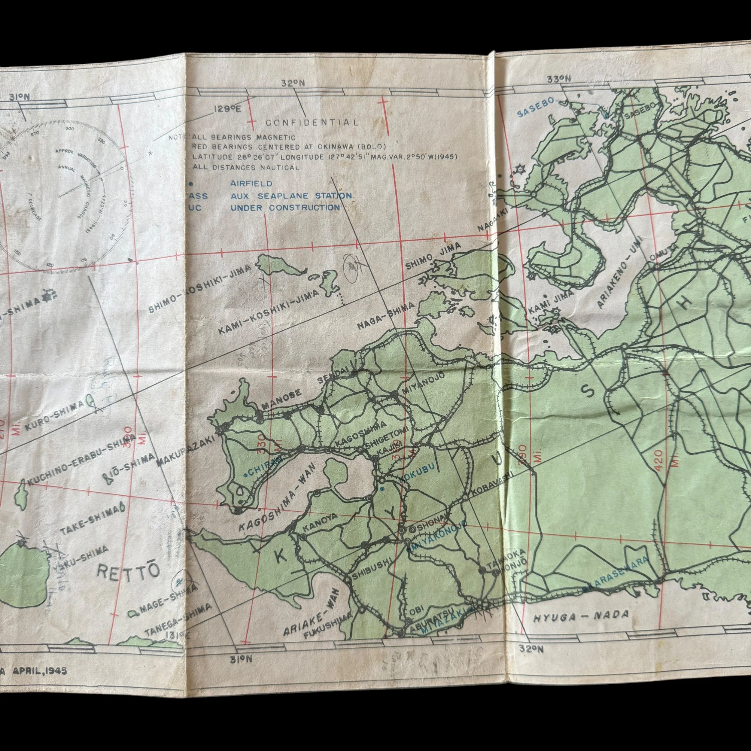
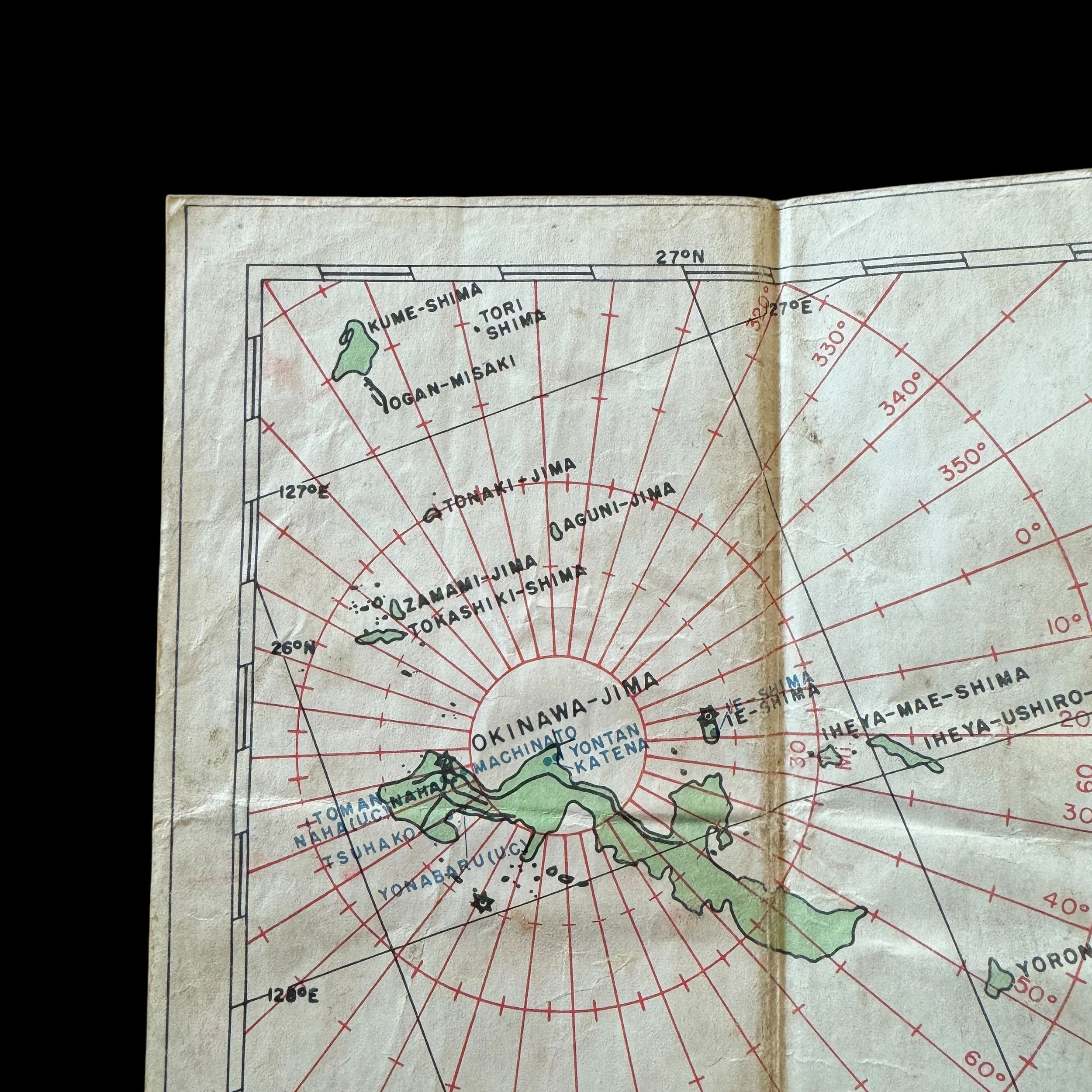
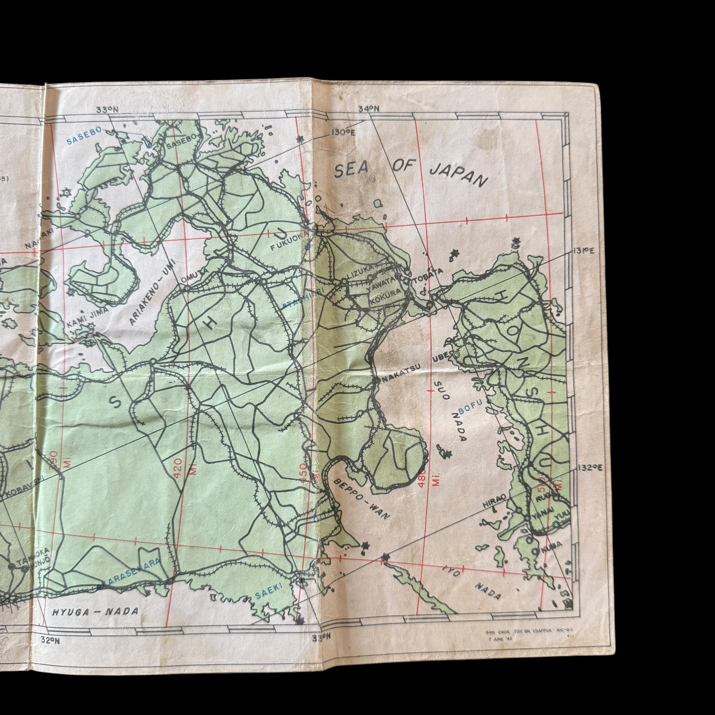
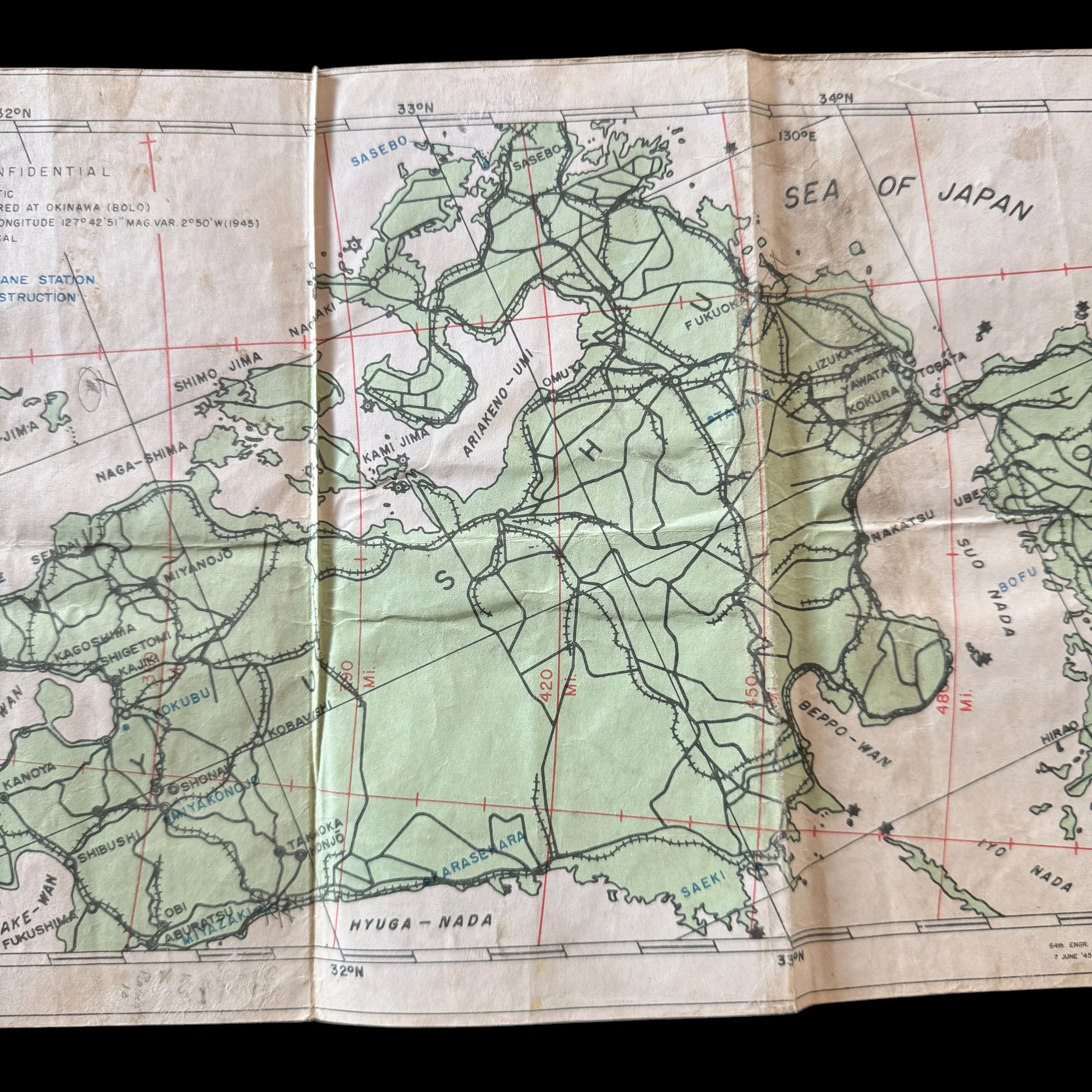
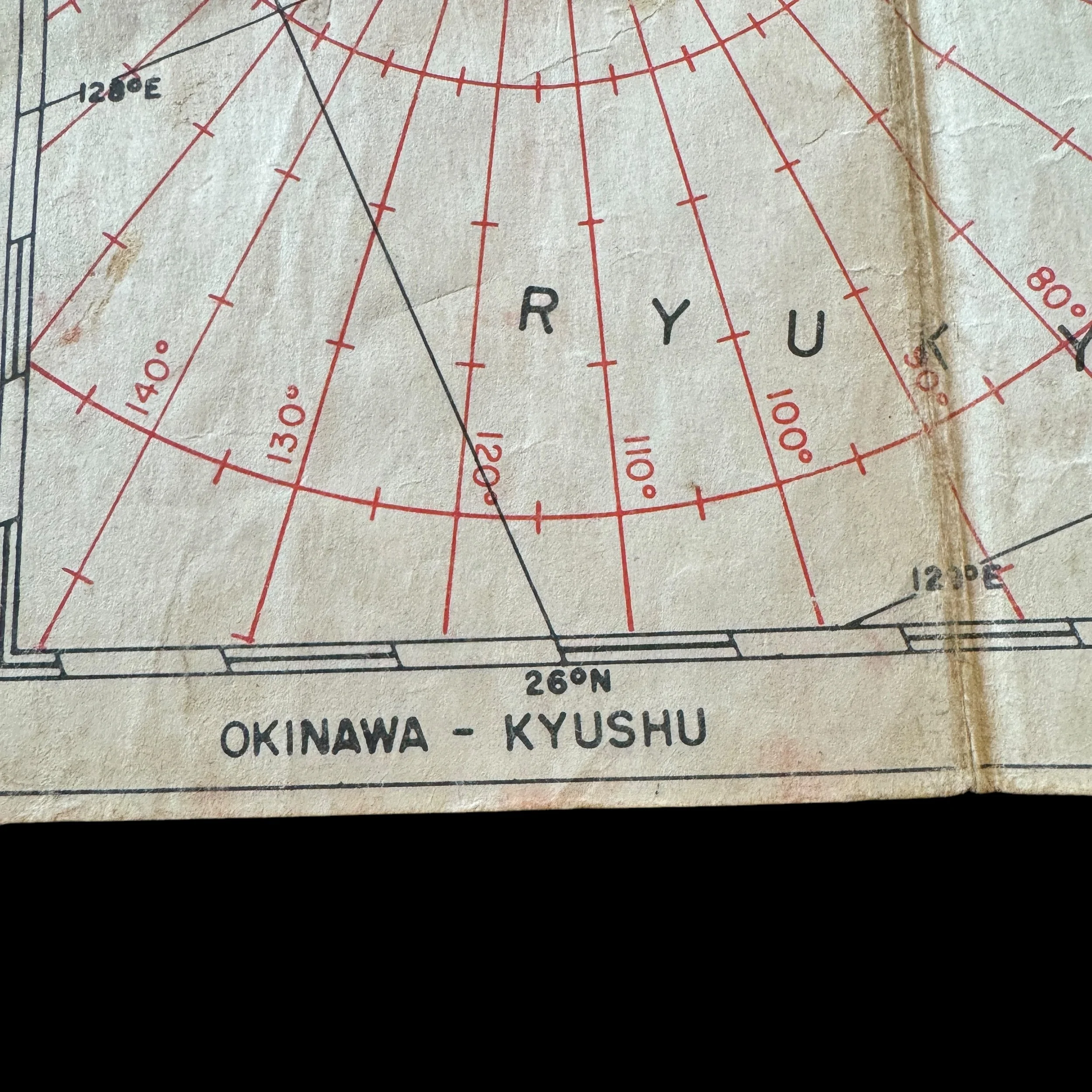
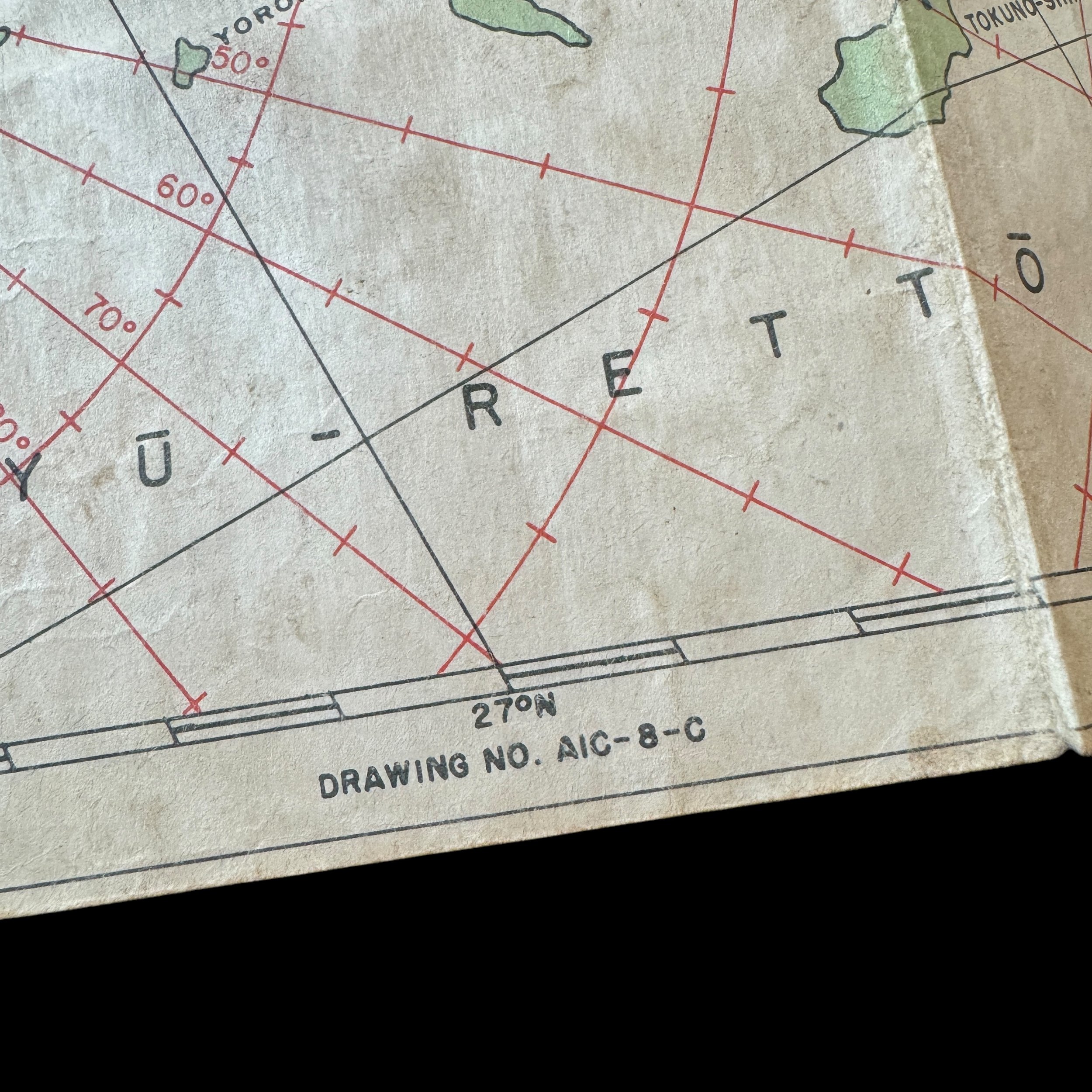
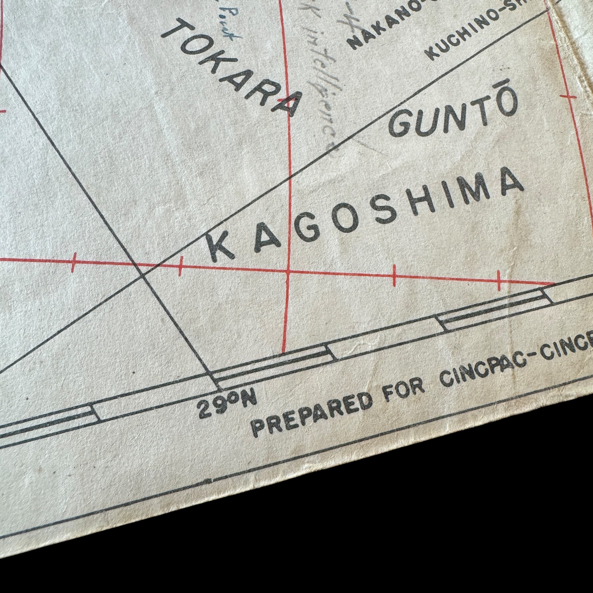
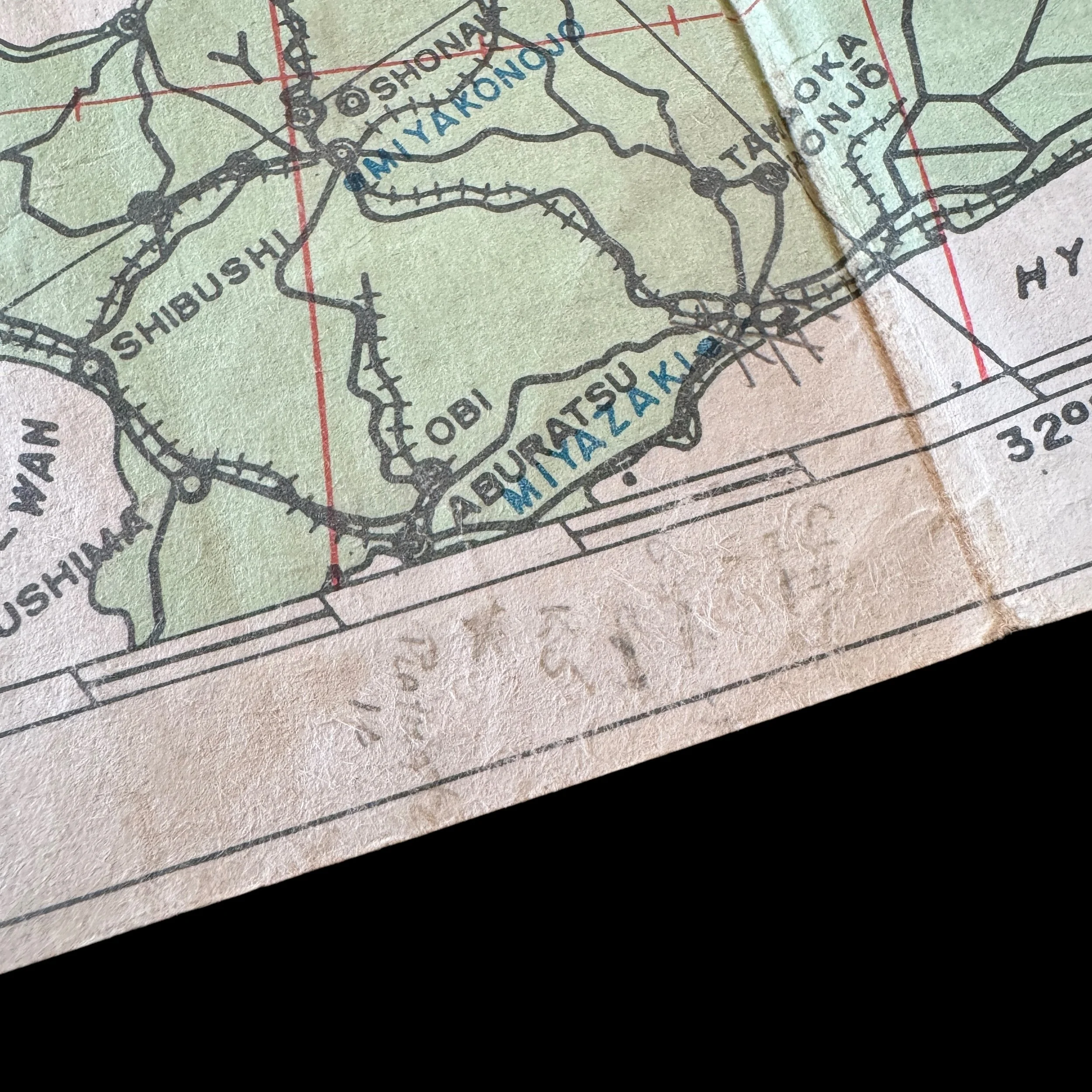
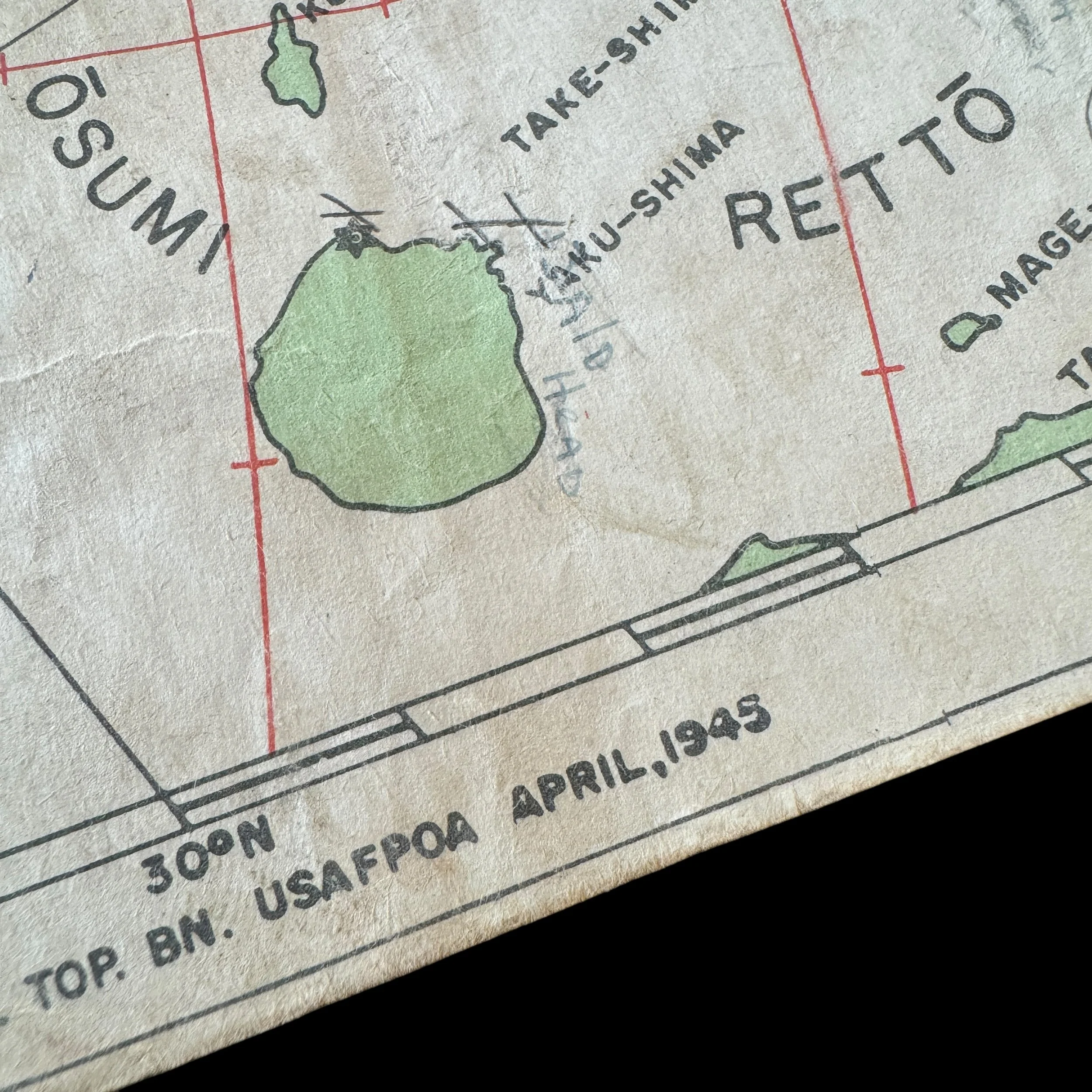
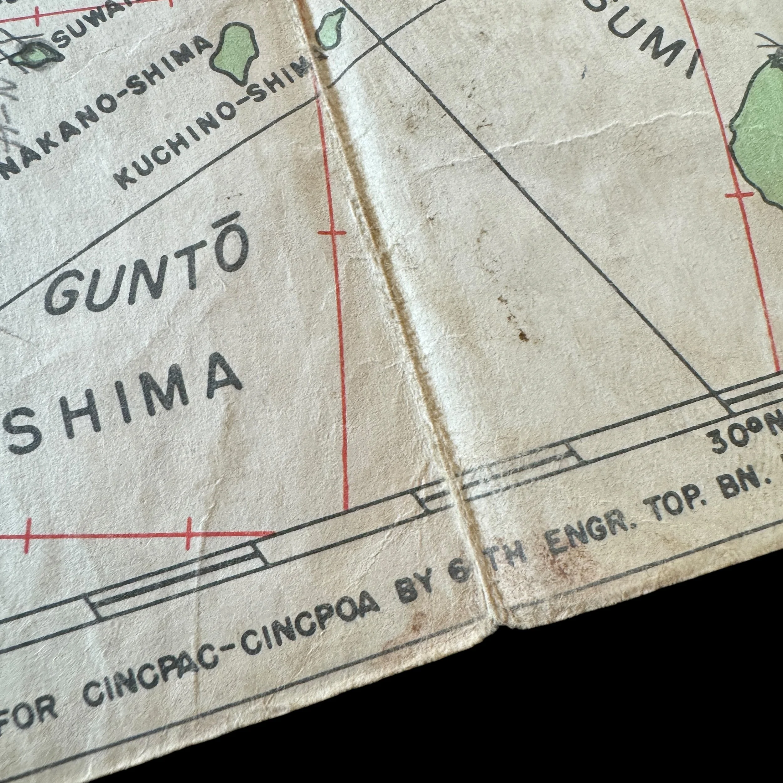
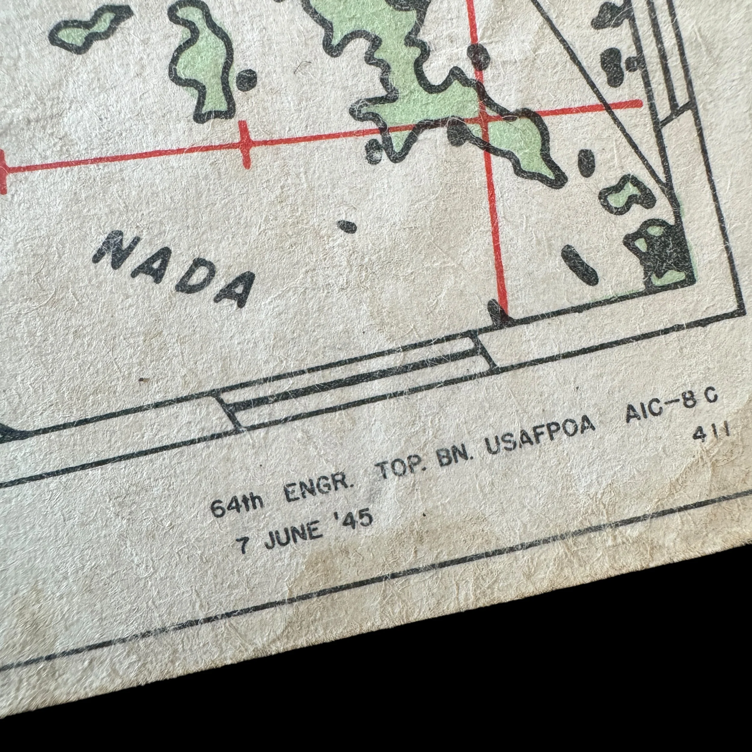
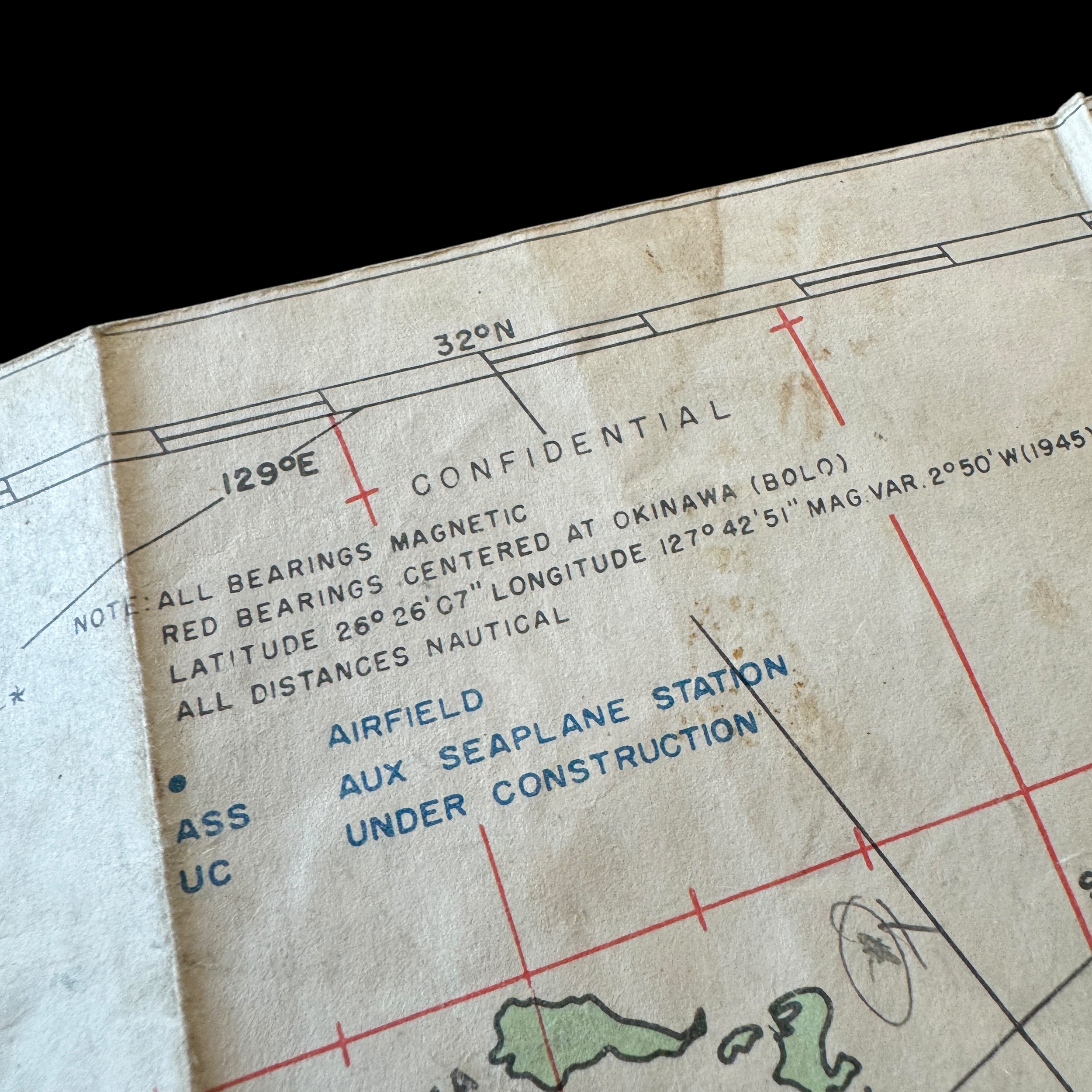
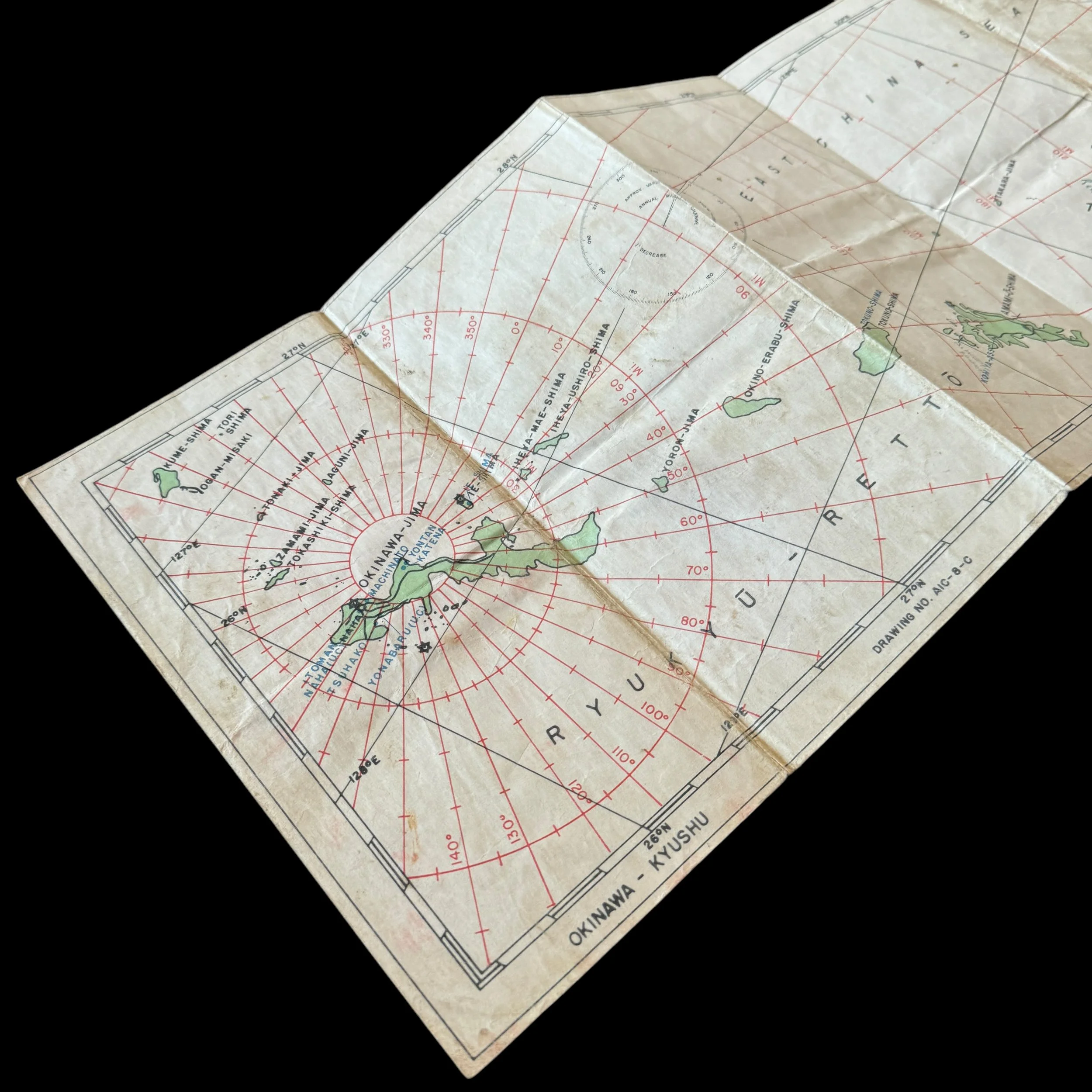
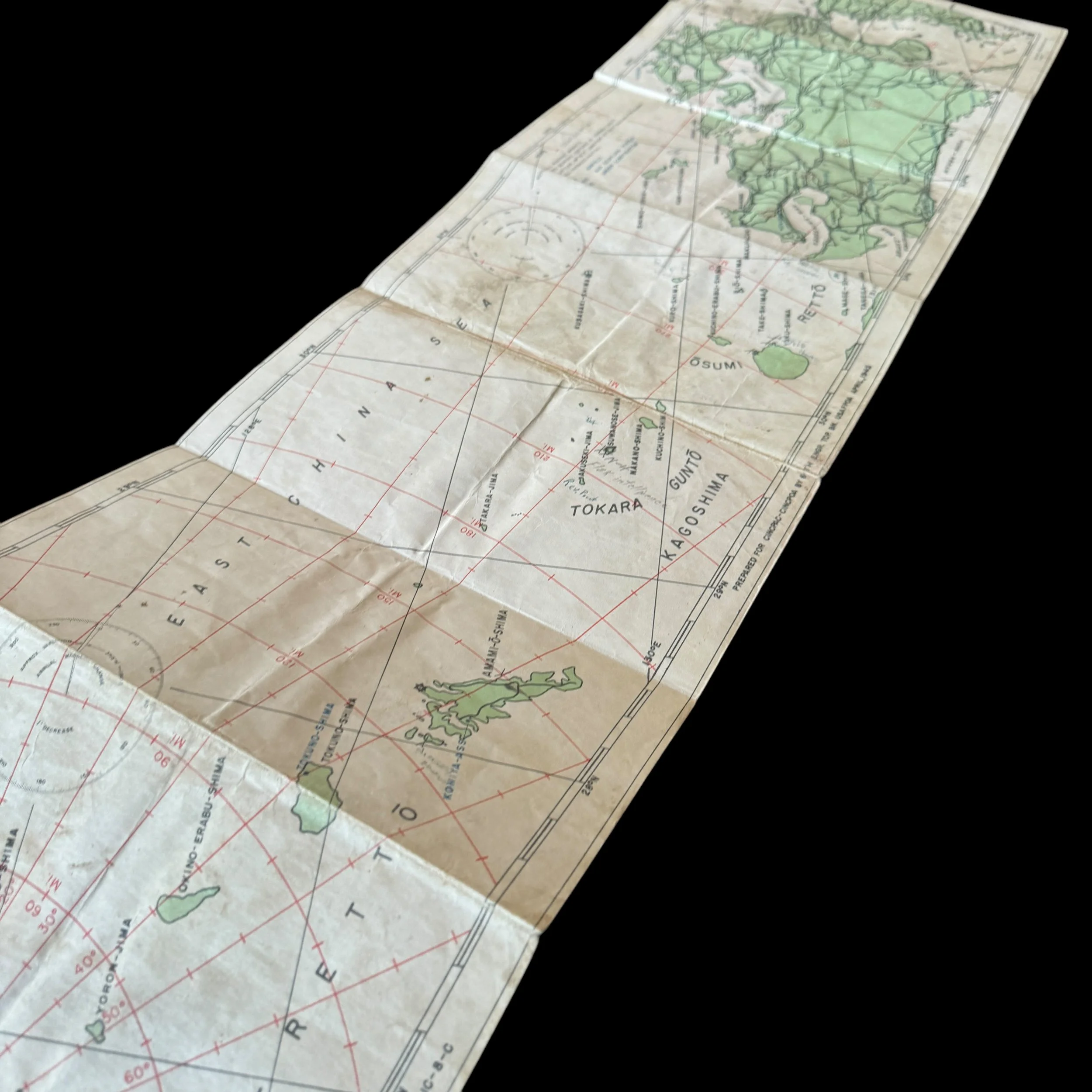
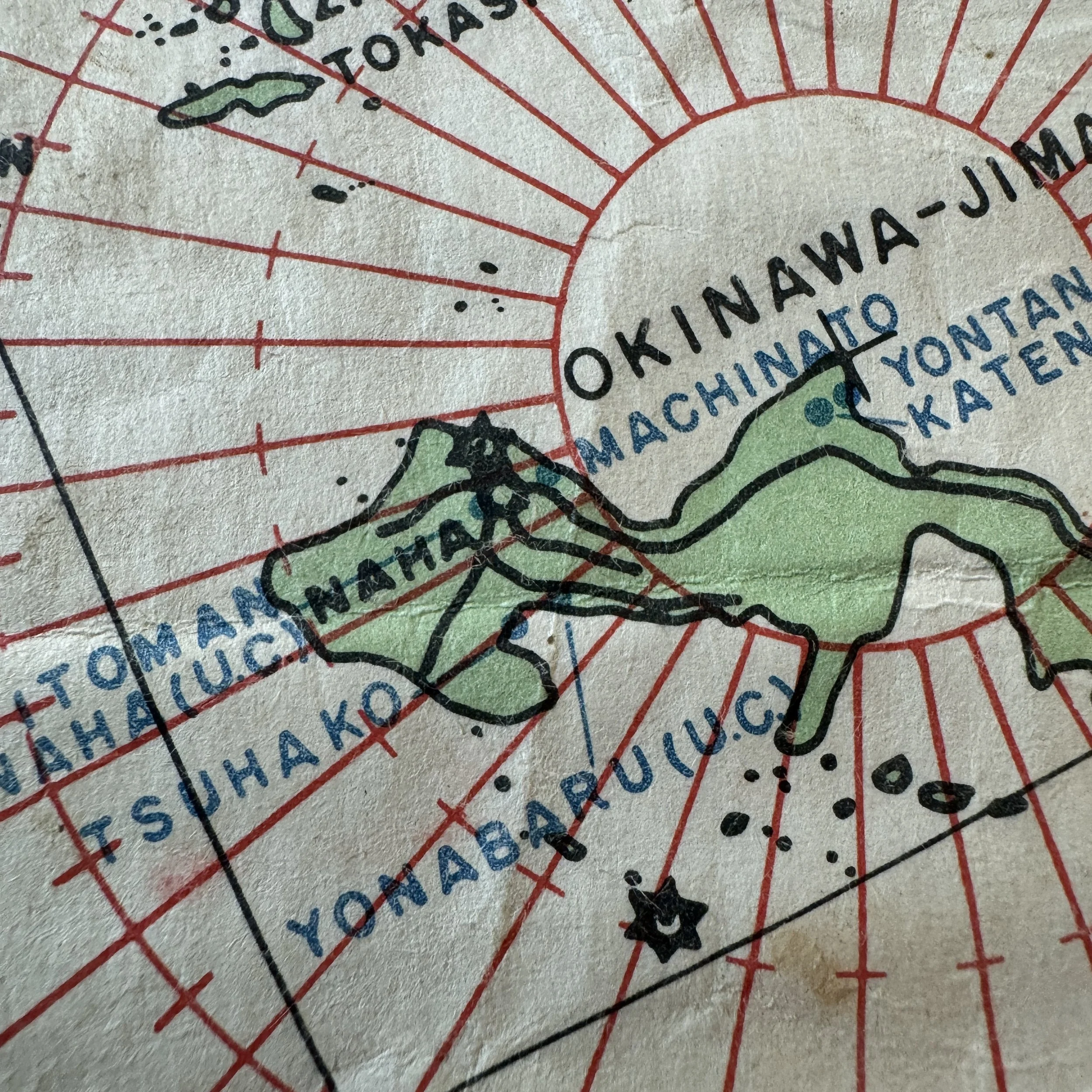
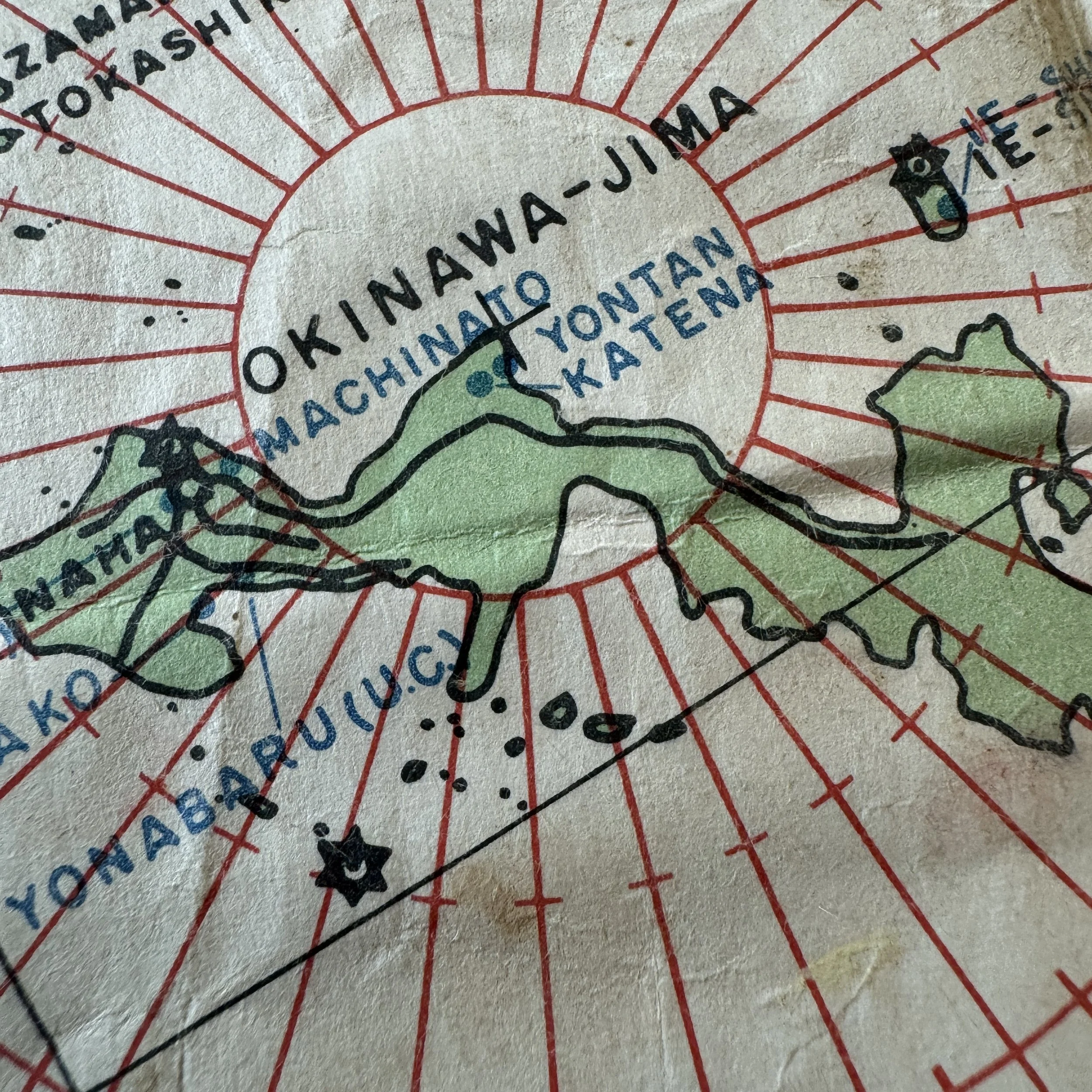
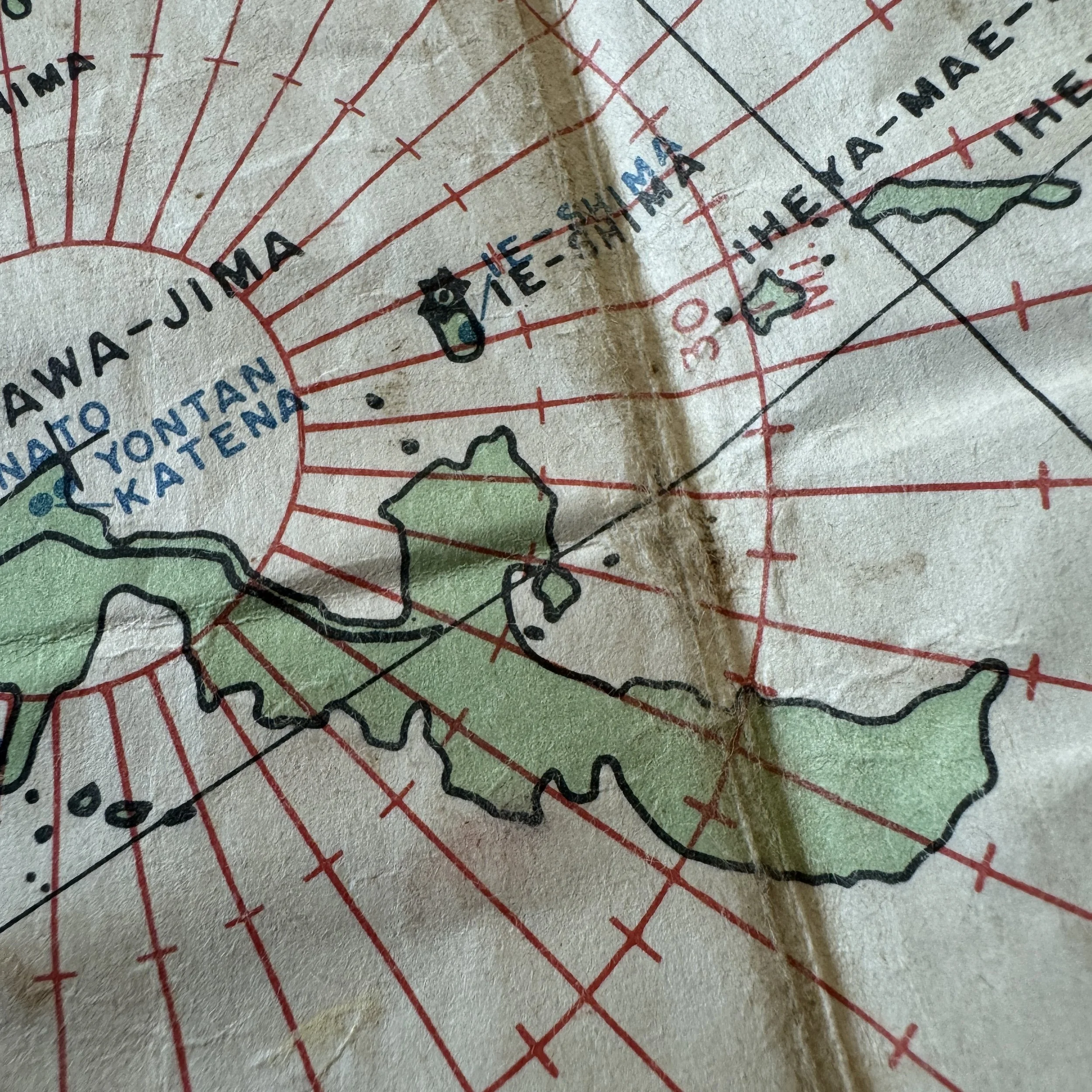
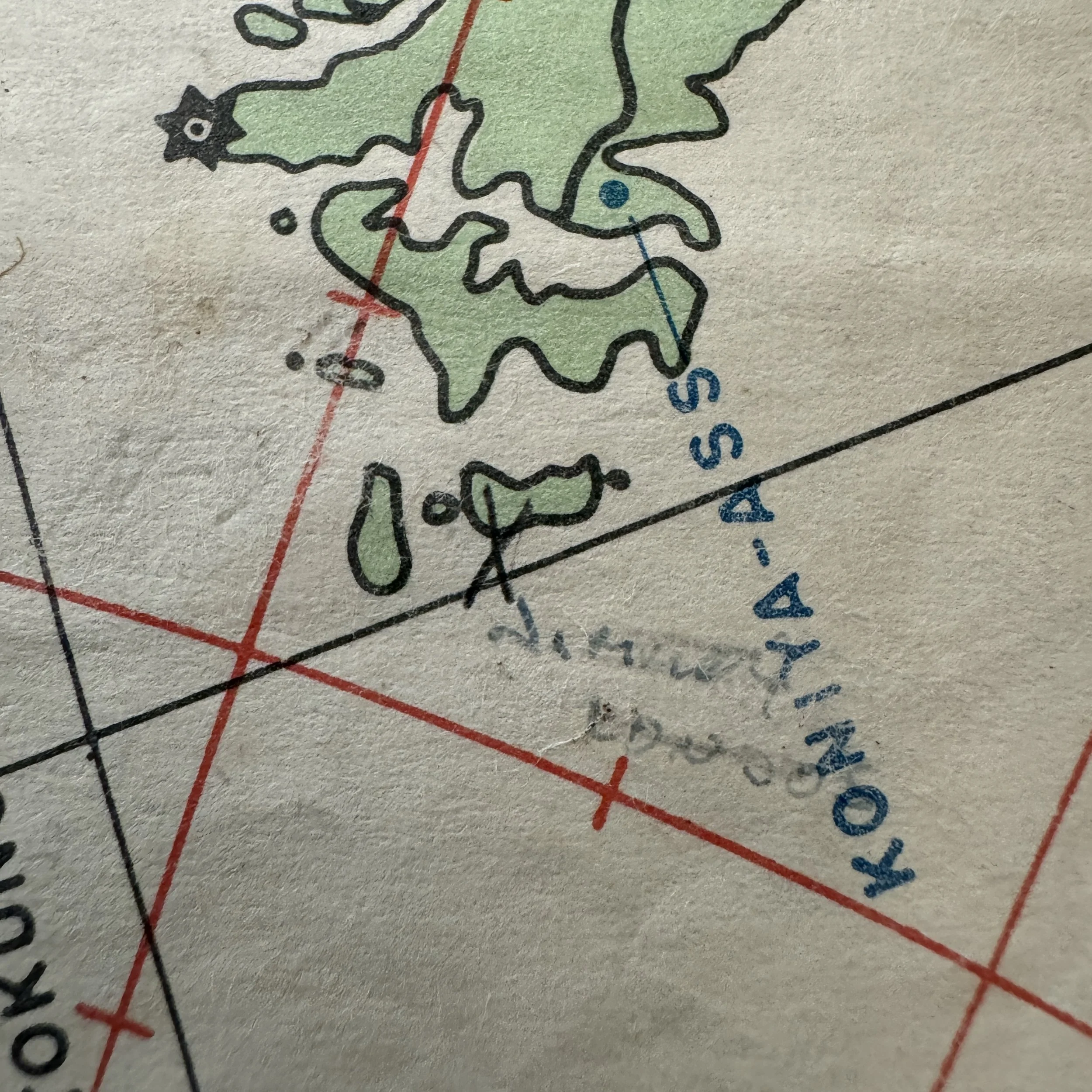
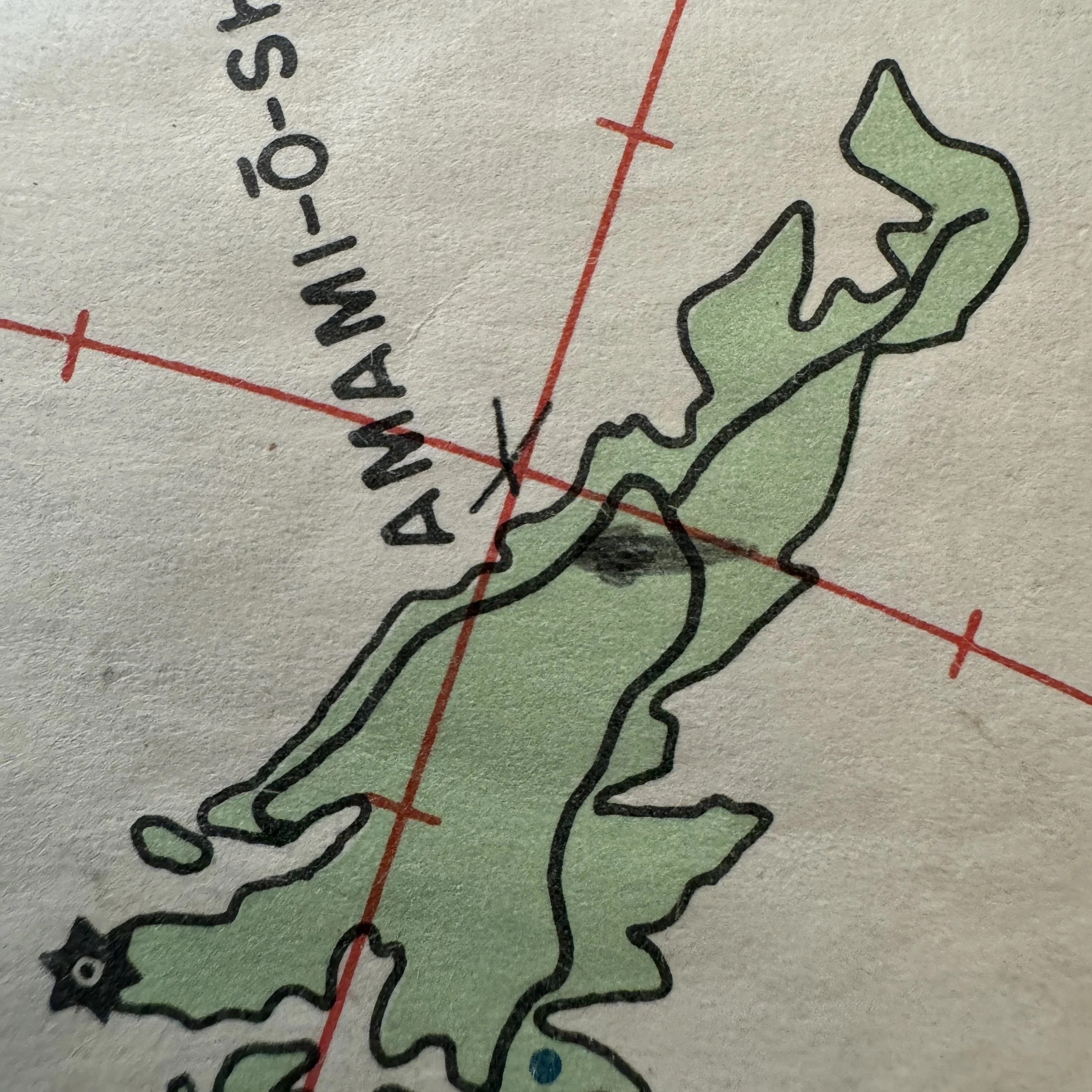
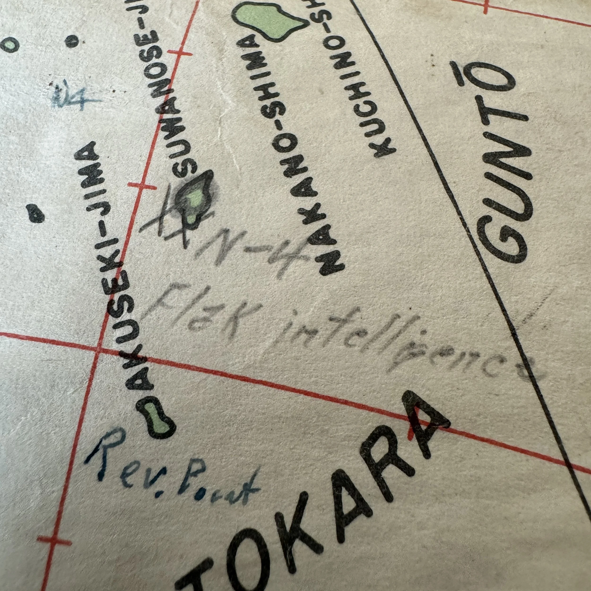
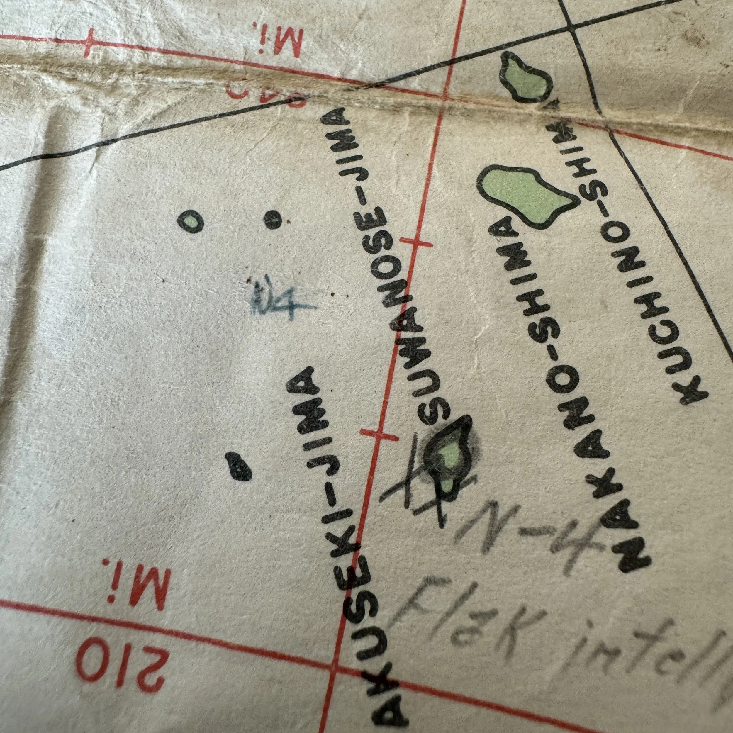
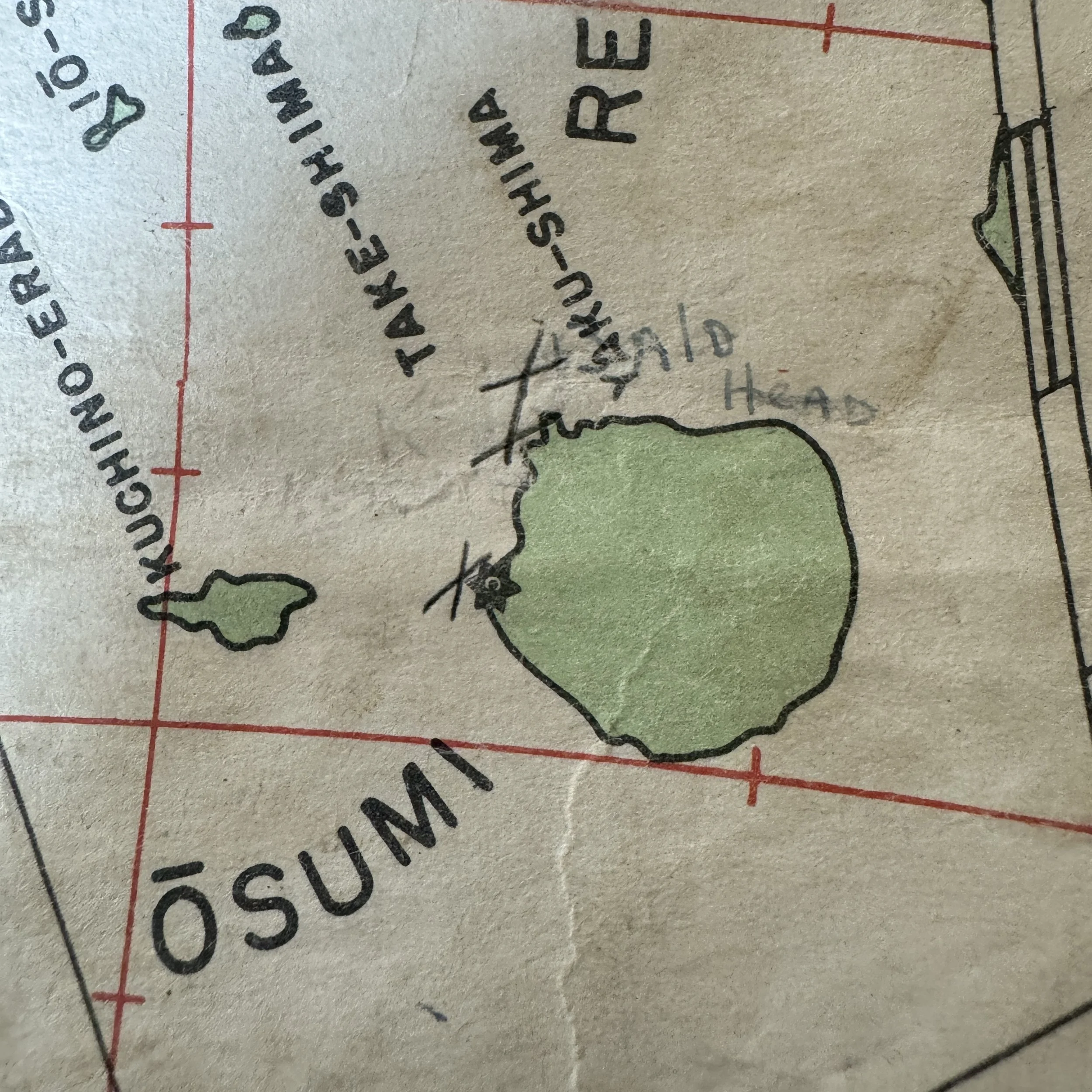
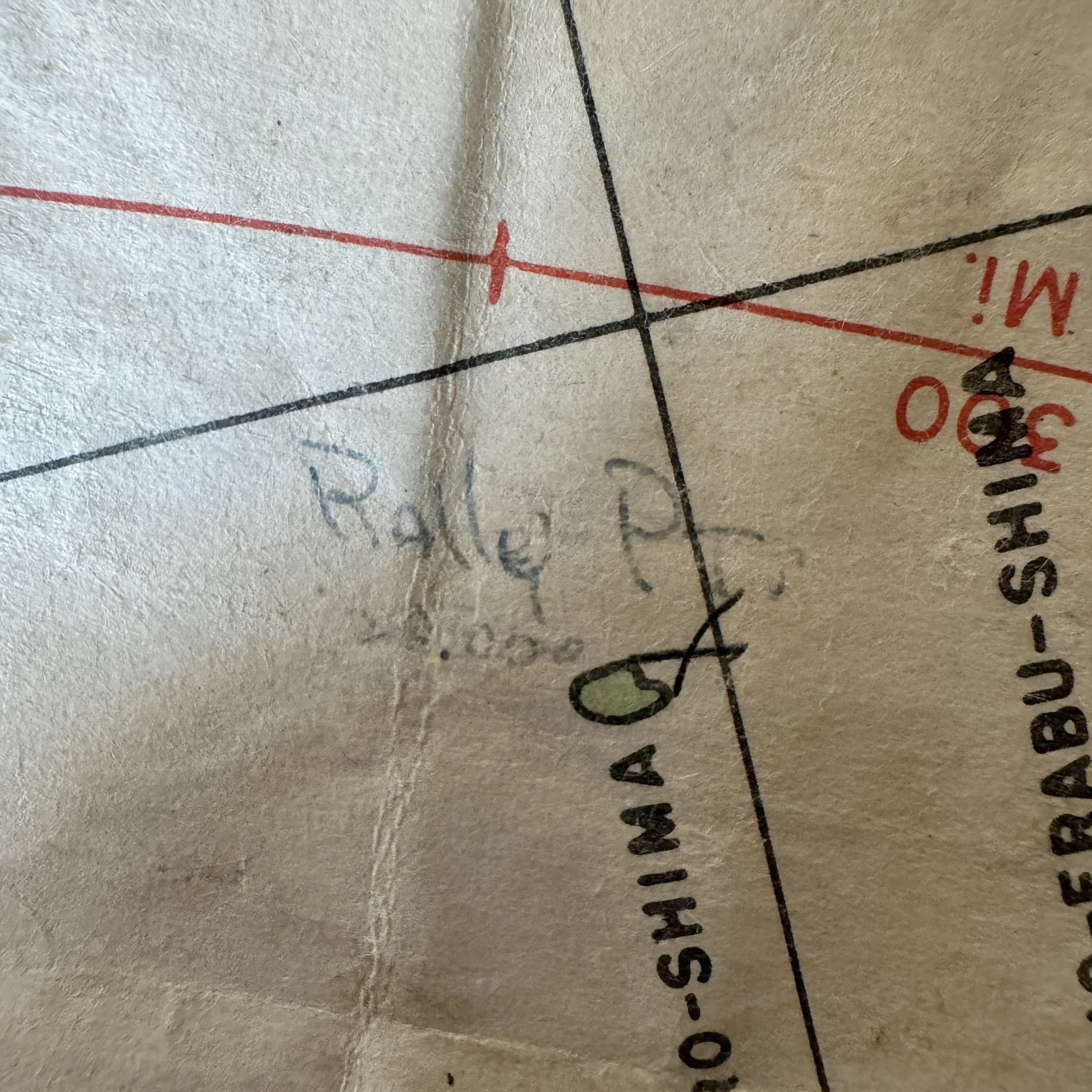
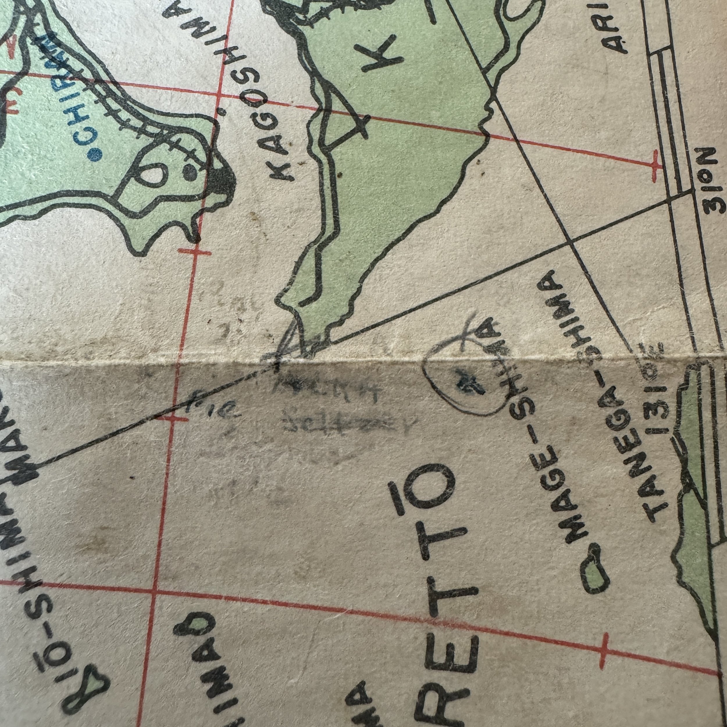
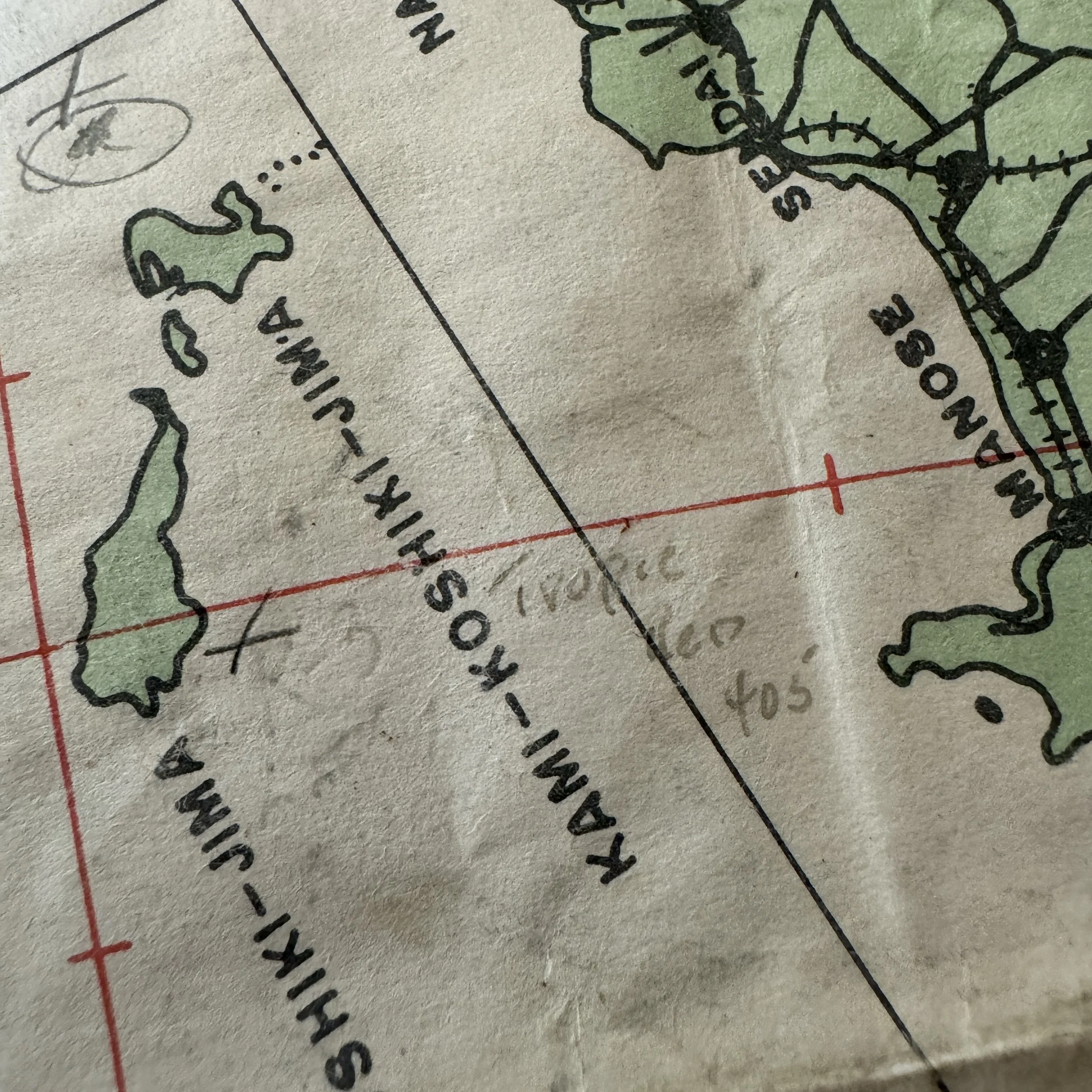
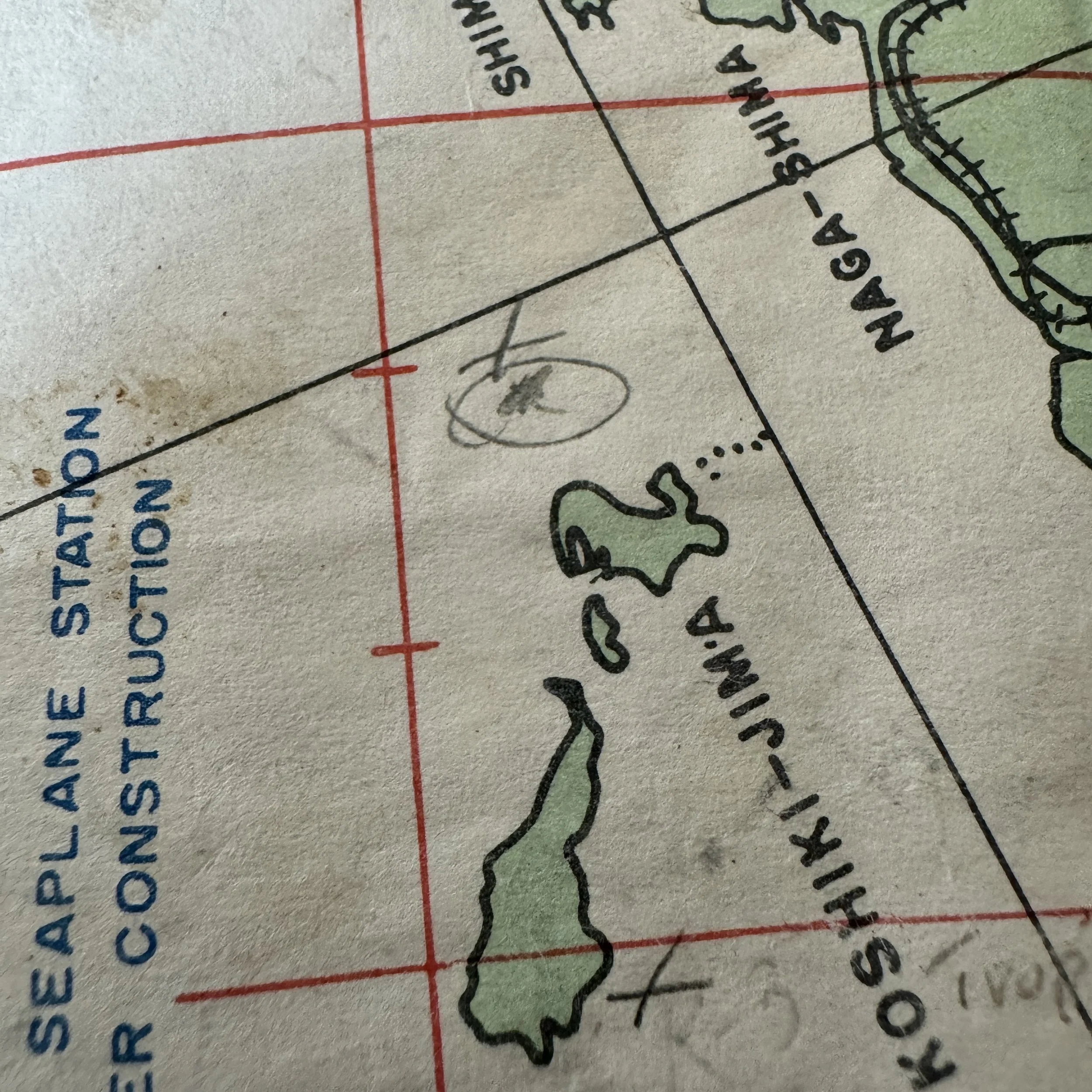
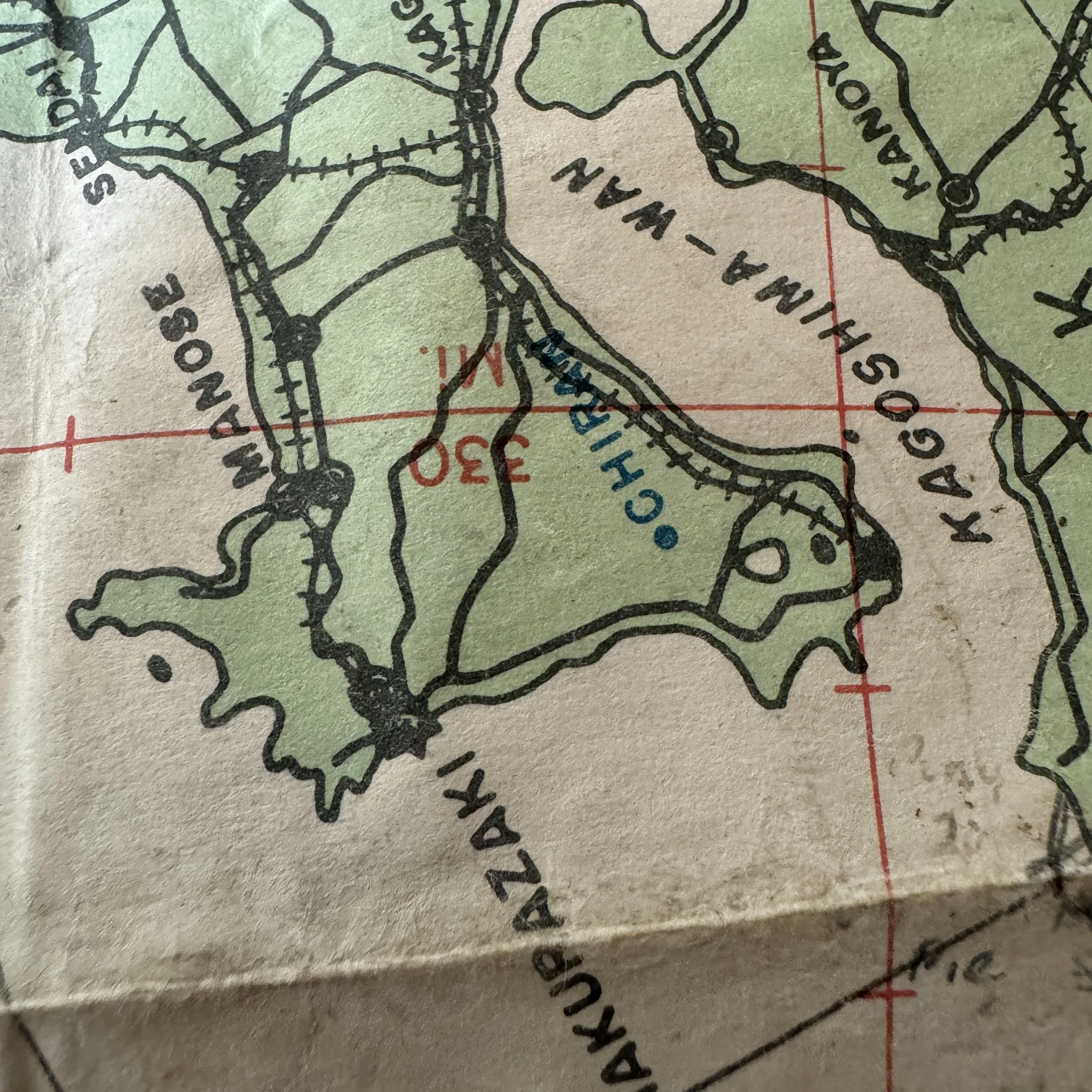
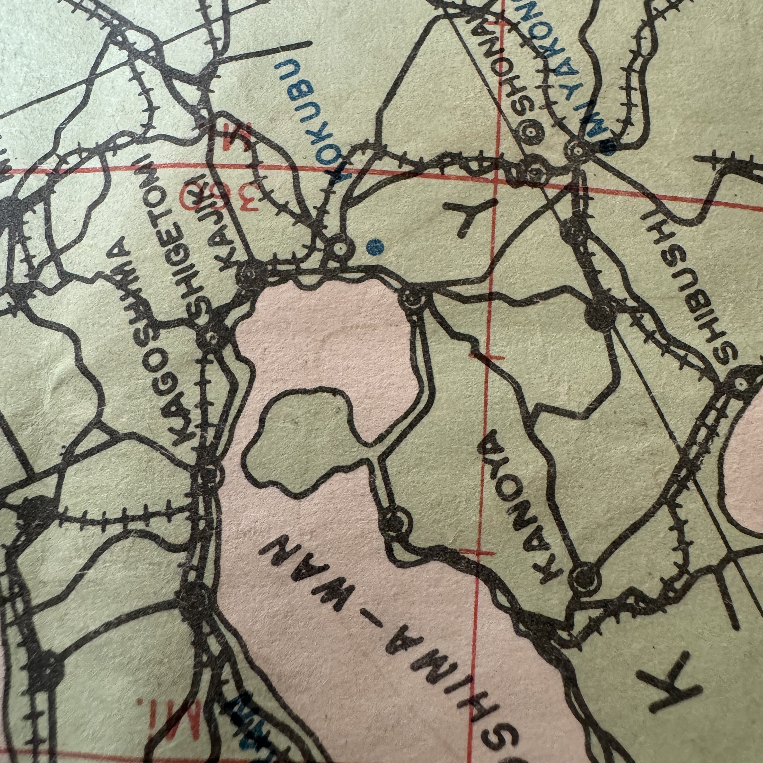
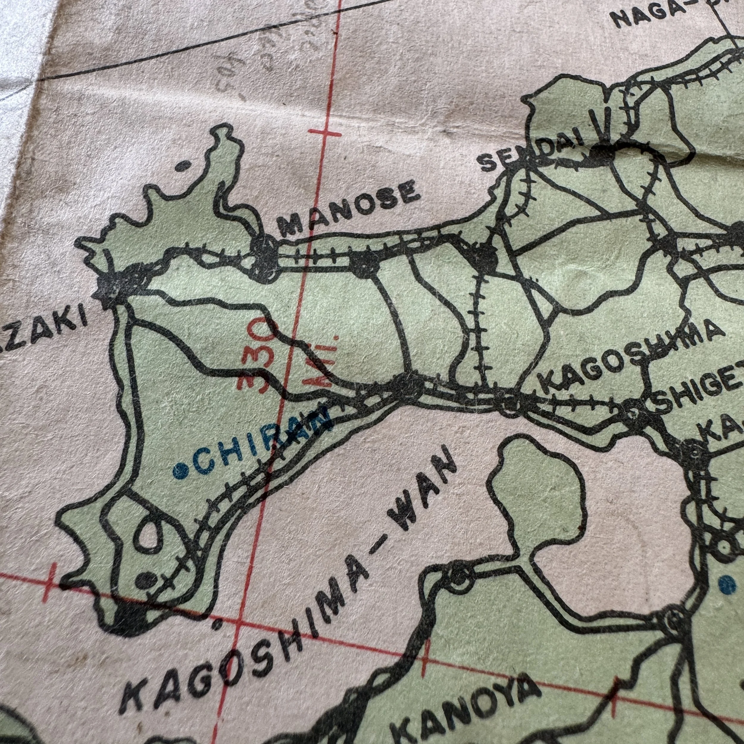
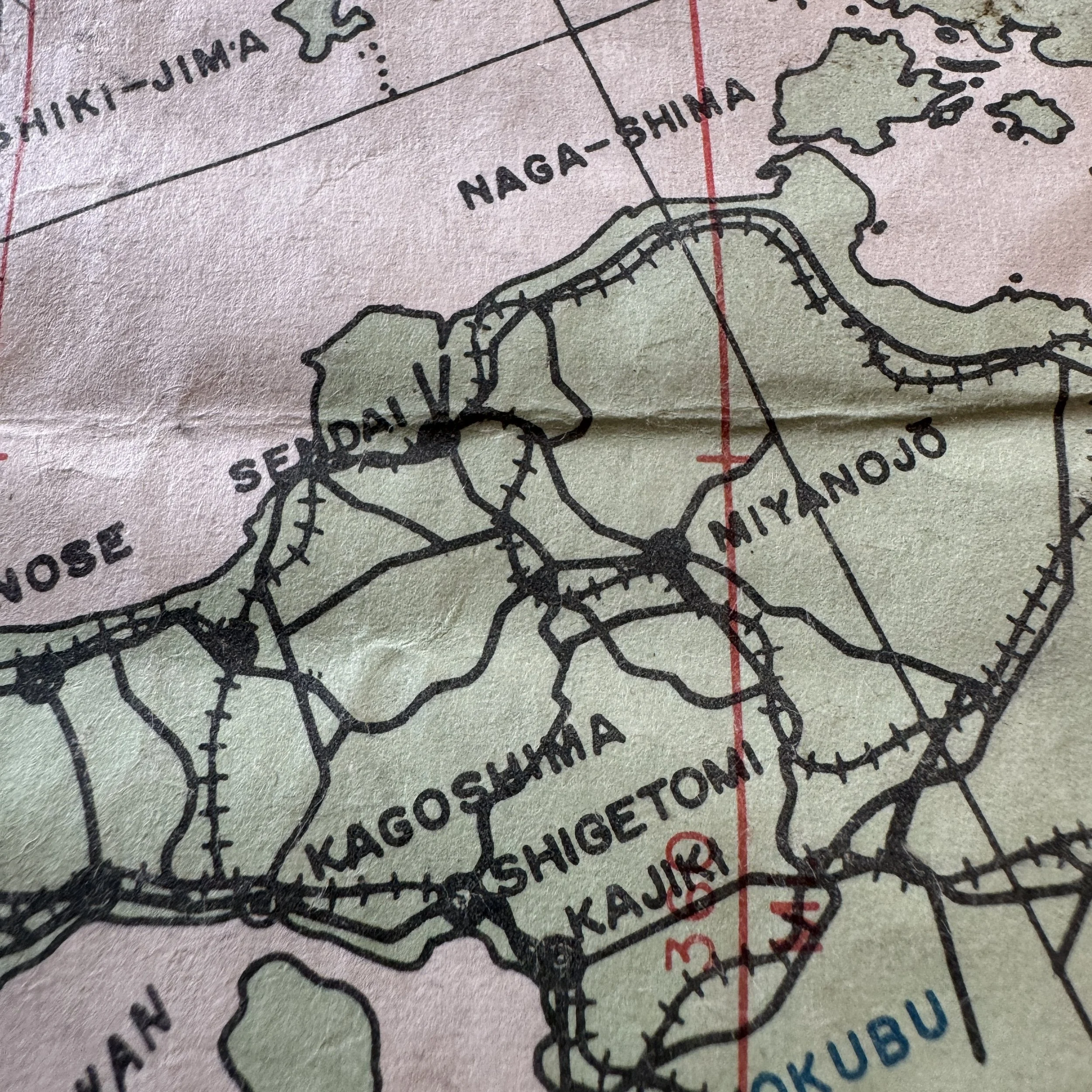
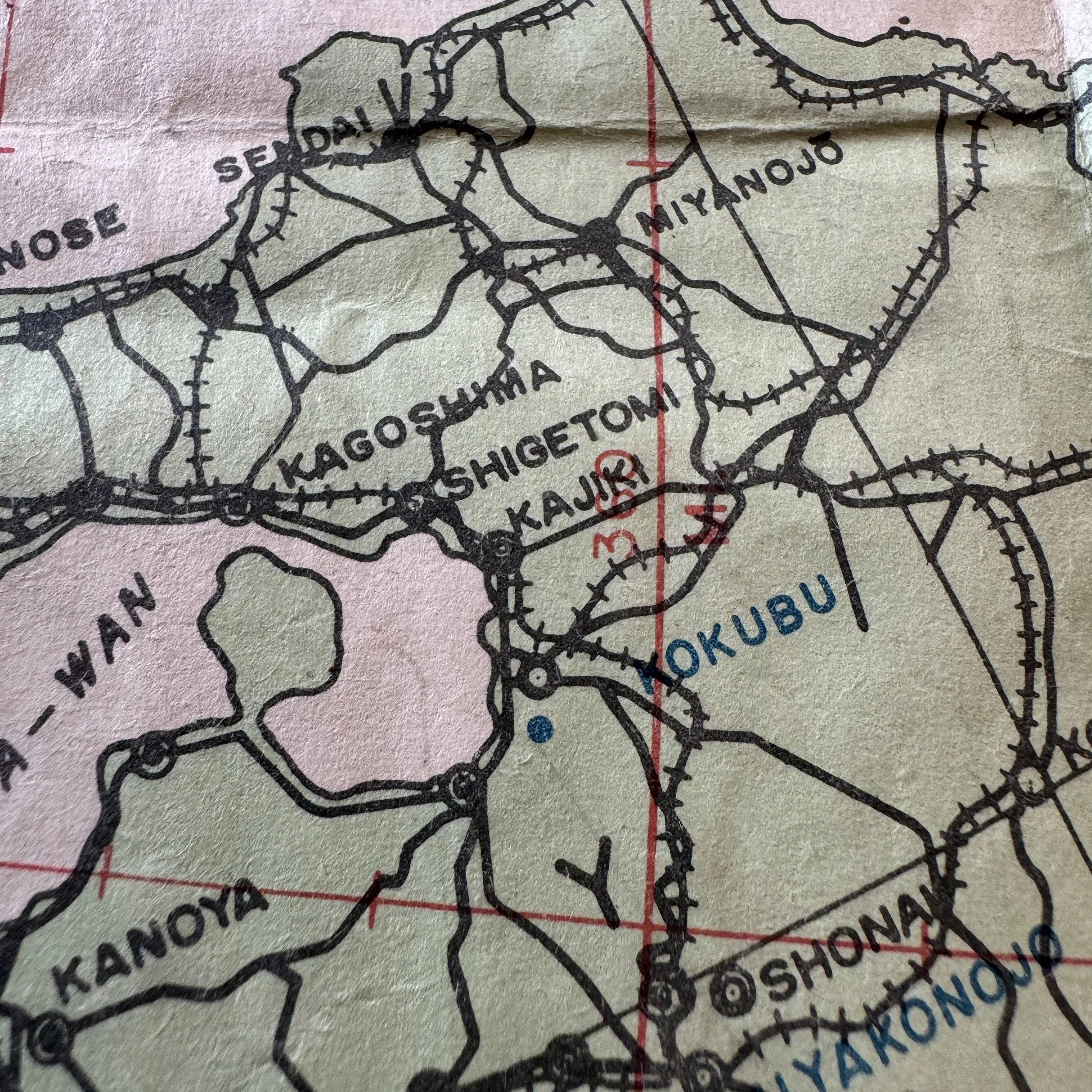
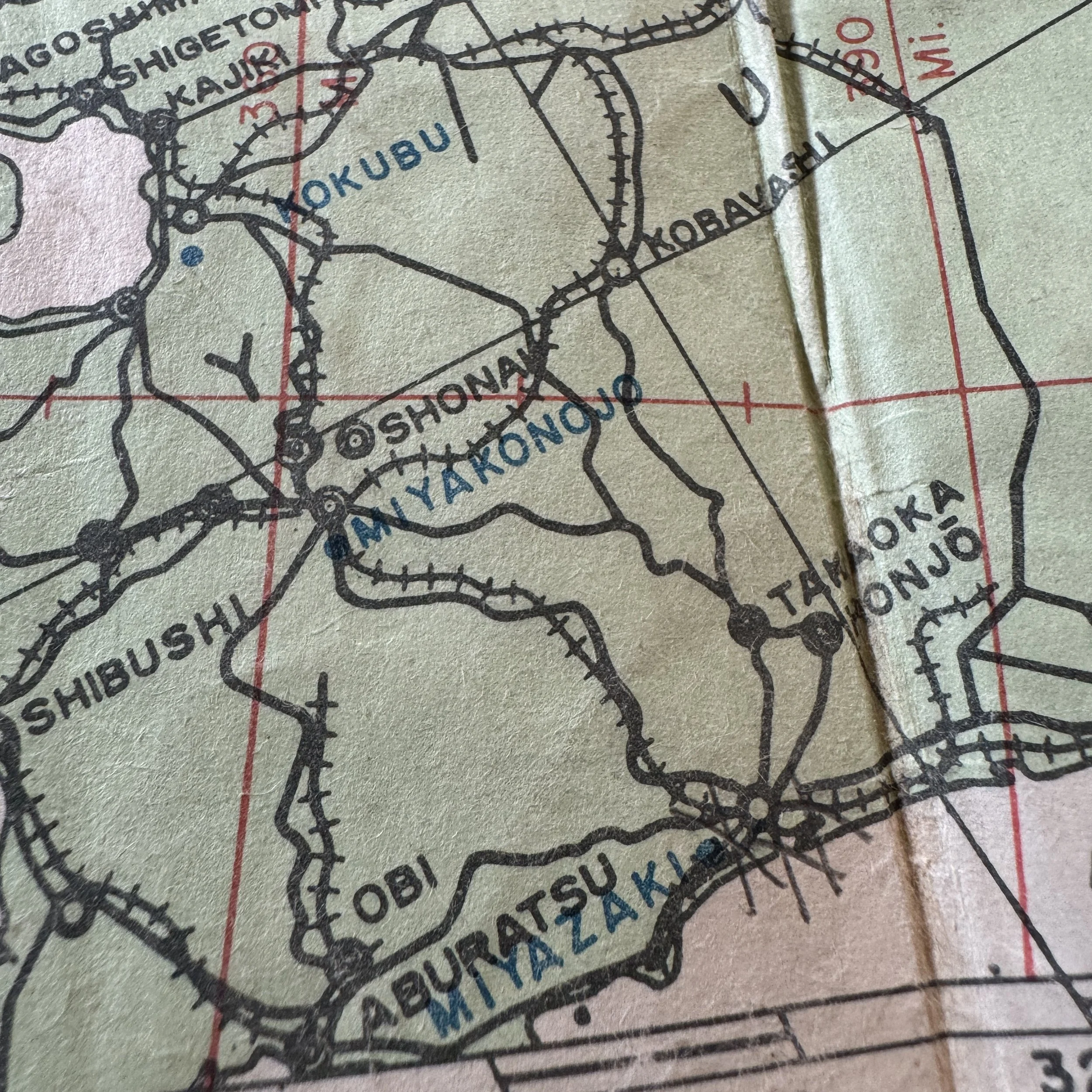
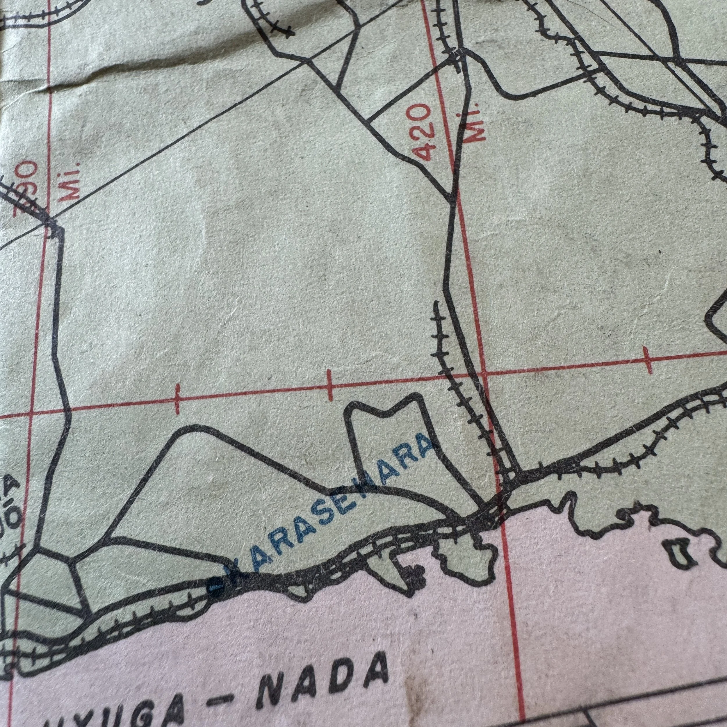
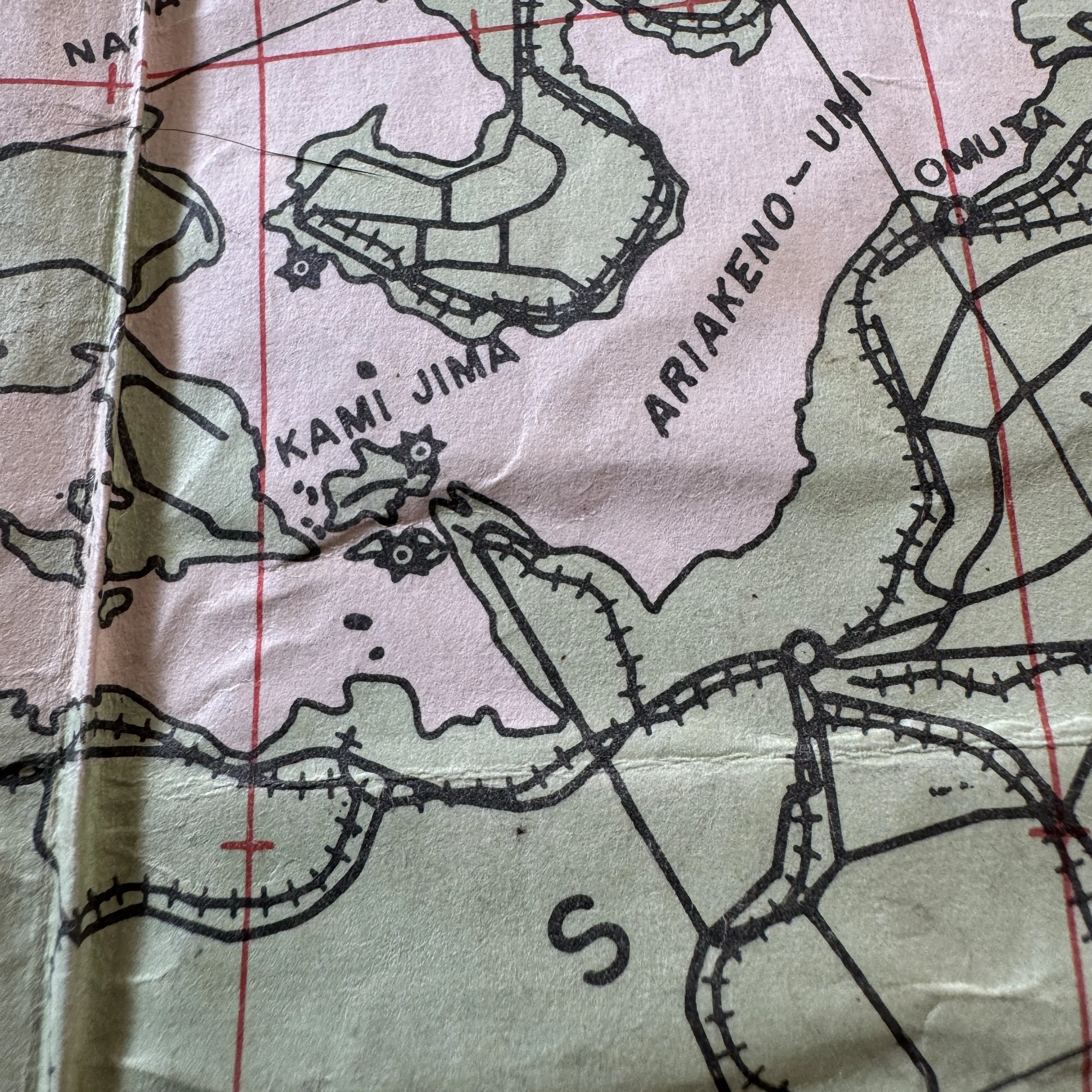
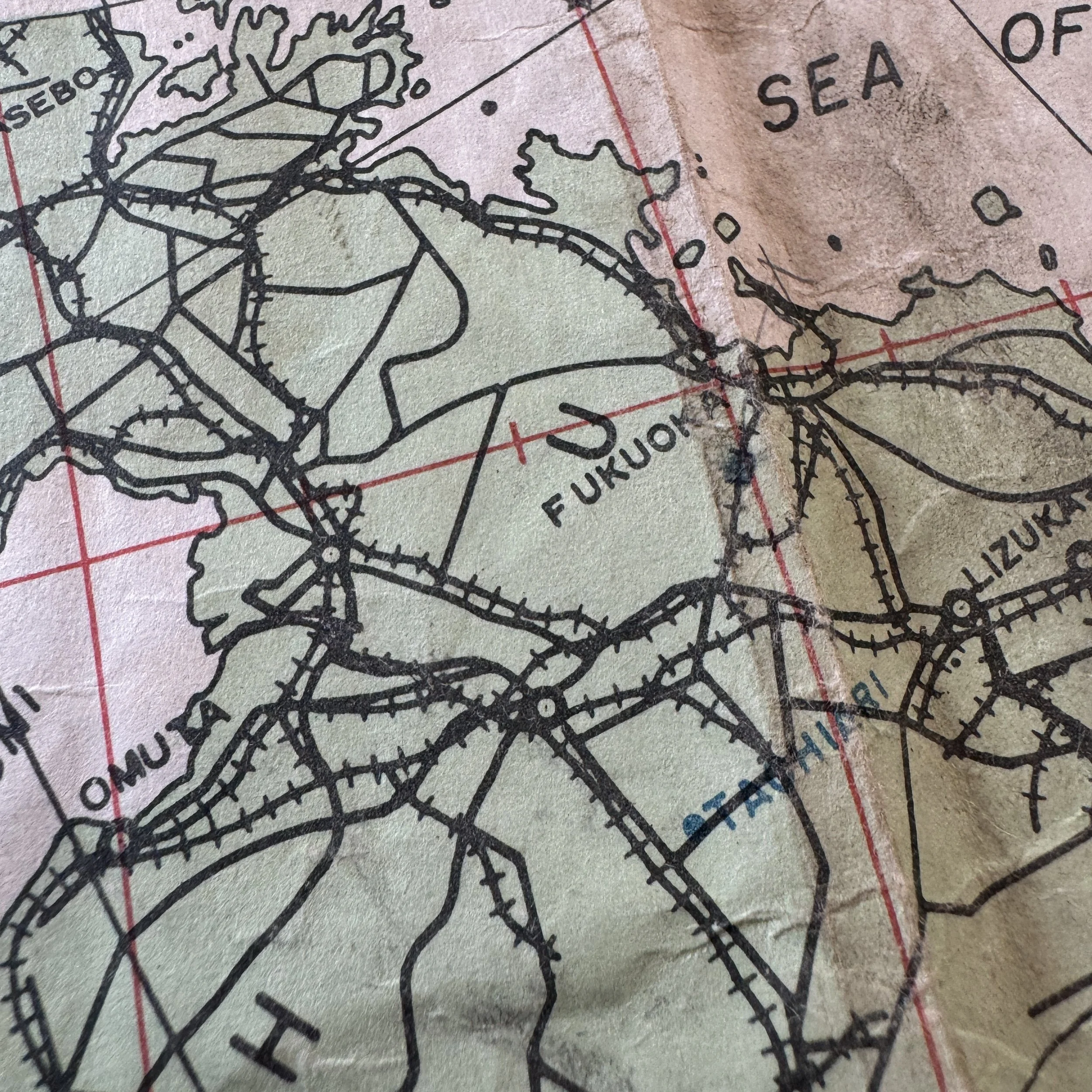
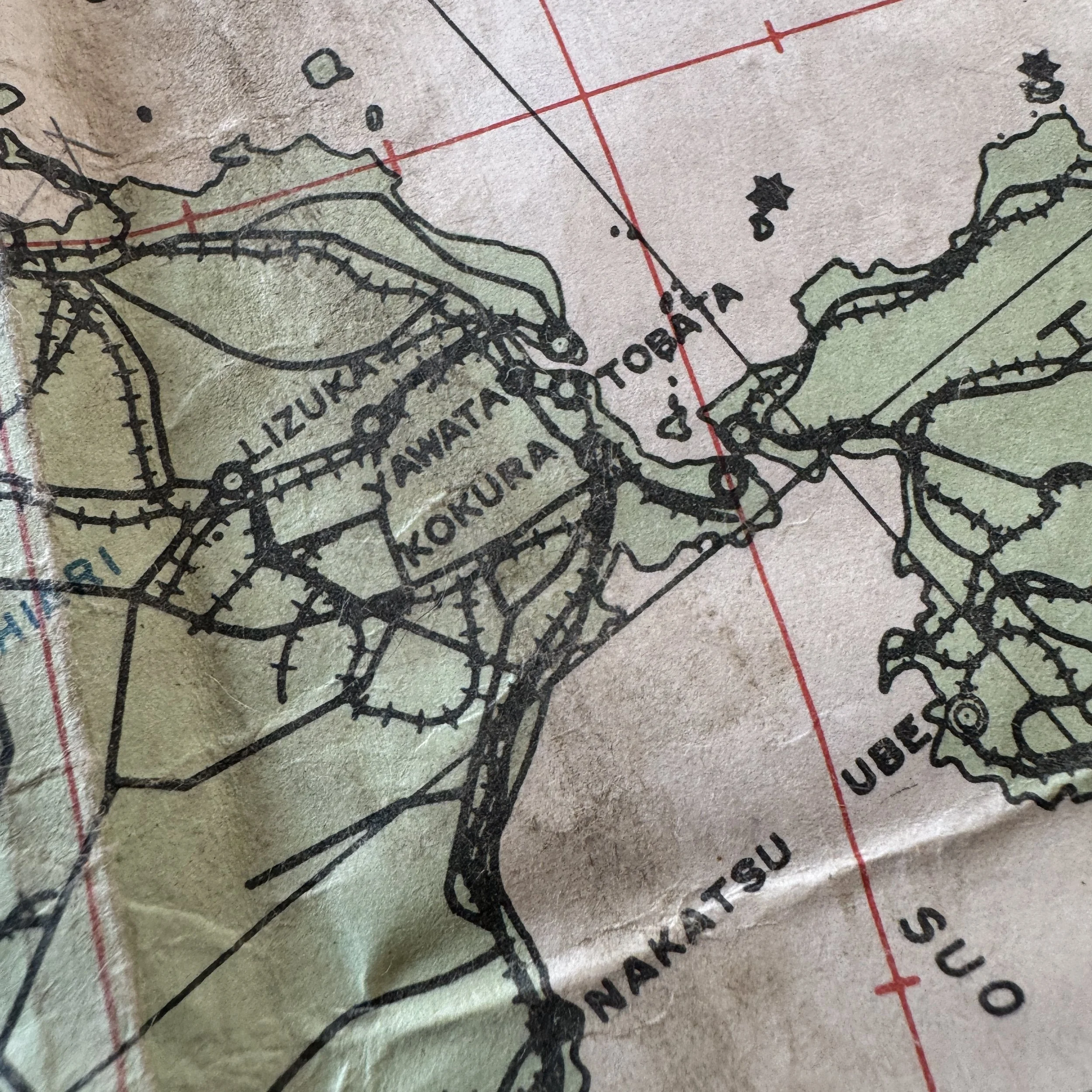
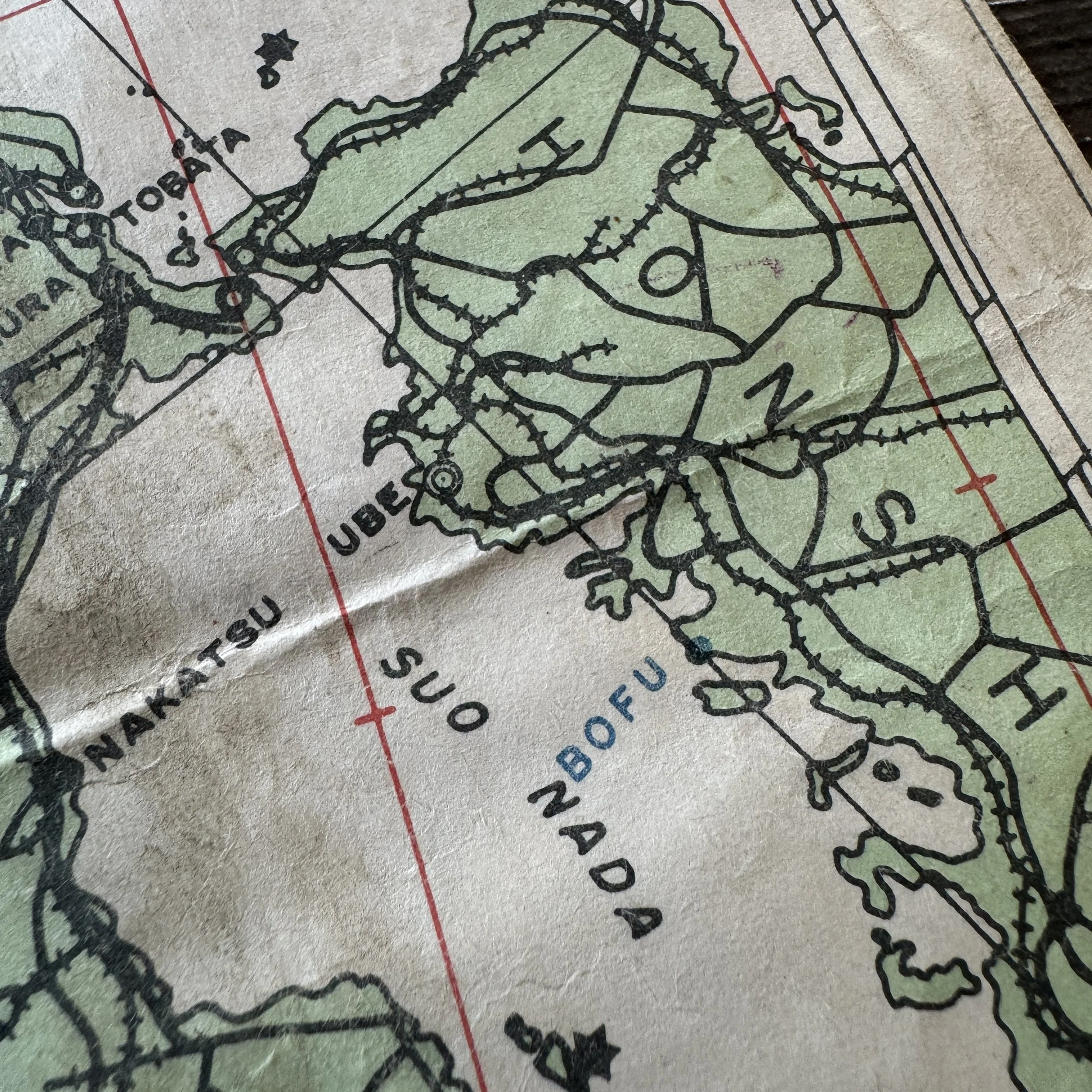
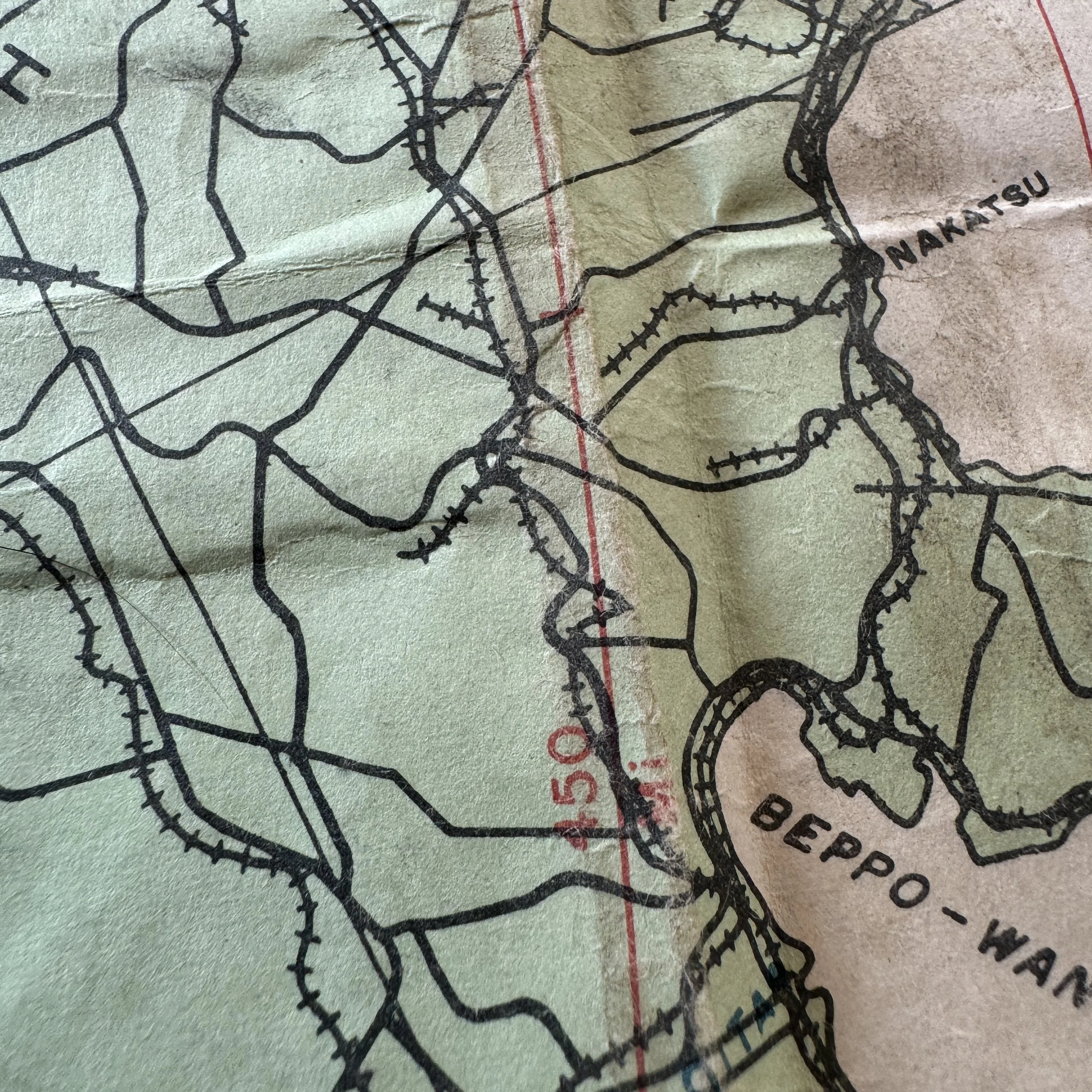
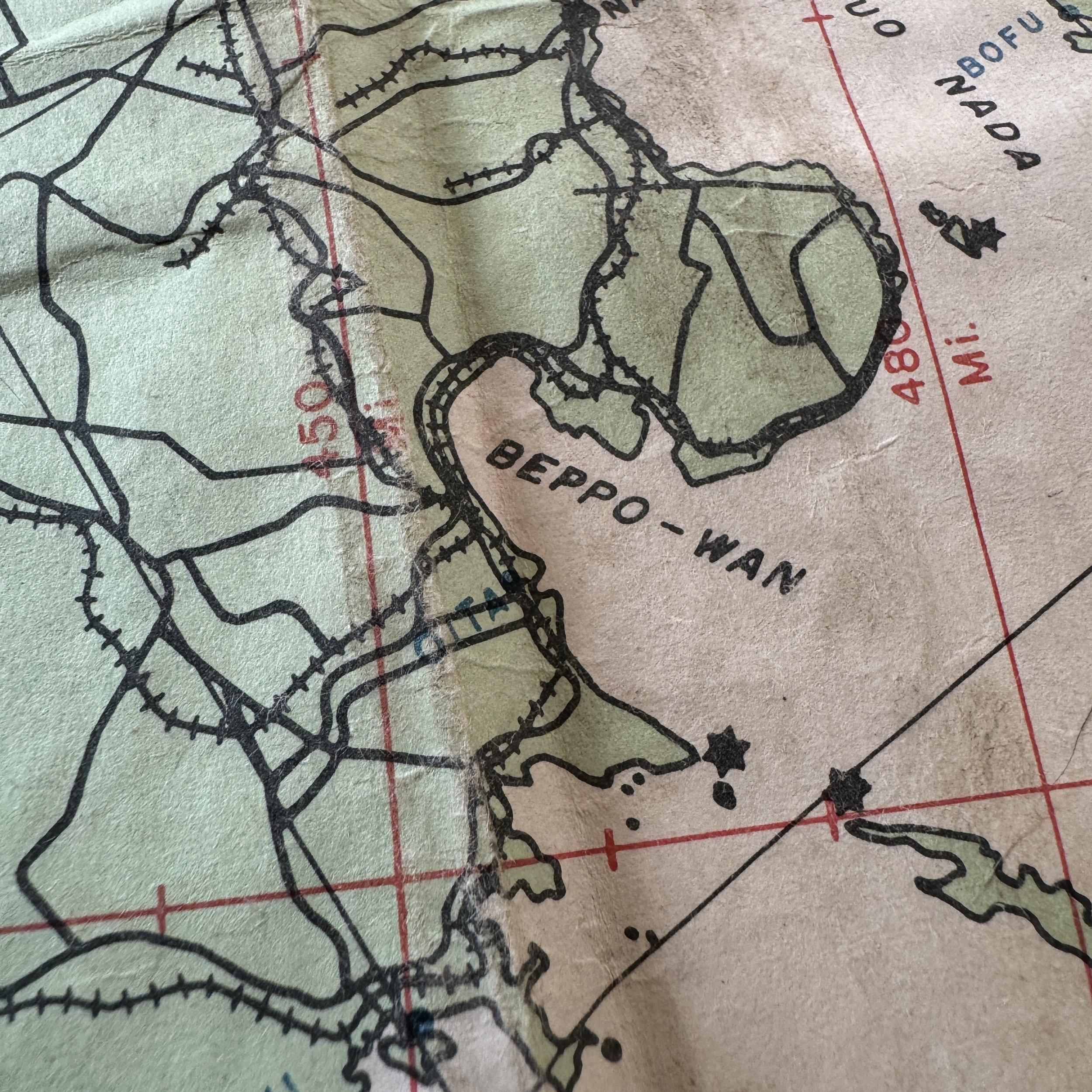
This exceptionally rare and museum-grade artifact is an original and extremely limited panoramic World War II "OKINAWA - KYUSHU" navigational flight map, issued specifically for B-29 Superfortress navigators flying long-range missions during the climactic months of the Pacific War. Dated April 1945 and stamped CONFIDENTIAL, this map played a crucial role in the United States Army Air Forces’ strategic bombing operations against mainland Japan as the Allies closed in on victory. Designed for operational use during combat, the map is marked with key navigational data essential to the safe and precise execution of aerial raids, including magnetic latitude and longitude, barons, distances in nautical miles, and detailed coastal outlines. What sets this map apart is the painstaking detail used to record enemy infrastructure—it identifies known Japanese airfields, auxiliary strips, seaplane stations, and even incomplete airfields still under construction as of early 1945, vital intelligence for bomber crews tasked with crippling Japan’s defensive and offensive capabilities.
Even more historically significant are the combat annotations made in pencil directly onto this map by the navigator of a B-29 crew. These wartime notations record firsthand tactical observations from actual missions: Japanese flag symbols indicate flagged installations on outlying islands en route to Kyushu, while precise marks show heading changes, rally points, and positional adjustments during bombing runs deep into enemy territory. Such markings reflect the life-and-death calculations navigators made in real time as they guided their crews across hostile skies. Maps like this were not only navigation aids but vital records of mission execution, offering a rare glimpse into the operational realities faced by aircrews flying from newly captured Okinawa into the heart of Japan.
Beginning in May 1945, following the bloody capture of Okinawa, aircraft of the USAAF’s Seventh Air Force — now under the broader command of the Far East Air Forces (FEAF) — commenced systematic bombing missions against the Japanese home islands, focusing particularly on Kyushu and western Honshu. These missions formed part of the overarching strategy for Operation Downfall, the planned invasion of Japan. From Okinawa and other Ryukyu bases, Seventh Air Force B-24 Liberators, and later B-29 Superfortresses, struck enemy airfields, transportation hubs, and industrial targets to pave the way for a potential amphibious assault. The tempo of attacks intensified throughout the summer of 1945. By war’s end, the Seventh Air Force had flown at least 784 bombing sorties targeting Kyushu’s airfields alone, while Fifth Air Force bombers added another 138 sorties against these critical assets.
Beyond airfields, Allied bombers and fighters also pounded road and rail infrastructure, attempting to isolate Kyushu from reinforcements and supplies. Key cities like Kagoshima were bombed repeatedly, their ports, rail yards, and logistical hubs left in ruins in an effort to paralyze Japan’s ability to resist. As the war neared its conclusion, maps like this one — worn, marked up, and invaluable — stood at the very heart of these operations, guiding American airmen through perilous missions that brought the war ever closer to Japan’s doorstep.
Surviving examples of such heavily used combat maps are exceptionally rare today, especially ones retaining pencil-marked combat annotations directly tied to the USAAF bombing campaign against Kyushu. This artifact offers not only a tangible link to the men who risked their lives over hostile skies but also a critical visual representation of the strategic calculus and navigational precision required during the final months of World War II.