Extremely Rare WWII 1945 CONFIDENTIAL Operation Downfall Invasion VERY LARGE SIZED Maps — Complete Set of 3 CINCPOA Kyushu & Honshu Planning Charts for Operations Olympic and Coronet


Extremely Rare WWII 1945 CONFIDENTIAL Operation Downfall Invasion VERY LARGE SIZED Maps — Complete Set of 3 CINCPOA Kyushu & Honshu Planning Charts for Operations Olympic and Coronet
Comes with a hand-signed C.O.A. and a full historical write-up research document
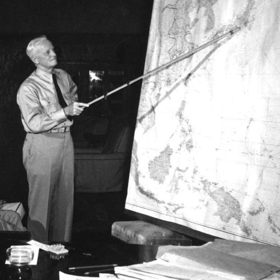
*CINCPOA (Commander in Chief, Pacific Ocean Areas), led by Admiral Chester W. Nimitz, played a central role in the planning and preparation for Operation Downfall, the proposed invasion of Japan scheduled for late 1945 and 1946. As CINCPOA, Nimitz held direct strategic command over the first phase, Operation Olympic, which targeted Kyushu to secure a foothold for the subsequent invasion of Honshu (Operation Coronet), overseen by General Douglas MacArthur's Southwest Pacific Area (SWPA). Nimitz's forces controlled vast areas of the Pacific, including Okinawa, the Marianas, and the Philippines, which served as major forward bases. CINCPOA was responsible for every aspect of the Kyushu invasion, from staging and launching the amphibious assault with Navy and Marine units, to providing air superiority through carrier and land-based bombers, ensuring naval gunfire support, and coordinating extensive logistical operations out of Okinawa. Had the invasion proceeded, CINCPOA forces would have faced formidable Japanese defenses, with casualty projections reaching into the hundreds of thousands—one of the key factors that ultimately led to the use of atomic bombs to force Japan’s surrender and avoid the costly operation.
From: World War II - Pacific Theater
Type: Extremely Rare WWII 1945 CONFIDENTIAL Operation Downfall Invasion Maps — Complete Set of 3 CINCPOA Kyushu & Honshu Planning Charts for Operations Olympic and Coronet
Quantity: 3 Individual Operation Downfall Planning Maps
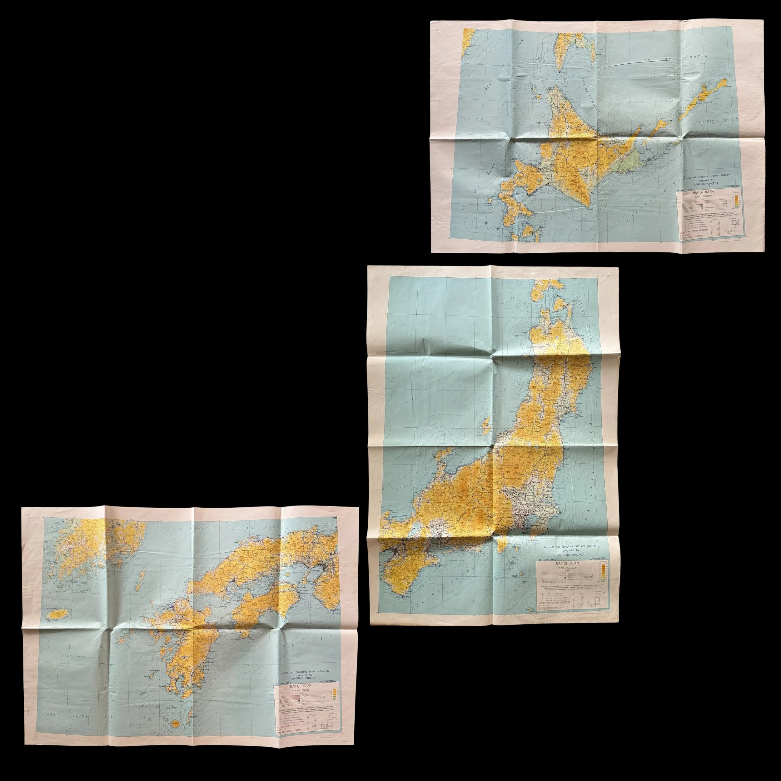
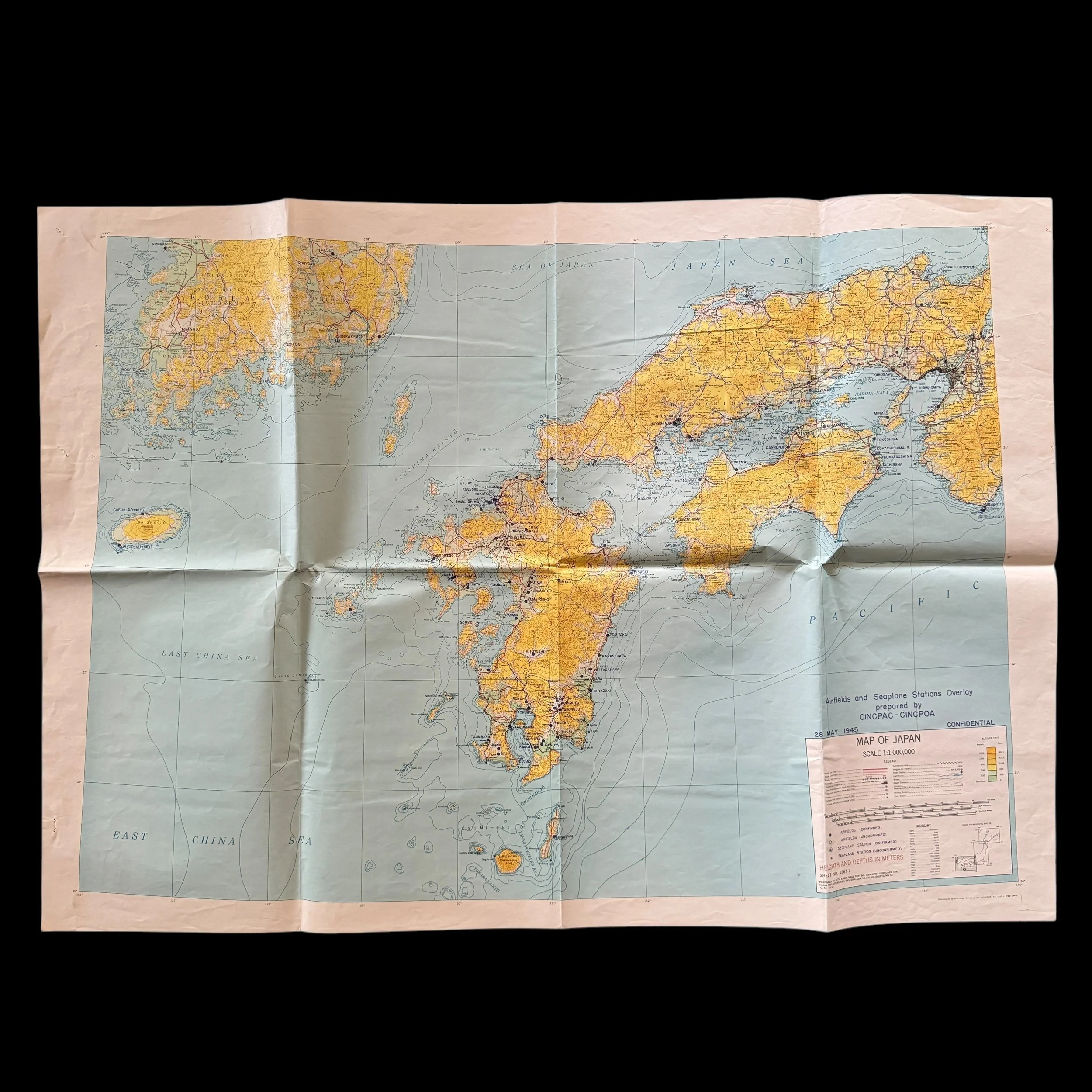
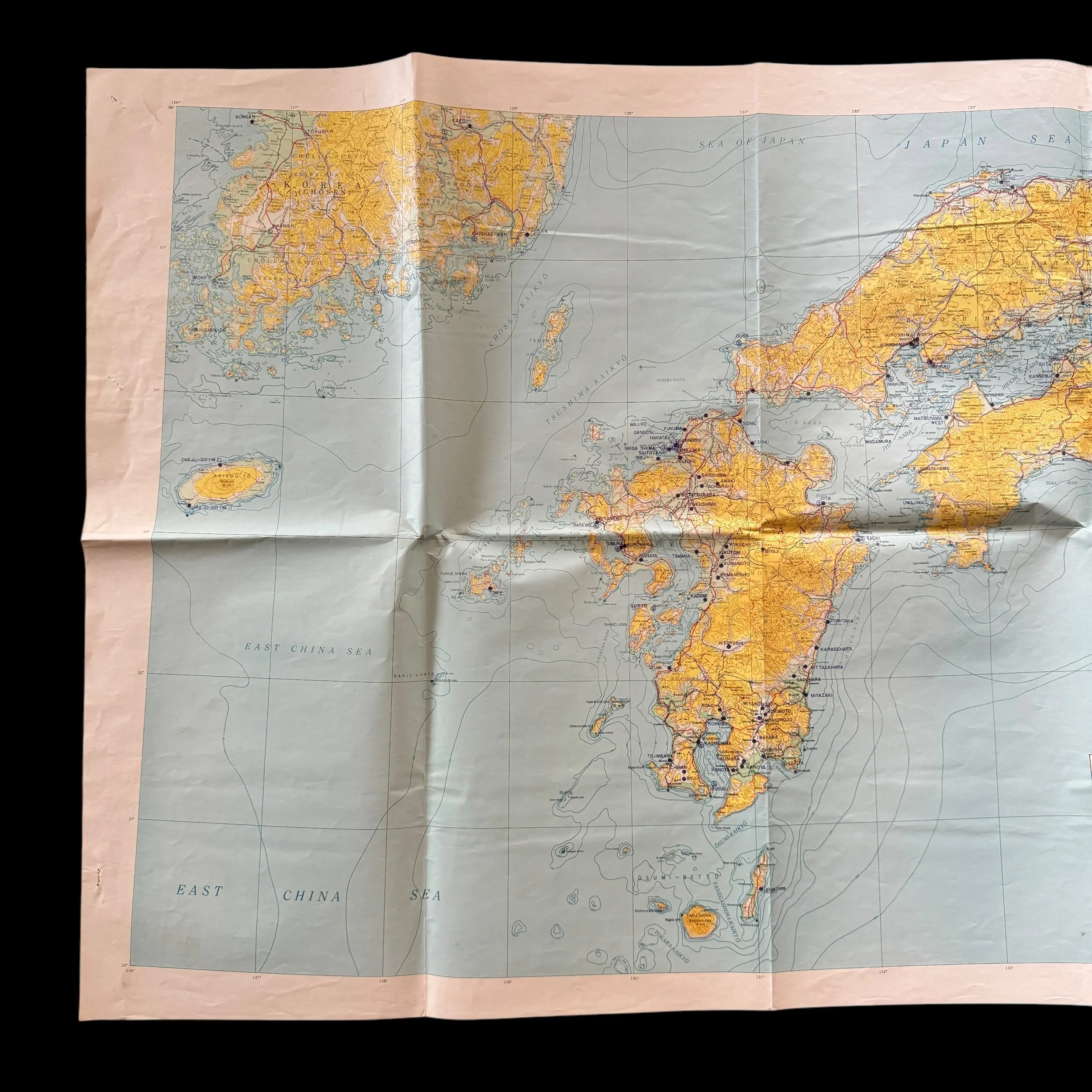
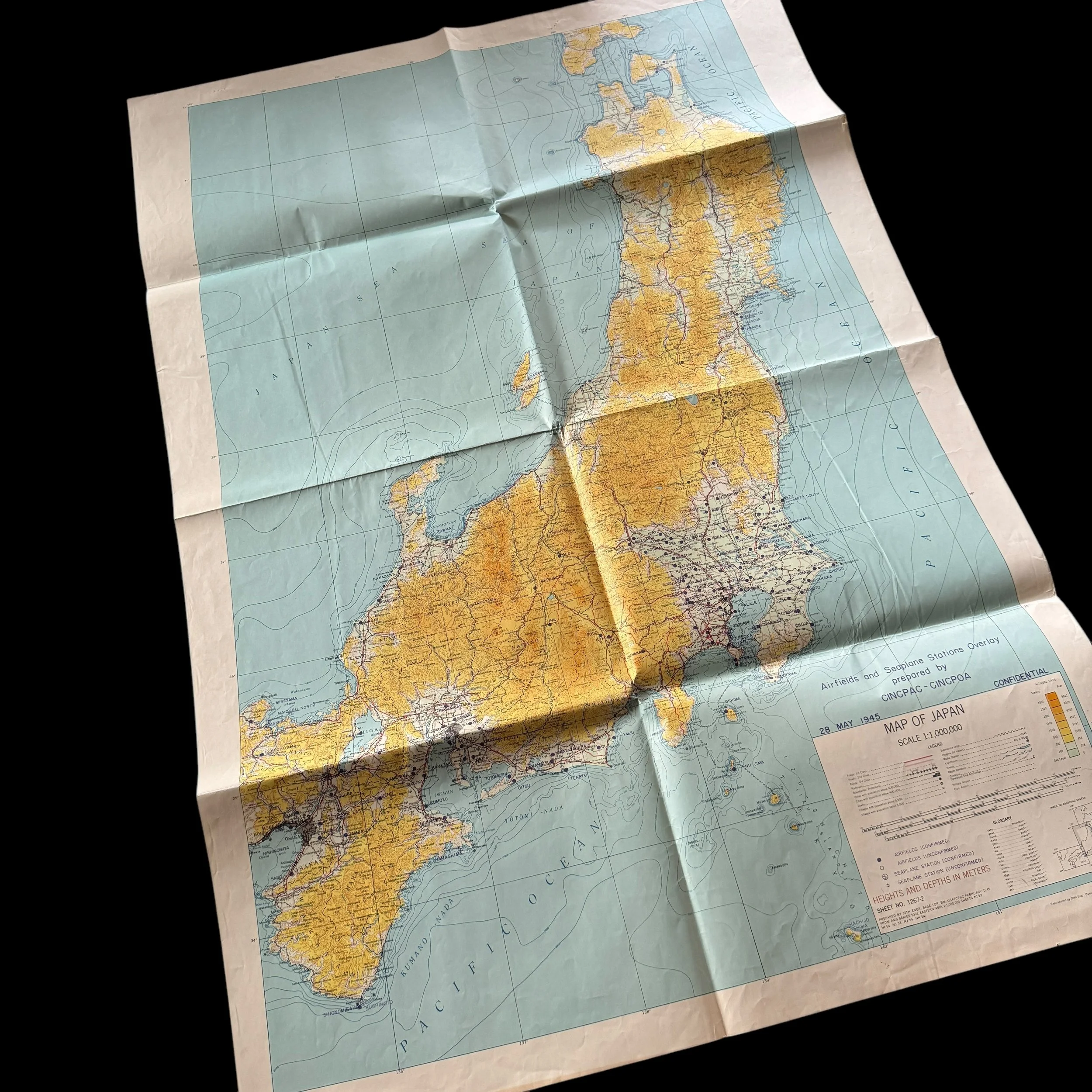
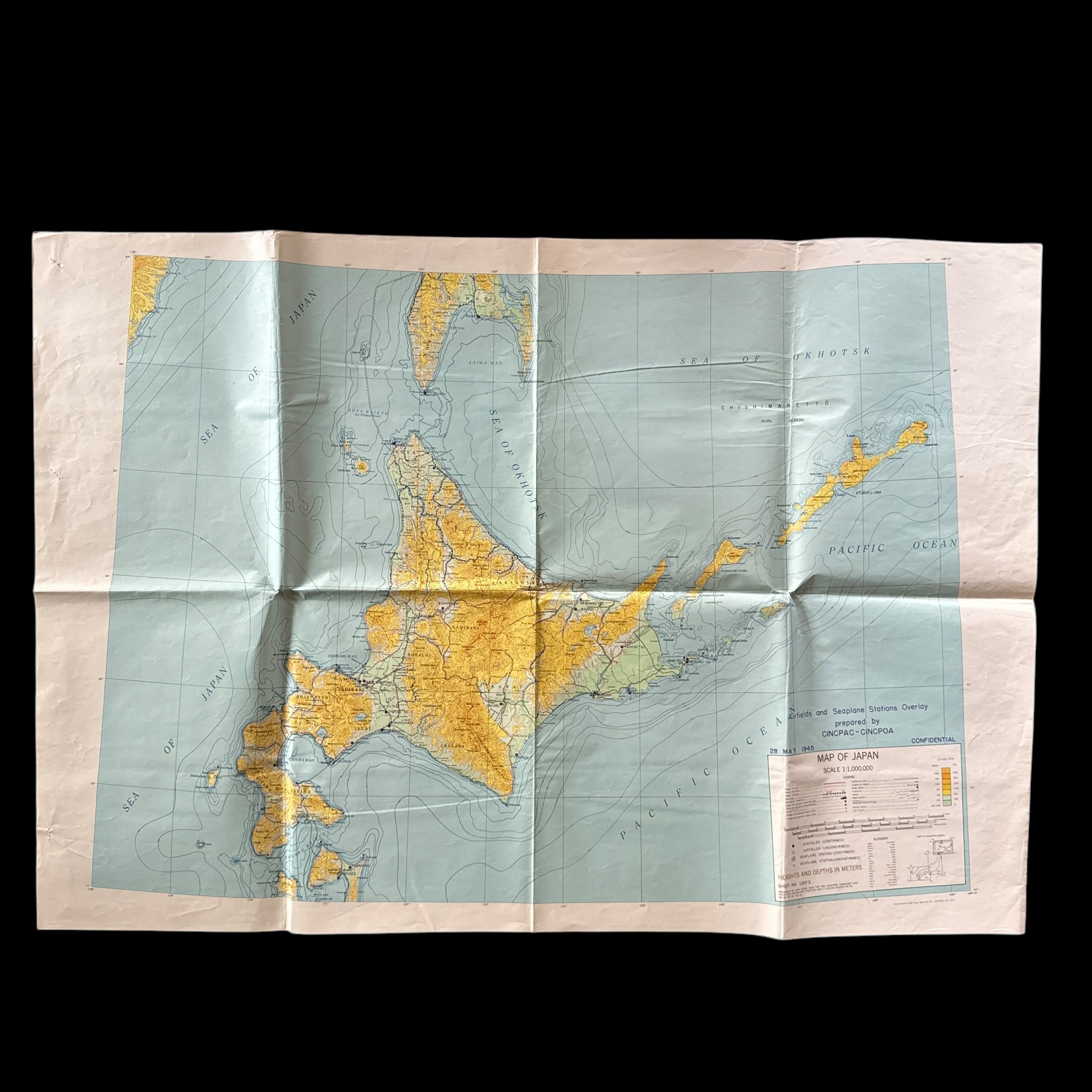
Size: 29 × 42 inches (all three measure the same size)
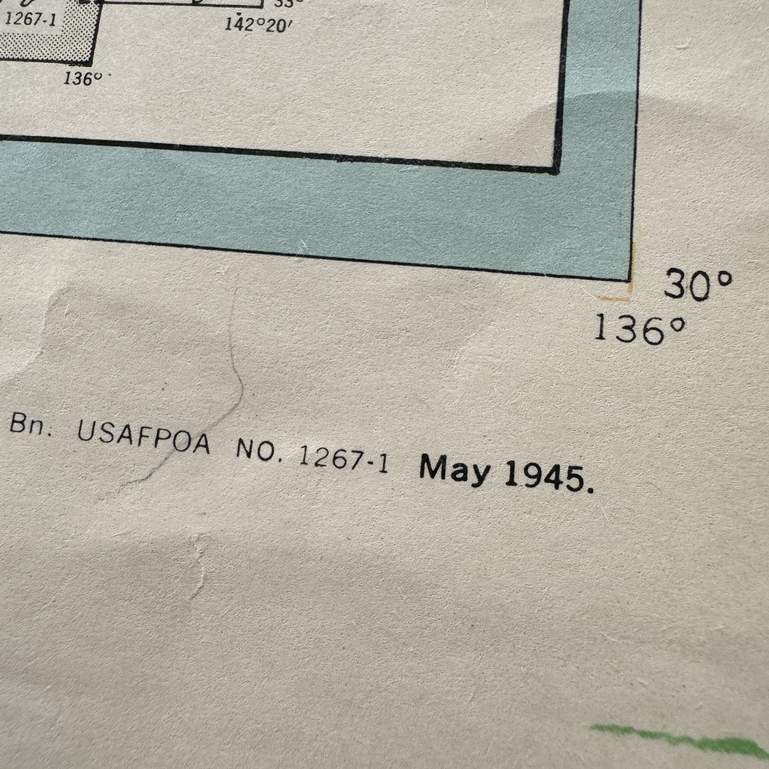
Dated: 1945
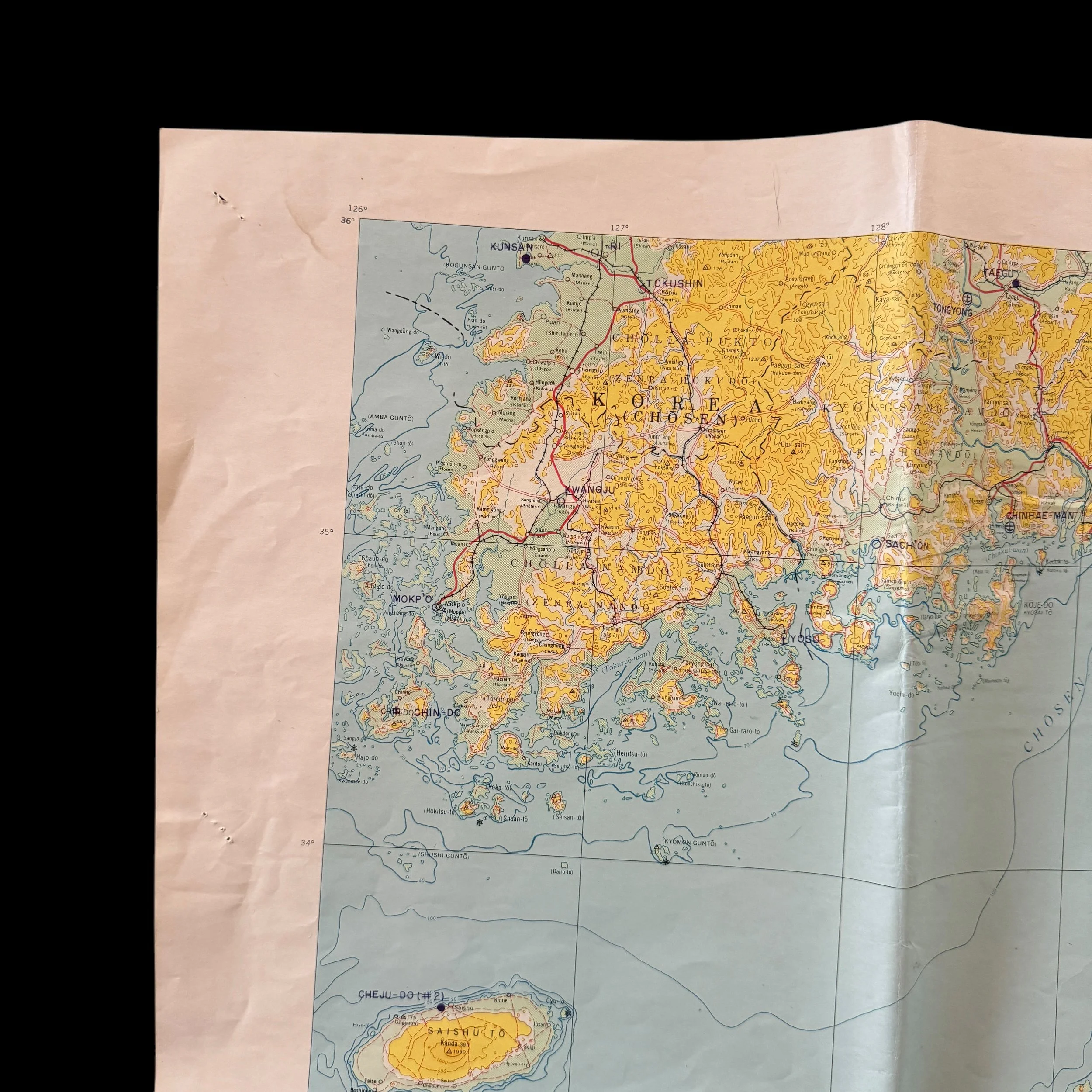
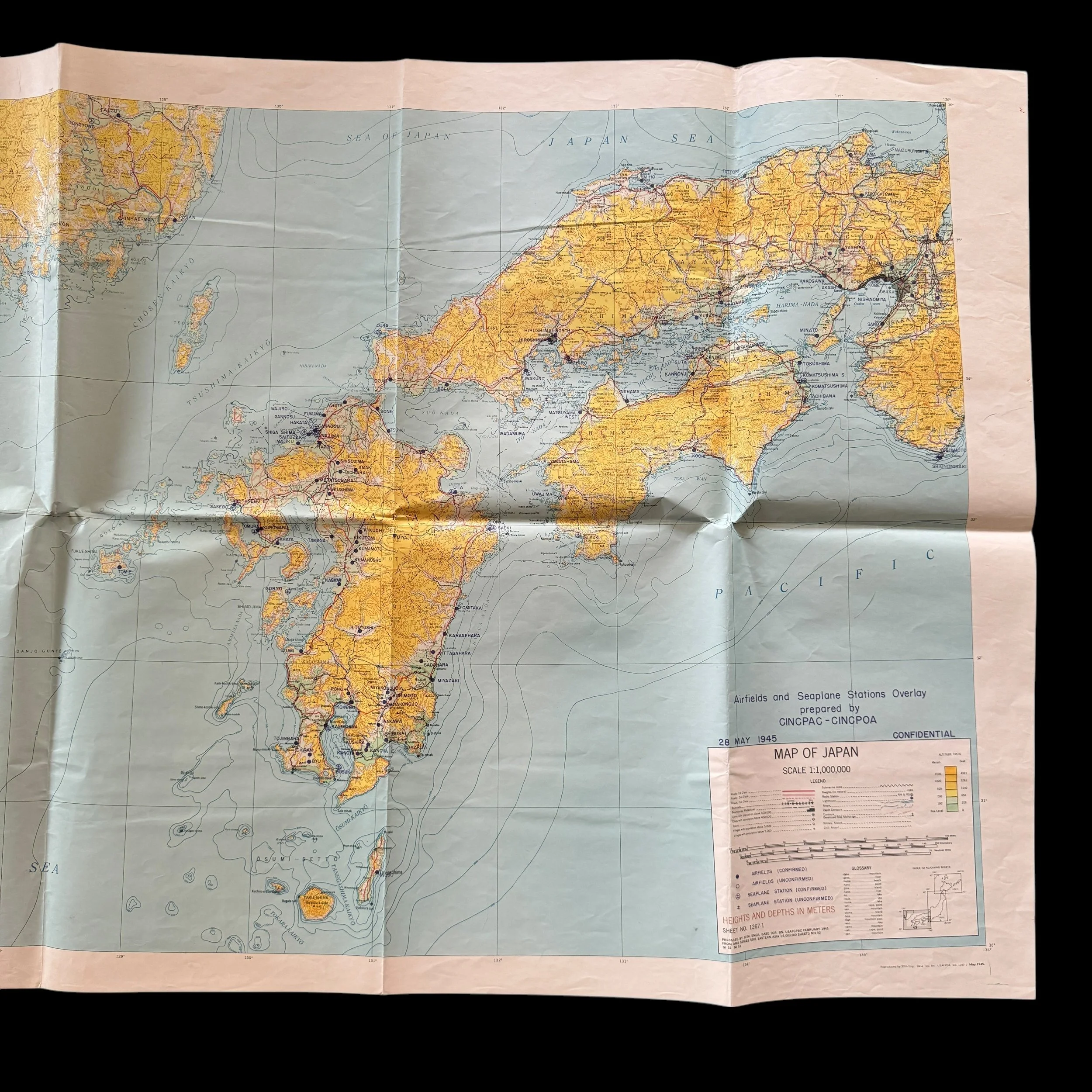
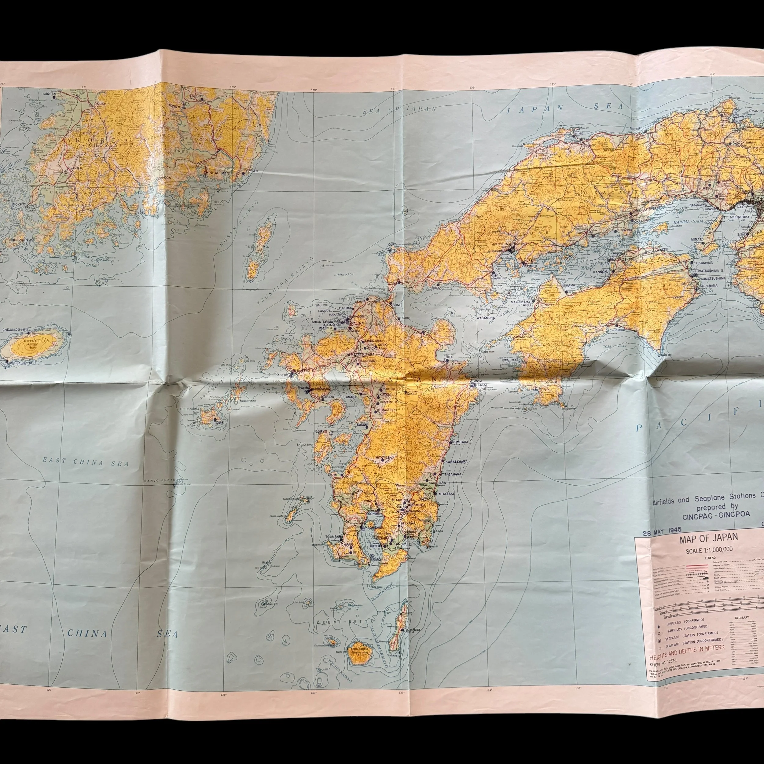
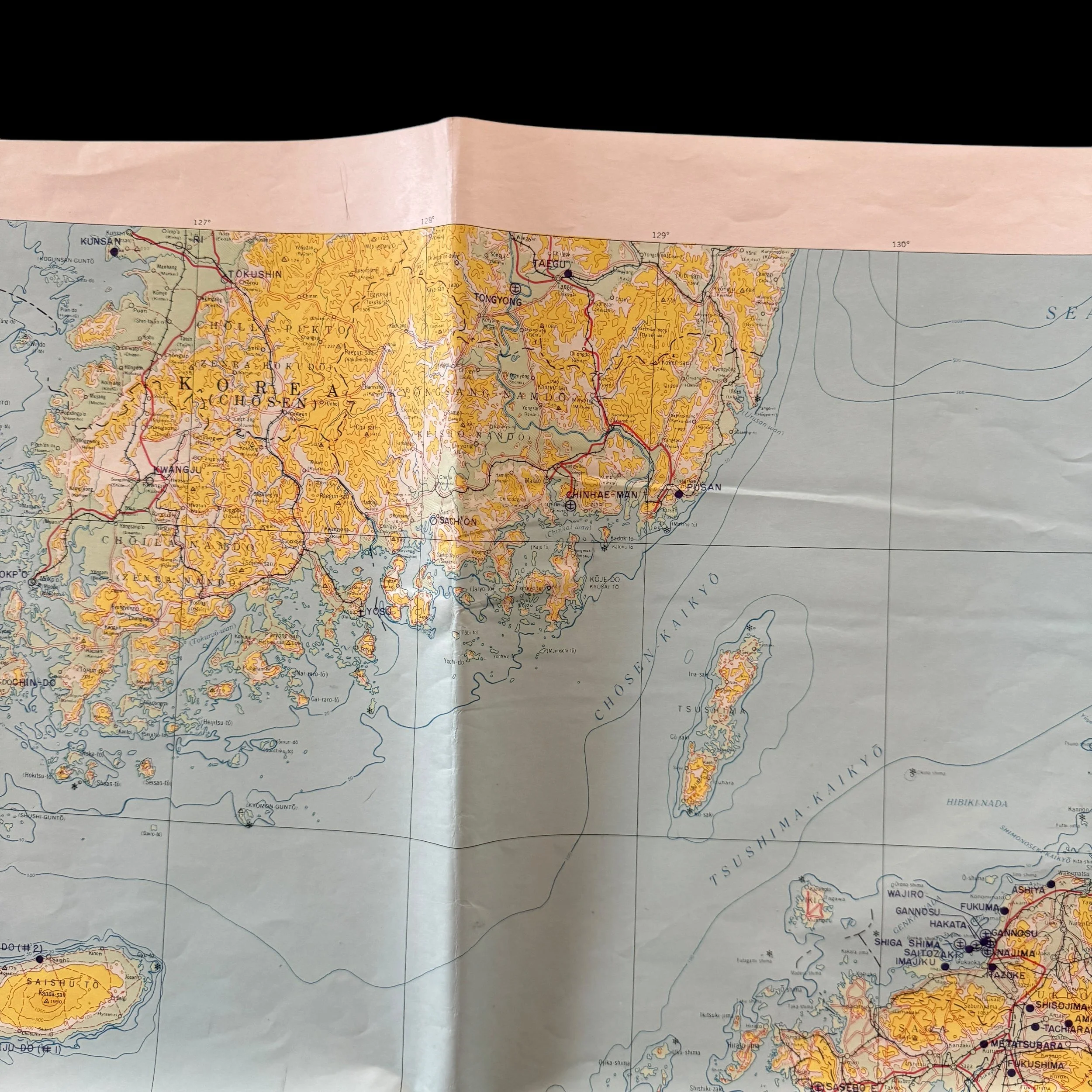
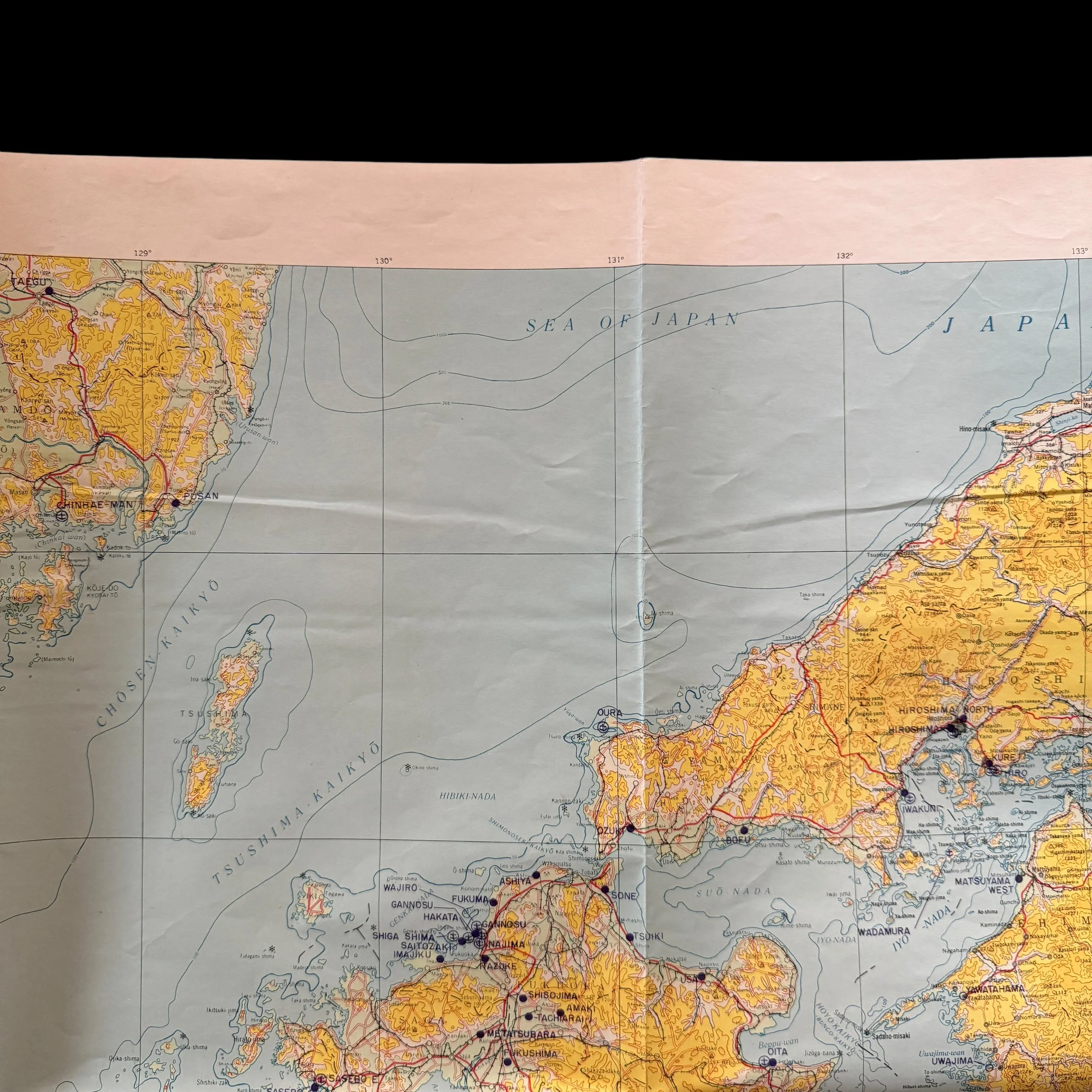
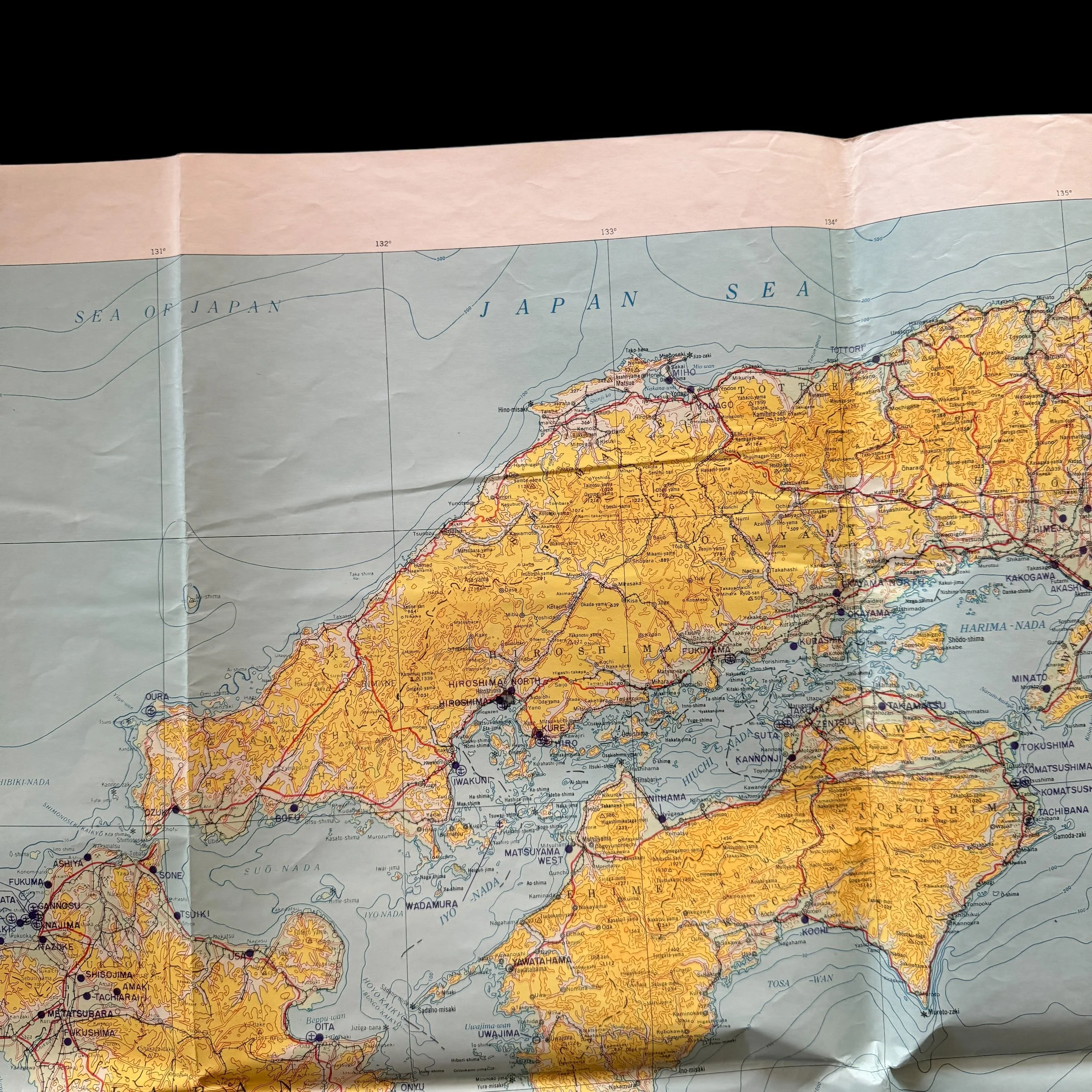
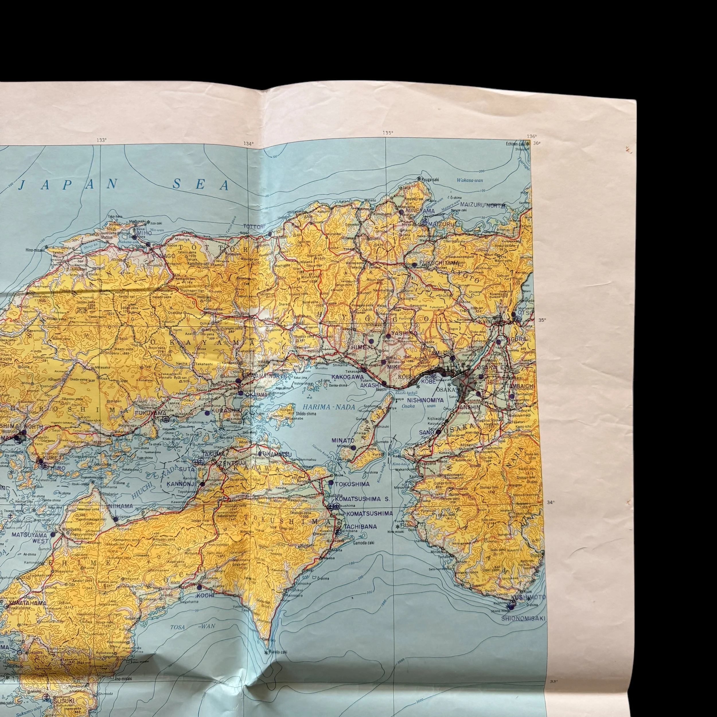
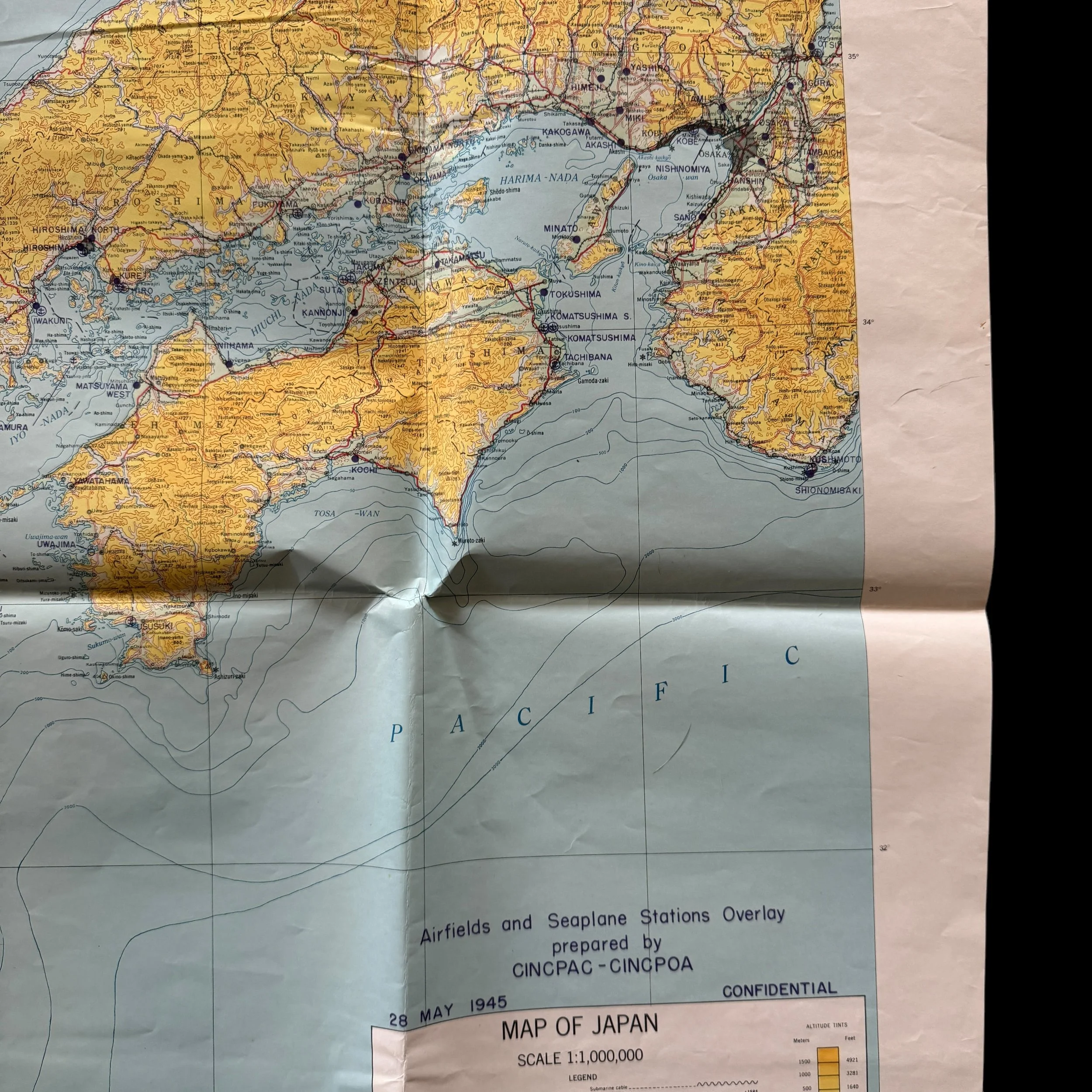
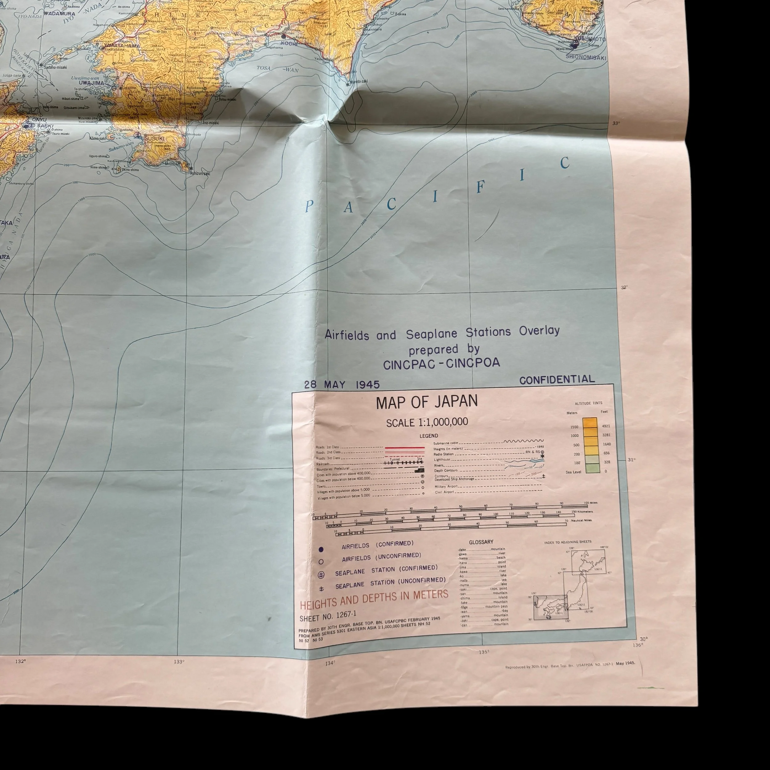
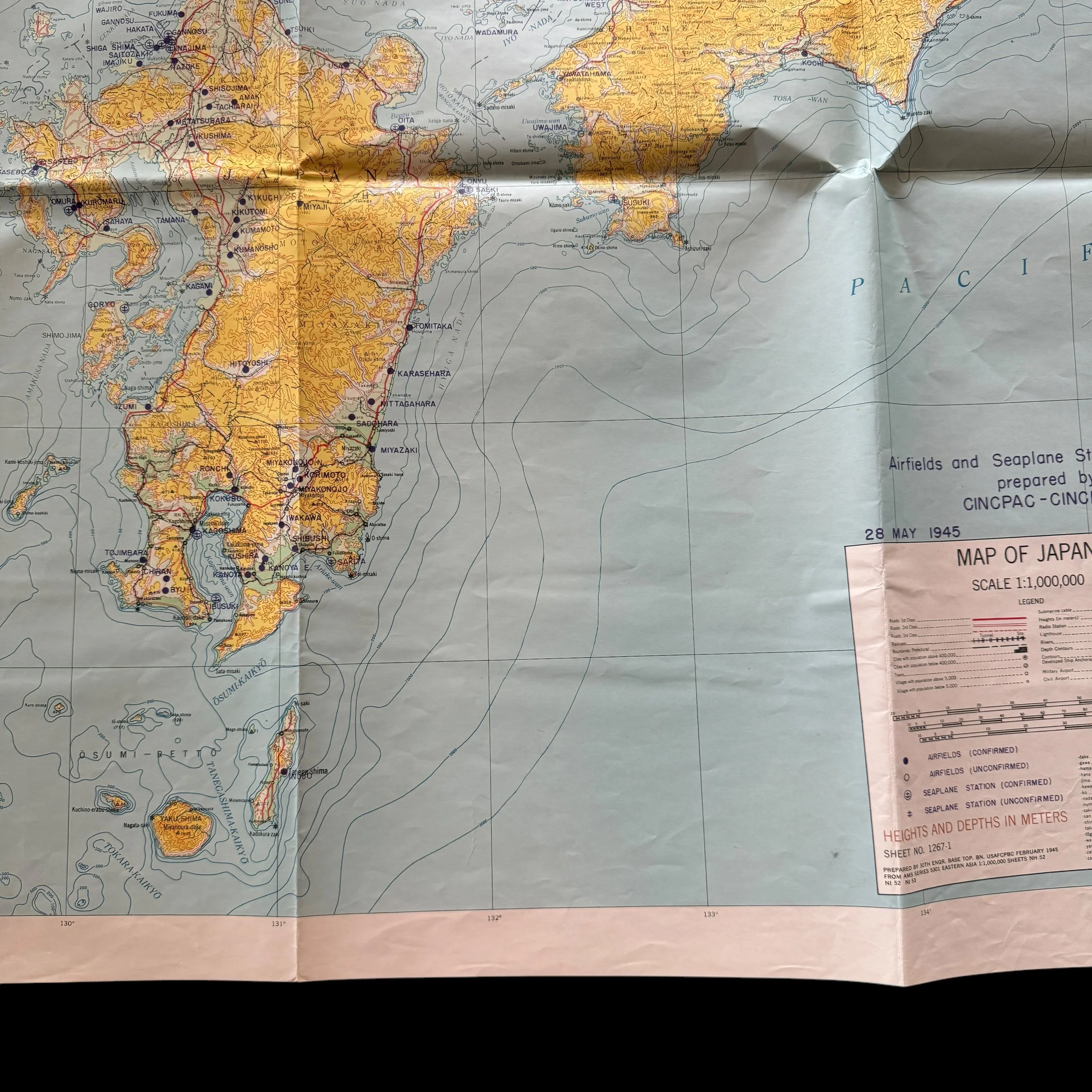
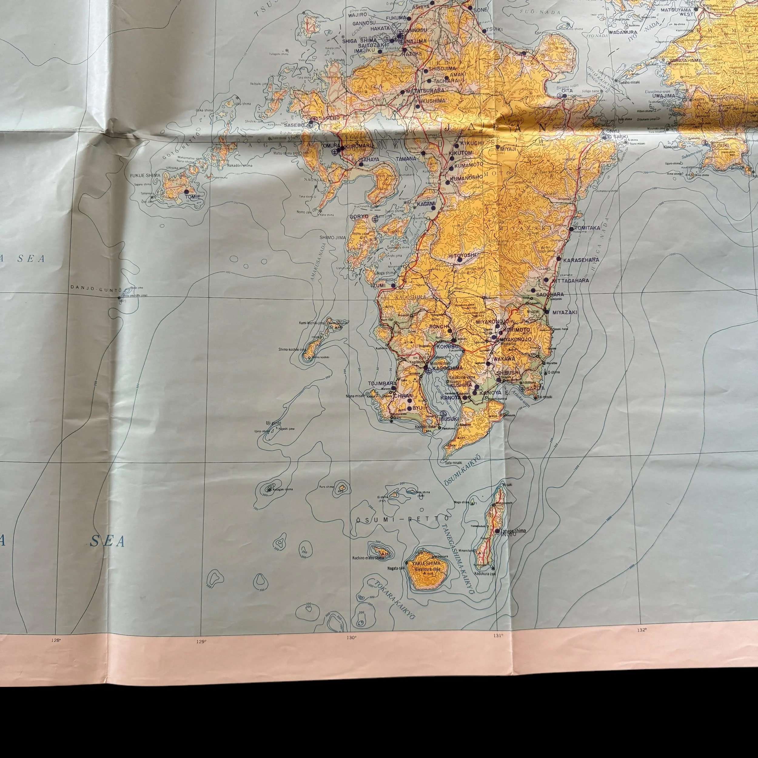
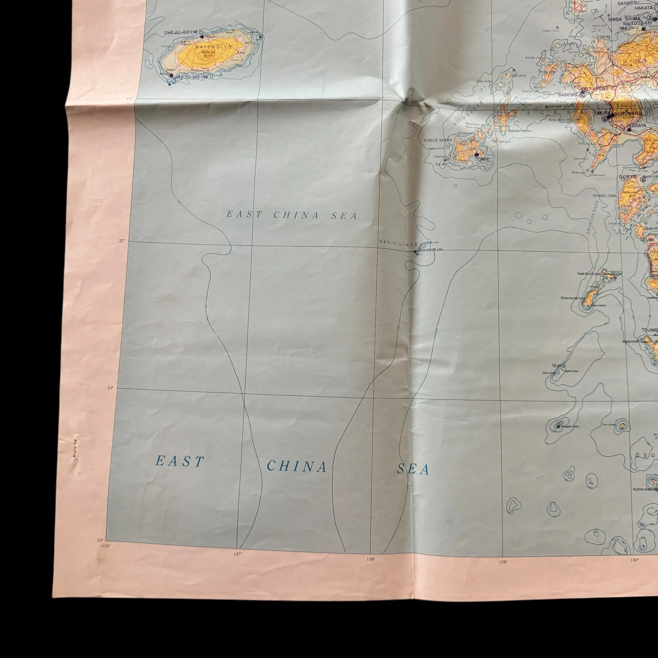
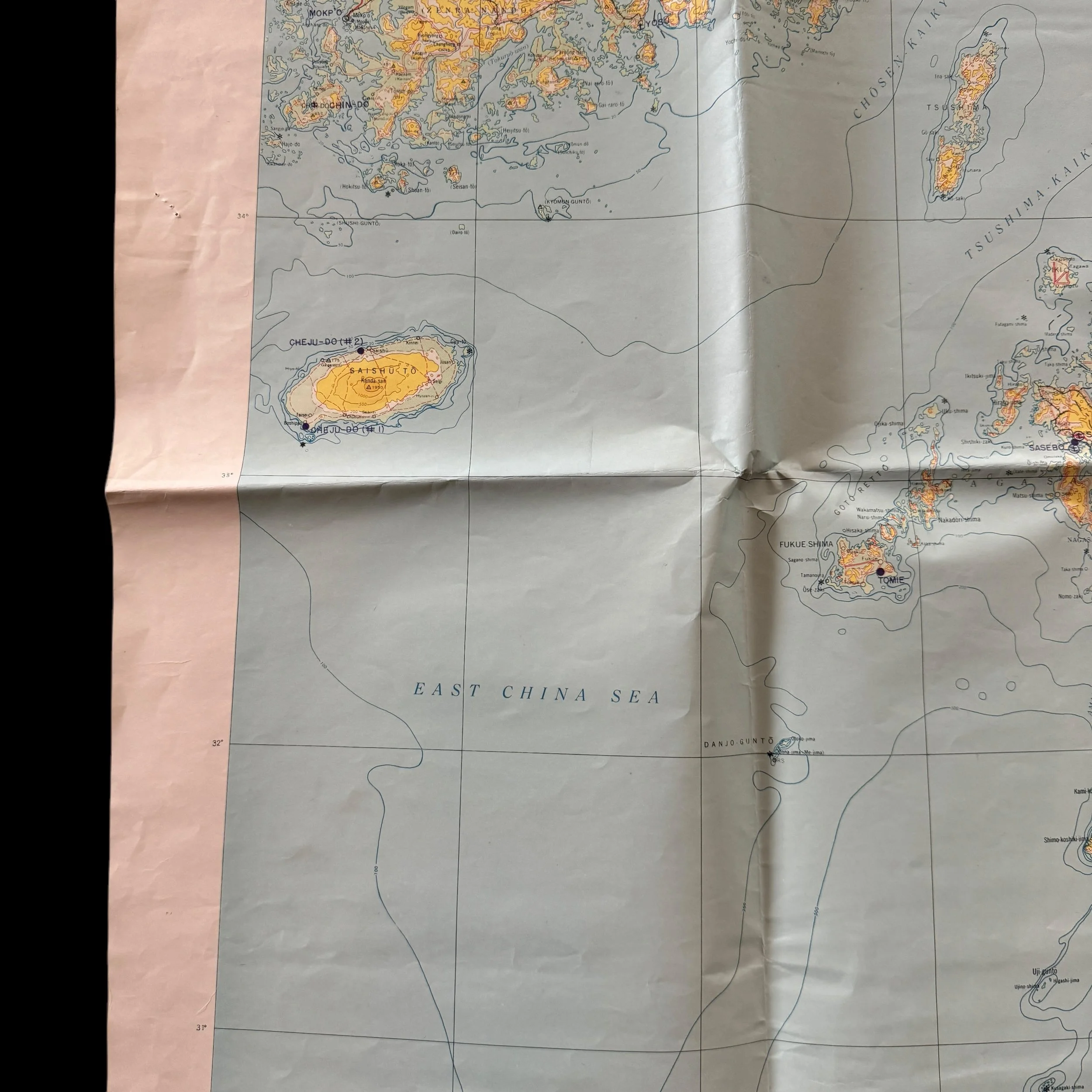
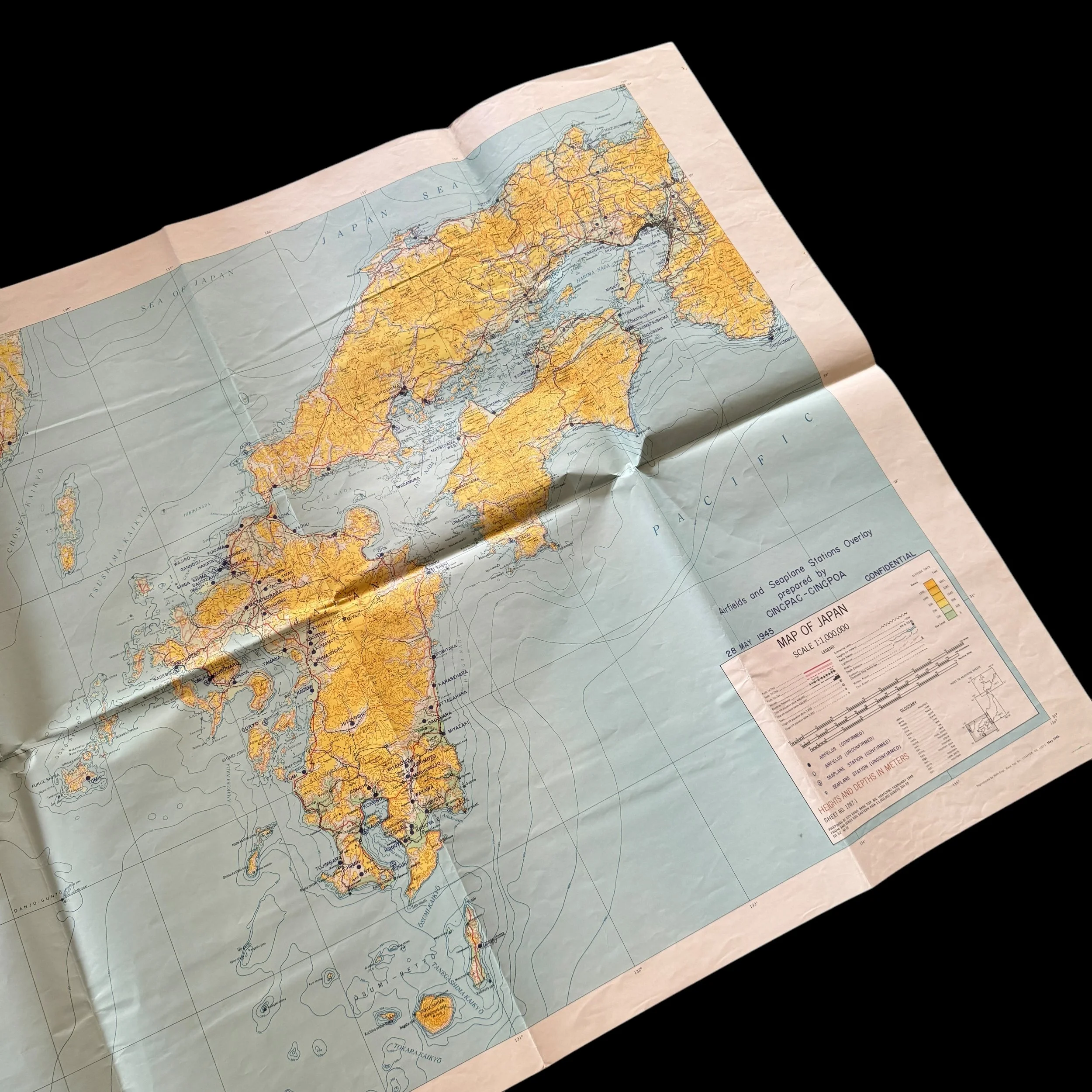
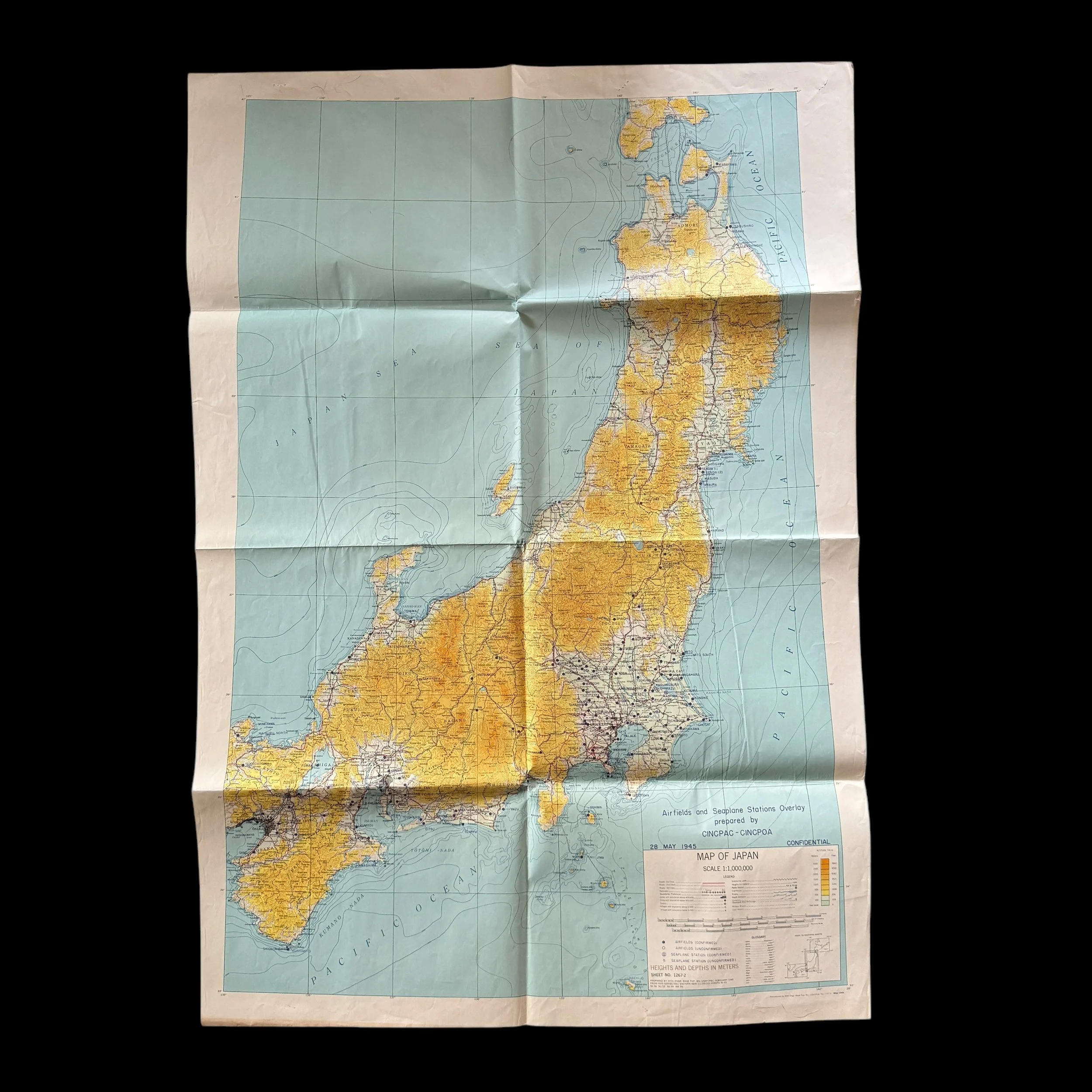
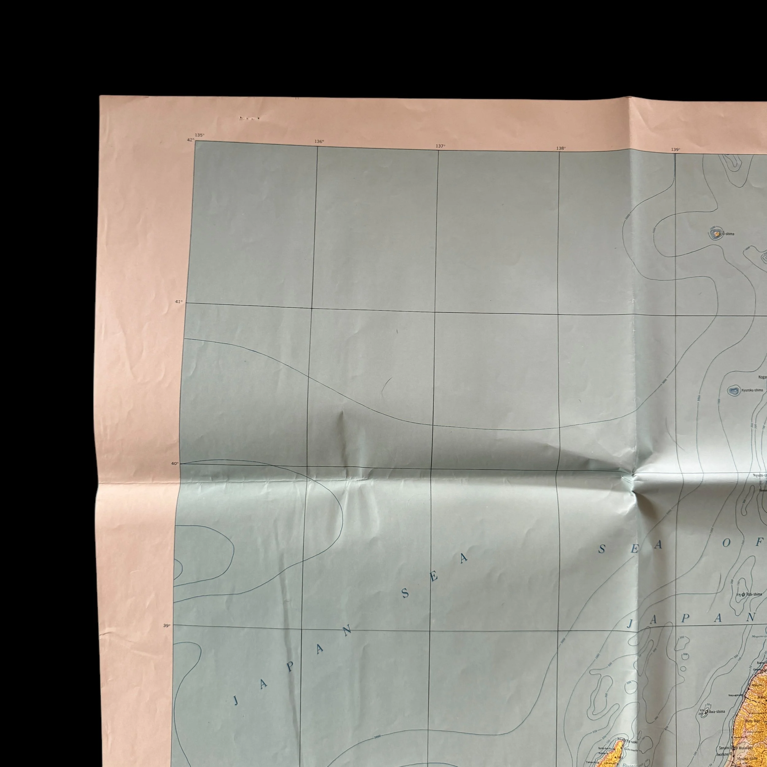
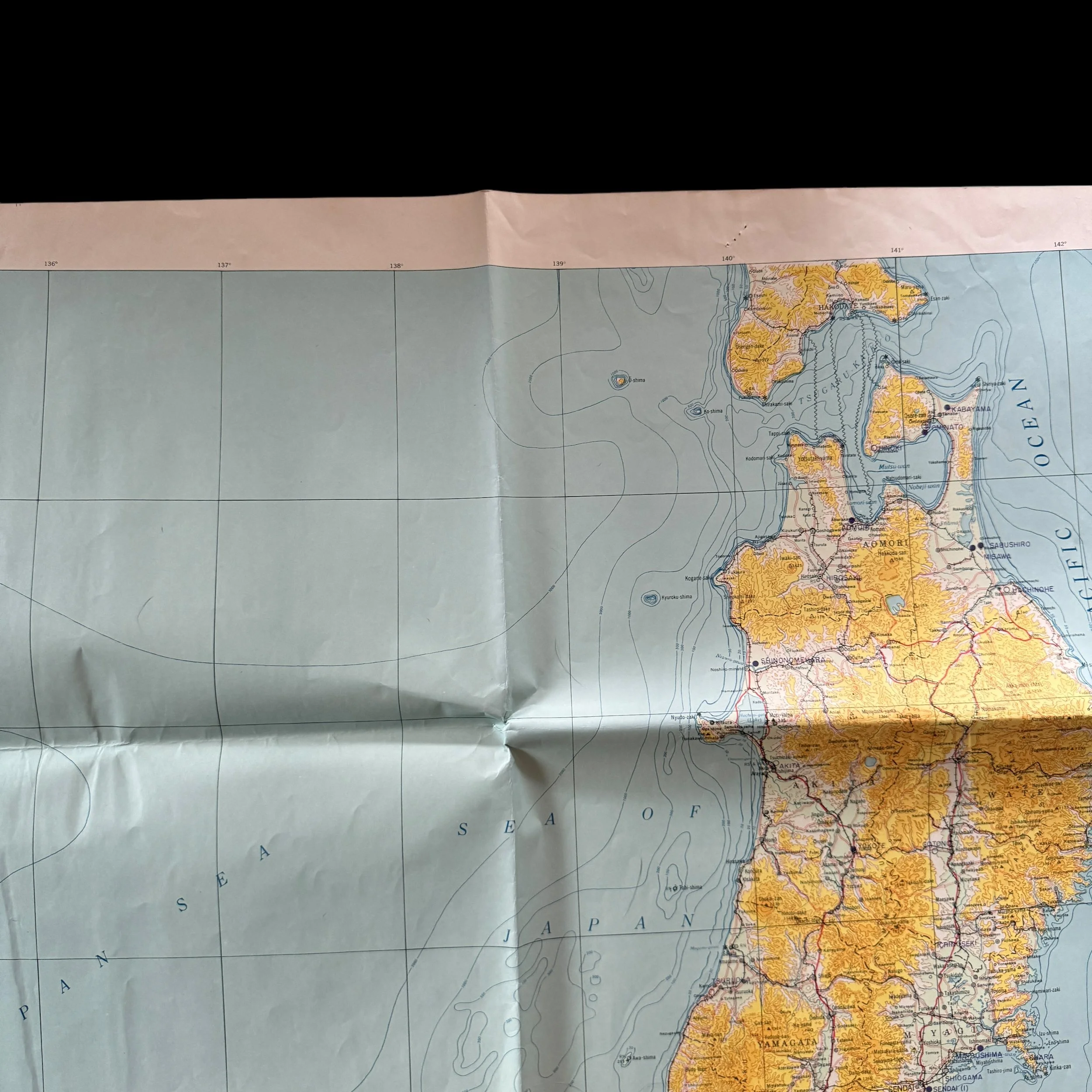
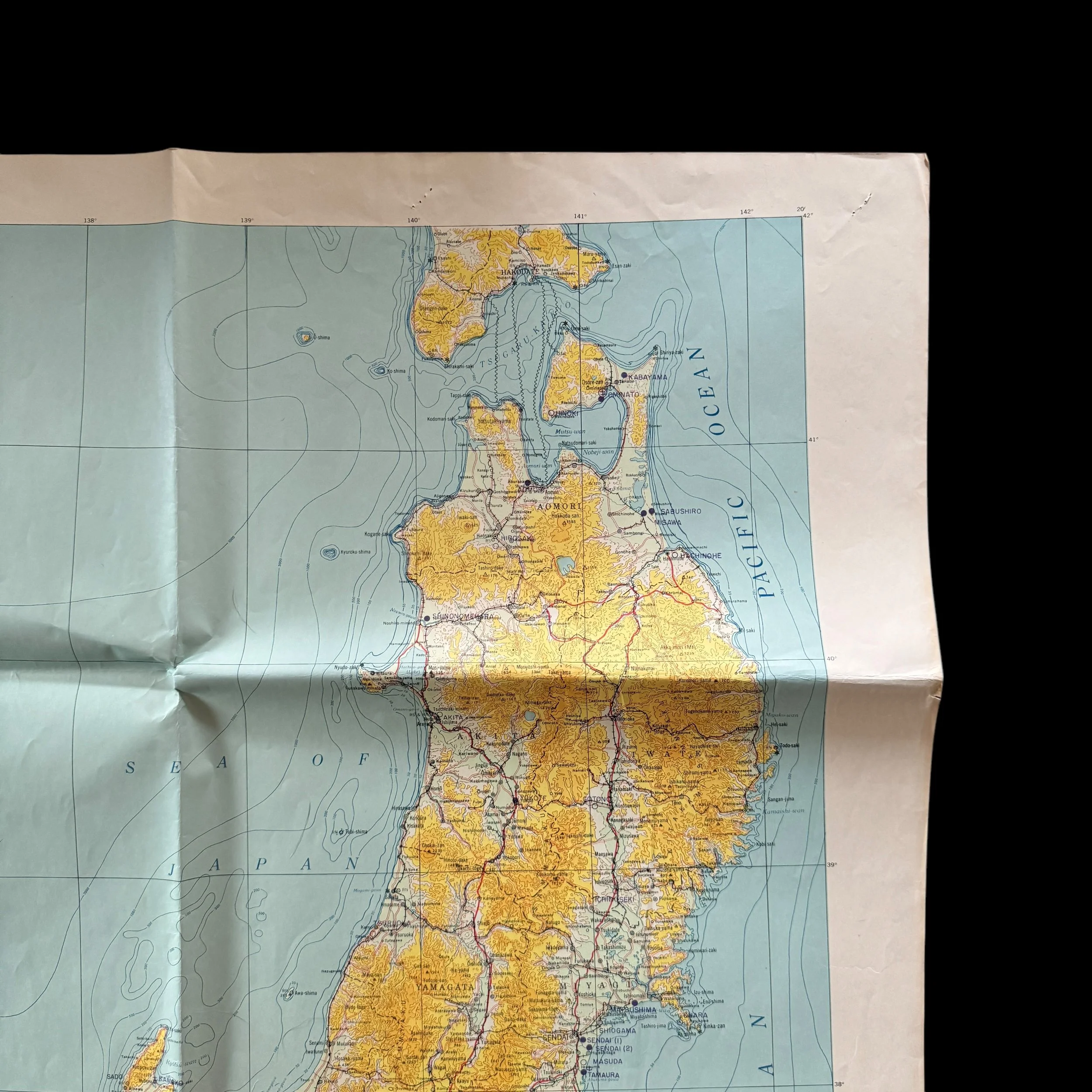
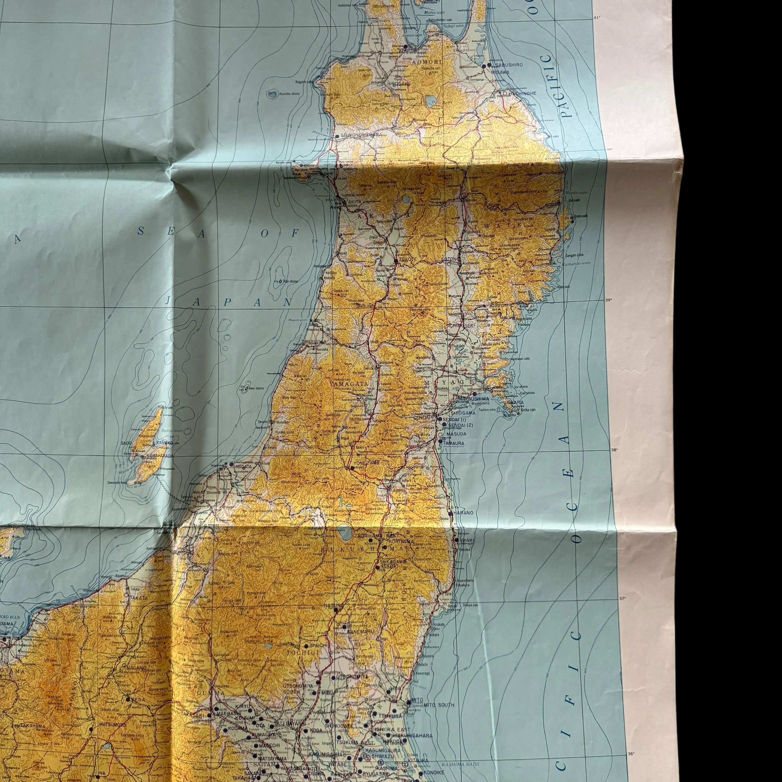
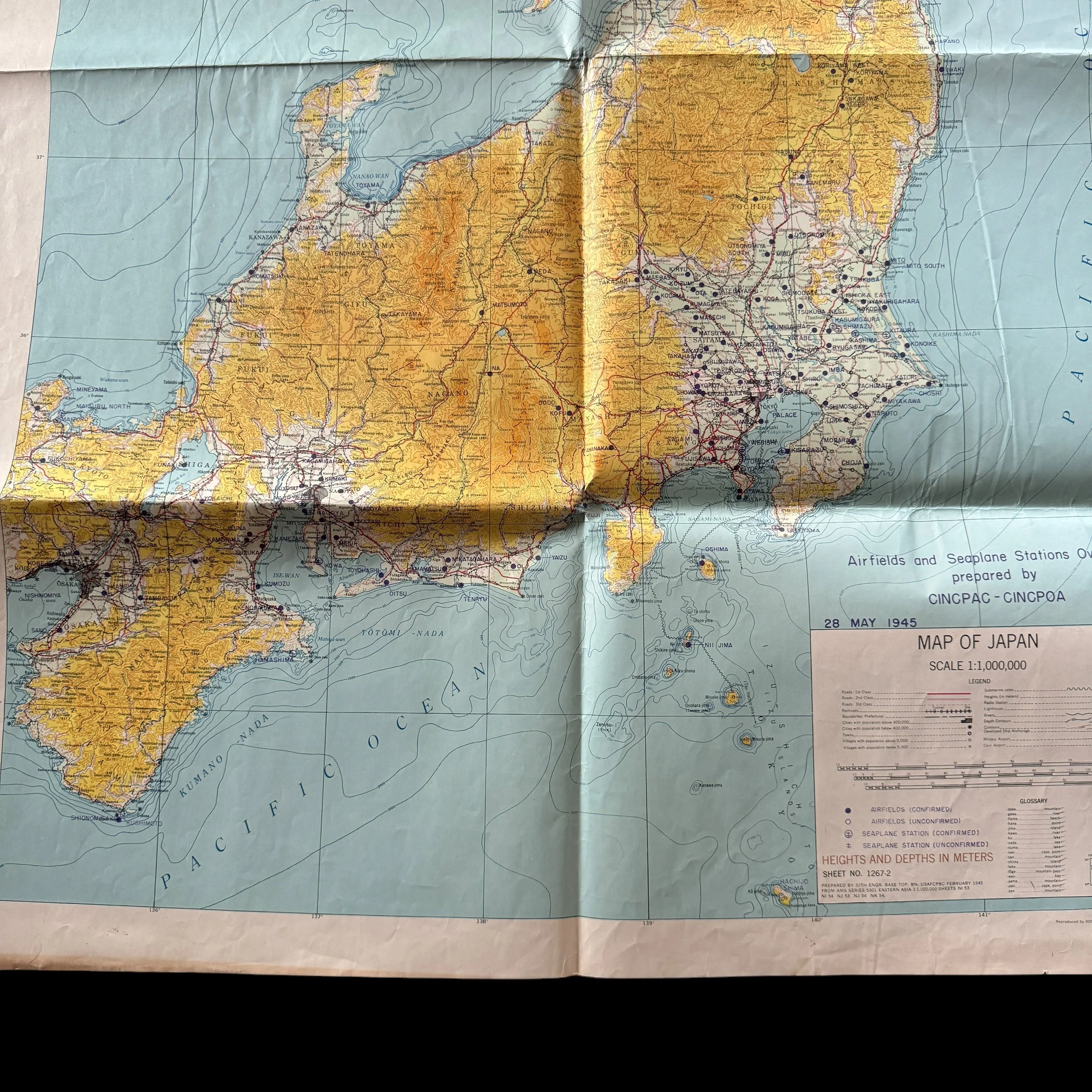
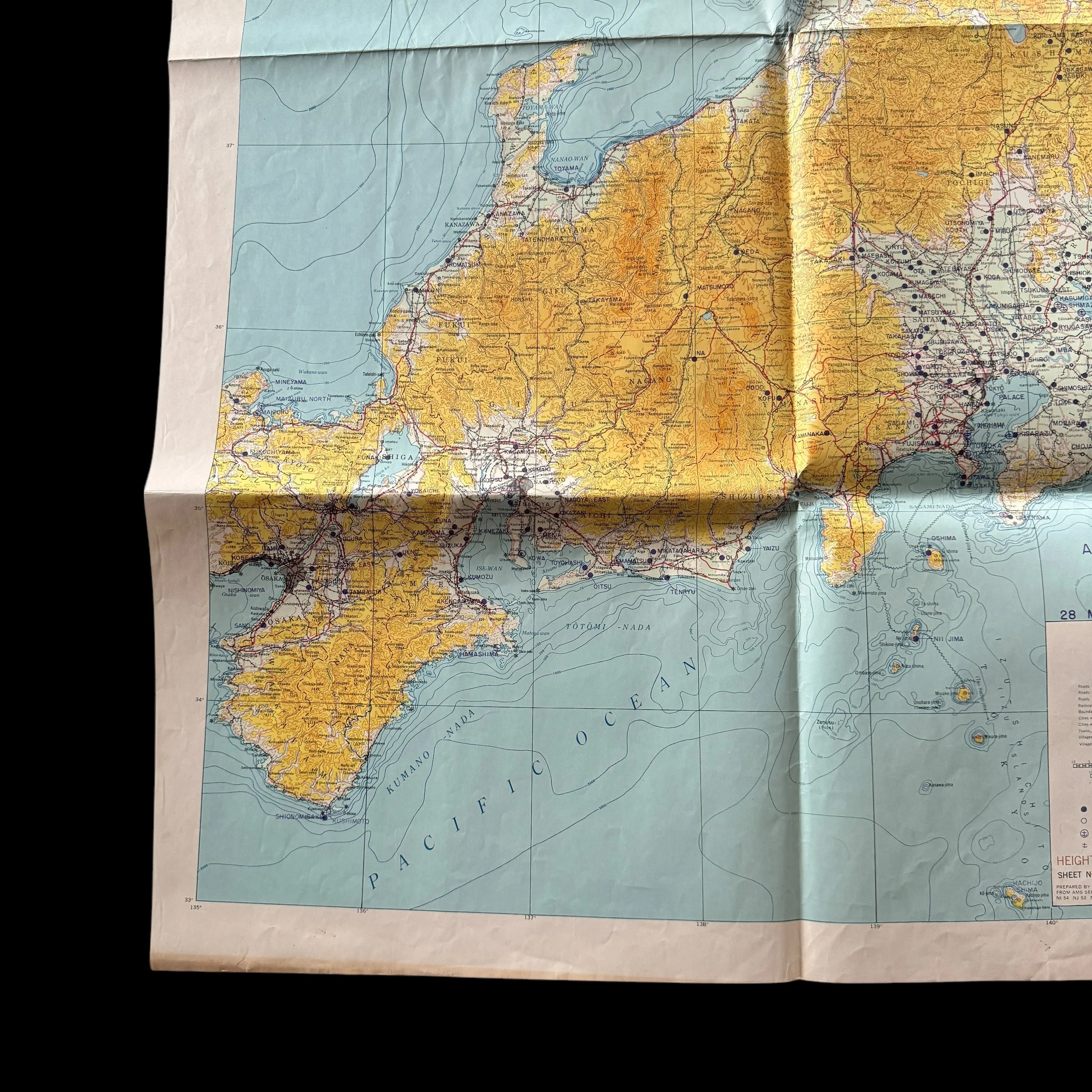
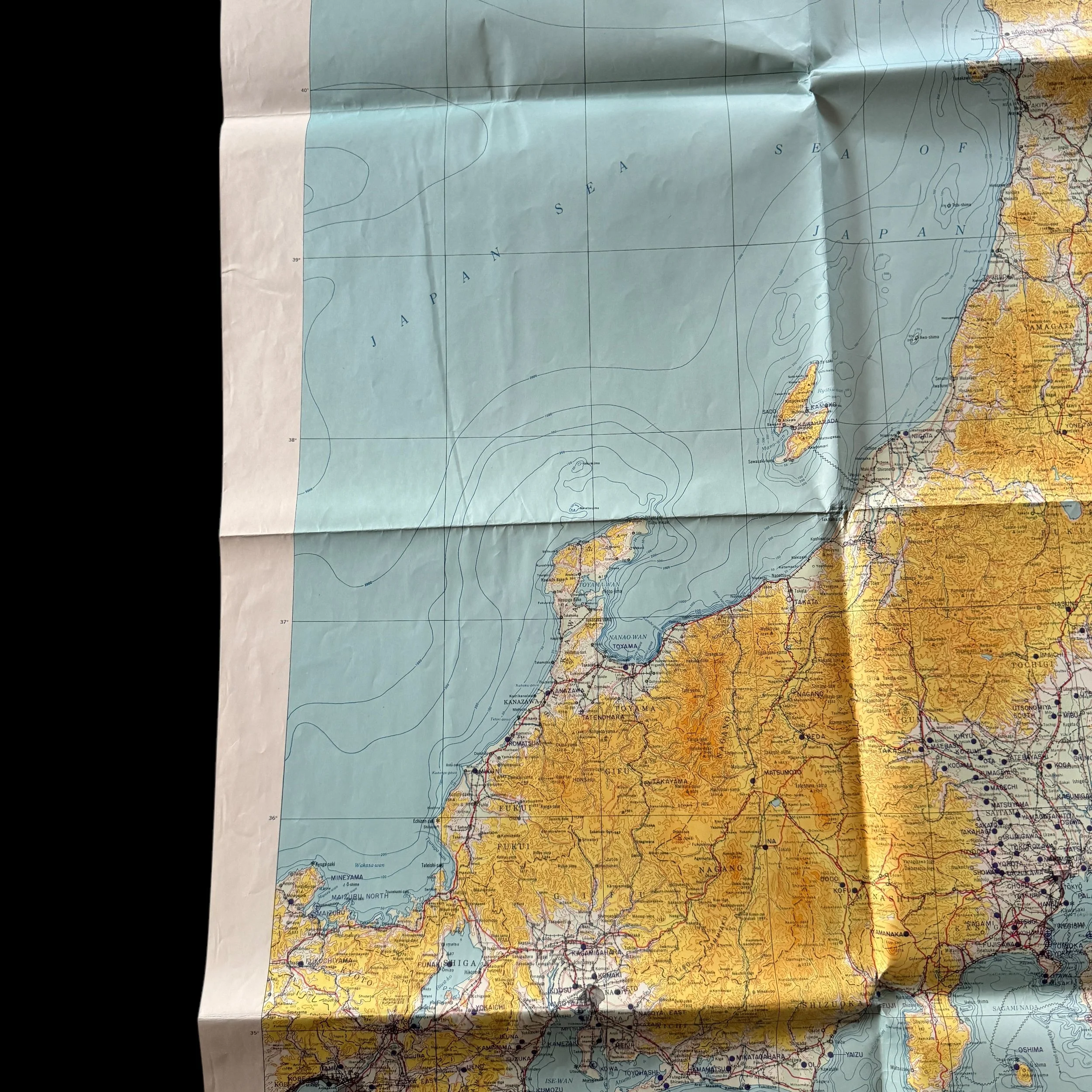
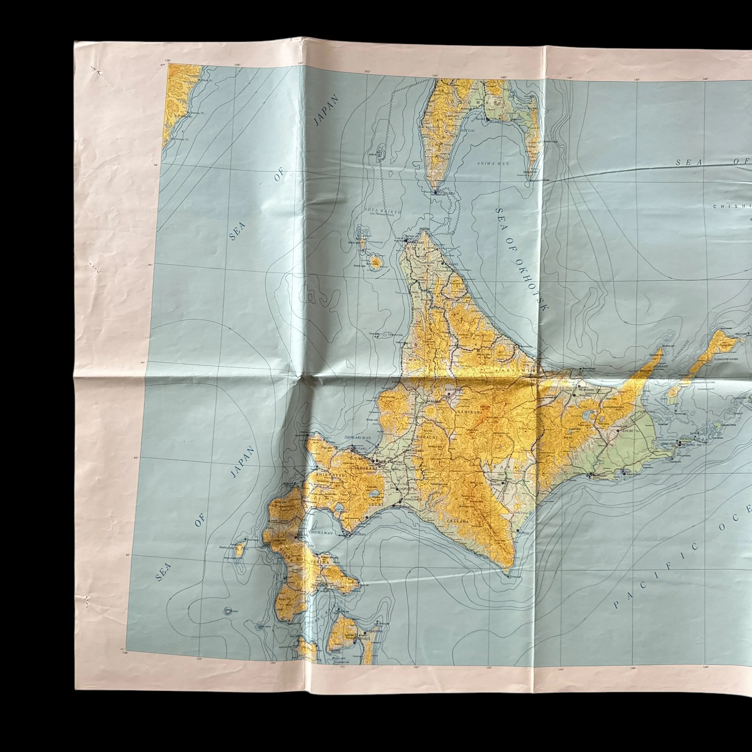
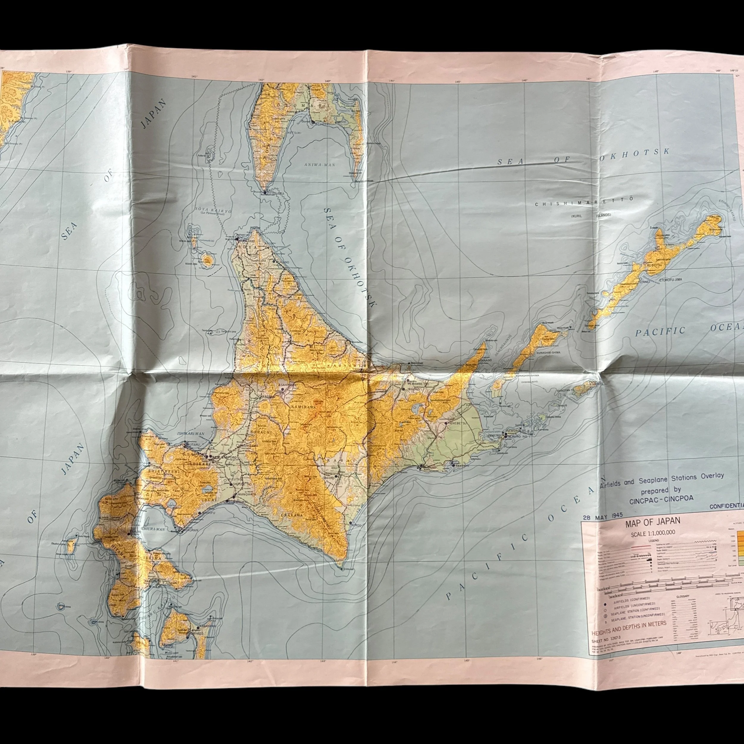
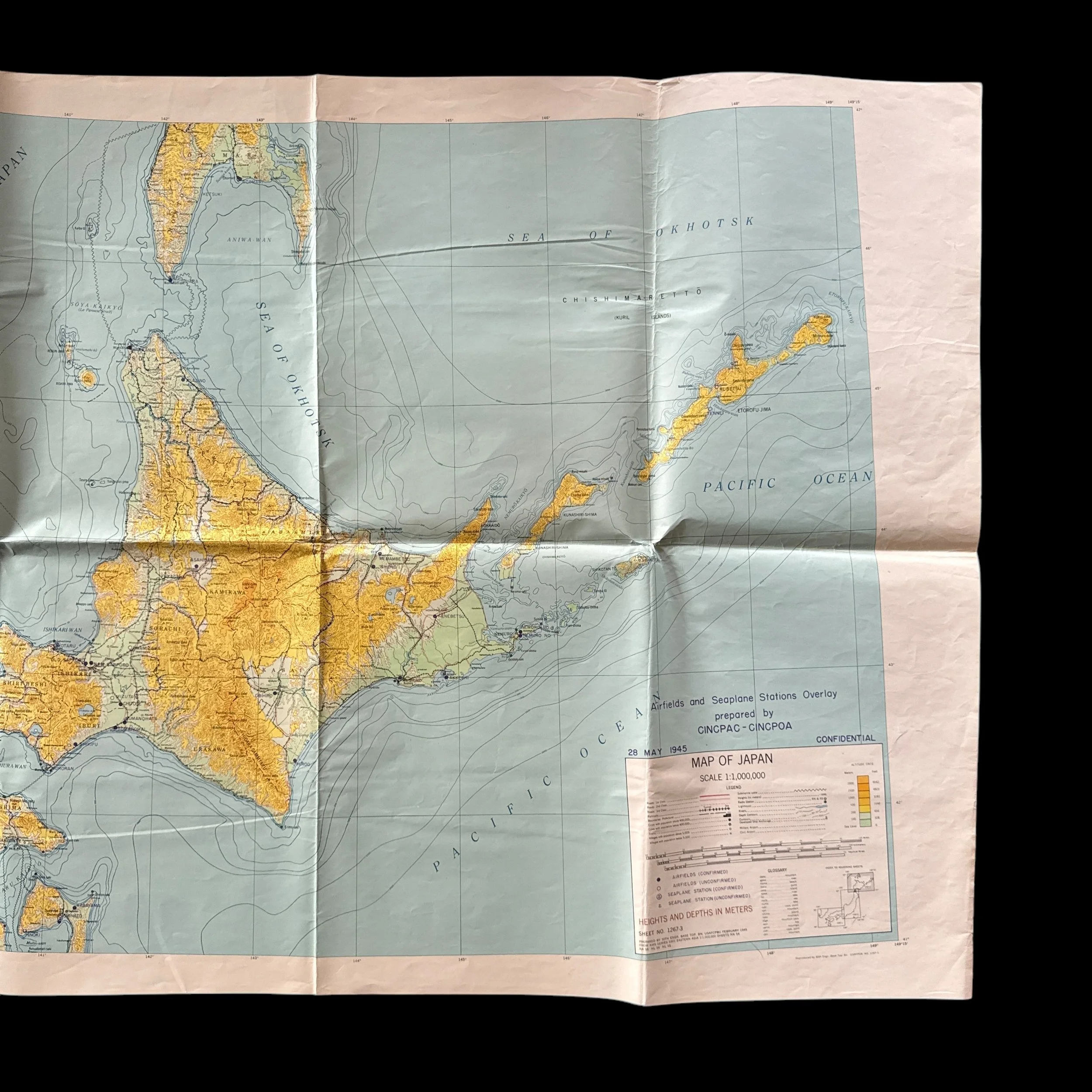
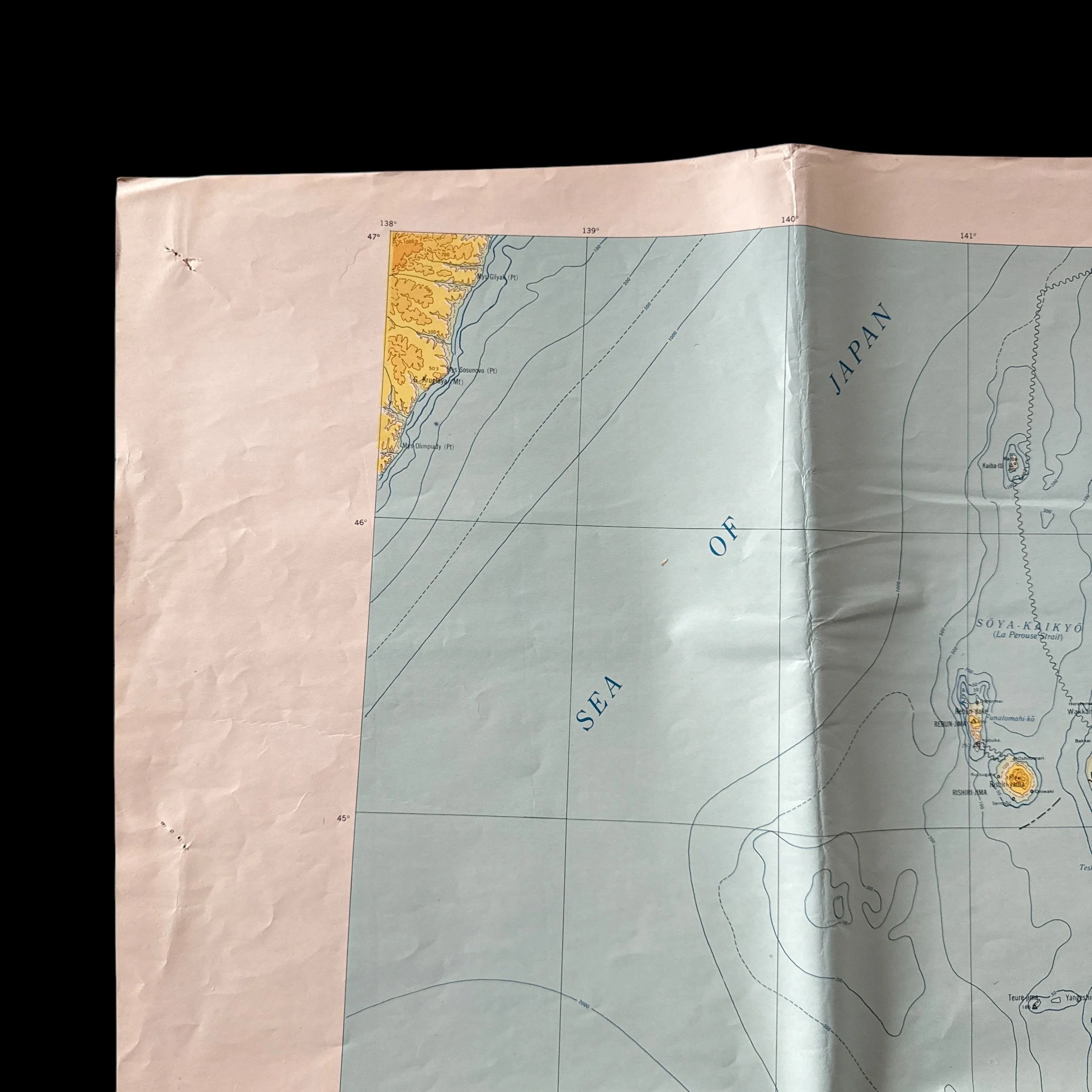
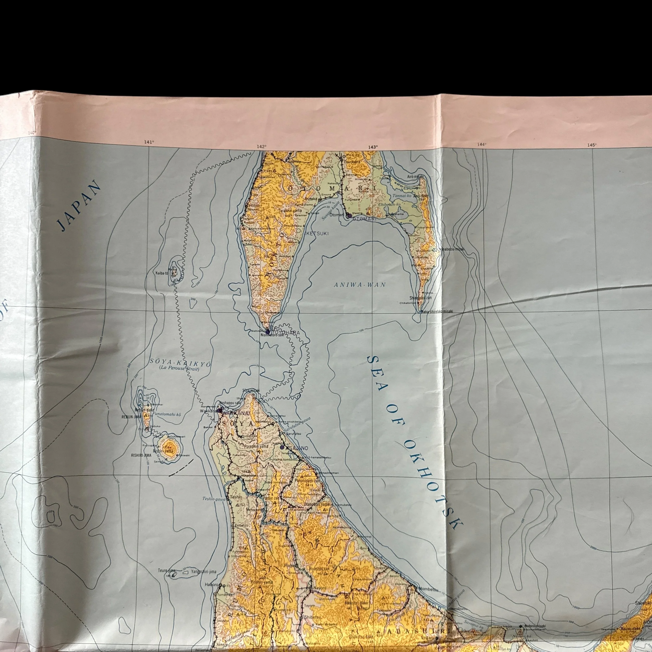
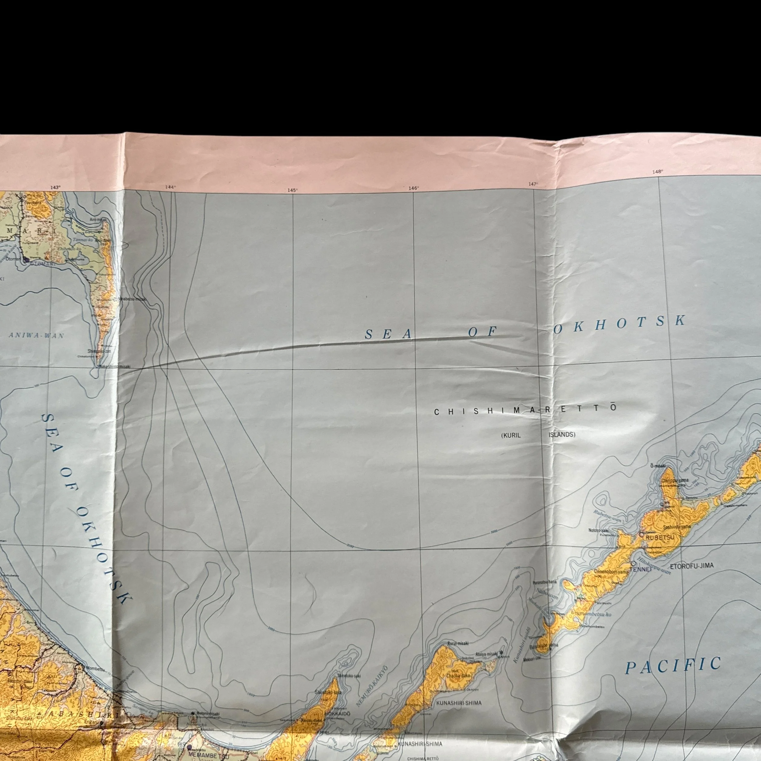
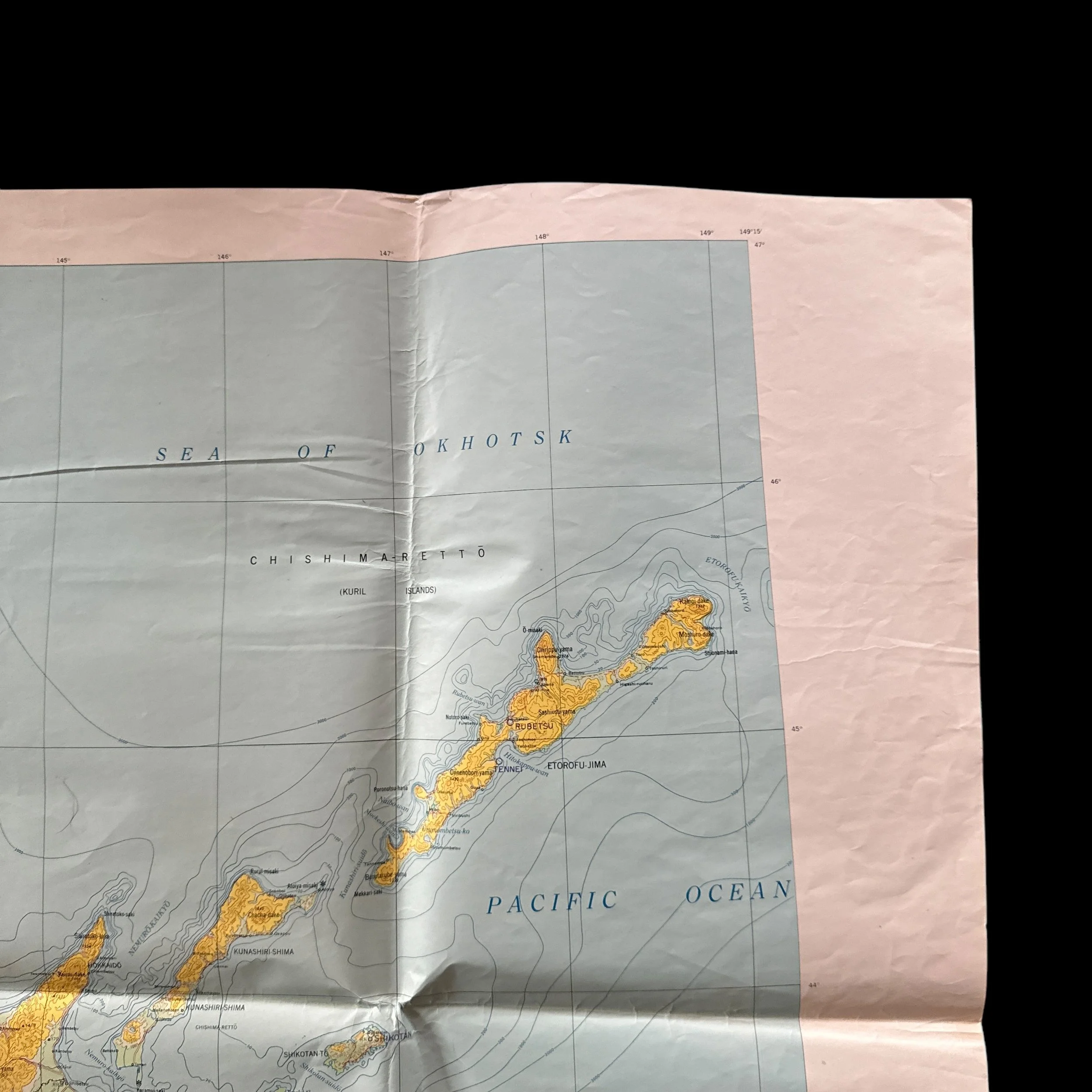
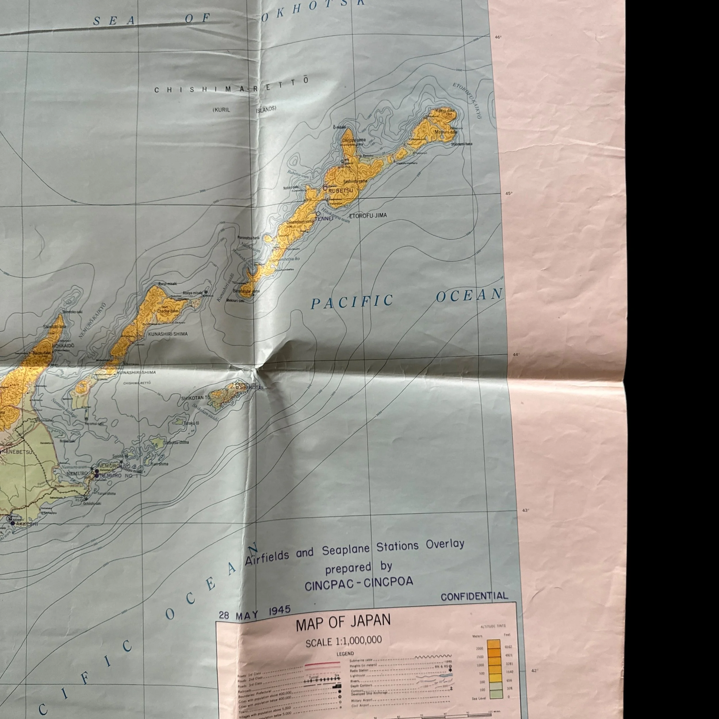
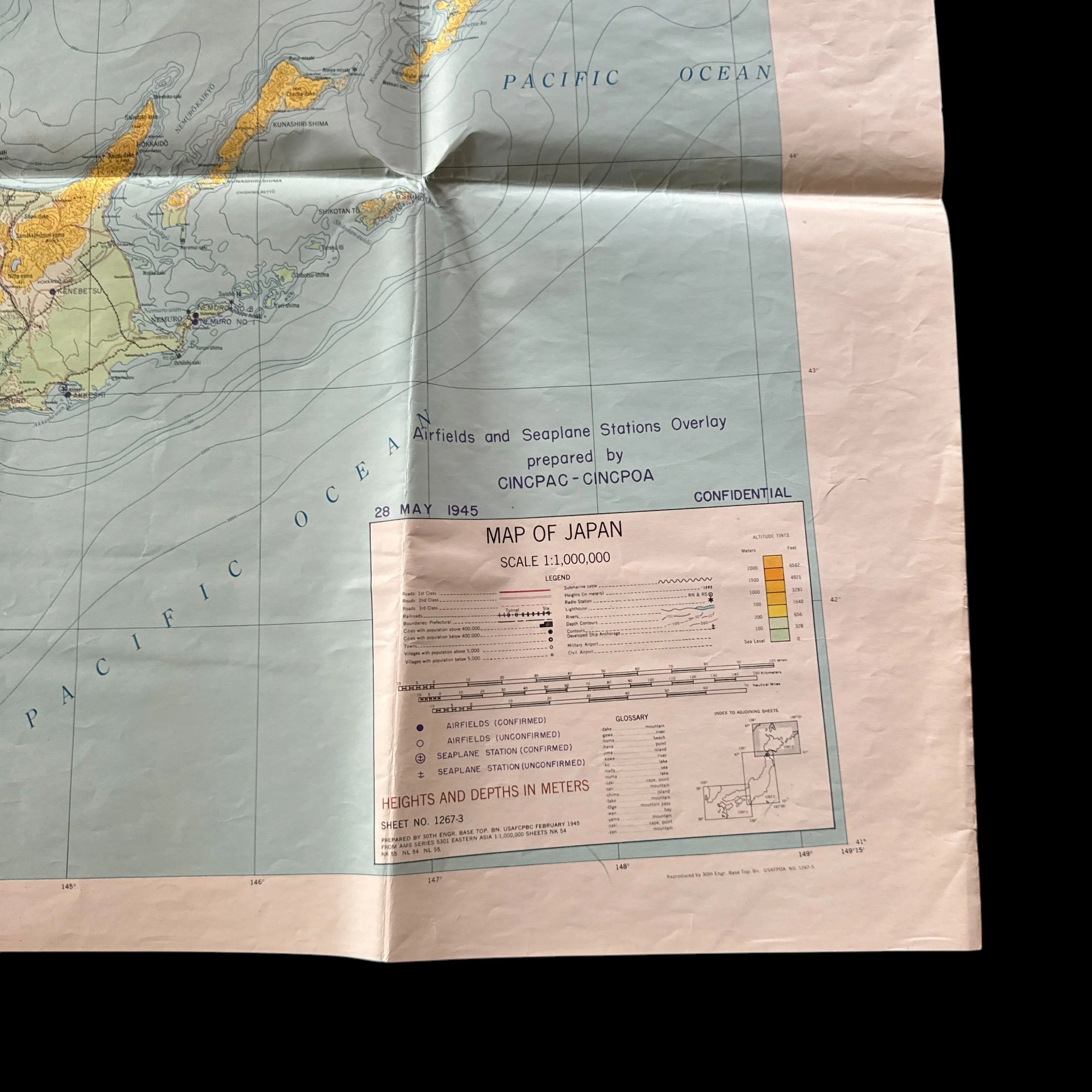
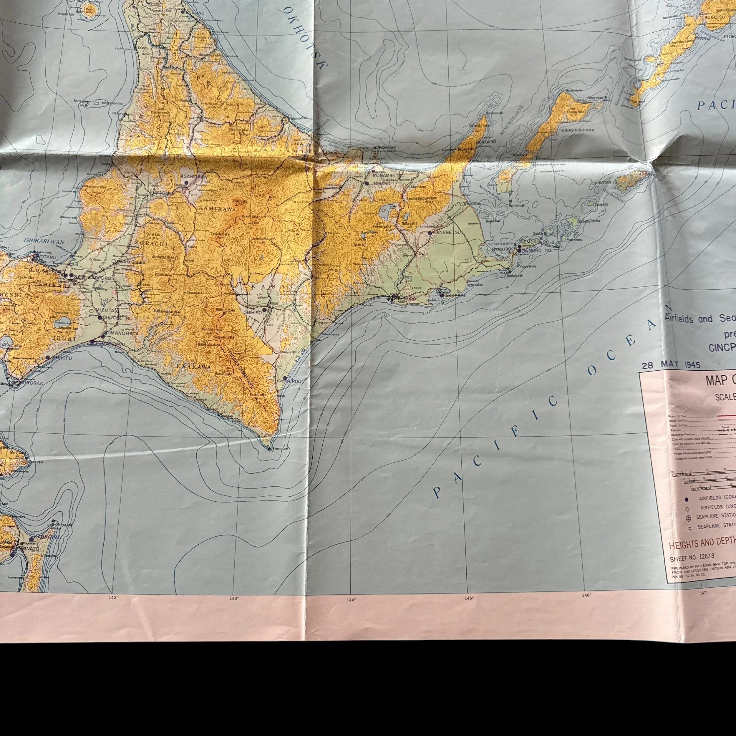
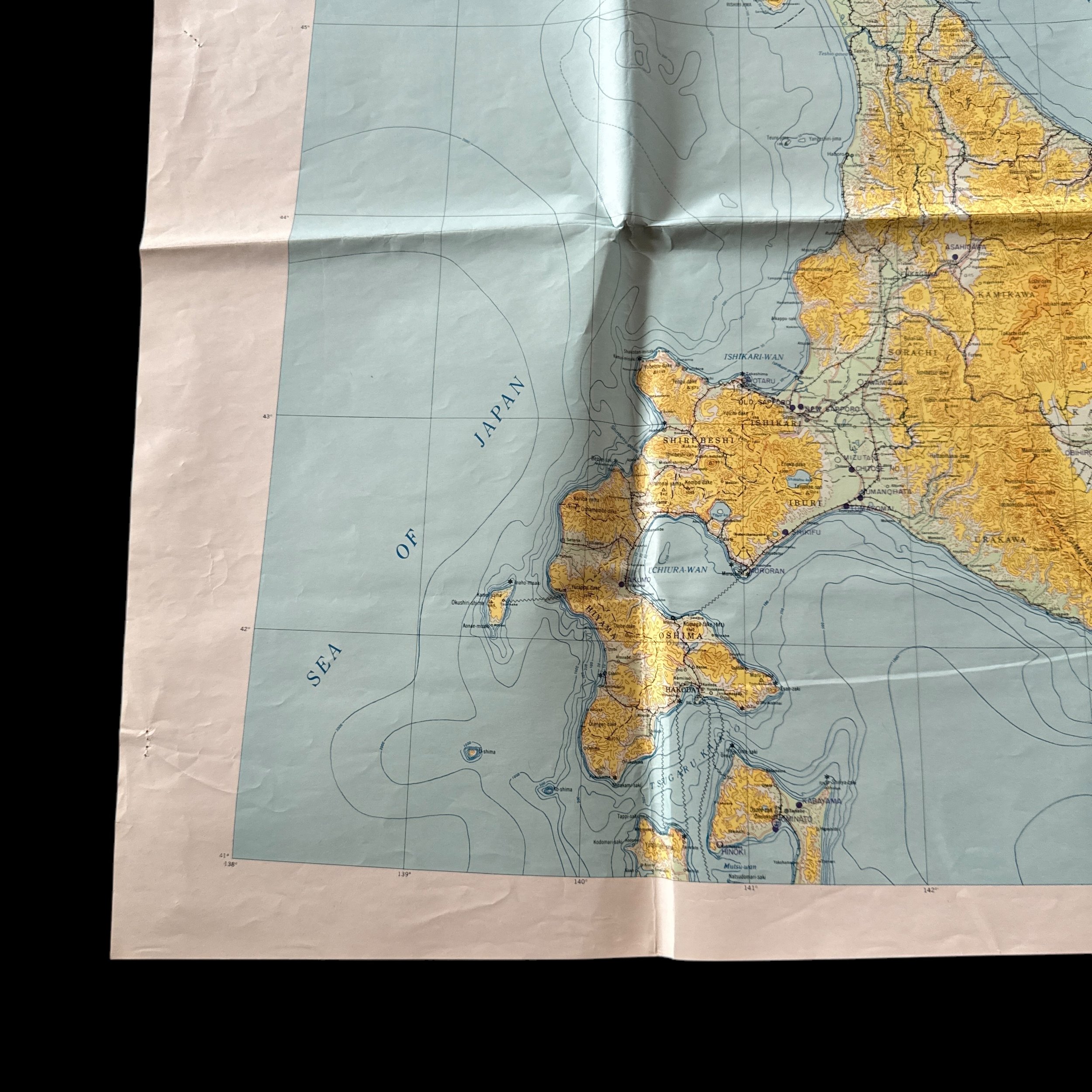
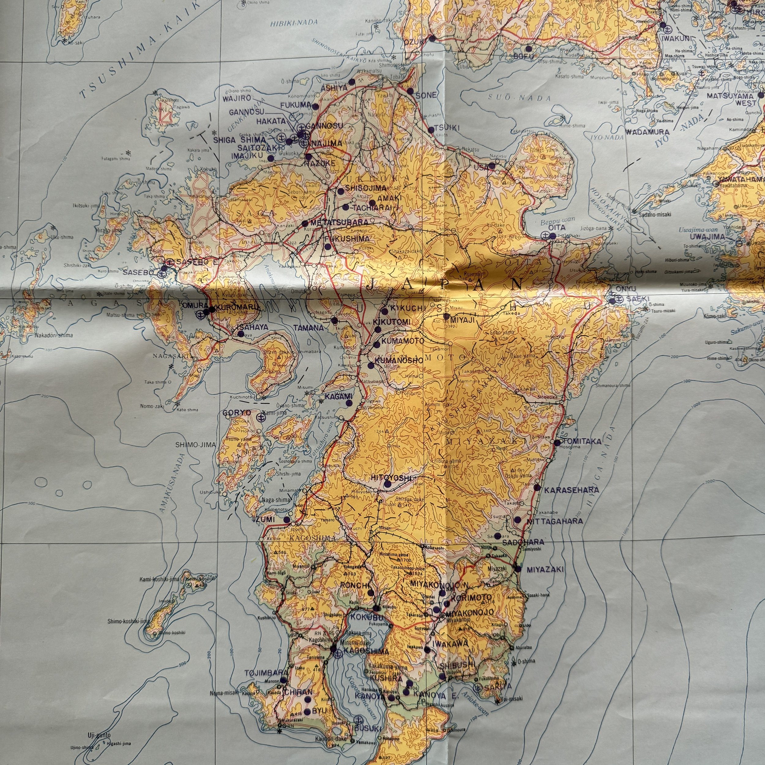
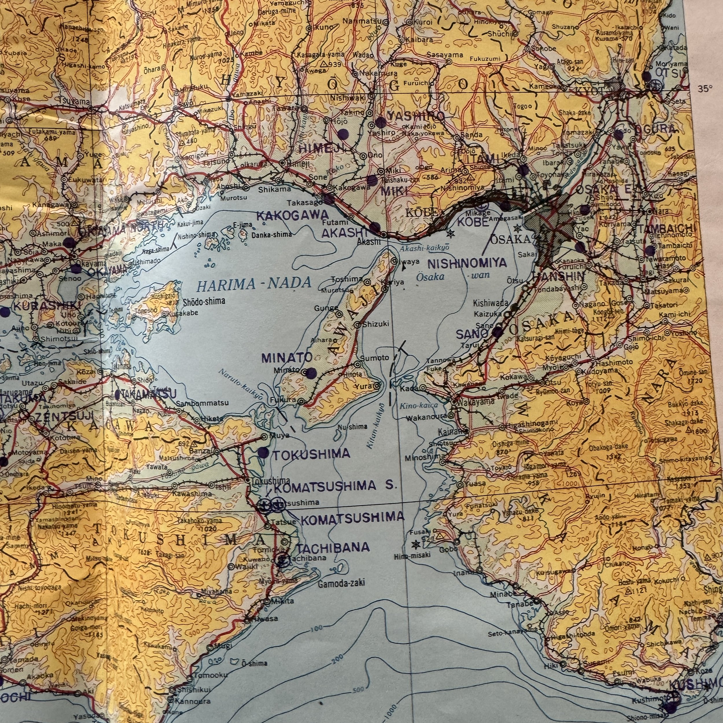
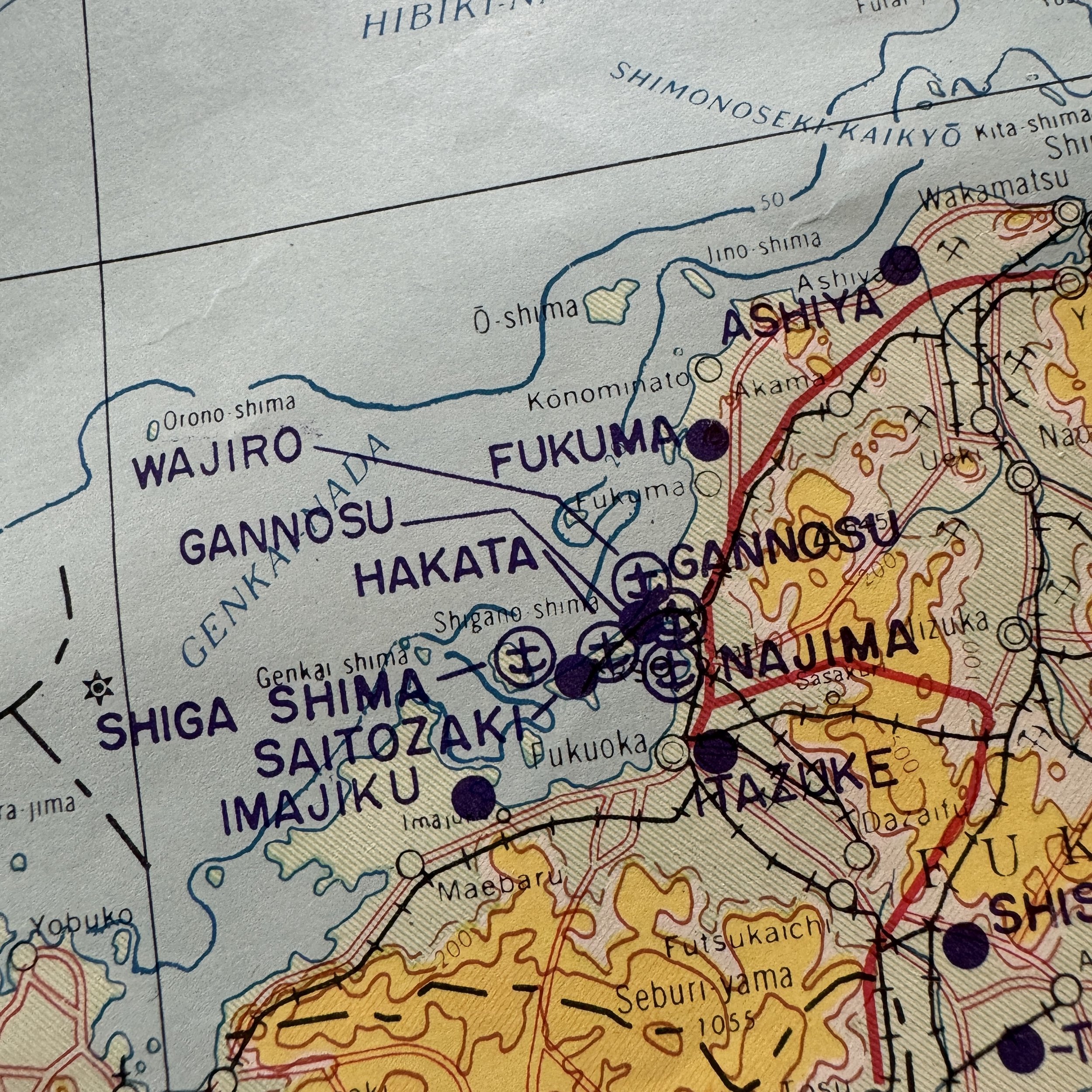
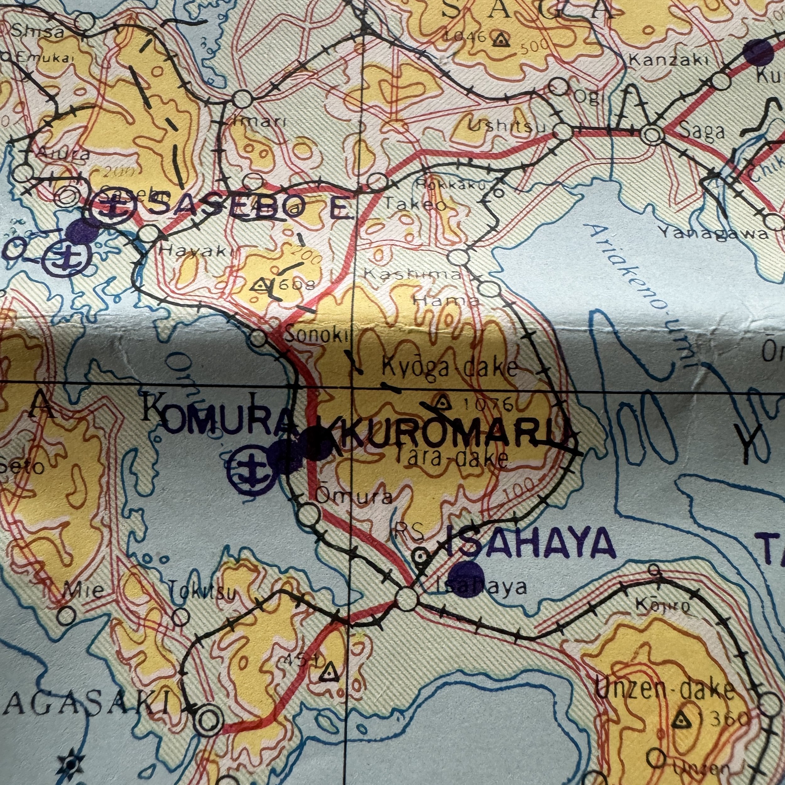
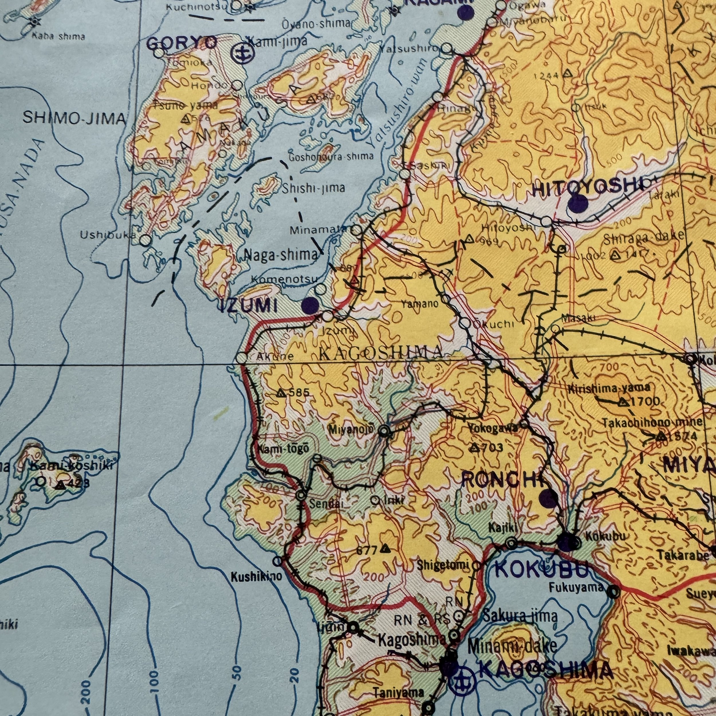
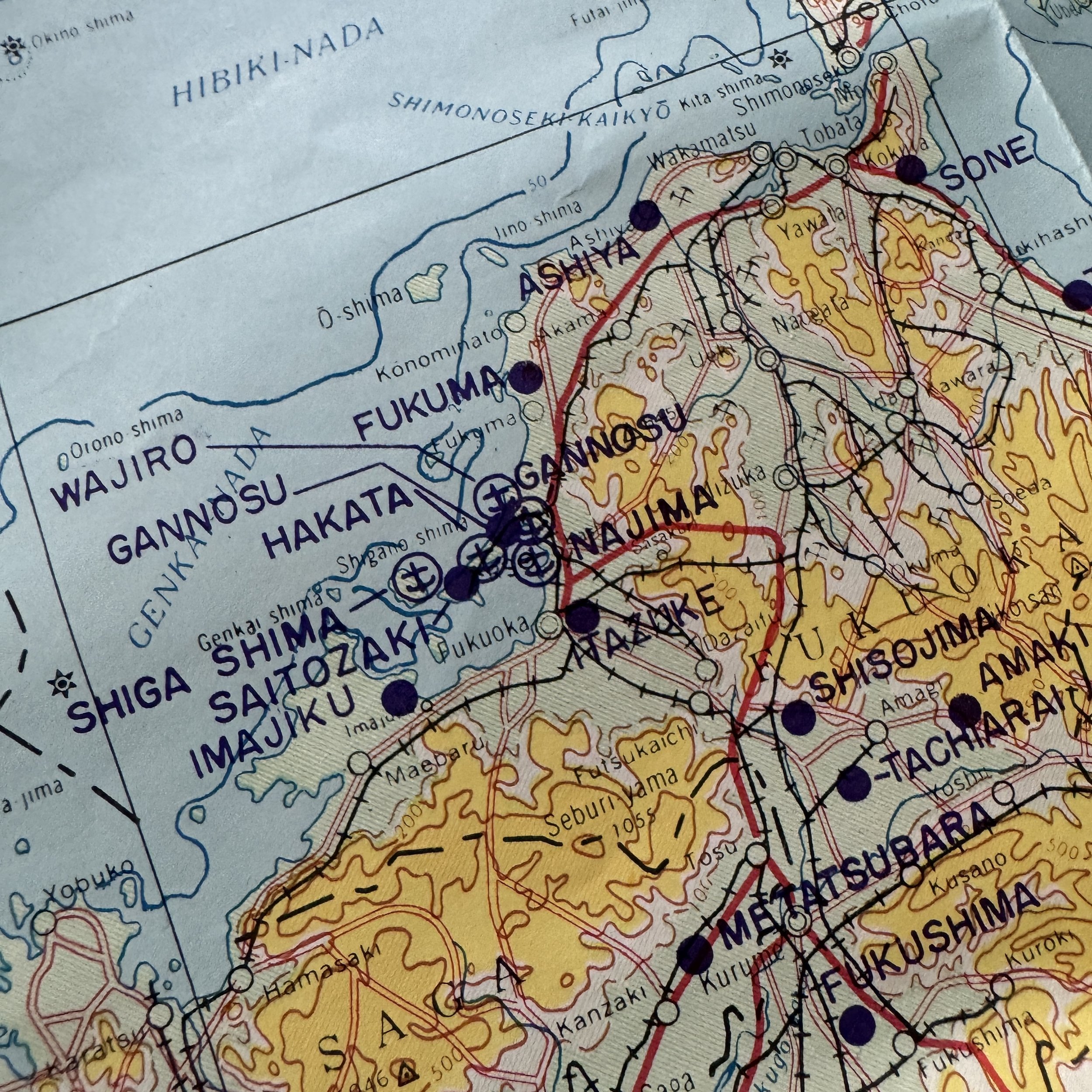
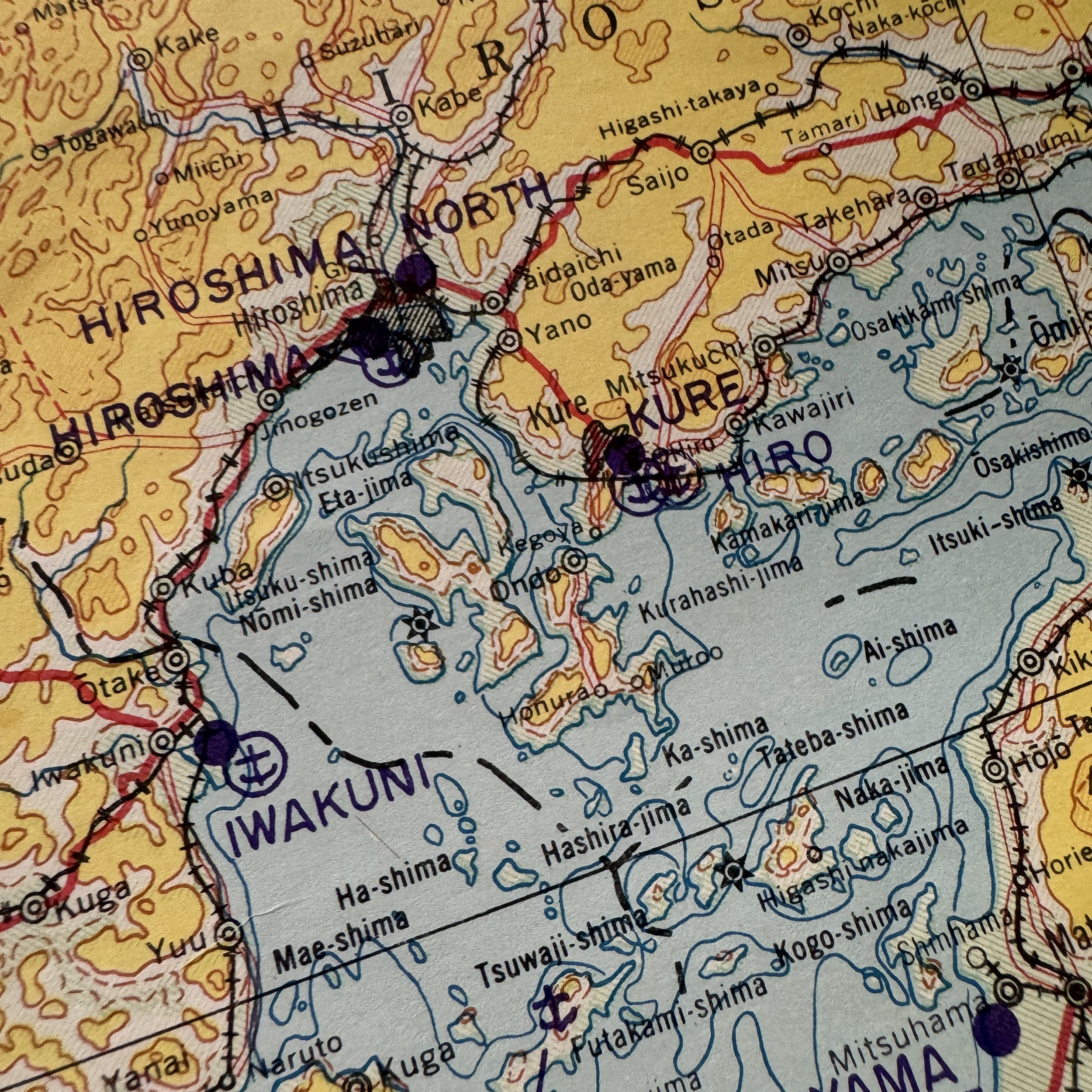
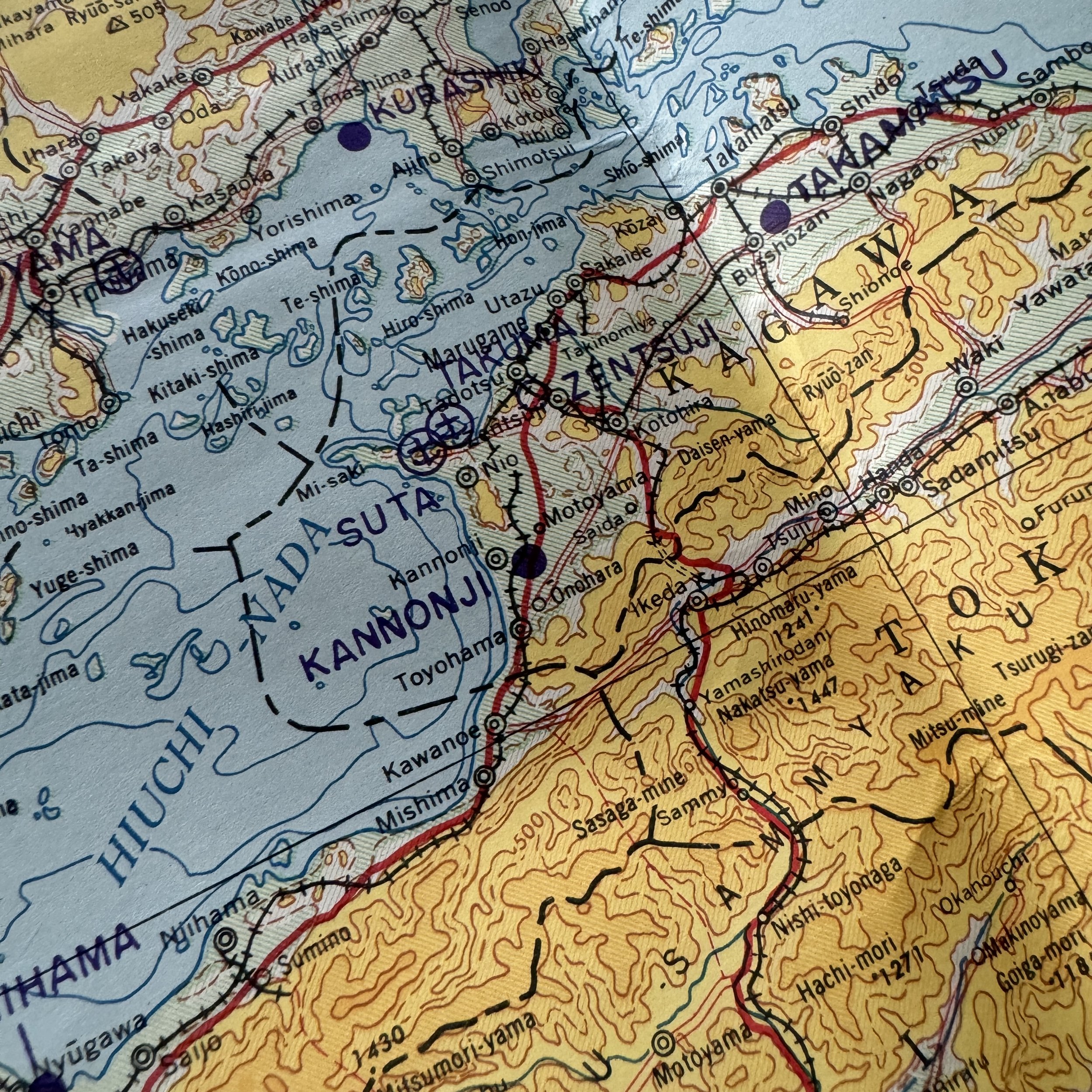
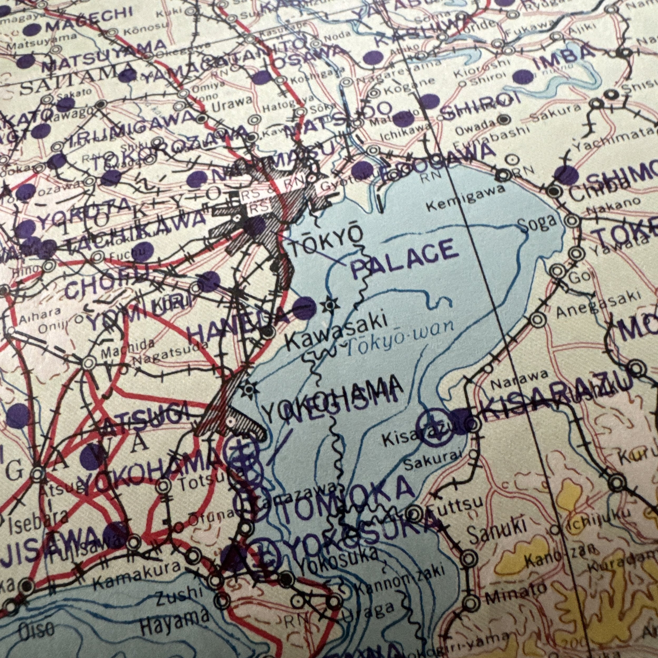
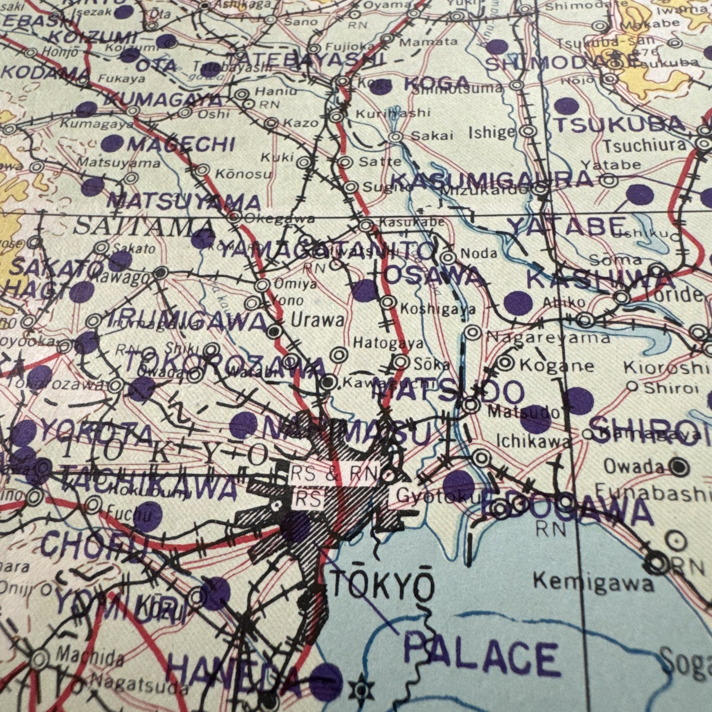
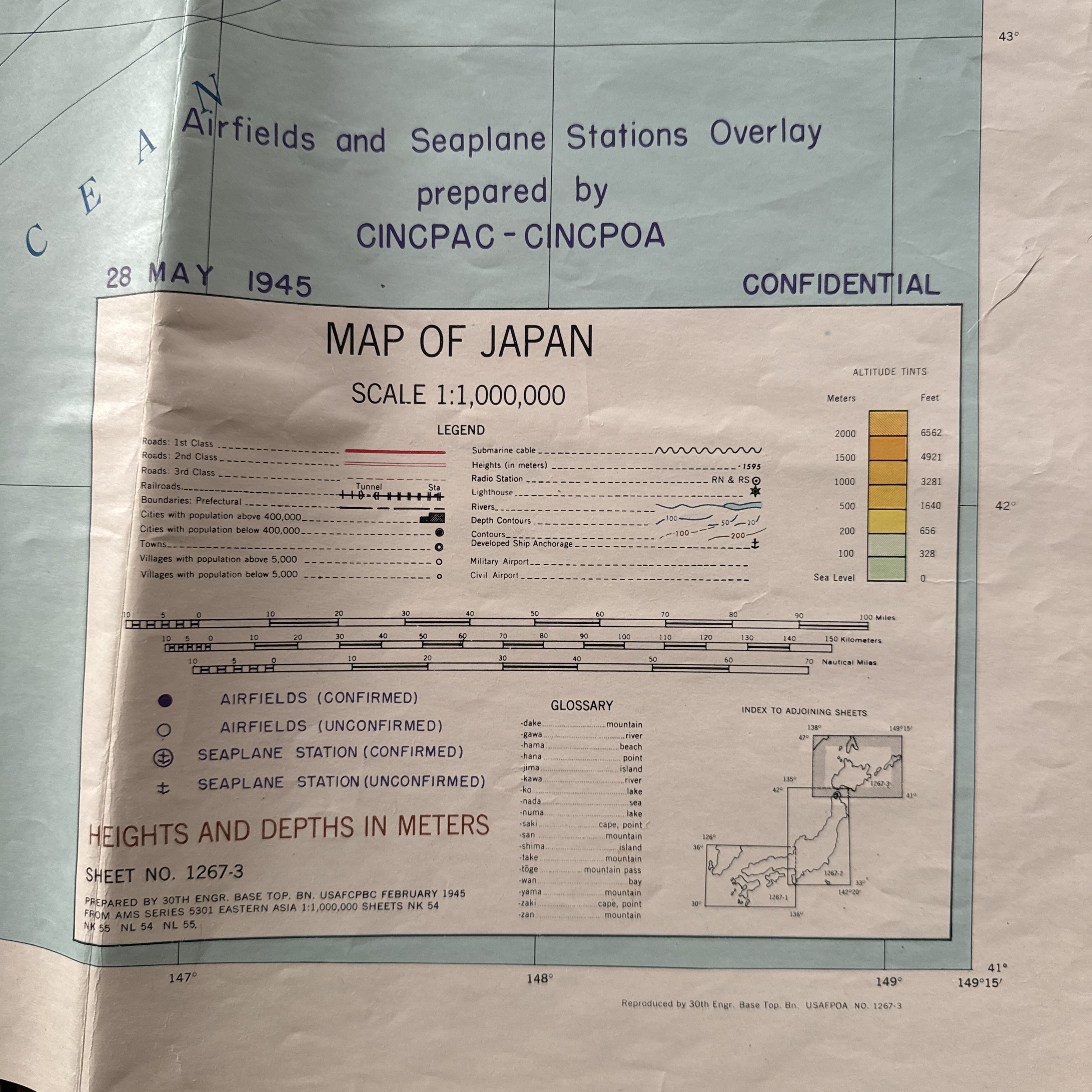
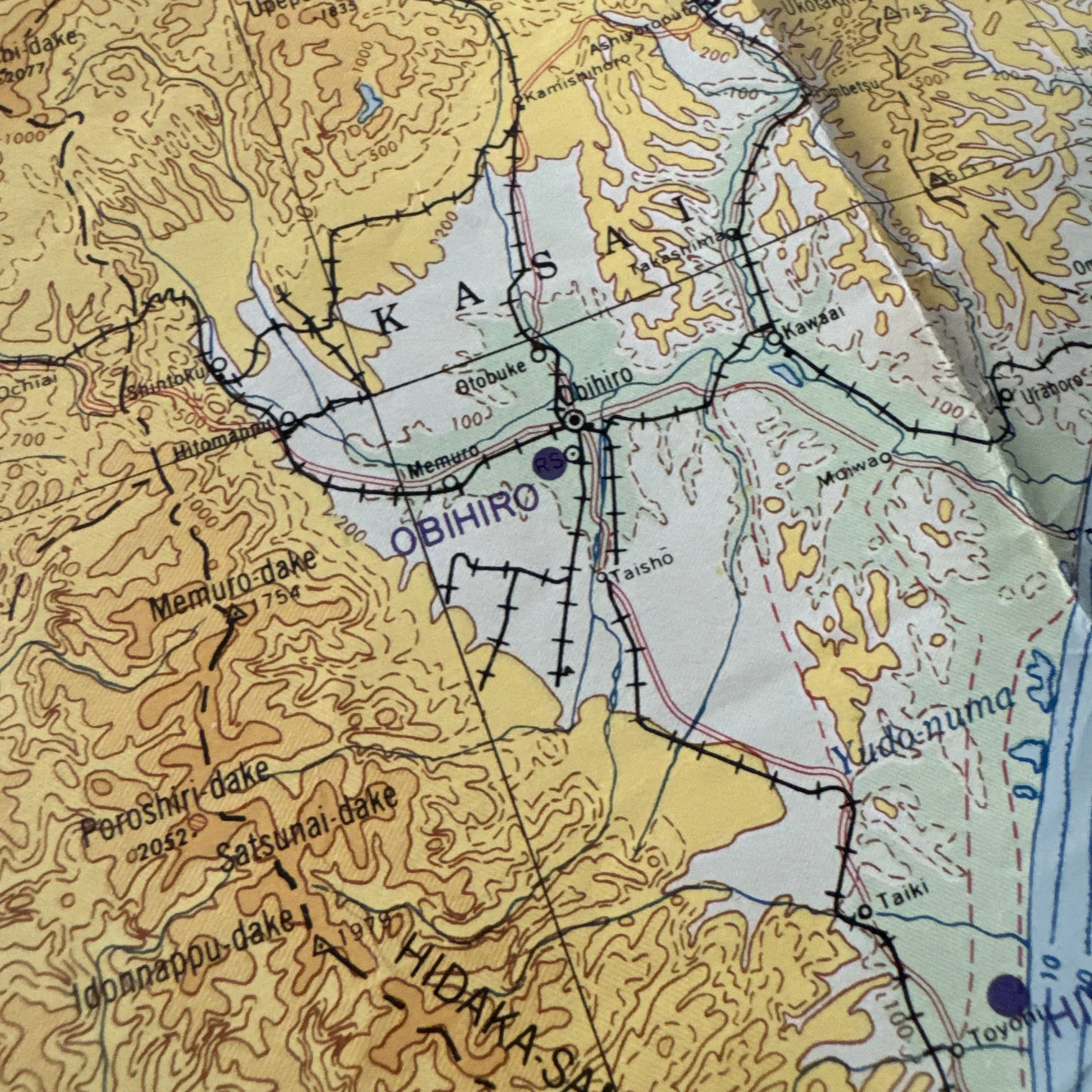
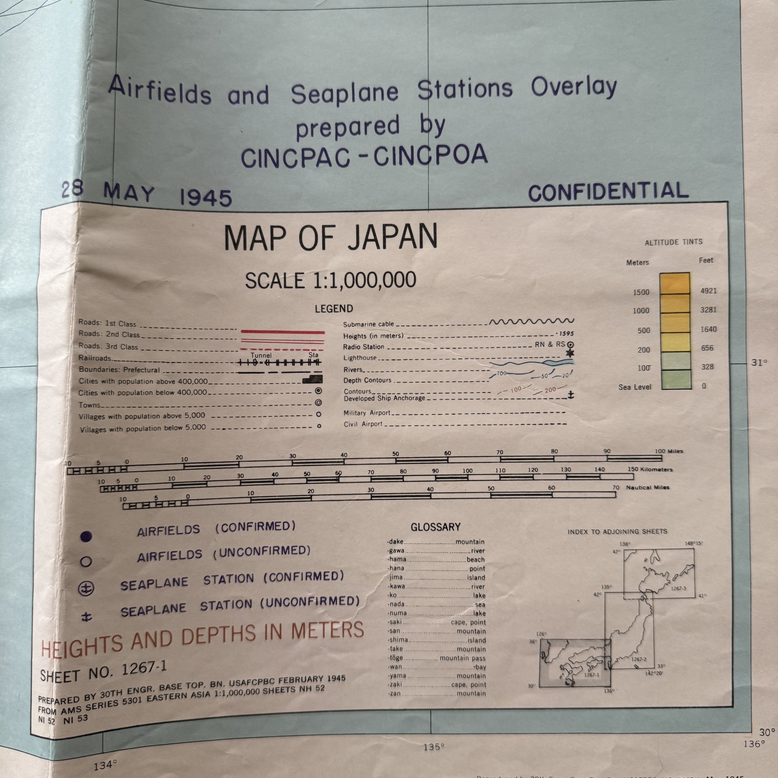
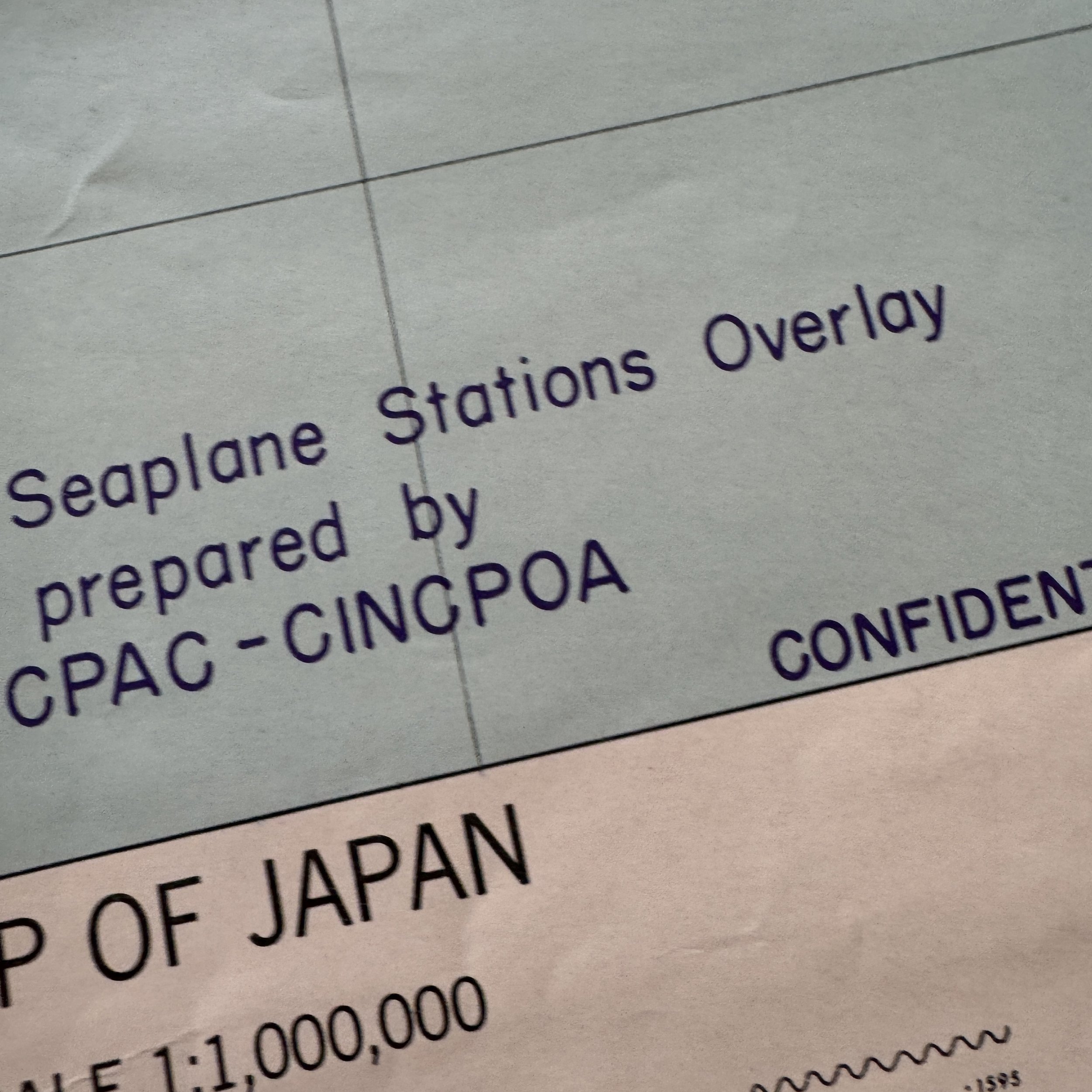
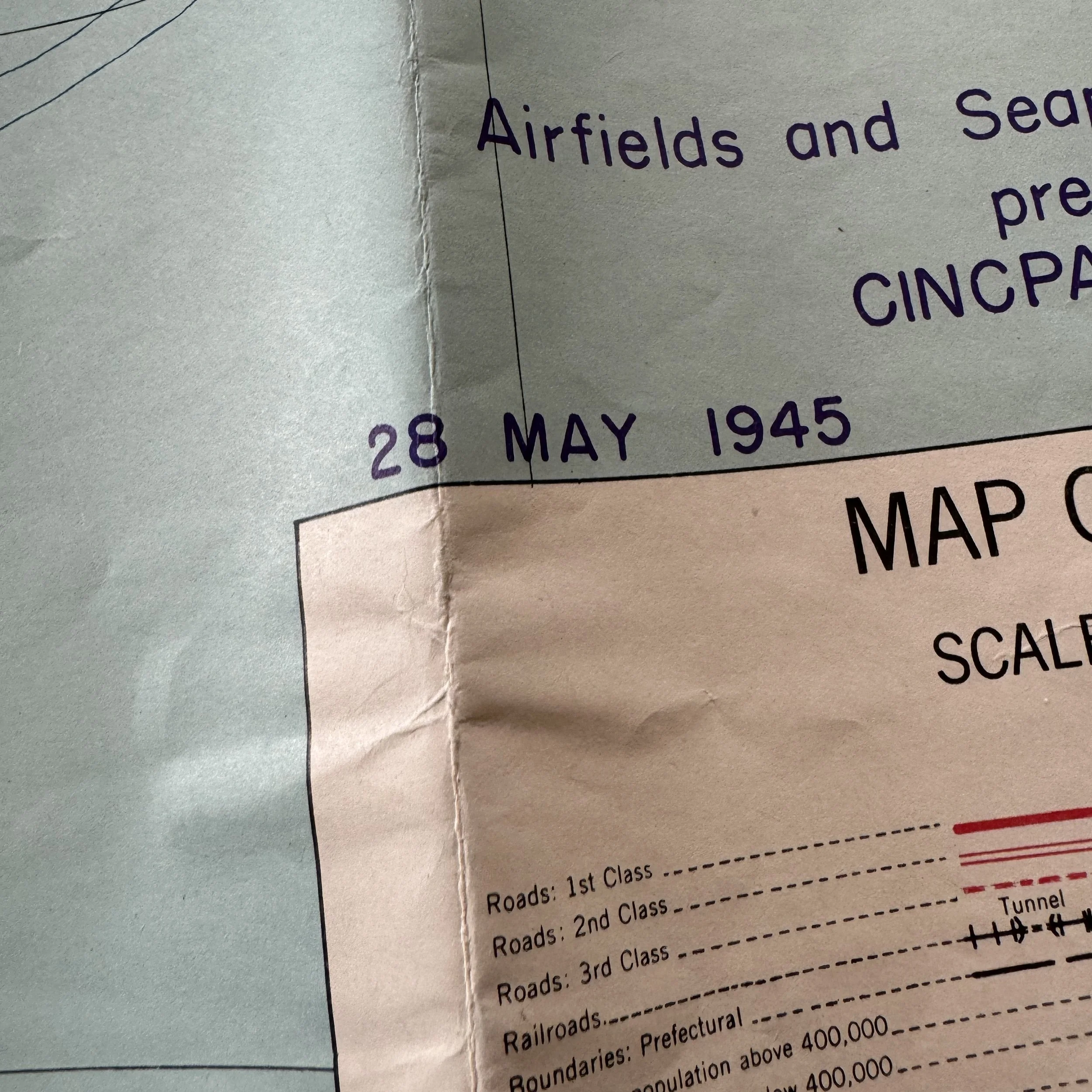
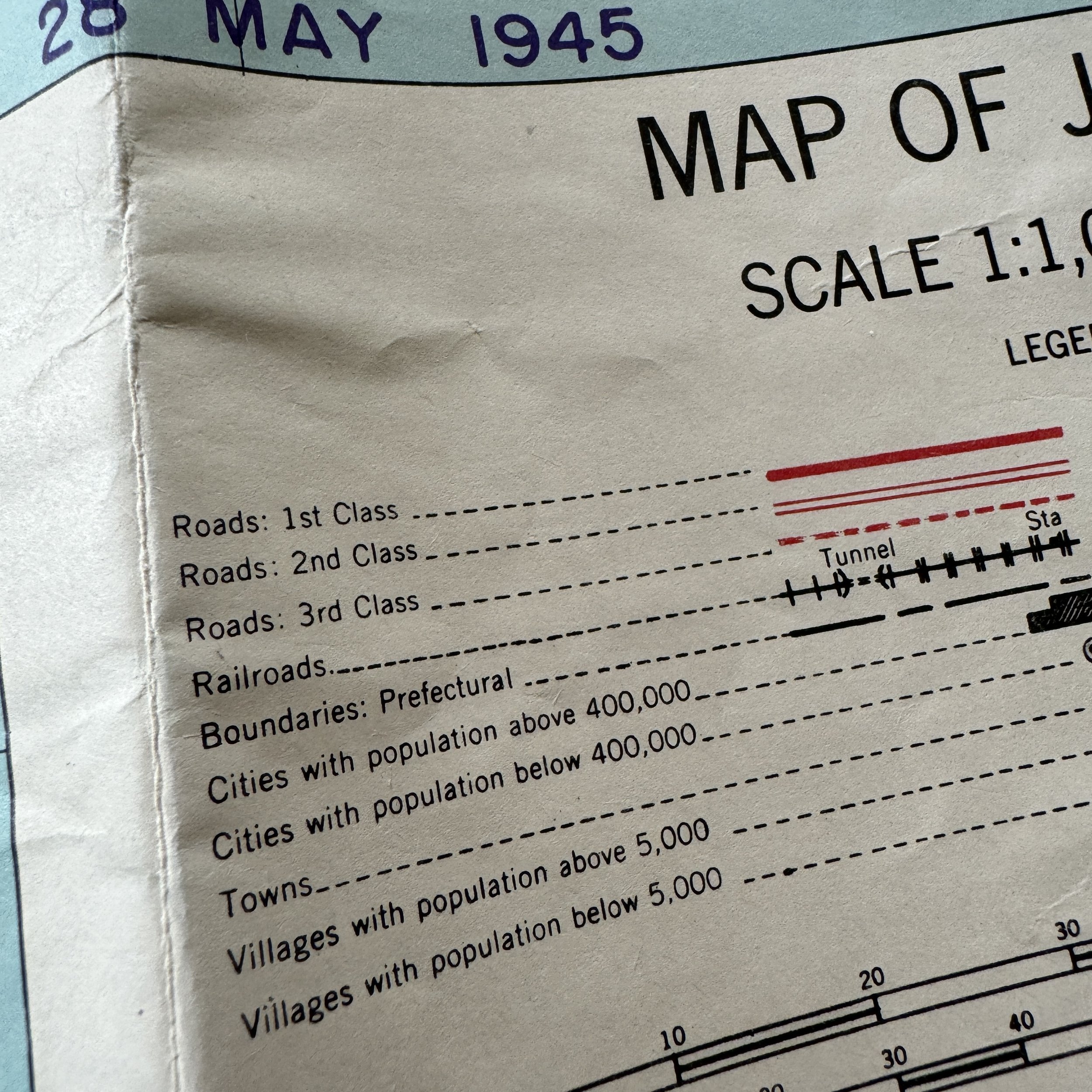
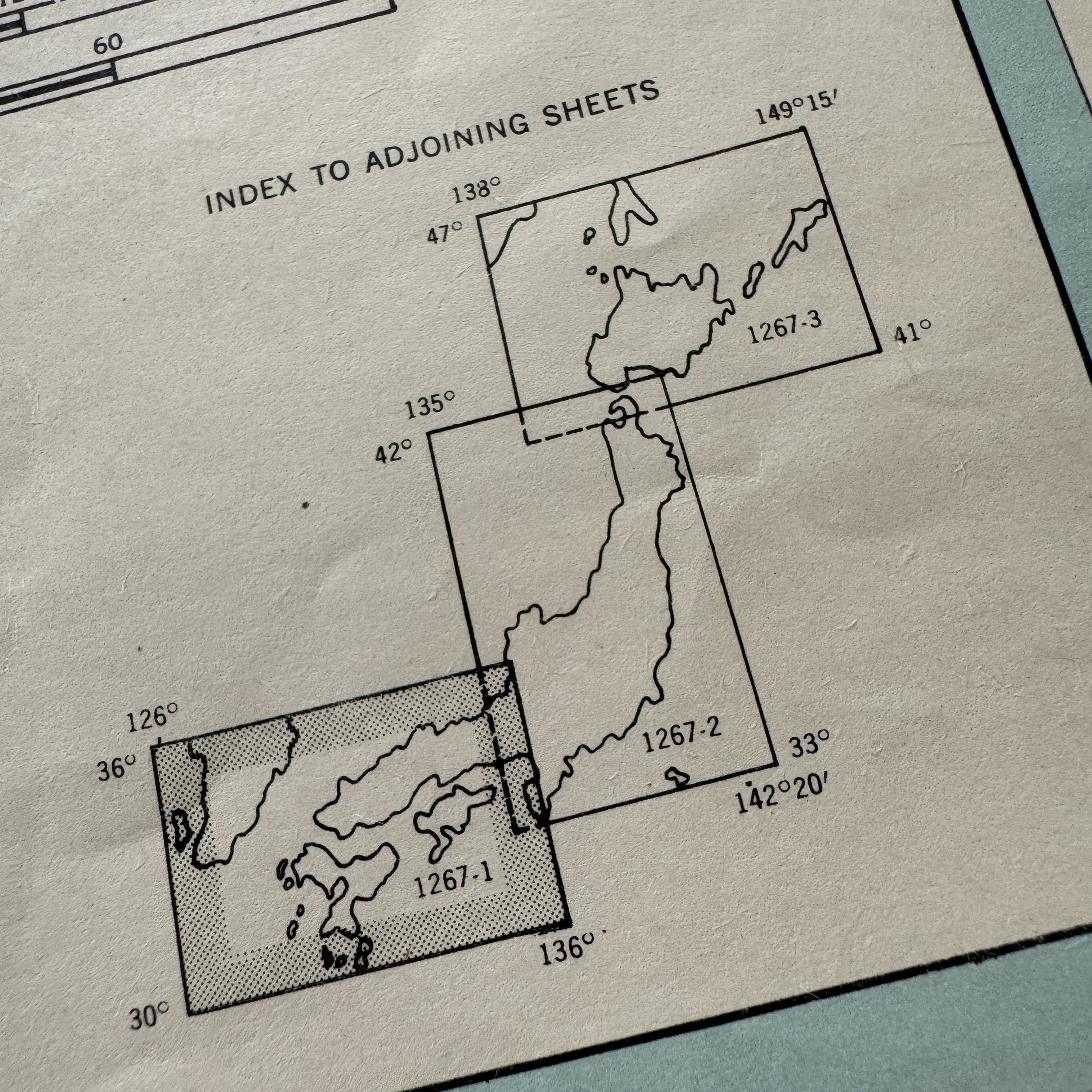
This rare and museum-grade World War II artifact collection represents a complete and historically significant set of three original CINCPOA (Commander in Chief, Pacific Ocean Areas) invasion maps, produced in preparation for what would have been the largest and most ambitious amphibious operation of the Pacific War: Operation Downfall. These extremely scarce maps, all marked “CONFIDENTIAL,” were issued with updated military intelligence as of May 28, 1945, and reflect the strategic thinking and meticulous planning for the invasion of mainland Japan, scheduled for late 1945 and into 1946. This particular set is believed to be the only known surviving complete grouping of all three adjoining CINCPOA maps depicting the Japanese Home Islands in precise detail, making it an exceptional and virtually unique historical grouping.
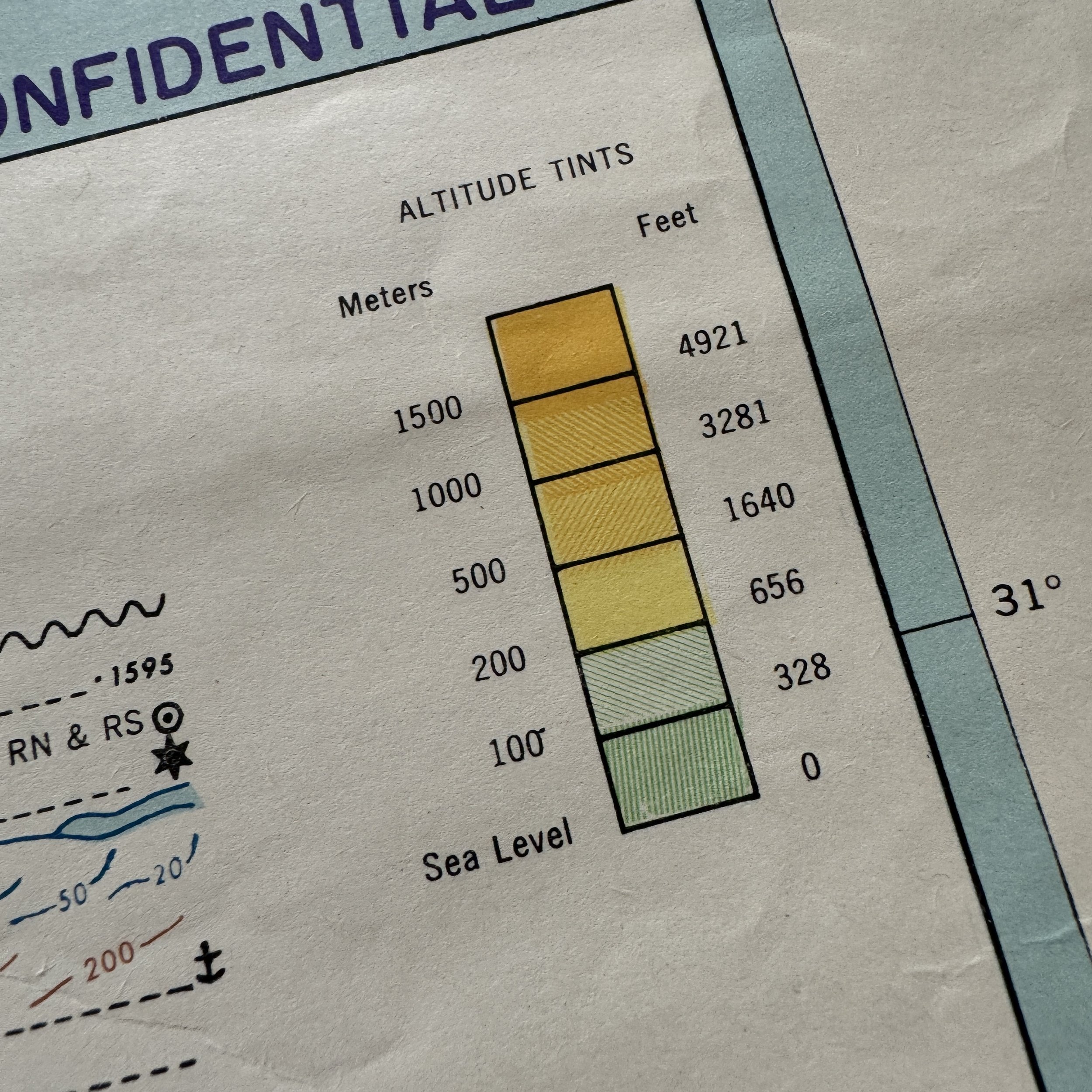
Created under the direct authority of Admiral Chester W. Nimitz, who held the dual titles of CINCPAC (Commander in Chief, Pacific Fleet) and CINCPOA, these maps were designed to aid in planning and executing the two-part invasion of Japan. They cover Kyushu and Honshu — the primary targets for Operations Olympic and Coronet — and meticulously chart known Japanese airfields, seaplane stations, ports, railways, roads, and critical infrastructure. Additional overlays incorporate intelligence on defensive fortifications, urban centers, radio stations, road boundaries, and topography, providing an invaluable reference for Allied commanders and navigators preparing for this massive undertaking.
CINCPOA’s role in Operation Downfall was both central and indispensable. Unlike General Douglas MacArthur’s command of the Southwest Pacific Area (SWPA), which would oversee Operation Coronet and the invasion of Honshu, Nimitz as CINCPOA was charged with directing the entirety of Operation Olympic. This first phase called for an amphibious invasion of Kyushu, intended to capture strategic airfields and ports necessary to support the subsequent assault on Tokyo and the Kanto Plain. The command structure divided responsibilities geographically, with the Central and Western Pacific under CINCPOA’s authority, including key staging areas such as the Marianas, the Philippines, and, critically, Okinawa — seized only weeks earlier at great cost.
Nimitz’s forces would be responsible for launching the amphibious assault with U.S. Navy and Marine Corps units at the spearhead. Carrier task forces and land-based bombers operating under CINCPOA would establish air superiority, disrupt Japanese communications and reinforcements, and conduct preparatory bombardments. Naval gunfire support ships would accompany the invasion fleet, tasked with neutralizing shore defenses and supporting the landing forces as they moved inland. Furthermore, Okinawa, as the main logistical hub, would supply and stage the tens of thousands of troops, vehicles, and supplies necessary for the campaign. Every aspect of this effort—from initial bombardment to amphibious landings to continued logistical support—fell under CINCPOA’s expansive command.
Had the invasion gone forward, the maps in this set would have been indispensable for operational commanders and navigators to chart flight paths, coordinate ground movements, and identify both targets and hazards amid what was expected to be fierce Japanese resistance. Intelligence at the time suggested the Japanese military planned to commit nearly everything to homeland defense, including massive kamikaze attacks, civilian militias, and well-fortified defensive belts along the Kyushu coastline. Estimated Allied casualties were staggering, with some projections reaching into the hundreds of thousands.
Ultimately, the atomic bombings of Hiroshima and Nagasaki, combined with the Soviet entry into the war against Japan, compelled Japan to surrender before Operation Downfall could be executed. As a result, these CINCPOA invasion maps remain as powerful artifacts representing a campaign that, though meticulously planned, was never fought—yet loomed as one of the most critical potential operations of the Second World War.
This complete set of maps is not only extraordinarily rare but also a poignant reminder of the scale of the Pacific War and the exhaustive planning undertaken to bring it to a final, and potentially devastating, conclusion.