VERY RARE! WWII May 1945 Mainland Japan Japanese Airfield & Installations U.S. Army Air Force B-29 Superfortresss Air Navigation Chart (Kyushu Targets)


VERY RARE! WWII May 1945 Mainland Japan Japanese Airfield & Installations U.S. Army Air Force B-29 Superfortresss Air Navigation Chart (Kyushu Targets)
Comes with a hand-signed C.O.A. and a full historical write-up research document
From: World War II - Pacific Theater
Size: 29 × 41 inches
Dated: May 17th, 1945
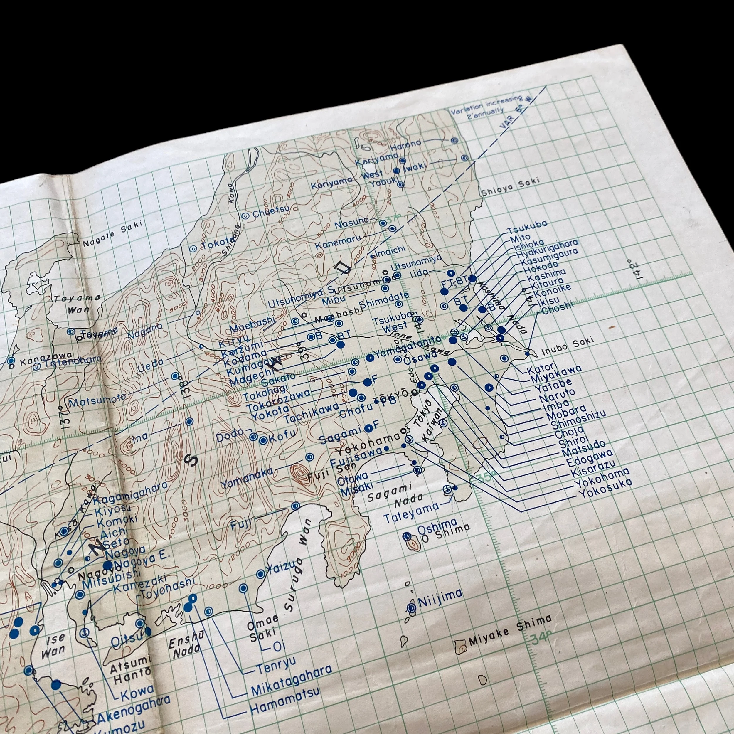
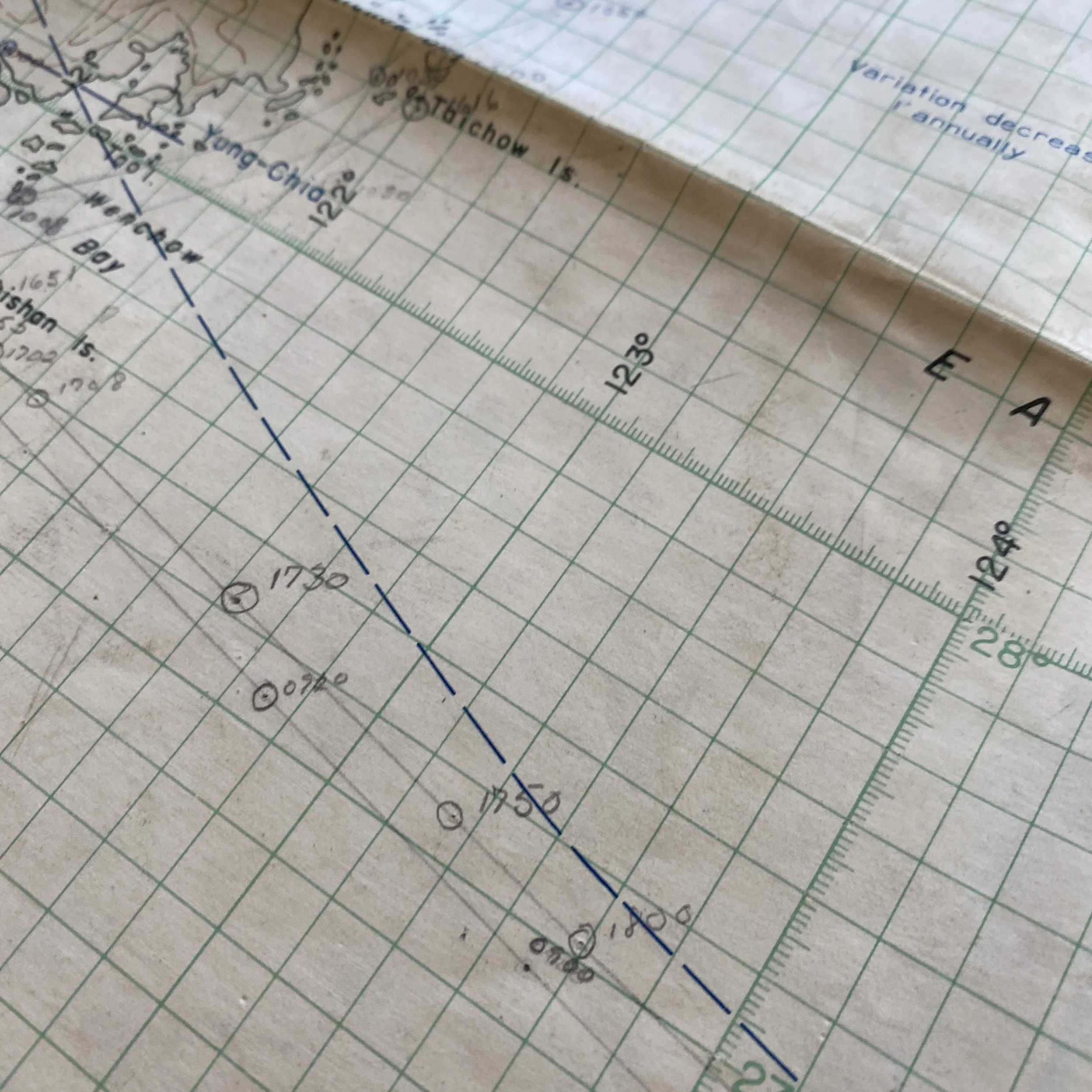
This exceptionally rare and museum-grade World War II artifact is an original U.S. Army Air Forces “RESTRICTED” Air Navigation Chart, dated May 1945, created during the climactic final phase of the Pacific War. Specially produced for B-29 Superfortress aircrews, this large and highly detailed map was a critical intelligence asset used for the strategic bombing campaign against Kyushu and mainland Japan.
The chart outlines the locations of all known Japanese combat fighter airfields, bomber bases, reconnaissance stations, and other high-value military targets across the Japanese home islands and nearby occupied territories. As part of a broader operational effort, these charts were indispensable for guiding American bombing missions launched from newly secured forward bases such as Iwo Jima and Okinawa—both of which had been captured earlier that year to bring the Japanese mainland within closer striking range.
The May 1945 issue of this chart, classified “RESTRICTED,” reflects its importance as a confidential combat planning tool. Aircrews depended on this kind of precise navigational data to plan routes to and from enemy territory while avoiding flak concentrations, enemy fighter patrols, and radar coverage zones. The map integrates intelligence gathered from aerial reconnaissance, naval hydrographic surveys, and previous bombing missions, all synthesized into one coordinated flight planning document. These navigation charts were essential tools used by the Twentieth Air Force and XXI Bomber Command, which were responsible for executing the air raids that devastated industrial cities and targeted military infrastructure across Japan. In addition to offering geographic and aeronautical information, the maps also included coded references to known enemy installations, helping crews deliver their payloads with increased accuracy. By mid-1945, missions originating from the Marianas, Iwo Jima, and Okinawa had intensified, with round-the-clock raids systematically crippling Japan’s war capacity and paving the way for Operation Downfall—the planned Allied invasion of Japan, which was ultimately never launched due to Japan's surrender following the atomic bombings of Hiroshima and Nagasaki.
Today, original WWII navigation charts like this one are extremely scarce and highly sought after by historians, museums, and serious collectors. They offer a tangible glimpse into the operational complexity of wartime aviation and the level of planning required for long-range bombing missions. As a surviving piece of strategic intelligence, this chart not only represents the tactical realities of air warfare but also serves as a compelling artifact of the immense logistical and technological efforts that defined the final months of the Pacific conflict.