EXTREMELY RARE! WWII 1945 "CONFIDENTIAL" XXI Bomber Command Panoramic Reconnaissance Mission Intelligence Photograph B-29 Superfortress Kyushu Japan Bombing Raids (Target: Tsuka Airfield, Kyushu)


EXTREMELY RARE! WWII 1945 "CONFIDENTIAL" XXI Bomber Command Panoramic Reconnaissance Mission Intelligence Photograph B-29 Superfortress Kyushu Japan Bombing Raids (Target: Tsuka Airfield, Kyushu)
Comes with a hand-signed C.O.A. and a full historical write-up research document
From: World War II - Pacific Theater
Unit: XXI Bomber Command - Twentieth Air Force
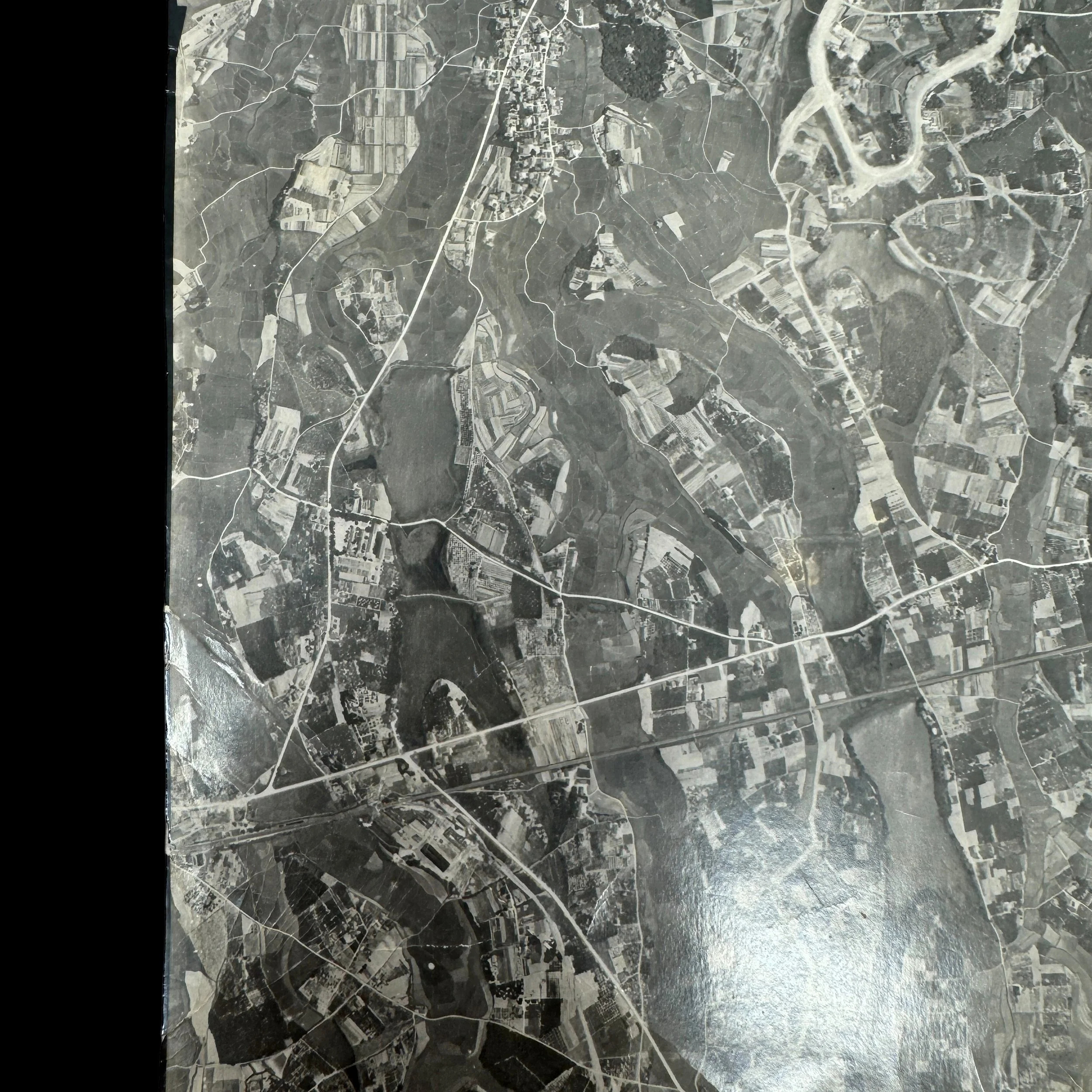
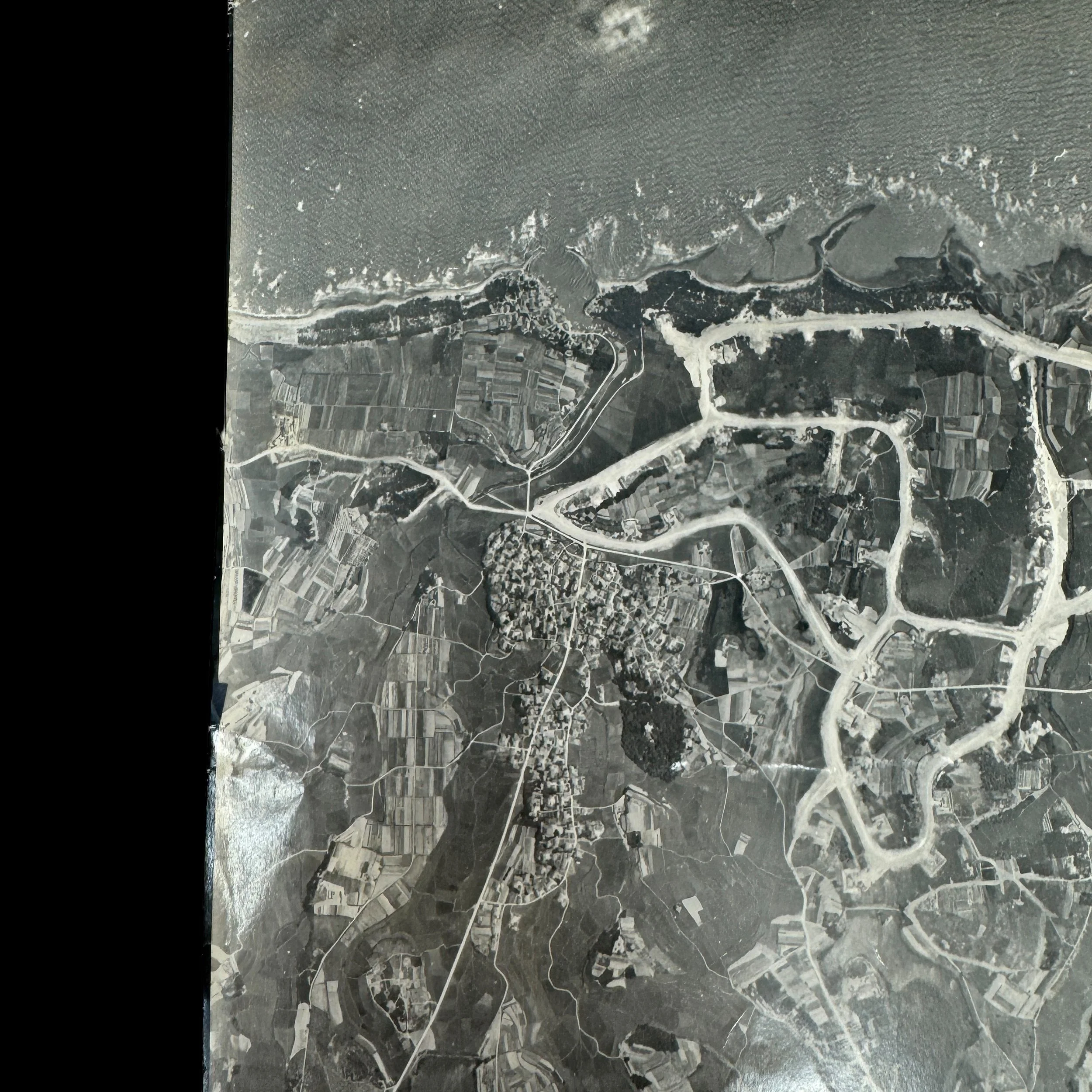
Type: “CONFIDENTIAL” Marked Aerial Reconnaissance Intelligence Photograph Used By XXI Bomber Command B-29 Crews During Strategic Bombing Operations On Kyushu, Japan
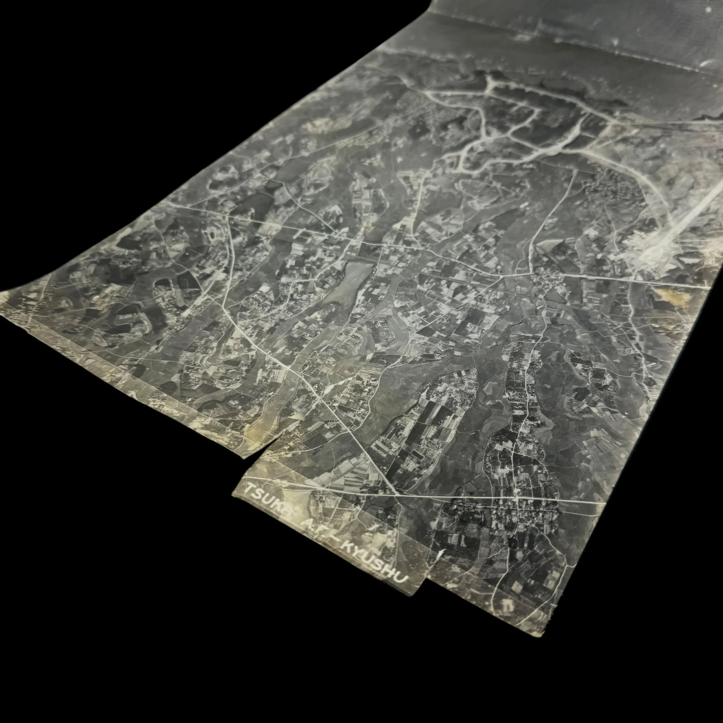
Size: 9 ¼ x 18 inches
Dated: 1945
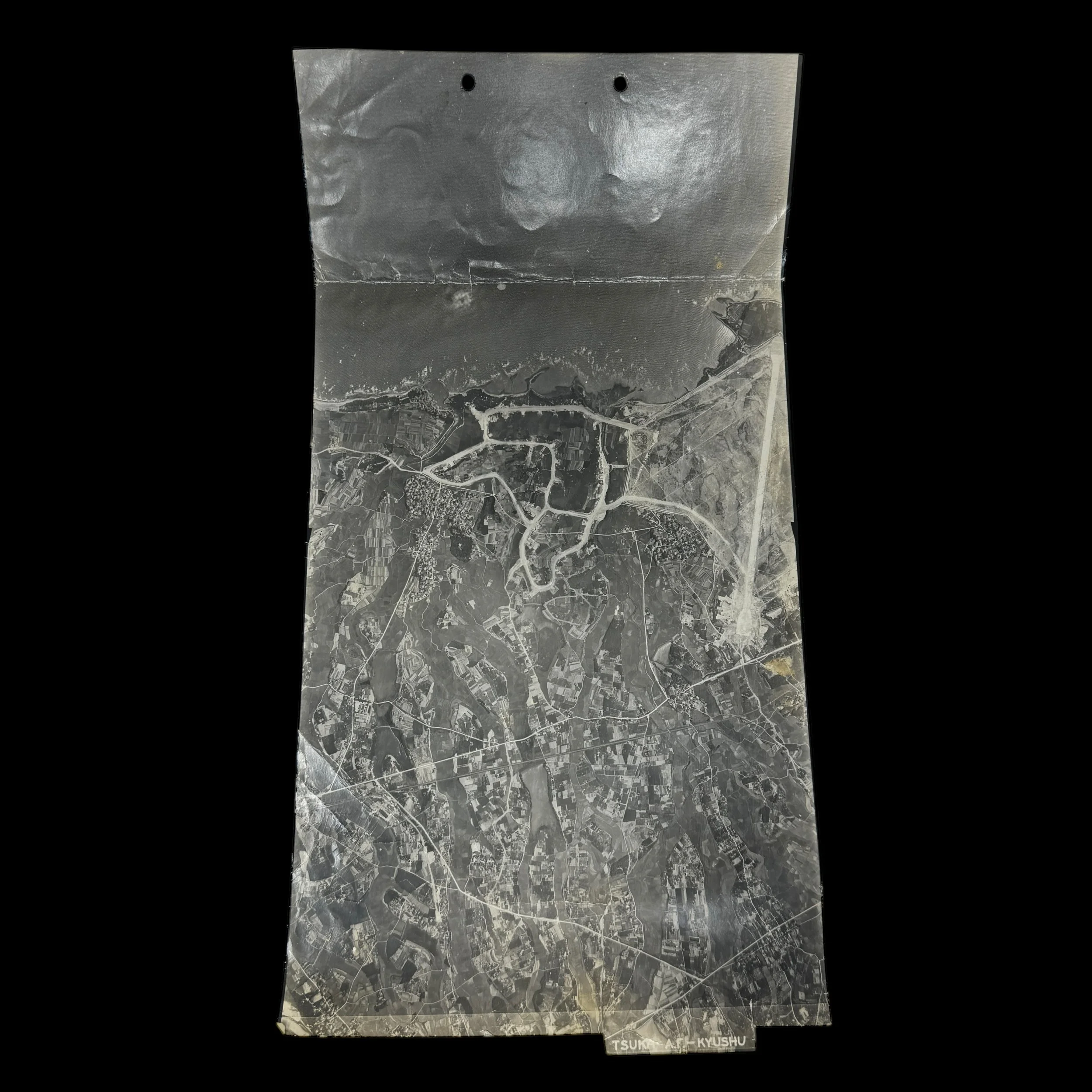
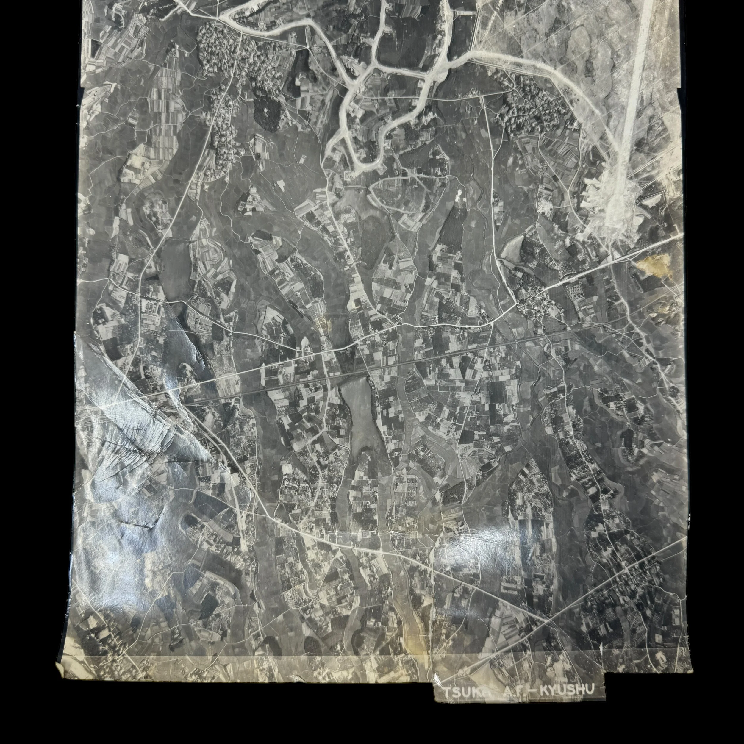
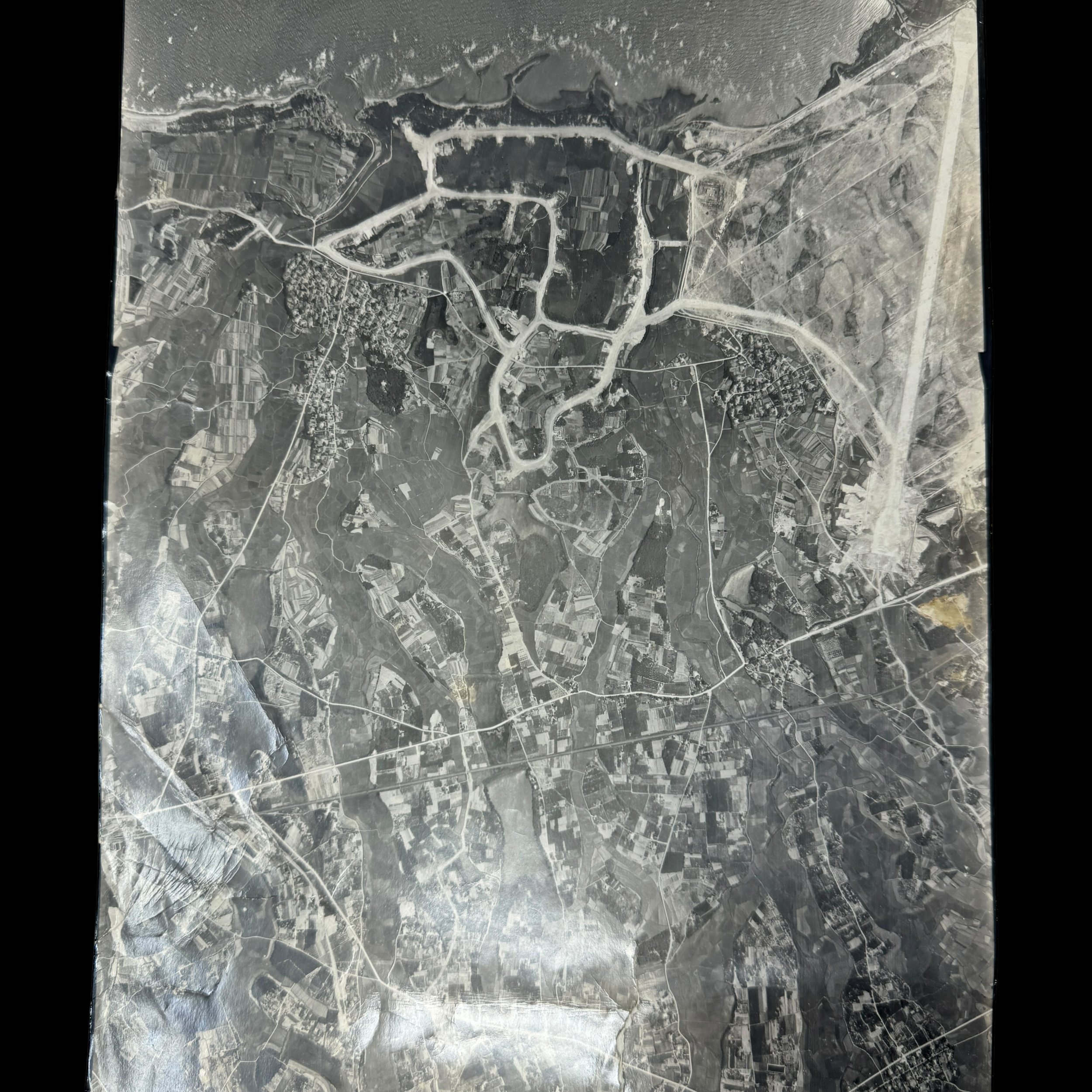
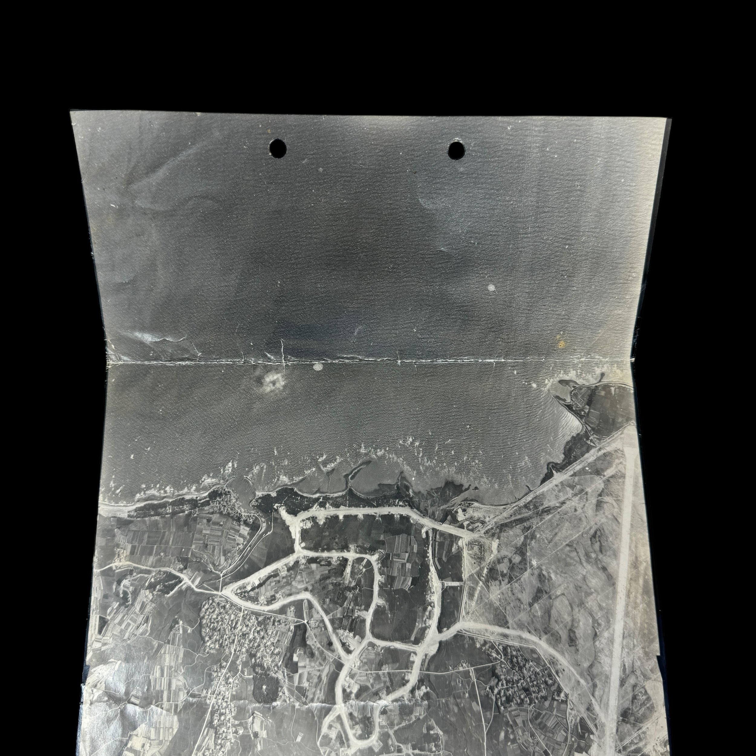
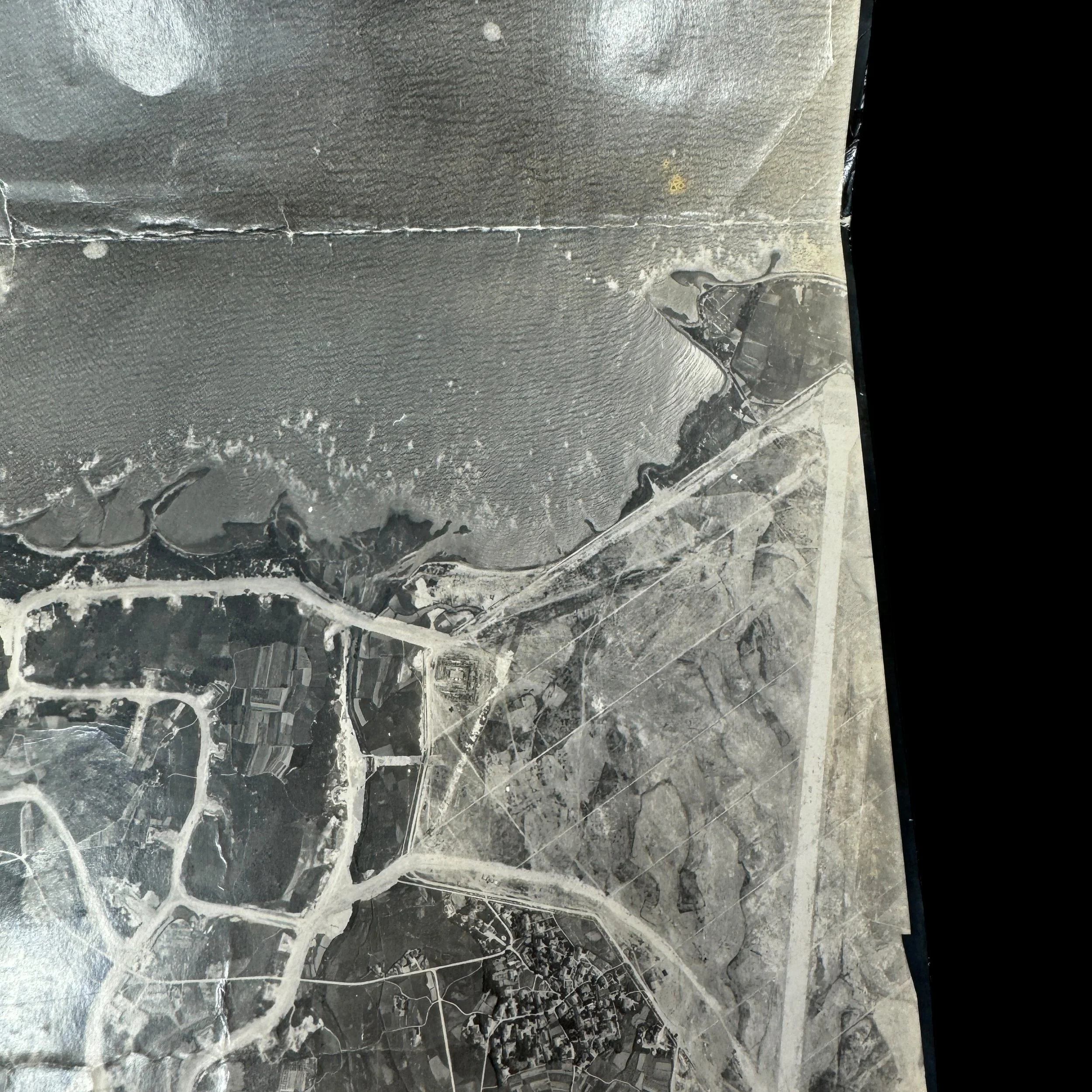
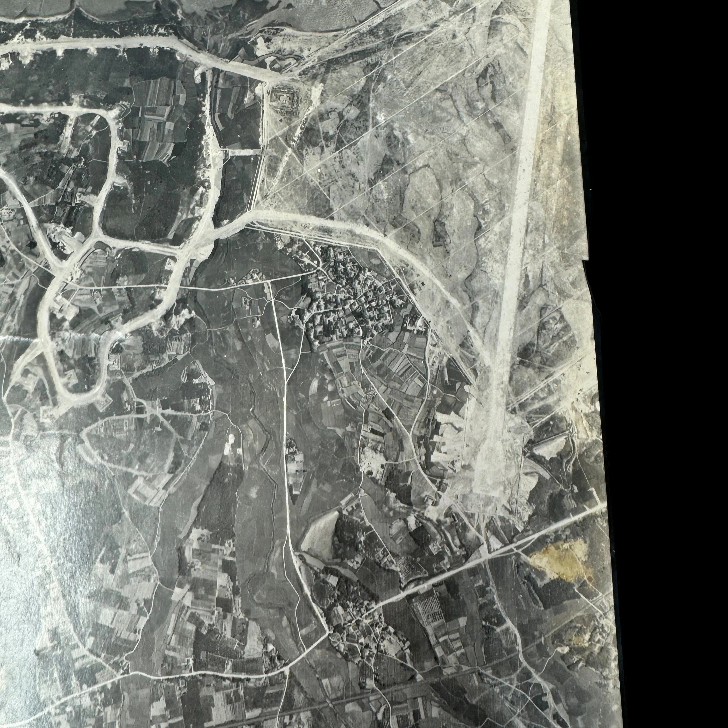
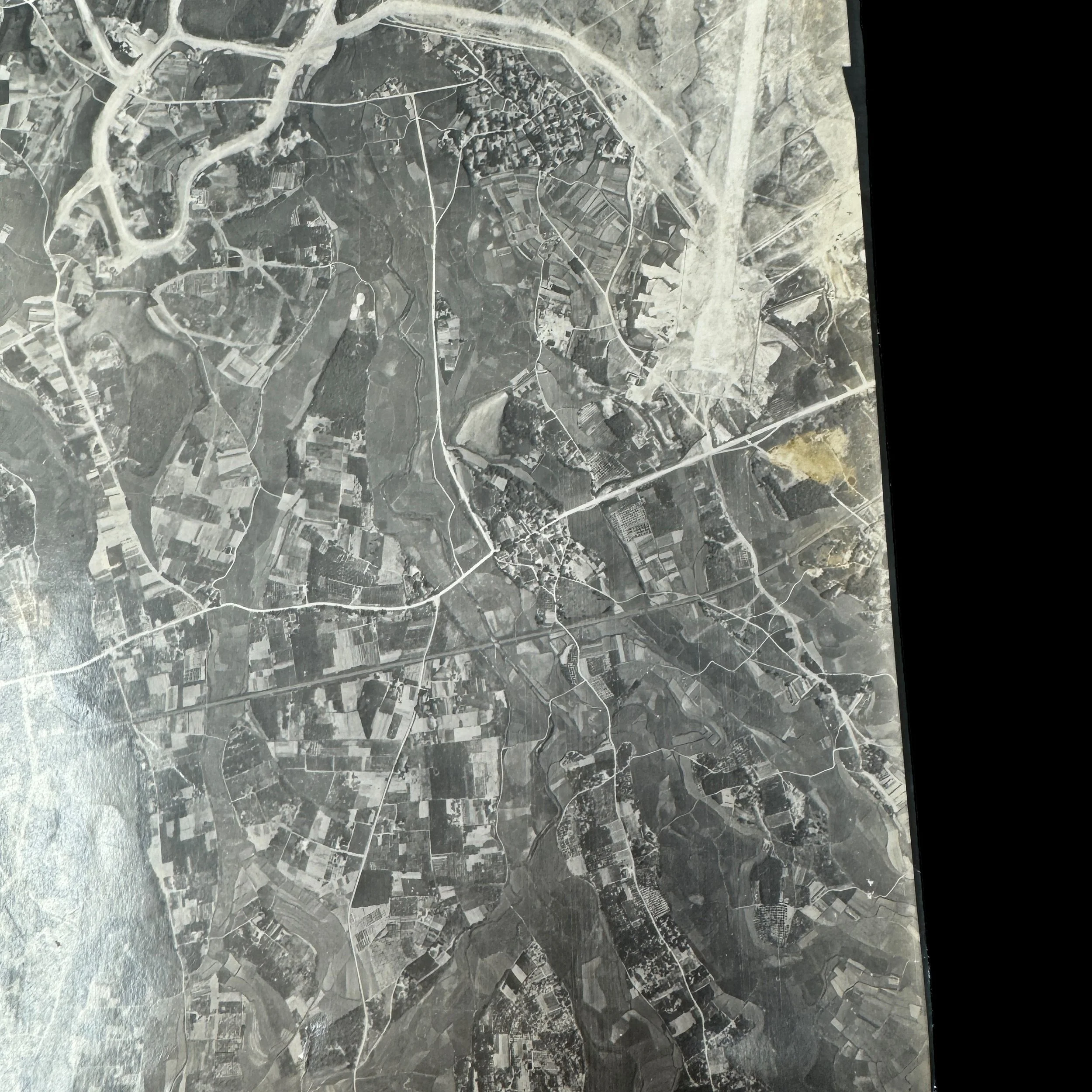
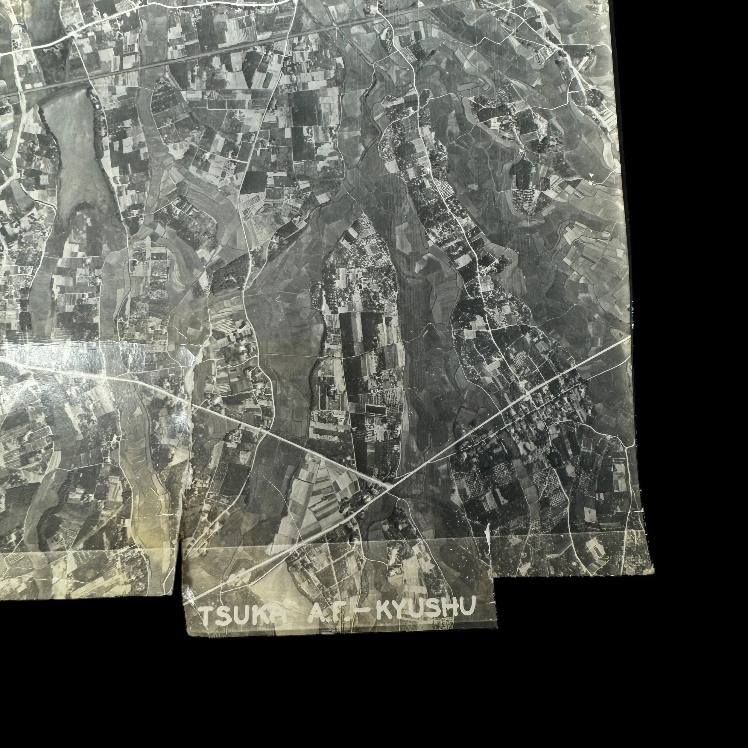
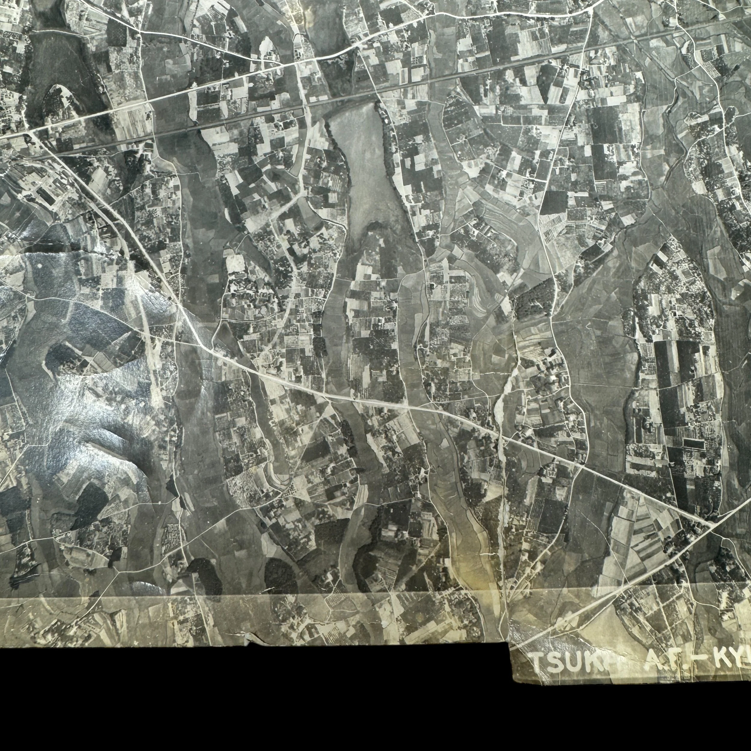
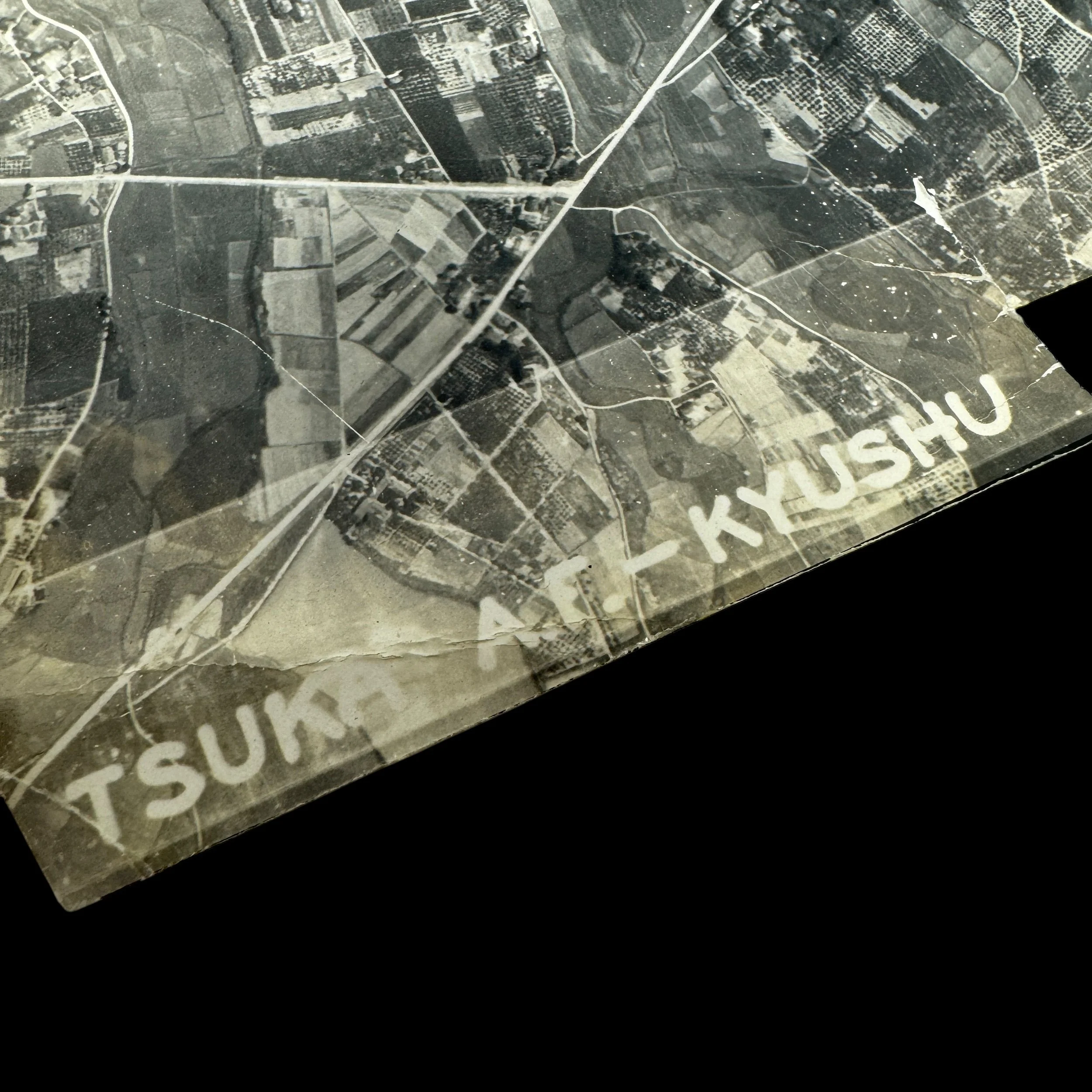
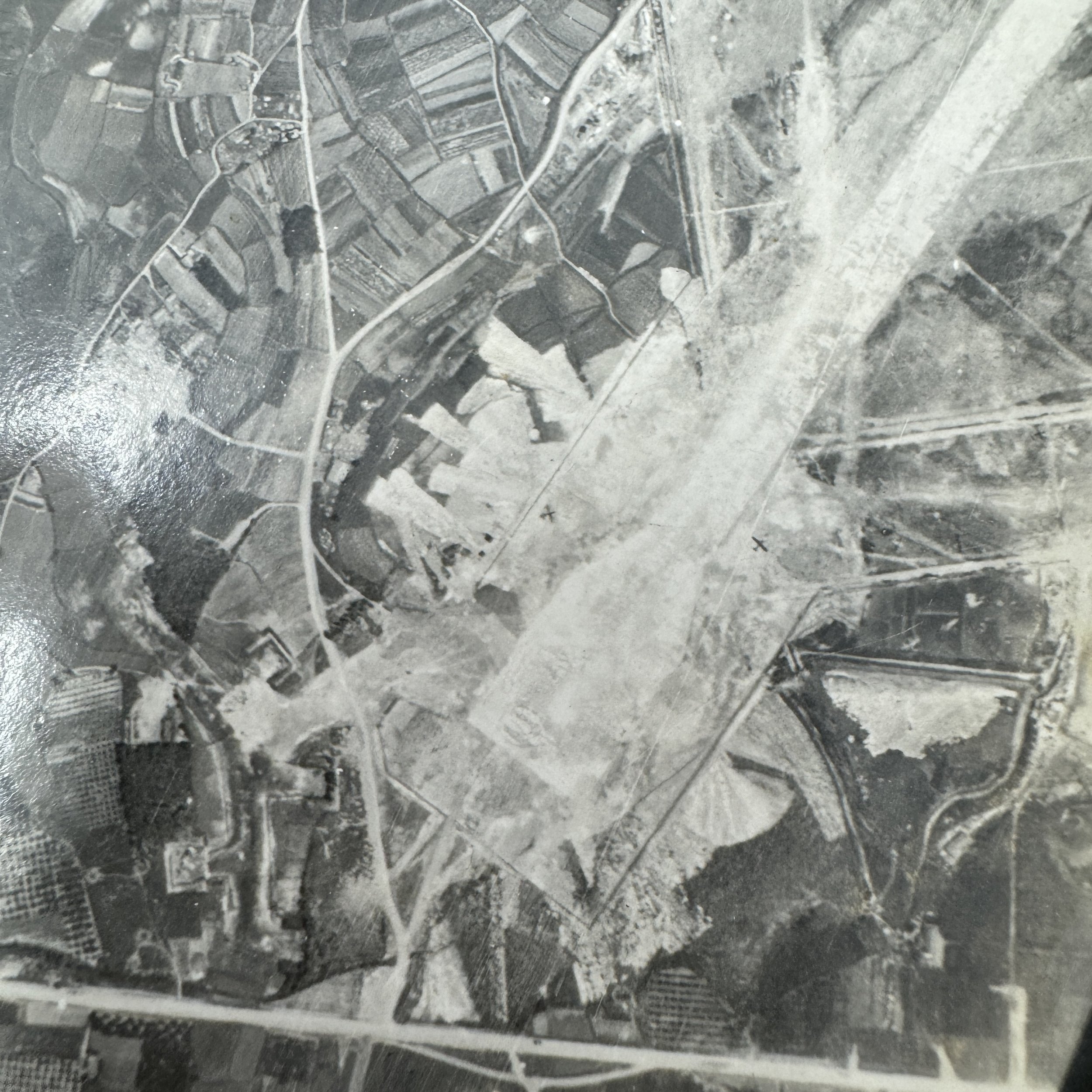
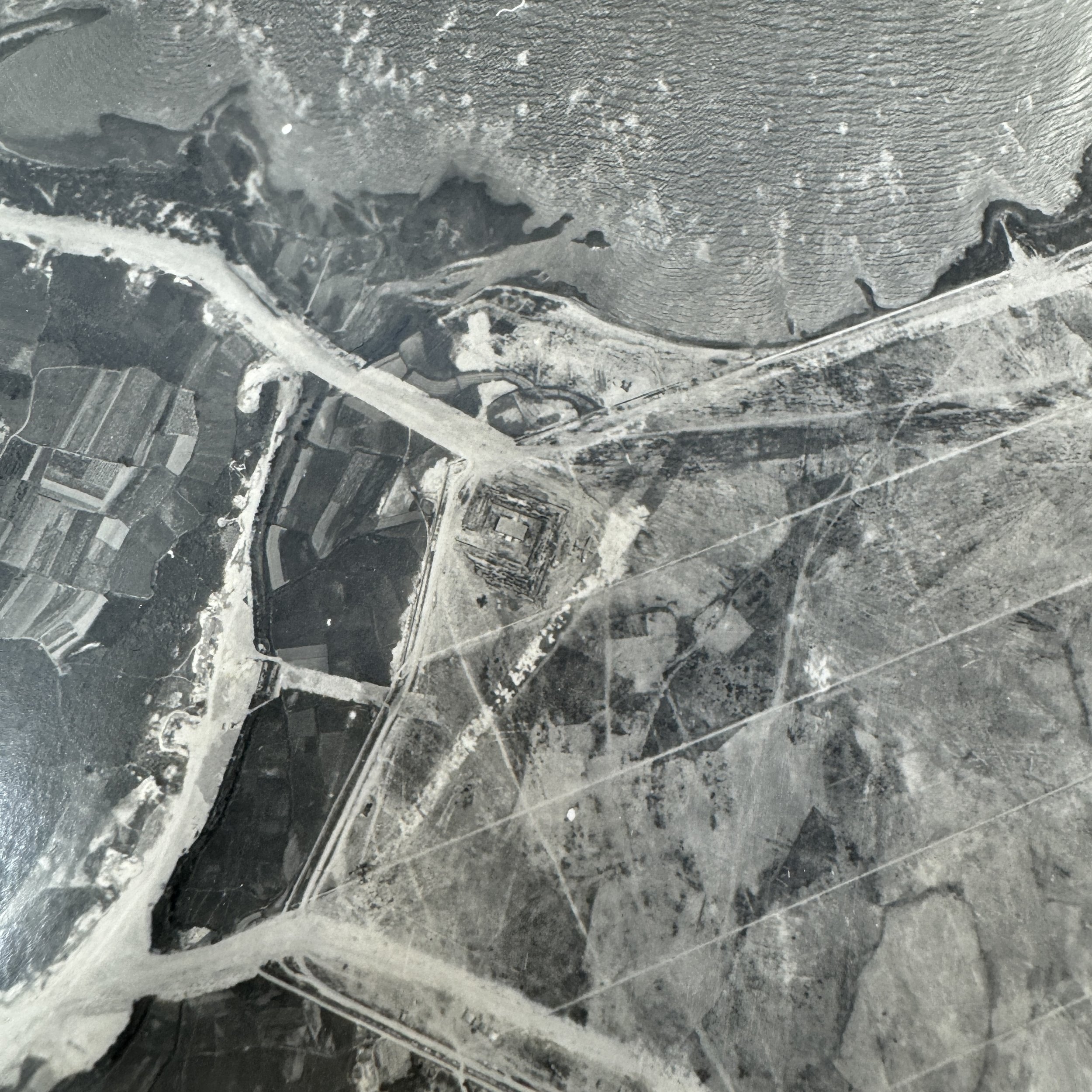
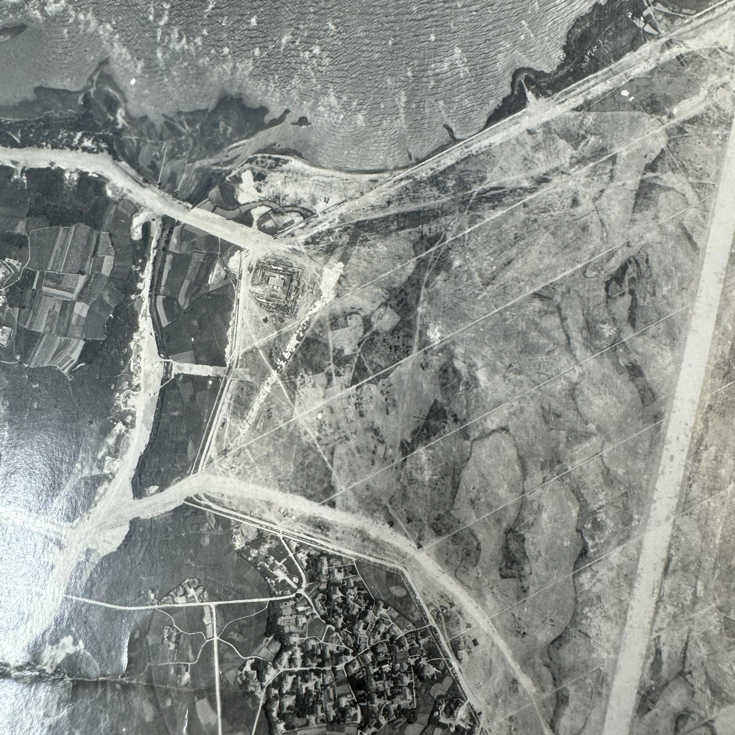
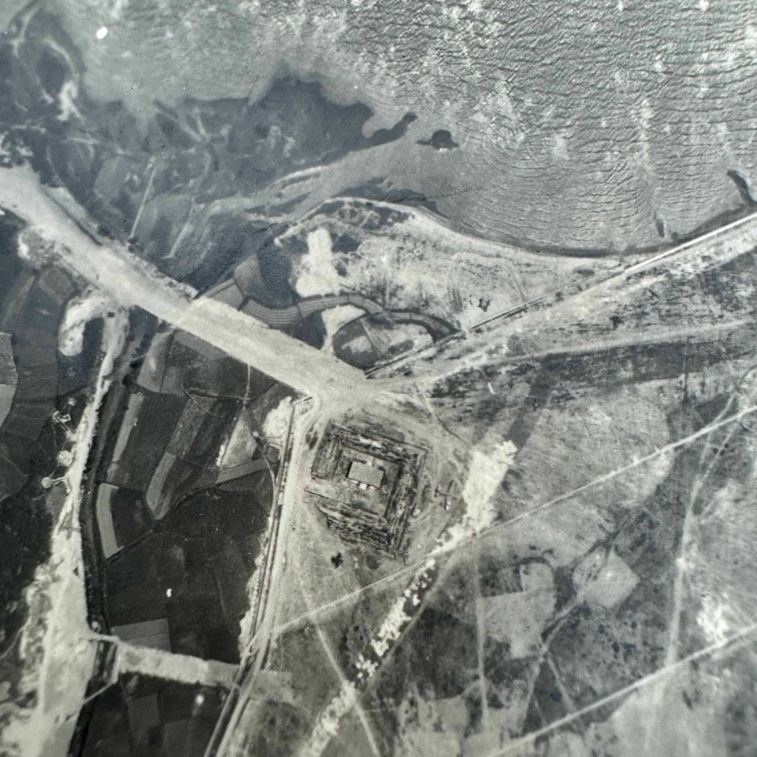
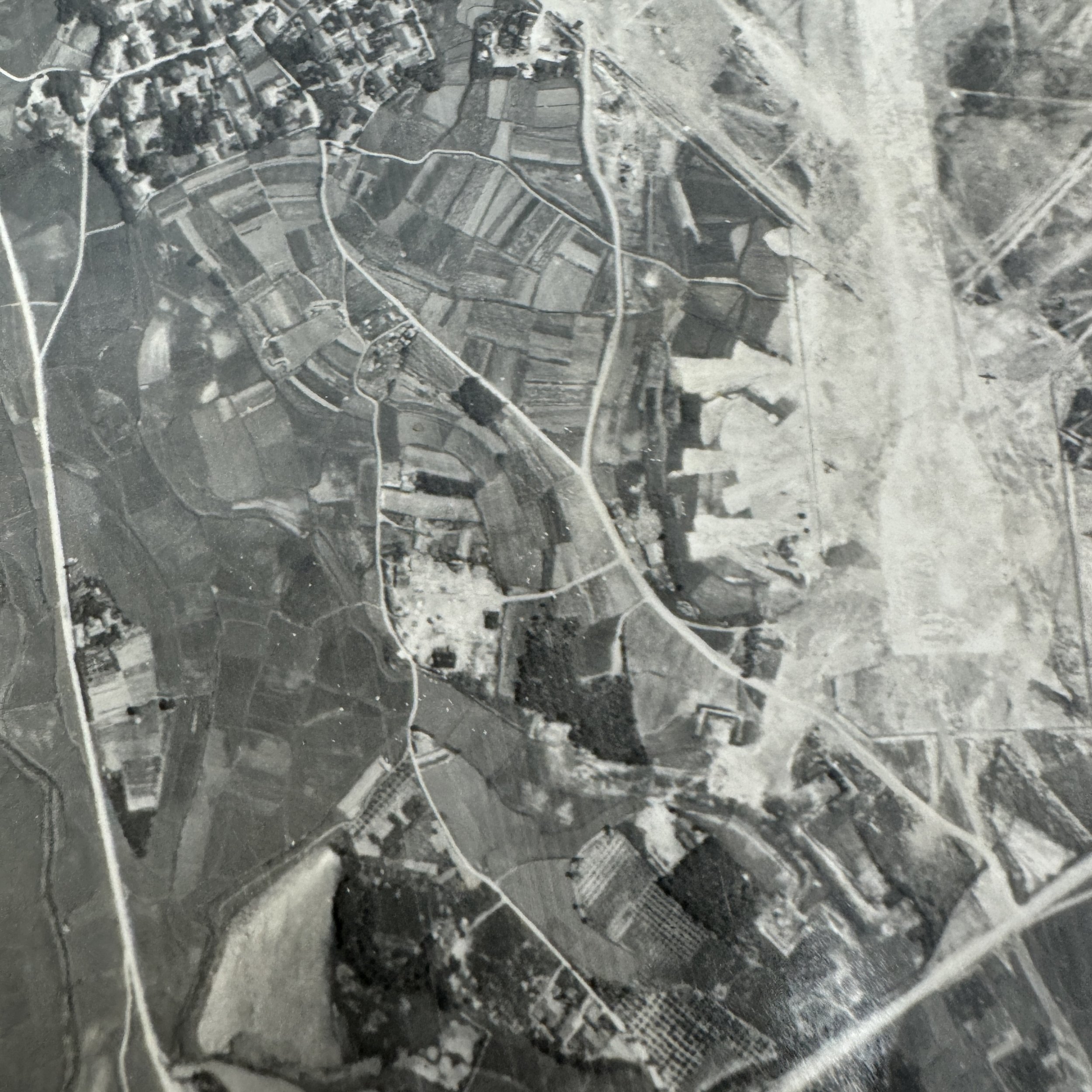
Target: Tsuka Airfield - Kyushu
Tsuka Airfield, located on the southern end of Kyushu, played a significant role in Japan’s increasingly desperate efforts to defend the home islands from the mounting pressure of Allied air superiority during the final months of World War II. As part of the broader network of airfields scattered across Kyushu, Tsuka was utilized by the Imperial Japanese Army and Navy to station both training and operational aircraft, and by mid-1945, had become a key launching point for kamikaze missions aimed at Allied naval forces encircling Okinawa. Its strategic location, within direct striking distance of U.S. fleet positions and invasion staging areas, made Tsuka a primary target in the XXI Bomber Command’s systematic airfield suppression campaign. Operating under the Twentieth Air Force from bases in the Mariana Islands, B-29 Superfortress units began launching intensive bombing missions over Kyushu beginning in the spring of 1945. These operations were supported by detailed reconnaissance photography missions flown by F-13 Superfortress aircraft, which captured high-altitude imagery of Tsuka and other regional airfields. Analysts used this intelligence to identify aircraft dispersal zones, fuel dumps, hangars, and flak emplacements, allowing mission planners to coordinate precision raids aimed at rendering the airfield inoperable. Beginning in June and continuing through August, B-29 formations carried out repeated strikes on Tsuka, cratering its runways, incinerating aircraft on the ground, and damaging key logistical support structures. These efforts not only degraded Japan’s ability to launch air attacks but also denied them the use of Tsuka as a fallback operational site as their forward airfields came under increasing Allied pressure. The destruction of Tsuka Airfield was a crucial part of the pre-invasion strategy under Operation Downfall, intended to establish total air dominance before any amphibious landings on the Japanese mainland. Its targeting underscores the precision and scale of XXI Bomber Command’s late-war campaign to paralyze Japan’s remaining air defenses and hasten the end of the conflict.
This extremely rare and museum-grade World War II artifact is an original XXI Bomber Command aerial reconnaissance intelligence photograph, stamped “CONFIDENTIAL” and used by the XXI Bomber Command of the Twentieth Air Force during its intensive strategic bombing campaign against the Japanese home island of Kyushu in 1945.
These marked aerial reconnaissance intelligence photographs of Kyushu, Japan were vital operational tools used by B-29 Superfortress crews during some of the most critical and technically sophisticated bombing missions of the Pacific Theater. As part of a broader intelligence network, these photographs were central to the success of the airfield suppression campaign, a late-war strategic initiative aimed at neutralizing Japanese aerial capabilities on Kyushu to prevent kamikaze attacks and secure air superiority ahead of potential invasion plans under Operation Downfall.
The XXI Bomber Command was a major component of the Twentieth Air Force, established to carry out long-range strategic bombing operations from bases in the Mariana Islands—primarily Tinian, Saipan, and Guam. By mid-1945, the B-29 units under XXI Bomber Command had already executed devastating raids on the Japanese mainland, including the infamous firebombing of Tokyo in March. However, the emphasis shifted toward southern Japan, particularly Kyushu, as the Allies prepared for the possible ground invasion of the Japanese home islands. The suppression of Japanese airfields on Kyushu was deemed essential to minimize the threat from kamikaze fighters, which had caused catastrophic damage during the Okinawa campaign.
The Kyushu airfield suppression raids, which intensified between July and August 1945, were meticulously planned operations targeting major military installations, airfields, and logistical infrastructure. Sites like Kagoshima, Miyakonojo, Kanoya, Oita, and Tachiarai were considered high-priority targets, as they housed interceptor aircraft, bomber units, and kamikaze squadrons poised to strike Allied naval forces. Many of these airfields were camouflaged or dispersed across challenging terrain, making them difficult to identify without accurate and timely intelligence.
This is where aerial reconnaissance photographs became indispensable. These images were typically captured by the F-13 Superfortress—a specially modified B-29 equipped with advanced photographic equipment capable of high-altitude and high-resolution imagery. F-13 missions would often precede major bombing raids, flying at altitudes above 30,000 feet to avoid enemy flak and fighters. The intelligence gathered was sent back to analysis units where photographic interpreters would study the prints to identify structures, camouflaged positions, runways, aircraft revetments, fuel storage tanks, and anti-aircraft batteries. These interpreters then annotated the photographs with key tactical information before passing them along to mission planners and flight crews.
During mission briefings, B-29 crews received these marked reconnaissance photographs to familiarize themselves with terrain features and target layouts. Navigators and bombardiers were trained to memorize key landmarks and to use the photos as visual references during bombing runs—especially critical in regions prone to cloud cover or where precise navigation was needed to hit dispersed or hidden targets. In many cases, copies of these images were carried onboard during the mission itself for mid-flight reference. Commanders could adjust flight paths, bombing altitudes, and target sequences based on updated intelligence from successive reconnaissance flights, reflecting a growing sophistication in U.S. air campaign planning.
In the broader context of the war, the integration of aerial photographic intelligence into XXI Bomber Command operations signaled a turning point in strategic airpower. It enabled a level of precision and adaptability previously unavailable in large-scale bombing missions. These images didn’t just guide bombs—they helped preserve lives by minimizing exposure to flak zones and reducing the risk of failed missions. They also allowed for the rapid reassessment of enemy defenses and infrastructure damage, shaping both immediate tactical choices and long-term strategic decisions.