EXTREMELY RARE! WWII D-Day "SECRET" Battle of Iwo Jima GREEN 1 Beach Invasion Defense Diagram South Eastern Beaches Iwo Jima

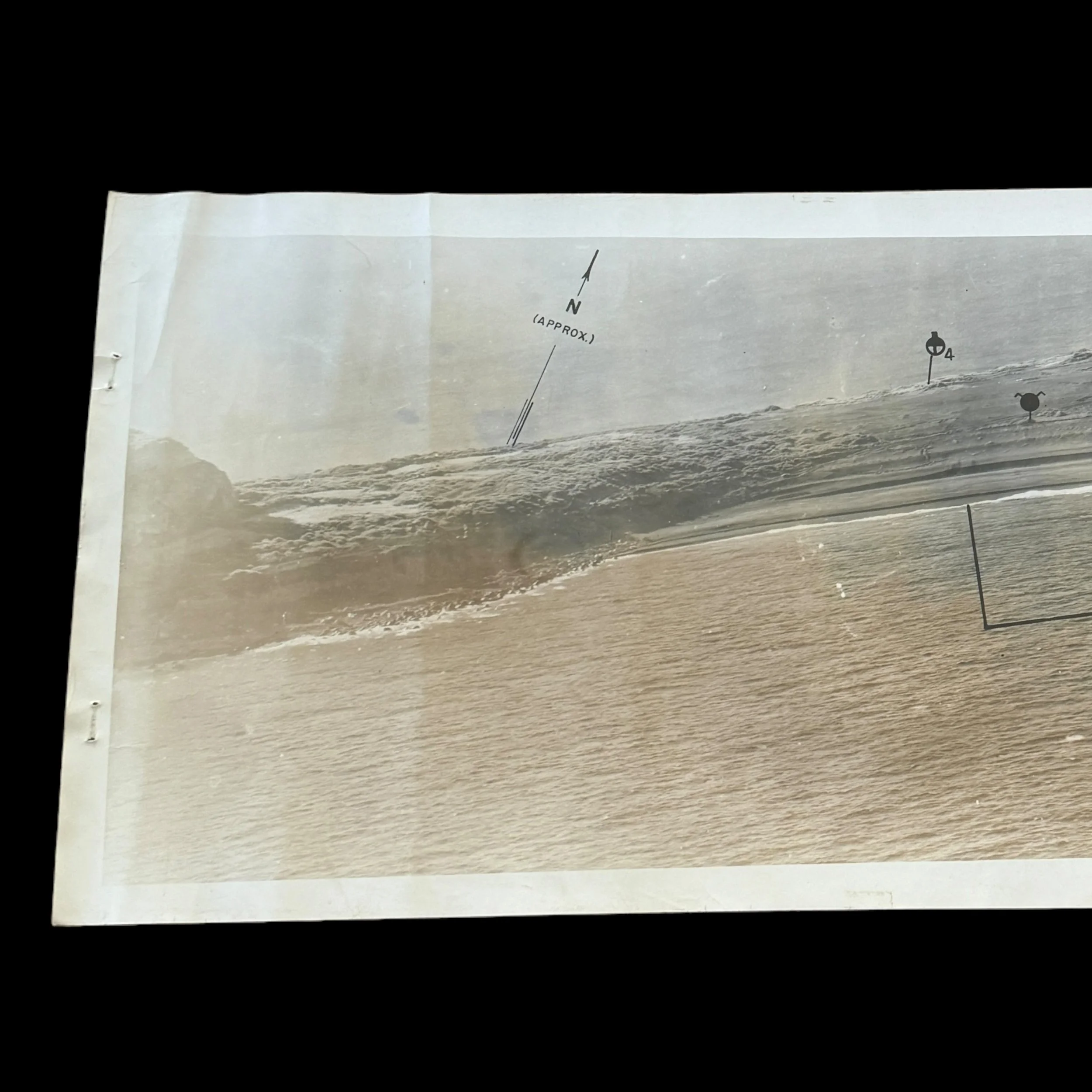
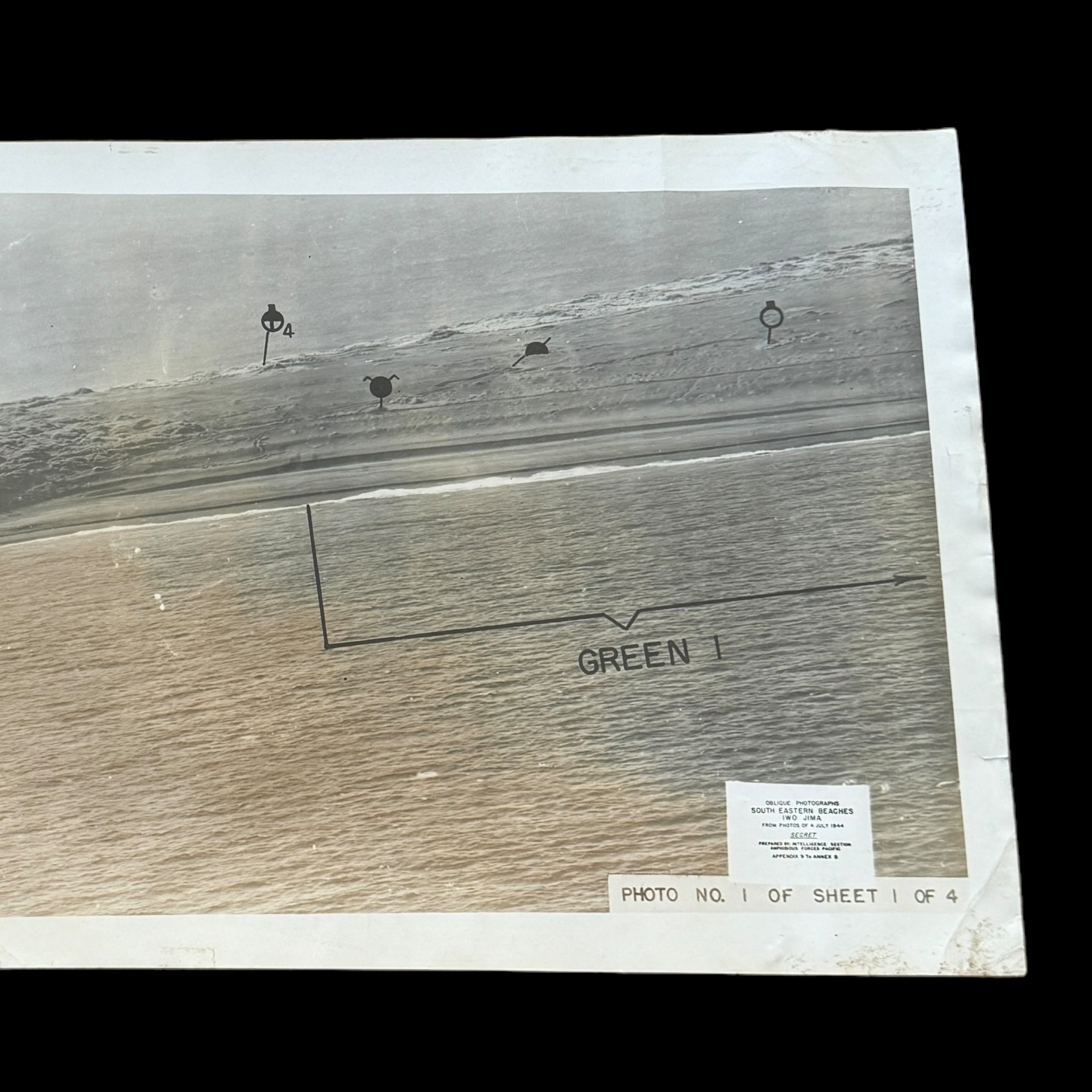


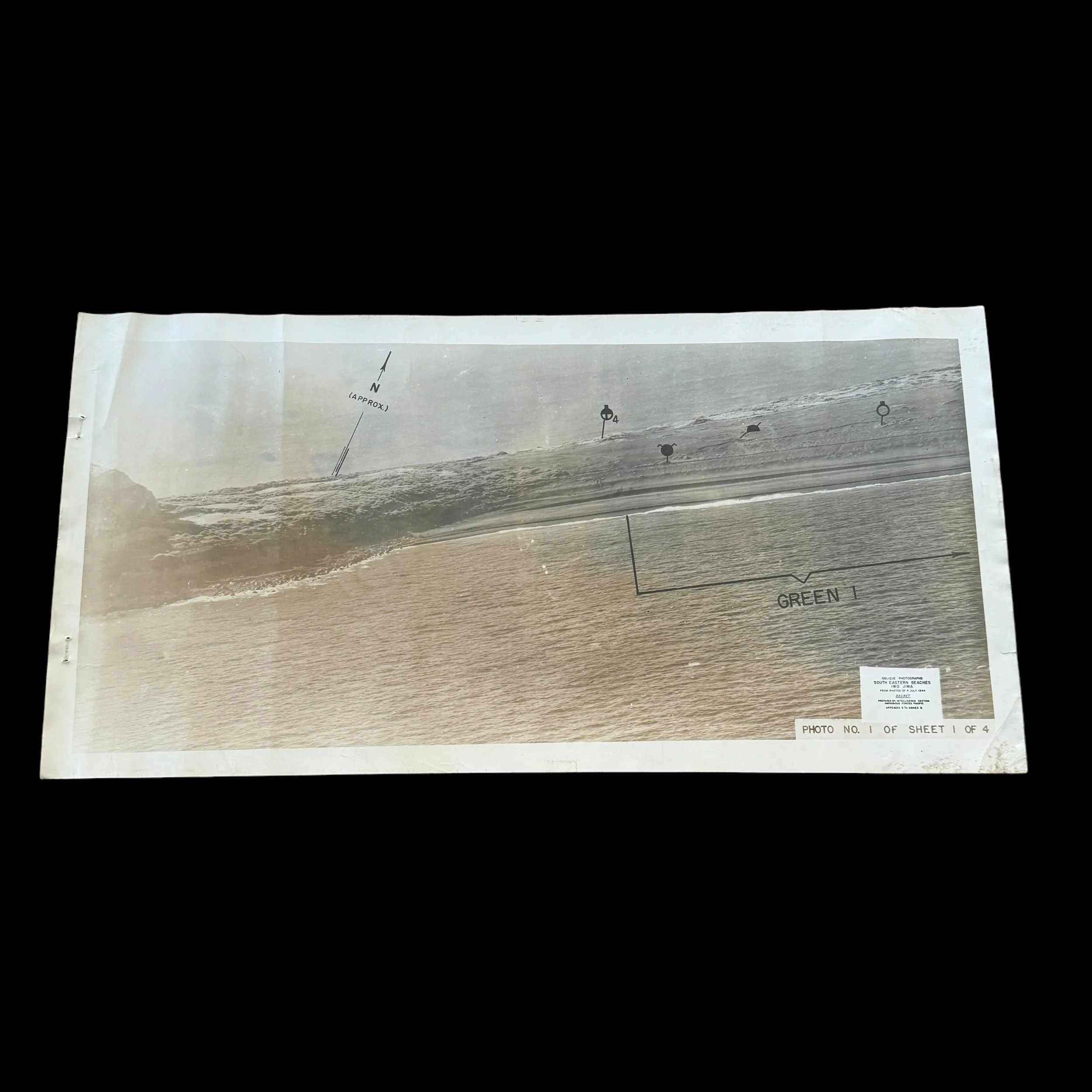


EXTREMELY RARE! WWII D-Day "SECRET" Battle of Iwo Jima GREEN 1 Beach Invasion Defense Diagram South Eastern Beaches Iwo Jima
Comes with a hand-signed C.O.A.
*Rarity: Due to the SECRET marking on this D-Day Iwo Jima invasion chart only a very limited number were produced before the invasion with only a small handful still believed to exist today with most being in high-end private museum collections. This Iwo Jima invasion beach chart is as rare and sought after as the TOP SECRET D-Day invasion of Normandy BIGOT maps and the SECRET Iwo Jima Beach Diagram maps. Two of the Iwo Jima diagrams were featured in an episode of the TV show Pawn Stars. Rick Harrison, the host of the show, wrote that he had sold one of the two views for $10,000.
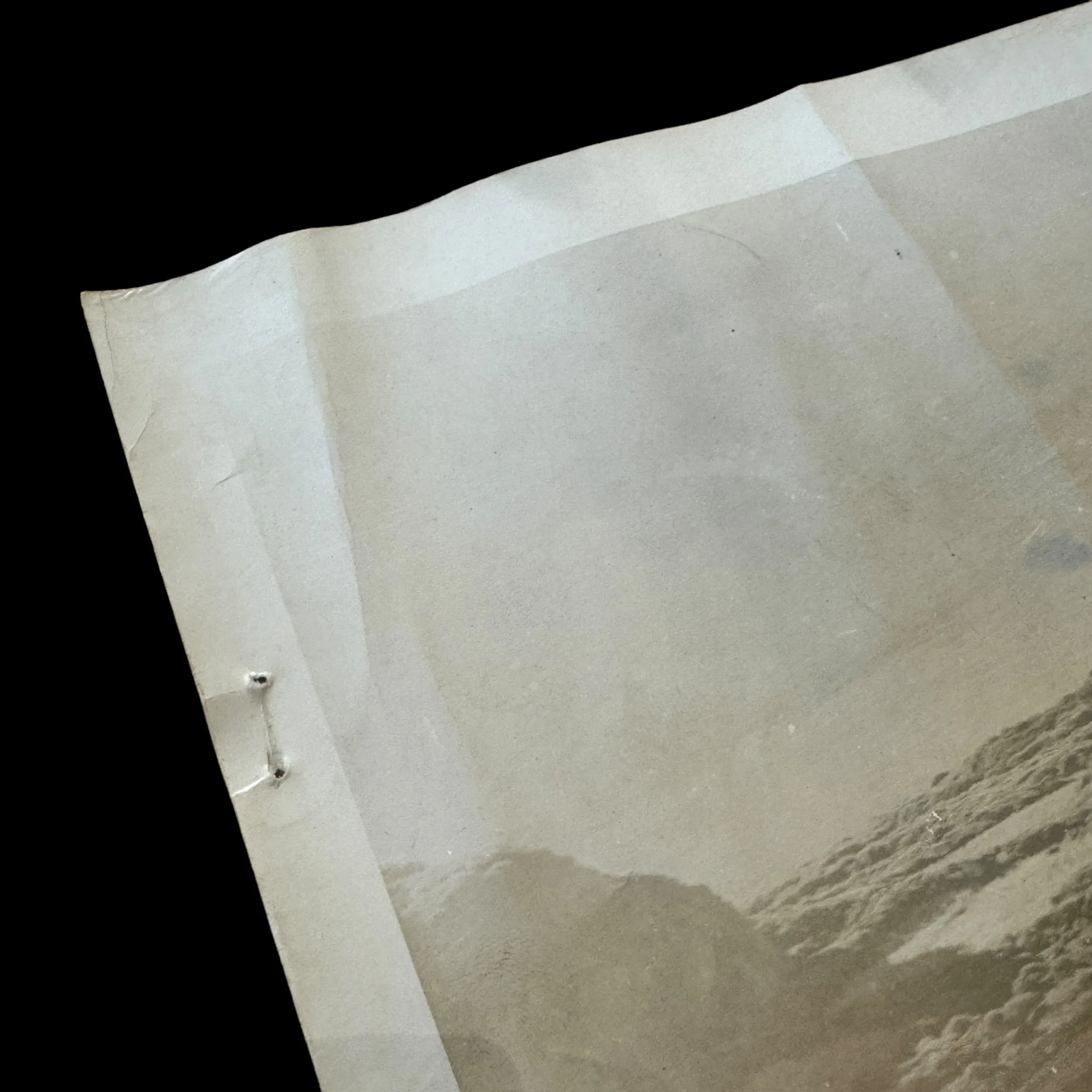
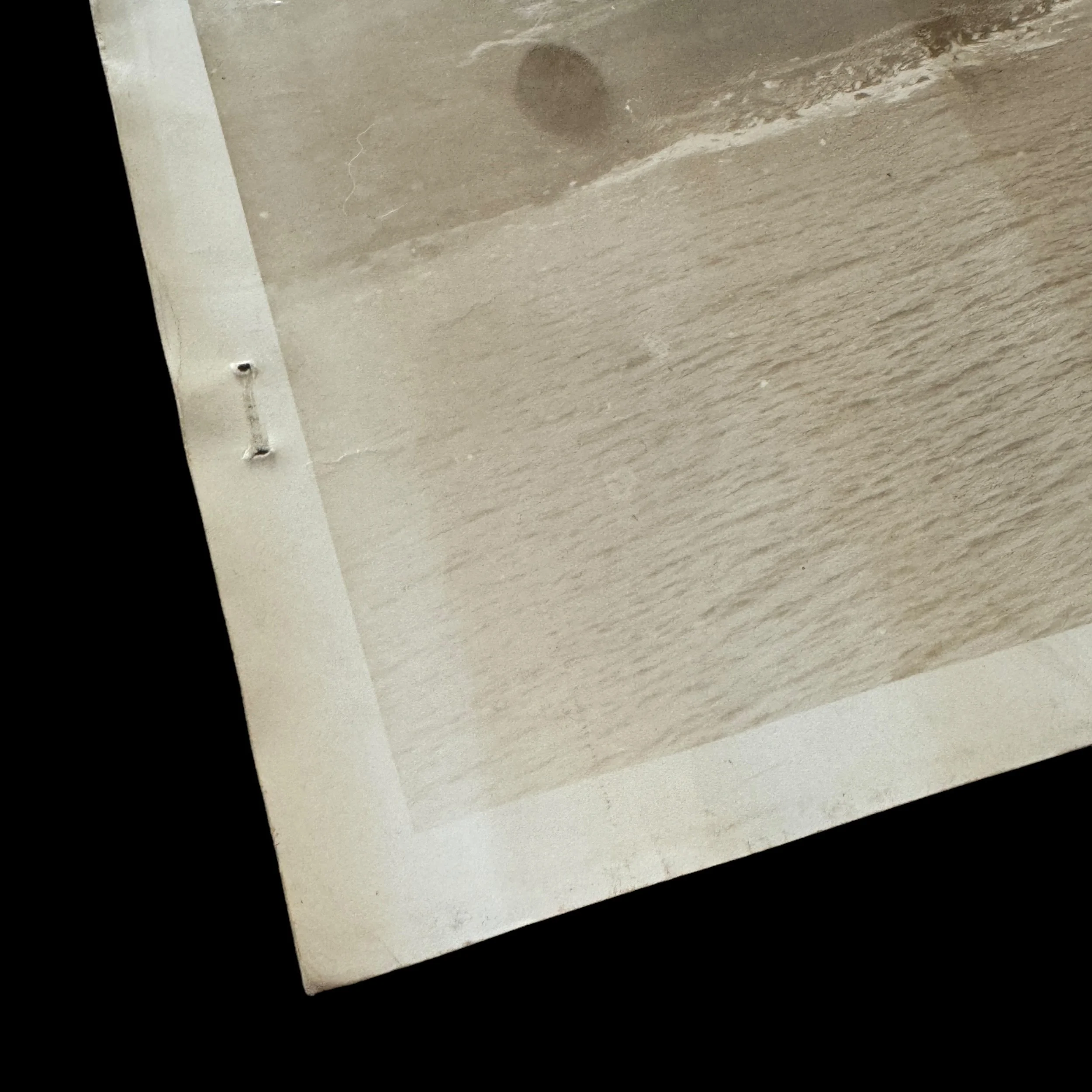
Size: 10 x 19.75 inches
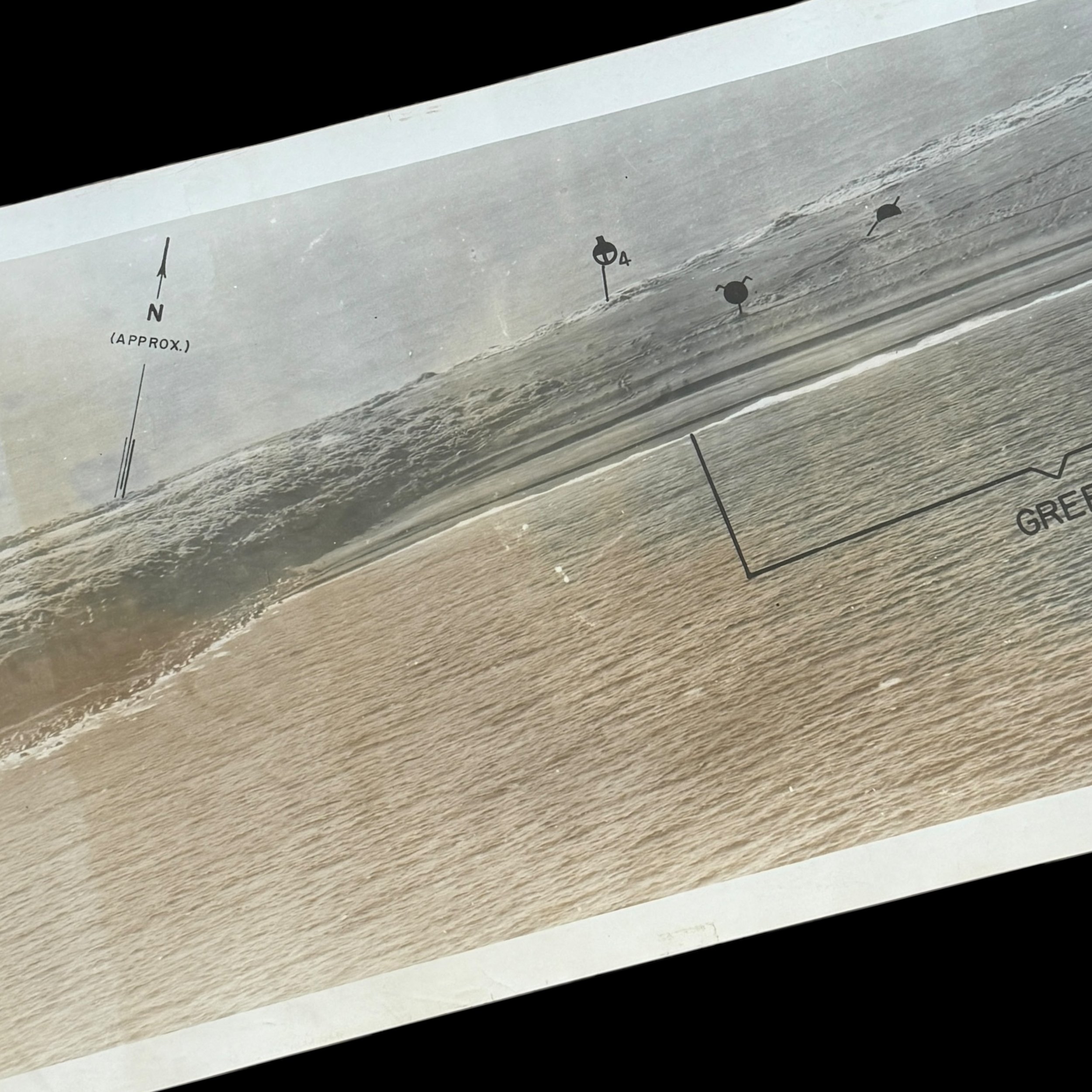
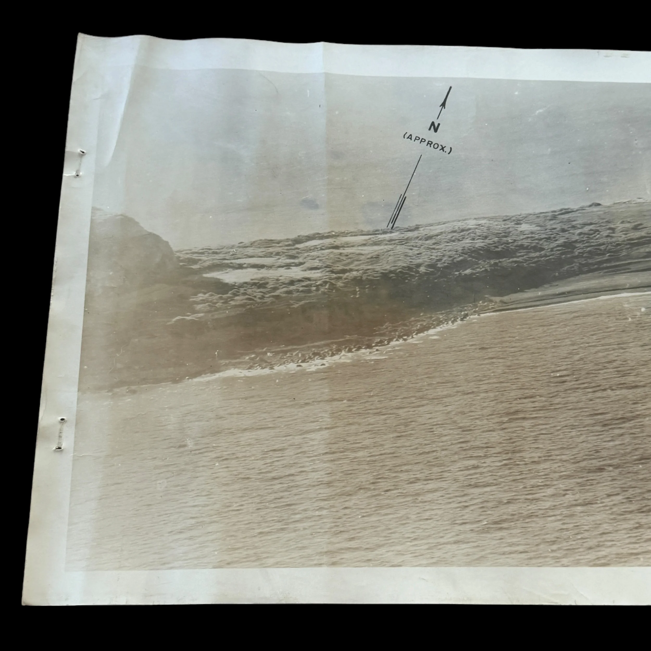
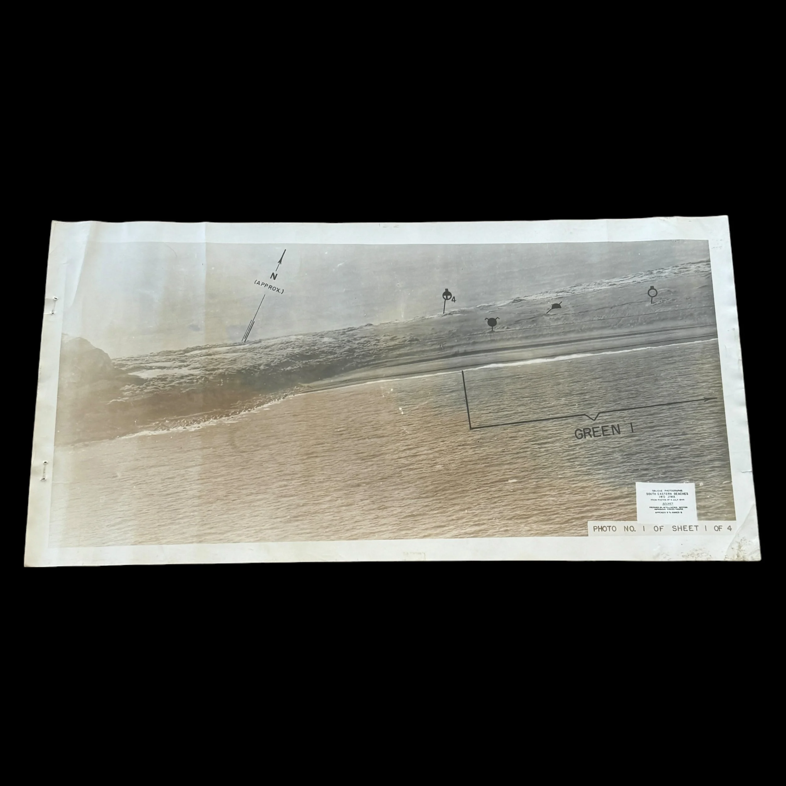
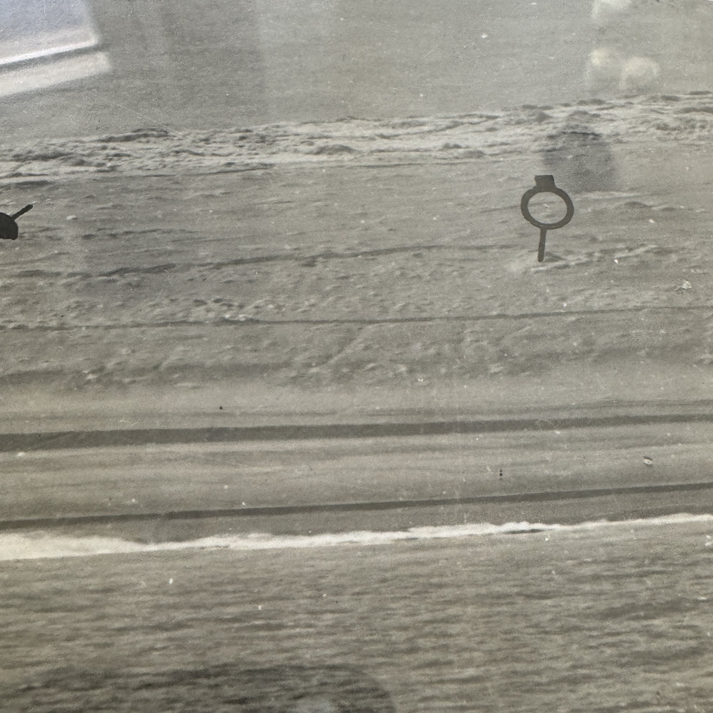
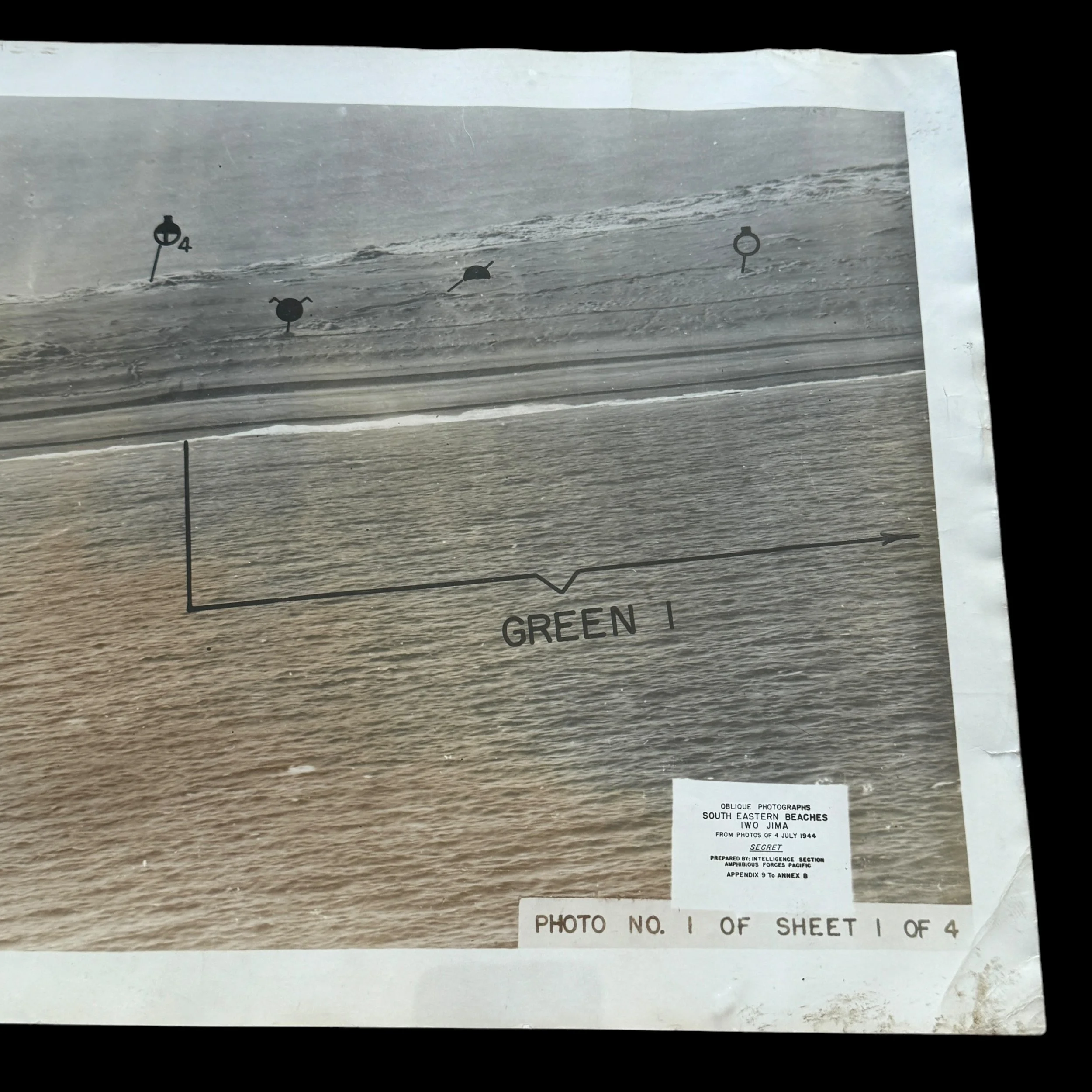
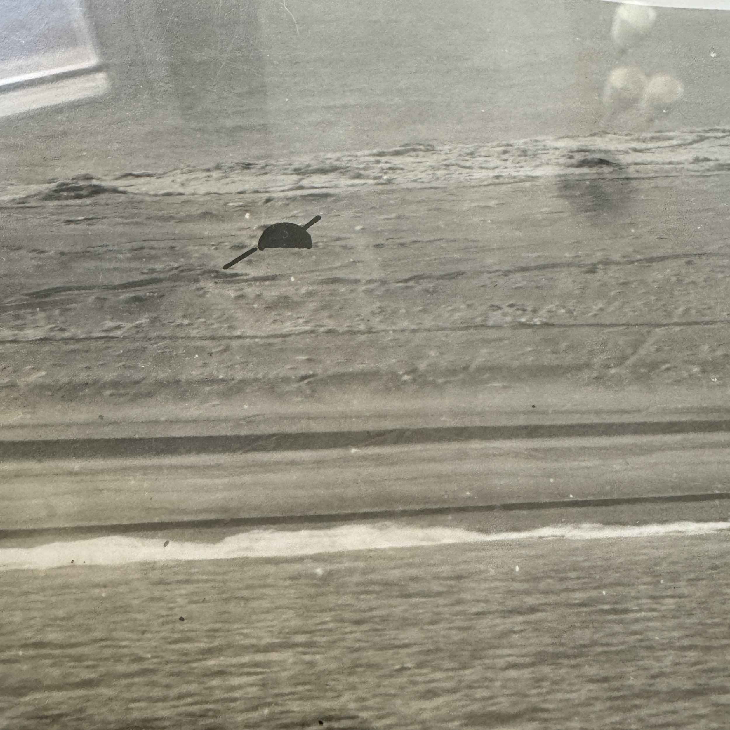
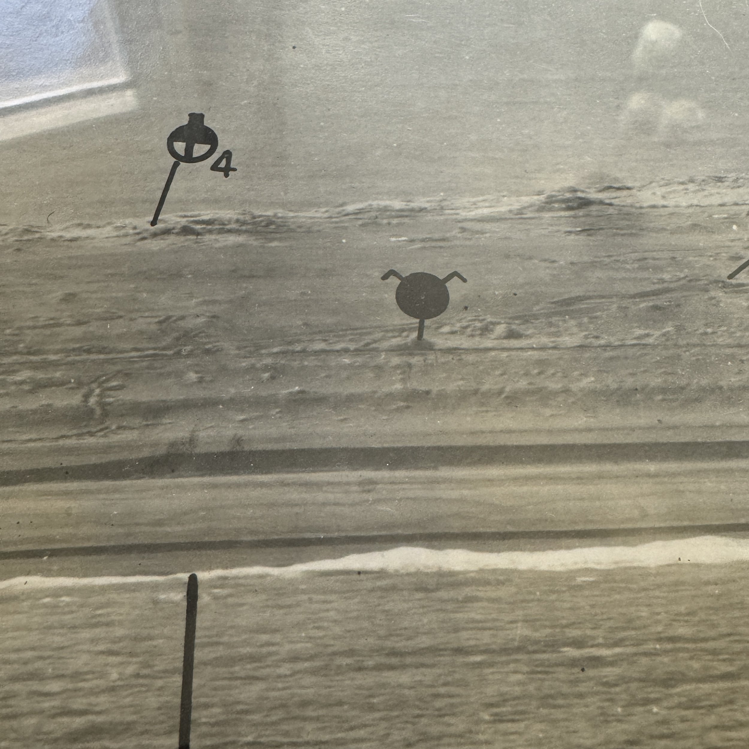
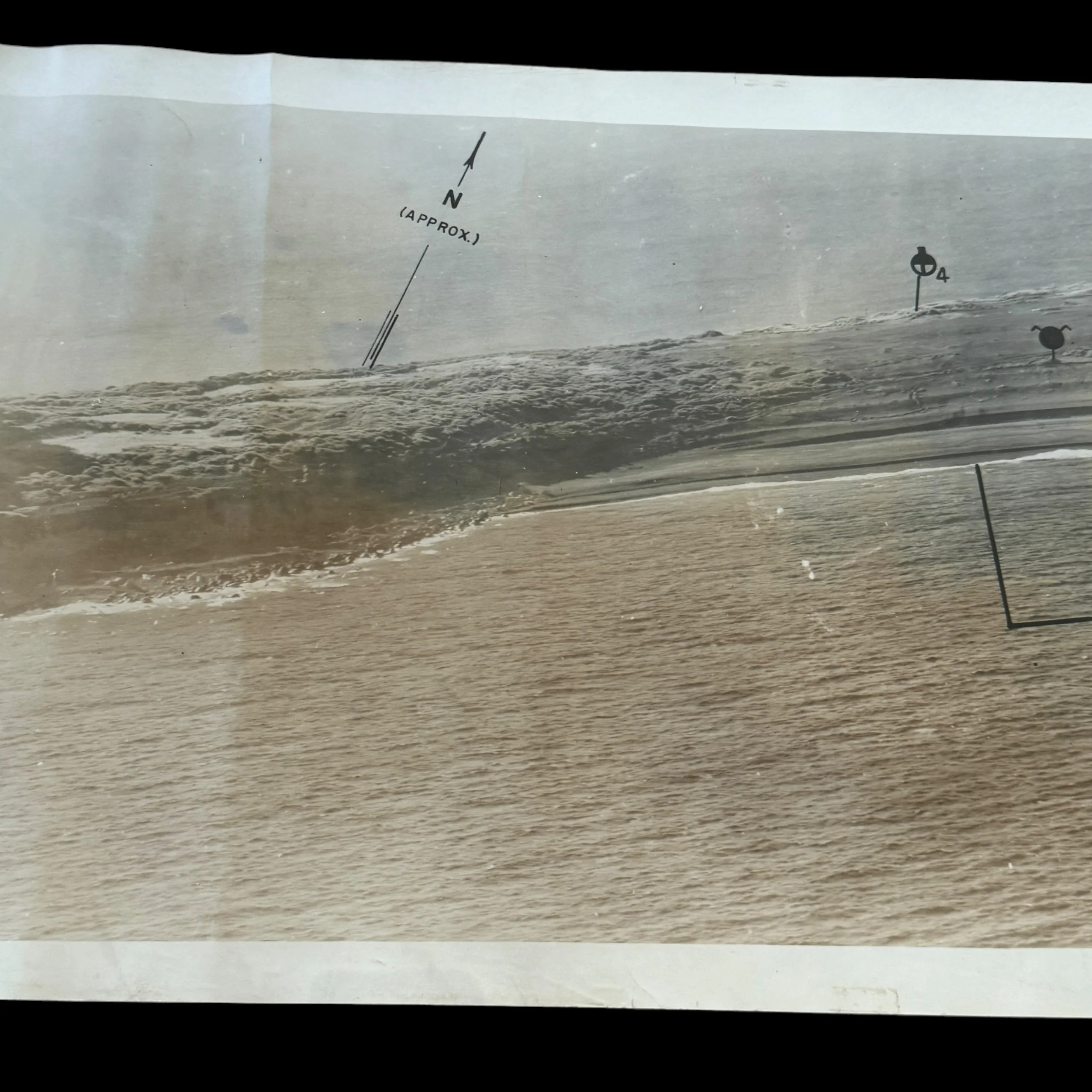
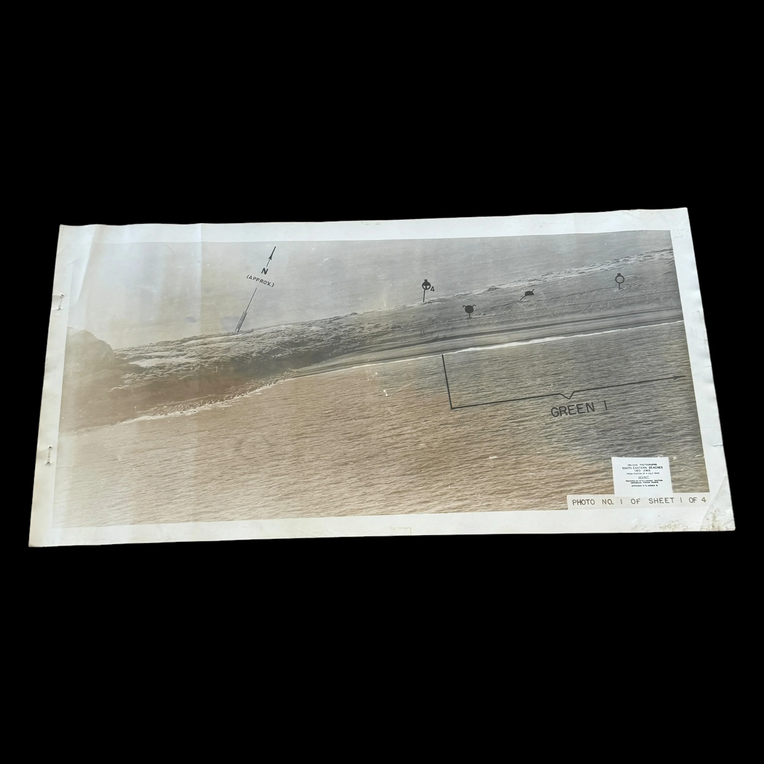
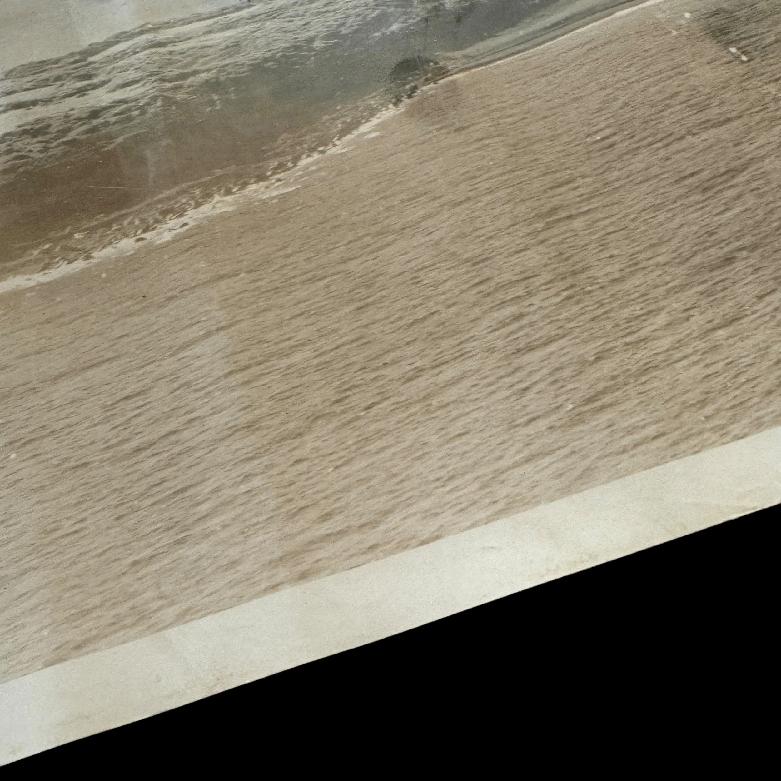
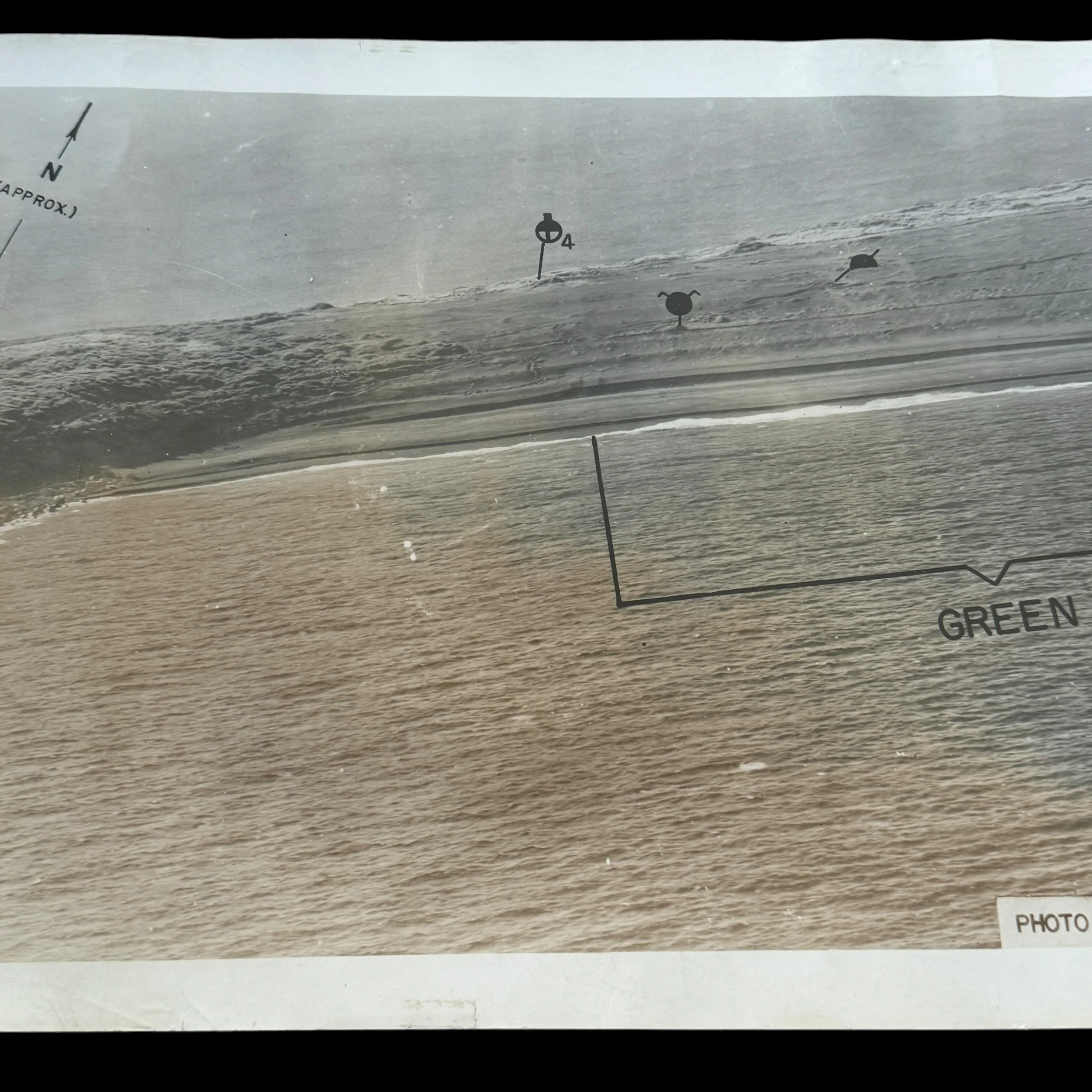
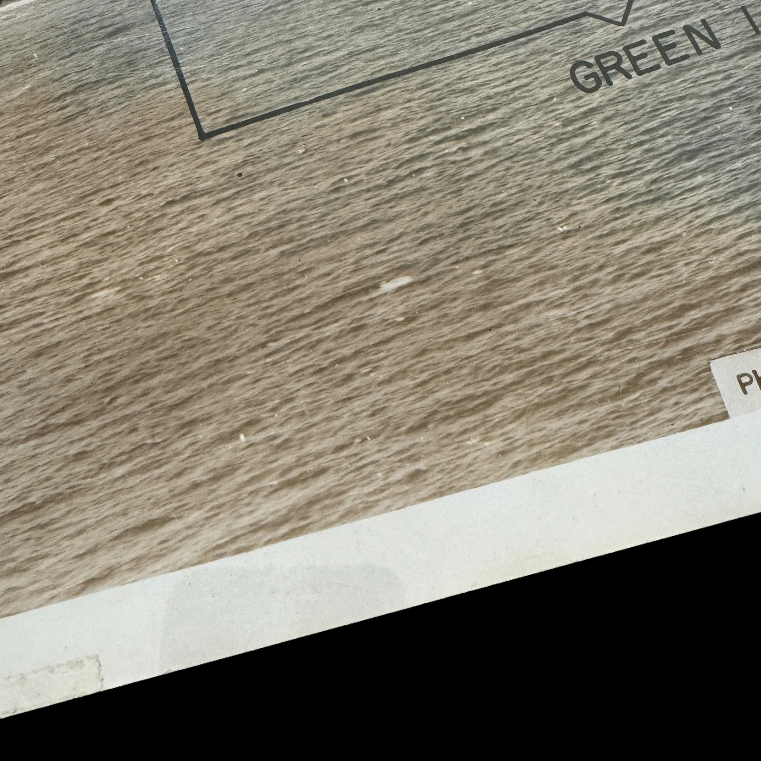
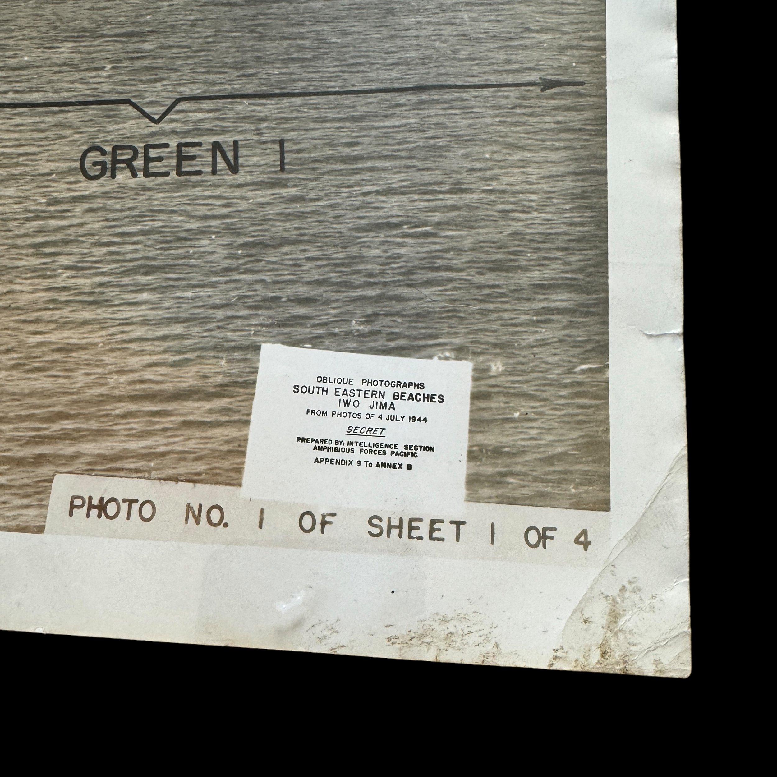
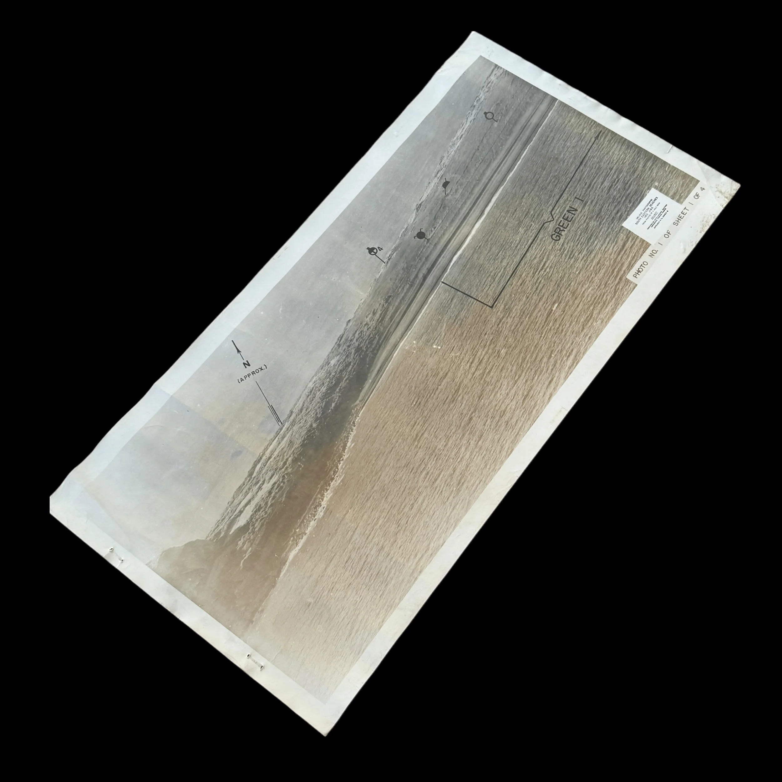
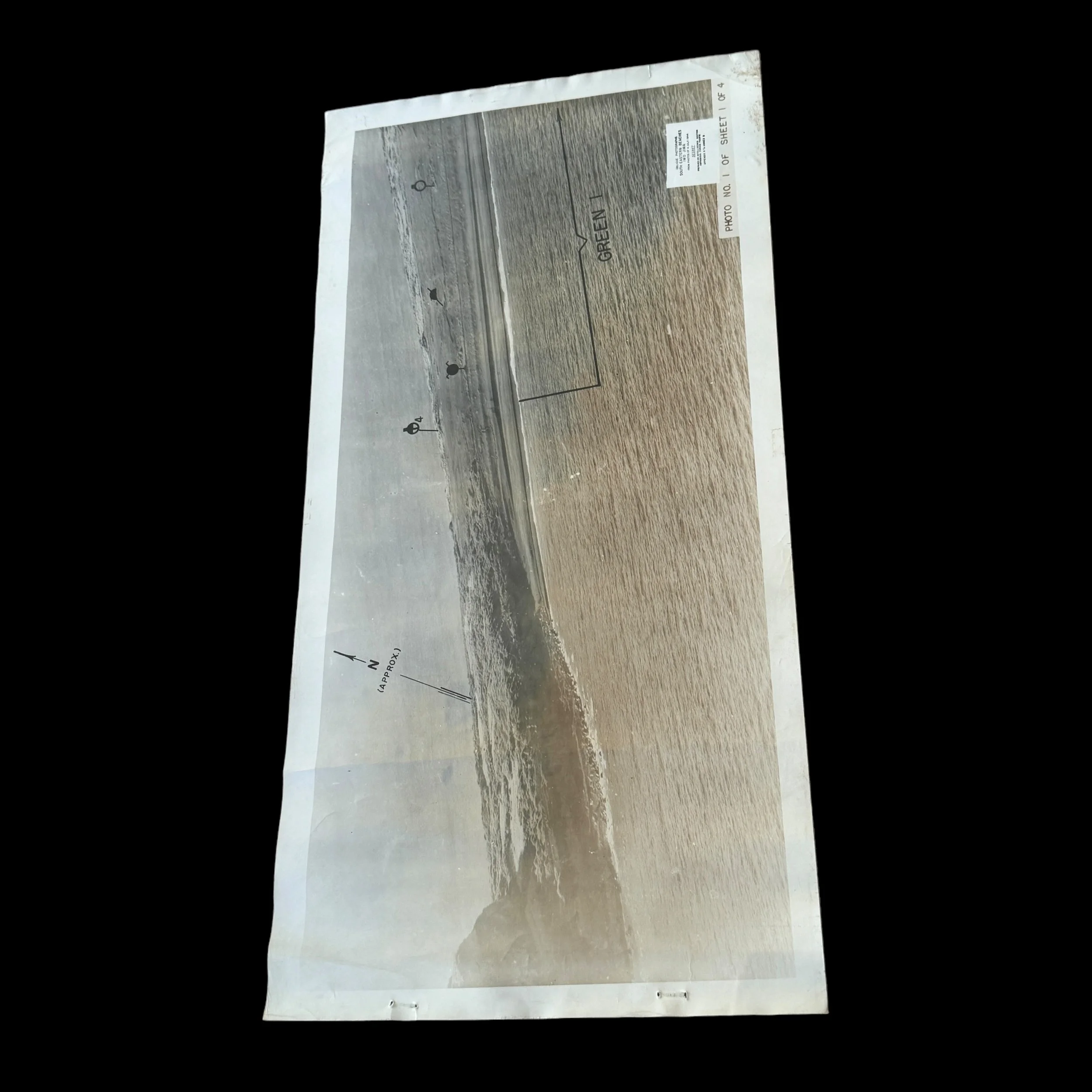
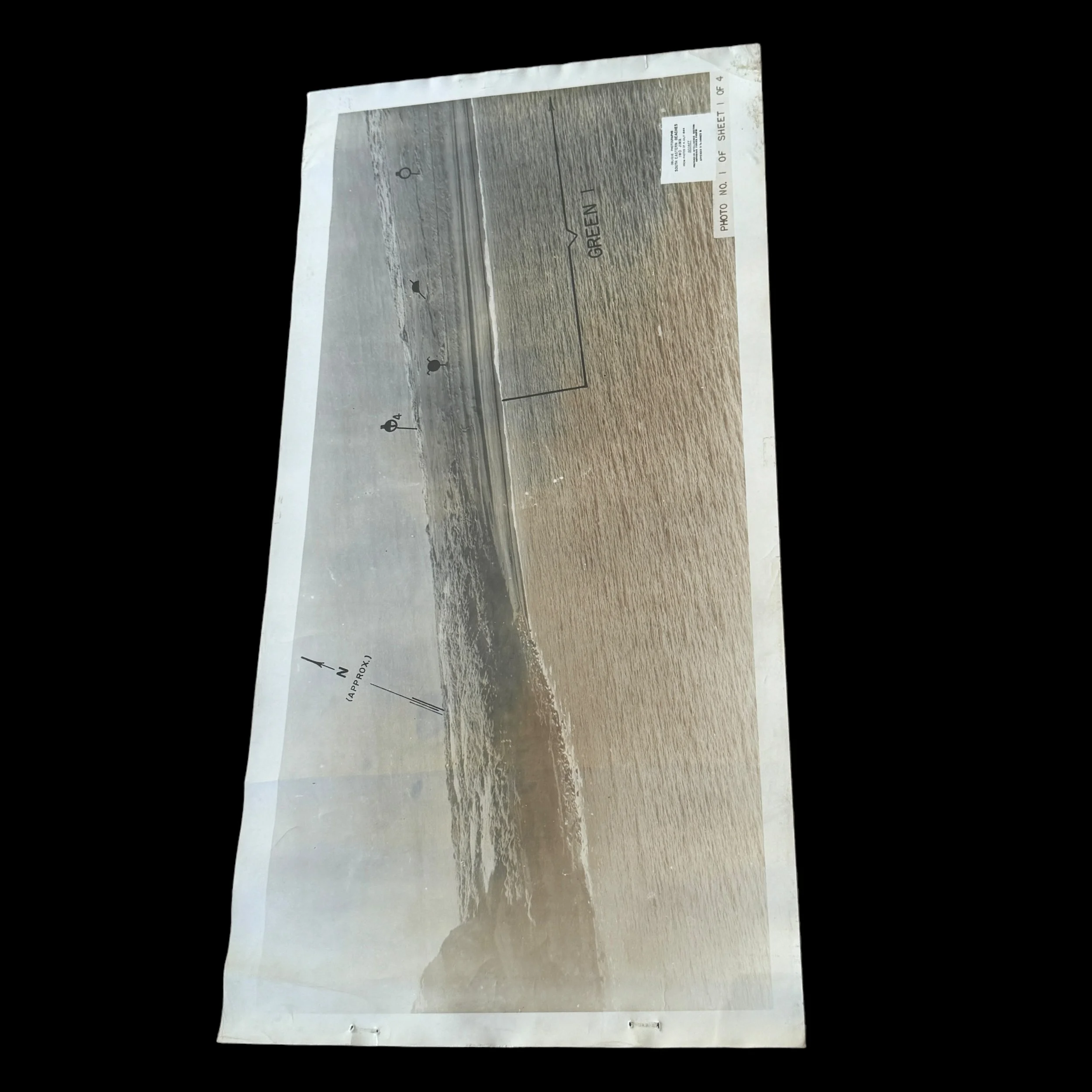
Green Beach (Green 1)
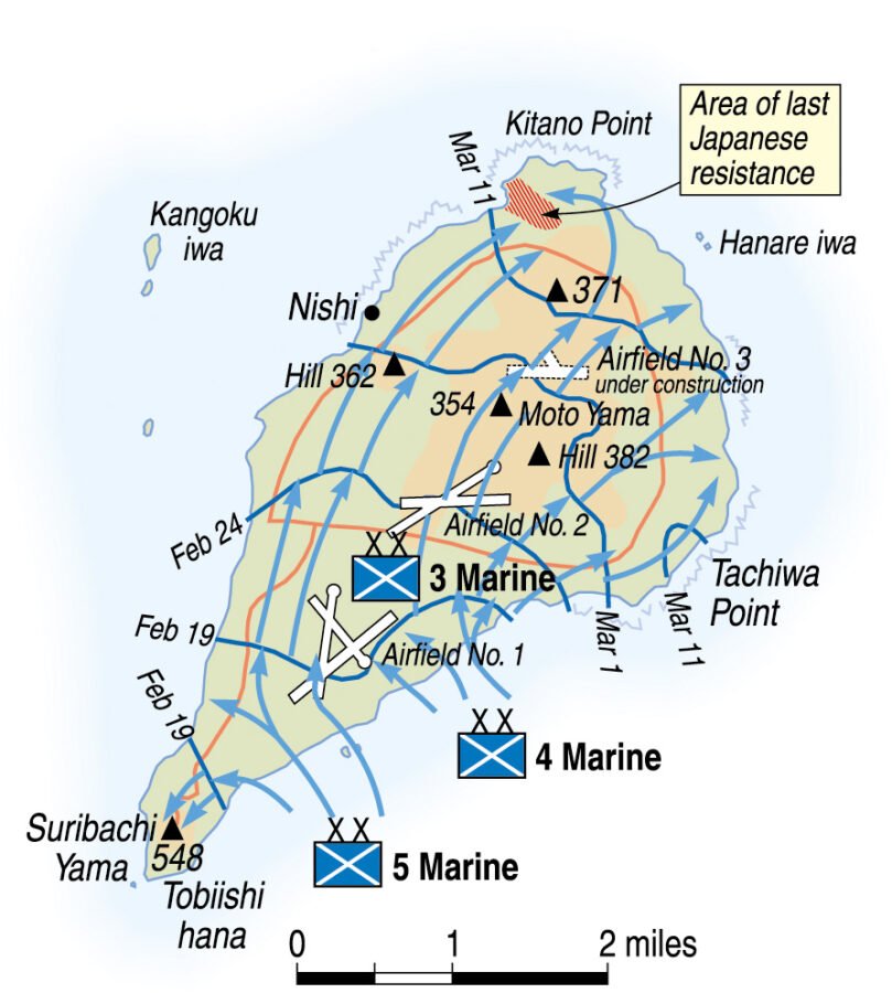
Location: The Green Beach zone was located on the extreme left (southwestern end) of the landing area, right at the base of Mount Suribachi.
Assigned Units: The 28th Marine Regiment, 5th Marine Division, was assigned to land on Green Beach.
Objective: The primary objective for the Marines landing on Green Beach was to isolate Mount Suribachi from the rest of the island by cutting off the narrow neck of land connecting it to the central part of Iwo Jima. This was crucial to preventing Japanese forces on the mountain from reinforcing other parts of the island.
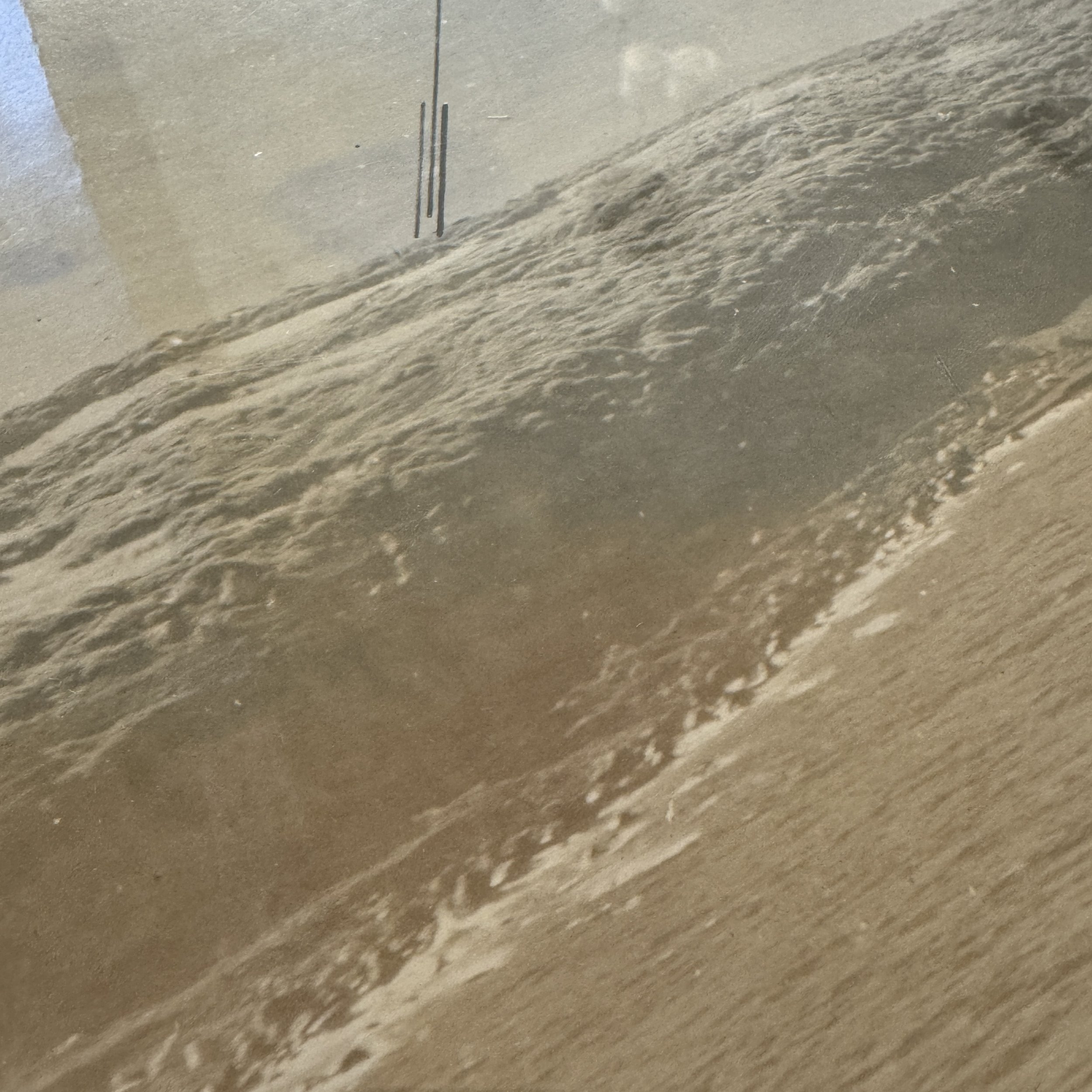
Challenges: Green Beach was heavily defended by Japanese artillery and machine-gun positions on Mount Suribachi. The black volcanic sand made movement difficult, and the steep incline toward the mountain posed additional challenges.
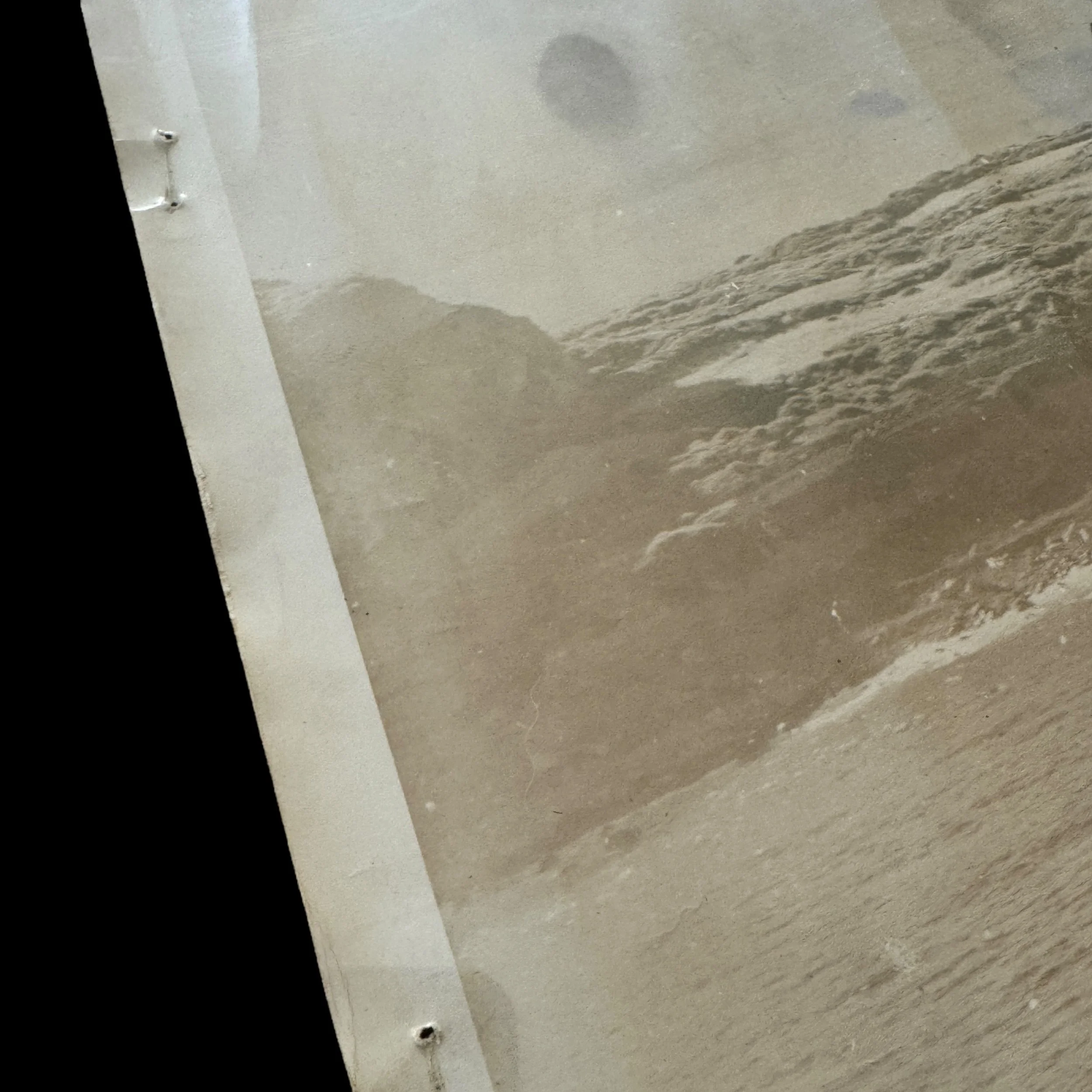
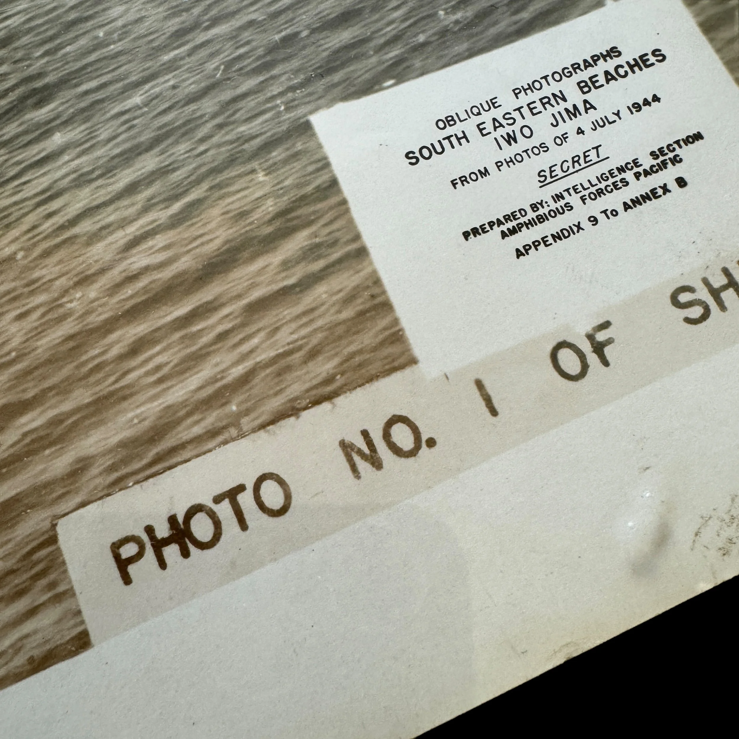
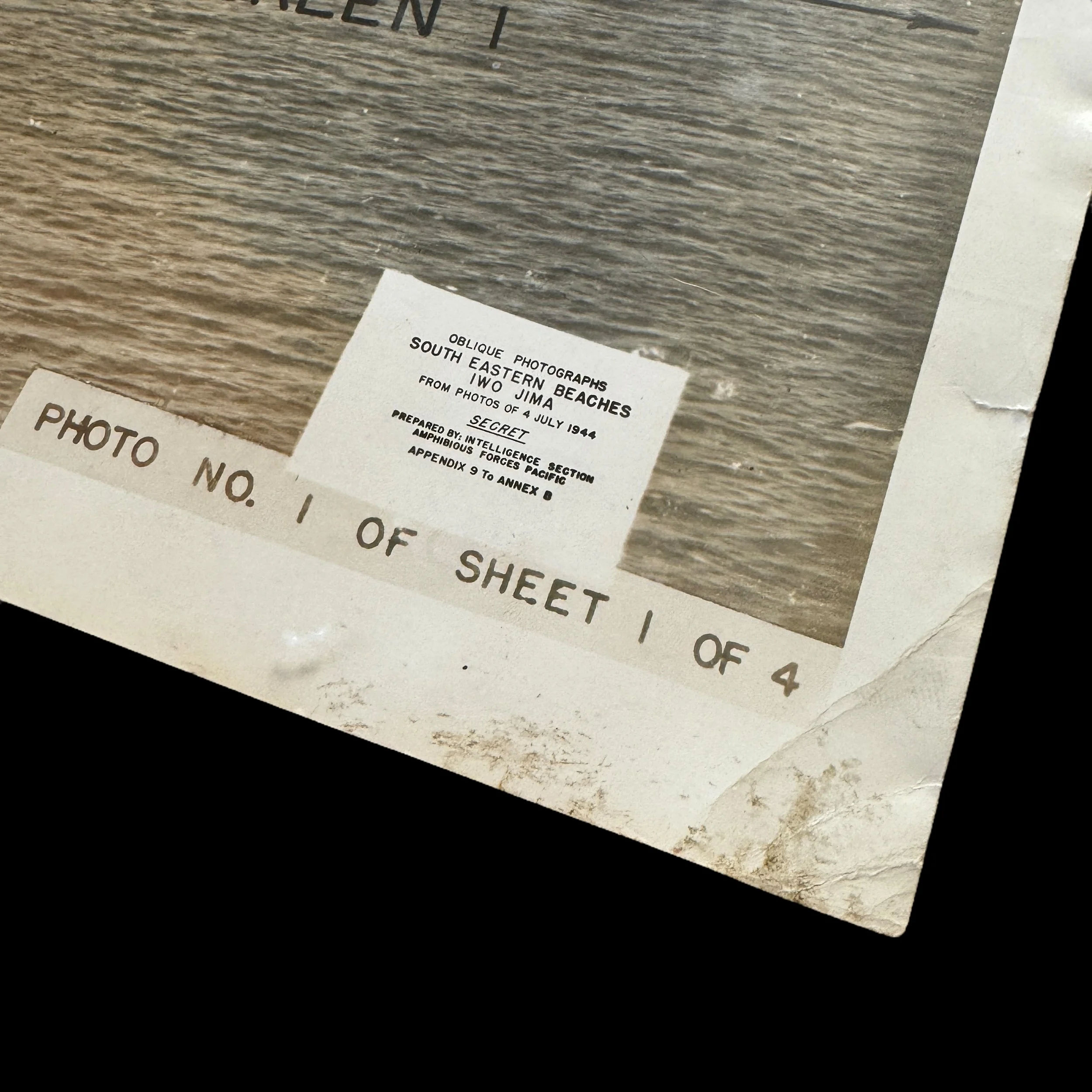
This extremely rare and museum-grade "SECRET" marked WWII Battle of Iwo Jima D-Day amphibious beach diagram vividly illustrates the intensive planning and operational accuracy that went behind Operation Detachment. Titled "Oblique Photographs - South Eastern Beaches Iwo Jima" this original SECRET Iwo Jima D-Day beach diagram was prepared by the Intelligence Section Amphibious Forces Pacific only a few months before the D-Day invasion of Iwo Jima in February 1945. These Iwo Jima invasion beach diagrams were studied and used by Captains of Landing Craft Infantry (LCI) and the initial waves of U.S. Marines set to land on their designated black sand beachheads. These invasion maps were vital to the initial landing success as they not only showed the visual views for the designated beachheads, but they also noted all of the updated Japanese defenses on Iwo Jima near that designated landed sector.
This SECRET Iwo Jima D-Day amphibious beach diagram was the original intelligence document used to make the infamous SECRET Iwo Jima invasion map. These were the Iwo Jima invasion intelligence documents used to make that exact map.
It shows little in the way of manmade impediments to amphibious invasion, belying the extensive Japanese fortifications and the dogged resistance that the Marines would face from the roughly 20,000 defenders. Eschewing Japanese doctrine, which called for him to contest every inch of the landing beaches, the commanding Lieutenant General Tadamichi Kuribayashi instead instructed his soldiers to allow the American forces to land en masse, before springing traps to kill as many newly-landed troops as possible.
American planners also misunderstood the nature of the volcanic sand and terrain of the beaches, most of which was thought to be perfectly suitable for disembarking and traversing. In these diagrams, little mention is made of the softness of this sand, and few obstacles are listed. In reality, the ash was very difficult to traverse, and equally difficult to dig into, greatly complicating the unloading of equipment and vehicles and the excavation of foxholes and trenches.
These errors were symptomatic of a general lack of accurate pre-invasion intelligence, which ultimately cost hundreds, even thousands of American lives.
The Role of Oblique Photograph Secret Invasion Beach Diagram Maps:
In preparation for the invasion of Iwo Jima, the U.S. military recognized the need for detailed and accurate intelligence about the island's topography and Japanese defenses. Traditional vertical aerial photographs, while useful, were insufficient for the task at hand due to the unique challenges posed by the island's terrain. Instead, the U.S. military employed oblique aerial photography, which involved taking photographs from an angle, rather than directly overhead. These oblique photographs provided a more realistic and three-dimensional view of the terrain, revealing details that would be obscured in vertical images.
The oblique photographs were used to create secret invasion beach diagram maps, which were crucial for planning the amphibious assault. These maps provided a detailed view of the landing beaches, the terrain beyond, and the Japanese defenses. They allowed the planners to identify potential obstacles, such as sandbars, reefs, and cliffs, as well as the locations of enemy fortifications. This intelligence was vital for selecting the best landing sites and determining the sequence and timing of the assault waves.
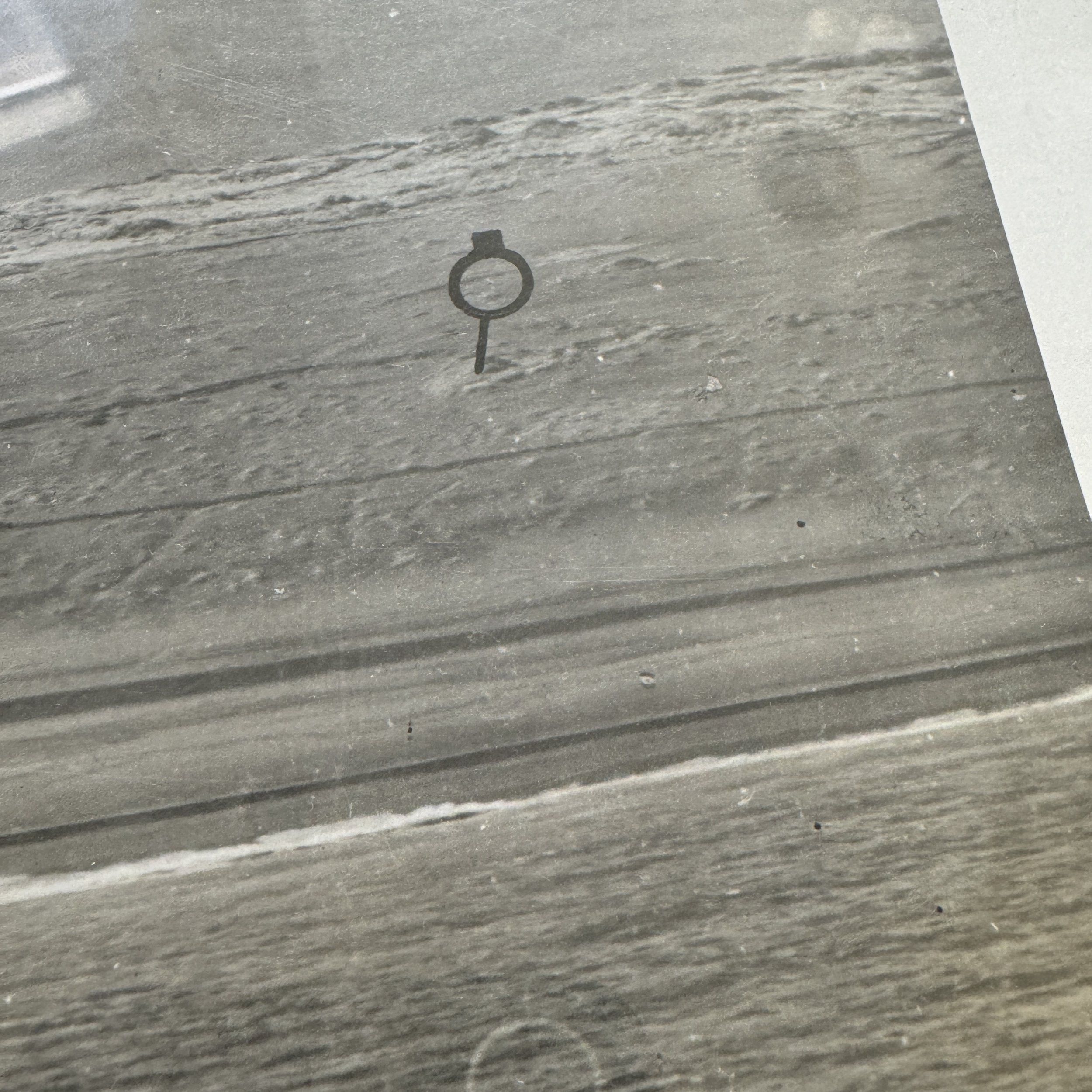
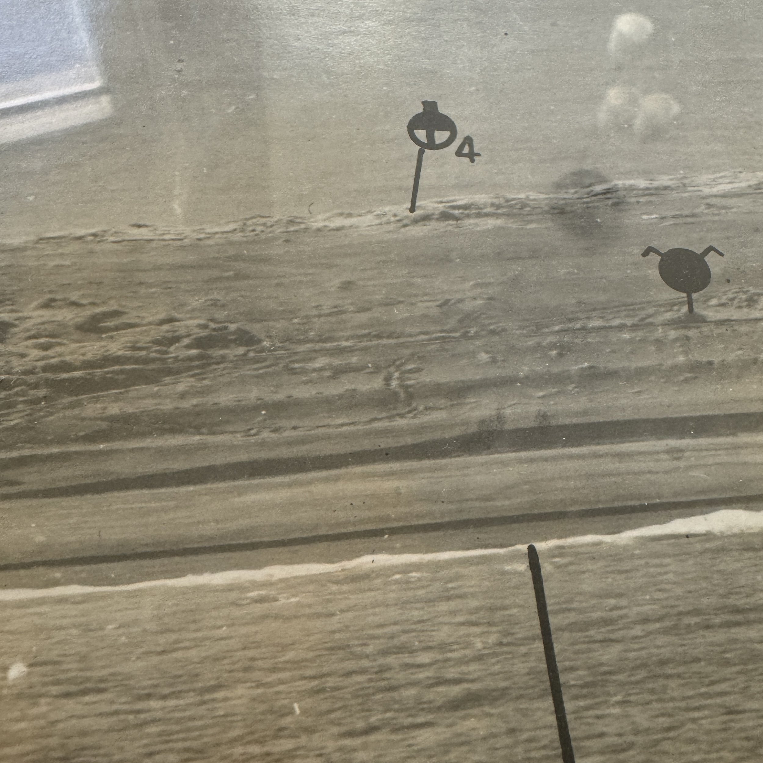
One of the most critical aspects of the oblique photograph maps was their ability to reveal the positions of Japanese bunkers, pillboxes, and artillery emplacements. The Japanese had gone to great lengths to conceal their defenses, camouflaging them and integrating them into the natural terrain. The oblique photographs, however, exposed subtle variations in the landscape that indicated the presence of these hidden fortifications. This information allowed the U.S. forces to target these positions with pre-invasion bombardments and to plan the movement of assault troops to avoid the most heavily defended areas.
The Invasion of Iwo Jima:
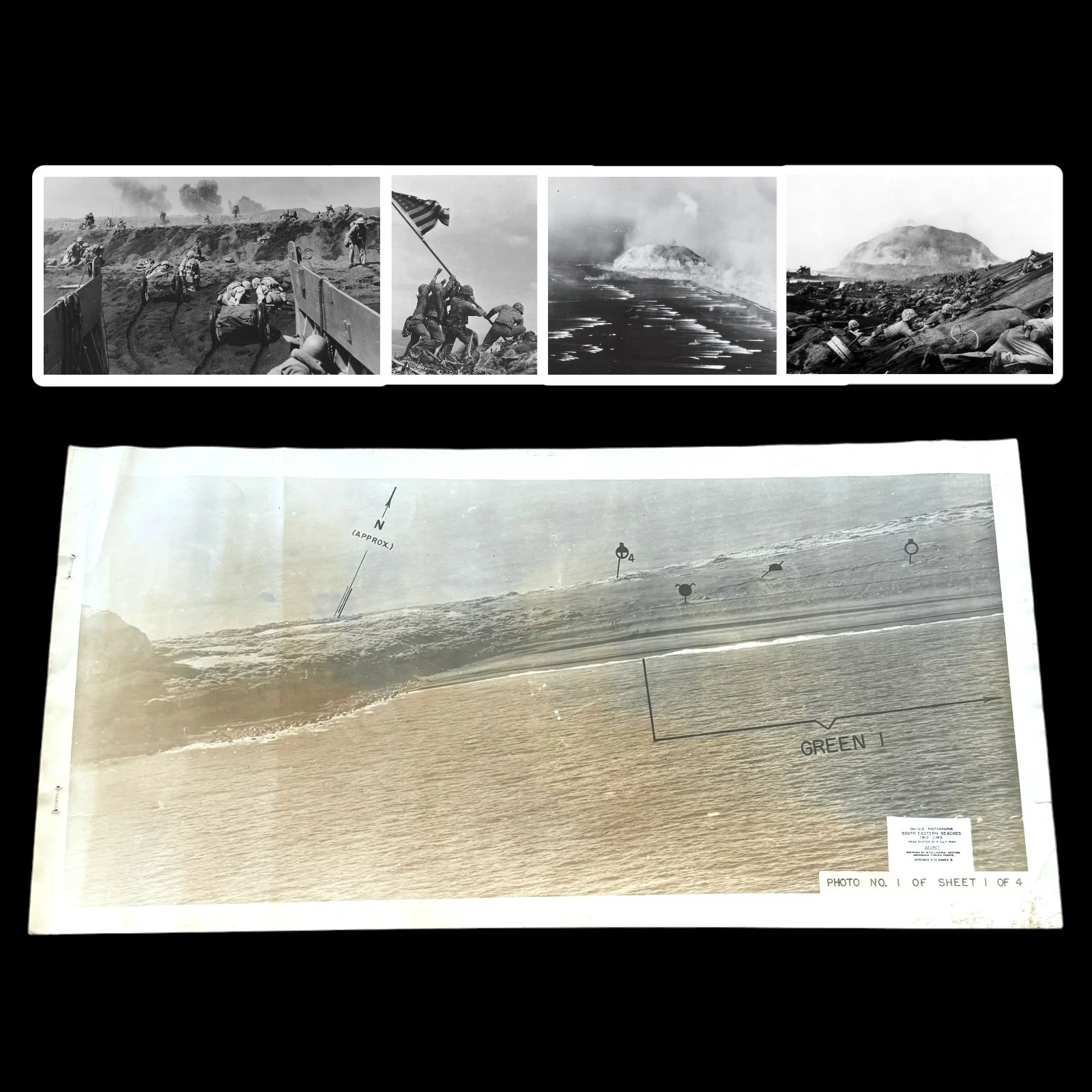
On February 19, 1945, the invasion of Iwo Jima commenced with one of the most intense pre-assault bombardments of the war. Naval and aerial bombardments targeted the island for several days, focusing on known Japanese positions identified through the oblique photograph maps. Despite this bombardment, many Japanese defenses remained intact, as they were deeply embedded in the island's volcanic rock.
The first wave of U.S. Marines landed on the southeastern beaches of Iwo Jima at 8:59 AM on February 19. The black volcanic sand made movement difficult, and the Marines quickly found themselves bogged down under heavy fire from Japanese artillery, machine guns, and mortars. The Japanese had allowed the initial waves to land almost unopposed, waiting until the beaches were crowded with men and equipment before unleashing a devastating counterattack.
The oblique photograph maps proved invaluable during this chaotic phase of the battle. Marine commanders used these maps to coordinate their movements, directing their forces toward less heavily defended areas and avoiding known kill zones. The maps also helped in directing naval gunfire and airstrikes against Japanese strongpoints that were holding up the advance.
As the battle progressed, the Marines faced the daunting task of advancing inland through a maze of bunkers, tunnels, and pillboxes. The oblique photograph maps continued to serve as a critical tool for identifying enemy positions and planning attacks. The detailed topographical information provided by the maps allowed the Marines to devise tactics for assaulting the Japanese defenses, such as using flamethrowers and demolition charges to clear bunkers and using tanks to provide direct fire support.
The fighting on Iwo Jima was brutal and relentless, with both sides suffering heavy casualties. The Japanese, true to their strategy, fought tenaciously from their fortified positions, inflicting severe losses on the Americans. The U.S. forces, however, continued to press forward, using their superior numbers, firepower, and intelligence to gradually overcome the Japanese defenses.
The iconic moment of the battle came on February 23, 1945, when a group of Marines from the 2nd Battalion, 28th Marines, raised the American flag atop Mount Suribachi. This moment, captured in the famous photograph by Joe Rosenthal, symbolized the eventual victory of the U.S. forces, but the battle was far from over. The fighting continued for several more weeks, as the Marines methodically cleared the remaining Japanese positions in the northern part of the island.
The Battle of Iwo Jima was one of the most grueling and costly battles of World War II, resulting in the deaths of nearly 7,000 U.S. Marines and the almost complete annihilation of the Japanese garrison. The victory, however, was of immense strategic importance, providing the U.S. with a critical base for air operations against Japan and marking a significant step toward the eventual defeat of the Japanese Empire.
The use of oblique photograph secret invasion beach diagram maps was a key factor in the success of the invasion. These maps provided the U.S. forces with the detailed and accurate intelligence needed to overcome the formidable defenses of Iwo Jima. They allowed the planners to devise a strategy that minimized casualties and maximized the effectiveness of the assault, ultimately contributing to the hard-won victory. The Battle of Iwo Jima, and the innovative use of intelligence and technology that characterized it, remains a powerful example of the complexity and the human cost of war.