VERY RARE! WWII Operation Iceberg April 1945 B-29 Navigator XXI Bomber Command OKINAWA Target Air Raid Mission Target Photo Map


VERY RARE! WWII Operation Iceberg April 1945 B-29 Navigator XXI Bomber Command OKINAWA Target Air Raid Mission Target Photo Map
Comes with hand-signed C.O.A.
These XXI Bomber Command target photo maps rarely come up for sale in the public sector. This is a once in a timeline chance to own a piece of B-29 WWII history.
In April 1945, the XXI Bomber Command shifted its attention from major enemy cities to airfields in Kyushu. From there, suicidal Japanese kamikazes launched deadly ramming attacks against the U.S. fleet during the invasion of Okinawa (Operation Iceberg). Okinawa in the Ryukyu Islands was to be the home of new B–29 bases for the strategic bombardment of Japan. Between April 8 and May 11, 75 percent of XXI Bomber Command missions supported Iceberg. Regrettably, these airfield raids were not very effective because the enemy forces hid their fighters and quickly rebuilt the strips.
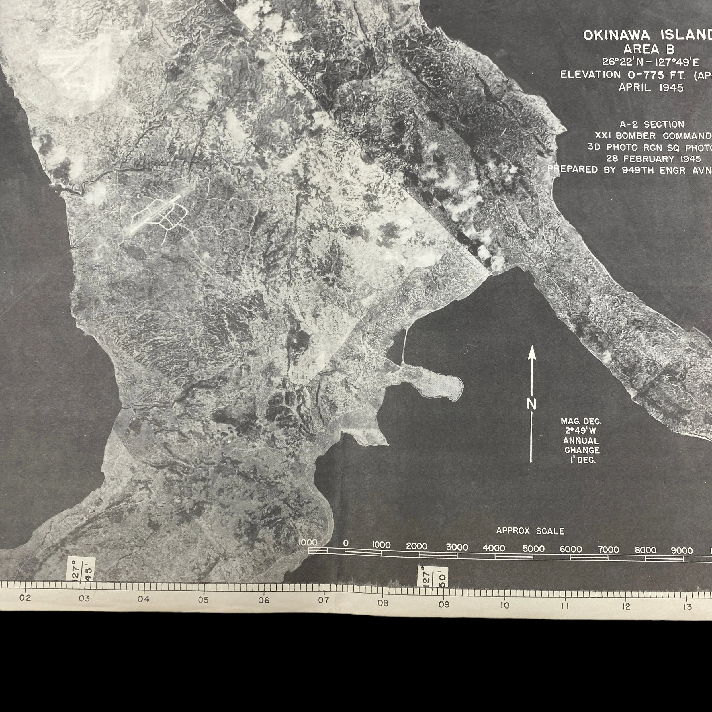
This incredibly scare and museum-grade ‘RESTRICTED’ WWII XXI Bomber Command (20th Air Force) TARGET AERIAL PHOTO MAP CHART was used during the USAAF long-range bombardment operations, against Japan until mid-July 1945. The XXI Bomber Command was headquartered at Harmon Field, Guam, in the Mariana Islands.
Dated April 1945 and titled “OKINAWA ISLAND AREA B”, this A-2 SECTION was produced in limited quantities with previous aerial reconnaissance mission photos by the 3rd Photo Reconnaissance Squadron taken on February 28th, 1945.
This navigators and bombardier aerial photo chart map was specifically creating using the most updated military intelligence in order to give B-29 Superfortress aircraft the most accurate target information. This was done for fast and effective target identification as well as accurate navigation and bomb/incendiary accuracy. These target photo charts were handed to B-29 crews during the target mission briefing and were then carried on the B-29 aircraft to used during the raid itself.
These aerial photo charts were referenced during pre-mission briefings as well as when the bombardier was approaching the target. This was meant to provide the B-29 bombardier with the most real view of his target for the best target identification. The most important primary target buildings were always outlined and marked with a number to be referenced on the target key.