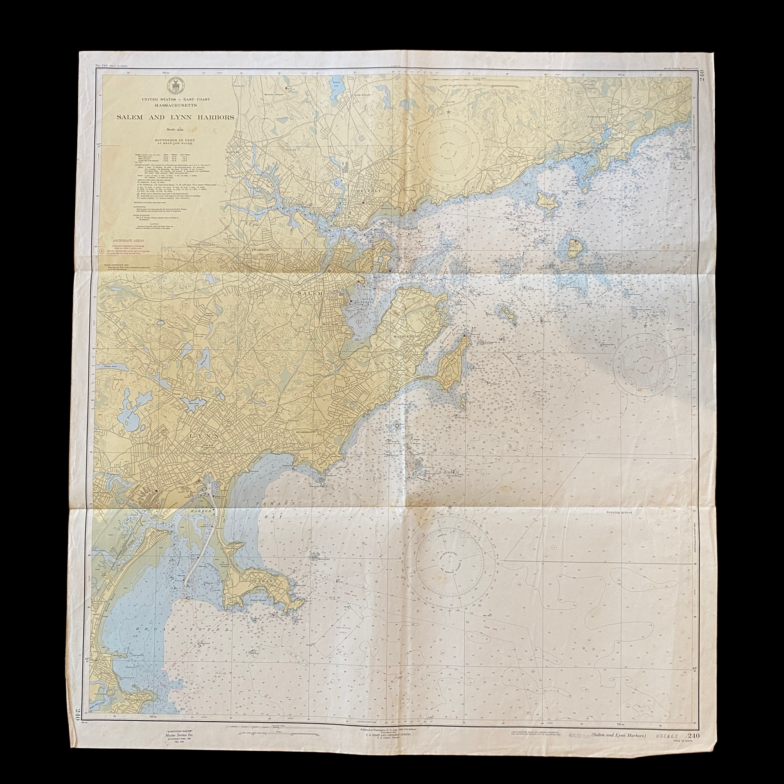
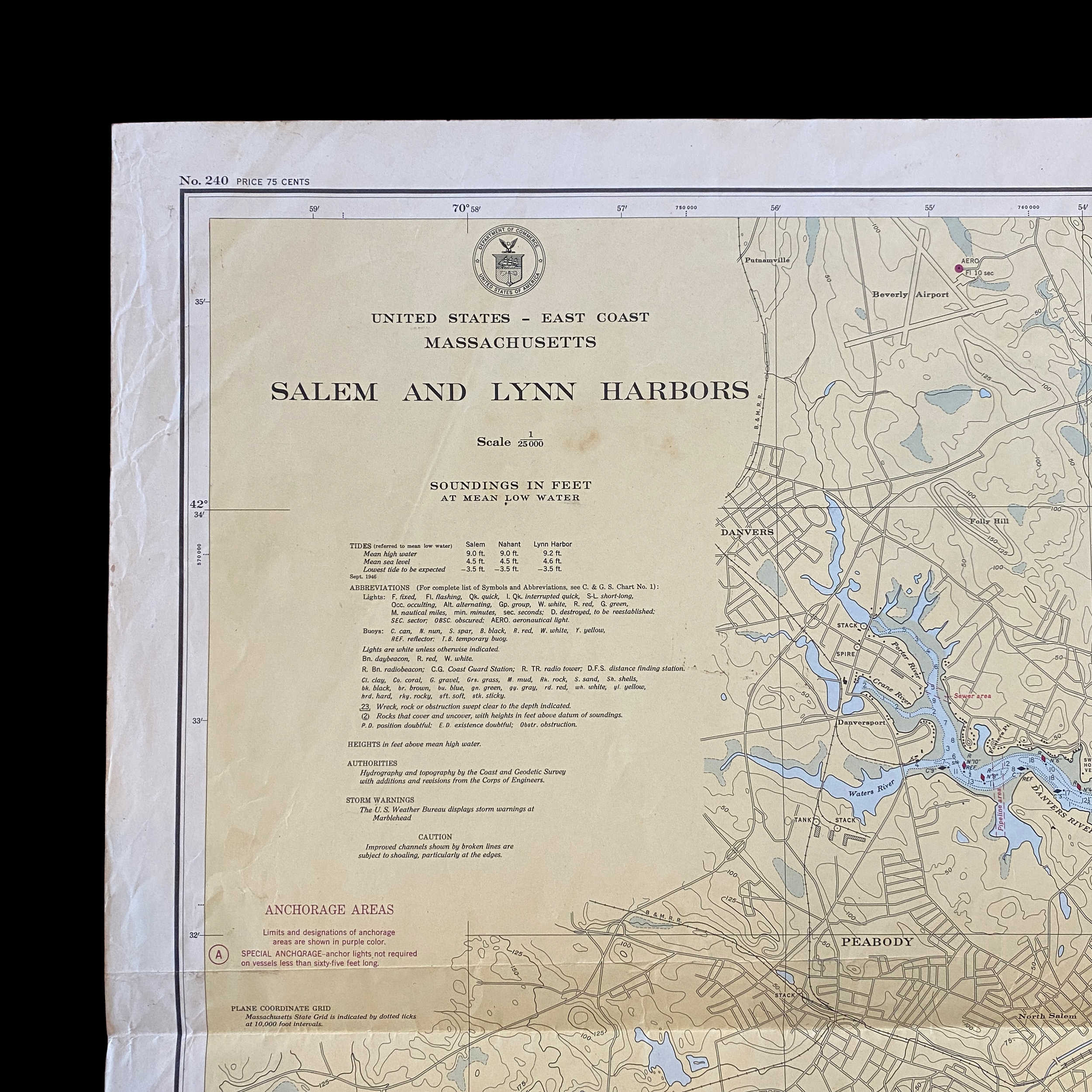
Original 1948 U.S. Department of Commerce "Salem to Lynn Harbor" Massachusetts Navigation and Ocean Fathom Depth Nautical Map*


Original 1948 U.S. Department of Commerce "Salem to Lynn Harbor" Massachusetts Navigation and Ocean Fathom Depth Nautical Map*
Comes with C.O.A.
Perfect for the historian, seaman, map-lover, the curious or just as a conversation starter. Wonderful and rare. Vintage maps such as these make great gifts.
Printed 1948.
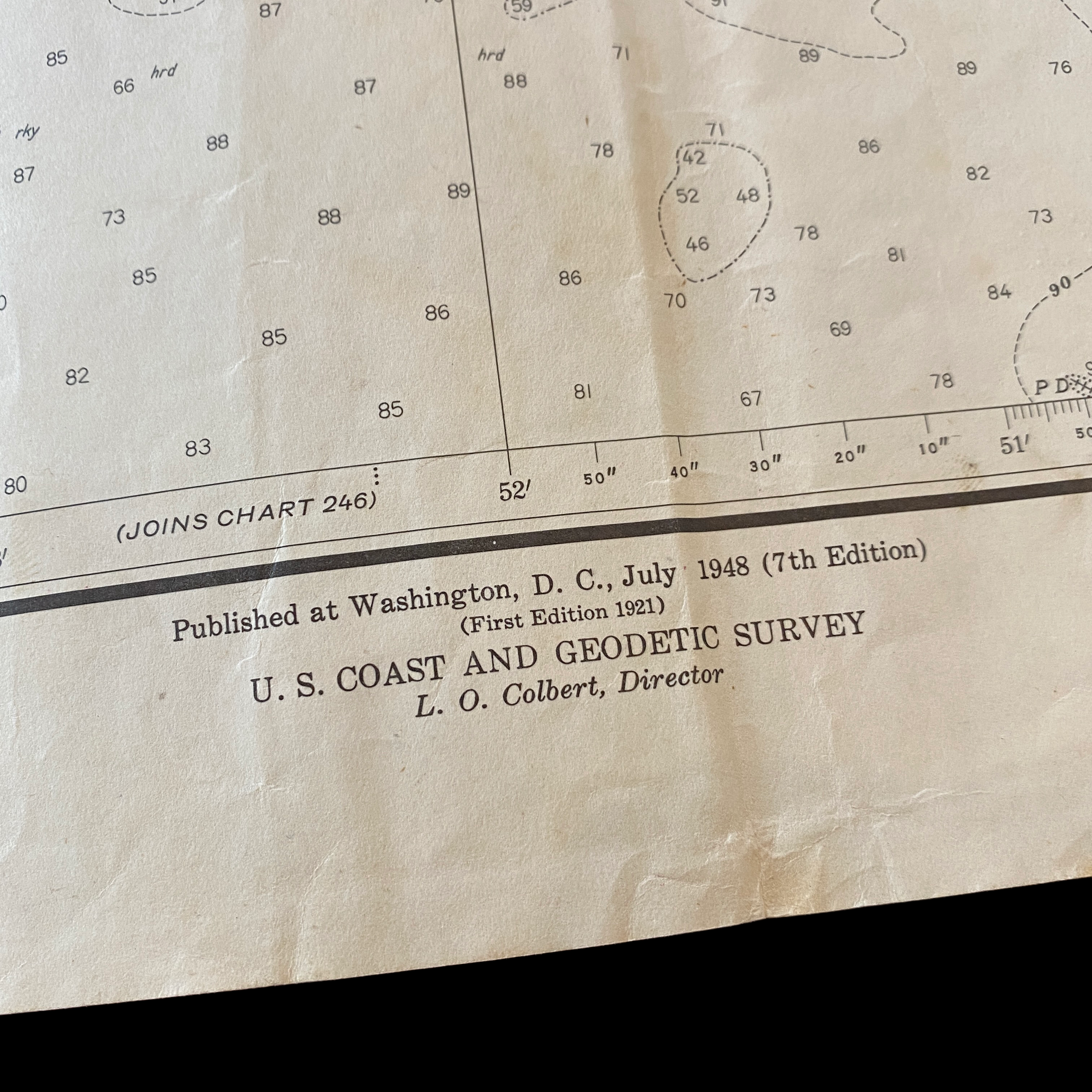
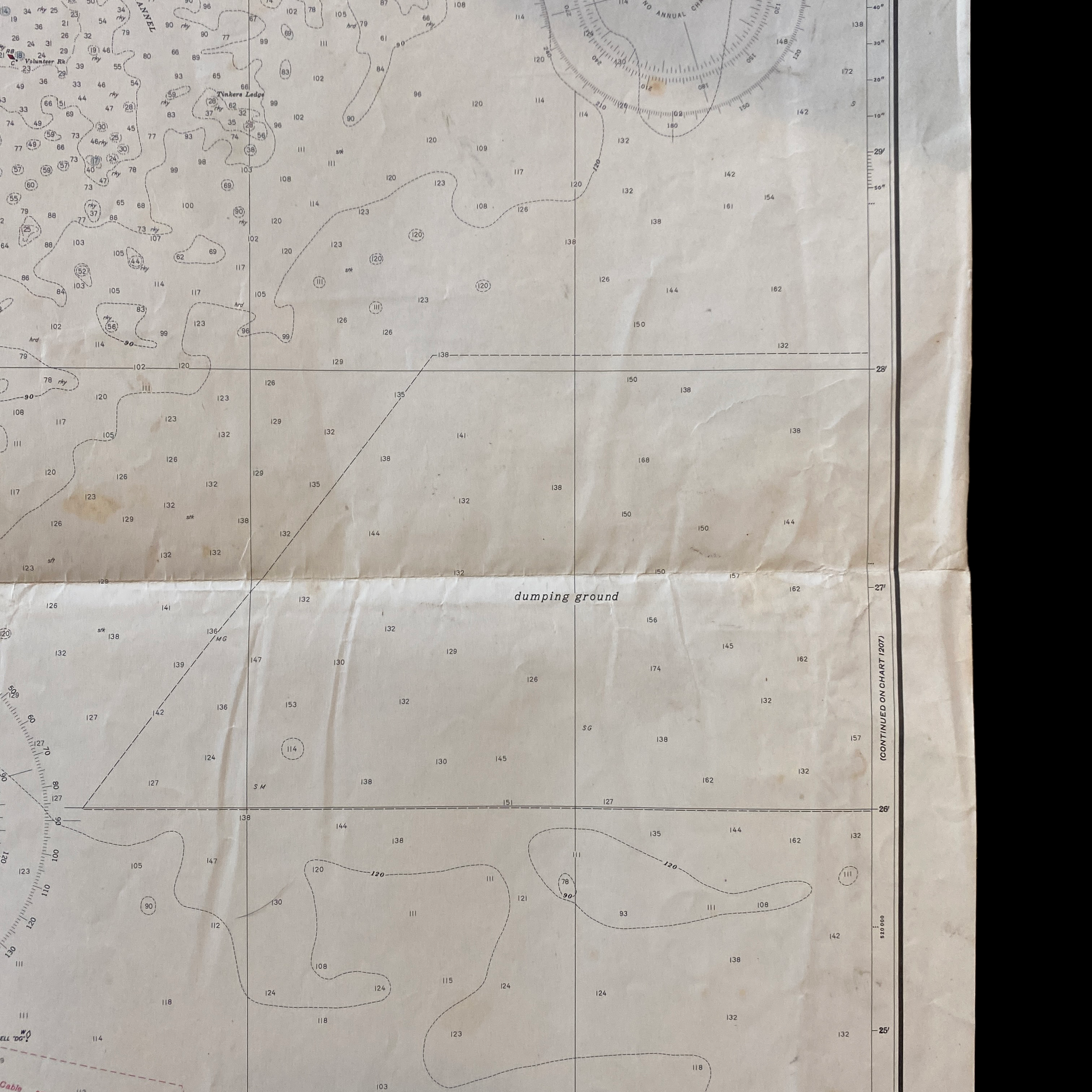
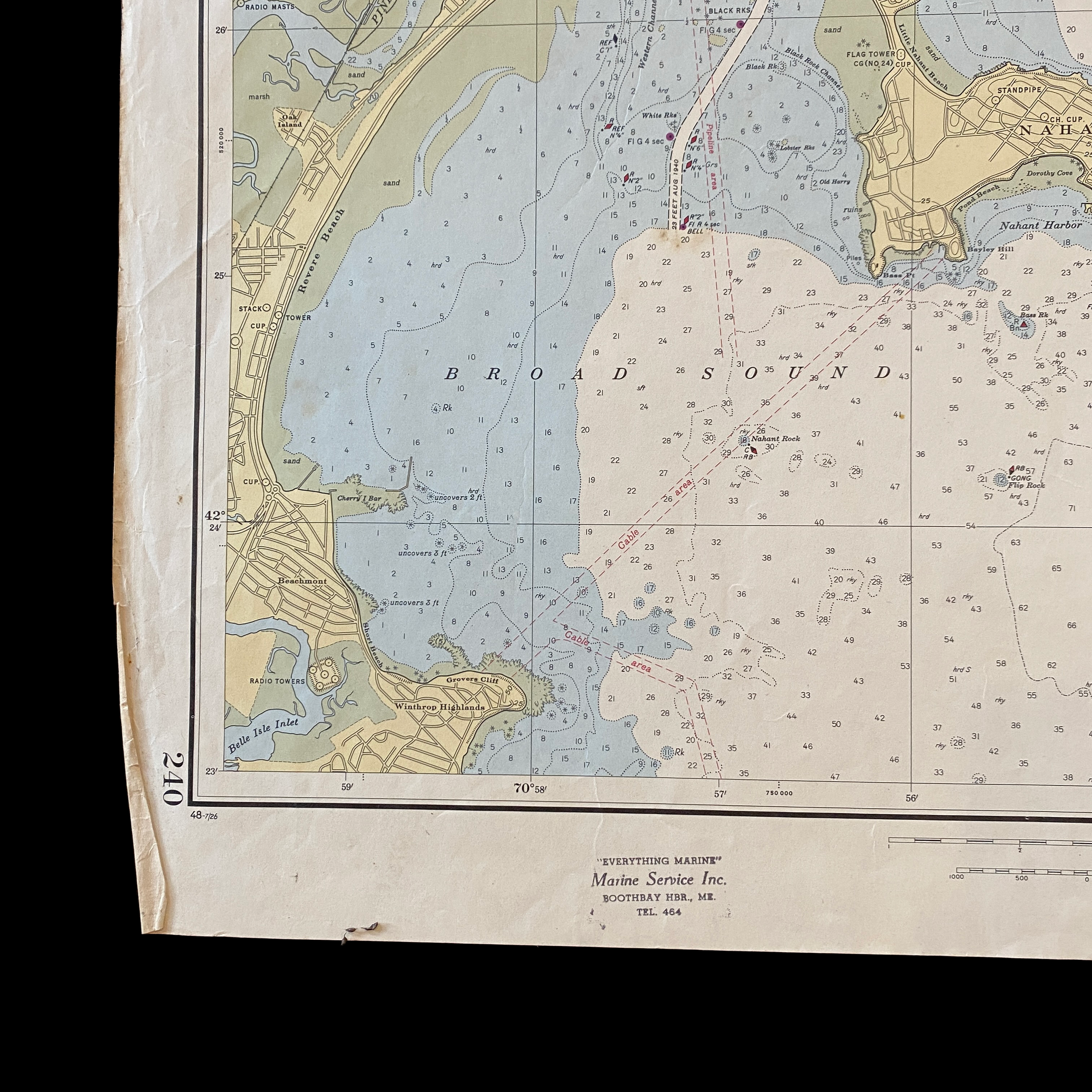
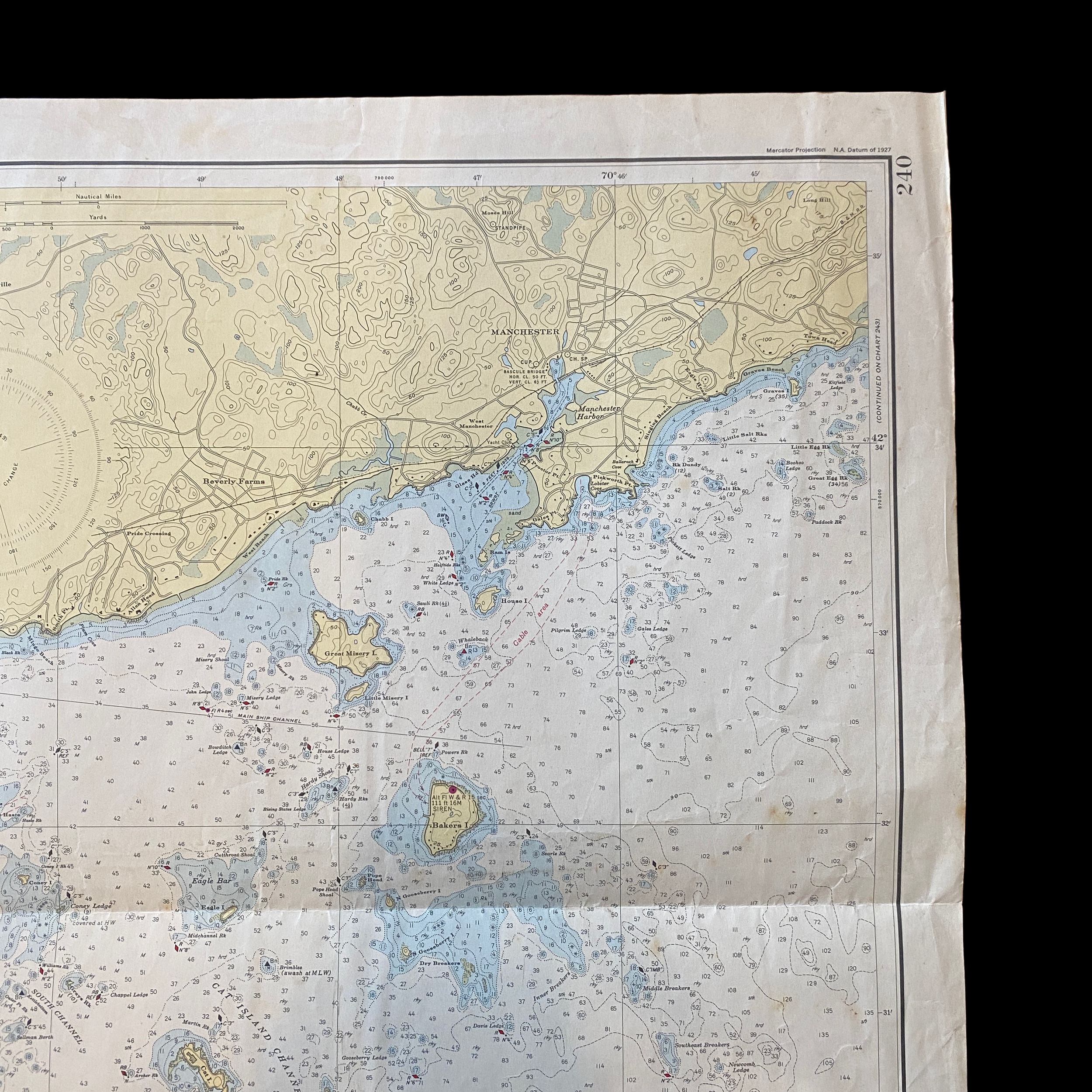
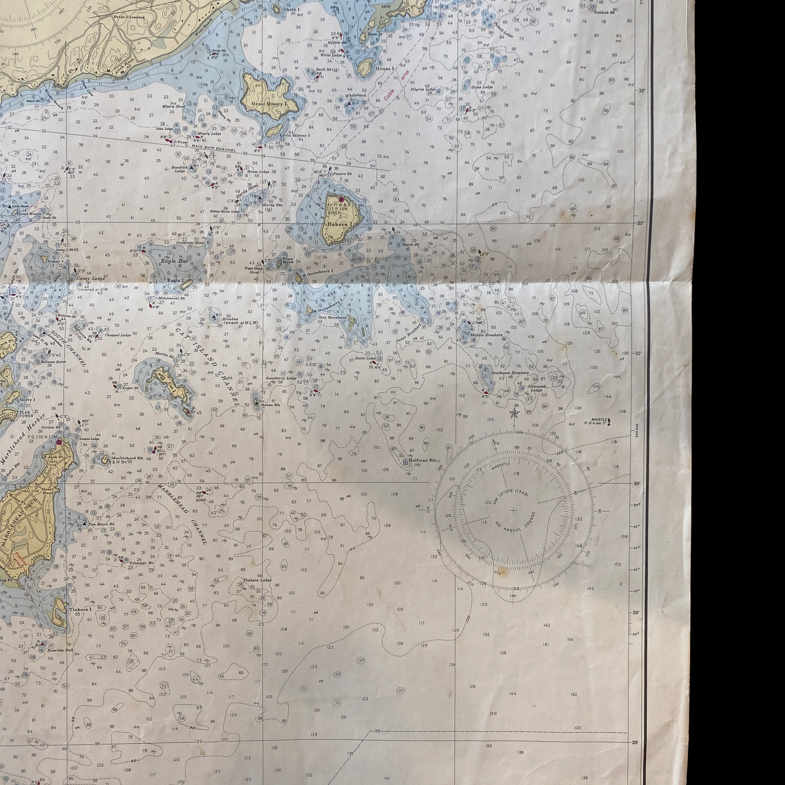
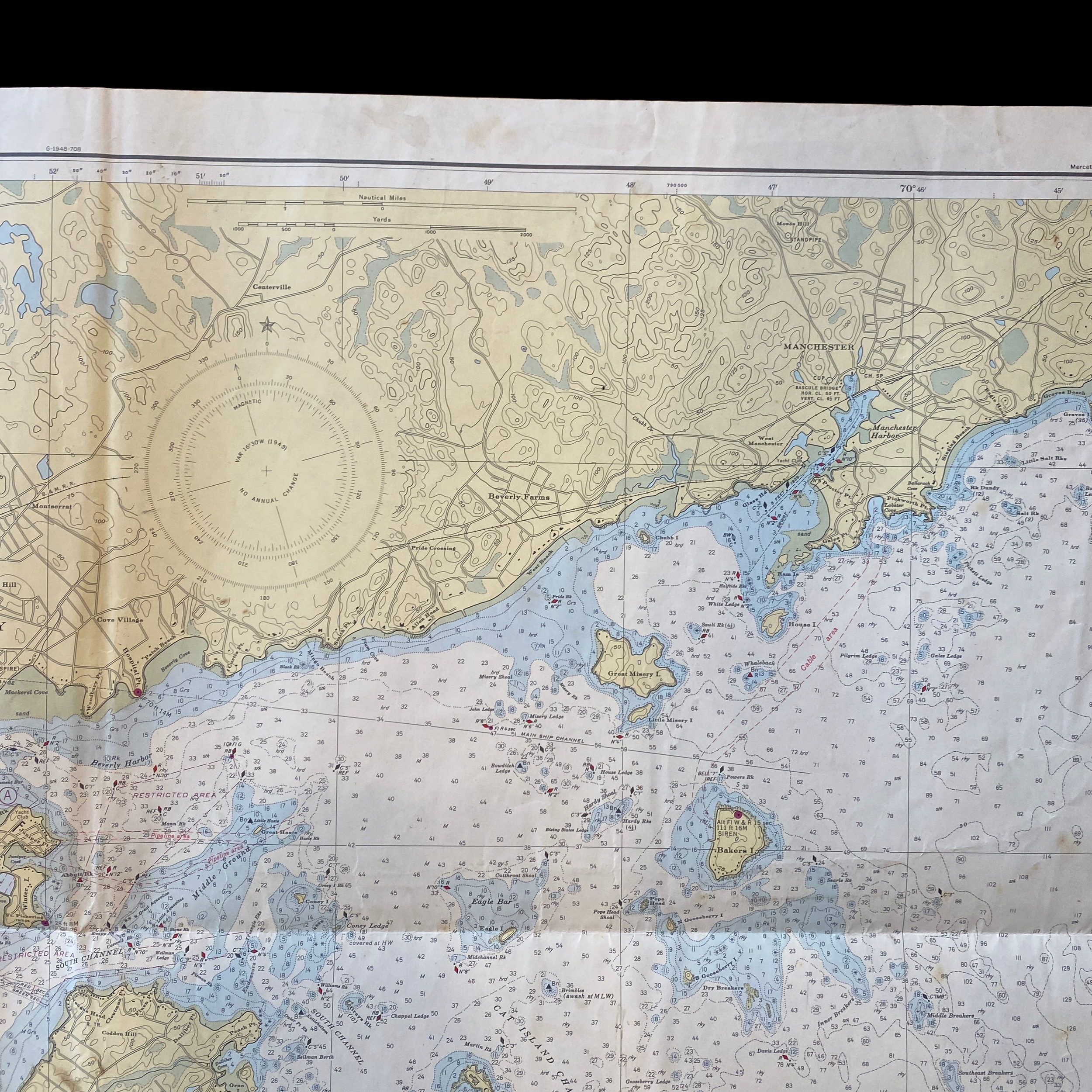
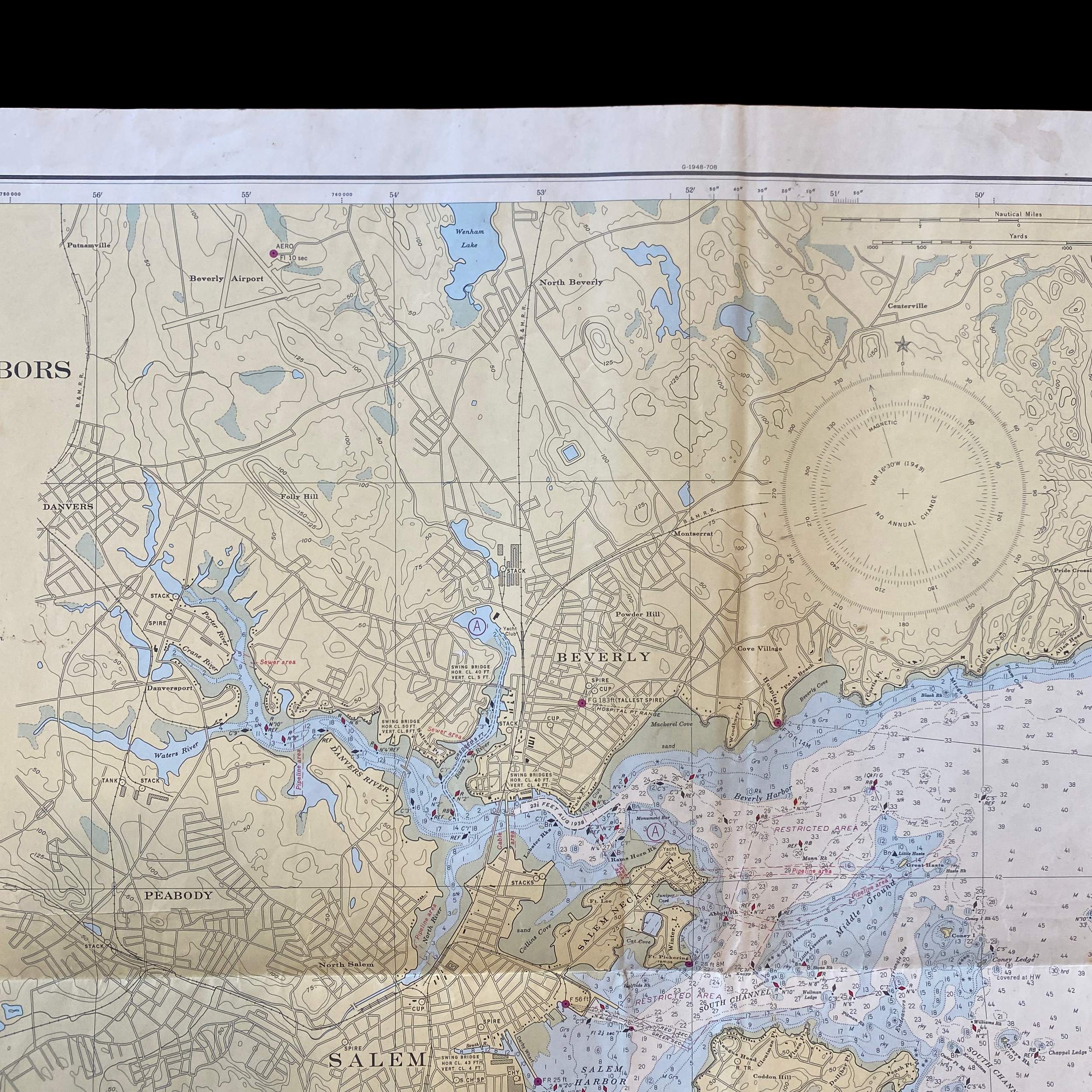
The United States Department of Commerce has a long history of producing detailed ocean maps and charts to aid navigation and support maritime industries. One such example is a fathom and depth chart of the ocean floor in the area between Salem and Lynn Harbor, Massachusetts, dated 1948. This chart provides valuable information on the topography of the ocean floor, including depths, contours, and underwater hazards.
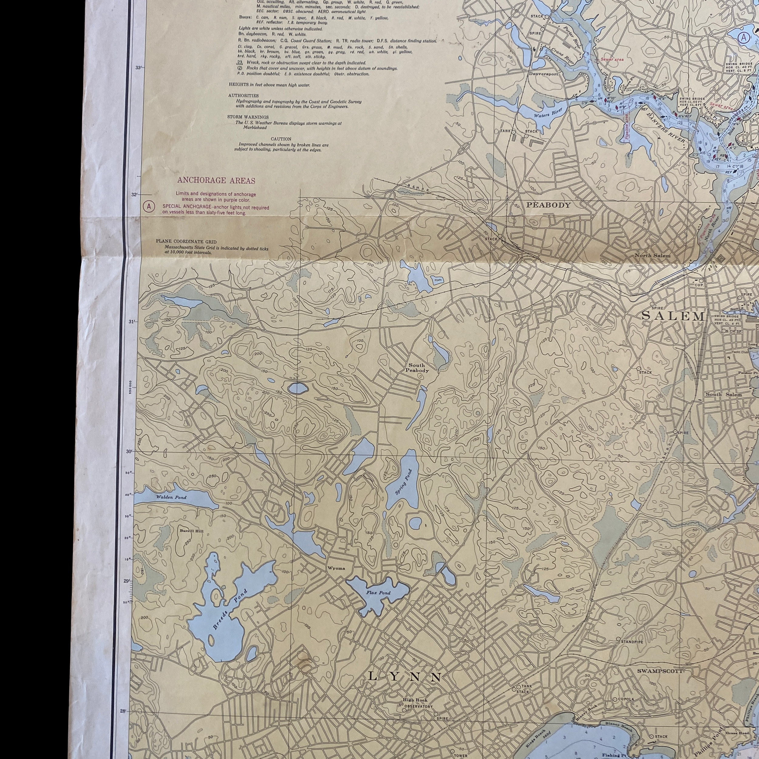
The chart covers an area of approximately 25 square miles, with Salem at the southern end and Lynn Harbor at the northern end. The chart is divided into a grid of squares, with each square representing an area of 1/4 square mile. Each square is further divided into smaller squares, with each of these squares representing an area of 1/16 square mile. This allows for a high level of detail and precision in the mapping of the ocean floor.
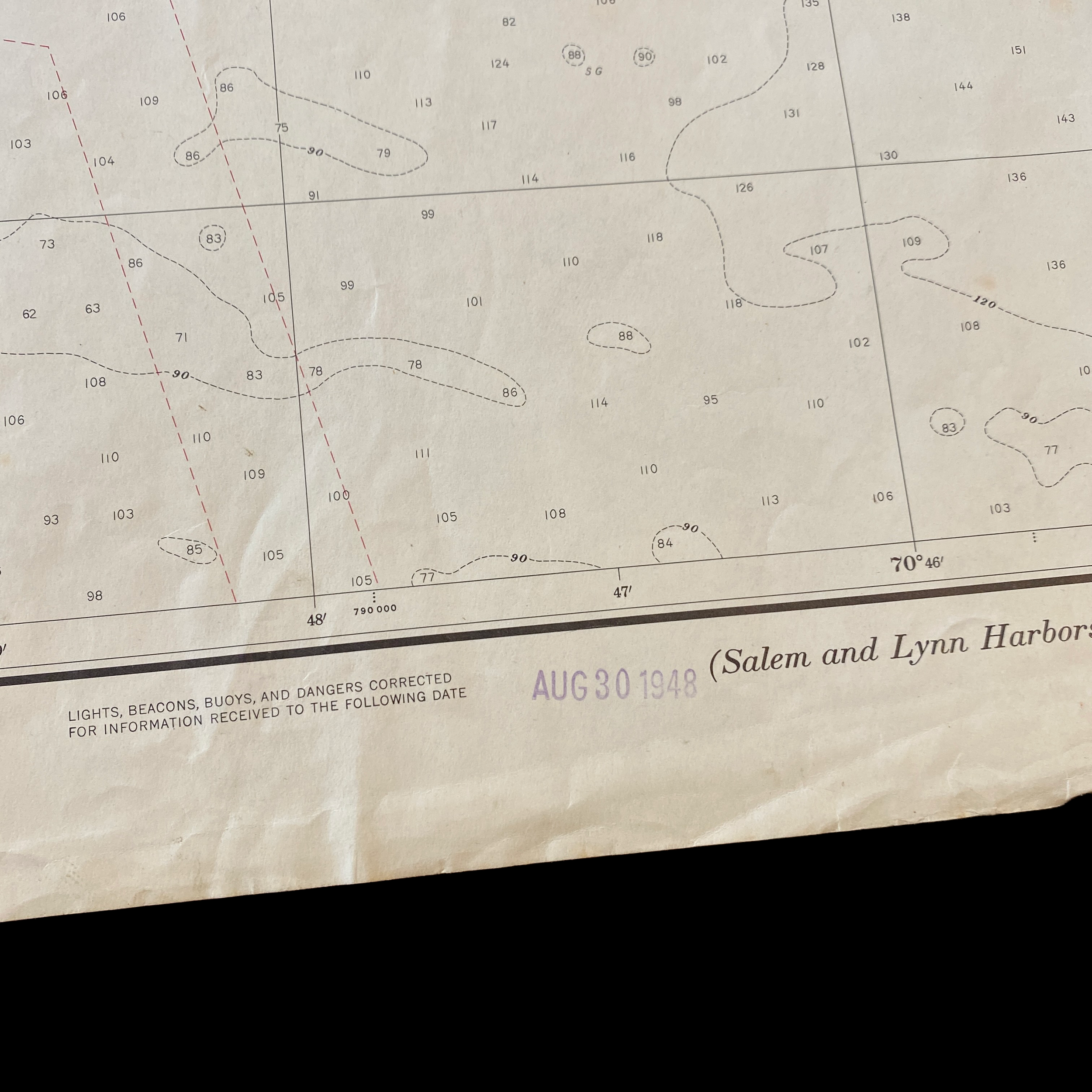
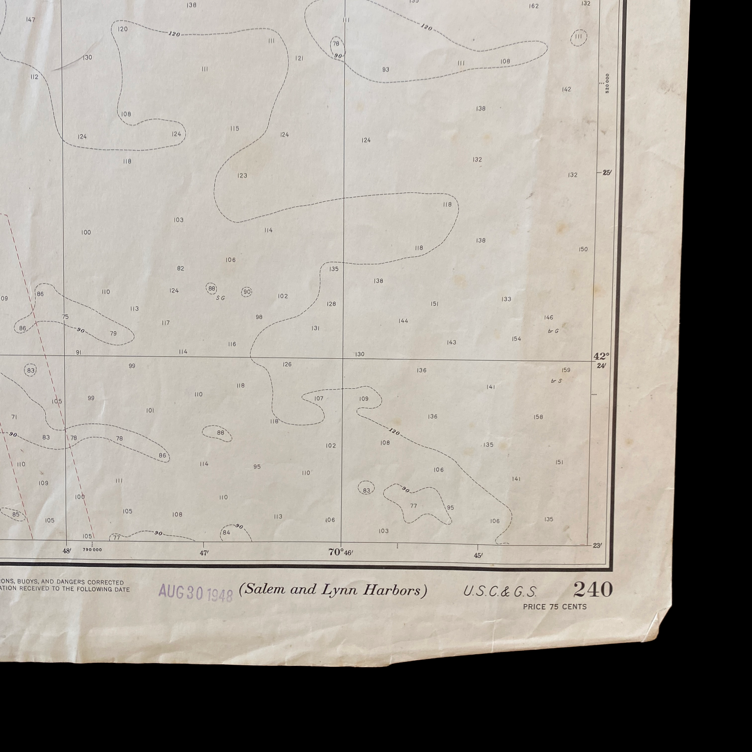
The chart is based on data collected using a variety of methods, including depth soundings, tide gauge readings, and underwater photography. The data was collected over a period of several years and was then used to create a detailed topographical map of the ocean floor. The chart shows depths ranging from 0 to 60 fathoms (360 feet) and contours are drawn every 3 fathoms (18 feet). This allows mariners to easily identify the depth of the ocean floor and navigate around any potential hazards.
The chart also includes a number of annotations and symbols that provide additional information to mariners. For example, the chart shows the location of underwater obstructions such as rocks and wrecks, as well as the location of lighthouses, buoys, and other navigational aids. Additionally, the chart includes a key that explains the various symbols and annotations used on the chart.
The 1948 fathom and depth chart of the ocean floor between Salem and Lynn Harbor, Massachusetts is an important historical document and provides valuable information for mariners and maritime industries. The chart is a testament to the dedication and expertise of the United States Department of Commerce in providing accurate and detailed ocean maps and charts to aid navigation and support maritime industries. With the advancement of technology, this kind of chart is not being used in the same way but the historical value is still there.