VERY RARE! WWII 1944 Operation Stalemate II - Palau Campaign (Angaur Island) CONFIDENTIAL Combat Intelligence Invasion Maps (Double-Sided)

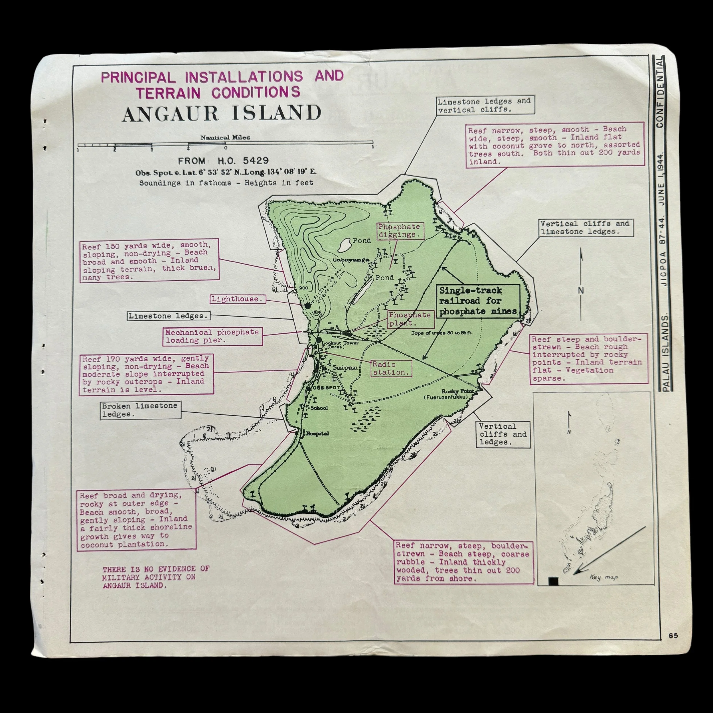
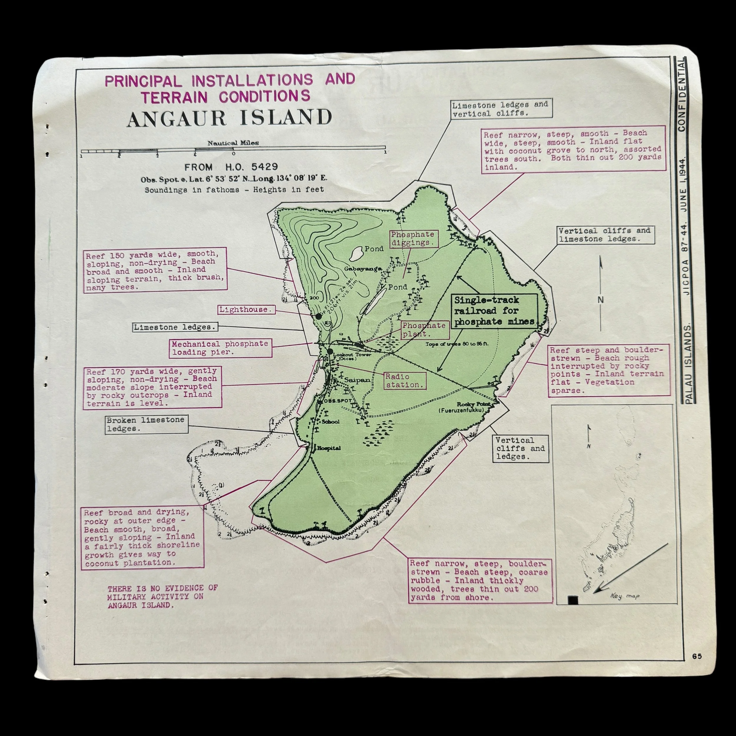
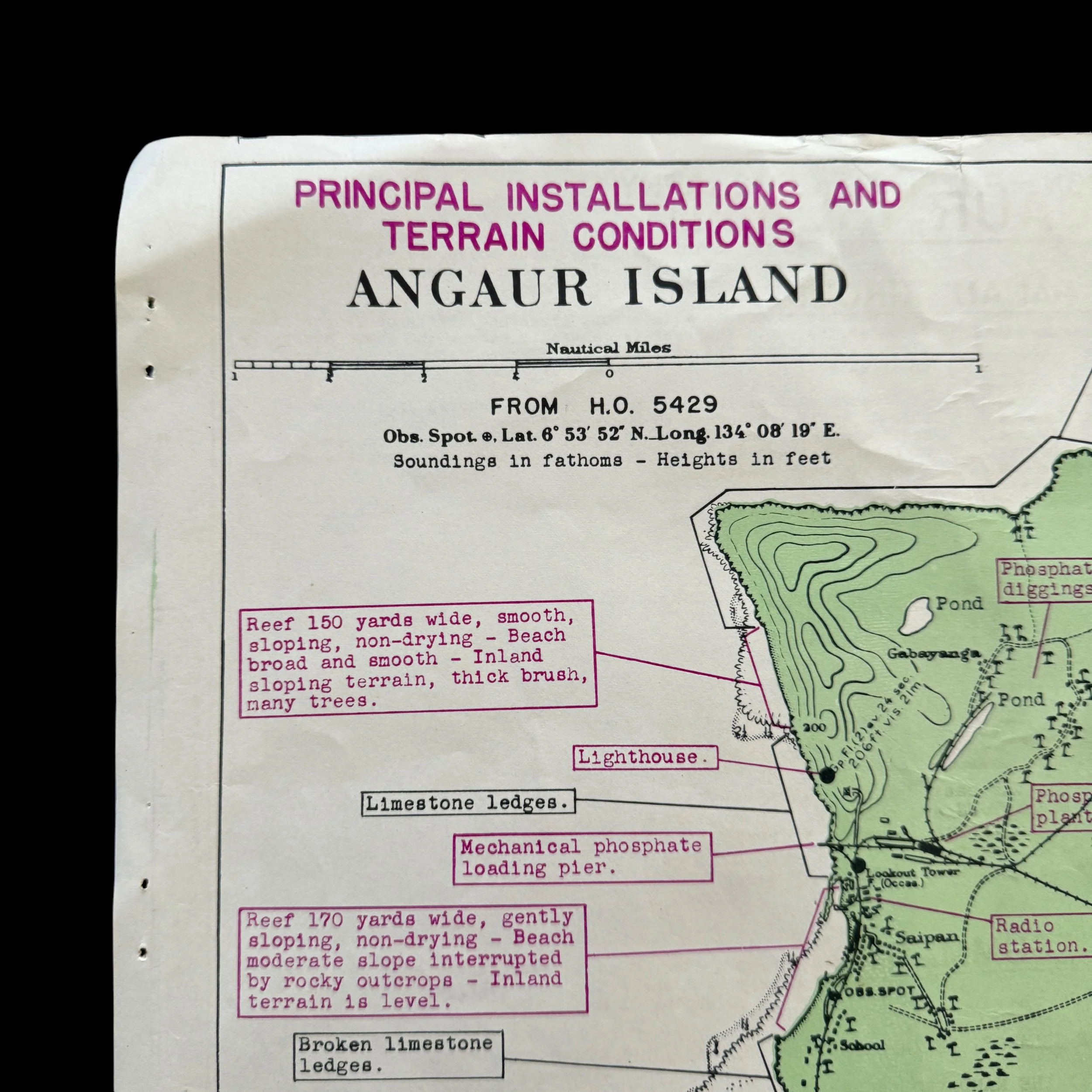
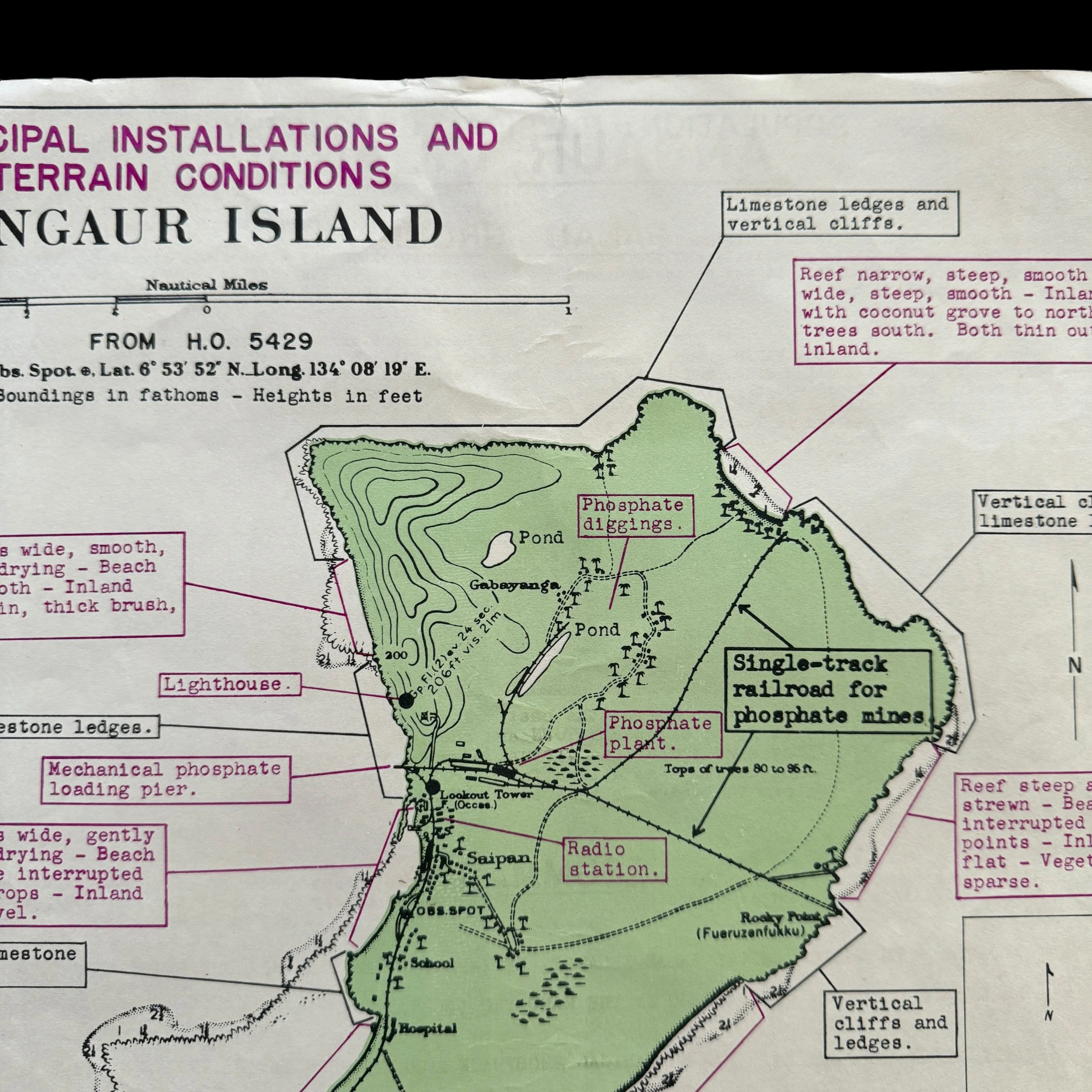

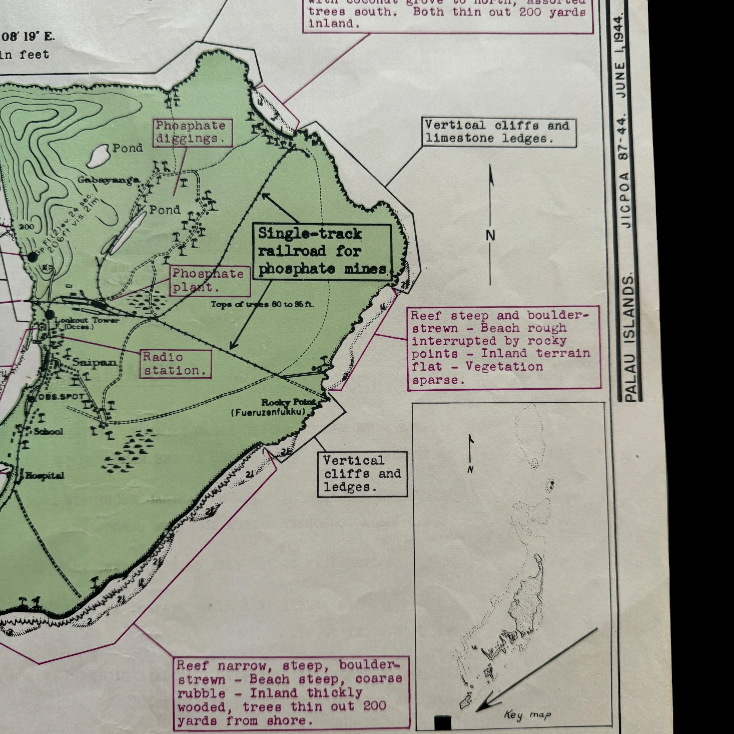

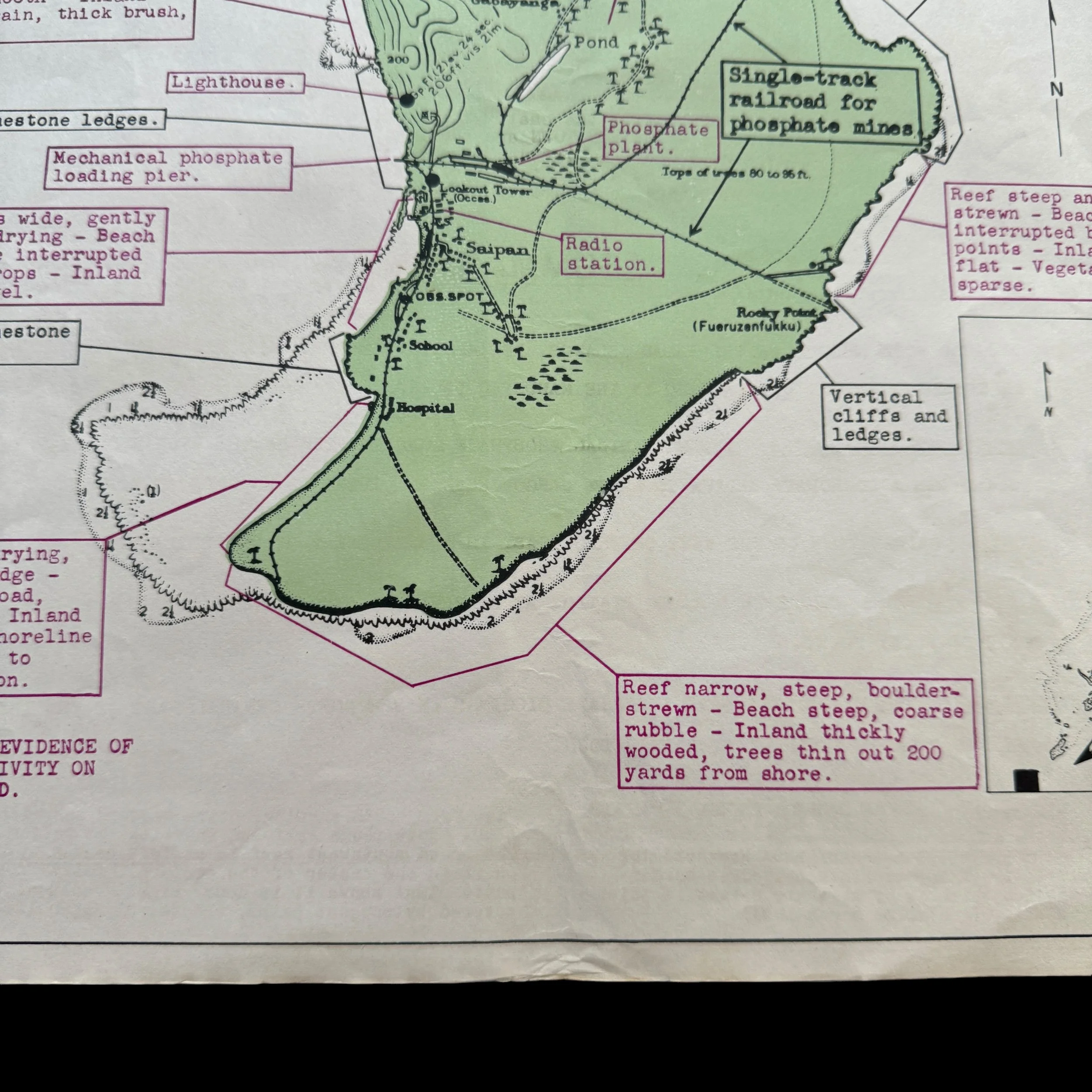
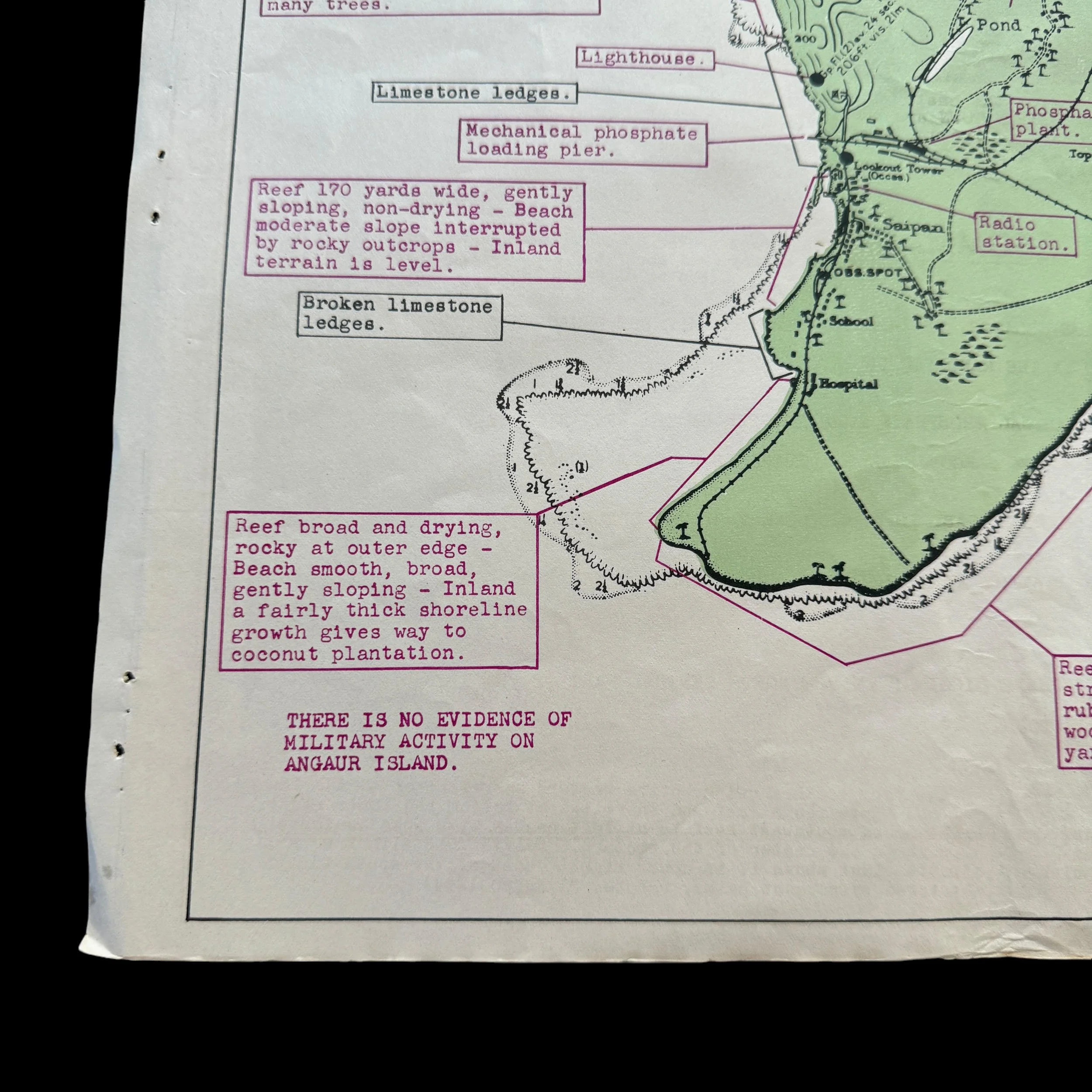
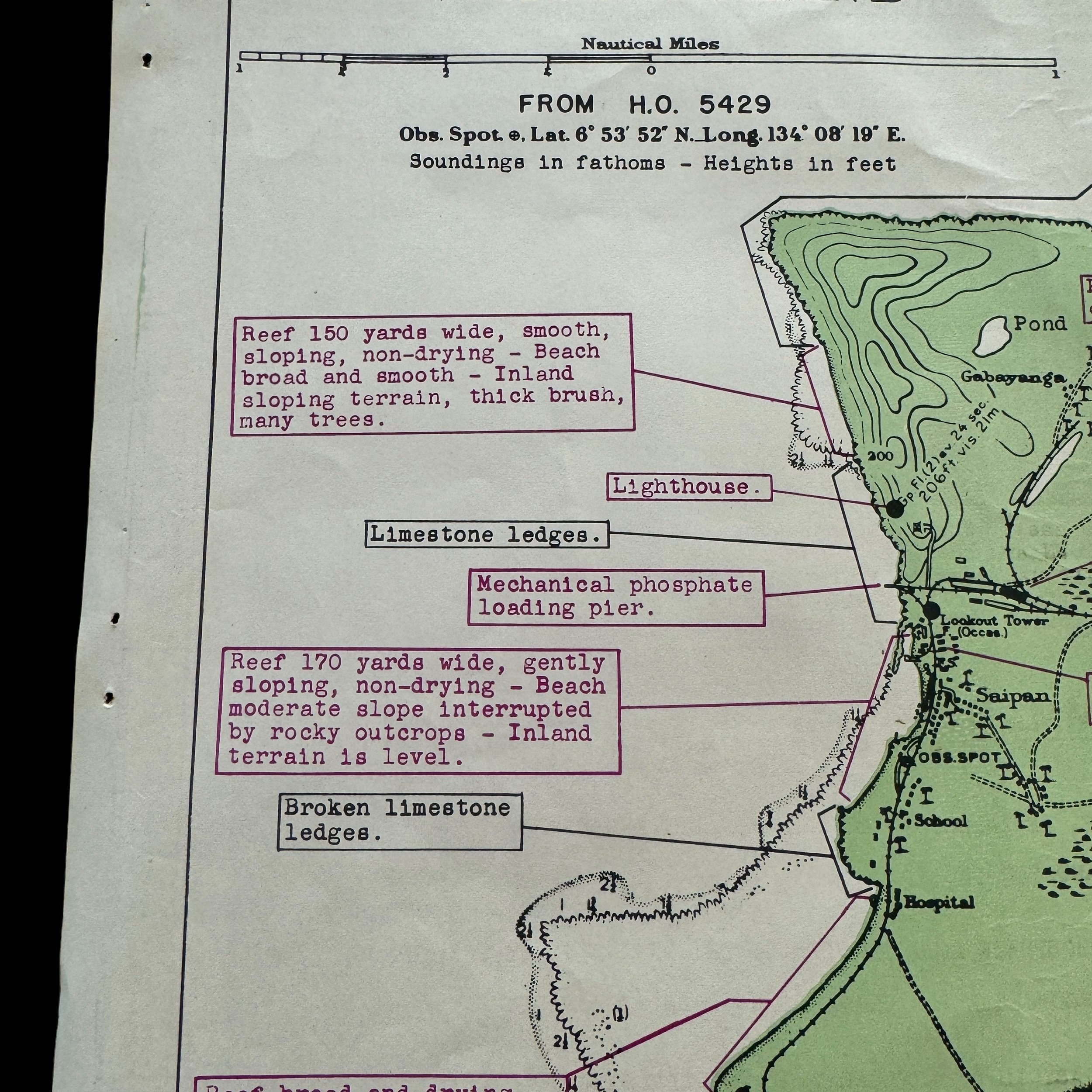
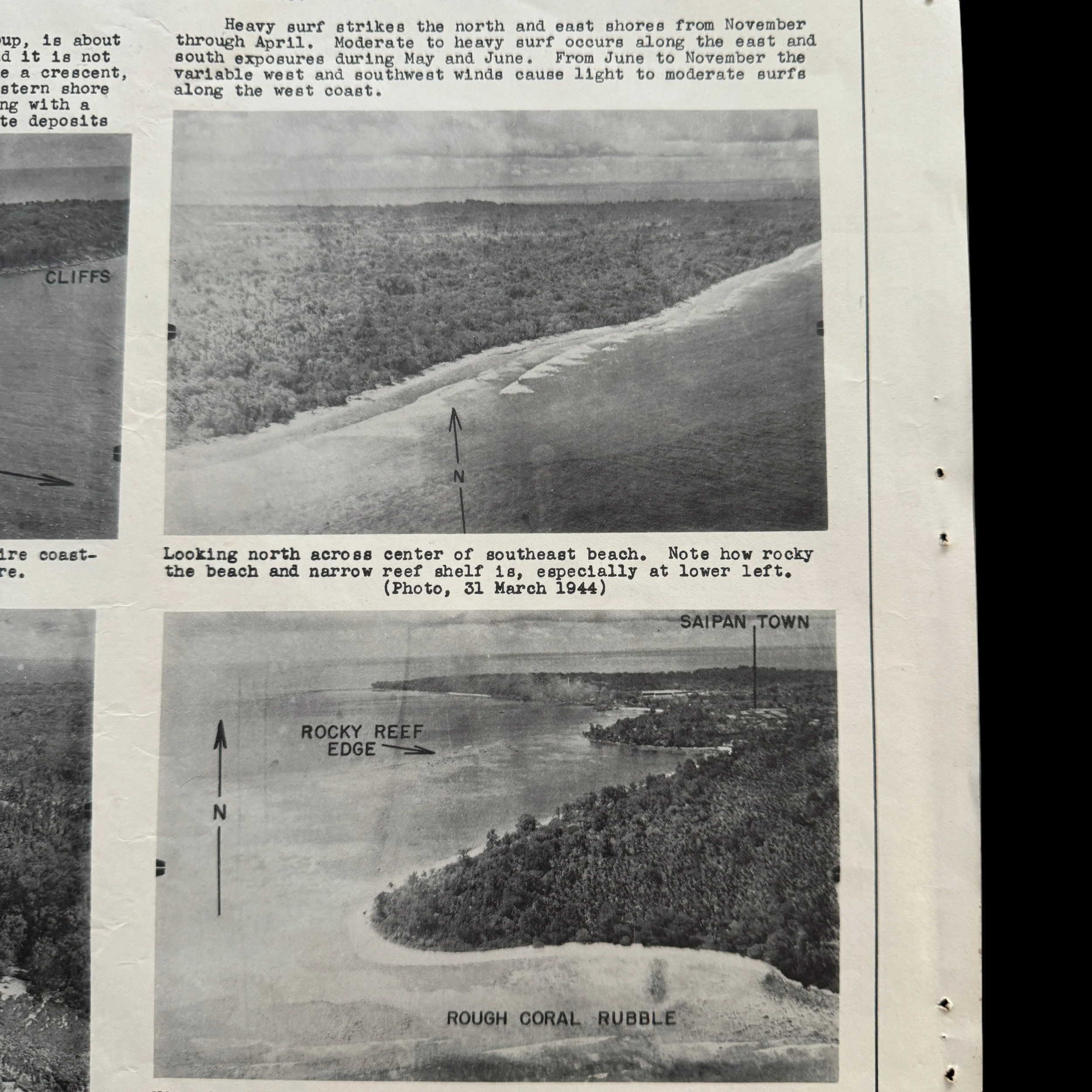
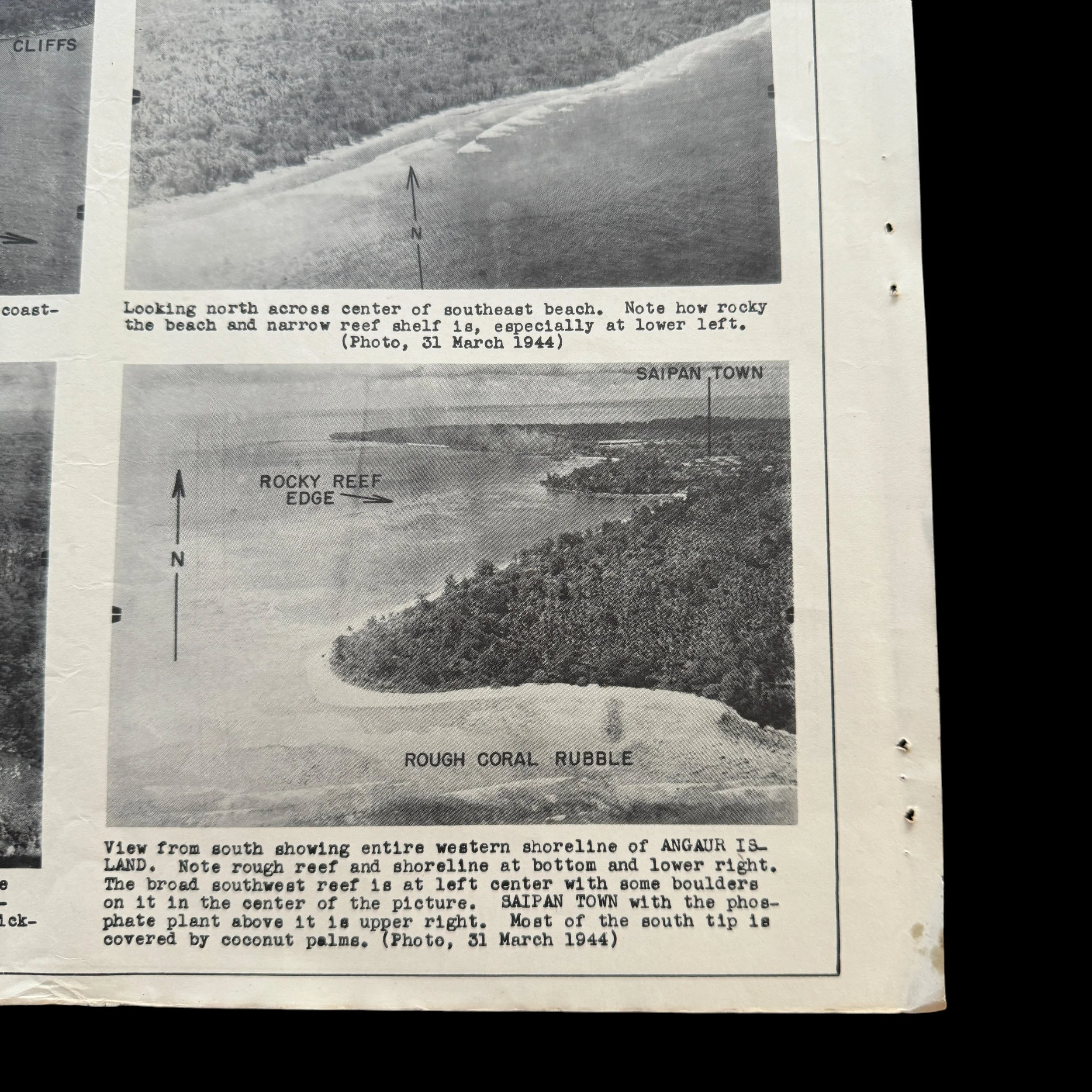
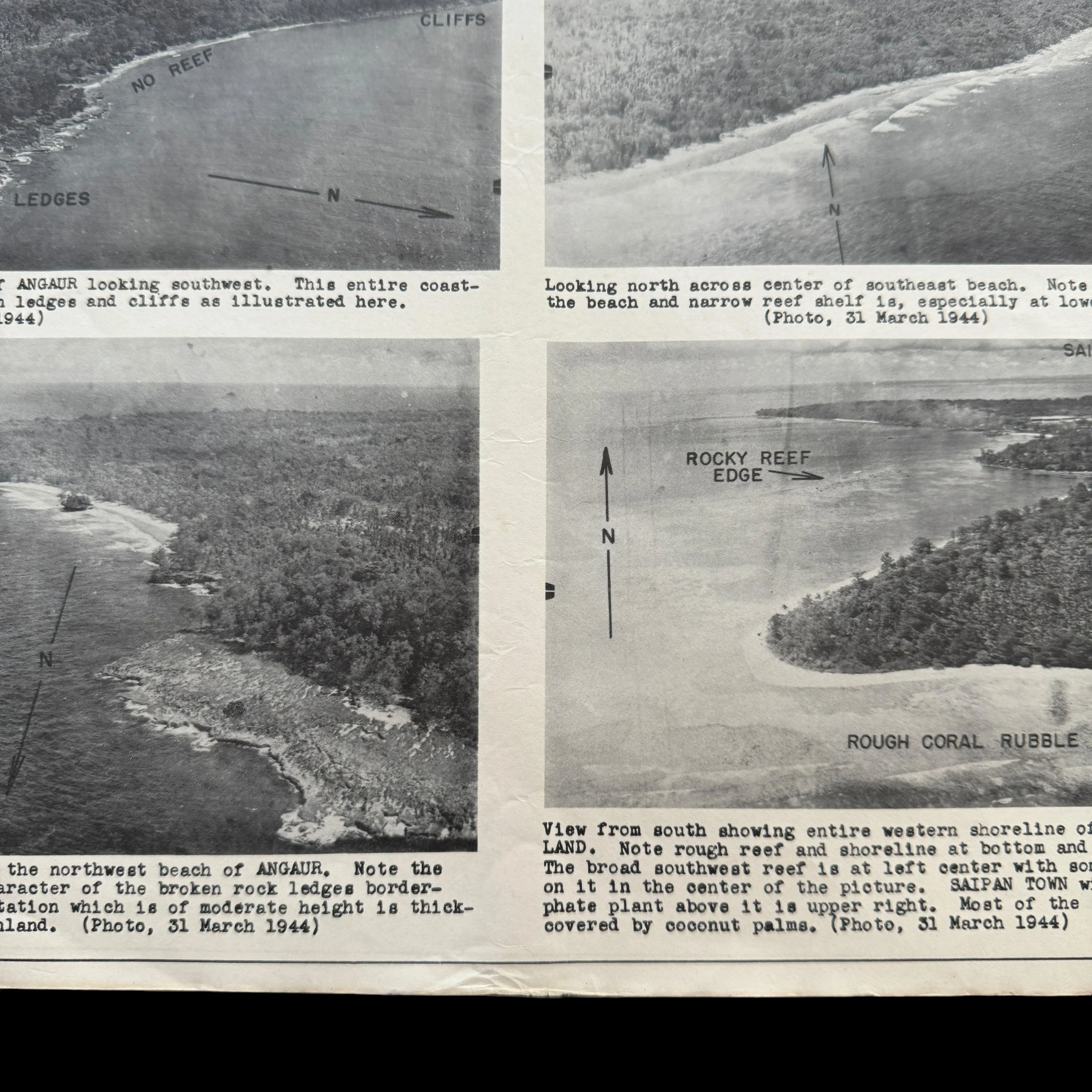
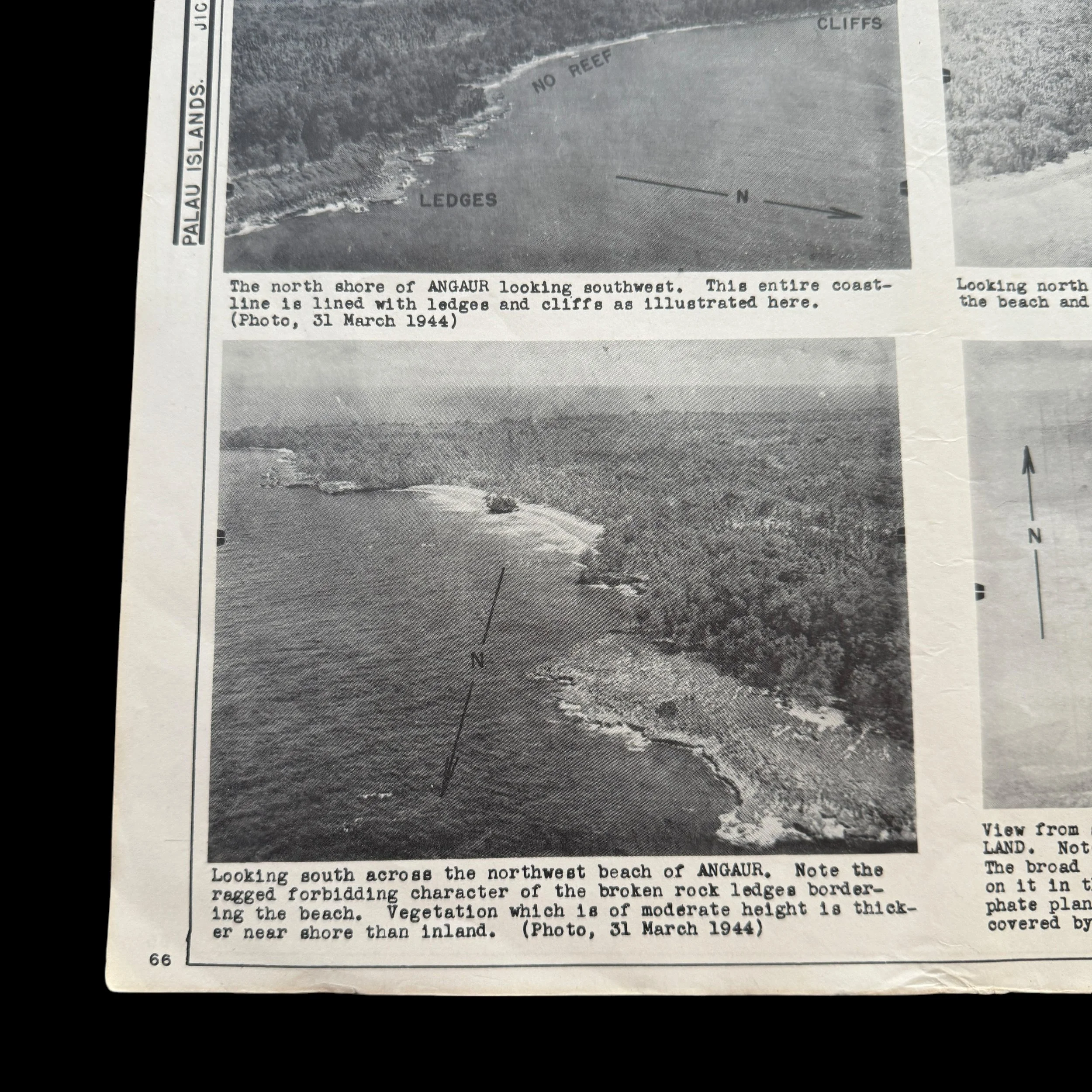
VERY RARE! WWII 1944 Operation Stalemate II - Palau Campaign (Angaur Island) CONFIDENTIAL Combat Intelligence Invasion Maps (Double-Sided)
Comes with a hand-signed C.O.A.
Size: 13 x 14 inches
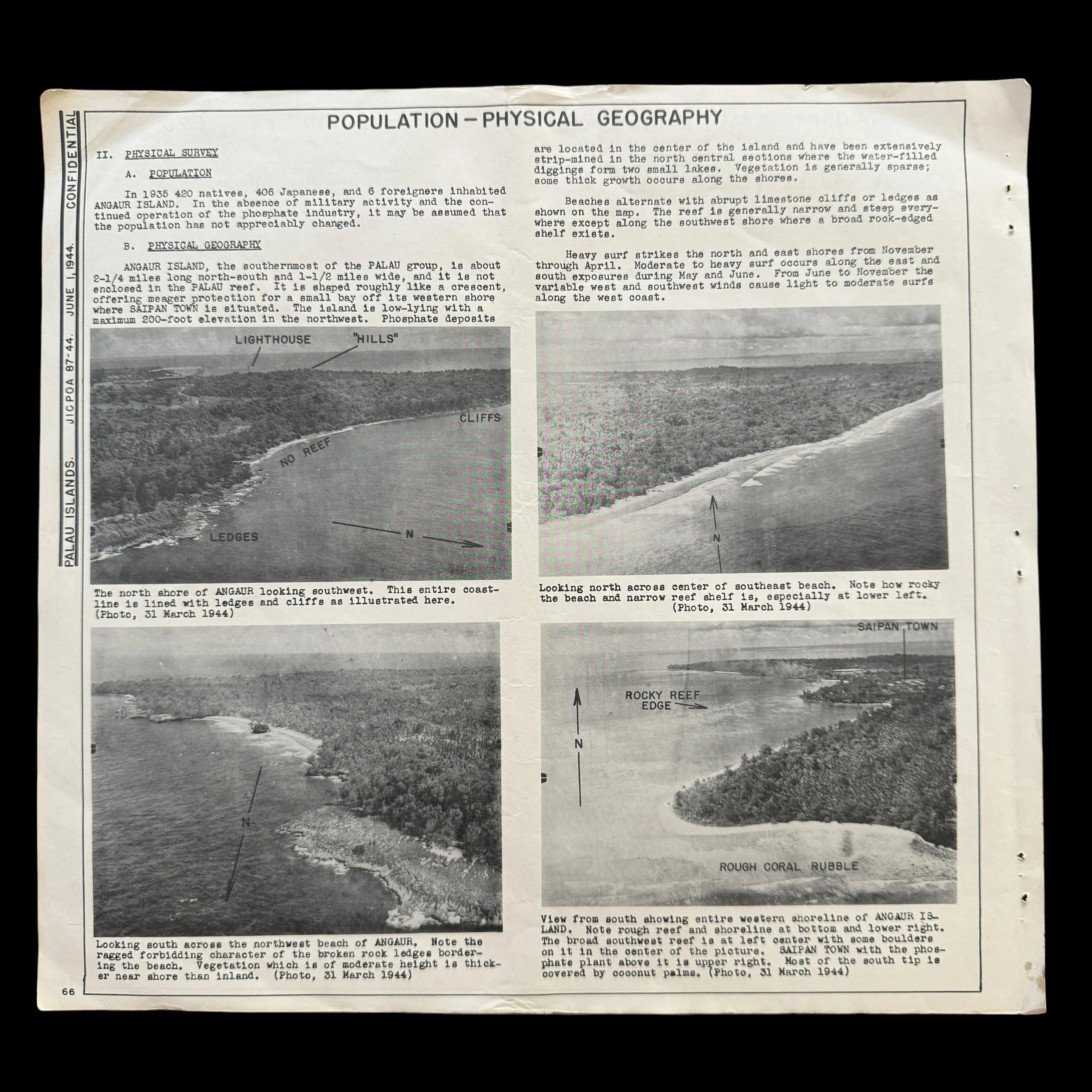
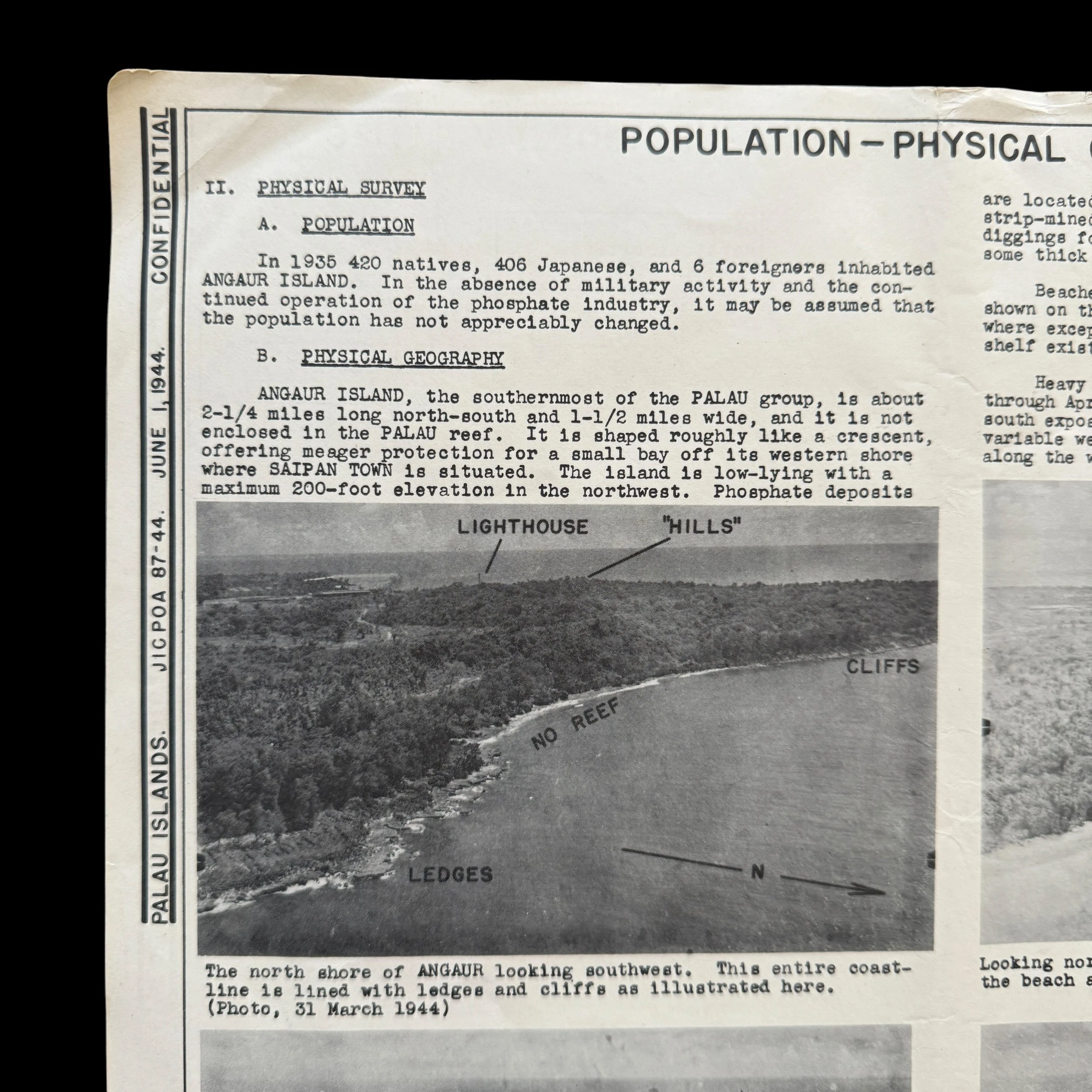
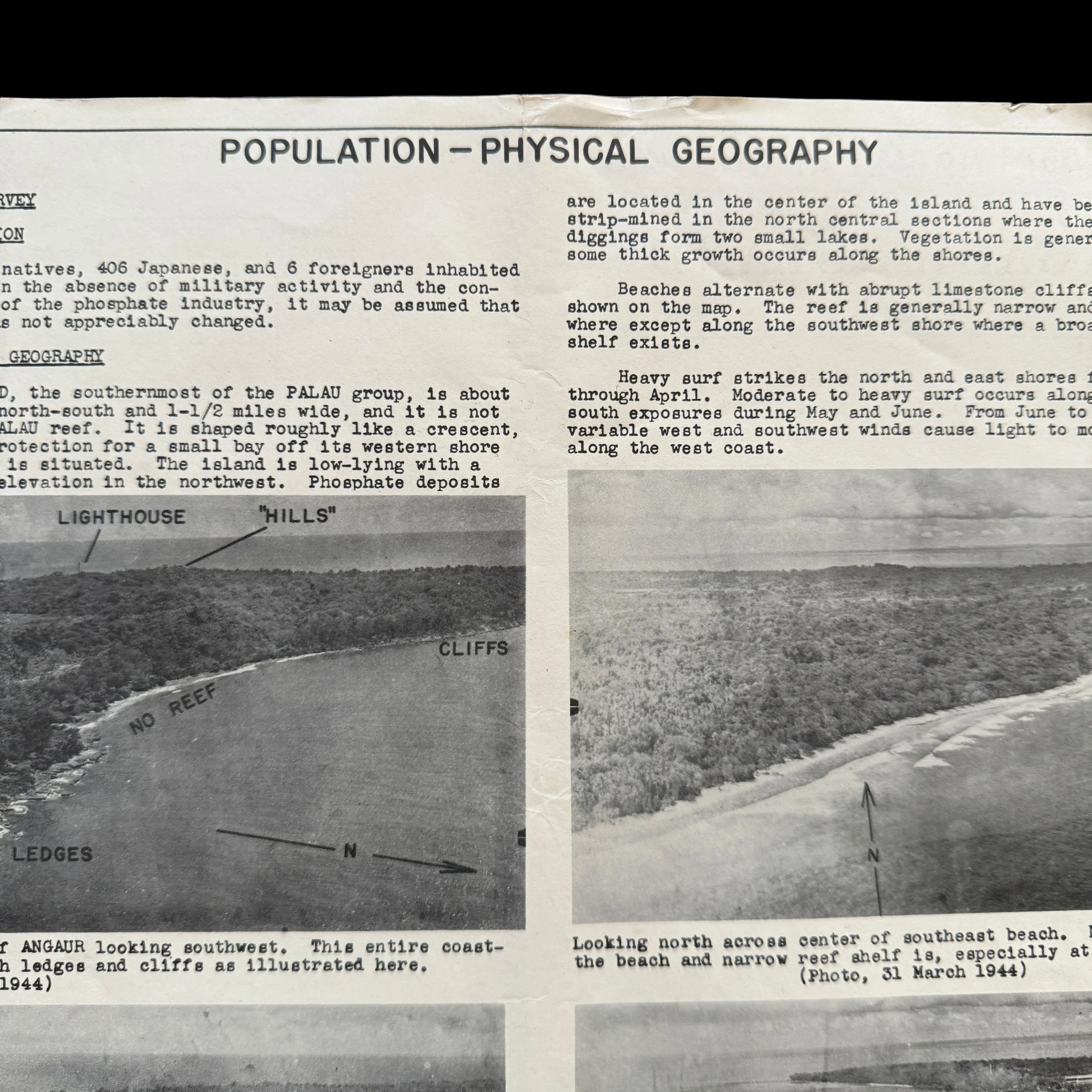
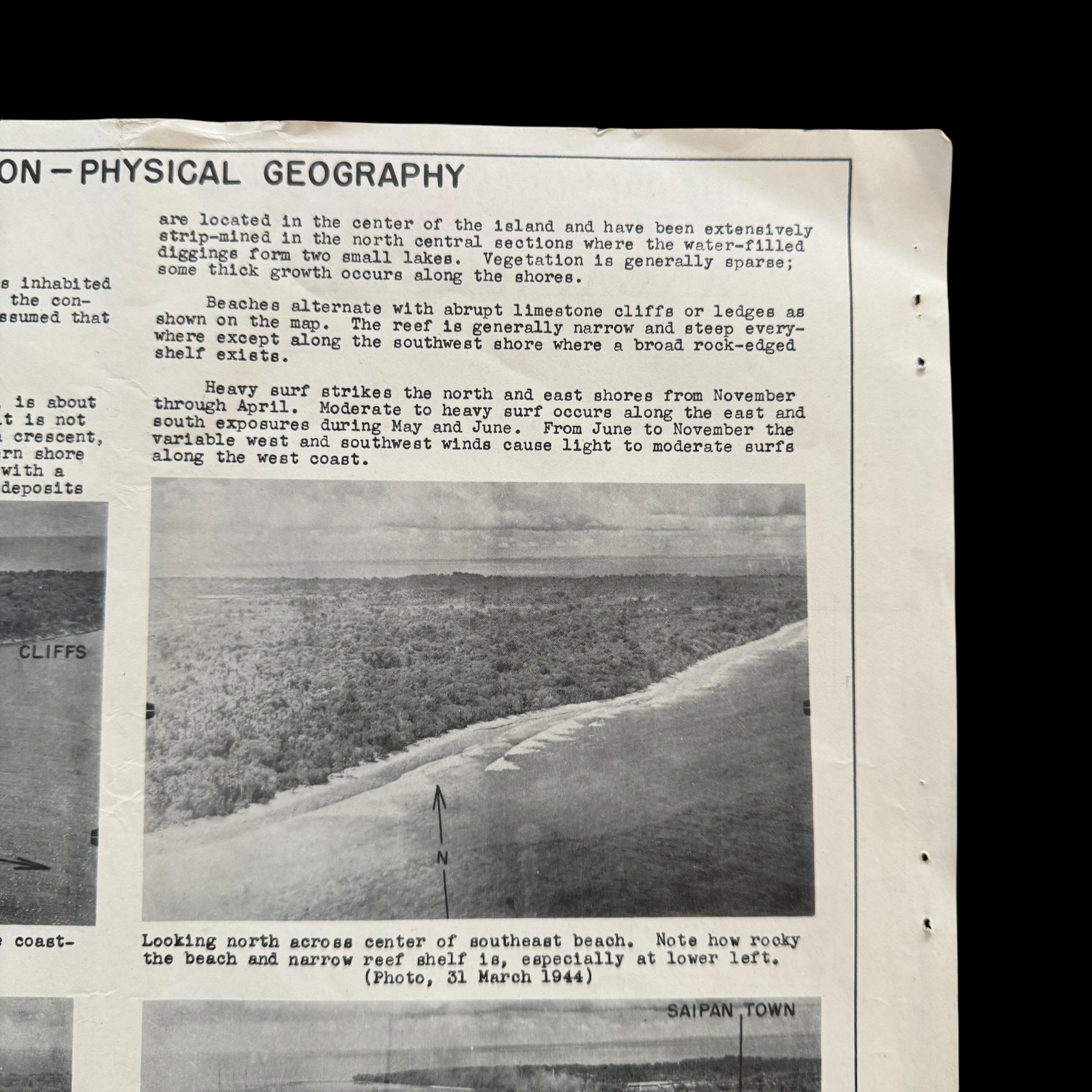
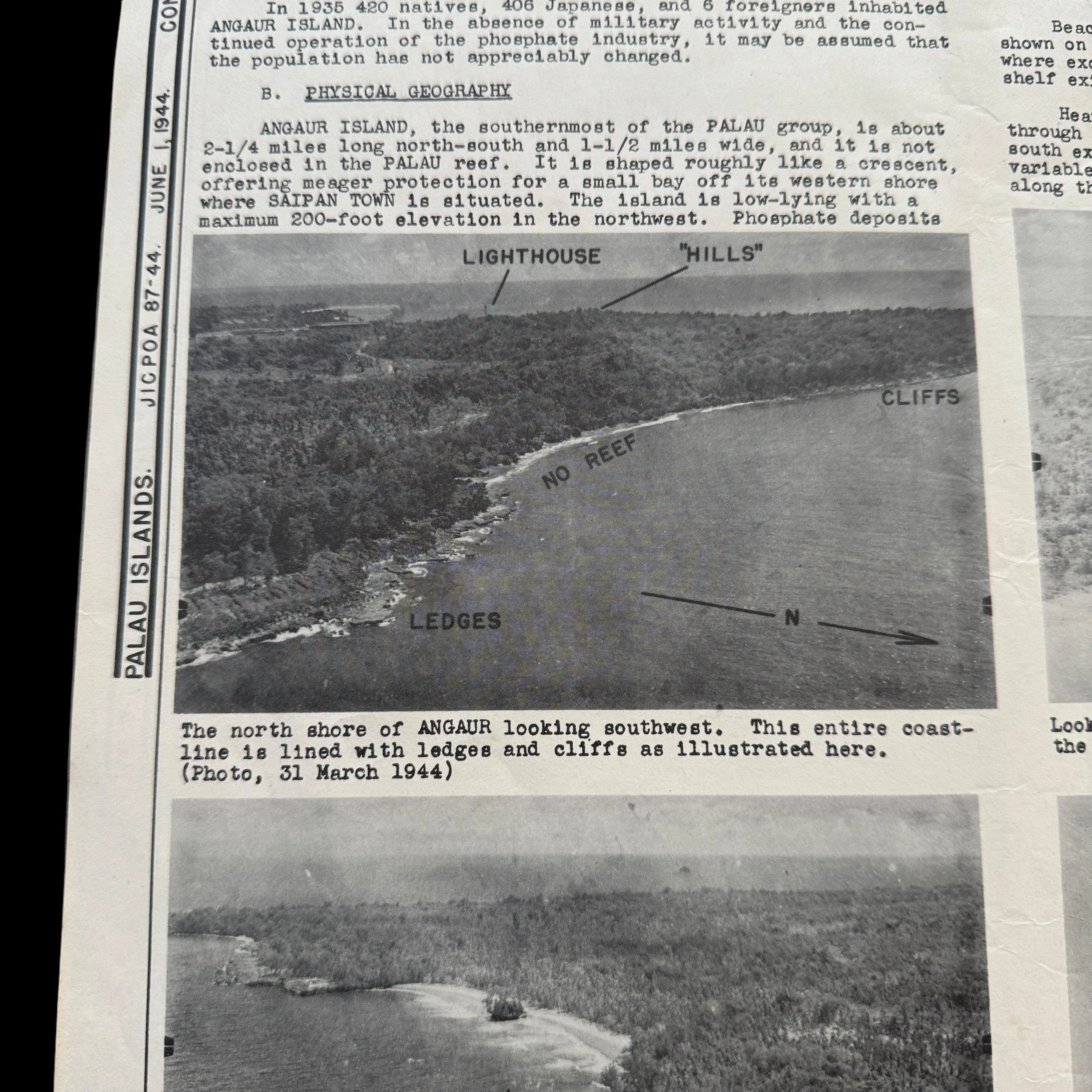
This incredibly rare and museum-grade WWII artifact is an original World War II Battle of Peleliu (Operation Stalemate II) CONFIDENTIAL marked combat intelligence invasion map and invasion military intelligence report (double-sided).
As per military classification guidelines at the time, it states, “It is recommended that "Top Secret" material - Operation Plans and Orders - be reclassified downward to "Secret or Confidential" prior to the start of an operation by a sufficient length of time to permit of adequate and timely distribution to commanders and officers and concerned. Only when in that area of combat theater can maps, reports, and plans be re-classified as “Restricted” to be used in combat and in the field.”
Dated June 1944 (3 months prior to the D-Day invasion of the Palua Islands) this map was a part of the largest amphibious operation in the Pacific to date, with more than 1,600 ships and craft and more than 800 aircraft deployed.
The Joint Intelligence Center Pacific Ocean Areas (JICPOA) played a pivotal role in producing military intelligence during World War II, particularly in the Pacific Theater. Established in 1943 under the command of Admiral Chester Nimitz, JICPOA was tasked with gathering, analyzing, and disseminating intelligence across the vast Pacific Ocean Area, covering millions of square miles of ocean and land. JICPOA’s multi-branch organization combined resources from the U.S. Army, Navy, Marine Corps, and other intelligence units, making it a hub for coordinated intelligence operations during the war.
One of JICPOA’s most significant contributions during WWII was in the preparation for amphibious assaults, such as the Battle of Peleliu in the Palau Islands, part of the larger Operation Stalemate II in 1944. JICPOA was responsible for producing detailed intelligence maps that were critical for the U.S. military's planning and execution of the invasion. These maps were created from aerial reconnaissance, submarine patrols, and photo interpretation, and they provided precise topographical details, enemy troop positions, and the layout of defensive installations, including the extensive cave networks that Japanese forces used for fortification.
For the Battle of Peleliu, JICPOA’s intelligence maps informed U.S. commanders about the island’s challenging terrain, fortifications, radio systems and more giving the U.S. forces a clearer understanding of what to expect. However, despite these detailed maps and military intelligence, the battle proved more difficult than anticipated due to the Japanese strategy of using fortified positions rather than a direct beach defense, leading to a protracted and costly engagement.
JICPOA’s ability to produce accurate intelligence maps underlined the importance of coordinated intelligence in modern warfare. The maps not only provided essential strategic insights but also saved lives by enabling U.S. forces to better prepare for the enemy’s defenses. In the Battle of Peleliu and other Pacific campaigns, JICPOA’s intelligence gathering and map production were critical in shaping the success of U.S. operations, contributing to the eventual Allied victory in the Pacific.
The Invasion of the Palau Islands and the Battle of Angaur Island
The Palau Islands, a chain of tropical islands in the Pacific Ocean, became a key strategic objective for the United States during World War II as part of its broader plan to neutralize Japanese forces in the Pacific and push towards the Philippines. The campaign to capture these islands in late 1944 was one of the many battles fought under the umbrella of Operation Forager, a larger military operation aimed at securing the Mariana Islands, Palau, and the Philippines. One of the lesser-known but significant battles in this campaign was the Battle of Angaur Island, a small yet strategically important island in the southern Palau group. The fighting on Angaur, although overshadowed by the much larger and bloodier Battle of Peleliu, serves as a stark reminder of the intense, methodical combat that characterized the Pacific War.
Strategic Importance of the Palau Islands
By mid-1944, the United States had recaptured key territories from the Japanese in the Pacific, including the Marshall and Mariana Islands. The next stage of the campaign was aimed at neutralizing Japanese positions in the Philippines, the Carolines, and Palau. The Palau Islands, located between the Philippines and the U.S.-controlled islands of the Central Pacific, were seen as a critical step in this effort.
The Japanese had heavily fortified several islands in the Palau chain, particularly Peleliu and Angaur, knowing that their capture would open the door for an American invasion of the Philippines. From these islands, the Japanese could launch air attacks on U.S. forces and disrupt their supply lines. Securing Palau would allow the United States to set up forward airbases to provide air cover for the invasion of the Philippines and, eventually, Japan itself.
The Overall Campaign in Palau
Operation Stalemate II was the codename for the invasion of the Palau Islands, which included the primary targets of Peleliu, Angaur, and the smaller islands surrounding them. The operation began in September 1944, with the U.S. Navy providing the amphibious assault force and the Marines and Army conducting the ground combat operations.
Peleliu, with its heavily fortified Japanese defenses, became the primary focus of the campaign. However, Angaur, a smaller island just southwest of Peleliu, was also a critical objective. Though smaller in scale, Angaur's capture was essential for the construction of an airfield that would help support operations throughout the region.
The Battle of Angaur Island: Planning and Preparations
Angaur is a volcanic island, relatively small (about 8 square miles), with dense jungles, rugged terrain, and a central highland area that would become a focal point during the battle. The island was occupied by approximately 1,400 Japanese troops, many of whom were from the 1st Battalion, 59th Infantry Regiment, under the command of Major Ushio Goto. These troops were entrenched in well-prepared defensive positions, including caves and tunnels dug into the island’s volcanic ridges, designed to inflict maximum damage on attacking forces while prolonging their resistance.
The U.S. plan to invade Angaur called for a direct amphibious assault. The U.S. Army’s 81st Infantry Division, nicknamed the "Wildcat Division," was tasked with the assault, while elements of the U.S. Navy and Marine Corps provided support. The operation was to be relatively quick compared to the larger Peleliu assault, which involved far more Japanese defenders in more complex terrain. The hope was that Angaur would be captured quickly, allowing the Allies to establish an airbase on the island.
The Landing and Initial Assault
The Battle of Angaur began on September 17, 1944, with a massive naval bombardment by the U.S. Navy. The goal was to soften the Japanese defenses and clear the way for the landing force. Following the bombardment, U.S. troops of the 81st Infantry Division landed on the northern and southeastern beaches of Angaur in the early hours of the day.
The initial landing was met with relatively light resistance, as many of the Japanese defenders had pulled back to more fortified positions inland. The Wildcat Division quickly secured the beachheads and began advancing toward the interior of the island. However, as the troops pushed forward, they encountered increasingly stiff resistance from Japanese machine gun nests, artillery, and snipers hidden in the dense jungle.
The first day of fighting saw the Americans capture most of the northern part of the island, including the key high ground of the "Schilling Roadblock" area, but as they moved deeper into the island, the fighting intensified. The Japanese, aware of their numerical disadvantage, had adopted a strategy of withdrawing into well-defended positions and fighting a slow, attritional battle.
The Battle for the "Bowl" and the Final Push
The central feature of the Battle of Angaur was the area known as the "Bowl," a large crater-like depression located in the southwest of the island. The Japanese had fortified this area with a network of caves, tunnels, and pillboxes, making it an incredibly difficult position to attack. Major Ushio Goto and his remaining forces concentrated their defense here, turning the Bowl into a deadly stronghold.
For nearly two weeks, U.S. troops struggled to dislodge the Japanese from the Bowl. The defenders used their tunnels to move between positions, launching ambushes and counterattacks that inflicted heavy casualties on the advancing Americans. In response, the U.S. Army used flamethrowers, grenades, and demolition charges to root out the Japanese defenders from their fortified positions.
Despite the fierce resistance, the U.S. forces steadily pushed the Japanese back. The Bowl became a scene of brutal, close-quarters combat, with American soldiers having to clear each cave and tunnel one by one. The Japanese, cut off from reinforcements and supplies, fought to the last man, refusing to surrender. The final phase of the battle was a bloody, methodical effort by the U.S. forces to completely eliminate the remaining Japanese positions.
Aftermath and Significance of the Battle
The Battle of Angaur officially ended on September 30, 1944, after nearly two weeks of intense fighting. The cost of the battle was high for both sides. The U.S. Army suffered over 260 killed and 1,500 wounded, while nearly all of the 1,400 Japanese defenders were killed, with only a handful taken prisoner. Despite the high cost, the battle was considered a success, as the island was secured and quickly transformed into an airbase.
Angaur's strategic value lay in its potential to serve as a forward airfield. In the months following the battle, U.S. engineers constructed an airstrip on the island, which would be used to support air operations in the Palau and Philippine campaigns. Angaur also provided a valuable logistical base for future operations in the Pacific.
Although the Battle of Angaur is often overshadowed by larger and more well-known battles such as Peleliu or Iwo Jima, it played a critical role in the broader campaign to push the Japanese back in the Pacific. The capture of Angaur, along with the other islands in the Palau group, helped pave the way for the invasion of the Philippines and ultimately contributed to the defeat of Japan.
The Battle of Angaur Island exemplifies the brutal, grinding nature of warfare in the Pacific Theater. Though small in scale compared to other battles, it was a crucial part of the overall U.S. strategy to retake the Pacific from Japanese control. The relentless Japanese defense of the Bowl, and the fierce determination of the U.S. troops to capture the island, is a testament to the intensity of the Pacific War. The successful capture of Angaur not only provided the United States with a valuable airbase but also further weakened Japanese positions in the Pacific, helping to bring the war closer to an end.
4o