VERY RARE! Original 1903 New York City - Melvina - Early 1900's NYC Blueprint Map (PLATE 22)*
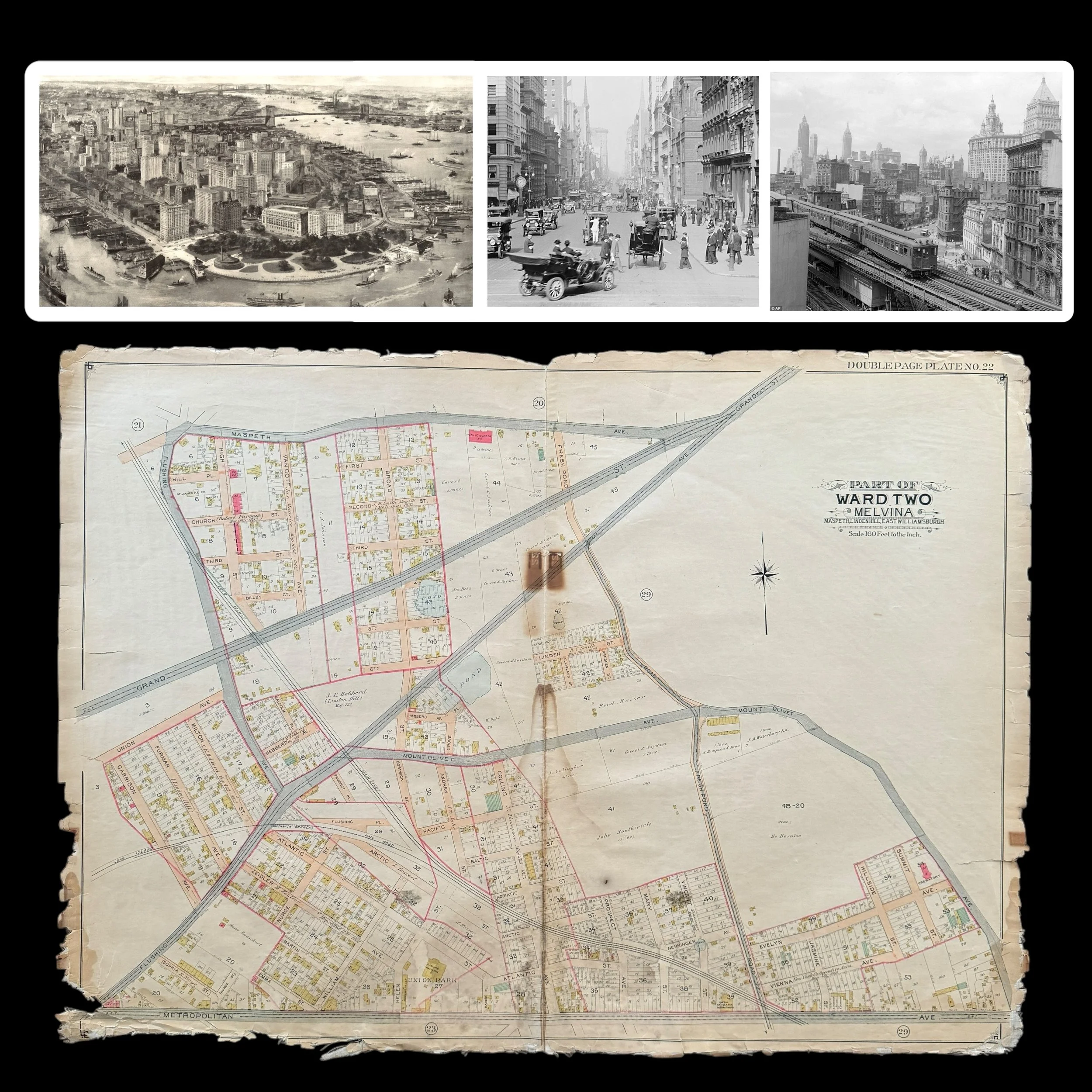
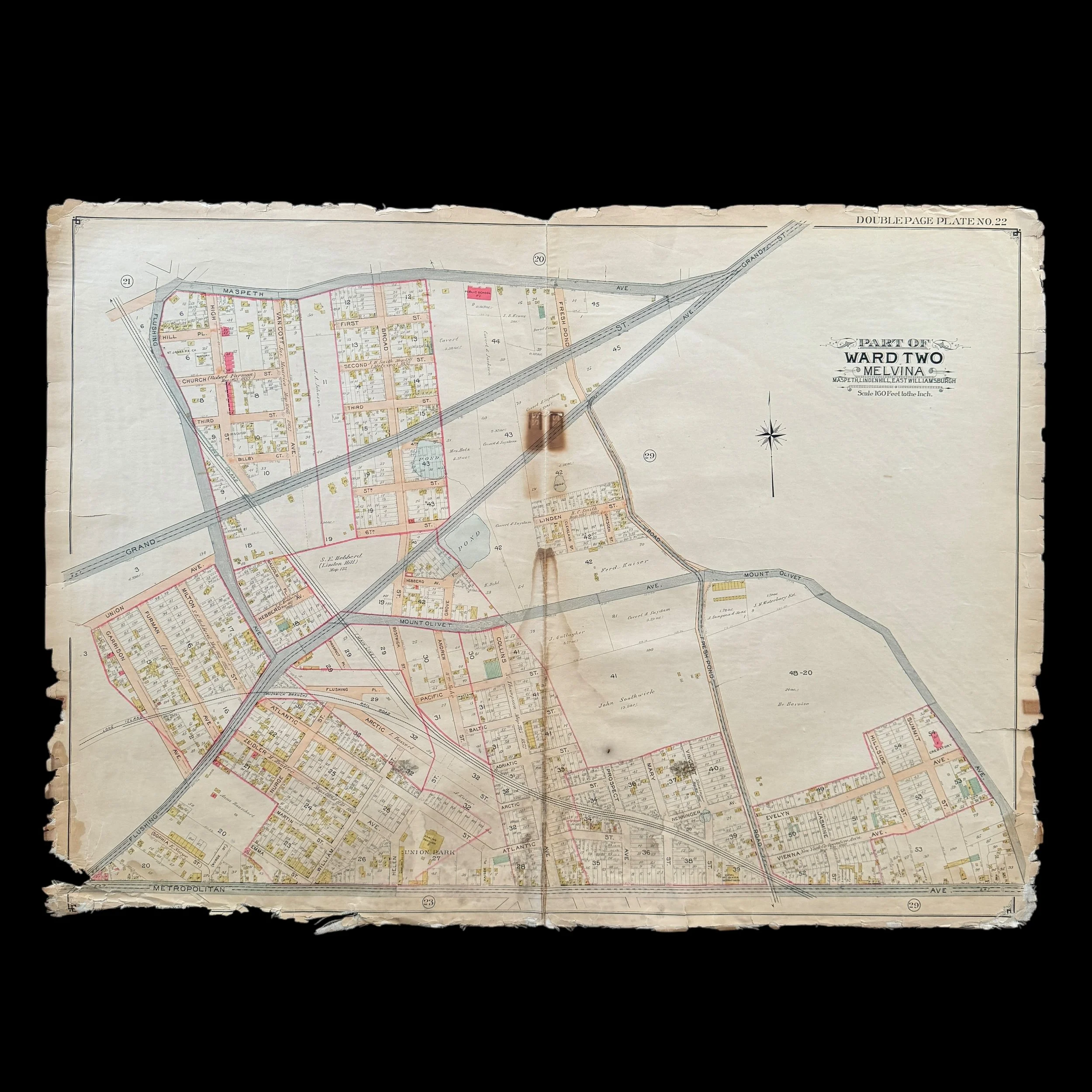
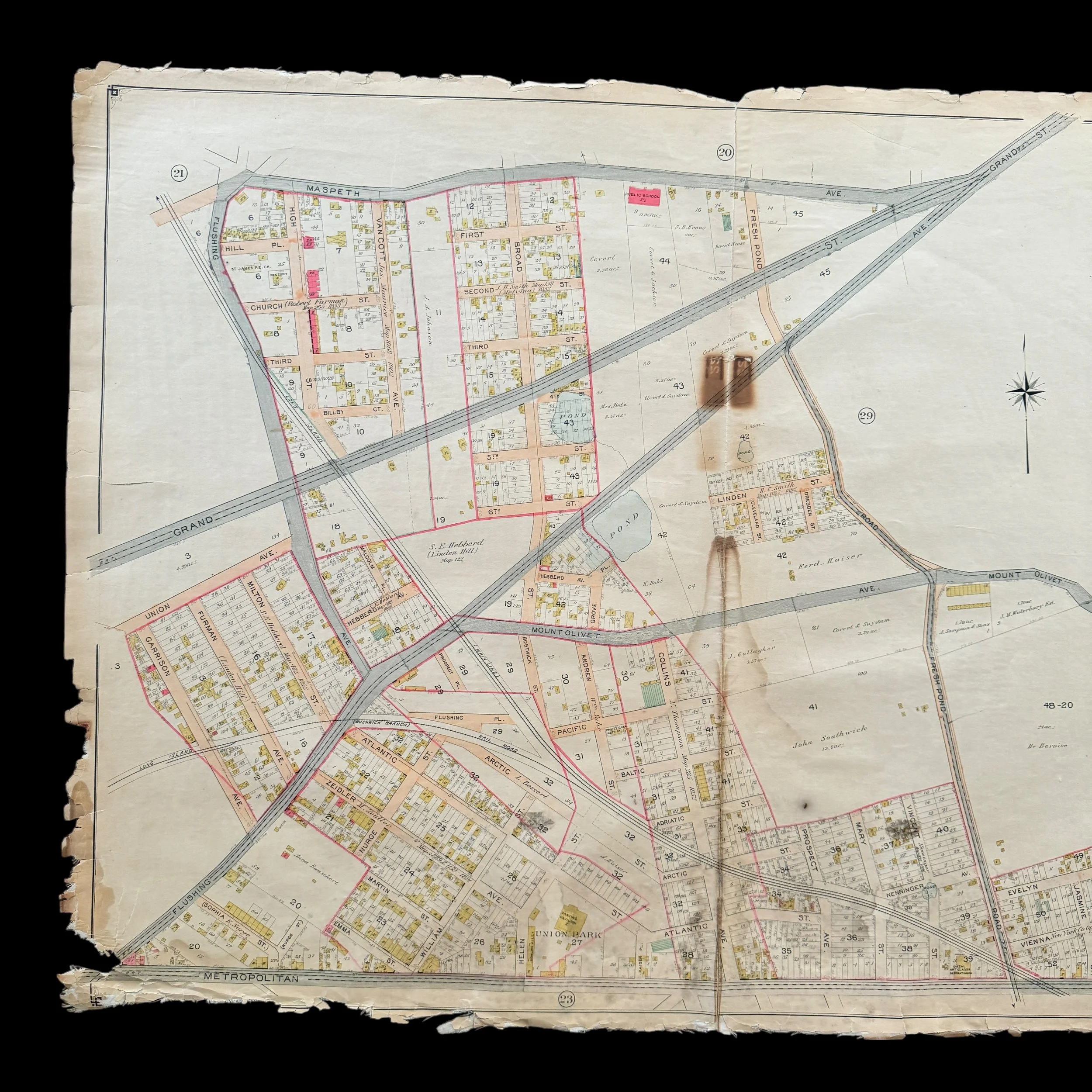
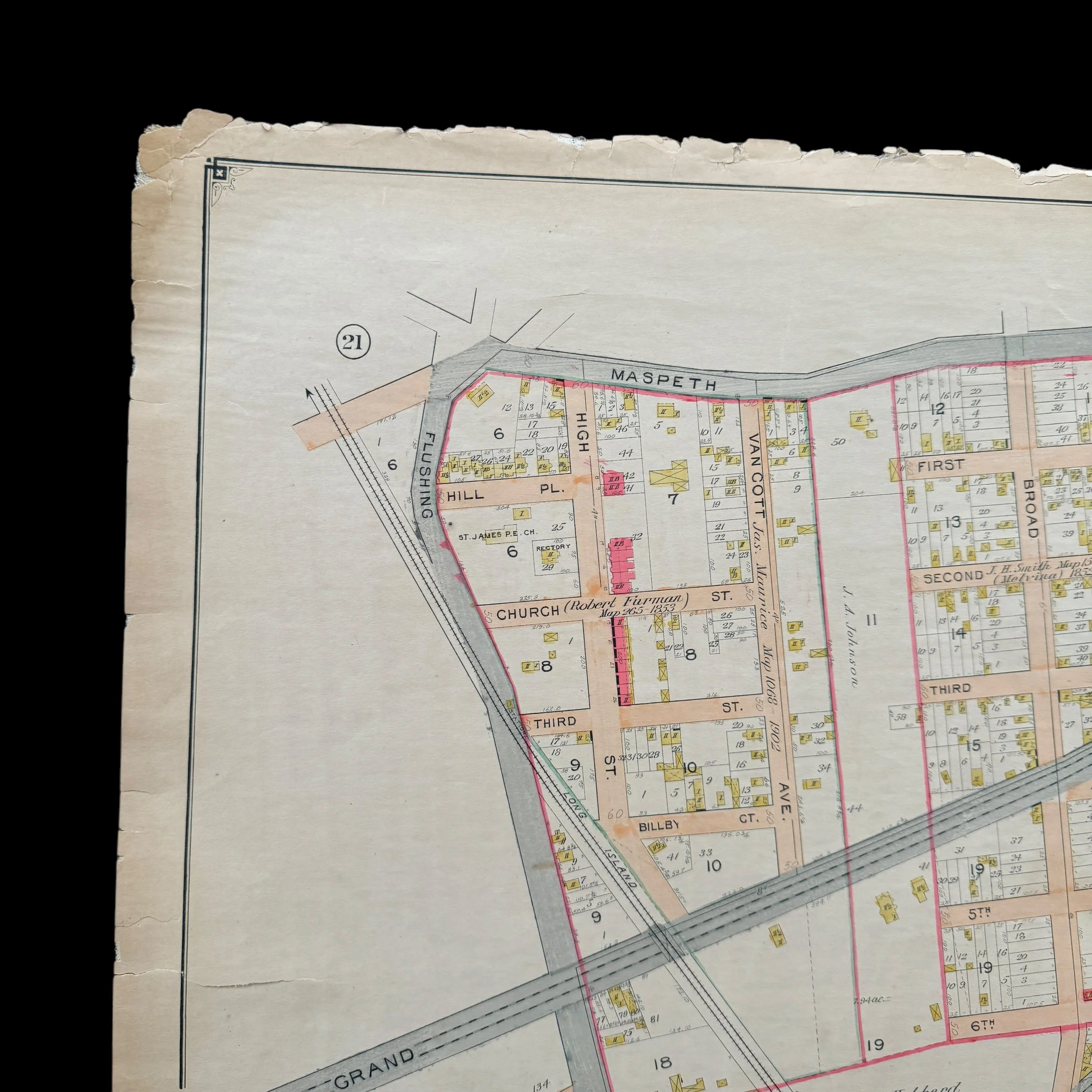
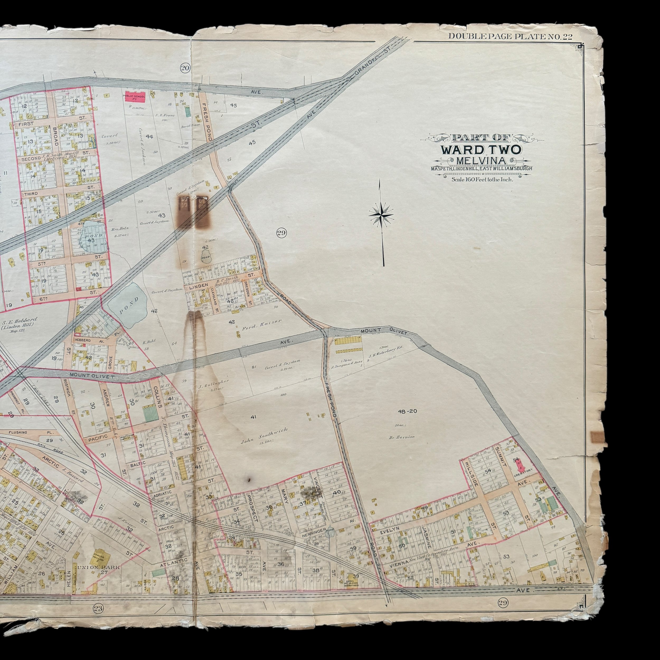
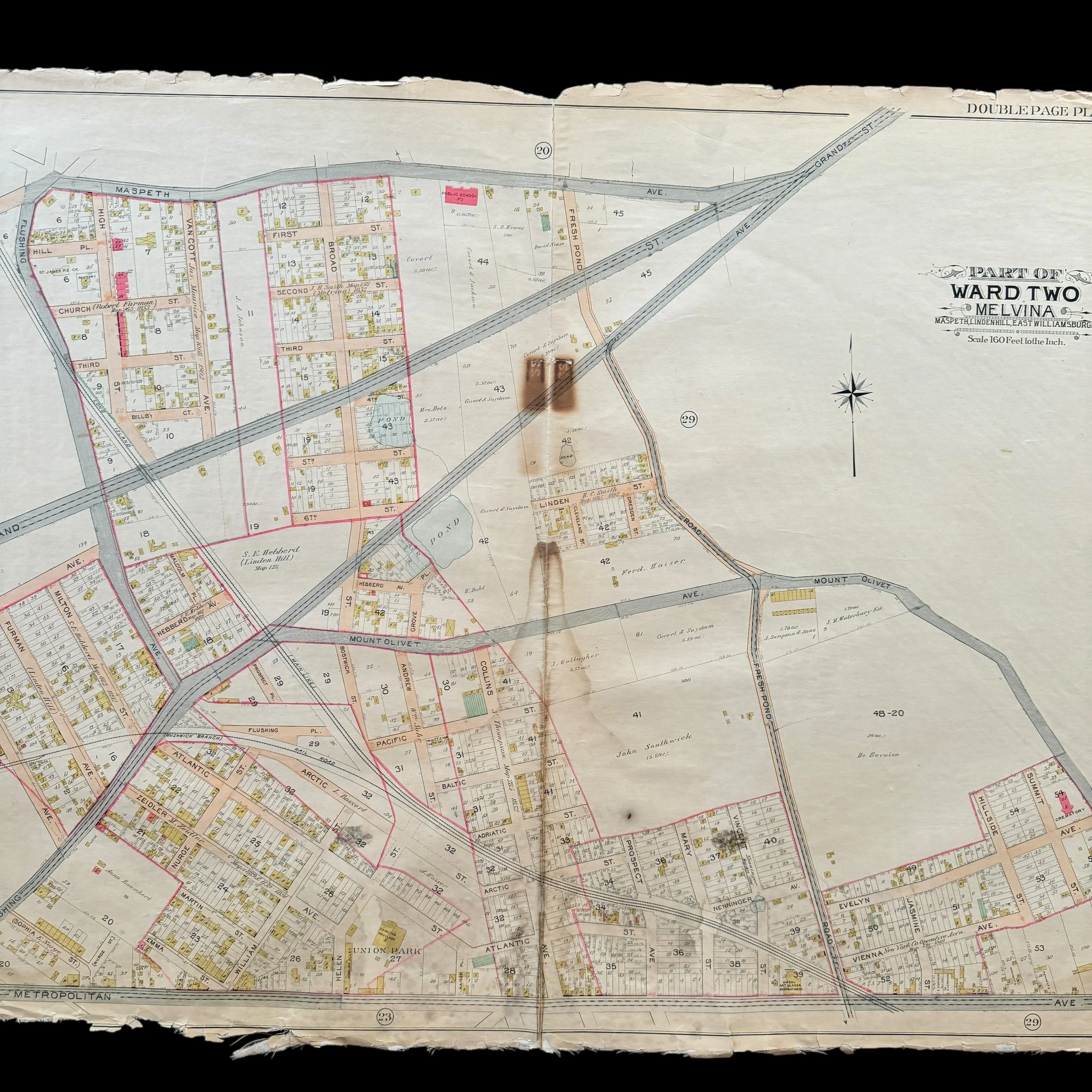
VERY RARE! Original 1903 New York City - Melvina - Early 1900's NYC Blueprint Map (PLATE 22)*
Comes with a hand-signed C.O.A.
*This is an extremely rare piece of original early 1900s New York City history that would make a stunning centerpiece in any collection. Framed and displayed, this original 1903 NYC blueprint would not only serve as a captivating conversation piece but also as a tangible link to the city’s past. Its detailed craftsmanship and historical significance make it perfect for anyone passionate about New York City's rich architectural and urban development history. Whether featured in a private collection, office, or historical space, this rare blueprint is sure to become a treasured heirloom that celebrates the evolution of one of the world's greatest cities.
Size: 27 × 37 inches
Dated: 1903
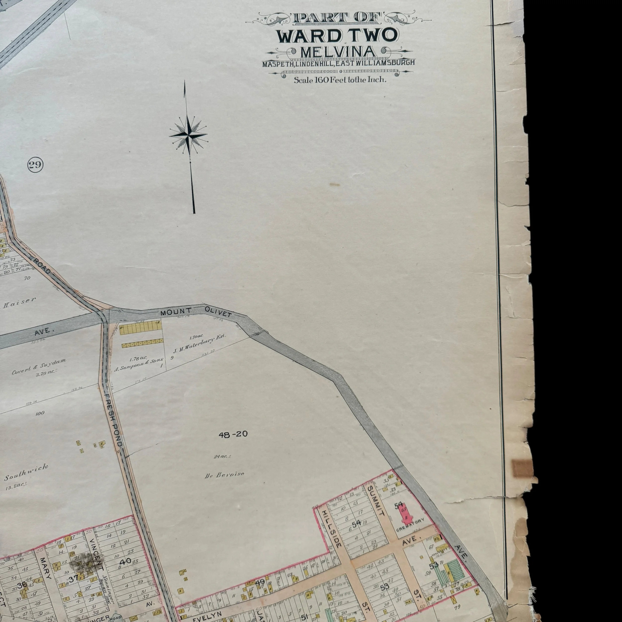
Place: New York - Brooklyn - Queens
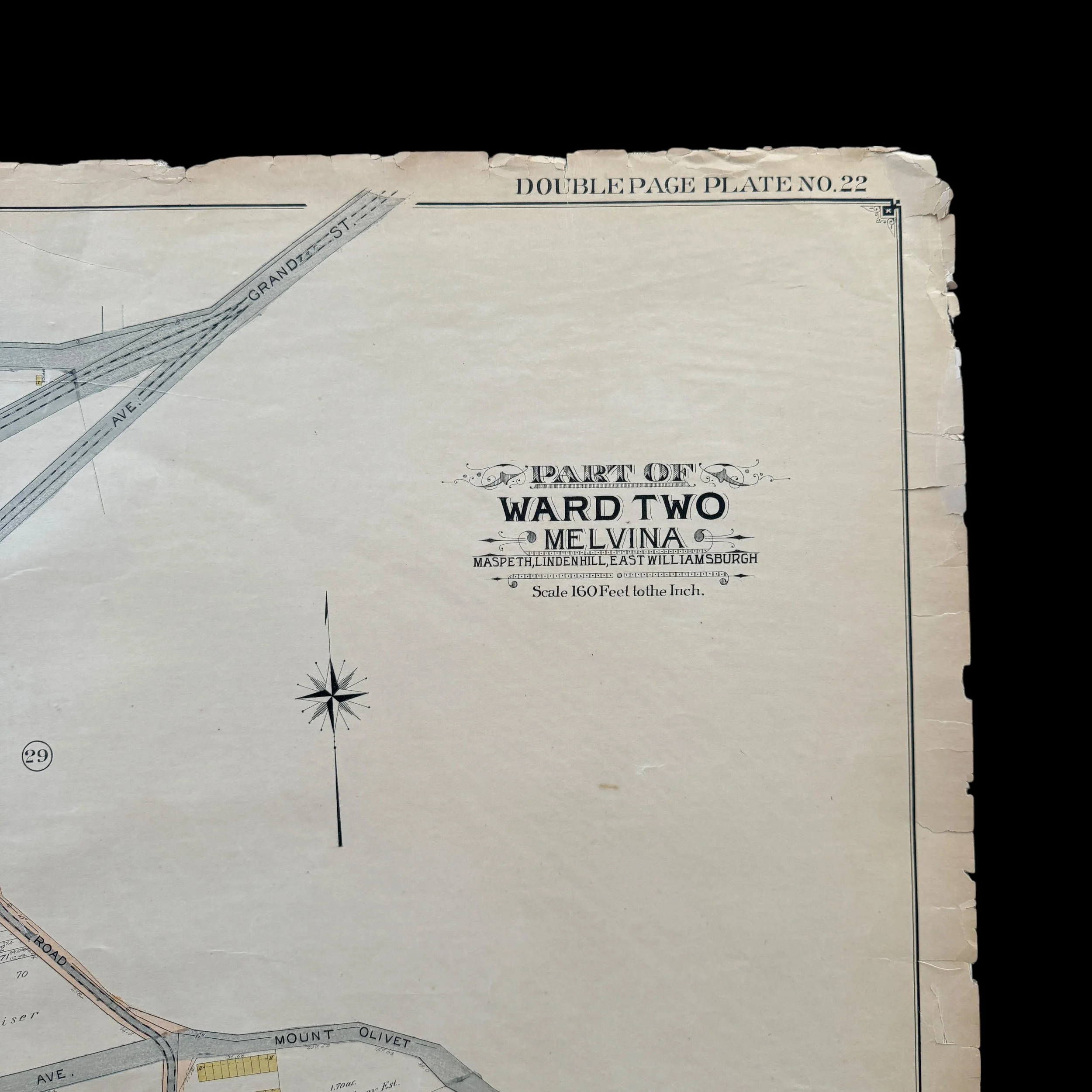
Publisher: E. Belcher Hyde
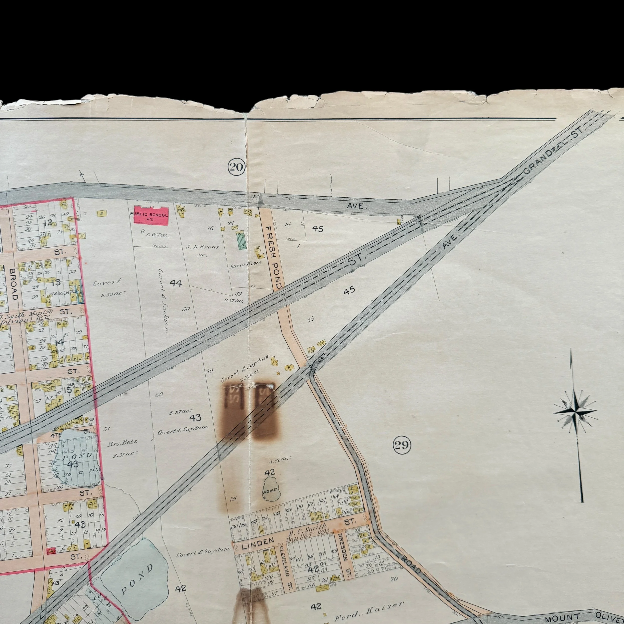
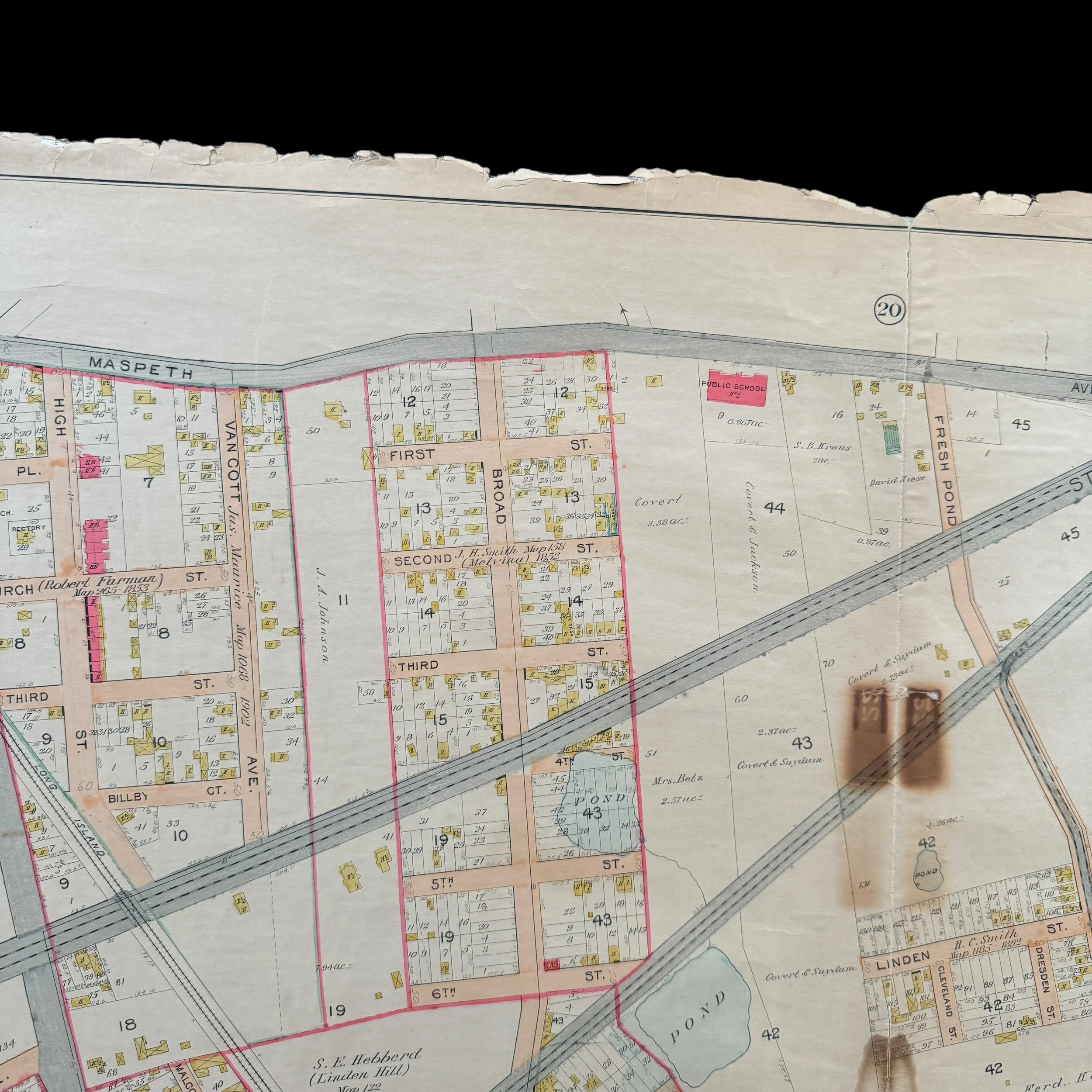
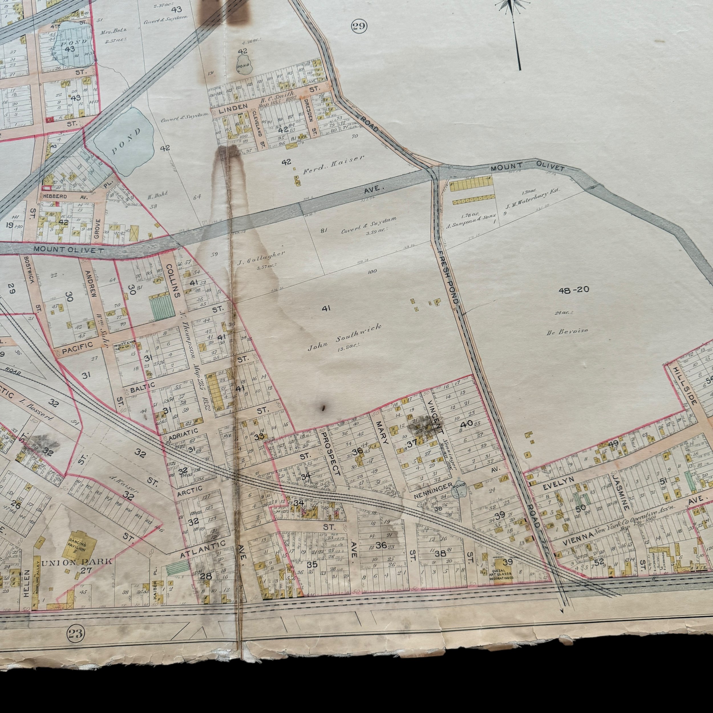
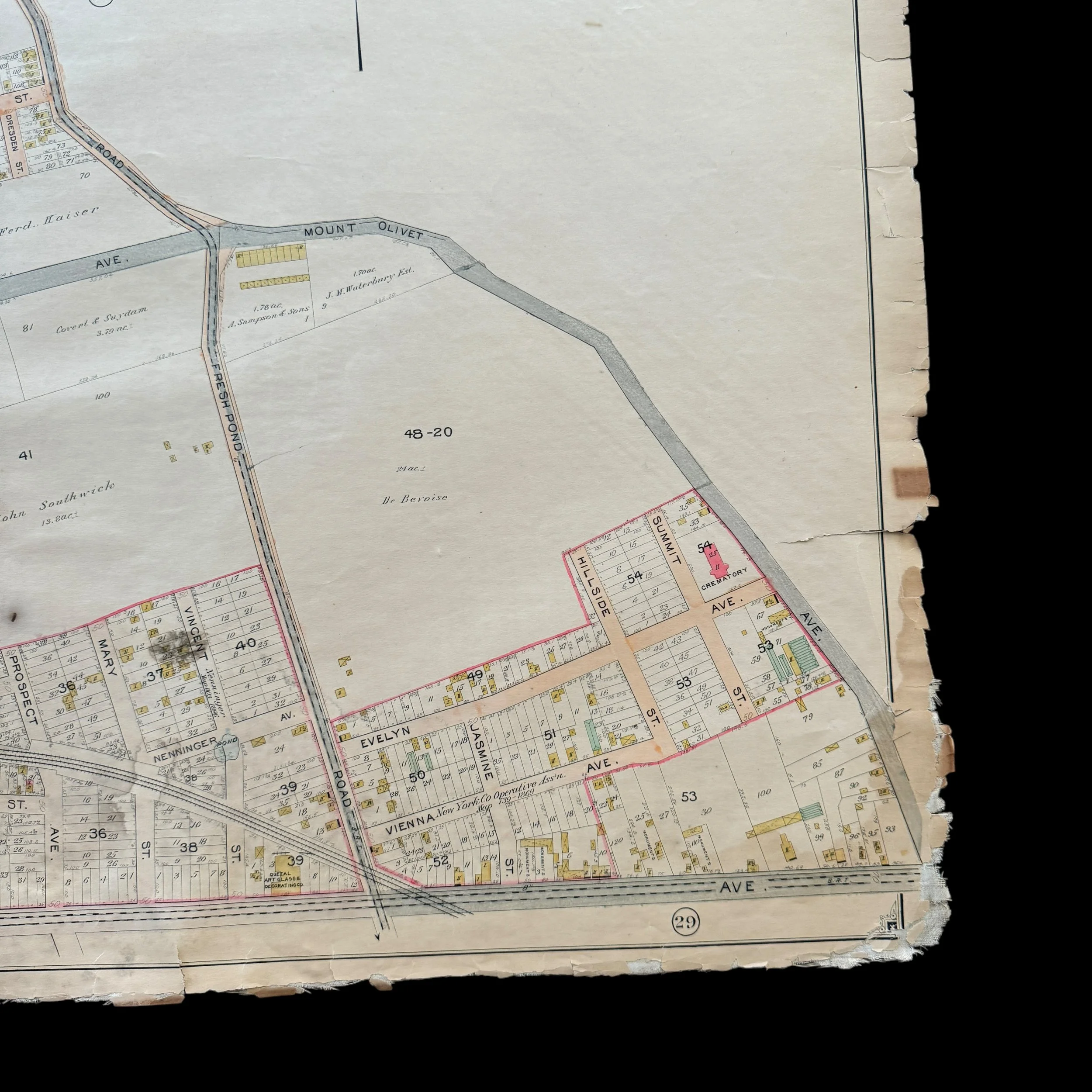
Features: Maspeth, Linden Hill, East William Burg; [Map bounded by Maspeth Ave., Grand St., Flushing Ave., Fresh Pond Road; Including Mount Olivet Ave., Metropolitan Ave., Garrison Ave., Union Ave.
This extremely rare, museum-grade artifact from early 1900s New York City is an original 1903 blueprint map that is a heavily used and marked blueprint was created by the renowned cartographer and publisher E. Belcher Hyde, whose detailed real estate and property maps of New York City and Long Island in the late 19th and early 20th centuries are revered for their precision and historical significance.
At more than 100 years old, this original NYC blueprint is part of a larger series that meticulously documented various sections of New York City, including Queens, Brooklyn, and other boroughs. These maps captured the rapid urban development during a time of major transformation for the city.
In 1903, NYC was at the heart of significant change, having been incorporated into Greater New York City just five years earlier in 1898. The area was transitioning from a largely industrial and residential neighborhood into a more integrated part of the bustling metropolis. Detailed blueprints like this one were vital to guiding that development, serving as indispensable tools for real estate professionals, city planners, and developers.
E. Belcher Hyde's blueprint for NYC offered a wealth of information, from property boundaries and building footprints to street layouts, lot numbers, and ownership details. The blueprint also included railways, waterways, and industrial zones, making it an essential resource for planning new developments and infrastructure. These blueprints were not just practical but legal documents, often used to resolve disputes over property lines and land use.
Hyde’s attention to detail and accuracy in cartography ensured that his blueprints reflected the rapidly changing landscape of New York City at the turn of the century. Today, the 1903 blueprint is a valuable historical artifact, offering a detailed glimpse into the urban planning and development of Long Island City during this pivotal era.
Maps published by E. Belcher Hyde are now considered some of the most important historical documents of the time, providing an unparalleled snapshot of New York City’s growth, land use, and infrastructure at the height of their transformation into a global metropolis.
This is truly a once-in-a-lifetime opportunity to own a one-of-a-kind piece of New York City history. This original 1903 E. Belcher Hyde blueprint is the only known version available for purchase in the public sector. With the majority of these rare blueprints held in private museum collections, opportunities like this are exceedingly rare, making this a unique chance to own an authentic artifact of New York’s early 20th-century development.