RARE! 1944 "FIELD PRINTED" STRASBOURG - BASEL U.S. Infantry and Armored Division Invasion of Germany Combat Map*


RARE! 1944 "FIELD PRINTED" STRASBOURG - BASEL U.S. Infantry and Armored Division Invasion of Germany Combat Map*
Comes with C.O.A.
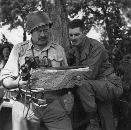
This original and museum-grade World War II map is a very rare FIELD-PRINTED combat map printed in the theater of combat during later 1944. Field printed maps are very rare as they were done to supply U.S. and other Allied Infantry and Armored Divisions with updated maps as they rapidly moved across the European Theater. These maps are one-of-a-kind and were printed on and with materials they had around them at the time. This combat field printed map is a double-sided map title “STRASBOURG - BASEL” and was used by Allied Infantry and Armored Divisions during Allied operations across the Rhine and into Germany.
The U.S. and Allied advance into Germany during World War II marked a pivotal phase in the European theater of operations. This strategic push into German territory was characterized by a series of meticulously planned and executed missions and operations, many of which revolved around key geographical locations such as Strasbourg, Basel, Haguenau, Bitche, and the Rhine River. The success of these operations depended heavily on various factors, including the effective use of maps and the coordinated movement of infantry and armored units defenses.
The Strategic Importance of Geography
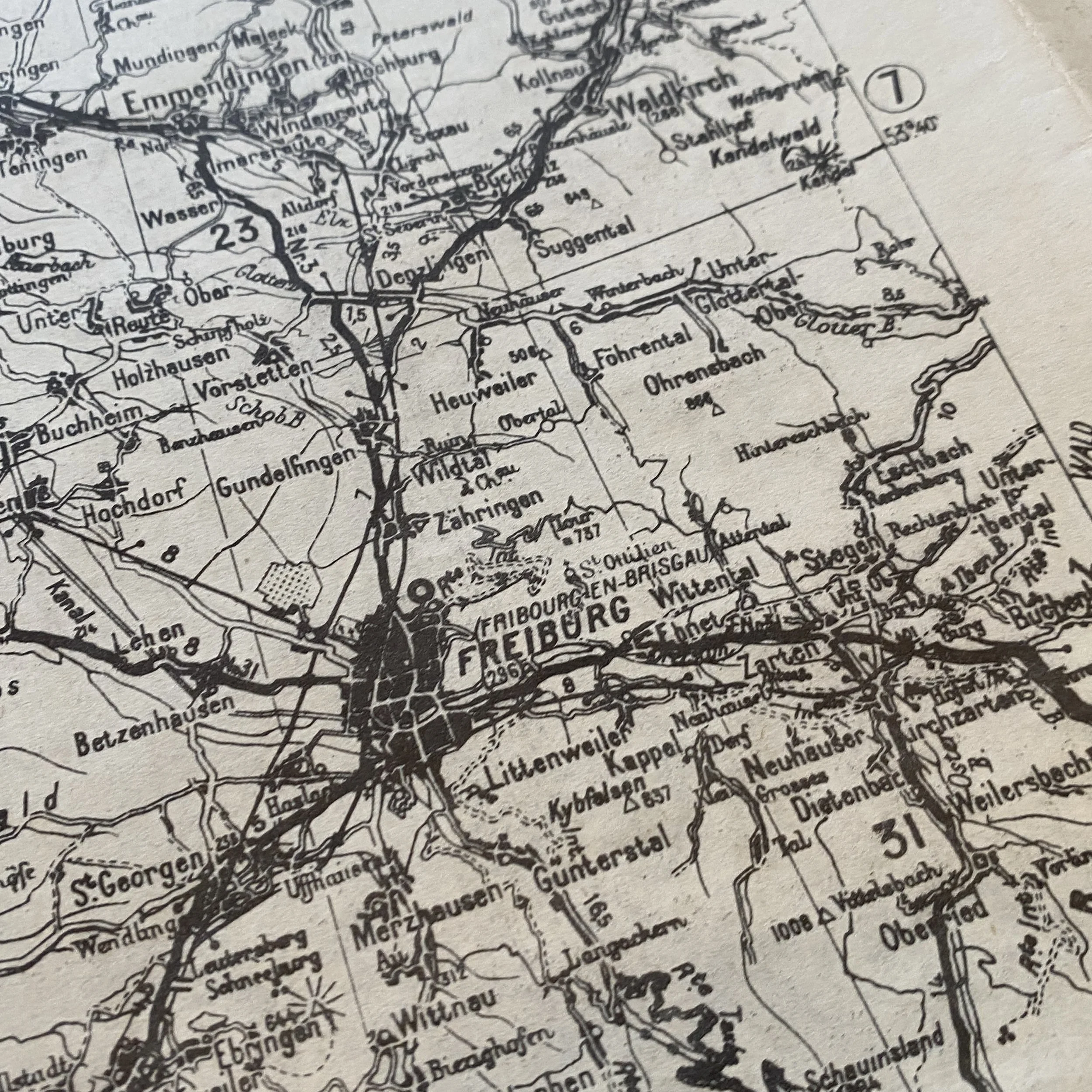
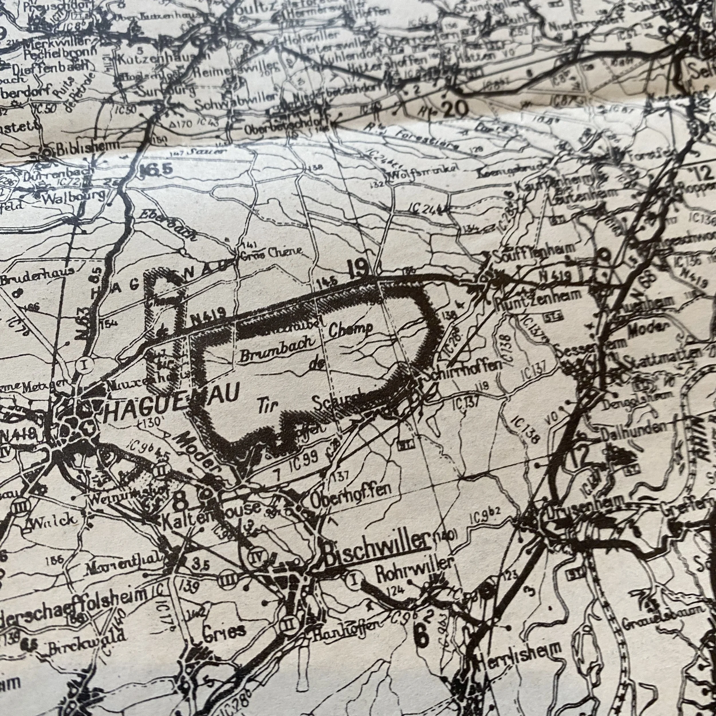
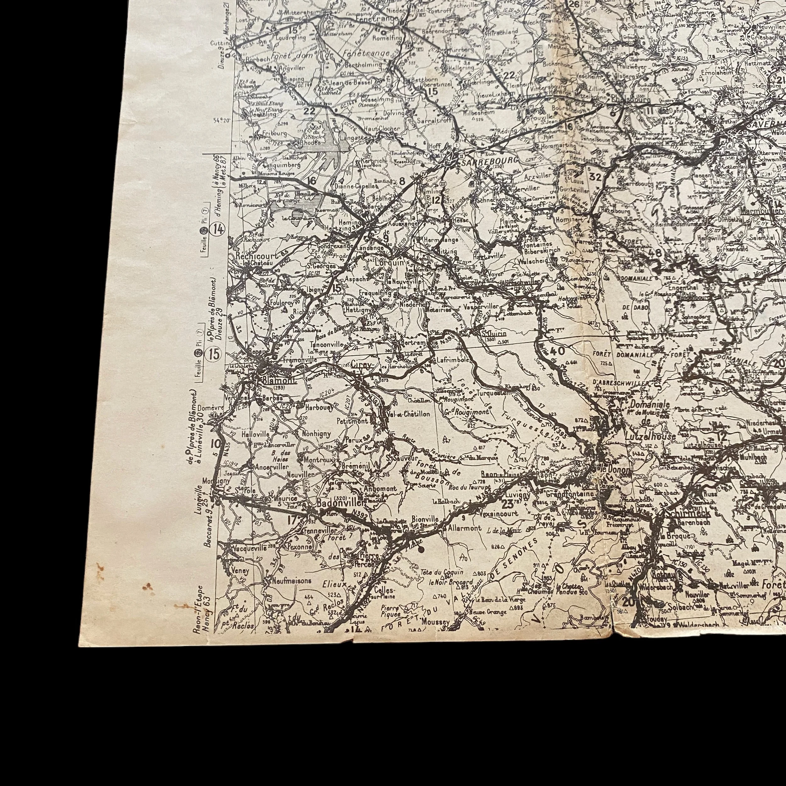
The cities of Strasbourg, Basel, Haguenau, and Bitche, along with the Rhine River, held significant strategic value for both the Allies and German forces. Strasbourg, situated near the Rhine River, was pivotal for its economic and symbolic importance, serving as a gateway to the German heartland. Basel, although located in neutral Switzerland, was close to the borders of Germany and France, making the surrounding areas critical for controlling access routes. Haguenau and Bitche were important due to their positions within the heavily forested and fortified region of the Maginot Line, offering defensive advantages to the occupiers. Lastly, the Rhine River itself was a major geographical barrier that the Allies needed to cross to penetrate deeper into German territory, representing both a physical and psychological hurdle.
The Role of Maps and Cartographic Intelligence
In this theater of war, maps and cartographic intelligence were indispensable tools for planning and executing military operations. The detailed maps used by the U.S. and Allied forces included topographical features, enemy fortifications, road networks, and other strategic points of interest. These maps were essential for navigating the complex European terrain, planning attacks, and logistical support, and anticipating enemy movements.
Infantry and armored units relied heavily on these maps for maneuvering through hostile territory. For instance, in the operation to liberate Strasbourg, commanders would have used detailed city maps and regional topographical data to identify key German defensive positions and to plan their approach. Armored units, with their ability to move quickly across the battlefield, depended on accurate road maps and knowledge of terrain to avoid ambushes and to exploit weaknesses in the German defenses.
Operations Around Strategic Locations
Strasbourg and Haguenau
The liberation of Strasbourg was a high point of the U.S. and Allied advance. The operation involved a combination of infantry assaults supported by artillery and armored thrusts. Maps of the city and its surroundings allowed the Allies to encircle Strasbourg, cutting off German supply lines and forcing a withdrawal from this critical position.
Nearby, the battle for Haguenau represented another example of the intricate use of maps in combat situations. Infantry units, often moving under the cover of darkness, used detailed maps to navigate through the dense forests and to flank German positions. The success of these operations required intimate knowledge of the terrain, something that could only be achieved through the use of detailed cartographic materials.
Bitche and the Rhine River Crossing
The capture of Bitche involved breaching the formidable defenses of the Maginot Line. Here, maps detailing the extensive fortifications, including bunkers and minefields, were crucial for planning the assault. The use of aerial reconnaissance photos supplemented these maps, providing a dynamic view of German troop movements and fortification updates.
The crossing of the Rhine River, Operation Plunder, was perhaps the most significant use of maps and cartography during the Allied advance. This operation involved detailed planning for the construction of bridges, the deployment of amphibious vehicles, and the establishment of beachheads on the opposite bank. Maps of the river and its surroundings were critical for identifying feasible crossing points, understanding the flow and depth of the river, and for positioning anti-aircraft and artillery units to cover the crossing forces.
The U.S. and Allied advance into Germany during World War II demonstrates the critical role of maps and cartographic intelligence in modern warfare. The operations around Strasbourg, Basel, Haguenau, Bitche, and the Rhine River highlight how detailed geographic knowledge and the strategic use of infantry and armored units could decisively impact the outcome of military engagements. These operations not only required brute force but also a deep understanding of the terrain, proving that in war, knowledge of the battlefield can be as powerful as the weapons wielded.