WWII APRIL 1945 U.S. Third Army Invasion of Germany Infantry & Armored Division MARLISHAUSEN - Germany Combat Map*


WWII APRIL 1945 U.S. Third Army Invasion of Germany Infantry & Armored Division MARLISHAUSEN - Germany Combat Map*
Comes with C.O.A.
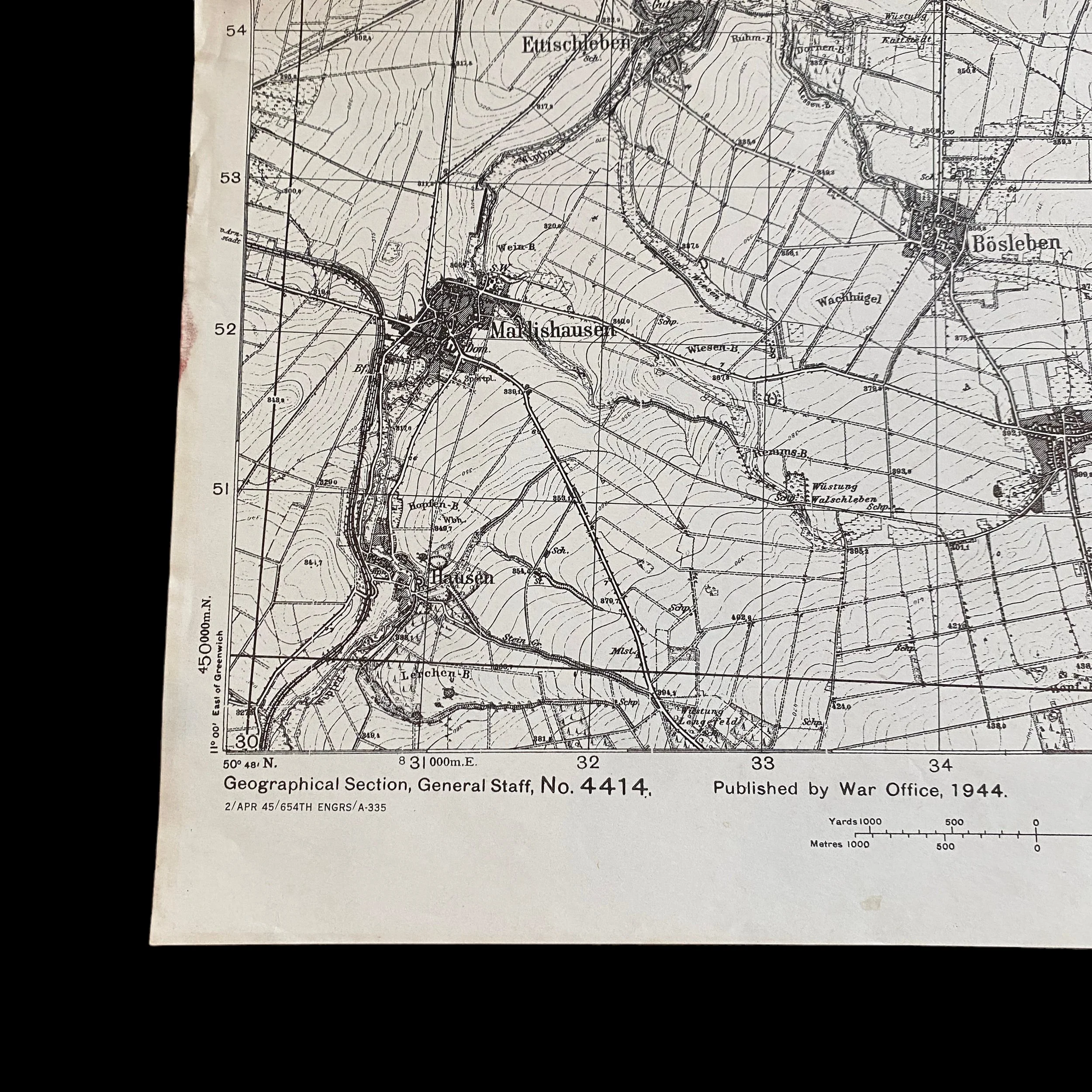
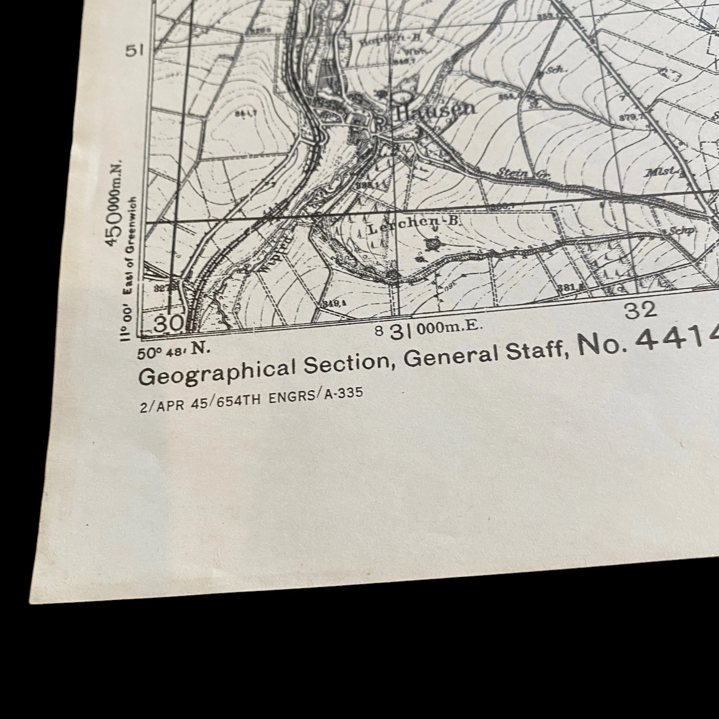
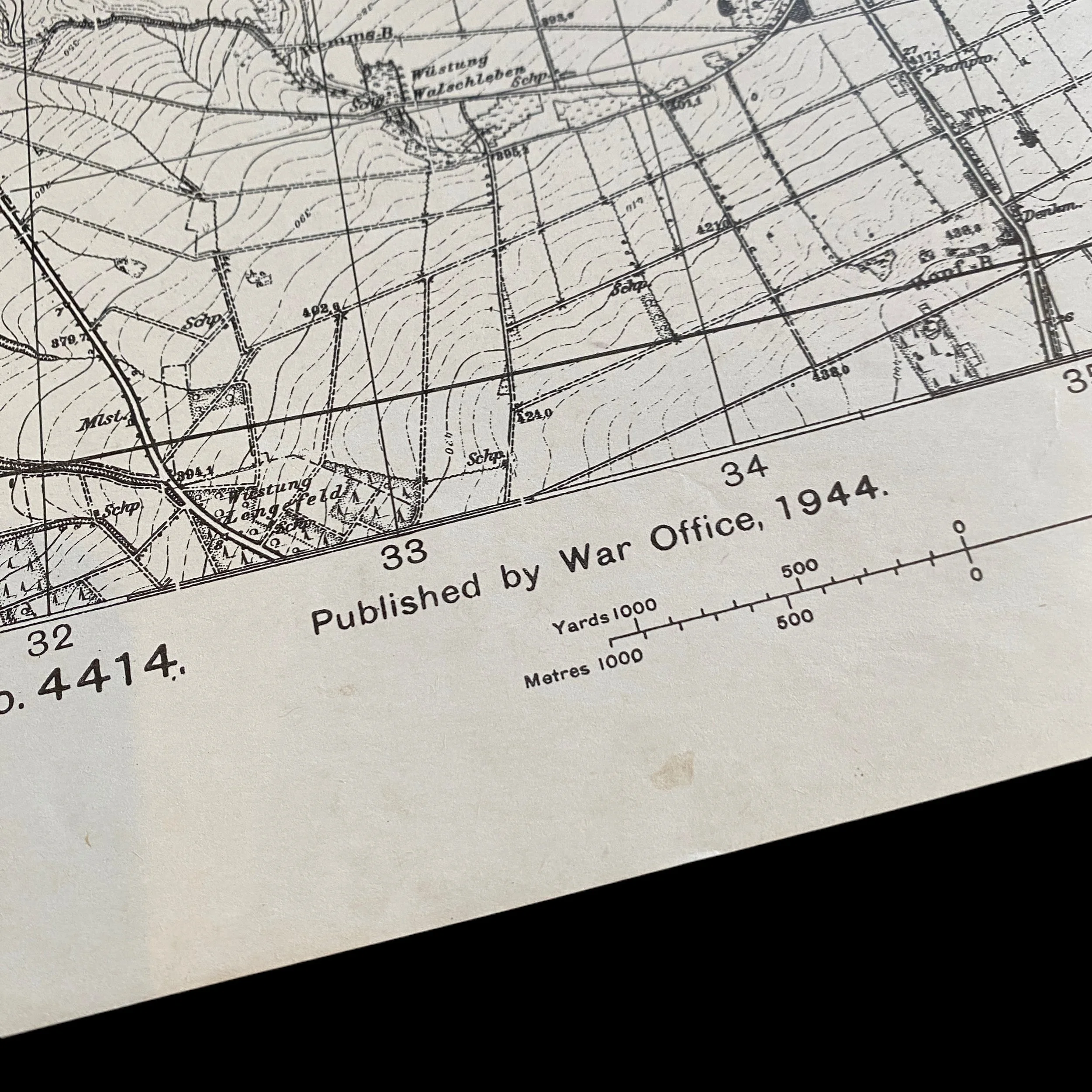
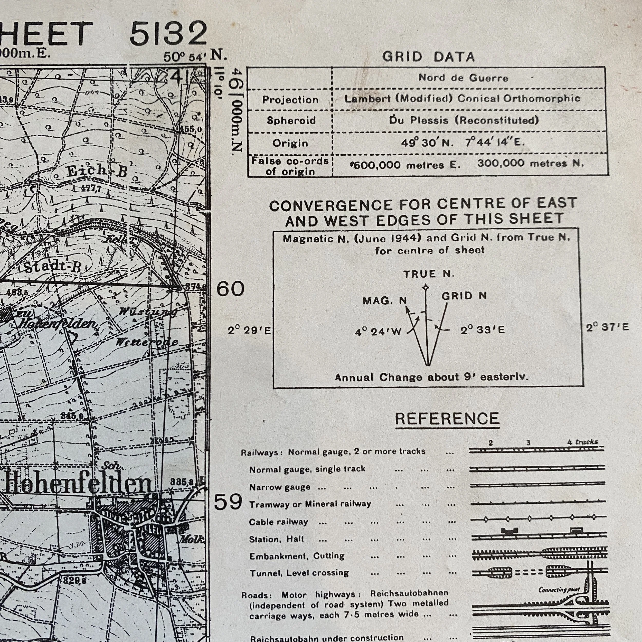
Printed in APRIL 1945, this incredible WWII combat operations map was specially created and used by U.S. Infantry and Armored divisions during the Western Allied invasion of Germany in the Western Front of the European theatre of World War II. This specific Invasion of Germany combat map was a bringback from a THIRD ARMY veteran of World War II.
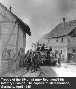
Below is a report of combat operations of U.S. Infantry and Armored Division while in this combat area of MARLISHAUSEN:
At 1815 as Battalion approached Gossel, Lt. Glen C. Belew, Battalion S-2, volunteered to go into the town with two German civilians under a flag of truce to demand its surrender. It was agreed that if he failed to return within half an hour the town would be subjected to intense artillery fire. When the trio entered Gossel they were immediately taken prisoner by about 60 German SS troops. The minutes ticked by. Five minutes before the artillery was scheduled to let loose, the Germans withdrew from the town taking Belew with them. By lagging behind he managed to elude his captors and worked his way back to the Battalion. The information he brought back -- that there were no enemy troops in the town -- helped to speed up the Battalion's advance. Later that night the Battalion was forced to the town cellars by 250 rounds of mortar and artillery fire from the vicinity of Pleue. When a man in Co.L was wounded, T/4 Donald A. Linder, a medic, attended him in spite of the fact that enemy fire was so close that his patient was wounded again.
At this time a definite pattern in the enemy's defense system had become apparent. During the mornings our troops were advancing .easily, meeting little opposition. Then in midafternoon the enemy would open up and continue firing until darkness. During the night they withdrew to their next defense area. The Regimental CP on April 1 0 was in Ohrdruf and the next day it was set up in Wullersleben.
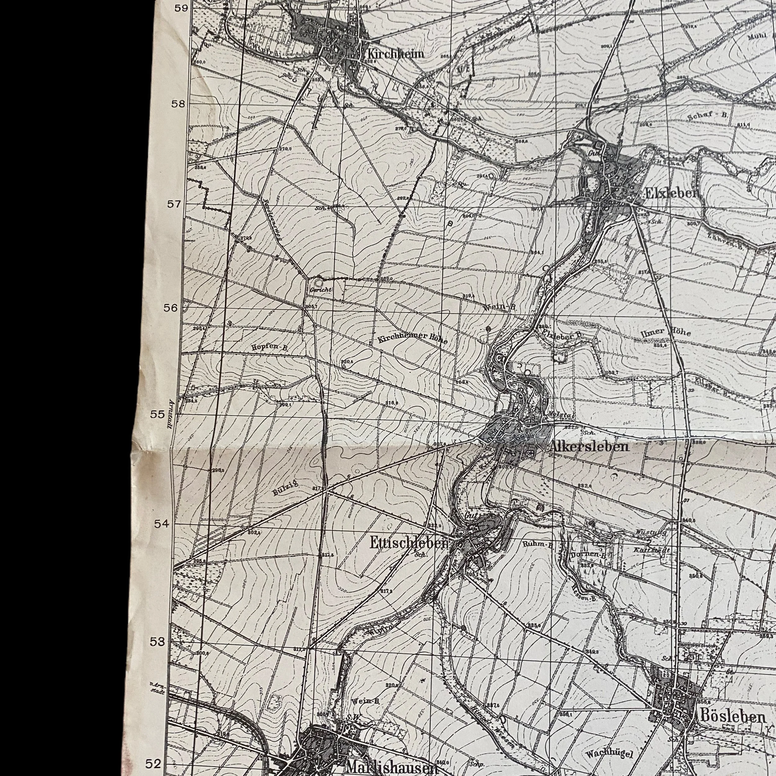
On the 11th the 1st Battalion began a movement at 0300 to a new assembly area at Lopenfeld. There Task Force Owens was formed, based on Co. C. As the Task Force formed in apparent concealment, a lone German machine gunner sat and watched. He waited until the force started to move and then -- timed with a feint air attack -- he opened up and drove the tank borne Co. C to the ditches. Several rounds from the tank's 76mm made a good German out of him and Task Force Owens moved on through Arnstadt and into Marlishausen. There 88mm fire and sniper fire forced them to dismount again. The tanks destroyed the building from which the sniper was firing and 88 withdrew. The rest of the Battalion reached Marlishausen at 1700.
The 2nd Battalion started across the Gera River at 0445 after all-night artillery preparation. Co. G entered Seiglebach at 0530 and Dannheim at 0630 against no resistance. By 0930 Co. E : was a Marlishausen and F and G Companies were in the vicinity of Hausen. The Battalion continued through Bosleben and Wullersleben, where Capt. David N. Galloway, CO of Co. F. was wounded towards Wizleben.
These maps were often revised and printed in the theater of operation using the most updated Allied Ariel photography and Royal Air Force reconnaissance photos. This ‘FIRST EDITION’ map was created using Allied aerial reconnaissance photos from 1944. This specific map type was distributed to units in the area of operations and was used as the map in the most intense battlefields of the ETO. This map would have been a key element in the elimination of German Tiger tanks, German infantry, and various other German fortifications during the final months of World War II. If time and information allowed there would be ‘SECRET’ overprints done on these exact maps to provide infantry and armor and divisions with even more information regarding German fortifications and gun emplacements. This original World War II map would have been vital to US infantry and armored division success as they pushed farther into Germany before the German armed forces surrendered unconditionally in the west on May 7 and in the east on May 9, 1945.
Third Army During WWII:
The Third Army was on active duty in the Southern United States when the United States entered WW II. Between 1932 and 1944, Headquarters for the Army alternated between Fort Sam Houston, Texas (where the VIII Corps HQ was located), and Atlanta, Georgia (where the IV Corps HQ was located), depending upon which Corps had the senior officer. On January 12th, 1944, the advance detachment of the Third Army left for England, and at midnight on January 25-26 General George Patton assumed command of the Army. In July of 1944, the Army Headquarters moved to the Cotentin Peninsula in Normandy, France. After heavy fighting in Brittany, the Third Army broke loose and raced across France crossing the Moselle River and cutting into the German winter defensive positions. Under Patton's brilliant leadership, elements of the Third Army raced 150 miles in 19 hours to attack the southern flank of the German forces during the Battle of the Bulge. After four days of fighting, the German siege of Bastogne was broken and the last major German offensive of WW II was brought to an end. The Third Army then forged the Rhine River, crossed Germany and the Danube River, and finally reached Czechoslovakia before the war ended.