Battle of the Selle '9/10/1918' German Emplacement and Trench Positions - "Andigny Forest" Combat Map
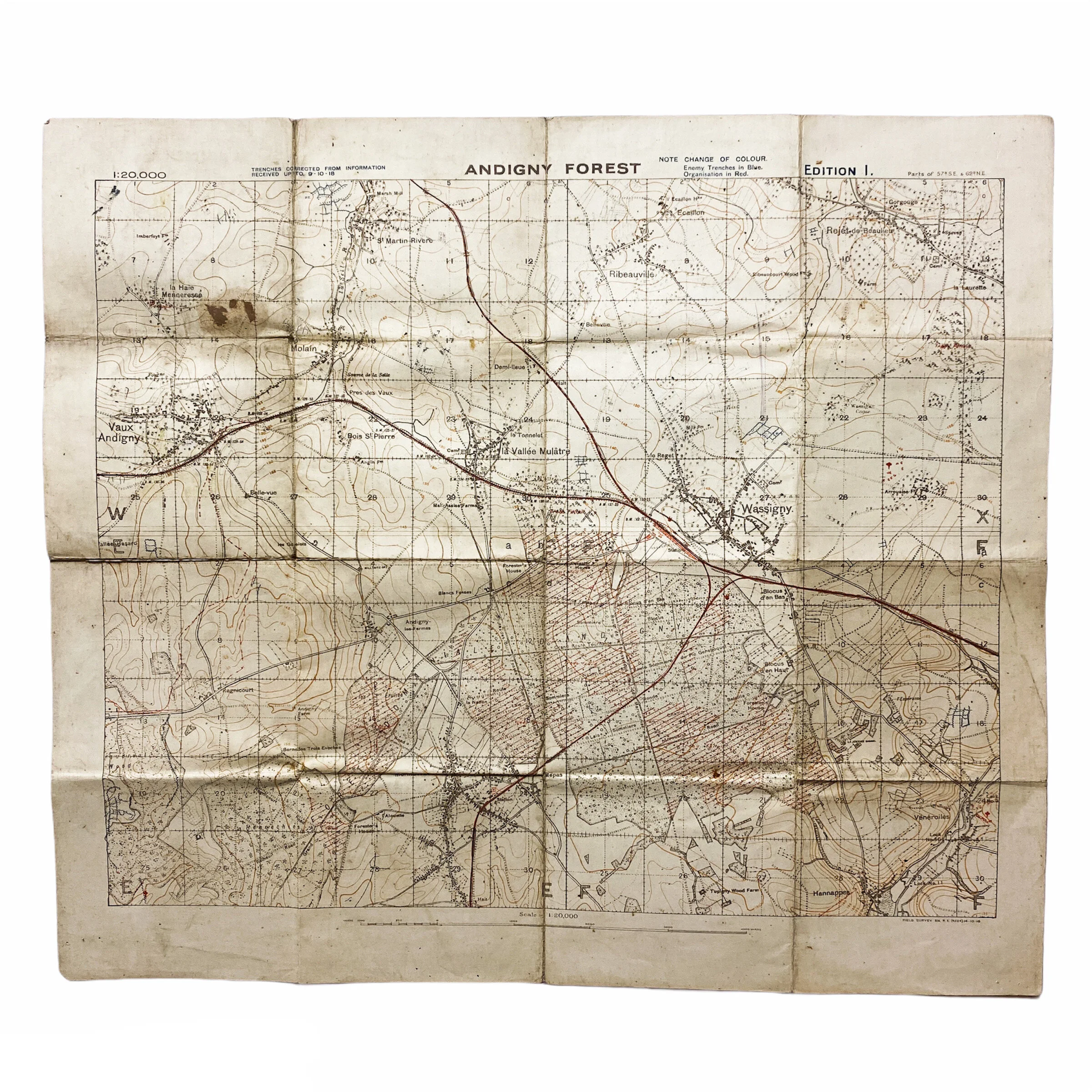


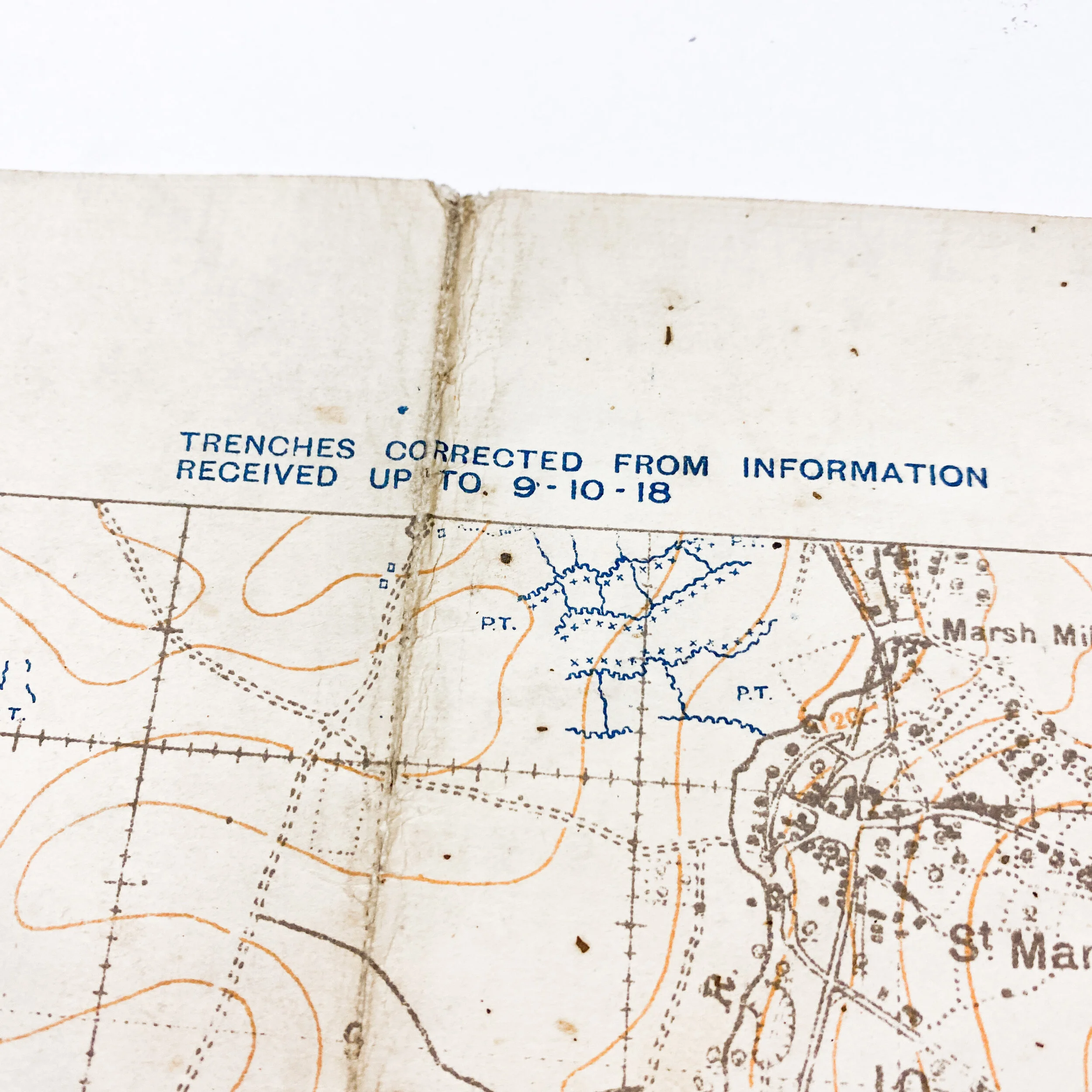


Battle of the Selle '9/10/1918' German Emplacement and Trench Positions - "Andigny Forest" Combat Map
Size: 20 x 23 inches
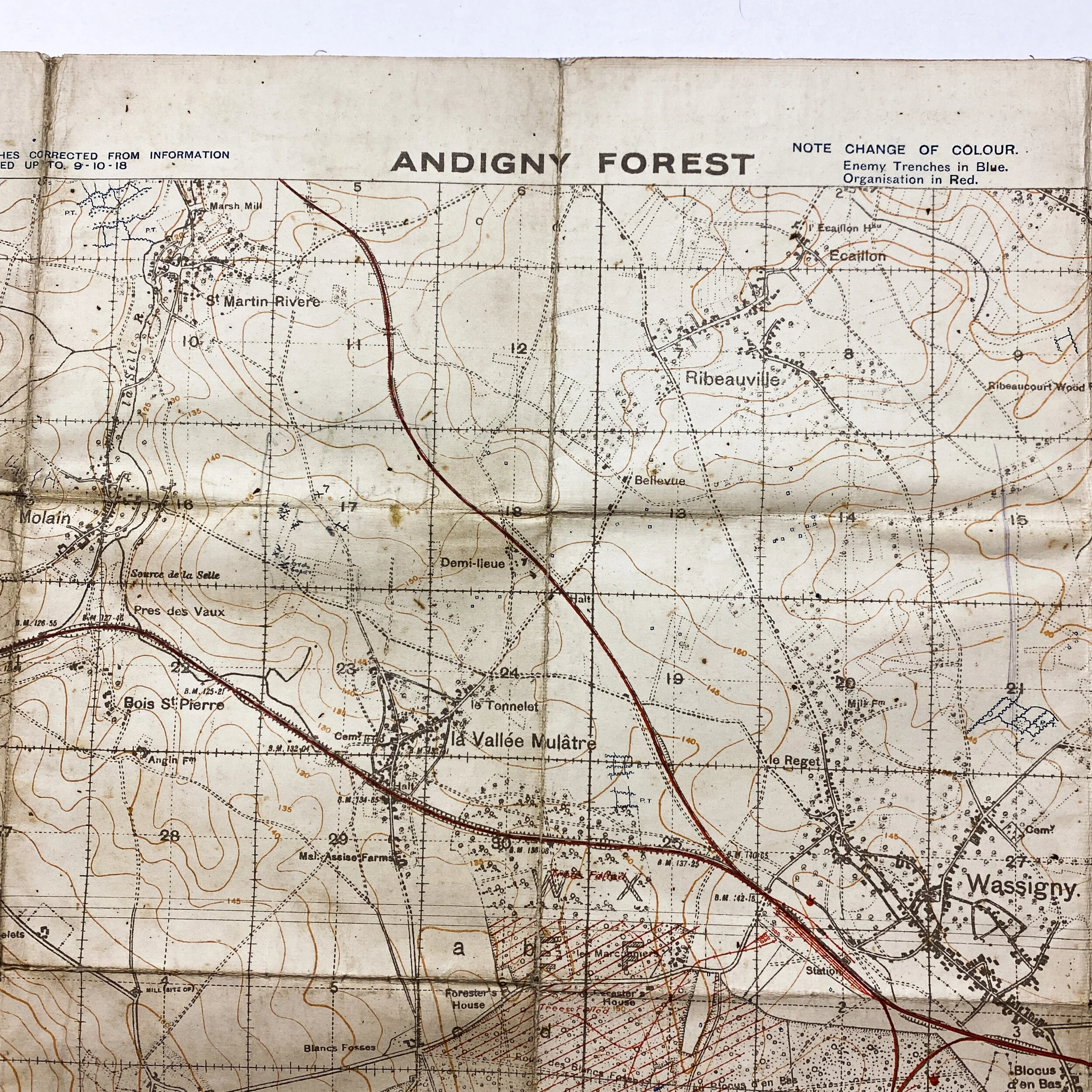
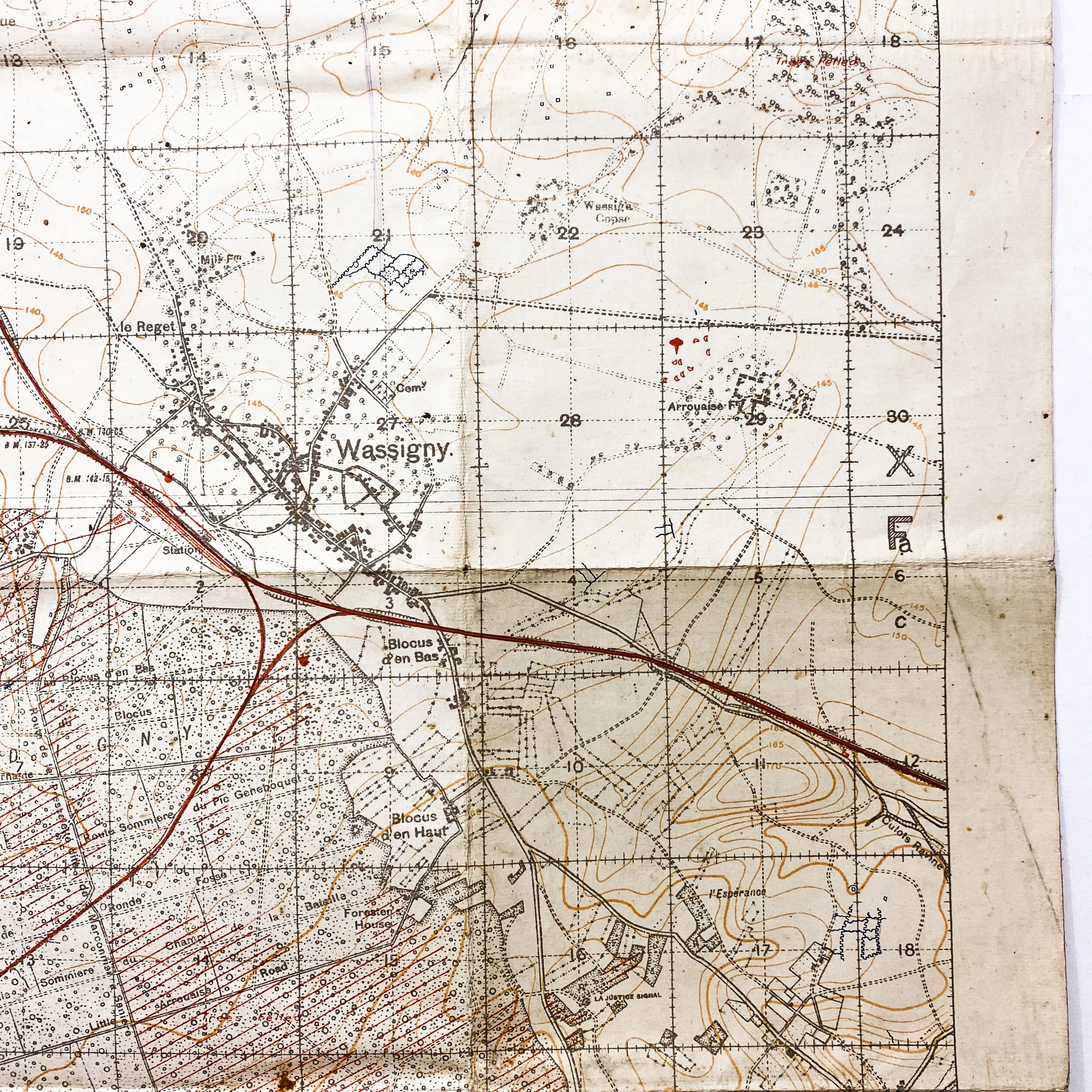
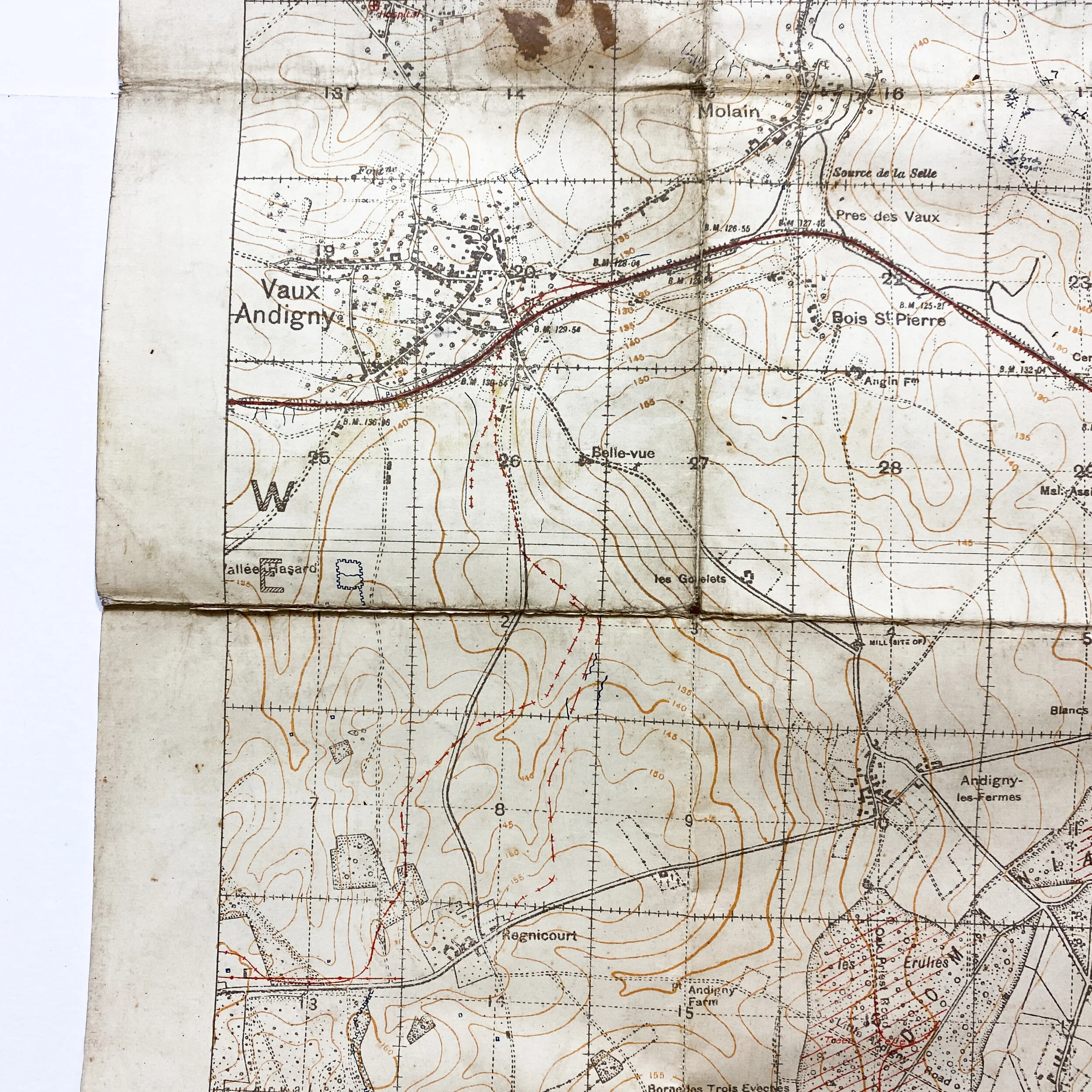
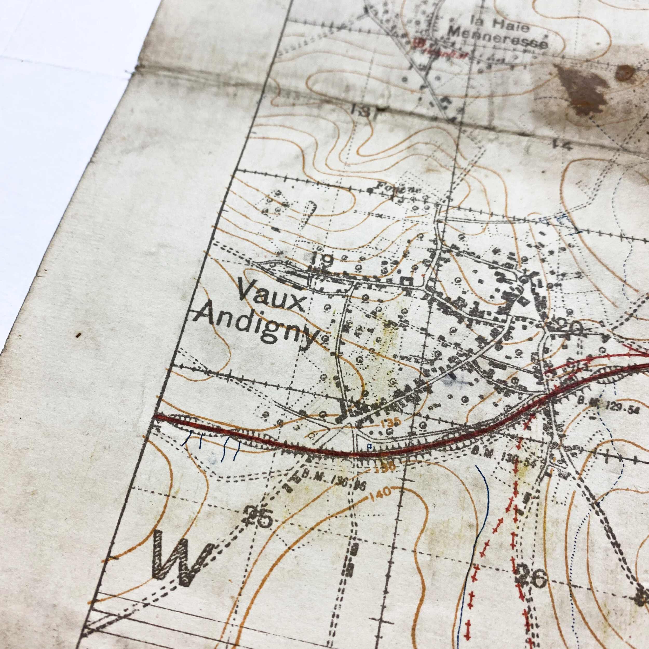
This heavily used and worn World War I combat trench map was used during the Battle of the Selle which took place in October of 1918. This was a battle between Allied forces and the German Army, fought during the Hundred Days Offensive of World War I. Titled “Andigny Forest” this map was a vital part of the Allies battle plans as it shows German trenches corrected from information received up to September 10th of 1918, or roughly one month before the battle took place.
As the German’s began to give ground to advancing Allies the Germans were favored by two important obstacles, the group of hills east of Berneville and the mass of Andigny Forest lying before Wassigny. They might attempt to make a stand on the Oise near Guise and along the Oise-Sambre Canal, but their forces had been so badly cut up by the French that their plight had become increasingly desperate. In less than a day they had lost more than 5,500 men and a vast amount of military supplies.
The British army, operating in conjunction with the Belgians, attacked on October 20, 1918, to the north and advanced past Courtrai. The recovery of Ghent had now become inevitable if the push could be maintained. For the Allied guns were pounding the Germans on all sides, while their cavalry patrols, leading the infantry, pressed on closer and closer to the city.
Meanwhile the British Third Army pushed its way eastward to the south of Valenciennes, endangering all the German forces northward to Flanders and southward to the Oise Canal behind which the enemy had begun to retreat before British and Americans. This thrust upset the German plan of trying to hold the line east of the Scheldt.
The British Third Army encountered the heaviest fighting in carrying out this operation, for the Germans realized the importance of delaying here their advance. Smashing all resistance the British gained the high ground to the east of the line from which they were advancing in the face of a torrential hail of machine-gun bullets. The destructive gun nests were rapidly cleaned up, and the German losses were very heavy. Fighting was especially bloody in the region of St. Python, where the enemy fought behind barricades. South of Le Cateau the British and Americans continued to make steady progress. American patrols pushing out from the Mazinghien area had now reached
the banks of the Oise Canal. In this region German guns were constantly active and all villages around were heavily shelled. It was necessary to remove the civilians from some of these towns to places of safety. The Germans entirely disregarded their presence.
Every hour now France and Belgium were recovering precious soil and cities, and thousands of their people were being liberated from German bondage. Especially grateful to the Belgians was the recovery of the ancient city of Bruges which Belgians and British won on October 20, 1918, though German rear guards were in the neighborhood. War had not changed greatly the grand old city built in the middle ages, or injured the beauty of its quaint architecture. The inhabitants massed before the Hôtel de Ville were celebrating their liberation from the Germans' yoke. Everyone had a flag or banner—British, Belgian, or French—and the British troops were received with the wildest enthusiasm and hailed as saviors.