1915 Canadian Corps Named 'Lens' Hill 70 Linen Combat Map with Combat Markings
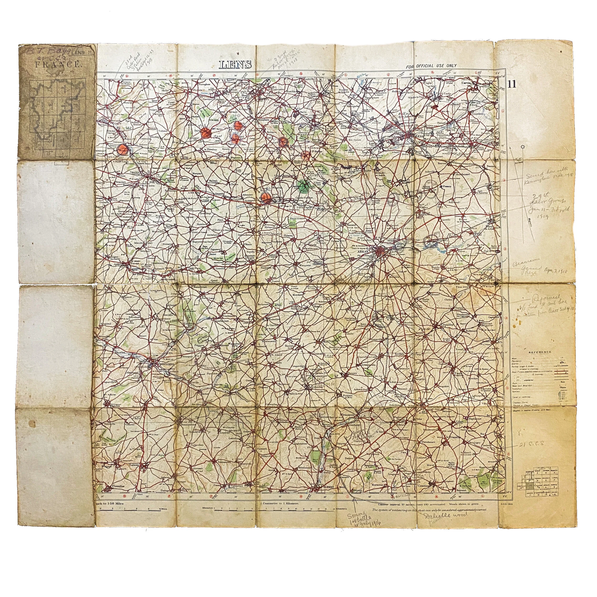

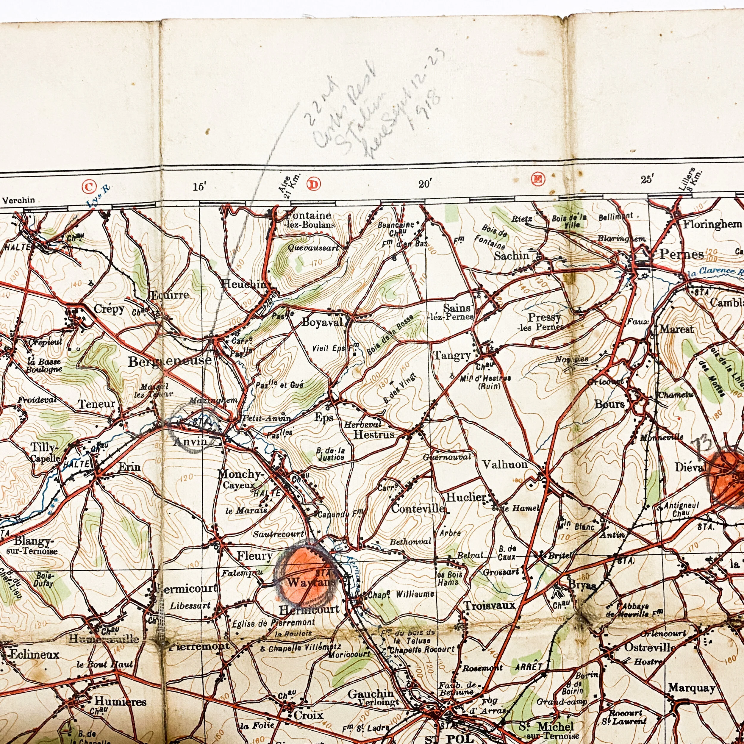
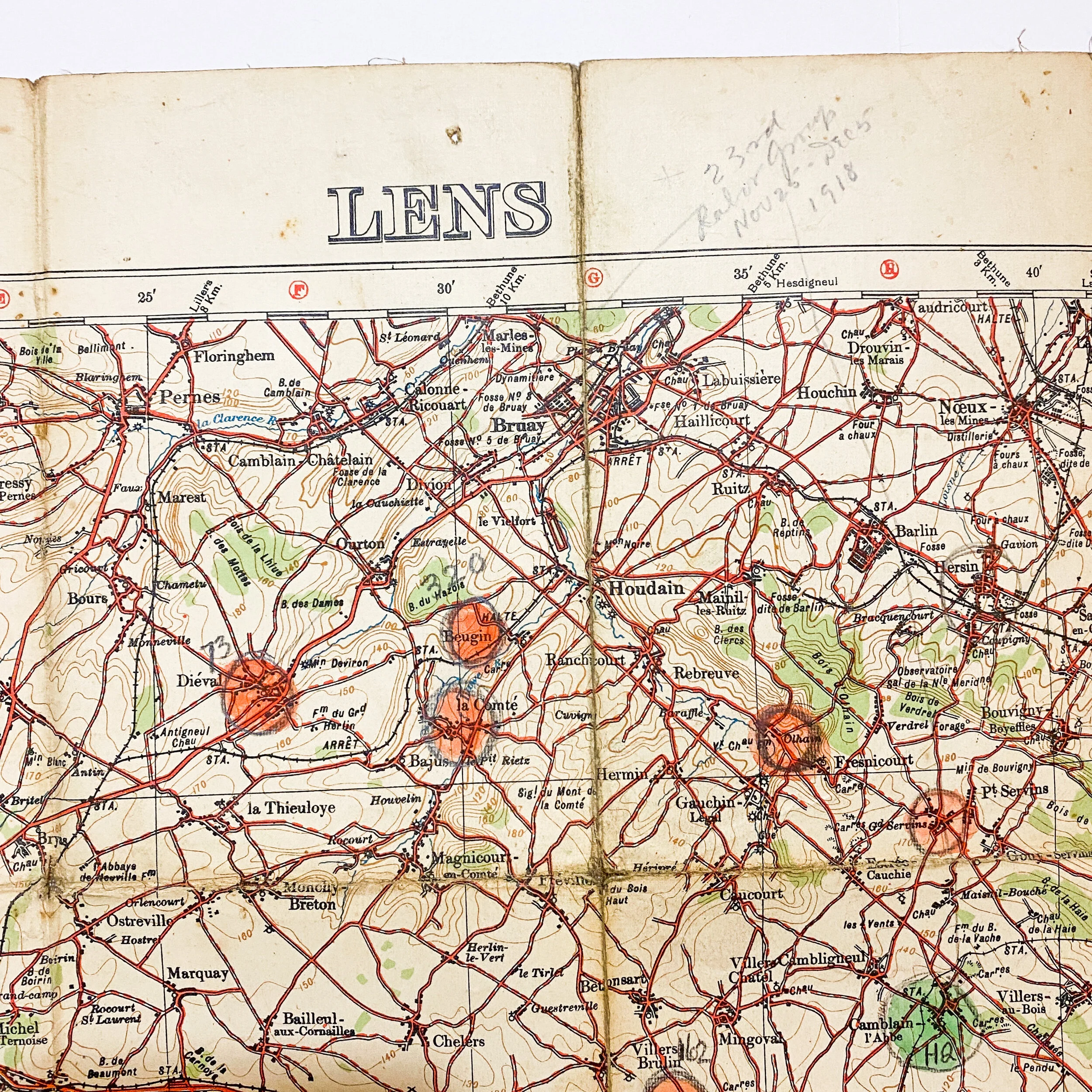


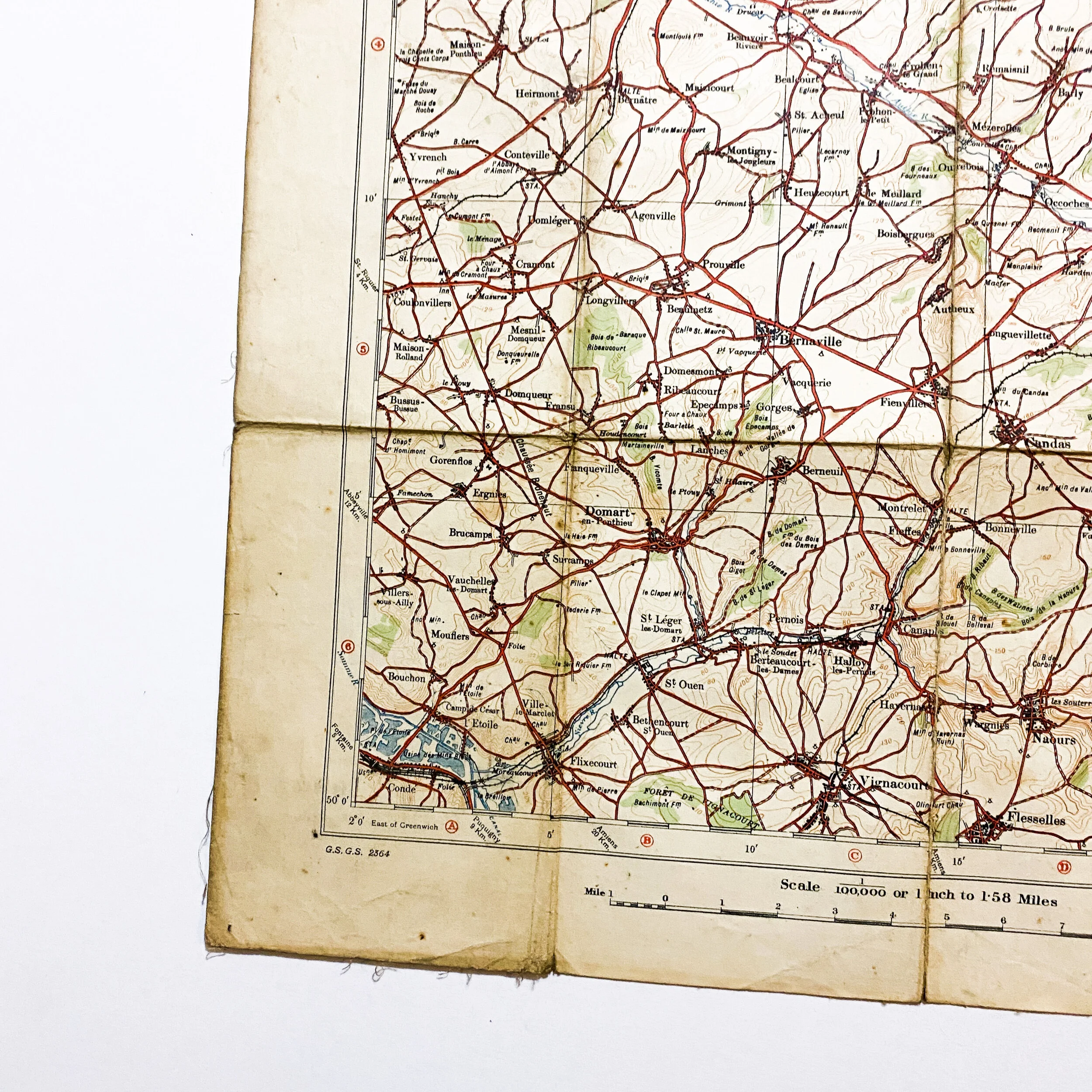


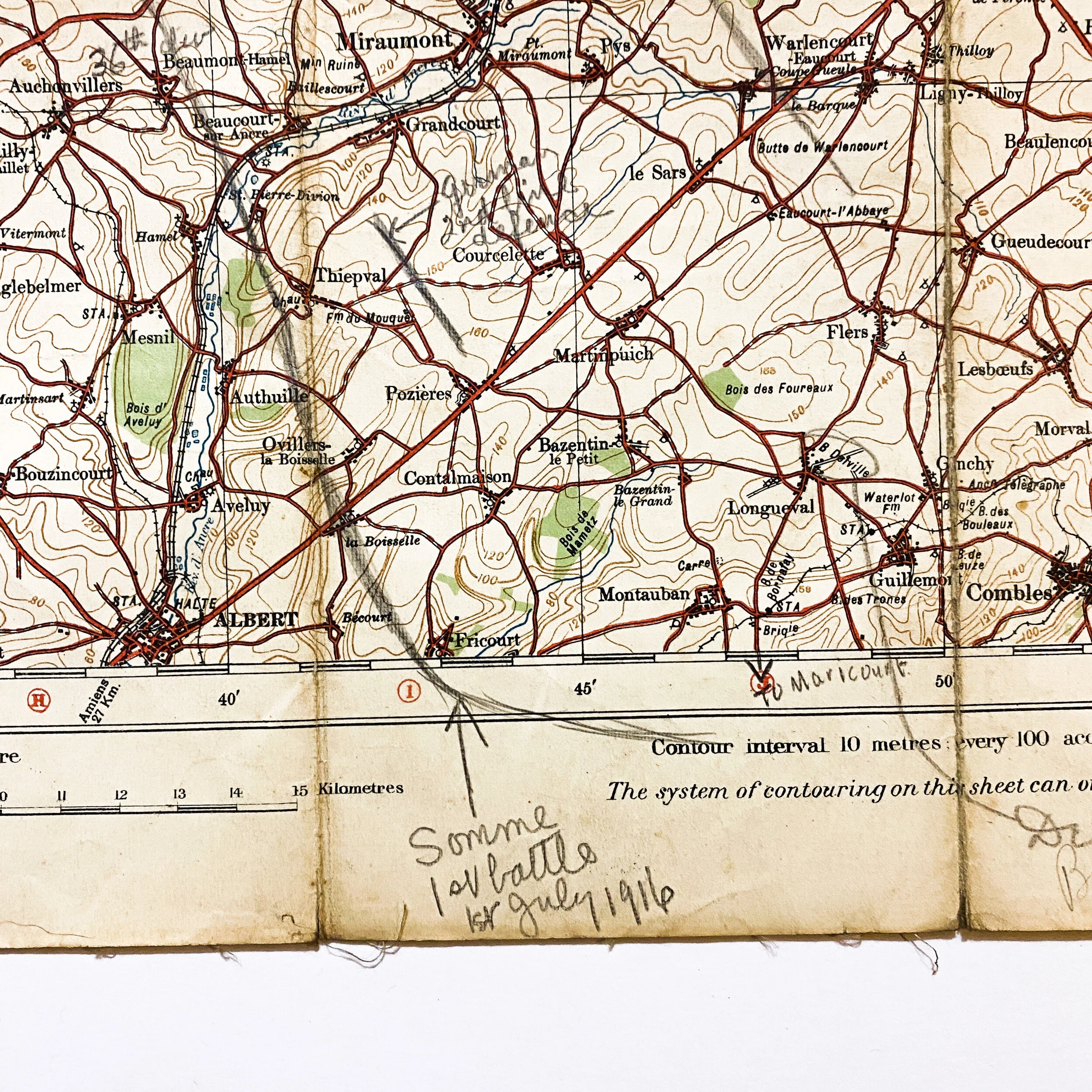
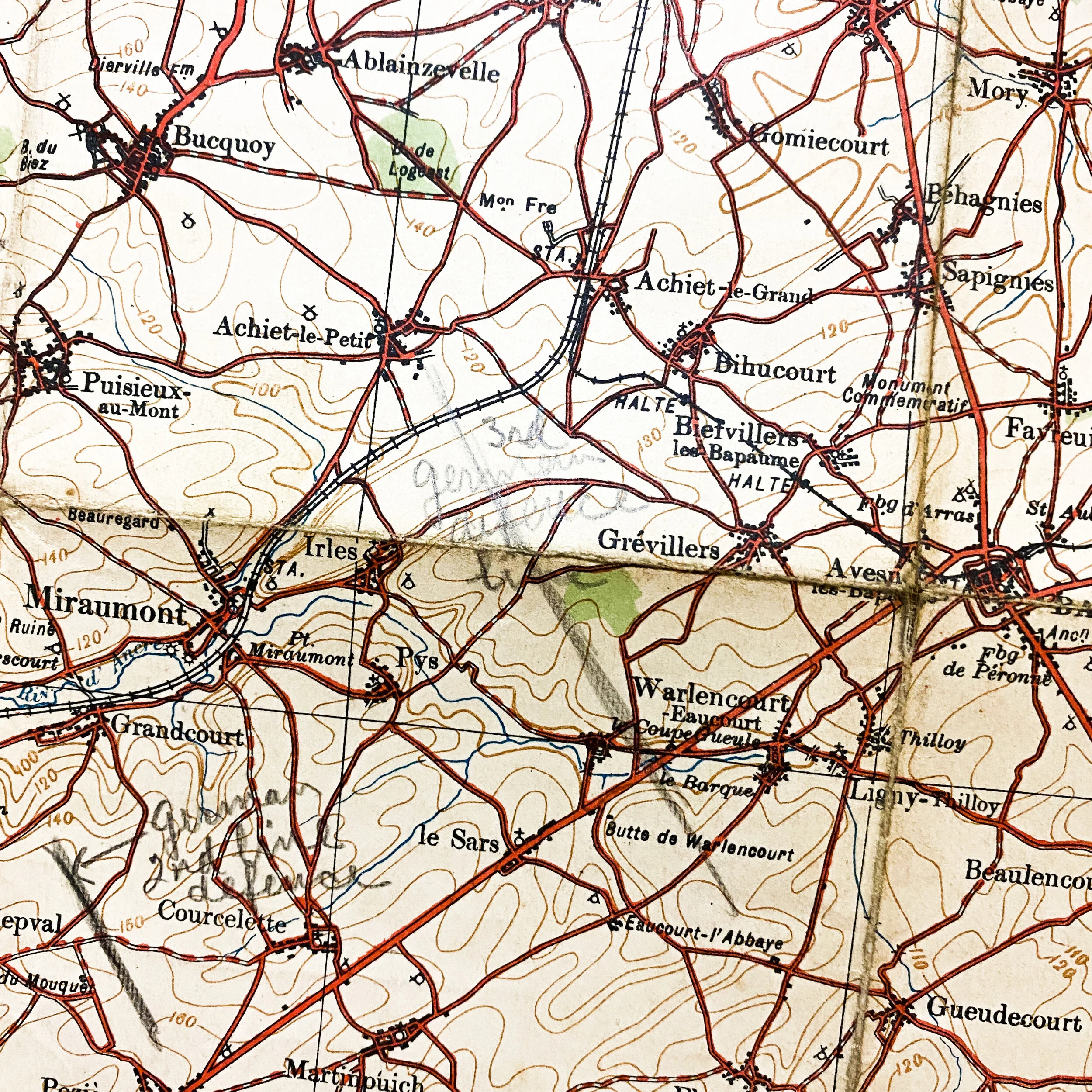
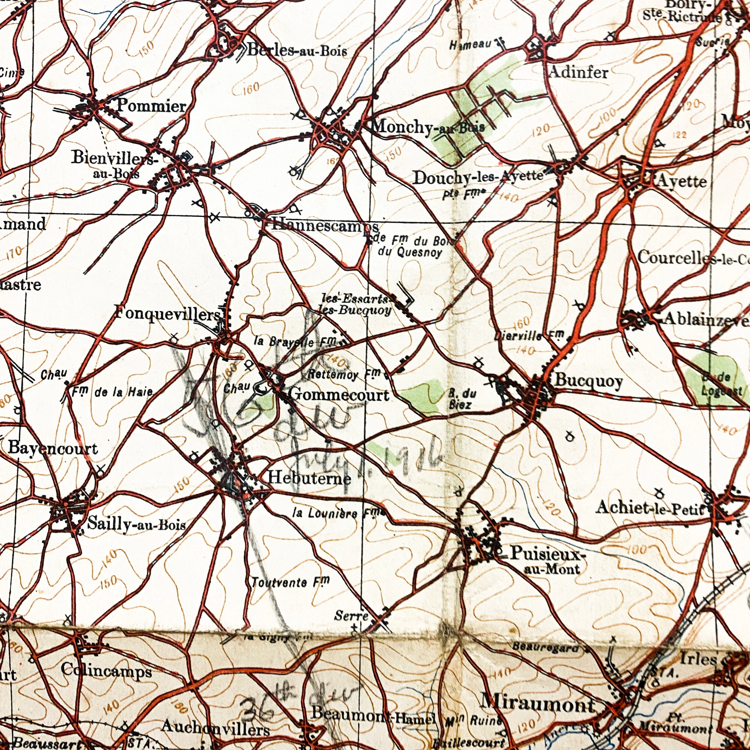


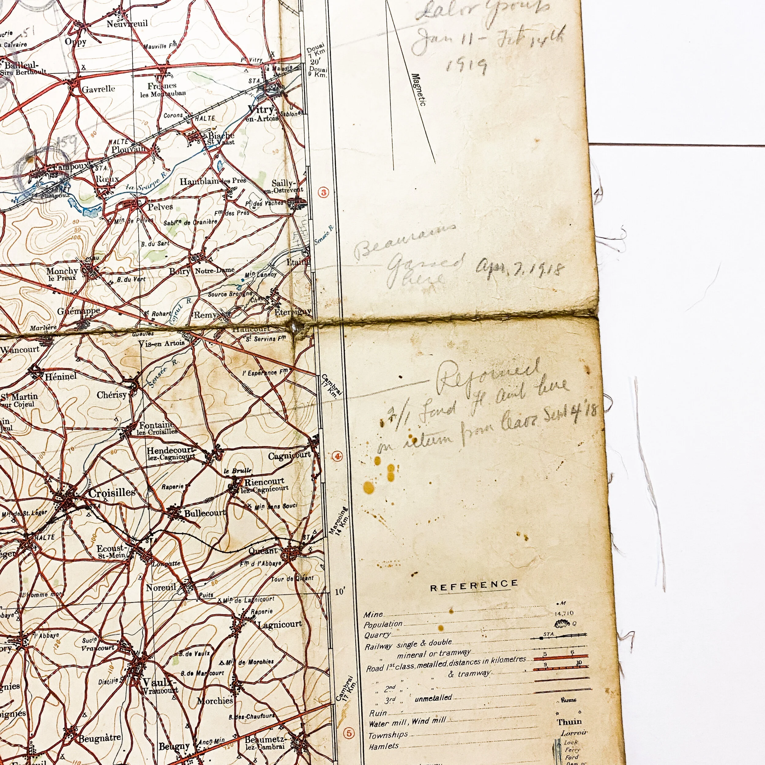

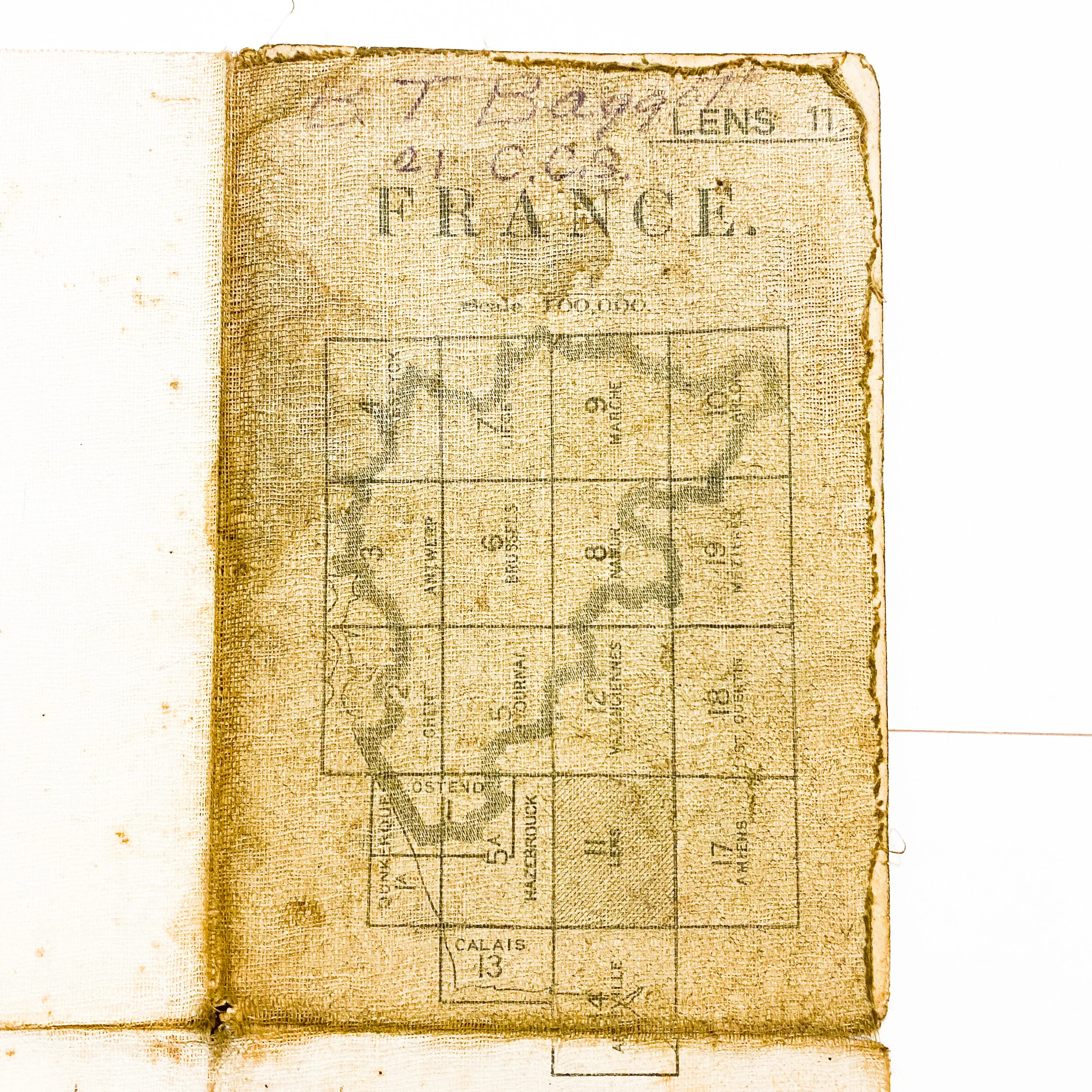
1915 Canadian Corps Named 'Lens' Hill 70 Linen Combat Map with Combat Markings
Size: 33.75 x 25.5 inches
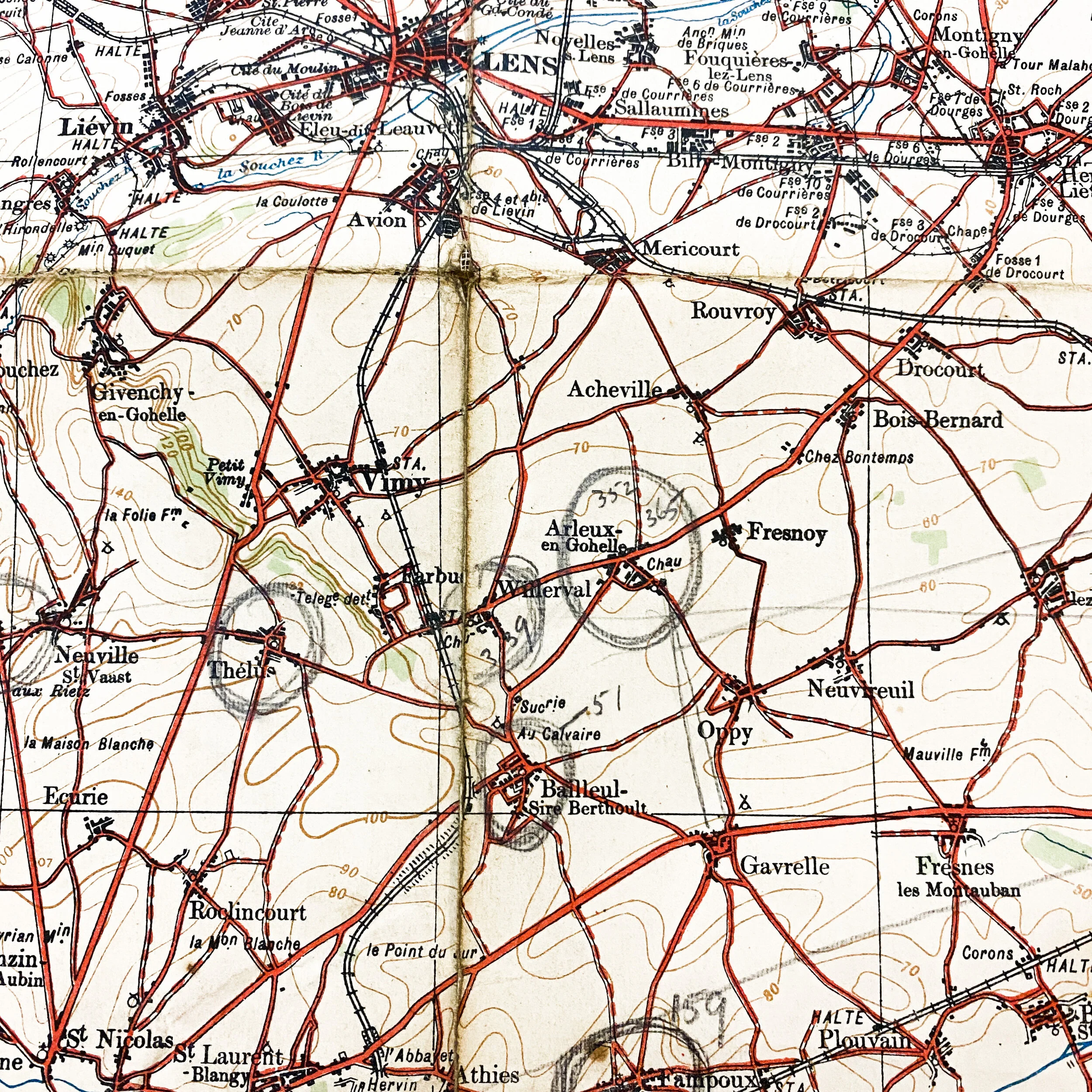
This 1915 dated original WWI liner cloth map shows the area of Lens and the surrounding towns and battlefields of World War I. This map is named to a soldier in the Canadian Corps by the name of B. T. Baggell. The maps has notable markings such as such as unit and division reinforcement dates located on the sides of the top, side and bottom of the map and have markings related to the Somme and Hill 70 operation marks.
The area of ‘Lens’ is more notably knowns for ‘The Battle of Hill 70’ which took place in the First World War between the Canadian Corps and four divisions of the German 6th Army. The battle took place along the Western Front on the outskirts of Lens in the Nord-Pas-de-Calais region of France between 15 and 25 August 1917.
The objectives of the assault were to inflict casualties and to draw German troops away from the 3rd Battle of Ypres and to make the German hold on Lens untenable. The Canadian Corps executed an operation to capture Hill 70 and then establish defensive positions from which combined small-arms and artillery fire, some of which used the new technique of predicted fire, would repel German counter-attacks and inflict as many casualties as possible. The goals of the Canadian Corps were only partially accomplished; the Germans were prevented from transferring local divisions to the Ypres Salient but failed to draw in troops from other areas.
A later attempt by the Canadian Corps to extend its position into the city of Lens failed but the German and Canadian assessments of the battle concluded that it succeeded in its attrition objective. The battle was costly for both sides and many casualties were suffered from extensive use of poison gas, including the new German Yellow Crossshell containing the blistering agent sulphur mustard (mustard gas).
Lens:
From Vimy Ridge the ground declines about 300 yd (270 m) into the Douai Plain; the valley of the Souchez river is about 22 yd (20 m) wide and flows south-west to north-east through the south of the city of Lens. In 1914, the river had several road and rail bridges. By 1917, much of the city was derelict due to years of artillery bombardments, the ruins being natural strongpoints overlooked by crassiers (slag heaps) and several hills, including Hill 70, Hill 65 and Sallaumines Hill. The city is in a shallow, saucer-shaped depression surrounded by the crassiers and hills. To the south-east, on terrain that is 82 to 148 ft (25 to 45 m) above sea level, Sallaumines Hill rises to 180 ft (55 m). On the west side of Lens is Hill 65 (Reservoir Hill) north of the Souchez, which is steep-sided and gives a fine view of the city.
To the north-west, on the east side of the Lens–Bethune road is a hill about 230 ft (70 m) high with the suburb of Cité St Pierre on top. Hill 70 is north of the city and has a flat top, giving a fine view of the city and the ground to the north and east. The hill slopes gently towards Lens and there is a shallow depression between it and Cité St Pierre. The slopes of Hill 70 towards Cité St Auguste are steeper.[6]Lens, Hill 70, Sallaumines and Sallaumines Hill to the south-east and their commanding views over the area and the city, fell under German control in October 1914, during the Race to the Sea. In September 1915, the British overran the hill during the Battle of Loos but it was recaptured by the Germans.