EXTREMELY RARE! WWII 1944 U.S. 5th Air Force New Guinea, New Britain & New Ireland Pacific Theater Campaign Combat Flight Navigation Map (Specially Produced For U.S. 5th Air Force Missions)
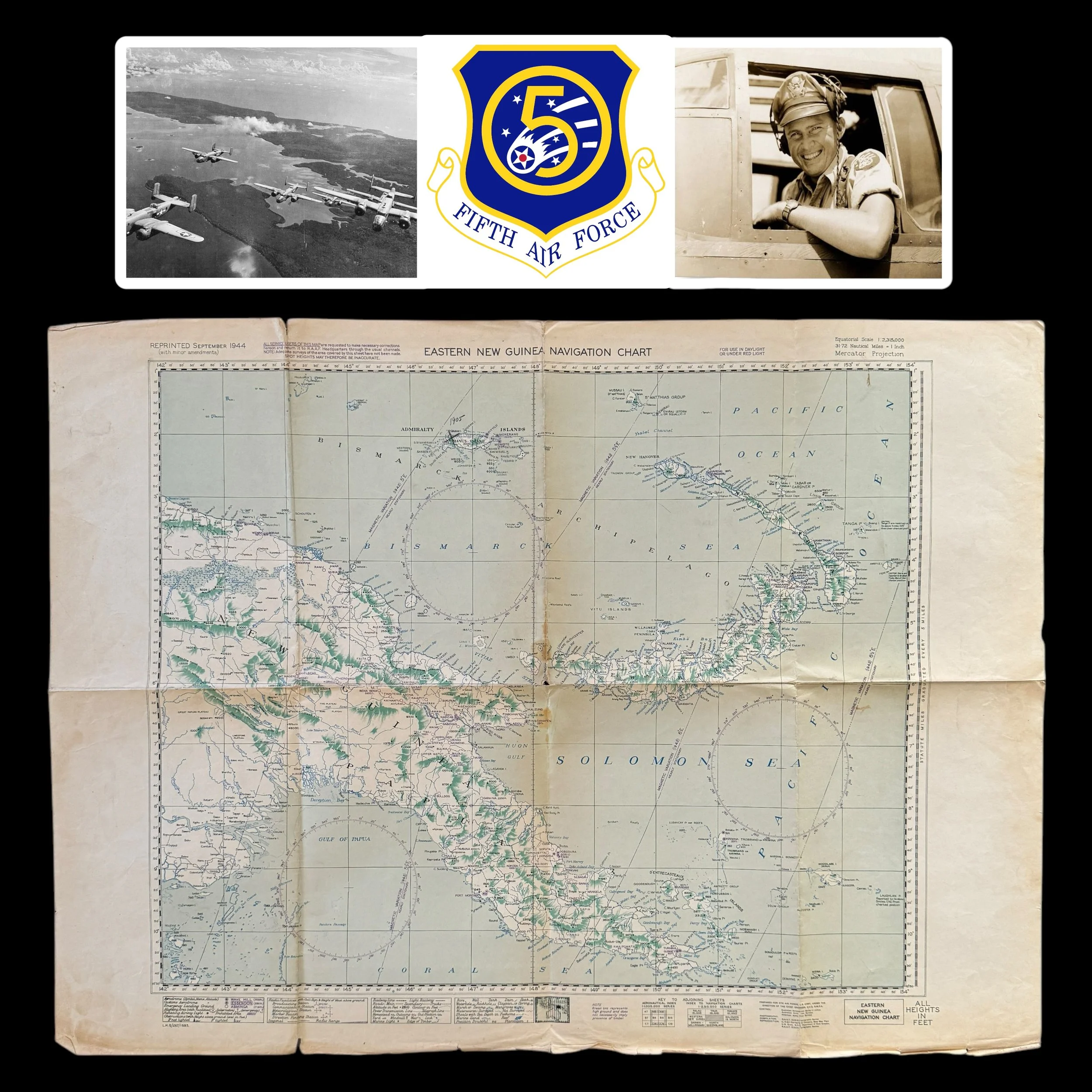


EXTREMELY RARE! WWII 1944 U.S. 5th Air Force New Guinea, New Britain & New Ireland Pacific Theater Campaign Combat Flight Navigation Map (Specially Produced For U.S. 5th Air Force Missions)
Comes with hand-signed C.O.A. and a full historical write-up
*From the World War II Pacific Theater Bring-Back Collection of a U.S. Fifth Air Force Veteran.
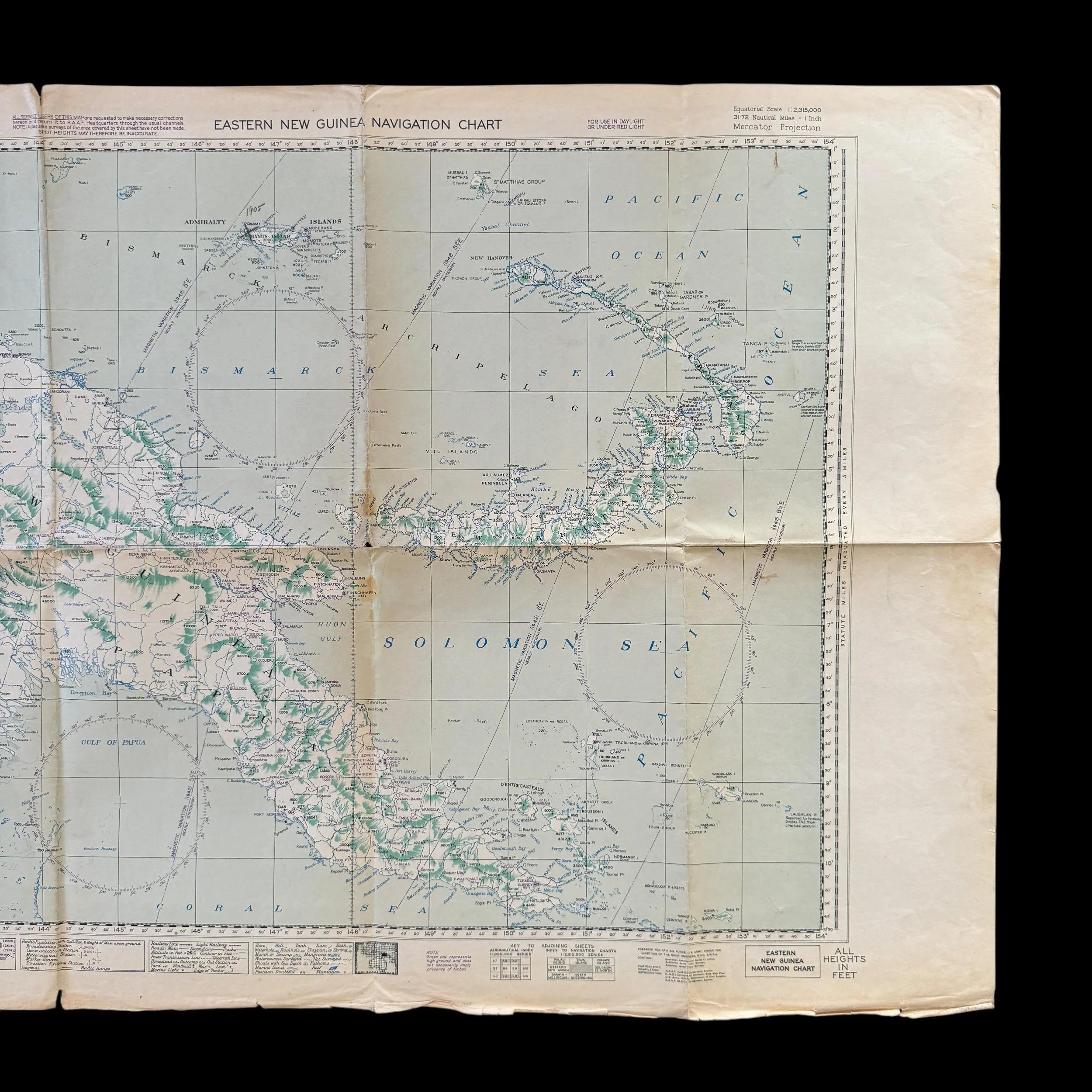
Type: Original World War II U.S. Army Air Force Combat Flight Navigation Map Specially Prepared for the U.S. 5th Air Force by South West Pacific Area Command.
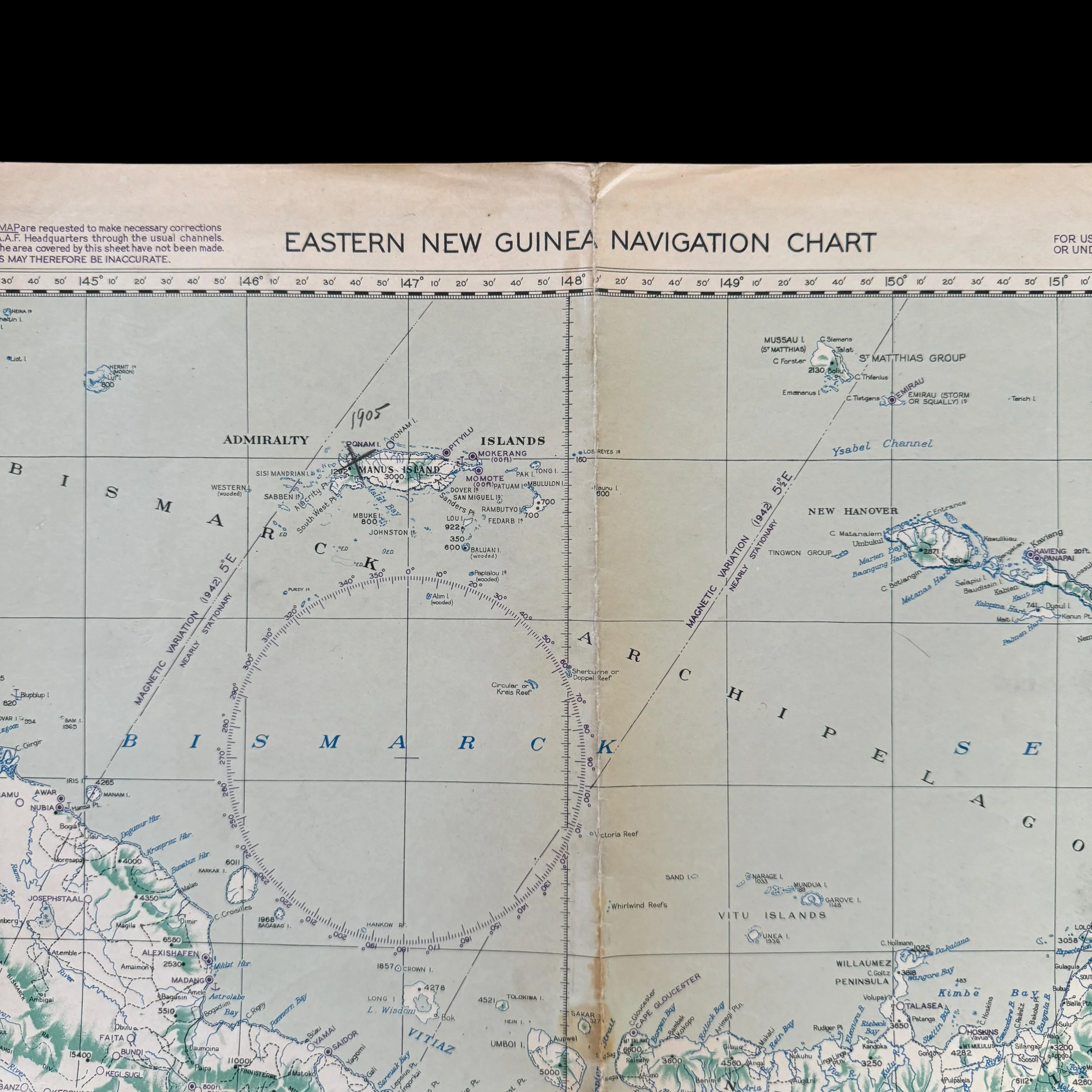
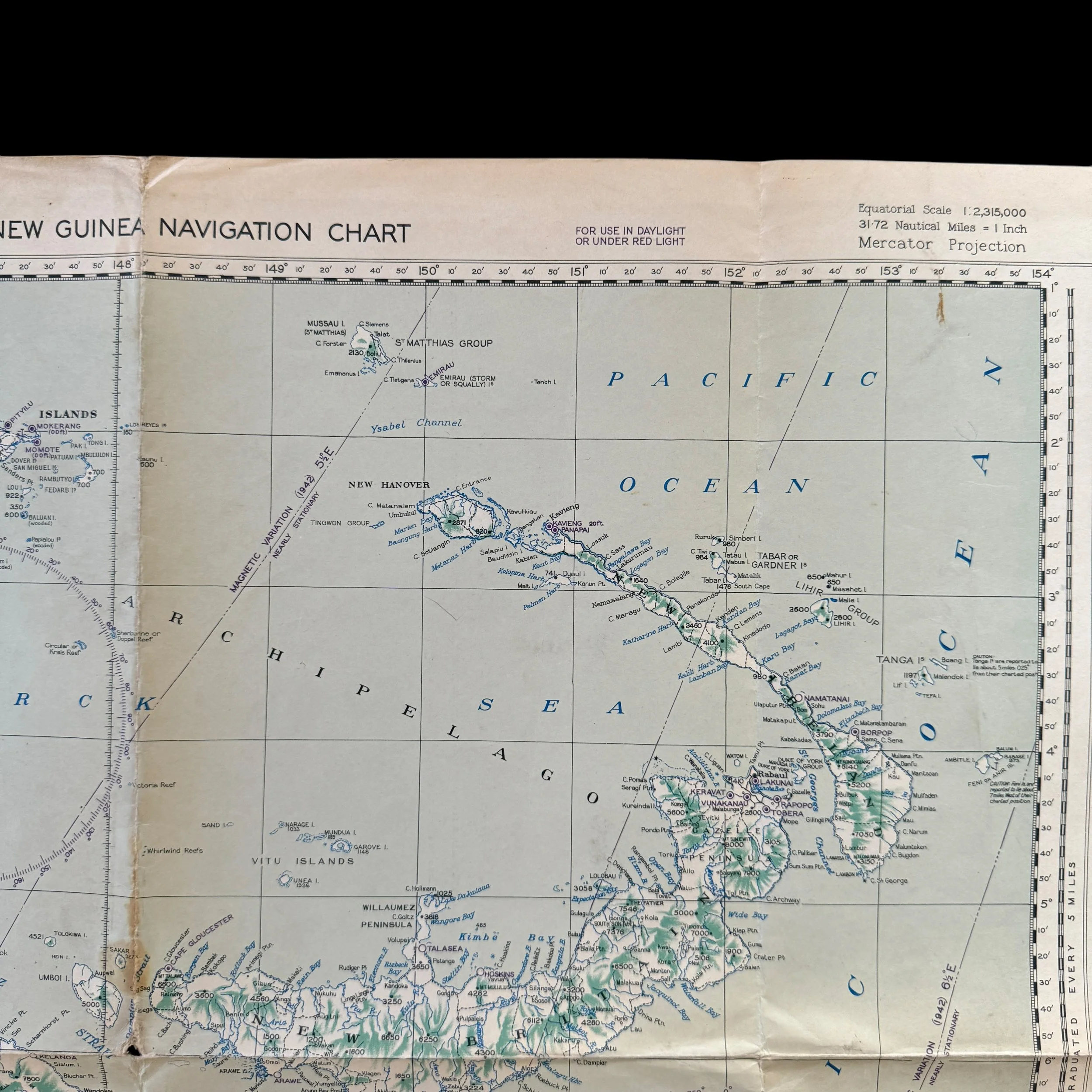
Campaign/Operations: Pacific Theater - New Guinea Campaign - New Guinea - New Britain - New Ireland - and the Admiralty Islands
From 1944 through 1945, the U.S. Fifth Air Force played a critical role in securing air superiority and supporting Allied operations across New Guinea, New Britain, New Ireland, and the Admiralty Islands, launching relentless aerial campaigns that crippled Japanese defenses. In April 1944, the Battle of Hollandia saw massive pre-invasion bombing raids that destroyed Japanese airfields and supply depots, ensuring the success of MacArthur’s amphibious landings. Subsequent operations in Biak and Noemfoor targeted fortified positions, allowing the capture of key airstrips. In New Britain, the Fifth Air Force conducted sustained bombing raids on Rabaul, destroying airfields, supply depots, and naval facilities, effectively isolating the stronghold. Over New Ireland, fighter sweeps and bombing missions suppressed Japanese reinforcements and anti-aircraft defenses. In the Admiralty Islands Campaign from February to May 1944, the Fifth Air Force provided close air support for amphibious landings on Los Negros and Manus Island, bombing entrenched Japanese positions and securing vital airstrips. By early 1945, these sustained air operations had neutralized Japanese air power in the region, ensuring Allied control and setting the stage for the decisive campaigns in the Philippines and beyond.
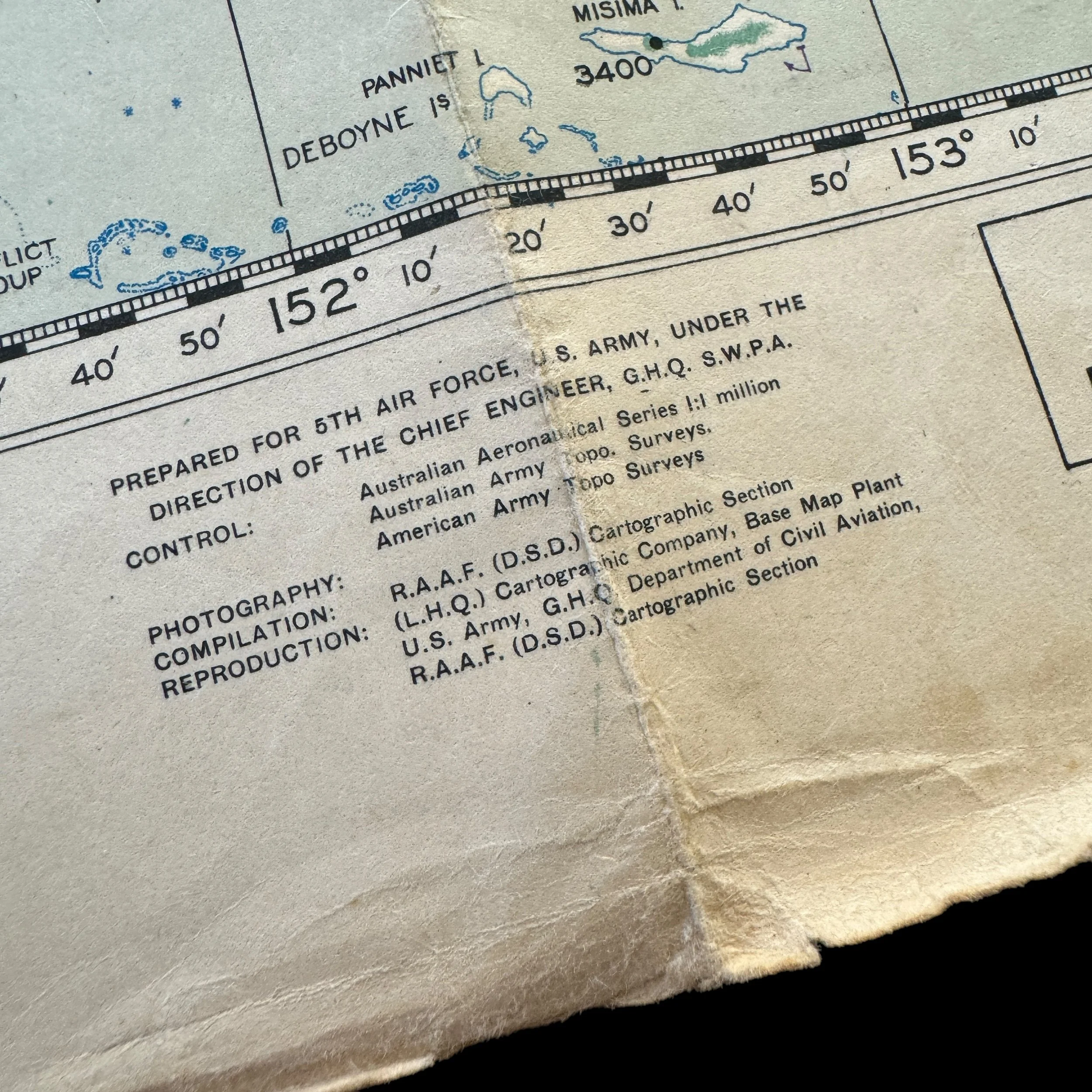
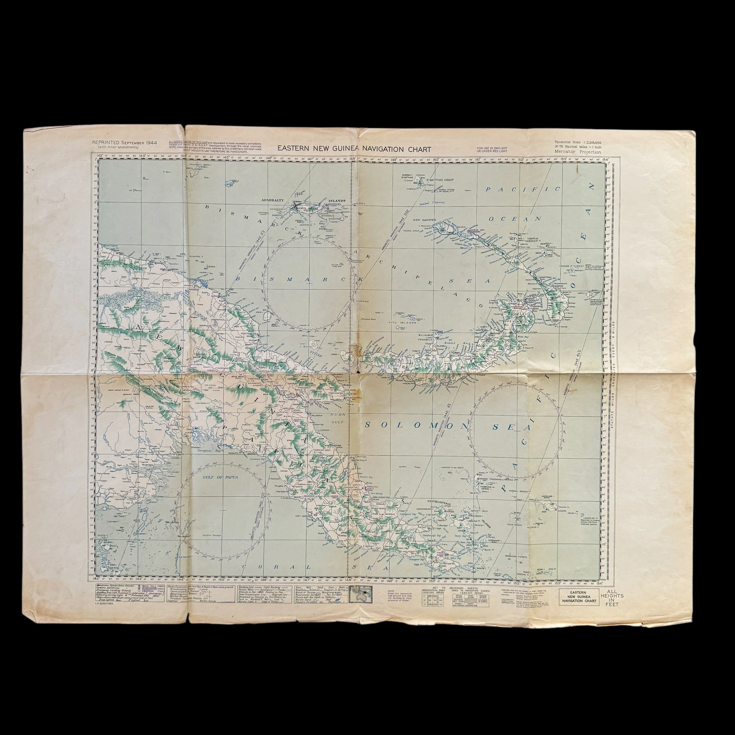
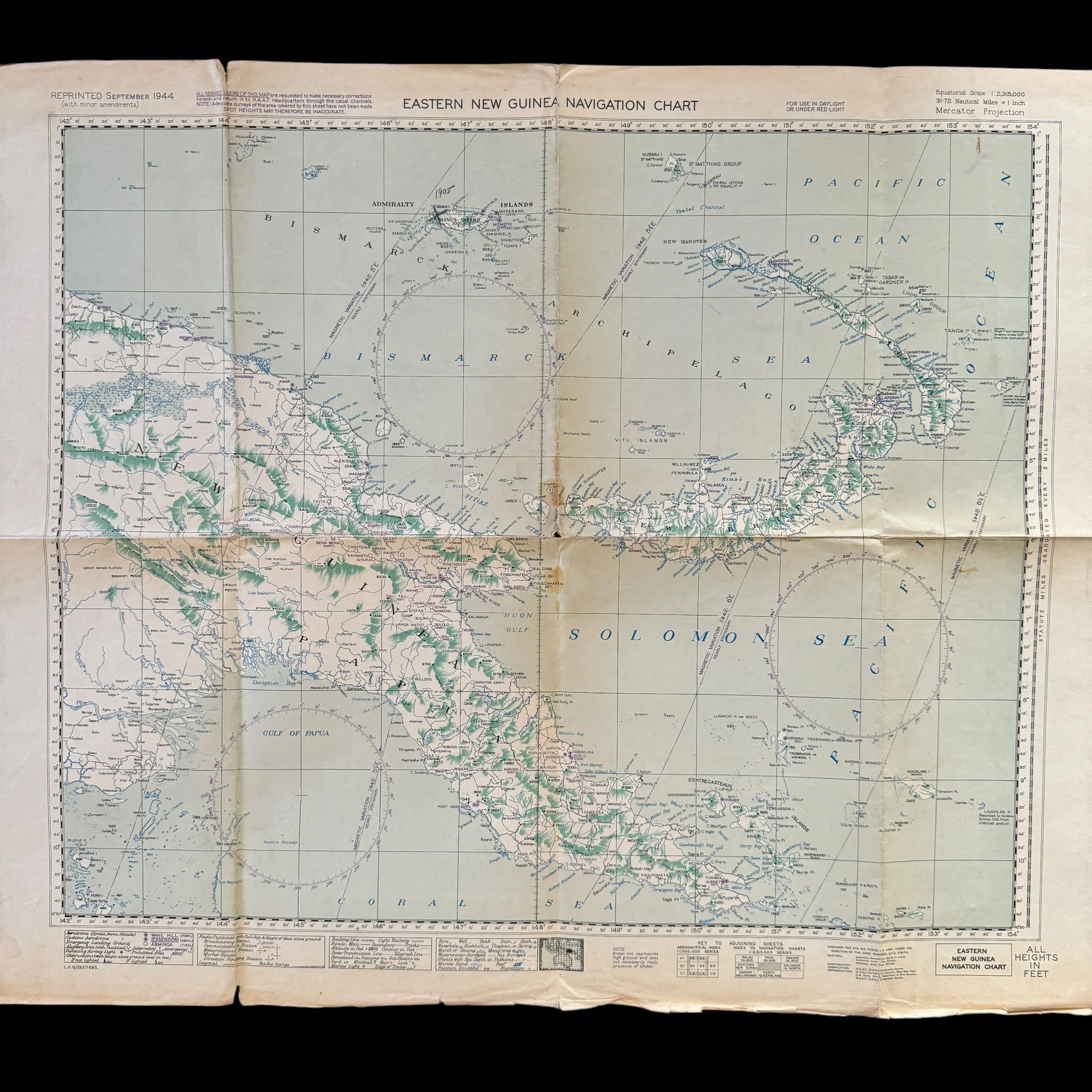
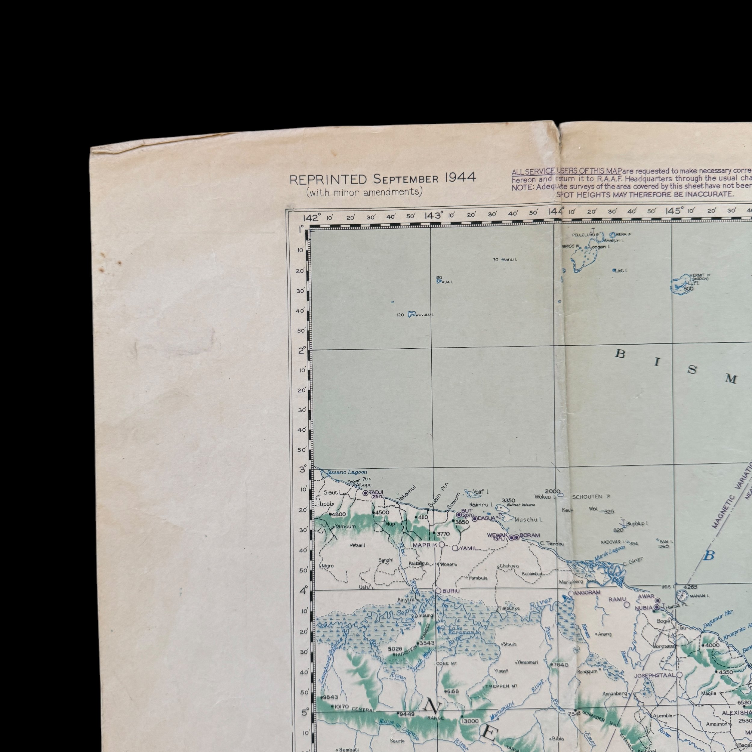
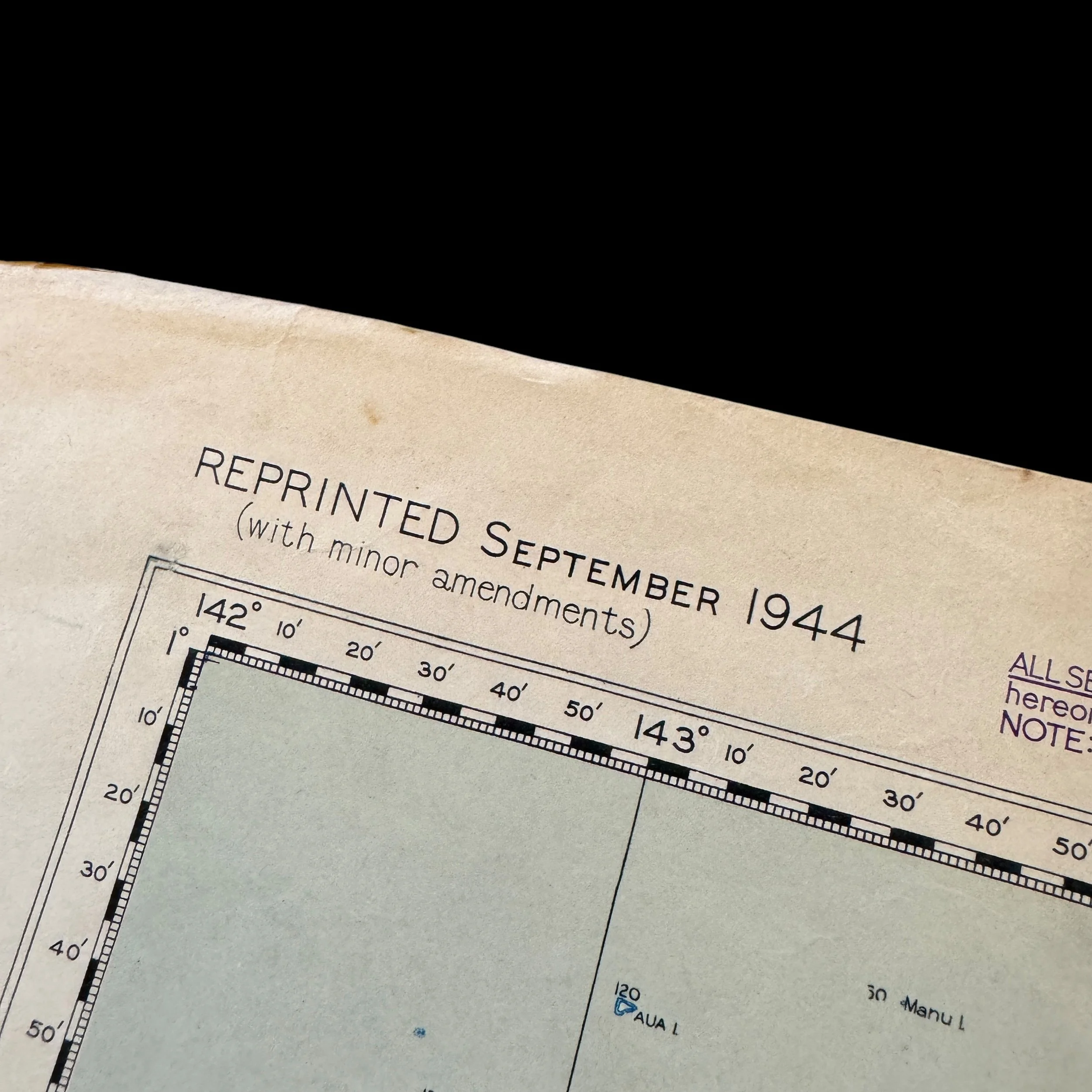
Date: September 1944
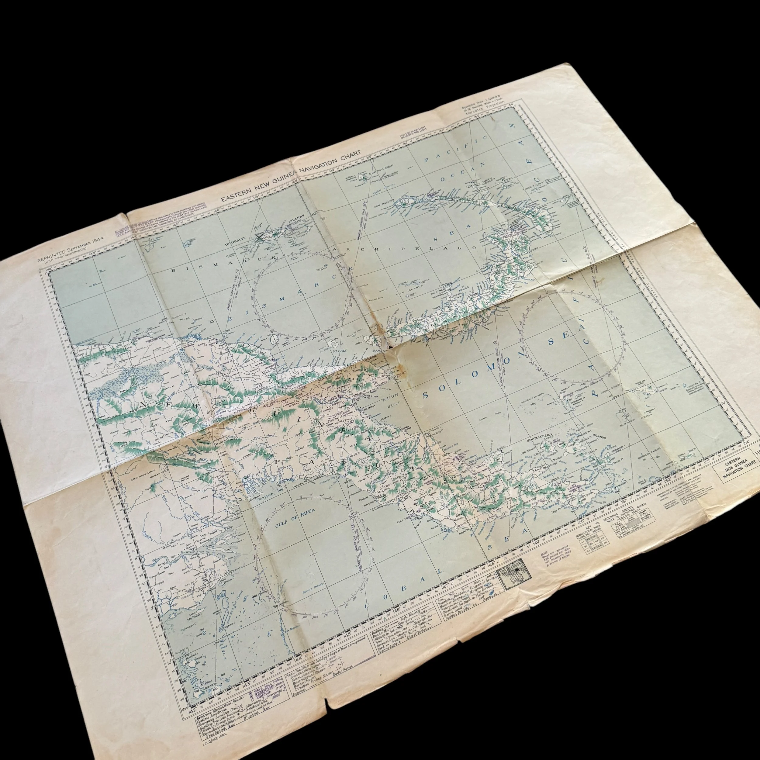
Size: 21.5 × 30 inches
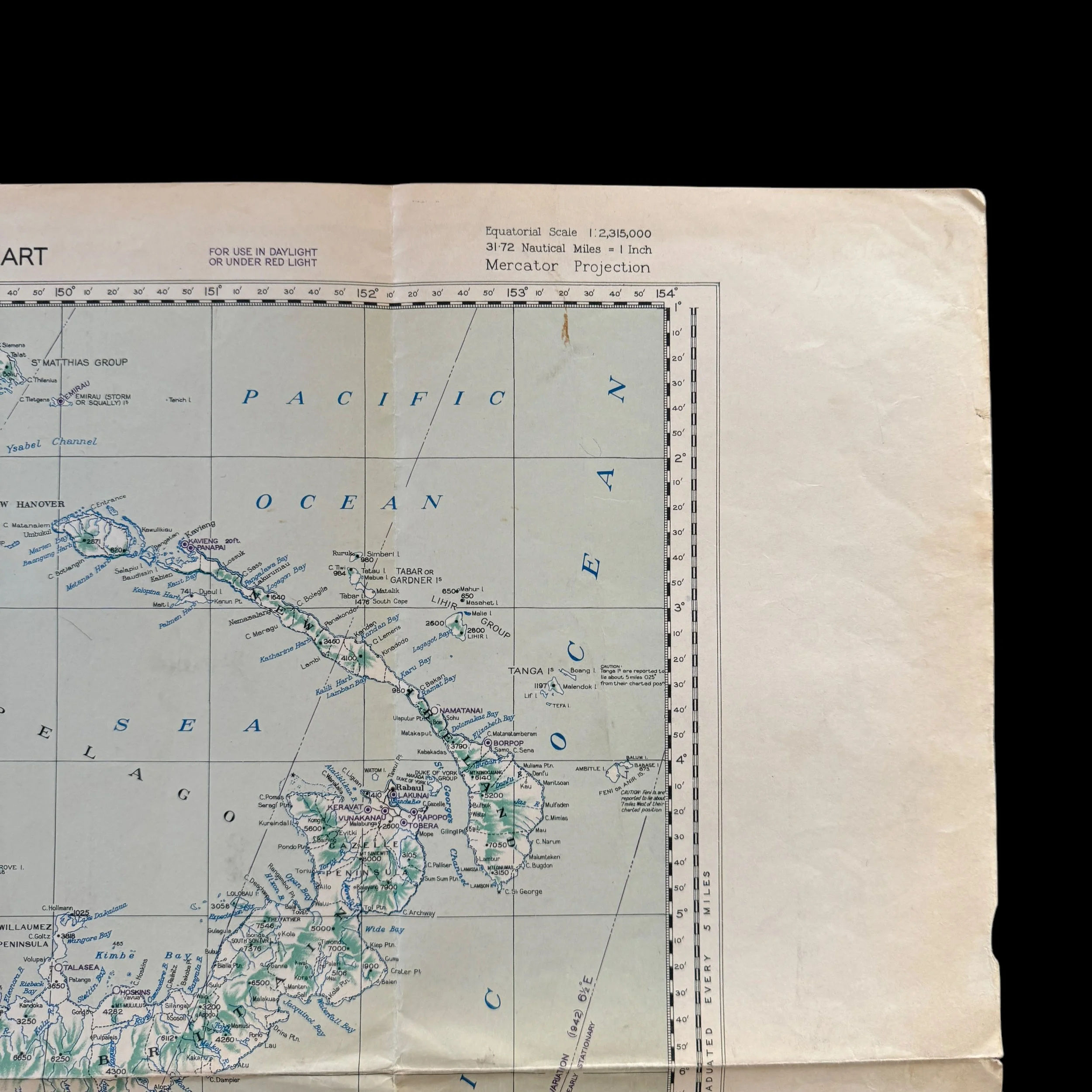
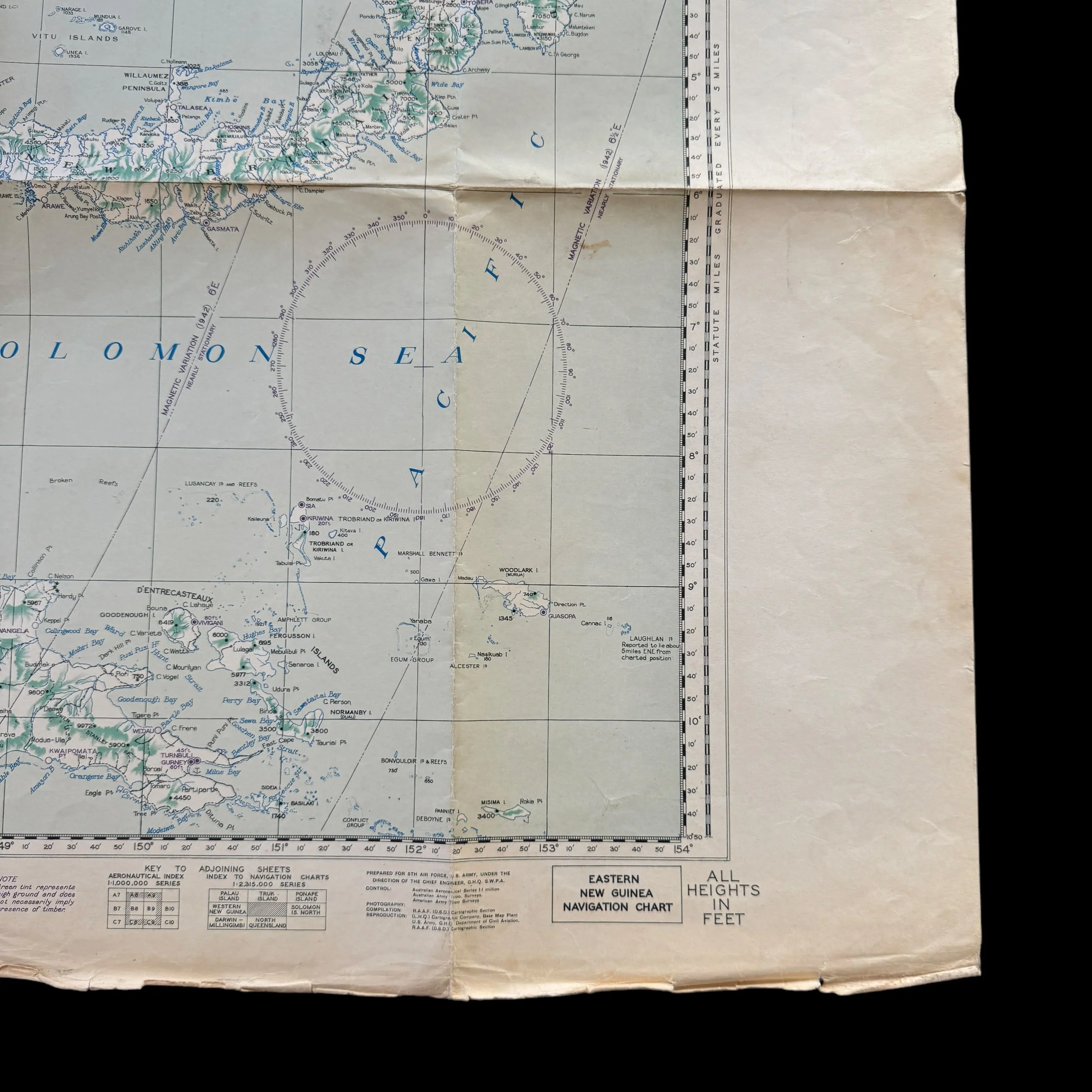
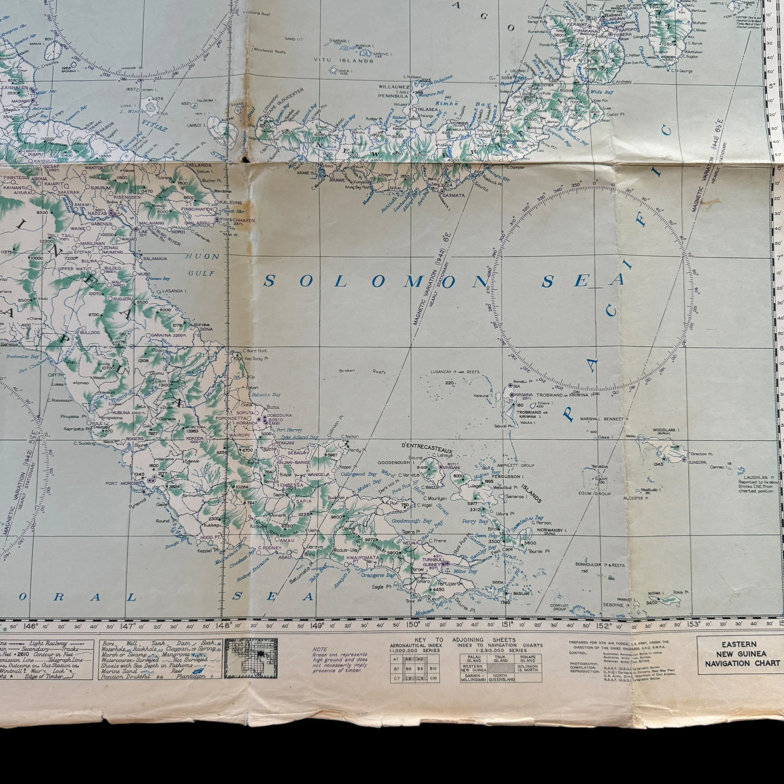
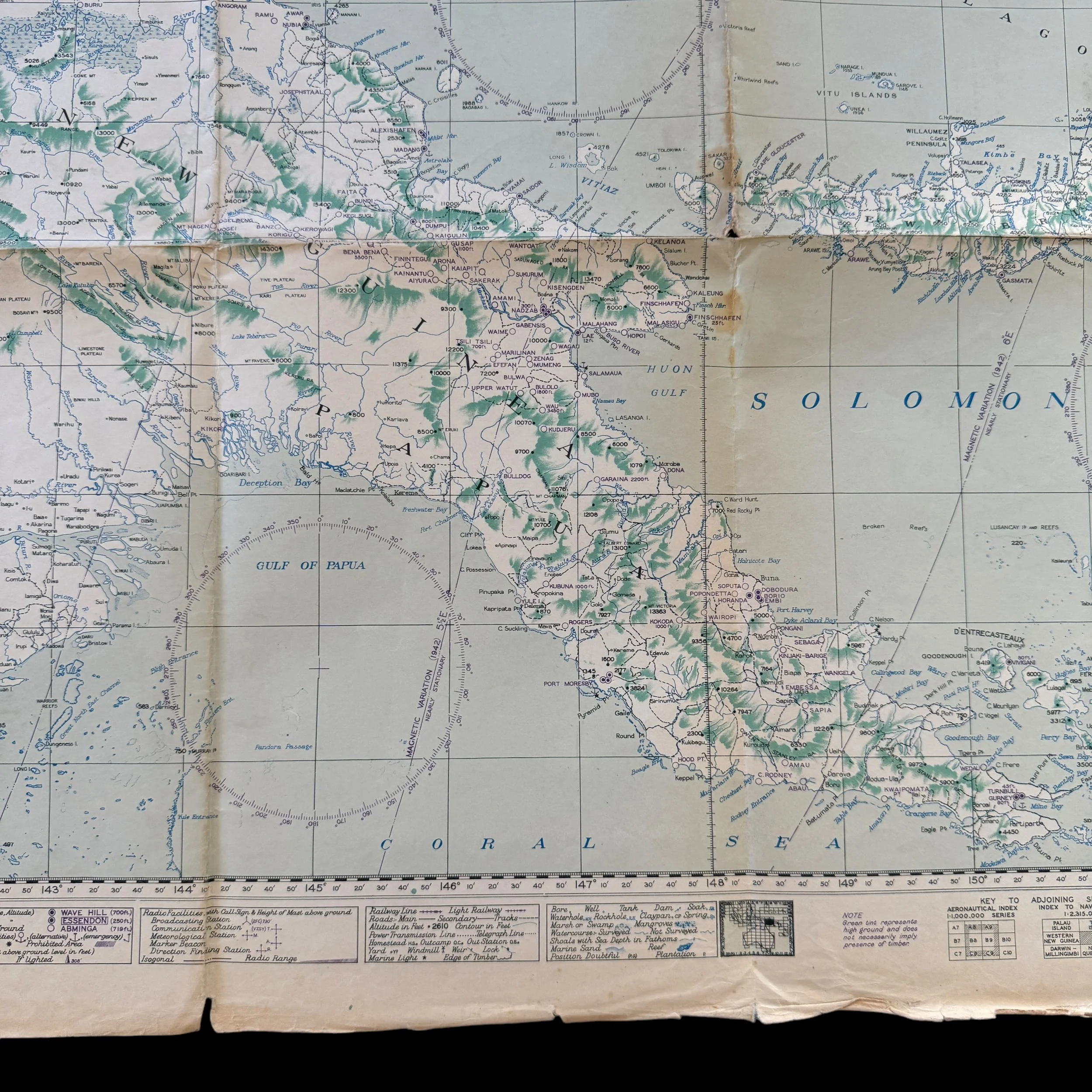
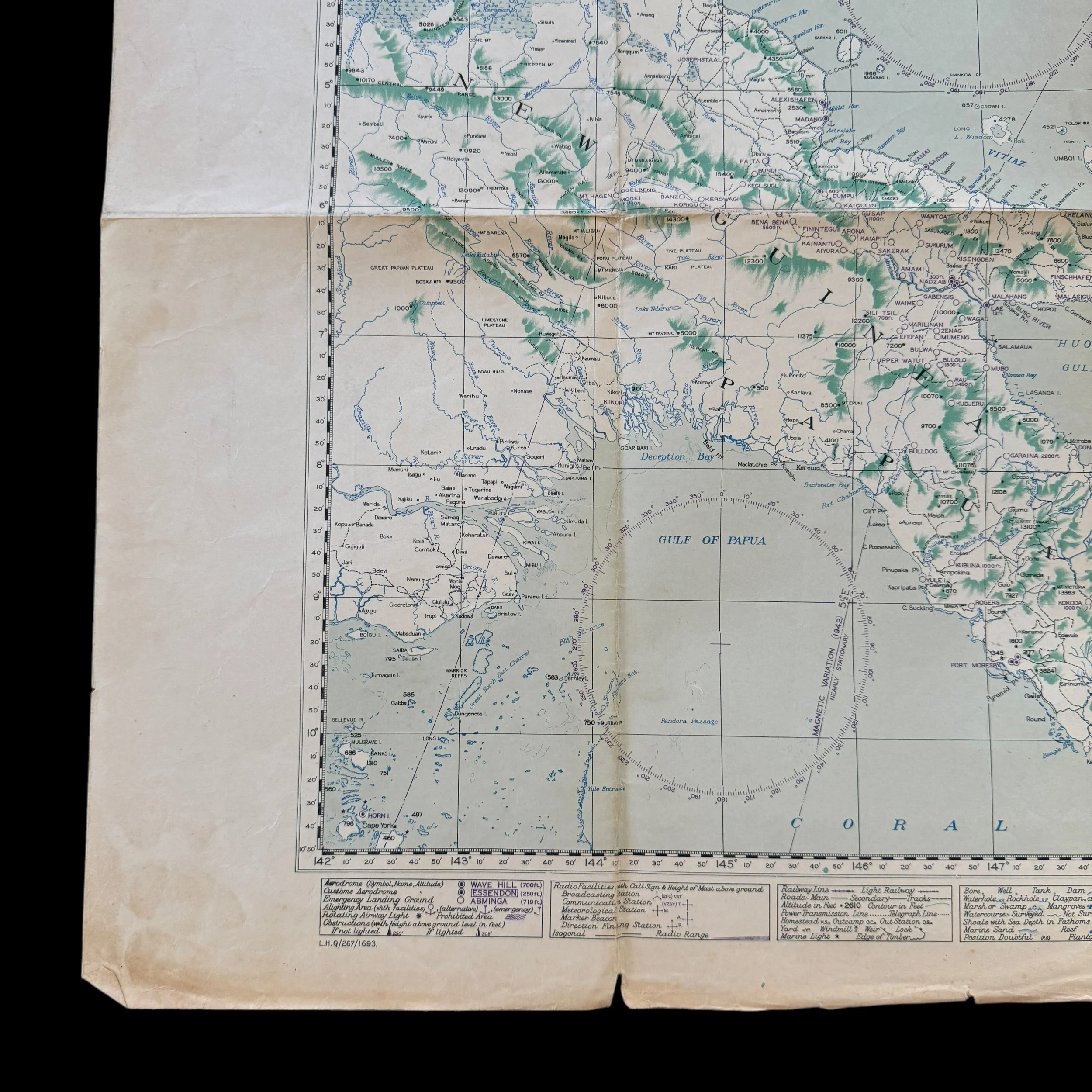
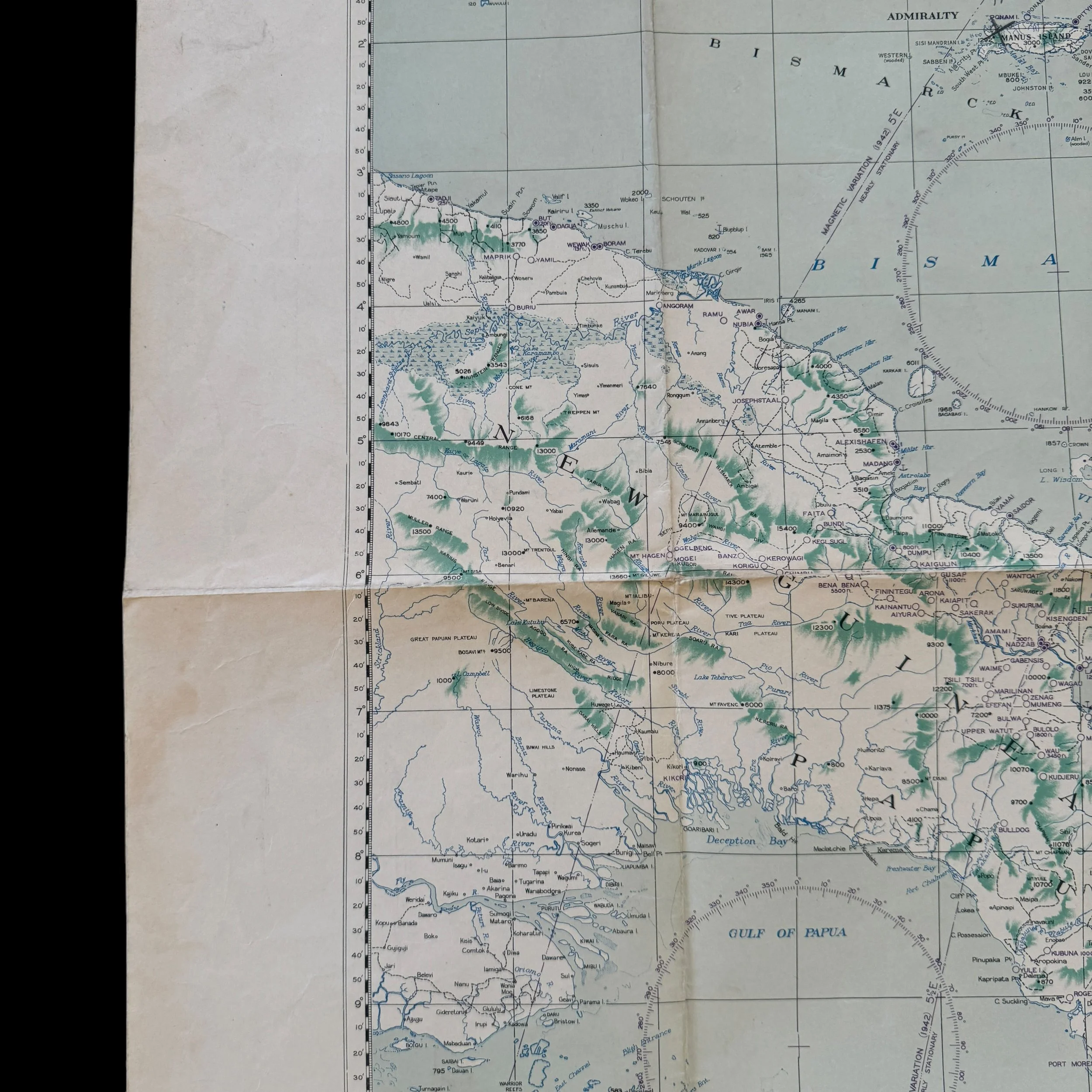
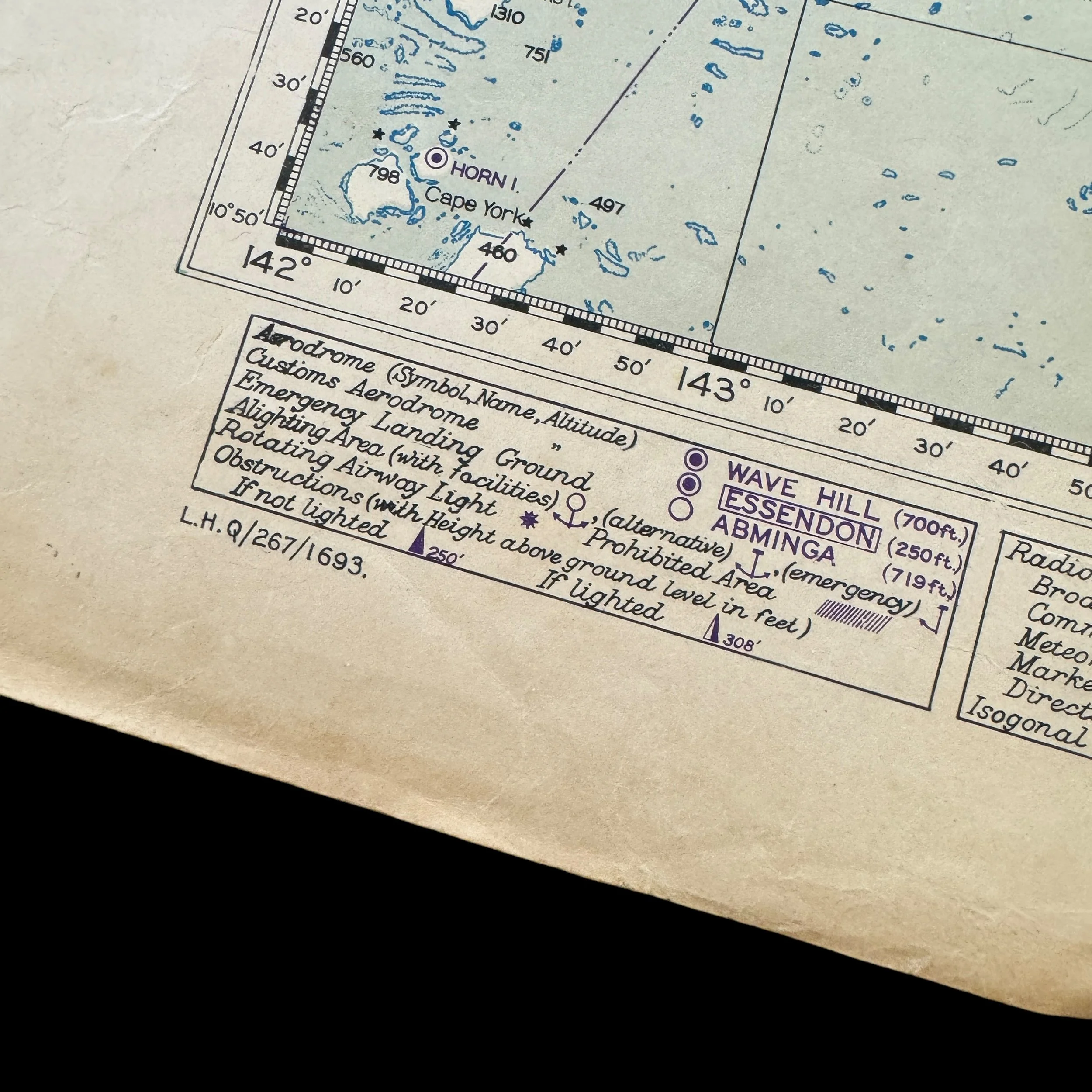
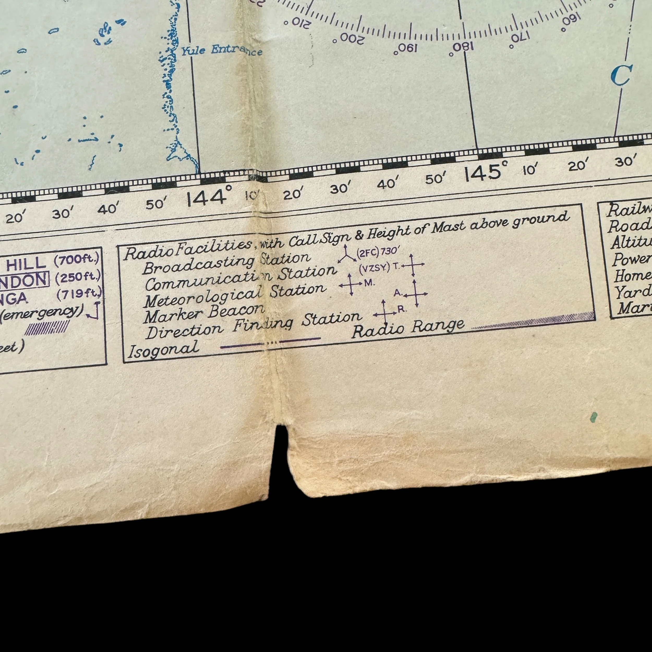
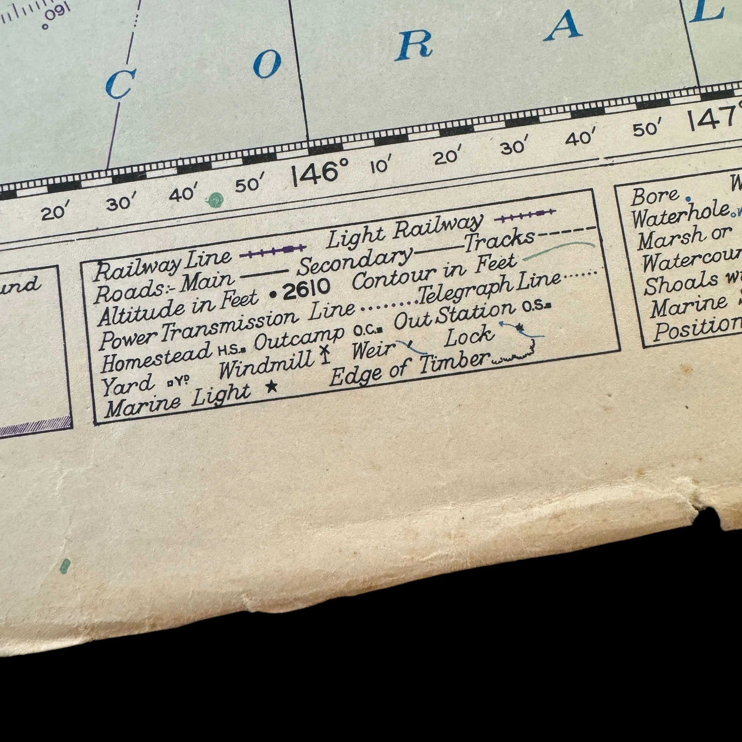
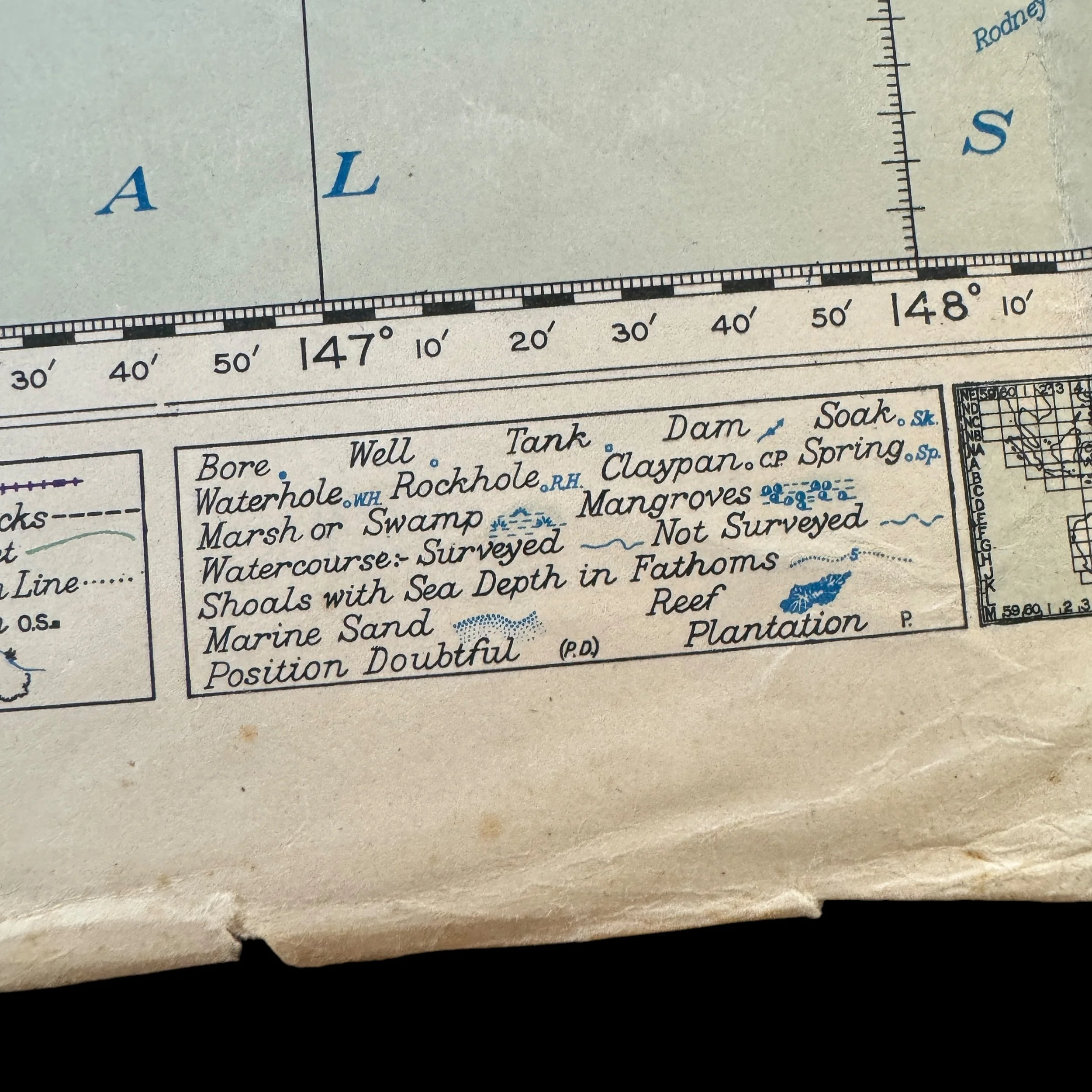
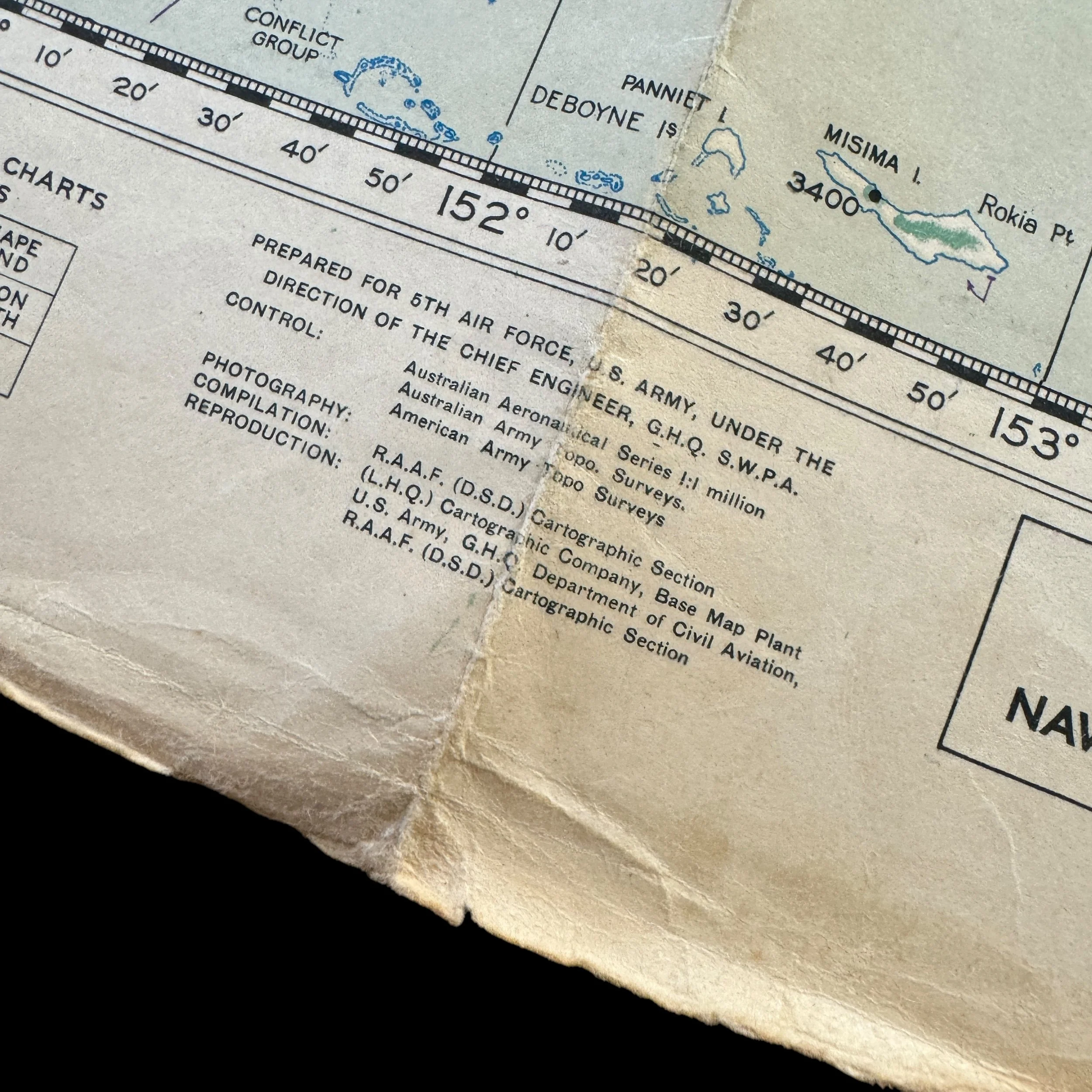
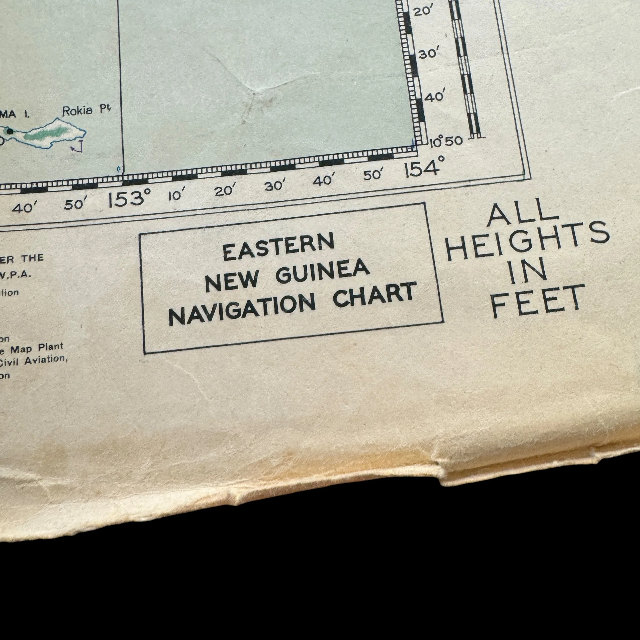
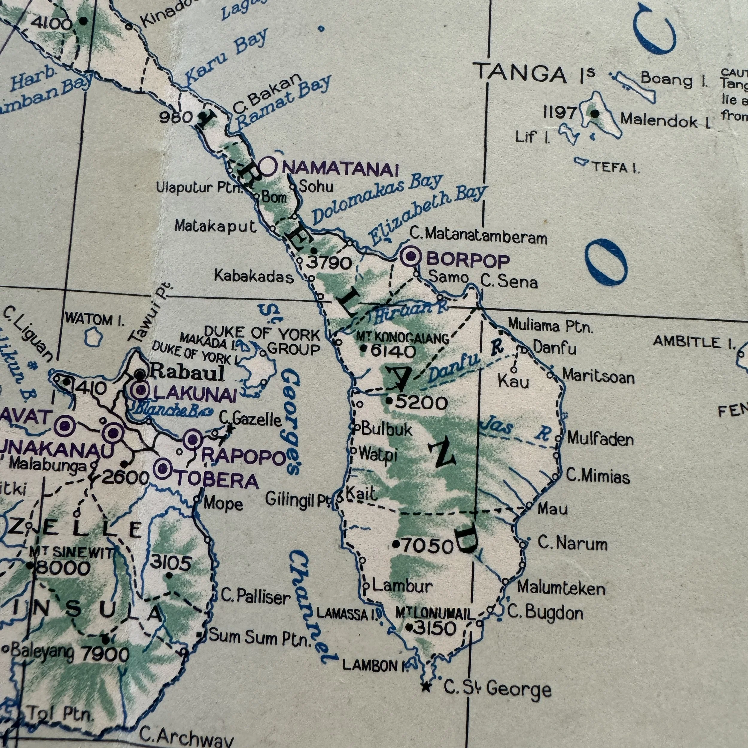
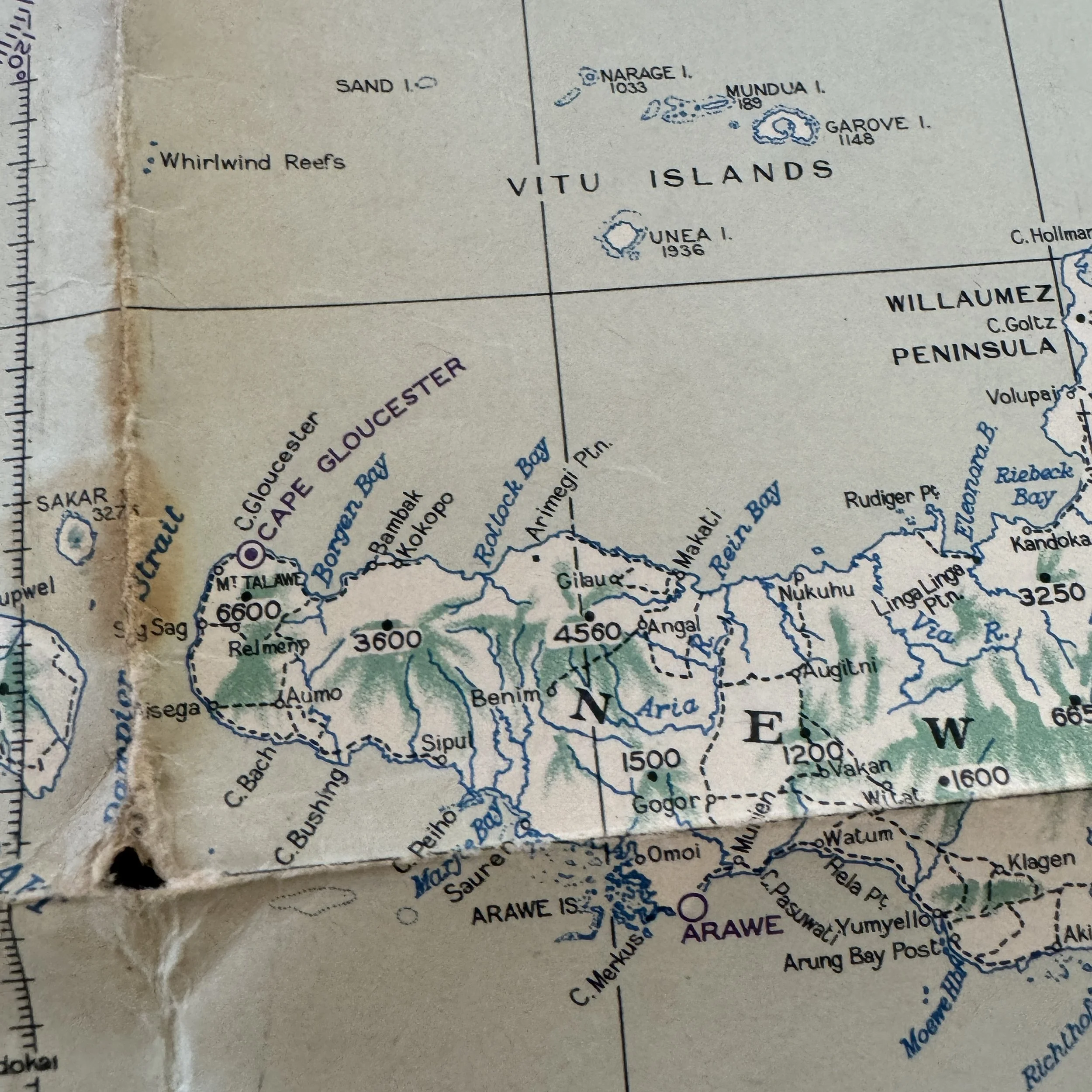
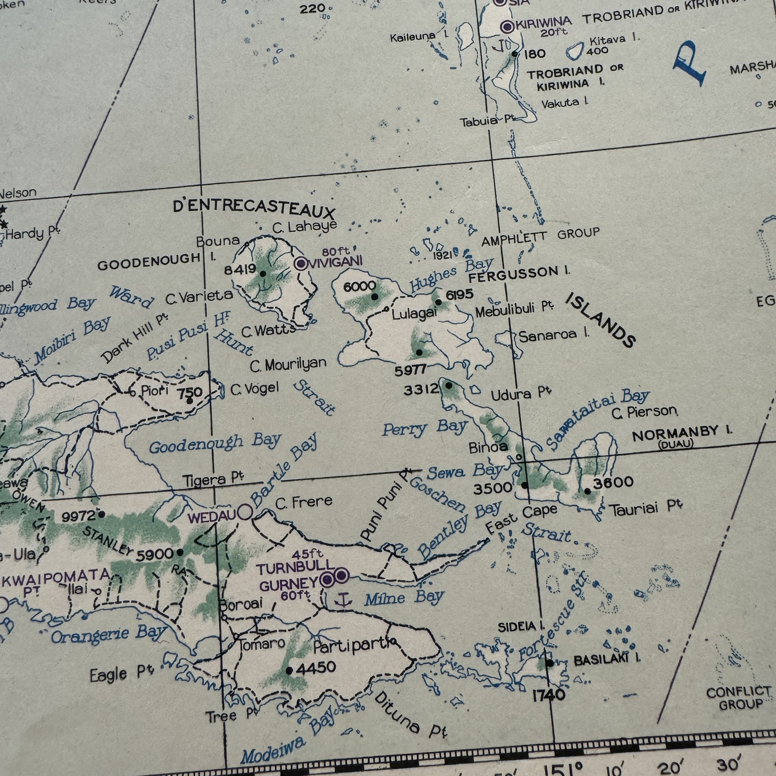
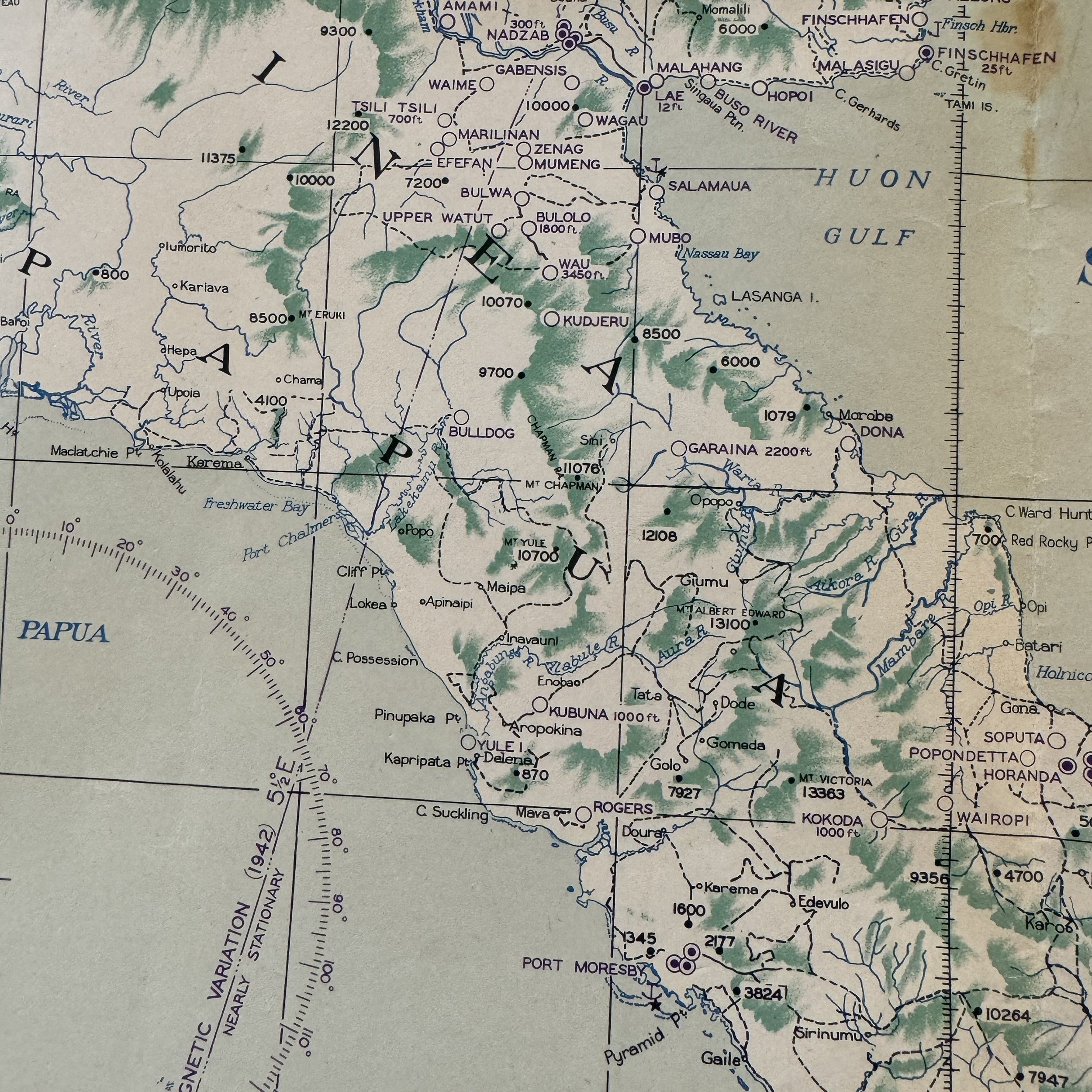
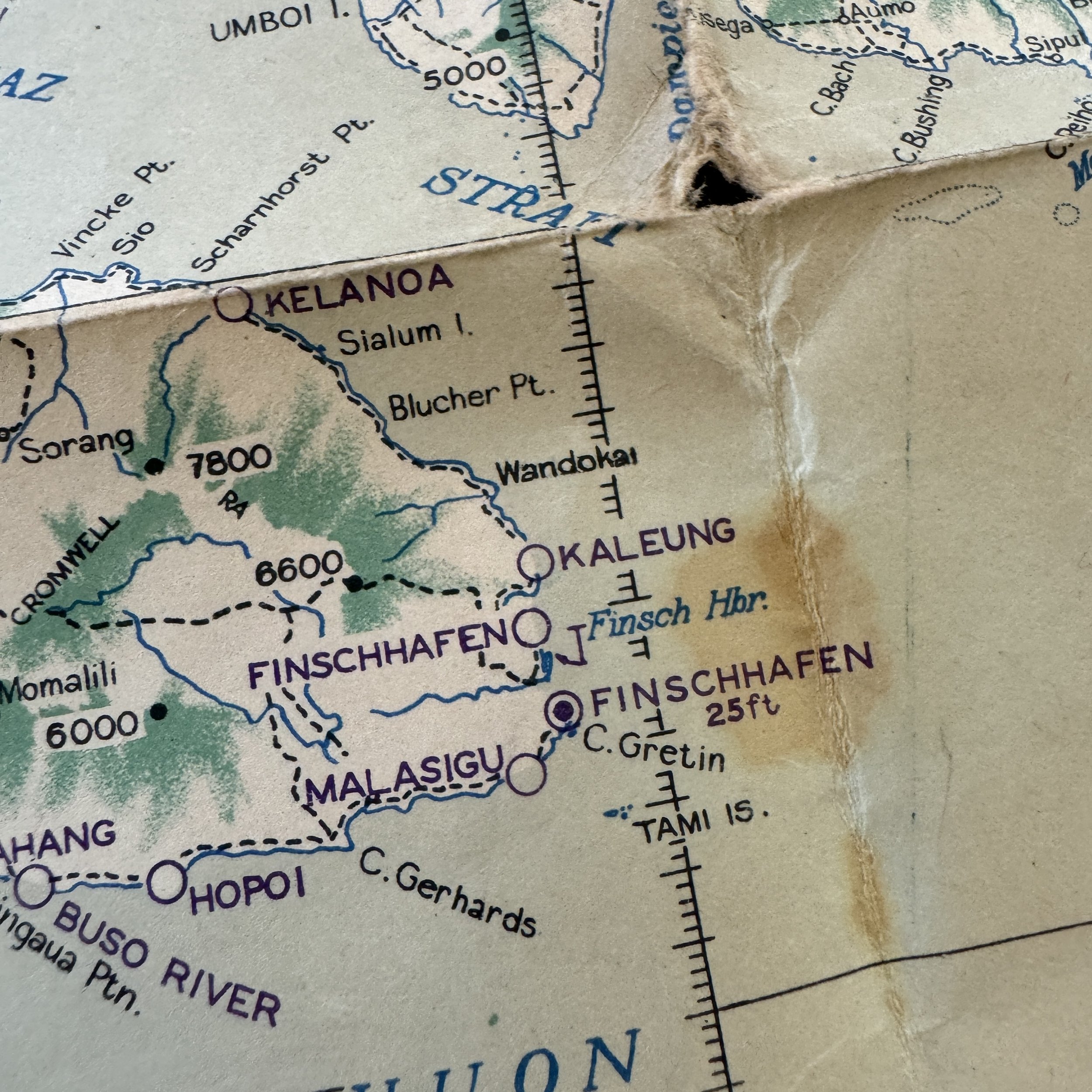
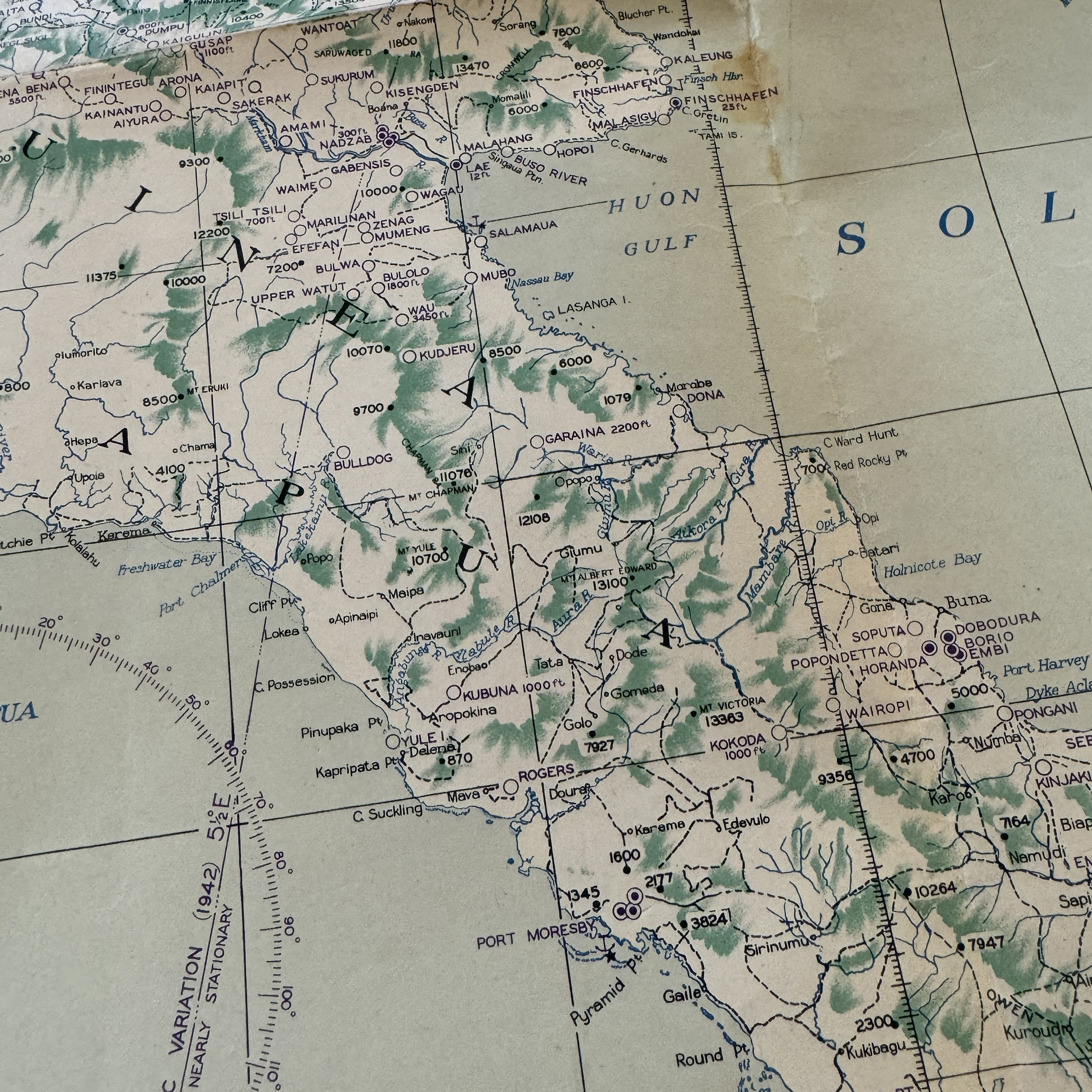
This exceptionally rare and museum-grade World War II artifact is an original U.S. Army Air Force combat flight navigation map, dated September 1944, that was specially prepared for the U.S. Fifth Air Force by the Ground Headquarters of the South West Pacific Area during the critical stages of the New Guinea Campaign. It is one of only a handful of known original examples still in existence, making it a significant historical artifact tied directly to the aerial operations that helped turn the tide of the war in the Pacific.
This combat mission flight map played an essential role in Fifth Air Force operations, guiding strategic bombing missions, air superiority campaigns, and ground support operations against entrenched Japanese forces throughout New Guinea. From early 1944 through mid-1945, the Fifth Air Force conducted relentless air raids on key Japanese strongholds across the island, including Hollandia, Biak, Wewak, and Noemfoor, in an effort to destroy enemy airfields, cripple supply networks, and clear the way for Allied ground advances. As a crucial navigational tool, this map provided U.S. pilots with topographical intelligence and detailed enemy positions, allowing for high-precision bombing raids and close air support missions that ensured the success of MacArthur’s island-hopping campaign.
What makes this map an extremely rare World War II artifact is its status as one of the few surviving Pacific Theater combat maps that were specifically prepared for the Fifth Air Force under the direction of the Chief Engineer of Ground Headquarters within the South West Pacific Area Command. These maps were developed using aerial reconnaissance data and topographical intelligence, ensuring that pilots and mission planners had the most accurate and up-to-date information when conducting high-risk bombing raids and fighter patrols over the dense jungles and mountainous terrain of New Guinea. This combat flight navigation map was the product of a close collaboration between the U.S. Fifth Air Force and the Royal Australian Air Force, reflecting the essential joint efforts between American and Australian forces in executing aerial operations against heavily fortified Japanese positions.
During this period, the Fifth Air Force played a decisive role in securing Allied air superiority in New Guinea. In April 1944, during the Battle of Hollandia, U.S. bombers launched devastating attacks on Japanese air bases, destroying hundreds of enemy aircraft on the ground and preventing them from disrupting the Allied landings. Throughout the summer, airstrikes against Biak and Noemfooreliminated key Japanese garrisons and provided the Allies with strategically located airfields for long-range bombing missions. From late 1944 into 1945, as the campaign shifted to western New Guinea, the Fifth Air Force intensified its bombing raids on Wewak, Sorong, and Timika, cutting off Japanese supply lines and isolating their remaining forces. Aircraft such as the B-24 Liberator, B-25 Mitchell, and P-38 Lightning relied on precise navigation maps like this one to execute long-range bombing missions, strafing runs on enemy supply convoys, and fighter escort duties for critical airstrikes that paved the way for the final phase of the New Guinea Campaign.
This map would have been used during aerial assaults on key Japanese airfields, heavily fortified garrisons, and logistical centers, guiding pilots through dangerous enemy-controlled territory where anti-aircraft fire and Japanese fighter aircraft posed constant threats. As the Fifth Air Force expanded its operations, combat flight maps like this became indispensable tools for mission planning, providing essential intelligence on enemy troop movements, coastal defenses, and strategic targets across New Guinea. By mid-1945, these sustained aerial operations had neutralized Japanese air power in the region, ensuring that Allied forces could focus their efforts on the liberation of the Philippines and the final push toward Japan.
This artifact stands as a testament to the ingenuity, precision, and strategic coordination that defined the U.S. Fifth Air Force’s aerial campaign in the Pacific War. With so few of these original combat navigation maps surviving, this piece represents a once-in-a-lifetime historical relic, directly linked to the air war that led to the successful completion of the New Guinea Campaign and the ultimate Allied victory in the Pacific.
Condensed 1944-1945 History of U.S. Fifth Air Force in the Pacific Theater:
The U.S. Fifth Air Force served as the aerial spearhead of General Douglas MacArthur’s island-hopping campaign from 1944 to 1945, playing a critical role in securing air superiority, conducting strategic bombing, and providing close air support for ground forces across the Pacific. As MacArthur’s forces advanced toward the Philippines and ultimately Japan, the Fifth Air Force was responsible for neutralizing key Japanese strongholds, disrupting enemy supply lines, and ensuring the success of amphibious landings. Throughout 1944, the Fifth Air Force was heavily engaged in the New Guinea Campaign, supporting operations in Hollandia (April 1944), Biak (May–June 1944), Noemfoor (July 1944), and Morotai (September 1944). These battles secured critical airfields, allowing the Allies to extend their operational reach further into the Pacific. The Admiralty Islands campaign (February–May 1944)was another key operation, during which the Fifth Air Force conducted extensive bombing raids and fighter sweeps to eliminate Japanese resistance on Los Negros and Manus Island. These islands provided the Allies with forward bases to launch further operations against the Philippines. By late 1944, the Fifth Air Force was instrumental in the Philippines Campaign, beginning with the Battle of Leyte Gulf (October 1944), where it conducted bombing raids on enemy airfields and provided air cover for naval and ground forces. As the campaign progressed into Luzon (January 1945), Mindoro, and Mindanao, Fifth Air Force aircraft engaged in relentless airstrikes against Japanese defensive positions, shipping convoys, and troop concentrations. Throughout these operations, the Fifth Air Force employed a variety of aircraft, including P-38 Lightnings, B-24 Liberators, B-25 Mitchells, and A-20 Havocs, to strike Japanese airfields, infrastructure, and reinforcements across islands such as Palawan, Cebu, Panay, and Borneo. As the war neared its end in mid-1945, the Fifth Air Force continued its air campaigns against Formosa (Taiwan) and the Ryukyu Islands, ensuring that Japan’s ability to counter the Allied advance was further diminished. By securing these islands, the Fifth Air Force played a decisive role in paving the way for the final stages of the Pacific War, culminating in the liberation of the Philippines and the eventual planning for an invasion of Japan.
19th Bombardment Group
22nd Bombardment Group
2d Combat Cargo Group
312th Bombardment Group
317th Troop Carrier Group
345th Bombardment Group
348th Fighter Group
35th Fighter Group
374th Troop Carrier Group
375th Troop Carrier Group
380th Bombardment Group
38th Bombardment Group
3rd Air Commando Group
3rd Bombardment Group
417th Bombardment Group
433rd Troop Carrier Group
43rd Bombardment Group
475th Fighter Group
49th Fighter Group
54th Troop Carrier Wing
58th Fighter Group
6th Reconnaissance Group
71st Reconnaissance Group
85th Fighter Wing
86th Fighter Wing
8th Fighter Group
90th Bombardment Group
91st Reconnaissance Wing
V Bomber Command
V Fighter Command