Original WWII B-17 Flying Fortress "Far East Air Force" Aerial Bombing Mission Photograph*


Original WWII B-17 Flying Fortress "Far East Air Force" Aerial Bombing Mission Photograph*
Comes with a hand-signed C.O.A. and a full historical research write-up
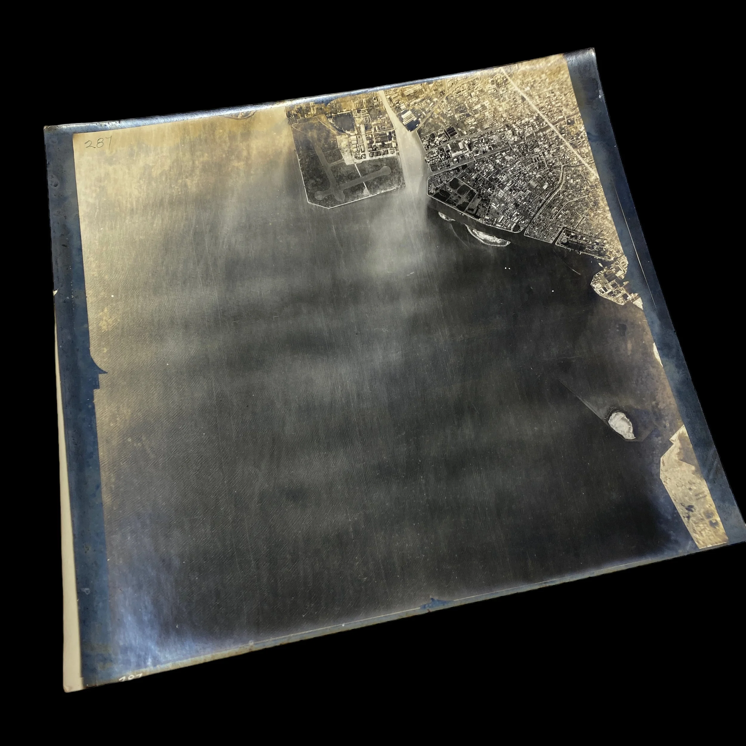
This incredible and museum-grade WWII U.S. B-17 Flying Fortress aerial mission bombardment photograph comes from a rare bring-back collection of original mission photographs from the “HEADQUARTERS, FAR EAST AIR FORCE”. This collection was from the Assistant Chief of Air Staff of The Far East Air Force (FEAF). The Far East Air Force (FEAF) is accredited with combat missions during the Philippines campaign, Defense of Bataan, Netherlands East Indies campaigns, and Operations on Java.
The B-17 Flying Fortress was an iconic heavy bomber aircraft employed by the United States during World War II. Renowned for its ability to withstand significant damage and still complete missions, the Flying Fortress played a pivotal role in strategic bombing campaigns. Equipped with an array of machine guns and capable of carrying a substantial bomb load, the B-17 was a formidable force in the skies.
The FEAF was a crucial component of the Allied forces in the Pacific Theater during World War II. It conducted numerous combat missions and played a significant role in various campaigns. The Philippines campaign marked the FEAF's efforts to regain control of the Philippines from Japanese forces. The Defense of Bataan highlighted the FEAF's dedication to protecting strategic locations, while the Netherlands East Indies campaigns aimed to secure territories under Dutch control. Operations on Java involved the defense of Java Island against Japanese advances.
This original mission photograph originating from the FEAF's Assistant Chief of Air Staff, represents a rare artifact that provides invaluable insights into the operations of the FEAF. These original mission raid photographs were developed immediately after landing at FEAF airfields in the Pacific Theater. They served multiple purposes, including post-raid target damage assessments, updated reconnaissance intelligence, and the creation of FLAK maps, among others. Such photographs were critical in evaluating the effectiveness of bombing runs and assessing the impact on enemy targets.
One of the primary uses of these mission raid photographs was to conduct post-raid target damage assessments. These assessments allowed commanders to evaluate the success of bombing missions and determine the effectiveness of their strategic objectives. By examining the photograph, experts could analyze the degree of destruction inflicted on enemy installations, infrastructure, and military assets. These assessments were instrumental in shaping subsequent missions, adjusting strategies, and maximizing the impact of future operations.
In addition to target damage assessments, original mission photographs provided valuable updated reconnaissance intelligence. By examining the captured images, military analysts and commanders could identify changes in enemy defenses, detect new installations or fortifications, and gather vital information about the enemy's movements and activities. This intelligence was crucial in adapting tactical approaches and maintaining a strategic advantage over the enemy.
These mission raid photographs also contributed to the creation of FLAK maps, which detailed the location of anti-aircraft defenses. By analyzing the photographs, military planners could identify the density and placement of enemy anti-aircraft artillery, enabling them to develop flight routes and operational plans that minimized the risk to their aircraft and personnel. FLAK maps played a vital role in ensuring the safety and success of future missions.
Full History of WWII Aerial Mission Photography:
World War II (WWII) was a pivotal moment in human history, marked by intense global conflict and unprecedented technological advancements. Among the various instruments of war, aerial reconnaissance photographs emerged as a critical component, providing invaluable intelligence to military strategists and shaping the outcome of battles. This essay explores the significance of WWII aerial reconnaissance photographs and their pivotal role in enhancing situational awareness, facilitating tactical decision-making, and ultimately altering the course of the war.
Aerial reconnaissance photographs revolutionized the way military commanders gathered information about enemy forces and terrain. Traditional ground-based reconnaissance methods were limited in scope and accuracy, making it difficult to obtain a comprehensive understanding of enemy positions and movements. However, with the advent of aerial photography, a bird's-eye view of the battlefield became accessible. These photographs captured detailed images of enemy fortifications, troop movements, supply lines, and key infrastructure, offering an unparalleled perspective that greatly enhanced situational awareness.
The availability of accurate and up-to-date aerial reconnaissance photographs played a pivotal role in facilitating tactical decision-making during WWII. Military commanders relied on these photographs to identify enemy weaknesses and vulnerabilities, plan troop movements, and devise effective strategies. By analyzing the photographs, commanders could evaluate the effectiveness of previous operations, identify potential targets, and anticipate enemy reactions. Aerial reconnaissance photographs provided real-time information, allowing for rapid adjustments to battle plans and increasing the likelihood of success on the battlefield.
Beyond immediate tactical advantages, aerial reconnaissance photographs also contributed significantly to strategic intelligence gathering during WWII. These photographs enabled analysts to study the layout of enemy defenses, assess the strength of opposing forces, and identify hidden military installations. They provided crucial information for long-term planning, aiding military leaders in making informed decisions regarding the allocation of resources and the development of large-scale military strategies. Aerial reconnaissance photographs played a crucial role in shaping the overall direction of the war and minimizing the element of surprise for both sides.
The effectiveness of aerial reconnaissance photographs during WWII can be attributed to technological advancements in both aircraft and photography equipment. High-altitude reconnaissance planes, such as the American P-38 Lightning or the British Spitfire PR variants, allowed for safe and efficient aerial reconnaissance missions. Additionally, improvements in photography equipment, including faster shutter speeds and higher resolution film, resulted in clearer and more detailed images. These technological advancements further increased the value of aerial reconnaissance photographs, enabling a more accurate interpretation of the captured data.
WWII aerial reconnaissance photographs were an indispensable asset in the Allied and Axis war efforts. By enhancing situational awareness, facilitating tactical decision-making, and providing critical strategic intelligence, these photographs played a vital role in shaping the outcome of battles and ultimately the war itself. The availability of accurate and up-to-date information offered through aerial reconnaissance photographs gave military commanders an edge, allowing them to respond swiftly to changing circumstances and exploit enemy weaknesses. As a result, aerial reconnaissance photographs emerged as one of the defining tools of WWII, revolutionizing military intelligence and forever altering the course of history.