RARE! WWII Era 1941 GNOMONIC PROJECTION "GREAT CIRCLE CHART - UNITED STATES"


RARE! WWII Era 1941 GNOMONIC PROJECTION "GREAT CIRCLE CHART - UNITED STATES"
Comes with C.O.A.
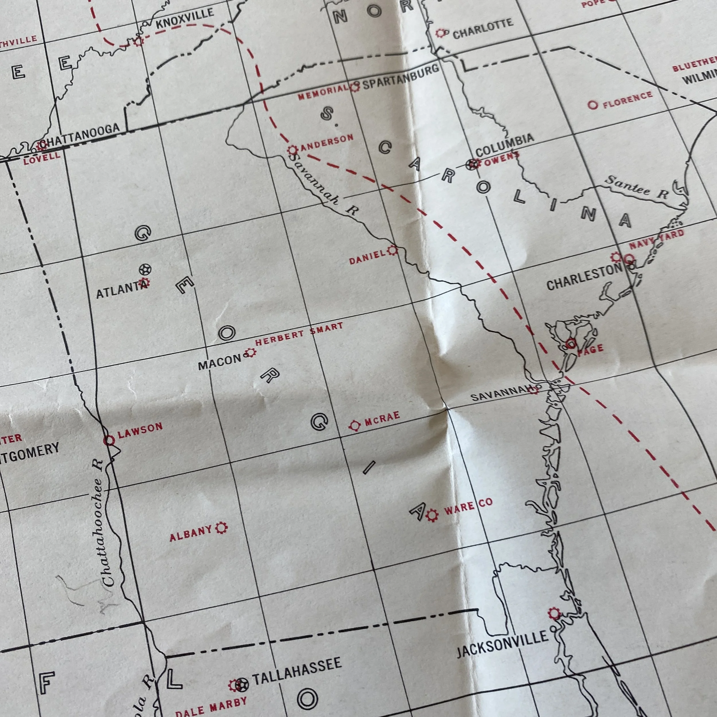
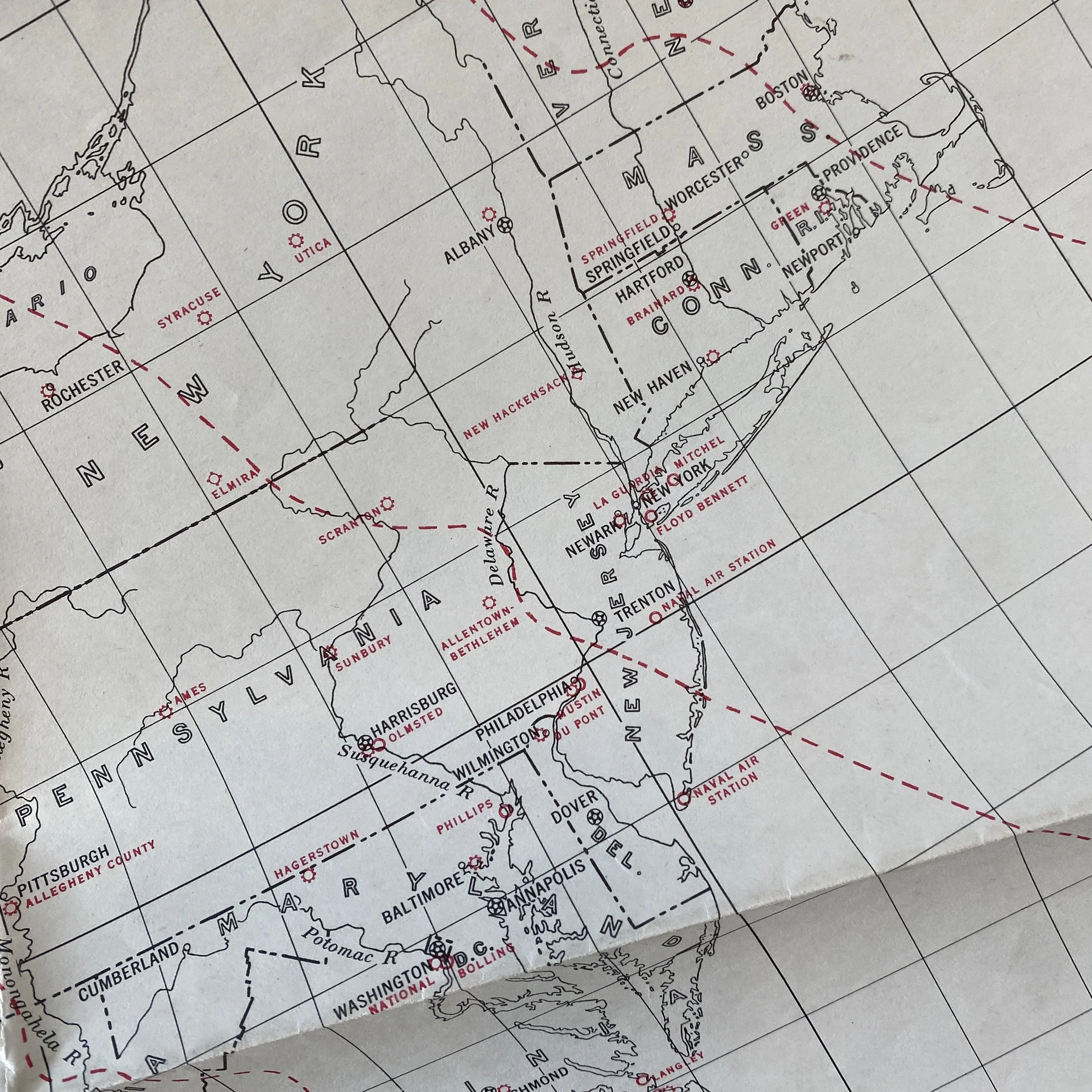
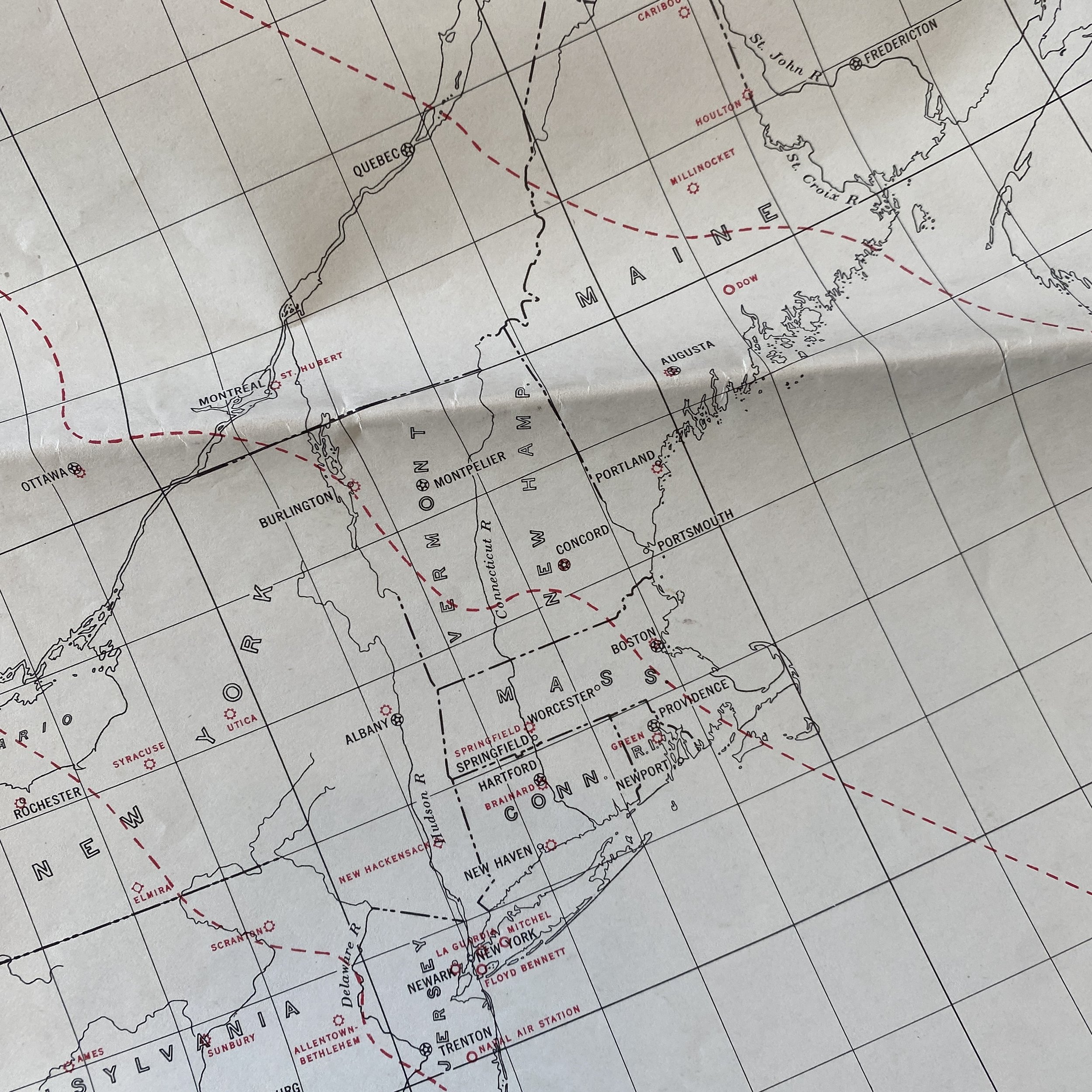
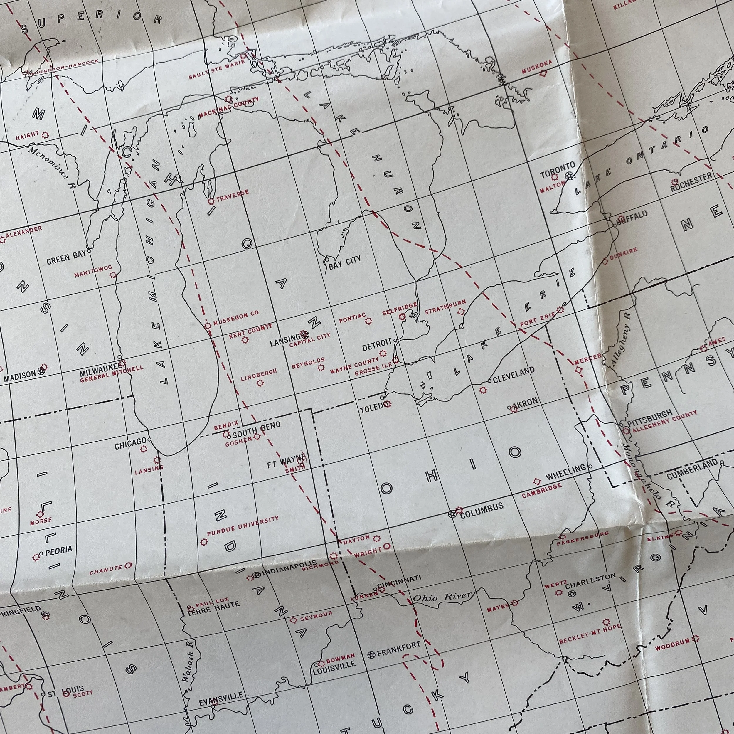
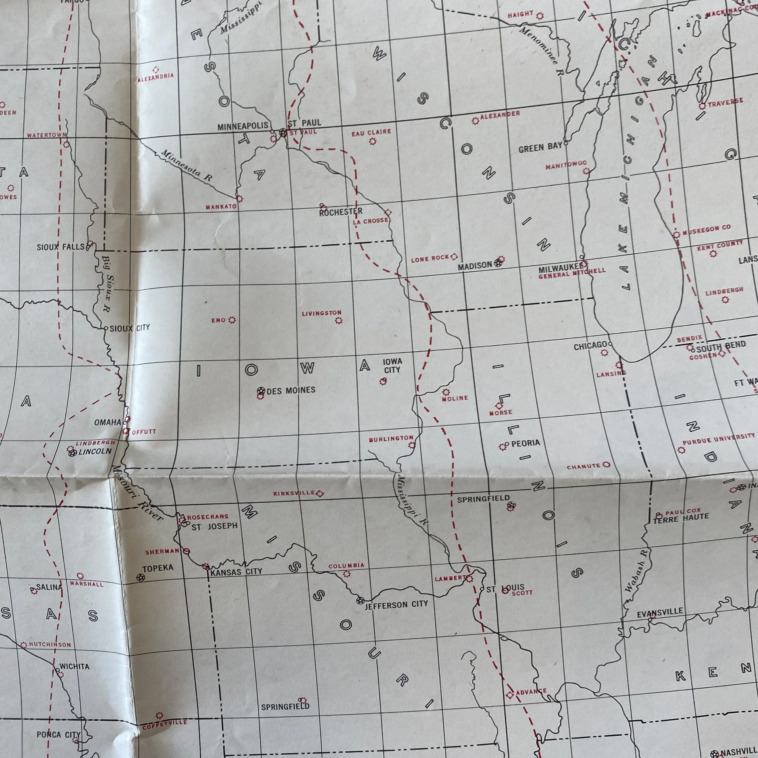
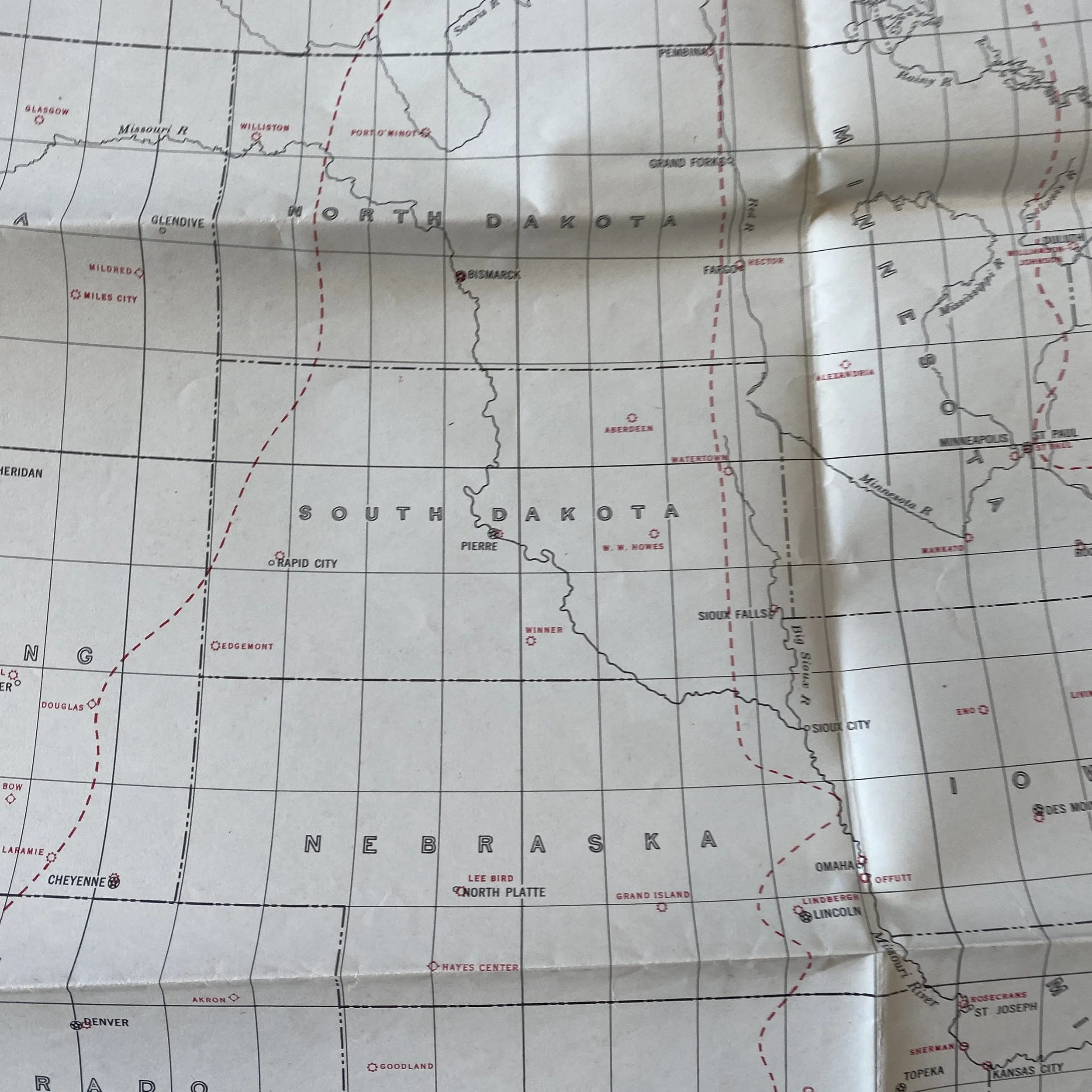
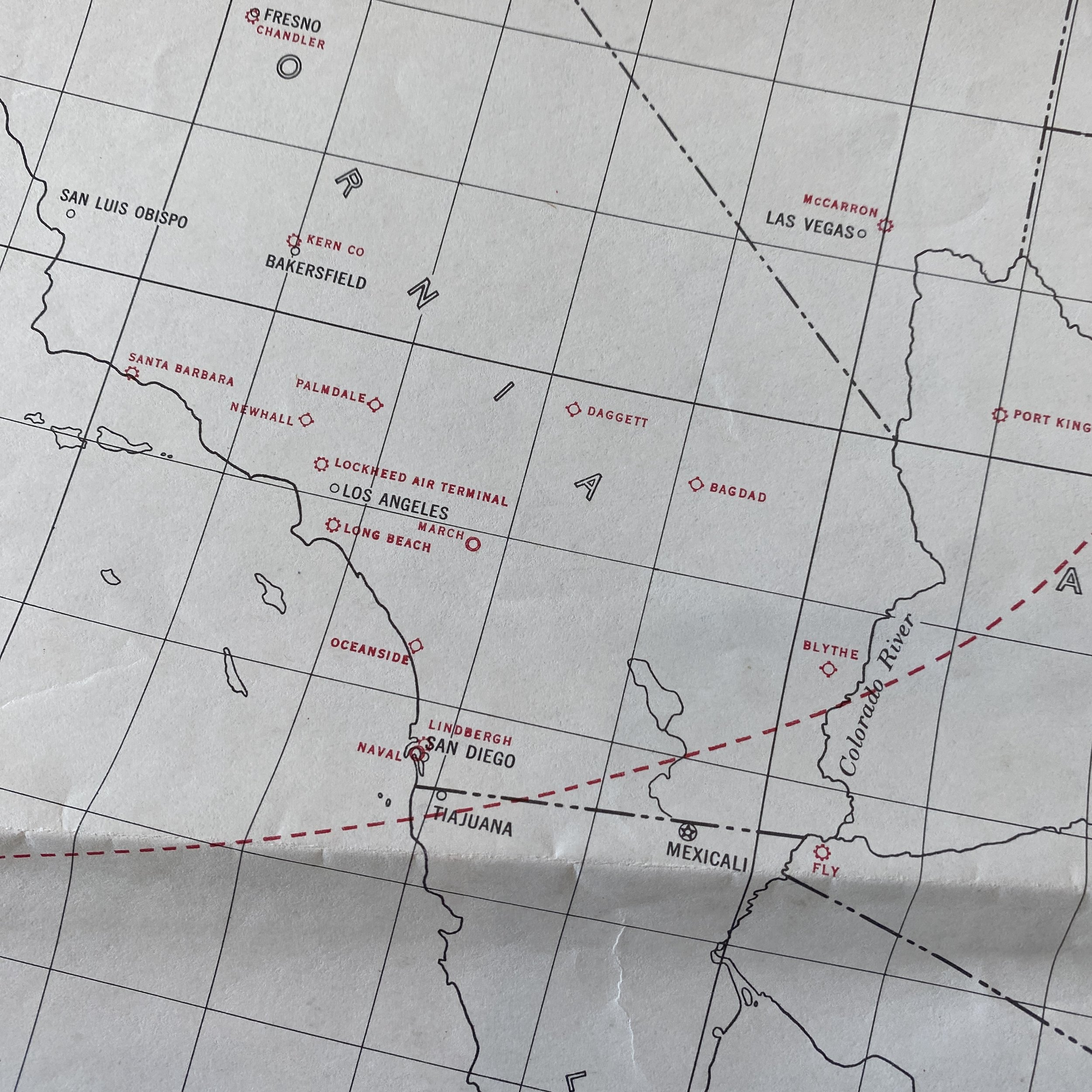
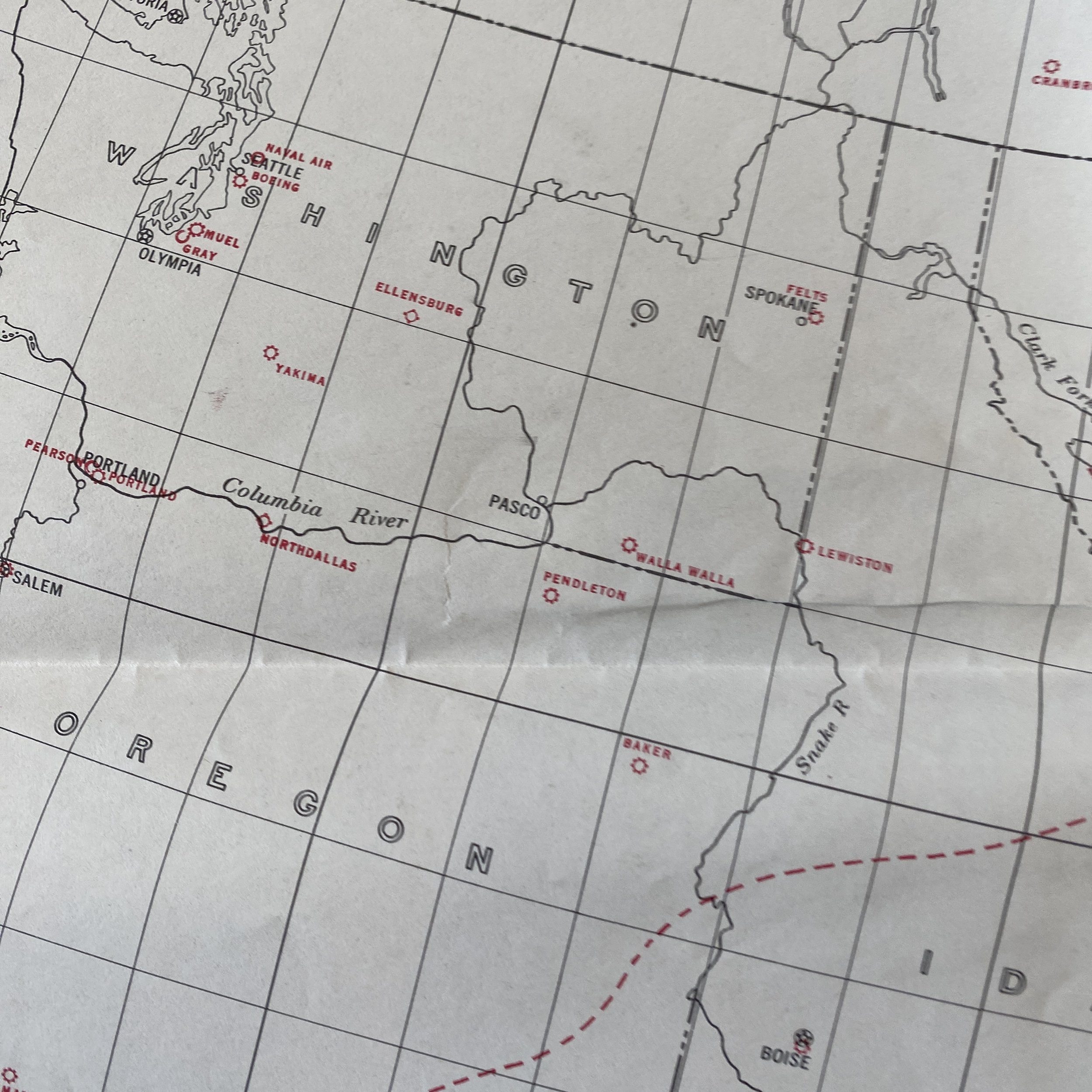
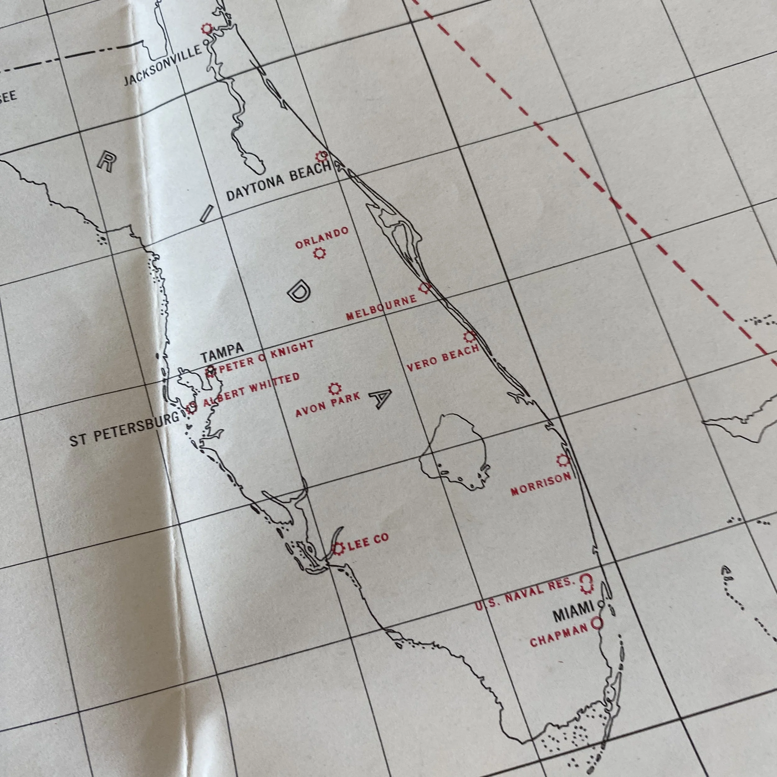
This original and museum-grade WWII era “GREAT CIRCLE CHART - UNITED STATES” is a rare GNOMONIC PROJECTION published at Washington D.C. in May 1941. This map shows the sensitive information of every ARMY, NAVY, and MARINE CORPS FIELD in the United States during the early stages of WWII
In the early 1940s, the United States found itself deeply entrenched in the global conflict of World War II. The need for accurate navigation was paramount for both military and civilian purposes. During this time, the Great Circle Chart and Gnomonic Projection emerged as crucial tools for navigators, aiding in precise calculations and facilitating more efficient travel across vast distances.
The Great Circle Chart is a navigational tool based on the concept of great circle routes. A great circle is the shortest path between two points on the surface of a sphere, such as the Earth. In the context of navigation, great circles are essential for long-distance travel as they represent the most direct route. During 1941, the development and use of Great Circle Charts became increasingly important for both military and civilian navigators.
These charts were meticulously crafted maps that depicted great circle routes across oceans and continents. The calculations involved in plotting these routes took into account the curvature of the Earth, providing navigators with a more accurate representation of distances and optimal paths. This was particularly critical during wartime when efficiency and speed were paramount.
The Great Circle Chart allowed navigators to plan routes that minimized travel time and fuel consumption. In military operations, this meant faster deployment of troops and resources. For civilian purposes, it translated to more efficient air and sea travel, contributing to the war effort and the overall functioning of the economy.
Gnomonic projection is a method of mapping the surface of a sphere onto a flat plane. Unlike other map projections that distort certain features, gnomonic projection preserves great circles as straight lines. This characteristic makes it particularly useful for navigational purposes, where maintaining the integrity of great circle routes is crucial.
During 1941, gnomonic projection gained prominence in navigation, especially for long-distance air travel. When planning a flight path, gnomonic projection allowed navigators to plot a straight line representing the great circle route on a flat chart. This simplified navigation by providing a clear and accurate representation of the shortest distance between two points on the Earth's surface.
The combination of the Great Circle Chart and gnomonic projection was instrumental in addressing the challenges posed by the vast distances involved in global warfare. Navigators could more effectively plan and execute long-range missions, ensuring that resources were deployed efficiently and strategically.
In the context of World War II, the importance of accurate navigation cannot be overstated. Military operations often spanned vast distances, from the Pacific to the Atlantic, and required precise planning to ensure the success of missions. The Great Circle Chart and gnomonic projection played a pivotal role in enabling military commanders to devise strategic plans that maximized the effectiveness of their forces.
Naval operations, in particular, benefited from these navigational tools. The ability to chart the most direct course across the ocean allowed naval fleets to reach their destinations more quickly, reducing the risk of detection by enemy forces. In the air, military aircraft could follow optimal routes, conserving fuel and increasing the range of their operations.
While the military applications of the Great Circle Chart and gnomonic projection were crucial during wartime, these navigational tools also had a profound impact on civilian travel and commerce. The aviation industry, which was experiencing rapid growth and technological advancements, embraced these tools to enhance the efficiency of air travel.
Commercial airlines utilized Great Circle Charts and gnomonic projection to plan more direct routes, reducing flight times and operational costs. This not only benefited the airlines but also made air travel more accessible and attractive to the general public. As a result, these navigational advancements during 1941 contributed to the post-war expansion of the aviation industry.
The Great Circle Chart and gnomonic projection, while initially developed and widely used during World War II, continue to be relevant in modern navigation. The principles behind these tools remain fundamental in aeronautics and maritime navigation, providing the foundation for advanced computer-based navigation systems.
In the contemporary era, with the advent of GPS and satellite navigation, the concepts of great circle routes and gnomonic projection are still applied. The efficiency and precision afforded by these methods have become even more critical in the age of globalized commerce and rapid international travel.
The Great Circle Chart and gnomonic projection were indispensable navigational tools during the pivotal year of 1941, aiding both military and civilian efforts during World War II. These tools not only facilitated more efficient and strategic military operations but also laid the groundwork for advancements in commercial aviation and maritime navigation. The legacy of the Great Circle Chart and gnomonic projection endures in the modern era, serving as foundational principles in the development of sophisticated navigation systems that continue to shape the way we traverse the globe.