RARE! WWII Battle of Okinawa TOP SECRET 77th Infantry Division Ie Shima Amphibious GREEN & RED Beaches Combat Assault Map (PRINTED ONBOARD THE USS Panamint Flagship)
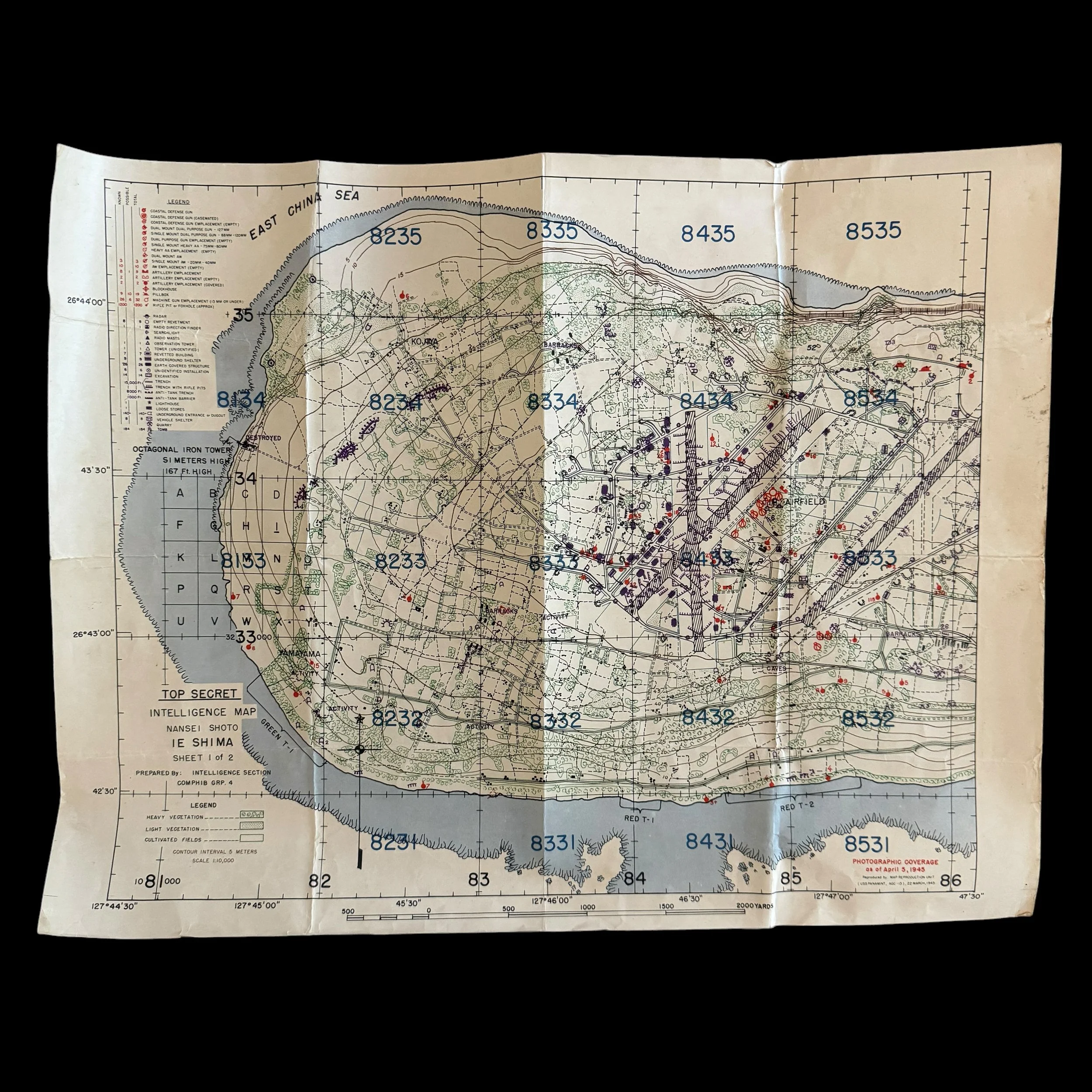
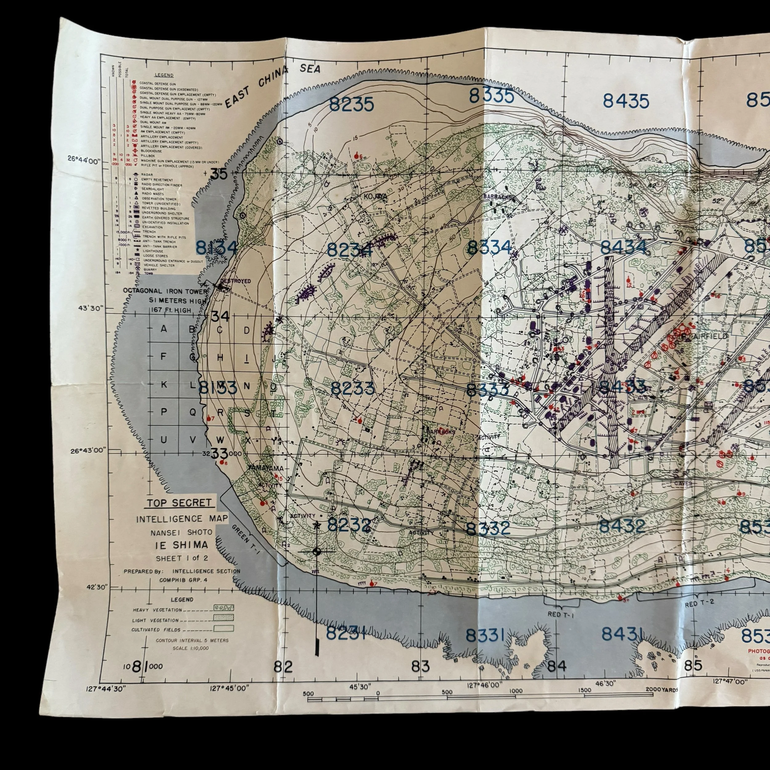
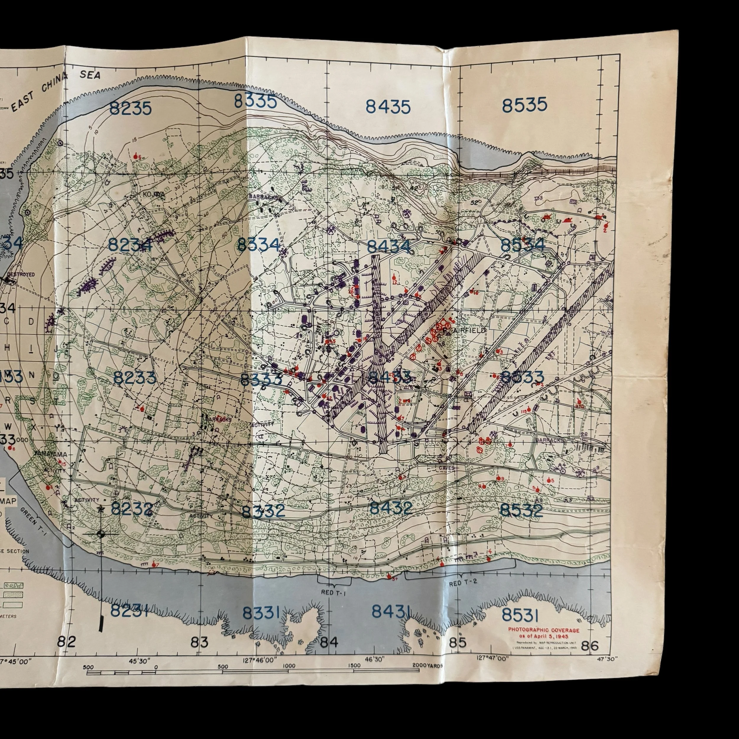
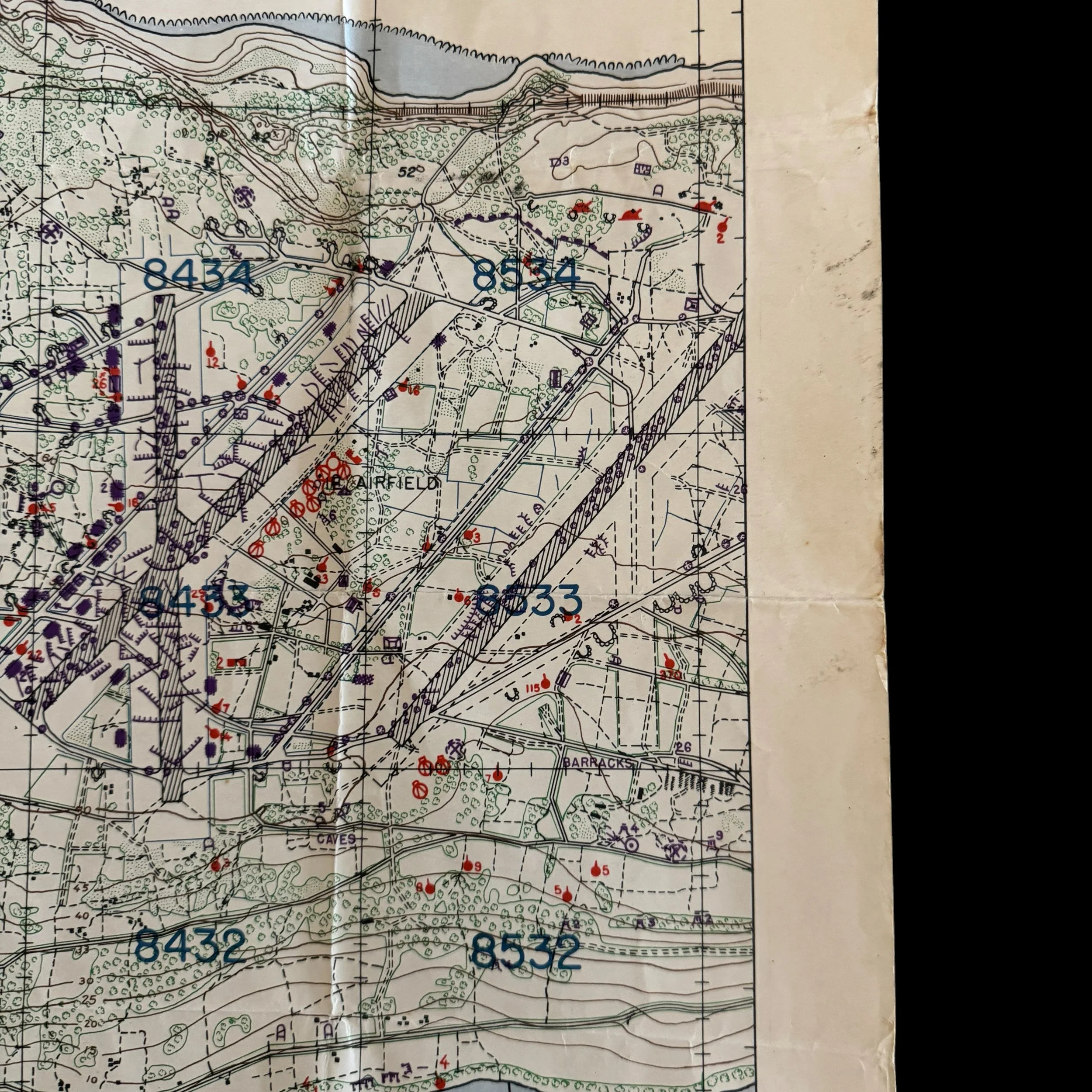
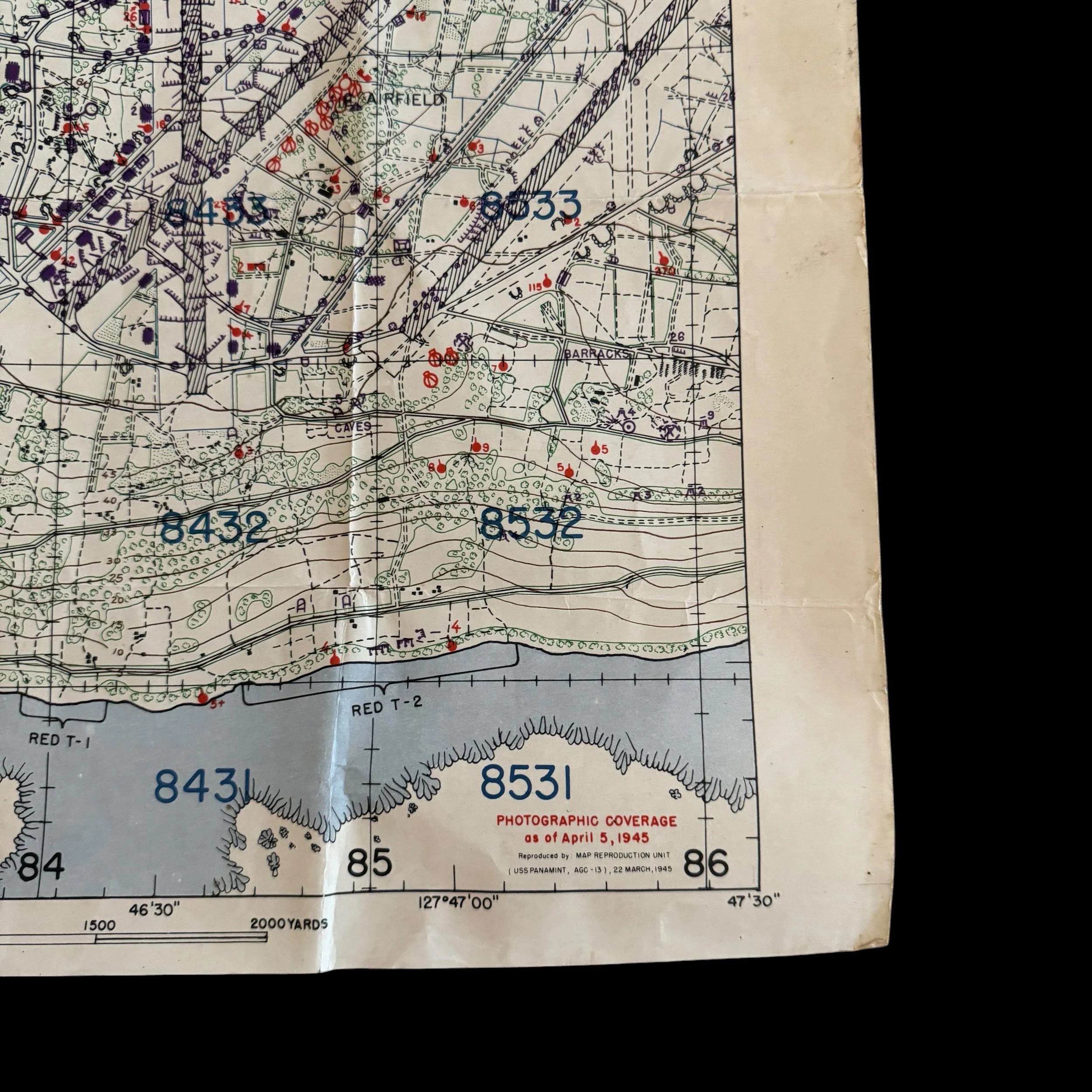
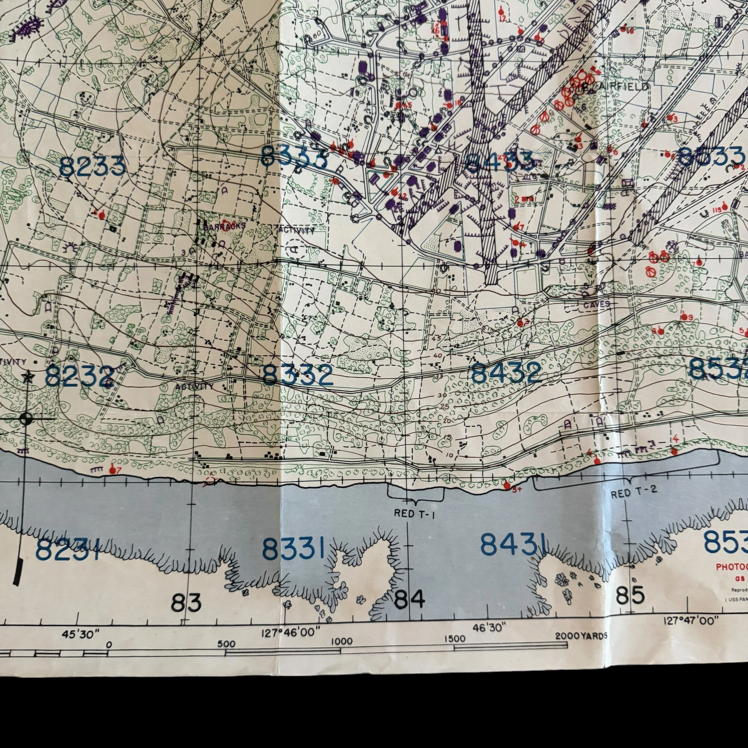
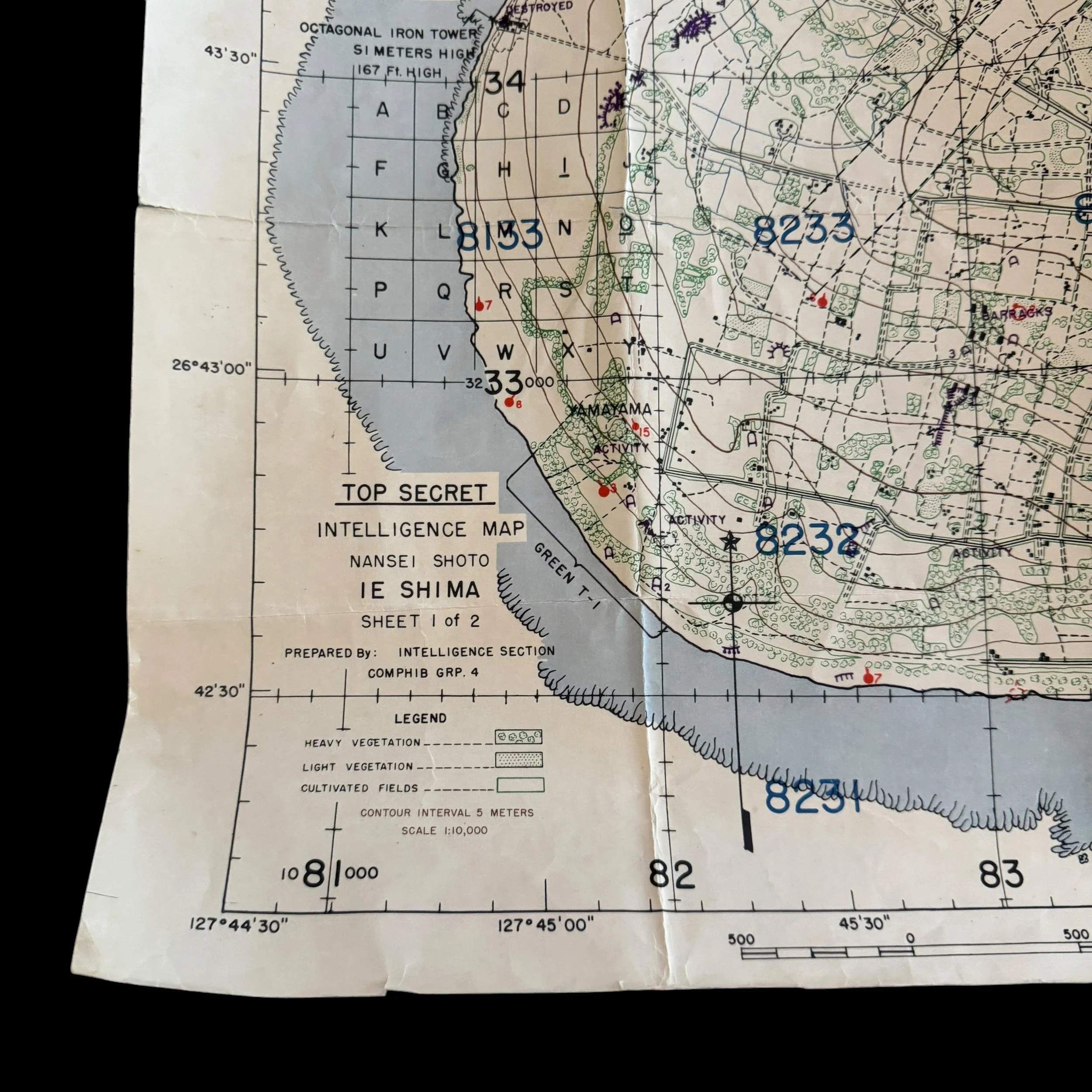
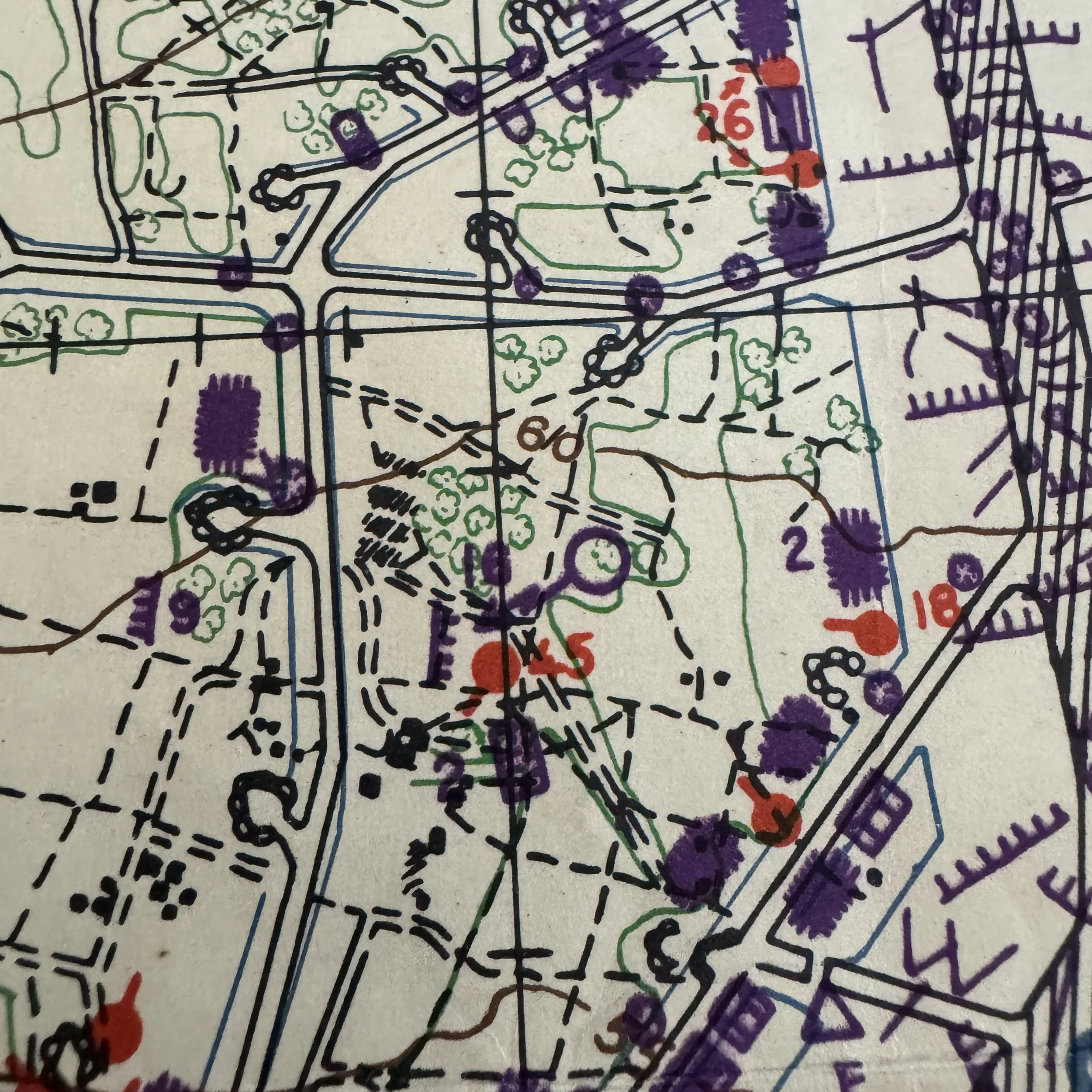
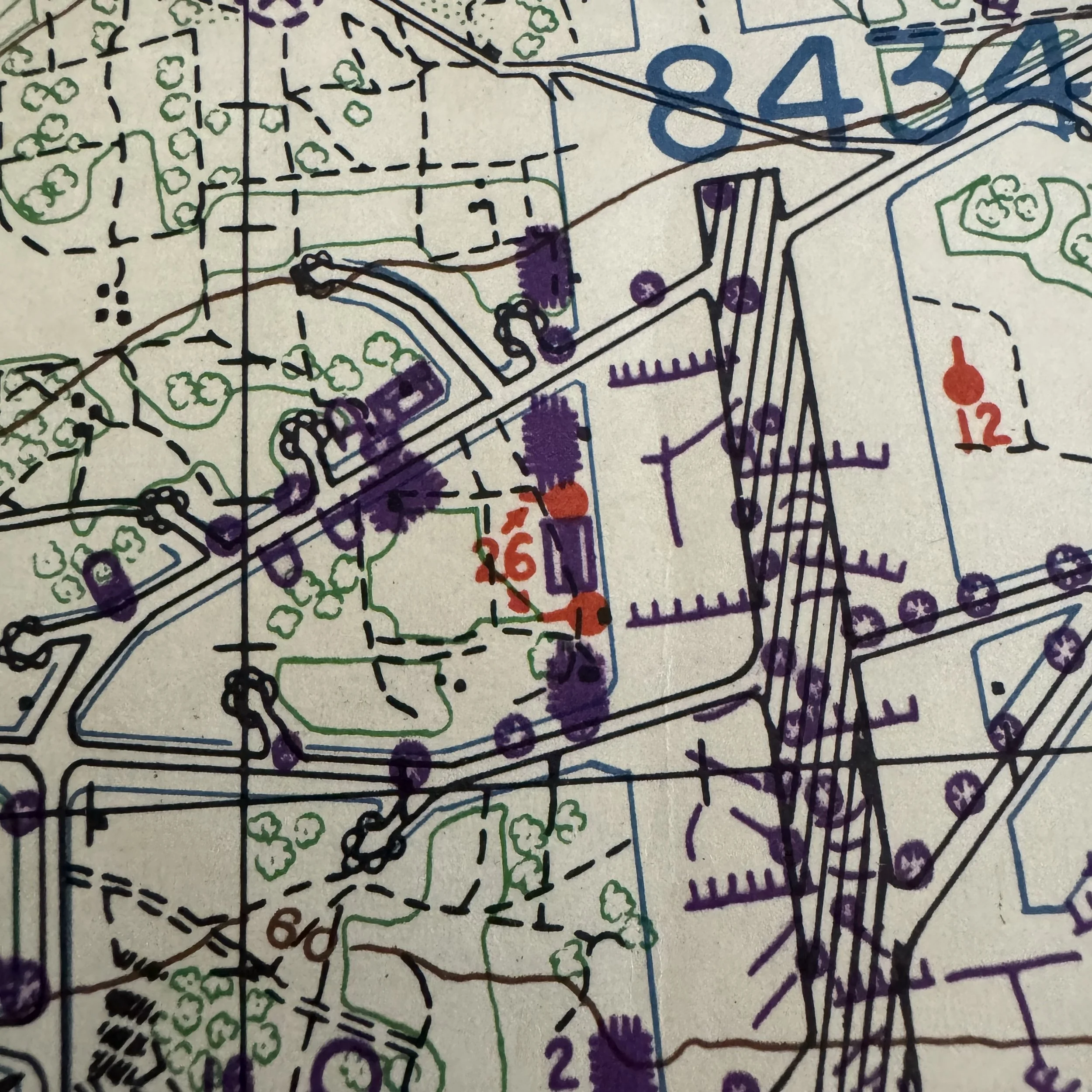
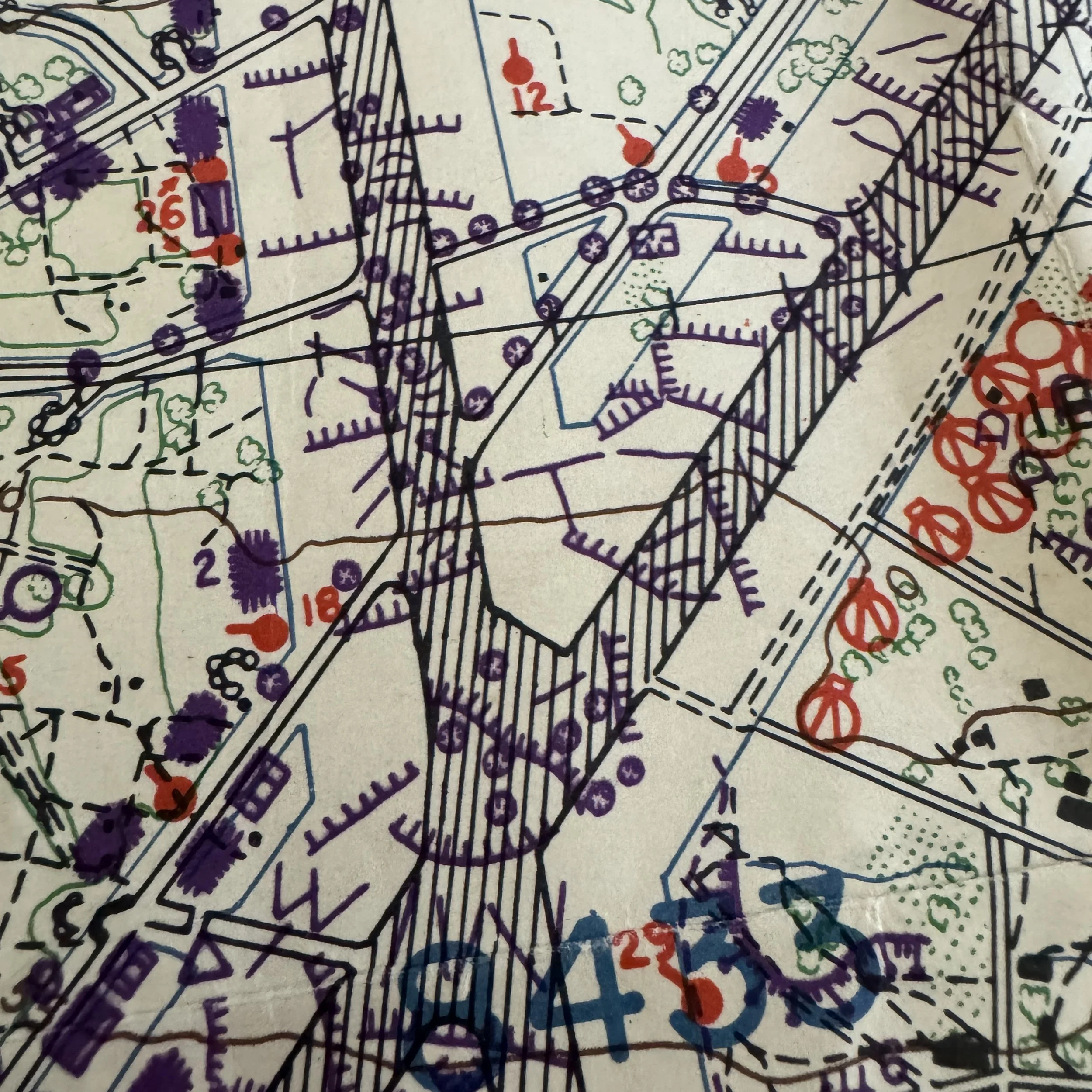
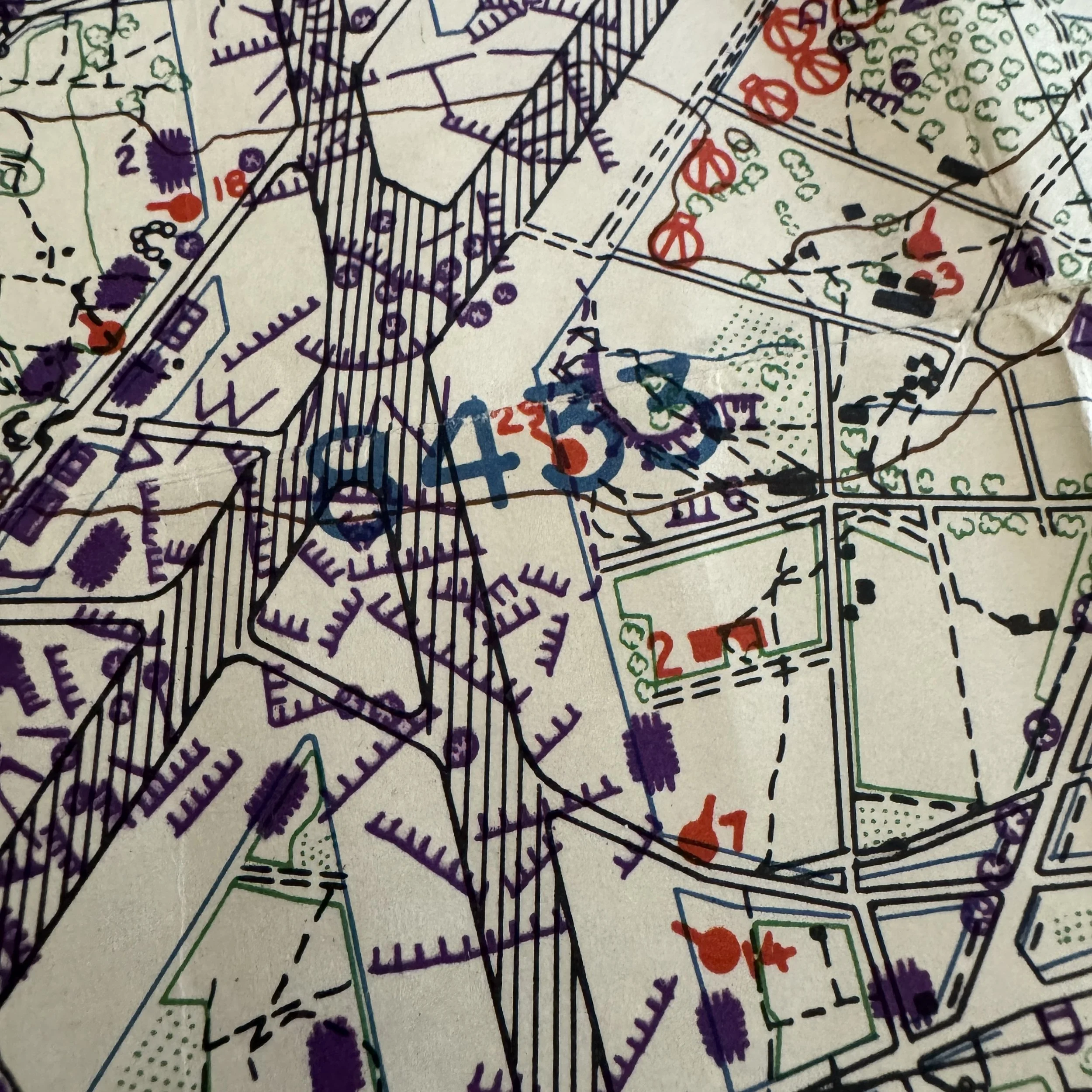
RARE! WWII Battle of Okinawa TOP SECRET 77th Infantry Division Ie Shima Amphibious GREEN & RED Beaches Combat Assault Map (PRINTED ONBOARD THE USS Panamint Flagship)
Comes with a hand-signed C.O.A.
Size: 17 × 22 inches
Rarity: EXTREMELY RARE (Theater-printed in strictly limited quantities aboard the USS Panamint (AGC-13) command ship in an active combat zone)
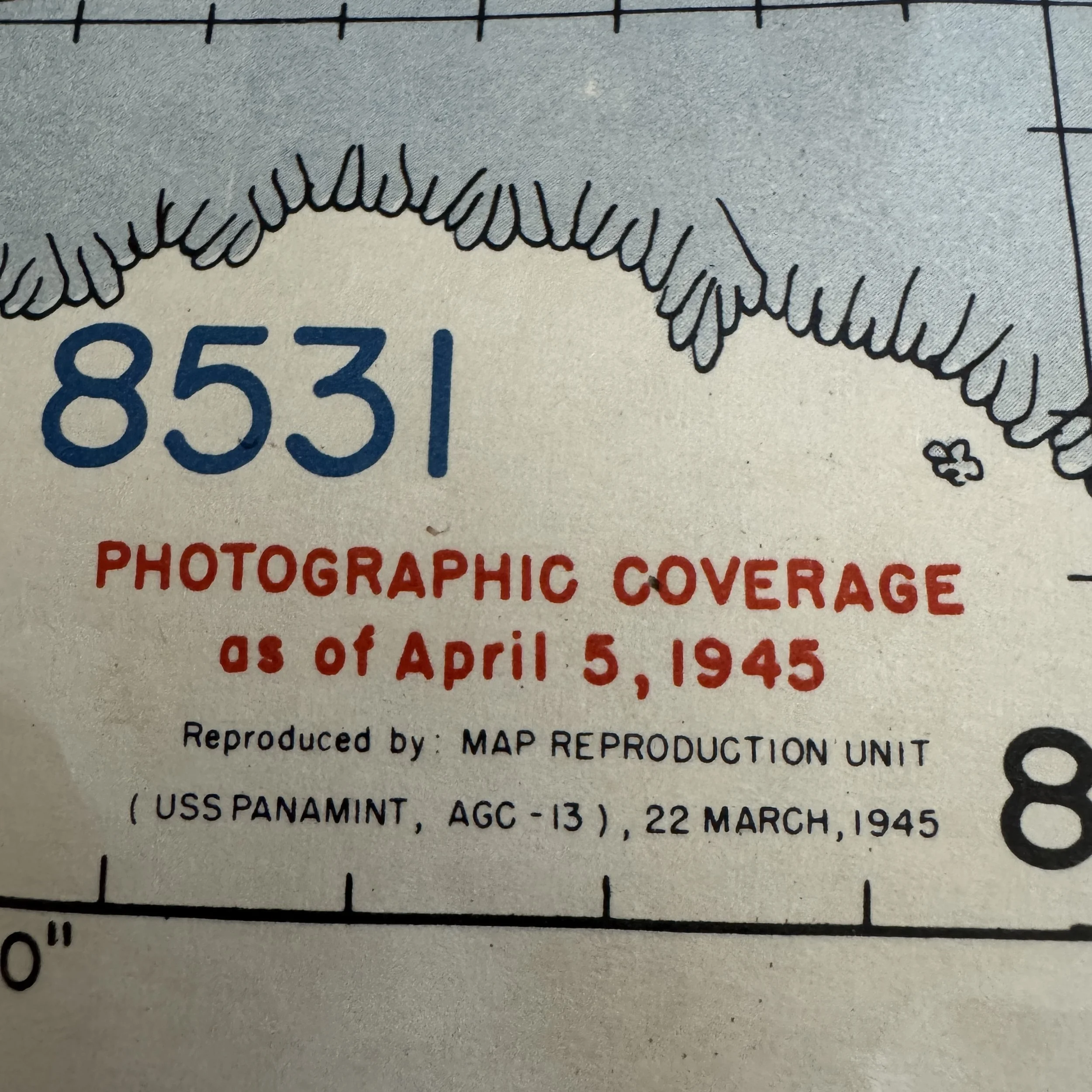
Dated: March 22, 1945 with "Top Secret" red intelligence photographic coverage overlay dated April 5, 1945 (Printed just 11 days before the April 16 invasion)
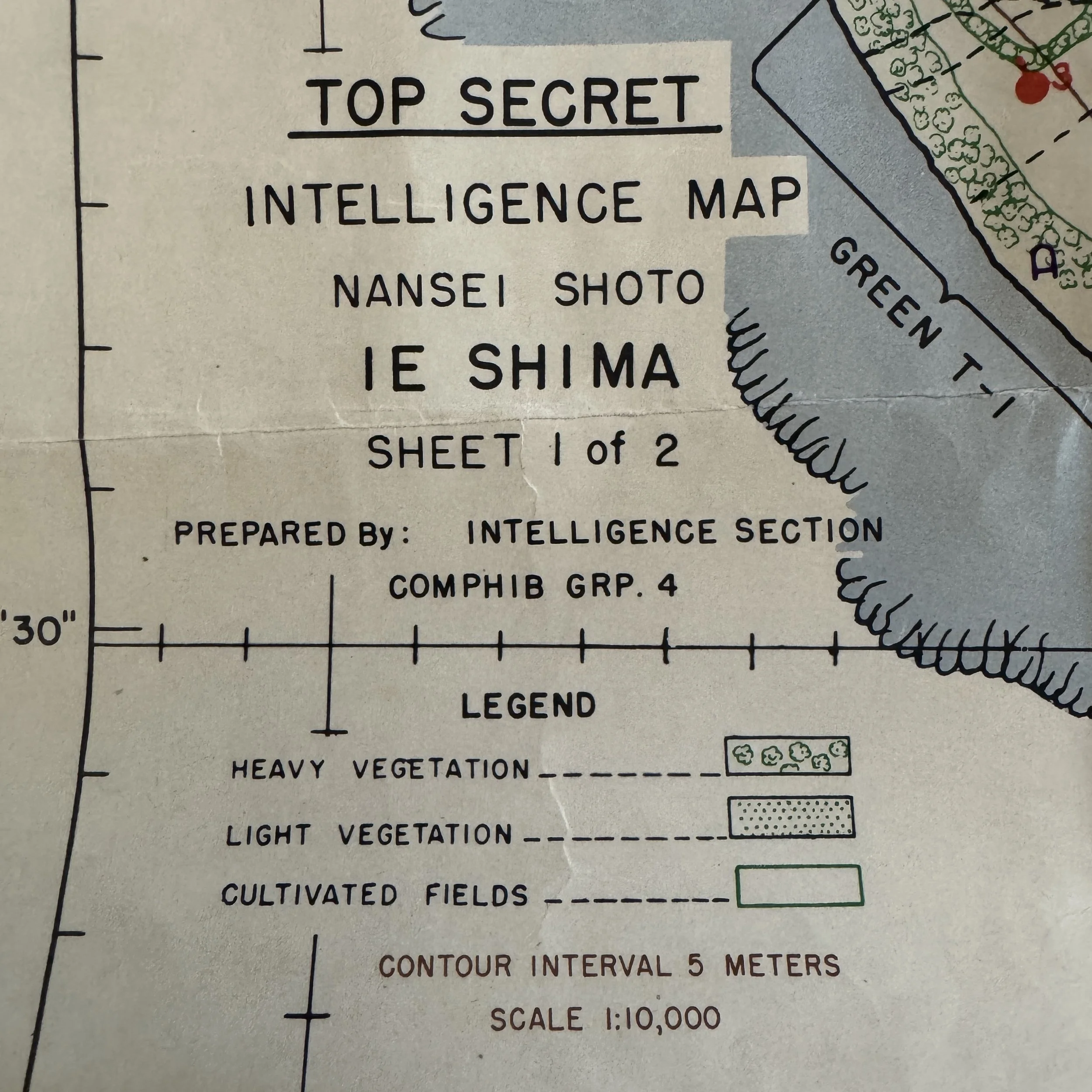
Created: Prepared by the Intelligence Section, COMPHIB GRP. 4 (Commander Amphibious Group 4) aboard the USS Panamint (AGC-13)
Provenance: Original combat-used artifact utilized by assault elements and officers of the U.S. Army’s 77th Infantry Division during the amphibious invasion of Ie Shima across the Green T-1, Red T-1, and Red T-2 landing beaches
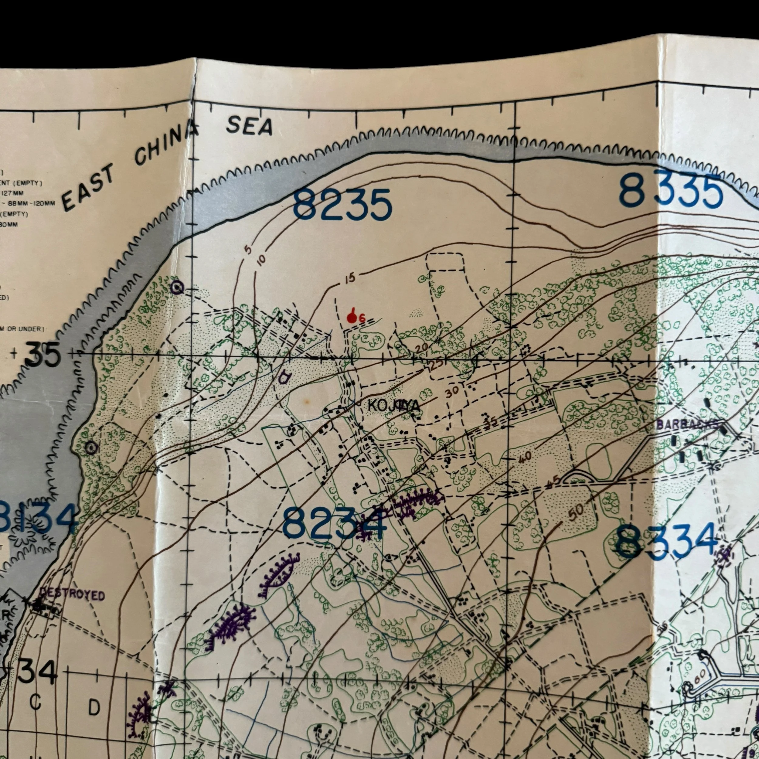
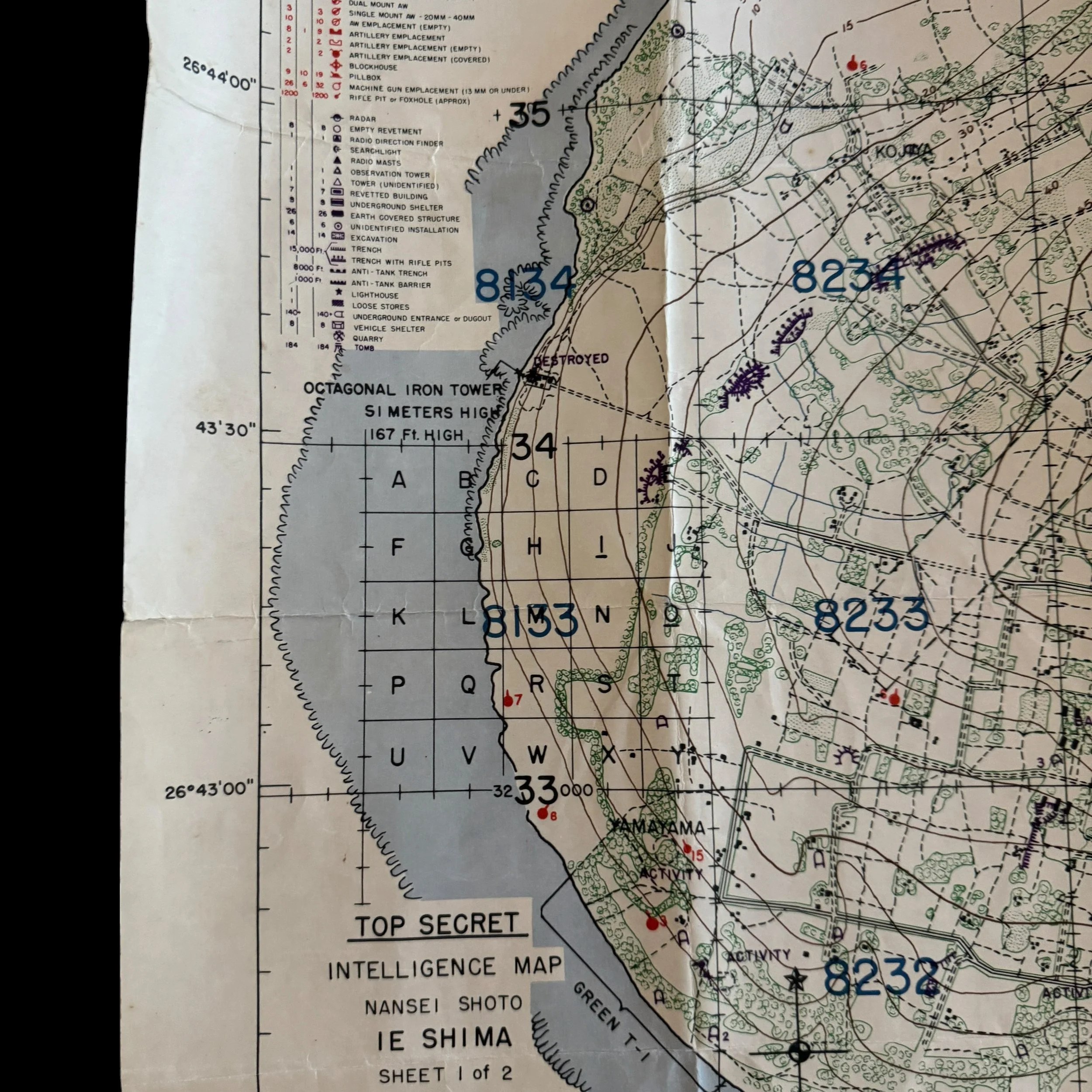
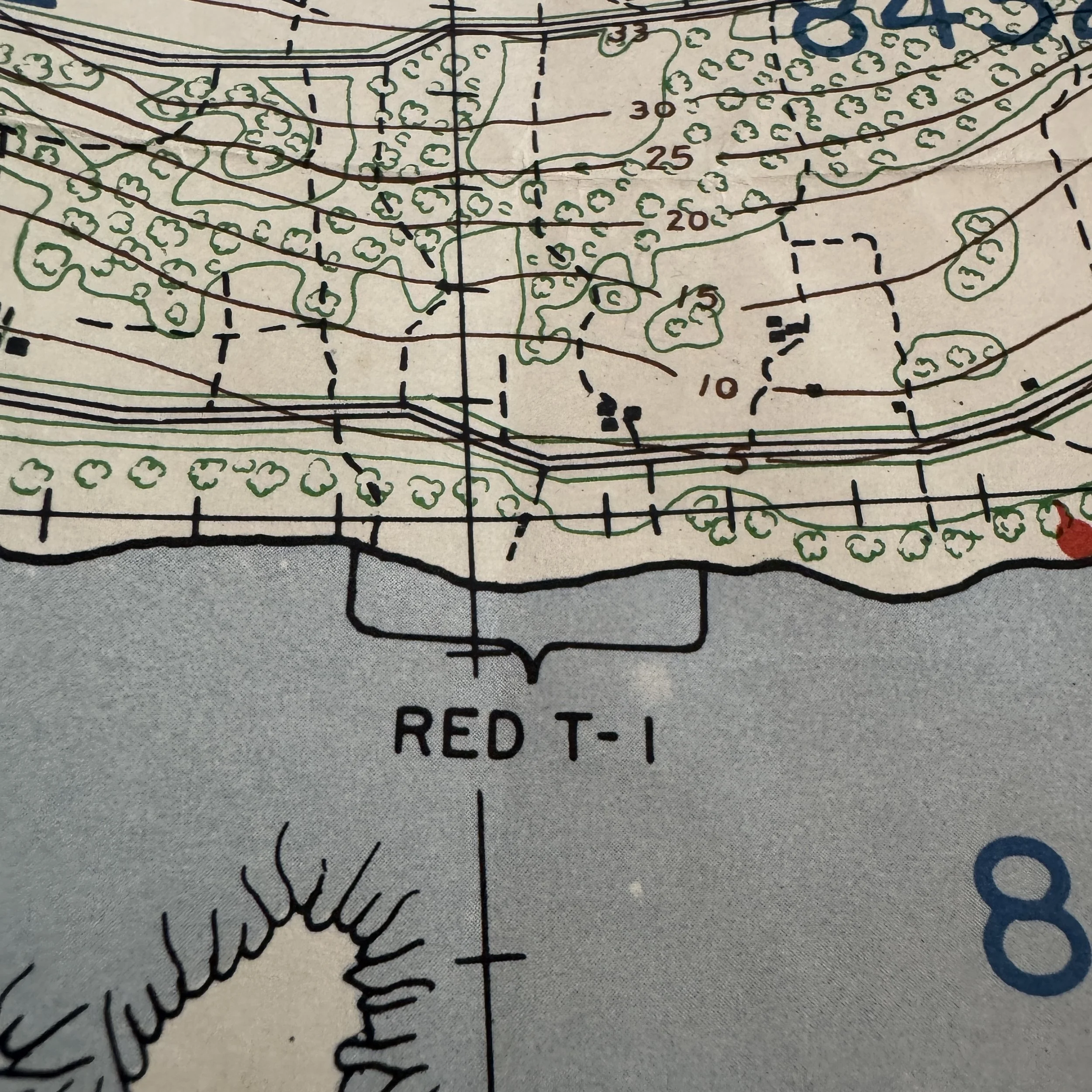
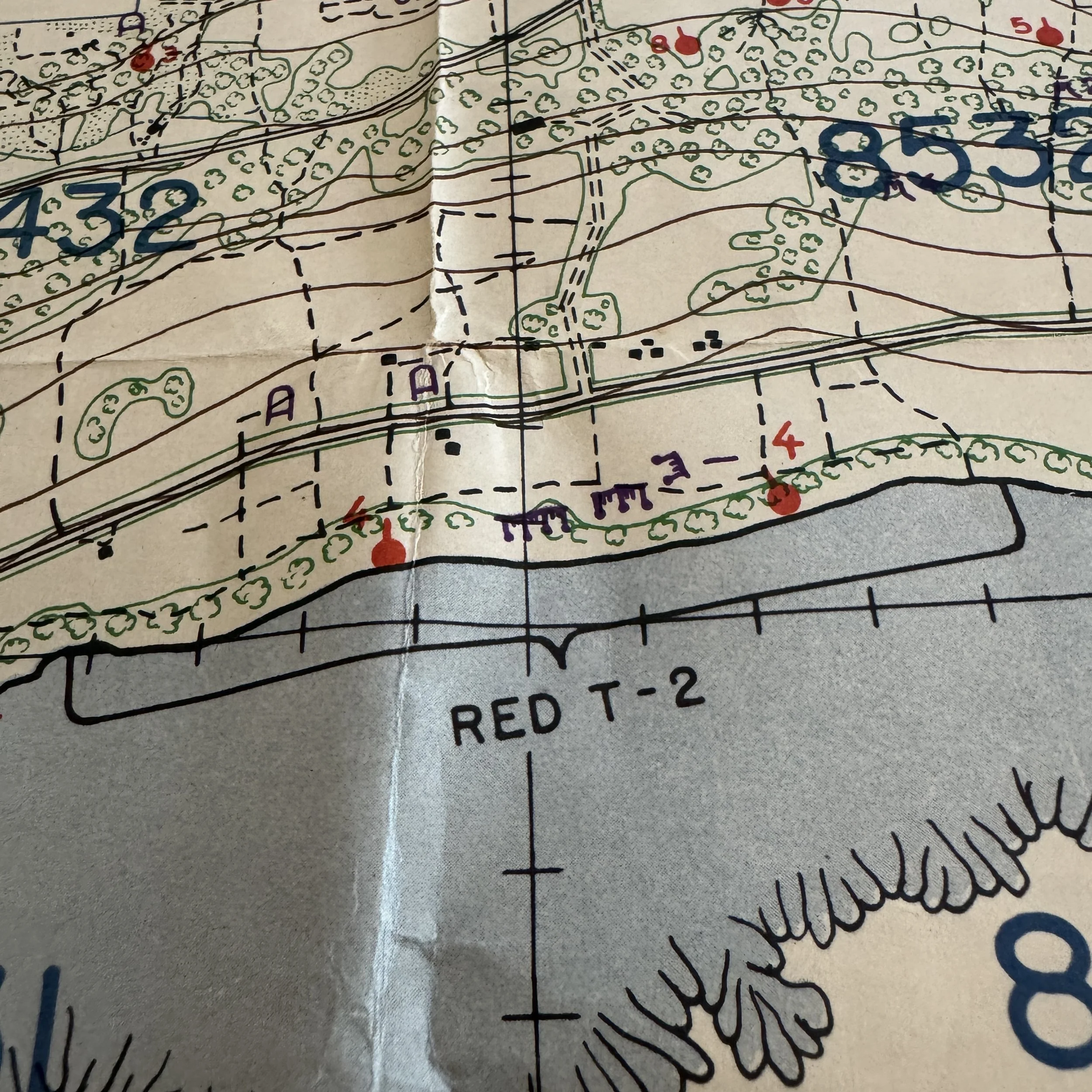
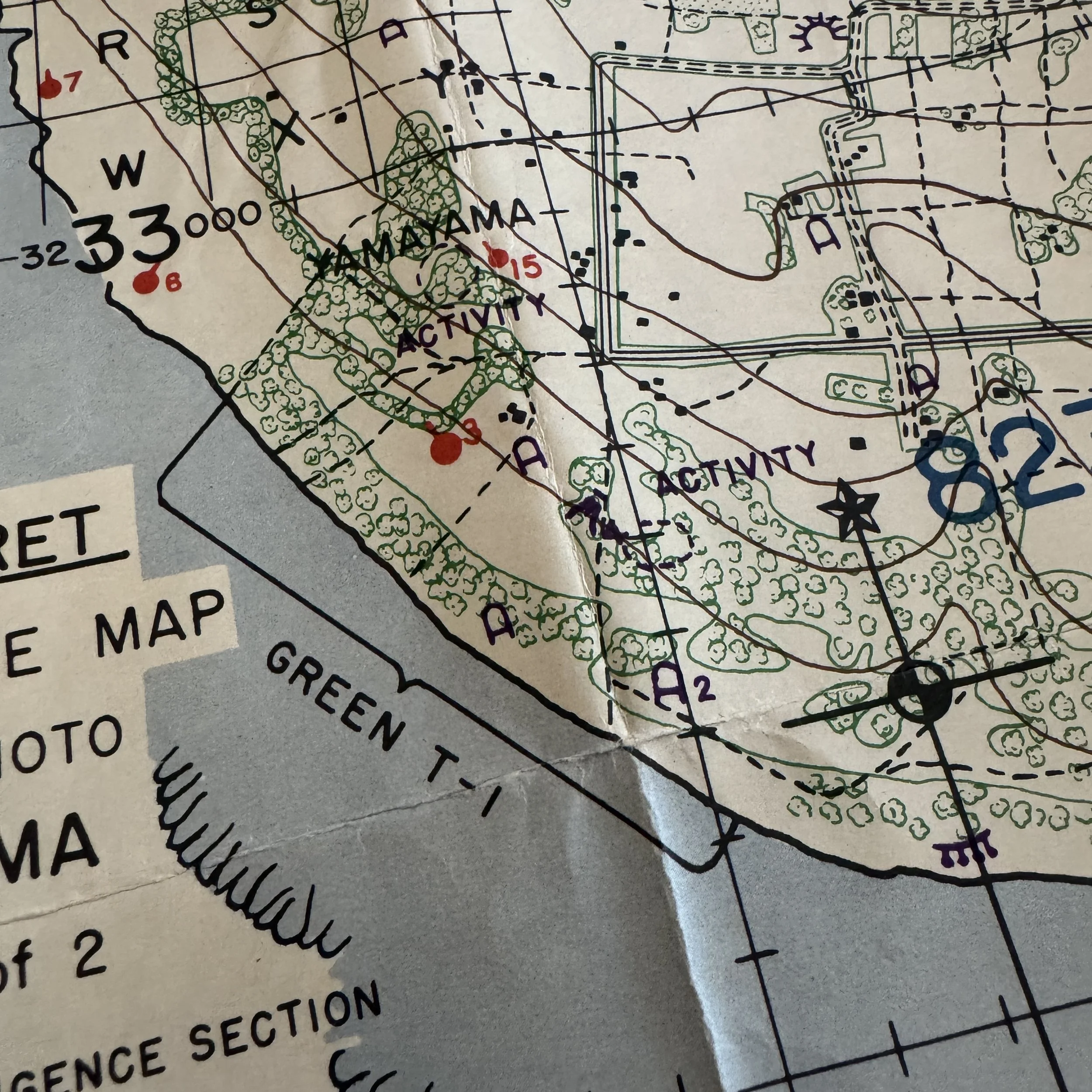
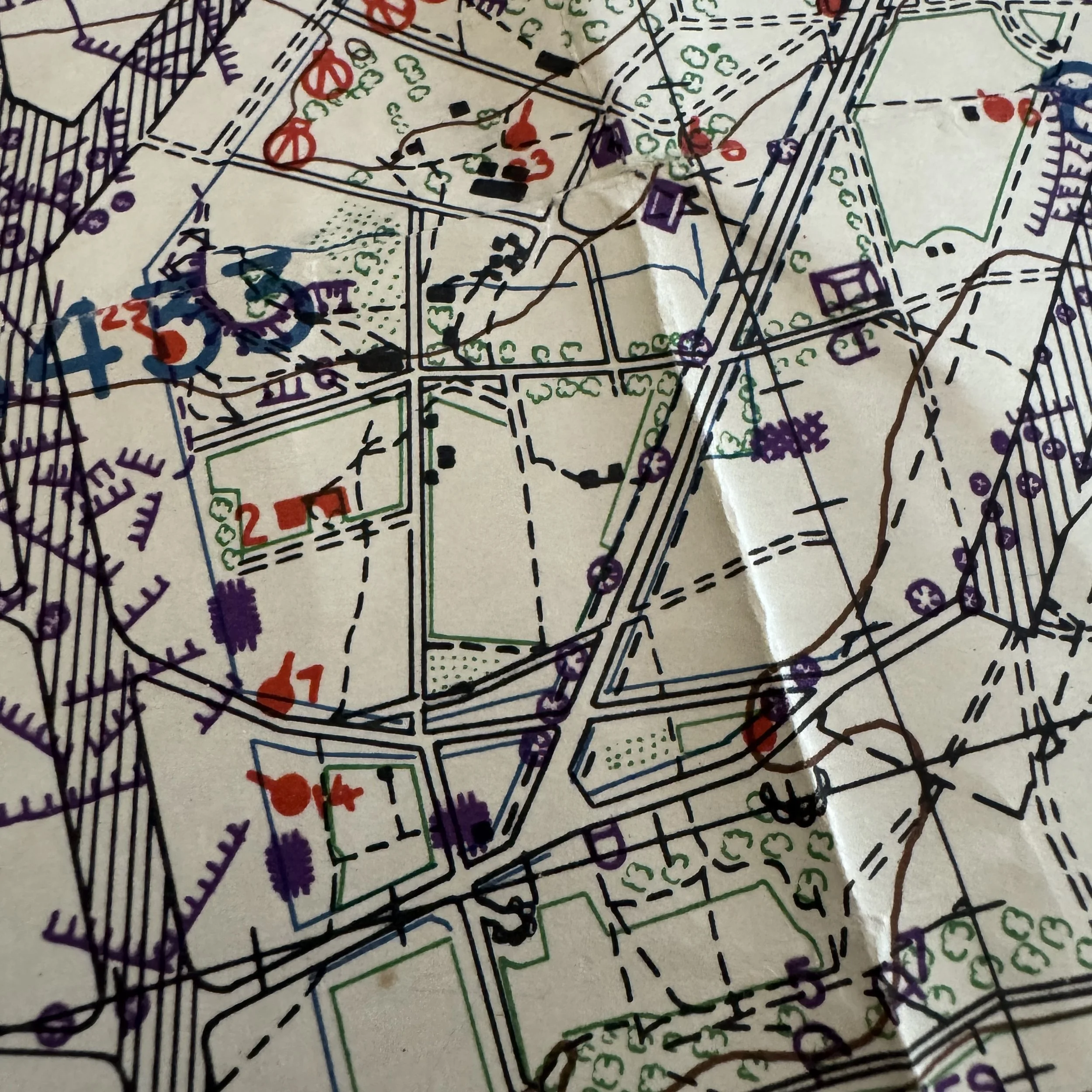
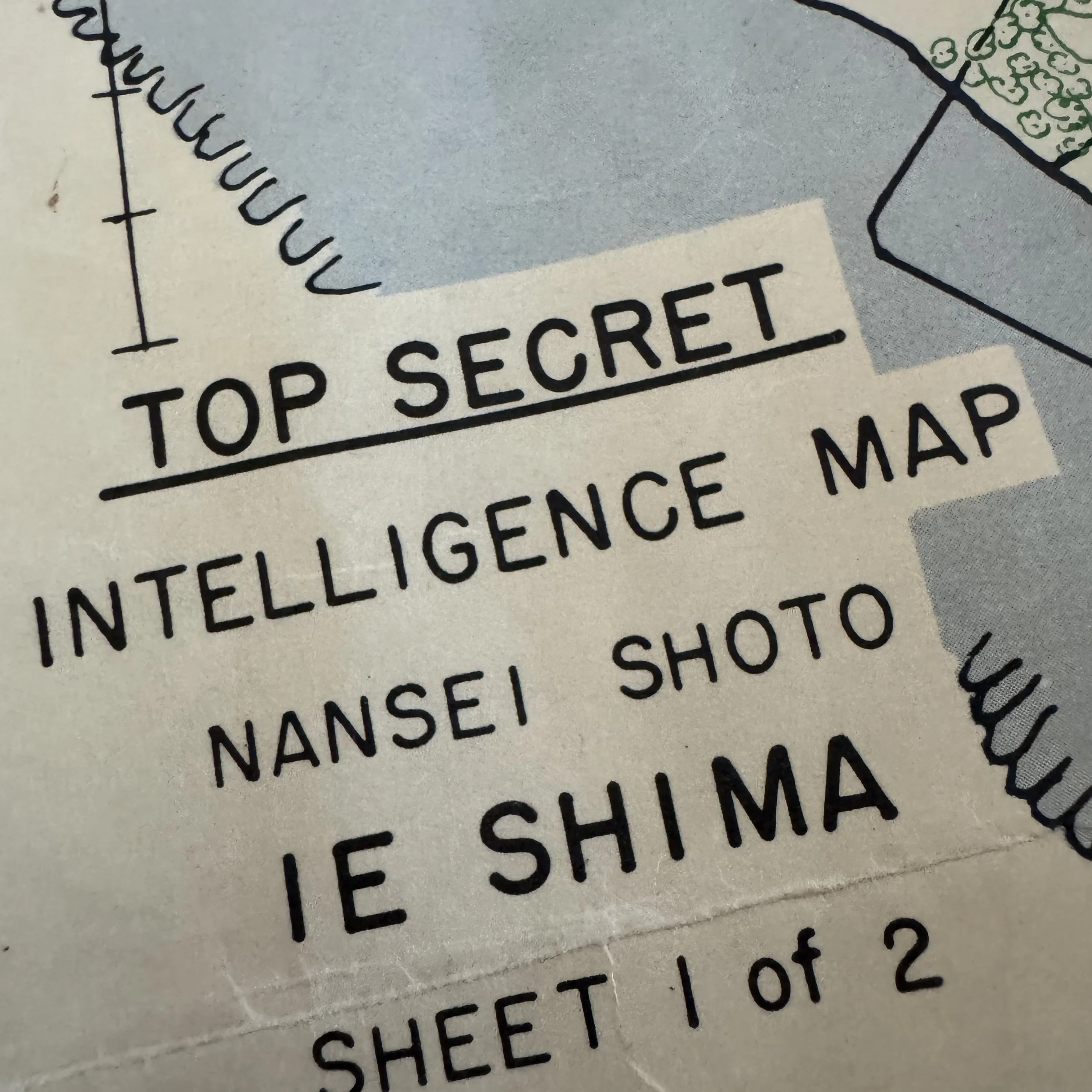
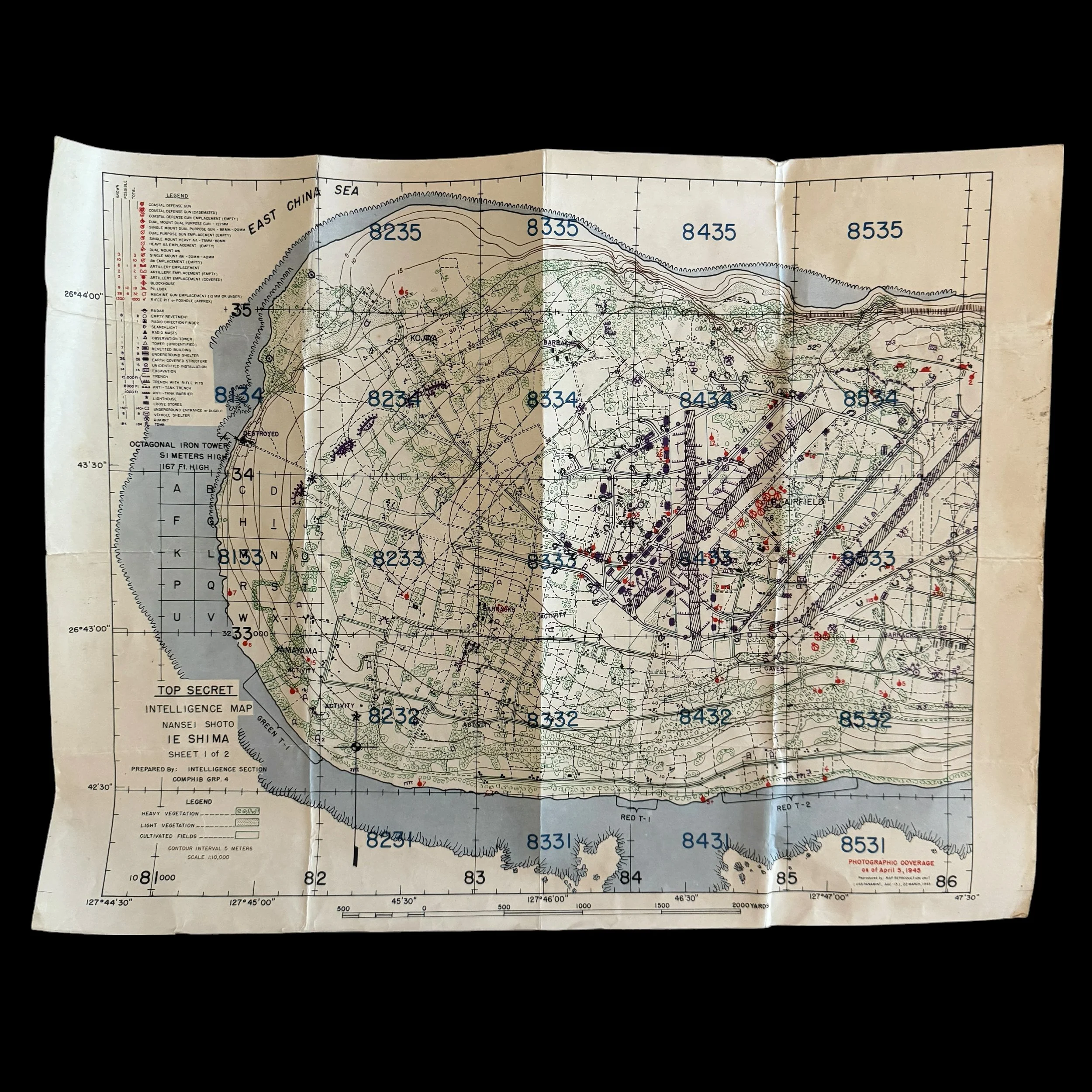
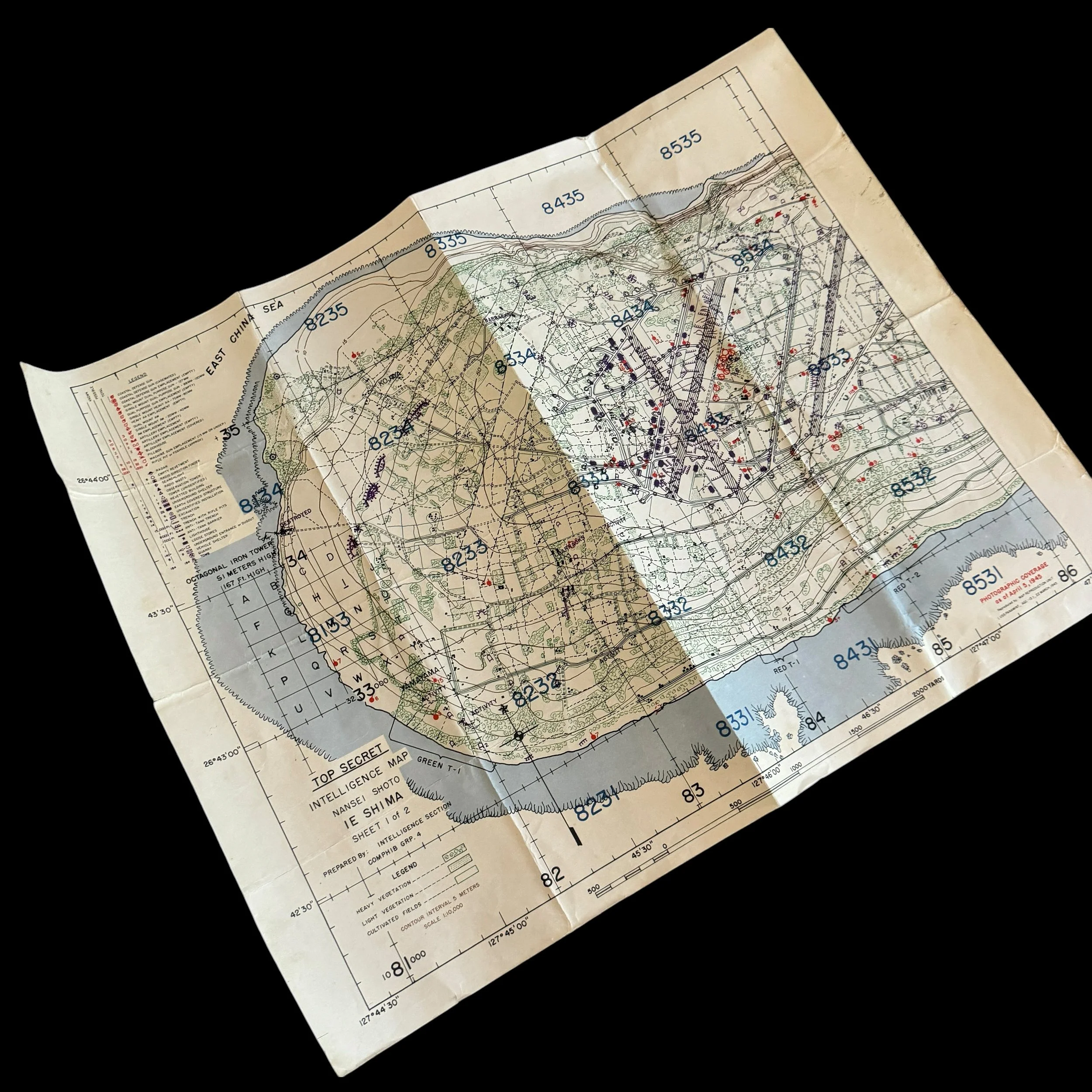
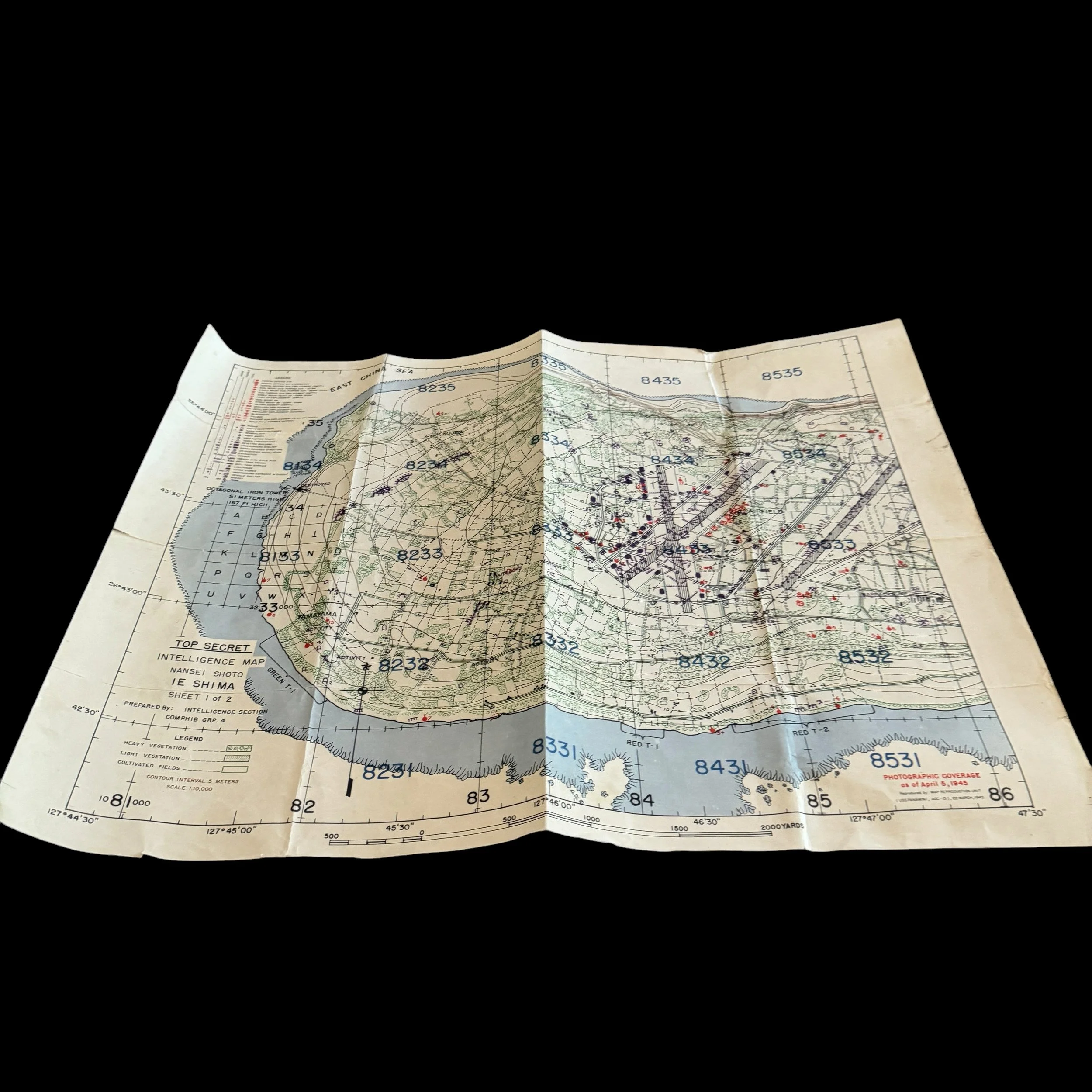
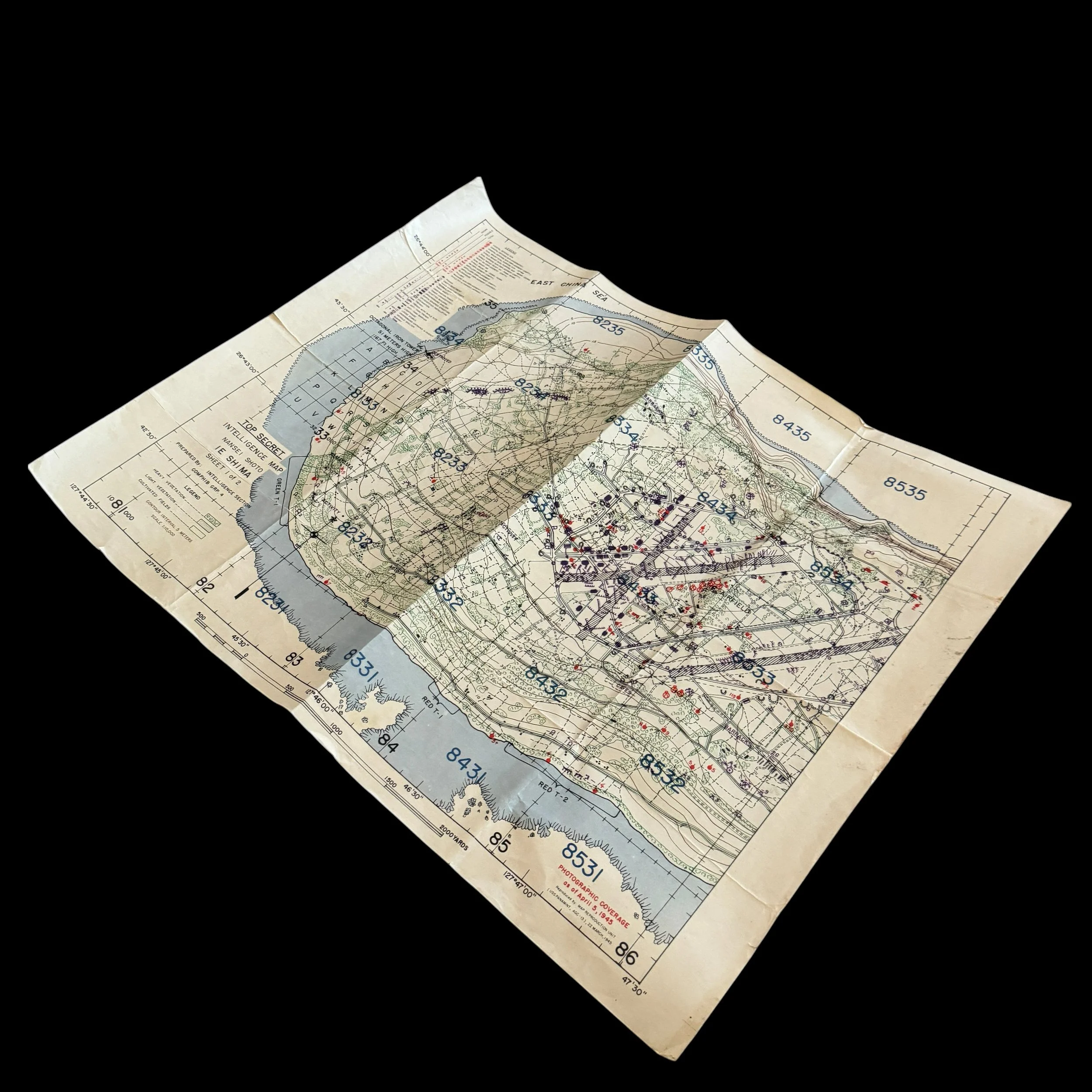
This extremely rare museum-grade WWII artifact is an original combat-used "Top Secret" amphibious assault intelligence map of Ie Shima, a crucial island target during the Battle of Okinawa, notably featuring the marked amphibious assault landing beaches of GREEN T-1, RED T-1, and RED T-2 printed just 11 days before the 77th Infantry Division Battle of Okinawa D-Day Assault.
Produced exclusively for the officers and assault elements of the U.S. Army’s 77th Infantry Division, this map represents the final, synthesized aerial intelligence picture provided to American forces just days before they stormed the island's beaches on April 16, 1945.
This Battle of Okinawa 77th Infantry Division map was prepared by the Intelligence Section of COMPHIB GRP. 4 (Commander Amphibious Group 4). It was physically printed aboard the USS Panamint (AGC-13) on March 22, 1945. The Panamint was an amphibious force flagship specially equipped with advanced map reproduction and intelligence-gathering units to support complex amphibious landings.
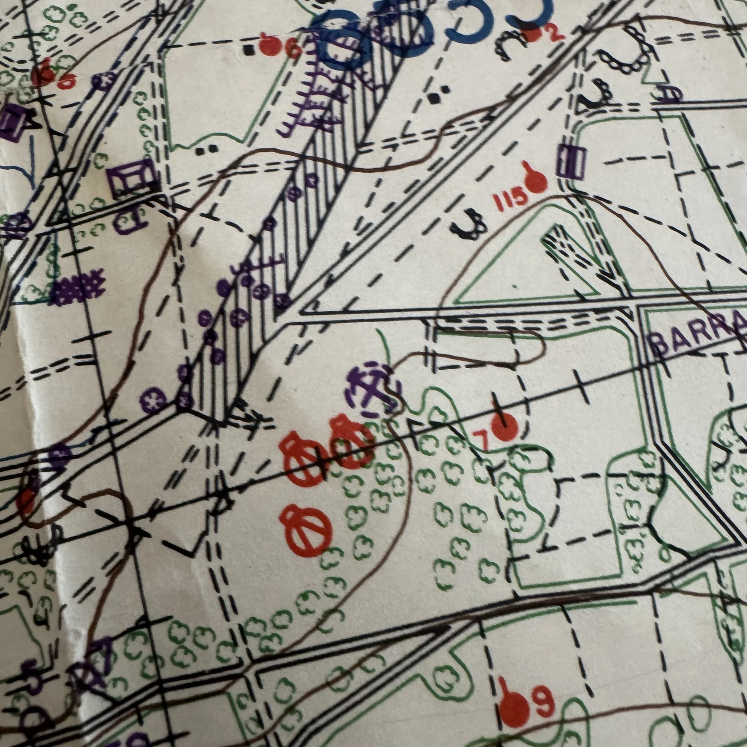
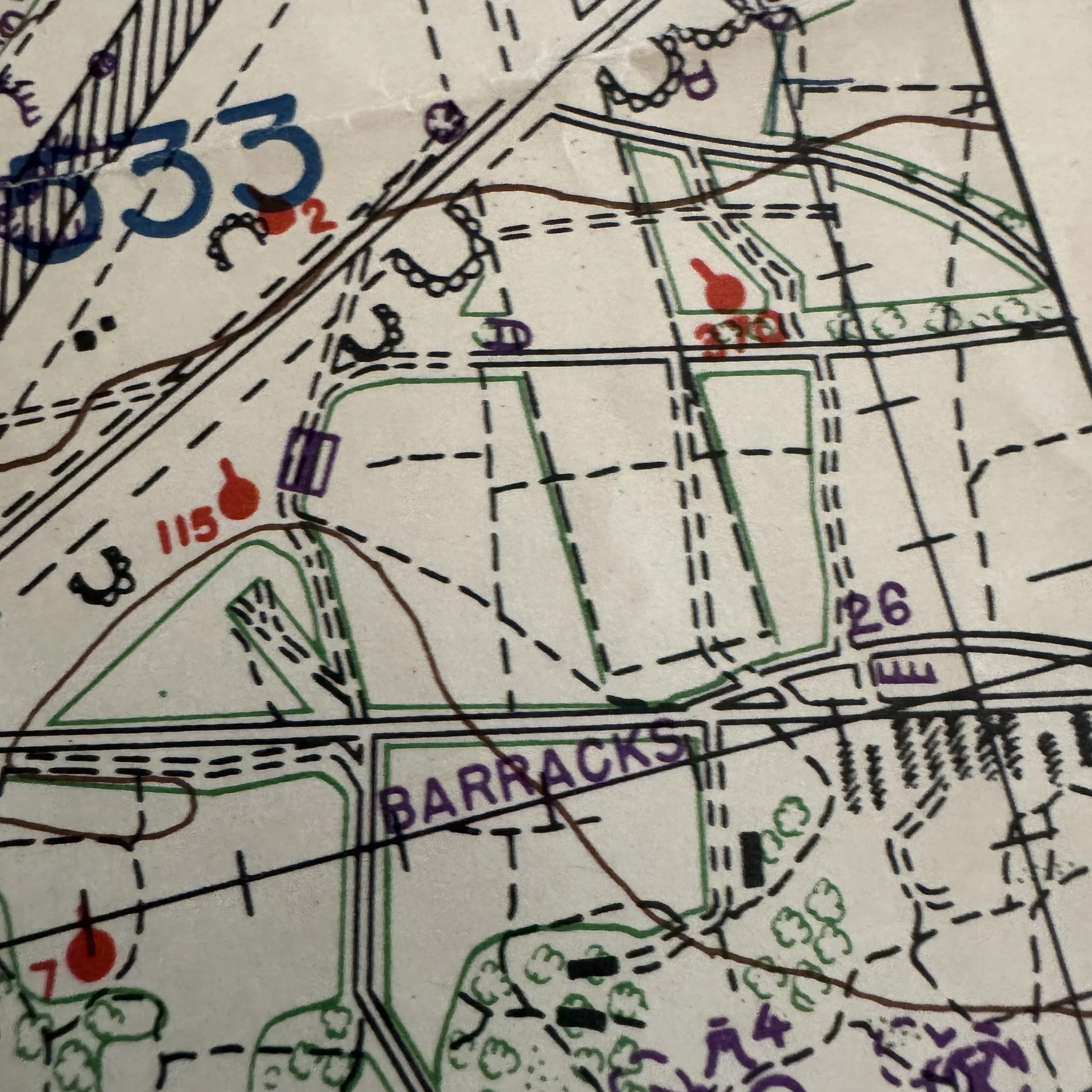
The base topographical map was printed in March, but the vital red text states:"PHOTOGRAPHIC COVERAGE as of April 5, 1945." This means the map was run through the presses a second time to overlay the most recent aerial reconnaissance intelligence just 11 days before the 77th Infantry Division landed.
Maps produced aboard ship in active combat zones were printed in strictly limited quantities often only a few hundred copies intended exclusively for ship commanders, artillery liaisons, and infantry battalion/company commanders. Most were destroyed in combat, discarded due to water damage, or surrendered due to their "Top Secret" classification, making surviving theater-printed examples exceedingly rare today.
Historical Context: The Strategic Value of Ie Shima
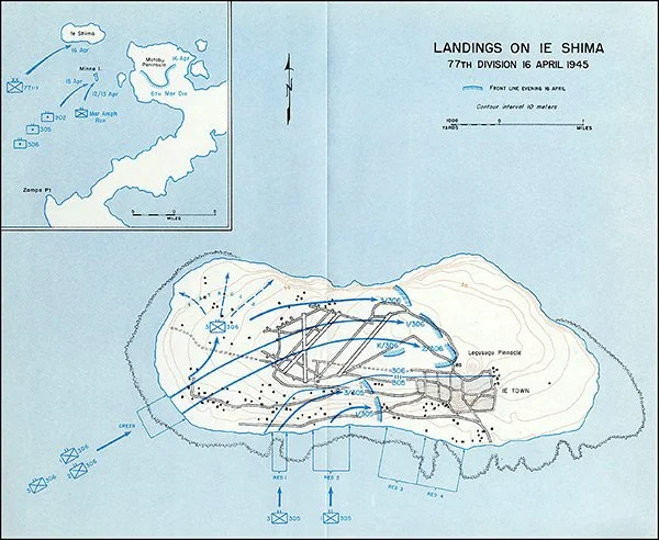
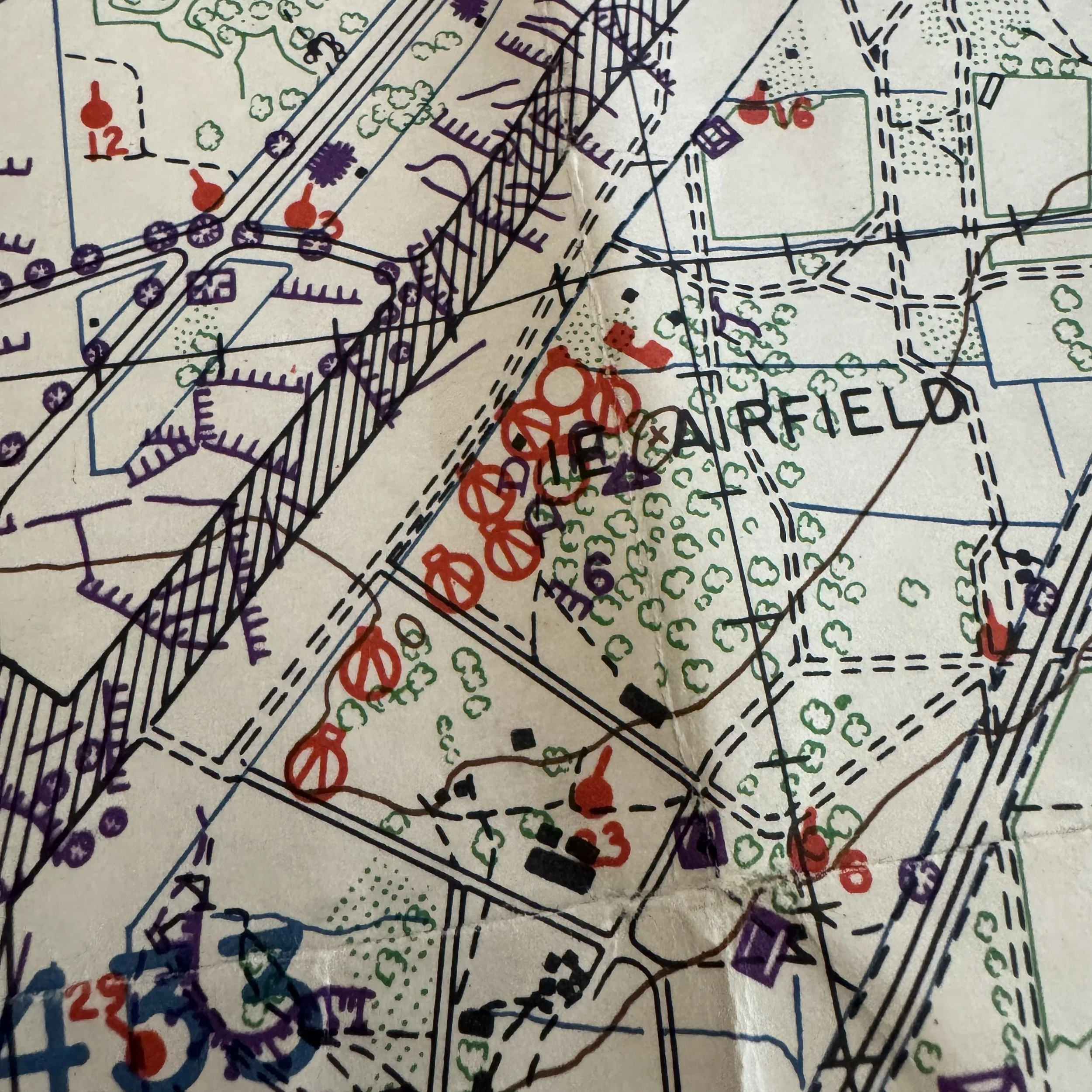
Ie Shima, located three and a half miles off the western coast of Okinawa's Motobu Peninsula, was a vital strategic prize due to its massive central plateau which housed a sprawling Japanese airfield complex featuring three runways. Capturing this airfield was essential for the Allies to establish land-based fighter and bomber support for the broader Okinawa campaign and eventual strikes against the Japanese home islands.
The assault was assigned to the 77th Infantry Division (specifically the 305th, 306th, and 307th Infantry Regiments). The Japanese defenders—consisting of the 1st Battalion, 2nd Infantry Unit, the 50th Specially Established Infantry Battalion,and conscripted Okinawan labor—had spent months transforming the island into a fortress, utilizing its key terrain feature, a 600-foot rocky spire known as Iegusugu or "The Pinnacle," as a formidable observation and defensive strongpoint.
Tactical Intelligence and Assault Planning
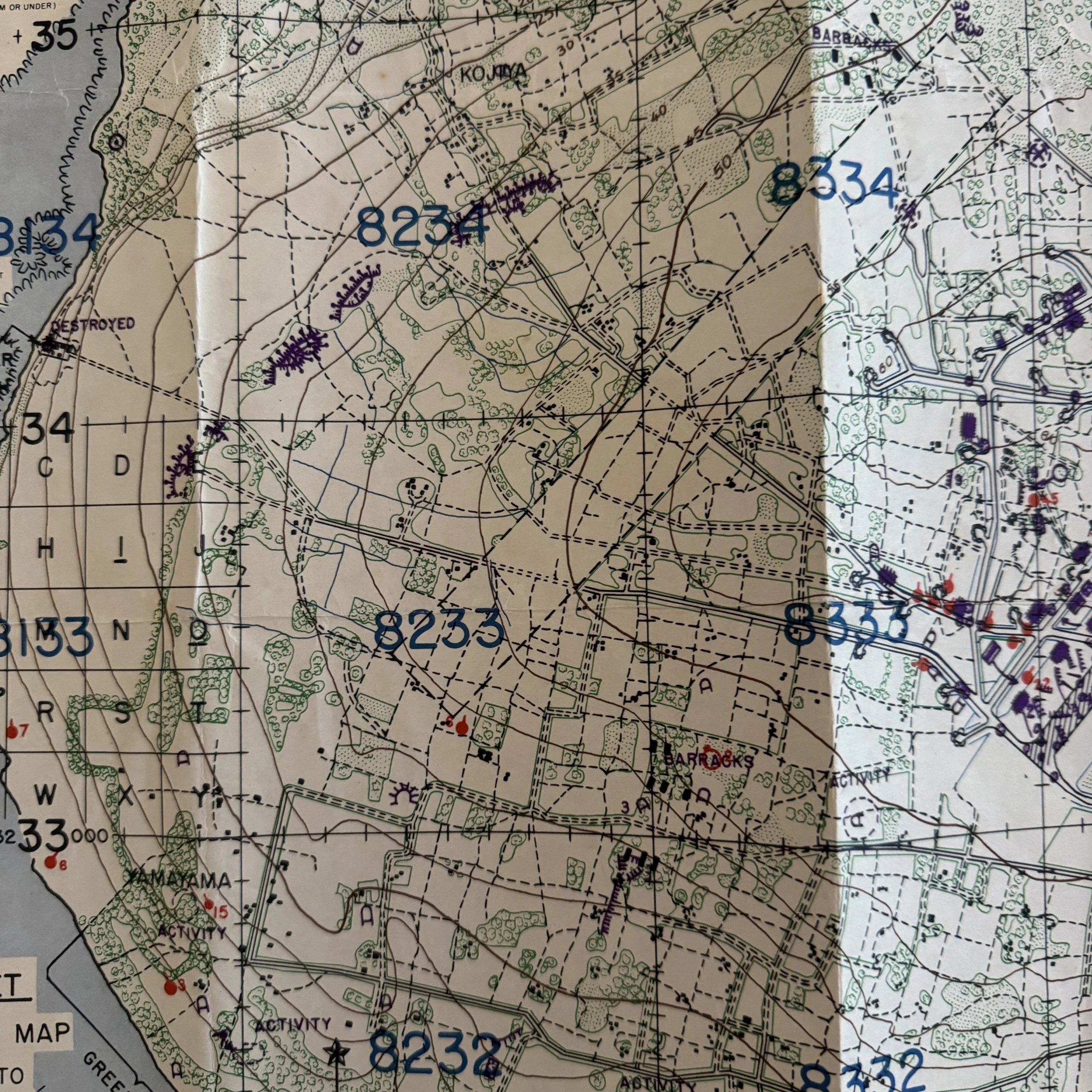
The map explicitly details the invasion beaches on the southern coast, marked as GREEN T-1, RED T-1, and RED T-2.These precise grid locations were used by the U.S. Navy for pre-invasion naval gunfire support and by the landing craft coxswains to guide the 77th Infantry Division ashore.
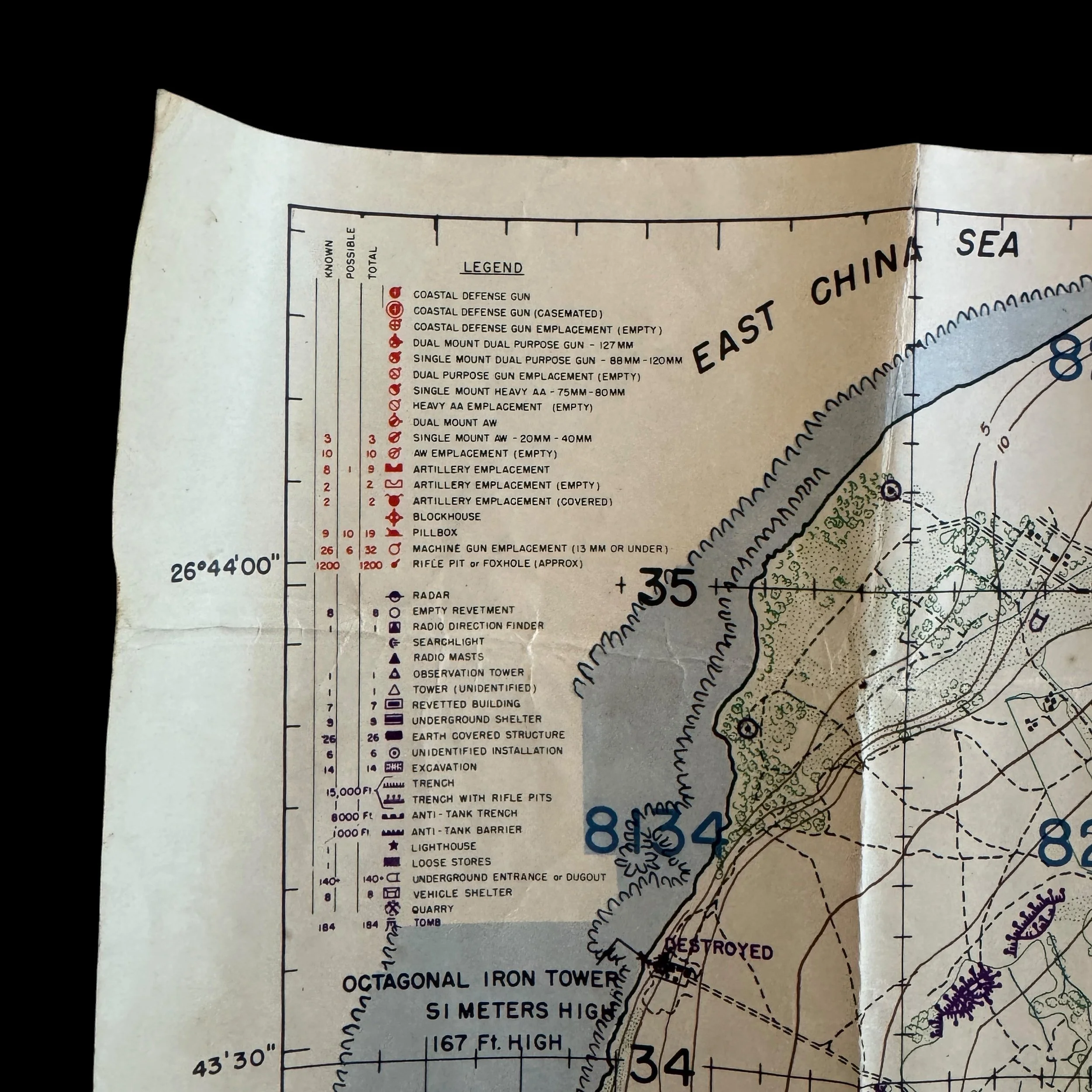
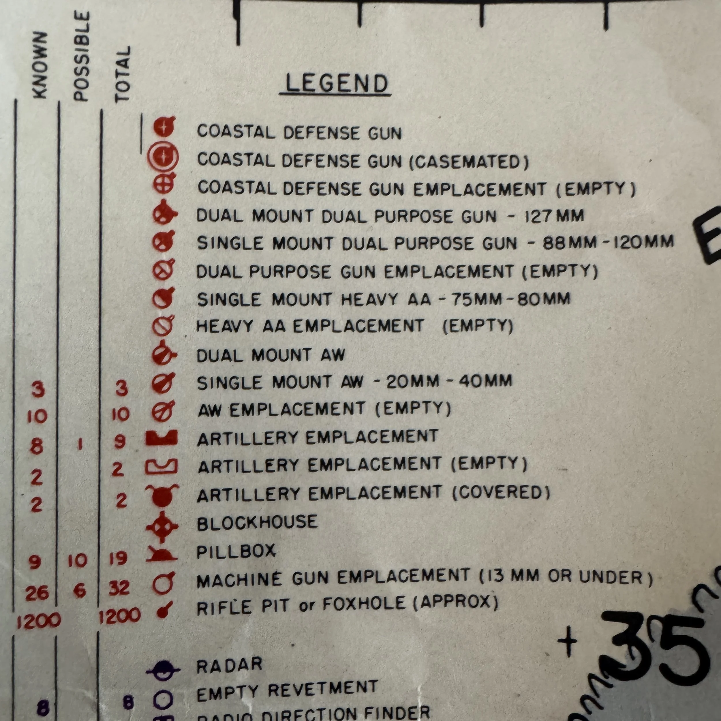
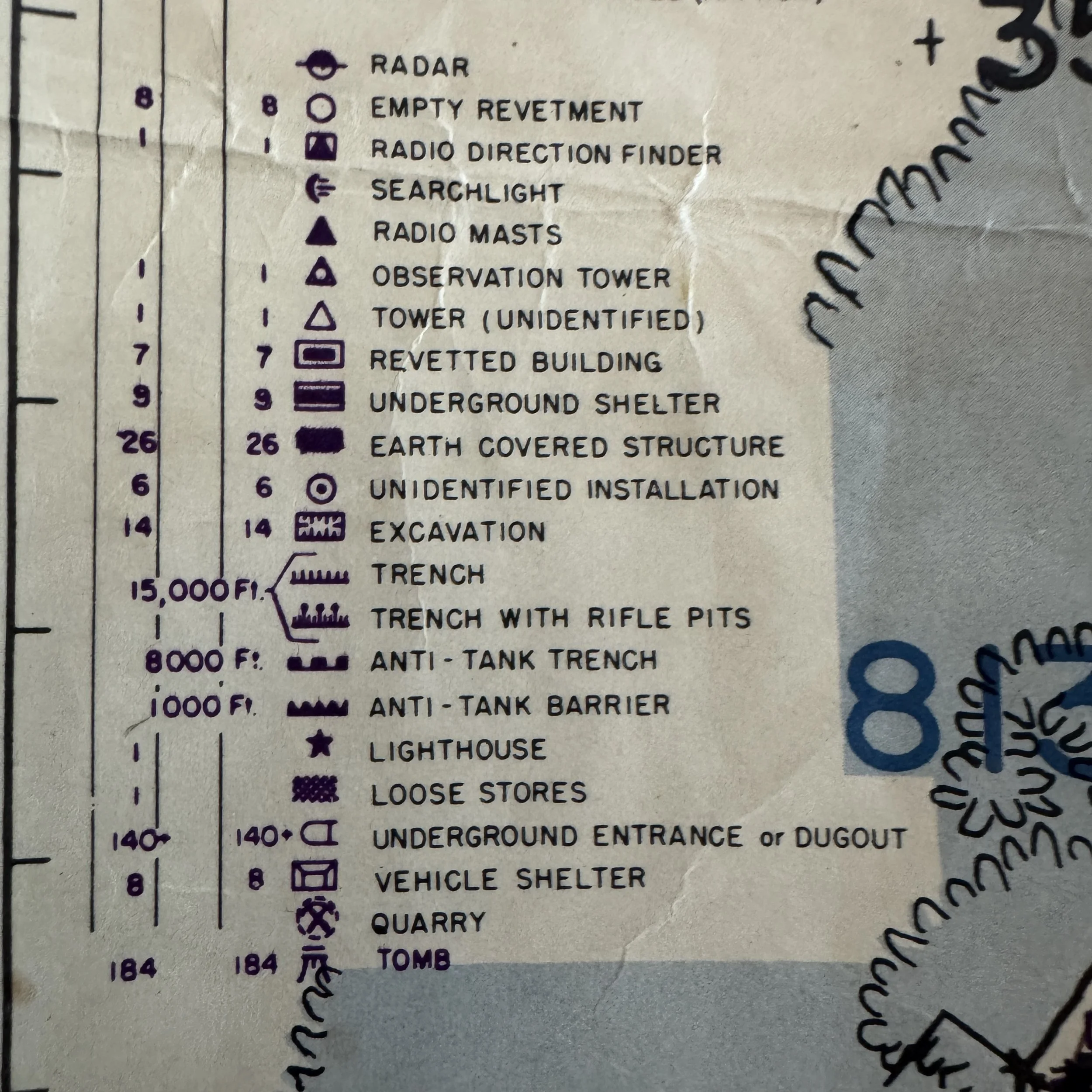
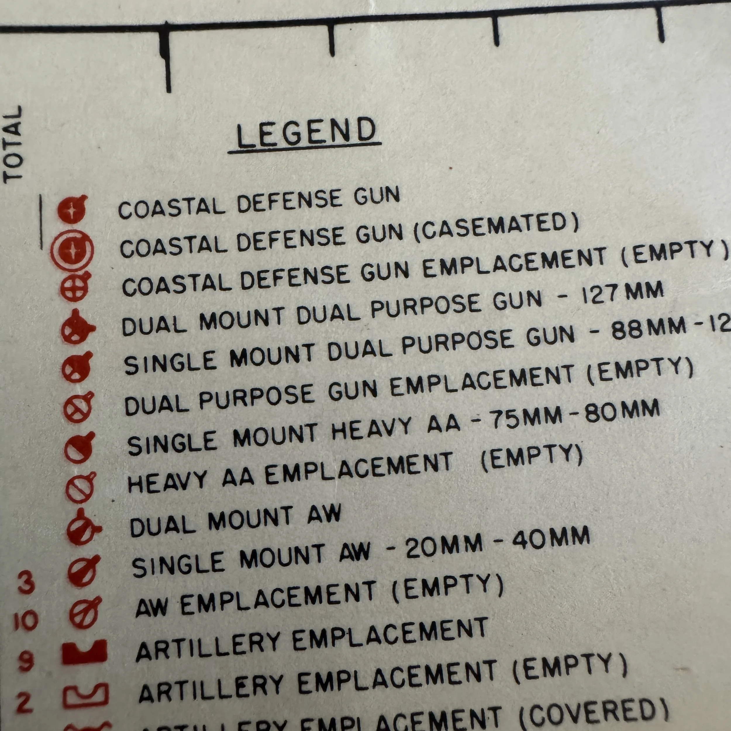
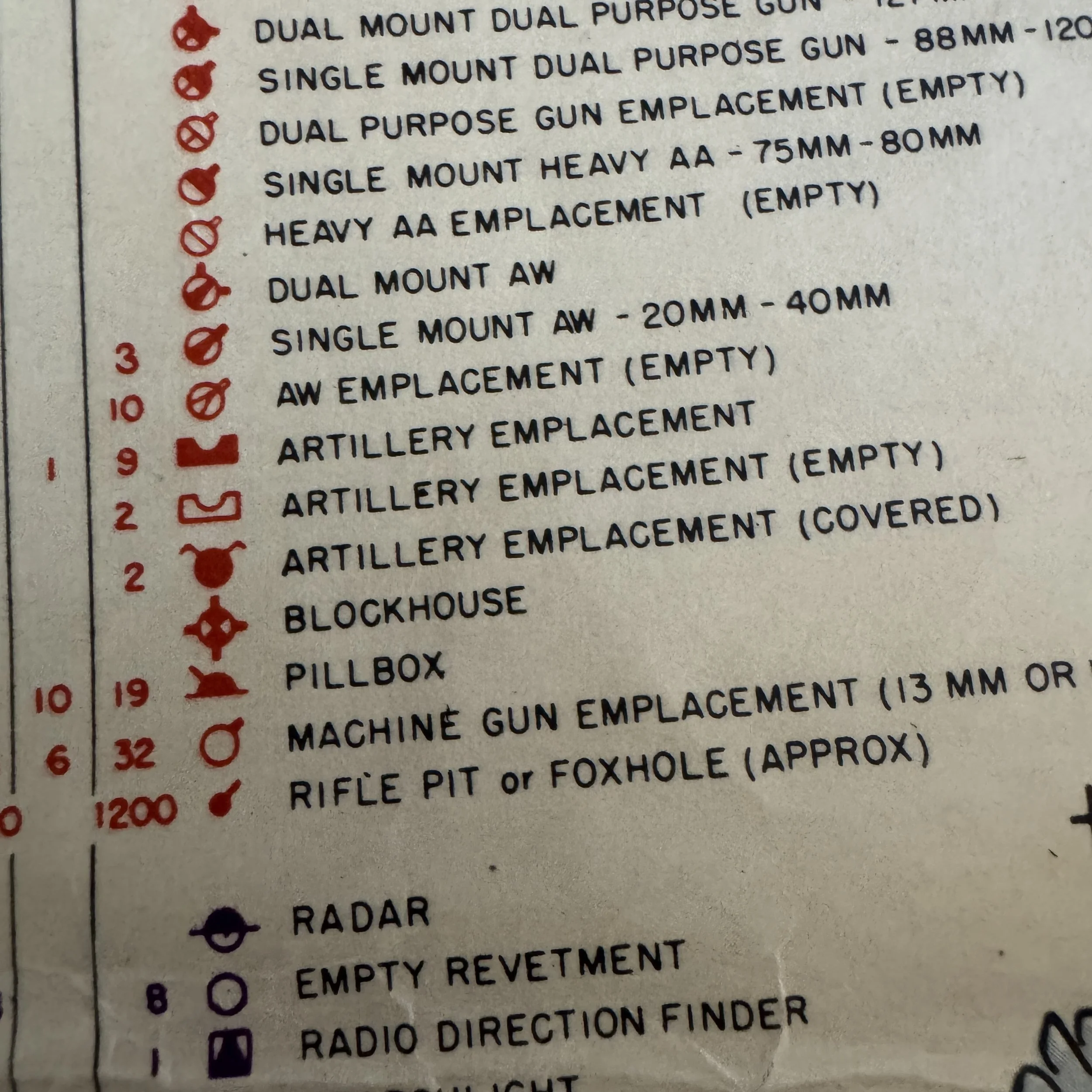
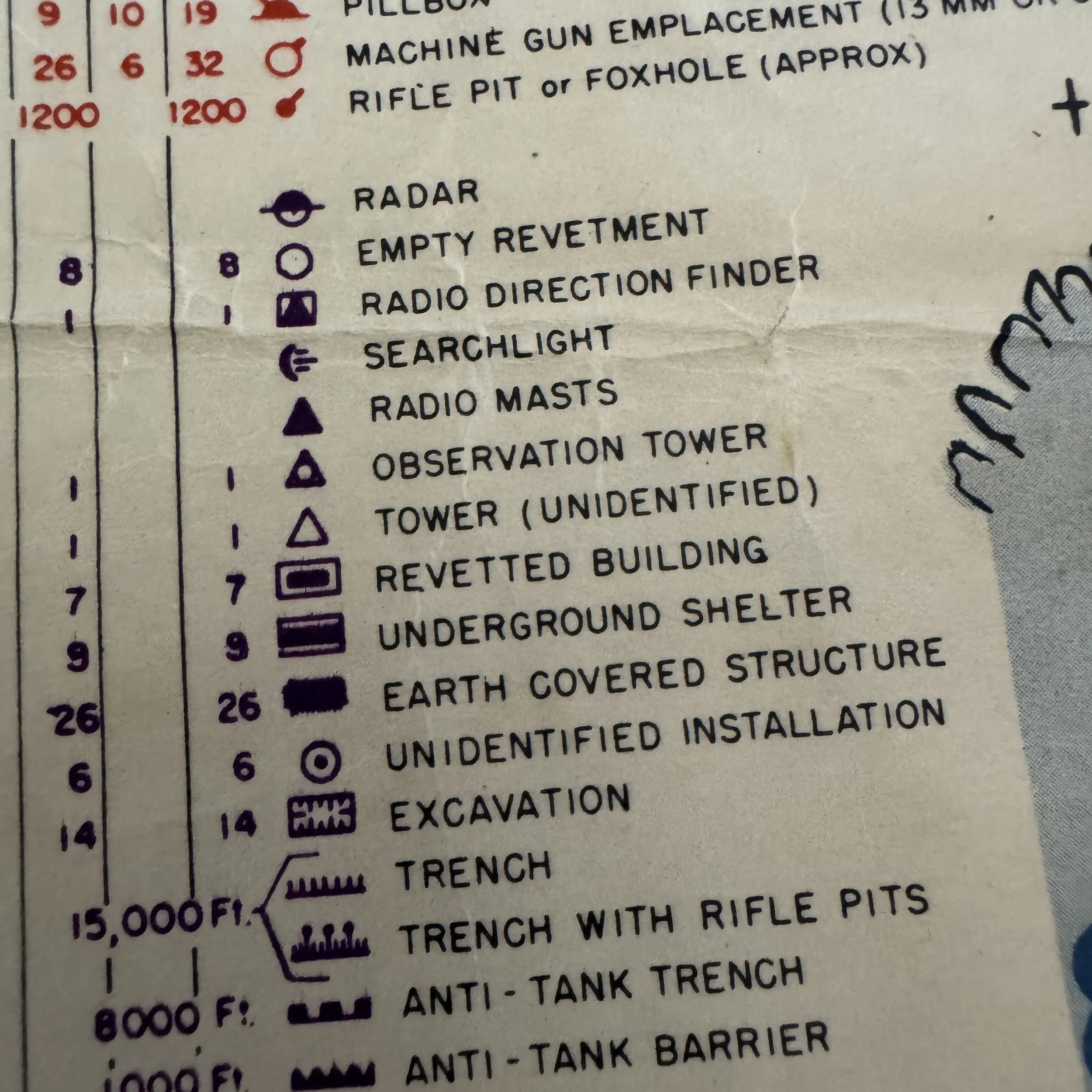
The legend provides a staggering, quantifiable look at the Japanese defensive network lying in wait for the Americans.The intelligence officers aboard the Panamint categorized the defenses into "Known" and "Possible" targets. Notable defensive statistics printed on this map include:
1,200 approximate rifle pits or foxholes
32 machine gun emplacements
19 pillboxes
26 earth-covered structures
15,000 feet of trench lines and 8,000 feet of anti-tank trenches
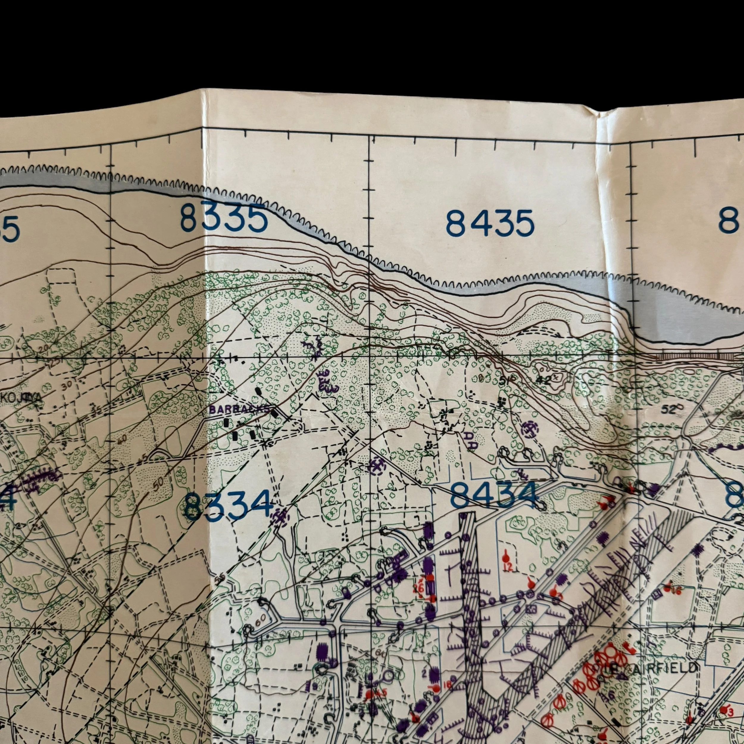
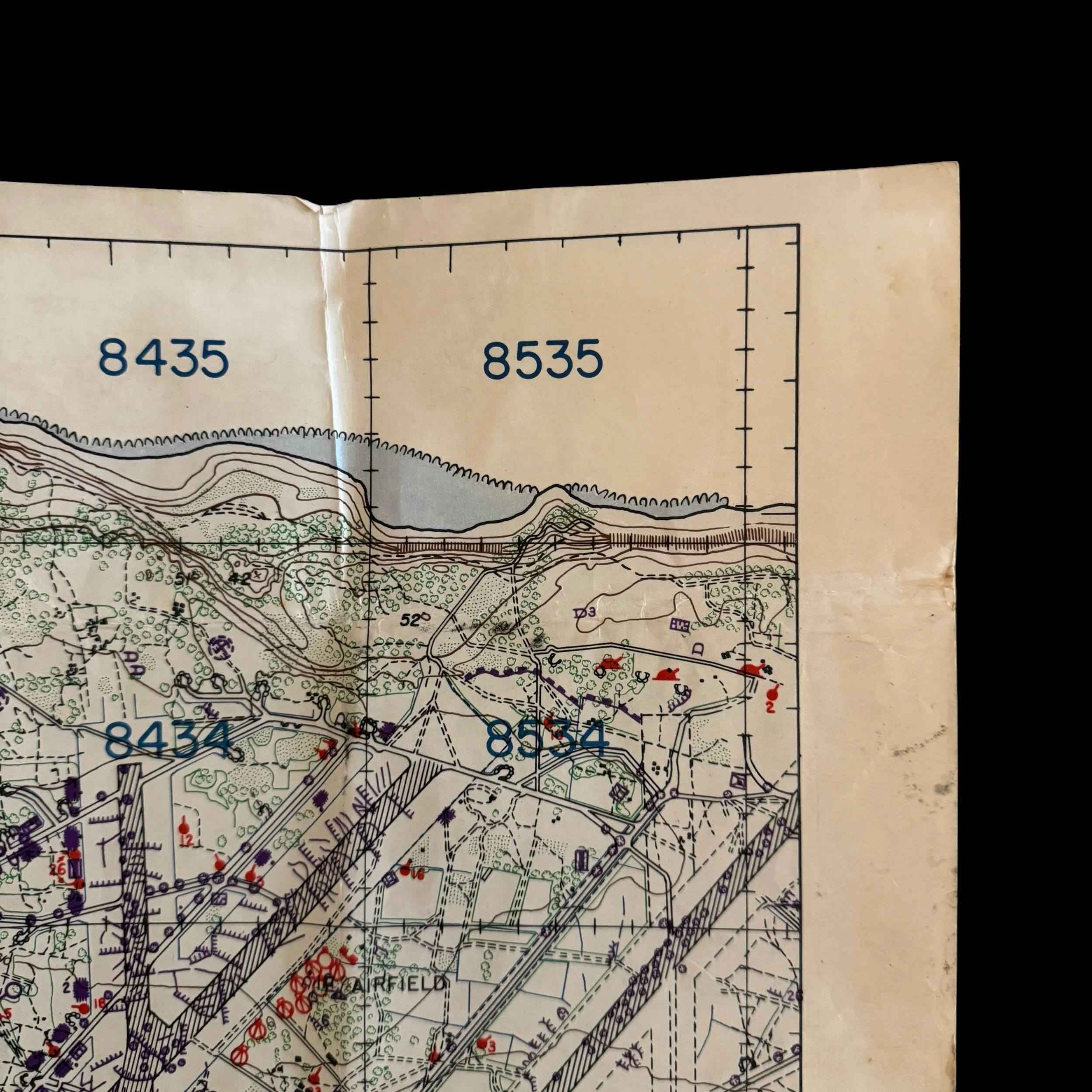
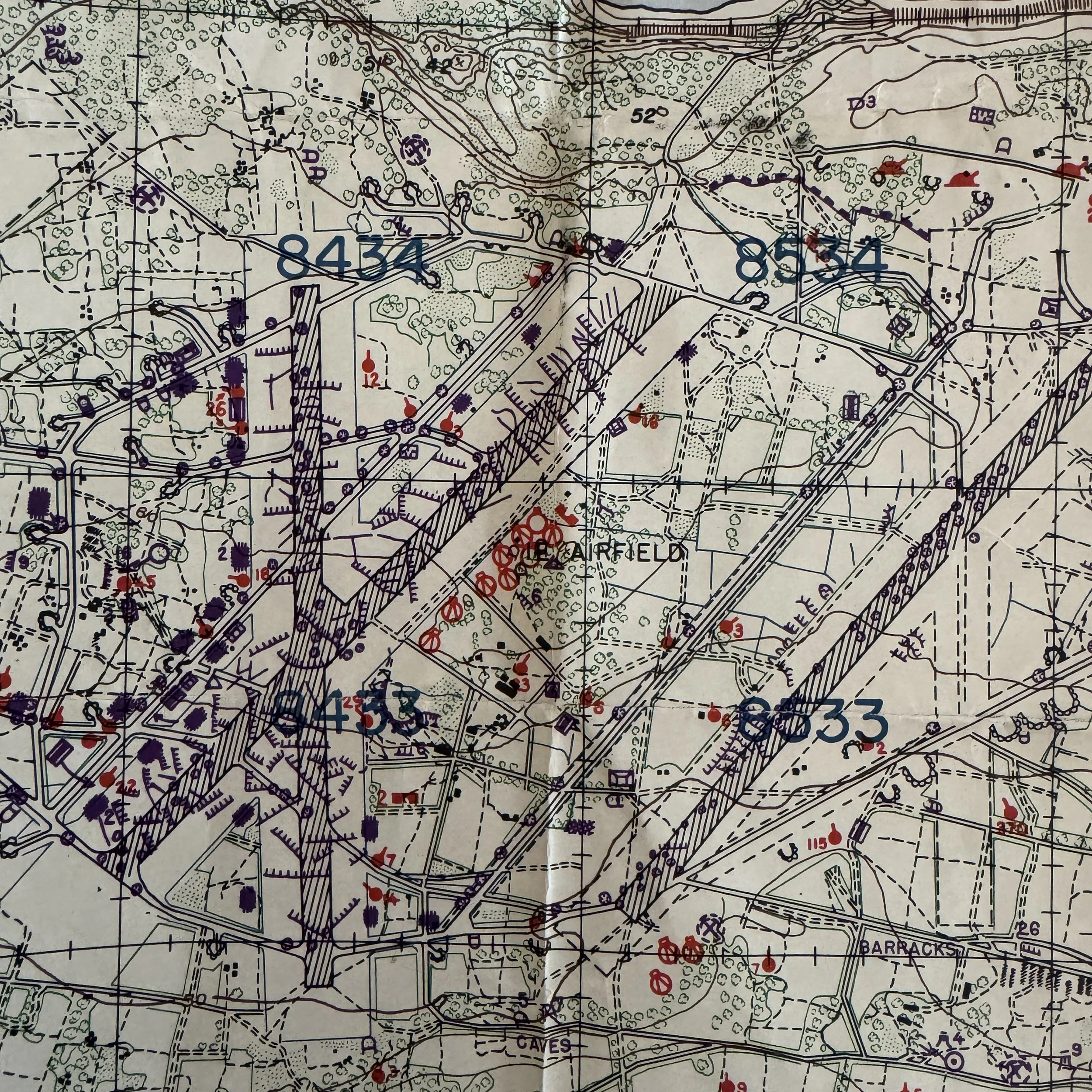
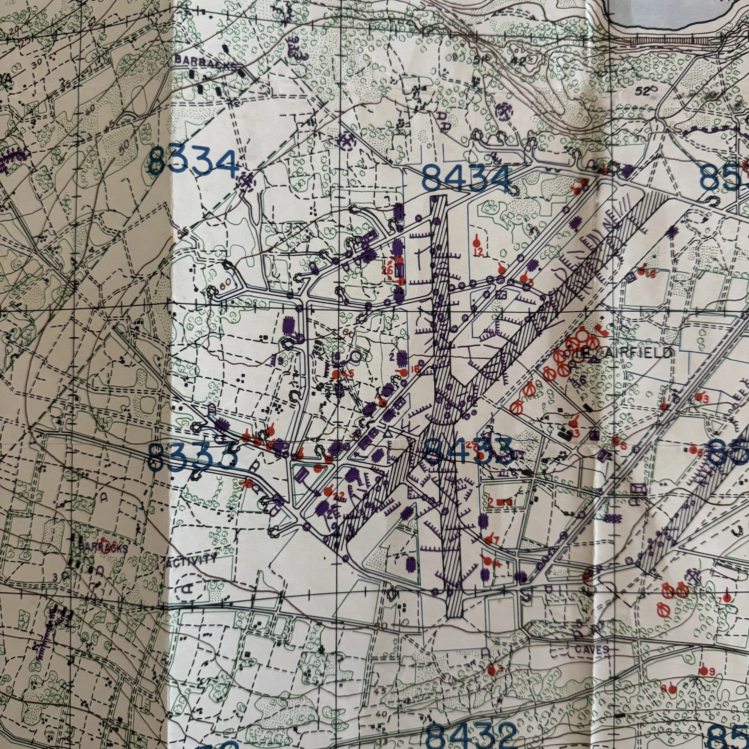
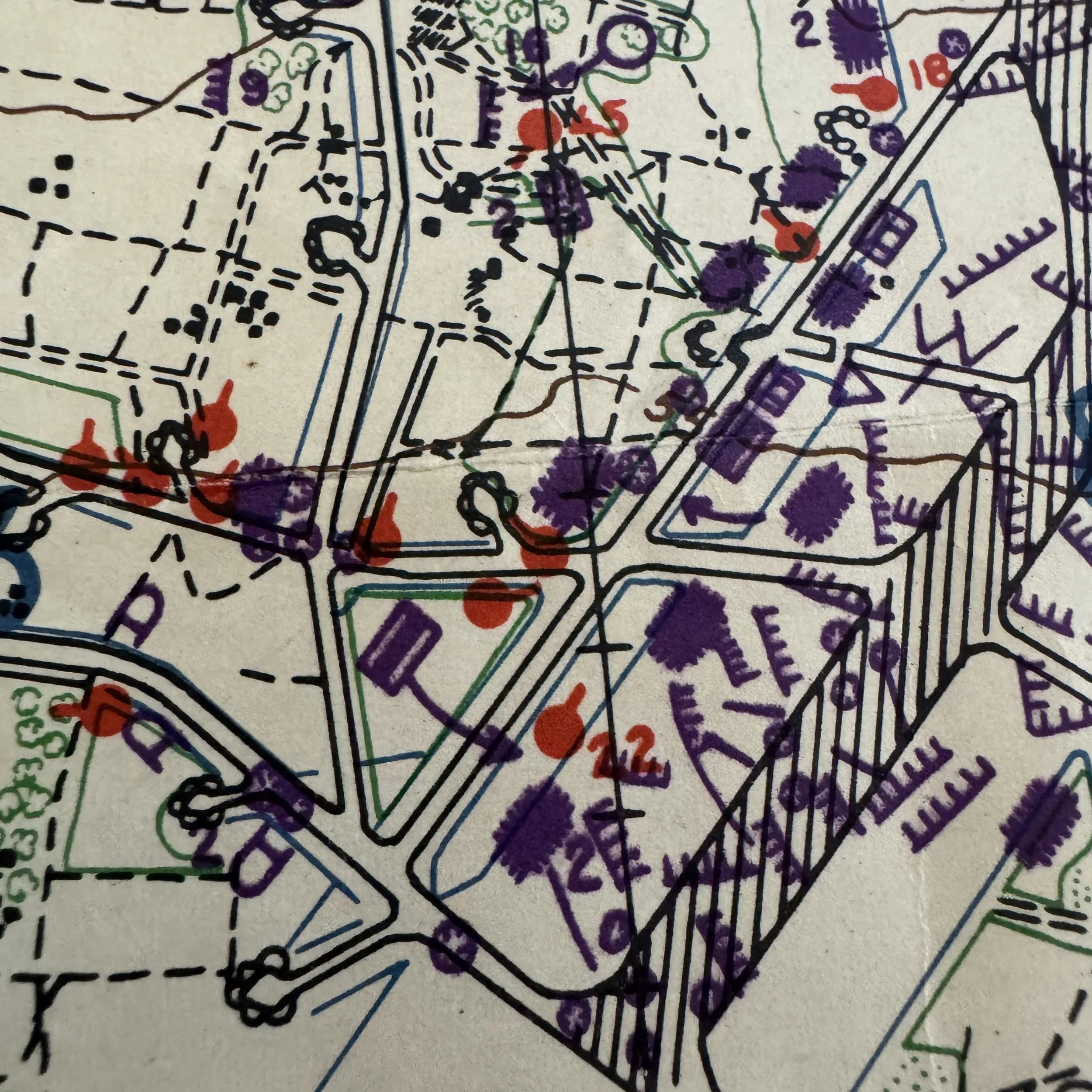
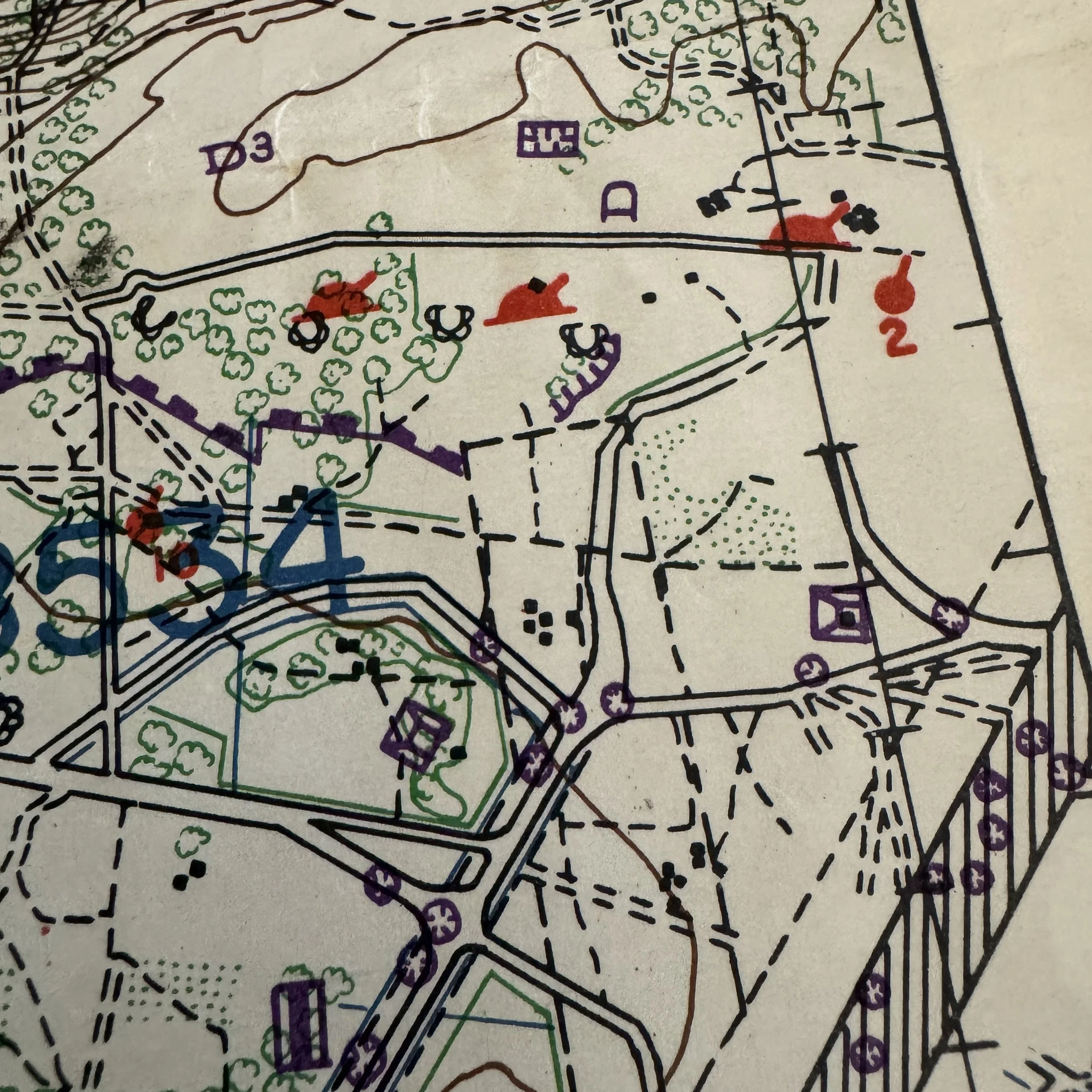
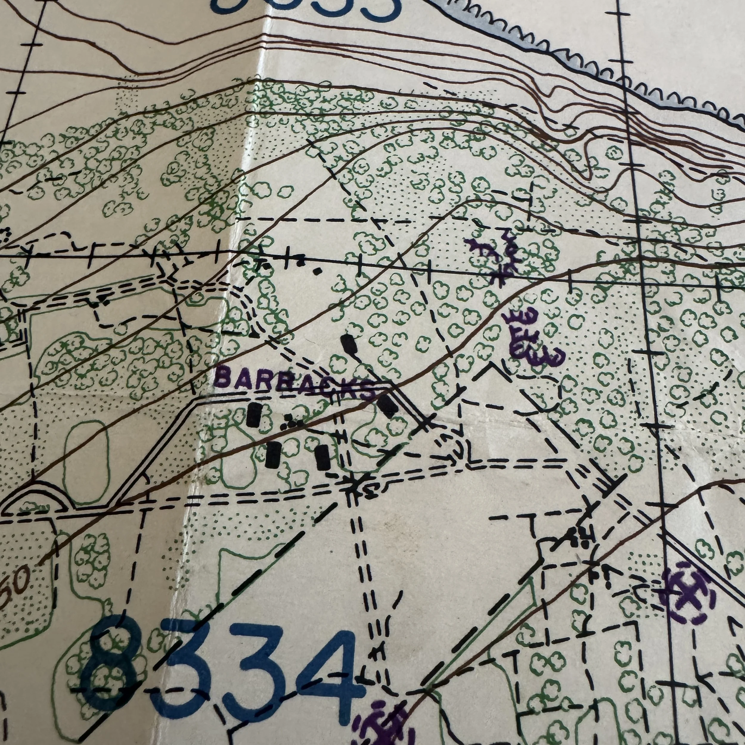
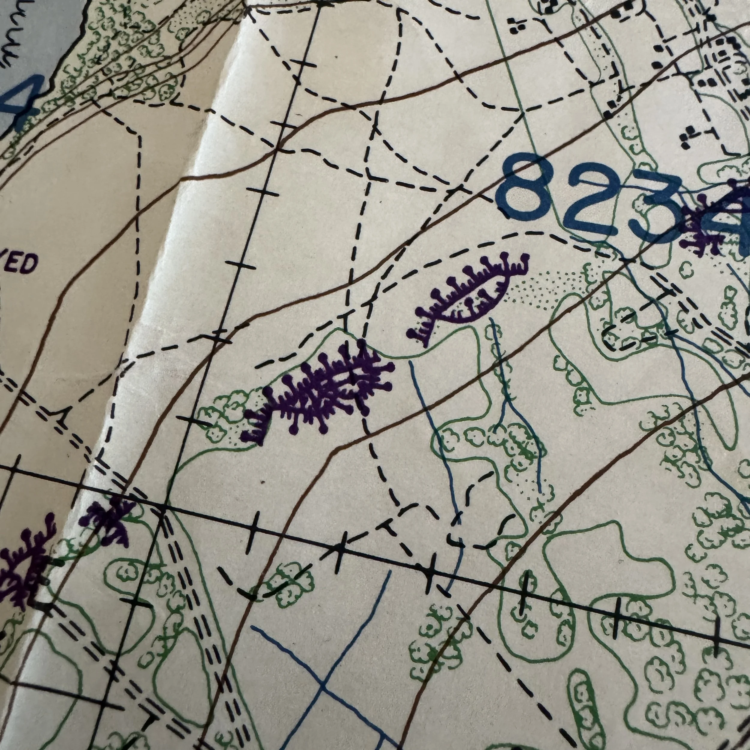
Looking closely at the center of the map, the airfield runways are heavily flanked by red and purple overprints indicating anti-aircraft (AA) batteries, dual-purpose guns, and revetted buildings. The density of these symbols around grids 8433 and 8434 shows exactly why the Japanese 50th Airfield Battalion was so difficult to dislodge; they had integrated their defenses directly into the airfield infrastructure.
The intelligence perfectly predicted the brutal nature of the battle. When the 77th Infantry Division landed on the Green and Red beaches on April 16, they faced exactly what this map depicted: a yard-by-yard, pillbox-by-pillbox slog through deeply entrenched positions, culminating in a bitter, bloody fight for the airfield and the Pinnacle. This map is a direct, tangible piece of that assault planning, reflecting the exact strategic picture American officers held in their hands as they waded onto the shores of Ie Shima.