Captured German Combat Map of 'Verdun 35D' France Sector
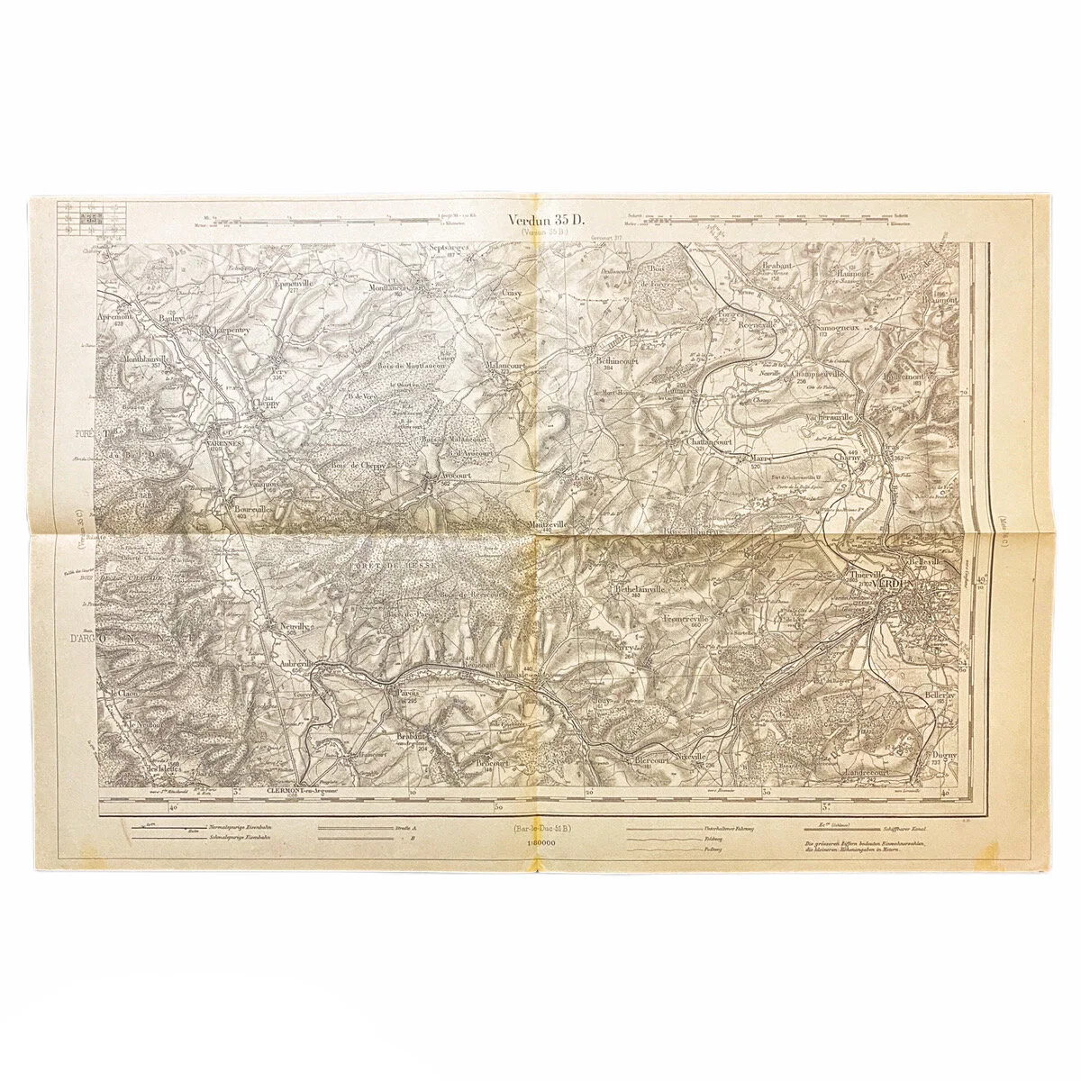


Captured German Combat Map of 'Verdun 35D' France Sector
Size: 18.5 x 12.5 inches
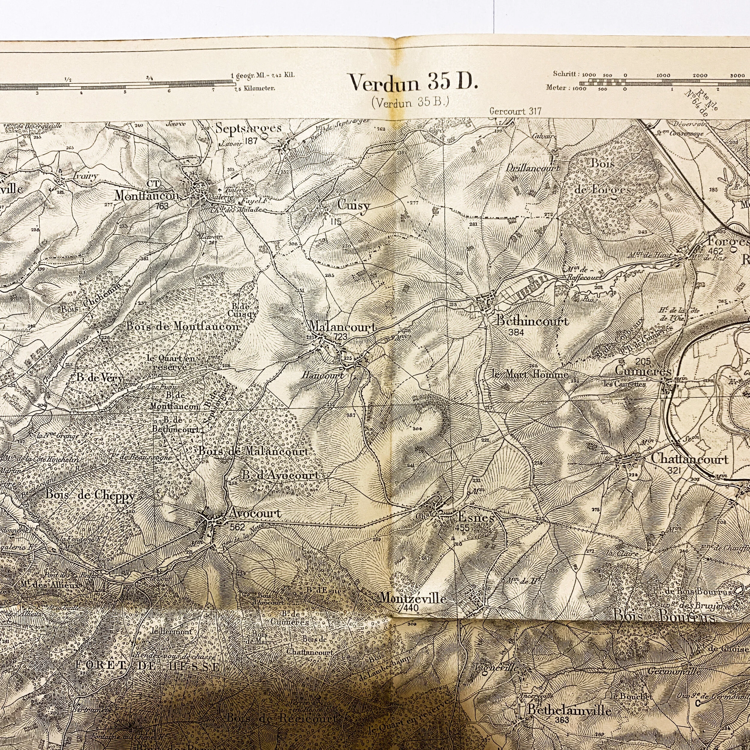
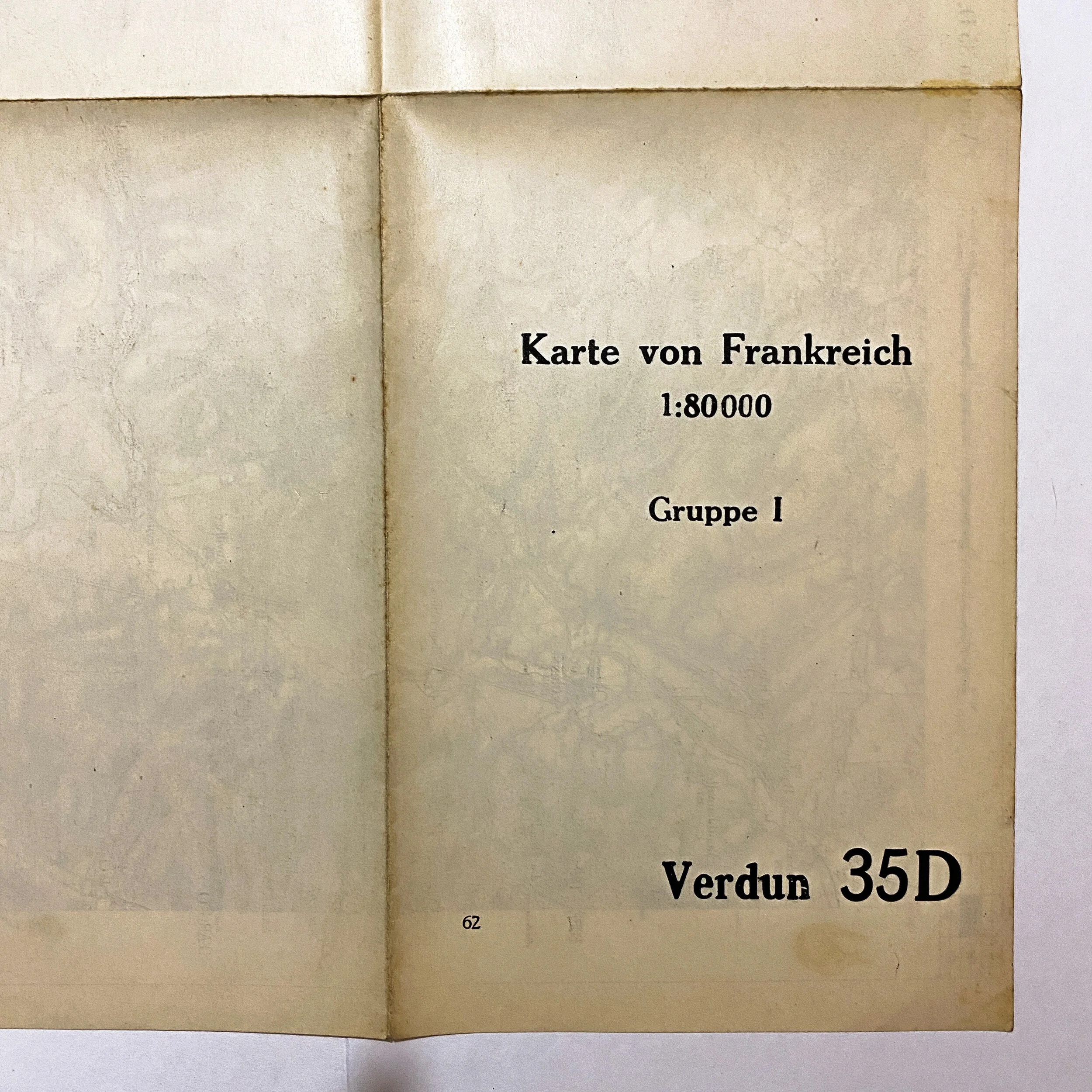
This original WWI German combat map of the ‘Verdun’ France sector is dated 1916. This map is one of 45 taken off of a German major on the battlefield of ‘Rupt en Weurve’ in the St. Mihiel Sector on September 13th, 1917 by Lieut. Harry G. Sheldon of the A.E.F. forces. These maps are broken into sets of 4 being label A,B,C and D of each given sector and district. Putting these section together forms a large map. They are all common scale and can be placed side by side to fit. This map is labeled ‘Verdun 35D’ and is 1 of 4 maps for this given sector.
This map was used during the Battle of Verdun as is features notable battle locations such as Verdun, Chattancourt, Hesse Forrest, and the Argonne Forrest.
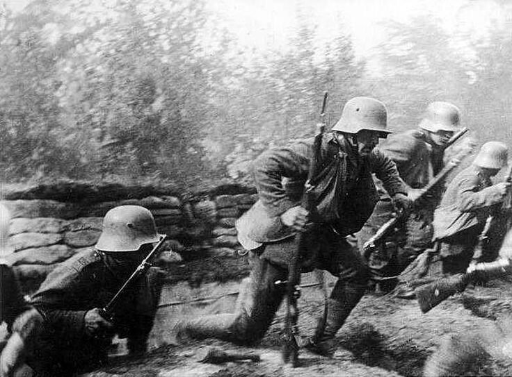
Battle of Verdun:
The Battle of Verdun was fought from 21 February to 18 December 1916 on the Western Front in France. The battle was the longest of the First World War and took place on the hills north of Verdun-sur-Meuse. The German 5th Army attacked the defenses of the Fortified Region of Verdun and those of the French Second Army on the right (east) bank of the Meuse. Using the experience of the Second Battle of Champagne in 1915, the Germans planned to capture the Meuse Heights, an excellent defensive position with good observation for artillery-fire on Verdun. The Germans hoped that the French would commit their strategic reserve to recapture the position and suffer catastrophic losses at little cost to the Germans.
The battle lasted for 302 days, the longest and one of the most costly in human history. It is estimated that the French suffered 377,231 casualties and the Germans 337,000, a total of 714,231, an average of 70,000 a month. In France, the battle came to symbolize the determination of the French Army and the destructiveness of the war.