Captured German Combat Map of 'Bar-le-Duc 51B' France Sector


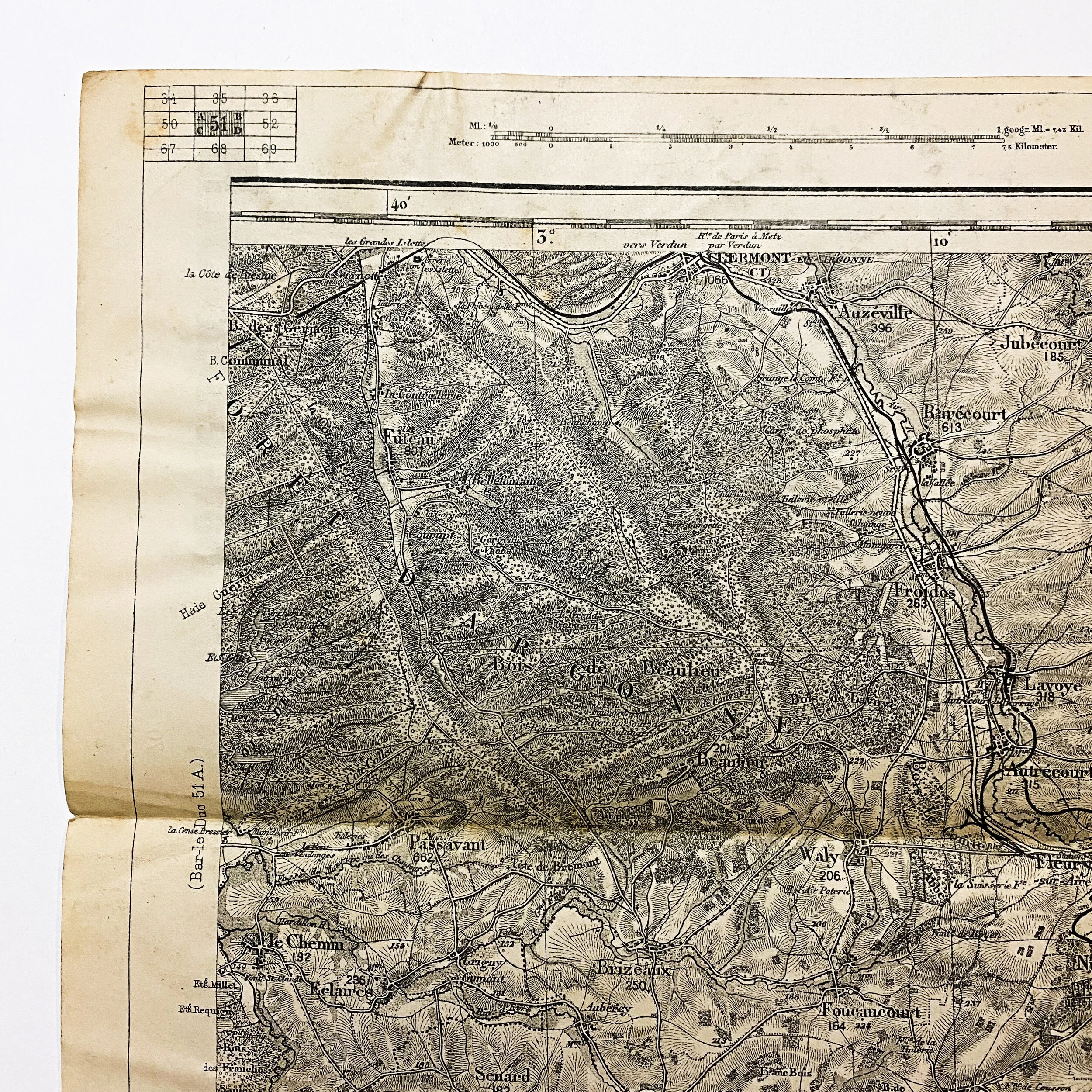


Captured German Combat Map of 'Bar-le-Duc 51B' France Sector
Size: 18.5 x 12.5 inches
This original WWI German combat map of the ‘Bar-le-Duc’ France sector is dated 1916. This map is one of 45 taken off of a German major on the battlefield of ‘Rupt en Weurve’ in the St. Mihiel Sector on September 13th, 1917 by Lieut. Harry G. Sheldon of the A.E.F. forces. These maps are broken into sets of 4 being label A,B,C and D of each given sector and district. Putting these section together forms a large map. They are all common scale and can be placed side by side to fit. This map is labeled ‘Bar-le-Duc 51B’ and is 1 of 4 maps for this given sector.
This map was most likely used during the Meuse–Argonne offensive as it features notable battle locations such as theArgonne Forest, Triaucoure, and the Forest de Souilly.
Meuse–Argonne Offensive:
The Meuse–Argonne offensive was a major part of the final Allied offensive of World War I that stretched along the entire Western Front. It was fought from September 26, 1918, until the Armistice of November 11, 1918, a total of 47 days. The Meuse–Argonne offensive was the largest in United States military history, involving 1.2 million American soldiers. It is the second deadliest battle in American history, resulting in over 350,000 casualties including 28,000 German lives, 26,277 American lives and an unknown number of French lives.
*Bar-le-Duc also served as the assembly point for essential supplies going to the besieged city of Verdun during the Battle of Verdun in 1916. Thousands of trucks, carrying men, equipment and food, traveled north, around the clock, on the road linking Bar-le-Duc to Verdun. The route was given the name Voie Sacrée, which translates to Sacred Way, by the writer and politician Maurice Barres in April 1916, a reference to the ancient Roman Sacra Via, leading to triumph.