RARE WWII D-Day JUNO & GOLD Normandy Infantry Amphibious Assault Map


RARE WWII D-Day JUNO & GOLD Normandy Infantry Amphibious Assault Map
Comes with C.O.A.
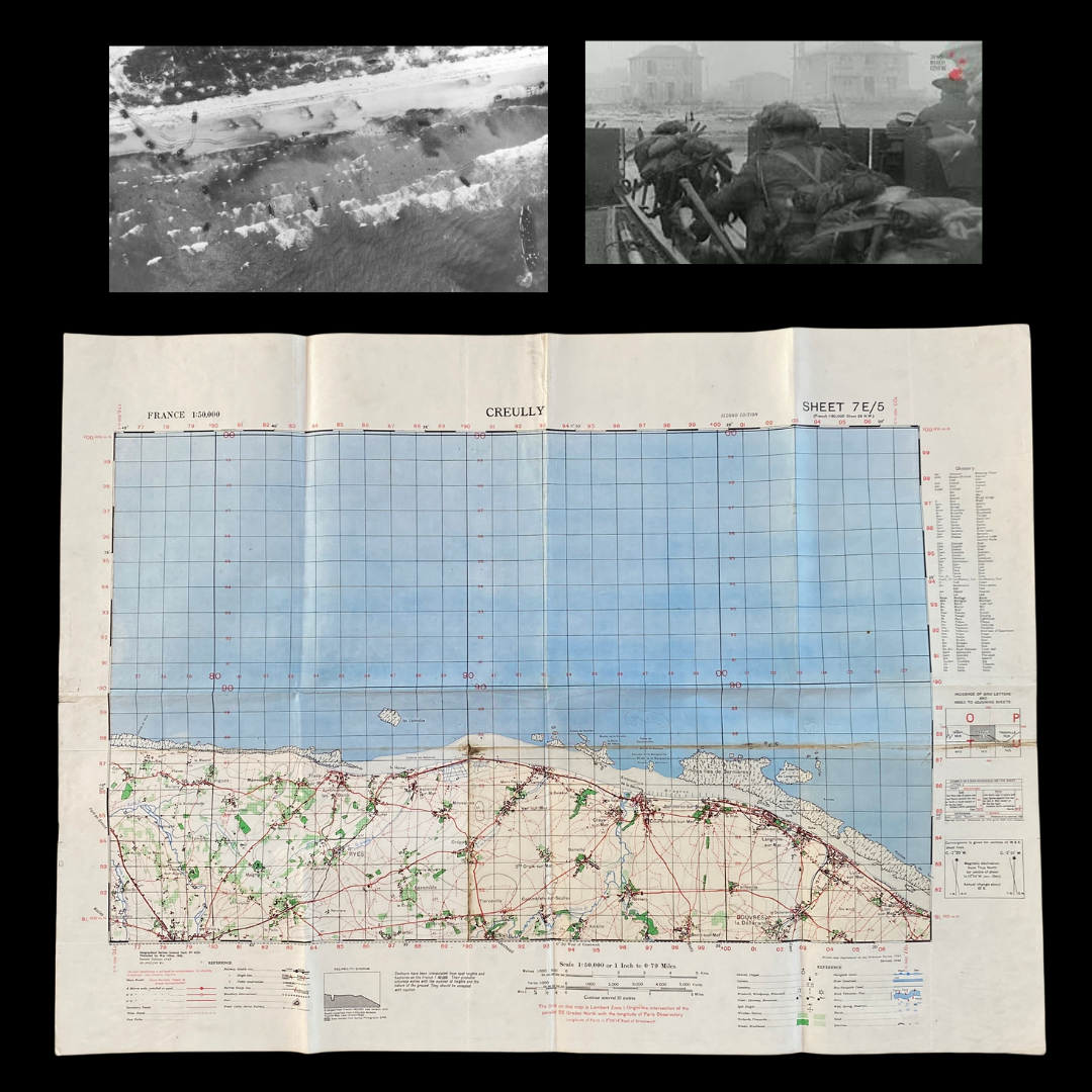
On 6 June 1944 – ‘D-Day’ – Allied forces launched the largest amphibious invasion in the history of warfare. Codenamed Operation ‘Overlord’, the Allied landings on the beaches of Normandy marked the start of a long and costly campaign to liberate north-west Europe from Nazi occupation. On the morning of D-Day, ground troops landed across five assault beaches – Utah, Omaha, Gold, Juno, and Sword. By the end of the day, the Allies had established themselves onshore and could begin the advance into France.
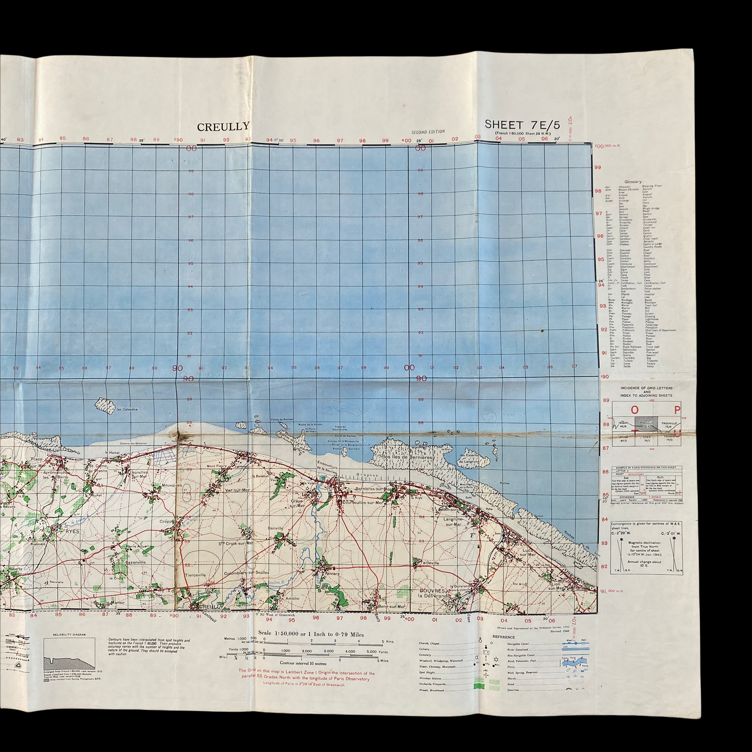
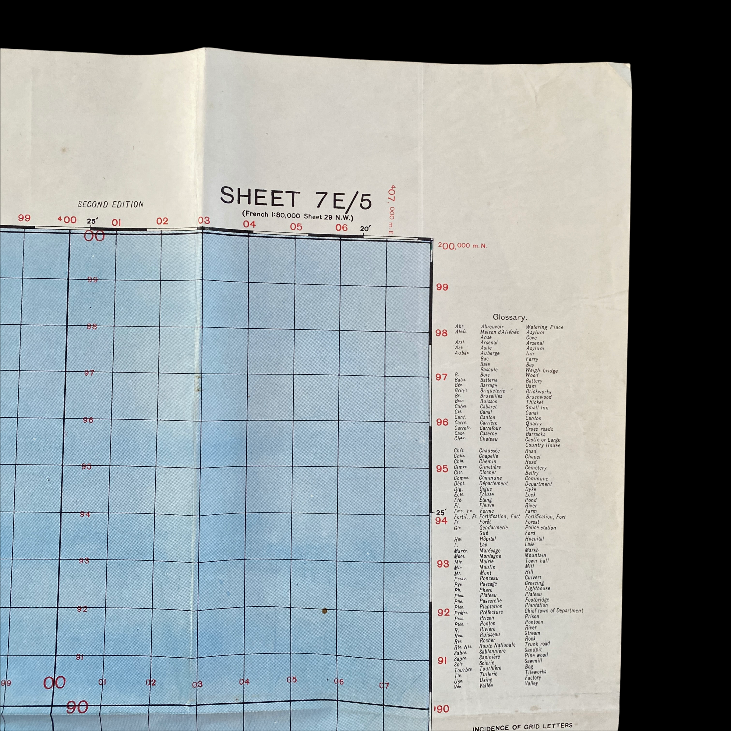
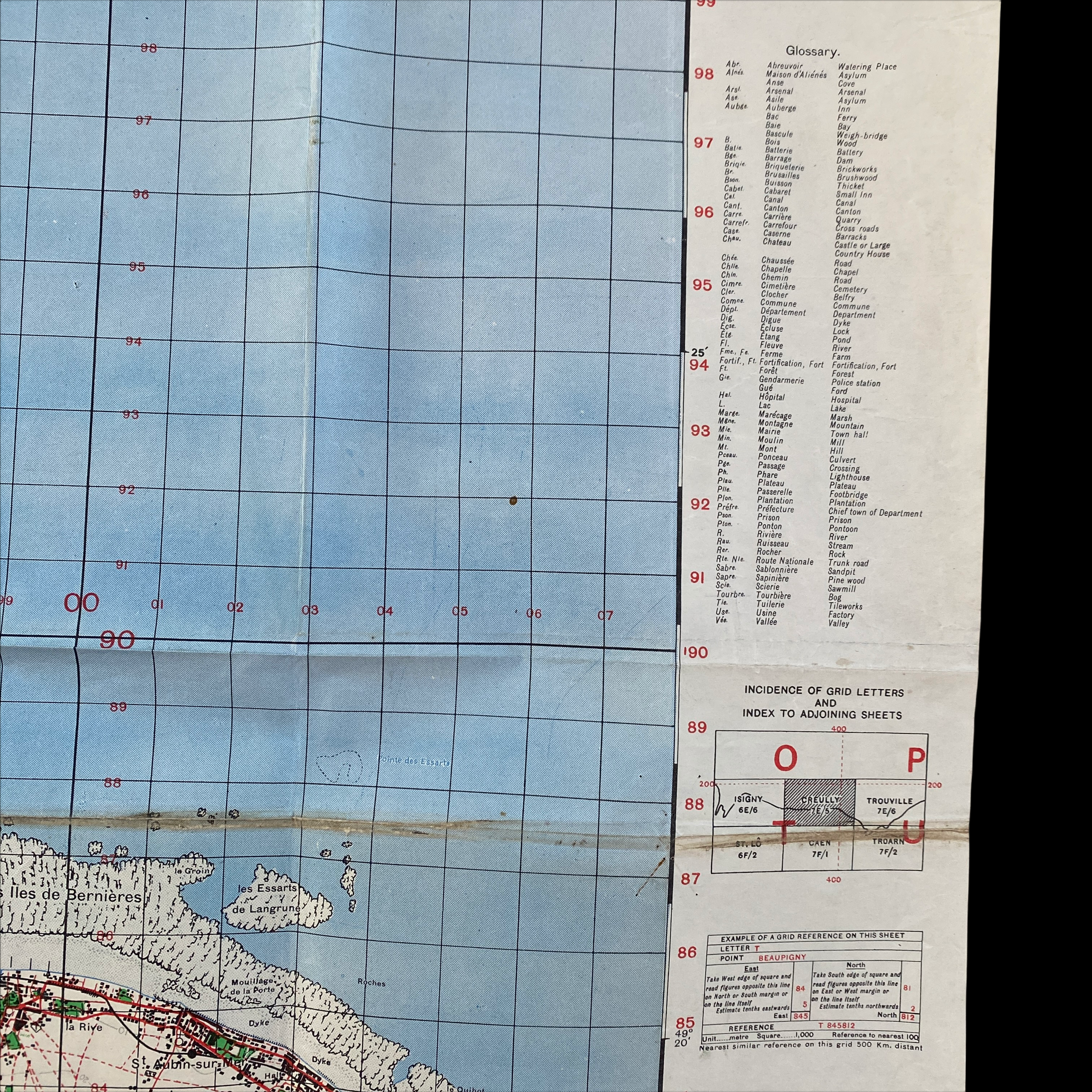
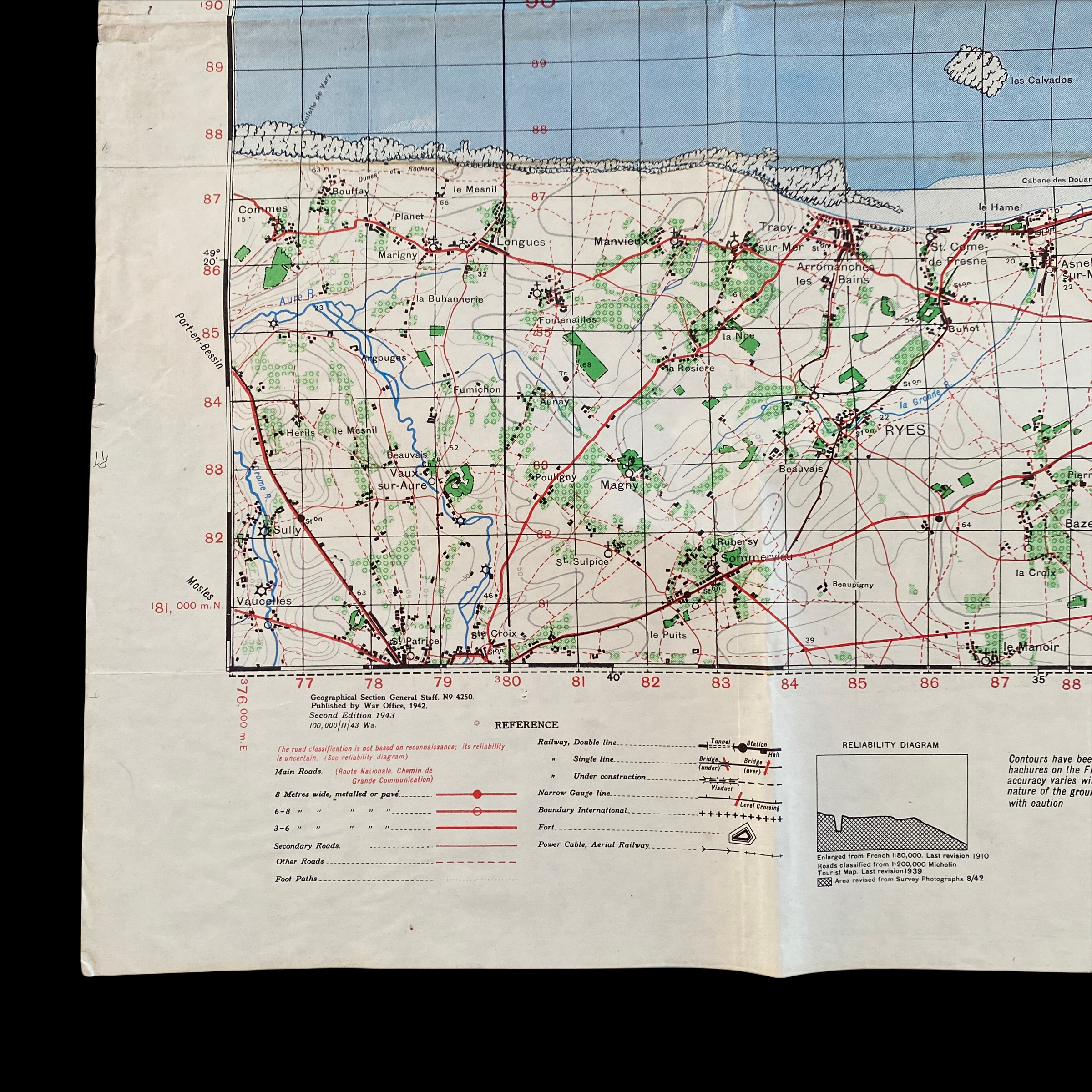
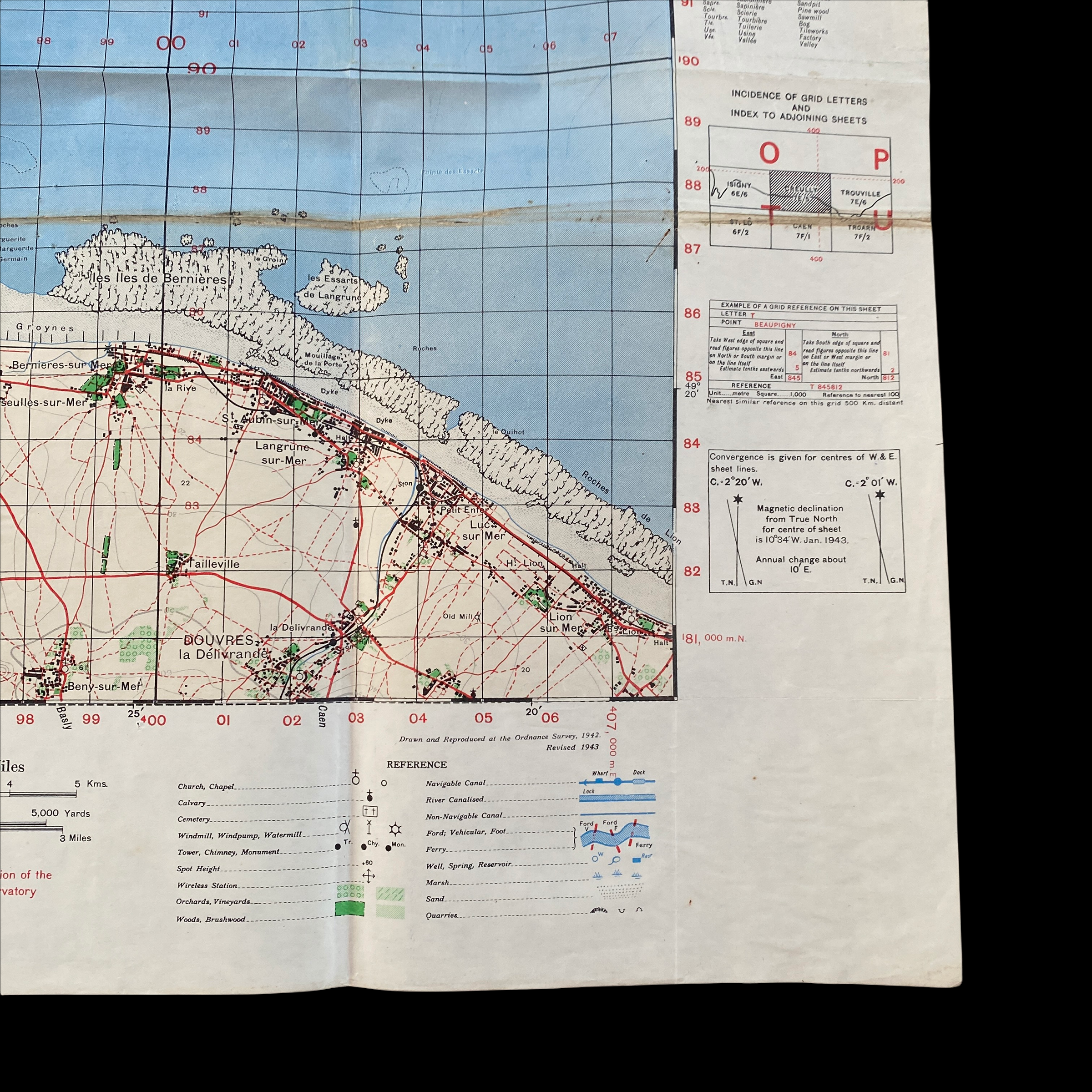
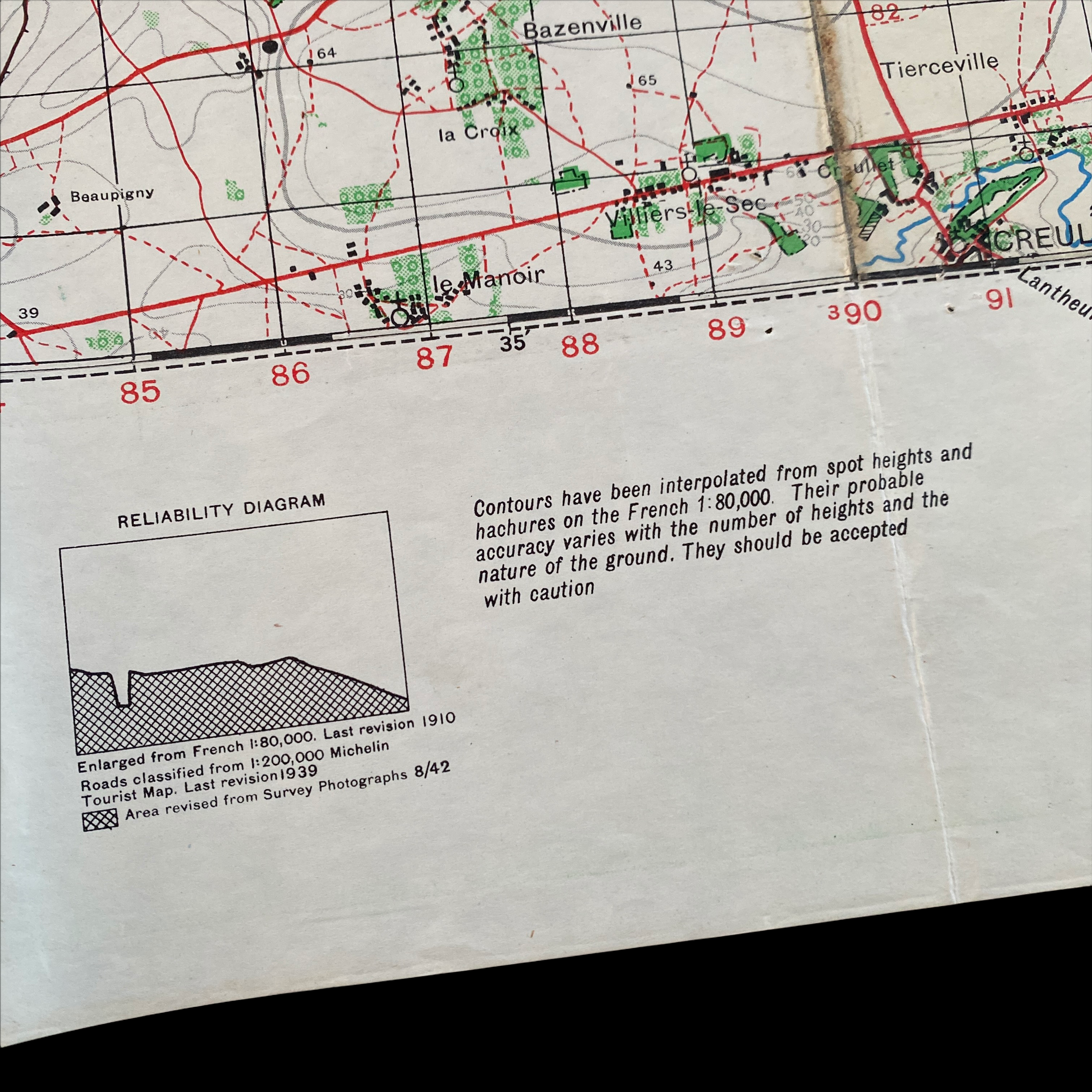
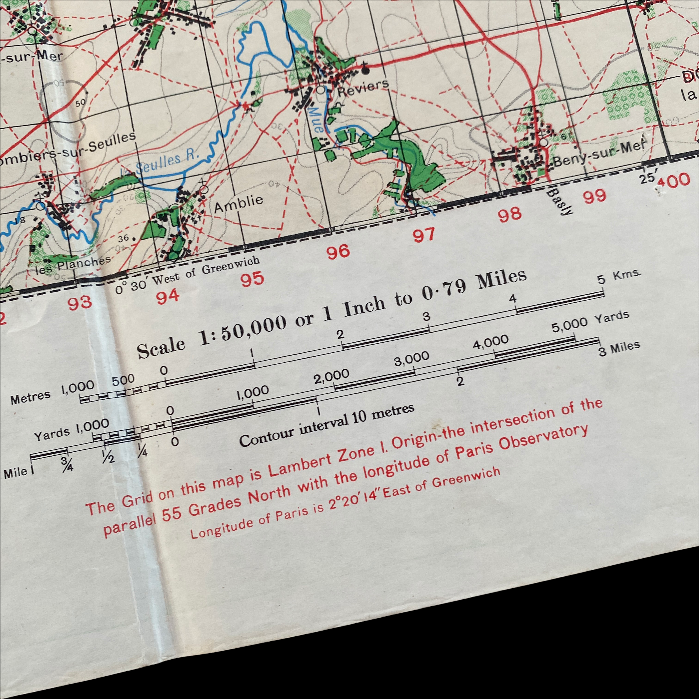
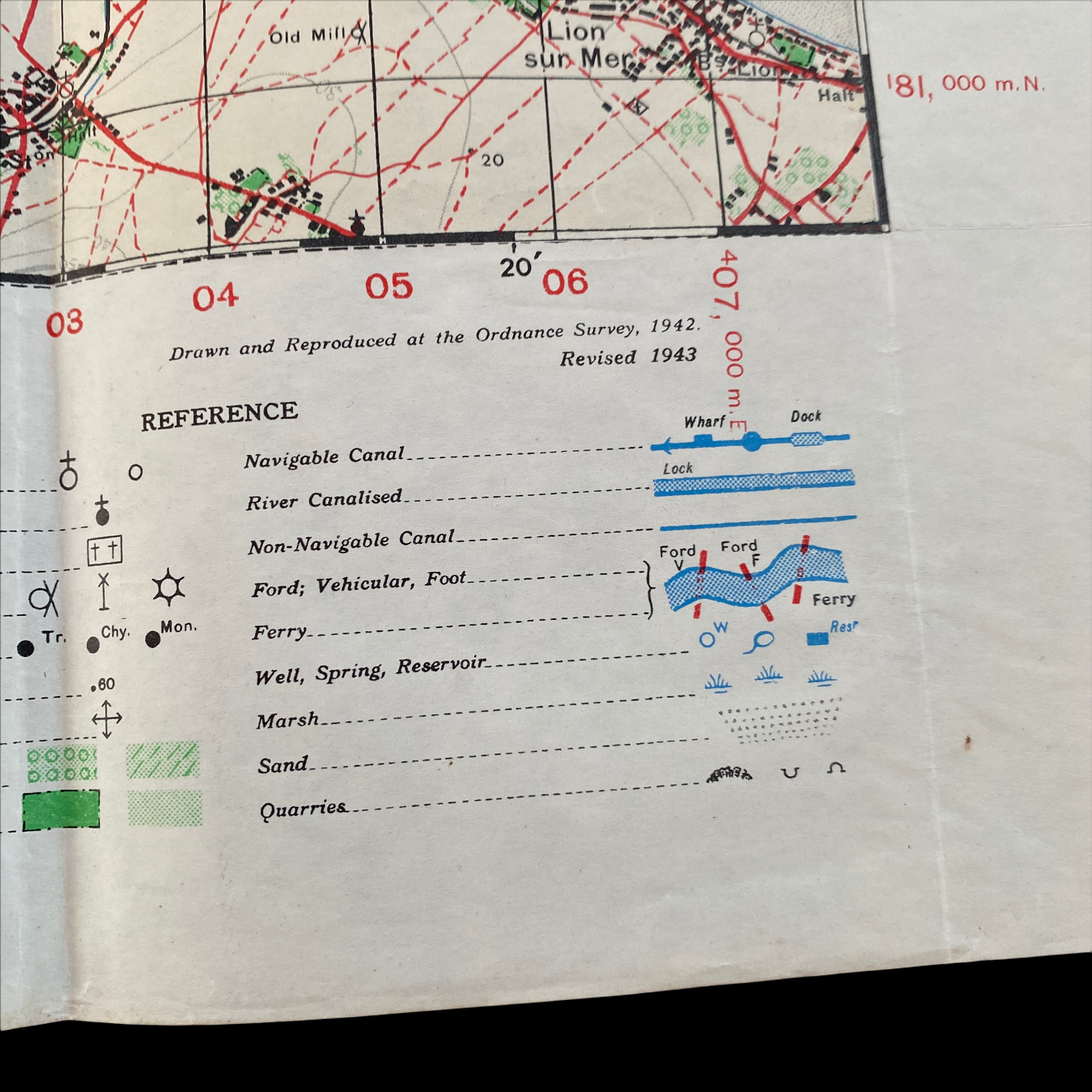
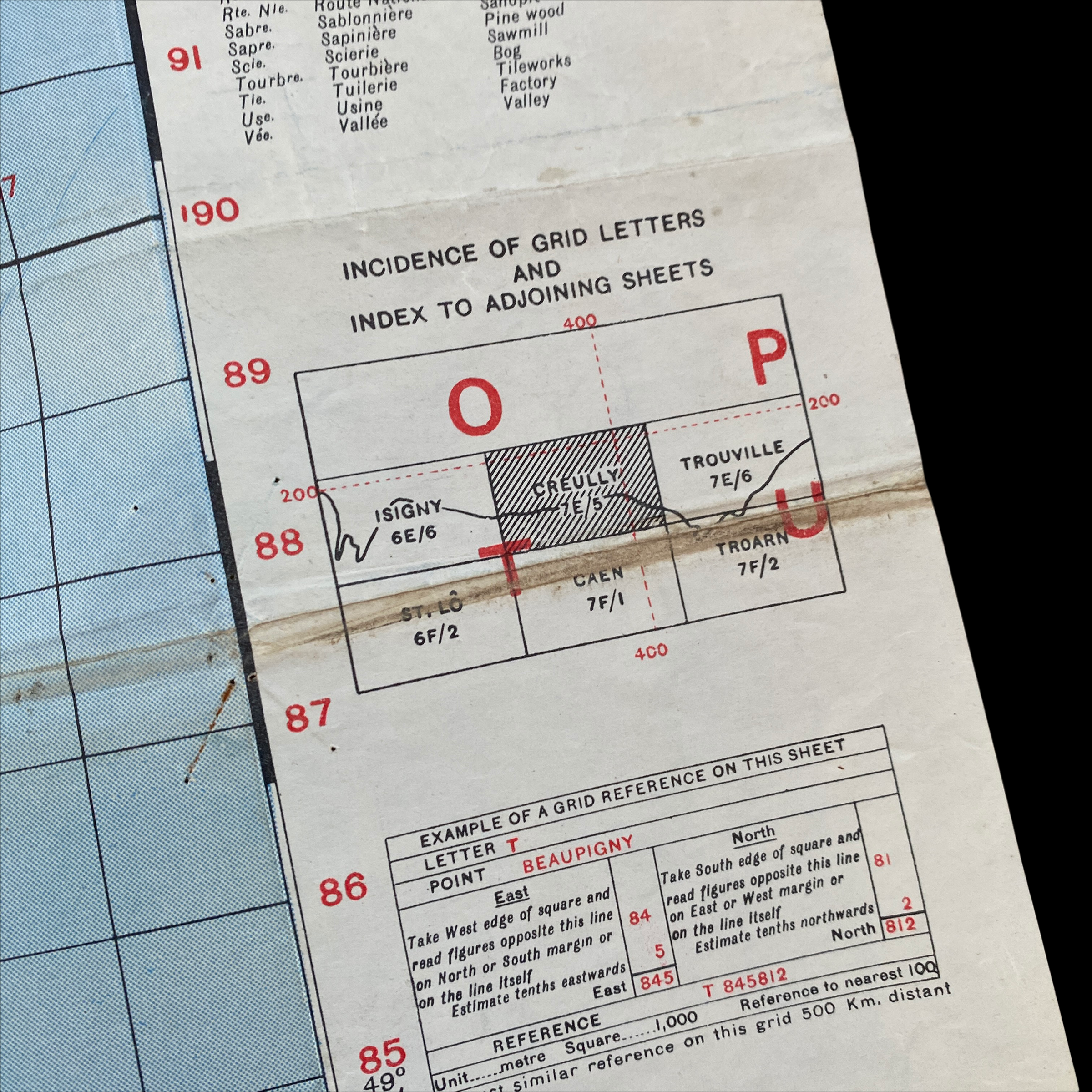
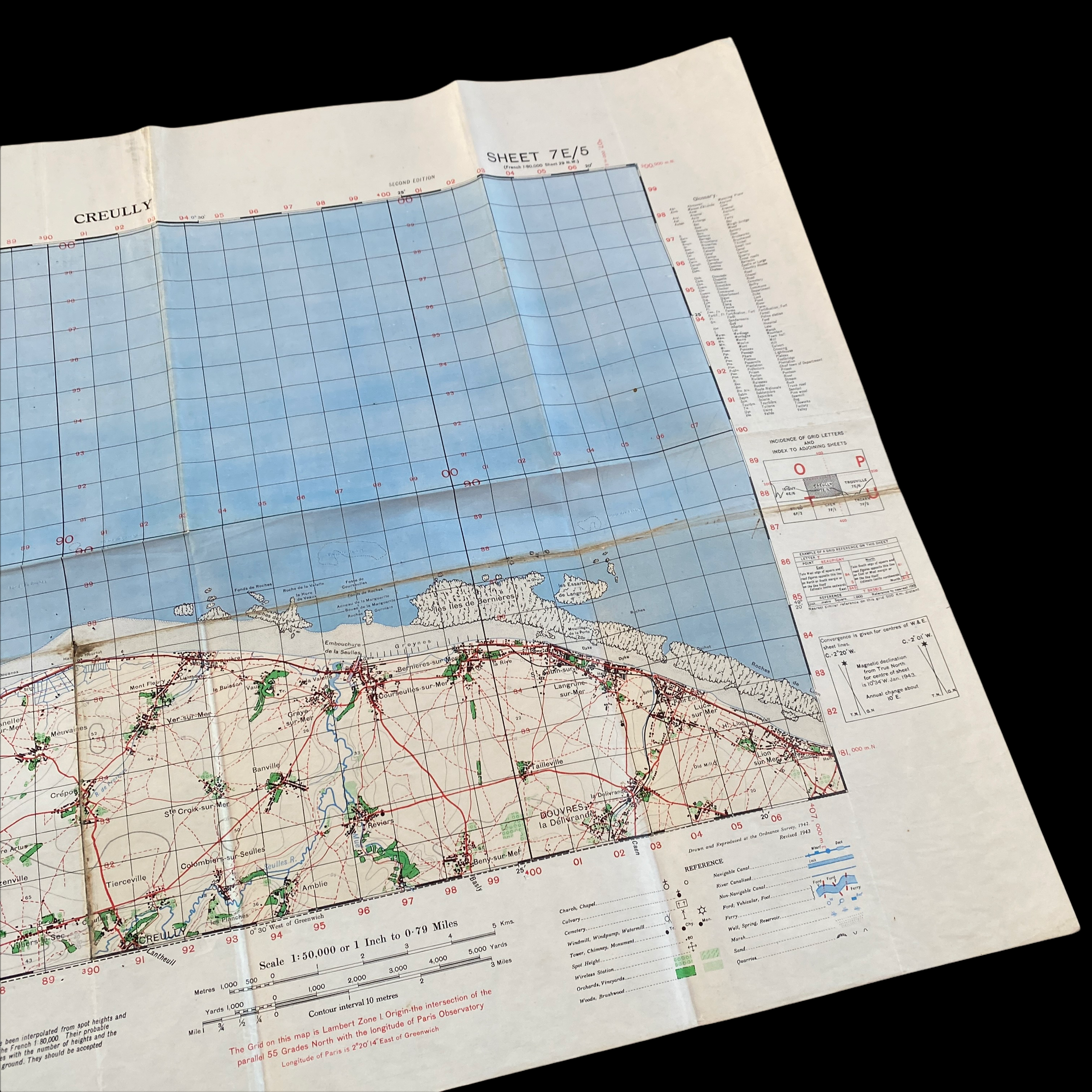
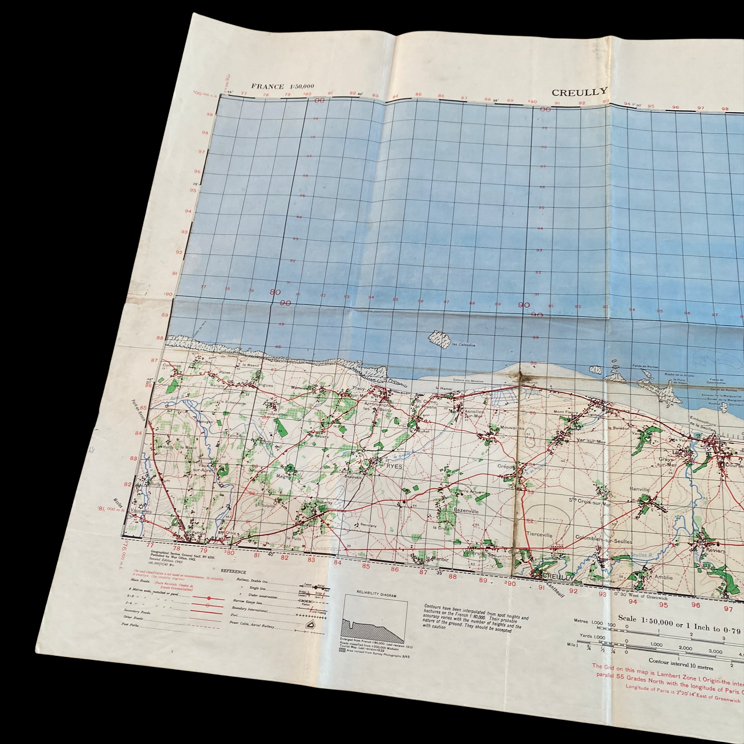
This incredibly rare WWII D-Day assault map was used during the amphibious landing of the 3rd Canadian Infantry Division and 50th British Infantry Division and shows the Normandy beachheads of GOLD and JUNO beach. Titled “Creully” this SECOND EDITION map was printed by the War Office in 1943 and would have been used for the strategic movement inland against German-occupied towns and coastal defenses as part of Operation Overlord.
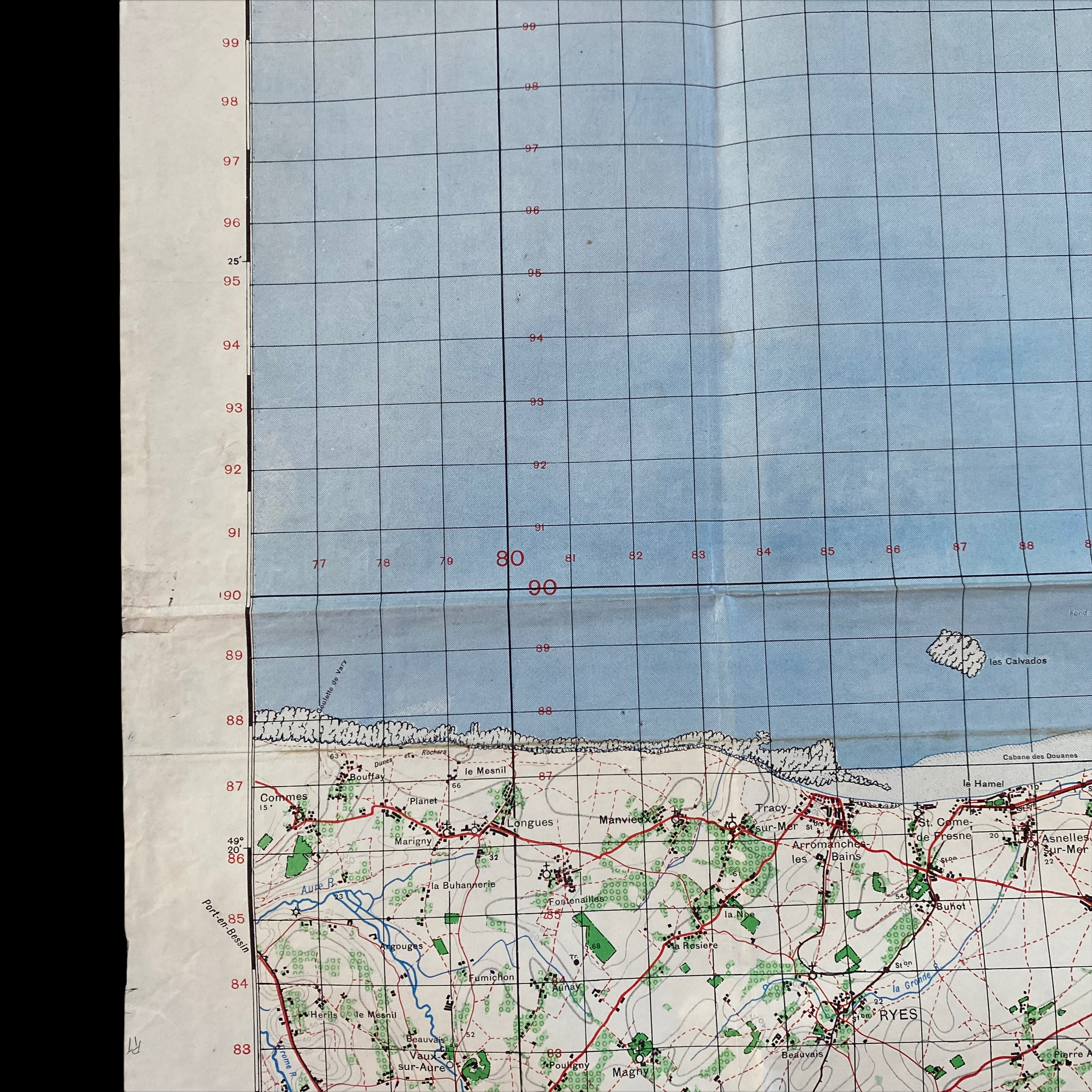
The landing area code-named Juno Beach was approximately 10 km (6 miles) wide and stretched on either side Courseulles-sur-Mer. This map features the entire JUNO amphibious beach landing sectors of LOVE, MIKE, and NAN. The landing area code-named Gold Beach was more than 8 km (5 miles) wide and included the coastal towns of La Rivière and Le Hamel. On the western end of the beach was the small port of Arromanches, and slightly west of that port was the town of Longues-sur-Mer. This map features the entire GOLD amphibious beach landing sectors of KING, JIG, ITEM, and HOW.
Juno Beach:
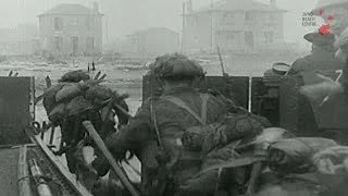
At Juno, Allied landing craft once again struggled with rough seas, along with offshore shoals and enemy mines. Upon finally disembarking, Canadian soldiers were then cut down in droves by Germans firing from seaside houses and bunkers. The first hour was particularly brutal, with a casualty rate approaching 50 percent for the leading assault teams. In the confusion, an Allied tank inadvertently ran over some of the wounded, stopping only when a Canadian captain blew its track off with a grenade. Other Canadians lacked any tank support at all. After fighting their way off the beach, however, German resistance slowed immensely, and the march into the interior went quickly. In fact, the Canadians advanced further inland than either their American or British counterparts. Though they didn’t quite meet their objective of taking Carpiquet airport, they captured several towns and linked up with the British on adjacent Gold Beach.
Gold Beach:
Owing to the direction of the tides, British troops began storming Gold, the middle of the five D-Day beaches, nearly an hour after fighting got underway at Utah and Omaha. The Germans initially put up robust resistance, but in sharp contrast to Omaha, an earlier aerial bombardment had wiped out much of their defenses. British warships also proved effective. The cruiser HMS Ajax, for example, displayed such pinpoint accuracy from miles away that it apparently sent one shell through a small slot in a German artillery battery’s concrete exterior—the military equivalent of a hole-in-one. On shore, meanwhile, armored vehicles known as “Funnies” cleared away minefields and other obstacles. Within an hour, the British had secured a few beach exits, and from there they rapidly pushed inland. They also captured the fishing village of Arromanches, which days later became the site of an artificial harbor used by the Allies to unload supplies.