Original 1948 1st Edition R.A.F. Royal Air Force (R.A.F.) “SCOTTISH CHAIN - NORTH WEST SHEET” Lattice Navigation Air Chart*


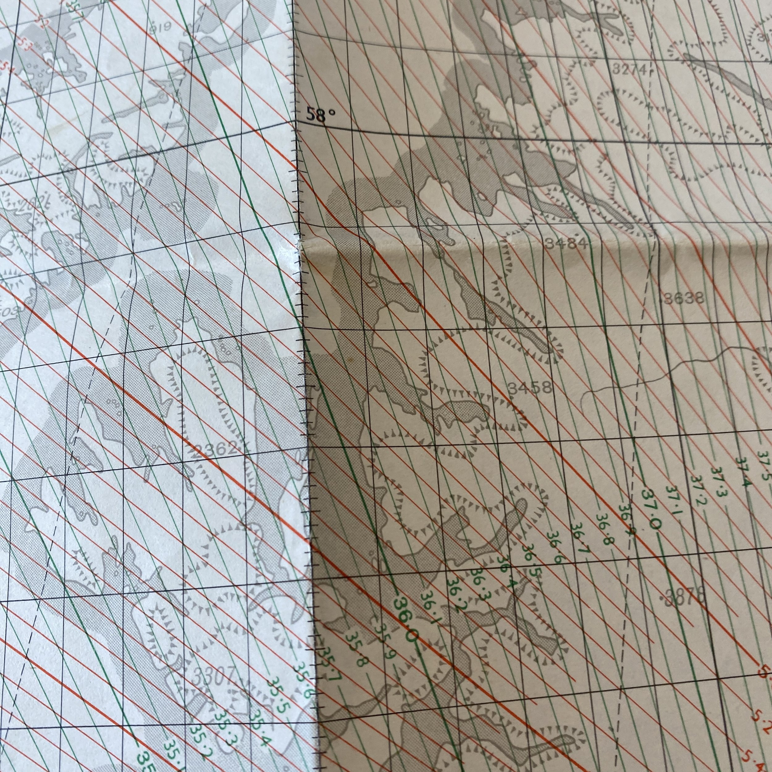
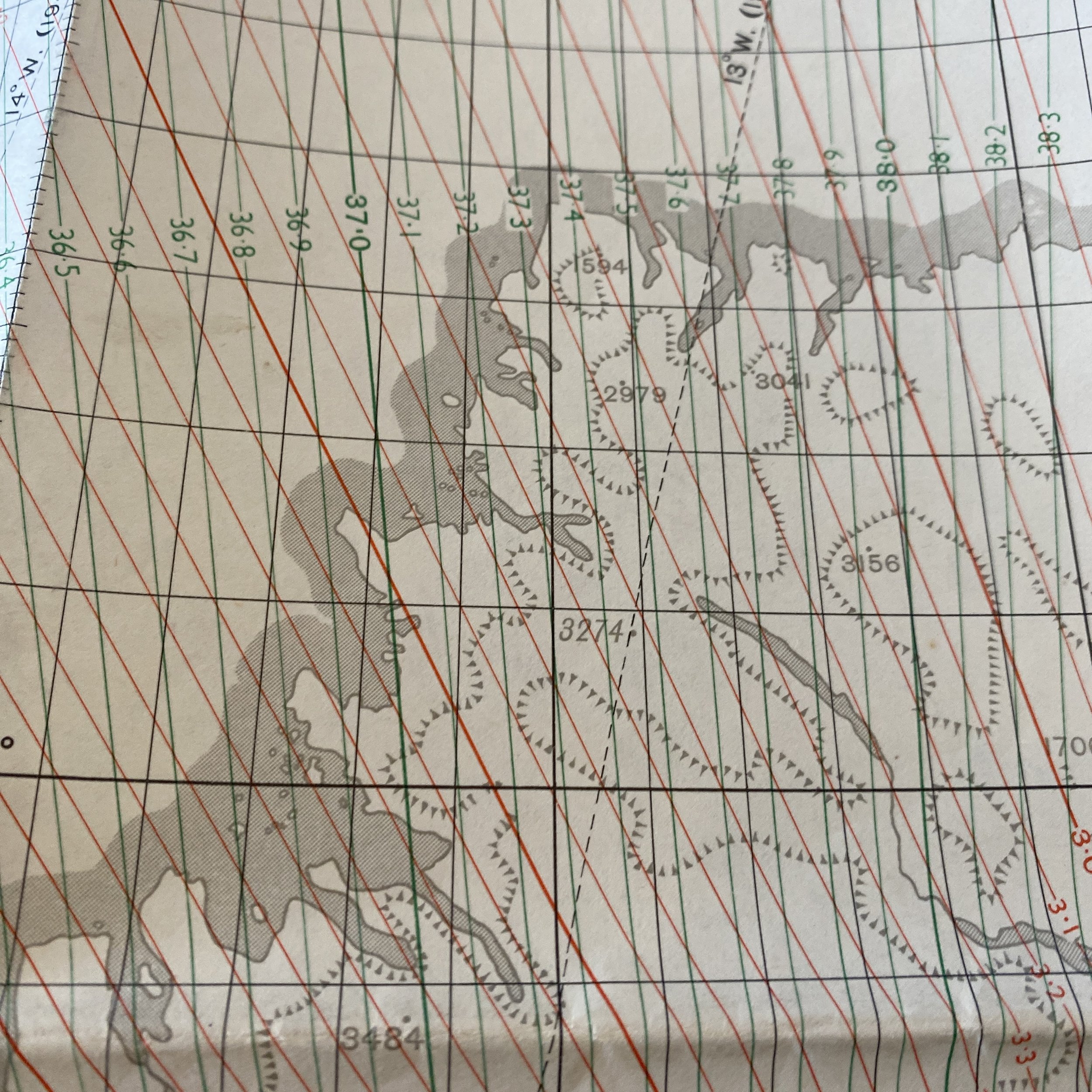


Original 1948 1st Edition R.A.F. Royal Air Force (R.A.F.) “SCOTTISH CHAIN - NORTH WEST SHEET” Lattice Navigation Air Chart*
Comes with C.O.A.
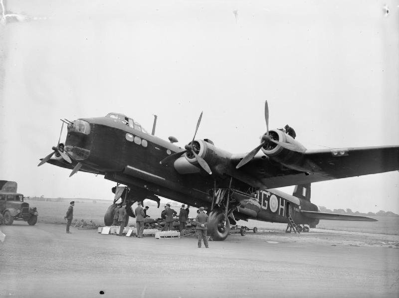
This rare and museum-grade Royal Air Force (R.A.F.) “SCOTTISH CHAIN - NORTH WEST SHEET” Lattice Chart is a rare 1st edition printed by the War Office in 1948. This mini navigation map was used by the Royal Air Force while operating air missions over the United Kingdom.
Gee was a radio navigation system that used signals from two or more ground-based transmitters to determine the precise location of an aircraft. It was developed to address the limitations of earlier navigation methods, particularly in situations where accuracy was crucial, such as during military operations. The system worked by comparing the time delays between signals received from different transmitters. The intersecting lines of position derived from these time delays allowed navigators to pinpoint the aircraft's location. Gee provided a significant improvement in accuracy over earlier systems, making it an important tool for the RAF. The term "Gee Lattice Chart" might refer to the navigational charts used in conjunction with the Gee system. These charts displayed the grid lines or lattice that corresponded to the intersecting lines of position generated by the Gee signals. The navigators on board the aircraft would use these charts to determine their precise location and plot their course. The lattice on the charts represented the hyperbolic lines of position generated by the time differences between the signals from different transmitters. By intersecting these lines on the chart, navigators could accurately determine the aircraft's position.