WWII September 1944 Ninth Air Force’s 10th Photographic Group (Reconnaissance) P-51 Mustang General Patton’s U.S. Third Army Battlefield Intelligence Photograph
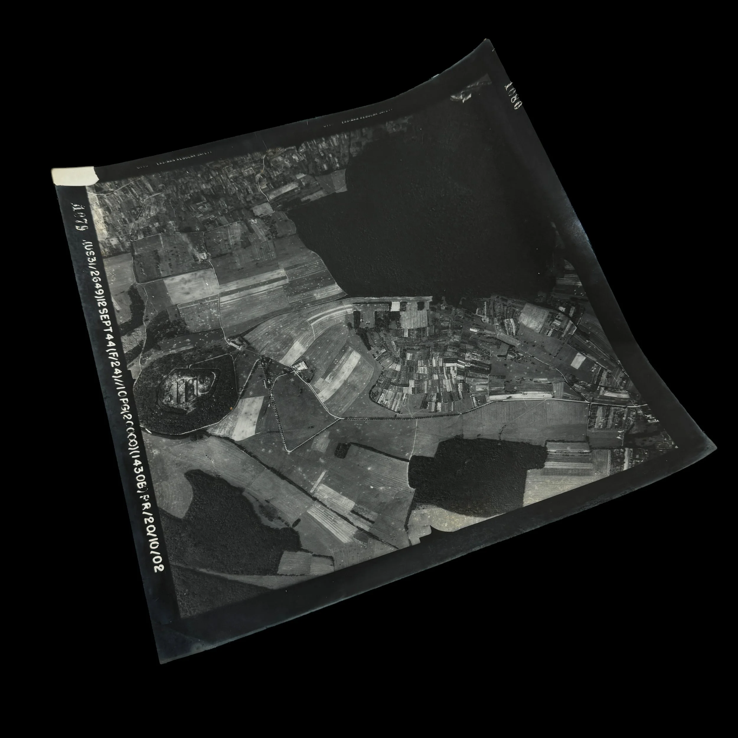
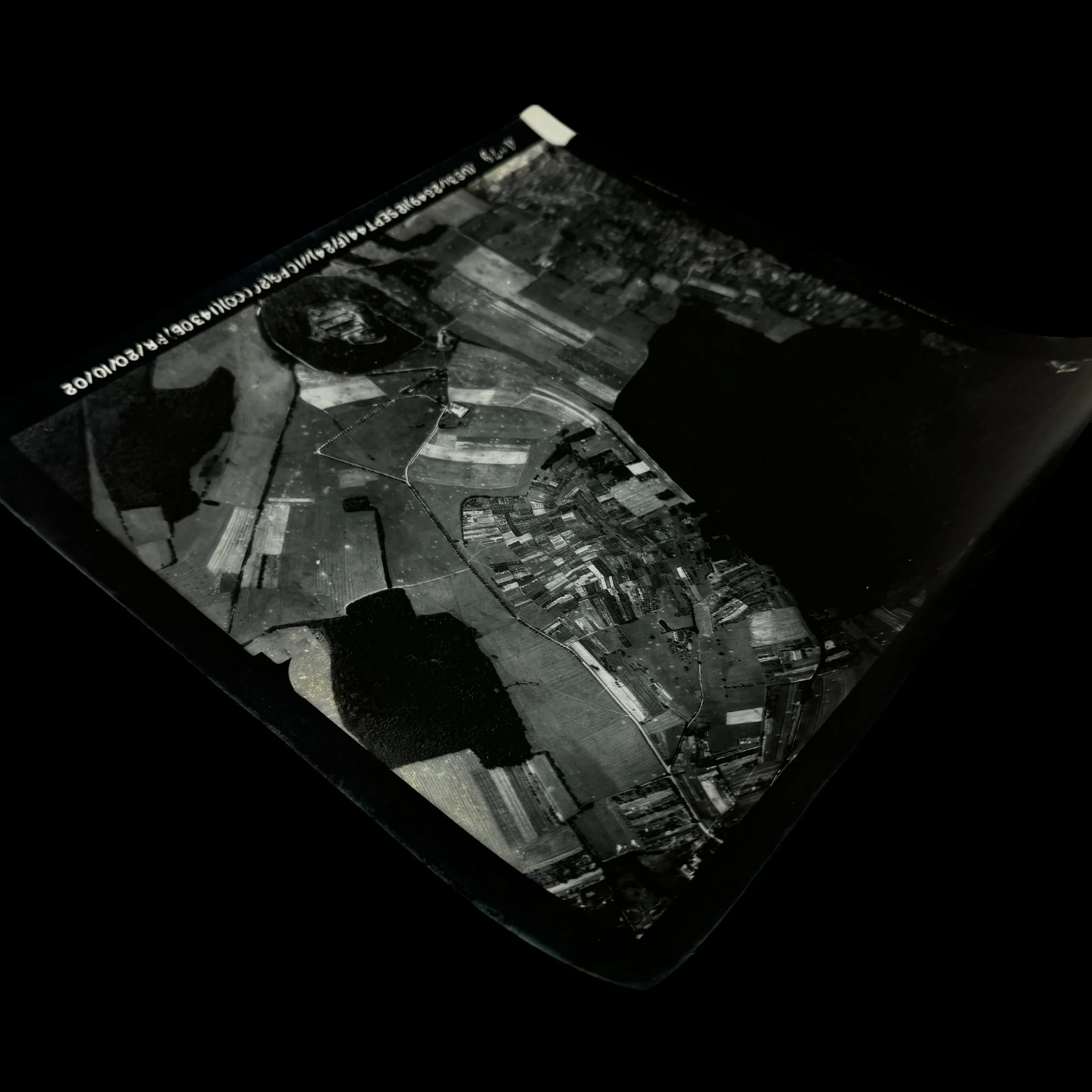
WWII September 1944 Ninth Air Force’s 10th Photographic Group (Reconnaissance) P-51 Mustang General Patton’s U.S. Third Army Battlefield Intelligence Photograph
Comes with a hand-signed C.O.A. and a full historical write-up research document
“From the summer of 1944 through the winter campaigns, including the drive toward the Siegfried Line and the brutal Battle of the Bulge, the P-51 Mustangs were constantly in the air, braving flak and enemy fighters to provide real-time updates for General Patton’s fast-moving Third Army. These pilots did not just observe—they directed U.S. artillery fire onto enemy emplacements, marked key targets for fighter-bomber squadrons, and ensured that Allied forces remained one step ahead in a rapidly changing battlefield. In the words of German General Werner von Fritsch, “The military organisation with the best aerial reconnaissance will win the next war.” With the P-51 Mustang leading the charge, the Allies proved that prediction true.”
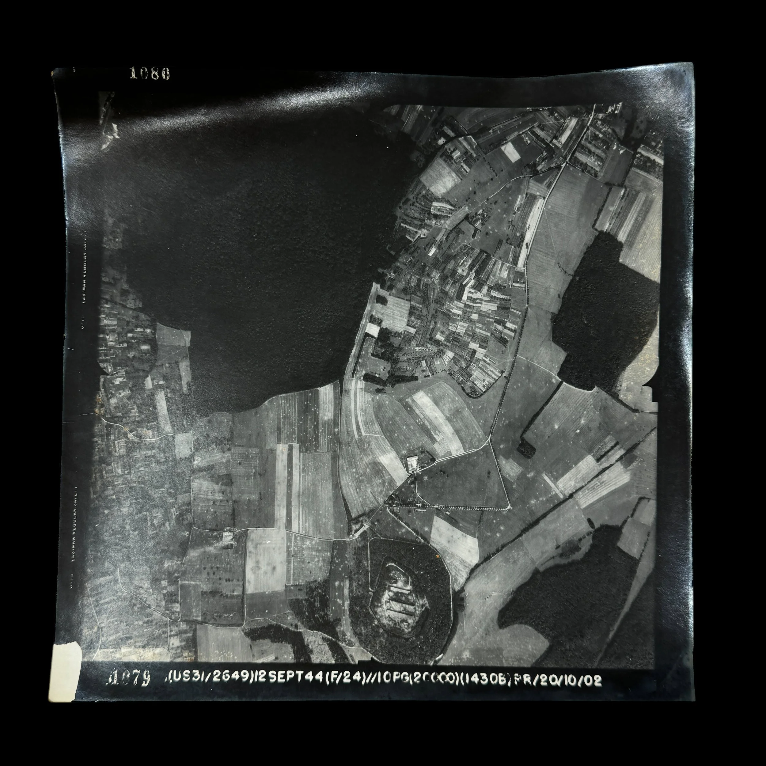
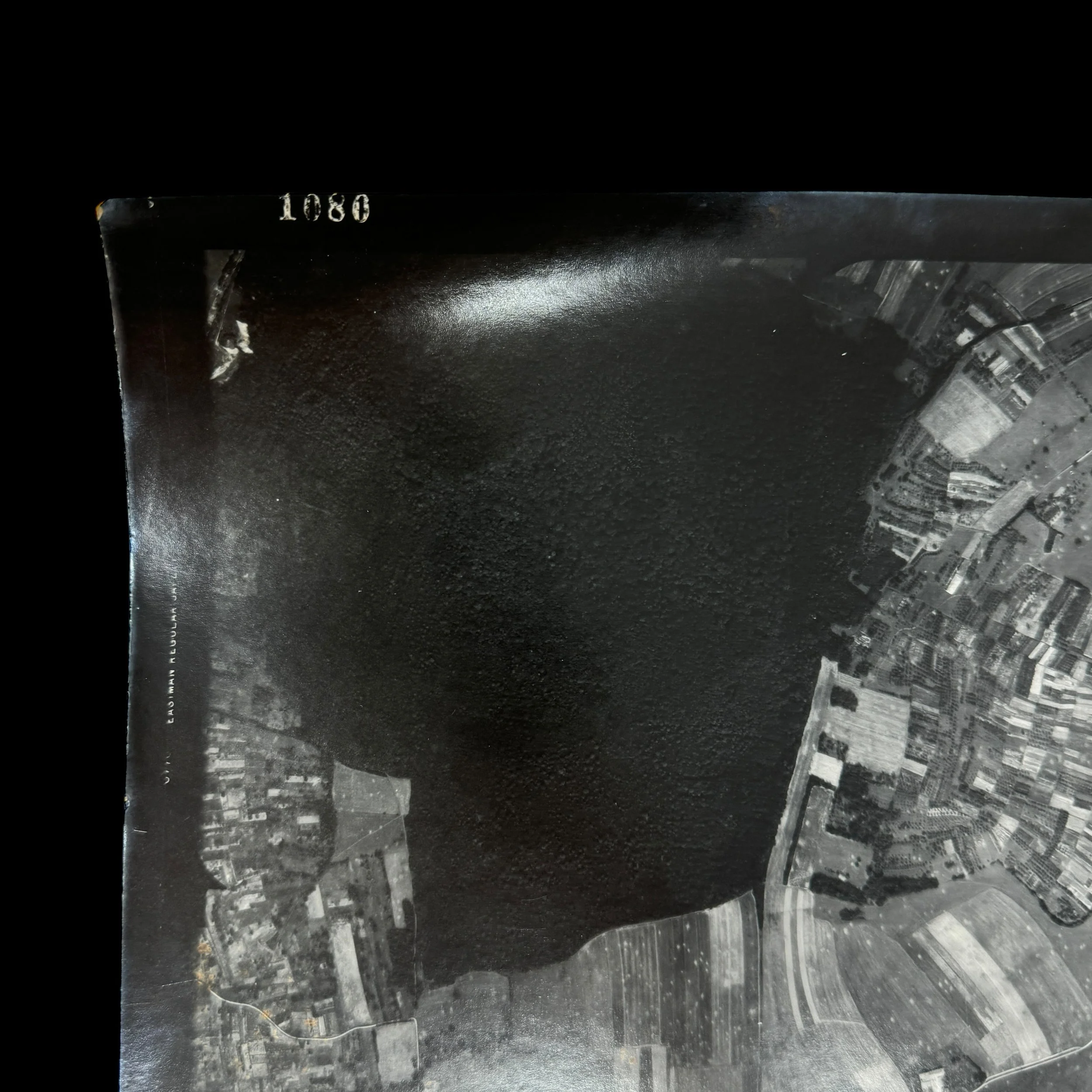
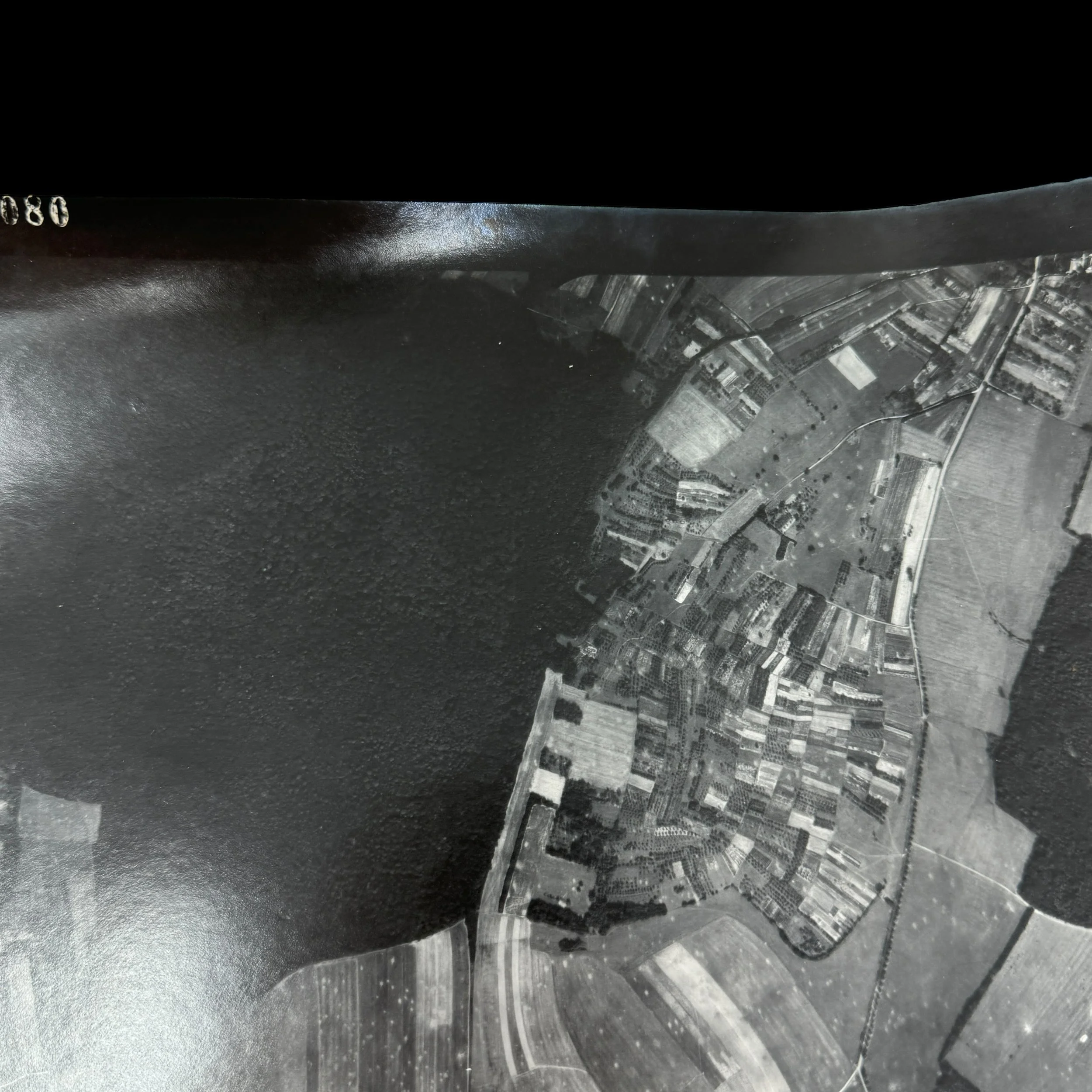
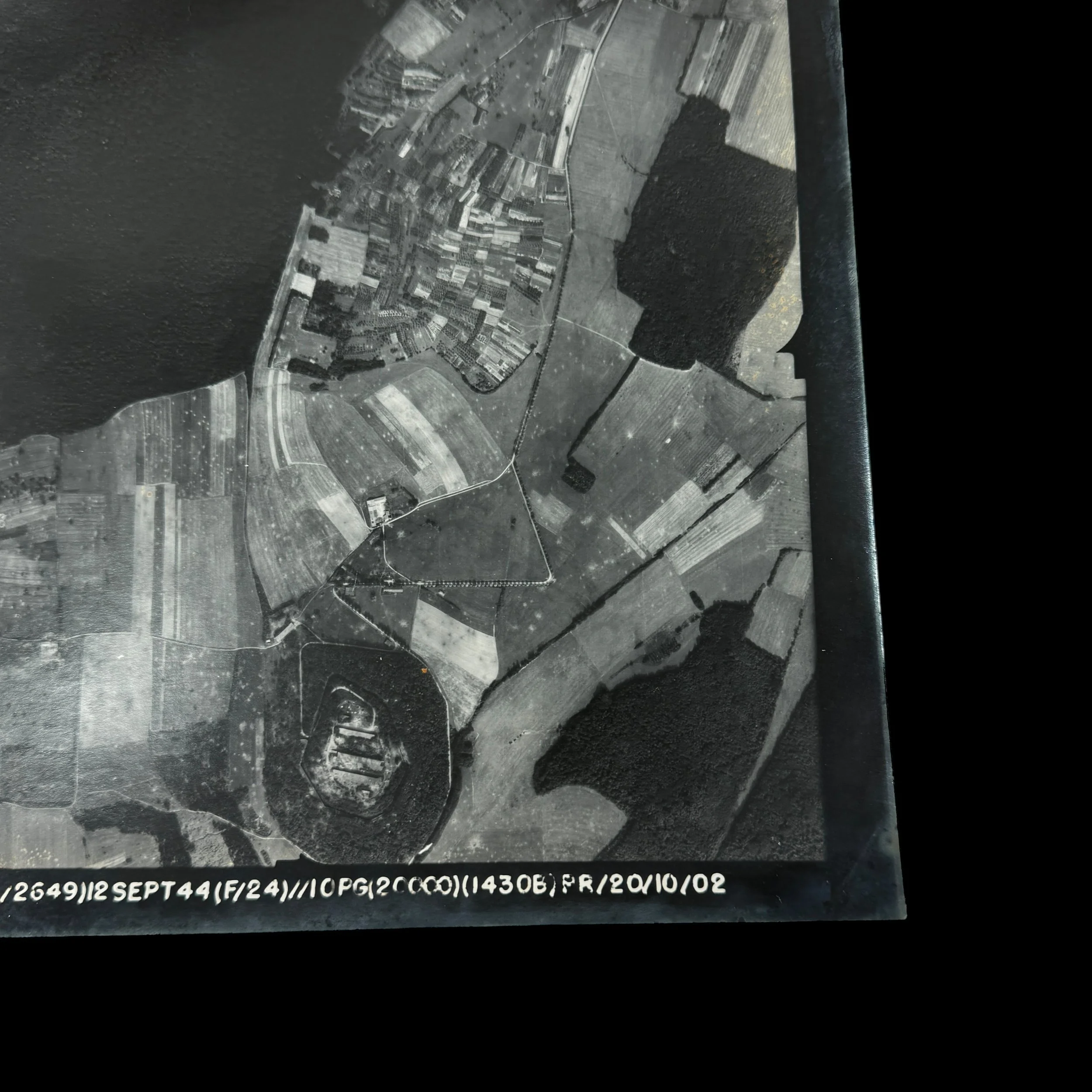
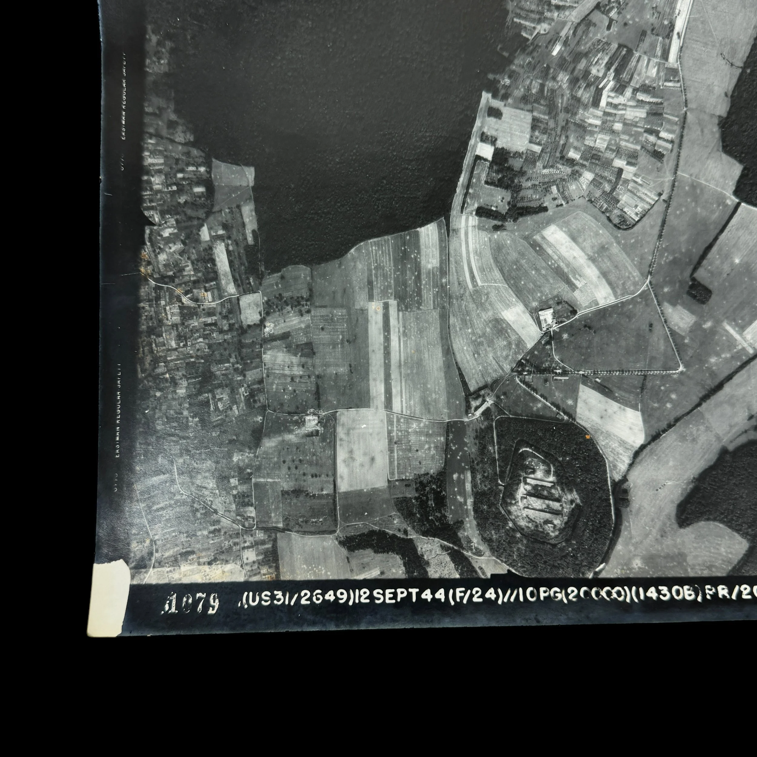
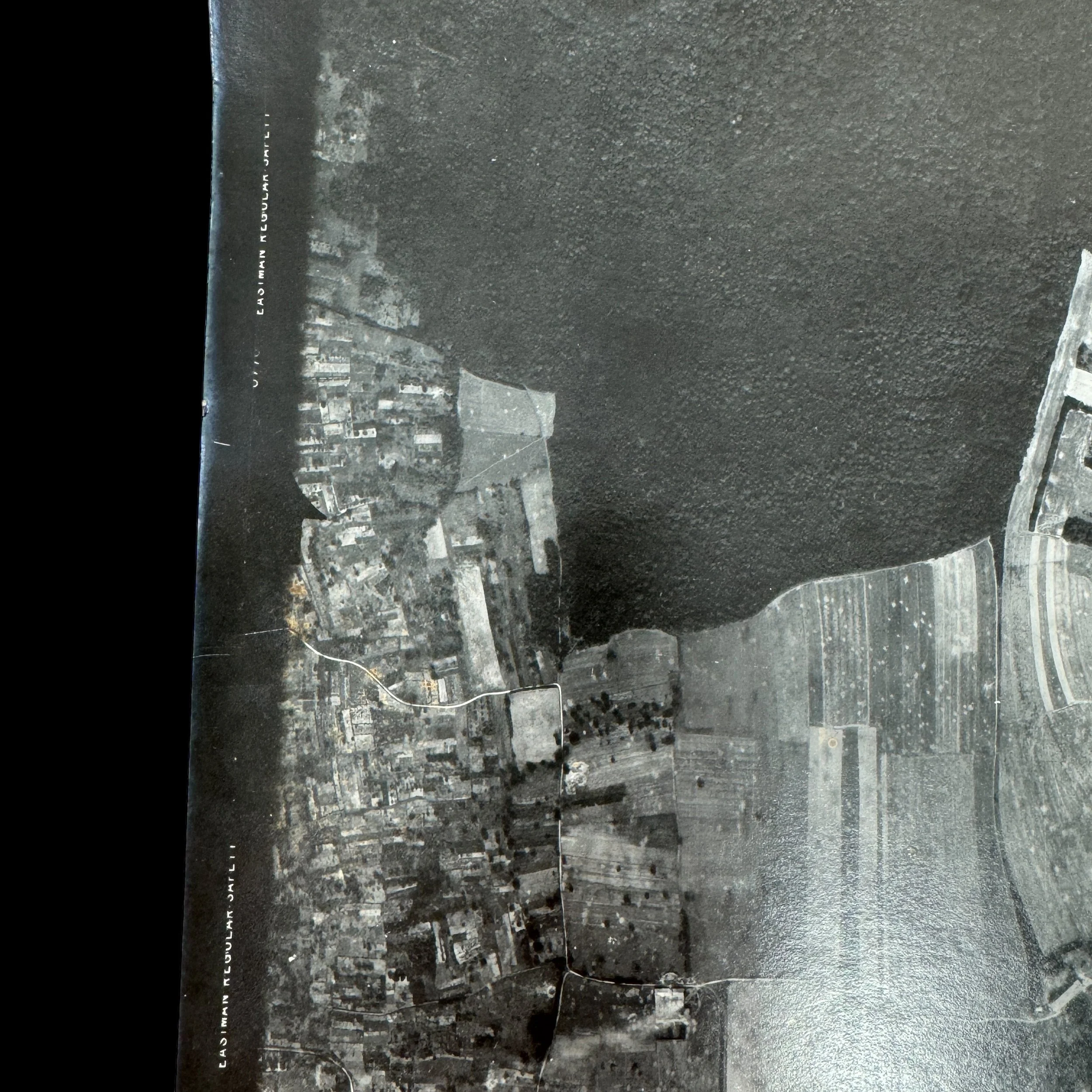
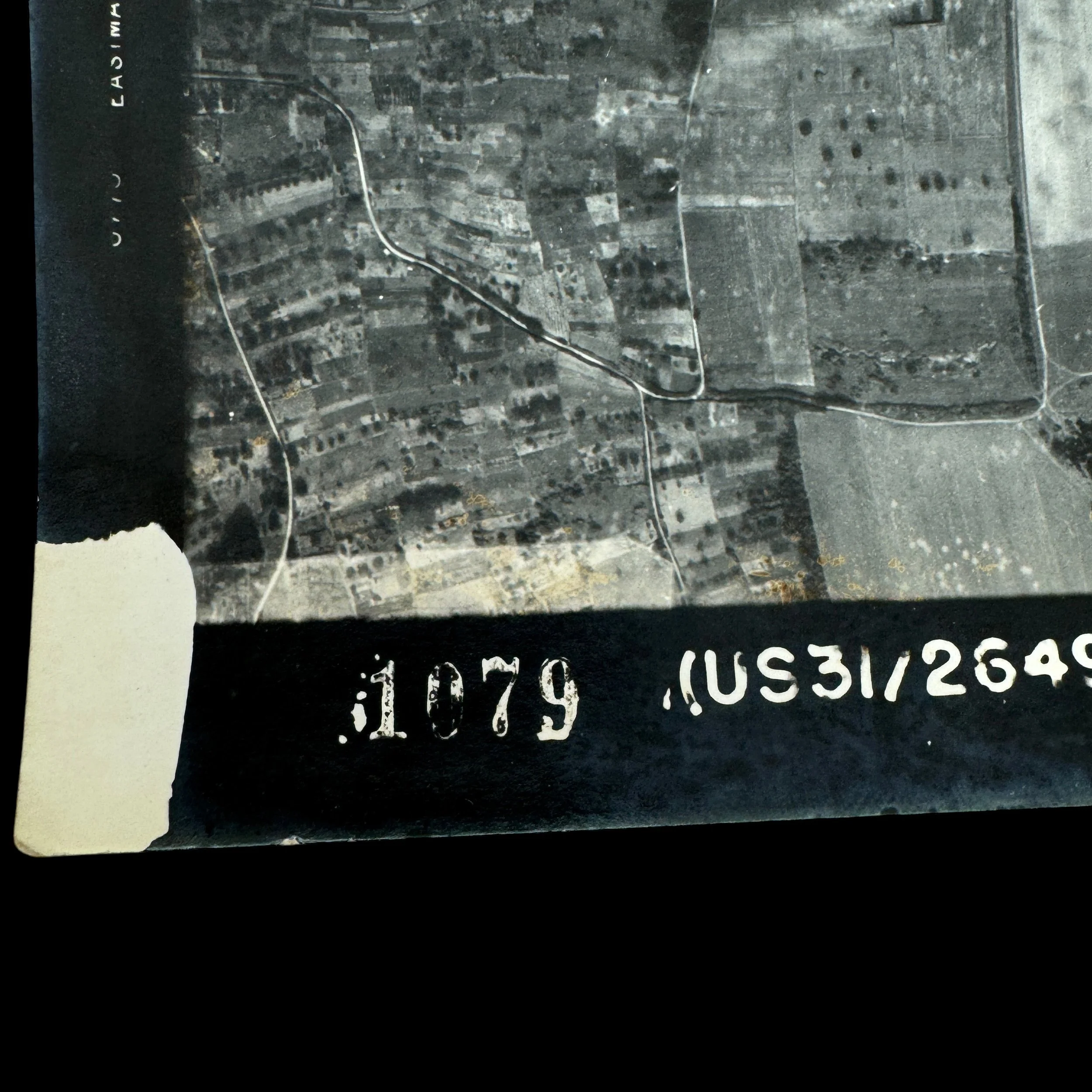
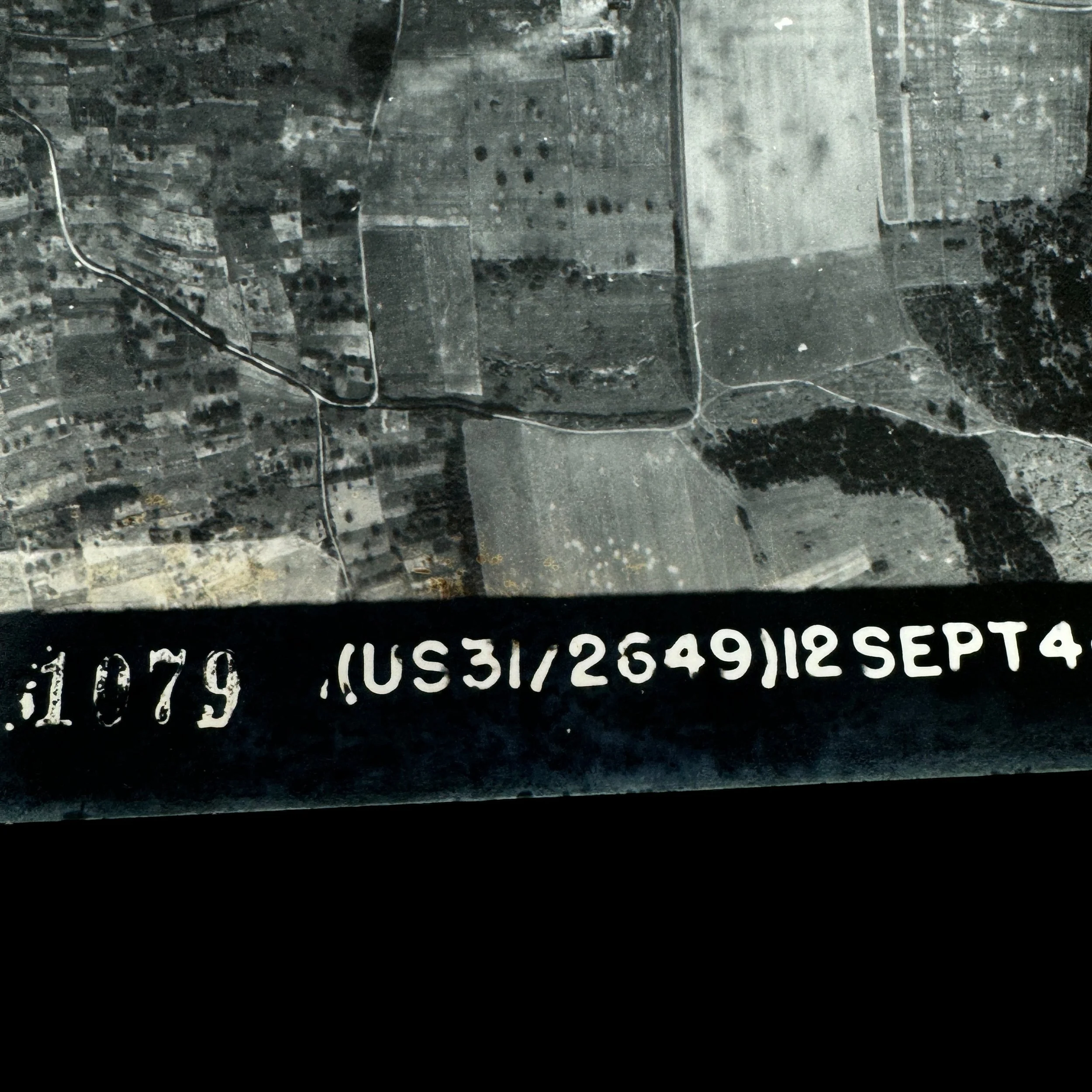
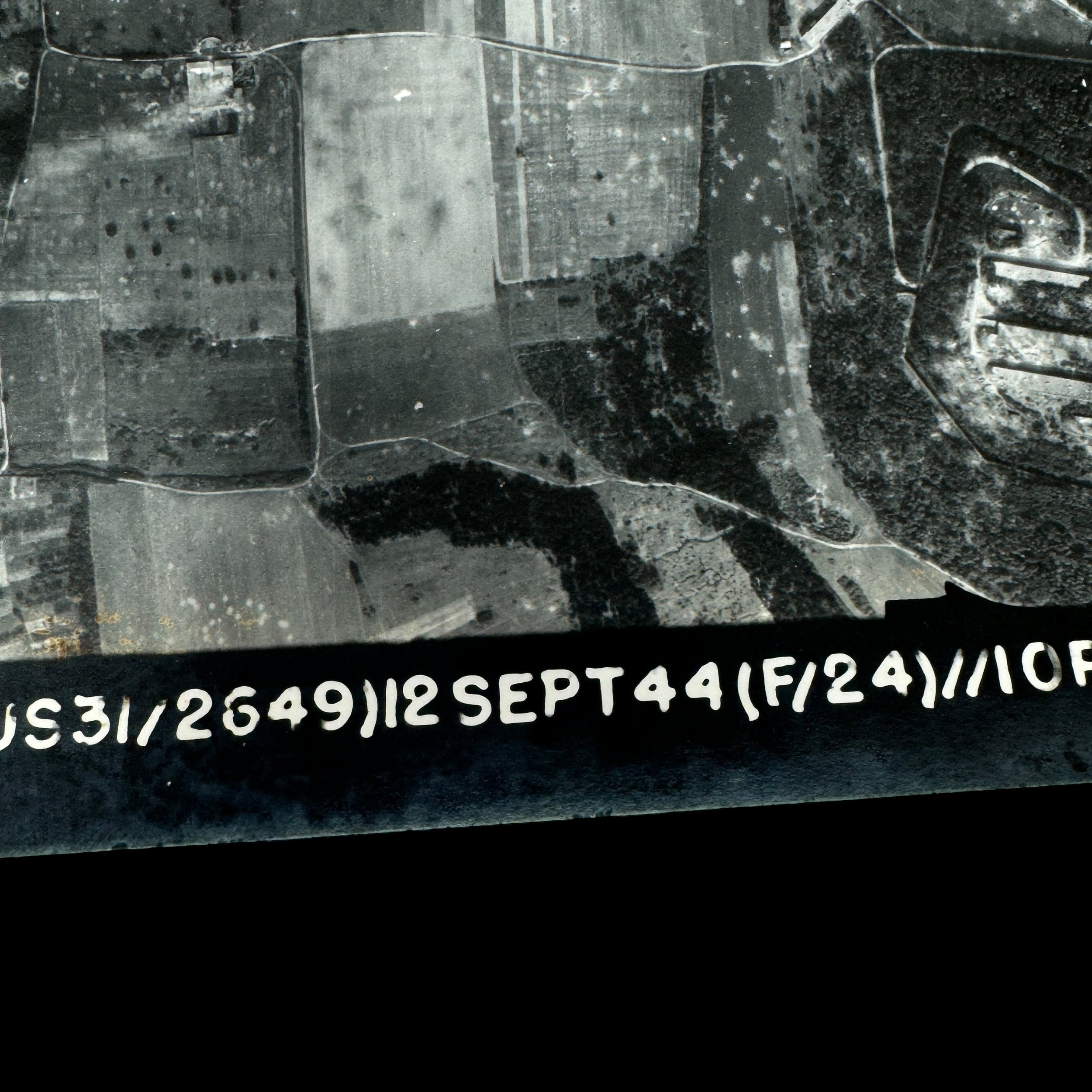
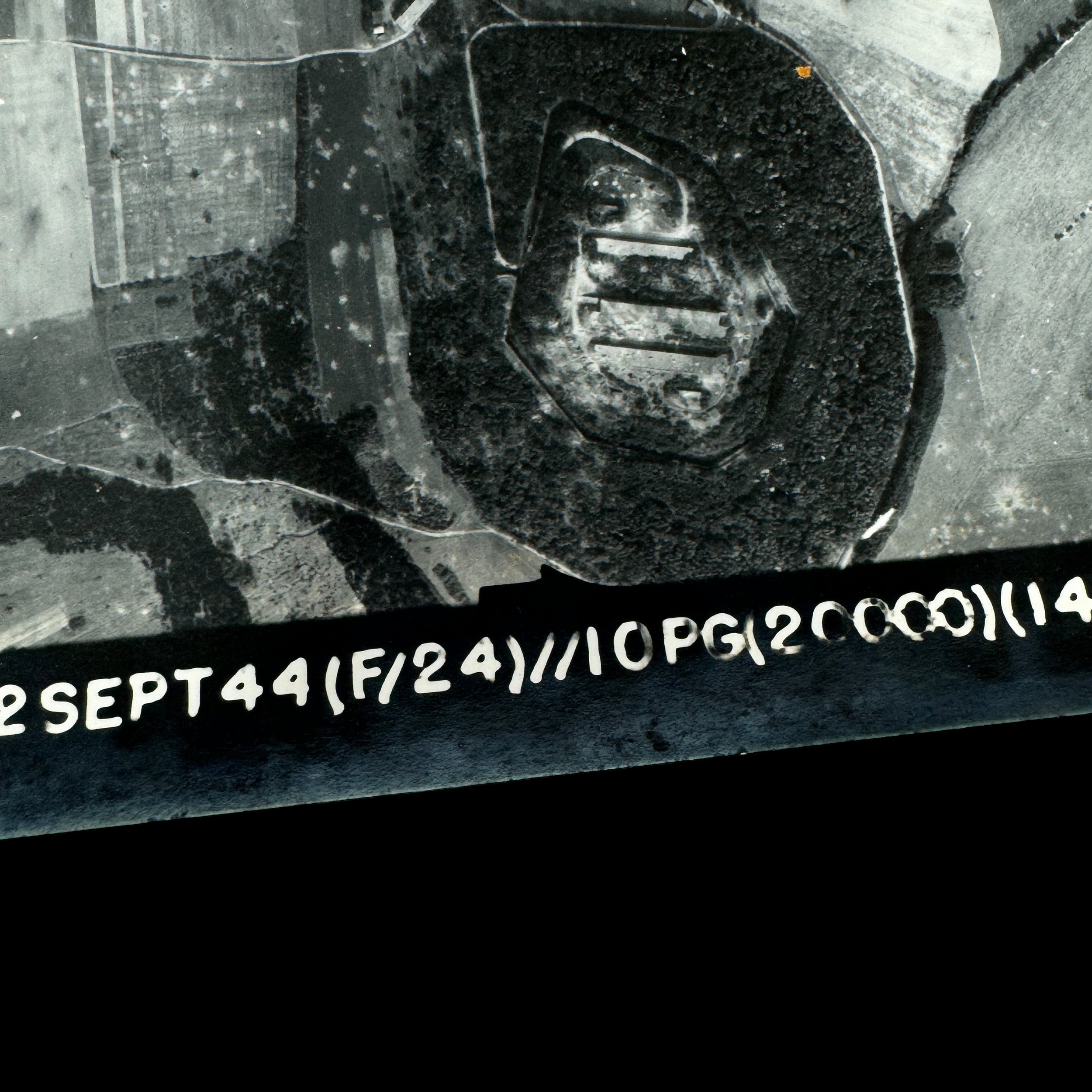
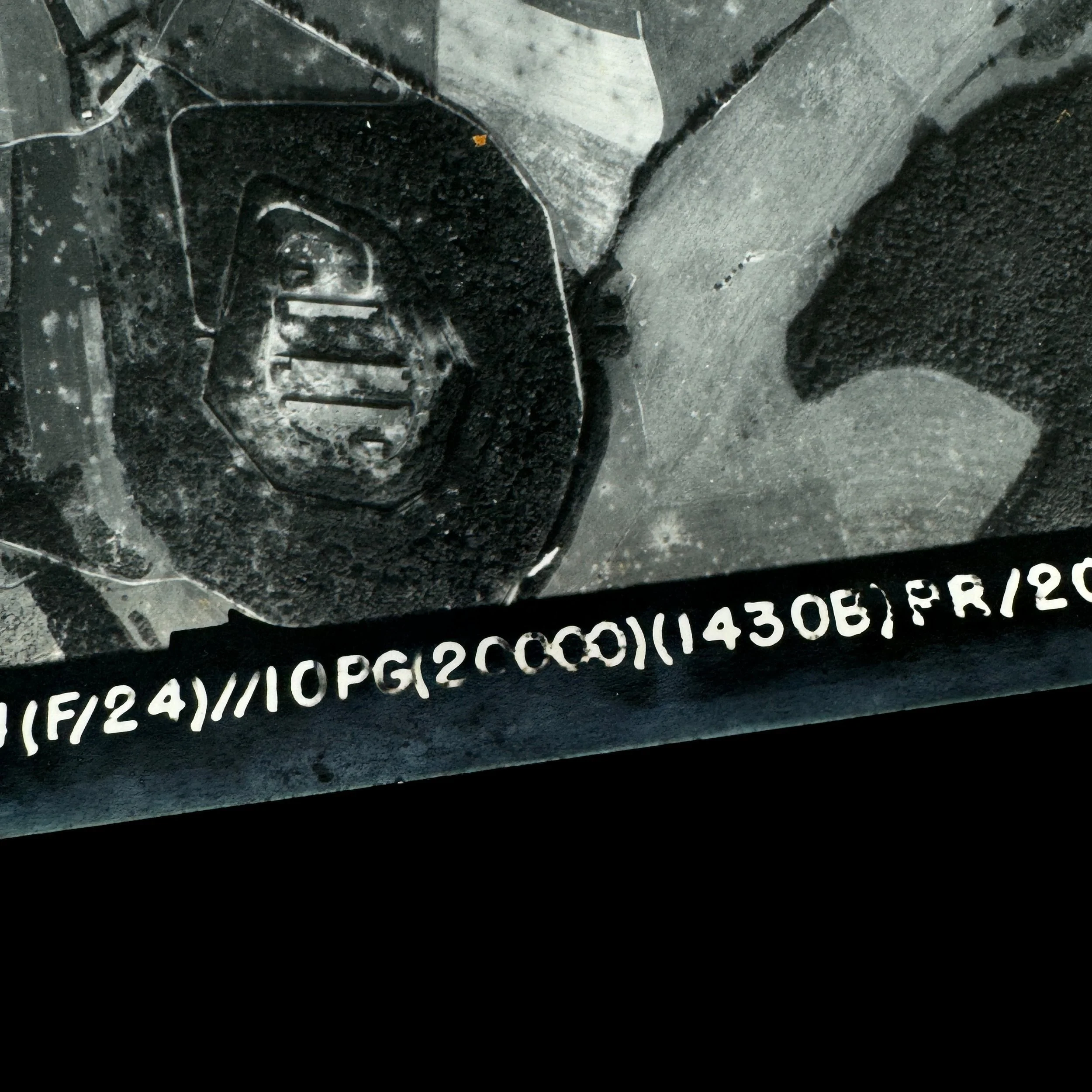
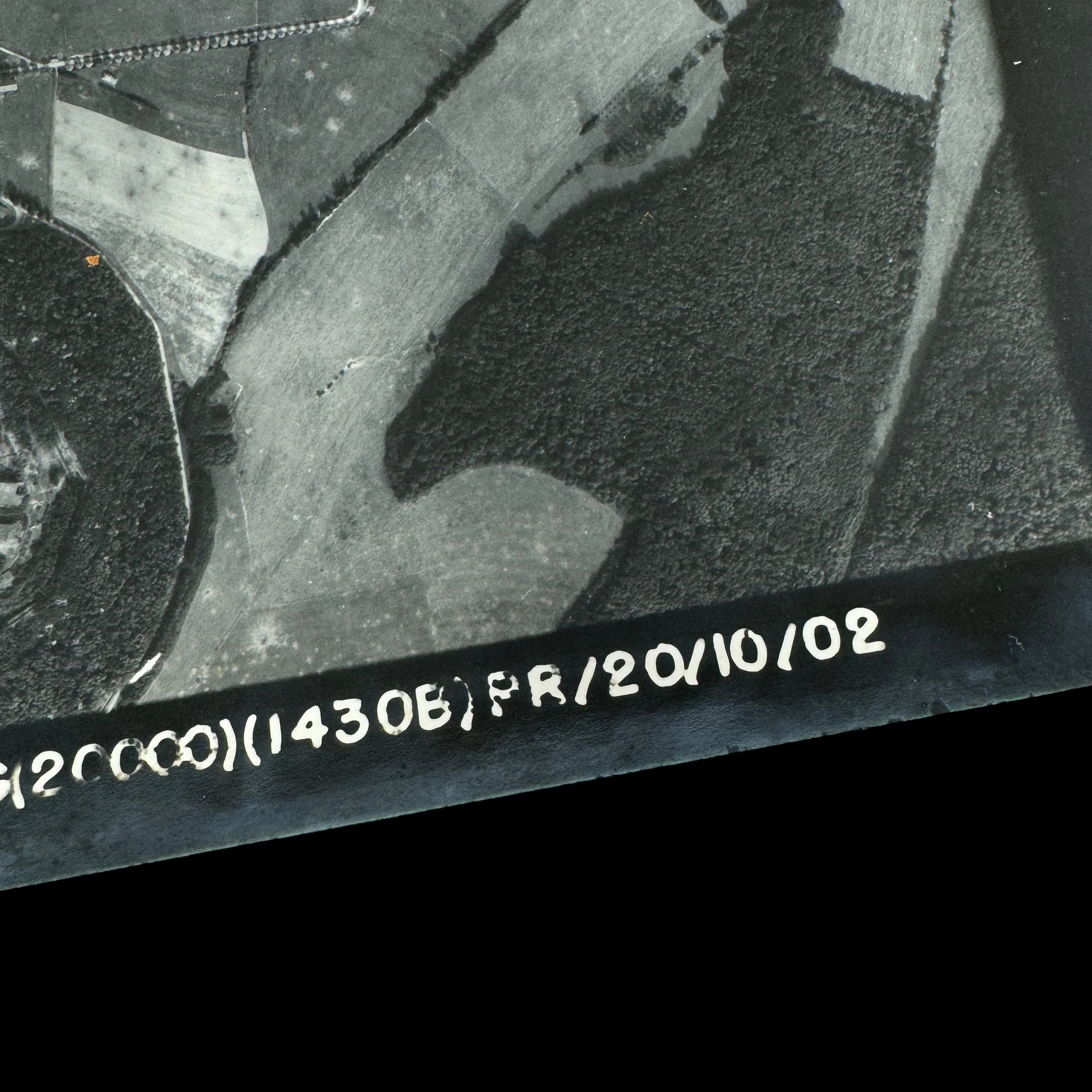
Mission Date: September 12th, 1944
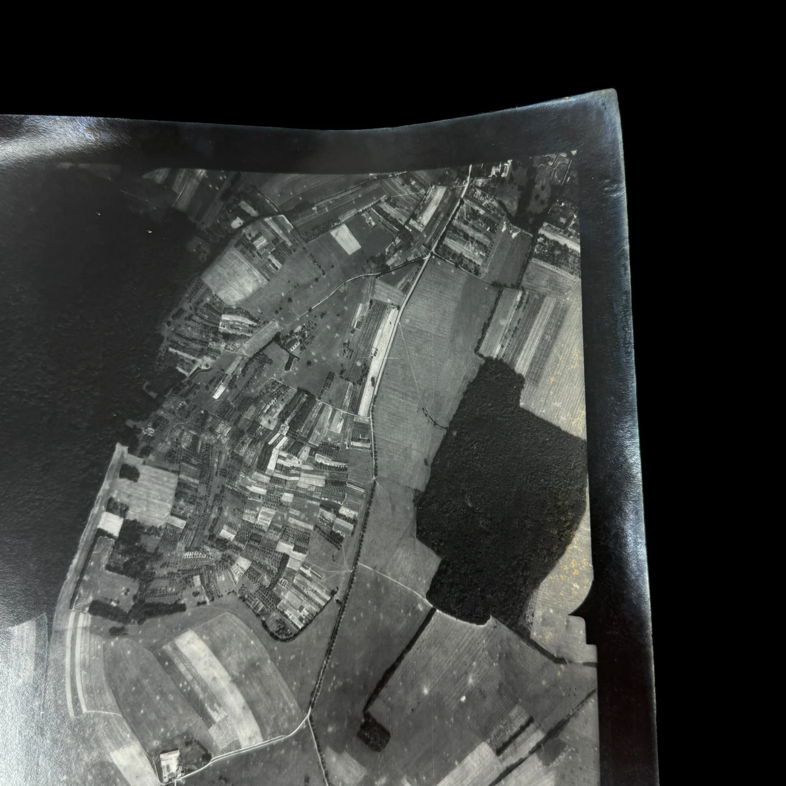
This mission by the Ninth Air Force’s 10th Photographic Group (Reconnaissance) took place during the Northern France and Rhineland Campaigns in direct support of General Patton’s rapidly advancing U.S. Third Army. The specific reconnaissance photograph was captured during a daylight mission flown by a P-51 Mustang pilot conducting tactical aerial reconnaissance. These missions provided critical intelligence for both ground and air operations by guiding U.S. artillery fire onto enemy positions and directing fighter-bombers to high-value German targets. From September through December 1944, the 10th Photographic Group played a vital role in supporting the Third Army’s push toward the fortified Siegfried Line.
From: World War II - European Theater
Air Force: Ninth Air Force - IX Tactical Air Command
Group: 10th Photographic Group (Reconnaissance)
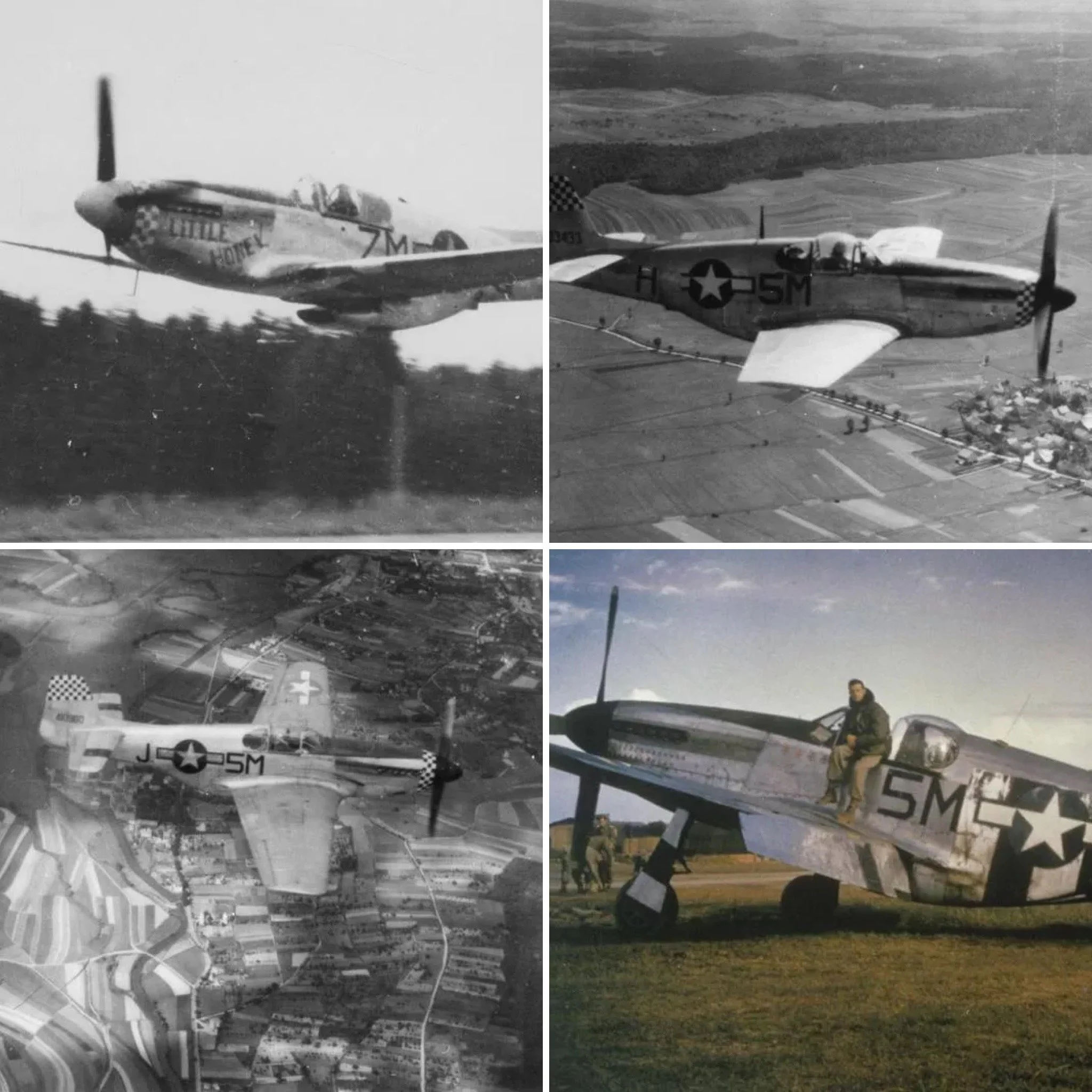
Aircraft: P-51 Mustang (F-6)
Size: 10 × 10 inches
This original aerial reconnaissance photograph was taken during one of the most critical periods of the Allied advance across Europe and represents the extraordinary role played by the P-51 Mustang in tactical aerial intelligence. Captured during a mission flown by the Ninth Air Force’s 10th Photographic Group (Reconnaissance), this aerial reconnaissance battlefield intelligence photograph reflects the daring precision of P-51 Mustang pilots who flew deep into enemy territory to gather critical information under hazardous conditions.
The story of the 10th Photographic Group (Reconnaissance) begins in 1941, when it was first constituted as the 73rd Observation Group on August 21 and activated shortly thereafter on September 1. In the years prior to overseas deployment, the unit engaged in intensive stateside training, including participation in the large-scale Tennessee Maneuvers of 1943. As the nature of warfare evolved, so too did the group’s designation and focus: it was redesignated as the 73rd Reconnaissance Group in April 1943, then as the 73rd Tactical Reconnaissance Group in August of that year. Finally, in December 1943, as preparations for the European campaign reached their peak, it became the 10th Photographic Group (Reconnaissance), the name it carried into combat.
Arriving in the European Theater between January and February 1944, the group became an integral part of the Ninth Air Force. From its arrival through to V-E Day, the 10th Photographic Group employed a wide variety of aircraft for its missions—including F-3s, F-5s, F-6s (the reconnaissance variant of the P-51 Mustang), and light liaison aircraft like the L-1, L-4, and L-5. But it was the F-6 P-51 Mustang that emerged as one of the most formidable reconnaissance platforms of the war. Its exceptional range, speed, and maneuverability enabled it to evade enemy defenses while capturing razor-sharp imagery from low and high altitudes alike.
The group’s reputation was cemented in May 1944, just before D-Day, when it was awarded a Distinguished Unit Citation (DUC) for flying low-level missions to photograph the heavily fortified Atlantic coastline from Blankenberghe to Dunkirk and from Le Touquet to St-Vaast-la-Hougue. These photos were essential in finalizing invasion plans for Operation Overlord. In the weeks that followed, the 10th Photographic Group’s Mustangs flew day and night reconnaissance missions over northern France, scouting bridges, artillery positions, road junctions, airfields, and enemy traffic nodes. Their intelligence was not only used for real-time targeting but also for post-strike bomb damage assessments, giving commanders a clear picture of where to strike next and what German resources were left intact.
From the summer of 1944 through the winter campaigns, including the drive toward the Siegfried Line and the brutal Battle of the Bulge, the F-6 Mustangs were constantly in the air, braving flak and enemy fighters to provide real-time updates for General Patton’s fast-moving Third Army. These pilots did not just observe—they directed U.S. artillery fire onto enemy emplacements, marked key targets for fighter-bomber squadrons, and ensured that Allied forces remained one step ahead in a rapidly changing battlefield.
Following the Rhine crossing in early 1945, the 10th Photographic Group continued to serve on the front lines of intelligence gathering, supporting the Allied push into Czechoslovakia and Austria until the final days of the war. Their photographs offered commanders at every level a direct window into enemy defenses, fortifications, and movements, enabling swift and strategic responses.
After the war, the unit remained in Germany as part of the occupation forces under the United States Air Forces in Europe and was redesignated the 10th Reconnaissance Group in June 1945. In 1947, it returned to the United States without personnel or equipment, was later remanned and reequipped with RF-51 Mustangs, and received its final wartime designation as the 10th Tactical Reconnaissance Group in 1948 before being inactivated in April 1949.
This photograph—captured through the lens of a P-51 Mustang—epitomizes the bravery, speed, and unmatched capability of America’s premier reconnaissance aircraft. It is a rare, museum-grade artifact from a unit whose work directly influenced the course of the war. In the words of German General Werner von Fritsch, “The military organisation with the best aerial reconnaissance will win the next war.” With the P-51 Mustang leading the charge, the Allies proved that prediction true.
Full Combat History of the 10th Photo Group:
10th Photogroup Campaigns. American Theater; Air Offensive, Europe; Normandy; Northern France; Rhineland; Ardennes-Alsace; Central Europe
Decorations. Distinguished Unit Citation: France, 6-20 May 1944
The 10th Reconnaissance Group served with the Ninth Air Force in Europe from May 1944 until the end of the fighting, helping to support the D-Day landings, the advance across France and the invasion of Germany. The group was originally formed as the 73rd Observation Group in August 1941. It spent several years based in the United States, taking part in the Tennessee Manoeuvres of 1943 and preparing for action overseas. During this period the group changed name several times, becoming the 10th Photographic Group (Reconnaissance) in December 1943. In January-February 1944 the group moved to Europe to join the Ninth Air Force, entering combat in February. At that stage it contained the 30th and 39th Photographic Reconnaissance Squadrons, but it quickly expanded. In March the 31st and 34th joined although the 39th left. In May the 33rd and 155th joining, bringing it up to five squadrons. In June 1944 the group lost the 30th and 33rd but gained the 12th and 15th. The 34th went in October 1944, reducing to four squadrons. In February 1945 it gained the 39th but lost the 155th. In March it lost the 39th and in April it briefly gained the 162nd. The group was heavily involved in the preparations for the D-Day landings. In May it flew ten particularly dangerous missions to take very low level photos of the landing beaches and nearby shallow waters, in an attempt to map out the underwater obstacles being built. These were flow from as little as 15ft, and won the unit a Presidential unit citation (as well as costing the life of one pilot). The group also photographed German installations along and just behind wide areas of the French coast. During the D-Day assault itself the group helped direct naval gunfire and also covered vital German transport links. By the end of July 1944 the group had completed the move to France. The unit took part in the siege of Brest (August-September 1944), helping to direct the Allied artillery fire. During the breakout from Normandy the group helped support the advancing troops, once again directly artillery fire onto German targets. In September-December 1944 the group was used to support the Third Army as it attacked the German western fortifications of the Siegfried Line. In the period before the battle of the Bulge the group spotted some German movement behind their lines, but not enough to reveal the upcoming attack. Poor weather limited their efforts in early December, stopping all flying on four days. Once the attack began the group was used over the battle area. By 1945 the group's main task was to direct the fighter-bombers and medium bombers that were roaming behind German lines, supporting the advance of the Third Army into southern Germany, Austria and Czechoslovakia.
Main Bases:
Chalgrove, England: Feb 1944
Rennes/St- Jacques, France: c. 11 Aug 1944
Chateaudun, France: c. 24 Aug 1944
St-Dizier/ Robinson, France: Sep 1944
Conflans/ Doncourt, France: Nov 1944
Trier/Evren, Germany: Mar 1945
Ober Olm, Germany: c. 5 Apr 1945
Furth, Germany: c. 28 Apr 1945
Full History of WWII Aerial Photographs:
World War II stands as one of the most pivotal moments in human history, with its impact reverberating across the globe for decades to come. Amidst the tumultuous battles and strategies of this era, aerial reconnaissance emerged as a critical tool that would prove instrumental in shaping the course of the conflict. The Allied forces, recognizing its potential, harnessed the power of aerial photography to gather intelligence, make informed decisions, and ultimately secure victory against their adversaries.
Aerial reconnaissance, the practice of obtaining visual information from the skies, rapidly established itself as an essential method of gathering intelligence during World War II. The speed and accuracy with which reconnaissance photographs could be obtained and analyzed revolutionized the way military operations were conducted. The European Theater, where Allied forces clashed with the Axis powers, witnessed the extensive utilization of aerial reconnaissance photographs that played a decisive role in shaping strategic decisions.
At its core, Allied aerial reconnaissance in World War II can be classified into two primary categories: mapping and damage assessment. Mapping involved capturing high-resolution images of enemy territories to create accurate and up-to-date maps. These maps proved invaluable for ground forces, enabling them to navigate and strategize effectively in unfamiliar terrain. The rapidity with which aerial reconnaissance photos could be developed and interpreted meant that front-line troops could receive critical geographical information within hours of the photographs being taken. This ability to promptly supply accurate maps endowed Allied commanders with a substantial advantage, facilitating swift and decisive movements across the battlefield.
Beyond mapping, damage assessment was another vital application of aerial reconnaissance. As targets were attacked by Allied forces, aerial photographs captured the destruction and allowed analysts to evaluate the extent of the damage inflicted on enemy installations, such as factories, supply lines, and infrastructure. This capability not only aided in gauging the effectiveness of previous strikes but also helped determine when a target should be re-attacked. The ability to time subsequent strikes accurately based on the analysis of reconnaissance photographs was a crucial aspect of optimizing offensive efforts and weakening the enemy's ability to rebuild and regroup.
The significance of photographic reconnaissance and intelligence work during World War II cannot be overstated. One of the most remarkable aspects was the speed at which valuable information could be obtained and disseminated. Within hours of a reconnaissance mission, film could be developed, prints produced, and photographs analyzed. This level of efficiency provided commanders with a near-real-time understanding of enemy movements, installations, and strengths, enabling them to adapt their strategies swiftly.
In the European Theater, where the conflict unfolded on a grand scale, aerial reconnaissance proved to be a game-changer. The landscapes across Western Europe were diverse, ranging from densely populated cities to vast rural expanses. Aerial photographs allowed Allied forces to comprehend the lay of the land, which was especially crucial during the Normandy invasion in 1944. The famous Operation Overlord, which marked the Allied landing in Normandy, was meticulously planned with the aid of reconnaissance photographs. These images provided invaluable insights into the geography, terrain, and enemy fortifications, facilitating the strategic decisions that led to the successful establishment of a beachhead and the eventual liberation of Western Europe.
General Werner Von Fritsch's observation in 1938, that the military organization with superior aerial reconnaissance would triumph in the next war, echoed with prophetic accuracy throughout World War II. The Allies embraced this principle wholeheartedly, harnessing the power of aerial photography to gain a decisive edge over their adversaries. By diligently cataloging enemy activities, locating new installations, and assessing damages, they ensured that their strategic decisions were informed by concrete evidence. The intelligence derived from reconnaissance photographs enabled them to allocate resources effectively, target key enemy assets, and adjust their tactics swiftly in response to changing circumstances.
In conclusion, World War II Allied aerial reconnaissance photographs stand as a testament to the potency of intelligence-gathering methods in shaping the course of history. The swift acquisition, analysis, and utilization of visual information from the skies enabled the Allies to make informed decisions and secure victory against formidable odds. Through mapping and damage assessment, they gained a critical advantage on the battlefield, optimizing their strategies and hastening the path to triumph. The legacy of their pioneering efforts in aerial reconnaissance continues to reverberate in the annals of military history, demonstrating the pivotal role that intelligence-gathering techniques play in shaping the outcomes of conflict.