RARE! WWII 1944 CONFIDENTIAL "Marshall Islands & Gilbert Islands - U.S. Army Air Force Pacific Theater Pilot’s Flight Chart (Double-Sided)


RARE! WWII 1944 CONFIDENTIAL "Marshall Islands & Gilbert Islands - U.S. Army Air Force Pacific Theater Pilot’s Flight Chart (Double-Sided)
Comes with a hand signed Certificate of Authenticity.
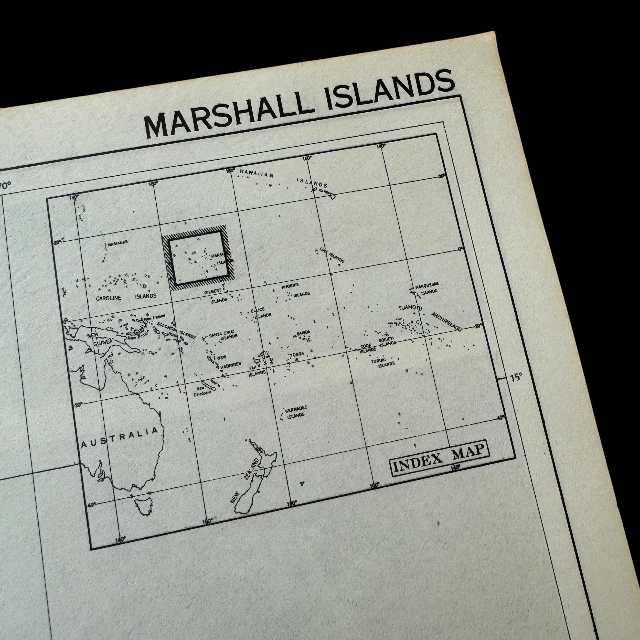
Size: 14 × 17 inches
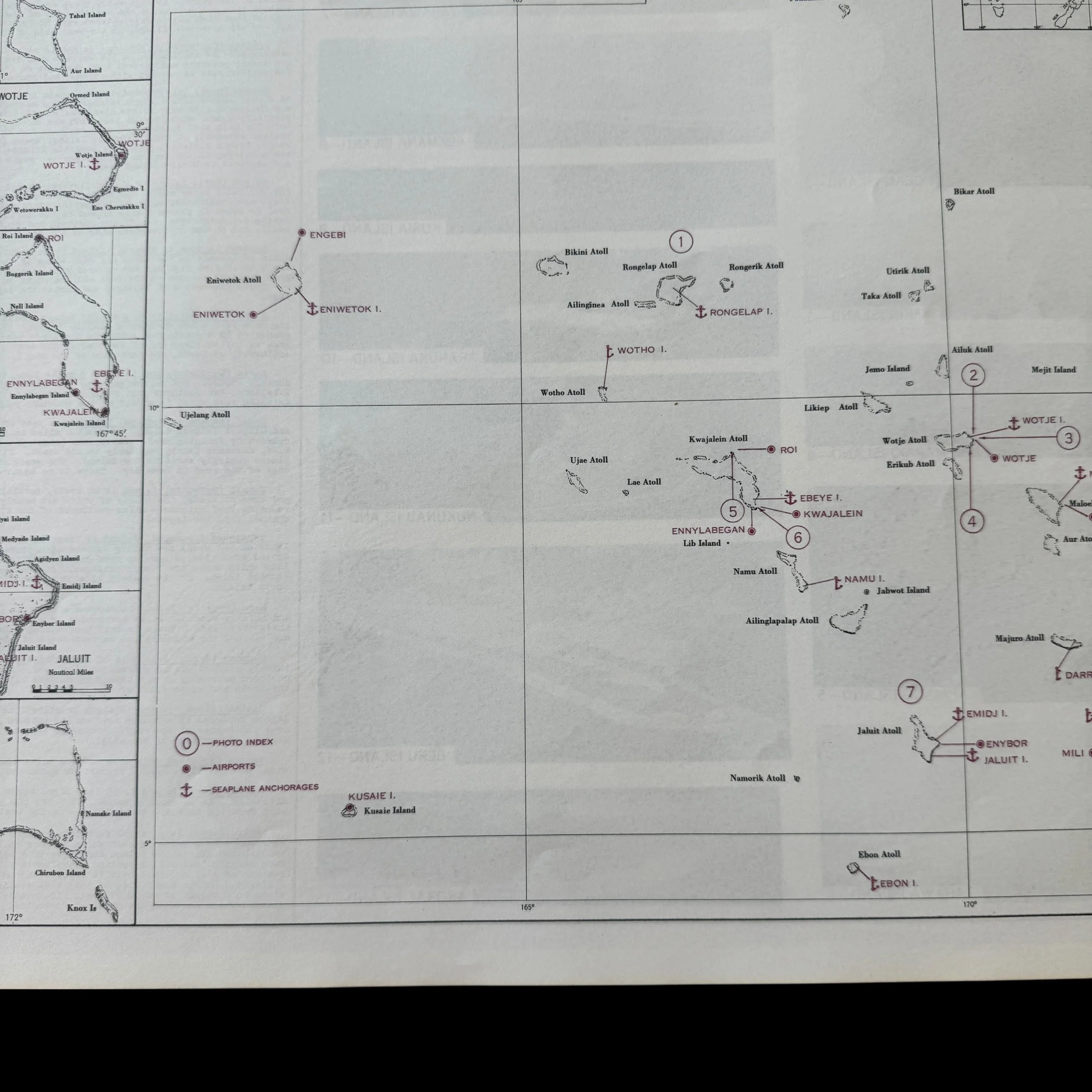
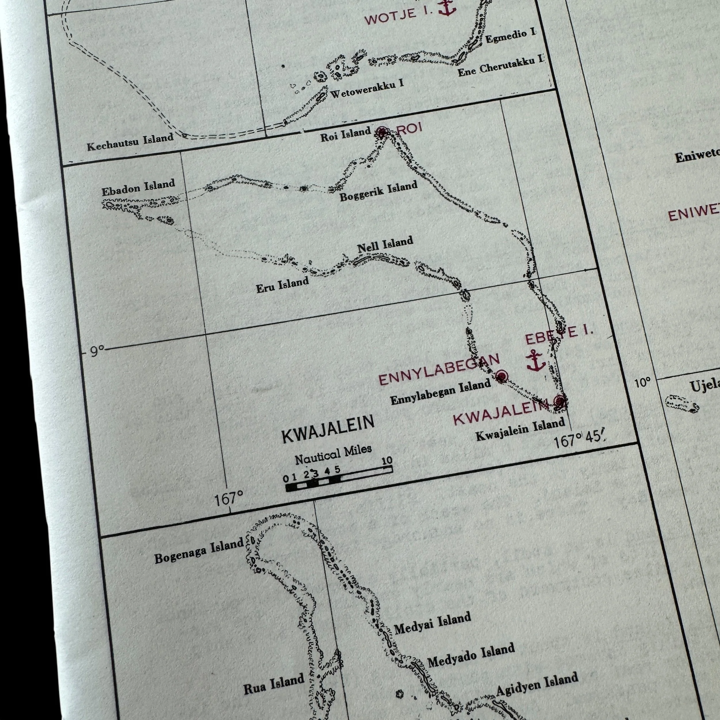
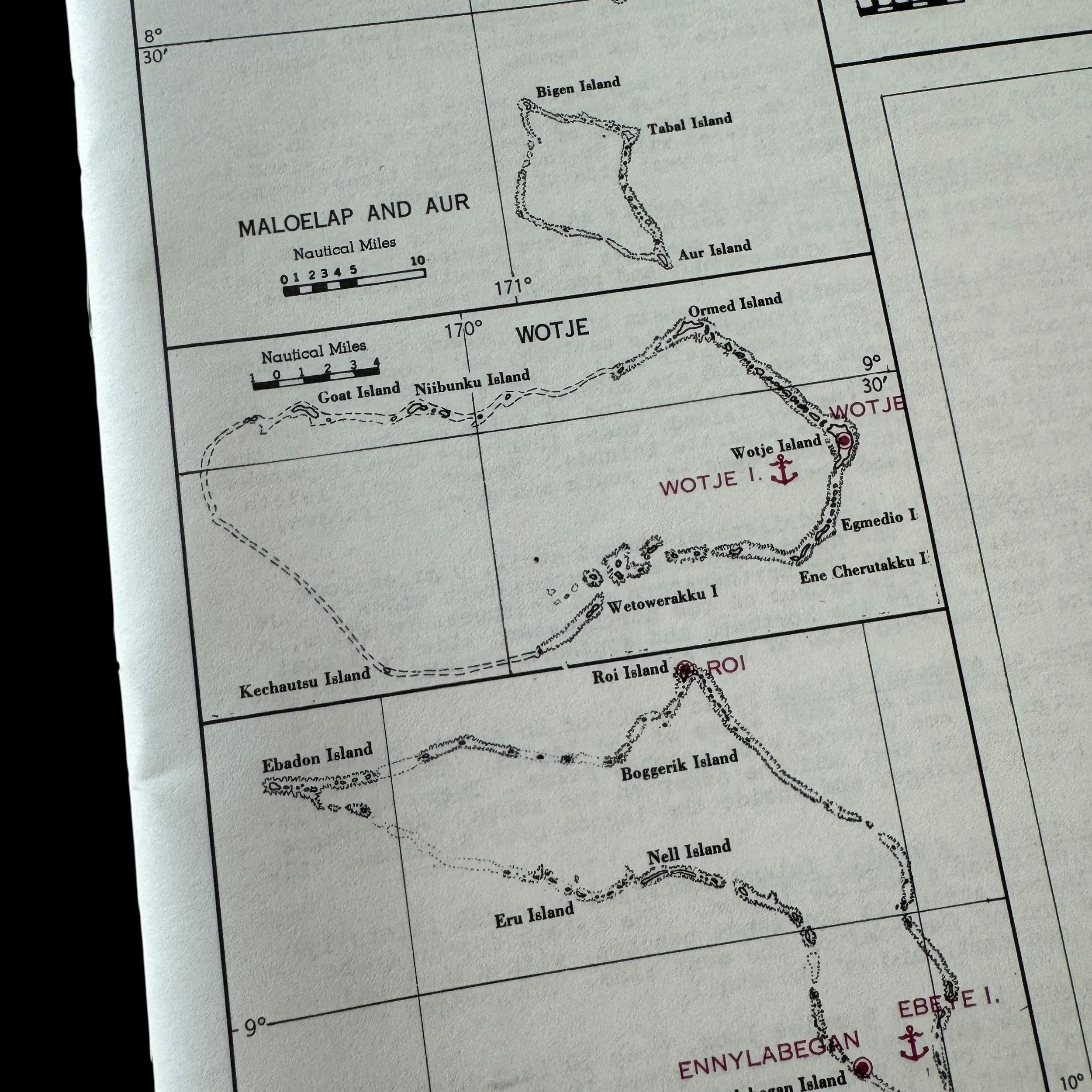
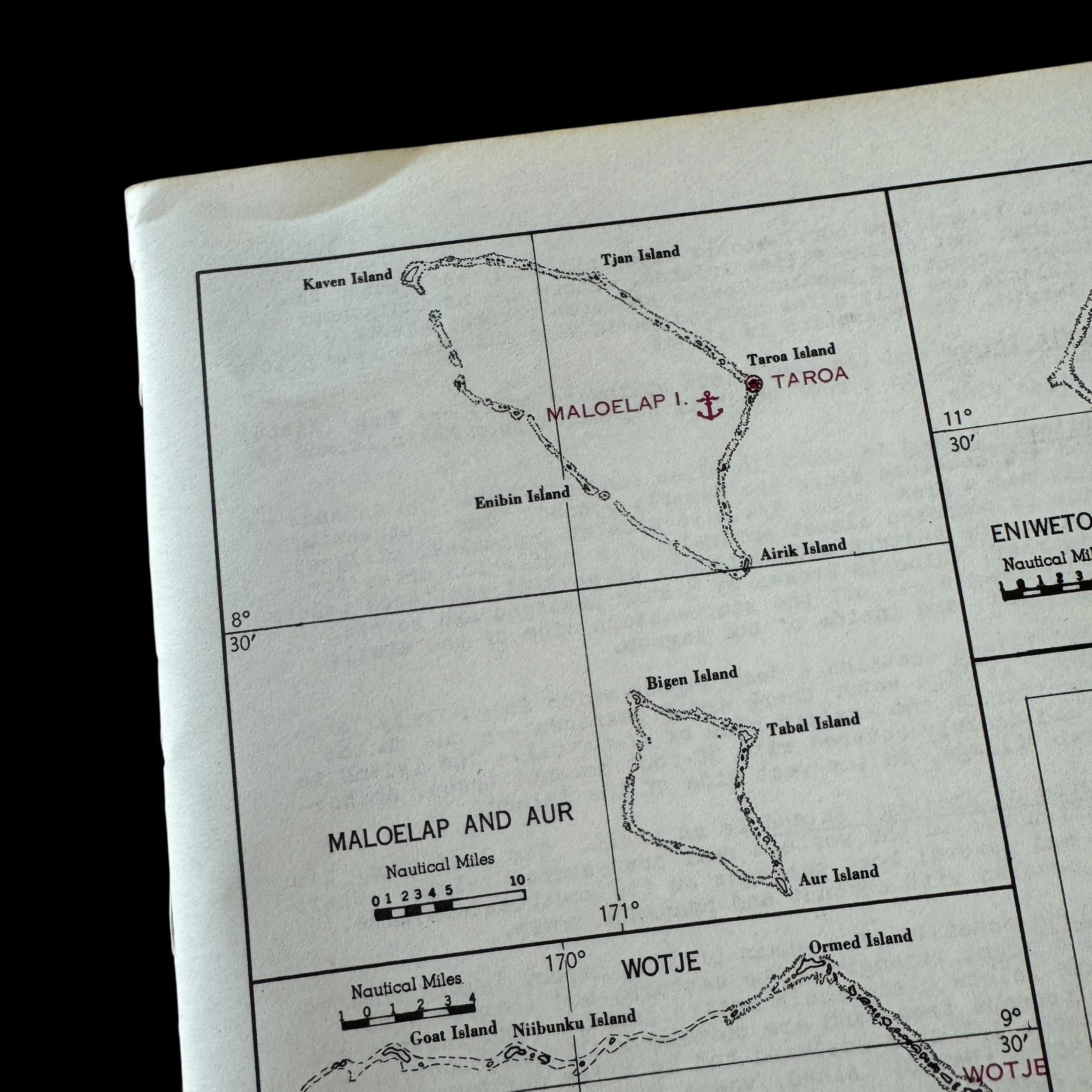
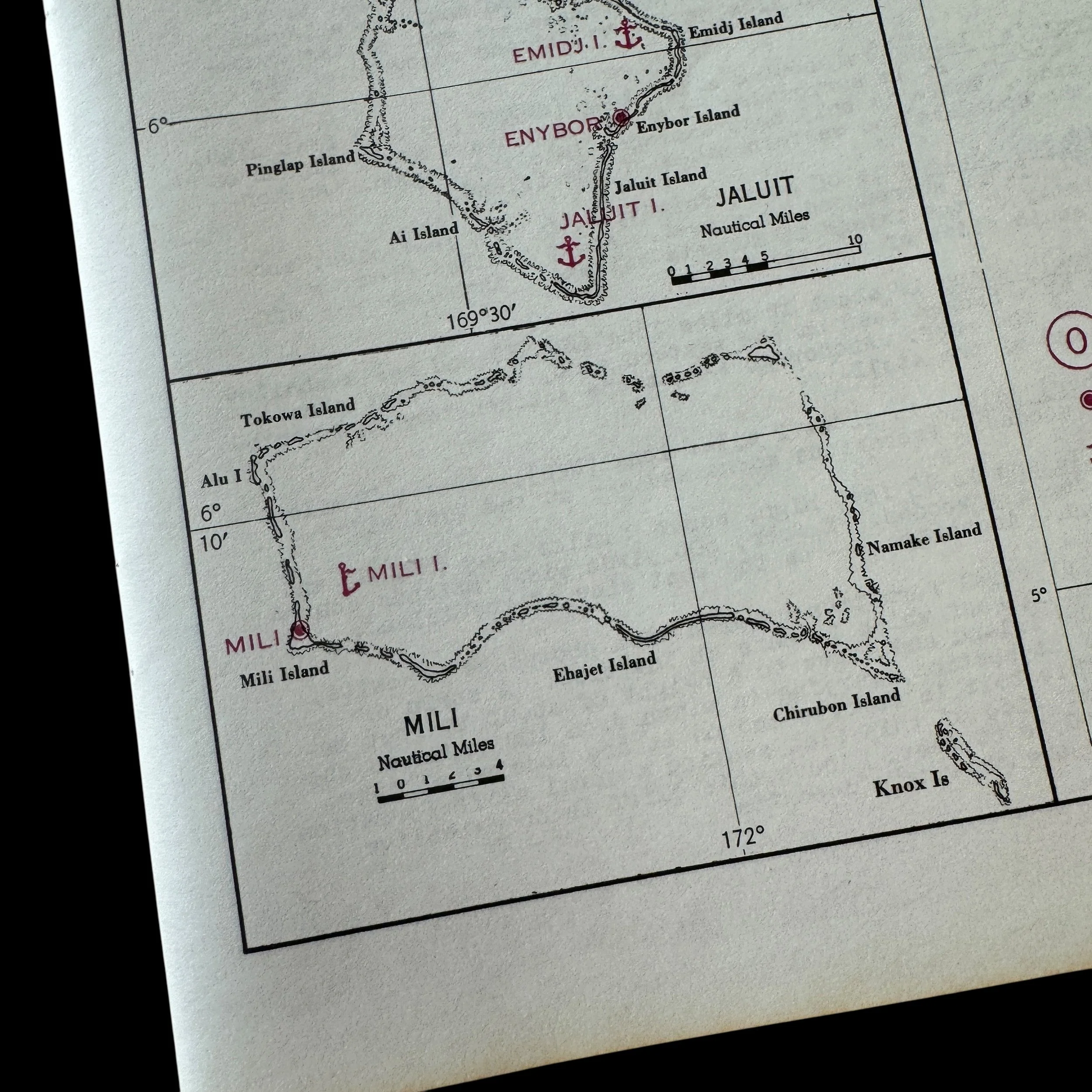
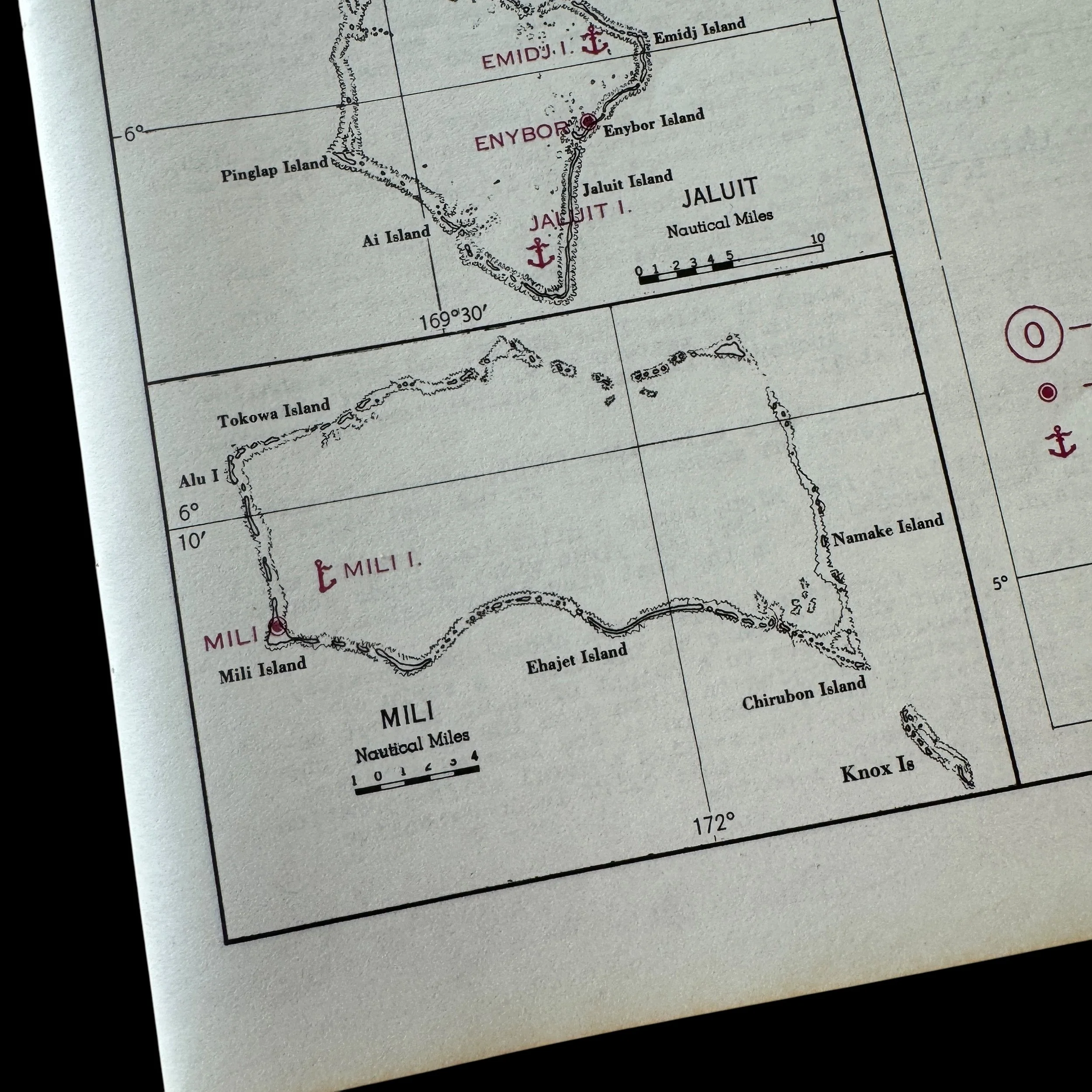
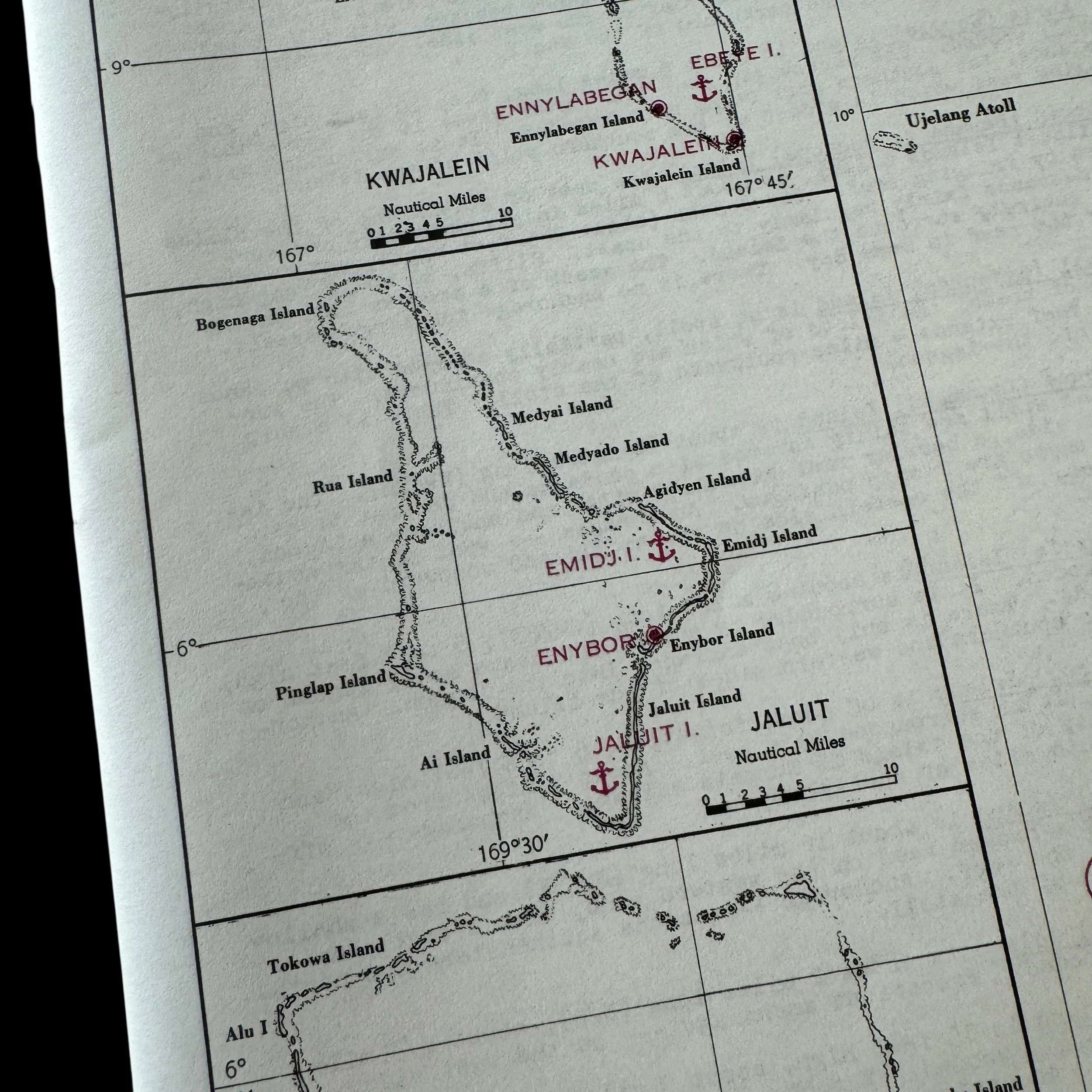
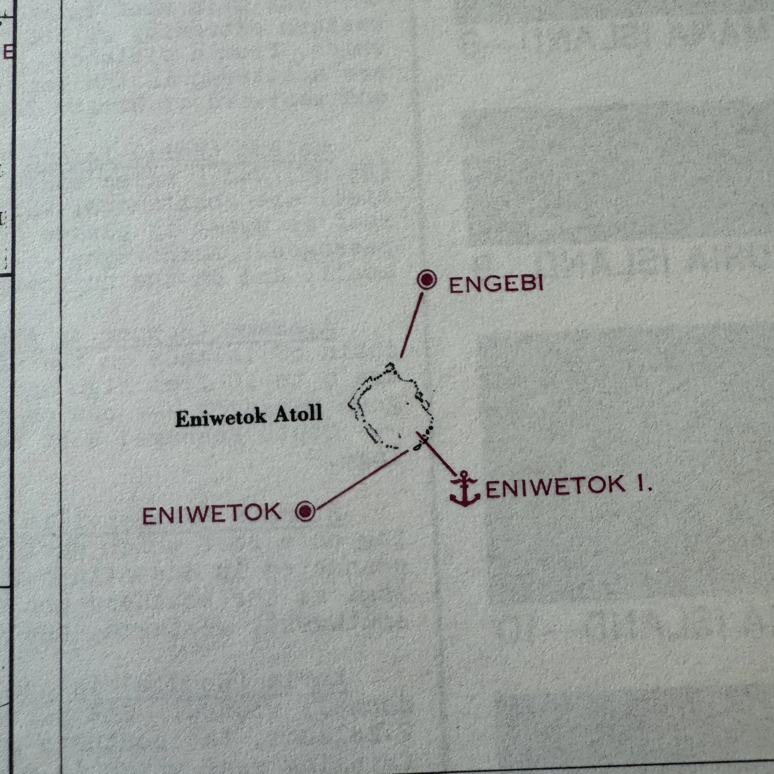
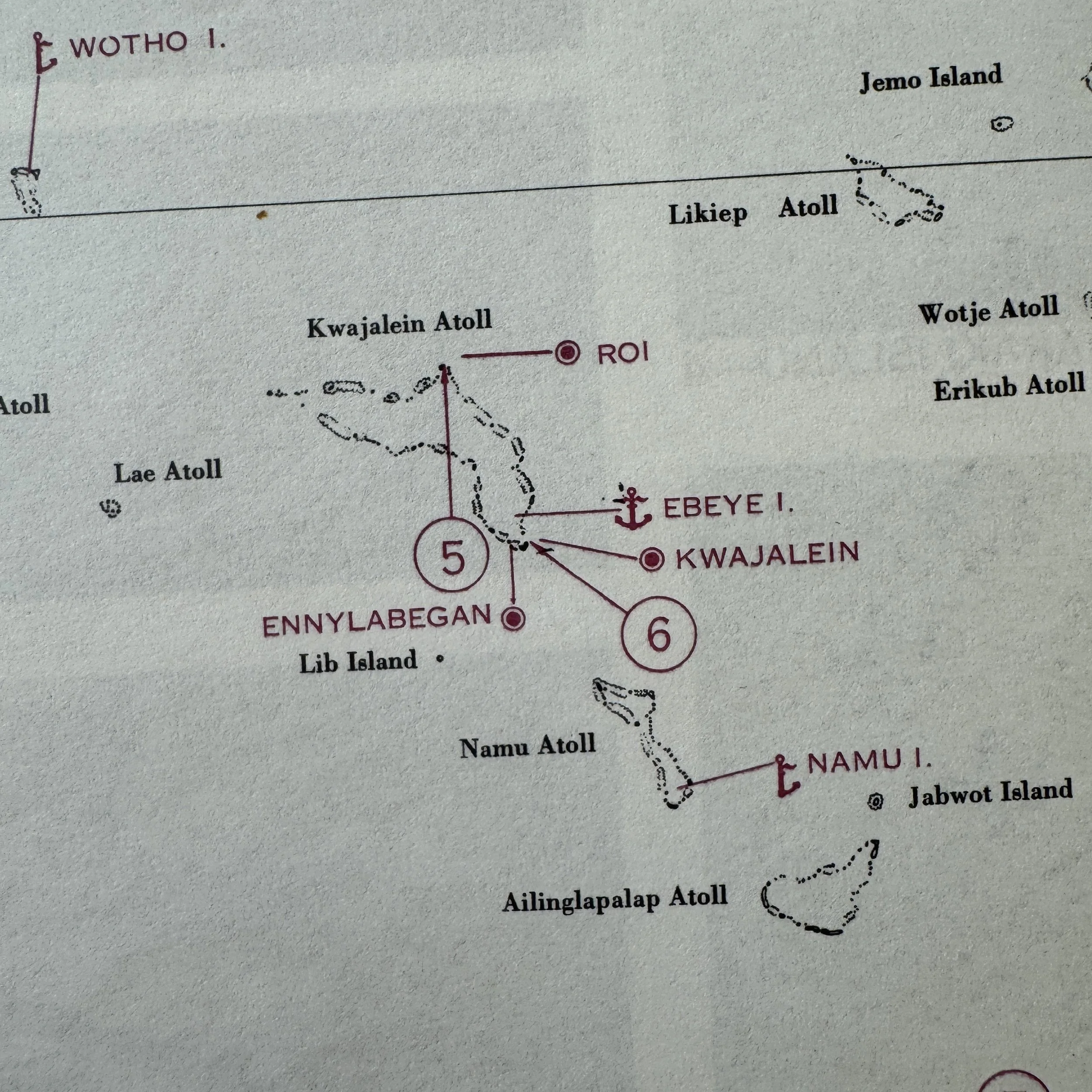
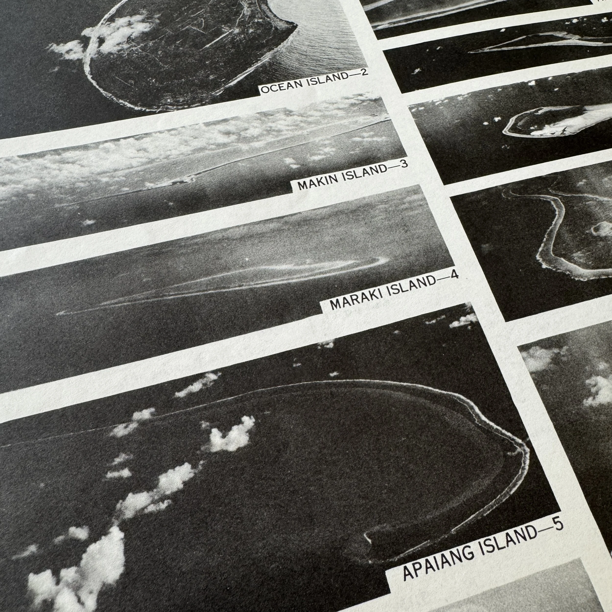
Contains Marshall and Gilbert Island of: Tarawa Island, Makin Island, Beru Island, Kwajalein Island, Eniwetok Island, Wotje Island, etc.
This exceptionally rare, museum-grade World War II artifact is an original CONFIDENTIAL double sided pilot’s flight chart dated January 1944 and specially produced by the Assistant Chief of Air Staff Intelligence at Headquarters Army Air Force in Washington, D.C. Issued in extremely limited quantities, this chart was distributed only to U.S. Army Air Forces Squadron Groups and Headquarters and intended for direct use aboard operational aircraft under the authority of commanding officers.
Because of its highly classified nature, strict destruction orders accompanied every chart. If an aircraft carrying this document was forced down over enemy controlled territory, the chart was to be destroyed by burning. If ditched at sea, it was to be sunk by the most practical method to prevent capture by Japanese forces. Containing vital navigation data and runway and lagoon landing guidance for key island targets in the Central Pacific, this chart was an essential operational tool for combat pilots and navigators during World War II.
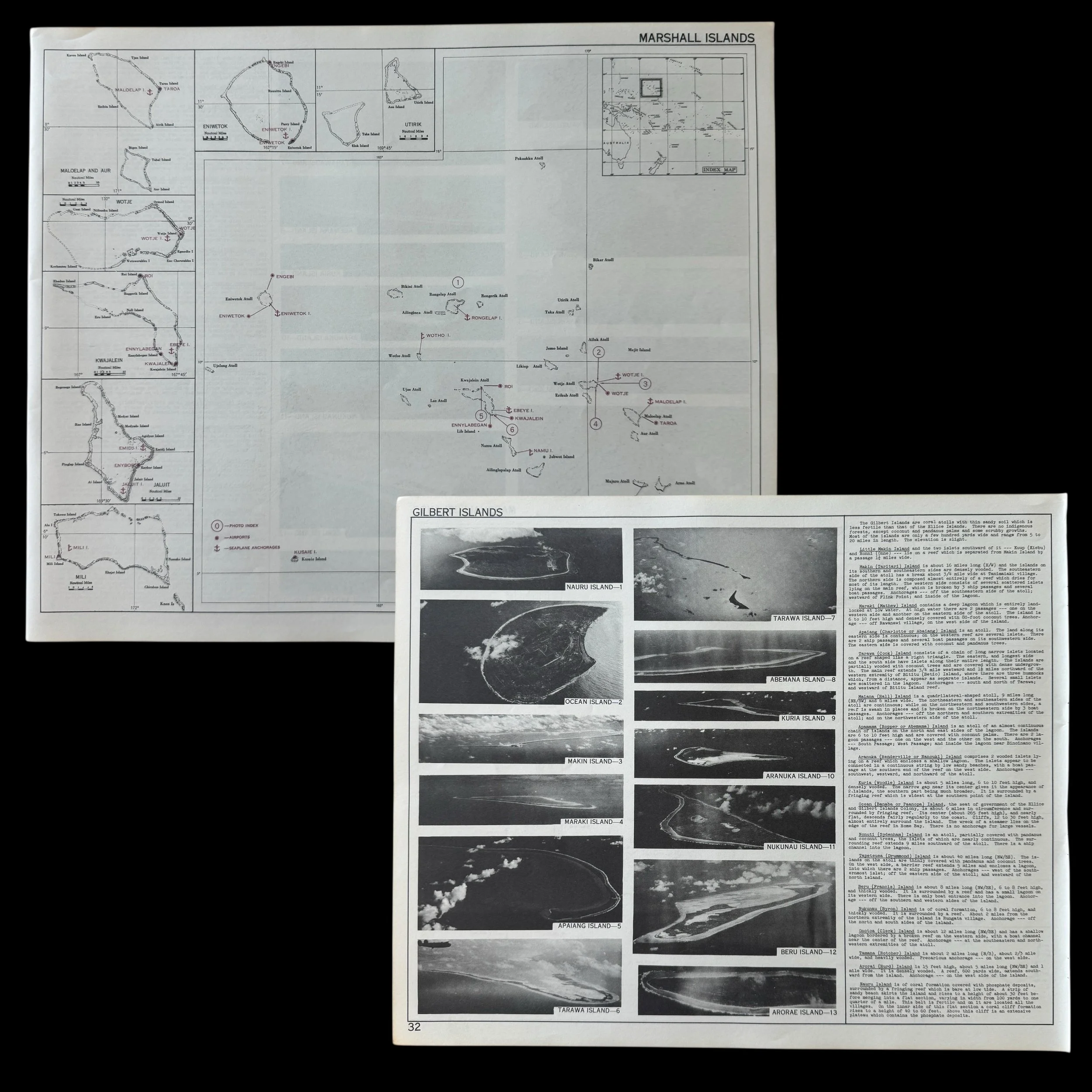
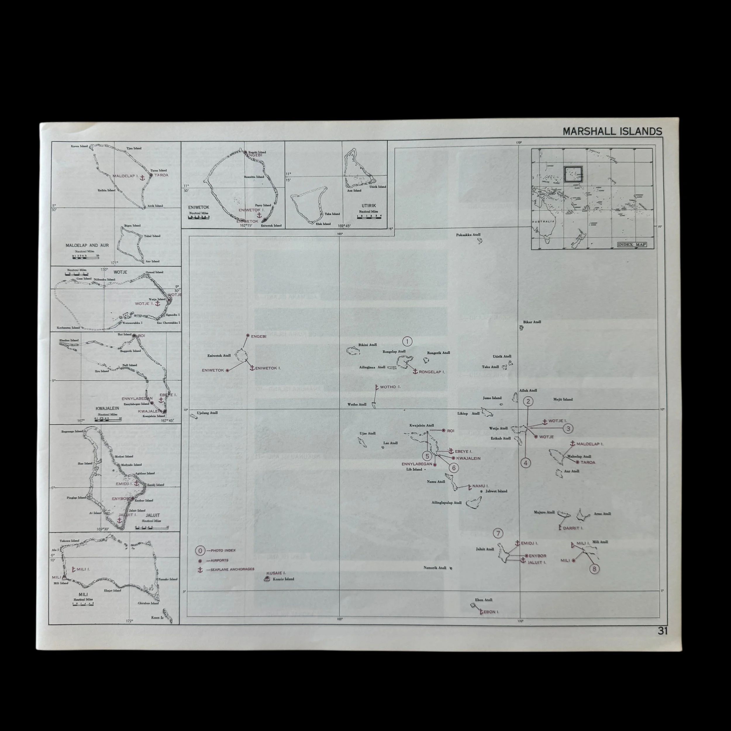
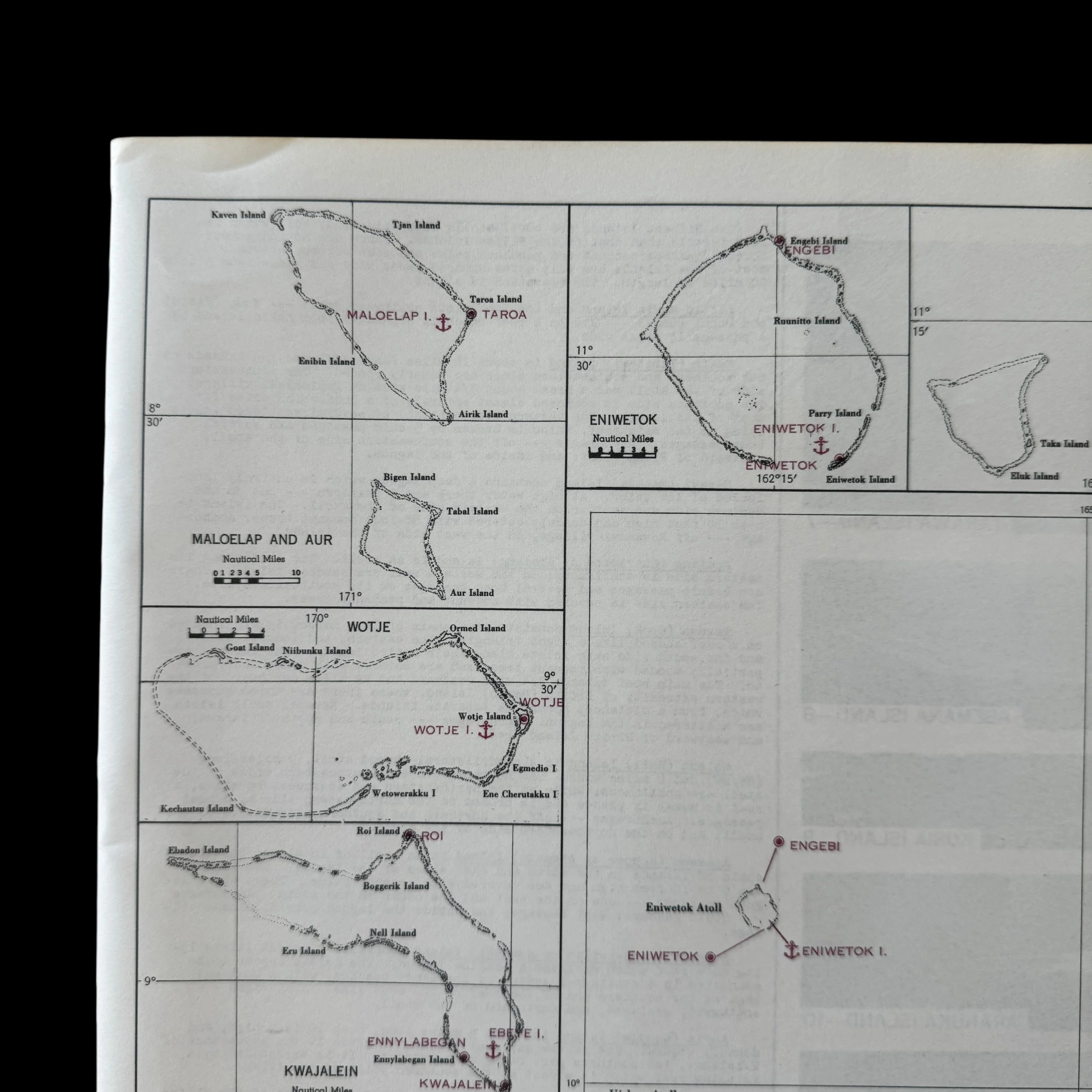
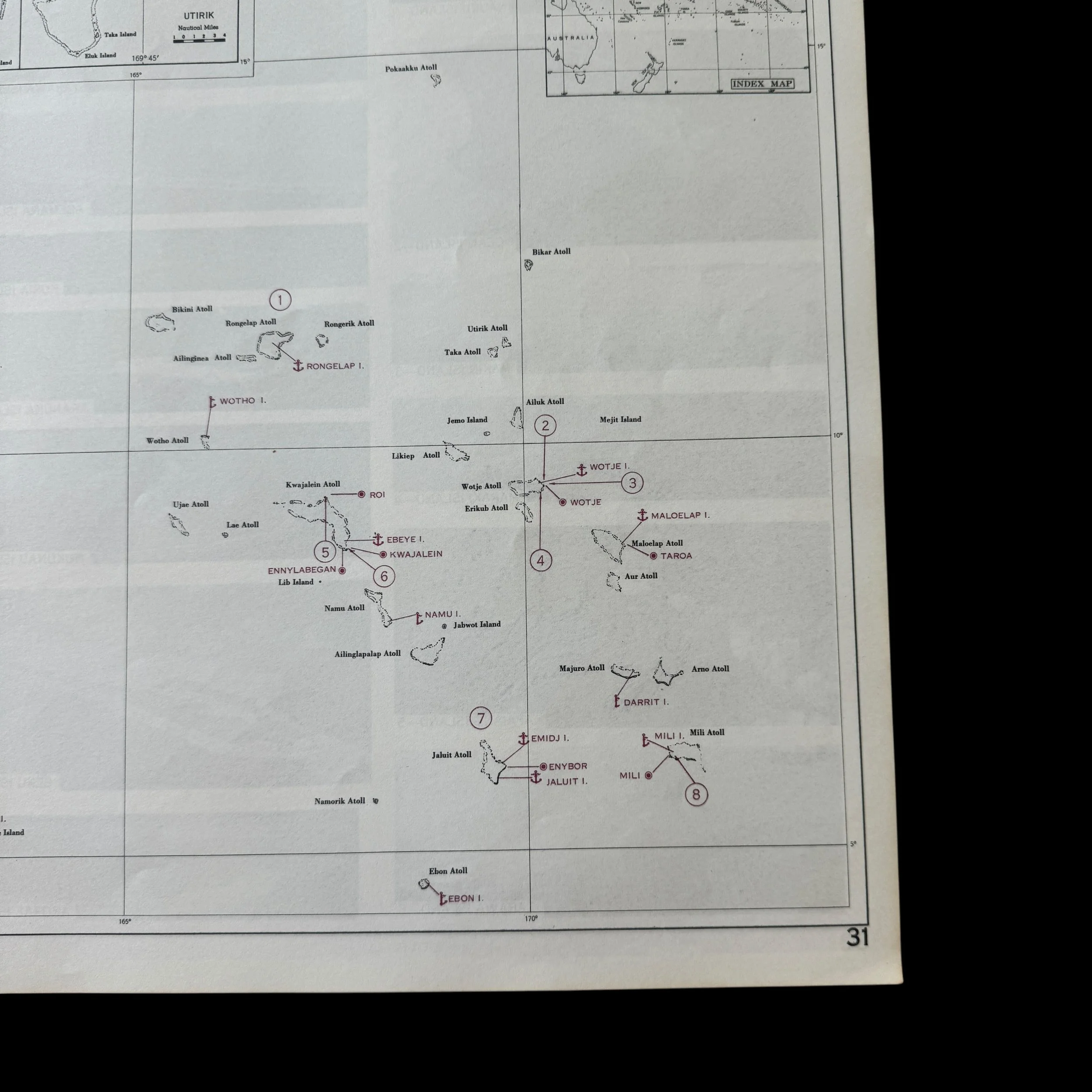
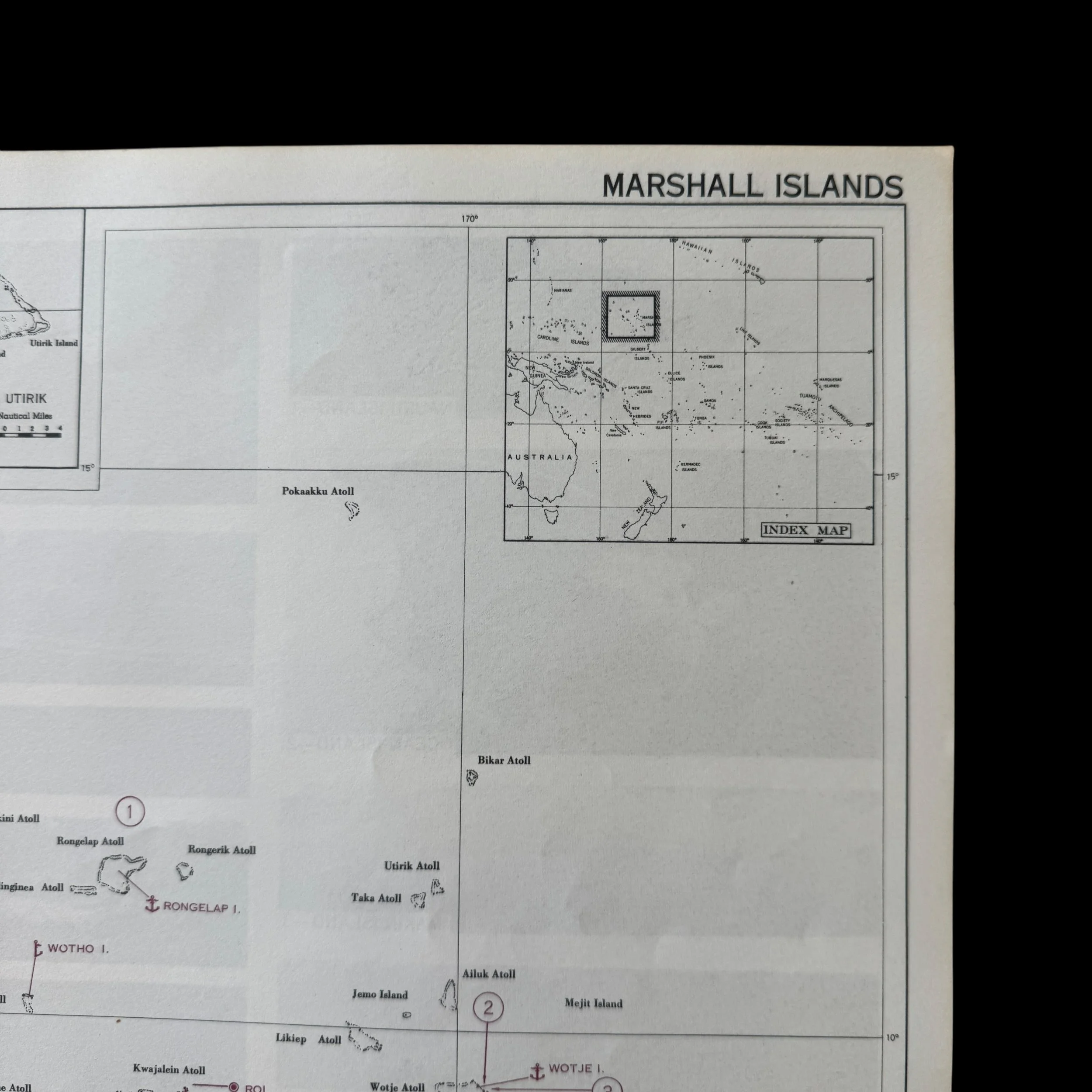
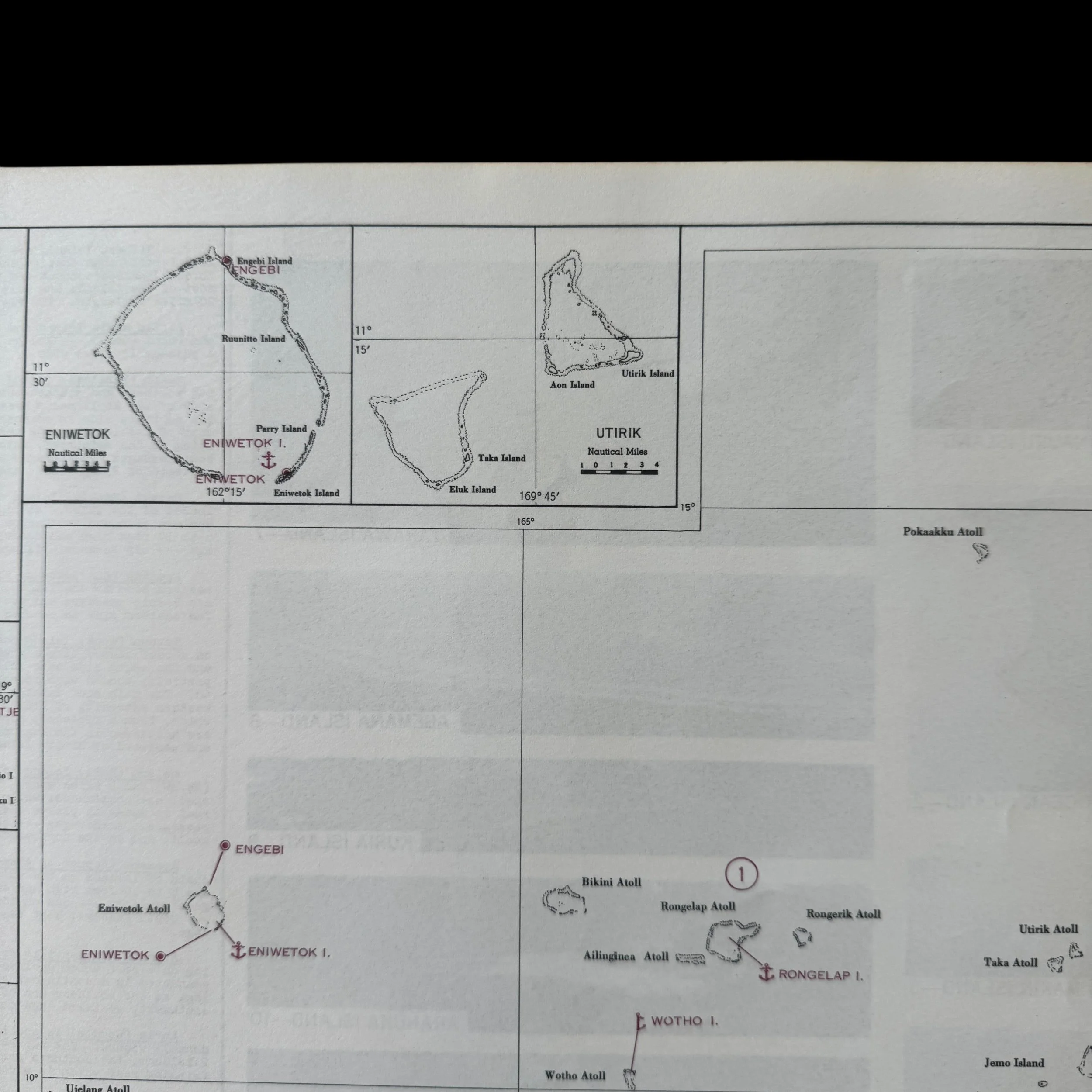
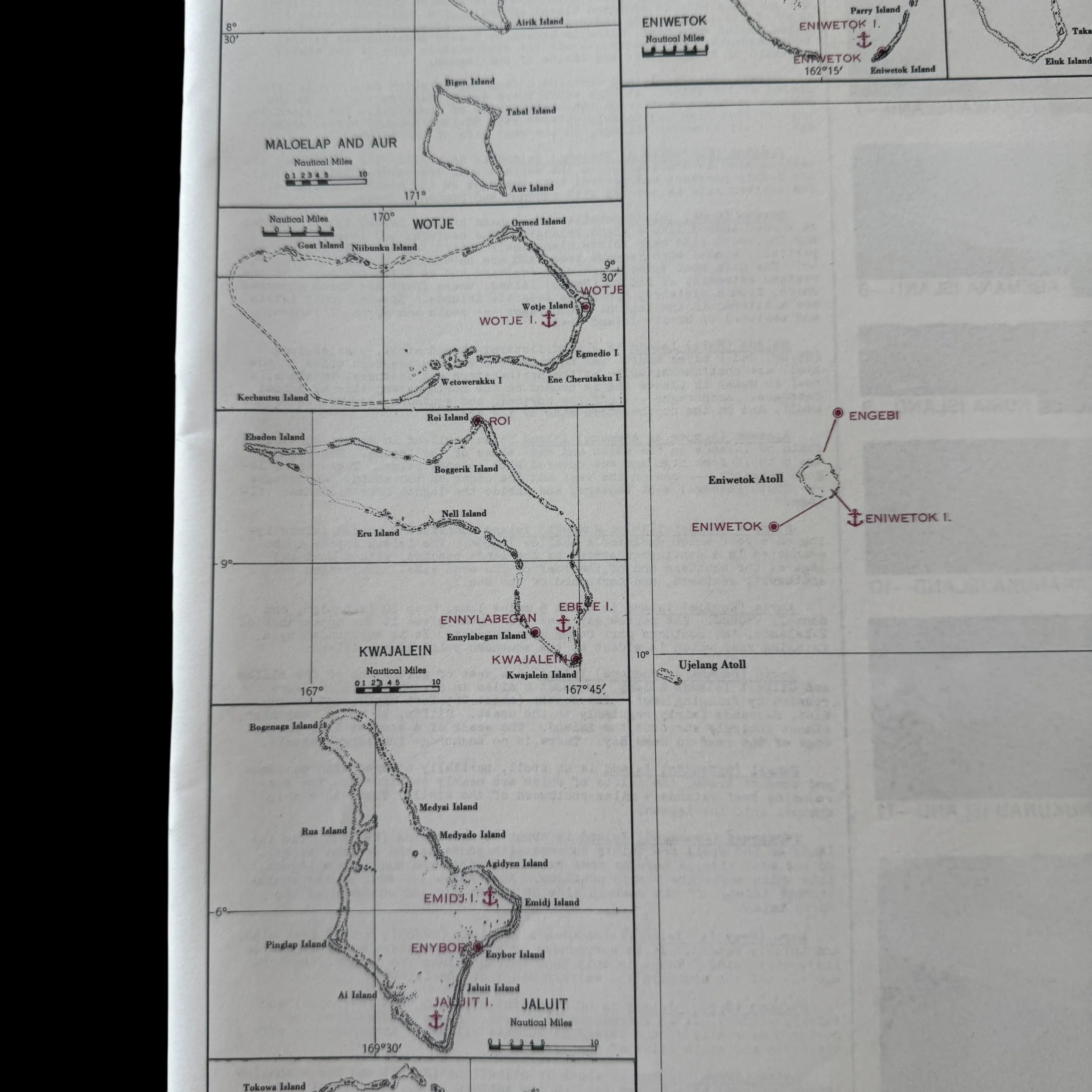
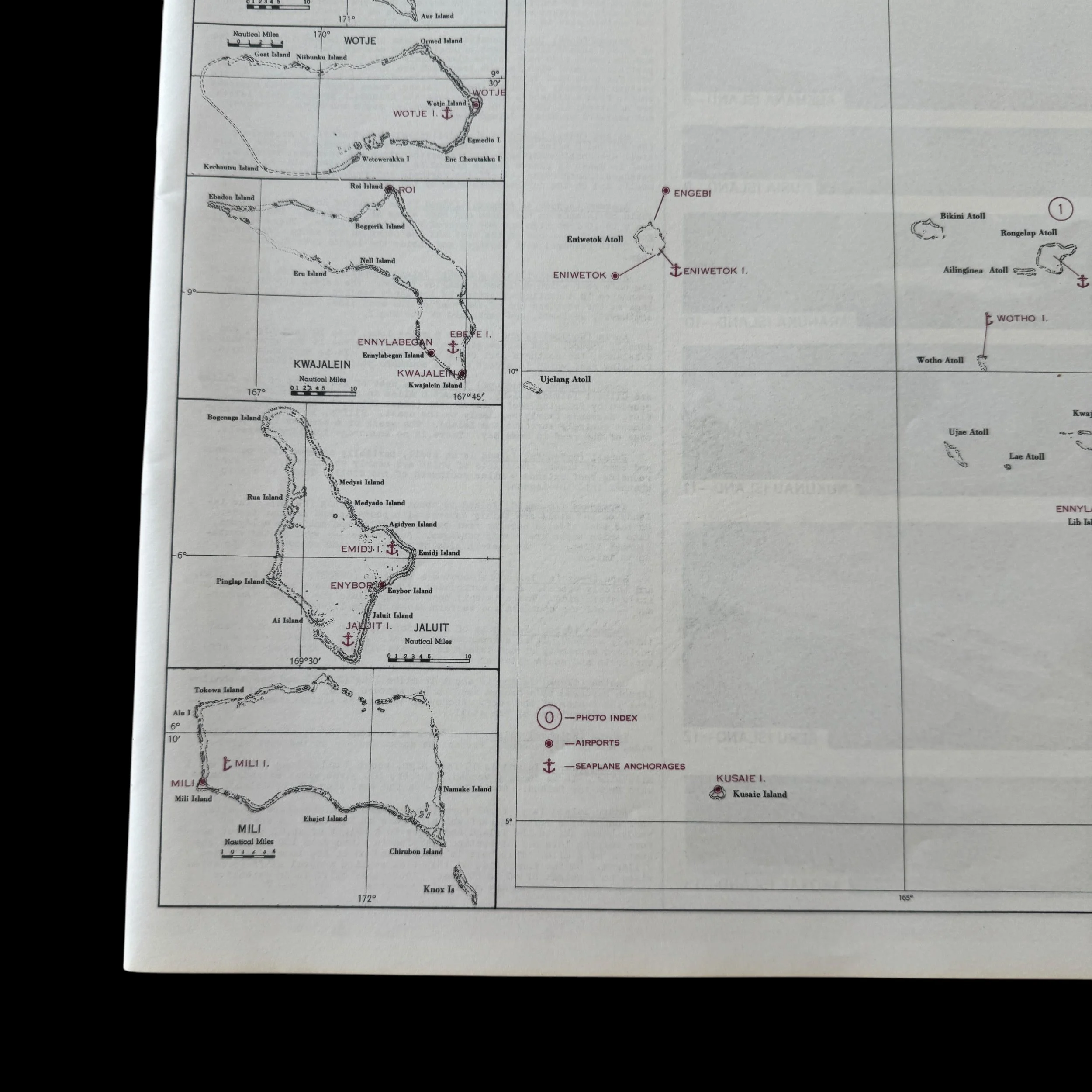
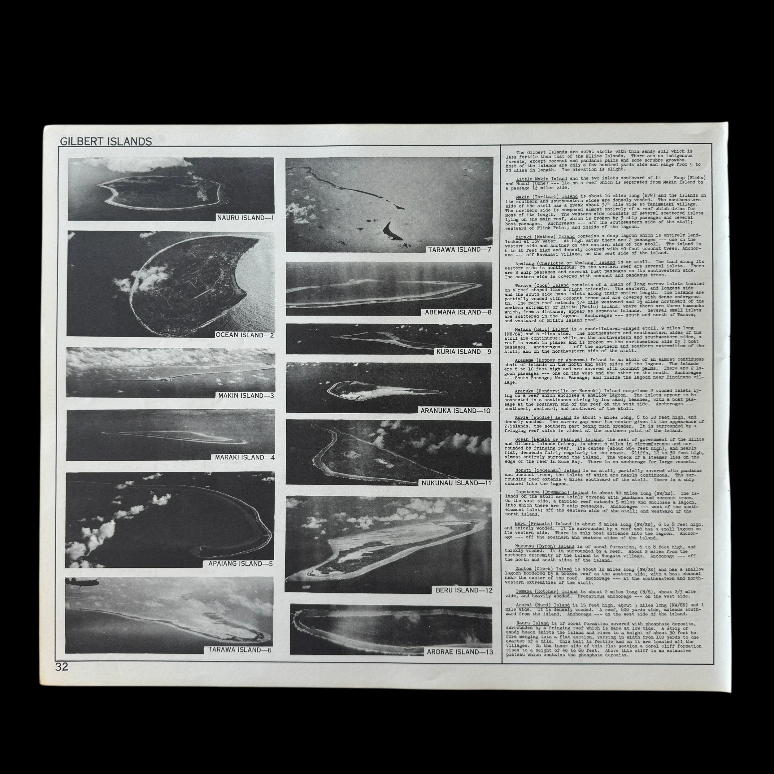
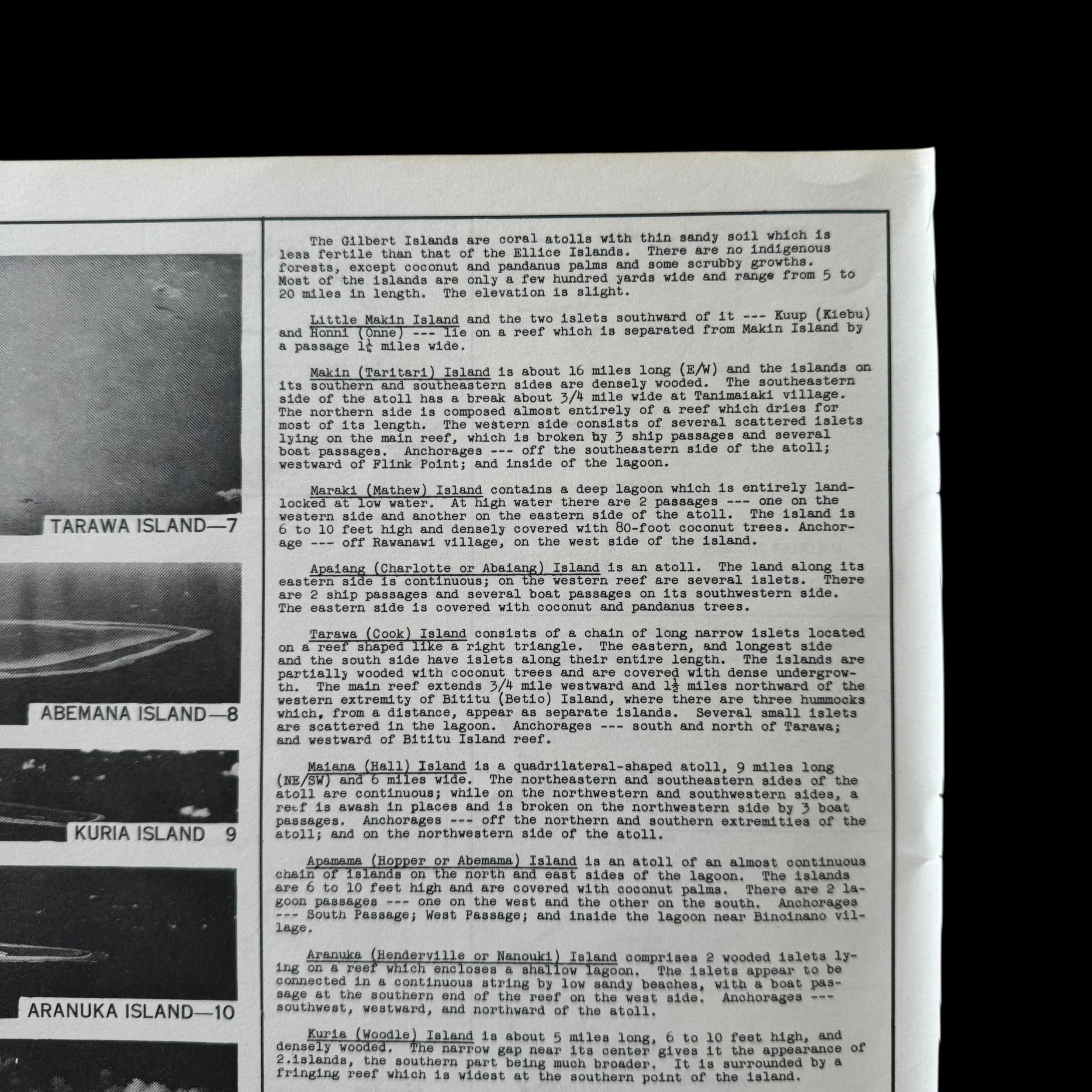
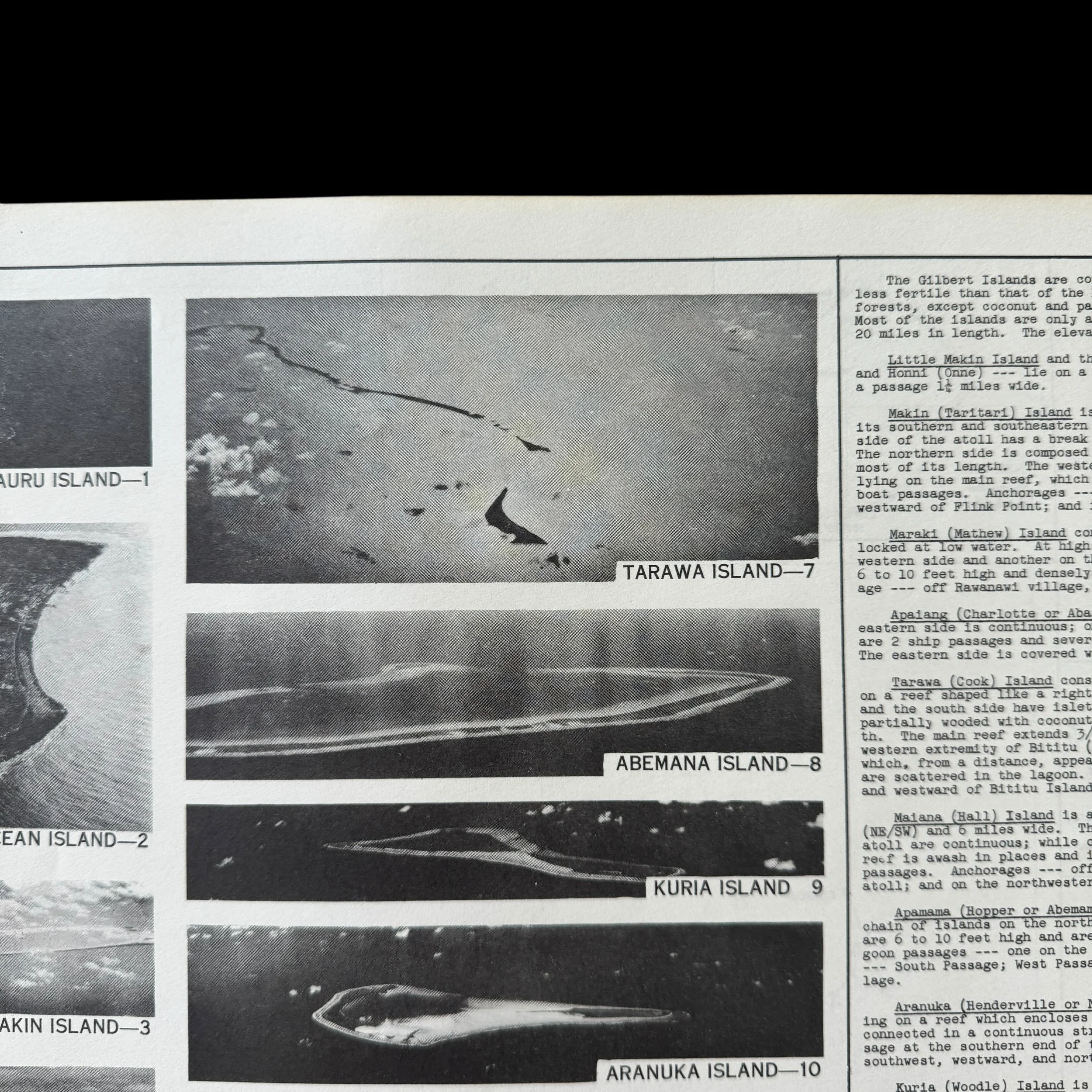
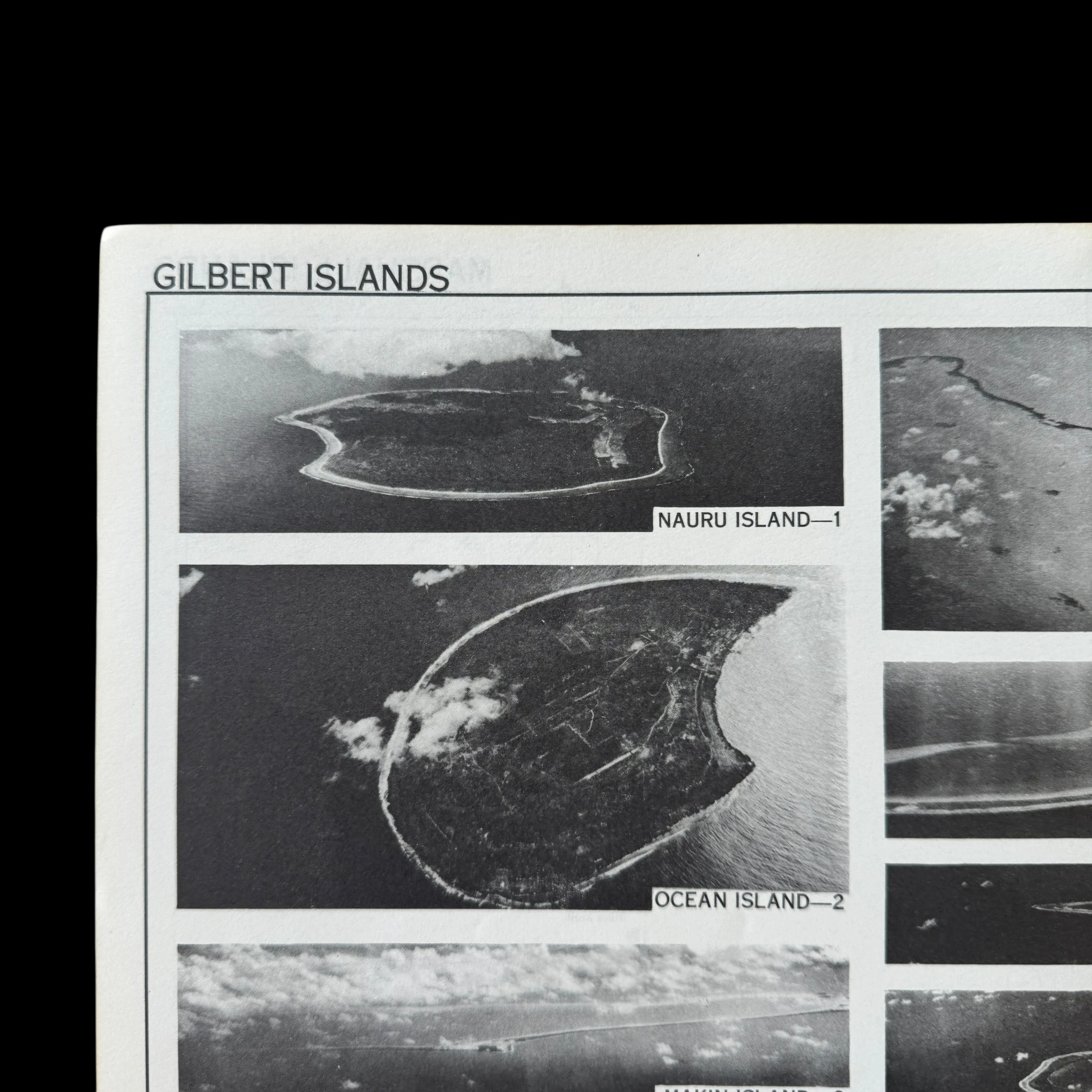
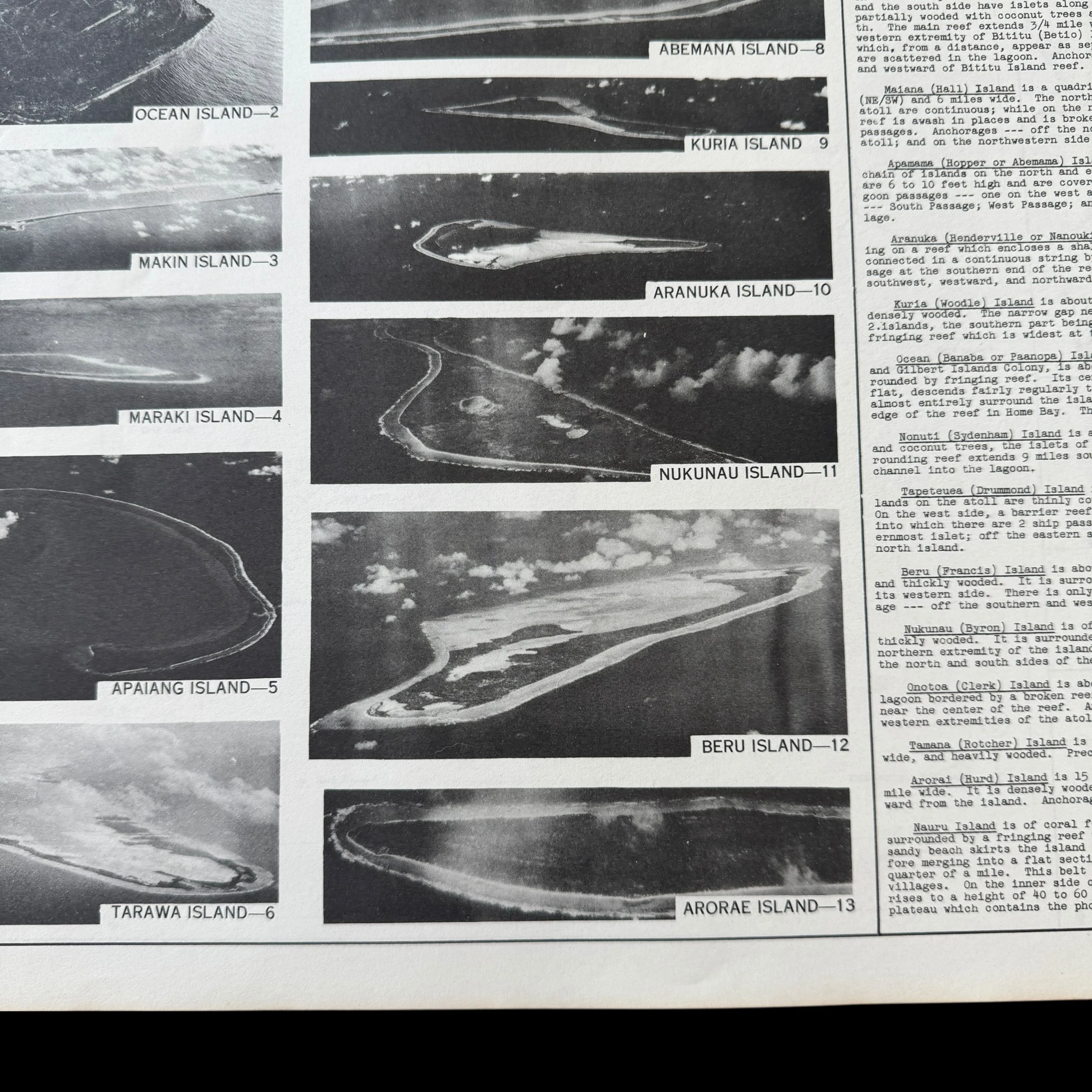
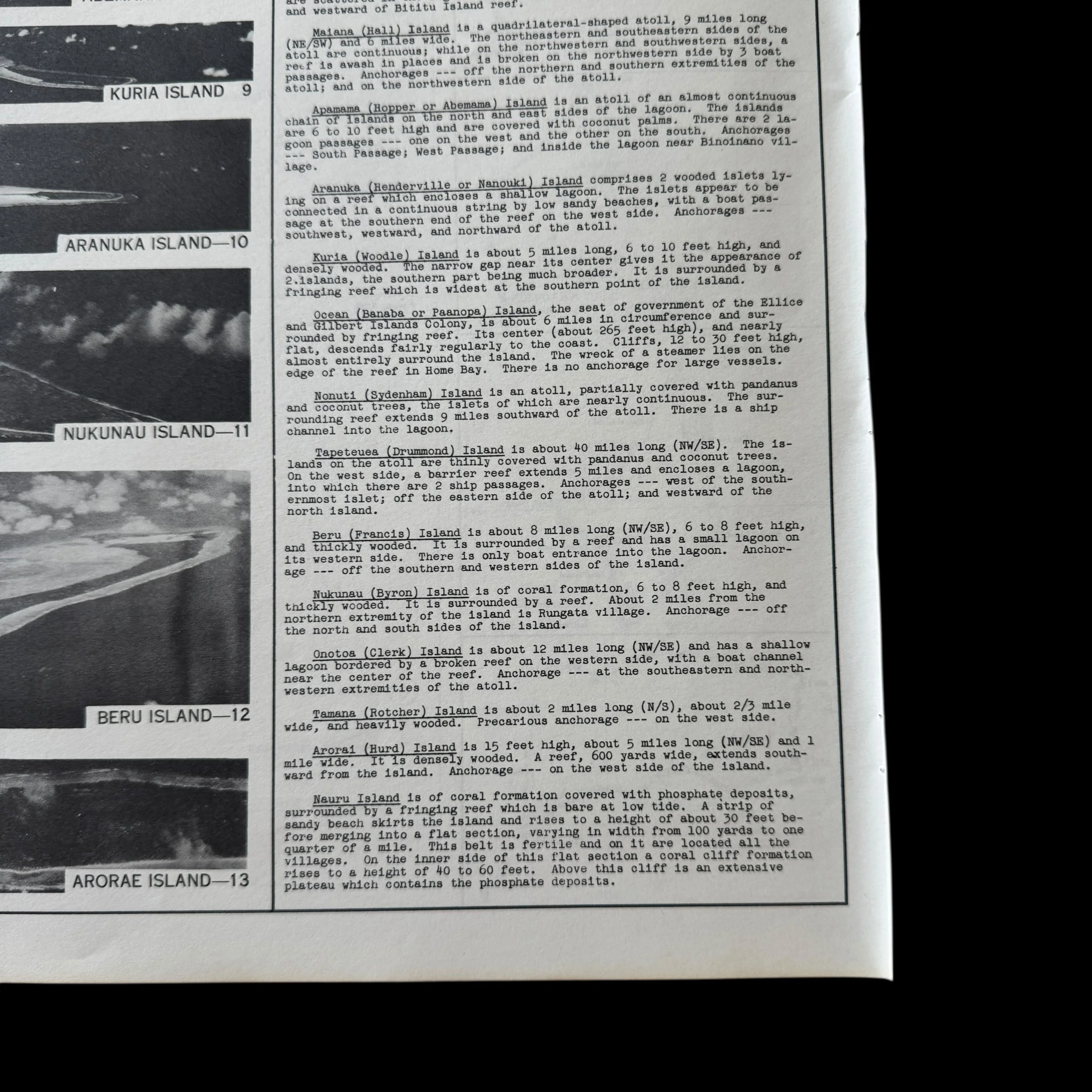
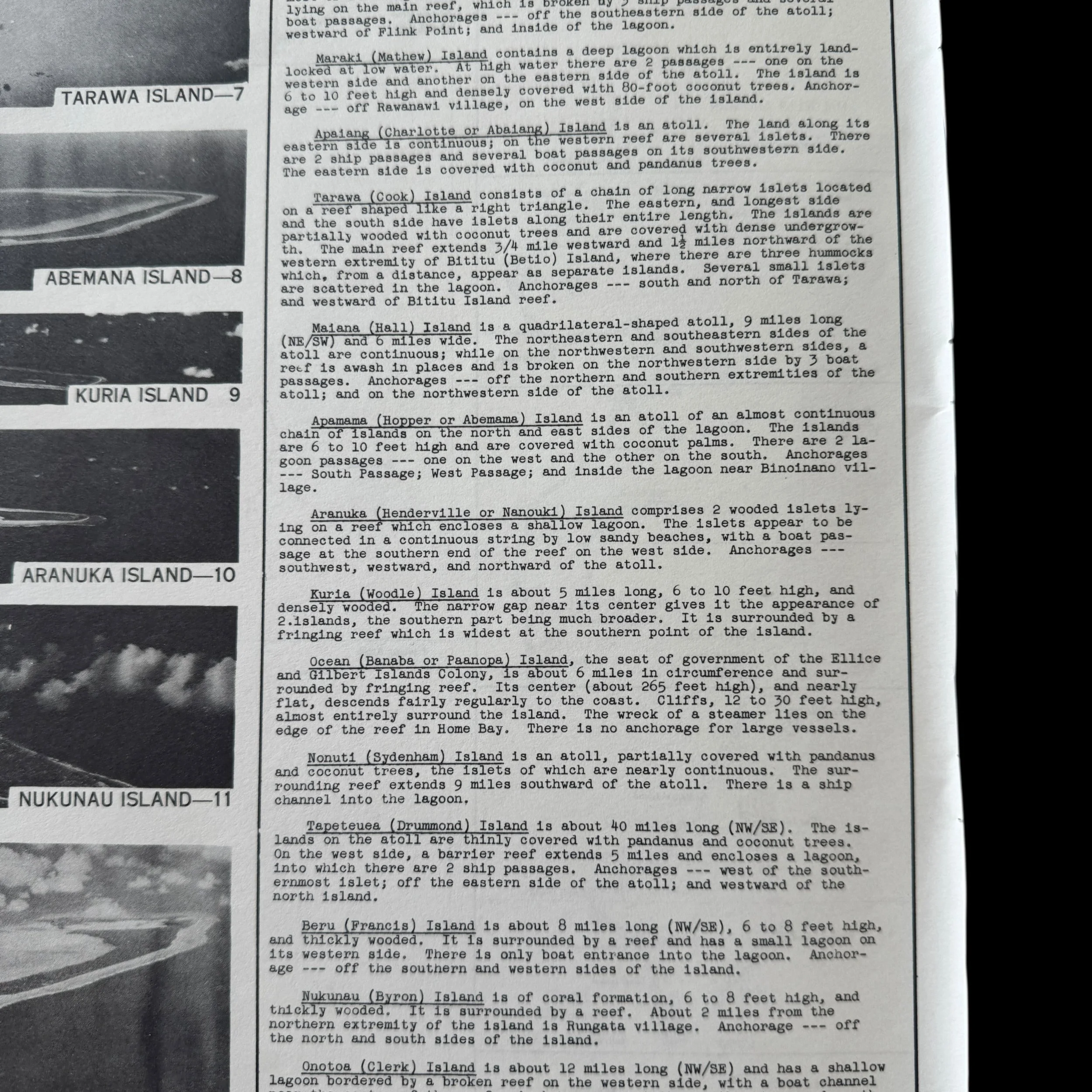
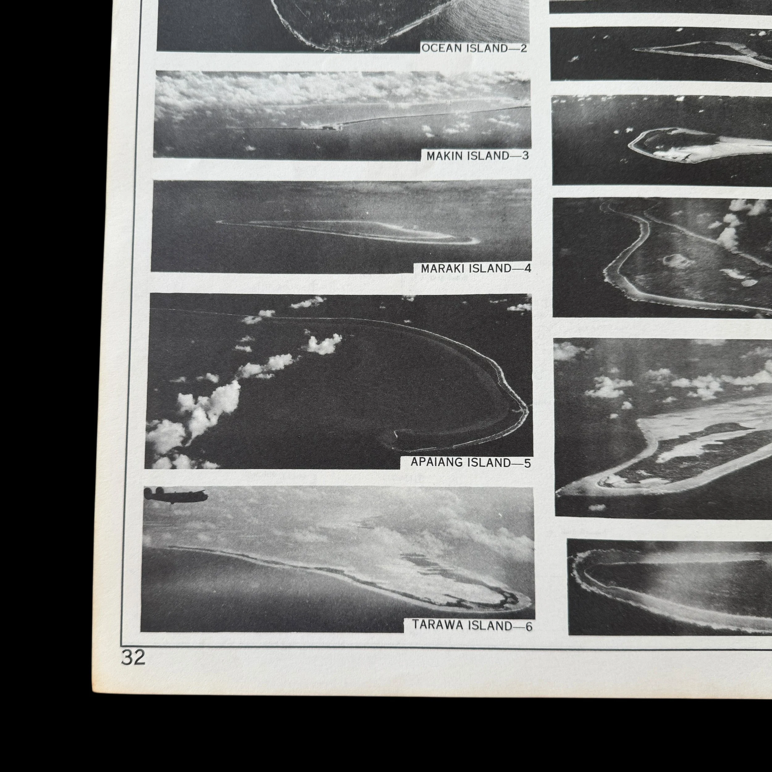
Titled “Marshall Islands & Gilbert Islands” this U.S. Army Air Force flight chart provides detailed navigational intelligence for the strategically critical atolls of Wotje, Eniwetok, Kwajalein, and surrounding Marshall Island groups. It identifies airstrips, seaplane anchorages, reef formations, lagoon approaches, elevations, and shoreline features that were necessary for both bombing missions and amphibious assault coordination. The reverse side features military intelligence photographs and reconnaissance imagery offering aerial perspectives that pilots, copilots, and navigators used to determine their precise position over enemy territory. These CONFIDENTIAL images replicated what aircrews would visually encounter during combat operations over the Marshall Islands in 1944.
This artifact represents a rare surviving example of top secret aviation intelligence used in one of the most important campaigns of the Pacific War.
The U.S. Military in the Marshall Islands During World War II. A Focus on 1944 and the Role of the U.S. Army Air Force
During World War II, the Marshall Islands became a central objective in the United States island hopping strategy across the Pacific. By early 1944, these islands formed a fortified Japanese defensive line protecting the inner perimeter of the Empire. Their capture would open a direct path toward the Mariana Islands and ultimately Japan itself. The U.S. Army, Navy, and Marine Corps all played major roles in the campaign, but it was the U.S. Army Air Force that provided the aerial intelligence, bombing power, and reconnaissance support that made the invasions possible.
The Marshall Islands Campaign and Strategic Importance
The Marshall Islands campaign began in January 1944 with coordinated landings on Kwajalein and Eniwetok. These atolls were heavily defended Japanese bases equipped with airfields, coastal artillery, and fortified bunkers. Their geographic position allowed Japan to monitor U.S. fleet movements and launch air attacks across the Central Pacific.
Once captured, the Marshalls became forward operating bases for American aircraft and naval forces. Kwajalein Lagoon, one of the largest in the world, provided safe anchorage for U.S. warships and served as a major logistics hub. Airfields constructed and expanded on Kwajalein and Eniwetok allowed U.S. bombers and fighters to strike deeper into Japanese held territory, including Truk and later the Mariana Islands.
U.S. Army Air Force Operations in the Marshall Islands
The U.S. Army Air Force played a decisive role in neutralizing Japanese defenses prior to the landings. Long range bombers such as the B 24 Liberator conducted sustained bombing raids against Wotje and Kwajalein, targeting runways, fuel depots, and anti aircraft positions. These attacks weakened Japanese air power and reduced resistance before amphibious assaults began.
After the capture of the islands, USAAF units quickly established operational airfields. From these bases, reconnaissance aircraft conducted photographic missions over surrounding island chains, mapping enemy installations and monitoring fleet movements. Modified reconnaissance planes such as the F 5 Lightning provided high altitude intelligence that guided future operations toward the Marianas and the Philippines.
Fighter squadrons stationed in the Marshalls provided air cover for naval task forces and protected transport ships carrying troops and supplies. These aircraft also escorted bombers on long range missions and intercepted Japanese aircraft attempting to disrupt American operations.
Reconnaissance and Intelligence Gathering
Reconnaissance missions launched from the Marshall Islands were critical in shaping the next phase of the Pacific War. Air crews photographed enemy bases on Truk, Ponape, and other strongholds, revealing runway layouts, troop concentrations, and defensive structures. This intelligence allowed U.S. commanders to bypass heavily fortified positions and focus on more strategically valuable targets.
The very flight charts such as this one guided pilots through complex reef systems, narrow lagoon entrances, and unfamiliar island silhouettes. Accurate navigation was essential, as a single mistake could result in aircraft crashing into reefs or being lost at sea in hostile waters.
Preparation for the Final Push Toward Japan
By mid 1944, the Marshall Islands had become a vital staging ground for the assault on the Mariana Islands, including Saipan, Tinian, and Guam. These islands would later host B 29 Superfortress bombers capable of striking the Japanese home islands directly.
Aircrews trained extensively in the Marshalls for long range missions over open ocean, learning navigation techniques that relied heavily on charts like this one combined with aerial photography. The experience gained in the Marshalls directly contributed to the success of strategic bombing campaigns that followed.
The Final Year of the War and the Marshalls’ Legacy
As the war advanced into 1945, the Marshall Islands continued to support operations against Iwo Jima and Okinawa. Aircraft passed through these bases for refueling, maintenance, and medical evacuation. Wounded pilots and sailors were transported back through Kwajalein and Eniwetok before returning to Hawaii or the mainland United States for treatment.
The role of the Marshall Islands in the Pacific War was one of transformation. What had once been isolated coral atolls became one of the most important military hubs in the Central Pacific. Their capture marked a turning point that allowed U.S. forces to project power directly toward Japan.
The legacy of the Marshall Islands campaign is inseparable from the success of the U.S. Army Air Force. Through bombing missions, reconnaissance flights, and navigation support, USAAF personnel helped dismantle Japan’s defensive perimeter and paved the way for Allied victory.
This original CONFIDENTIAL Marshall Islands flight chart stands as a powerful artifact from that moment in history. It is a tangible link to the pilots who flew over Wotje, Eniwetok, Kwajalein, and countless other atolls while carrying classified intelligence that shaped the course of World War II. It represents not only aviation history, but the courage and precision required to wage war across the vast and unforgiving Pacific Ocean.