RARE! WWII VII Fighter Command P-51 Mustang Pilot Guam (Marianas Group) "Kneepocket" Flight Combat Map
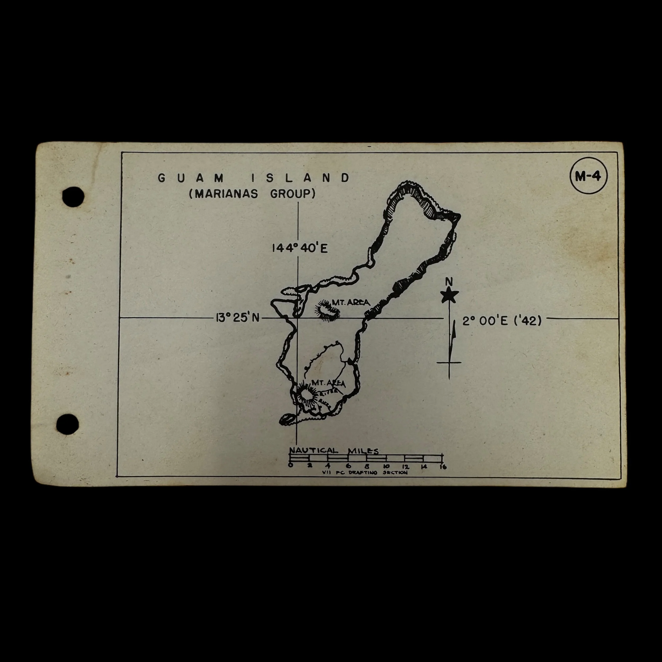
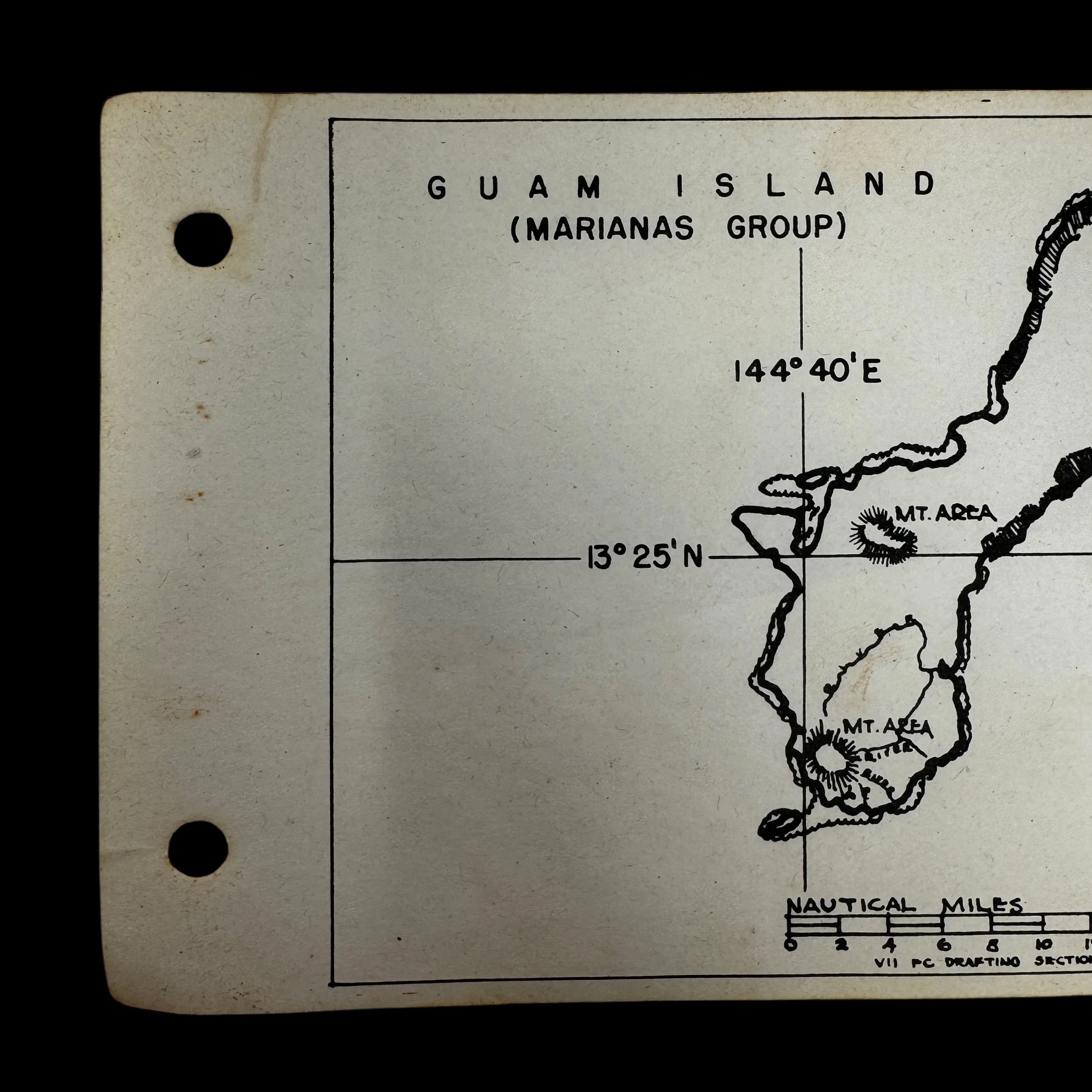


RARE! WWII VII Fighter Command P-51 Mustang Pilot Guam (Marianas Group) "Kneepocket" Flight Combat Map
Comes with a hand-signed C.O.A.
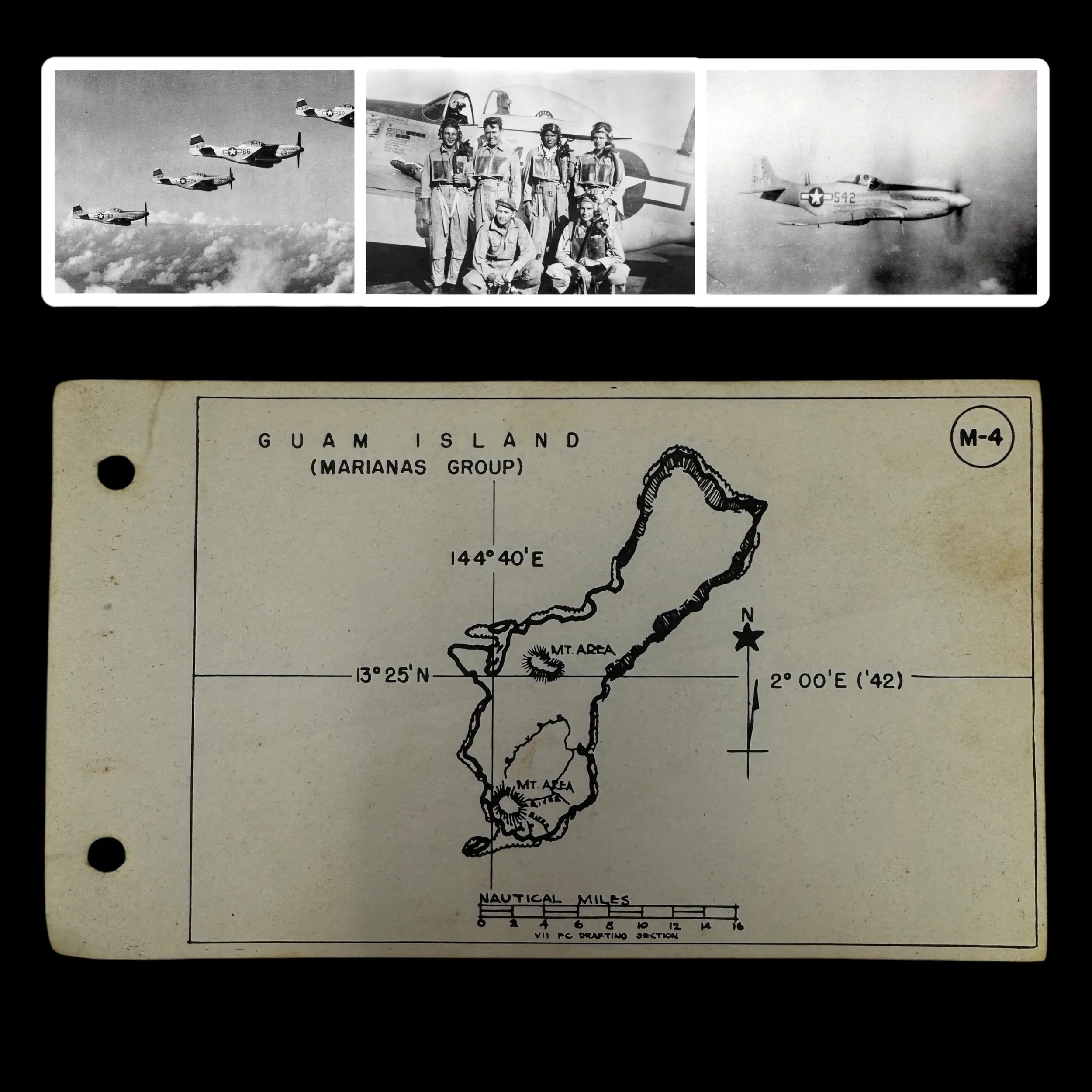
“As part of the Seventh Air Force, the VII Fighter Command P-51 pilots were instrumental in securing U.S. air superiority, conducting long-range escort missions, and supporting the strategic bombing campaign against Japan. Their deployment in the Marianas Campaign was pivotal to the success of the island-hopping strategy and the eventual destruction of Japan’s war-making capabilities”
Type: Original World War II VII Fighter Command “Kneepocket" Flight Map Specially Made For P-51 Mustang Pilots of the Seventh Air Force’s VII Fighter Command
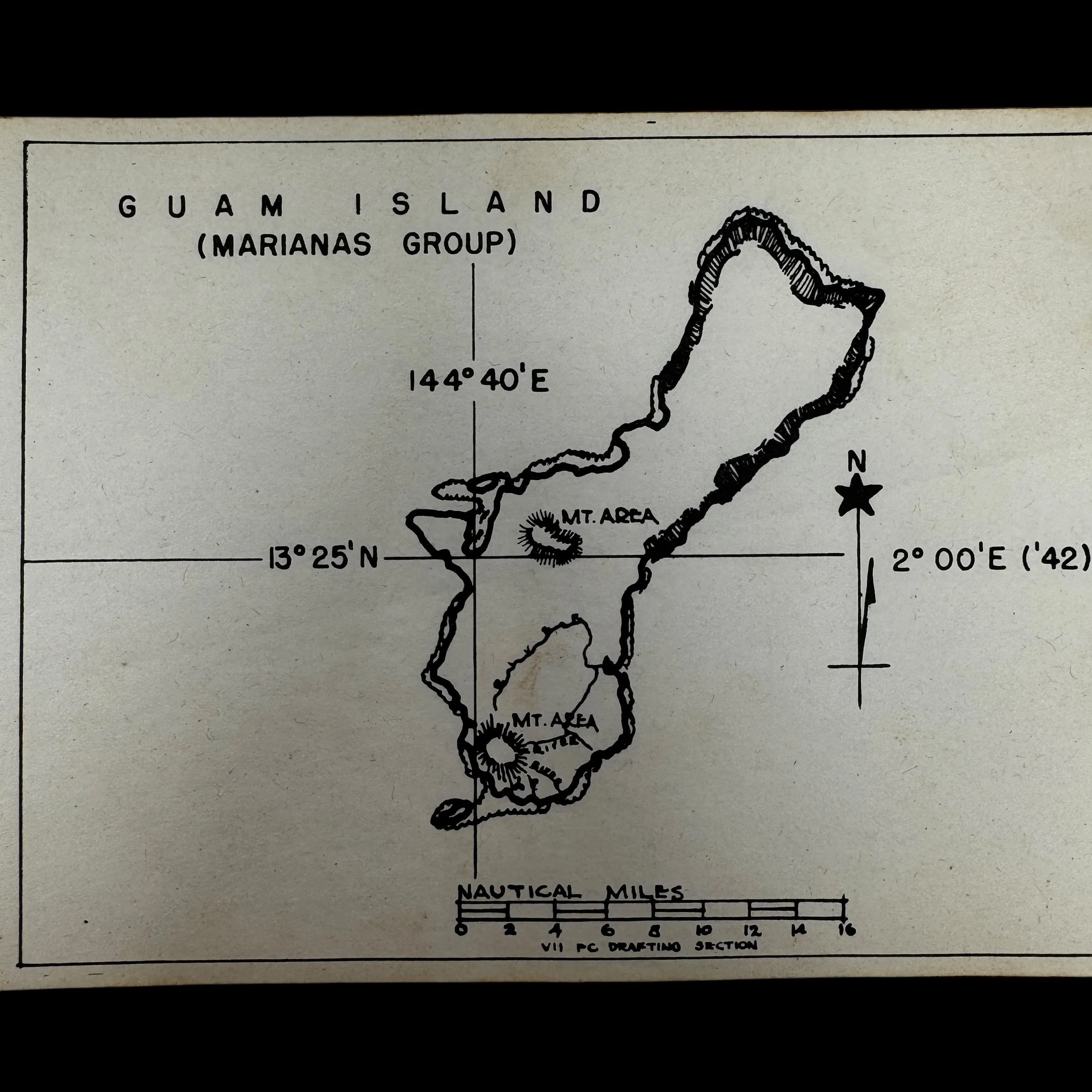
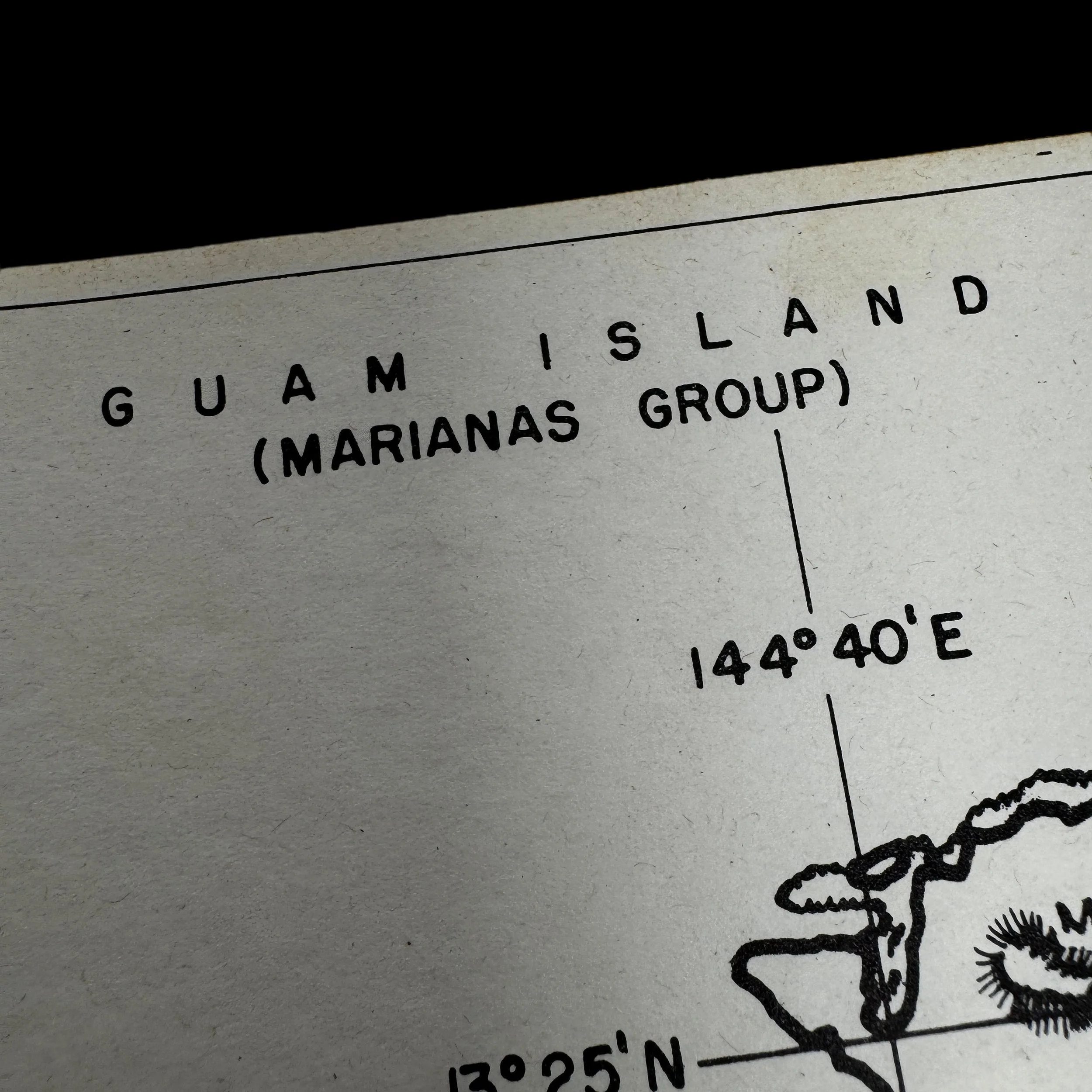
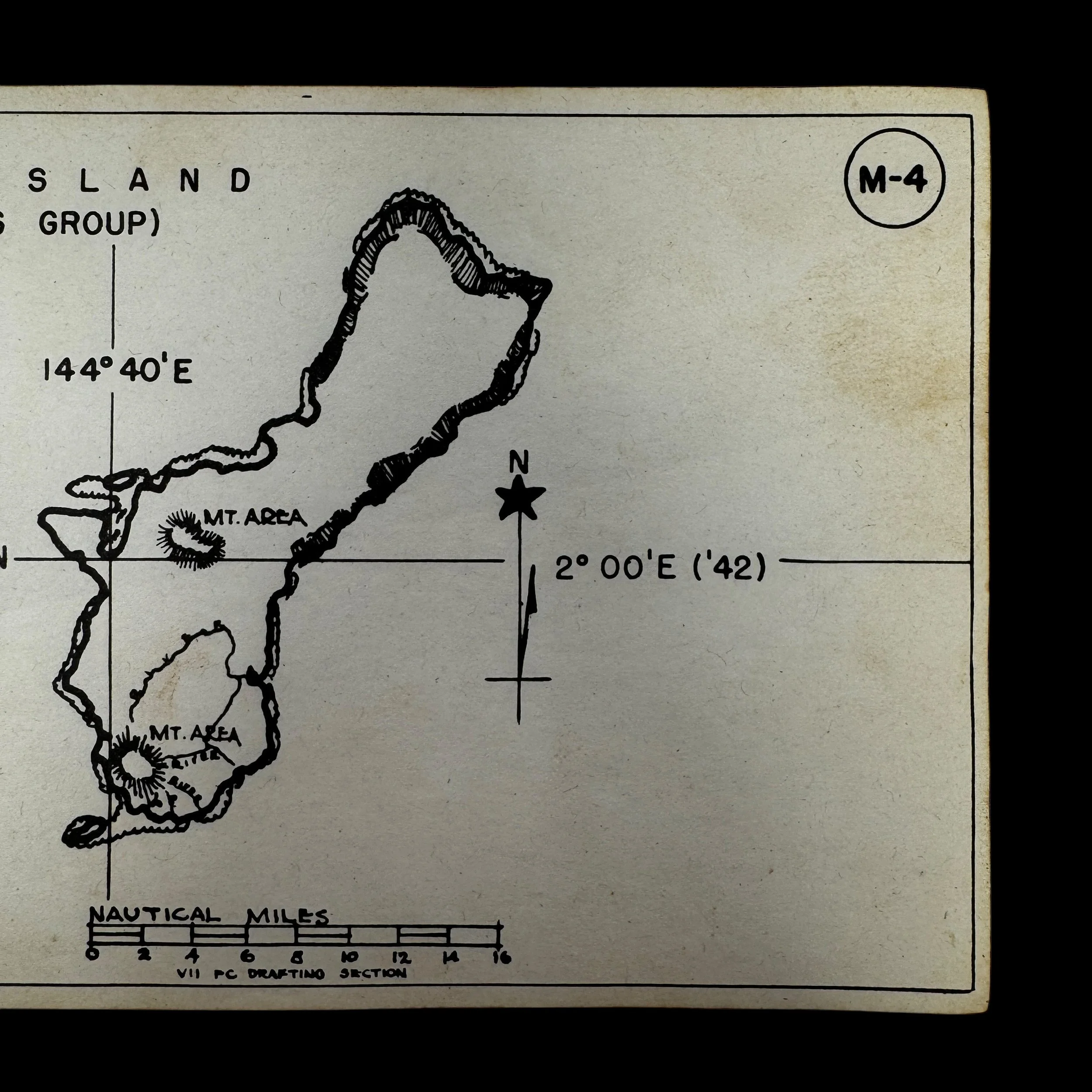
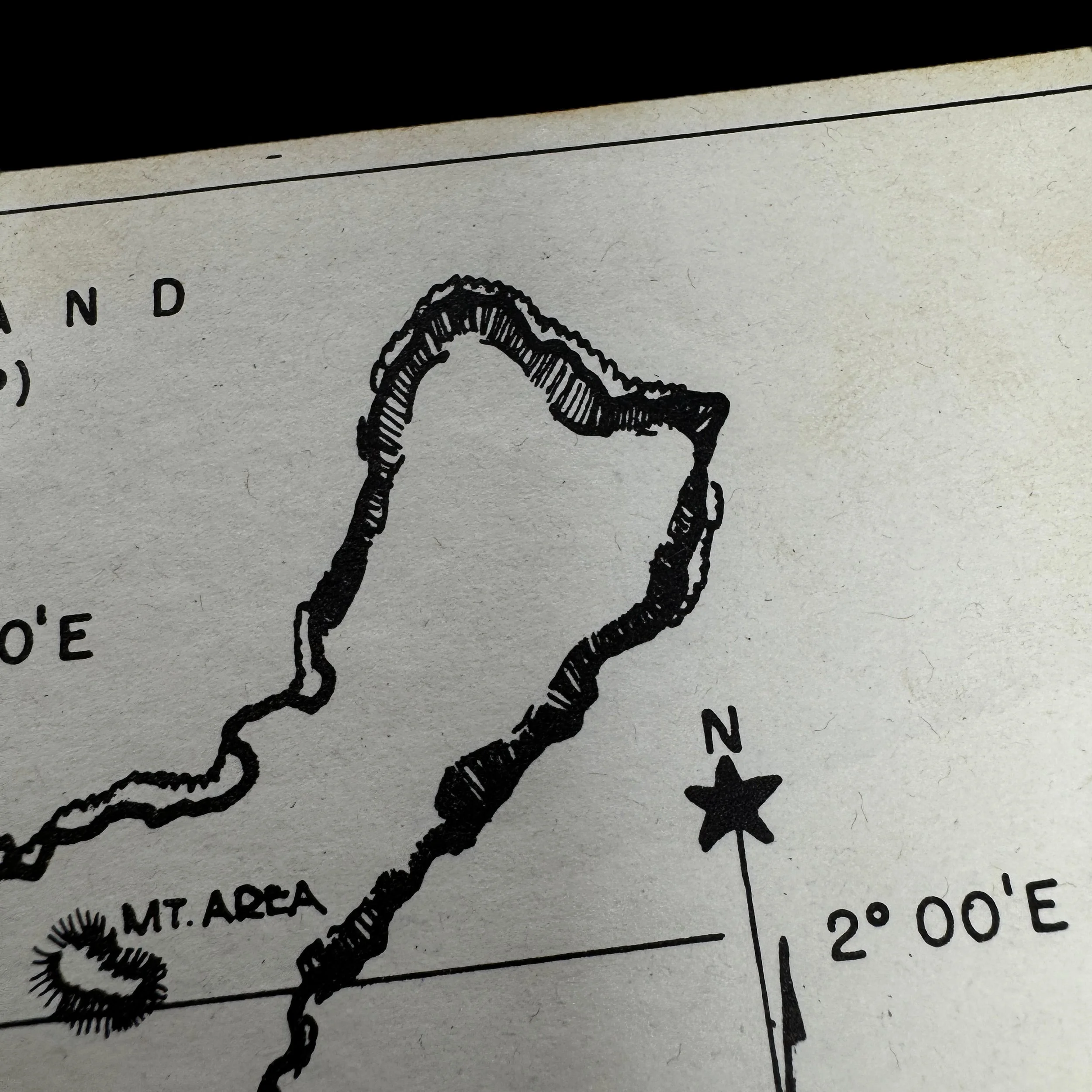
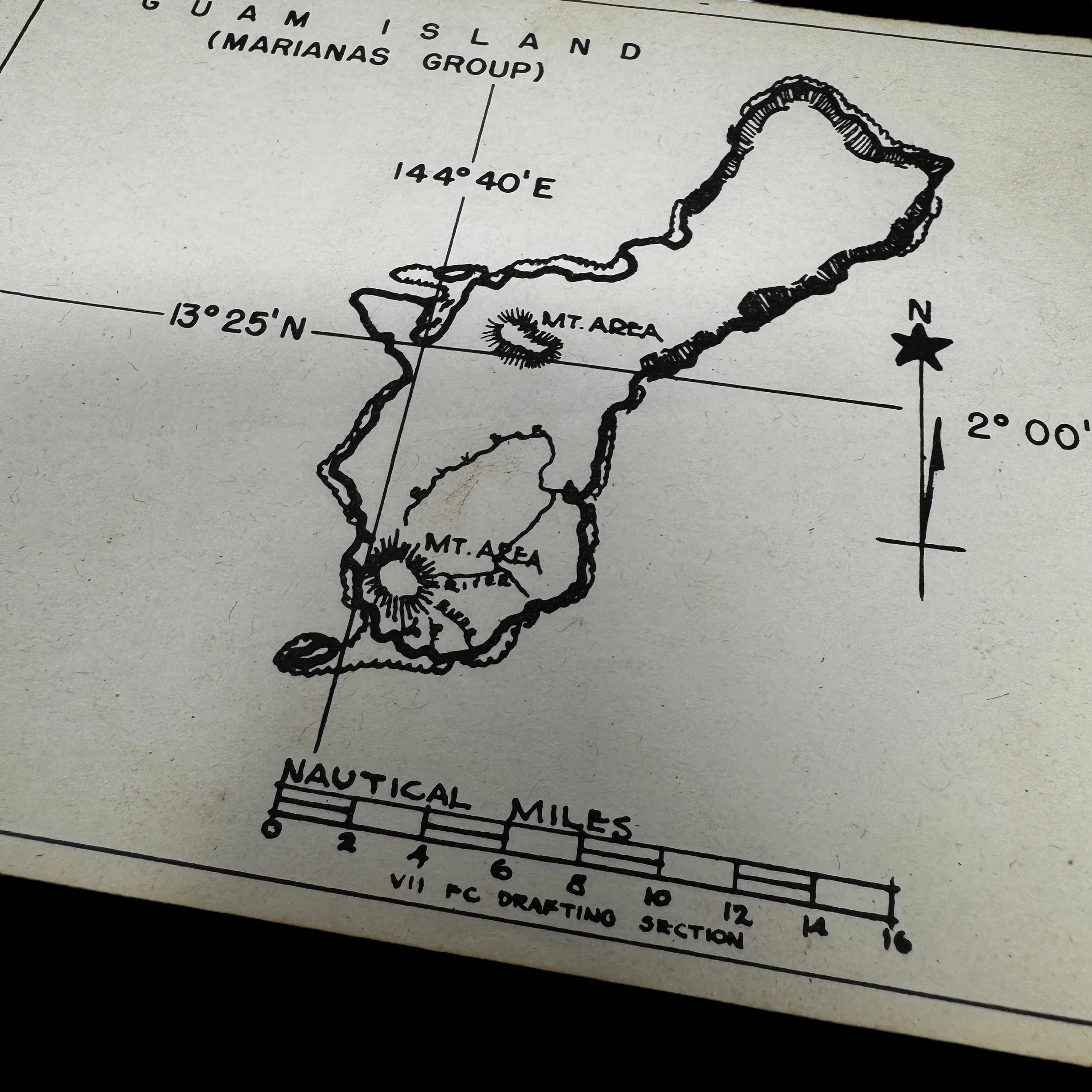
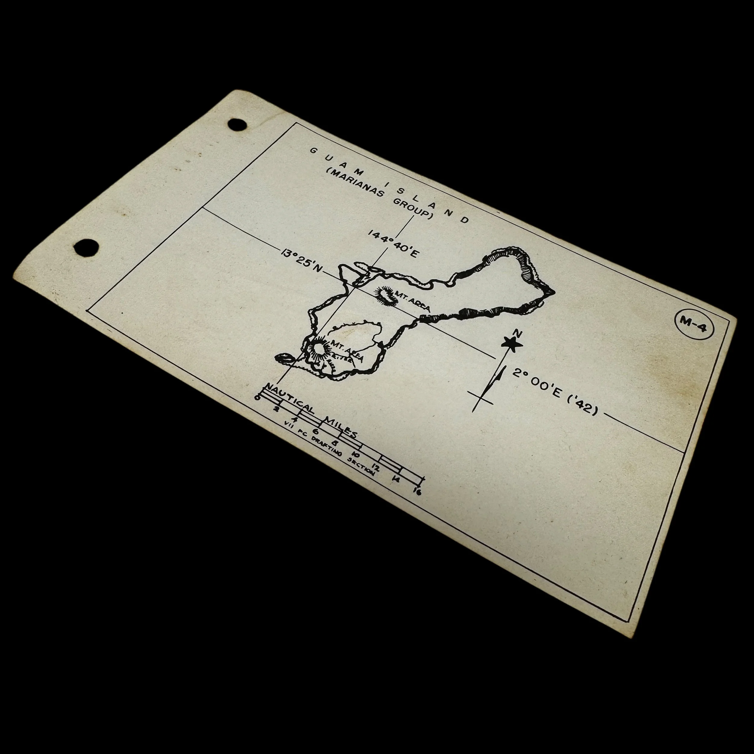
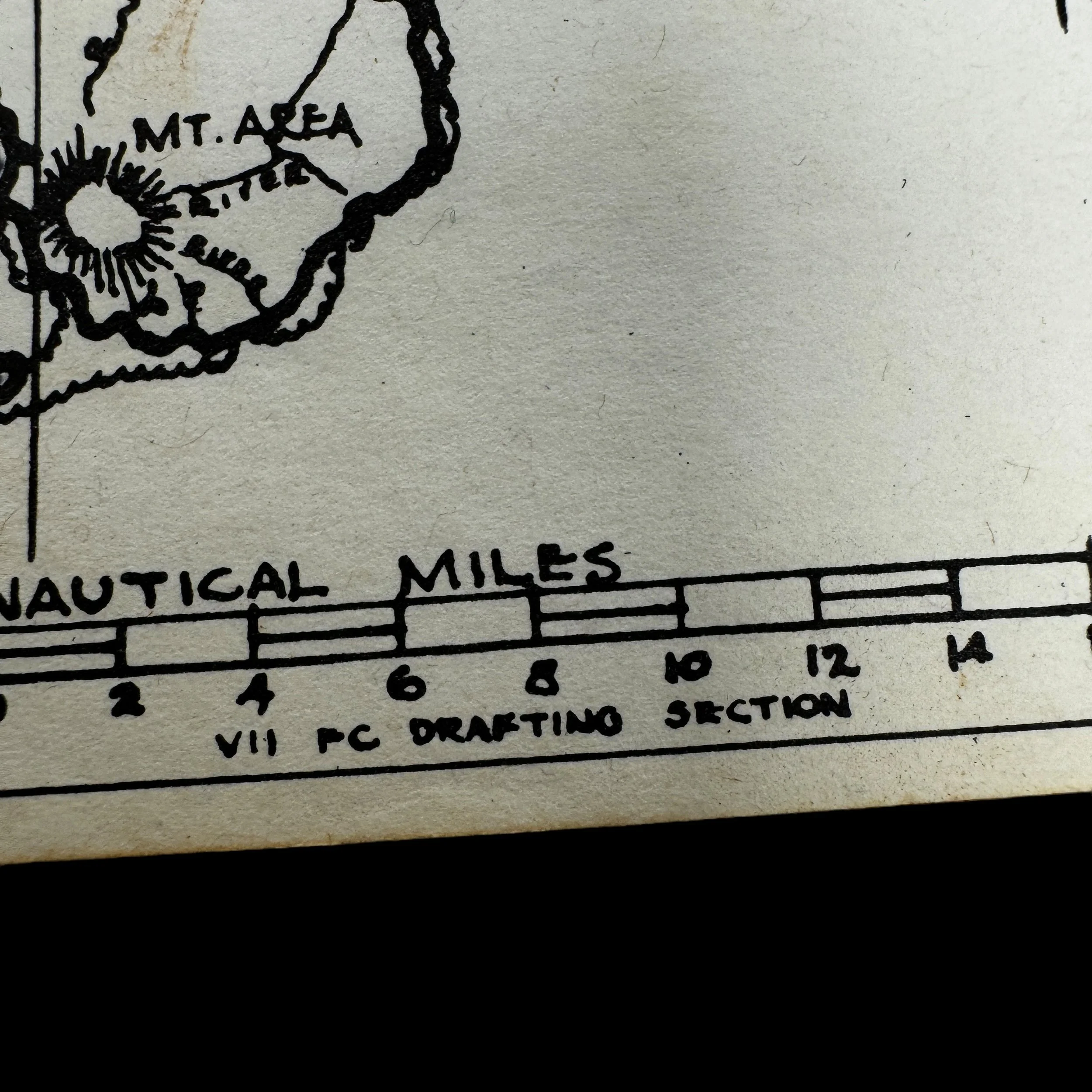
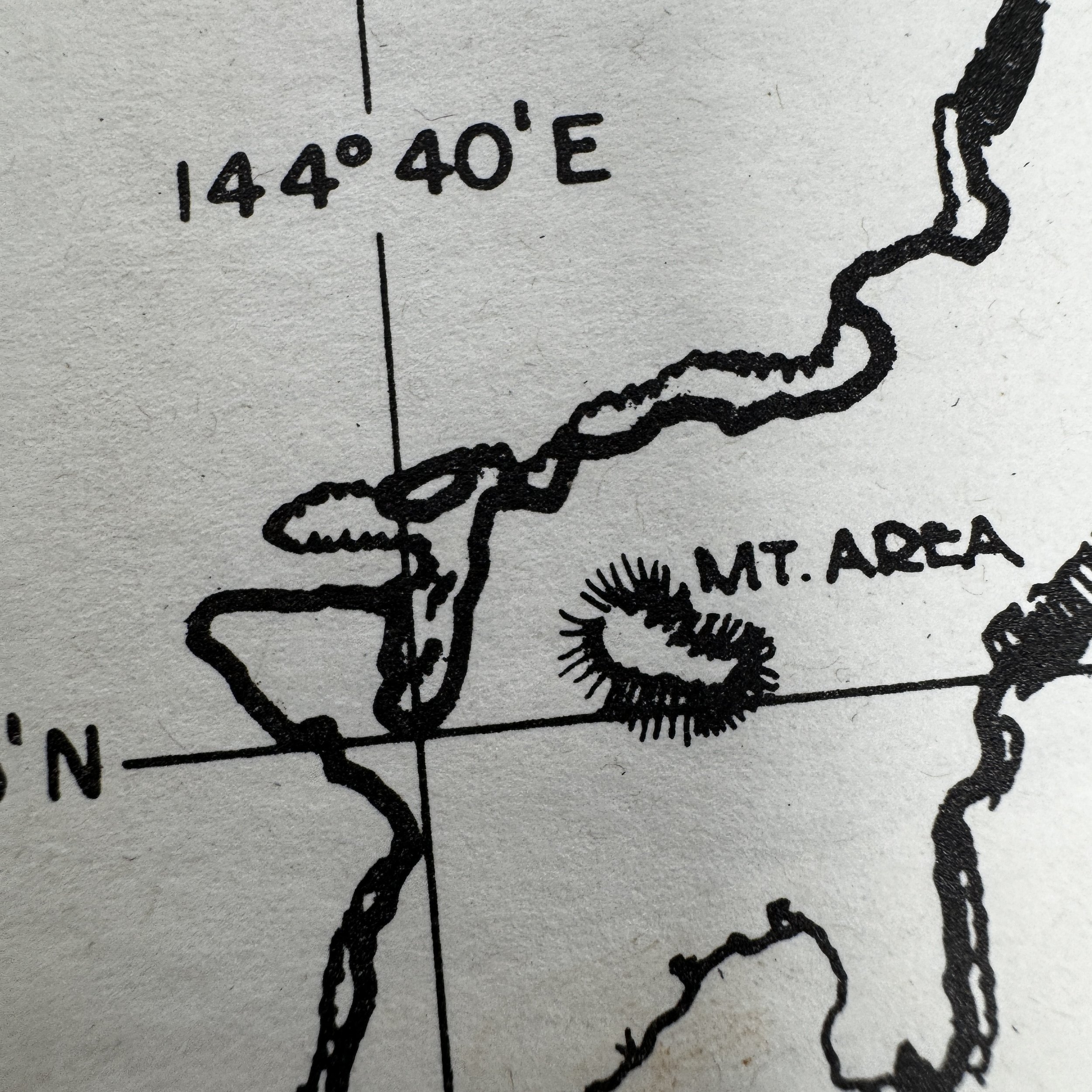
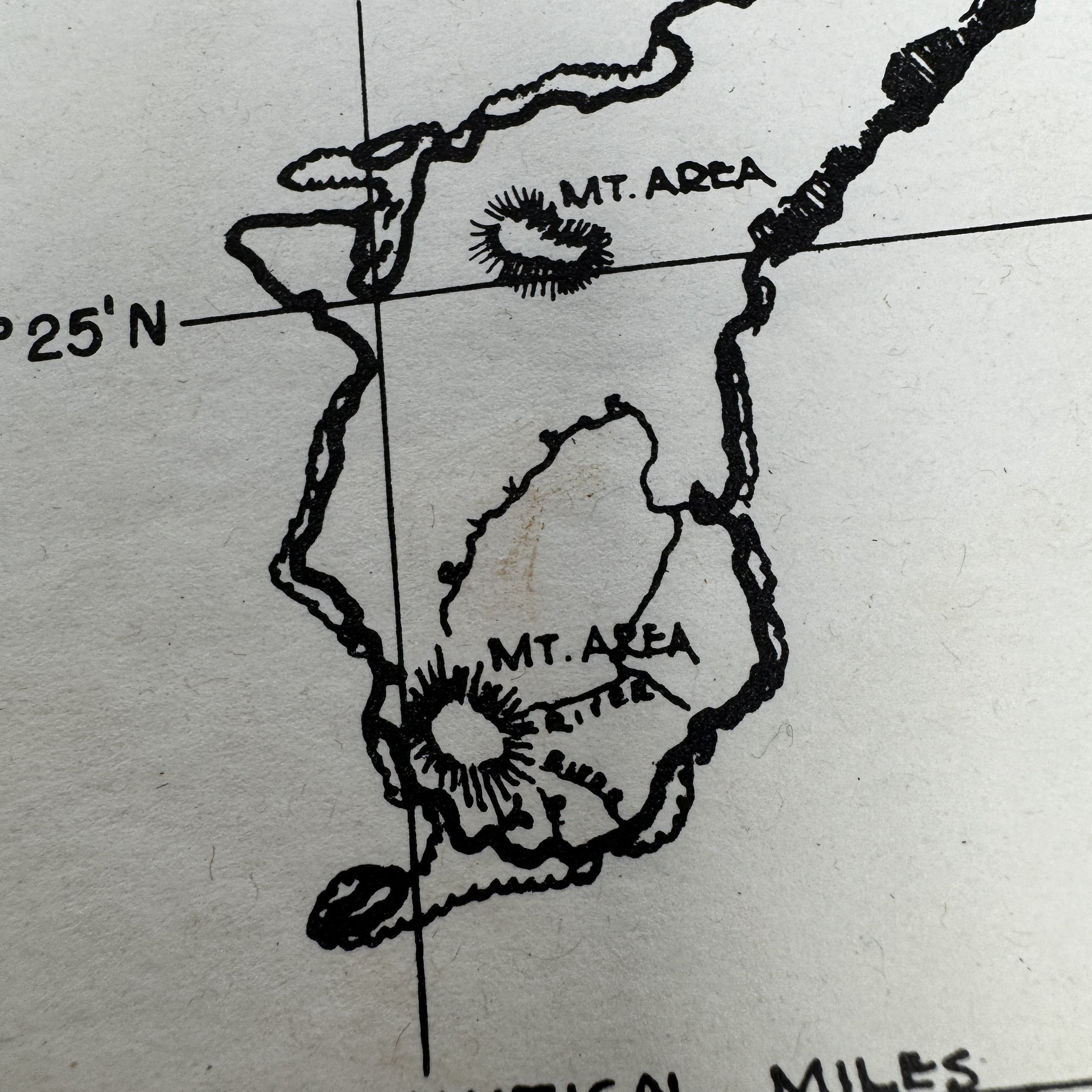
Titled: Guam Island - Marianas Group
Size: 4 × 7 inches
This incredibly rare, museum-grade World War II artifact is an original combat map used by United States Army Air Forces (USAAF) pilots from the Pacific Theater's VII Fighter Command. Known among pilots as the "kneepocket" map, this essential navigation tool was carried by all P-51 Mustang pilots on every combat mission during the war.
Designed and field-printed by the “VII Fighter Command Drafting Section”, this compact yet detailed map was tailored for the specific challenges faced during long-range escort and reconnaissance missions over the vast Pacific Ocean. It was designed to fit perfectly inside the large knee pocket of a P-51 pilot’s flight suit, ensuring easy access without interfering with cockpit controls during combat missions.
The kneepocket map was vital during missions, whether escorting B-29 Superfortresses on Very Long Range (VLR) bombing runs to Japan, or conducting fighter sweeps and reconnaissance. Pilots used this map while in the air to track their positions, coordinate formation movements, and record real-time intelligence on enemy activity and potential targets.
Additionally, the map played a crucial role in emergency planning, providing vital information about nearby islands for potential crash landings. In a theater where engine failure, damage from enemy fire, or fuel shortages posed constant threats, the kneepocket map could mean the difference between survival and being lost at sea.
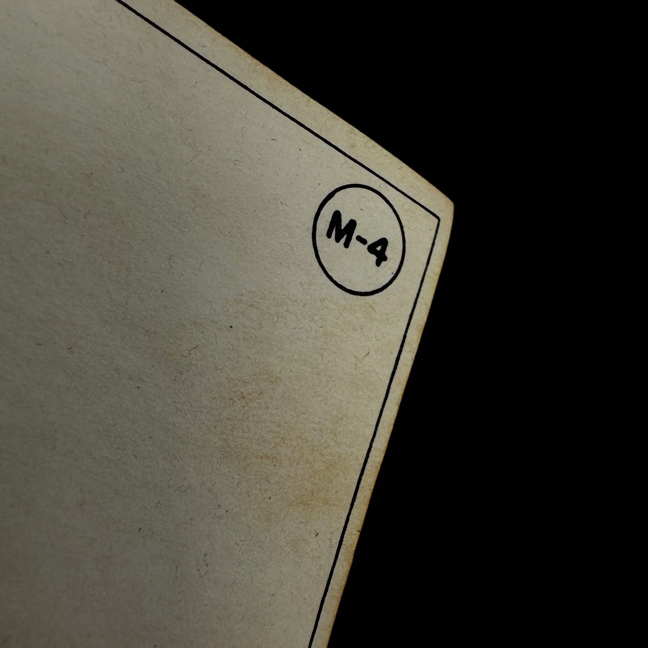
As a field-produced document, each map was unique, and only a handful of examples with direct connections to the VII Fighter Command have survived, with most reserved for high-end museum archives. Today, these original VII Fighter Command combat maps are exceedingly rare artifacts of WWII aviation history.
The VII Fighter Command and Its Role in the Marianas: The Pivotal Use of the "Kneepocket" Map in Pacific Combat Missions
The VII Fighter Command played a critical role in the Pacific Theater during World War II, particularly in operations around the Marianas, where its long-range escort and ground attack missions proved instrumental in securing American air superiority. As part of the Seventh Air Force, the command initially focused on island-hopping campaigns but later became heavily involved in supporting the strategic bombing missions over Japan. Among its various contributions, the VII Fighter Command’s operations from Guam stand out as a key aspect of the American war effort in the Pacific. A particularly noteworthy detail of these missions was the use of the "kneepocket" map, an essential navigational tool carried by P-51 Mustang fighter pilots. This map, small enough to be stored in the knee pocket of their flight uniforms, was a vital resource that enabled pilots to navigate vast stretches of open ocean, locate targets, and find their way back to base under hazardous conditions. The operations of the VII Fighter Command in the Marianas, especially from Guam, and the role of the kneepocket map highlight the strategic complexity and the high-risk nature of air combat in the Pacific.
The VII Fighter Command in the Pacific Theater
The VII Fighter Command was initially established as the Hawaiian Air Force’s fighter component and later expanded to take on an aggressive role in the Central Pacific. Its primary mission was to provide air superiority and escort American bombers on their raids deep into enemy territory. Unlike their European counterparts, pilots in the Pacific faced unique challenges, including vast oceanic distances, unpredictable weather, and the necessity of long overwater flights, often without the luxury of nearby emergency landing fields. By mid-1944, following the successful American invasion of the Marianas, the VII Fighter Command was tasked with providing air cover, escorting bombers, and conducting offensive operations from newly captured airfields on islands like Saipan, Tinian, and Guam.
Guam, the largest and southernmost of the Marianas Islands, was of particular strategic importance. Following the American recapture of the island in August 1944, it was rapidly developed into a major airbase complex. The VII Fighter Command stationed its P-51 Mustang squadrons on Guam, where they carried out a range of missions, including fighter sweeps, bomber escort duties, and strafing attacks on Japanese positions across the Pacific. The ability of the Mustangs to provide long-range escort for the B-29 Superfortresses of the XXI Bomber Command was vital, as the strategic bombing of Japan increased in intensity in late 1944 and early 1945. Pilots flying out of Guam participated in grueling missions, some lasting more than seven hours, requiring precise navigation and fuel management to ensure their safe return.
The "Kneepocket" Map: An Essential Tool for Survival
One of the most crucial pieces of equipment carried by VII Fighter Command pilots during these perilous missions was the "kneepocket" map. This compact, foldable map was specifically designed to fit in the knee pocket of a pilot’s uniform, allowing for quick and easy access in the cramped cockpit of a P-51 Mustang. Given the vast distances covered during escort and interdiction missions, accurate navigation was a matter of life and death. The kneepocket map contained vital information, including the locations of friendly and enemy airfields, known anti-aircraft positions, emergency ditching zones, and radio frequencies for coordination with other aircraft and naval assets.
Pilots relied on the kneepocket map not only for navigation but also for contingency planning. In the event of an engine failure or damage sustained in combat, the map helped them determine the safest possible landing areas or bailout zones. Additionally, with the Pacific Theater’s unpredictable weather patterns, pilots often had to divert their return routes based on incoming storm formations. The kneepocket map provided an immediate reference, allowing pilots to make split-second decisions in the air, sometimes determining whether they lived or perished.
VII Fighter Command Missions from Guam
From their bases on Guam, the VII Fighter Command carried out a range of operations that directly contributed to the success of the strategic bombing campaign against Japan. The primary mission was to escort the B-29 Superfortresses that flew from bases in the Marianas to targets in the Japanese Home Islands. Before the introduction of the P-51 Mustang in early 1945, these bombers flew unescorted, suffering heavy losses to Japanese fighters. With the arrival of the VII Fighter Command’s Mustangs, the odds began to shift in favor of the Americans.
In addition to escort missions, VII Fighter Command pilots engaged in aggressive fighter sweeps over Iwo Jima, the Bonin Islands, and later over Japan itself. These operations, known as "heckling" missions, involved low-altitude strafing and attacks on Japanese airfields, supply depots, and ground installations. The Mustangs also played a vital role in air-sea rescue operations, assisting in the location and recovery of downed B-29 crews. In many of these cases, the kneepocket map was indispensable, as it provided precise coordinates for rendezvous points with rescue aircraft or submarines tasked with recovering pilots who had ditched into the ocean.
As the war progressed and the American island-hopping campaign brought the fight closer to the Japanese mainland, the VII Fighter Command’s operations from Guam became increasingly daring. In early 1945, P-51 squadrons began flying Very Long Range (VLR) missions, pushing the limits of their aircraft by operating at distances of over 1,500 miles round-trip. These missions, which targeted airfields, factories, and military installations on Kyushu and Honshu, were among the most grueling ever undertaken by fighter pilots in World War II. Without the kneepocket map, navigating these extreme distances, particularly when weather or enemy fire forced pilots off their planned flight paths, would have been nearly impossible.
The Legacy of the VII Fighter Command in the Marianas
By the time of Japan’s surrender in August 1945, the VII Fighter Command had solidified its reputation as a formidable force in the Pacific War. The pilots who flew from Guam and other bases in the Marianas played a key role in ensuring the success of the strategic bombing campaign, ultimately hastening the end of the war. Their contributions, however, came at a steep cost, as many pilots were lost over the vast expanse of the Pacific. The kneepocket map, while seemingly a simple tool, was instrumental in the survival of many aviators, guiding them back to safety in the face of daunting odds.
In the post-war years, the VII Fighter Command’s legacy continued to influence modern air combat doctrine, particularly in the areas of long-range fighter operations and combat navigation. The kneepocket map became an early precursor to the advanced digital mapping systems used in modern fighter jets, underscoring the enduring importance of reliable navigational tools in military aviation. Today, the story of the VII Fighter Command and its operations in the Marianas remains a testament to the bravery, ingenuity, and resilience of the pilots who flew some of the most perilous missions of the Pacific War.
In conclusion, the VII Fighter Command’s missions from Guam and the wider Marianas were critical to the success of the American air campaign in the Pacific. The P-51 Mustang pilots who carried out these missions faced extreme challenges, but their ability to navigate vast distances with the aid of the kneepocket map ensured that many survived to fight another day. As a small yet vital piece of wartime ingenuity, the kneepocket map symbolized the adaptability and resourcefulness that defined the air war over the Pacific, allowing the VII Fighter Command to play a decisive role in the final defeat of Imperial Japan.