RARE! WWII 1945 XXI Bomber Command OSAKA & AMAGASAKI Missions B-29 Superfortress Target Photo Map — 20th Air Force USAAF Mainland Japan Aerial Raid Mission Chart


RARE! WWII 1945 XXI Bomber Command OSAKA & AMAGASAKI Missions B-29 Superfortress Target Photo Map — 20th Air Force USAAF Mainland Japan Aerial Raid Mission Chart
Comes with a hand-signed C.O.A.
These original World War II XXI Bomber Command B-29 target maps are among the rarest surviving artifacts from the strategic bombing campaign against Japan and seldom, if ever, surface in the public marketplace. Most were classified RESTRICTED, heavily used during missions, and either destroyed afterward to safeguard military intelligence or retained within official archives. As a result, very few examples have ever been released or made available to collectors or institutions. The opportunity to acquire such a historically significant map represents far more than a typical collectible—it offers a direct and tangible connection to the men of the B-29 Superfortress crews and their perilous long-range missions over mainland Japan. This is truly a once-in-a-lifetime opportunity to own a critical artifact of the air war in the Pacific, preserved from one of the most pivotal and technologically advanced aerial campaigns of World War II.
From: World War II
Type: Original XXI Bomber Command (20th Air Force) B-29 Superfortress Aerial Raids on Mainland Japan Target Map
Dated: 1945
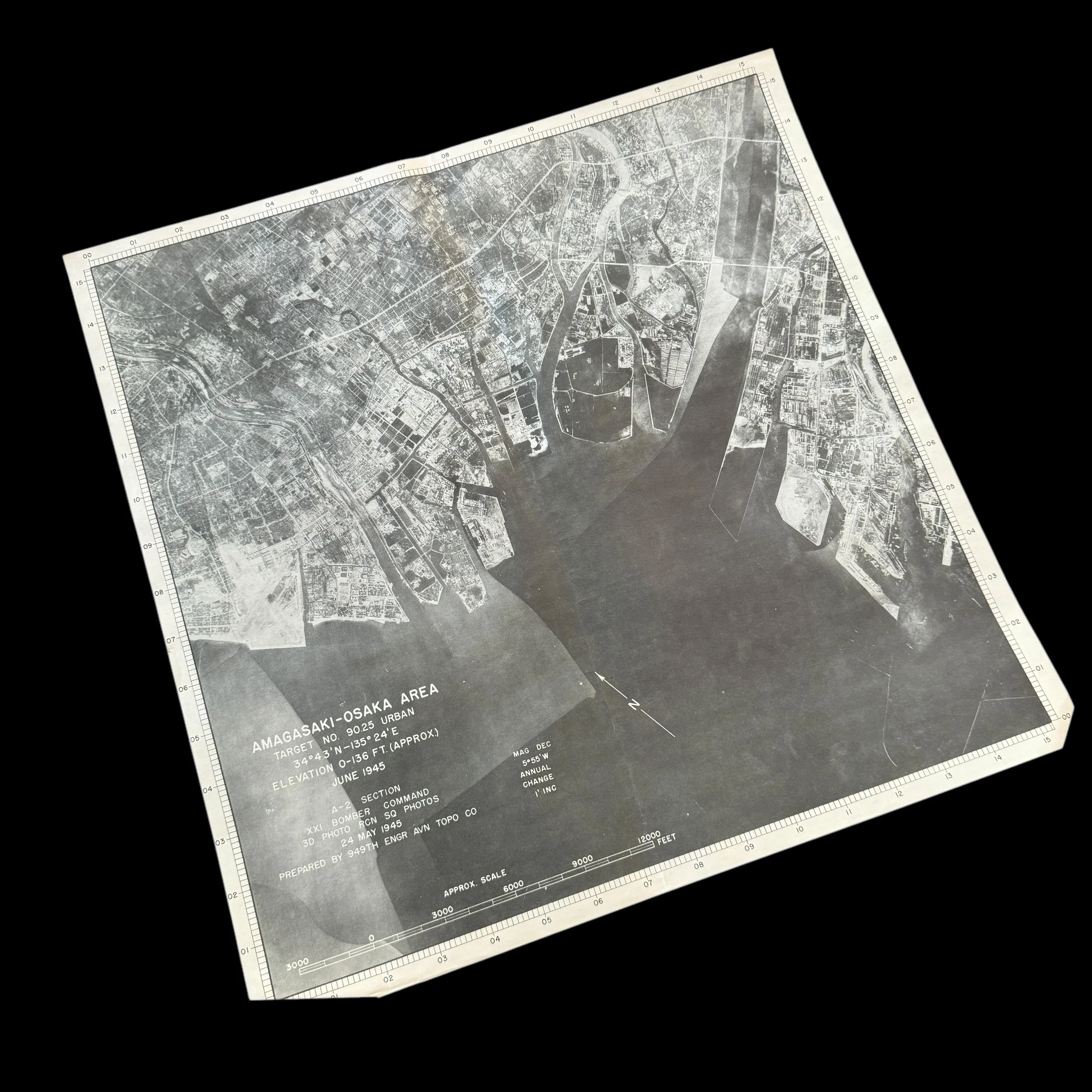
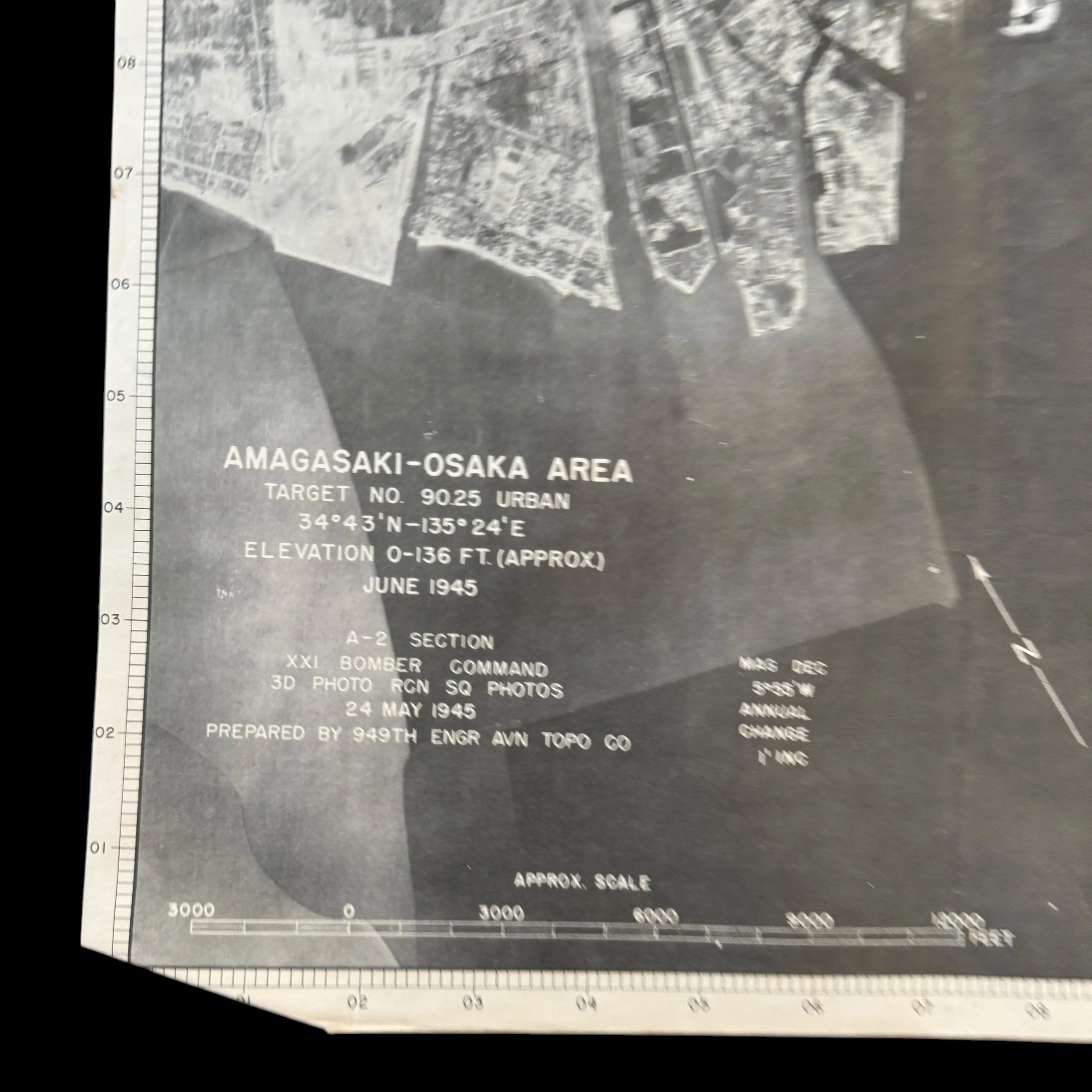
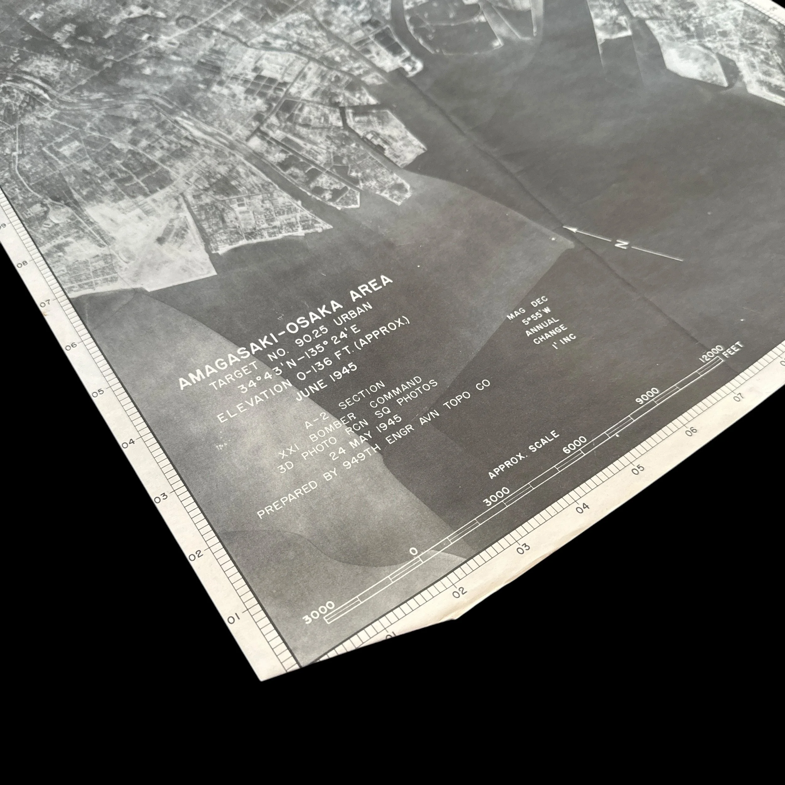
Size: 16 ¼ x 16 ¼ inches
XXI Bomber Command Mission: OSAKA & AMAGASAKI Missions
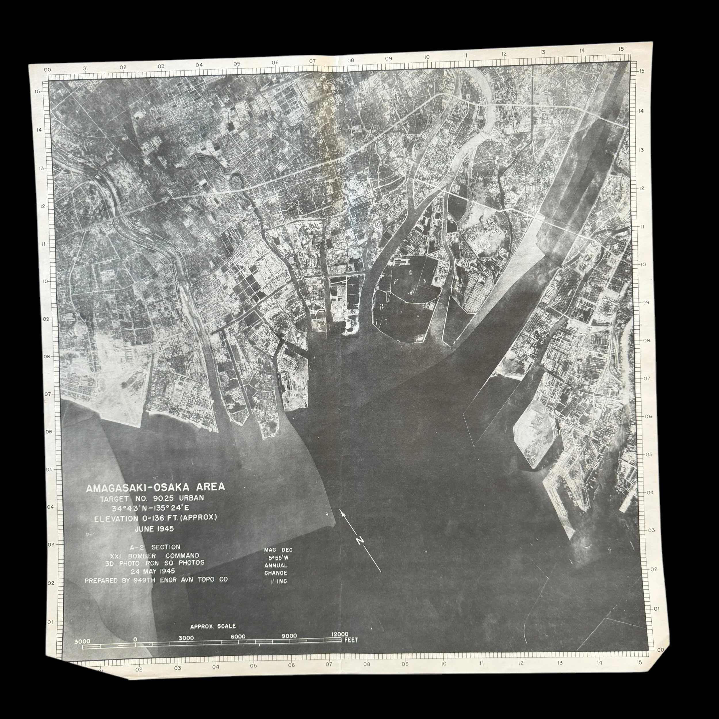
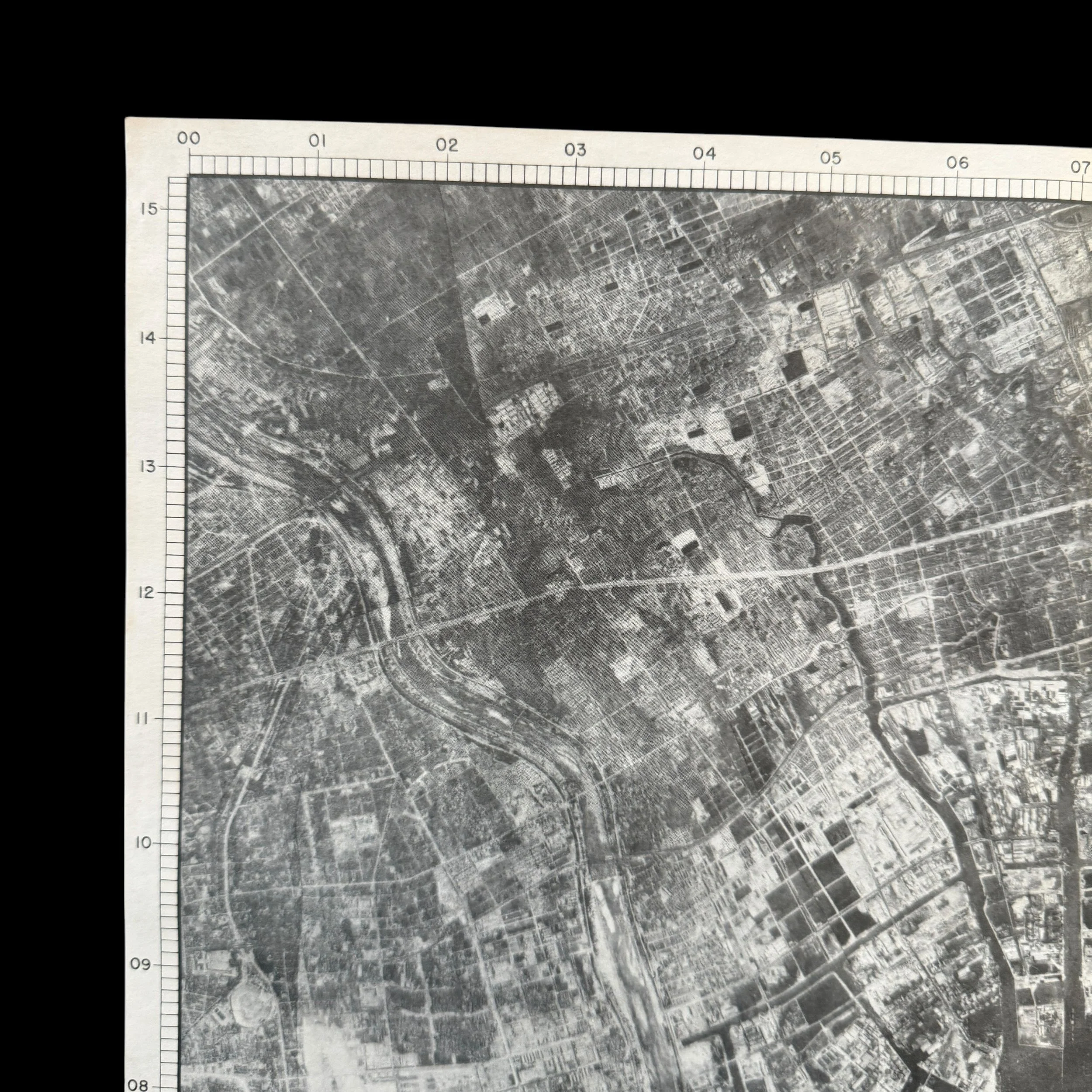
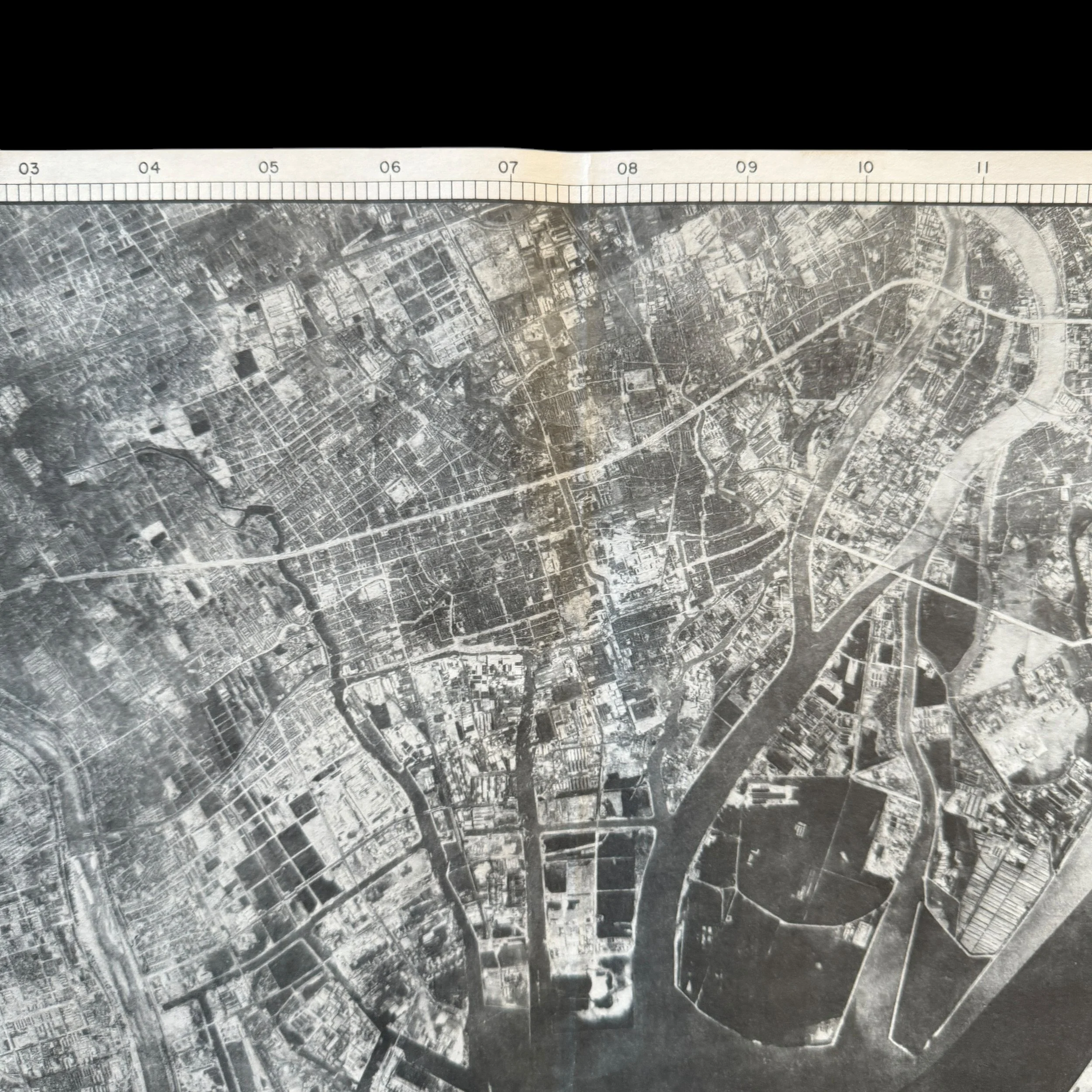
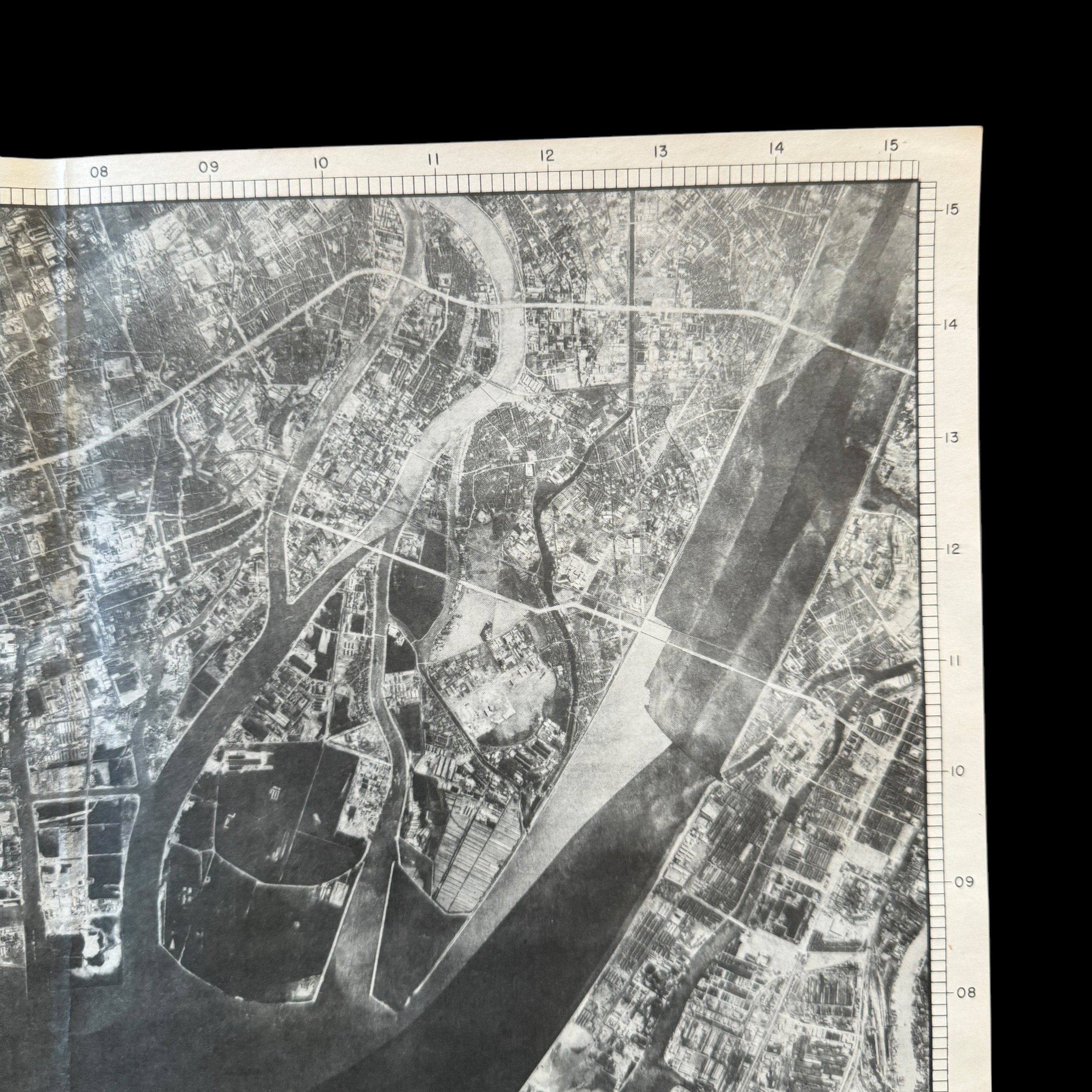
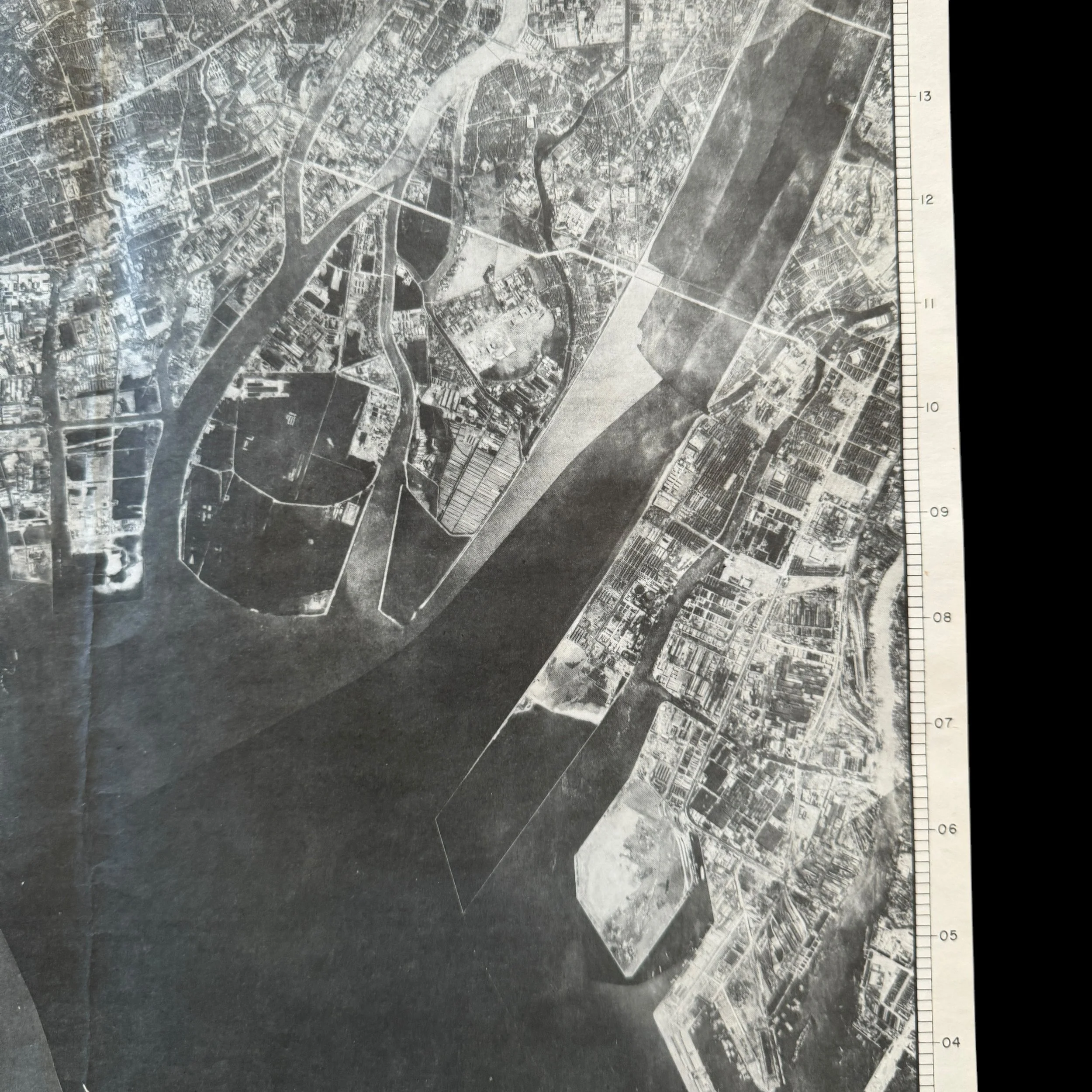
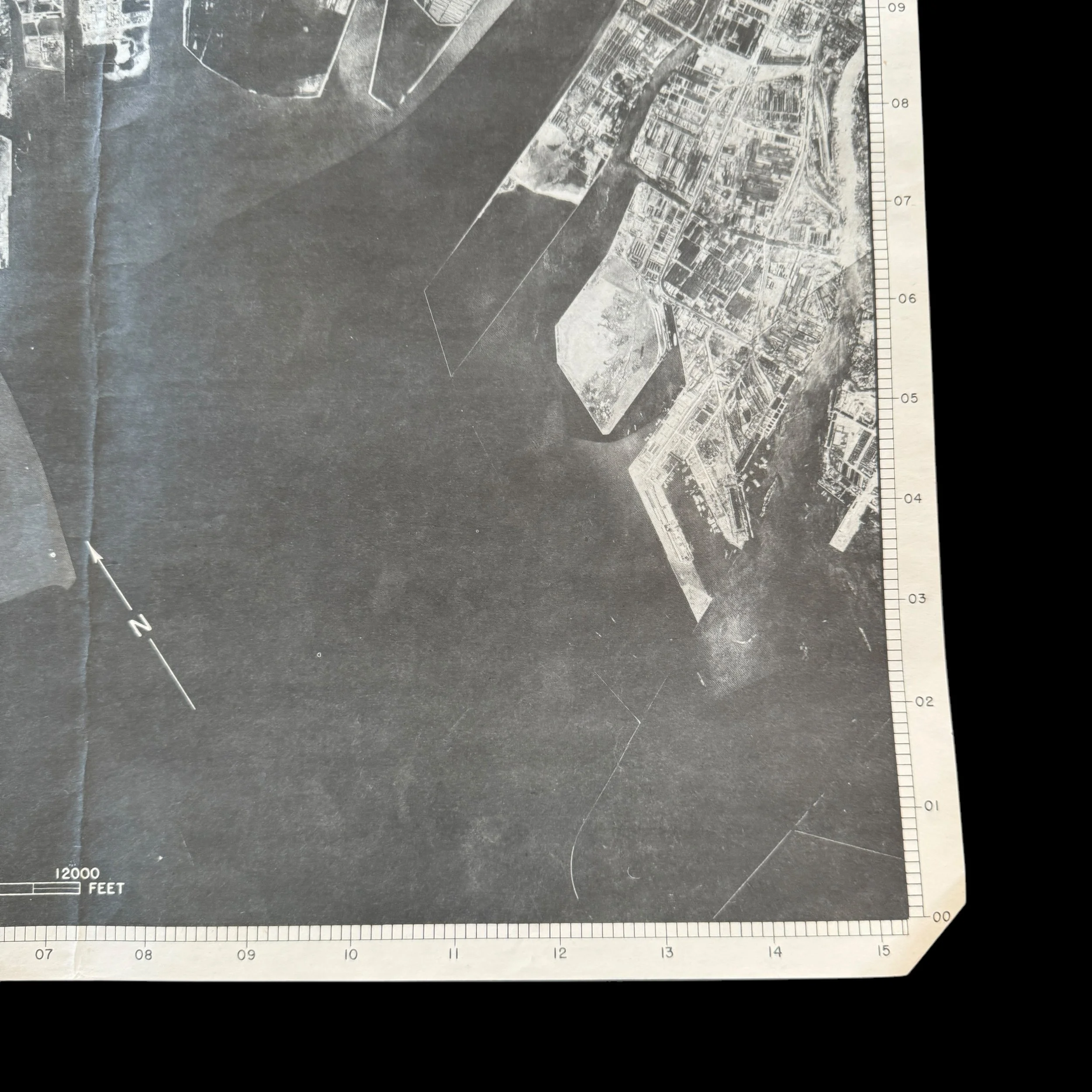
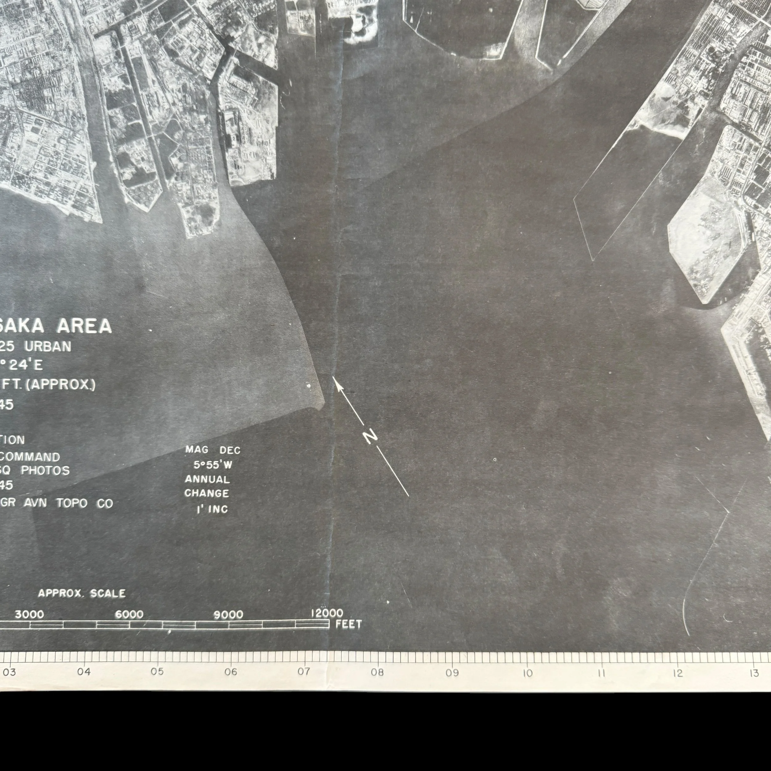
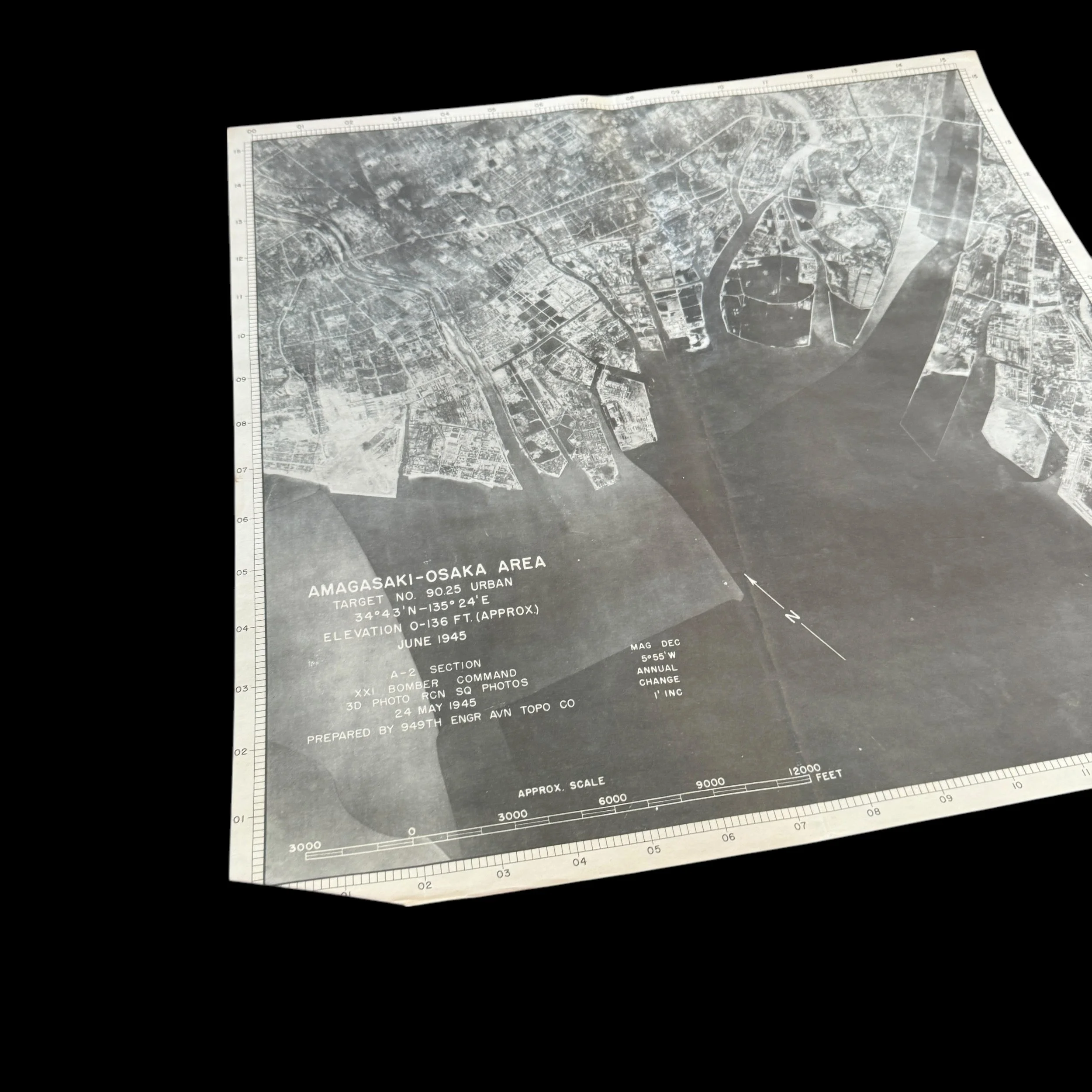
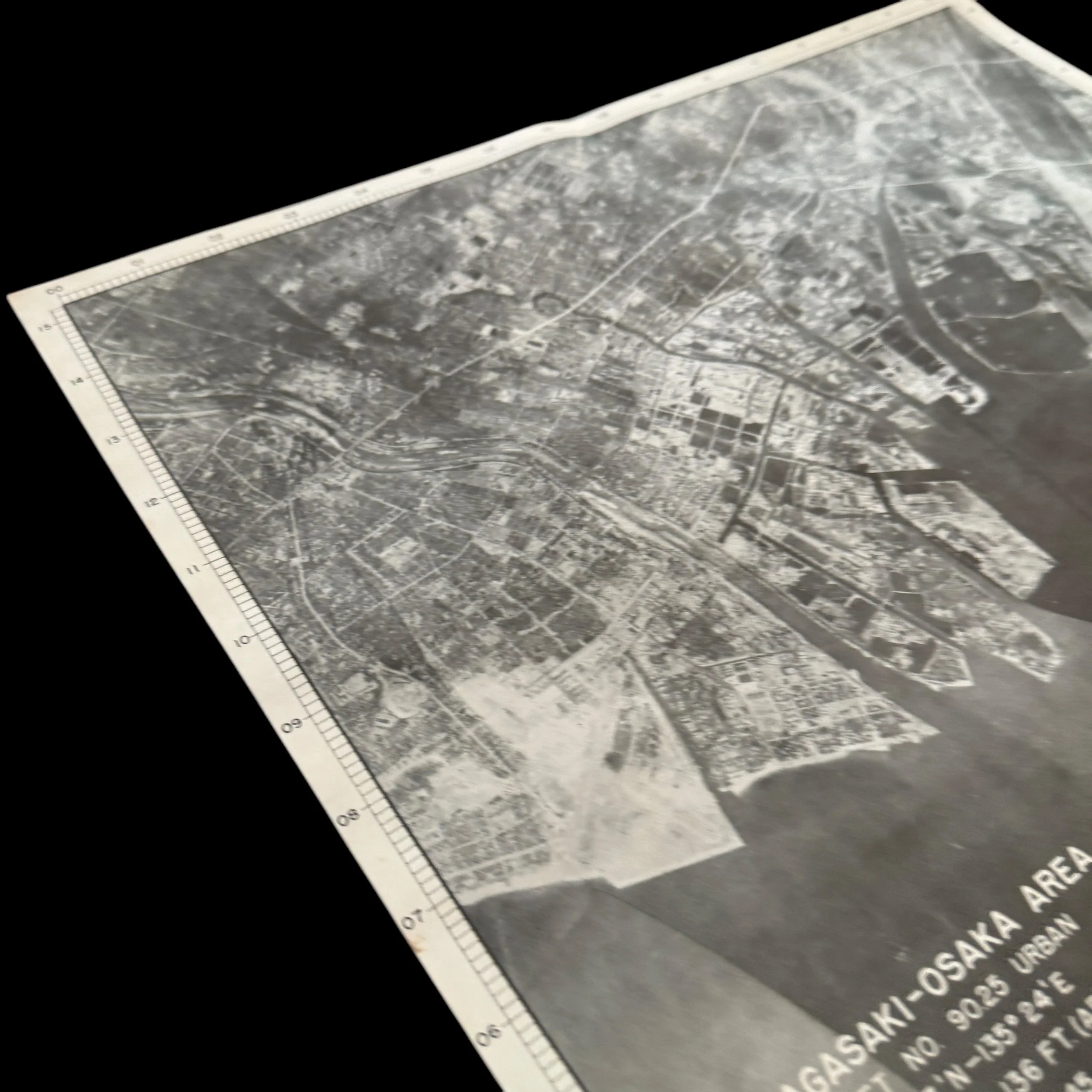
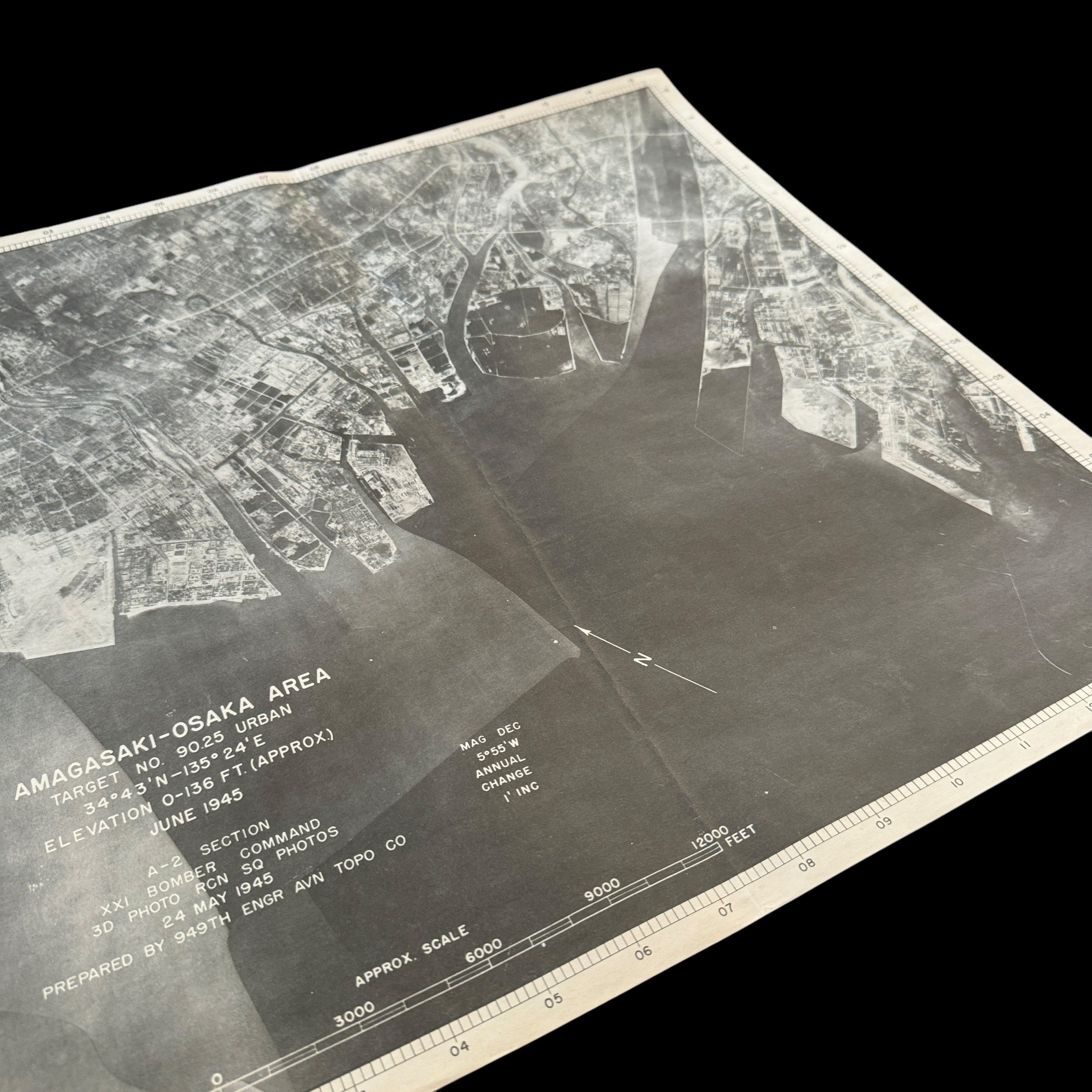
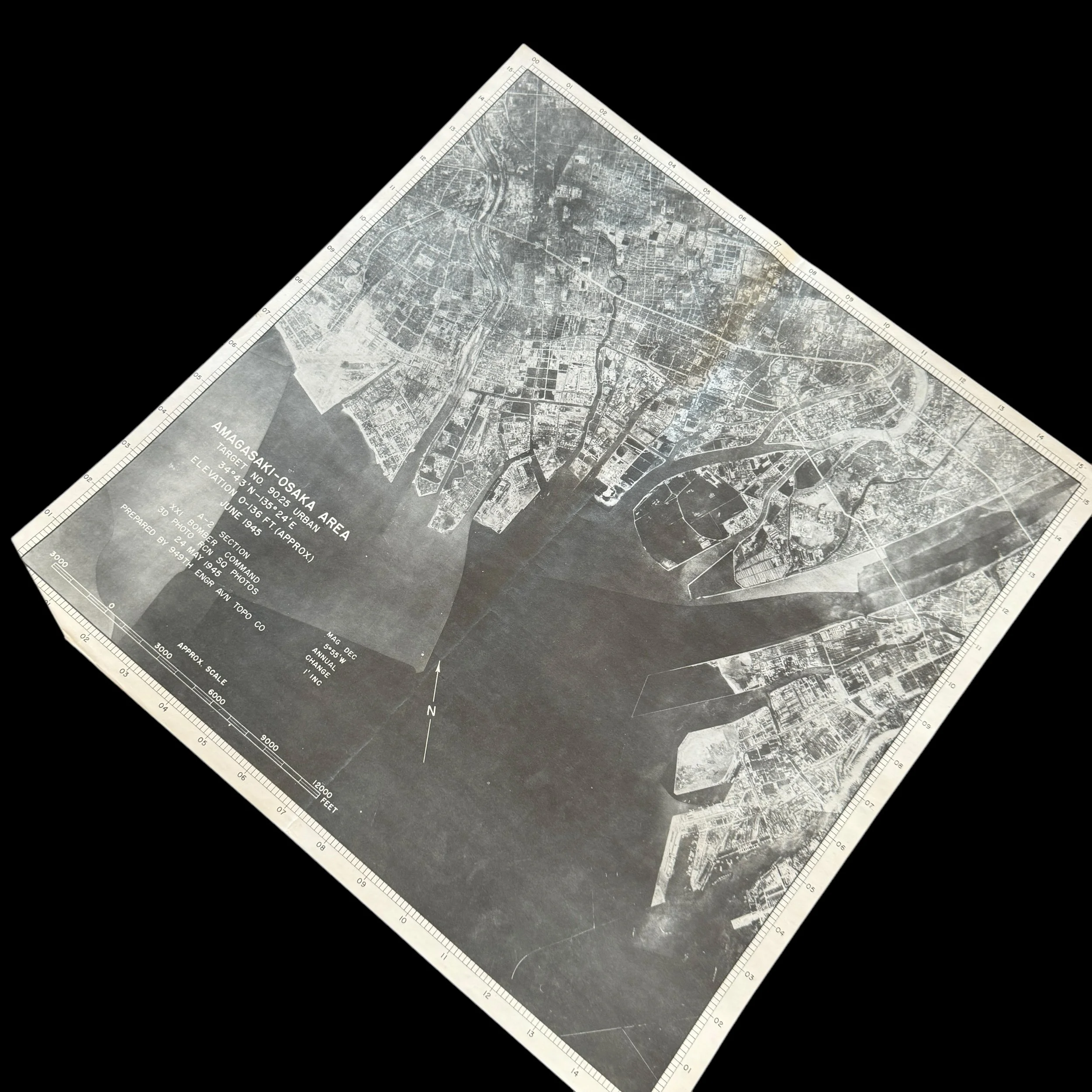
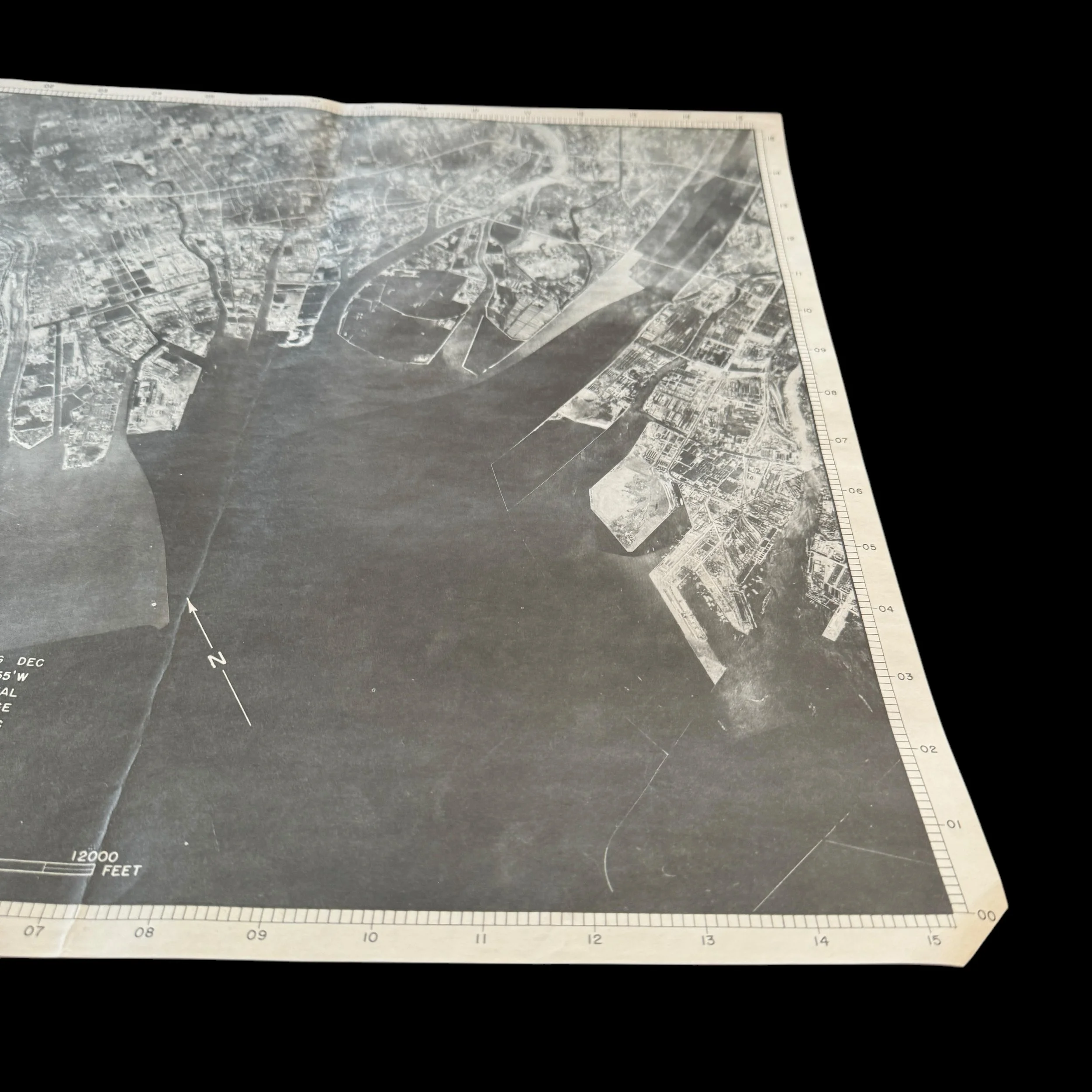
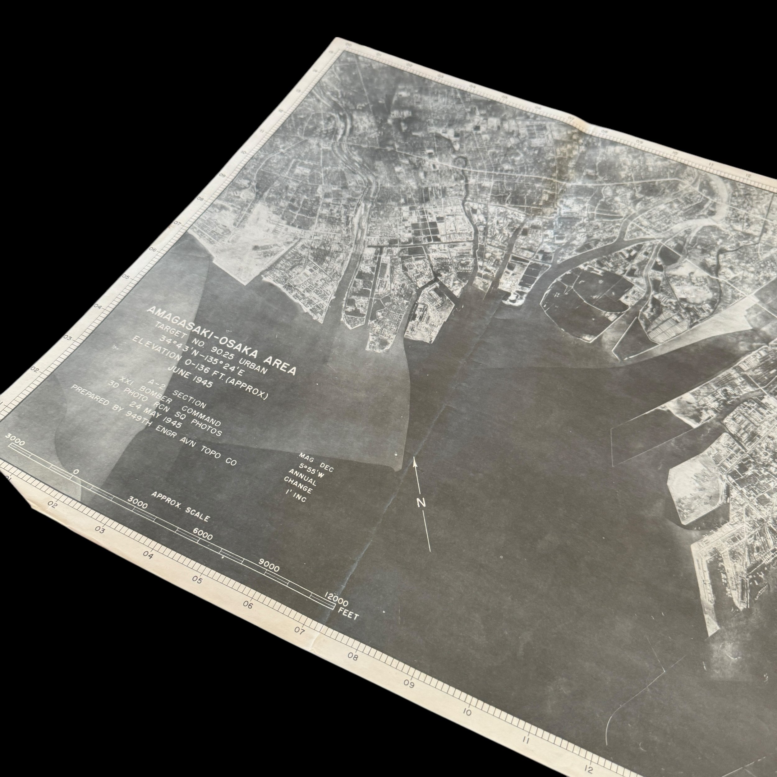
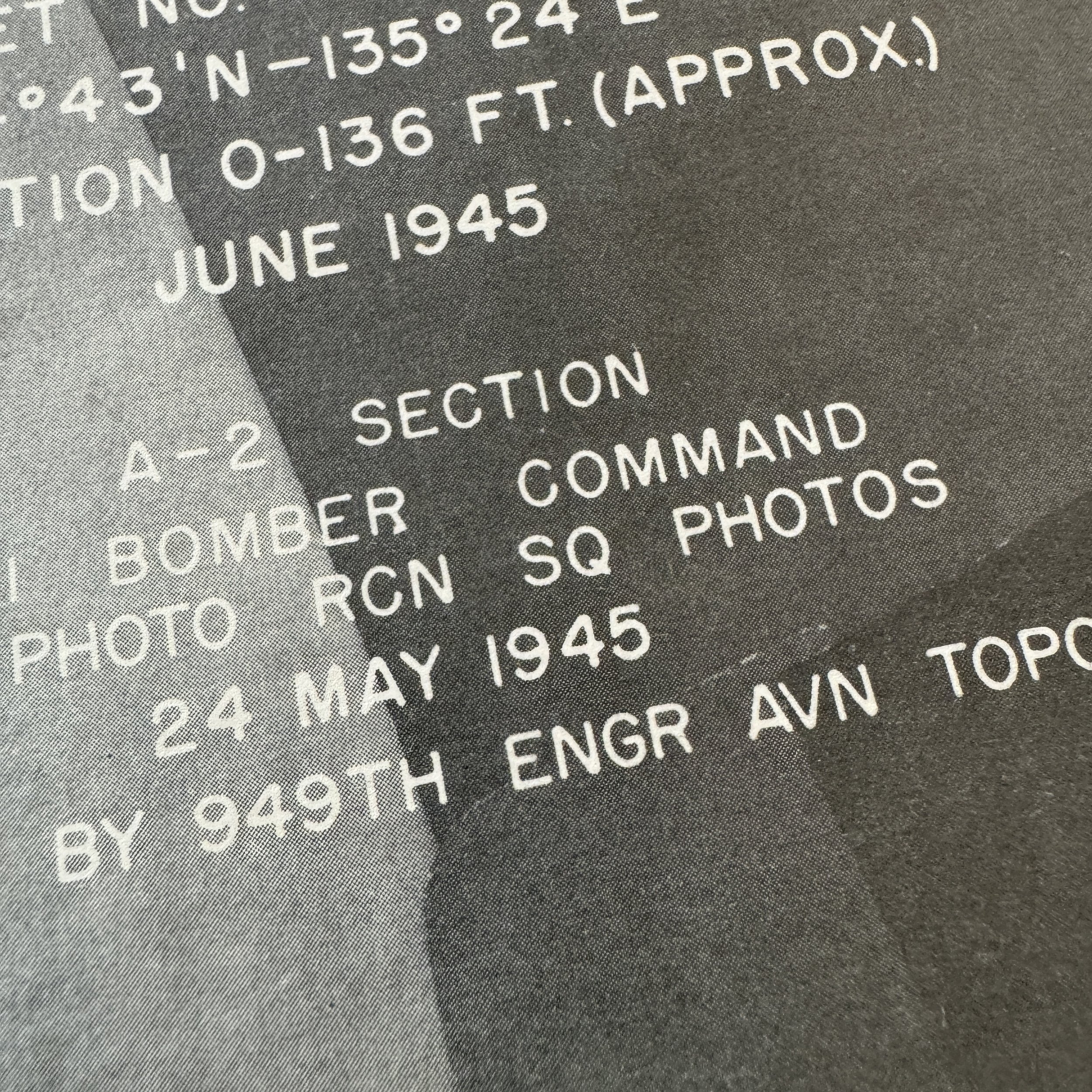
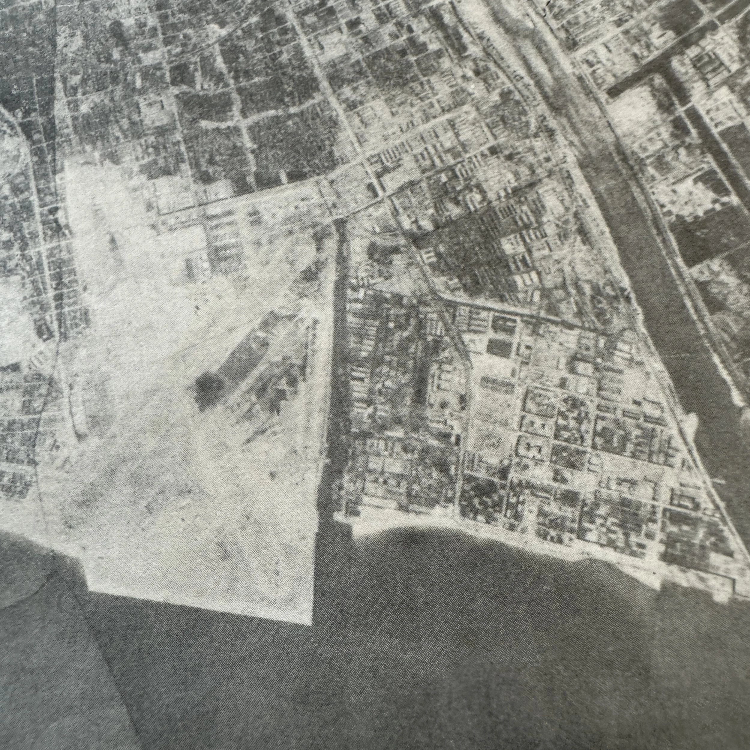
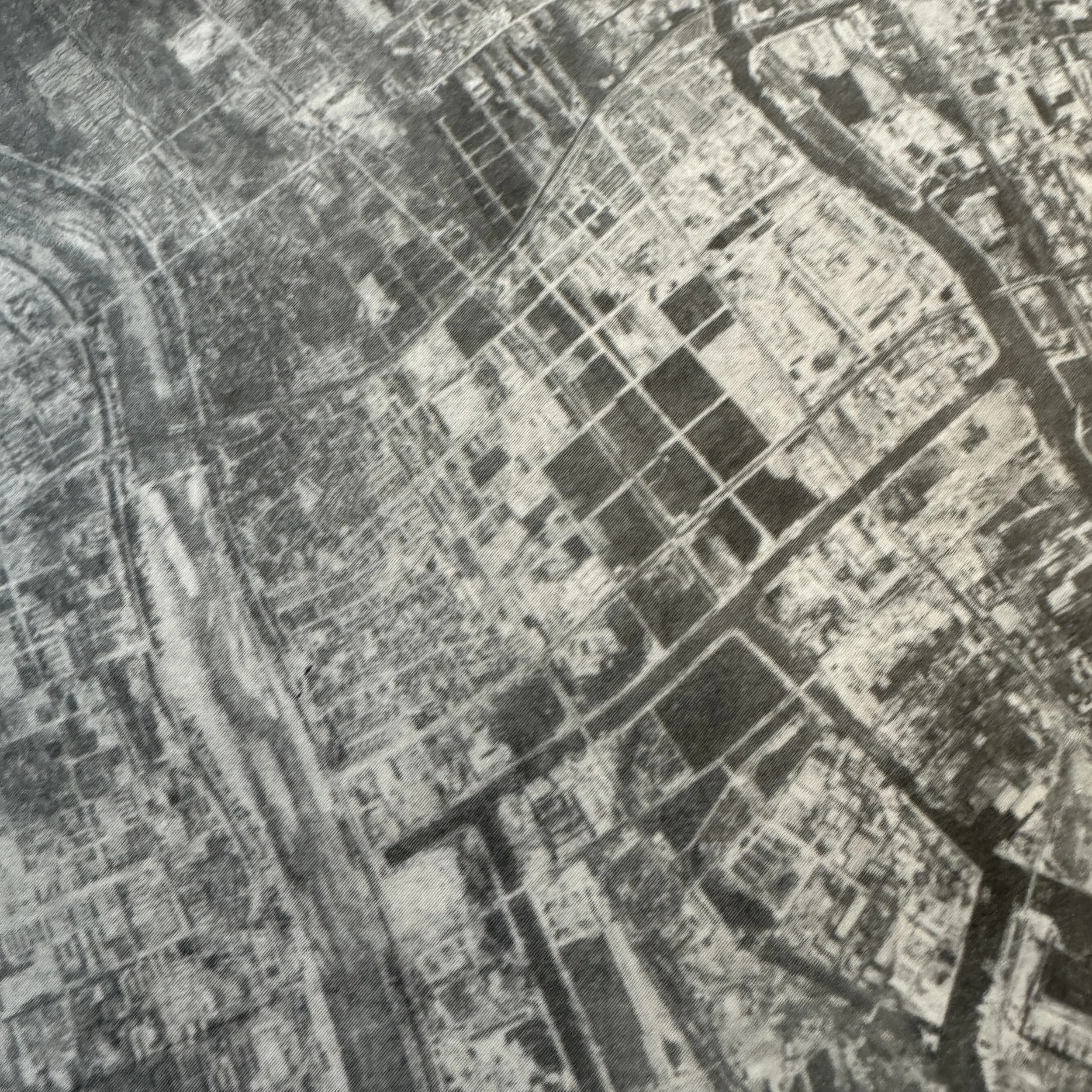
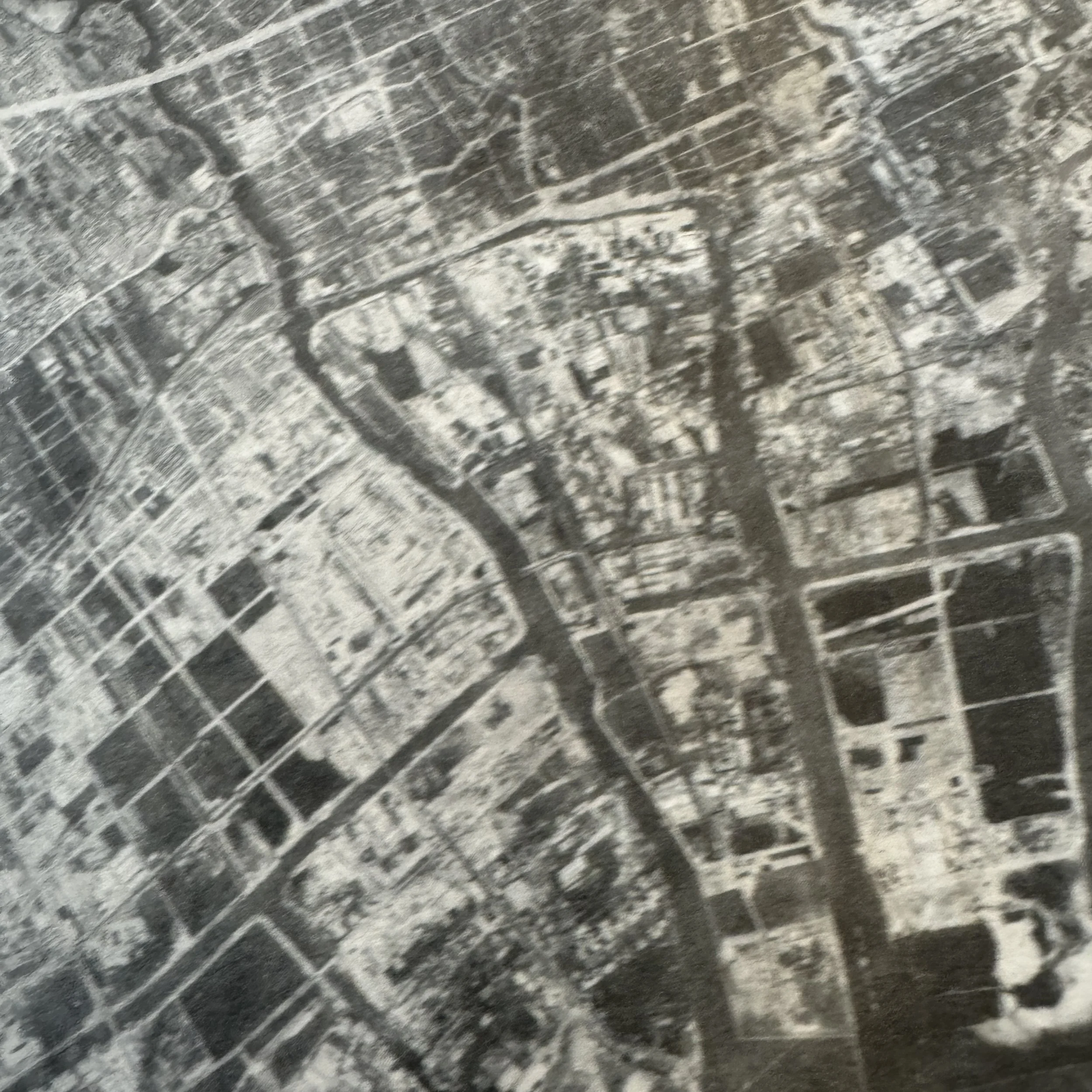
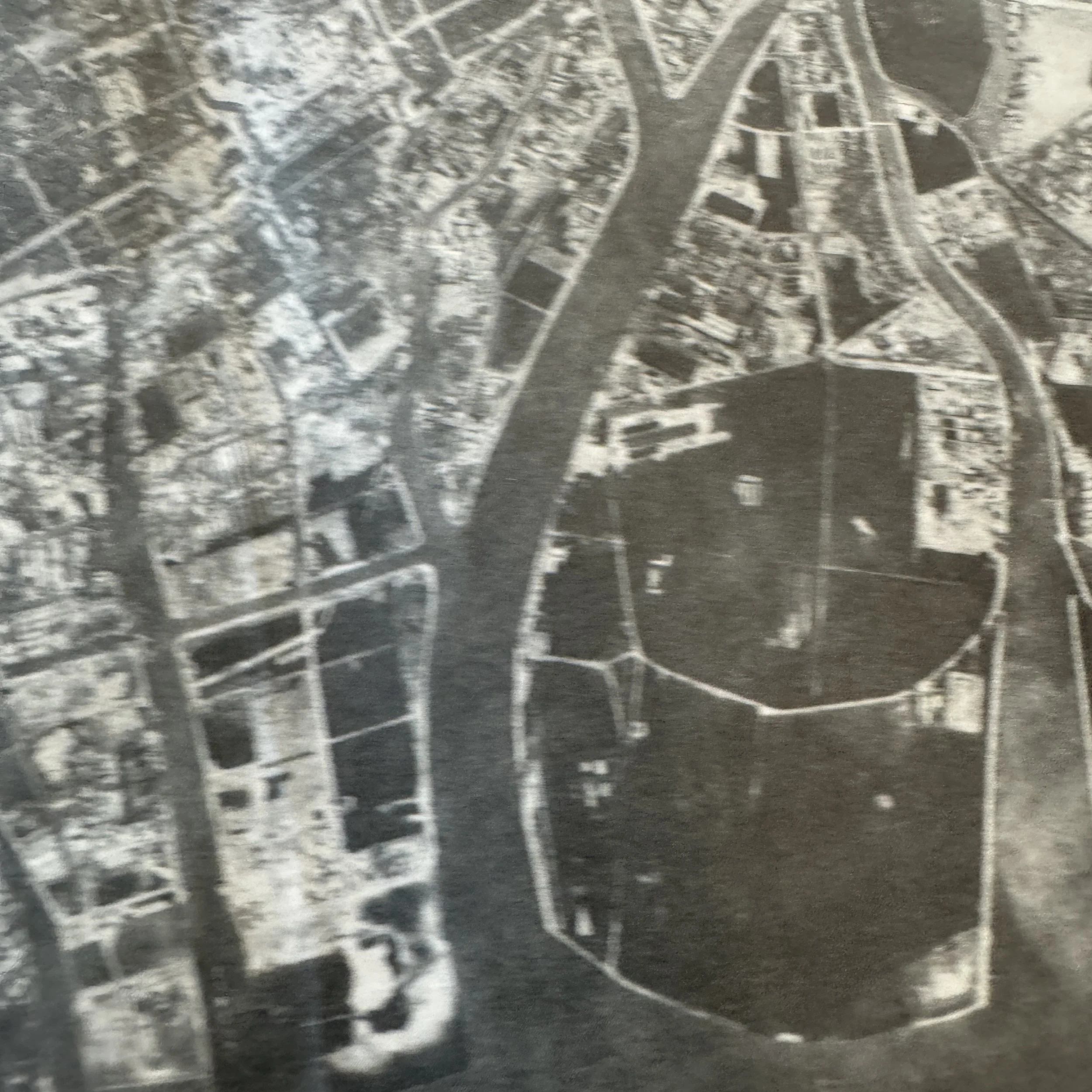
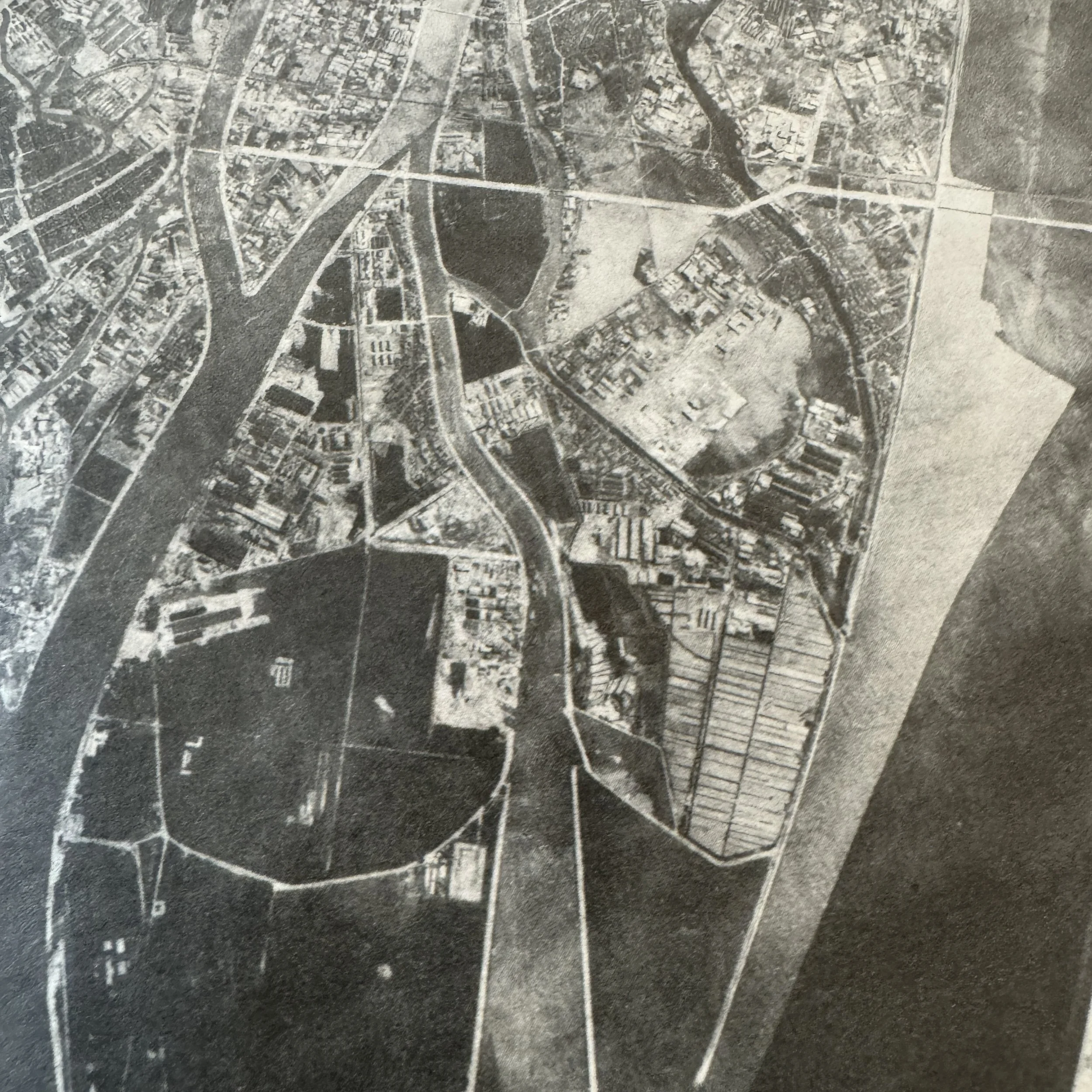
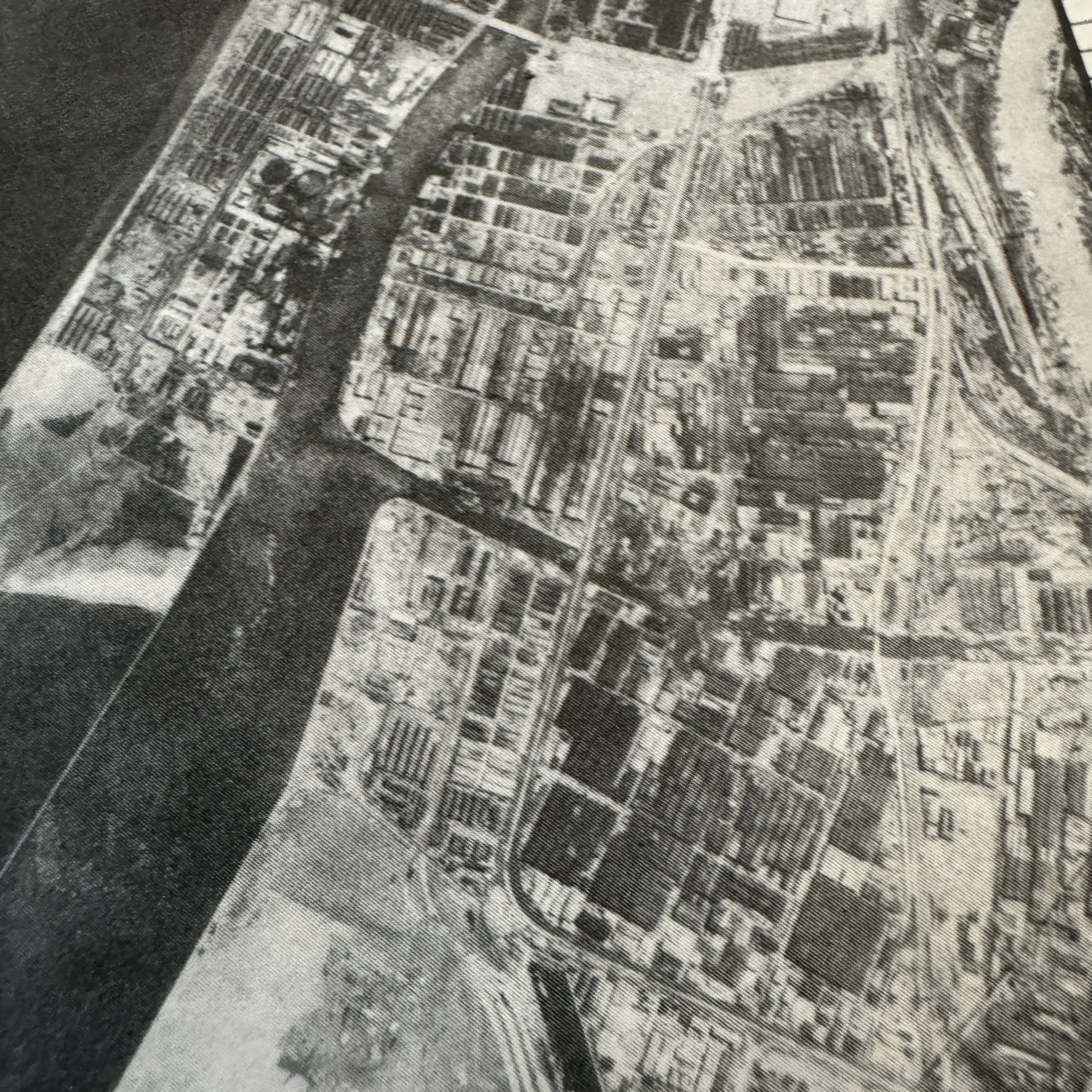
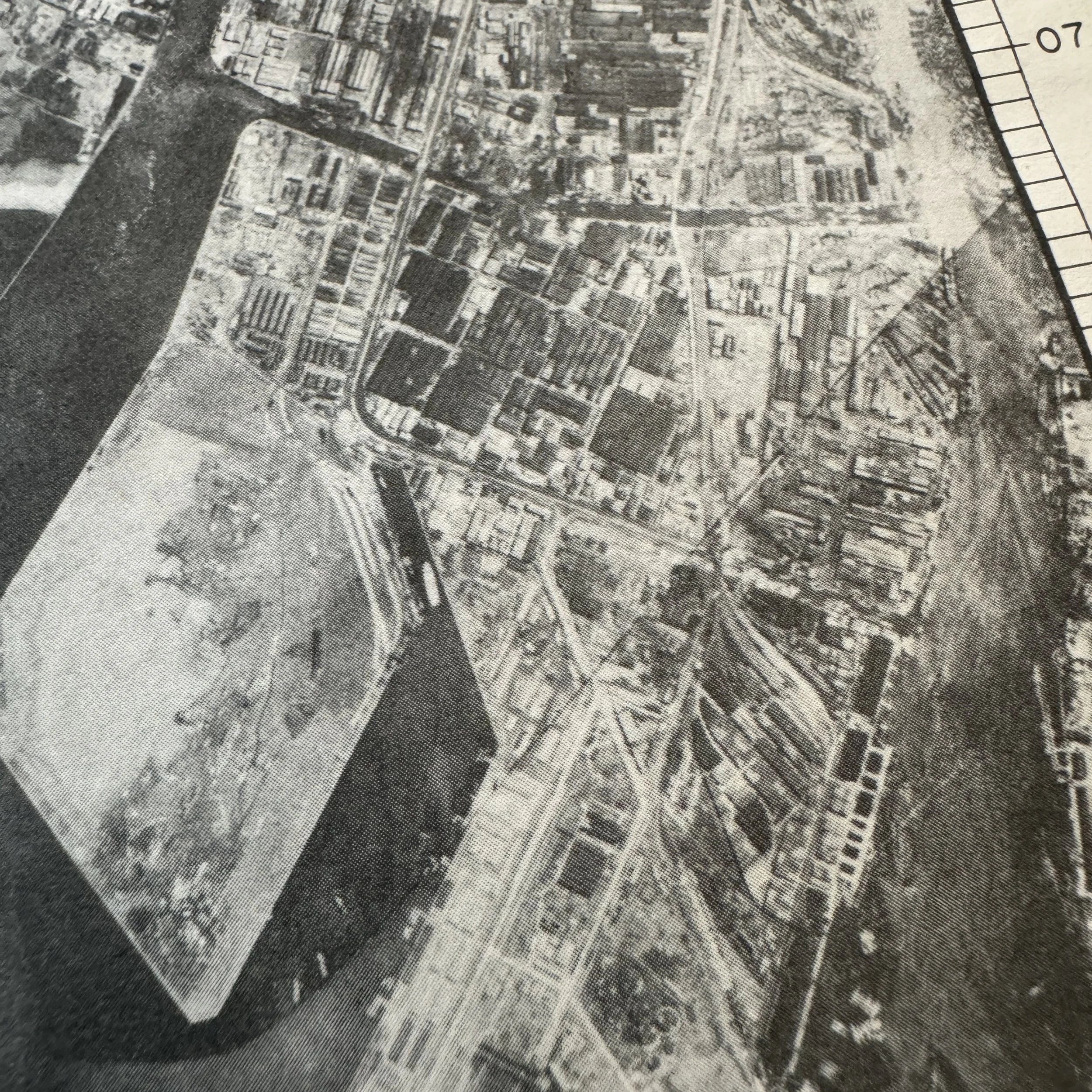
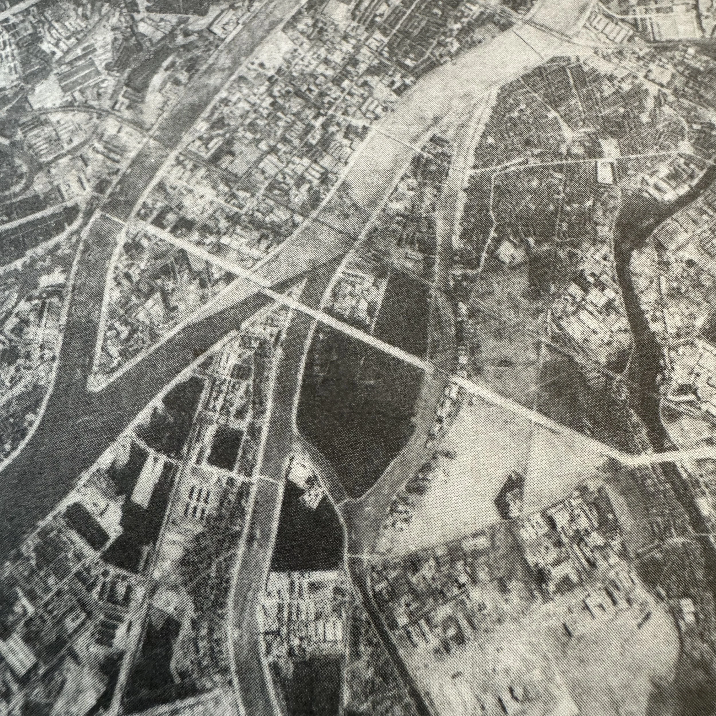
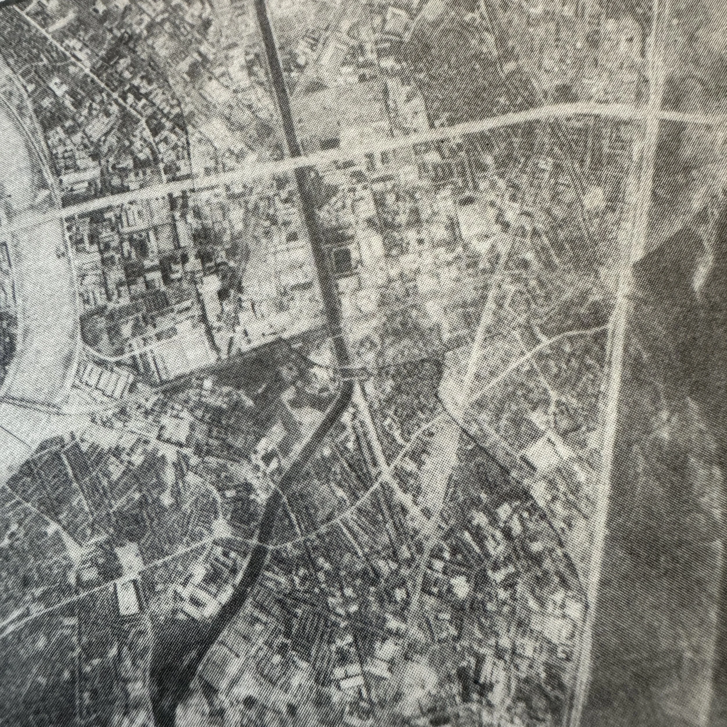
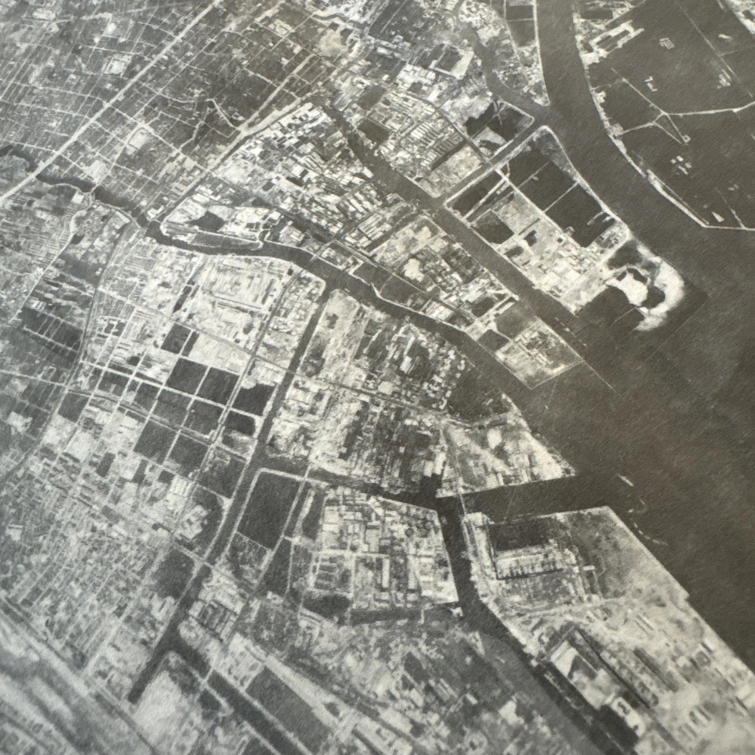
This exceptionally rare and museum-grade artifact is an original World War II XXI Bomber Command (20th Air Force) target aerial photo map, directly linked to the historic long-range strategic bombing campaign against mainland Japan. Used by B-29 Superfortress navigators and bombardiers, this B-29 target mission map played a vital role in precision targeting during the closing months of the Pacific War as part of the United States Army Air Forces’ relentless aerial offensive leading up to the planned invasion of Japan, Operation Downfall. Dated June 1945, the map is formally titled “AMAGASAKI - OSAKA APPROACH — TARGET NO. 90.25 URBAN” and was produced as an A-2 SECTION target chart, representing one of the limited distribution maps created from the latest aerial reconnaissance photographs taken by the elite 3rd Photo Reconnaissance Squadron on May 24, 1945.
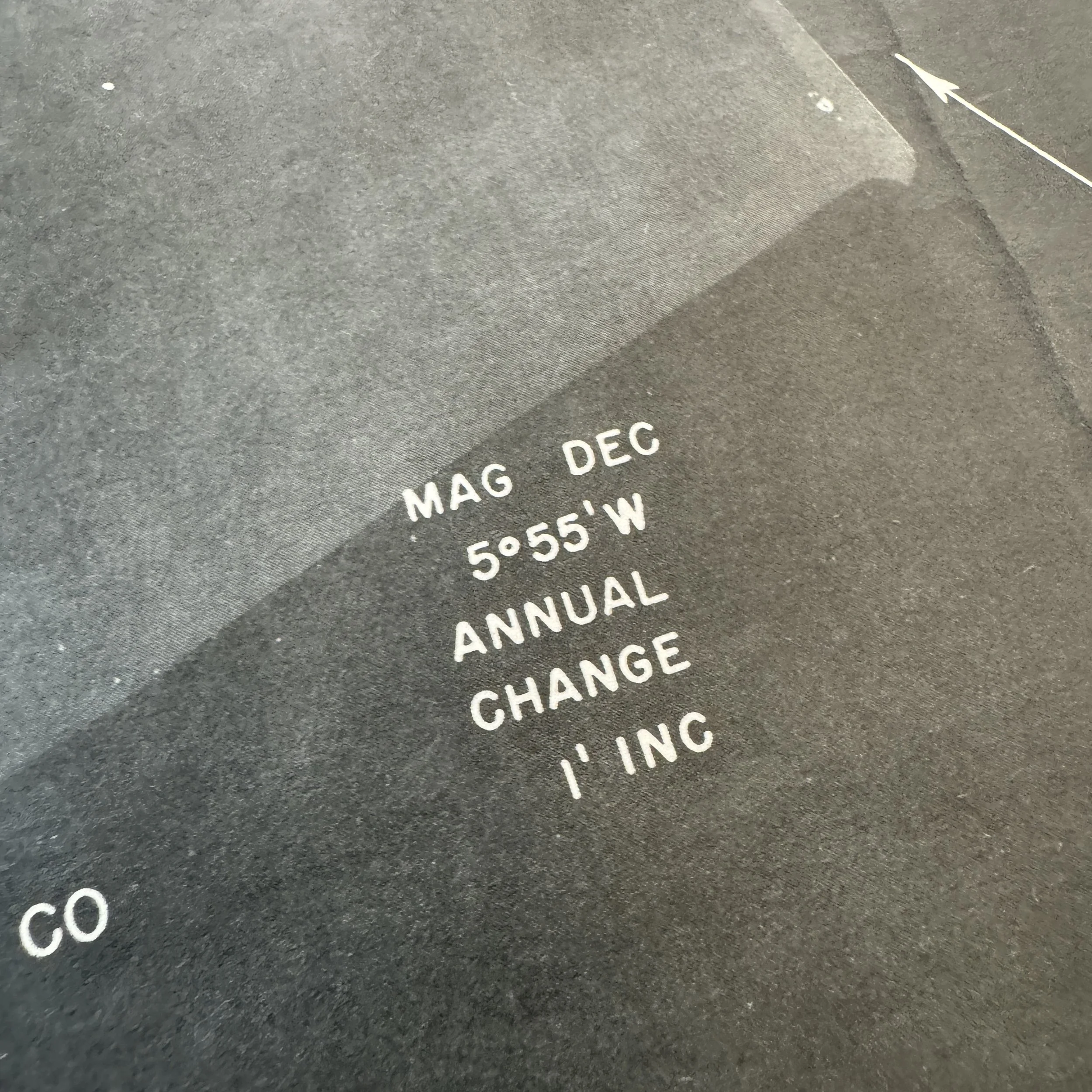
By mid-1945, XXI Bomber Command’s strategy had shifted heavily towards precision urban bombing with incendiaries, targeting Japanese industrial, military, and urban infrastructure. To support this effort, highly detailed target photo charts such as this were prepared using intelligence gathered from high-altitude photographic reconnaissance missions. These images were analyzed, annotated, and transformed into actionable target maps by intelligence and photographic interpretation personnel stationed at the XXI Bomber Command headquarters located on Guam and Tinian, central hubs of the Pacific strategic bombing effort. The maps were designed for ease of use under combat conditions, combining photographic realism with military symbology and reference codes for rapid identification during the heat of a bombing run.
Prior to a raid, these charts were issued to B-29 crew members during intensive mission briefings. Navigators used the charts en route for course correction and position verification as they approached the target area, while bombardiers used them during the critical bomb run phase. The photographic nature of the chart allowed bombardiers to visually match what they saw through their Norden bombsight with the features depicted on the map, ensuring accurate target recognition and improving bombing accuracy. This was especially critical when striking urban areas like Fukushima, where industrial sites and residential zones were often tightly interwoven.
Additionally, these maps featured clearly marked and numbered primary target structures, which were cross-referenced to a separate target key outlining priority objectives such as factories, transportation hubs, and storage facilities. This system was essential for maximizing mission success and minimizing the risk of missing key infrastructure during fast-moving bombing raids often carried out at night or under marginal weather conditions.
Maps of this type were often retained by crew members after missions or destroyed to prevent intelligence compromise, making surviving examples extremely scarce. As such, this aerial photo map from the final summer of the Pacific War offers an extraordinary and tangible connection to the USAAF’s air campaign over Japan and the preparations for what would have been the largest amphibious invasion in history—Operation Downfall. Today, this artifact serves as a powerful reminder of the technological sophistication, strategic intensity, and historical gravity of the final air battles over the Pacific.
3rd Photo Reconnaissance Squadron and Operation Downfall:
The 3rd Photo Reconnaissance Squadron played a crucial and often overlooked role in the success of the XXI Bomber Command’s strategic bombing campaign and the greater planning efforts for Operation Downfall. Flying unarmed and alone deep into enemy territory, these specially modified aircraft, including variants of the F-13 (a reconnaissance version of the B-29), undertook hazardous missions to capture high-resolution aerial photographs of key Japanese industrial, military, and urban targets. Their sorties were critical for updating target intelligence as Japan's infrastructure evolved and as bomb damage assessments became essential for planning repeat missions. These photos, once developed and analyzed by intelligence officers in rear-area command posts on Guam, Tinian, and Saipan, became the foundational source material for the target photo maps issued to combat crews. In the broader context of Operation Downfall—the planned Allied invasion of Japan—the 3rd Photo Recon Squadron’s work was indispensable. Detailed and current aerial photography was needed not only for bombing raids but also to prepare for amphibious assaults, paratrooper landings, and ground operations across the Japanese home islands. Every bridge, road network, factory, and defensive position needed to be identified, cataloged, and evaluated. As part of this enormous logistical and intelligence effort, the photo maps derived from the 3rd’s missions allowed bombardiers and navigators to precisely identify their objectives amidst the sprawling and often smoke-obscured urban landscapes. In essence, these charts transformed raw reconnaissance imagery into mission-critical tools for warfighters, bridging the gap between strategic intelligence and tactical execution in the air.