RARE! WWII VII Fighter Command P-51 Mustang Pilot Anatahan Island (Marianas Group) "Kneepocket" Flight Combat Map
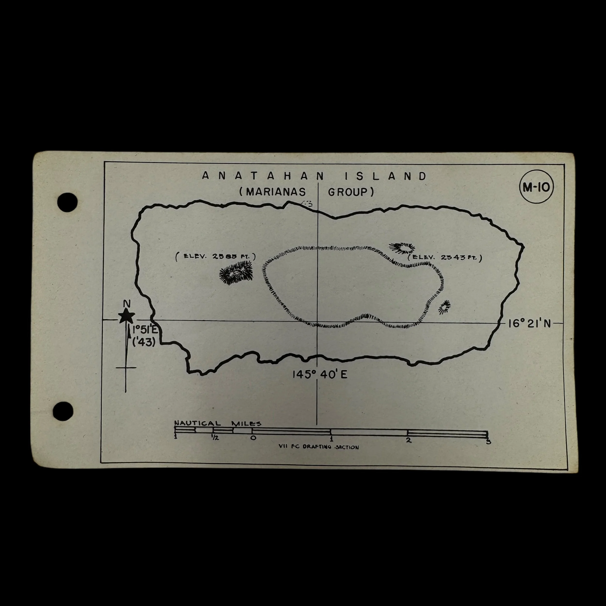


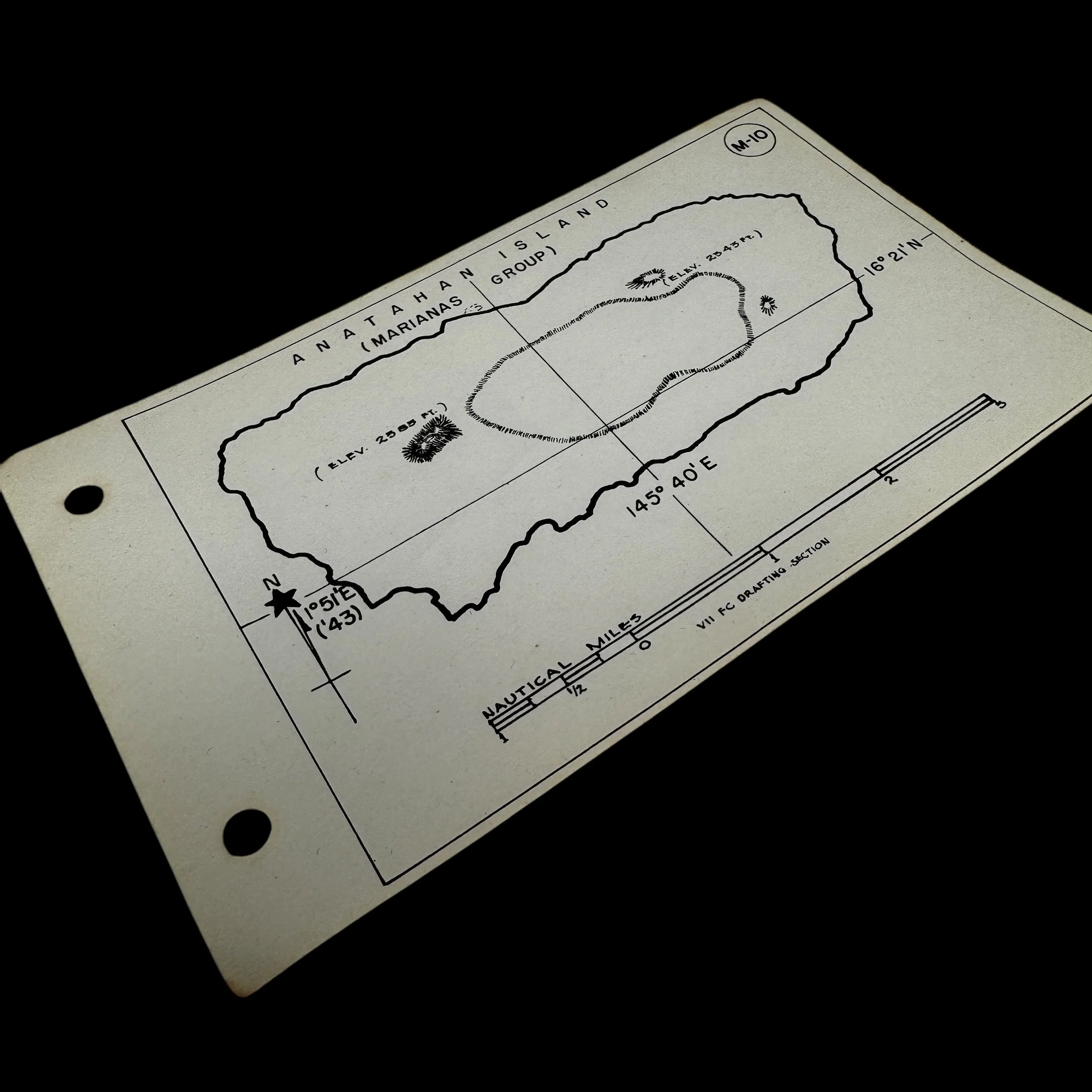


RARE! WWII VII Fighter Command P-51 Mustang Pilot Anatahan Island (Marianas Group) "Kneepocket" Flight Combat Map
Comes with a hand-signed C.O.A.
“As part of the Seventh Air Force, the VII Fighter Command P-51 pilots were instrumental in securing U.S. air superiority, conducting long-range escort missions, and supporting the strategic bombing campaign against Japan. Their deployment in the Marianas Campaign was pivotal to the success of the island-hopping strategy and the eventual destruction of Japan’s war-making capabilities”
Type: Original World War II VII Fighter Command “Kneepocket" Flight Map Specially Made For P-51 Mustang Pilots of the Seventh Air Force’s VII Fighter Command
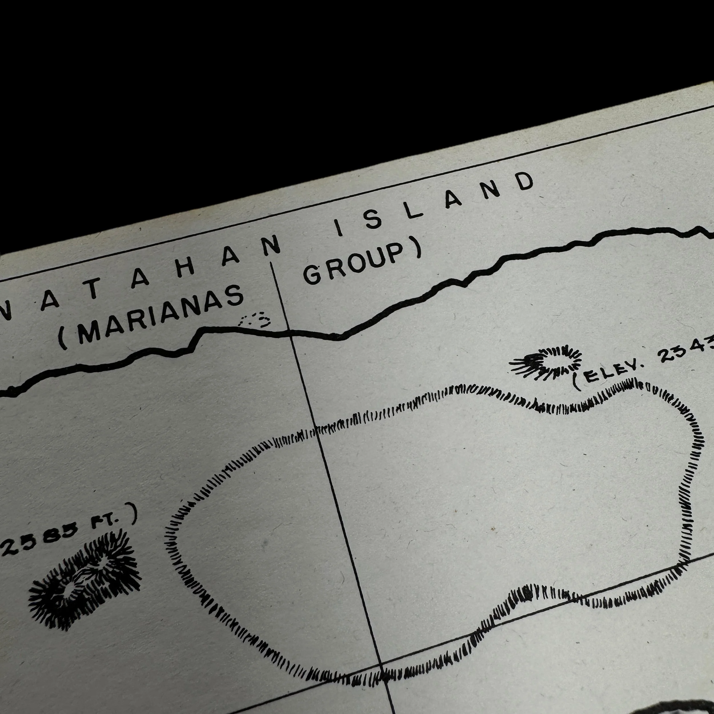
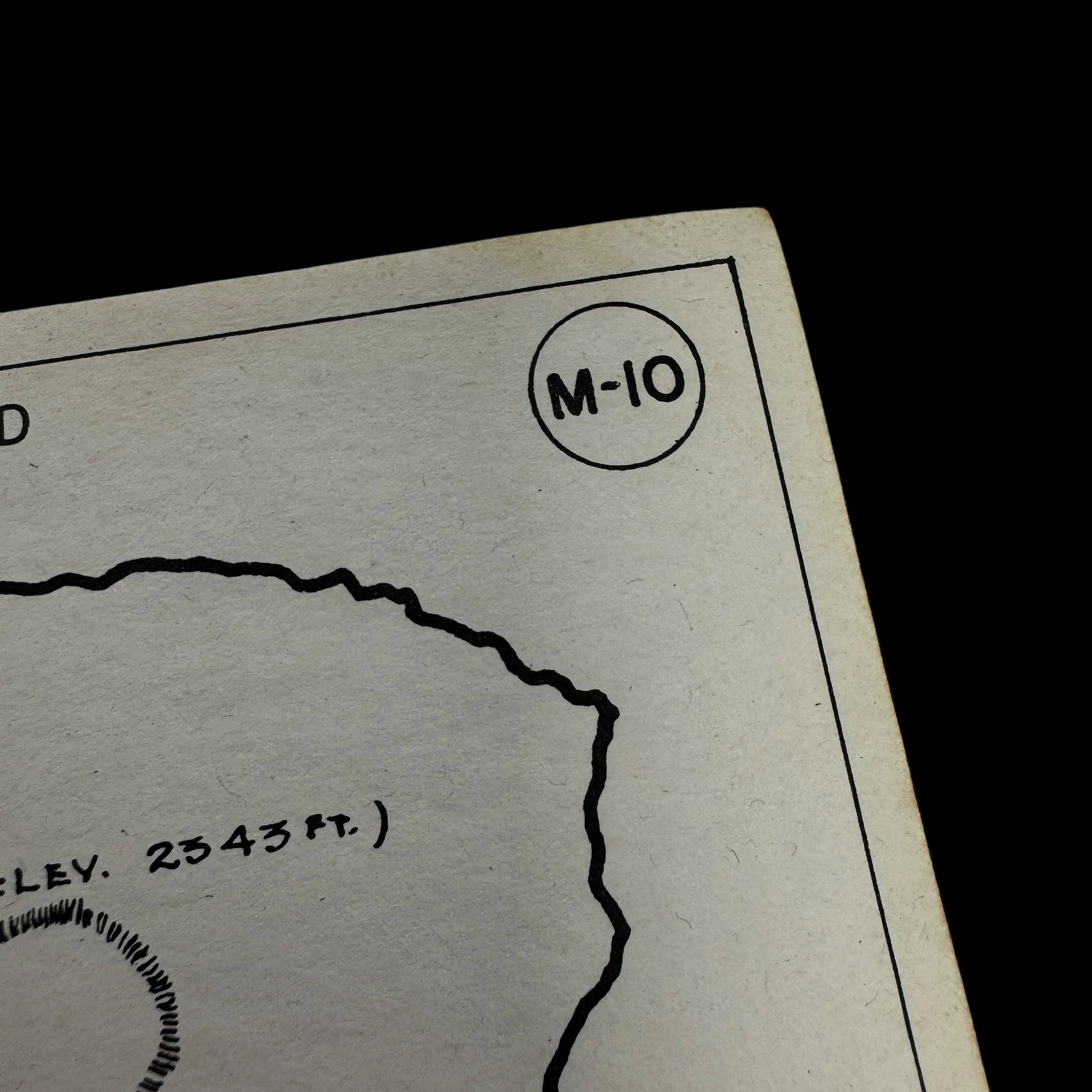
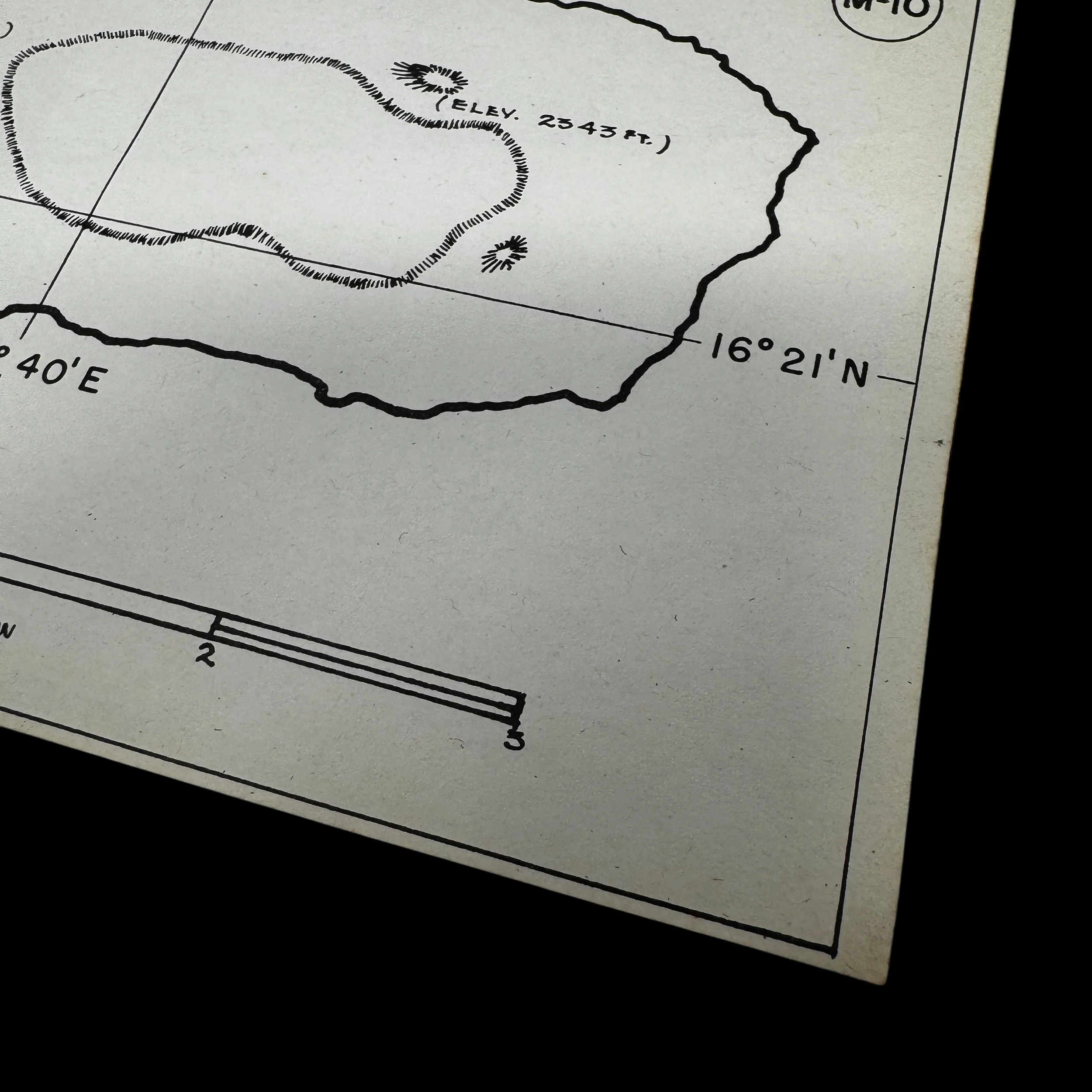
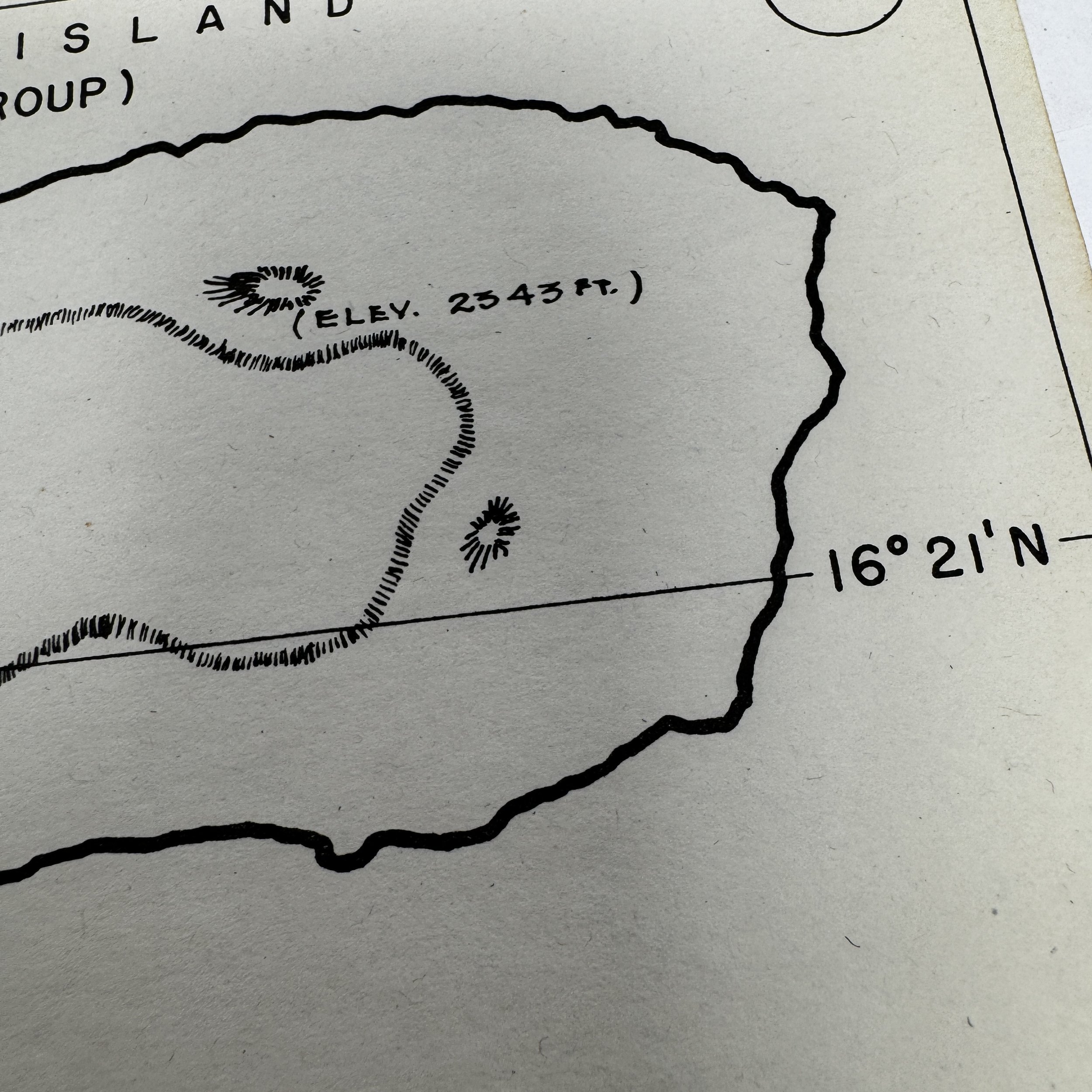
Titled: Anatahan Island - Marianas Group
VII Fighter Command Operations Near Anatahan
While most of the VII Fighter Command’s missions focused on escorting B-29 bombers to Japan, the command also conducted combat patrols over the waters surrounding the Marianas. These missions were designed to protect American naval convoys, intercept Japanese aircraft attempting to disrupt U.S. operations, and provide air cover for American search-and-rescue efforts. The waters near Anatahan were particularly dangerous due to the presence of hidden enemy forces, both in the form of stranded soldiers and potential Japanese submarine activity.
Some of the VII Fighter Command’s operations near Anatahan involved strafing runs against Japanese positions on smaller islands where enemy holdouts were still active. In some cases, pilots reported seeing signal fires or makeshift shelters on the island, indicating the presence of stranded personnel. However, as these isolated garrisons were deemed non-threatening to the overall war effort, most were left alone unless they engaged American forces.
The VII Fighter Command also played a role in reconnaissance missions that documented Japanese activities on Anatahan and other nearby islands. These missions helped U.S. forces monitor potential threats and provided valuable intelligence for later post-war operations aimed at repatriating surviving Japanese personnel.
Size: 4 × 7 inches
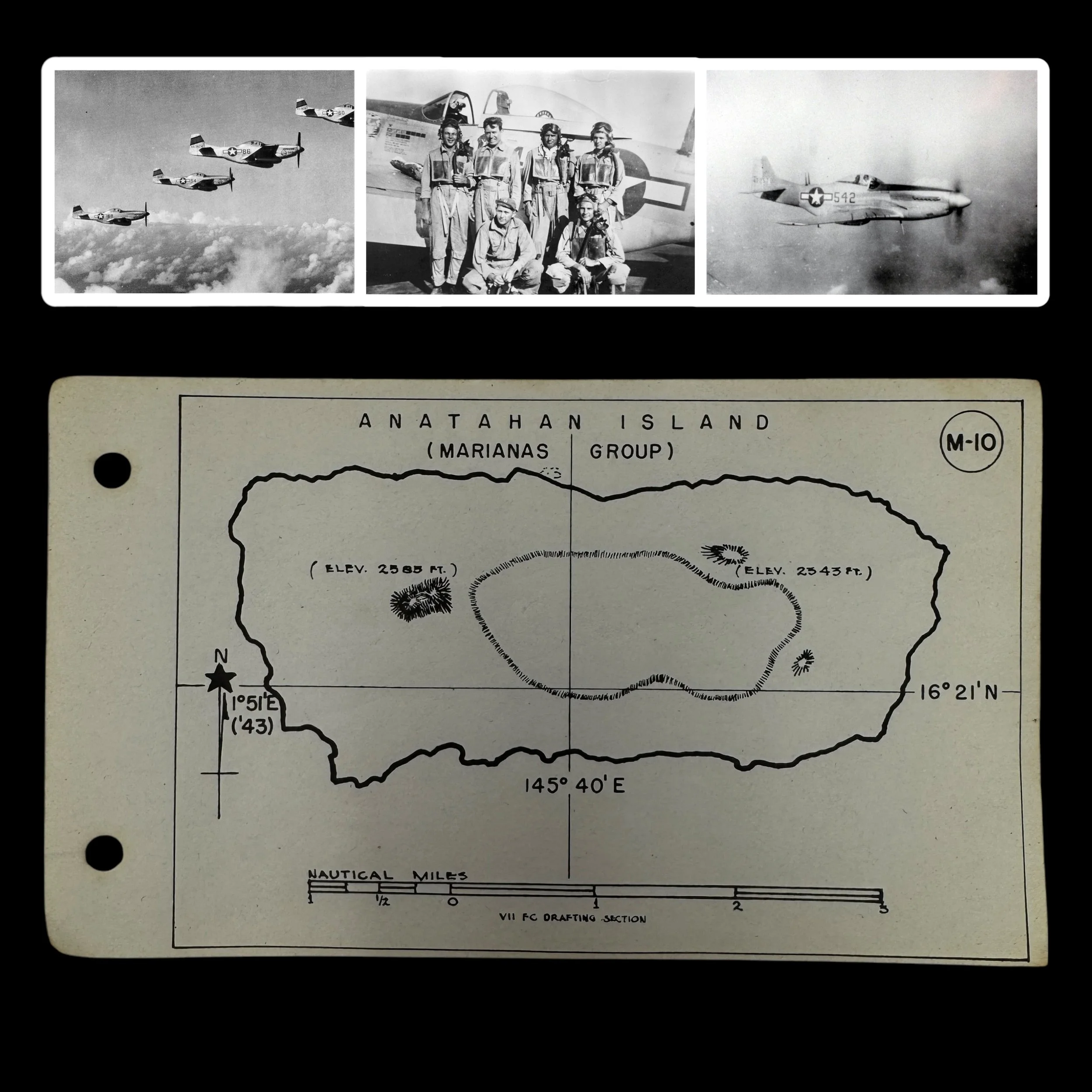
This incredibly rare, museum-grade World War II artifact is an original combat map used by United States Army Air Forces (USAAF) pilots from the Pacific Theater's VII Fighter Command. Known among pilots as the "kneepocket" map, this essential navigation tool was carried by all P-51 Mustang pilots on every combat mission during the war.
Designed and field-printed by the “VII Fighter Command Drafting Section”, this compact yet detailed map was tailored for the specific challenges faced during long-range escort and reconnaissance missions over the vast Pacific Ocean. It was designed to fit perfectly inside the large knee pocket of a P-51 pilot’s flight suit, ensuring easy access without interfering with cockpit controls during combat missions.
The kneepocket map was vital during missions, whether escorting B-29 Superfortresses on Very Long Range (VLR) bombing runs to Japan, or conducting fighter sweeps and reconnaissance. Pilots used this map while in the air to track their positions, coordinate formation movements, and record real-time intelligence on enemy activity and potential targets.
Additionally, the map played a crucial role in emergency planning, providing vital information about nearby islands for potential crash landings. In a theater where engine failure, damage from enemy fire, or fuel shortages posed constant threats, the kneepocket map could mean the difference between survival and being lost at sea.
As a field-produced document, each map was unique, and only a handful of examples with direct connections to the VII Fighter Command have survived, with most reserved for high-end museum archives. Today, these original VII Fighter Command combat maps are exceedingly rare artifacts of WWII aviation history.
The VII Fighter Command in the Marianas: Combat Operations and the Critical Role of the Kneepocket Map with a Focus on Anatahan Island
The VII Fighter Command played an essential role in the Pacific Theater during World War II, particularly in the air war over the Marianas and surrounding islands. As part of the Seventh Air Force, this command was instrumental in executing long-range escort missions, air superiority operations, and ground attack strikes. The capture of key islands in the Marianas, including Guam, Saipan, and Tinian, allowed the VII Fighter Command to extend its operational reach, supporting the strategic bombing campaign against Japan and engaging in vital interdiction missions throughout the region. Among the many critical elements that ensured the success and survival of VII Fighter Command pilots was the "kneepocket" map—an indispensable navigational tool carried by P-51 Mustang pilots in the knee pocket of their flight uniforms. This map was vital in allowing pilots to navigate the vast and treacherous expanse of the Pacific, pinpoint enemy and friendly positions, and, when necessary, locate emergency landing areas or escape routes. One of the most fascinating aspects of the VII Fighter Command’s operations was its connection to the remote and isolated island of Anatahan, a site that would later gain notoriety for its unique post-war history involving stranded Japanese personnel. The VII Fighter Command’s role in the Marianas, combined with the essential use of the kneepocket map and its involvement around Anatahan Island, underscores the complexity and perilous nature of aerial warfare in the Pacific.
The Role of the VII Fighter Command in the Marianas
The VII Fighter Command was initially created to defend Hawaii and the surrounding Pacific islands, but its role quickly expanded as the war progressed. By mid-1944, following the successful capture of the Marianas, the command was assigned the critical task of providing fighter escort for the B-29 Superfortresses of the XXI Bomber Command. These bombers, operating from newly established airfields on Saipan, Tinian, and Guam, launched strategic bombing missions deep into the Japanese Home Islands. However, the long distances involved in these missions meant that American bombers were highly vulnerable to Japanese fighter attacks. The introduction of the long-range P-51 Mustang, combined with the VII Fighter Command’s ability to conduct extended escort missions, significantly improved the effectiveness and survivability of these operations.
The VII Fighter Command was not solely limited to escort duties. Pilots also carried out ground-attack missions, reconnaissance flights, and search-and-rescue operations. The vastness of the Pacific presented a unique challenge compared to the European Theater; instead of cities, rivers, and roads, pilots navigated an expanse of open ocean dotted with small, often indistinguishable islands. The challenge of precise navigation in such an environment made tools like the kneepocket map invaluable.
The Importance of the Kneepocket Map
Every P-51 Mustang pilot in the VII Fighter Command carried a kneepocket map on each mission. This small but highly detailed map was specifically designed to fit in the knee pocket of a pilot’s uniform, ensuring quick and easy access in the cramped cockpit. The kneepocket map contained crucial information, including the locations of friendly airfields, known enemy positions, radio frequencies, and emergency landing or bailout zones. Given the long distances over open ocean, these maps were vital in helping pilots return to base, especially if they became disoriented or were forced to divert due to mechanical failure or combat damage.
For pilots flying from the Marianas, the kneepocket map was also essential for avoiding or identifying small, isolated islands that could be used as emergency landing sites—or, conversely, islands that were still occupied by Japanese forces. Many of the smaller islands in the region remained under Japanese control even after the American capture of the major Marianas bases. Some of these islands, such as Anatahan, would become infamous for their role in post-war Japanese holdouts. The VII Fighter Command pilots flying missions near such islands had to be acutely aware of their surroundings, using their kneepocket maps to ensure they did not accidentally land or ditch in hostile territory.
Anatahan Island and the VII Fighter Command
Anatahan Island, a small volcanic island in the Northern Marianas, played a unique and somewhat mysterious role in the Pacific War. Although the island was not a primary target of American military operations, it was frequently overflown by VII Fighter Command pilots conducting reconnaissance, interdiction, and bomber escort missions. Anatahan’s steep terrain and dense vegetation made it an unappealing location for airstrips, but it remained strategically significant due to the presence of Japanese personnel stranded there.
During the latter part of the war, American aircrews often reported seeing signs of Japanese activity on Anatahan. These reports were confirmed after the war when it was discovered that a group of Japanese soldiers and sailors had been stranded on the island since 1944, surviving off the land for years. These men, cut off from the rest of the world, refused to believe that the war had ended until they were finally convinced to surrender in 1951.
For VII Fighter Command pilots flying over Anatahan, the kneepocket map provided a critical reference for avoiding unnecessary engagement with such isolated enemy forces. The map included notations on suspected Japanese positions and known safe zones, ensuring that pilots had a clear understanding of the risks associated with various islands. In emergency situations, the map could also guide pilots toward American-controlled islands where they could land or be rescued rather than ending up in hostile territory.
VII Fighter Command Operations Near Anatahan
While most of the VII Fighter Command’s missions focused on escorting B-29 bombers to Japan, the command also conducted combat patrols over the waters surrounding the Marianas. These missions were designed to protect American naval convoys, intercept Japanese aircraft attempting to disrupt U.S. operations, and provide air cover for American search-and-rescue efforts. The waters near Anatahan were particularly dangerous due to the presence of hidden enemy forces, both in the form of stranded soldiers and potential Japanese submarine activity.
Some of the VII Fighter Command’s operations near Anatahan involved strafing runs against Japanese positions on smaller islands where enemy holdouts were still active. In some cases, pilots reported seeing signal fires or makeshift shelters on the island, indicating the presence of stranded personnel. However, as these isolated garrisons were deemed non-threatening to the overall war effort, most were left alone unless they engaged American forces.
The VII Fighter Command also played a role in reconnaissance missions that documented Japanese activities on Anatahan and other nearby islands. These missions helped U.S. forces monitor potential threats and provided valuable intelligence for later post-war operations aimed at repatriating surviving Japanese personnel.
The VII Fighter Command’s contributions to the Pacific War were essential in securing American air dominance and ensuring the success of the strategic bombing campaign against Japan. The command’s pilots faced extreme challenges, including long-range navigation, open-ocean combat, and the threat of being stranded far from friendly territory. The kneepocket map, though small, played an enormous role in ensuring their survival, providing critical navigational information that allowed them to return safely to their bases.
Anatahan Island, though not a major battlefield, serves as a fascinating example of the complexities of the Pacific War. For VII Fighter Command pilots flying over the Marianas, the island was a stark reminder of the lingering presence of the enemy, even in territories that had largely fallen under American control. The story of the command’s operations in and around Anatahan highlights the dangers and uncertainties of air combat in the Pacific and underscores the importance of proper navigation tools, such as the kneepocket map, in determining whether a pilot lived or perished in the vast expanse of the Pacific Theater.