WWII France U.S. Infantry and Armored Division "Arras-Mezieres" Combat Operations Map*


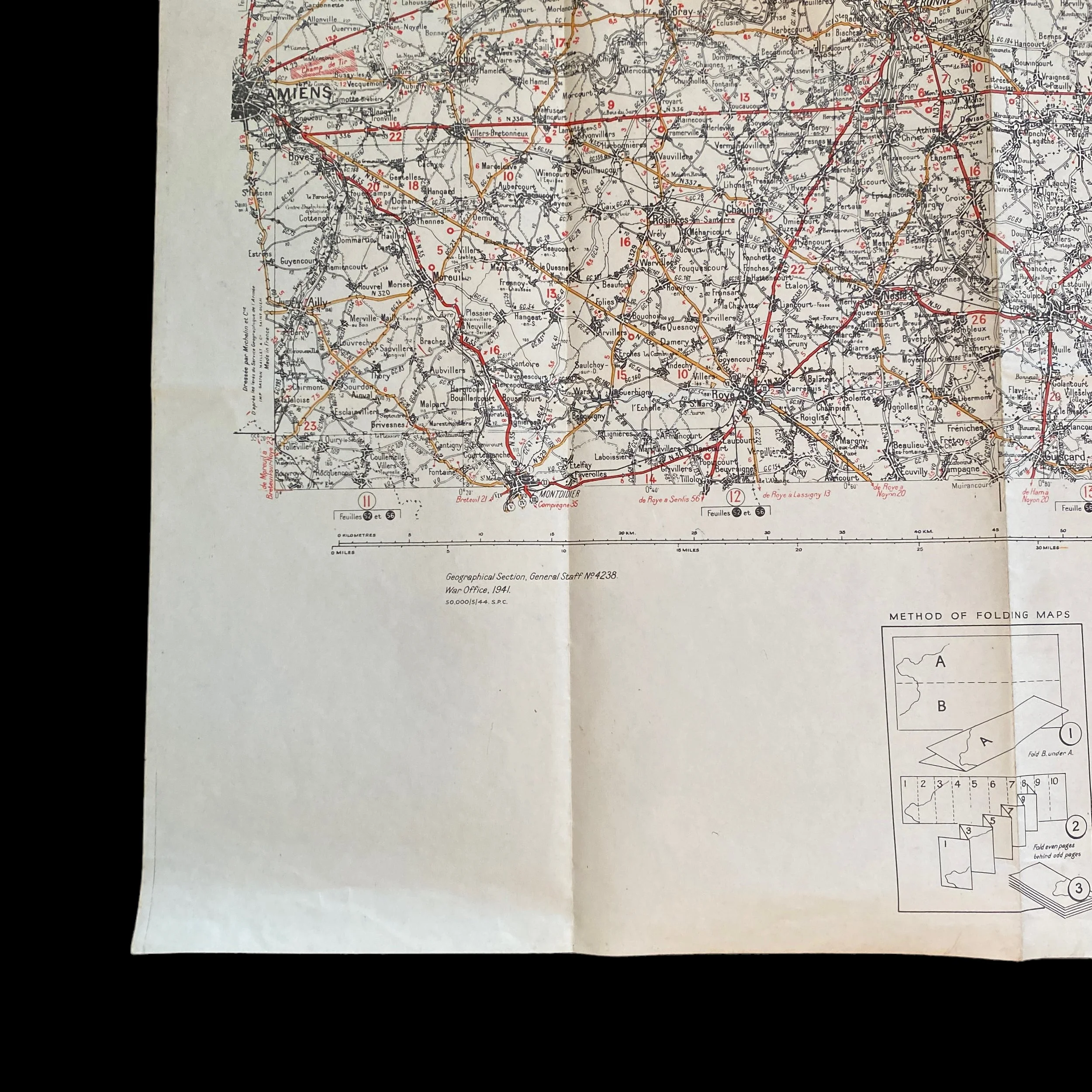


WWII France U.S. Infantry and Armored Division "Arras-Mezieres" Combat Operations Map*
Comes with hand-signed C.O.A.
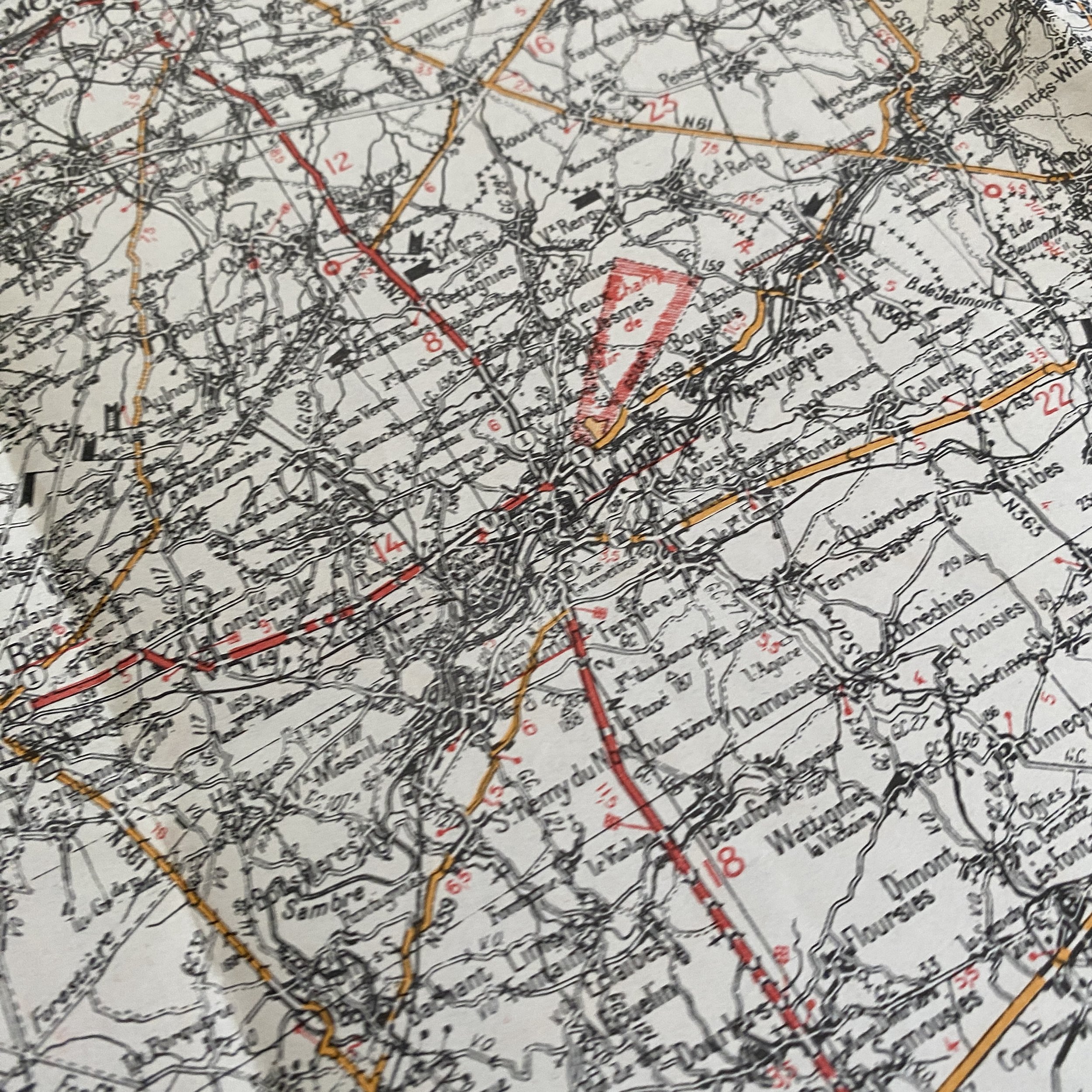
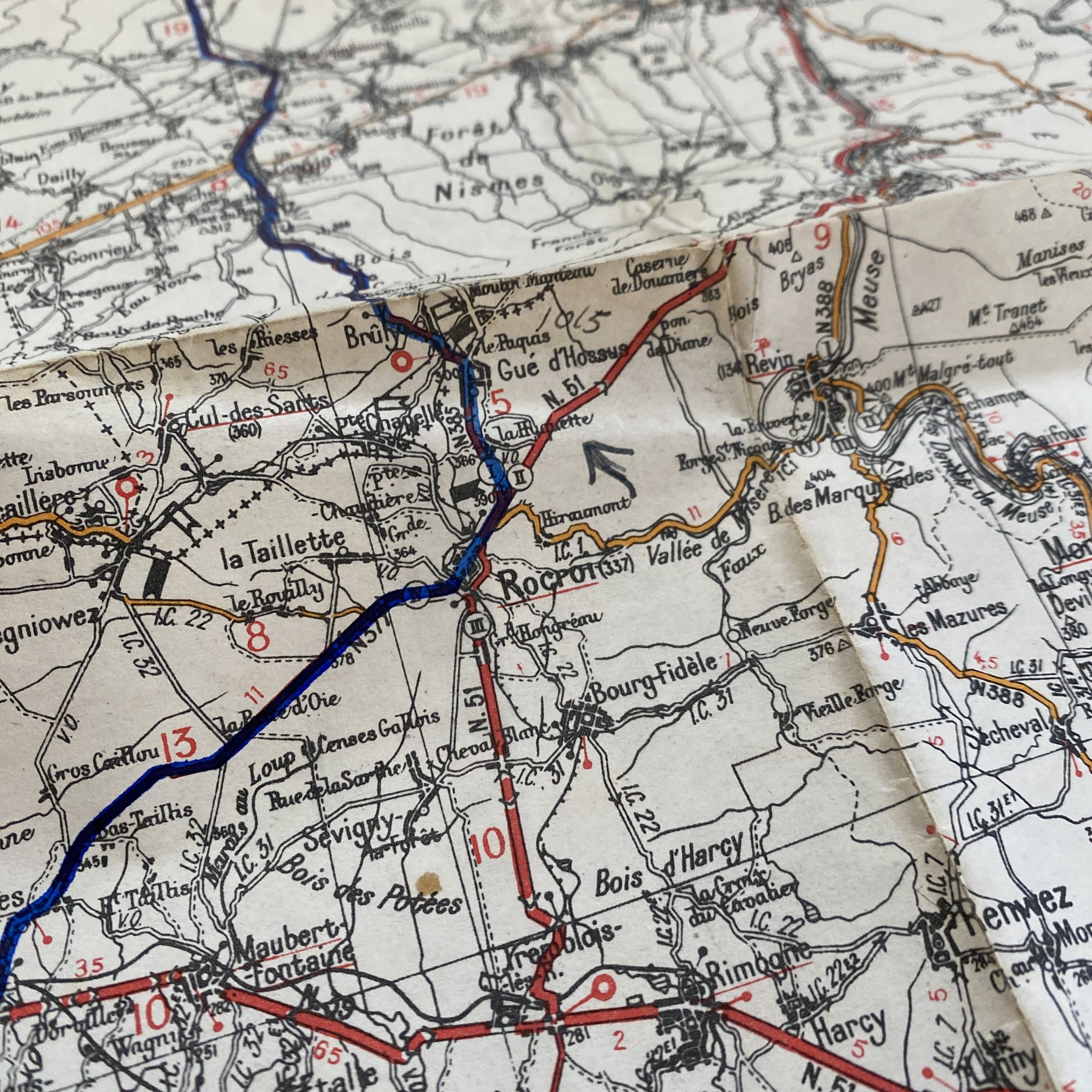
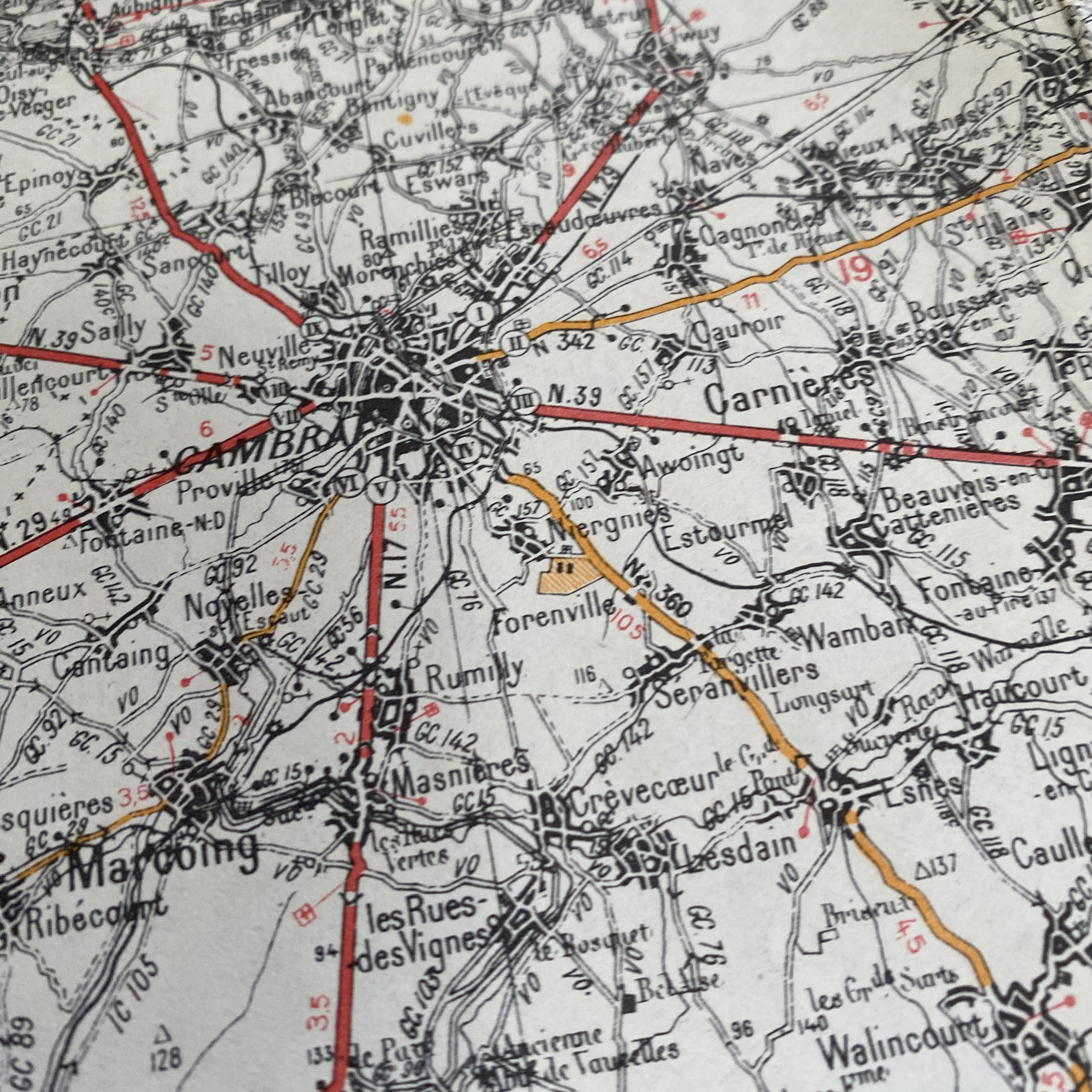
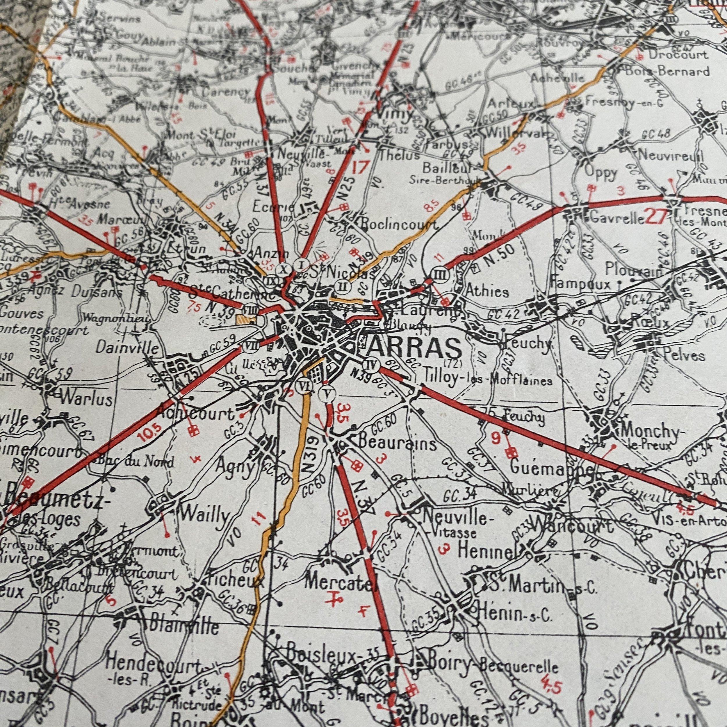
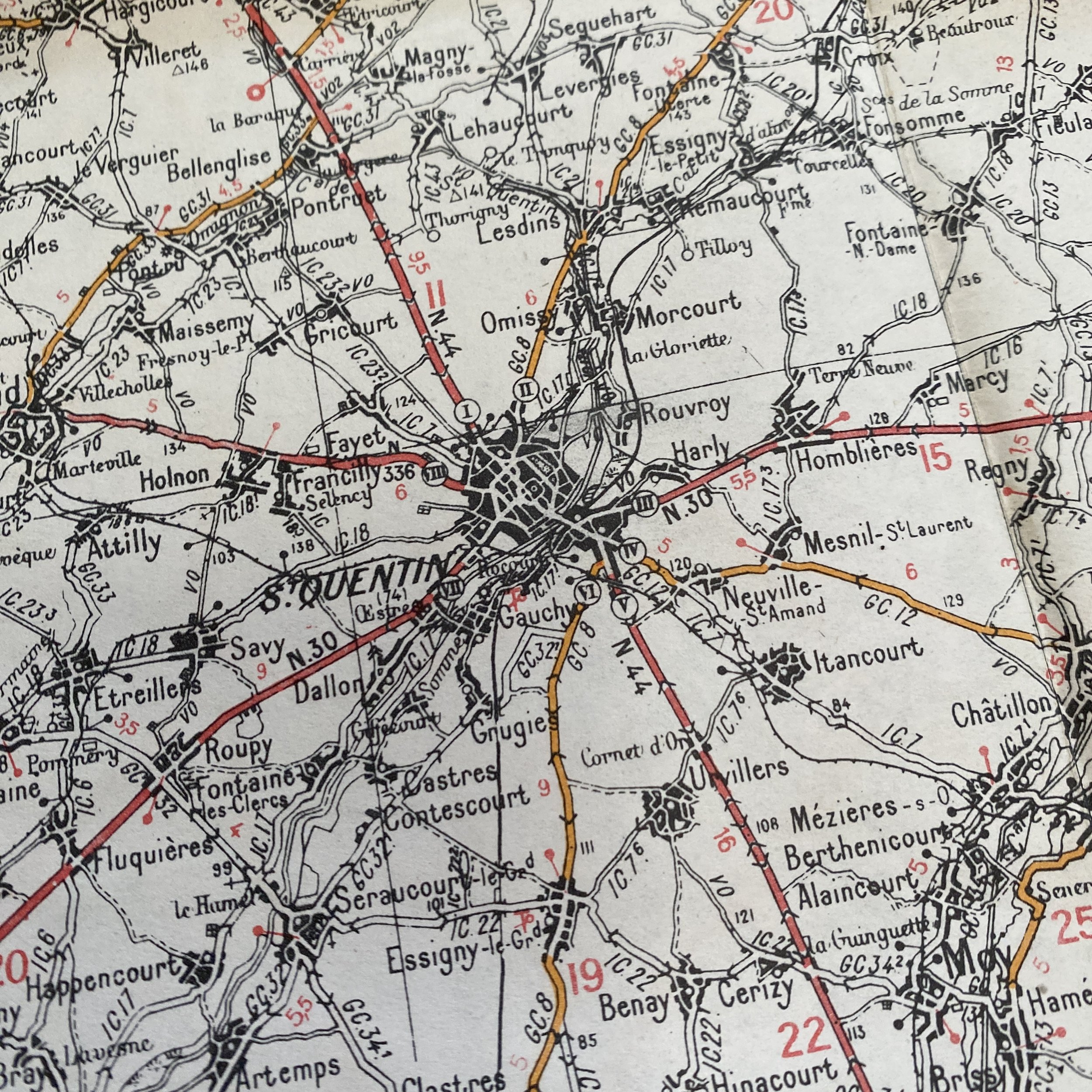
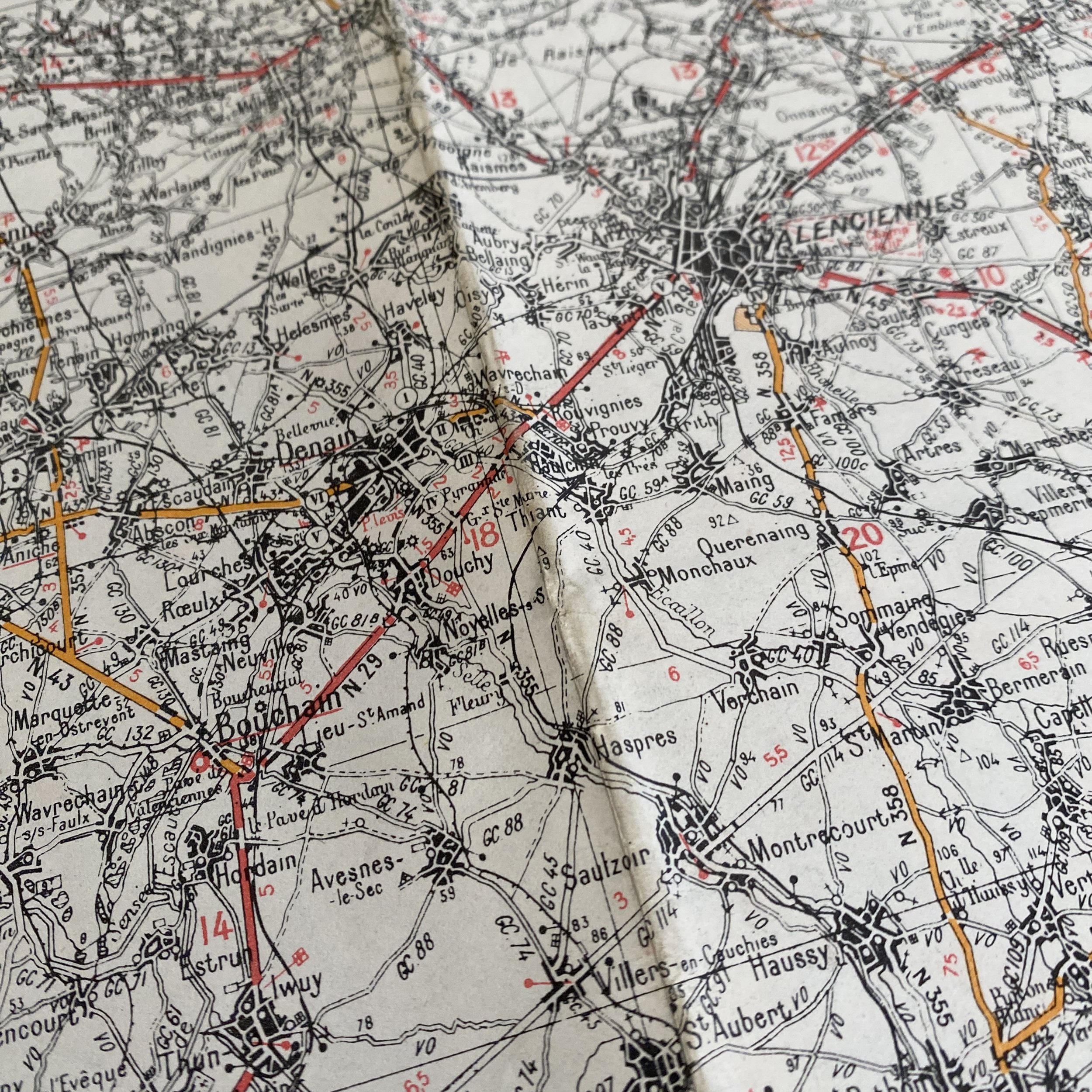
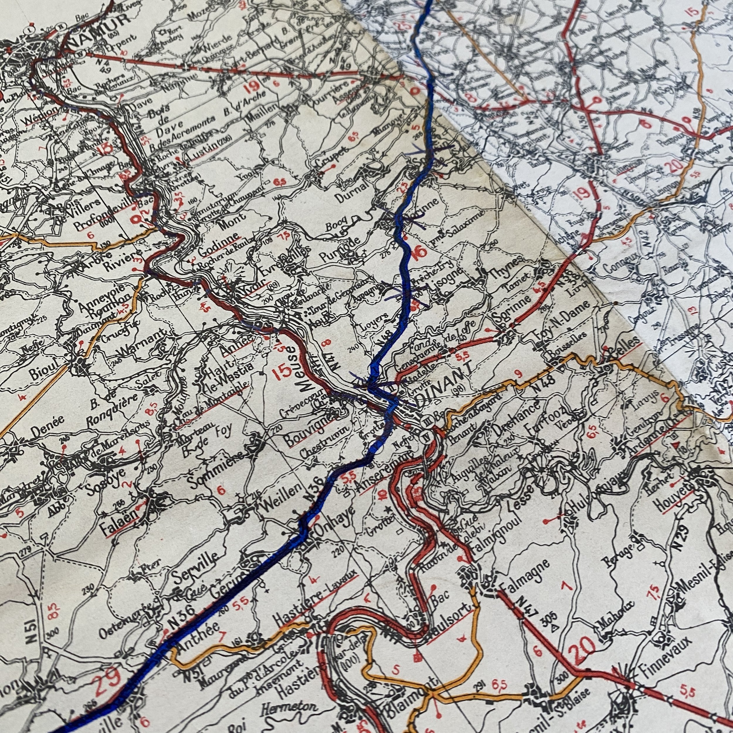
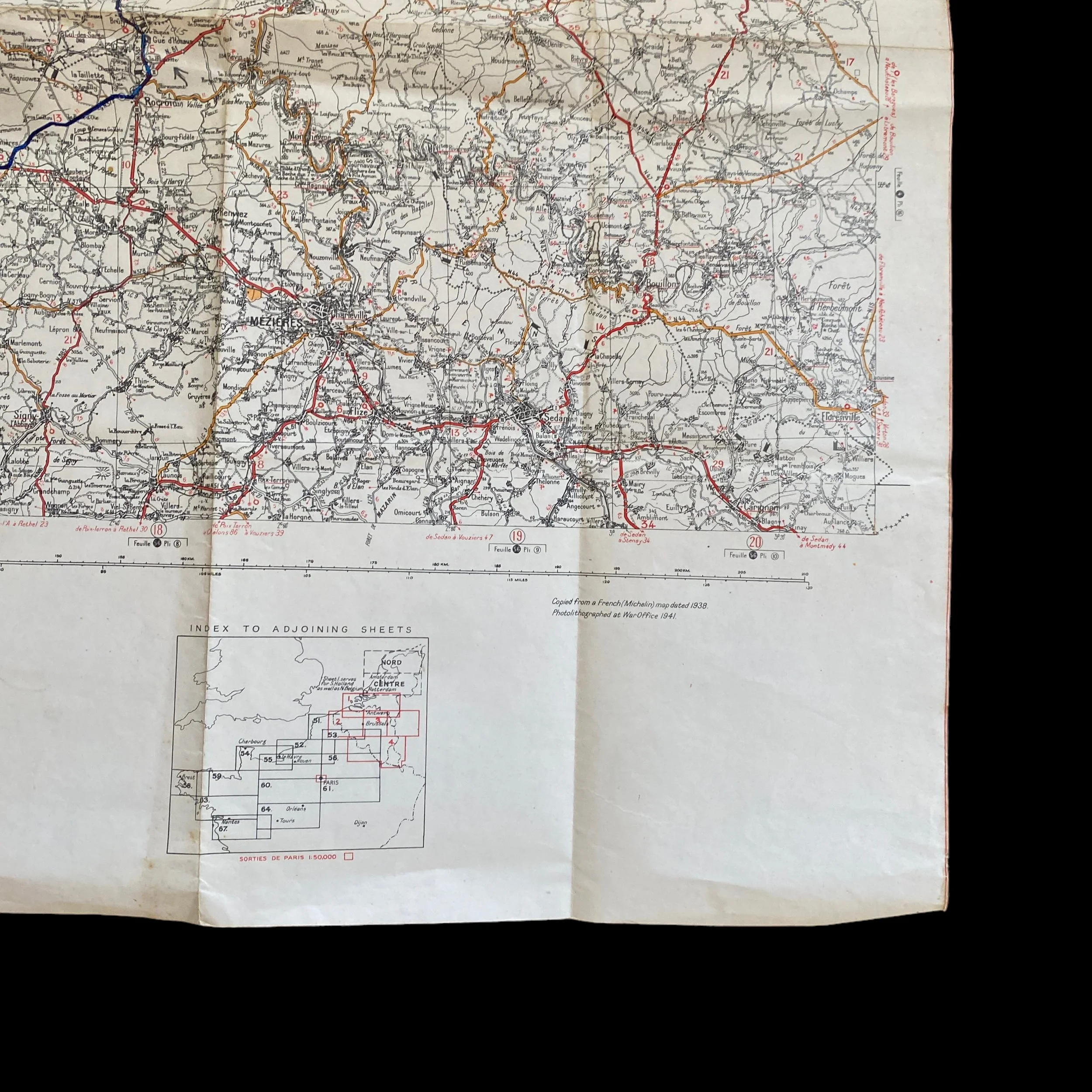
This original and museum-grade WWII combat map was by U.S. Infantry and Armored Divisions operating in the Arras-Mezieres region of France and part of Belgium following the Allied D-Day landings on June 6th, 1944.
World War II marked a turning point in military history, witnessing unprecedented advancements in technology and strategic innovations. Among these innovations, combat road maps played a crucial role in guiding U.S. Infantry and Armored Divisions through the complex and dynamic landscapes of the war.
Before delving into their use during World War II, it is essential to understand the evolution of combat road maps. The early 20th century saw the emergence of military maps, but the intricacies of modern warfare demanded more detailed and specialized cartography. The U.S. military recognized the need for accurate, up-to-date maps that could facilitate swift and precise movements on the battlefield.
One of the primary functions of combat road maps during World War II was to enhance the mobility and maneuverability of U.S. Infantry and Armored Divisions. The fluid nature of the battlefield required constant adjustments to strategic plans, and combat road maps provided commanders with real-time information on road networks, terrain features, and potential obstacles. This allowed for rapid decision-making and the ability to exploit opportunities or respond to threats promptly.
Effective coordination among different divisions and units was paramount for the success of military operations during World War II. Combat road maps served as a common reference point for commanders, facilitating communication and coordination between infantry and armored units. The maps provided a shared understanding of the operational environment, allowing for synchronized movements and strategic alignment.
The theaters of war during World War II presented diverse and challenging terrains, from the dense forests of Europe to the vast deserts of North Africa. Combat road maps played a crucial role in helping U.S. forces navigate through these varied landscapes. Whether planning an offensive through a mountainous region or conducting armored maneuvers in open fields, the detailed information provided by combat road maps enabled commanders to adapt their strategies to the specific challenges posed by different terrains.
In addition to aiding in physical navigation, combat road maps were instrumental in enhancing intelligence and situational awareness. By incorporating information about enemy positions, defensive structures, and potential ambush points, these maps provided a comprehensive overview of the battlefield. This intelligence allowed U.S. commanders to make informed decisions and adjust their tactics based on the evolving dynamics of the conflict.
The use of combat road maps by U.S. Infantry and Armored Divisions during World War II was instrumental in achieving strategic success on the battlefield. These maps served as indispensable tools for enhancing mobility, coordination, and situational awareness, allowing American forces to navigate the complexities of diverse theaters of war. The legacy of combat road maps in World War II underscores their pivotal role in shaping military operations and highlights the importance of detailed cartography in modern warfare.