Early WWII NANTES - POITIERS " Allied France ETO Operations" Allied Infantry and Armored Division Combat Map*


Early WWII NANTES - POITIERS " Allied France ETO Operations" Allied Infantry and Armored Division Combat Map*
Comes with C.O.A.
This original and rare museum-grade World War II combat map titled “NANTES - POITIERS” was published was used by Allied Infantry and Armored Divisions during Allied operations in France following the Allied D-Day landings in Normandy on June 6th, 1944.
World War II was a global conflict that reshaped the course of history, with pivotal moments like the Allied invasion of Normandy, commonly known as D-Day, marking a turning point in the war against Axis forces. Following the successful landings in Normandy on June 6, 1944, the Allied forces, primarily led by the United States, embarked on a series of strategic missions and operations across France to liberate it from occupation. Among the key locations where intense battles ensued were Nantes, Poitiers, Cholet, Parthenay, and Saumur.
Allied Operations in France
After the initial landings at Normandy, Allied forces swiftly moved to expand their foothold in France. Nantes, a major city in western France, was a crucial target due to its strategic location and port facilities. The liberation of Nantes was part of Operation Cobra, the Allied offensive aimed at breaking out of the Normandy beachhead and advancing into France. US infantry and armored divisions played a vital role in securing Nantes, engaging in fierce urban combat against entrenched German forces.
Similarly, Poitiers, located in central-western France, witnessed intense fighting as Allied forces pushed eastward. Poitiers held significant importance as a transportation hub and a center of communication. The liberation of Poitiers was part of the broader Allied campaign to disrupt German supply lines and establish control over key infrastructure. US and Allied troops executed coordinated attacks, utilizing a combination of infantry assaults and armored thrusts to overcome German defenses.
Cholet, situated in the Loire Valley, emerged as another critical battleground during the Allied advance through France. The town's strategic position made it a desirable objective for both sides. Allied forces sought to secure Cholet to prevent German counterattacks and facilitate their advance deeper into French territory. US infantry units, supported by armored divisions, engaged in intense combat to liberate Cholet, facing stiff resistance from German defenders determined to hold their ground.
Parthenay, a small town in western France, became a focal point of Allied operations as they sought to consolidate their gains and push farther inland. Parthenay's location along key road networks made it a strategic asset for controlling the surrounding region. US and Allied forces employed a combination of maneuver warfare and close-quarters combat tactics to overcome German opposition and liberate Parthenay, paving the way for further advances.
Saumur, situated along the Loire River, assumed strategic significance due to its defensive fortifications and position as a river crossing point. The liberation of Saumur was crucial for securing a vital transportation route and denying its use to the enemy. US and Allied forces conducted amphibious assaults and coordinated infantry offensives to capture Saumur, engaging in fierce battles against determined German resistance.
Utilization of Maps in Combat
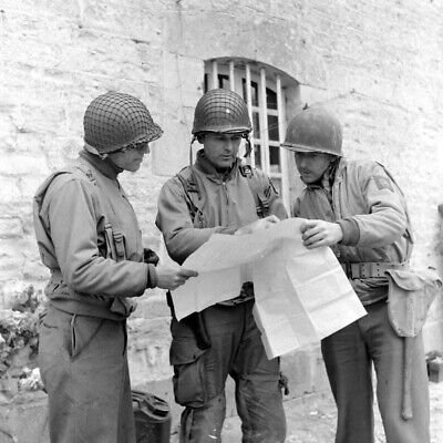
Maps played a pivotal role in guiding infantry and armored units through the complex terrain of France and aiding in the planning and execution of military operations. Infantry units relied on detailed maps to navigate unfamiliar terrain, identify key objectives, and coordinate movements with other units. These maps provided valuable information about terrain features, enemy positions, and friendly troop locations, enabling infantry commanders to make informed decisions in the heat of battle.
Armored units, equipped with tanks and mechanized vehicles, also relied heavily on maps to plan and execute their maneuvers effectively. Maps helped tank commanders identify suitable routes of advance, anticipate potential obstacles and hazards, and coordinate with infantry support units. Moreover, maps provided vital intelligence on enemy defensive positions, allowing armored units to conduct reconnaissance and plan targeted attacks to exploit vulnerabilities in the enemy's lines.
In combat situations, maps were often annotated with important information such as enemy positions, friendly unit locations, and proposed routes of advance. This facilitated real-time decision-making and communication between units, ensuring that actions were coordinated and objectives were achieved efficiently. Additionally, maps were frequently updated to reflect changing battlefield conditions, allowing commanders to adapt their strategies and tactics accordingly.
The US and Allied operations in France following D-Day were characterized by a series of strategic missions and operations aimed at liberating key towns and cities from German occupation. Nantes, Poitiers, Cholet, Parthenay, and Saumur were among the locations where intense battles were fought as Allied forces advanced through France. The utilization of maps played a crucial role in guiding infantry and armored units through the complex terrain and facilitating the planning and execution of military operations. By leveraging the power of maps, Allied forces were able to navigate unfamiliar terrain, coordinate maneuvers, and achieve decisive victories against German forces, ultimately contributing to the liberation of France and the eventual defeat of the Axis powers in World War II.