Special Print WWII 1943 U.S. Allied Transportation Map of the Middle East


Special Print WWII 1943 U.S. Allied Transportation Map of the Middle East
Comes with C.O.A.
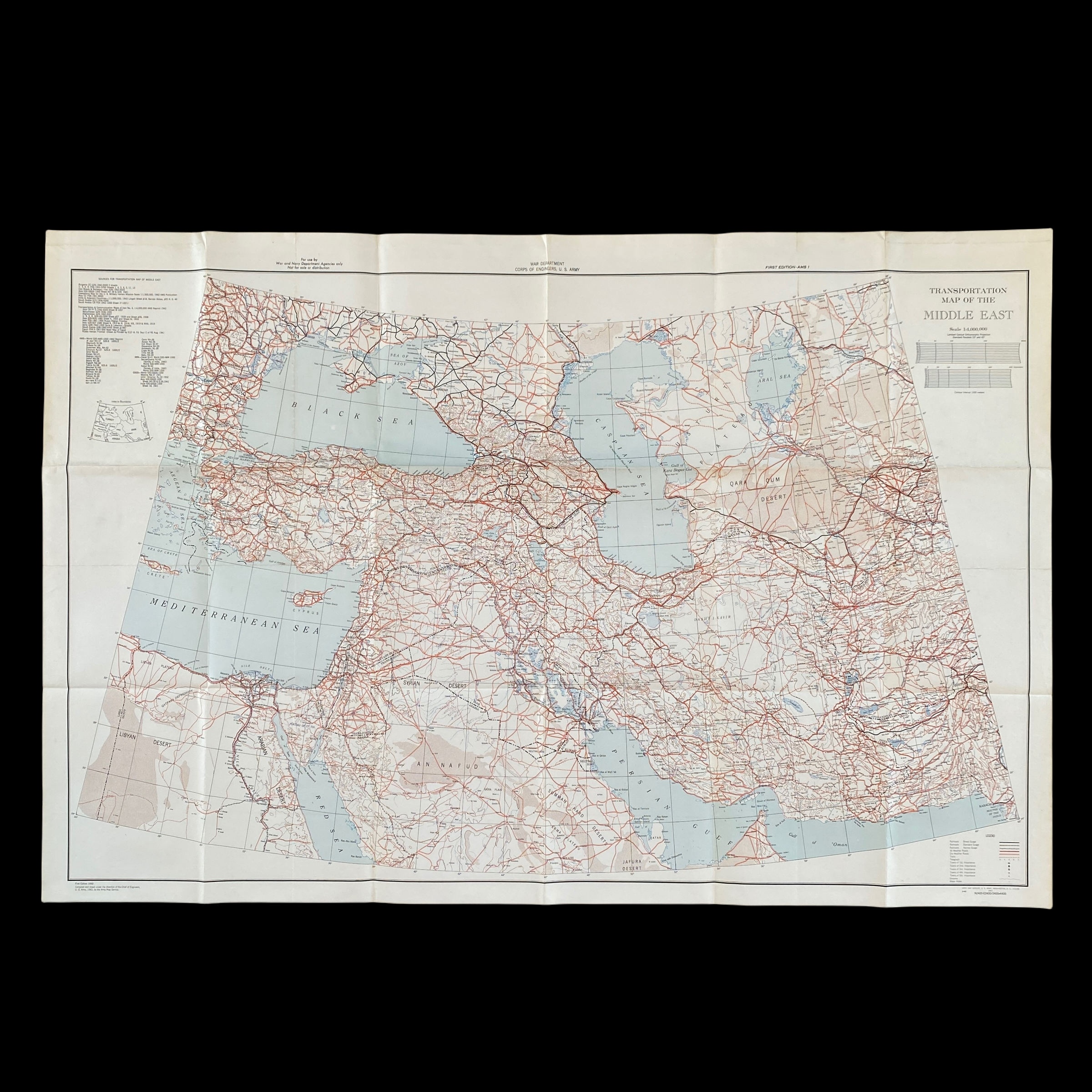
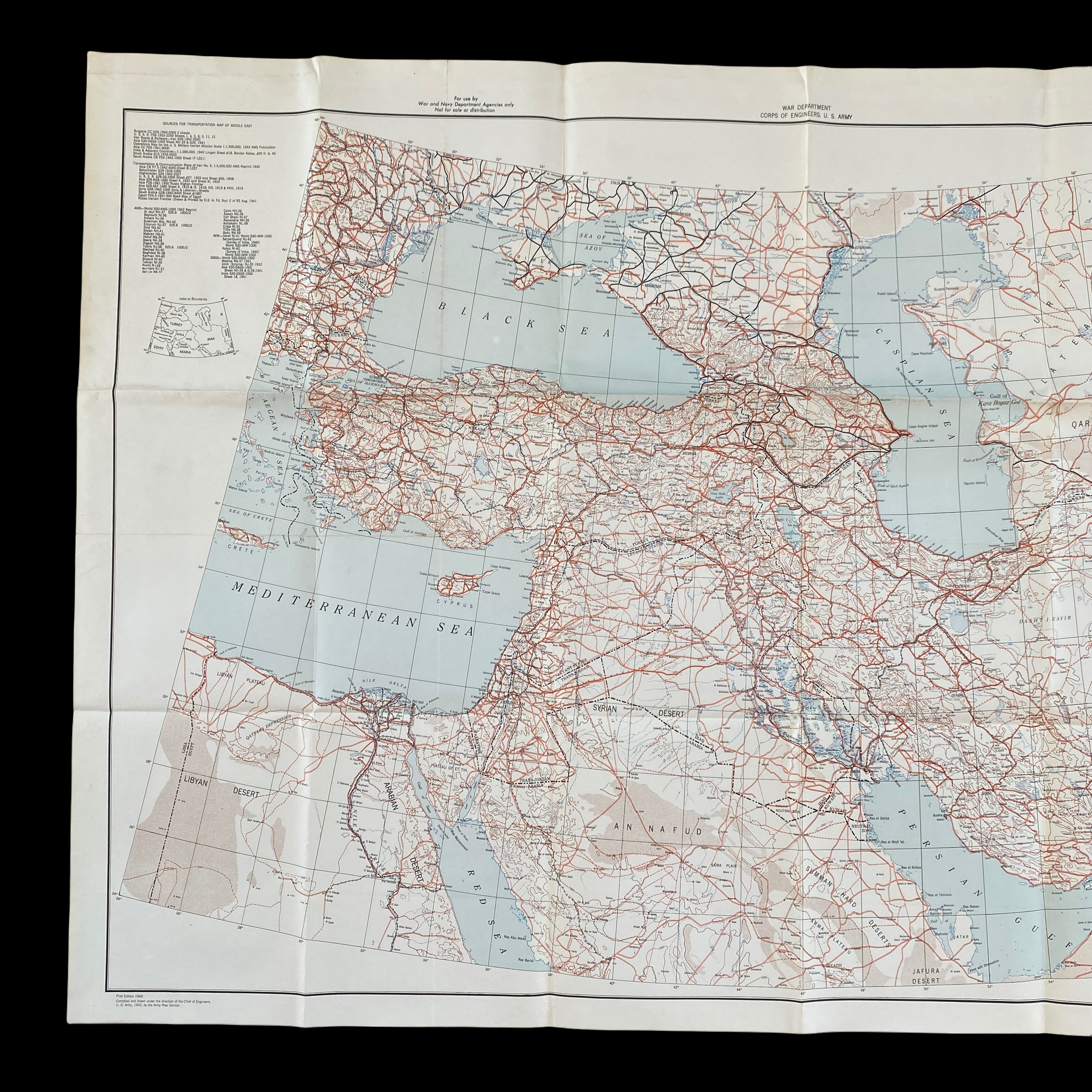
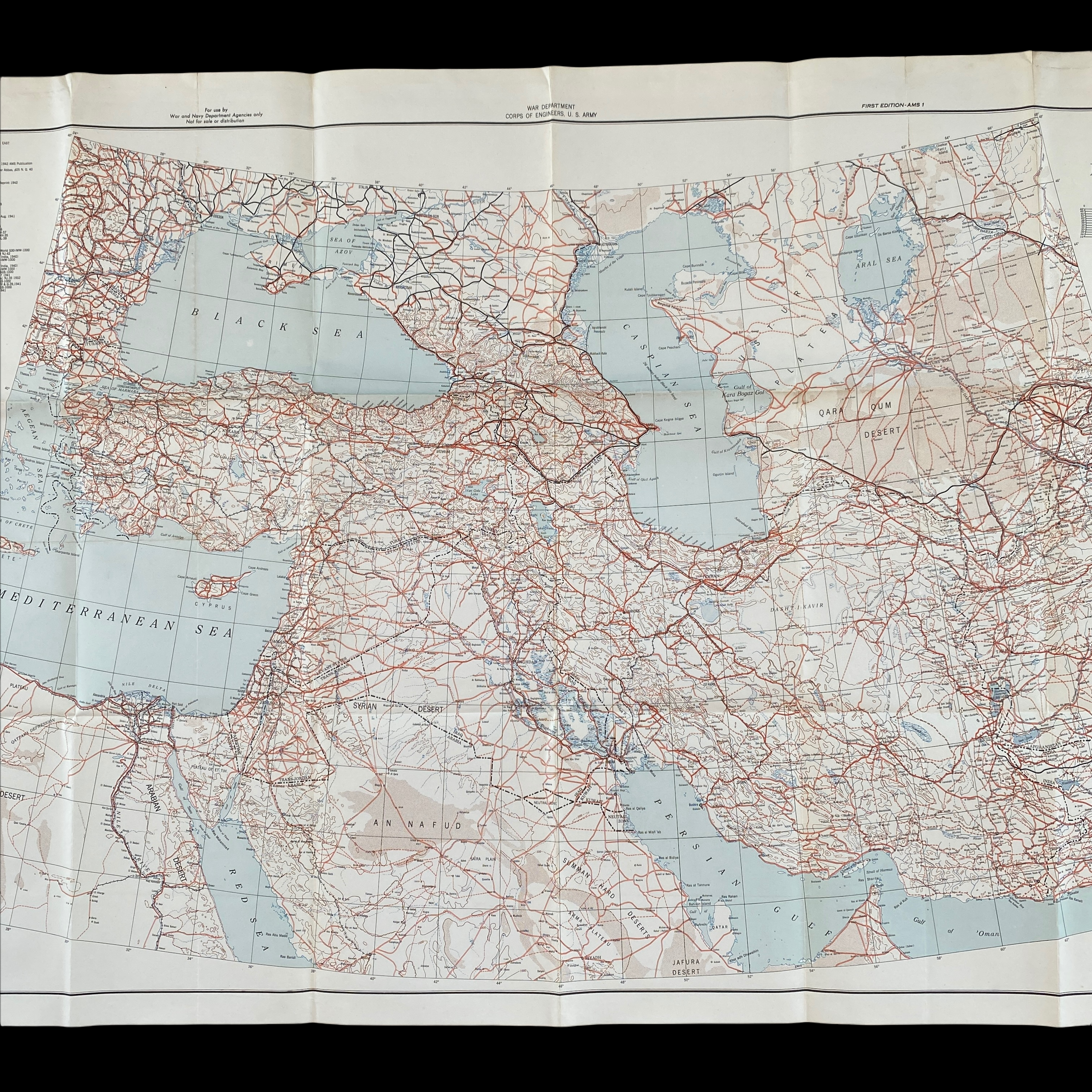
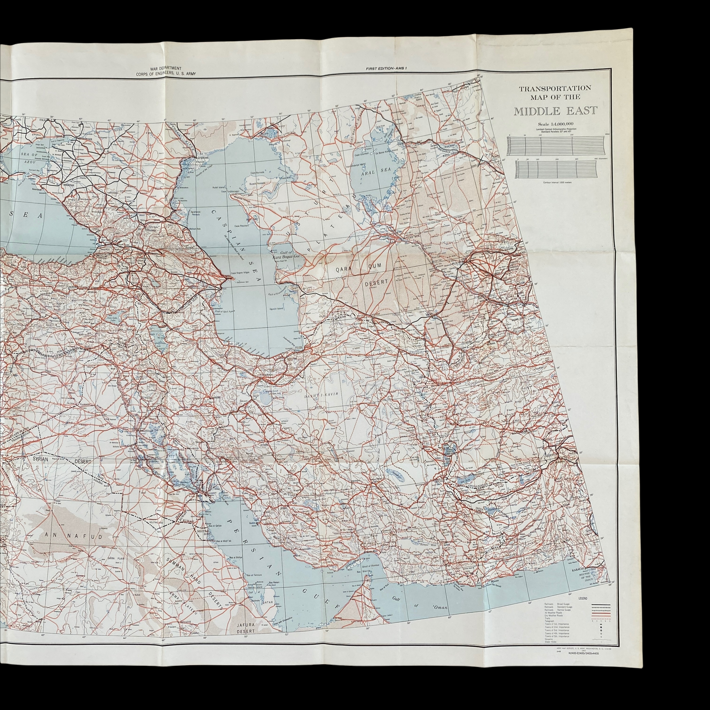
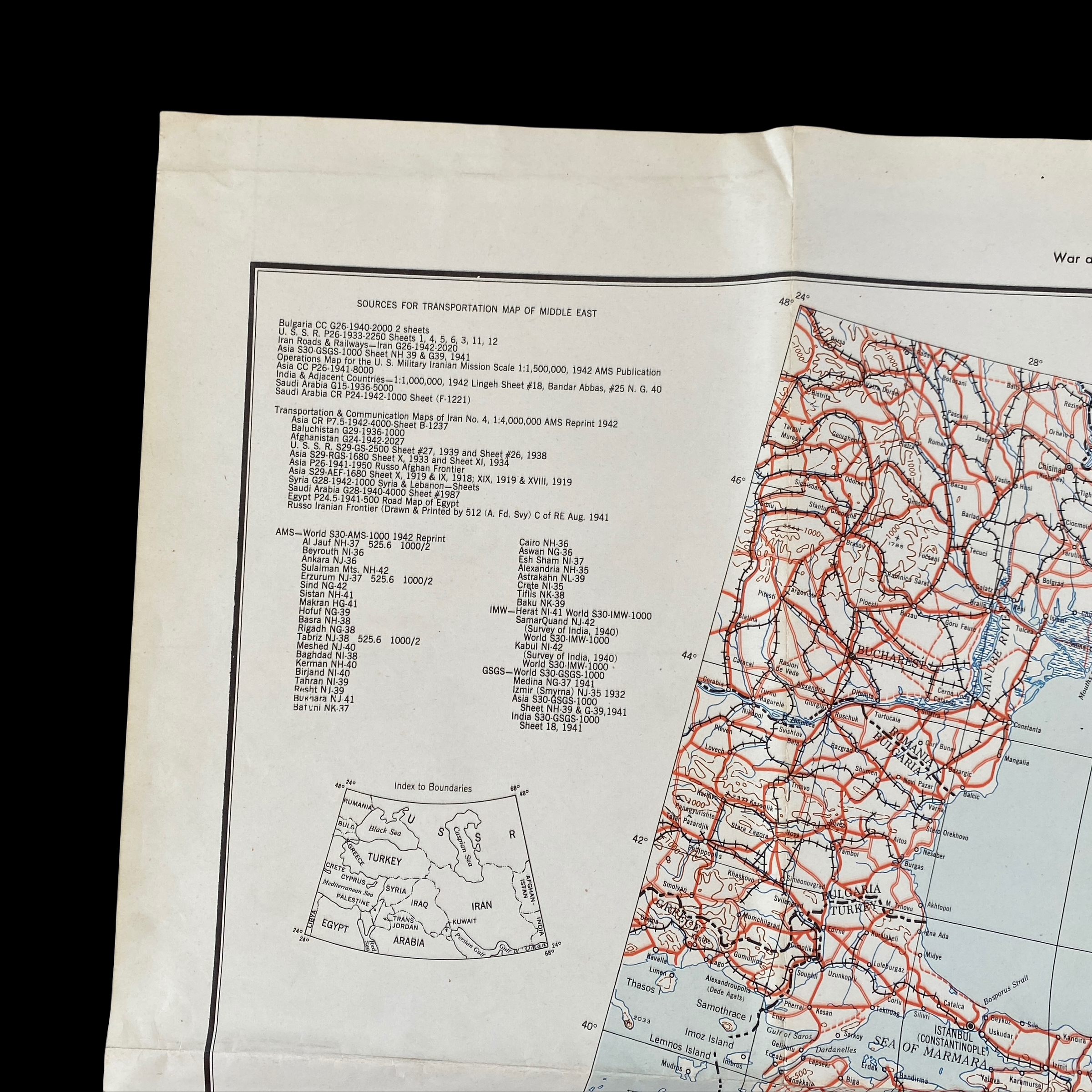
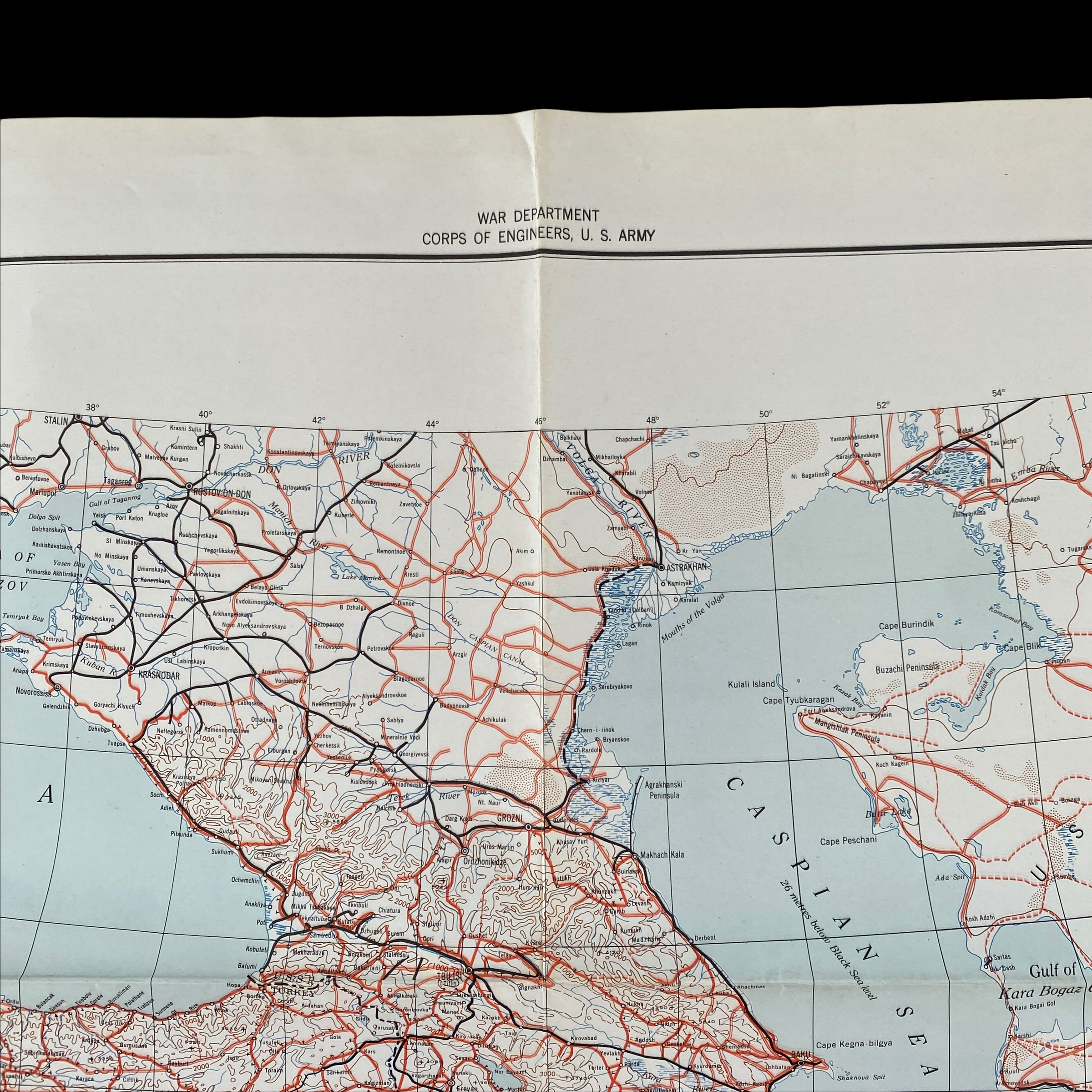
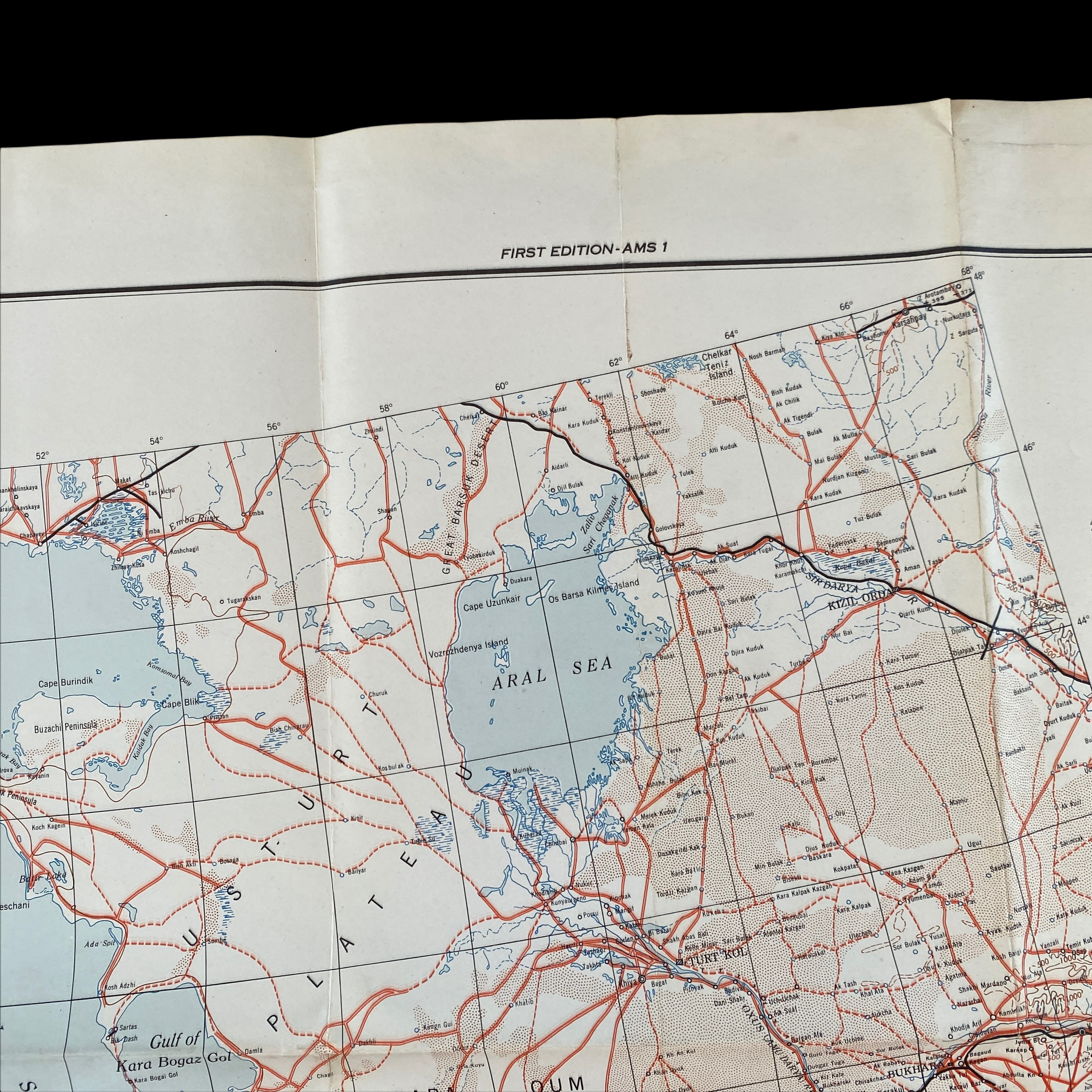
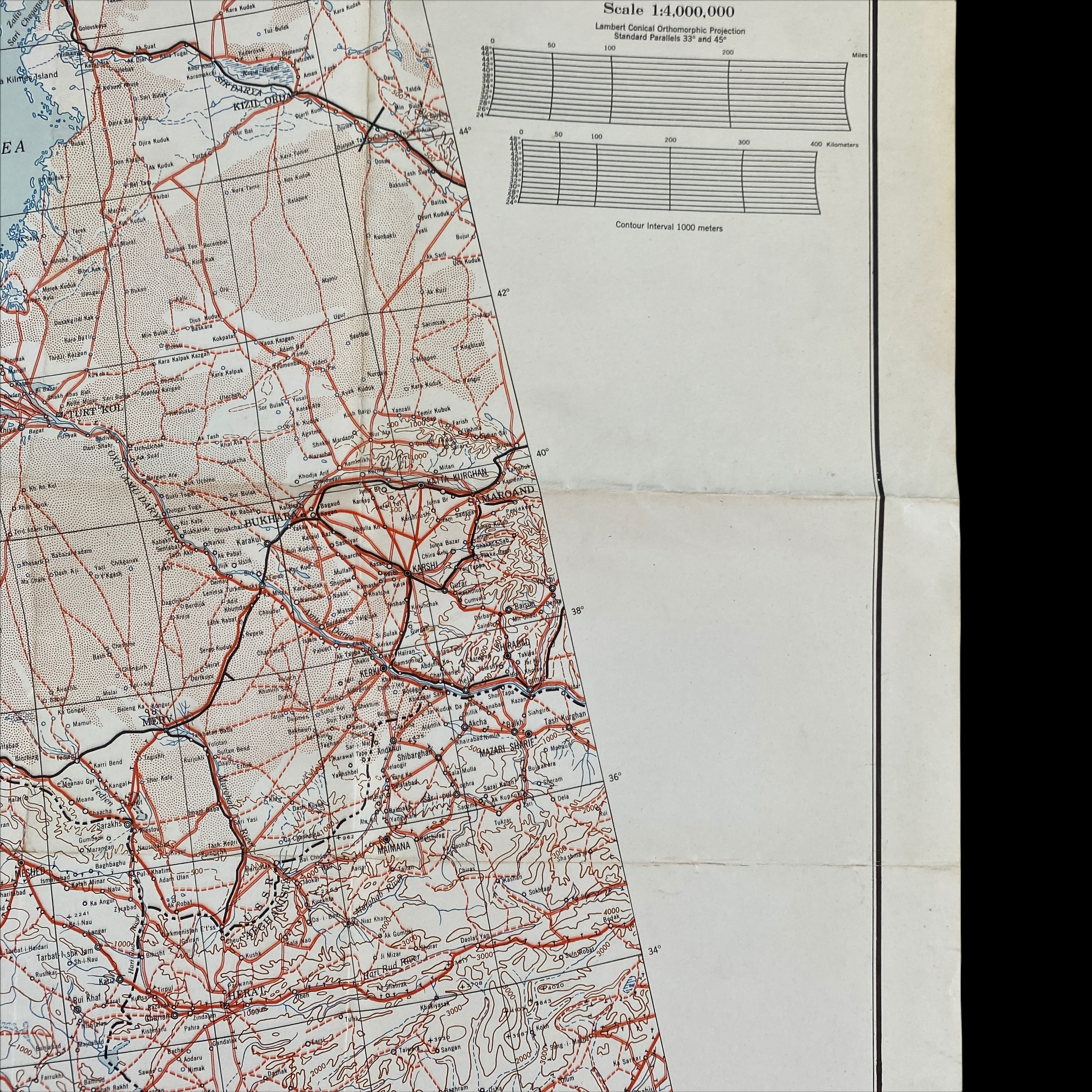
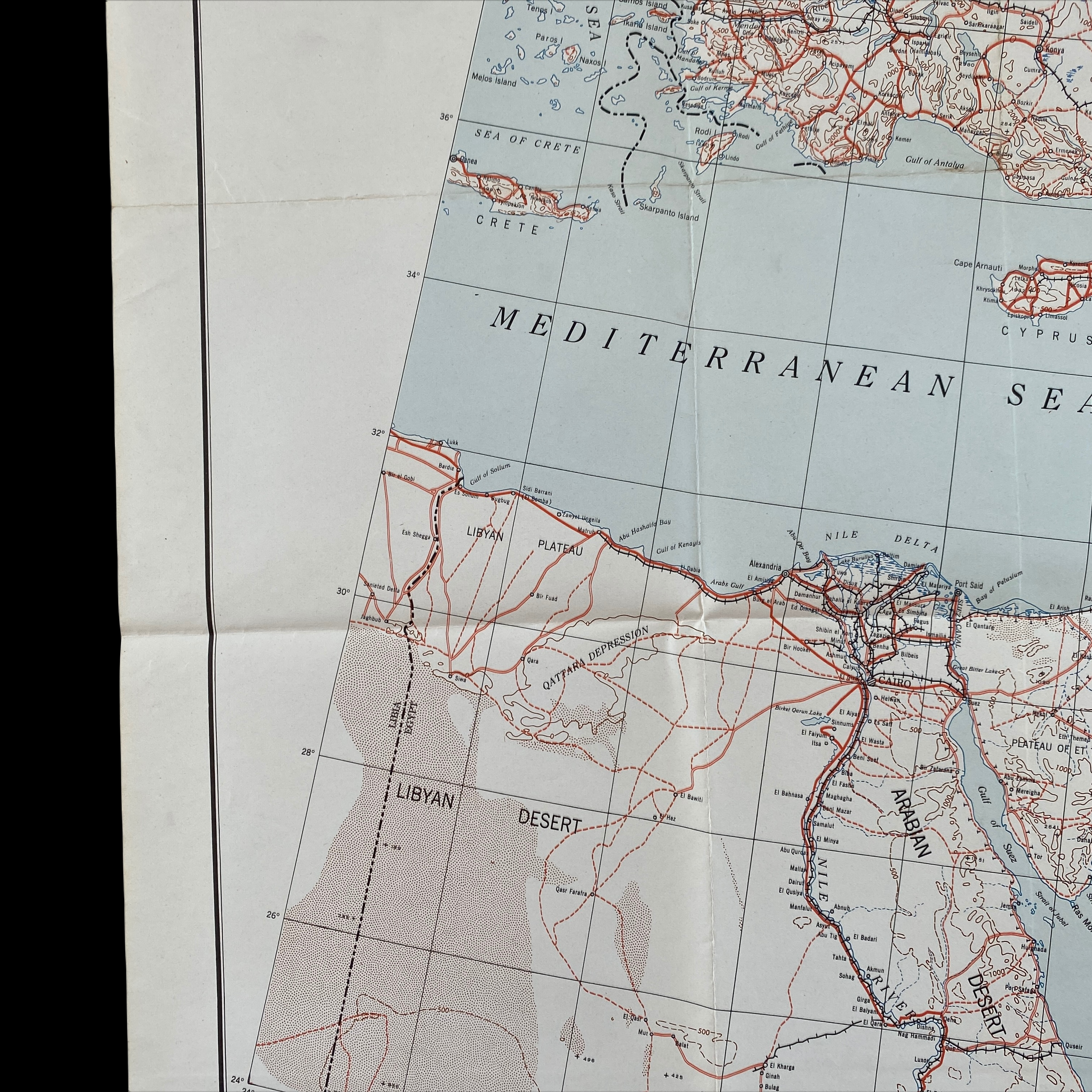
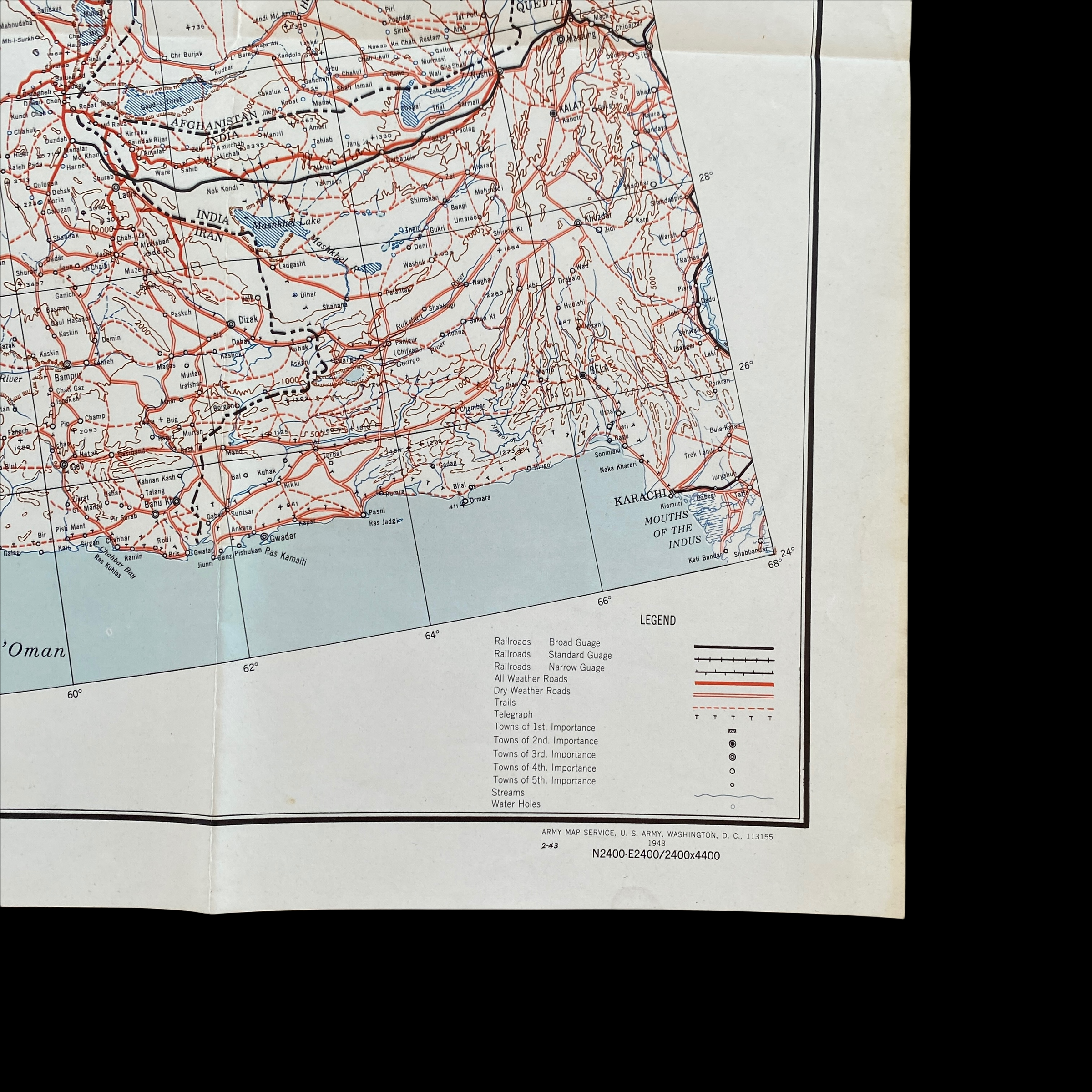
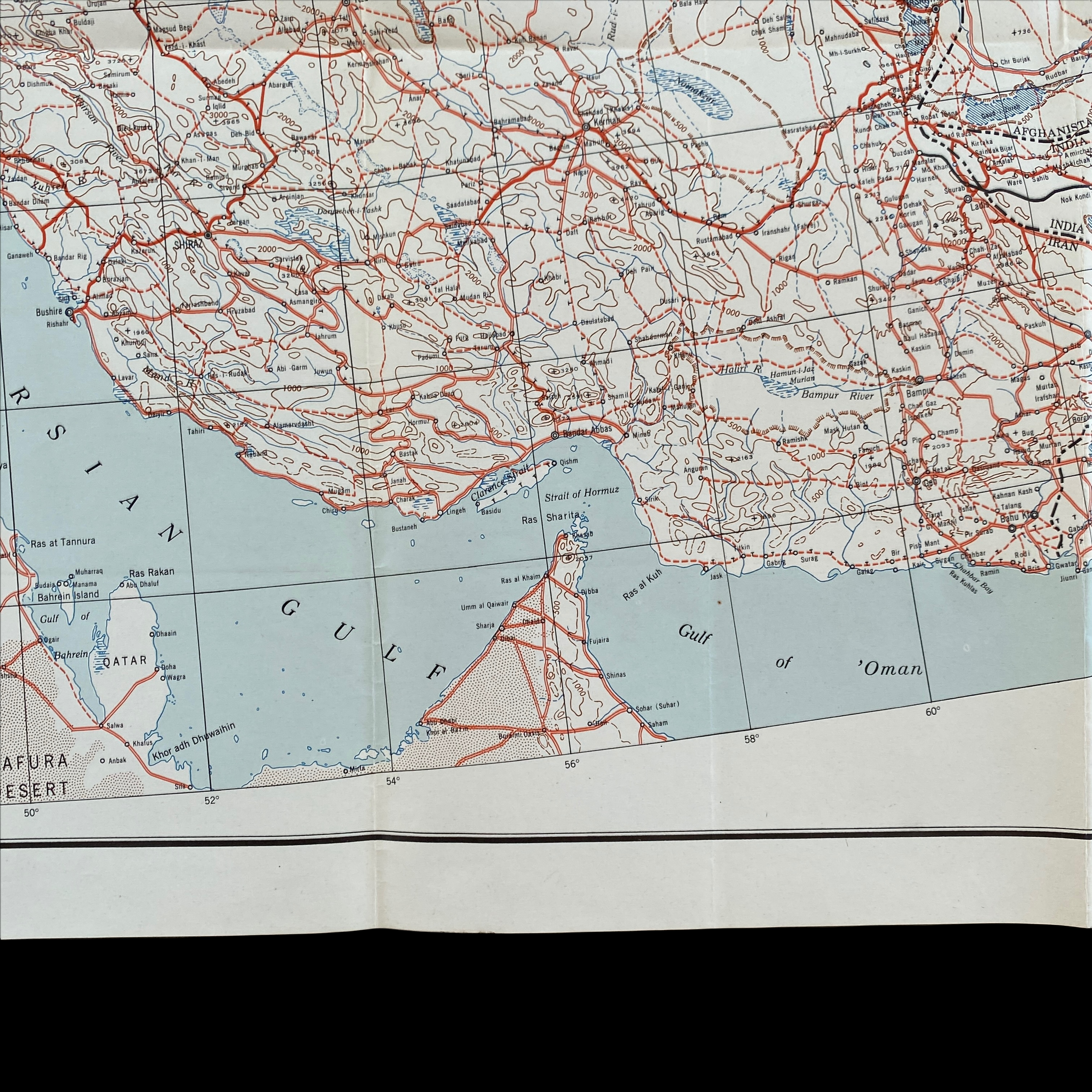
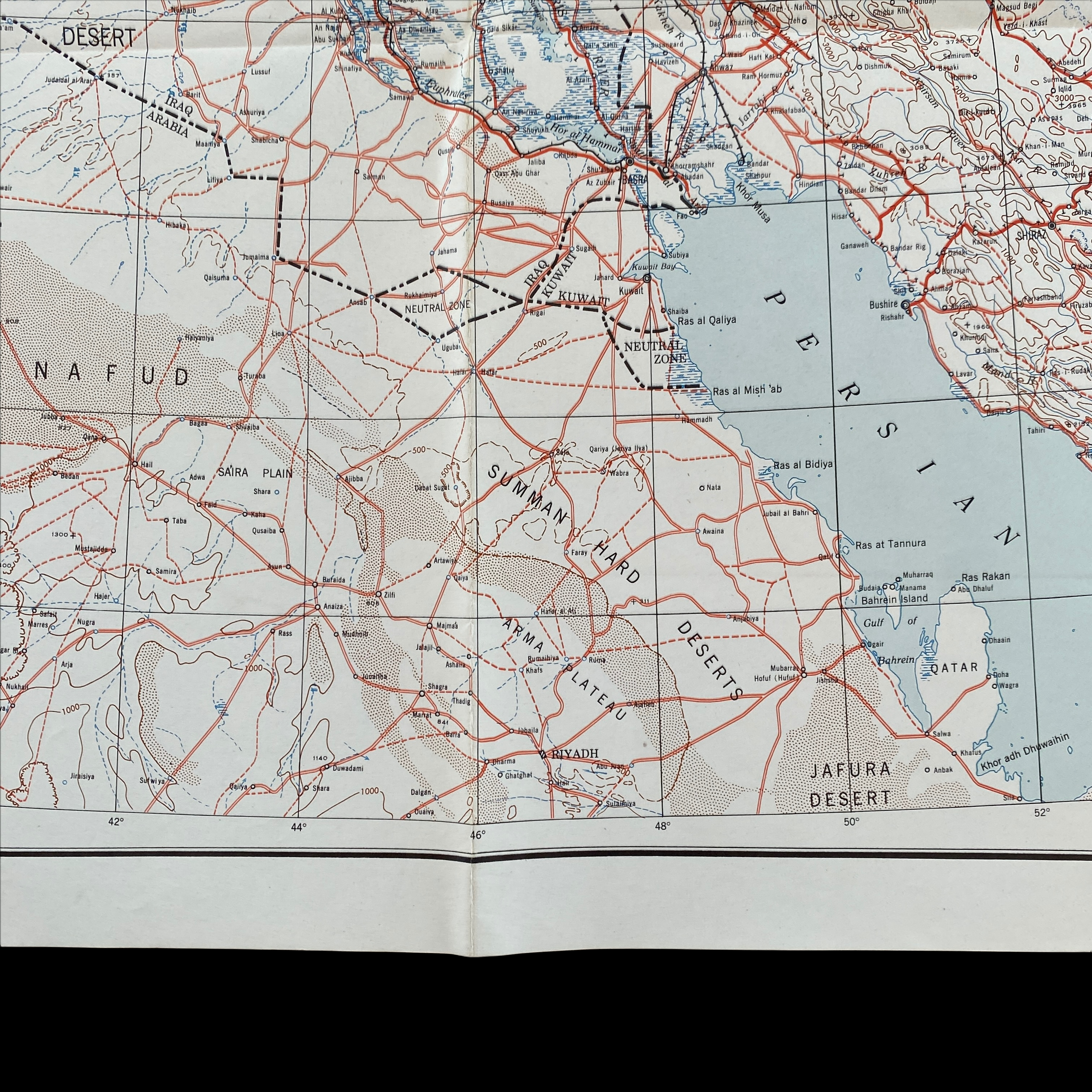
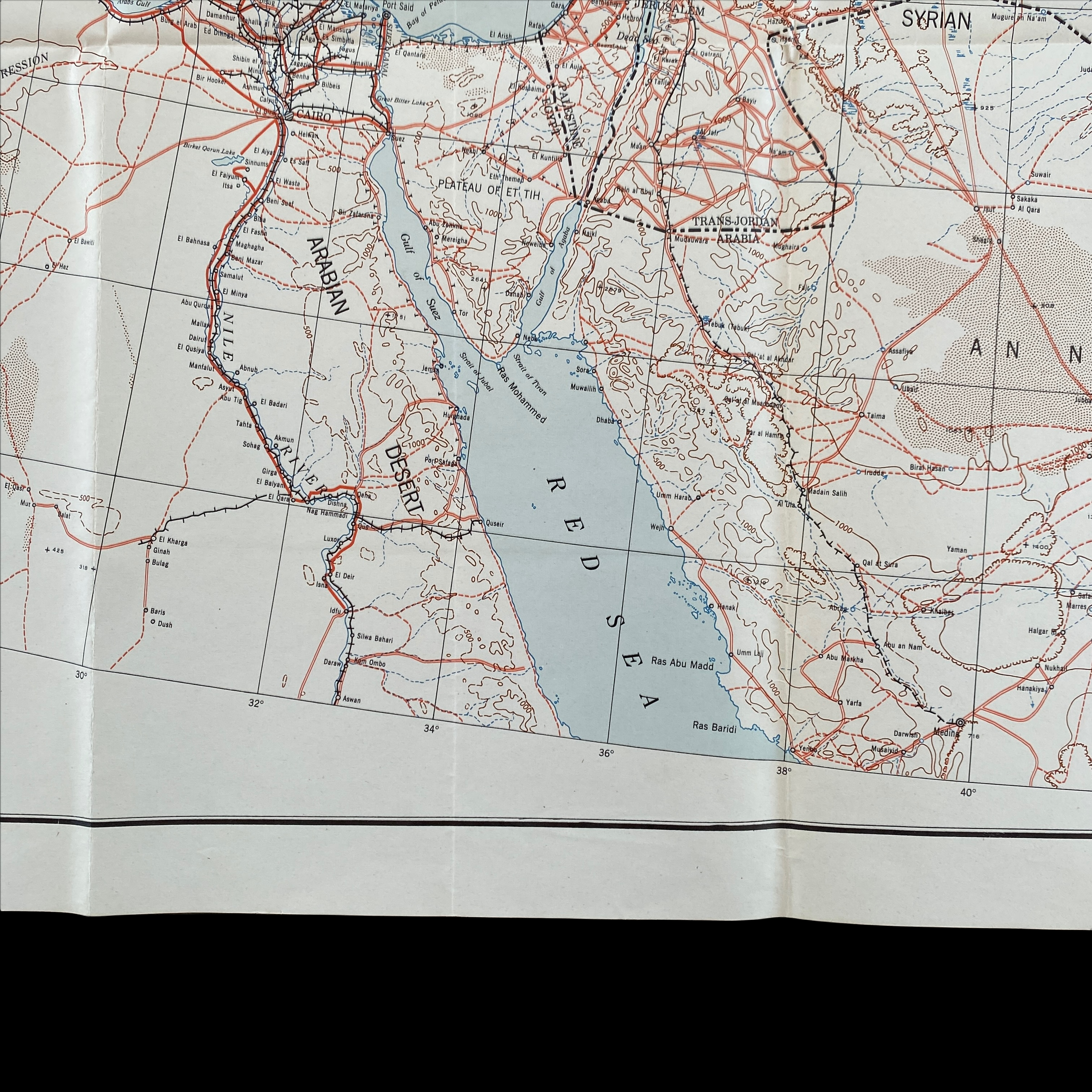
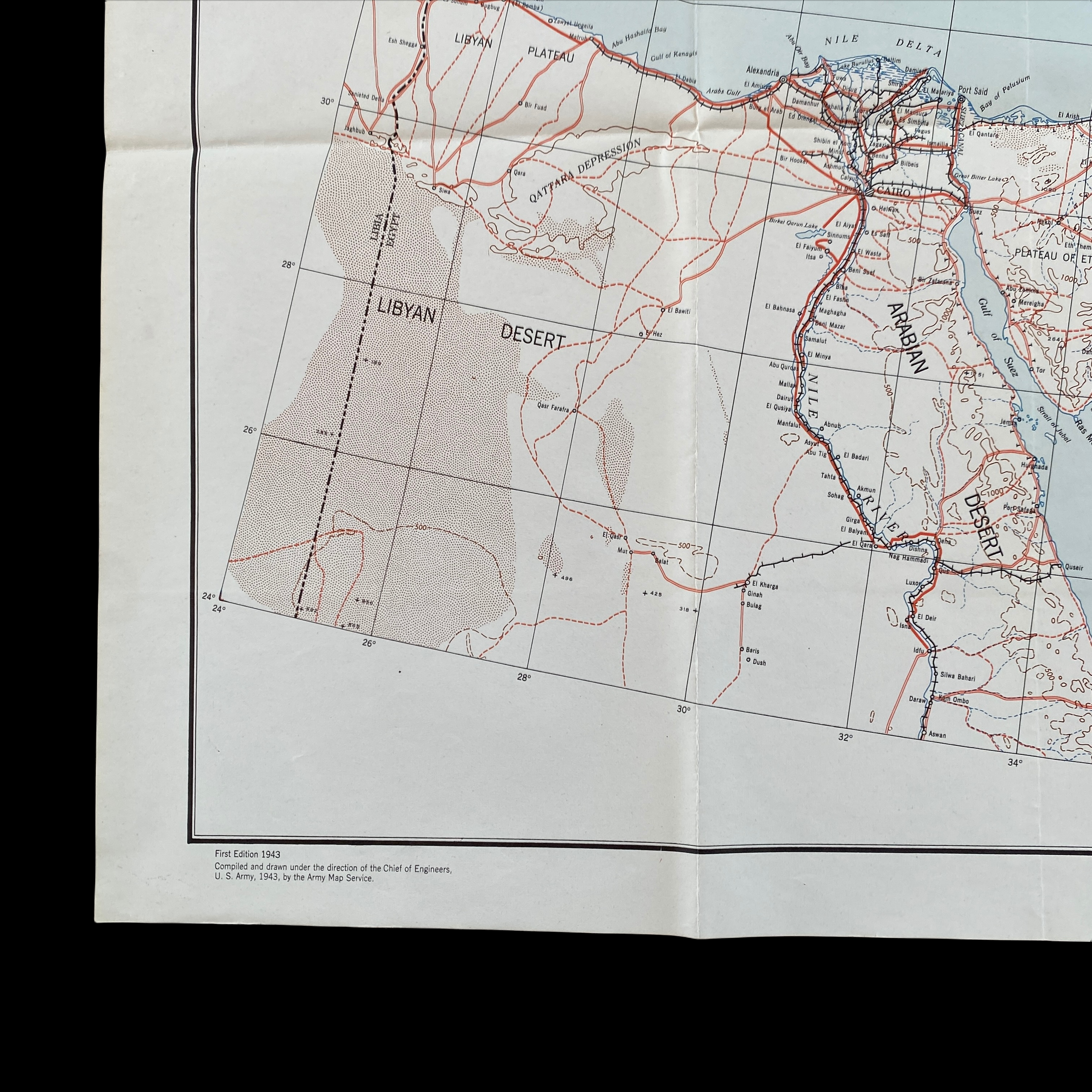
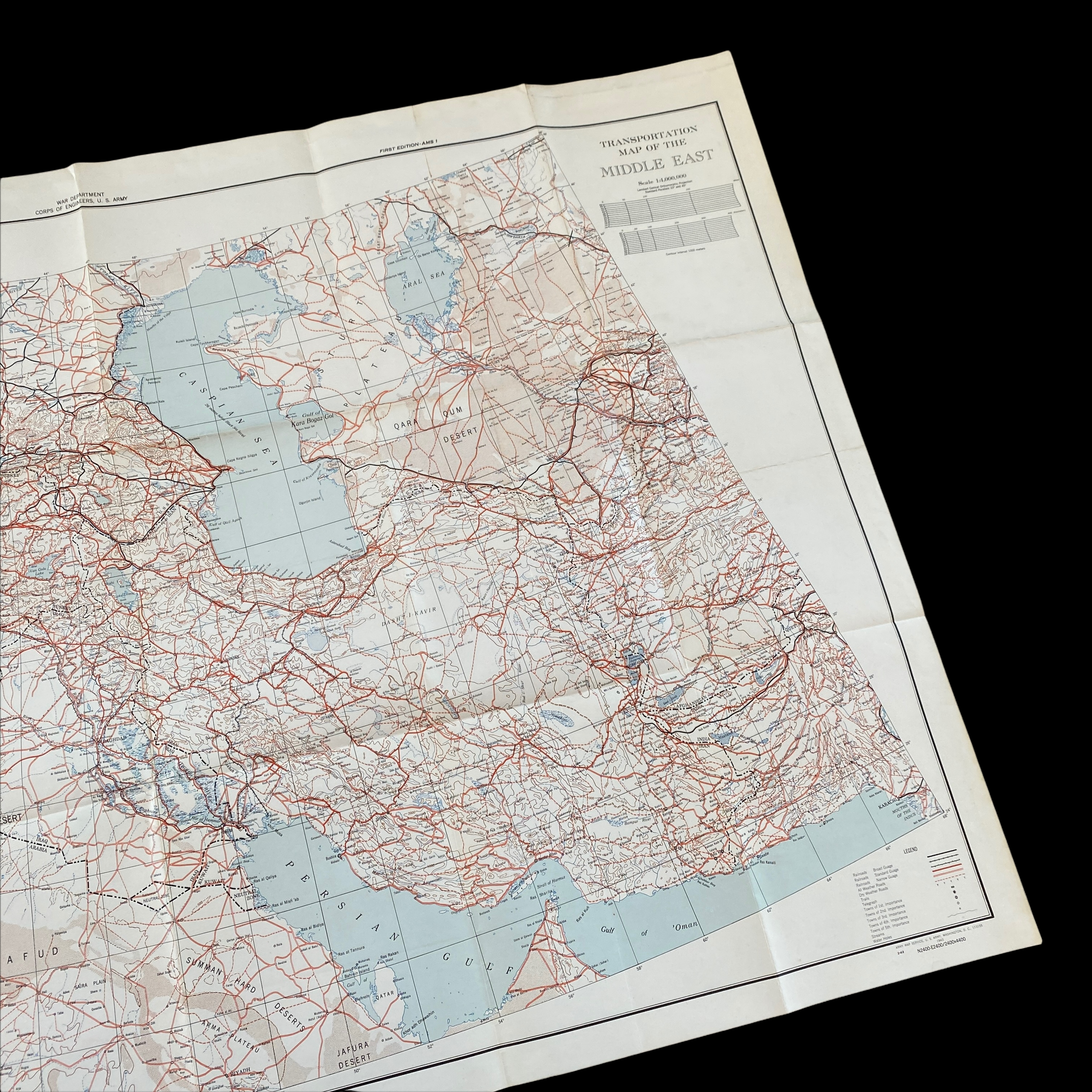
Printed in 1943, this very limited print and rare special edition WWII map is titled “Transportation Map of the Middle East”. The Middle East Theatre of World War II is defined largely by reference to the British Middle East Command, which controlled Allied forces in both Middle East and eastern North Africa. From 1943, most of the action and forces concerned were in the adjoining Mediterranean Theatre.
This special print transportation map was compiled using dozens of collected Egyptian, Iranian, Asian, and Saudi Arabian maps as well as past Army maps of the region. This map shows an extreme amount of detail in the geographical contours of the regions, cities of most importance, as well as various colored road conditions. This was not a heavy distributor transportation map and would've been vital for very important Allied transportation missions.
*This would make an incredible addition to any Mediterranean and Middle East theatre of World War II collector.