RARE WWI 1917 Battle Of Arras British Expeditionary Force B.E.F. Coordinate Artillery Firing Map
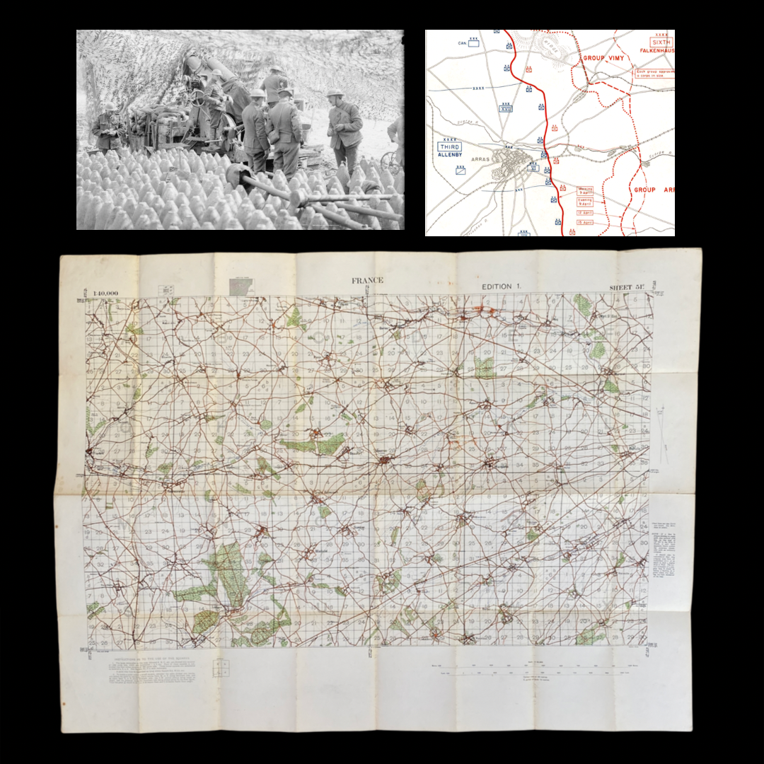


RARE WWI 1917 Battle Of Arras British Expeditionary Force B.E.F. Coordinate Artillery Firing Map
Comes with C.O.A.
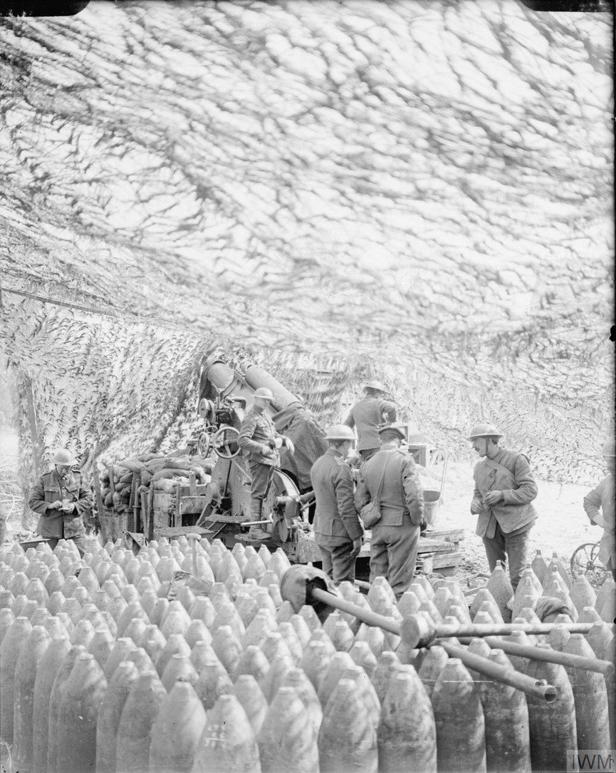
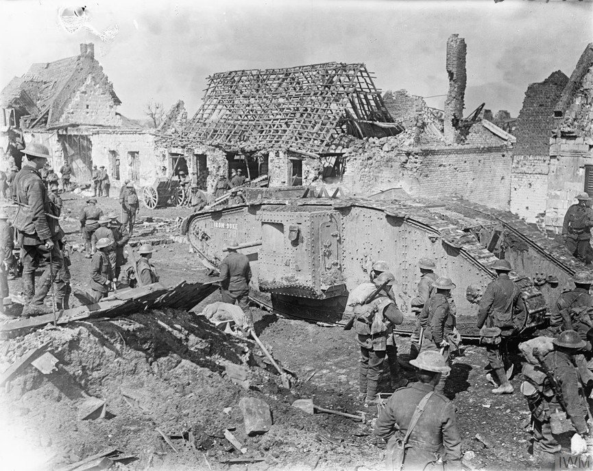
*The Battle Of Arras in 1917 was part of the wider Nivelle Offensive beginning with the largest artillery bombardment of the First World War. The preliminary bombardment at the Battle of Arras saw German positions pulverized by more than 2.5 million shells, about 1 million more than at the Somme. When troops attacked, they were supported by a creeping barrage. Artillery support was more effective at Arras than at the Somme thanks in part to improvements in training and scheduling, and the new 106 fuse, which made high explosive shells more reliable. This was even larger than seen at the Somme.
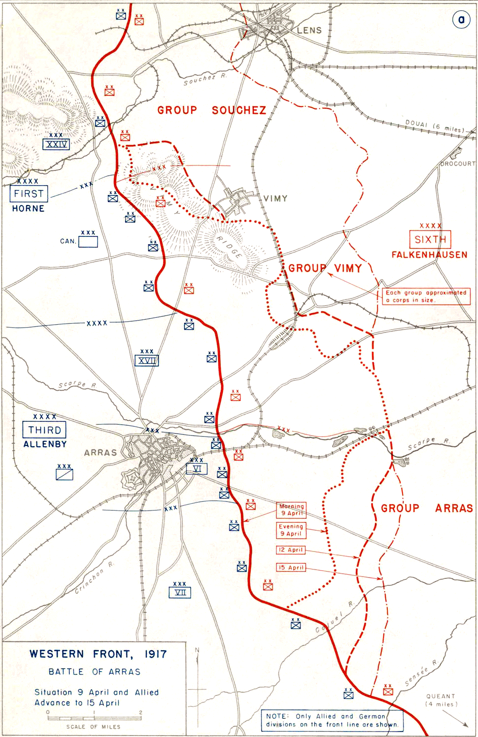
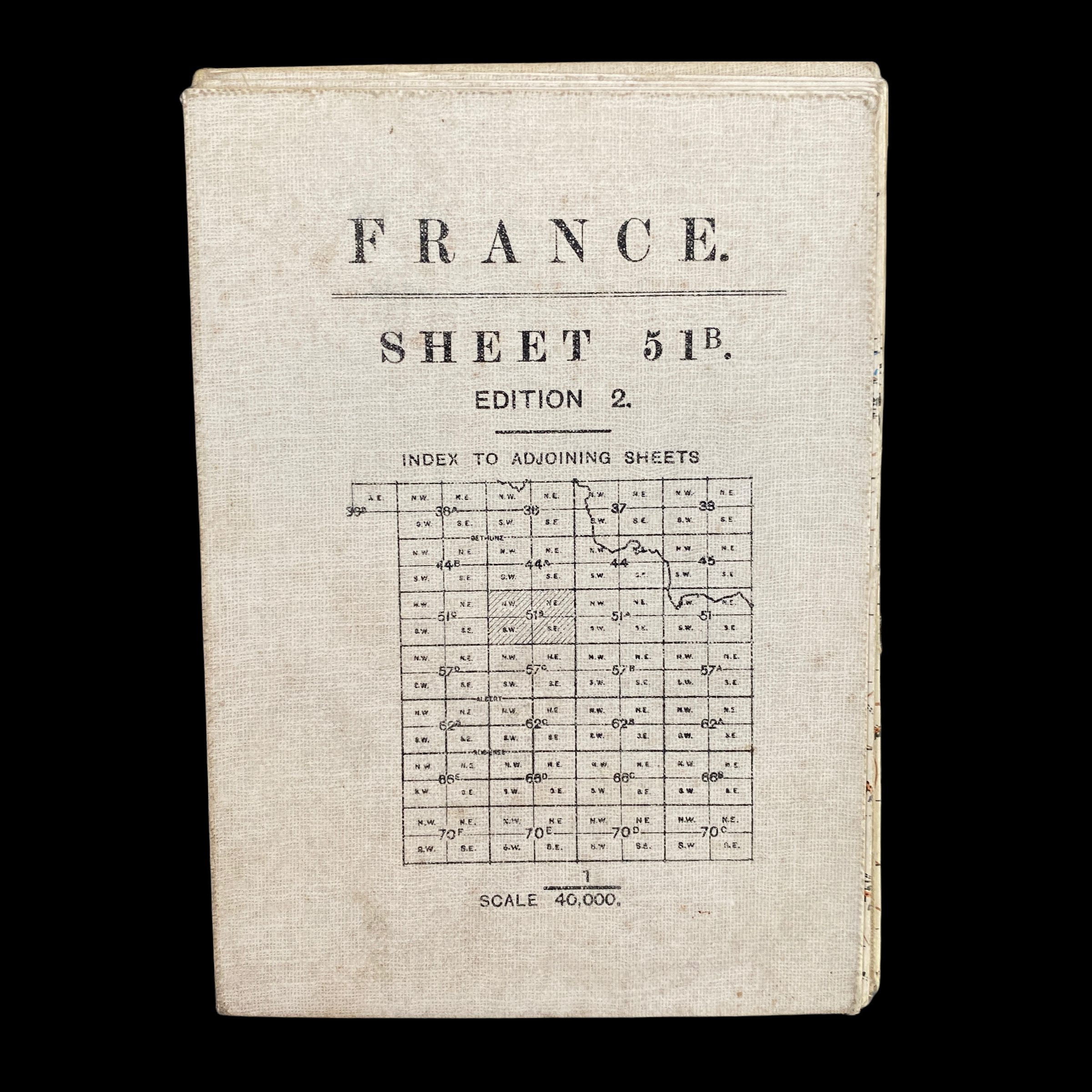
This 1917 dated original WWI liner cloth artillery map was used by British Expeditionary Forces and Canadian Expeditionary Forces during the infamous Battle of Arras (1917). The Battle of Arras (also known as the Second Battle of Arras) was a British offensive on the Western Front during the First World War. From 9 April to 16 May 1917, British troops attacked German defences near the French city of Arras on the Western Front. The British achieved the longest advance since trench warfare had begun, surpassing the record set by the French Sixth Army on 1 July 1916. The British advance slowed in the next few days and the German defence recovered. The battle became a costly stalemate for both sides and by the end of the battle, the British Third Army and the First Army had suffered about 160,000 casualties and the German 6th Army about 125,000.
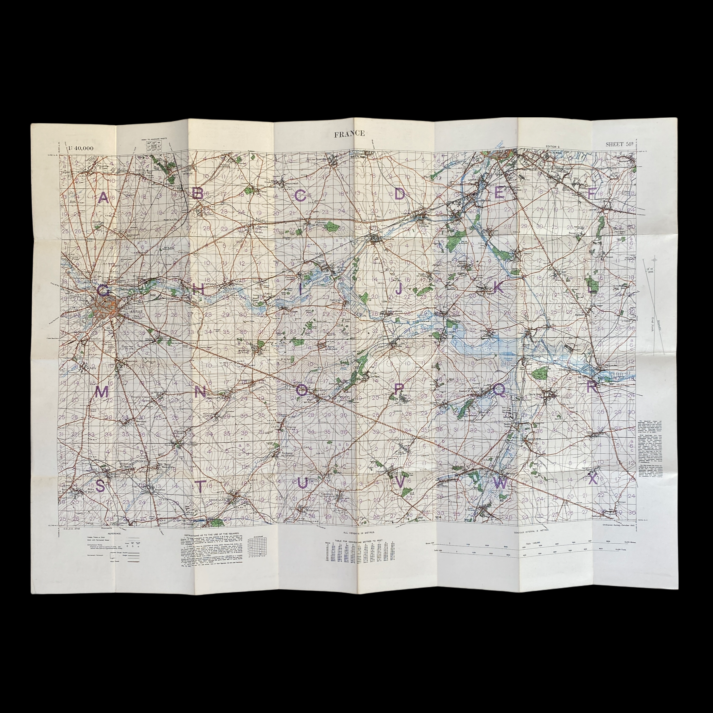
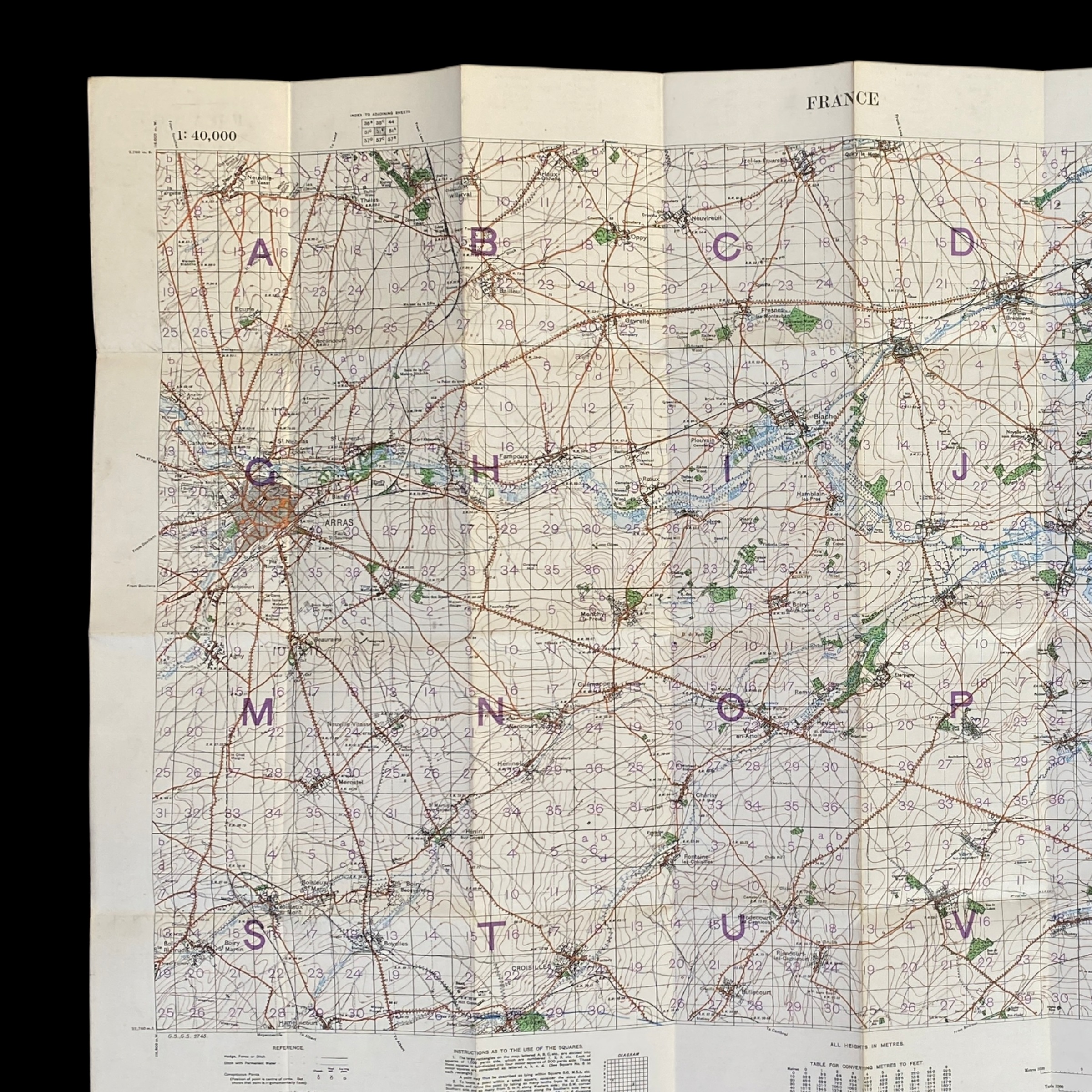
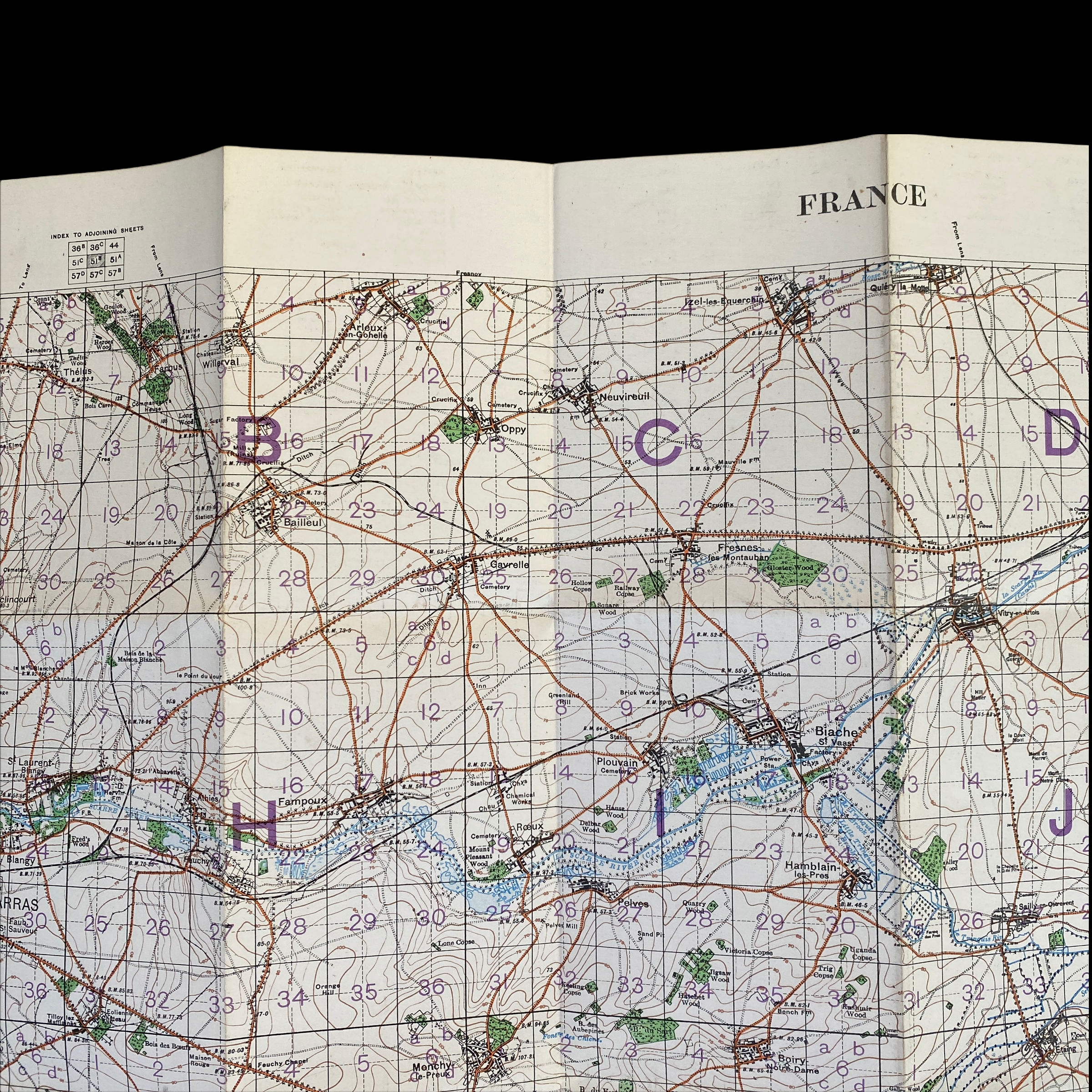
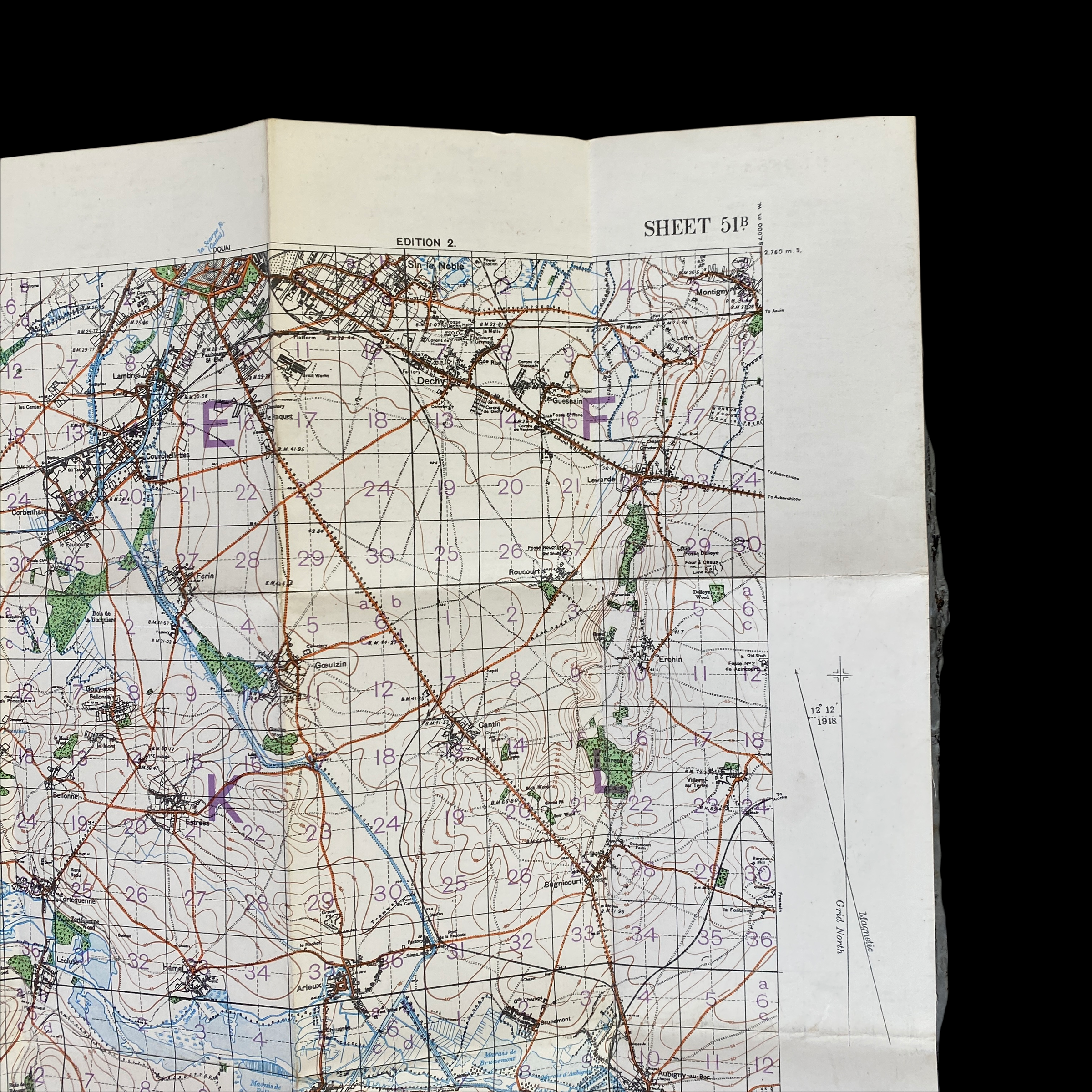
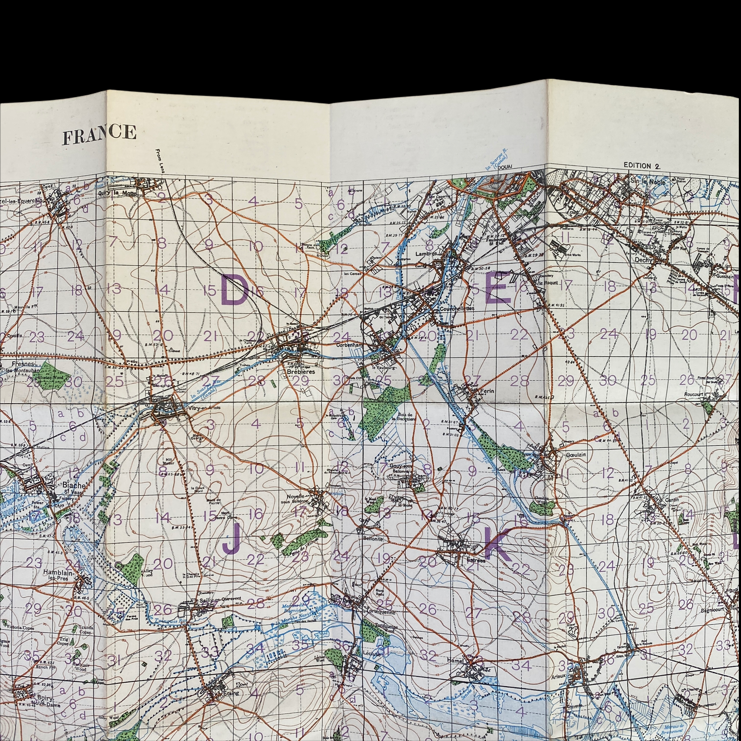
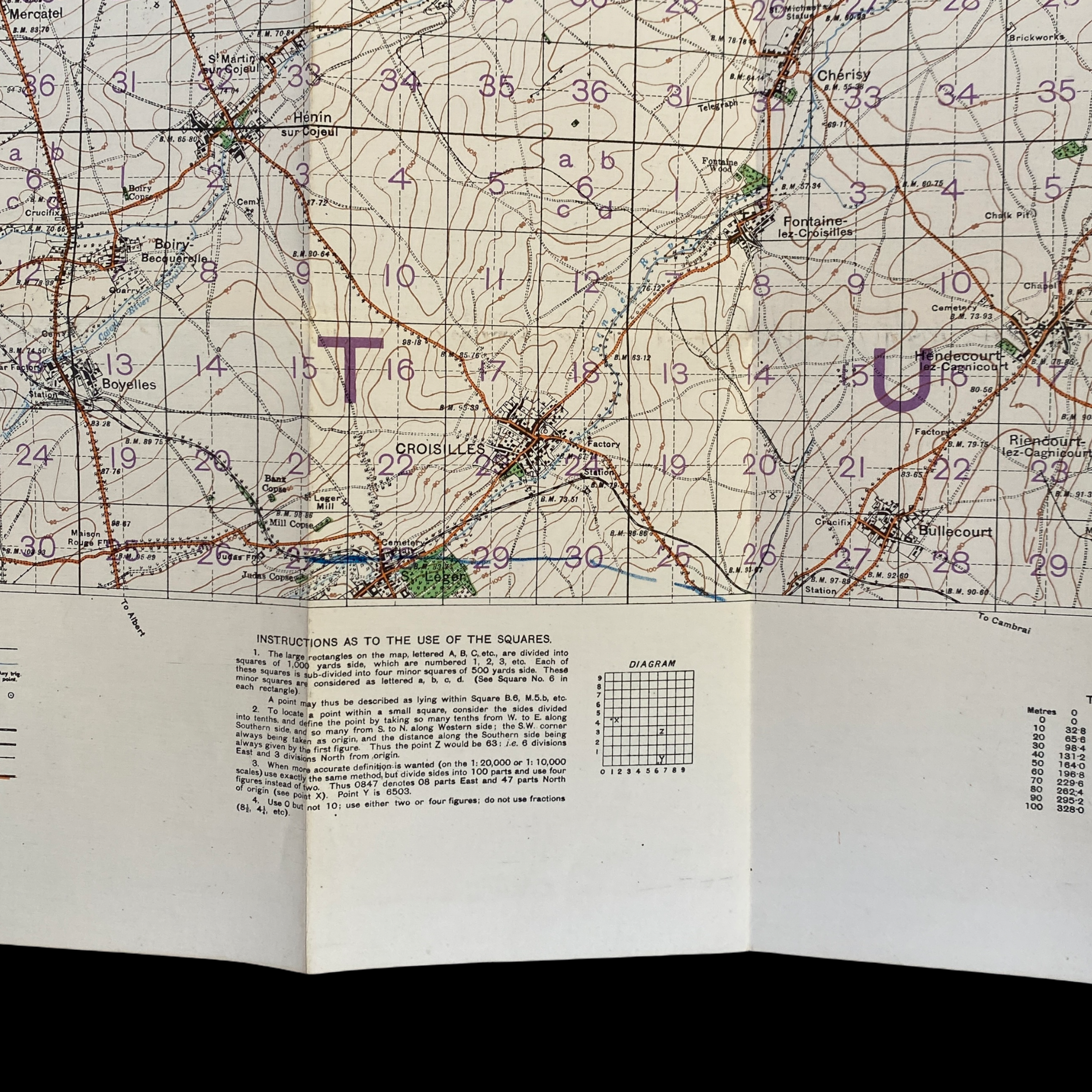
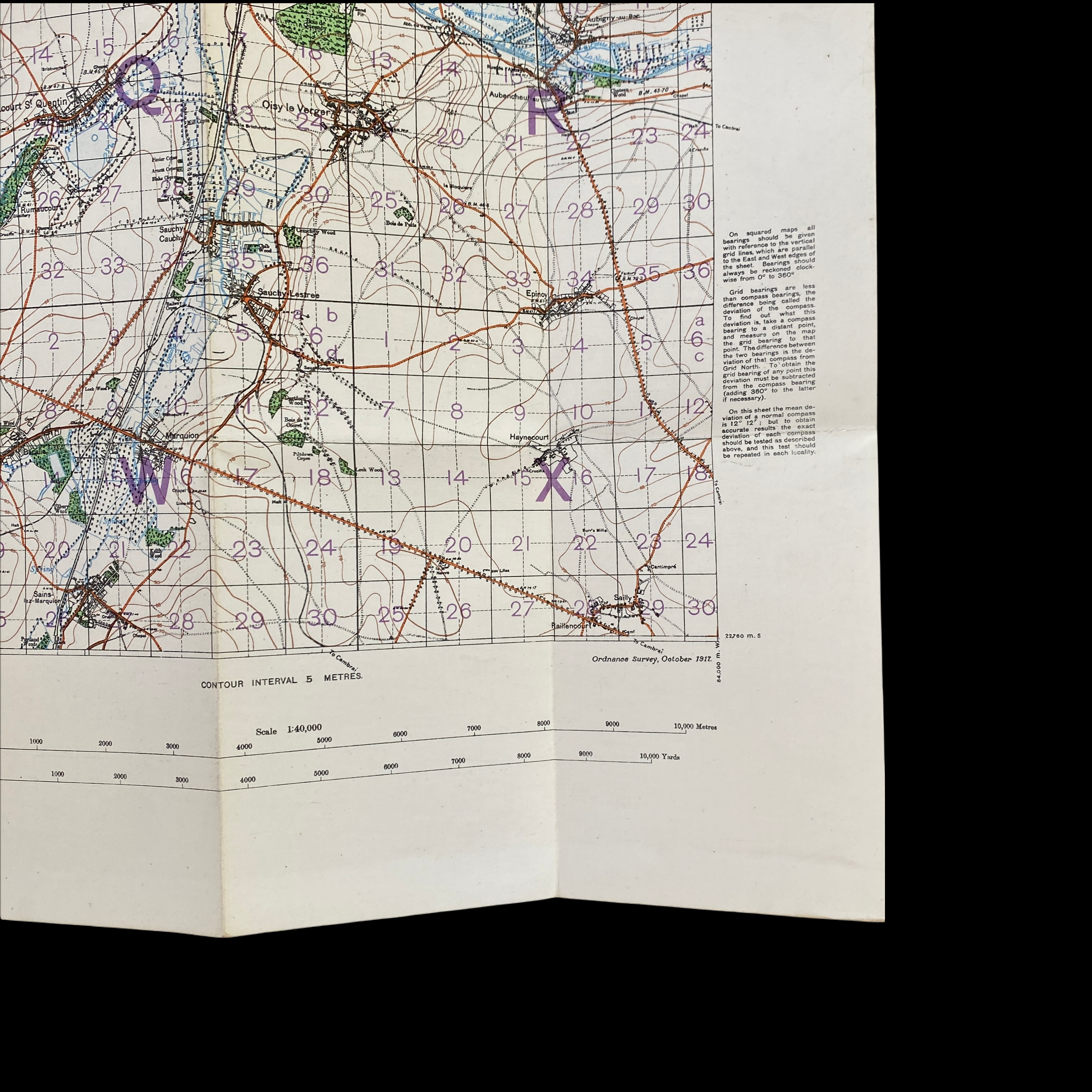
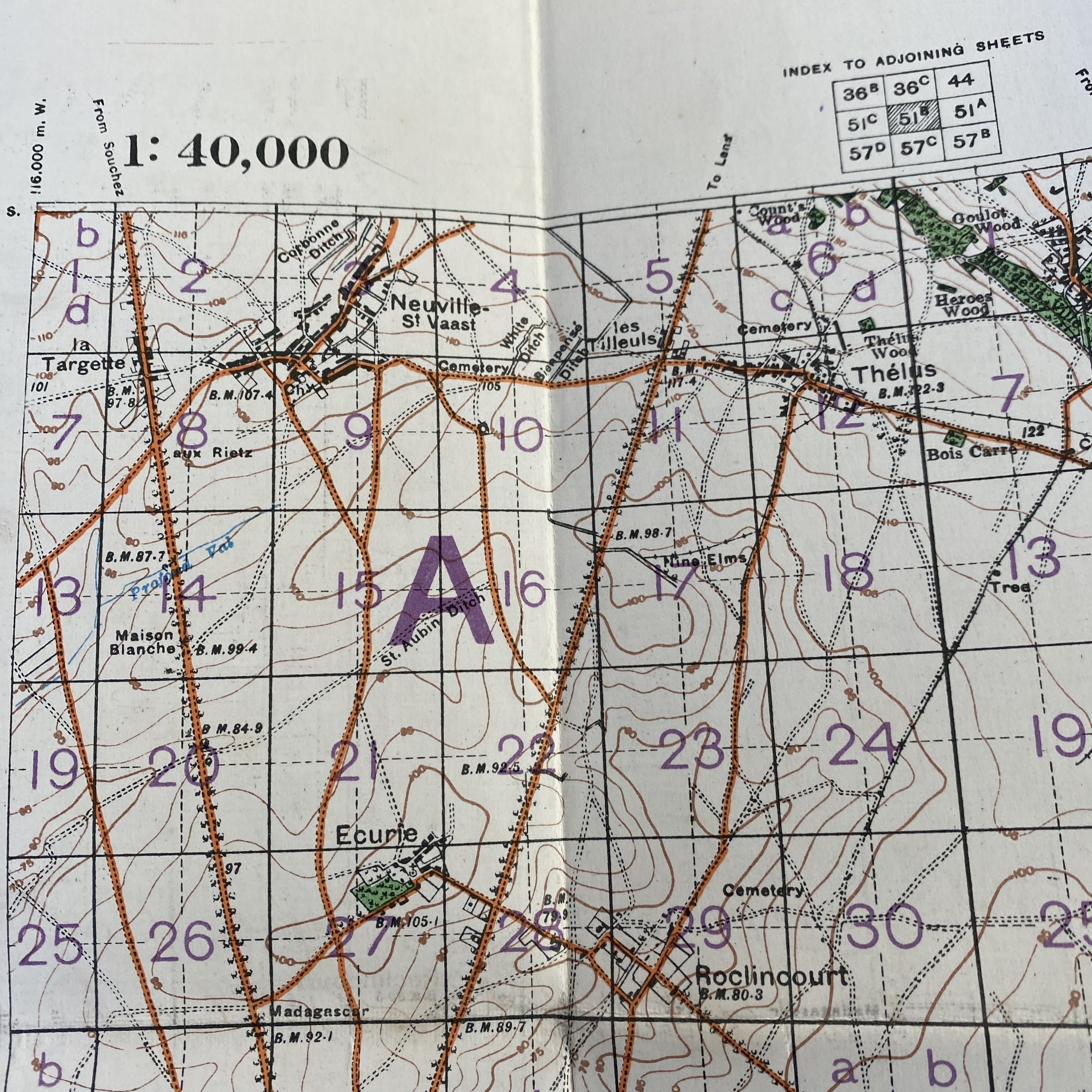
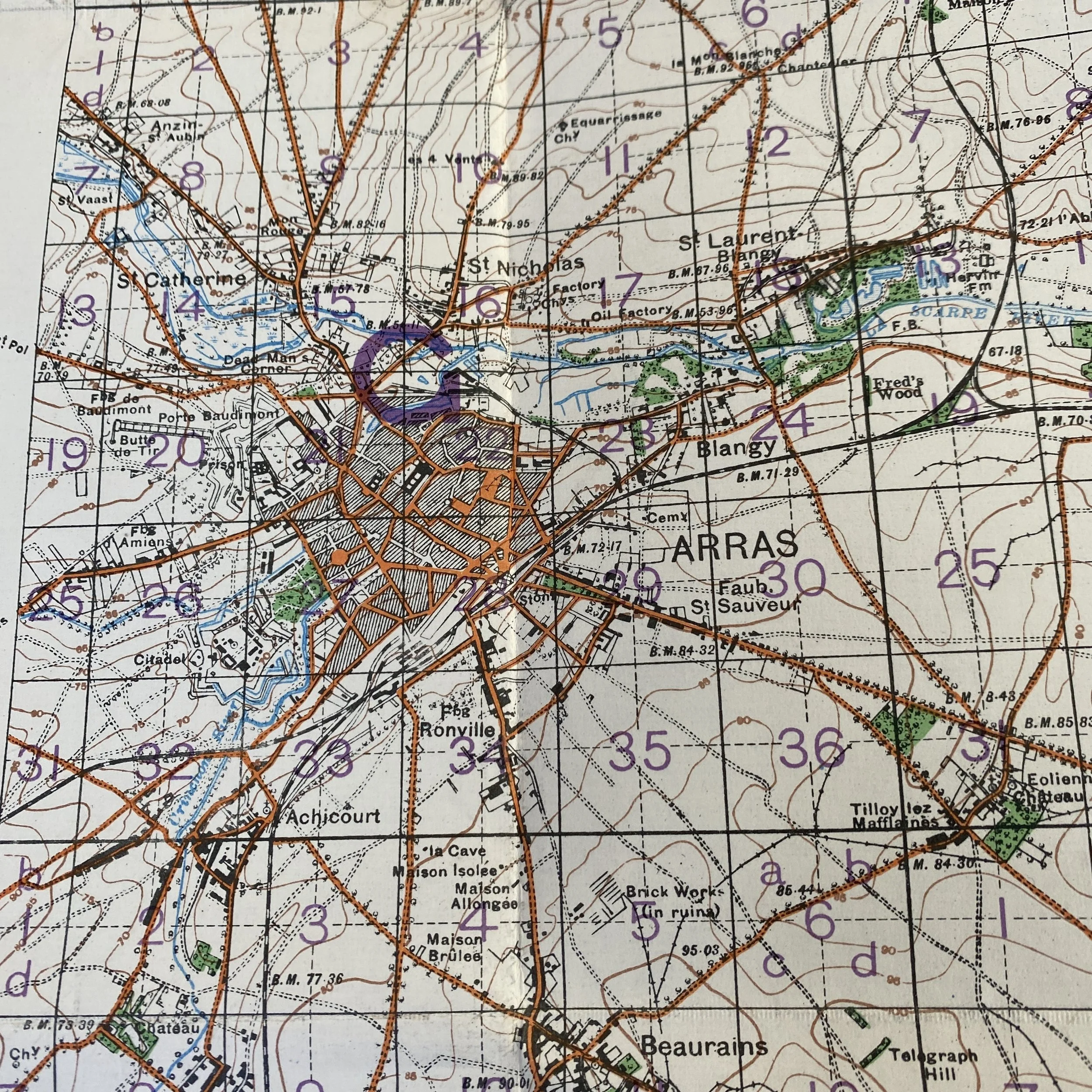
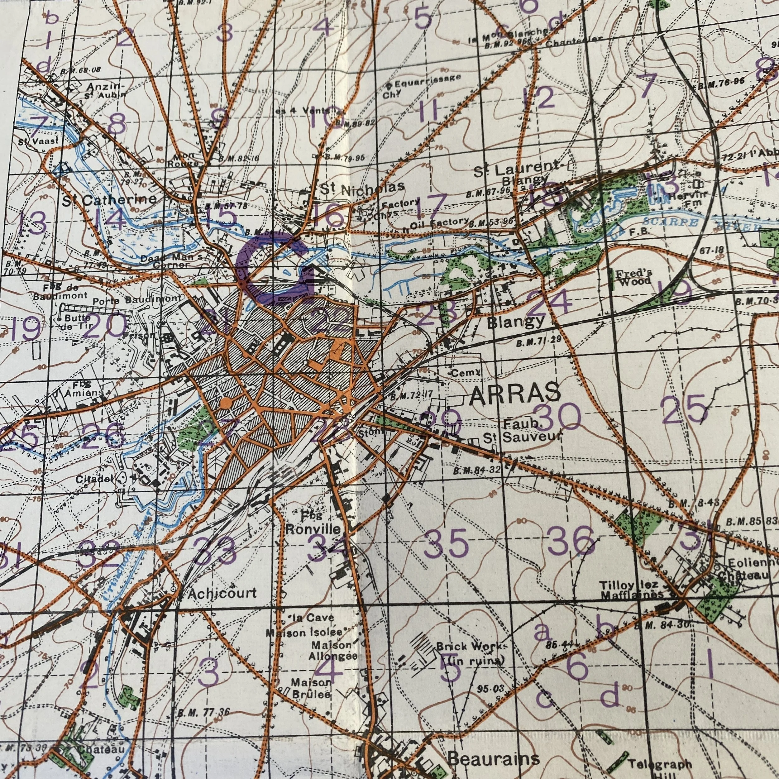
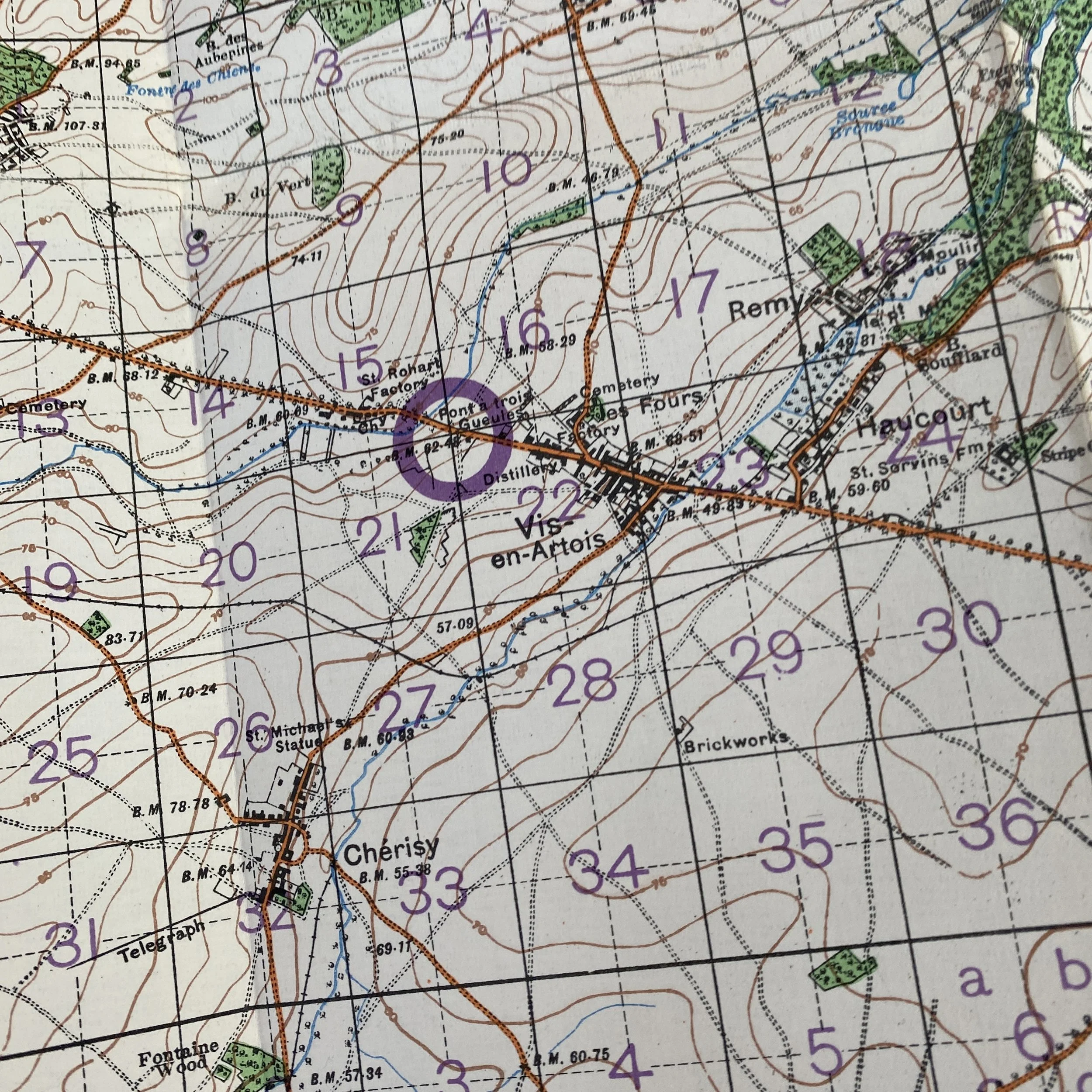
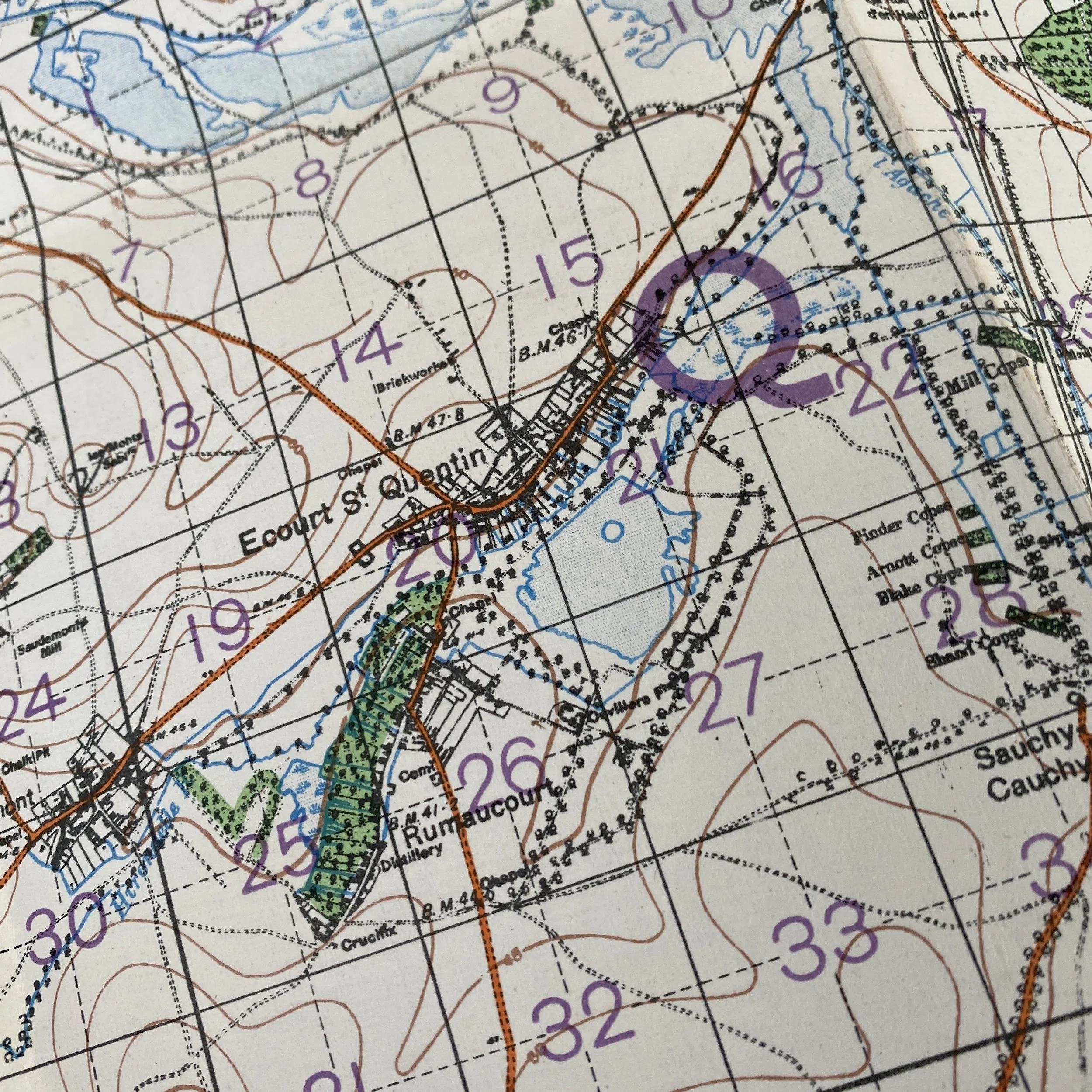
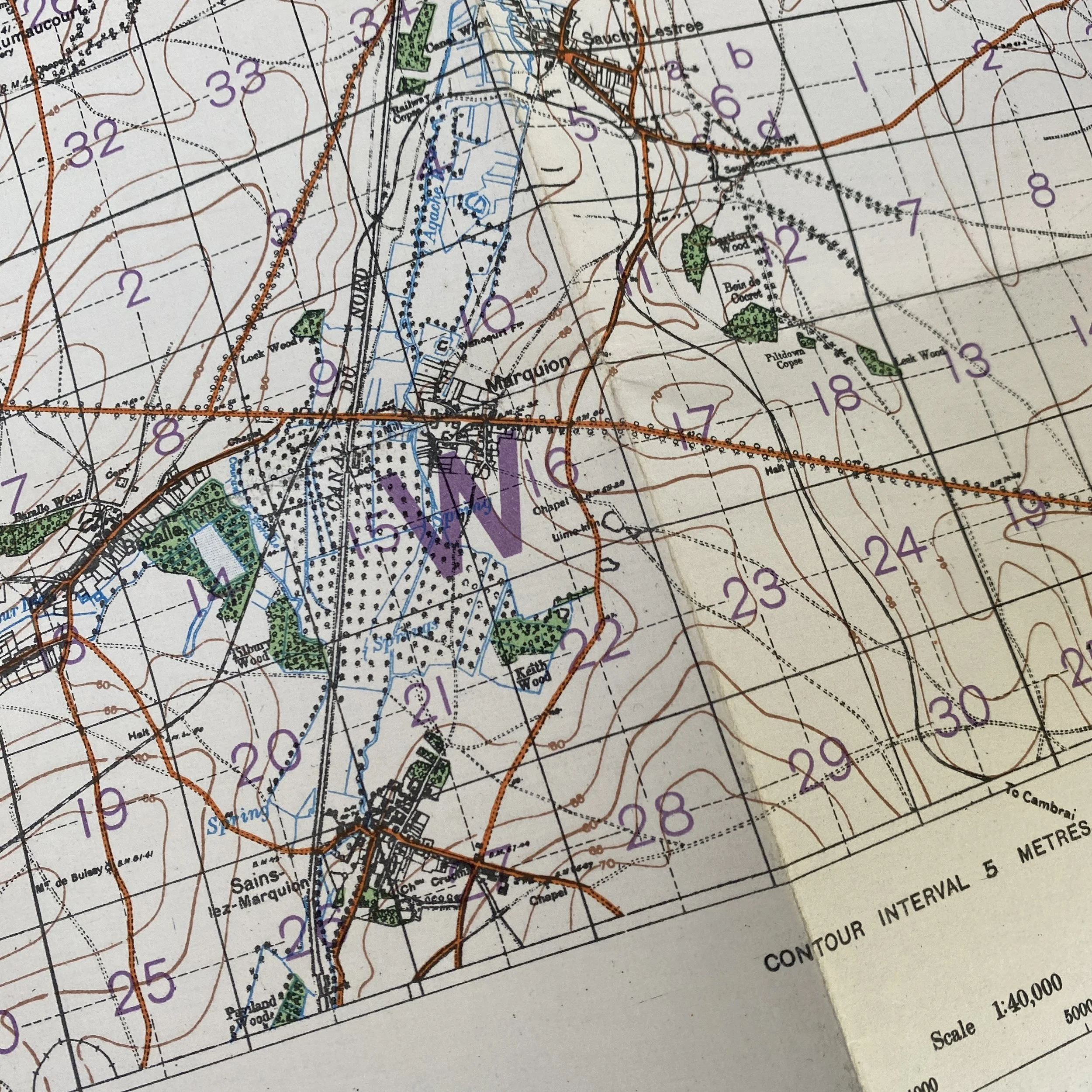
This grided firing map was meant to provide the BEF and CEF artillerymen with the most accurate firing coordinates for the battlefield. Each of the large rectangles is sub-sectioned into smaller squares with A-D notations. By using these grid split into 1,000 and 500-yard increments artillery placement could be extremely accurate as it was received and the firing order was carried out.
What makes this artilleryman’s B.E.F./C.E.F. map so unique is the table conversions for METERS TO FEET to help with more accurate and faster firing adjustments. This map also has a special “CONSPICUOUS POINTS” marking system which labeled large landmarks like churches and windmills to help artillerymen use trigonometrically fixed points for even more accurate firing.