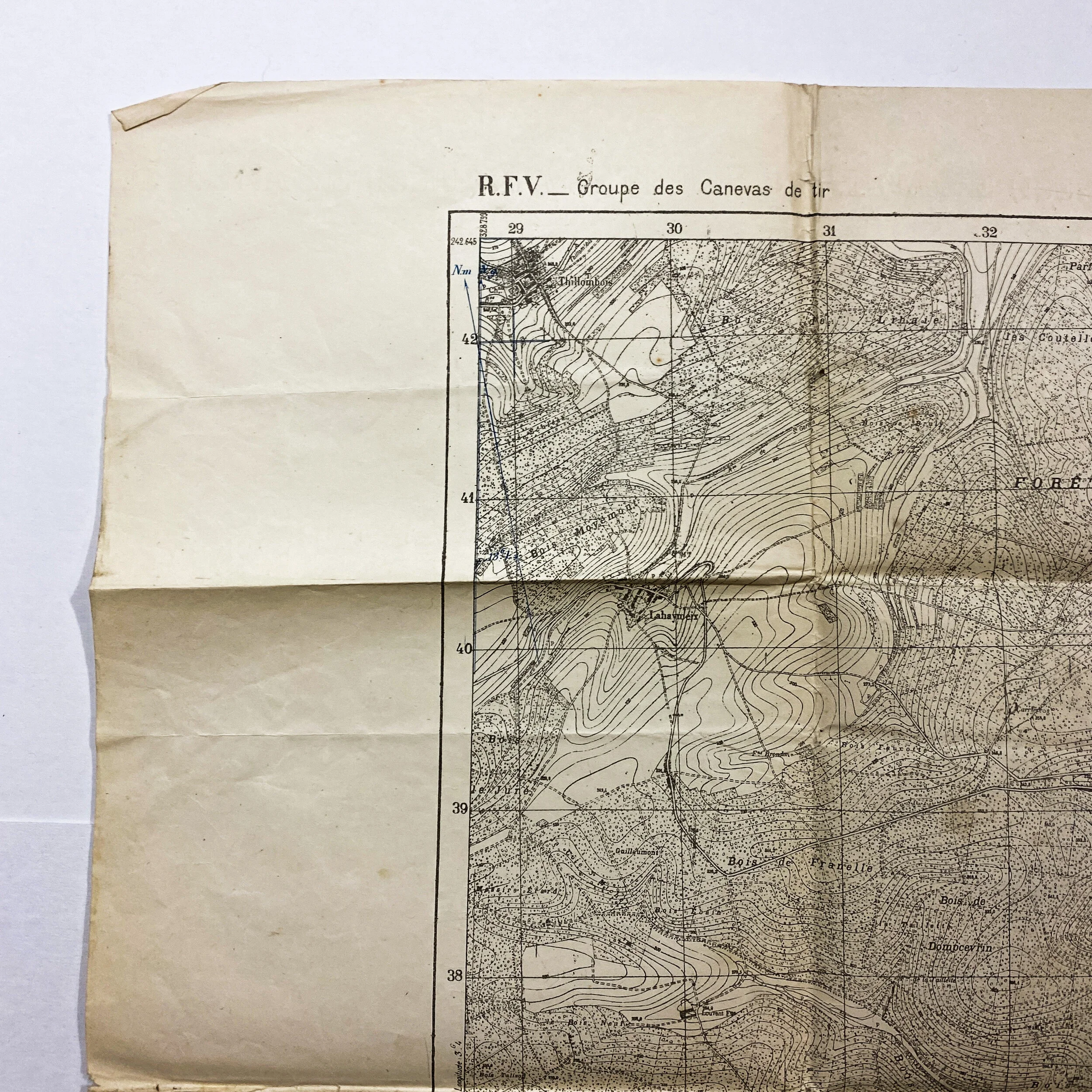
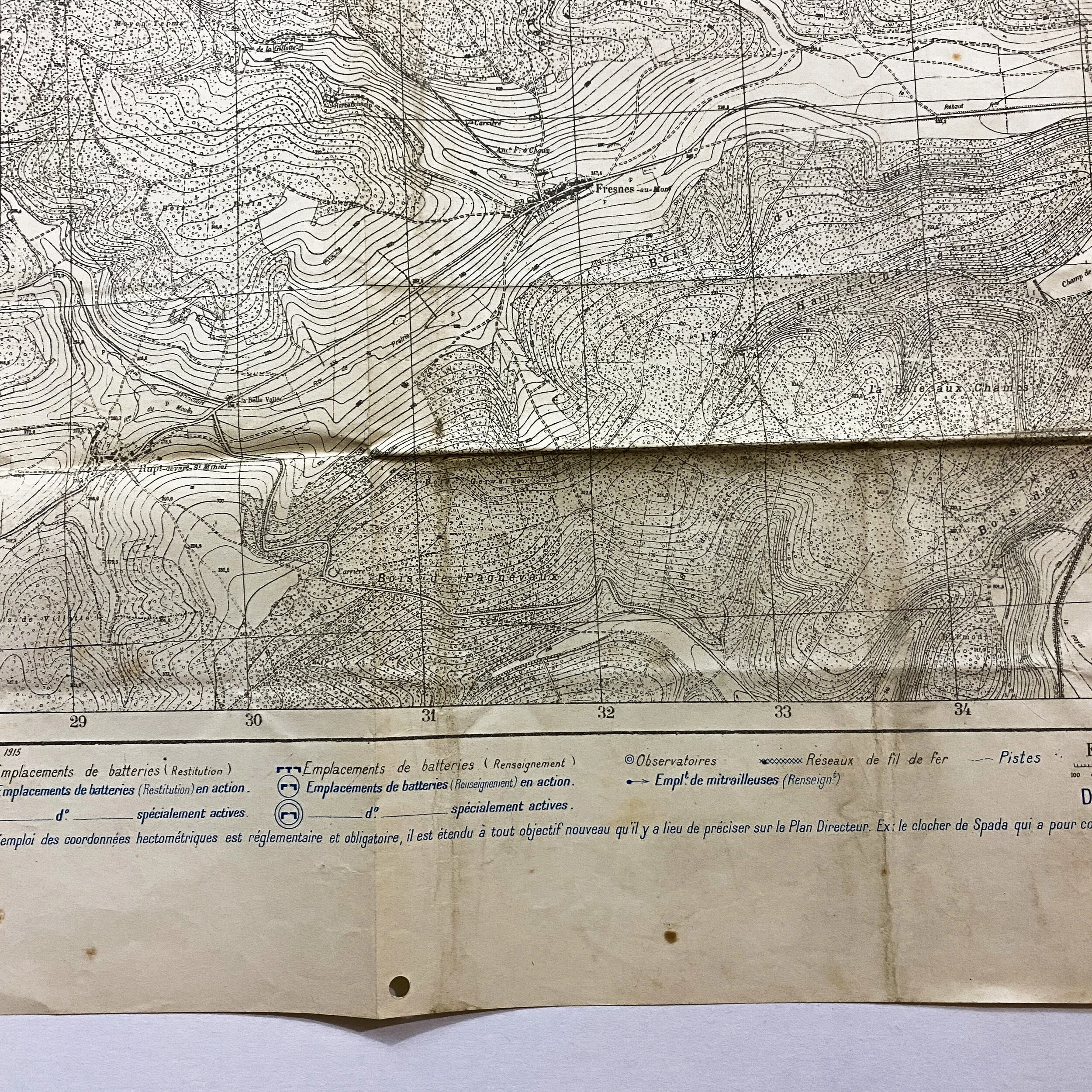
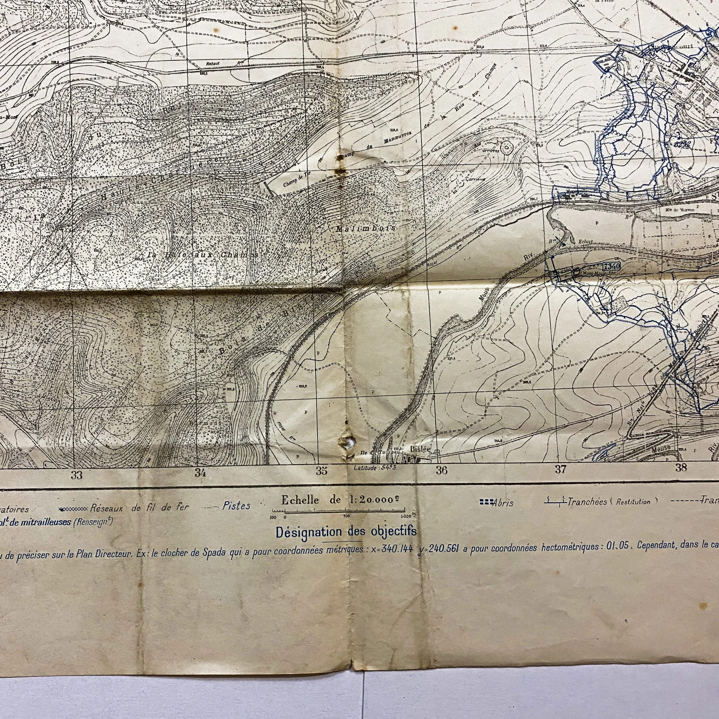
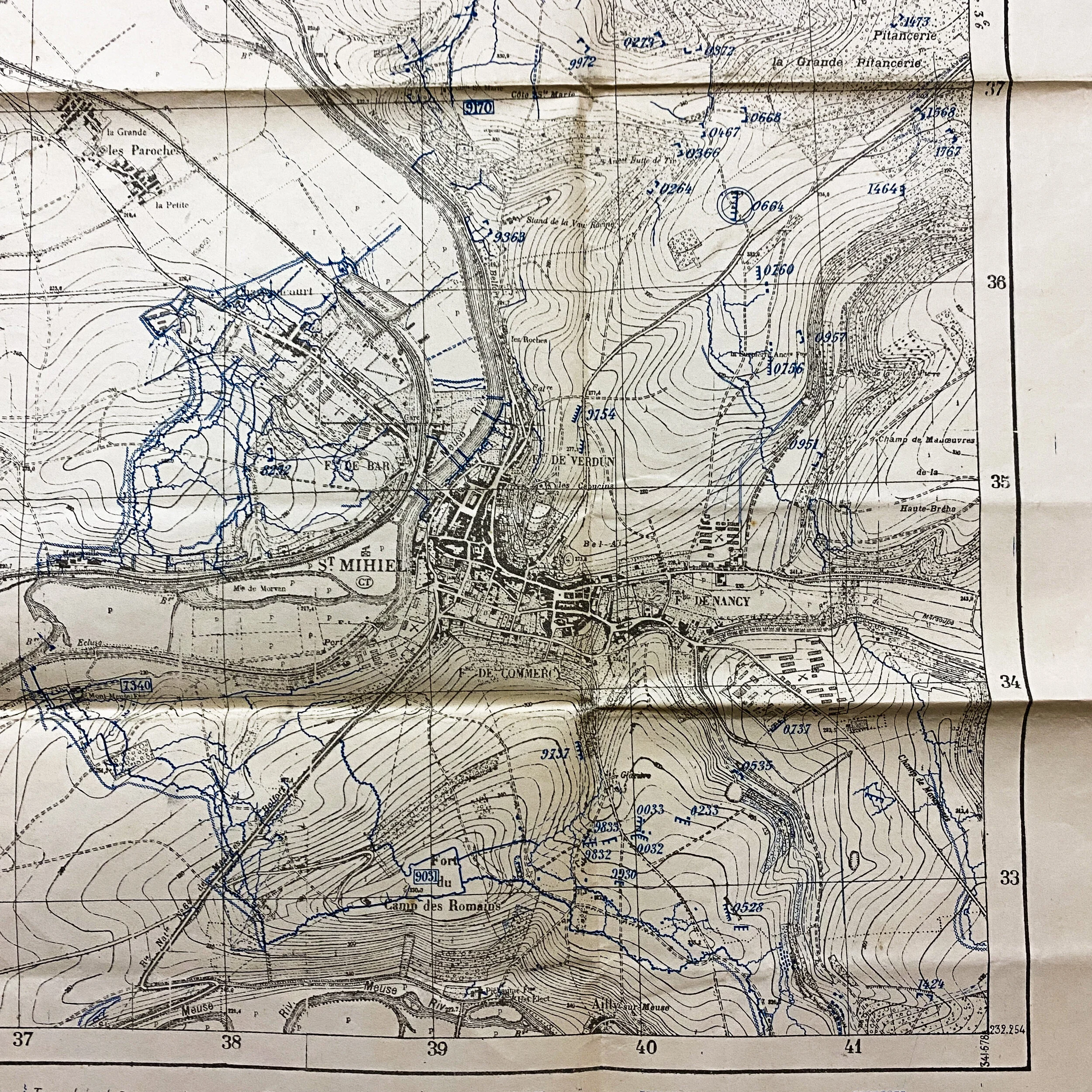
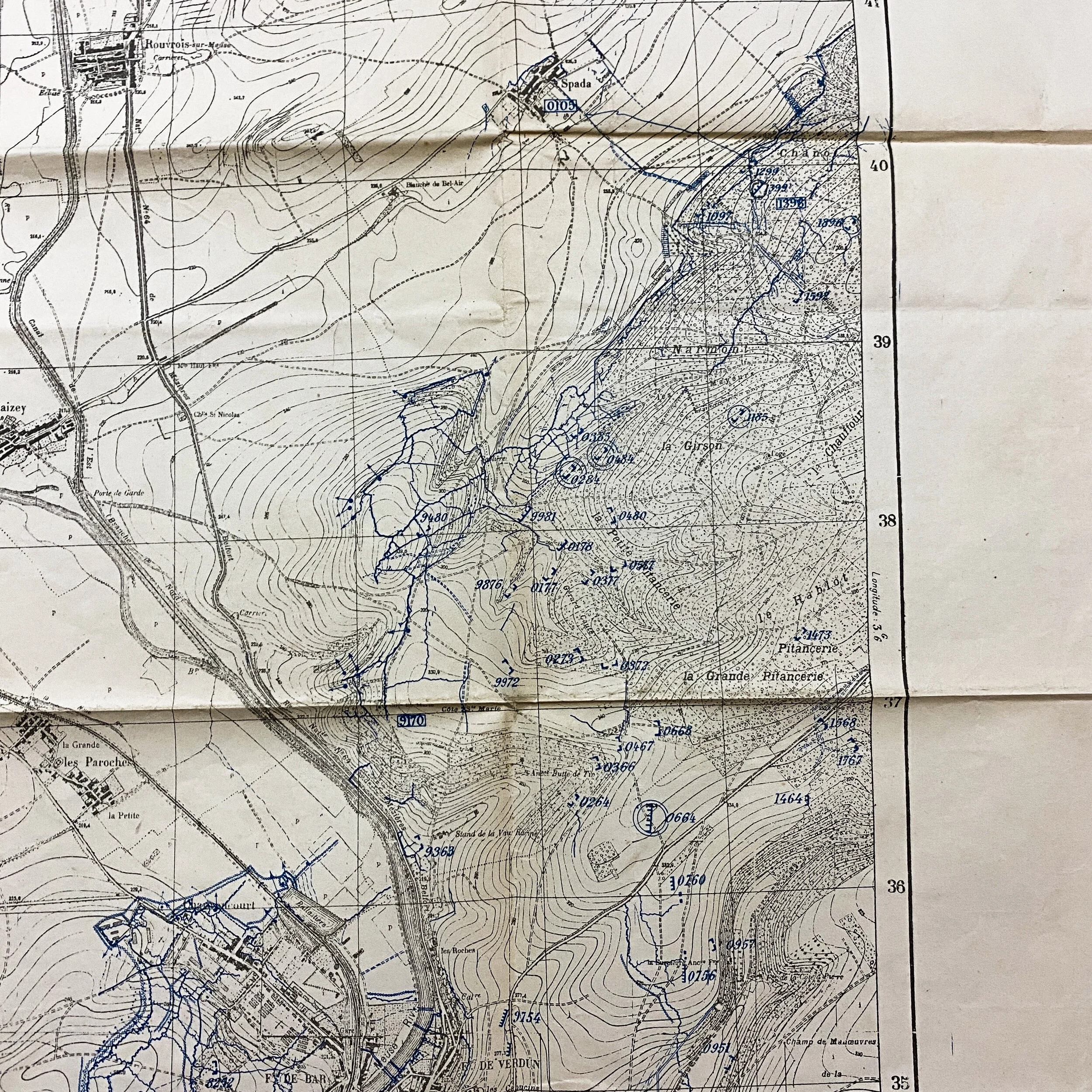
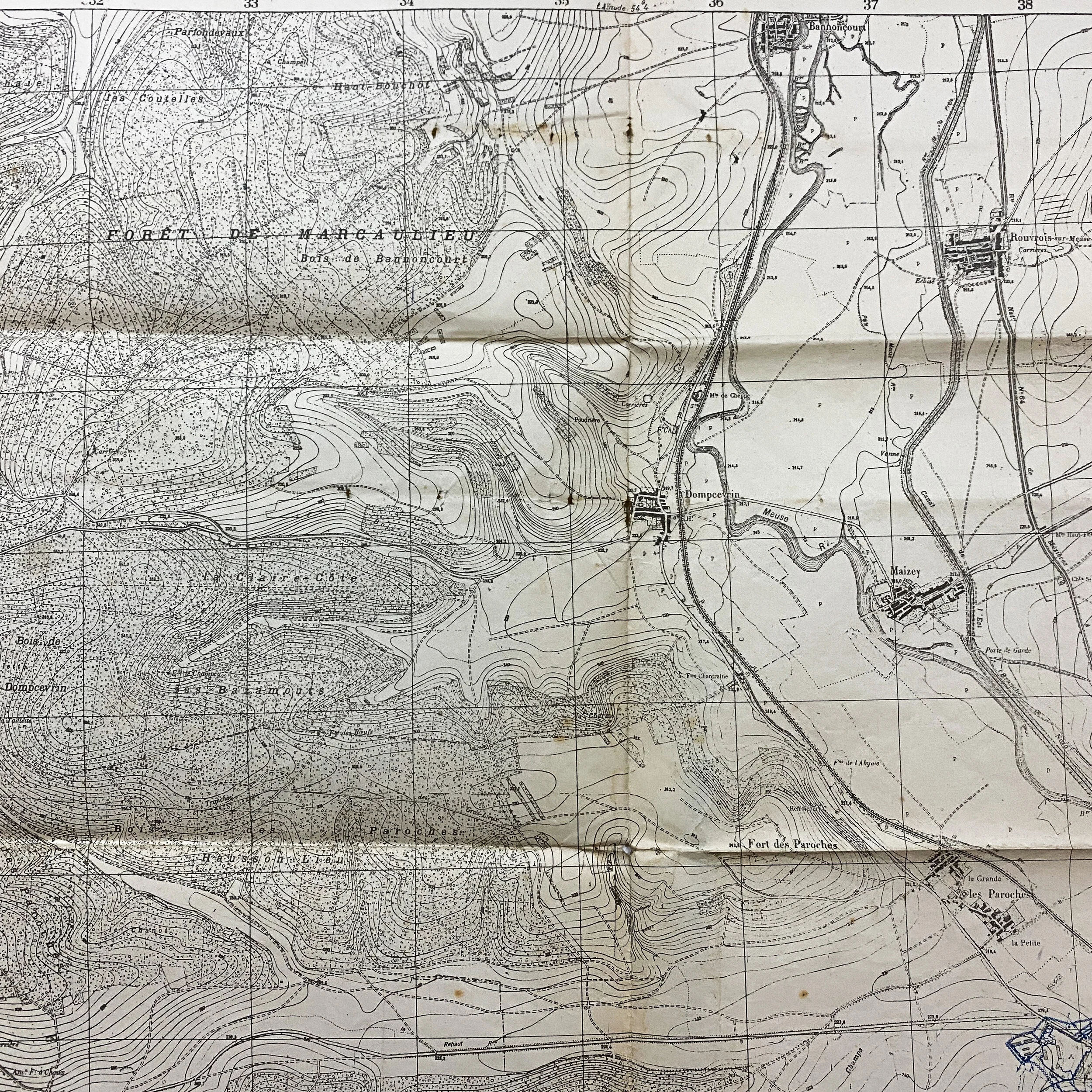
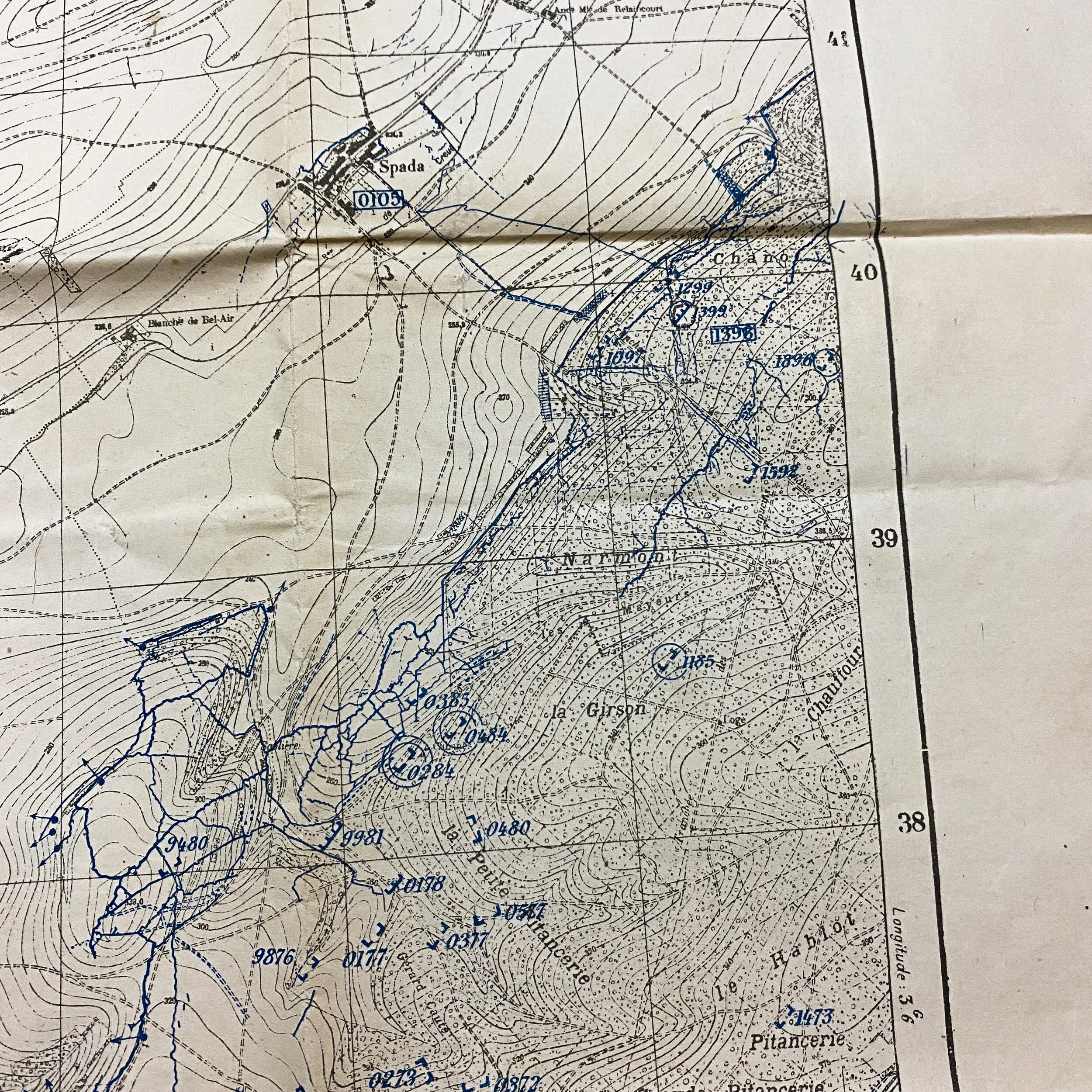
1916 Dated - St. Mihiel Offensive - A.E.F. used French Printed Map of German Trench Positions


1916 Dated - St. Mihiel Offensive - A.E.F. used French Printed Map of German Trench Positions
$575.00
Size: 35 x 25 inches
This is an original French map given to officers and commanders in the field. These maps were utalized by both the French as well as AEF and other Expeditionary Forces in the area as they attacked the surrounding town of St. Mihiel. This map is dated and named 'Positions of the Enemy as of February 27th, 1916'. This map is extremely rare given the blue markers showing German trench lines as well as battery positions, encampments and scouted artillery positions in the St. Mihiel area. This is a nice well presented trench map in truly excellent condition.