EXTREMELY RARE! WWII "Mission 11-404" July 1945 "RESTRICTED" 431st Bombardment Sq. XXI Bomber Command Reconnaissance Mission Intelligence Photo B-29 Kyushu Raids (Target: Kagoshima Marshalling Yard)


EXTREMELY RARE! WWII "Mission 11-404" July 1945 "RESTRICTED" 431st Bombardment Sq. XXI Bomber Command Reconnaissance Mission Intelligence Photo B-29 Kyushu Raids (Target: Kagoshima Marshalling Yard)
Comes with a hand-signed C.O.A. and a full historical write-up research document
From: World War II - Pacific Theater
Unit: XXI Bomber Command - 431st Bombardment Squadron - Twentieth Air Force
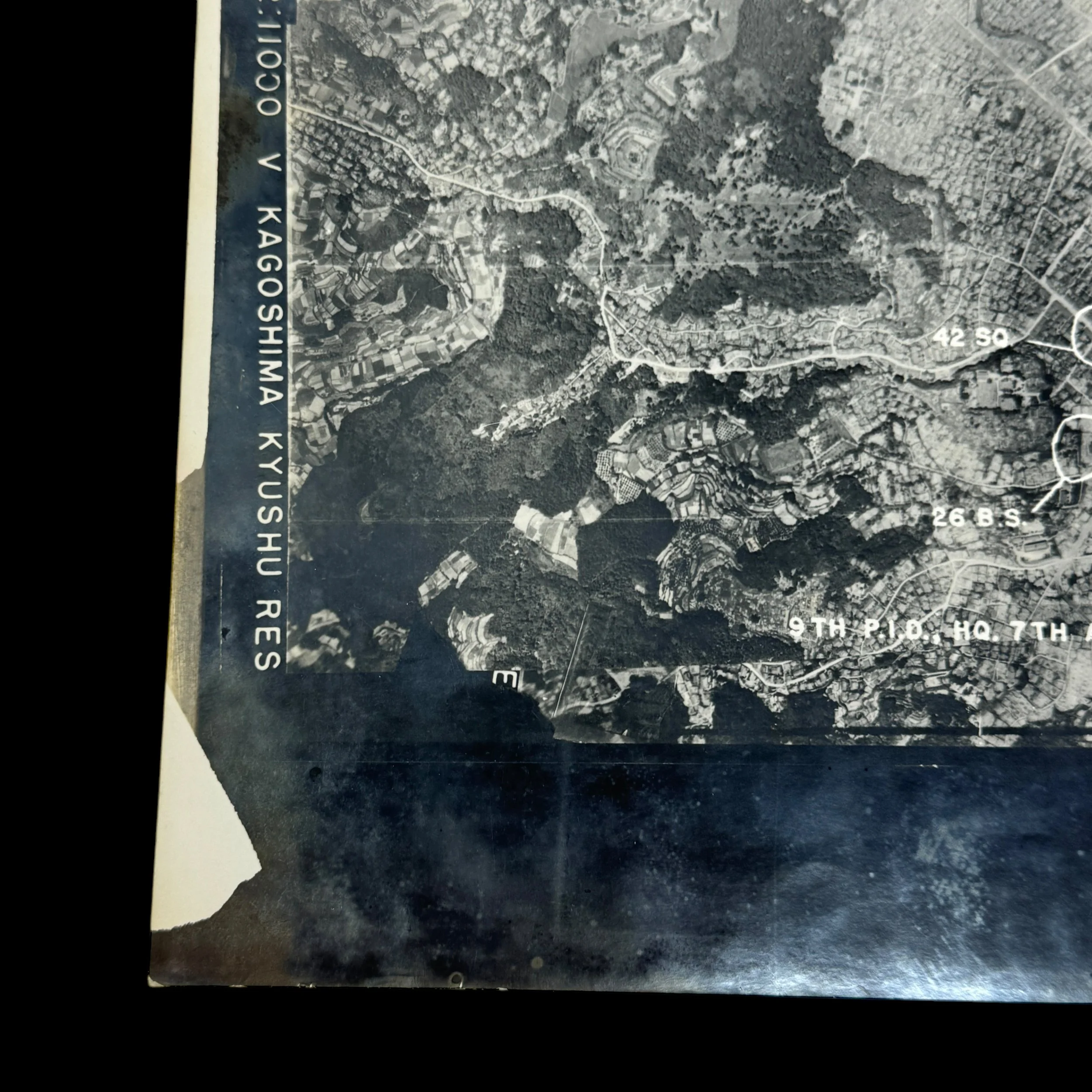
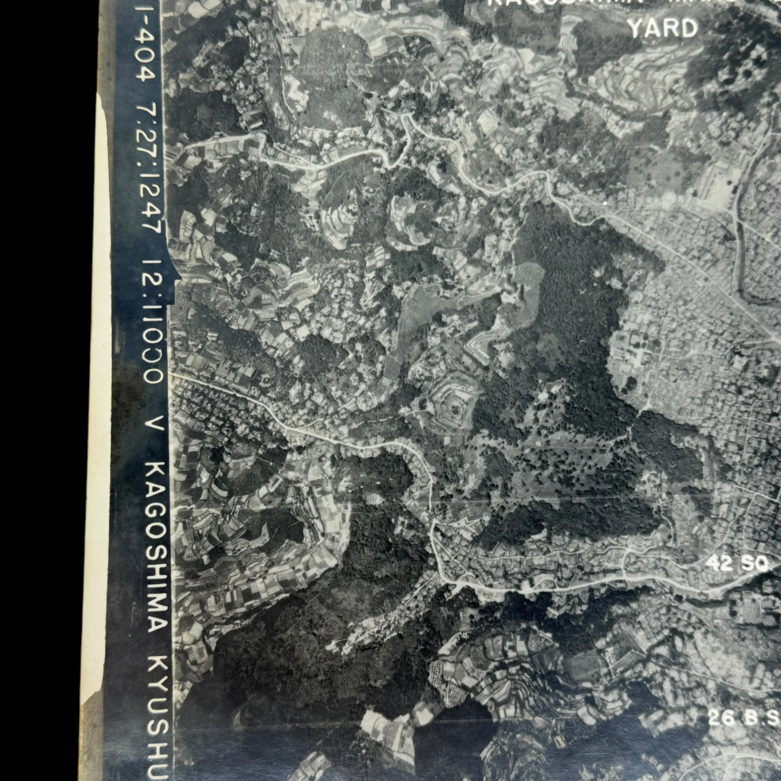
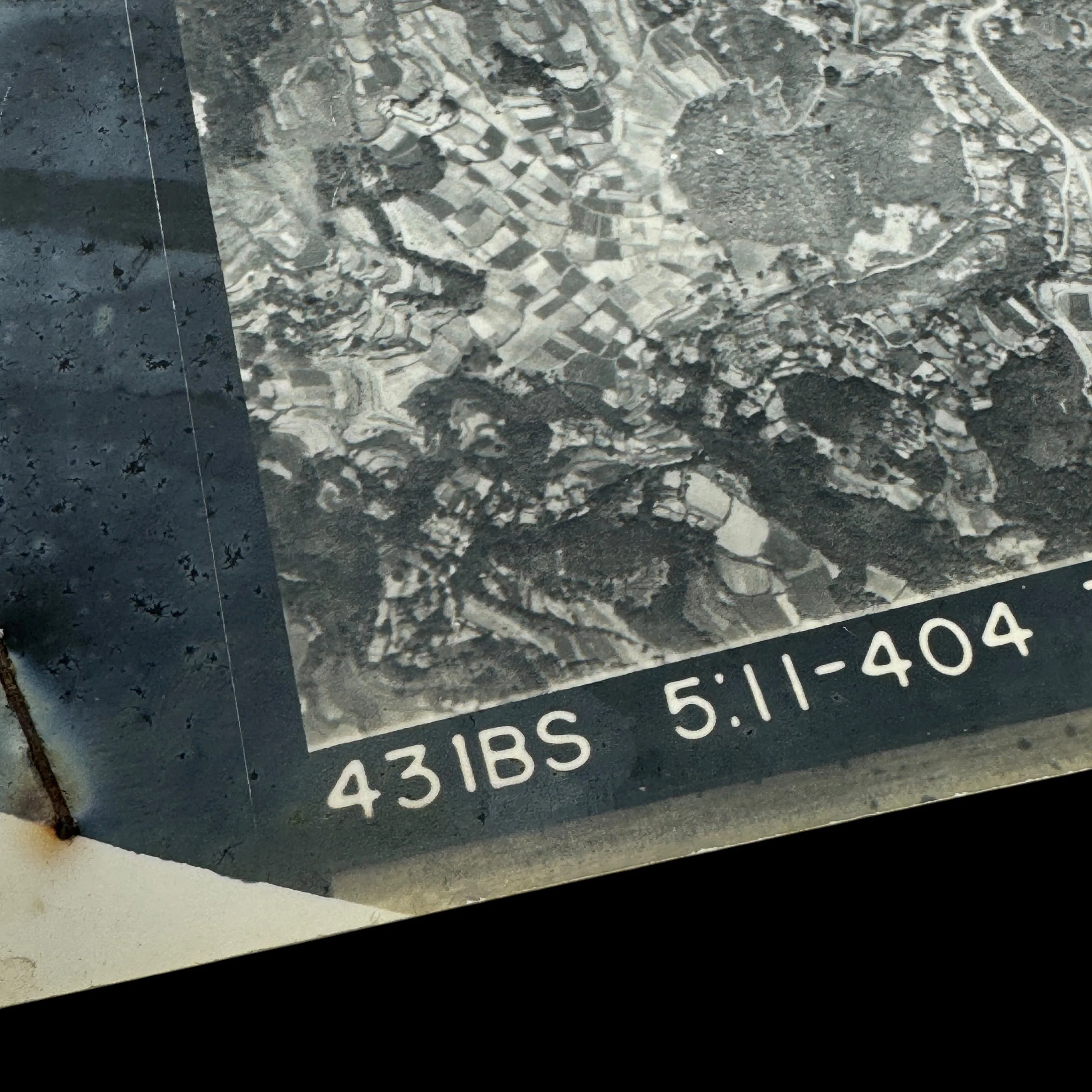
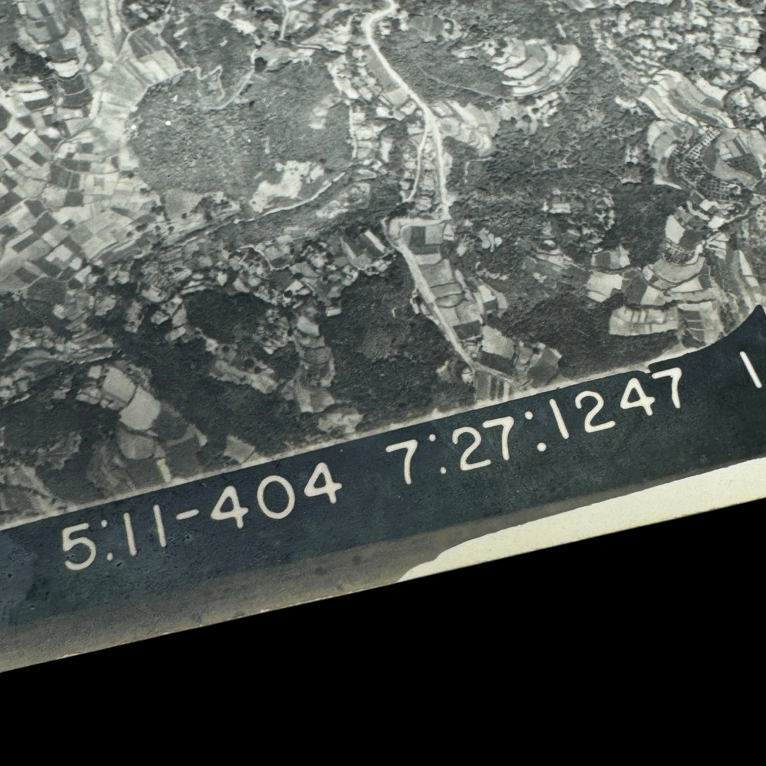
Type: “CONFIDENTIAL” Marked Aerial Reconnaissance Intelligence Photograph Taken By XXI Bomber Command’s 431st Bombardment Squadron B-29 Superfortress During Strategic Bombing Operations On Kyushu, Japan
Size: 10 × 10 inches
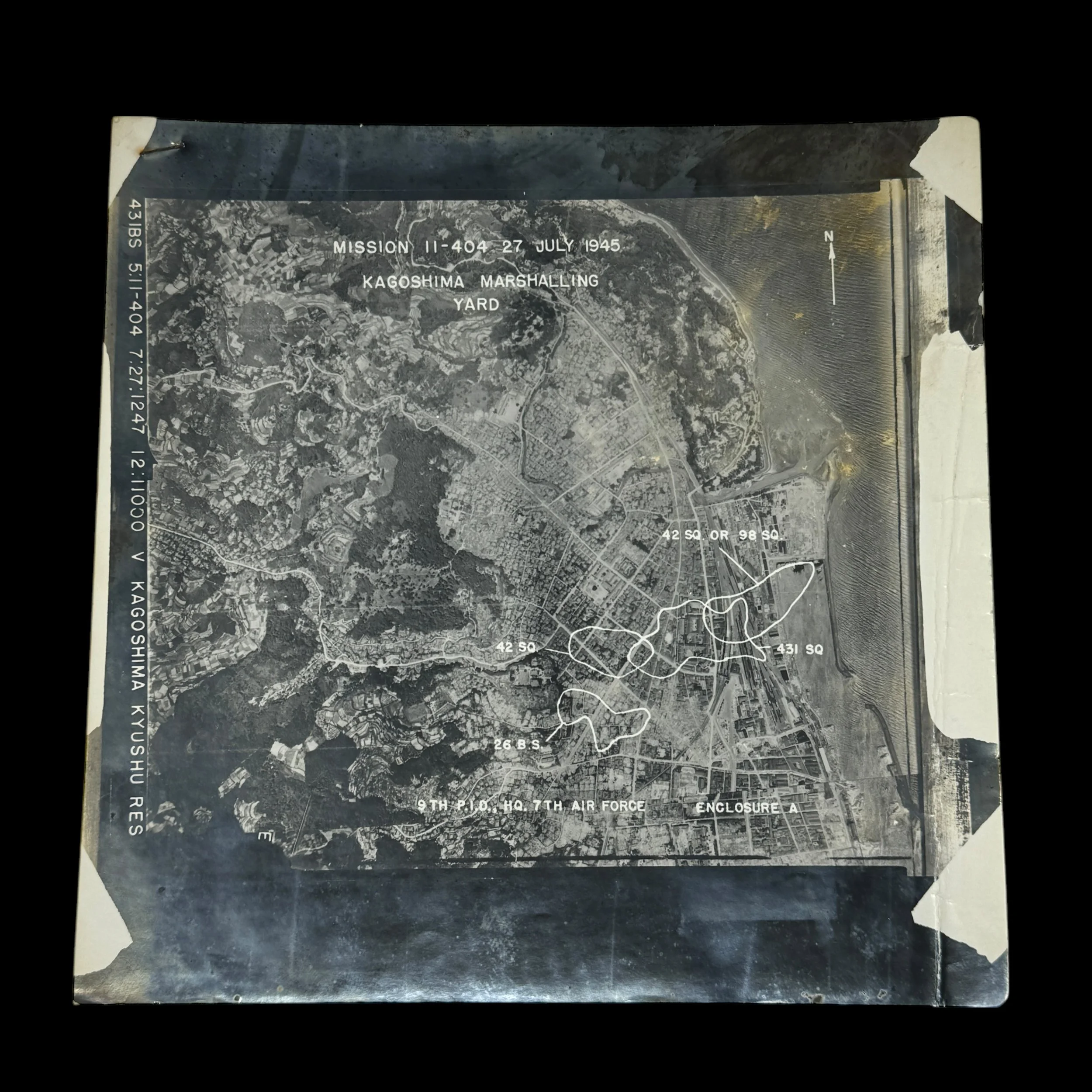
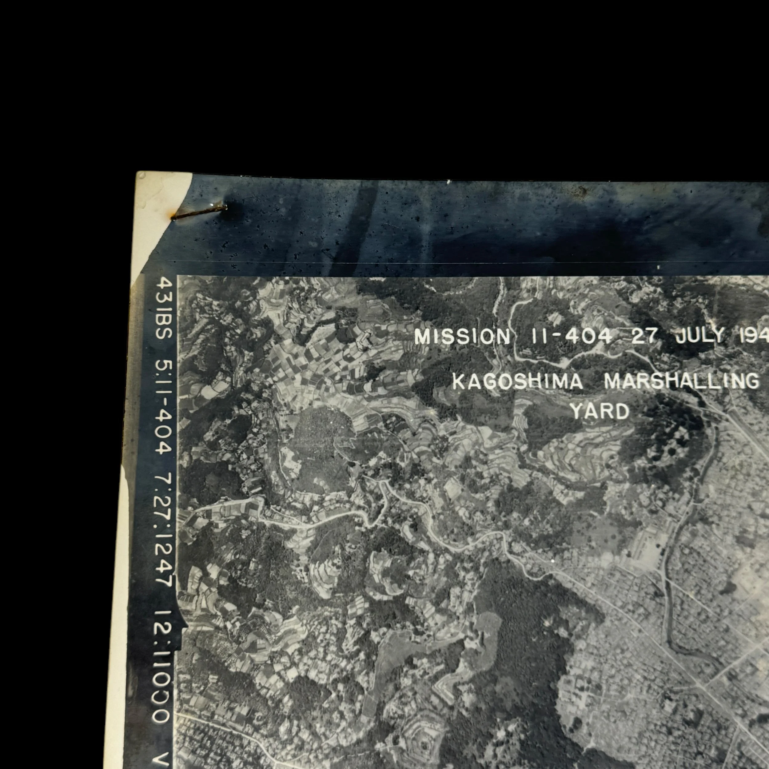
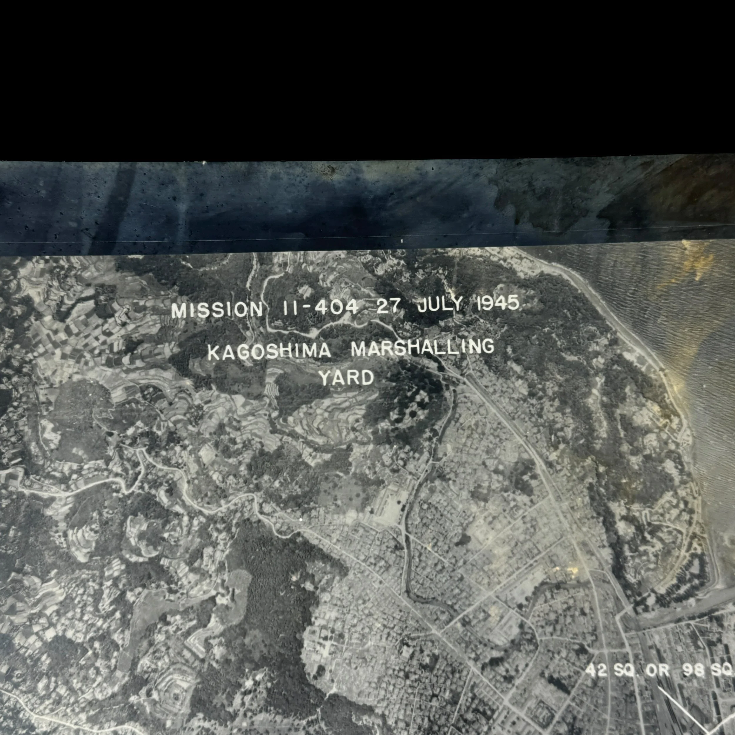
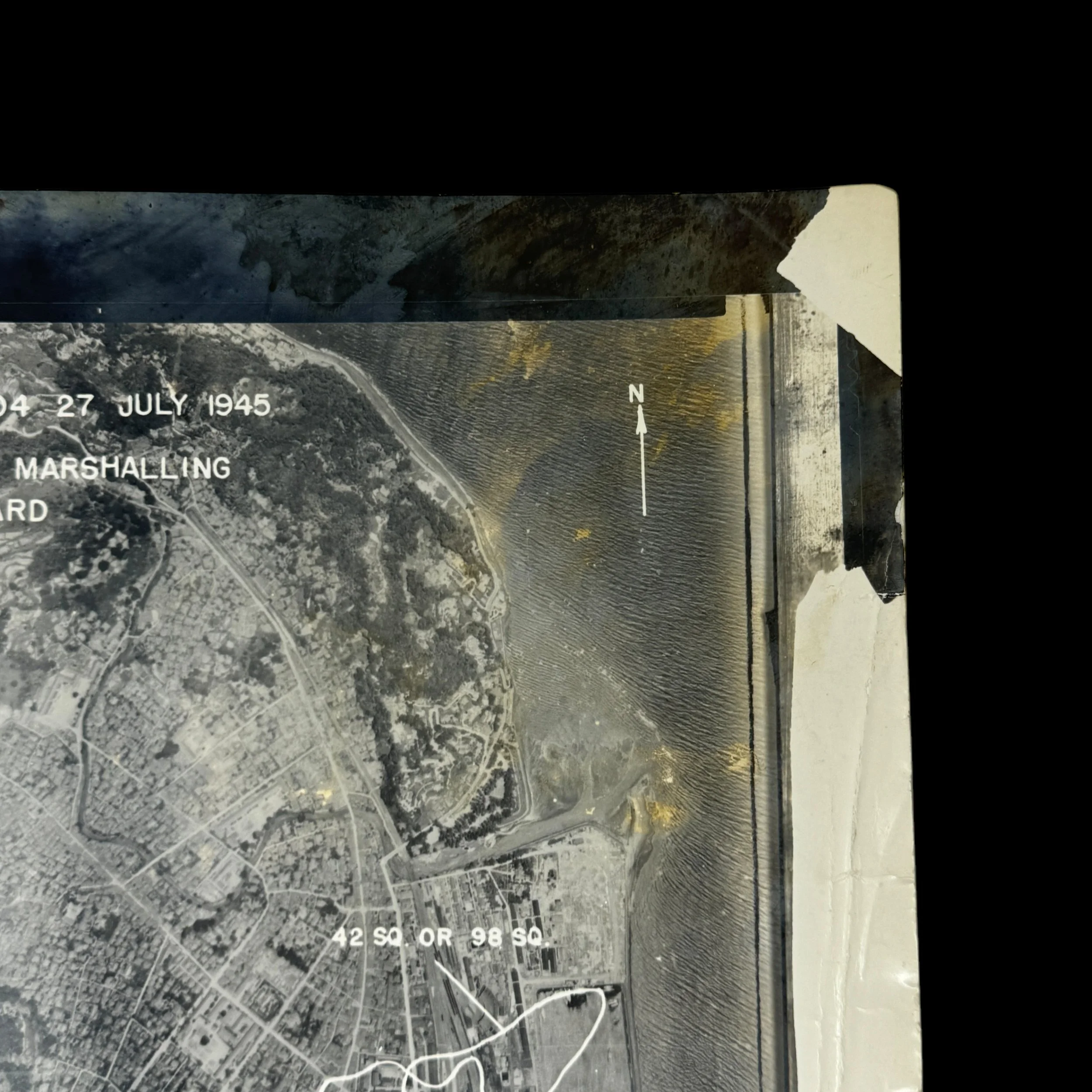
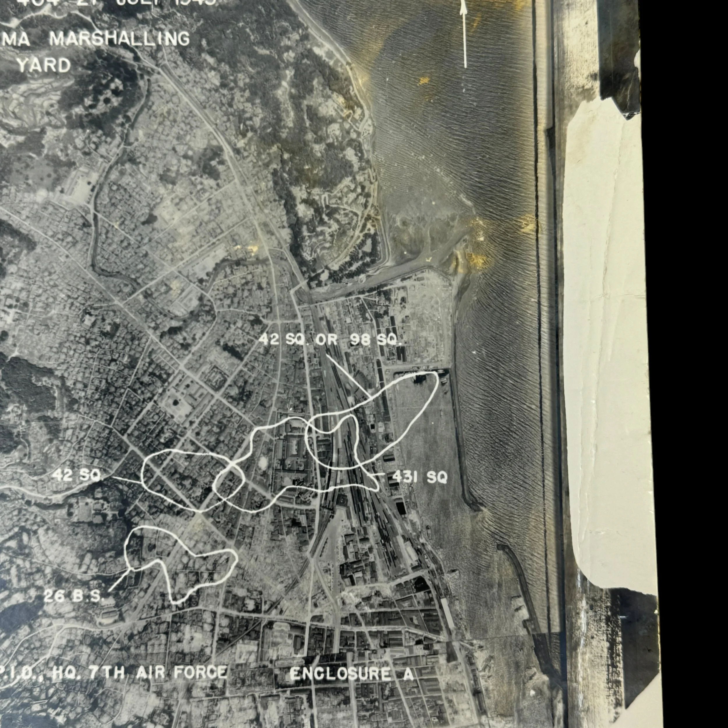
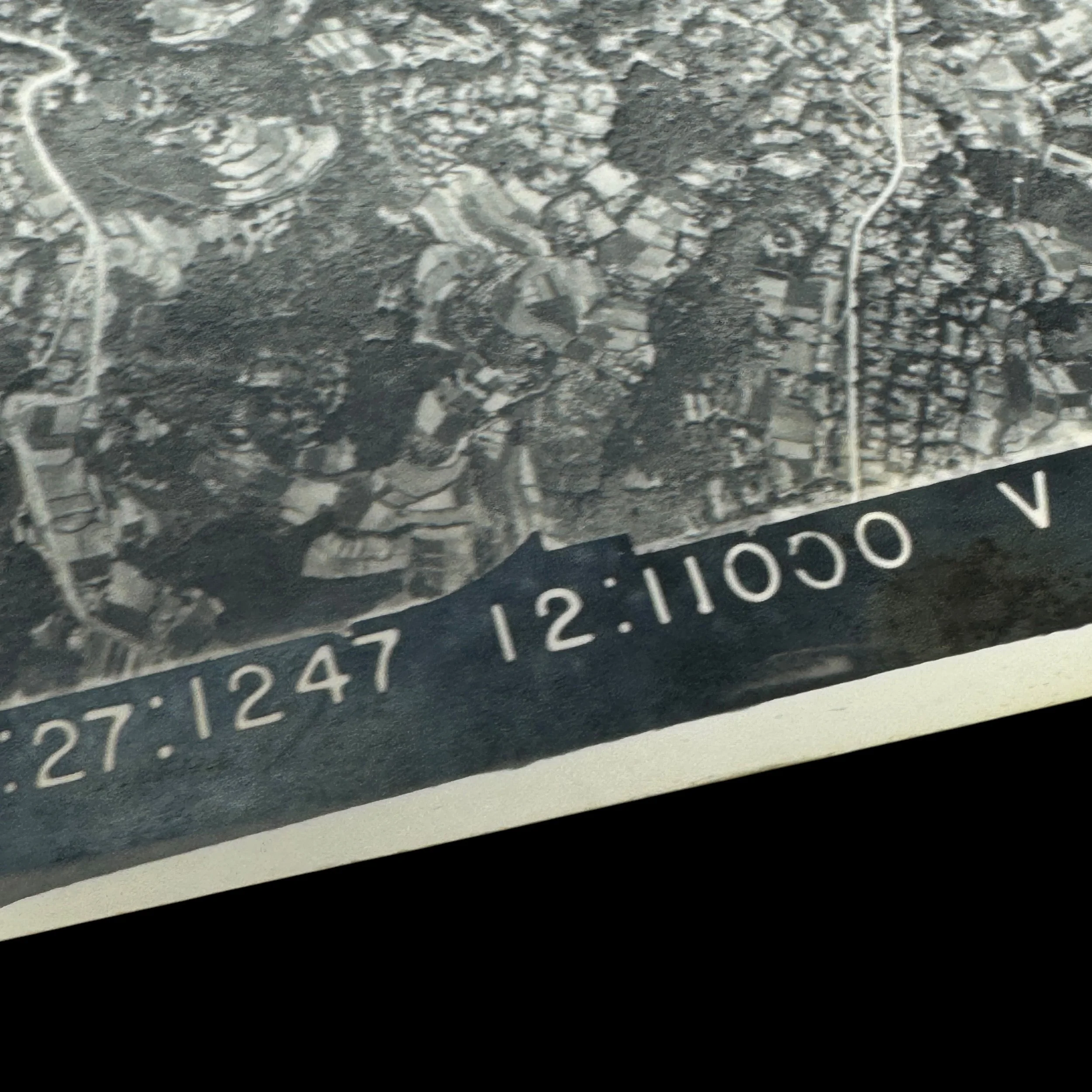
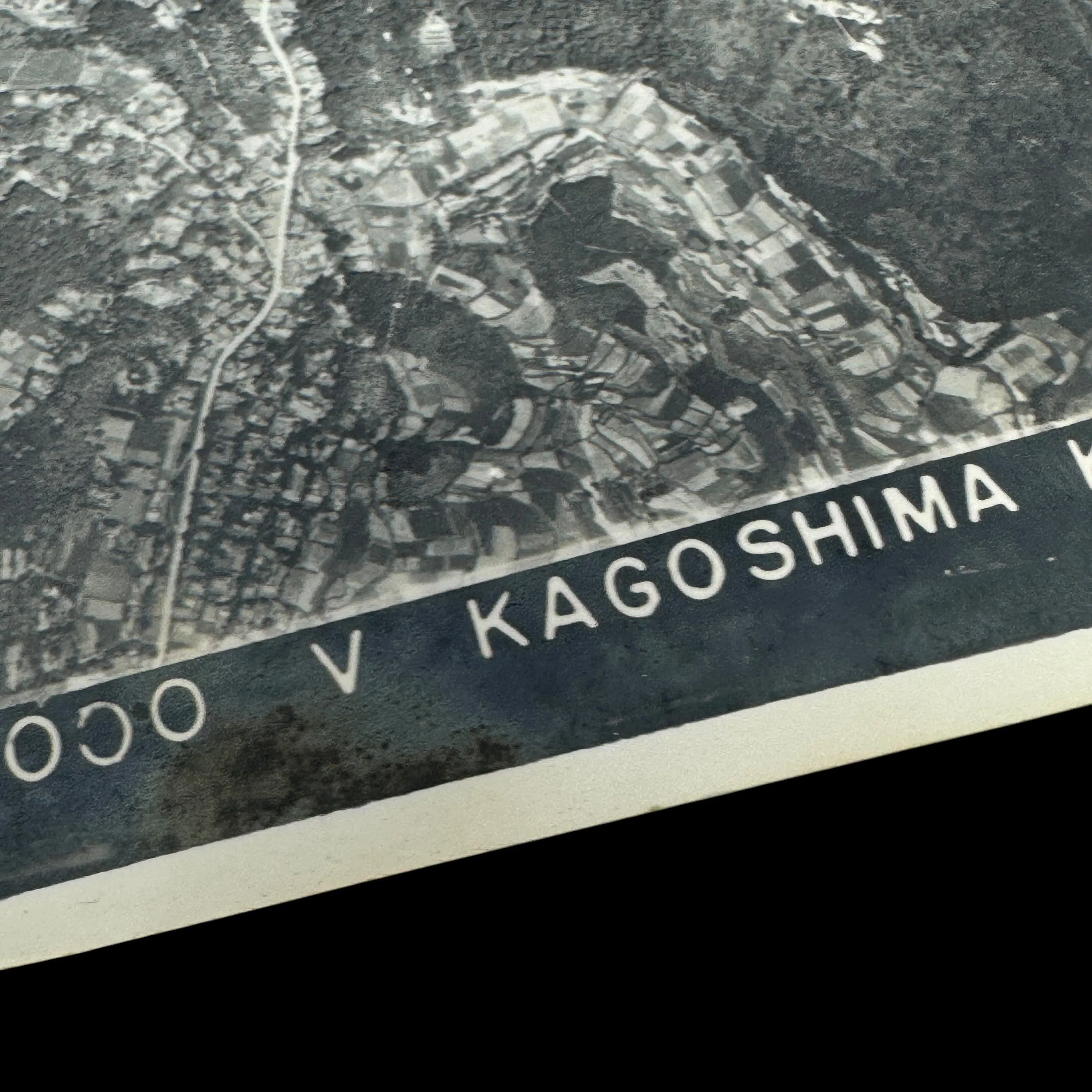
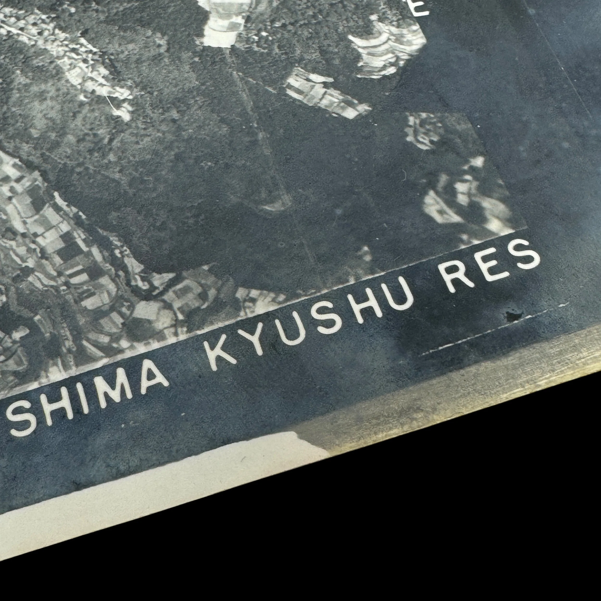
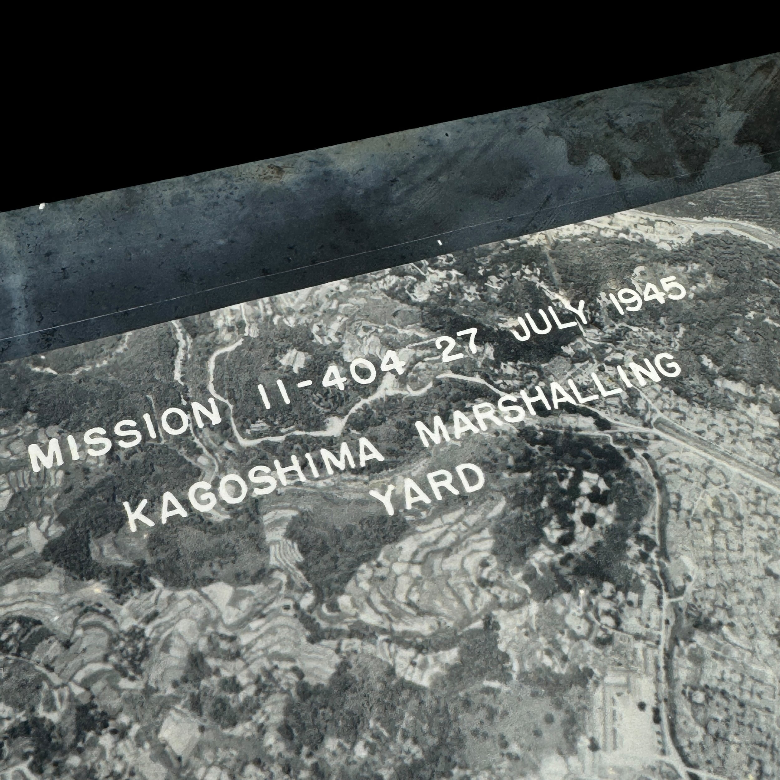
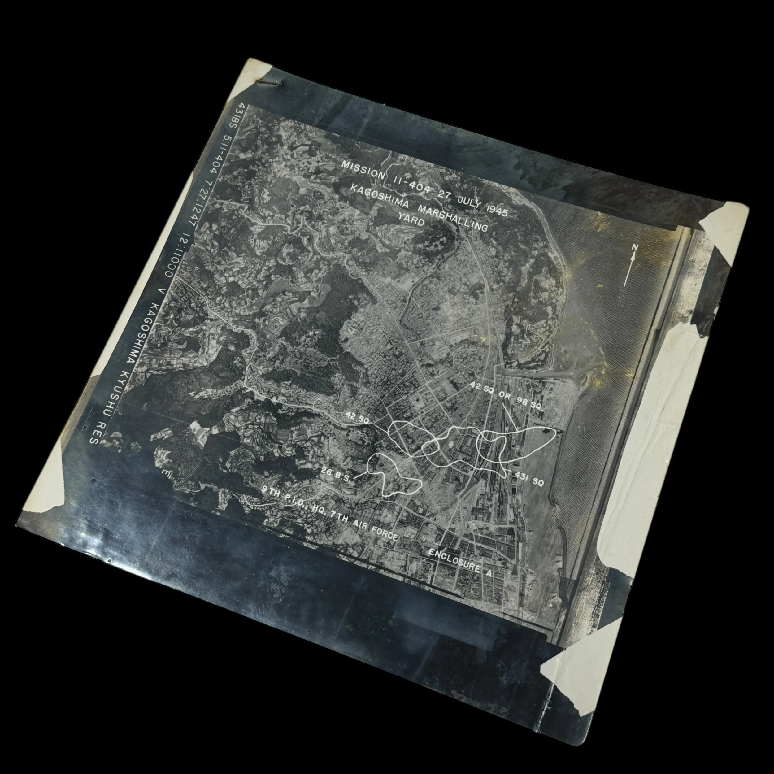
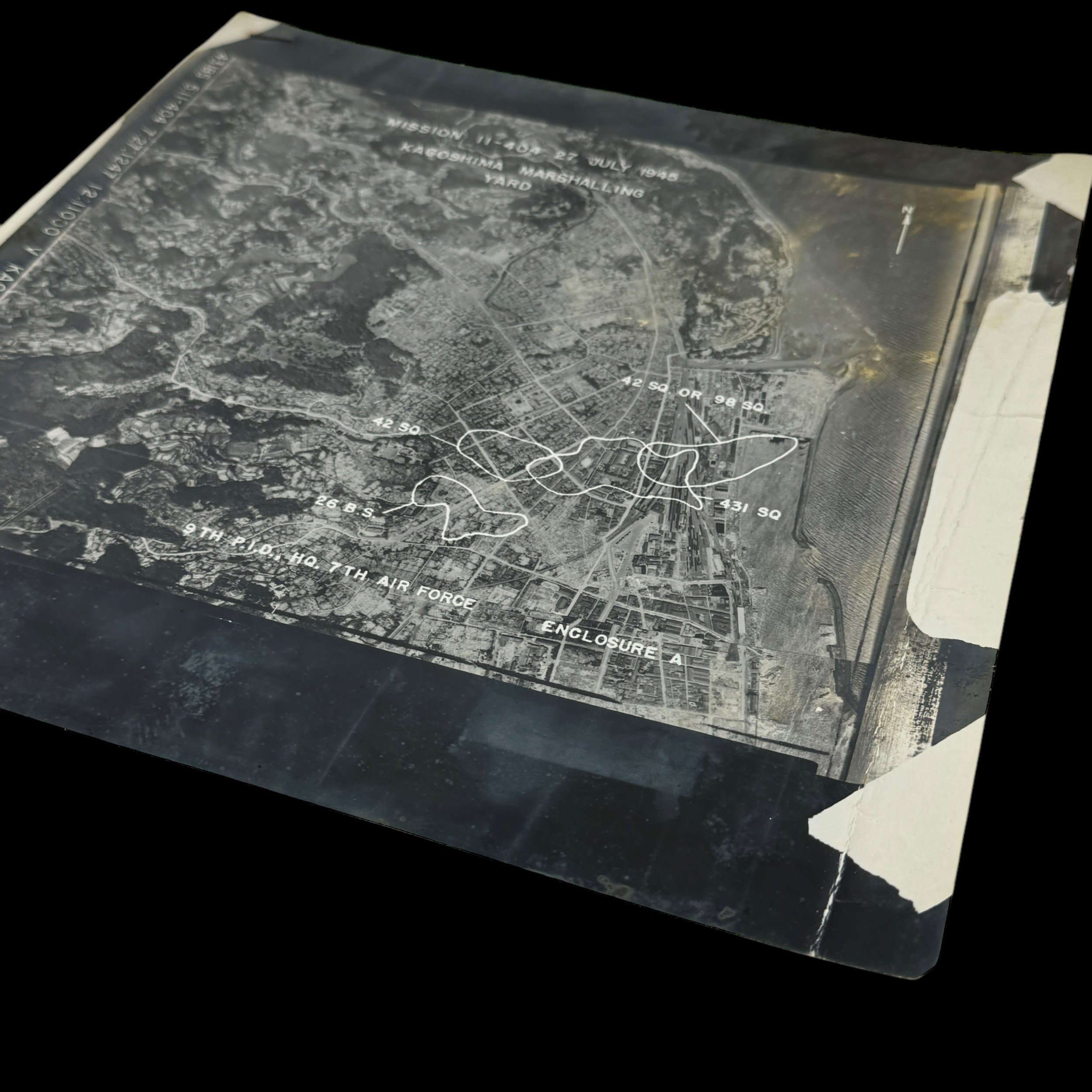
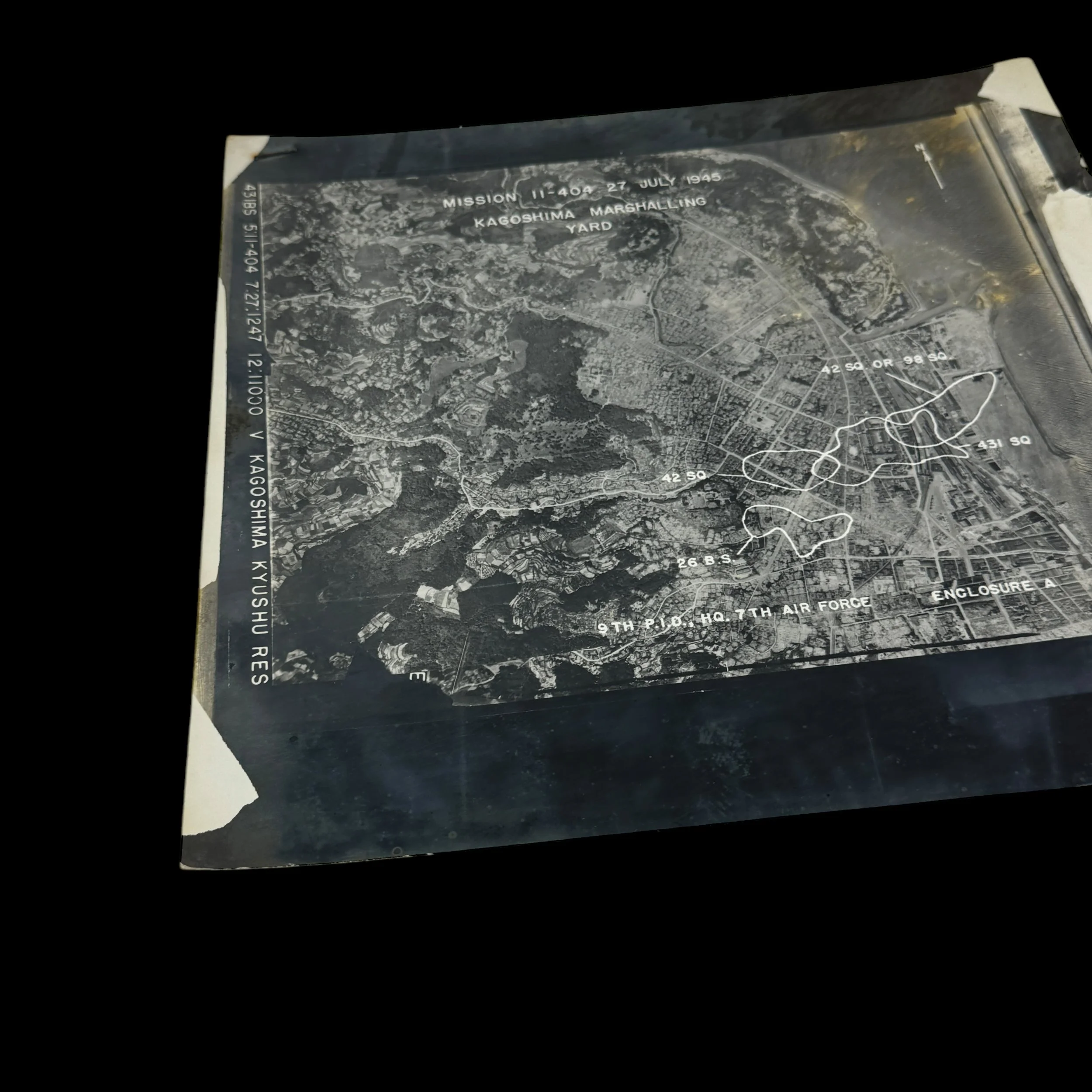
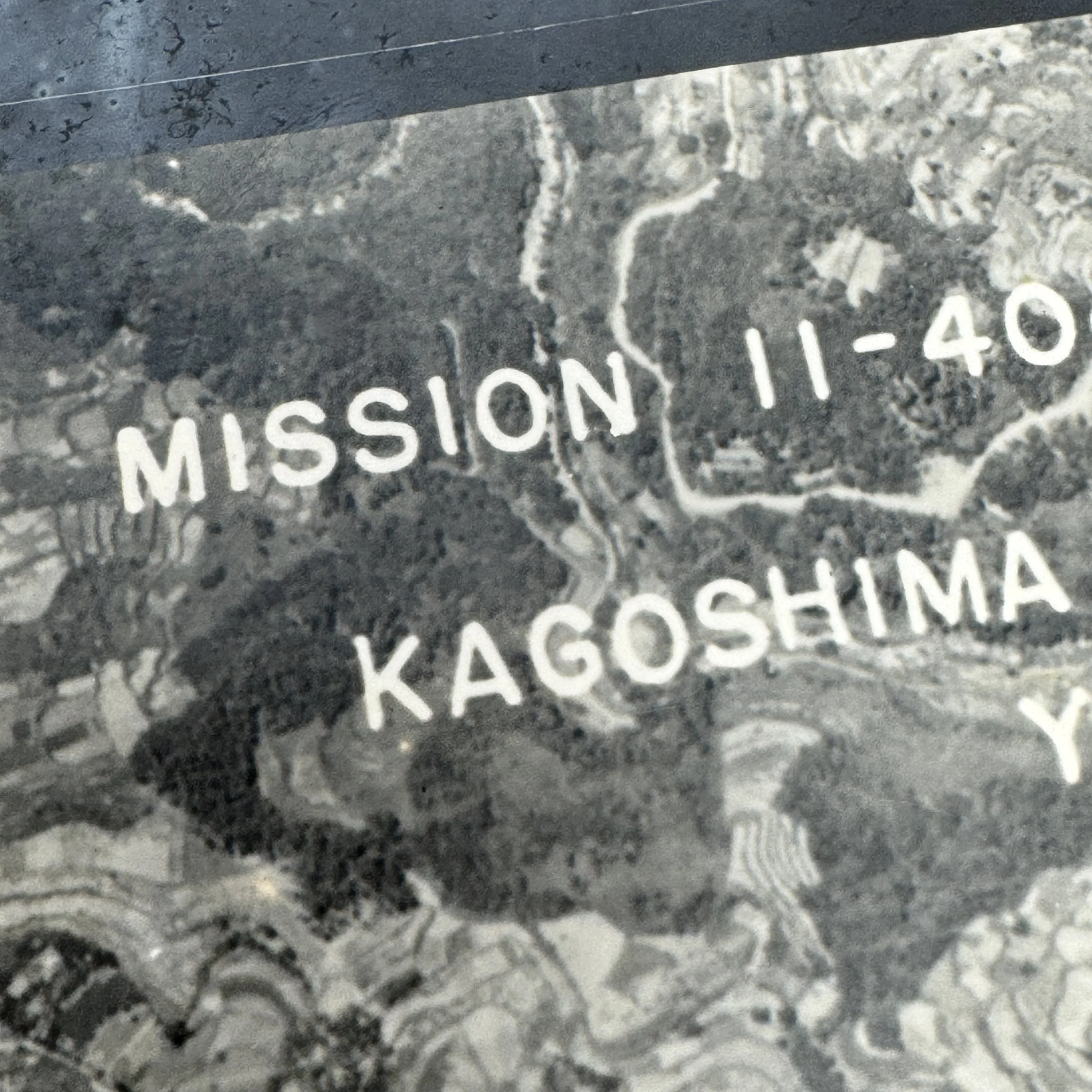
Dated: July 27th, 1945
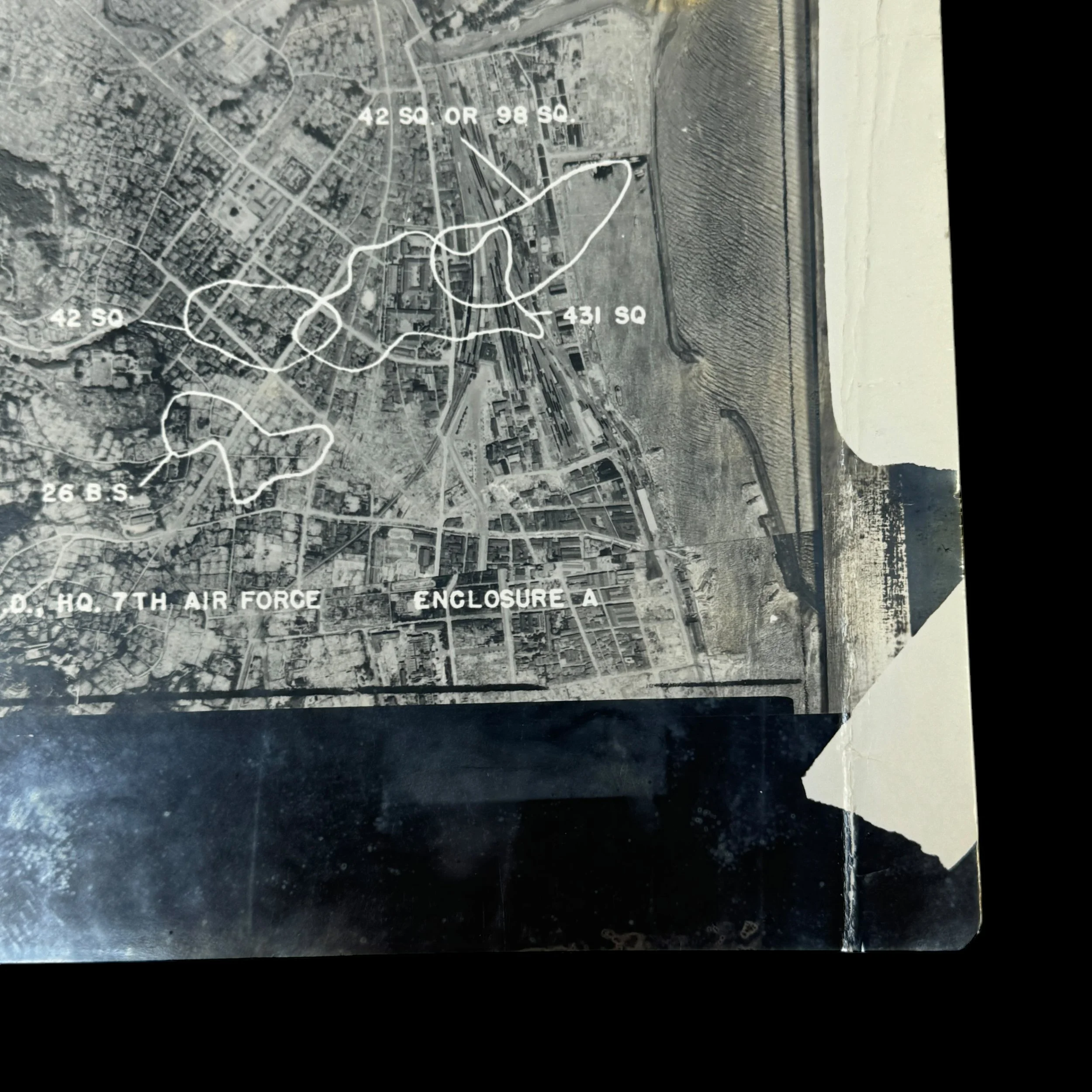
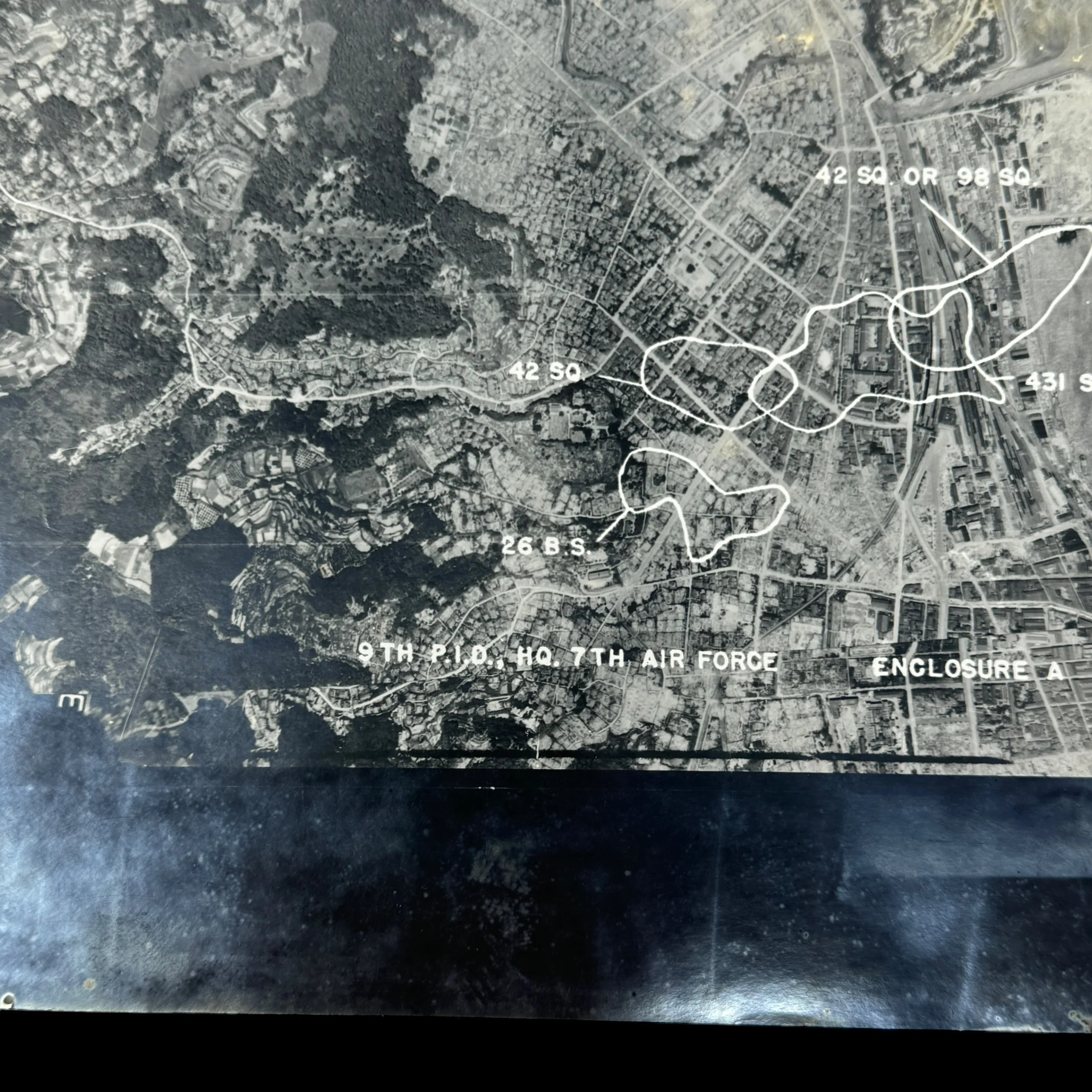
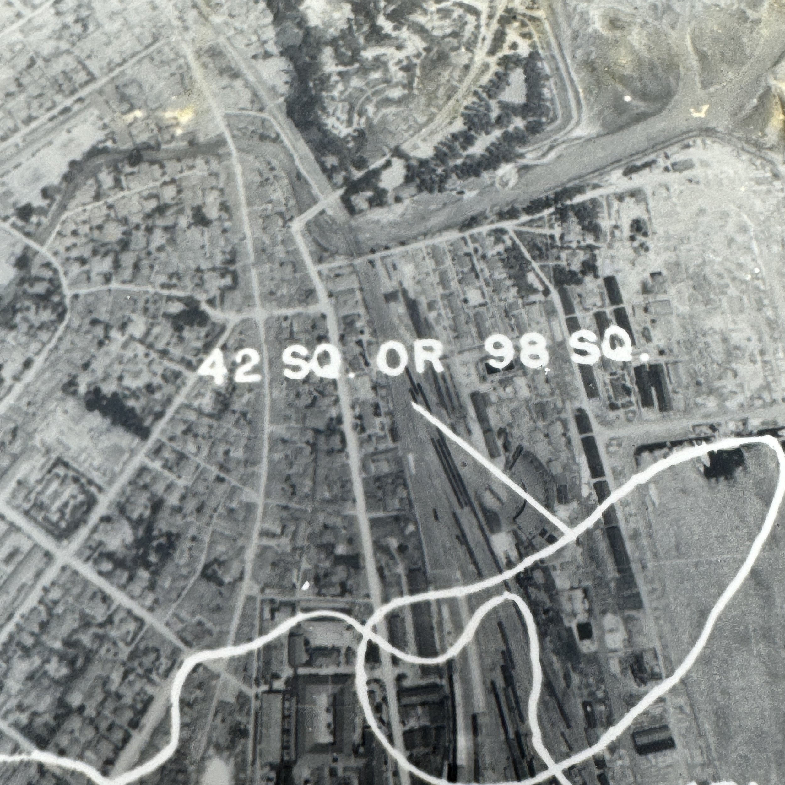
Target: Kagoshima Marshalling Yard - Kyushu, Japan
The Kagoshima Marshalling Yard, located in southern Kyushu near a vital port, served as a critical logistics hub for Japan during the final phase of World War II, directing the movement of troops and supplies to southern defenses, including airfields and the Ryukyu front. As part of the Twentieth Air Force’s broader effort to cripple Japan’s transportation and military infrastructure ahead of Operation Downfall, the yard became a priority target for XXI Bomber Command B-29 Superfortress raids launched from the Mariana Islands in mid-1945. These precision strikes in July and August aimed to destroy rail lines, fuel depots, and switching stations, paralyzing the flow of military materiel and reinforcements. Using aerial reconnaissance from F-13 variants, mission planners mapped and executed targeted bombings that severely disrupted Japan’s southern logistics network, contributing to the broader Allied goal of isolating Kyushu and neutralizing Japan’s capacity for coordinated defense.
This extremely rare and museum-grade World War II artifact is an original XXI Bomber Command aerial reconnaissance intelligence photograph, stamped “RESTRICTED” and used by the XXI Bomber Command of the Twentieth Air Force during its intensive strategic bombing campaign against the Japanese home island of Kyushu in 1945.
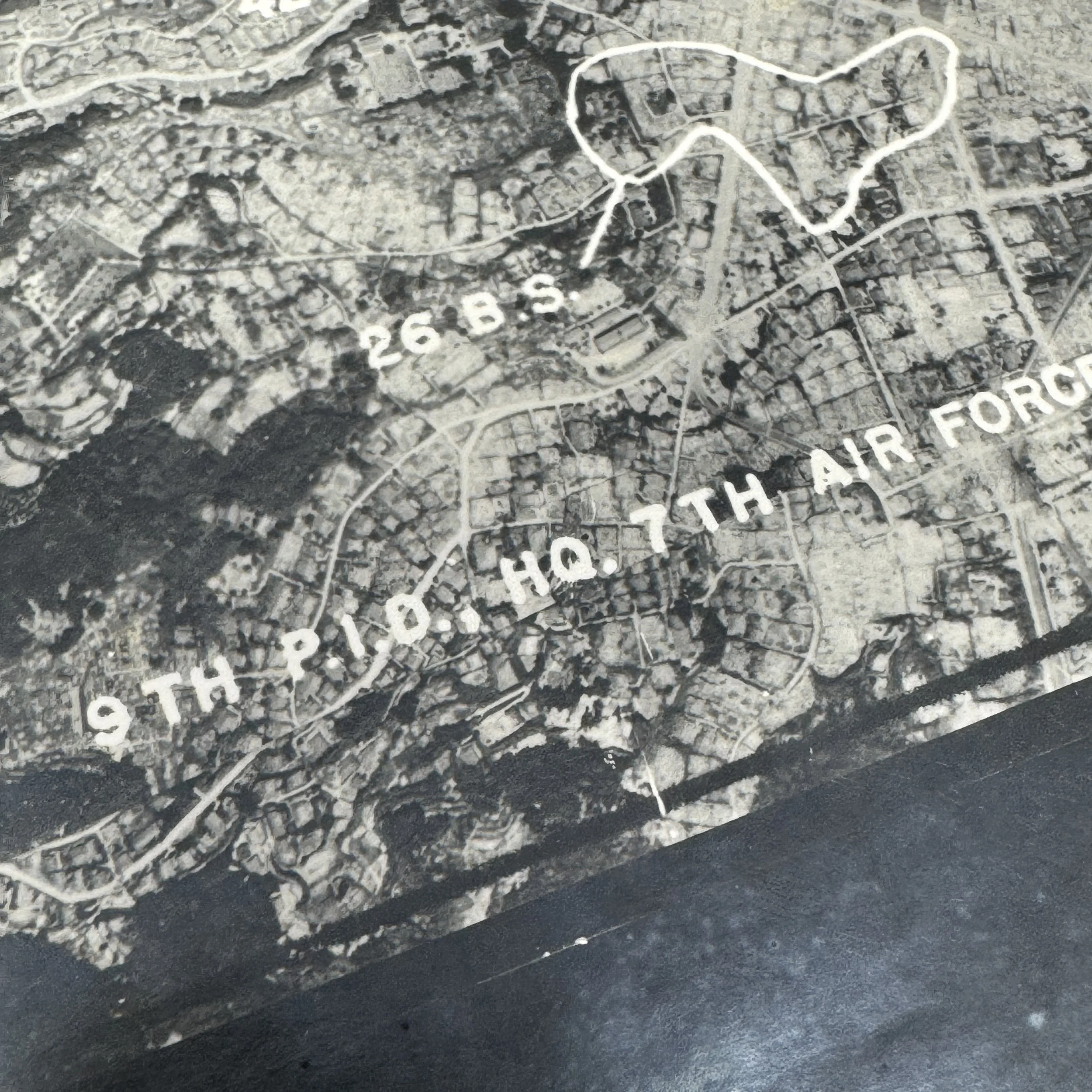
These marked aerial reconnaissance intelligence photographs of Kyushu, Japan were vital operational tools used by B-29 Superfortress crews during some of the most critical and technically sophisticated bombing missions of the Pacific Theater. As part of a broader intelligence network, these photographs were central to the success of the airfield suppression campaign, a late-war strategic initiative aimed at neutralizing Japanese aerial capabilities on Kyushu to prevent kamikaze attacks and secure air superiority ahead of potential invasion plans under Operation Downfall.
The XXI Bomber Command was a major component of the Twentieth Air Force, established to carry out long-range strategic bombing operations from bases in the Mariana Islands—primarily Tinian, Saipan, and Guam. By mid-1945, the B-29 units under XXI Bomber Command had already executed devastating raids on the Japanese mainland, including the infamous firebombing of Tokyo in March. However, the emphasis shifted toward southern Japan, particularly Kyushu, as the Allies prepared for the possible ground invasion of the Japanese home islands. The suppression of Japanese airfields on Kyushu was deemed essential to minimize the threat from kamikaze fighters, which had caused catastrophic damage during the Okinawa campaign.
The Kyushu airfield suppression raids, which intensified between July and August 1945, were meticulously planned operations targeting major military installations, airfields, and logistical infrastructure. Sites like Kagoshima, Miyakonojo, Kanoya, Oita, and Tachiarai were considered high-priority targets, as they housed interceptor aircraft, bomber units, and kamikaze squadrons poised to strike Allied naval forces. Many of these airfields were camouflaged or dispersed across challenging terrain, making them difficult to identify without accurate and timely intelligence.
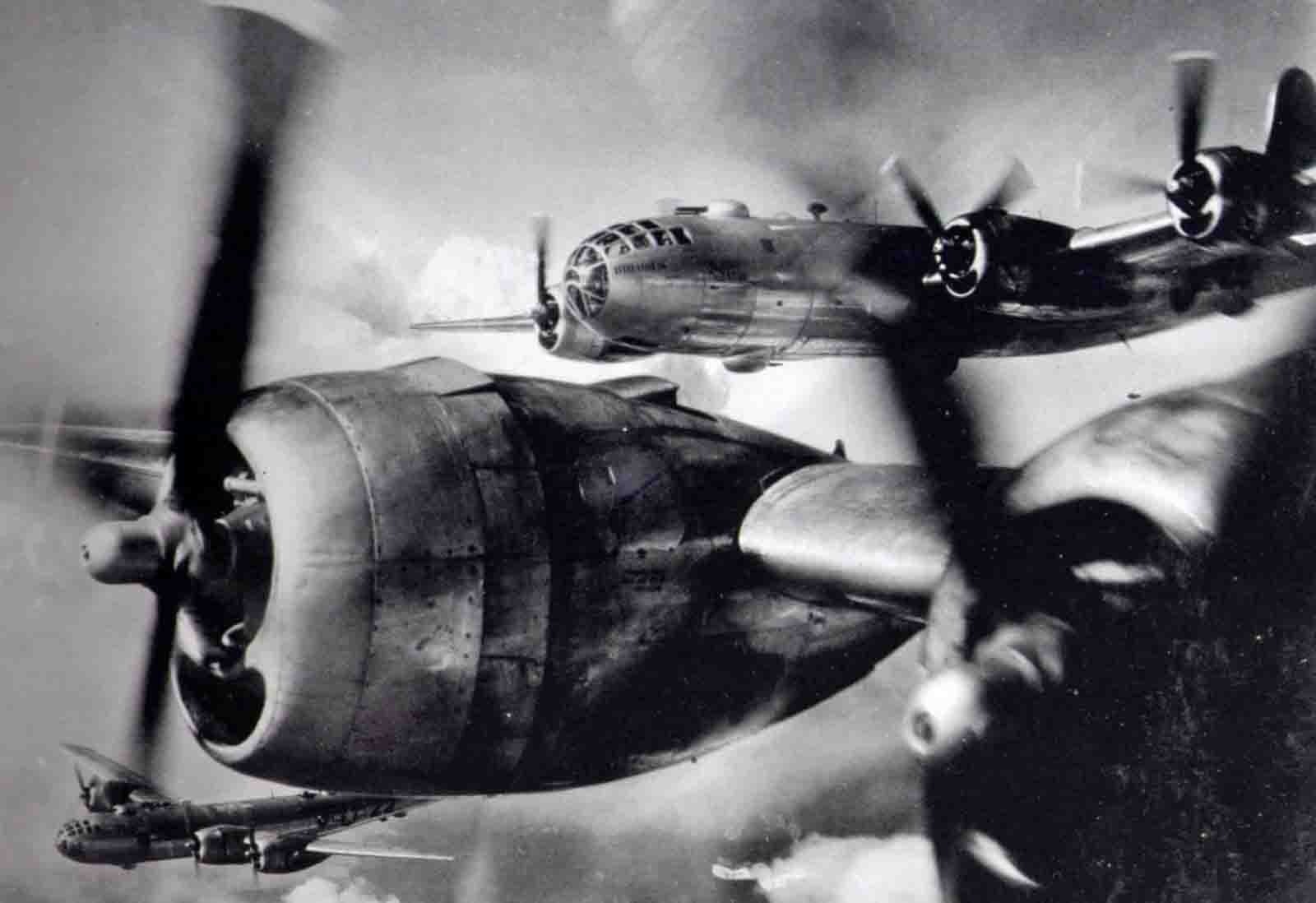
This is where aerial reconnaissance photographs became indispensable. These images were typically captured by the F-13 Superfortress—a specially modified B-29 equipped with advanced photographic equipment capable of high-altitude and high-resolution imagery. F-13 missions would often precede major bombing raids, flying at altitudes above 30,000 feet to avoid enemy flak and fighters. The intelligence gathered was sent back to analysis units where photographic interpreters would study the prints to identify structures, camouflaged positions, runways, aircraft revetments, fuel storage tanks, and anti-aircraft batteries. These interpreters then annotated the photographs with key tactical information before passing them along to mission planners and flight crews.
During mission briefings, B-29 crews received these marked reconnaissance photographs to familiarize themselves with terrain features and target layouts. Navigators and bombardiers were trained to memorize key landmarks and to use the photos as visual references during bombing runs—especially critical in regions prone to cloud cover or where precise navigation was needed to hit dispersed or hidden targets. In many cases, copies of these images were carried onboard during the mission itself for mid-flight reference. Commanders could adjust flight paths, bombing altitudes, and target sequences based on updated intelligence from successive reconnaissance flights, reflecting a growing sophistication in U.S. air campaign planning.
In the broader context of the war, the integration of aerial photographic intelligence into XXI Bomber Command operations signaled a turning point in strategic airpower. It enabled a level of precision and adaptability previously unavailable in large-scale bombing missions. These images didn’t just guide bombs—they helped preserve lives by minimizing exposure to flak zones and reducing the risk of failed missions. They also allowed for the rapid reassessment of enemy defenses and infrastructure damage, shaping both immediate tactical choices and long-term strategic decisions.