*EXCLUSIVE* 1938 German Pilot Named 'Staff Sargent Mortiz' Linen Luftwaffe Aviator Map of 'Brussel' (Battle of Dunkirk)


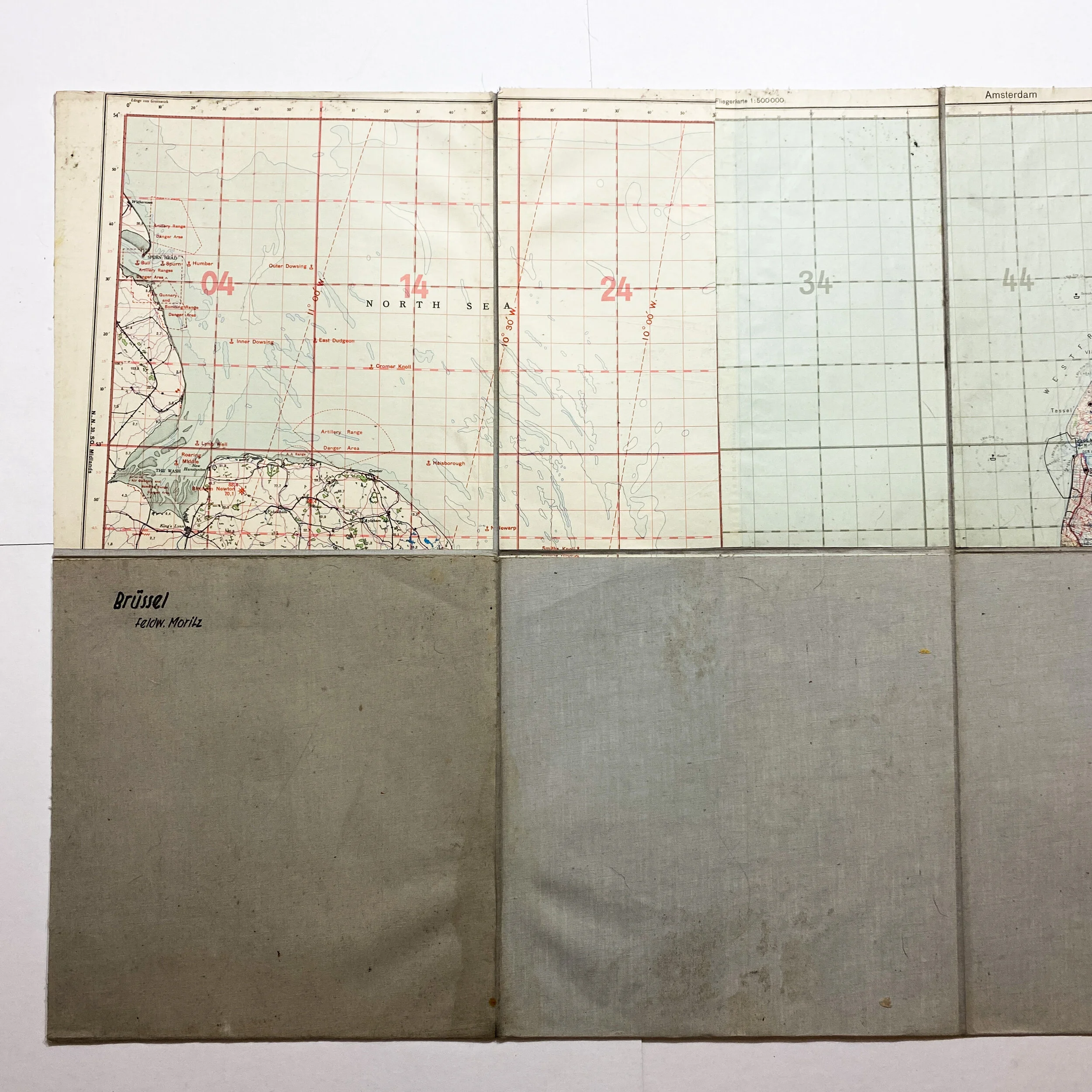


*EXCLUSIVE* 1938 German Pilot Named 'Staff Sargent Mortiz' Linen Luftwaffe Aviator Map of 'Brussel' (Battle of Dunkirk)
Museum Grade WWII ‘Battle of Dunkirk’ Artifact:
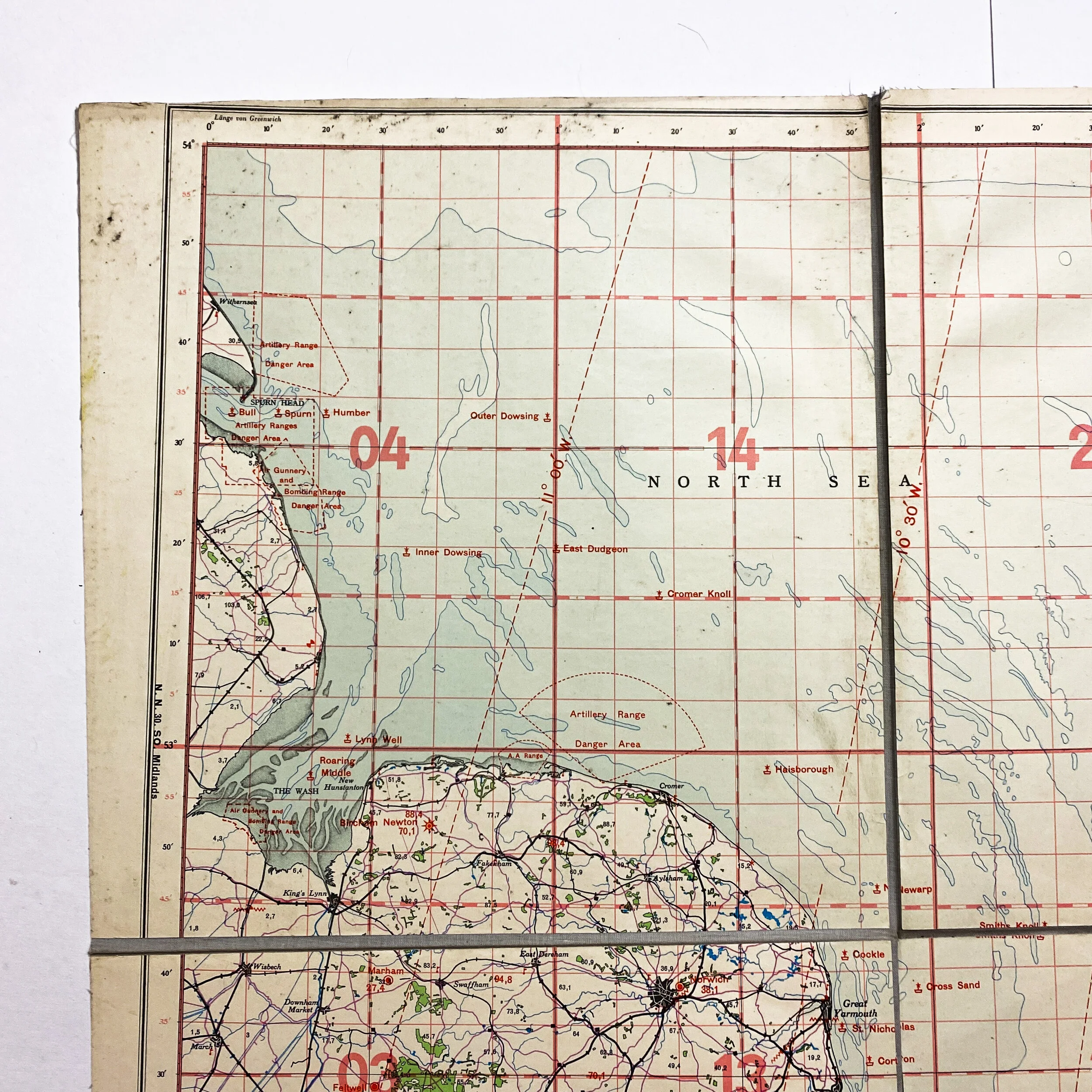
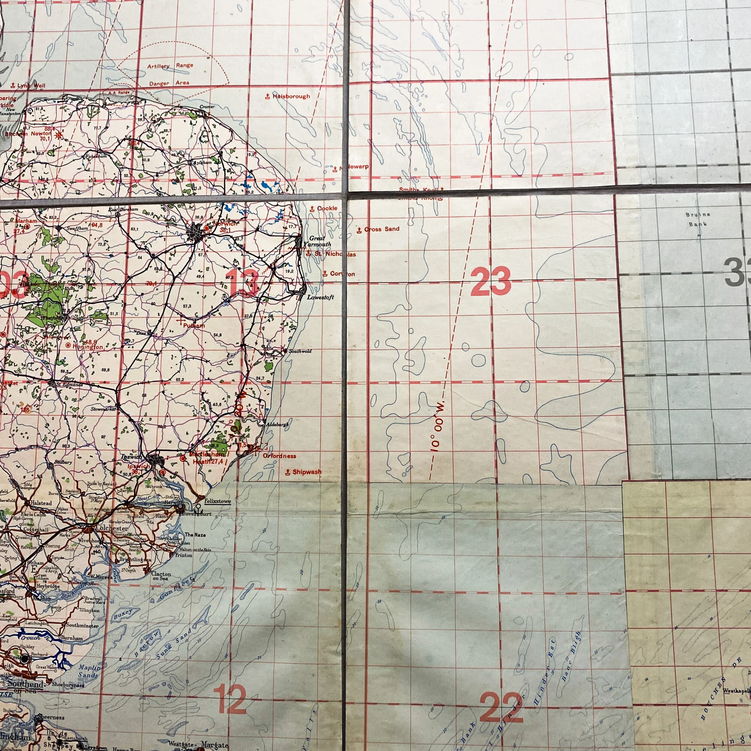
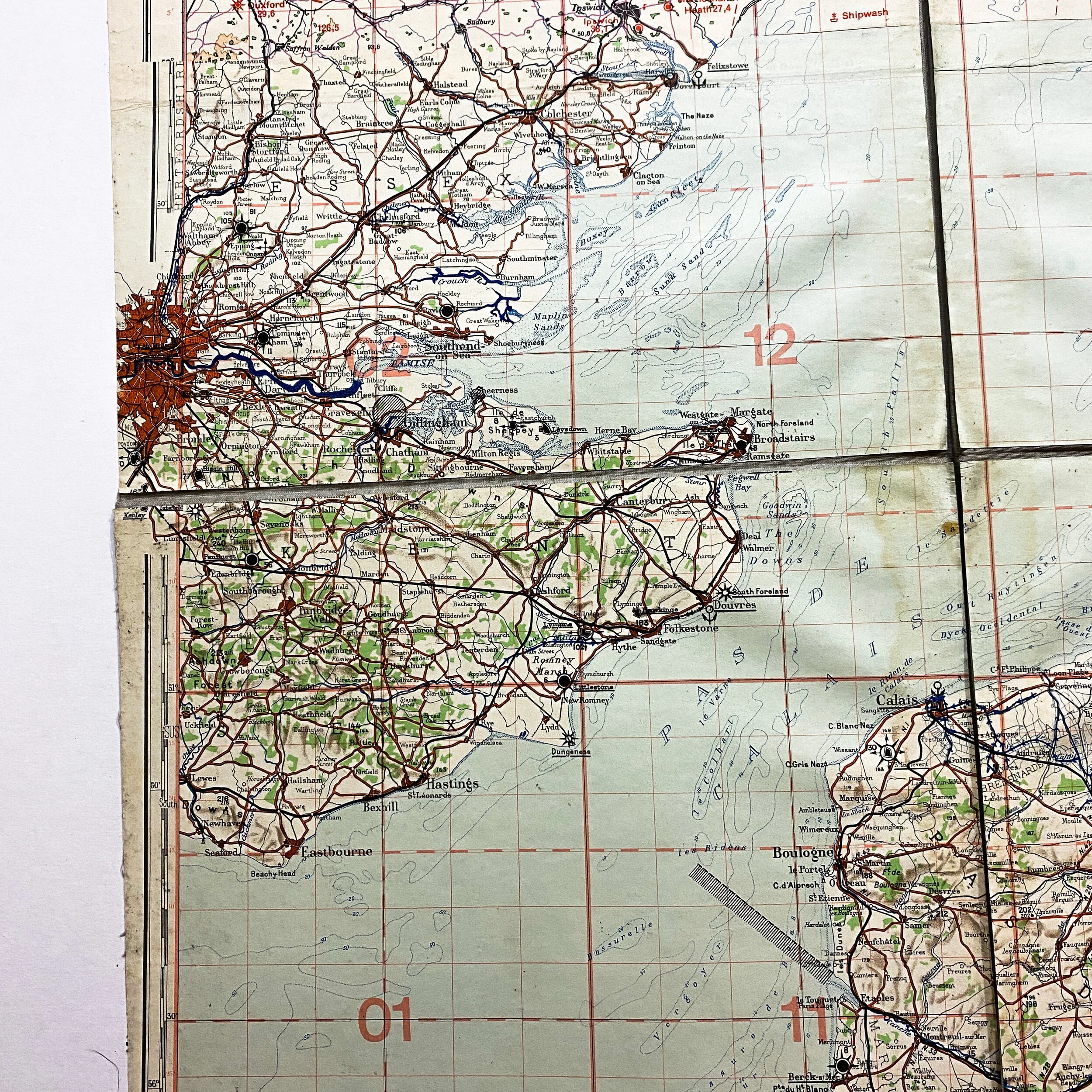
Size: 37 x 35 inches
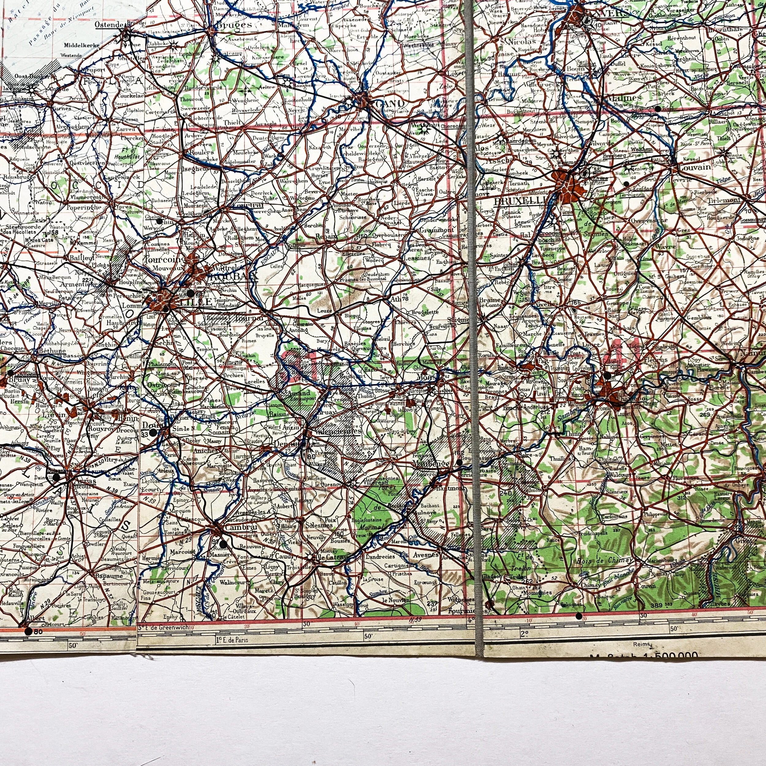
This incredibly large 1938 dated Northwestern France map shows some of the most infamous geographical battle locations of early WWII during the Battle of France and parts of England that saw heavy action during the Luftwaffe air raid attacks on the UK between 1939 and 1944. This map shows the famous dock city labeled in German as ‘Dunkerque’. The Battle of Dunkirk (French: Bataille de Dunkerque) was fought in Dunkirk (Dunkerque), France, during the Second World War, between the Allies and Nazi Germany. As the Allies were losing the Battle of France on the Western Front, the Battle of Dunkirk was the defense and evacuation to Britain of British and other Allied forces in Europe from 26 May to 4 June 1940.
Eerily enough, this map would have been used in what would have been Adolf Hitler’s Operation Sea Lion, also written as Operation Sealion. As Nazi Germany's code name for the plan for an invasion of the United Kingdom during the Battle of Britain in the Second World War. Following the fall of France, Adolf Hitler, the German Führer and Supreme Commander of the Armed Forces, hoped the British government would accept his offer to end the war, and he reluctantly considered invasion only as a last resort if all other options failed. As a precondition, Hitler specified the achievement of both air and naval superiority over the English Channel and the proposed landing sites, but the German forces did not achieve either at any point during the war, and both the German High Command and Hitler himself had serious doubts about the prospects for success. Nevertheless, both the German Army and Navy undertook a major programme of preparations for an invasion: training troops, developing specialized weapons and equipment, and modifying transport vessels. A large number of river barges and transport ships were gathered together on the Channel coast, but with Luftwaffe aircraft losses increasing in the Battle of Britain and no sign that the Royal Air Force had been defeated, Hitler postponed Sea Lion indefinitely on 17 September 1940 and it was never put into action.
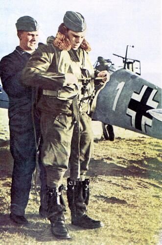
This France linen aviator map is named to a German Luftwaffe ‘Feldwalbe’ (Staff Sargent) Mortiz. This map still shows the writing of the staff sergeant on the back heavy duty linen side with his hand written name as well as the map label of ‘Brussel’. The map is constructed from nine individual paper grids adhered to a heavy duty cloth backing. This heavy-duty cloth material as well as grid sectors seen within the map were commonly carried by Luftwaffe pilots an airmen during WWII. The map is marked in German and is labeled as “Only for Service Use” and “Aviator Edition”. The map shows important towns and cities, naval locations, docks, landmasses and other important landmarks in the area occupied by the Nazis prior to the Allied invasion in the near area.
This map would have been used by German Luftwaffe pilots and bomber crews in the area of Northern France during their initial takeover and occupation of France and bombing raids against Britain. Maps such as these have been documented to have been used for in-flight navigation by German pilots as well as during the pre-bombing and mission briefings. This map sparks an interesting piece of history as it was used during such early parts of the war and most likely was extensive actions.