VERY RARE! WWII June 6th, 1944 D-Day "Allied" Captured Normandy Beachhead German Combat Map (Omaha, Gold, Juno, Sword)


VERY RARE! WWII June 6th, 1944 D-Day "Allied" Captured Normandy Beachhead German Combat Map (Omaha, Gold, Juno, Sword)
Comes with C.O.A.
*This captured D-Day map has the name of the Allied soldier that captured it signed in the upper right “R. L. Summers”.
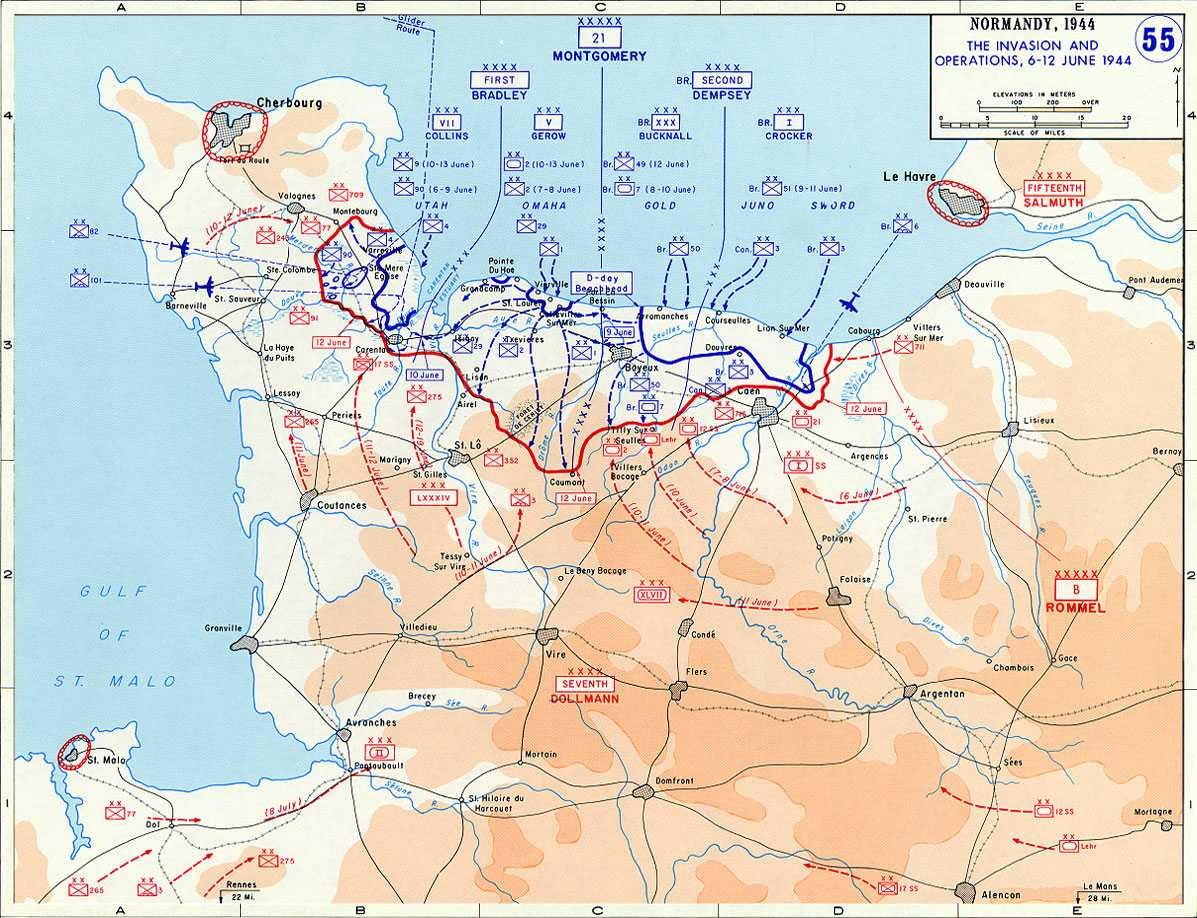
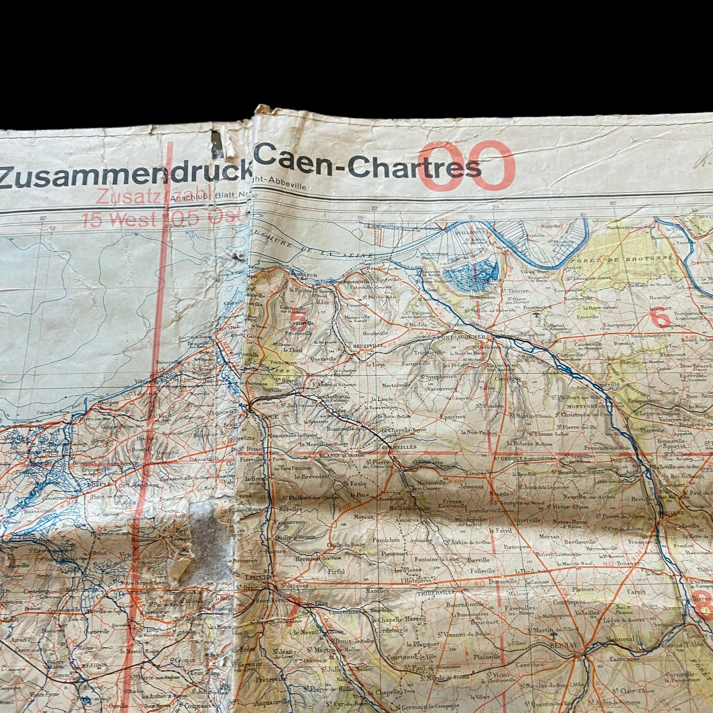
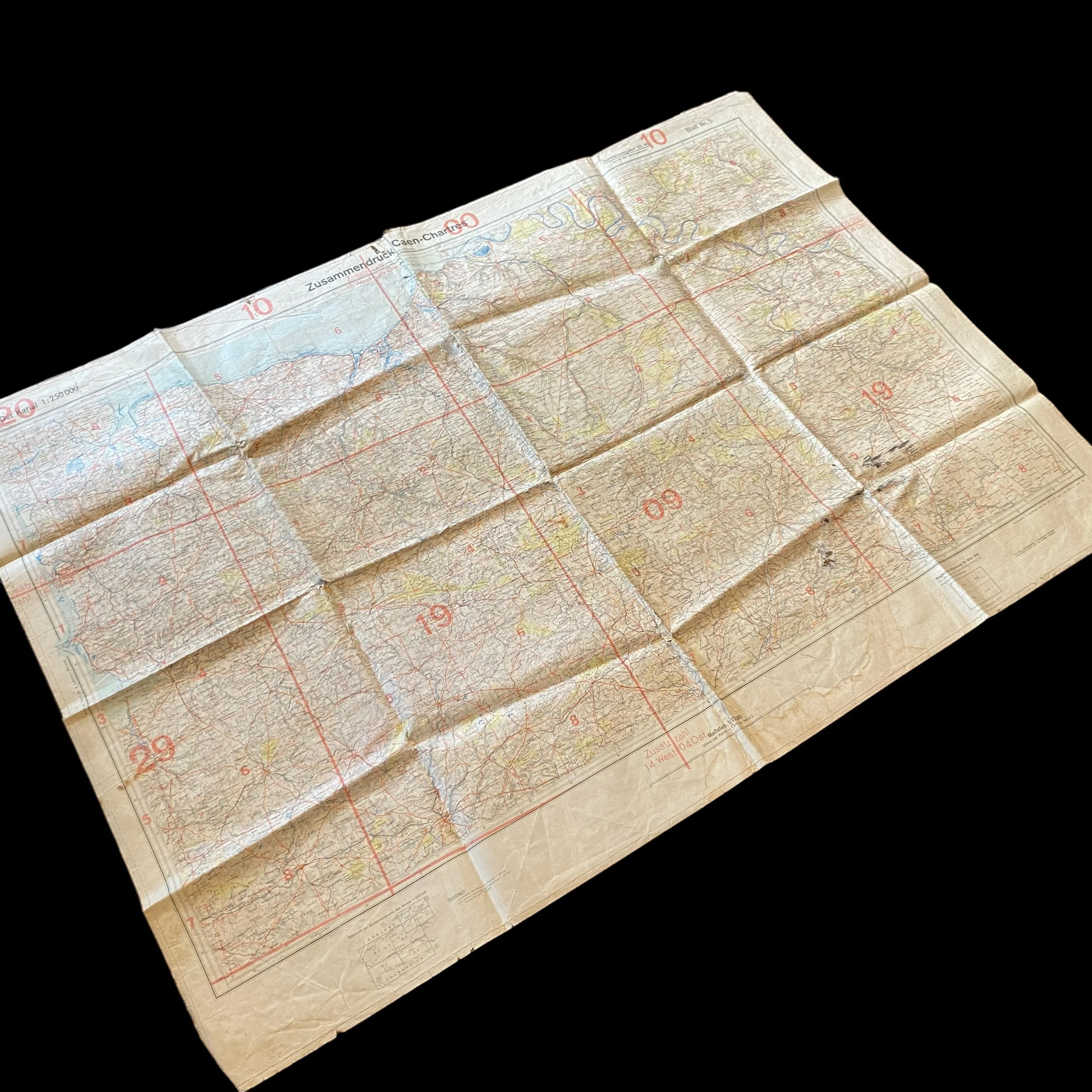
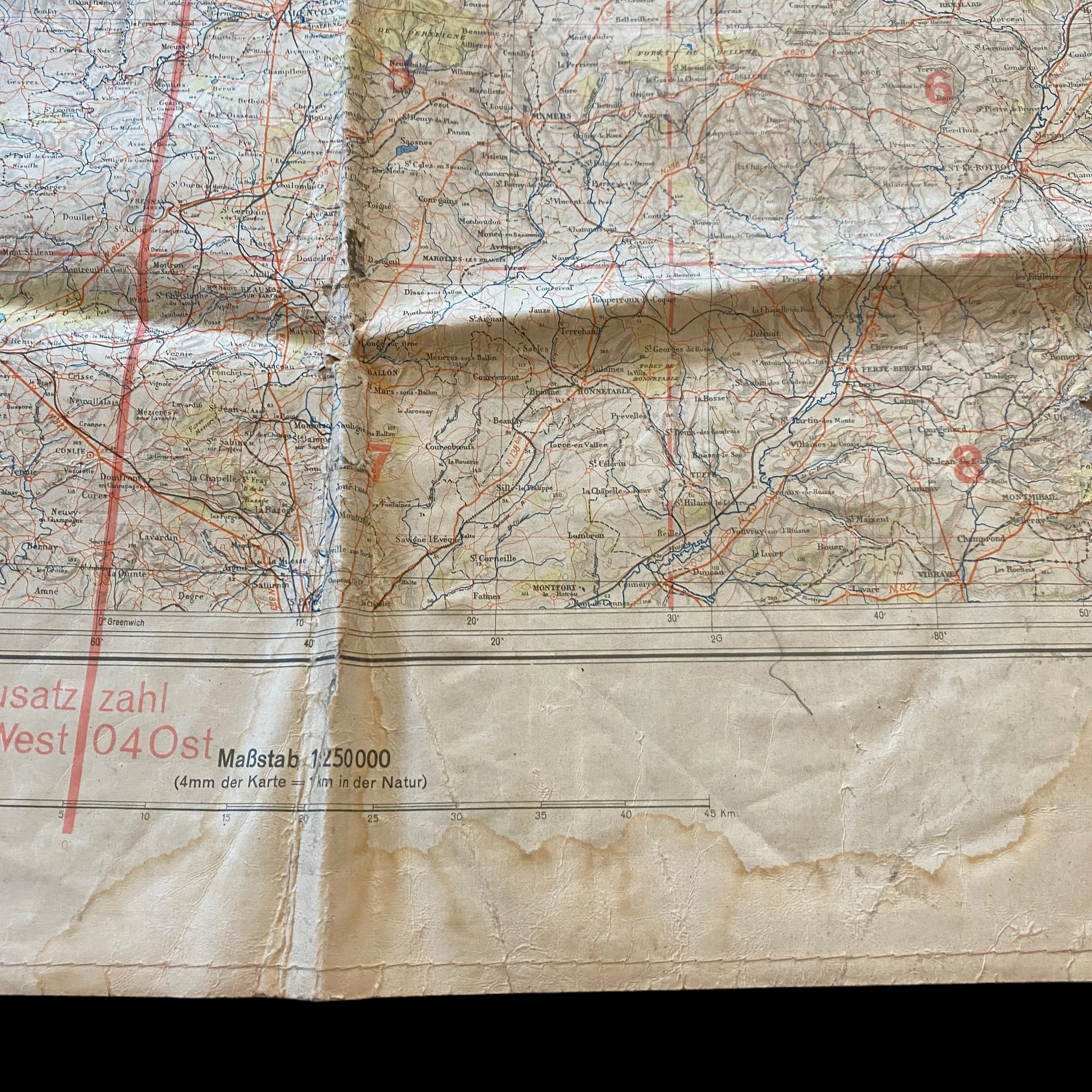
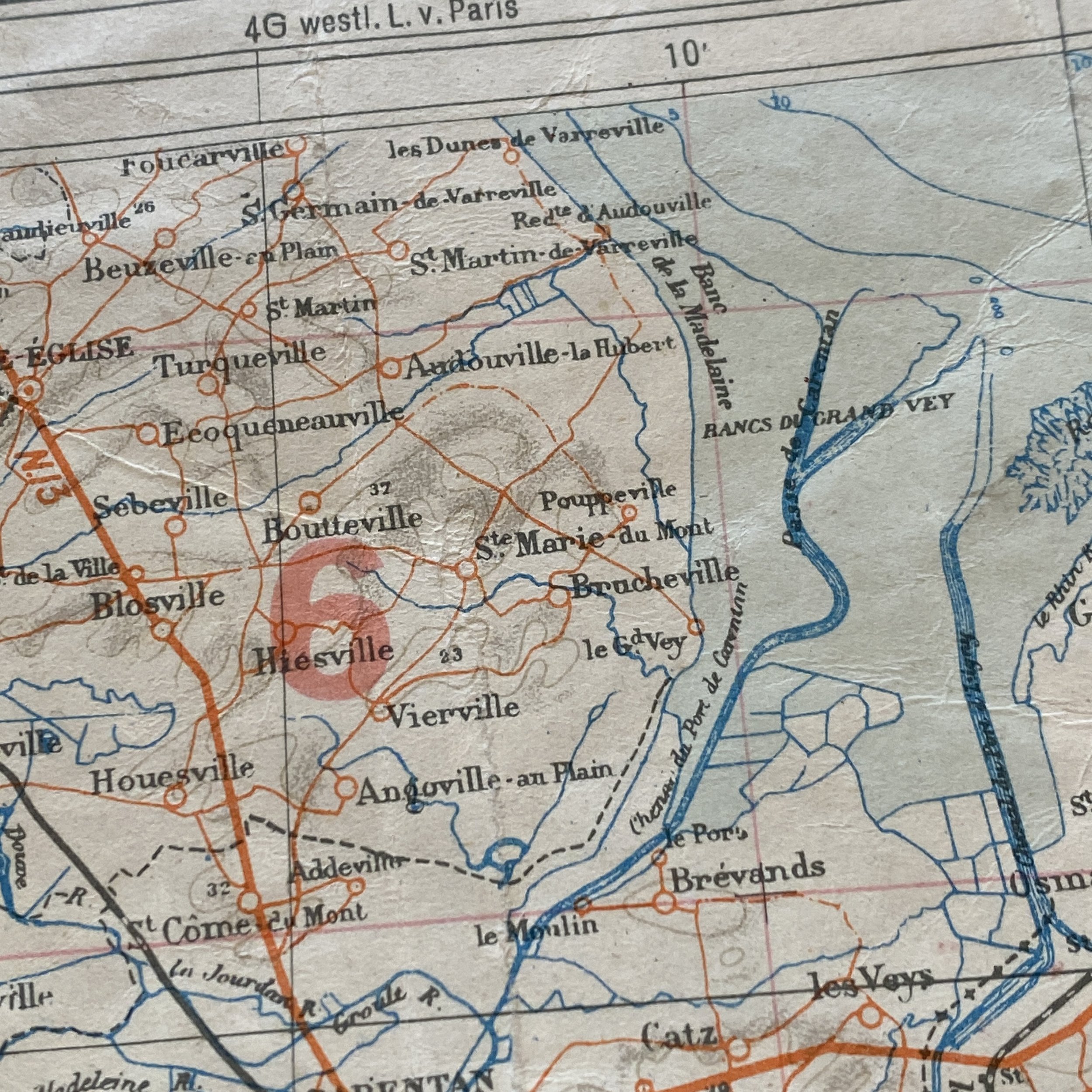
This extremely rare and museum-grade WWII D-Day captured German map is titled ‘Zusammedruck- Caen - Chartres’ (Compression Map- Caen - Chartres) and shows all of the June 6th, 1944 Allied D-Day landing beach heads of OMAHA BEACH, UTAH BEACH, GOLD BEACH, SWORD BEACH, AND JUNO BEACH.
This is a vary rare weather proof German map that was used by higher-ranking German officers throughout the D-Day Normandy region. This map was used to prepare for the D-Day landings by moving troops, supplies, and men all around the areas from the D-Day beaches, St. Mere Eglise Caen, Granville, and Chartres. This map type was often found in the concrete German fortifications, gun fortress (pillbox), or German operational command post and used when moving troops and supplies from the beaches and throughout the Normandy region. This would have been used corresponding with the other 5 German maps labeled: Blatt Nr. 1, Blatt Nr. 2, Blatt Nr. 3, Blatt Nr. 4, and Blatt Nr. 5. These map sections and other sectors can been seen in the bottom left section of the map.
The German Soldier Position at the D-Day Beachheads and Normandy: A Strategic Analysis:
The events of June 6, 1944, commonly known as D-Day, marked a pivotal moment in World War II, as Allied forces launched a massive amphibious invasion of German-occupied France. The success of Operation Overlord depended not only on Allied planning and execution but also on the German response and defense strategy.
Preparation and Defense:
Before delving into the specifics of D-Day, it is crucial to understand the German strategy leading up to the invasion. By 1944, Germany had constructed the Atlantic Wall, a formidable defensive line stretching along the coast of Western Europe. This defense system consisted of concrete bunkers, artillery emplacements, minefields, and obstacles designed to repel any amphibious assault.
German Field Marshal Erwin Rommel, appointed as the commander of Army Group B tasked with defending the French coast, recognized the vulnerability of Normandy but faced challenges in reinforcing the region due to Allied deception operations and Hitler's reluctance to commit reserves until the invasion's location was clear. Nevertheless, Rommel ordered the construction of additional defenses and deployed troops to potential landing sites.
The Role of Maps:
Maps played a crucial role in the German defense strategy. They provided detailed information about terrain, potential landing sites, defensive positions, and avenues of approach. German cartographers meticulously crafted maps, incorporating intelligence gathered from aerial reconnaissance, coastal surveys, and captured documents.
These maps allowed German commanders to identify key chokepoints, such as river crossings and road junctions, where they could concentrate their defenses. Moreover, maps facilitated communication and coordination among German units, enabling them to respond effectively to Allied movements.
Omaha Beach:
Omaha Beach, situated between the villages of Vierville-sur-Mer and Colleville-sur-Mer, posed a significant challenge for the Allied forces due to its high bluffs and heavily defended coastal defenses. German forces, comprising elements of the 352nd Infantry Division and the 716th Infantry Division, had fortified the area with machine gun nests, artillery batteries, and obstacles.
Using maps, German commanders positioned their troops to cover potential landing zones and established overlapping fields of fire to maximize their defensive capabilities. They also relied on terrain features, such as cliffs and ridgelines, to provide natural barriers against Allied assault.
Utah Beach:
Utah Beach, located further west than the other landing sites, was defended by the 709th Infantry Division. Despite being less heavily fortified than Omaha Beach, German troops still relied on maps to anticipate Allied landing zones and concentrate their defenses accordingly.
By studying coastal maps, German commanders identified key defensive positions and deployed troops to counter any amphibious assault. They also integrated coastal artillery batteries into their defense plan, aiming to disrupt Allied landing operations from afar.
Gold Beach, Sword Beach, and Juno Beach:
Gold Beach, situated between Arromanches-les-Bains and La Rivière, and Sword Beach, near the town of Ouistreham, were assaulted by British and Canadian forces respectively. German defenses in these sectors, primarily manned by elements of the 716th Infantry Division, were well-prepared, with fortified positions and obstacles designed to hinder Allied progress.
Using maps, German commanders established strongpoints along the coast and inland, ensuring that they could respond effectively to any Allied incursions. Coastal maps allowed them to identify potential landing sites and deploy reserves to reinforce vulnerable areas.
The Allied Invasion:
On the morning of June 6, 1944, Allied forces launched a massive amphibious assault on the beaches of Normandy. Despite meticulous planning and preparation, the Germans were caught off guard by the scale and ferocity of the invasion. Allied air and naval bombardments had disrupted communication lines and destroyed many coastal defenses, leaving German troops isolated and disorganized.
As the Allied forces landed on the beaches, German soldiers fought tenaciously to repel them, but the overwhelming firepower and numerical superiority of the Allies eventually led to the breach of German defenses. Despite their resilience, German units struggled to coordinate their efforts effectively, hampered by the destruction of command infrastructure and the confusion of battle.
Post-Invasion:
In the days and weeks following the D-Day landings, Allied forces expanded their beachheads and pushed inland, encountering fierce resistance from German units. Despite initial setbacks, German commanders attempted to mount counterattacks and reinforce their defenses, but Allied air superiority and logistical support gave them a significant advantage.
Gradually, the Allied advance overwhelmed German defenses, leading to the liberation of Normandy and the subsequent defeat of Nazi Germany. The success of Operation Overlord was a testament to the Allied planning and coordination, but it also highlighted the resilience and determination of the German soldiers who defended the Atlantic Wall.
In conclusion, the German soldier position at the D-Day beachheads and in the Normandy region was fortified and strategically planned using maps to anticipate Allied movements and concentrate defenses. However, despite their preparations, the Germans were ultimately unable to withstand the overwhelming force of the Allied invasion. D-Day marked a turning point in World War II, paving the way for the liberation of Europe and the eventual defeat of Nazi Germany.