1941 German Intelligence Map of Pacific Theater


1941 German Intelligence Map of Pacific Theater
Size: 21.5 x 16 inches
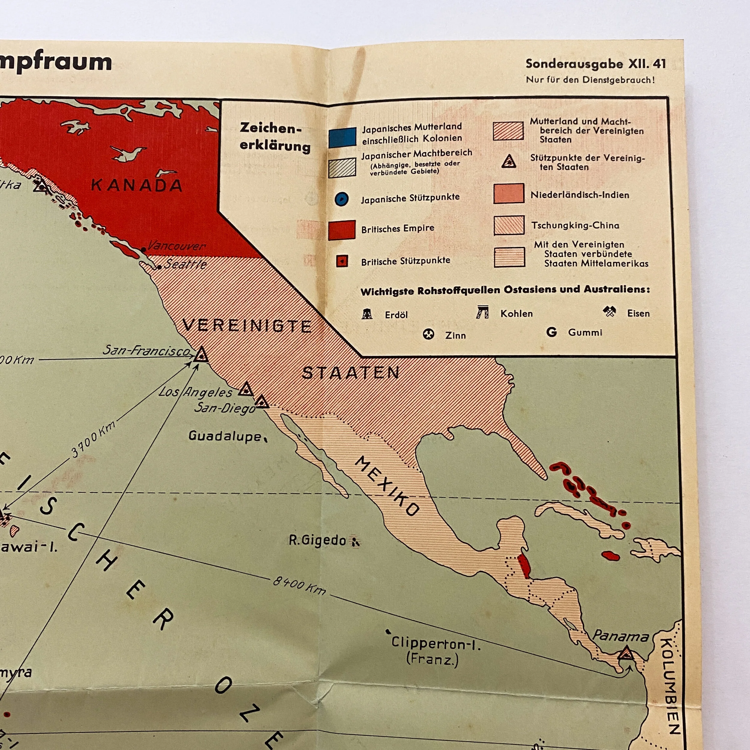
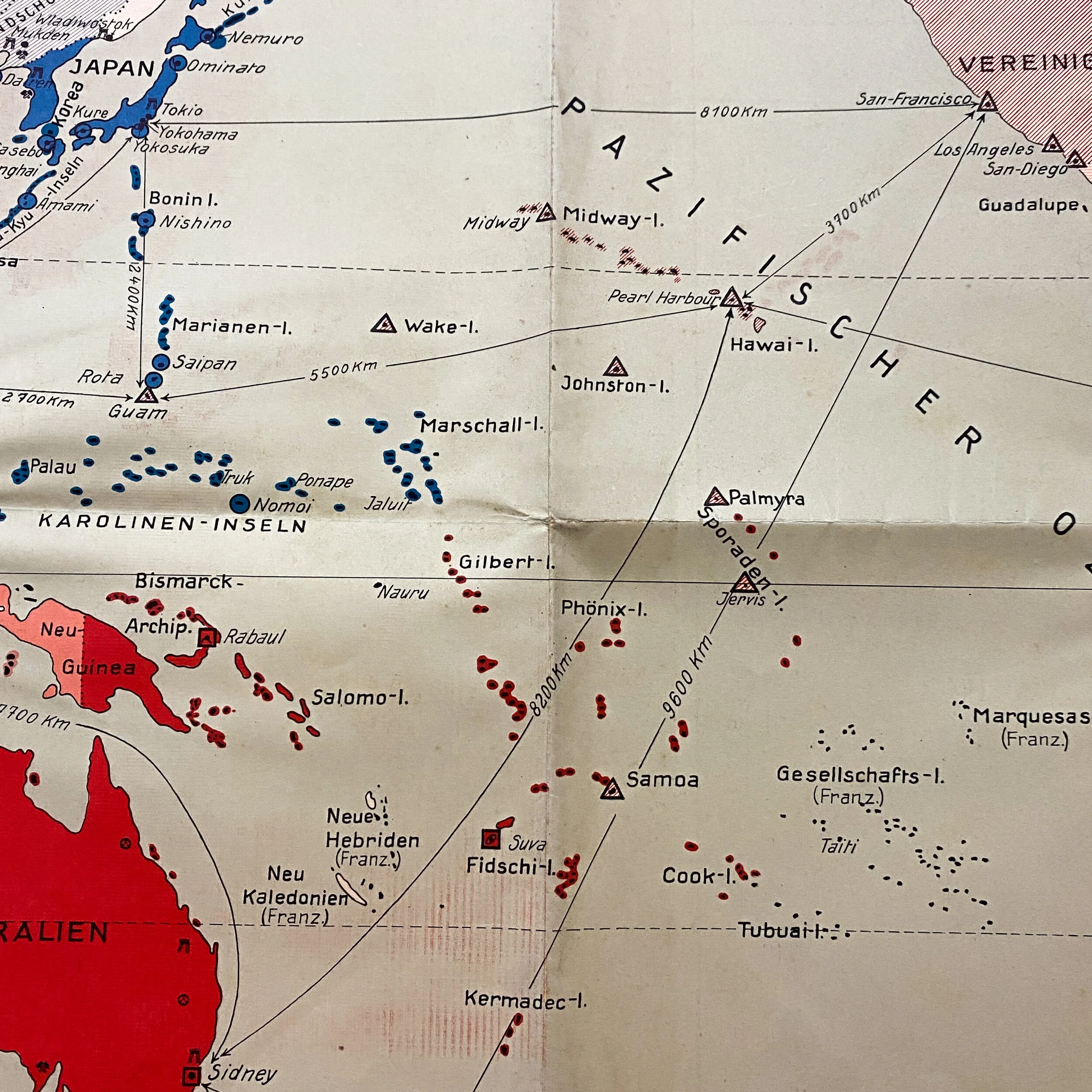
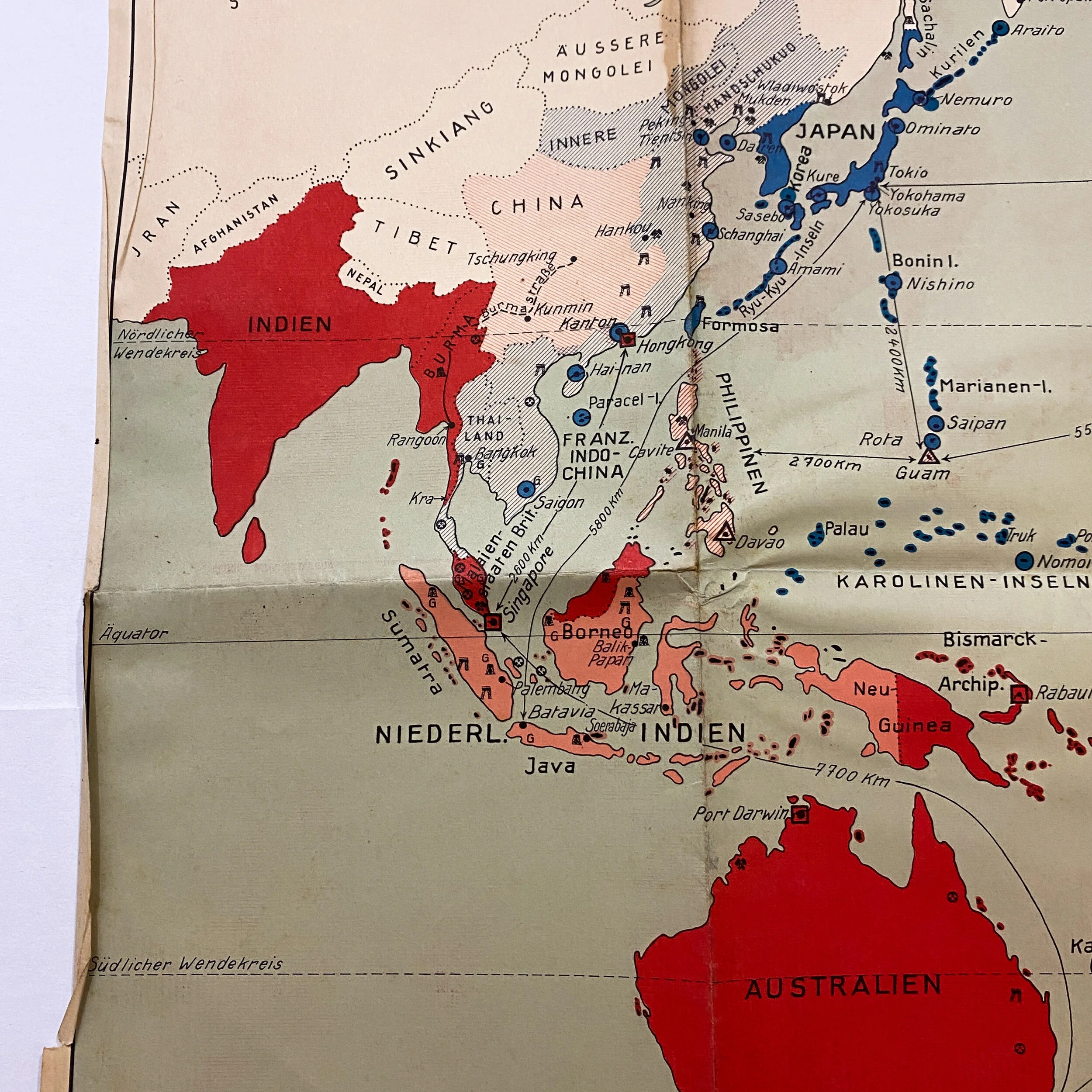
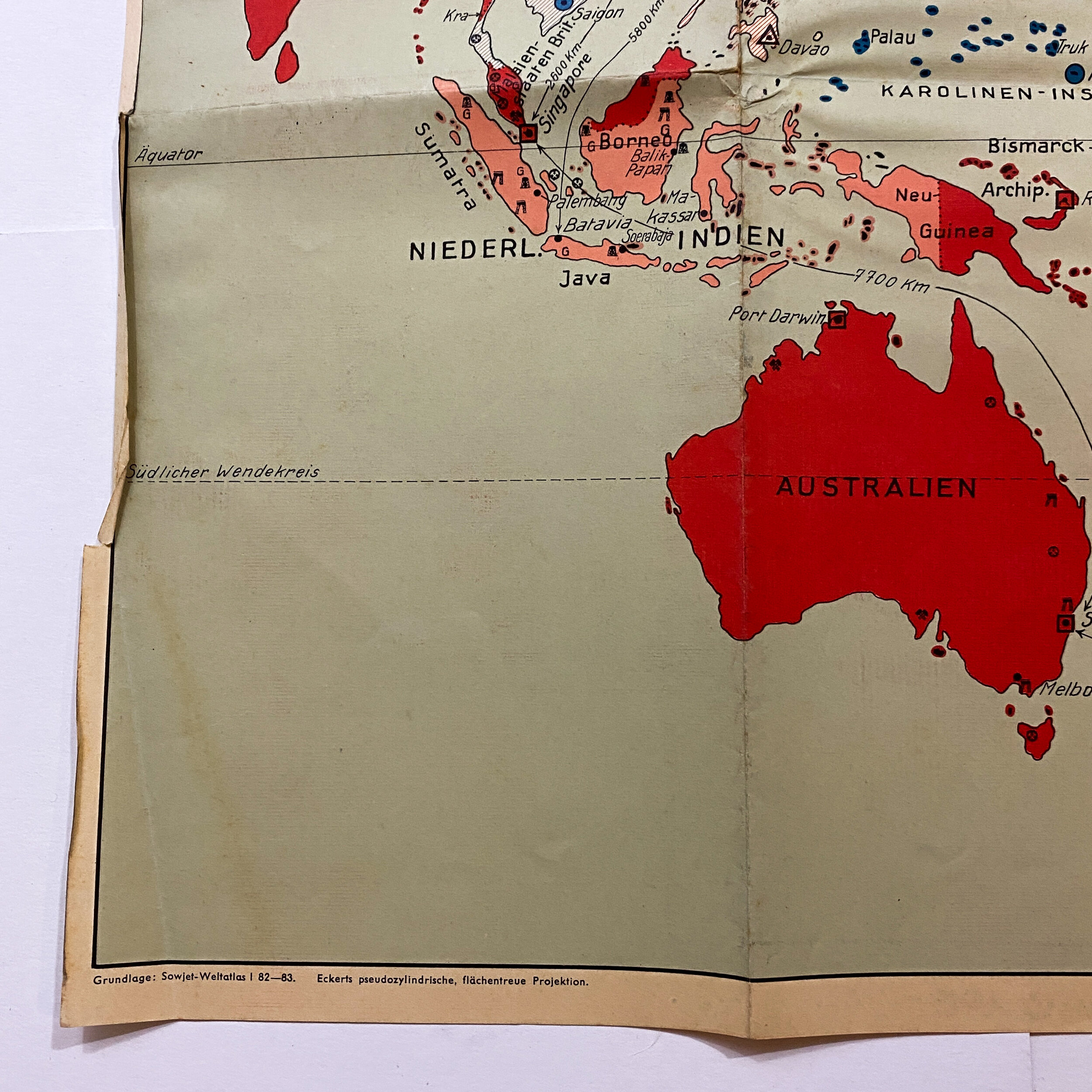
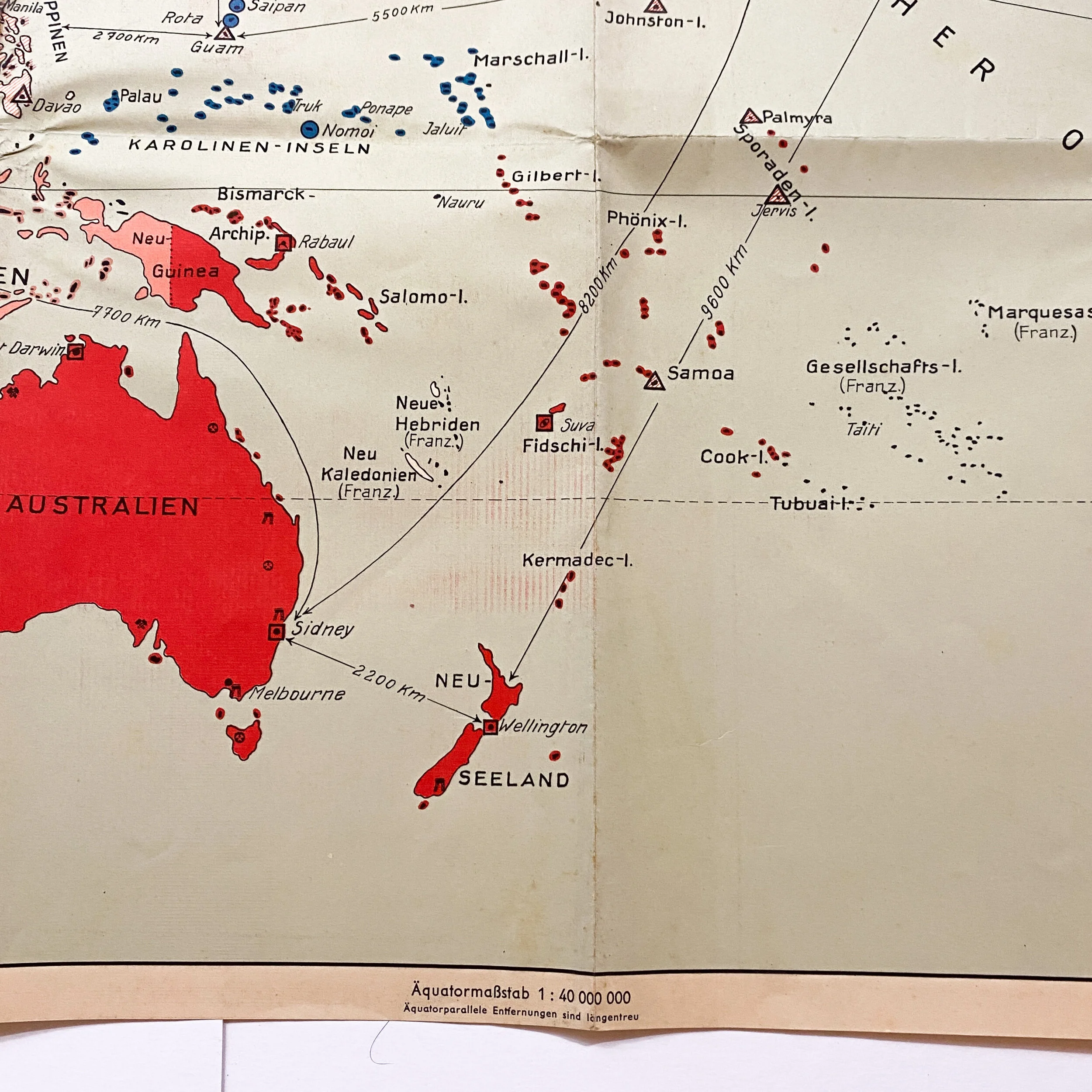
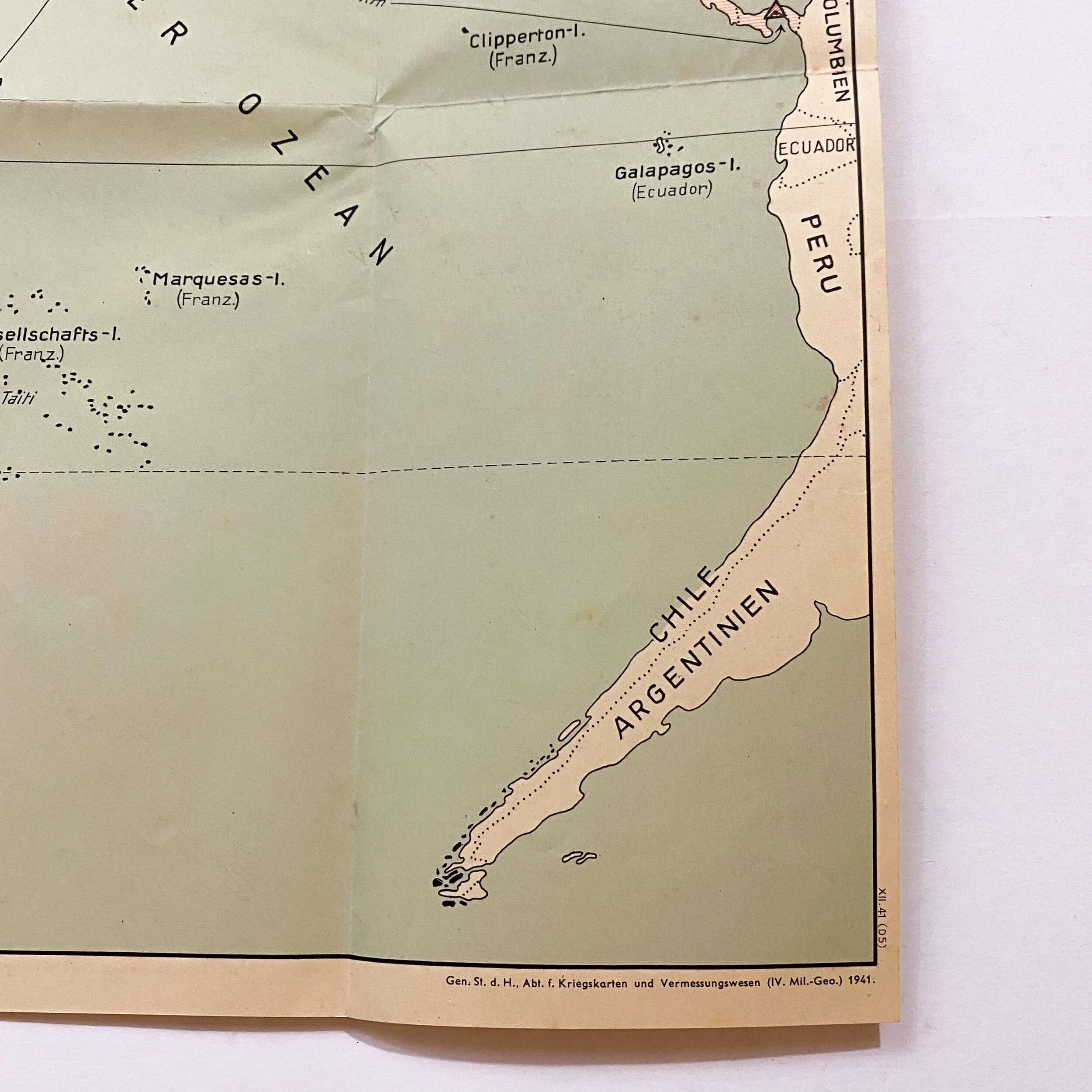
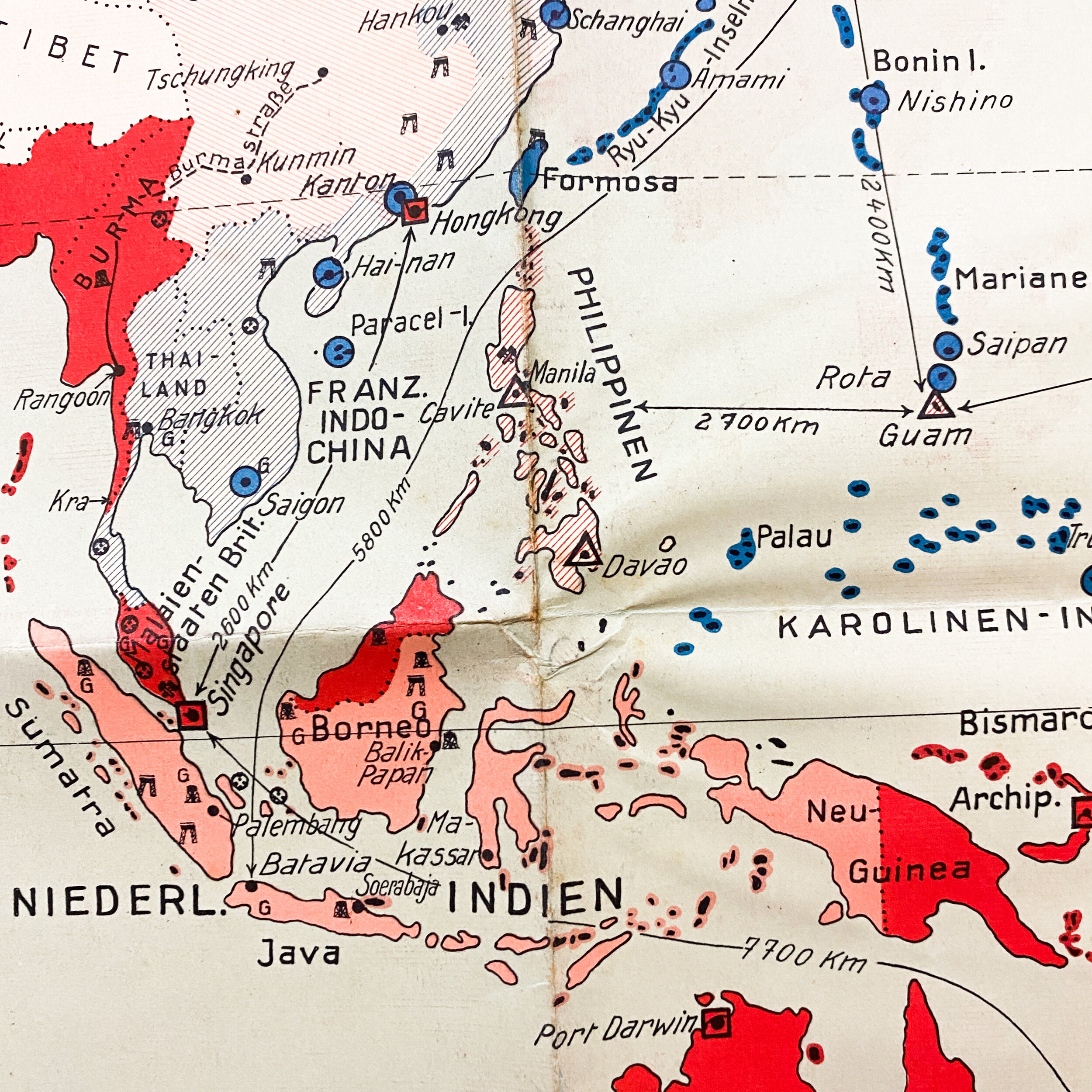
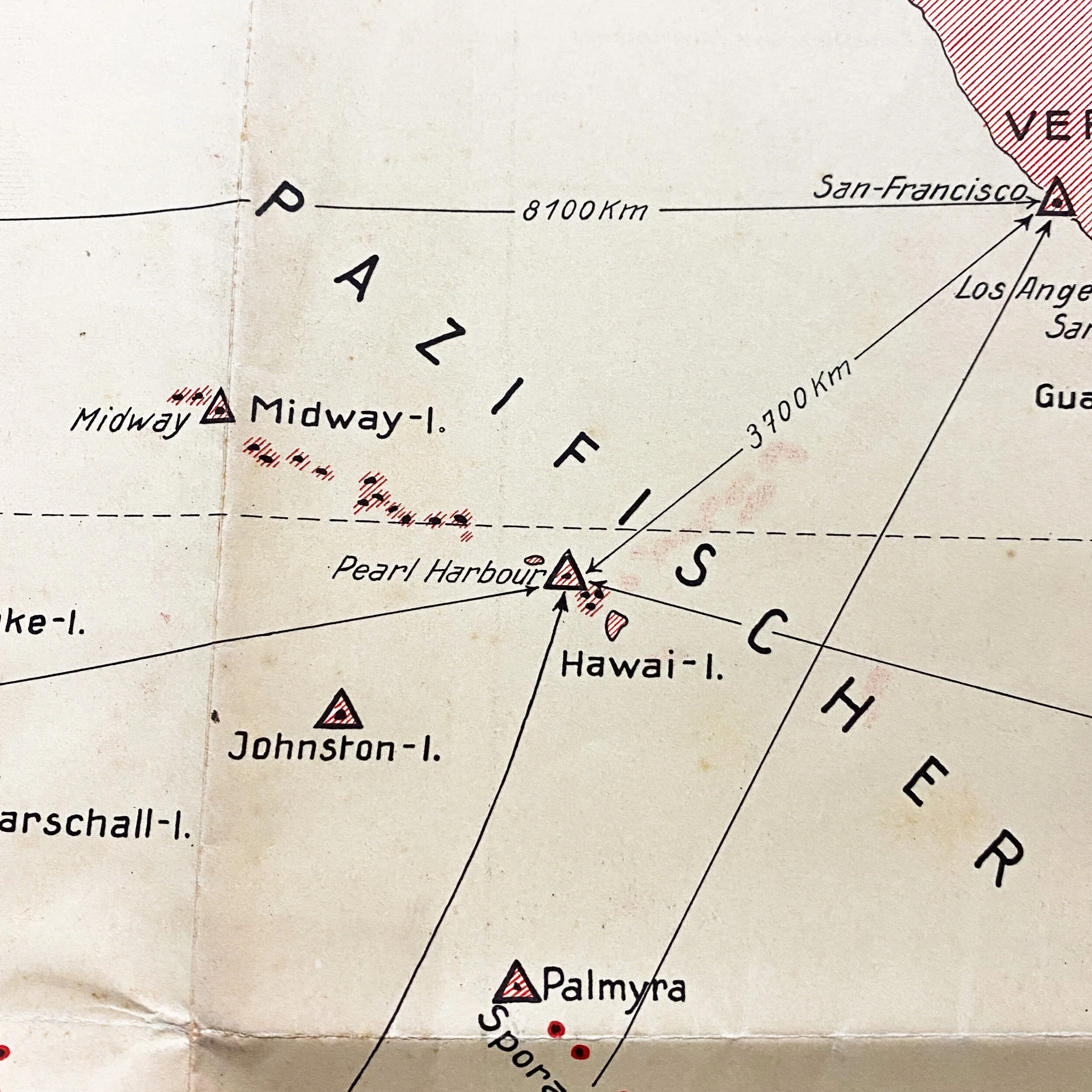
This original early war German intelligence map titled “Der Ostasiatisch-Pazifische Kampfraum” (The East Asian-Pacific Fighting Area) is dated 1941. The map shows the occupied islands of the Allies and the Japanese forces. The legend in the top right shows ‘stutzpunkte’ or support points of the Japanese on islands such as Saipan and Nomoi as well as American and British support points on Wake Island and Samoa. This map also shows distance calculations from major Allied locations to islands all over the Pacific Theater. This map would have been used by German high command and officers when briefing about the Axis power of Japans progress in the Pacific. This map shows a unique and extremely rare look at the Germans intelligence and watchful eye over the Pacific.