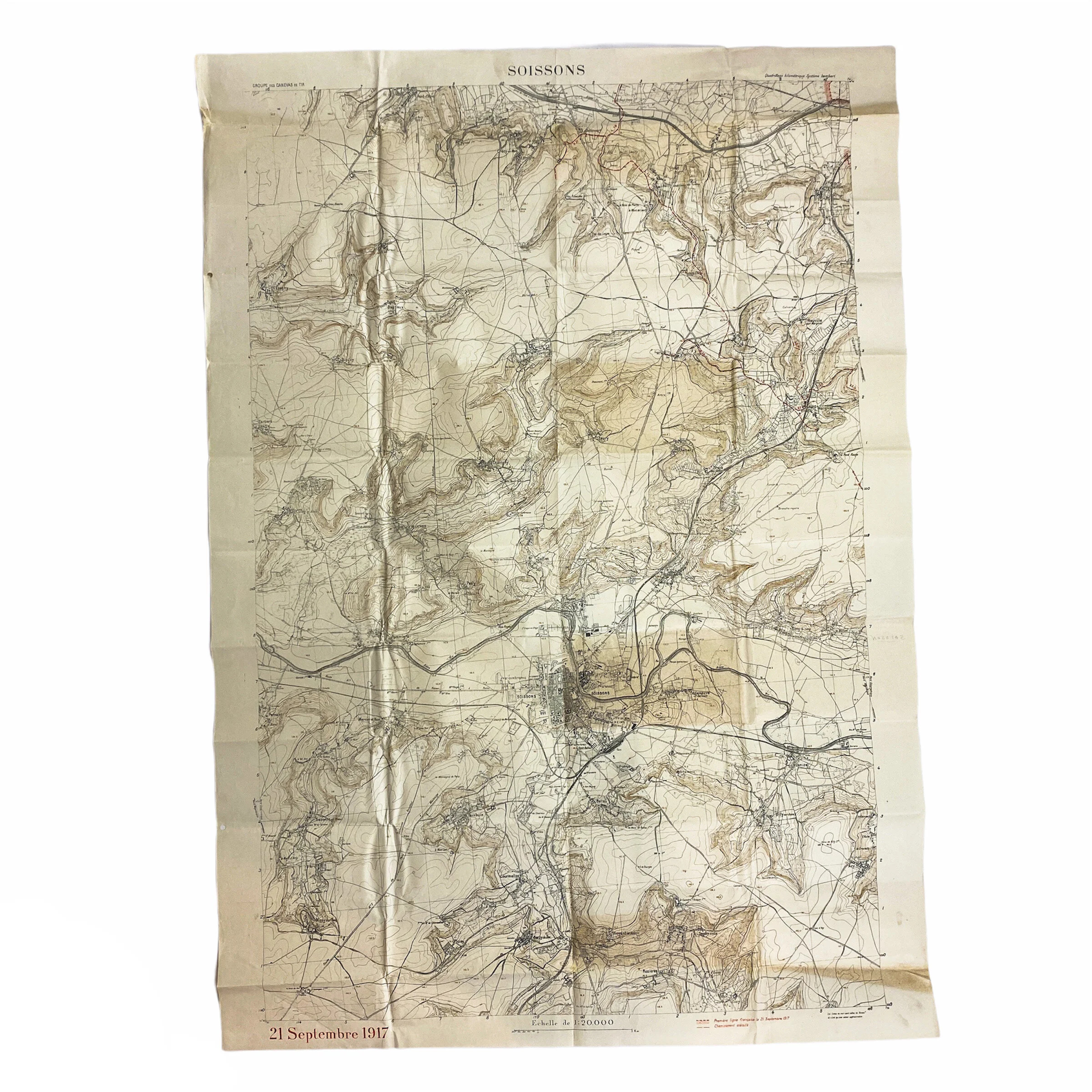
September 21st, 1917 Dated - Aisne Offensive Sector Map - "Soissons" - 1st Lieut.. E. V. McKey Jr. - 134th Field Artillery


September 21st, 1917 Dated - Aisne Offensive Sector Map - "Soissons" - 1st Lieut.. E. V. McKey Jr. - 134th Field Artillery
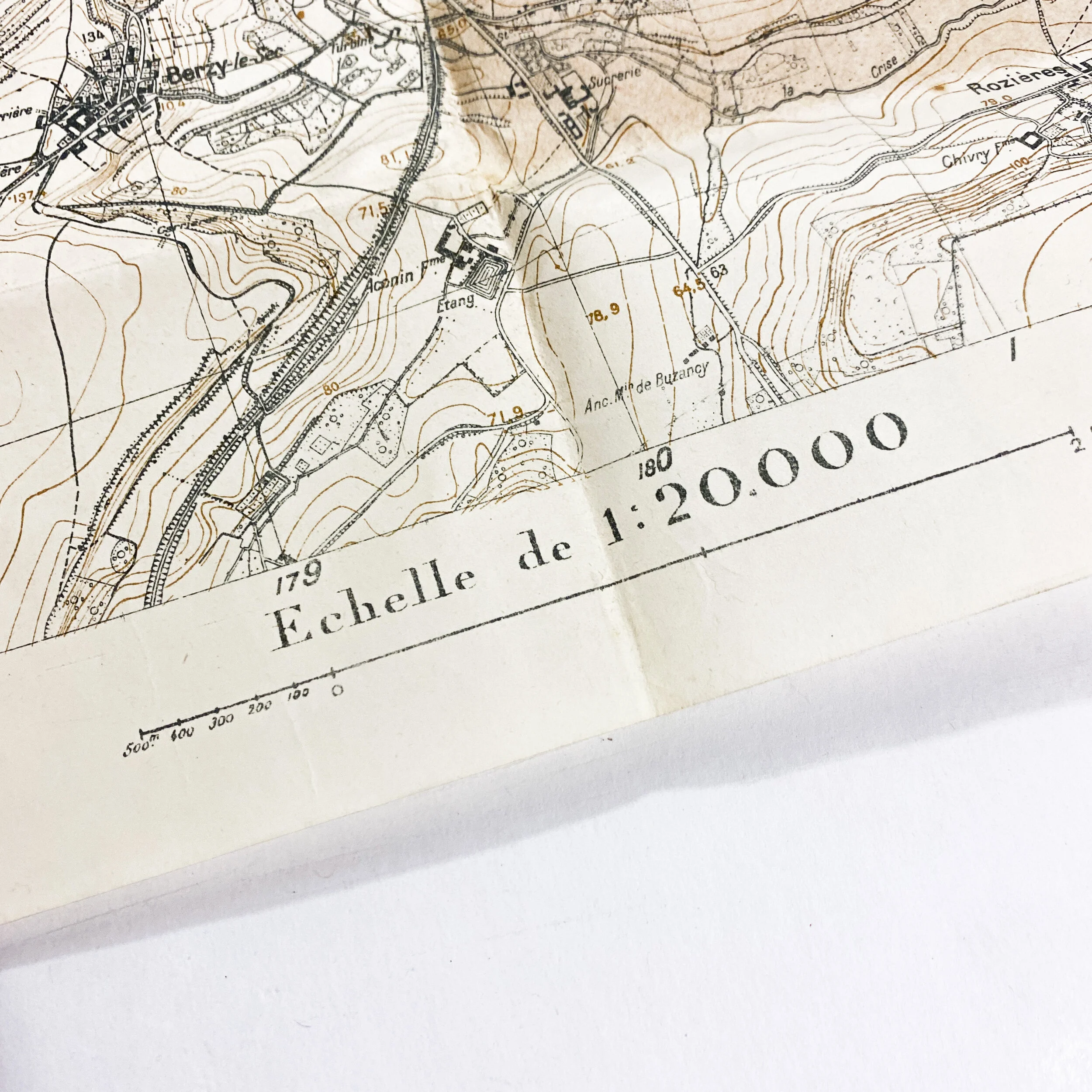
Size: 42 x 29.5 inches
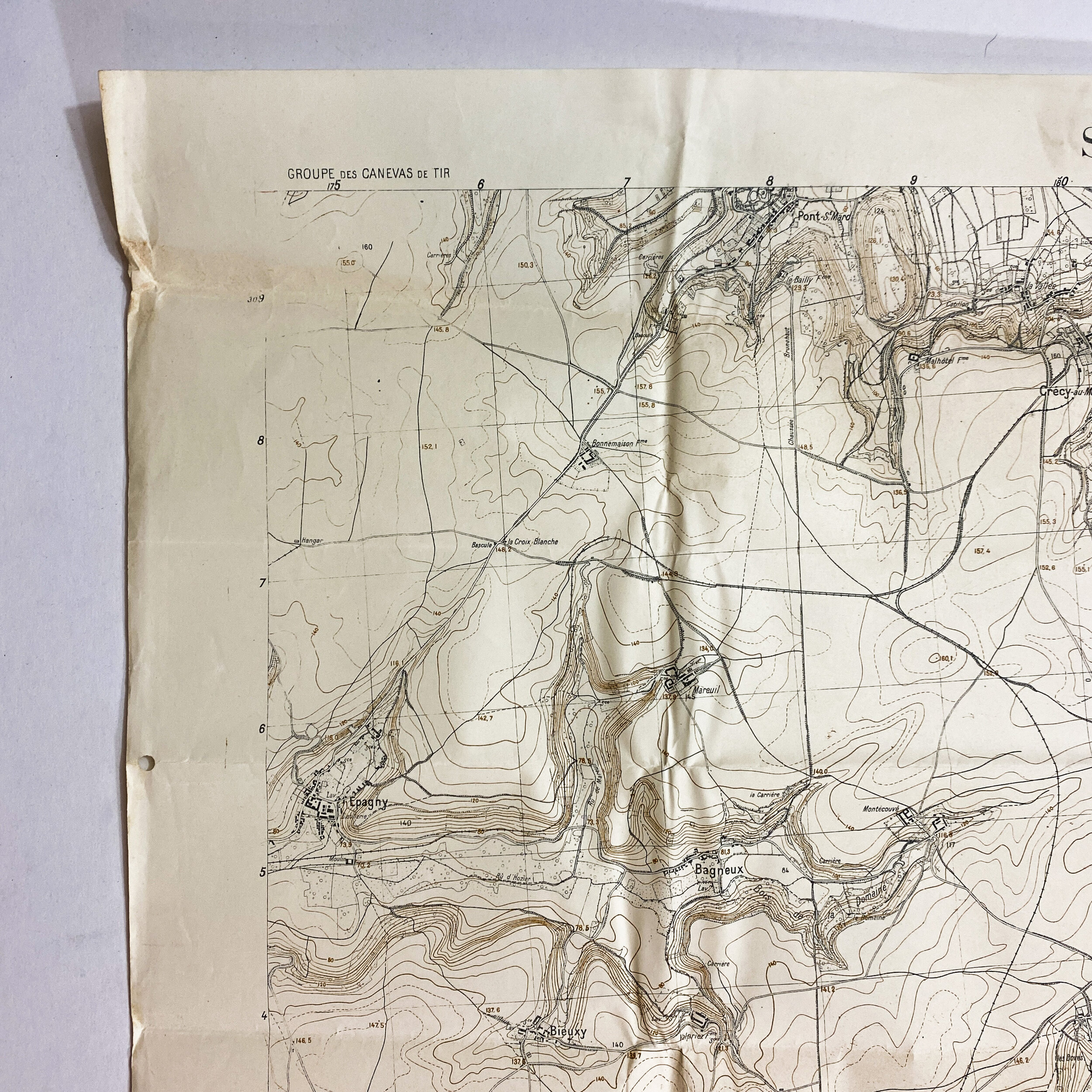
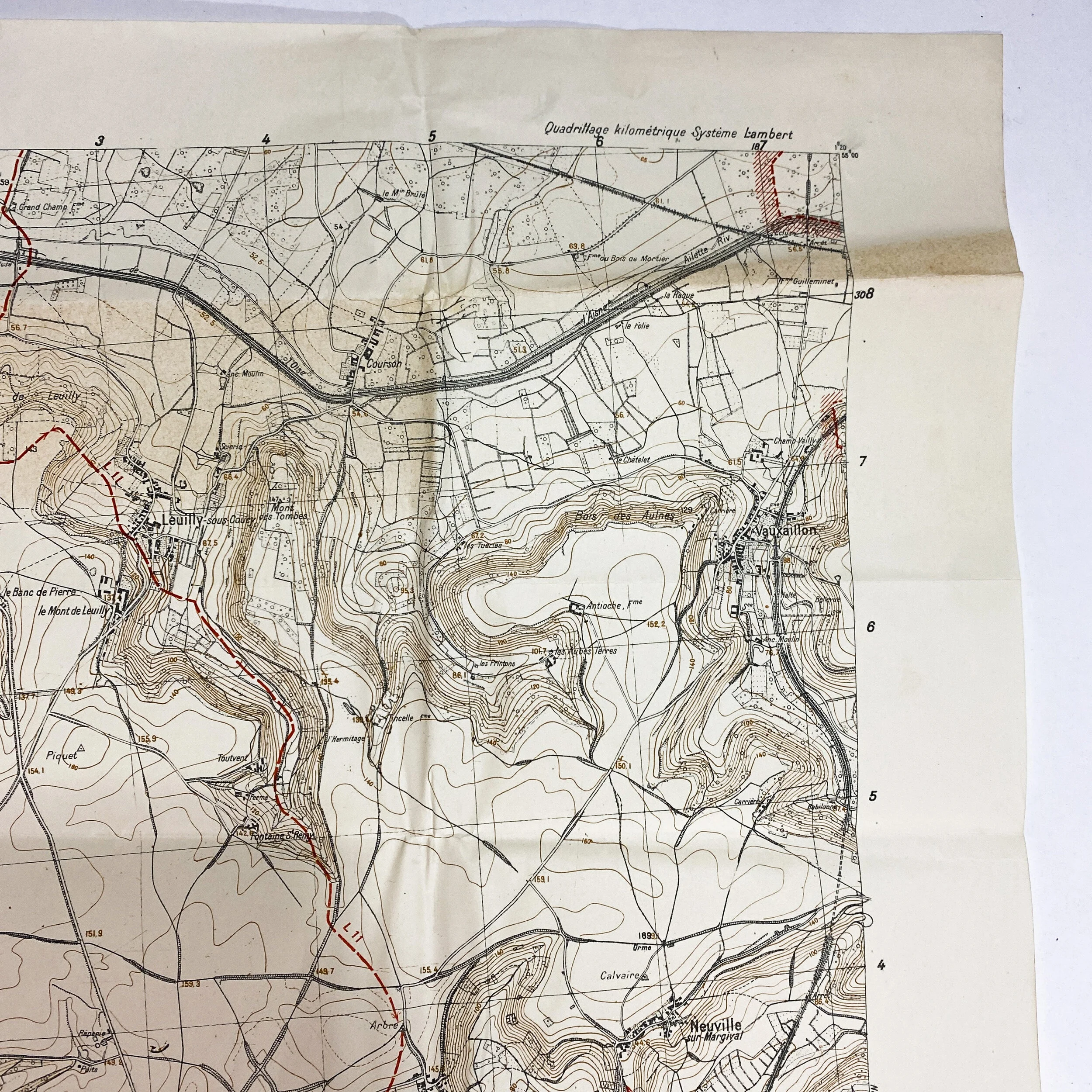
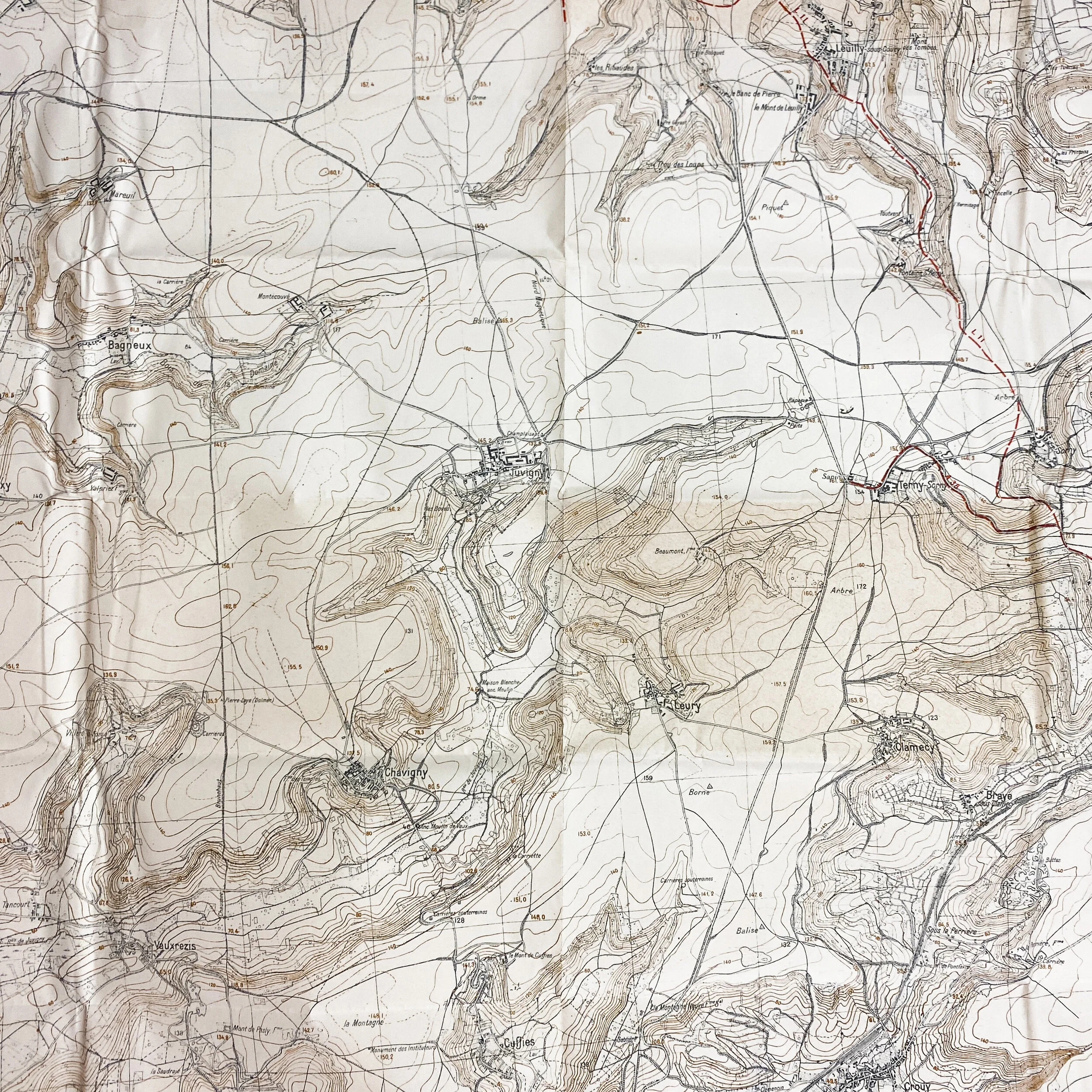
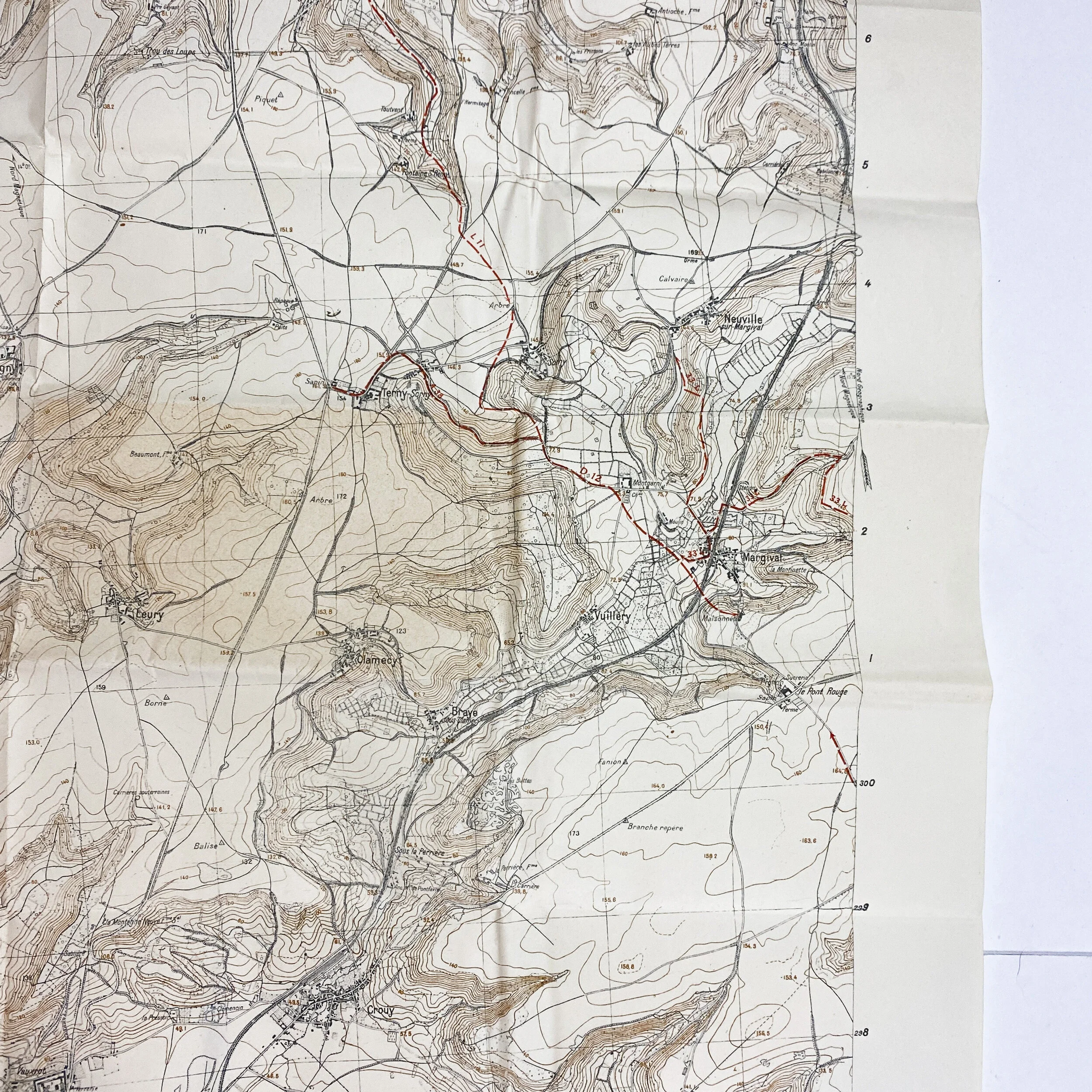
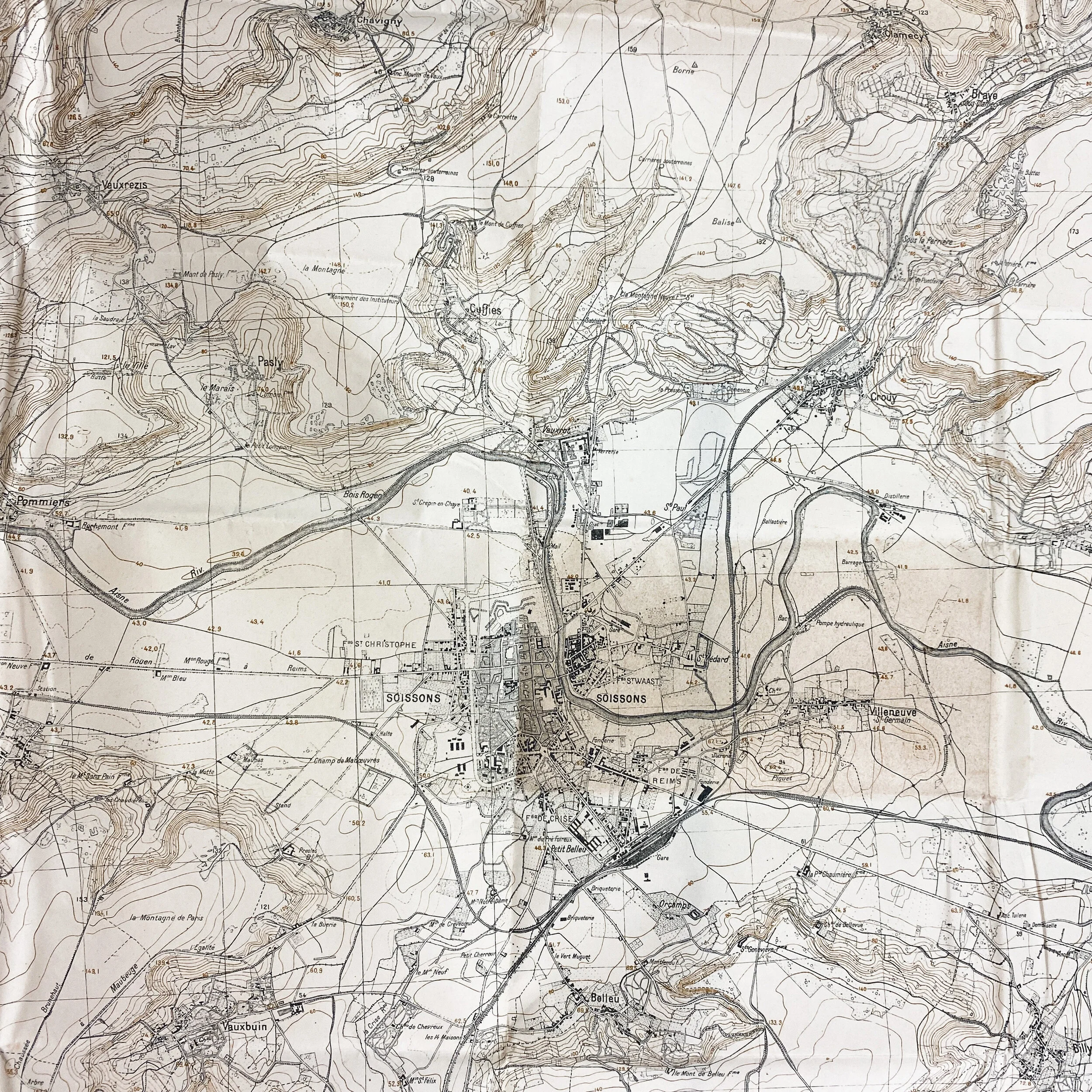
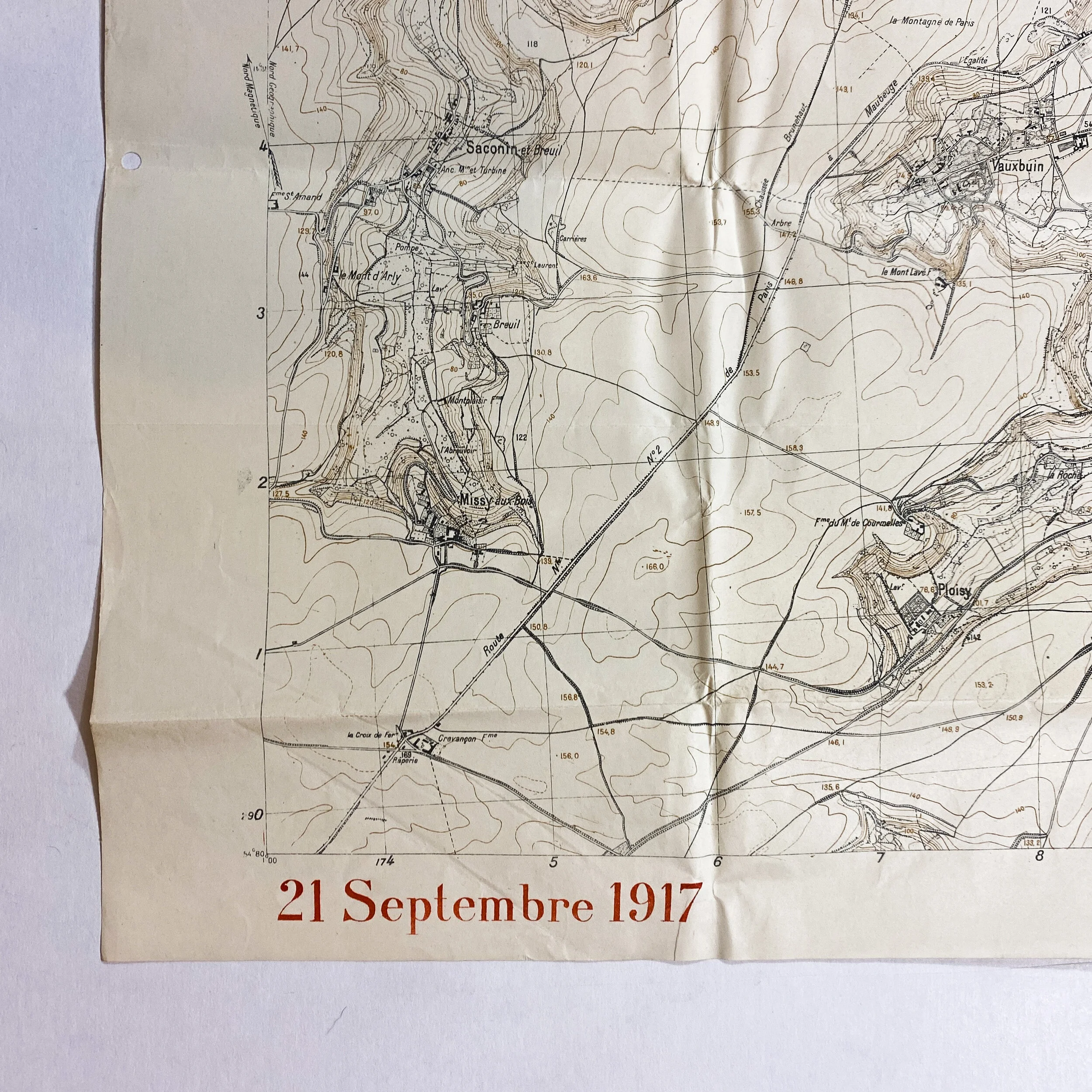
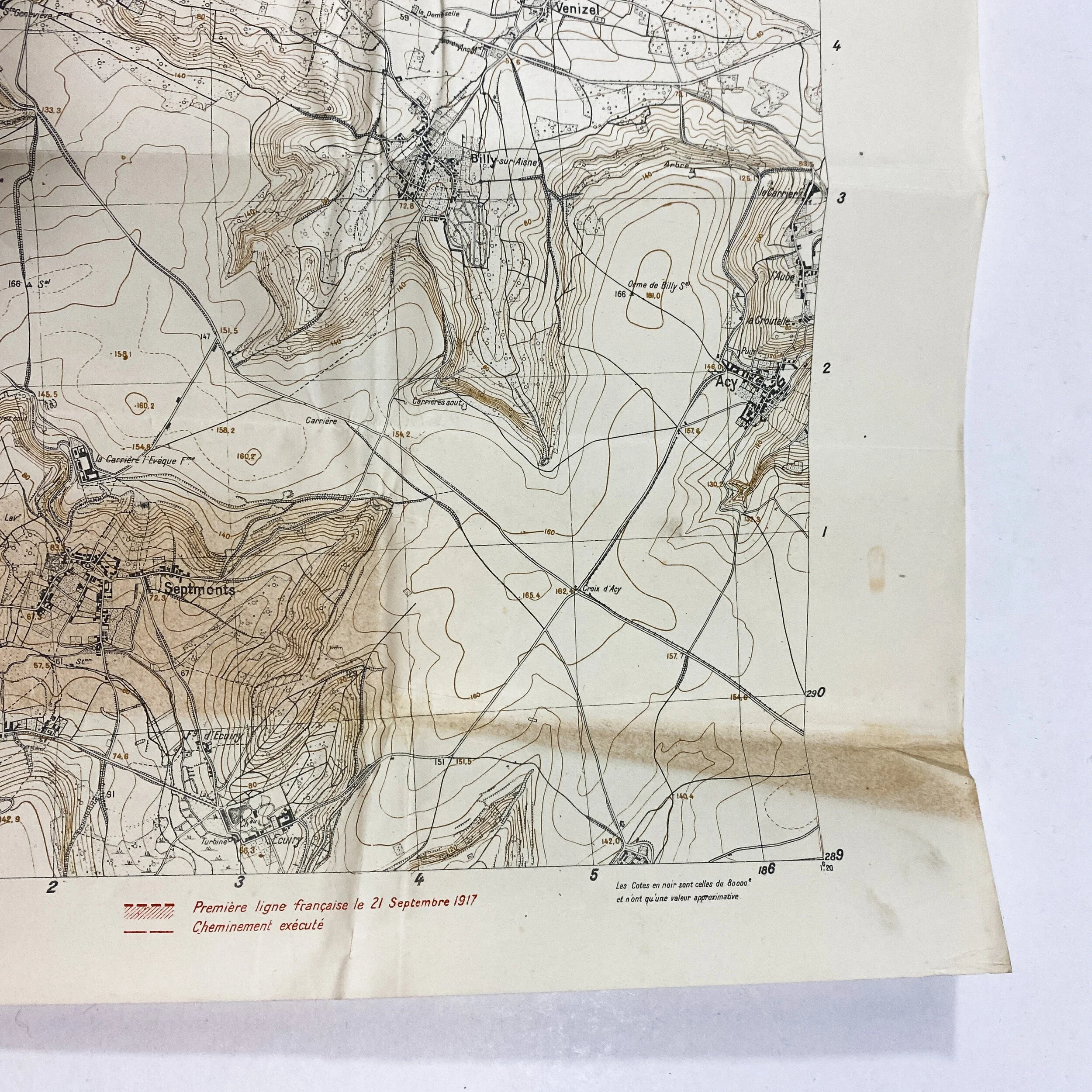
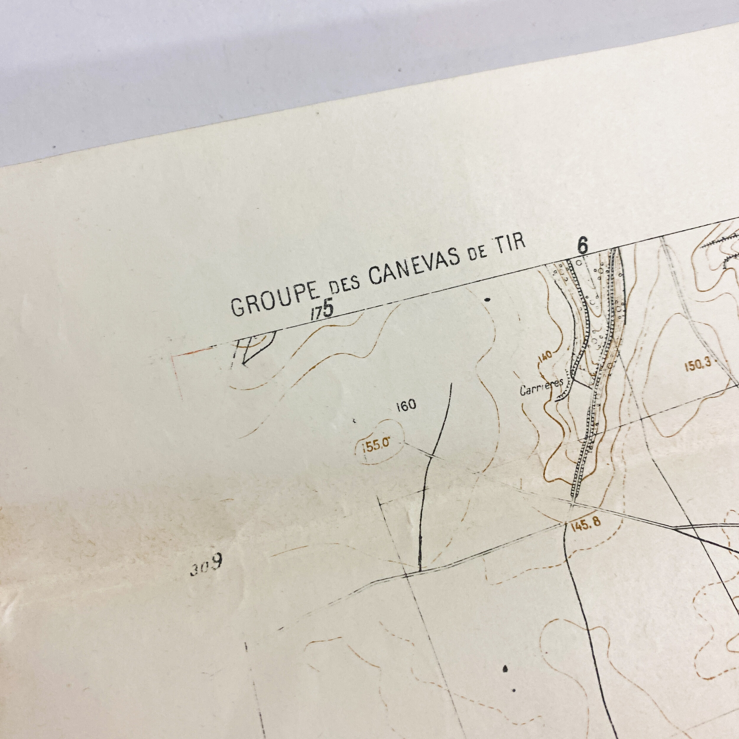
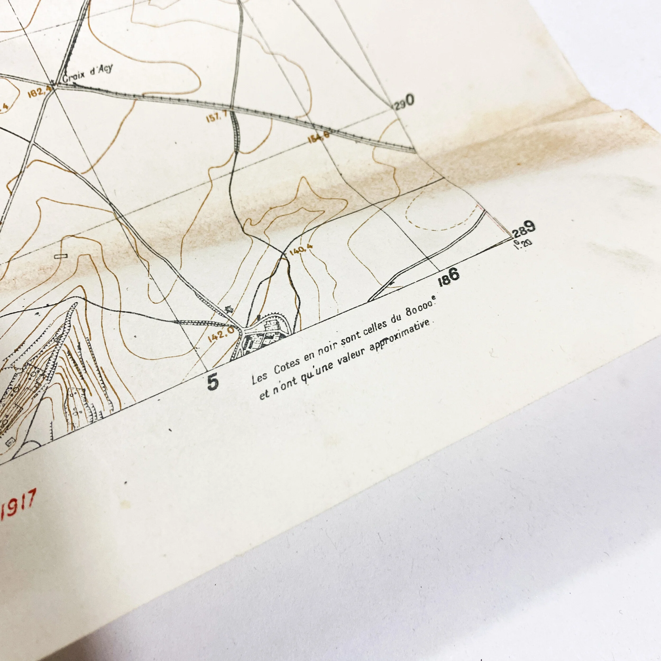
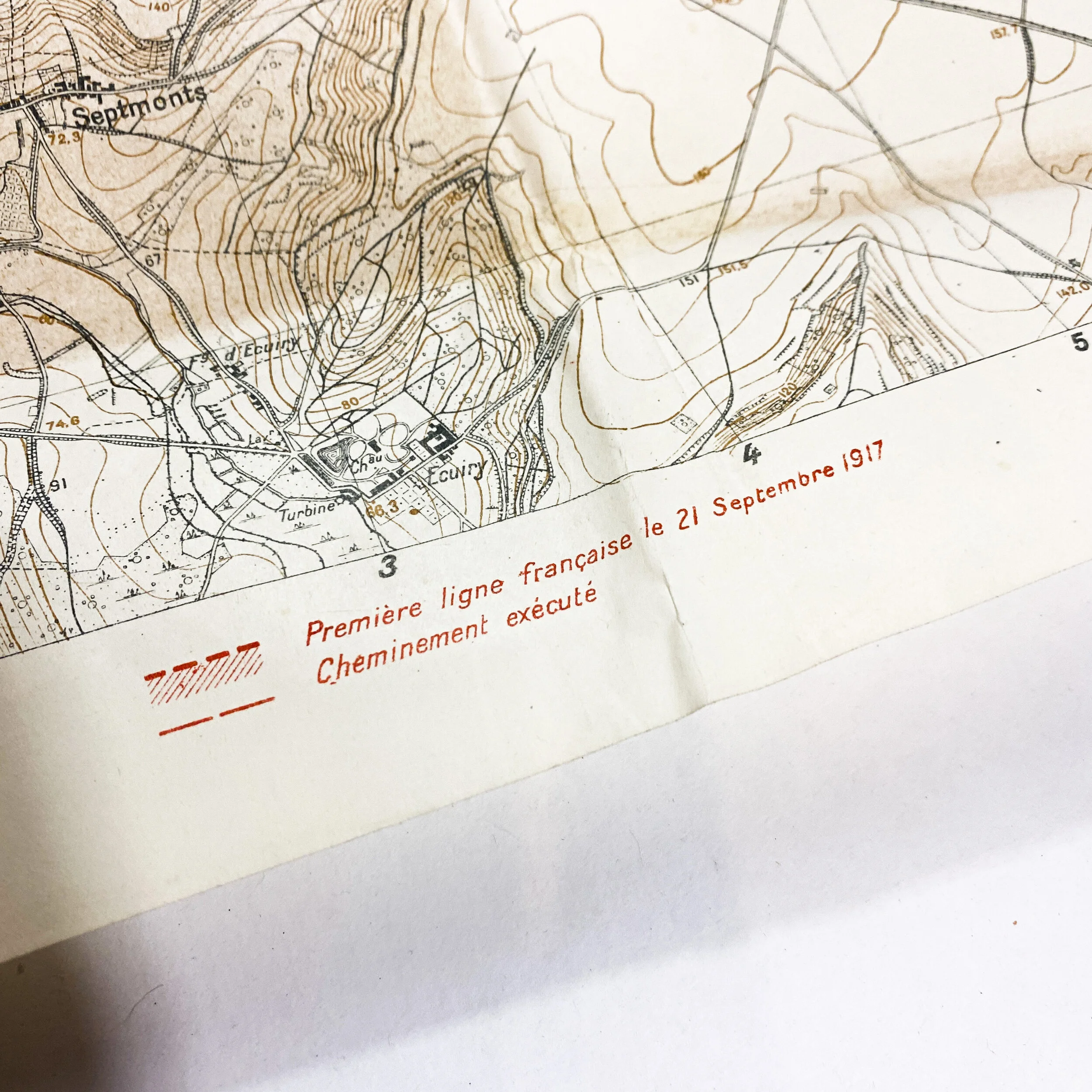
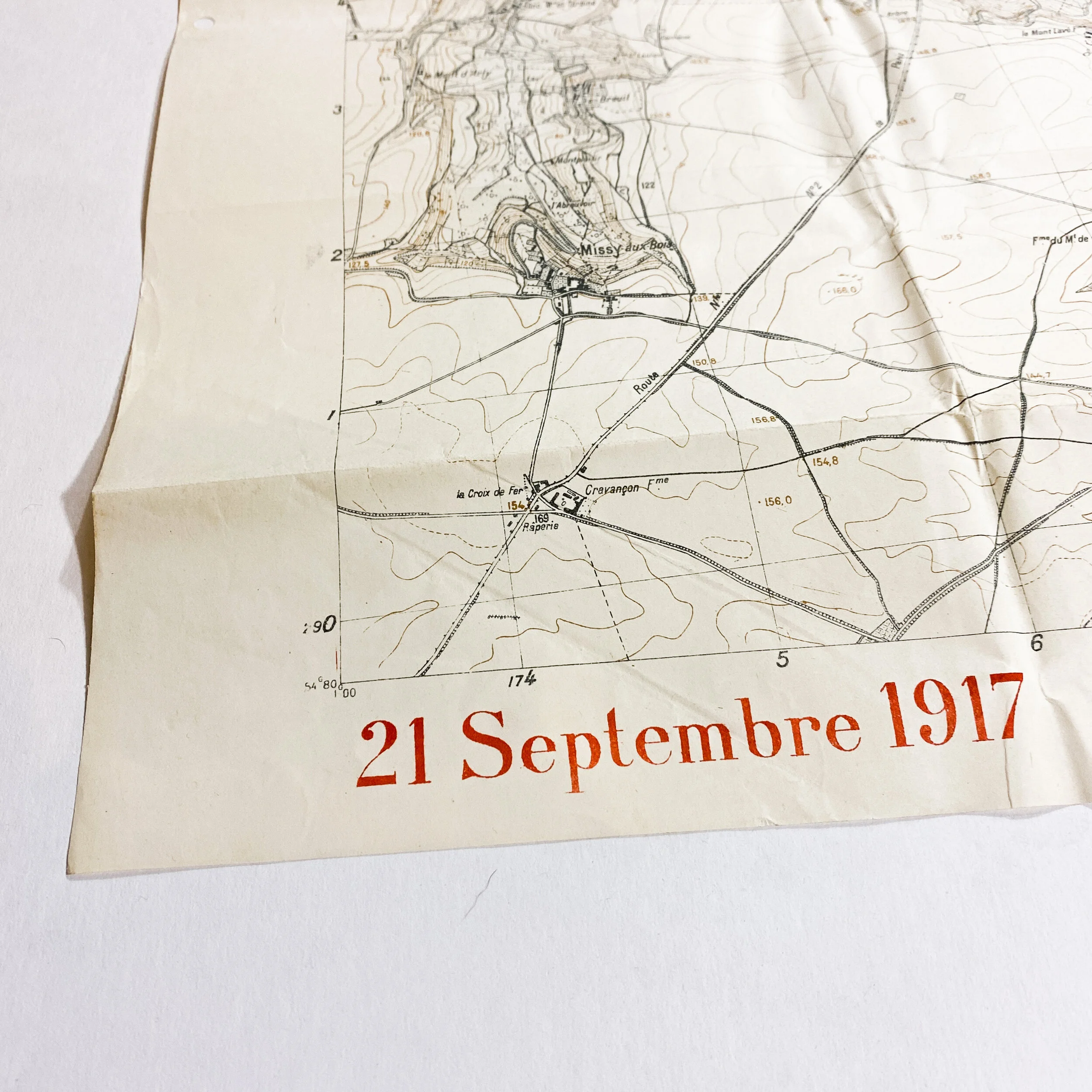
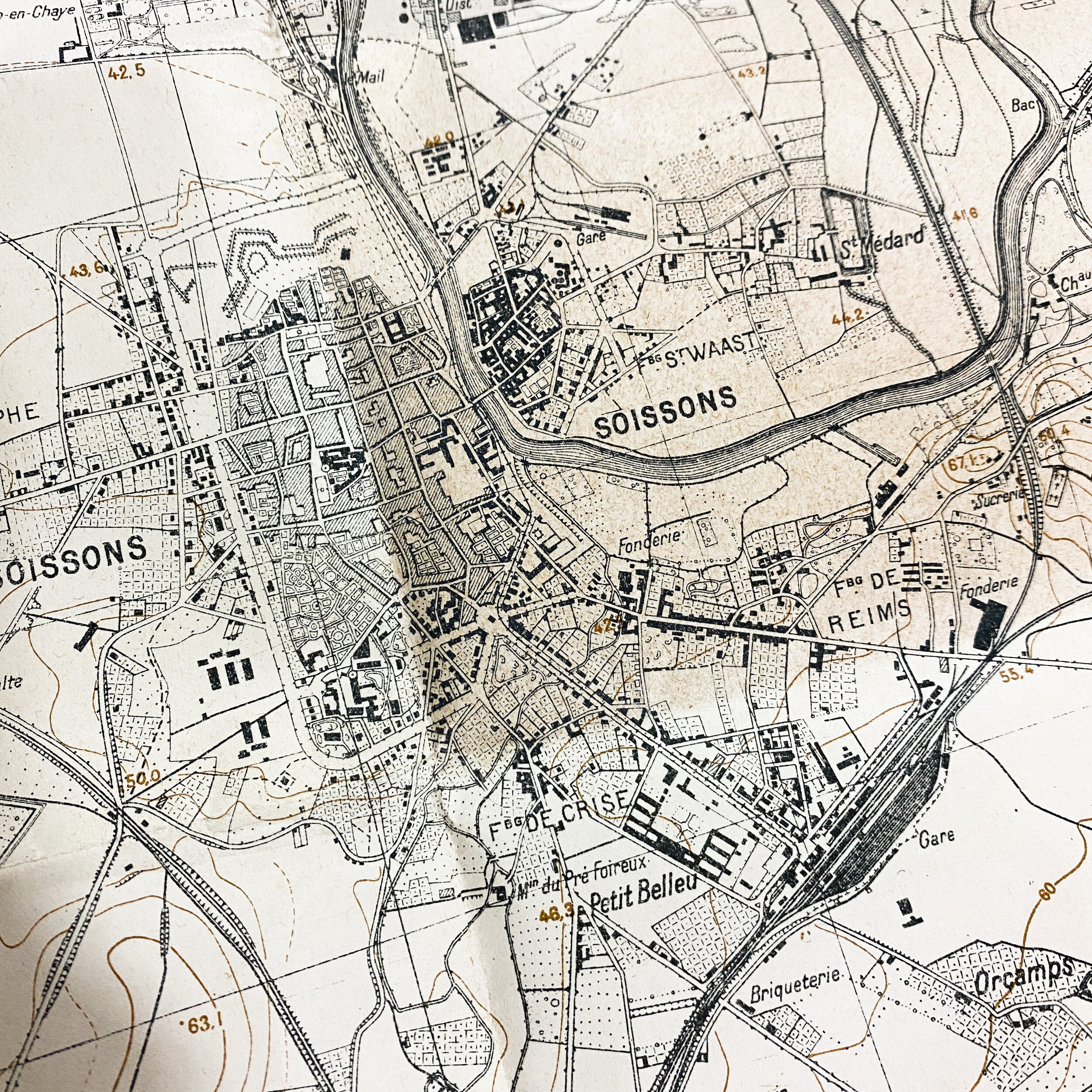
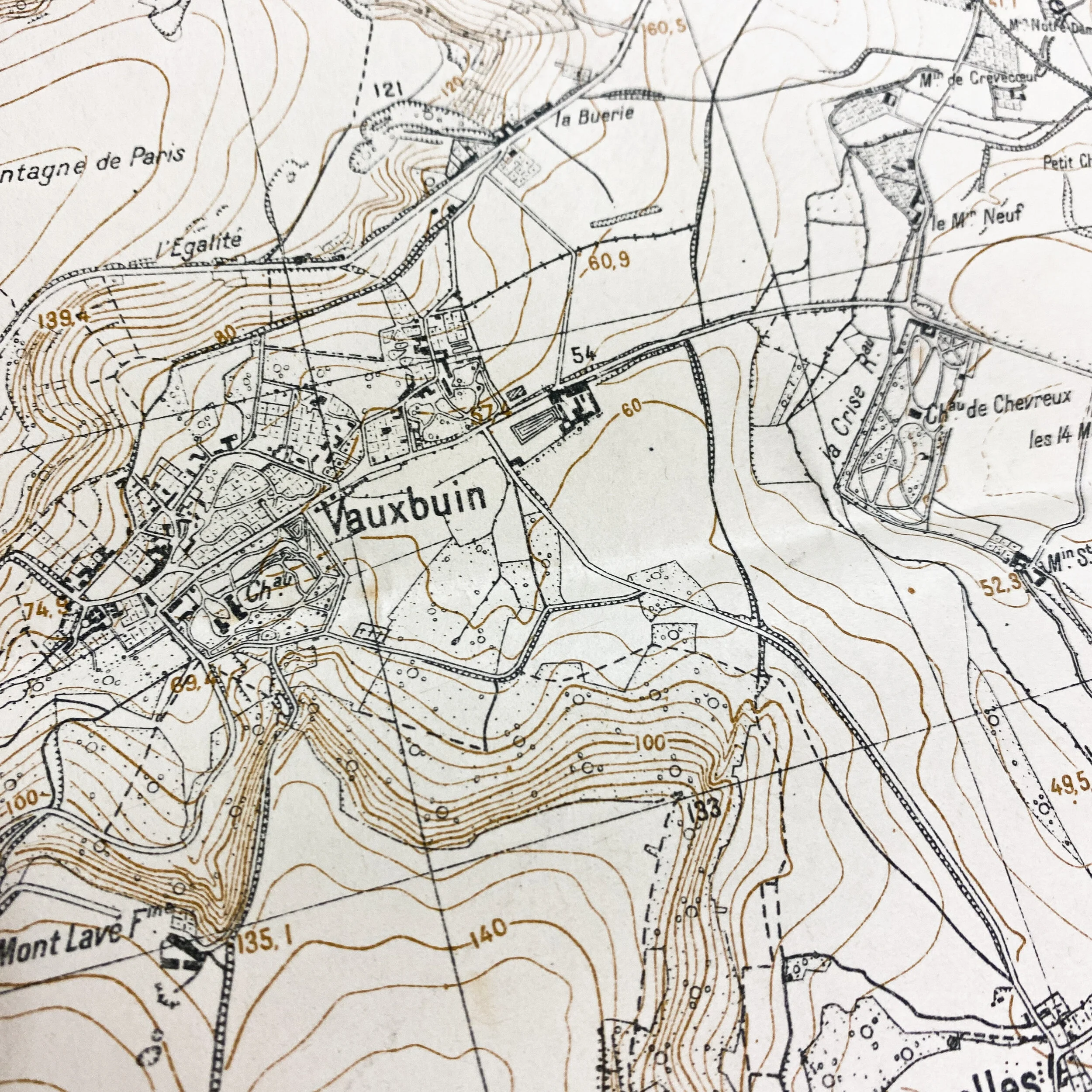
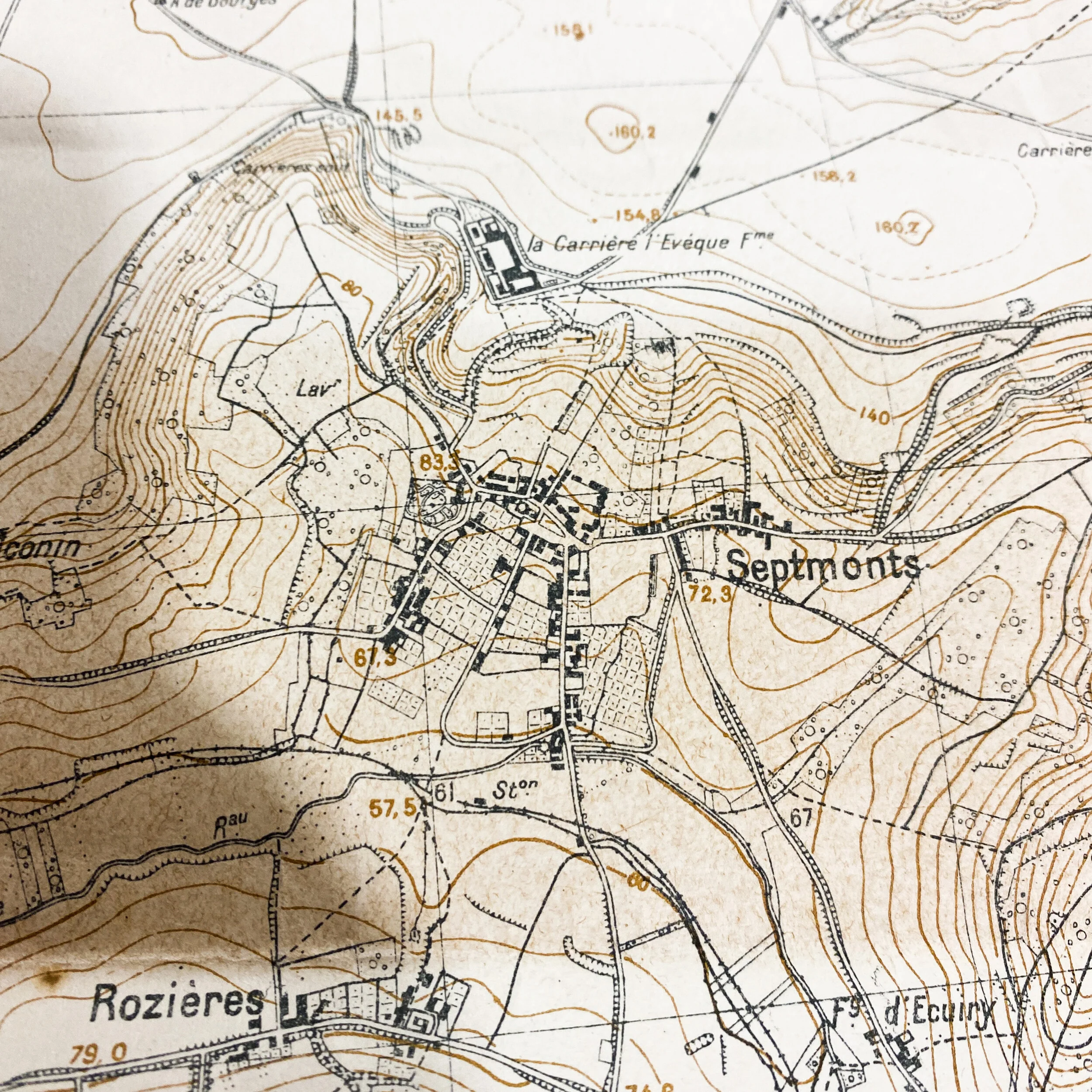
This World War 1 trench map is dated in big red letters near the bottom left corner ‘21 Septembre 1917’ (September 21st, 1917) and is titled “Soissons”. This French constructed map shows elements of trenches of the ‘première linge française’ or ‘first French line’ as September 21st, 1917 and the ‘cheminement execute’ (path executed). This map would have been similar to those used in the planning of attack in the area, divisional movements, as well as artillery fire support. For added assistance of artillery firing coordinates, a smaller transparent overlay of fine transparent paper would have most likely been placed over this map and written on with the H+ hours and firing lines ordered by headquarters. This map shows important villages and towns such as Leuilly, Neuville, Chavigny, Soissons, Vauxbuin, and Septmonts.
This trench map Geographical location falls within the Aisne Offensive sector where the Battle of Soissons took place. This battle was fought on the Western Front during World War I. Waged from July 18th through the 22nd of 1918 between the French (with American and British assistance) and the German armies, the battle was part of the much larger Allied Aisne-Marne counter-offensive. It followed the final German Spring Offensive, Operation Marneschutz-Reims (also known as the Friedensturm or peace offensive). The primary objective of the attack was to cut both the Soissons – Château-Thierry road and the railroad running south from Soissons to Château-Thierry. As these were the main supply routes for the German forces in the Marne salient, cutting them would severely impair the Germans' ability to supply its armies defending it. This would force them to retreat and give up their gains. This battle marked the turning point of the war as the Germans would be on the defensive for the remainder of the conflict. This operation was the largest American offensive action to this date in the First World War took place on July 18, 1918. For the first time, two U.S. divisions attacked side by side: the 1st and 2nd Divisions at the Battle of Soissons.
Collection: 1st Lieut.. E. V. McKey Jr. and the 134th Field Artillery.
This exclusive collection of World War I maps are from the bring back collection of 1st Lieut. E. V. McKey Jr. who was an A.E.F. artilleryman and saw extensive combat over the course of WWI serving valiantly with the 37th Infantry Division - 62nd Field Artillery Brigade -134th Field Artillery Regiment. The 62d Field Artillery Brigade - 134th Field Artillery is accredited battle participations in the Marbache sector where they provided extensive fire support and artillery barrages during the Meuse-Argonne offensive as well as the Thiaucourt sector during the St. Mihiel offensive. Many of these maps were used directly by 1st Lieut. E. V. McKey Jr. and his men of the 134th Field Artillery as they provided offensive and defensive fire supporting for the Allies with their 75 mm cannons. The 62nd Field Artillery Brigade is one of the most infamous field artillery unit of World War .