*St. Mihiel Offensive - A.E.F. Captured German Artillery Barrage Trench Map - with Glued Artillery Meter Ruler
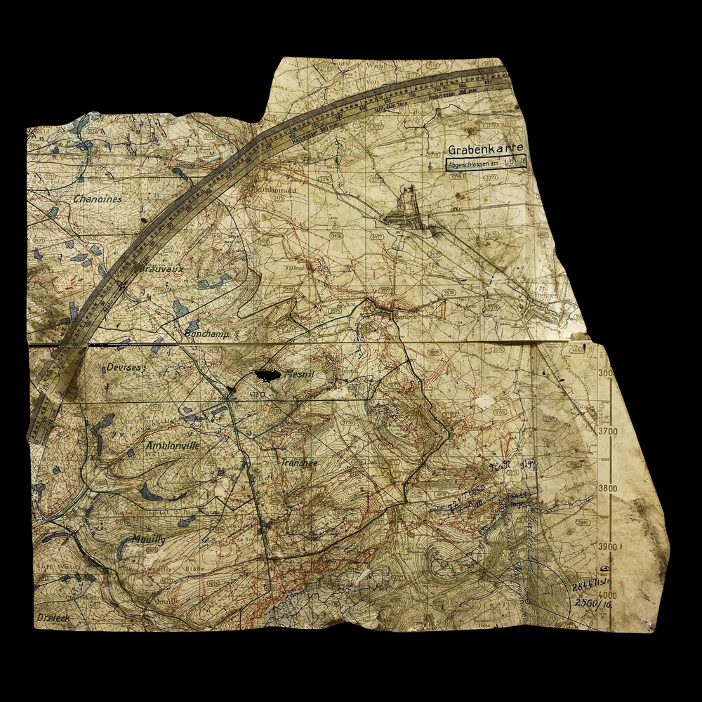


*St. Mihiel Offensive - A.E.F. Captured German Artillery Barrage Trench Map - with Glued Artillery Meter Ruler
Size: 16 x 17.5 inches
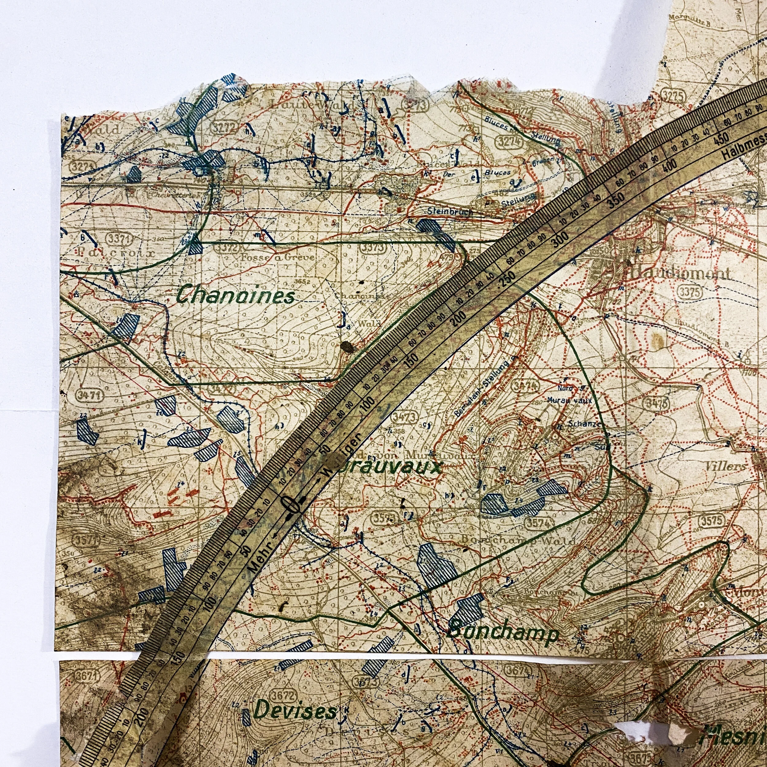
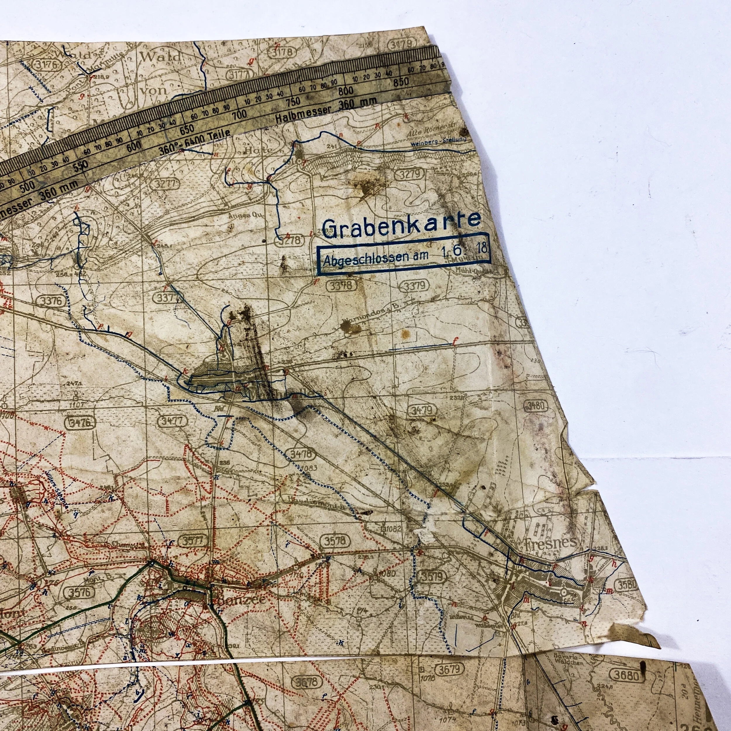
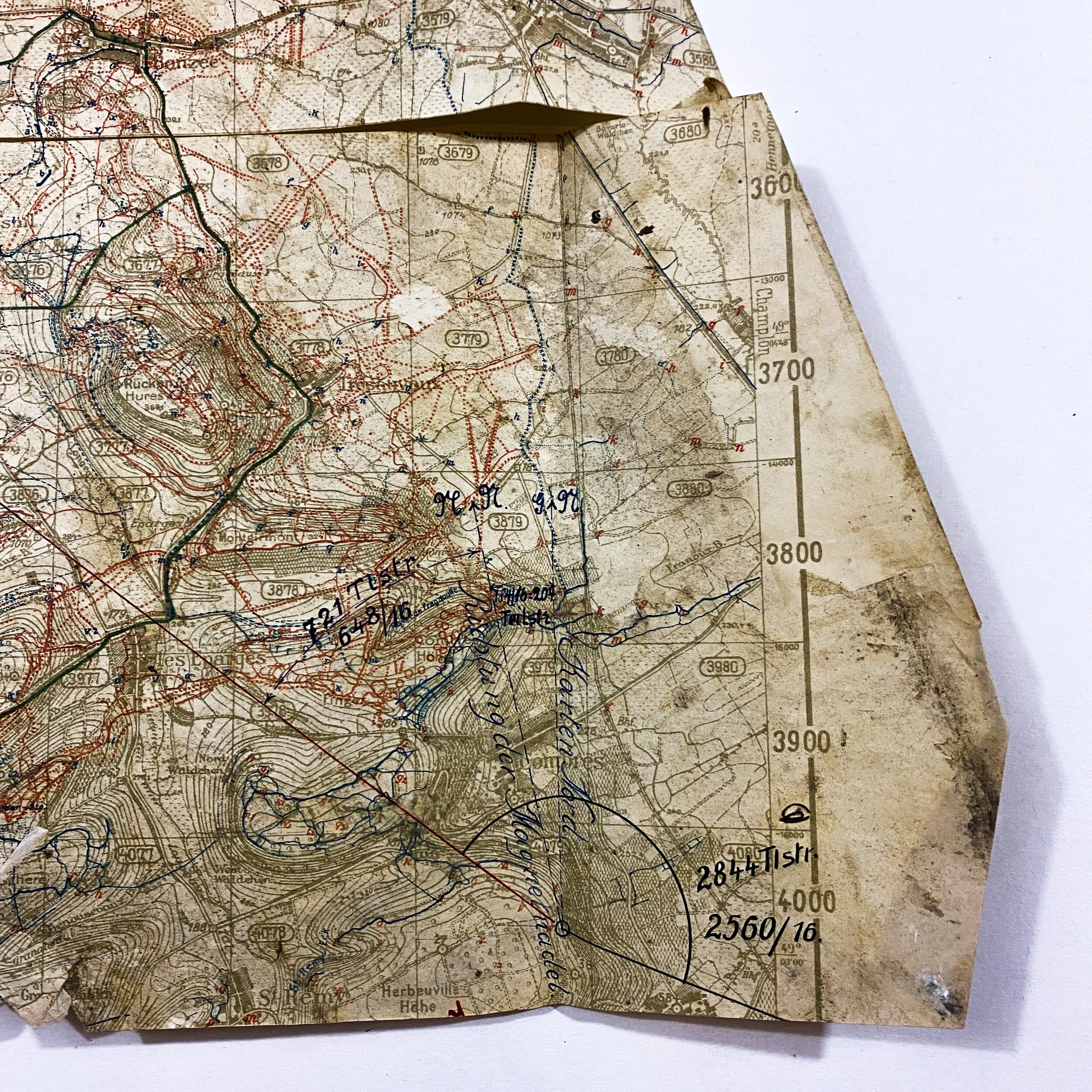
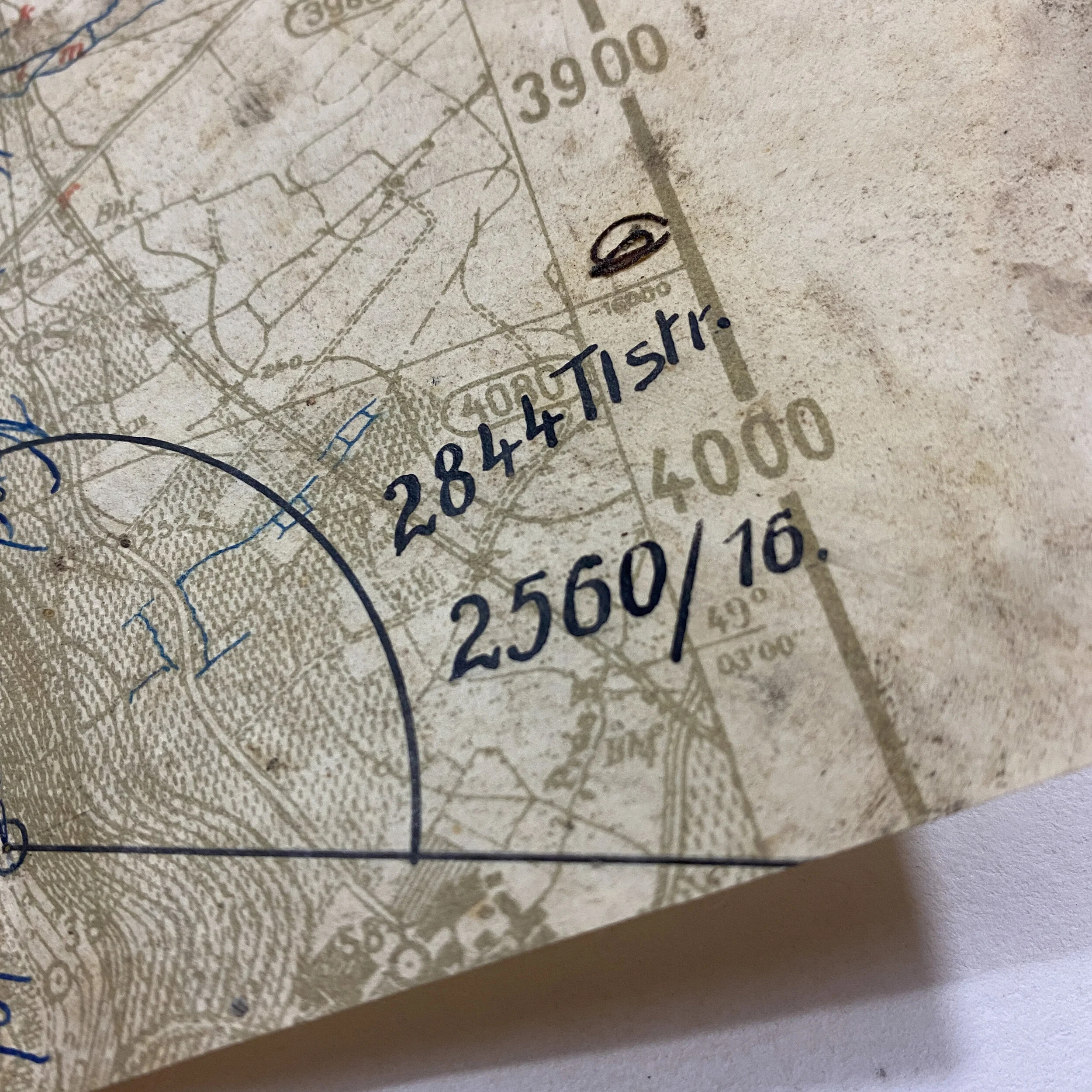
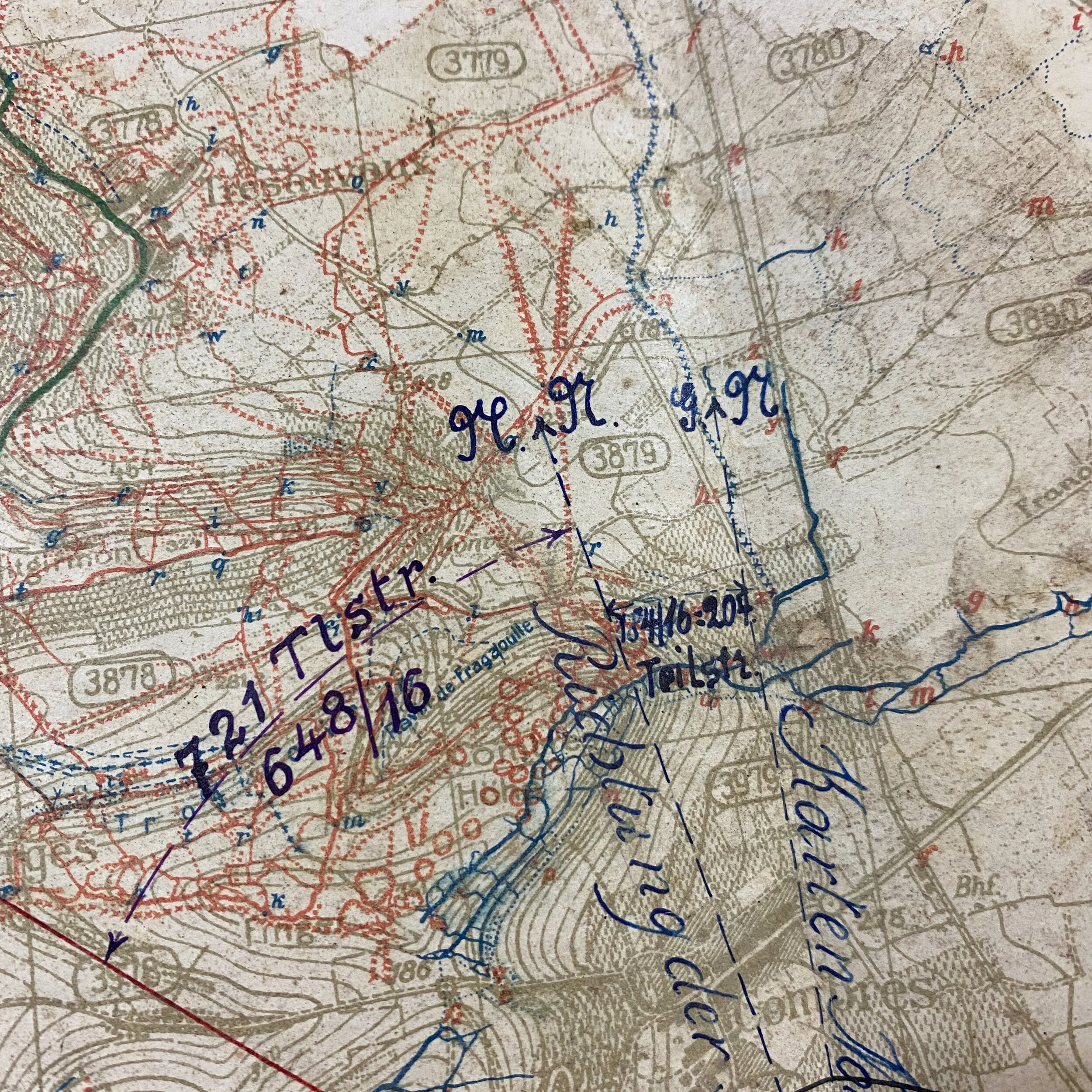
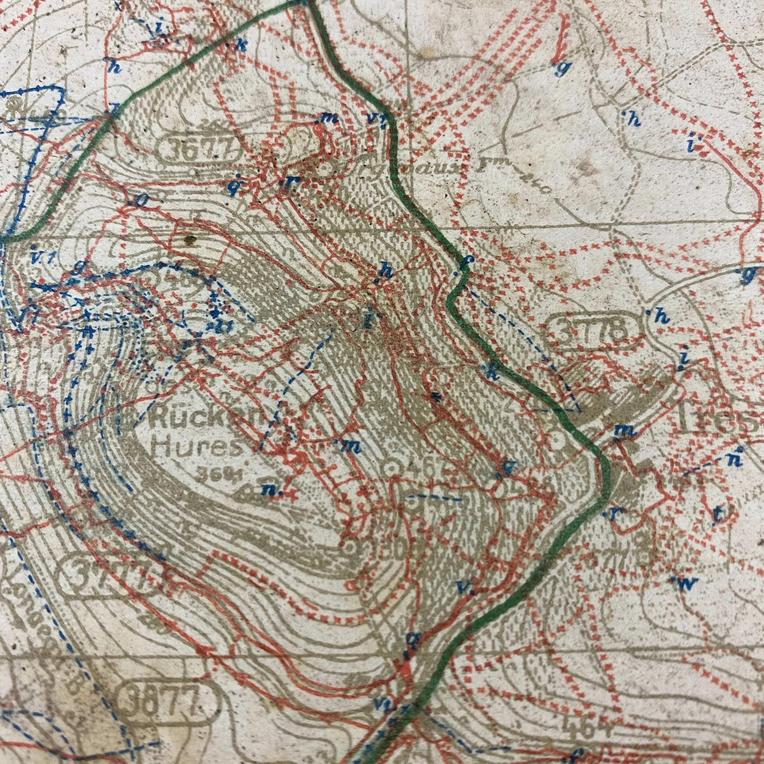
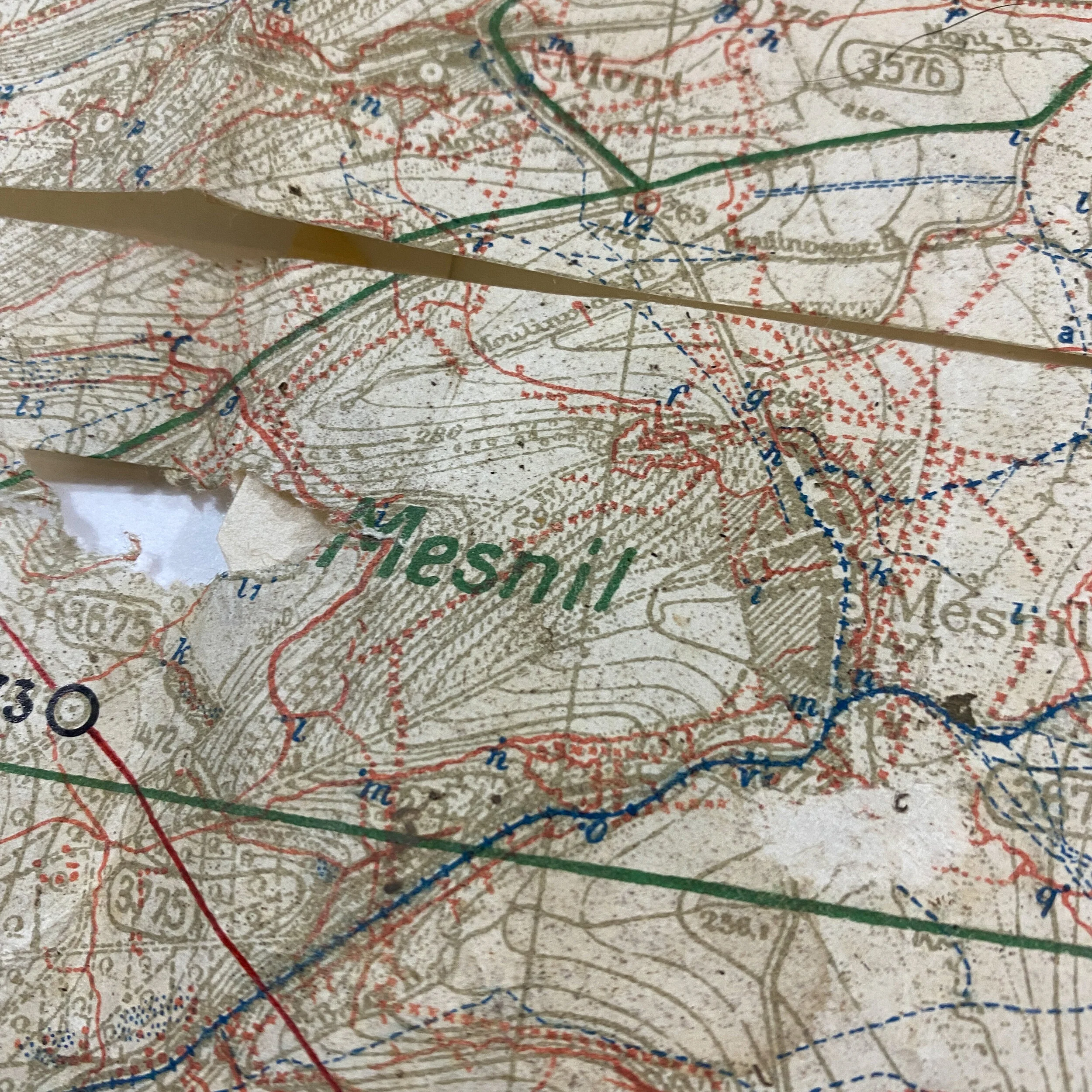
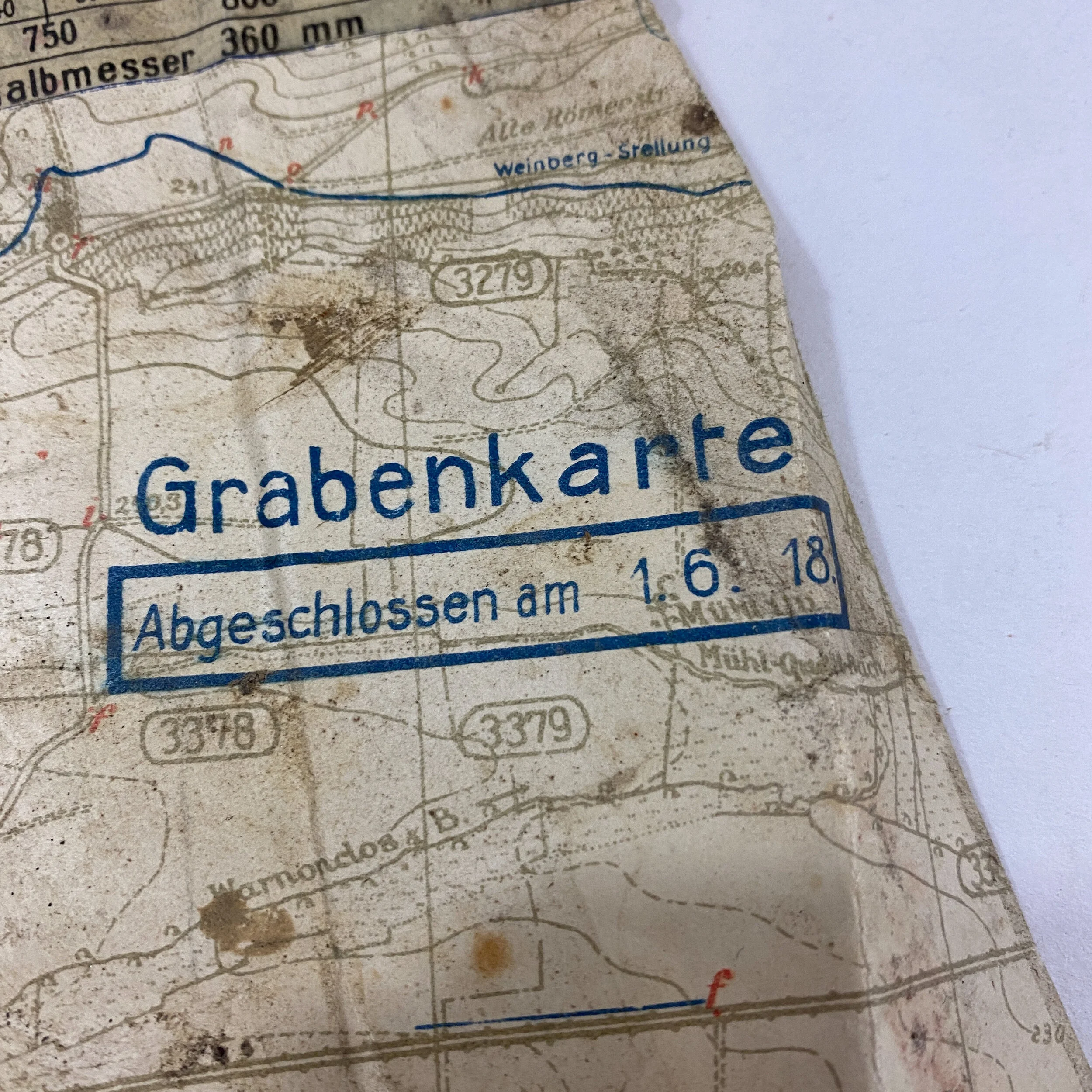
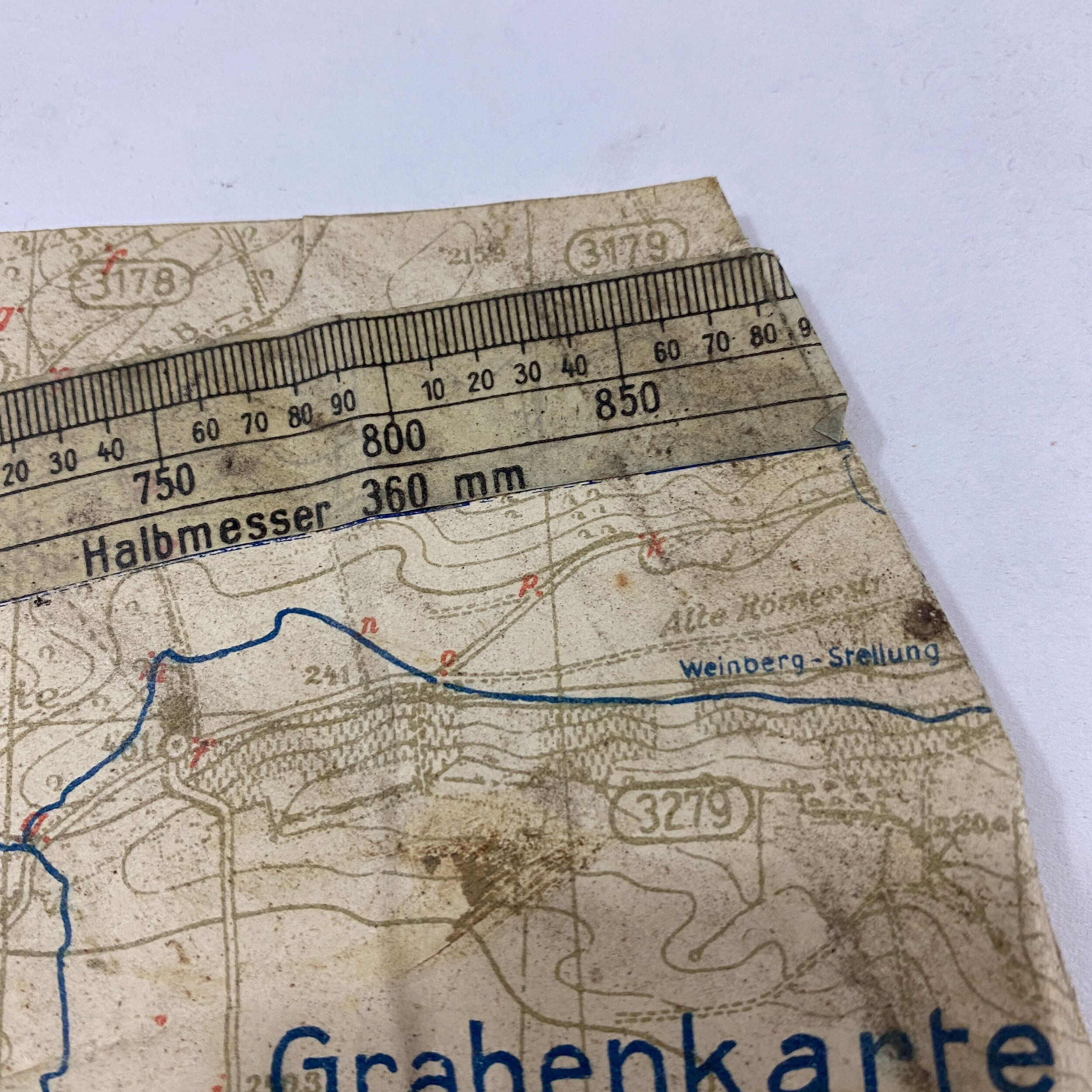
This heavily used and battle-worn section of a German ‘Grabenkarte’ (trench map) is undated as it is only a partial section of an overall German map of the St. Mihiel sector. What makes this map so unique is not only the very intricate blue and red trench markings of the frontline but the custom cut and glued artillery meter arch seen going across the entire map face. This very thin and delicate transparent ruler would have most likely been hand cut by a German artilleryman and taped either as a half circle or full circle around the center German occupied observation post seen in the lower right section of the map with German writing and annotations. This ruled marker is extremely rare as many did not survive as they were very delicate and oftentimes were not directly taped to the map itself. When observing the battlefield from an artillery firing ground or observation post, direct fire and artillery barrages could have been more easily coordinated with the use of this ruler. Left and right swivels of the artillery along with additional math and measurements would aid in quicker and more accurate German barrage fire.
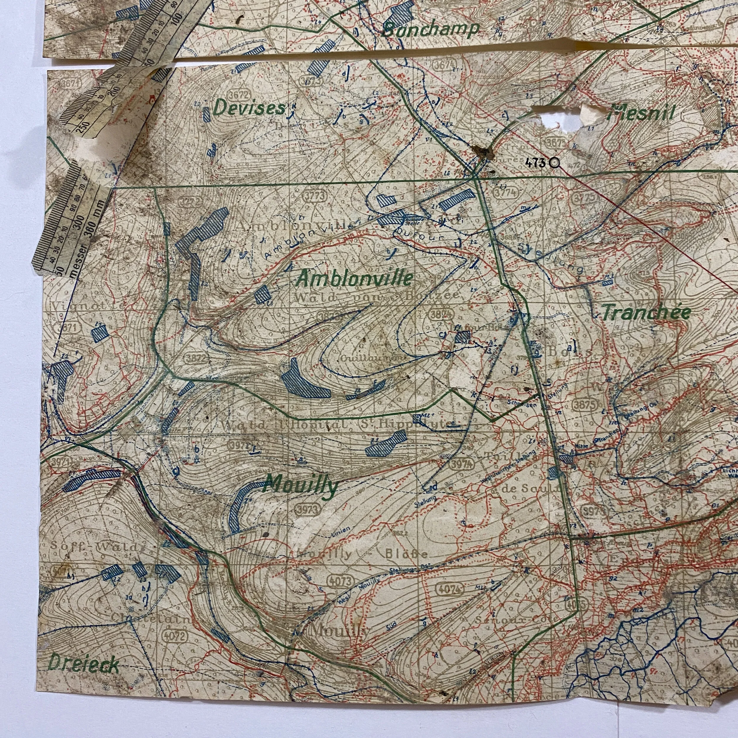
This map shows important villages and landmarks such as Mouilly, Mesnil, Tranchee, Handiomont and many more. This map was used during the St. Mihiel Offensive where the American First Army attack at Saint-Mihiel salient on September 12th of 1918. The attack of 26th Division from the west and 1st Division from the south to close the salient at Vigneulles was a change to the original order, exploiting successes of the first day of battle. This map was a bring back of 1st Lieut.. E. V. McKey Jr. where he and the 134th Field Artillery provided extensive fire support and artillery barrages during the St. Mihiel offensive. While it cannot be fully known if 1st Lieut.. E. V. McKey Jr. picked up and captured this map directly, it was most likely picked up by A.E.F. forces and utilized as an enemy intelligence map and looked at by the 134th Field Artillery Headquarters. Thus being used to aid A.E.F. artillerymen. This map would have never been used as a fire coordinate map by the A.E.F. but rather an intelligence map of the enemy.
Collection: 1st Lieut.. E. V. McKey Jr. and the 134th Field Artillery.
This exclusive collection of World War I maps are from the bring back collection of 1st Lieut. E. V. McKey Jr. who was an A.E.F. artilleryman and saw extensive combat over the course of WWI serving valiantly with the 37th Infantry Division - 62nd Field Artillery Brigade -134th Field Artillery Regiment. The 62d Field Artillery Brigade - 134th Field Artillery is accredited battle participations in the Marbache sector where they provided extensive fire support and artillery barrages during the Meuse-Argonne offensive as well as the Thiaucourt sector during the St. Mihiel offensive. Many of these maps were used directly by 1st Lieut. E. V. McKey Jr. and his men of the 134th Field Artillery as they provided offensive and defensive fire supporting for the Allies with their 75 mm cannons. The 62nd Field Artillery Brigade is one of the most infamous field artillery unit of World War .
The Battle of Saint-Mihiel:
The Battle of Saint-Mihiel was a major World War I battle fought in September of 1918, involving the American Expeditionary Forces (AEF) and 110,000 French troops under the command of General John J. Pershing of the United States against German positions. The U.S. Army Air Service played a significant role in this action. This battle marked the first use of the terms "D-Day" and "H-Hour" by the Americans.
The Saint-Mihiel offensive began on September 12th with a threefold assault on the salient. The main attack was made against the south face by two American corps. On the right was the I Corps (from right to left the 82nd, 90th, 5th, and 2nd Divisions in line with the 78th in reserve) covering a front from Pont-à-Mousson on the Moselle west toward Limey; on the left, the IV Corps (from right to left the 89th, 42d, and 1st Divisions in line with the 3rd in reserve) extending along a front from Limey west toward Marvoisin. A secondary thrust was carried out against the west face along the heights of the Meuse, from Mouilly north to Haudimont, by the V Corps (from right to left the 26th Division, the French 15th Colonial Division, and the 8th Brigade, 4th Division in line with the rest of the 4th in reserve). A holding attack against the apex, to keep the enemy in the salient, was made by the French II Colonial Corps (from right to left the French 39th Colonial Division, the French 26th Division, and the French 2nd Cavalry Division in line). In First Army reserve were the American 35th, 80th, and 91st Divisions.
The American V Corps location was at the northwestern vertices, the II French Colonial Corps at the southern apex, and the American IV and I Corps at the southeastern vertices of the salient. Furthermore, General Pershing's intent was obvious; to envelop the salient by using the main enveloping thrusts of the attack against the weak vertices. The remaining forces would then advance on a broad front toward Metz. This pincer action, by the IV and V Corps, was to drive the attack into the salient and to link the friendly forces at the French village of Vigneulles, while the II French Colonial Corps kept the remaining Germans tied down. The French II Colonial Corps were successful in the attack on the apex and entered Saint-Mihiel on 15 September 1918, taking 4000 prisoners. They then pushed into the plain of Woëvre up to Haumont-Woël-Doncourt.
The Allies mobilized 1,481 aircraft to provide air superiority and close air support over the front. About 40% were American-flown in American units, the remainder were British, French, and Italian. Nine bomber squadrons of the British RAF, although provided for the battle, were not under Pershing's operational control.
Defending the salient was German "Army Detachment C", consisting of eight divisions and a brigade in the line and about two divisions in reserve. Now desperately short of manpower, they had begun a step-by-step withdrawal from the salient only the day before the offensive began.
Pershing's plan had tanks supporting the advancing infantry, with two tank companies interspersed into a depth of at least three lines, and a third tank company in reserve. The result of the detailed planning was an almost unopposed assault into the salient.[15][failed verification] The American I Corps reached its first day's objective before noon, and the second day's objective by late afternoon of the second. The attack went so well on 12 September that Pershing ordered a speedup in the offensive. By the morning of 13 September, the 1st Division, advancing from the east, joined up with the 26th Division, moving in from the west, and before evening all objectives in the salient had been captured. At this point, Pershing halted further advances so that American units could be withdrawn for the coming Meuse-Argonne Offensive.