EXTREMELY RARE! WWII DECEMBER 19th, 1944 Battle of the Bulge Bastogne Field Printed Day-By-Day Combat Situation Map (Colonel Wade C. Gatchell - 10th Armored Division)


EXTREMELY RARE! WWII DECEMBER 19th, 1944 Battle of the Bulge Bastogne Field Printed Day-By-Day Combat Situation Map (Colonel Wade C. Gatchell - 10th Armored Division)
Comes with a hand-signed C.O.A.
Size: 18 × 20 inches
Rarity: EXTREMELY RARE
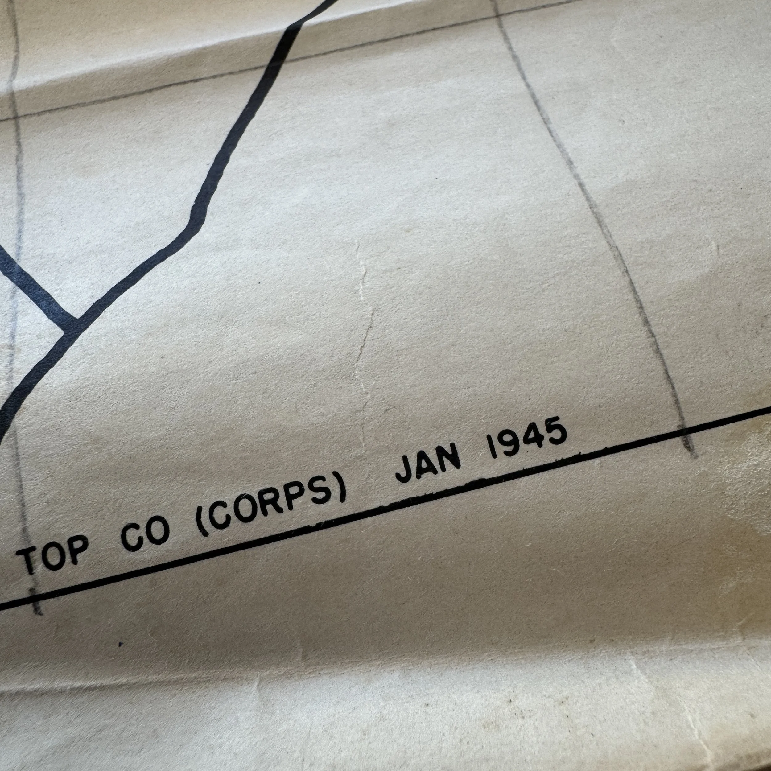
Dated: January 1945 - ETO Field Printed Only Within 5 Weeks Following the Battle of Bastogne
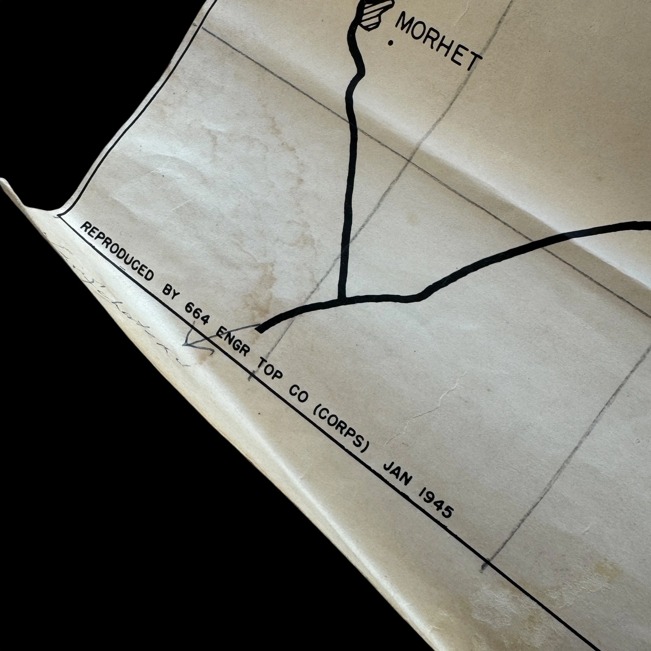
Created: 664th Engineer Topographic Corps, a unit attached to General George S. Patton’s Third Army
Providence: From the direct collection of Colonel Wade C. Gatchell, who served as the Commanding Officer of the Reserve Command, 10th Armored Division (the famed “Tiger Division”)
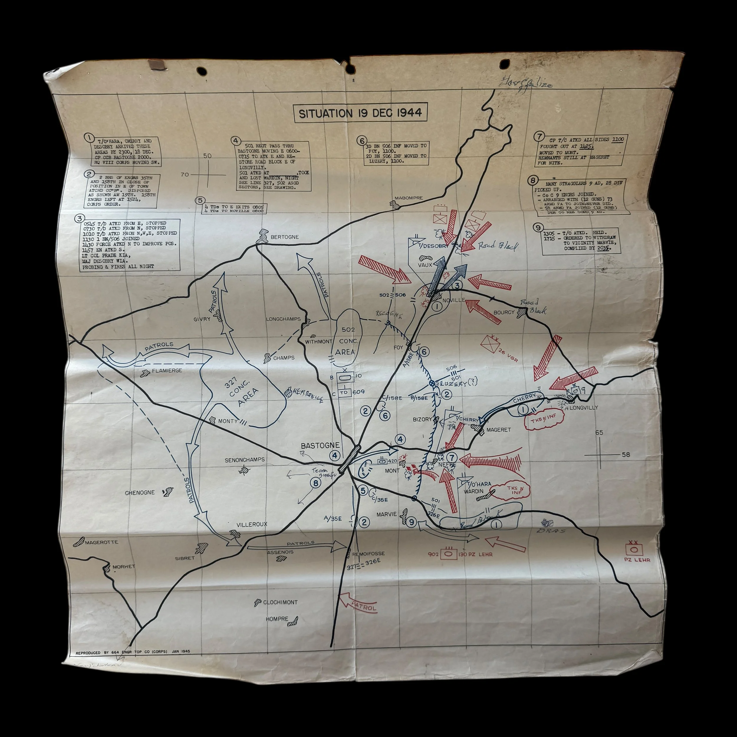
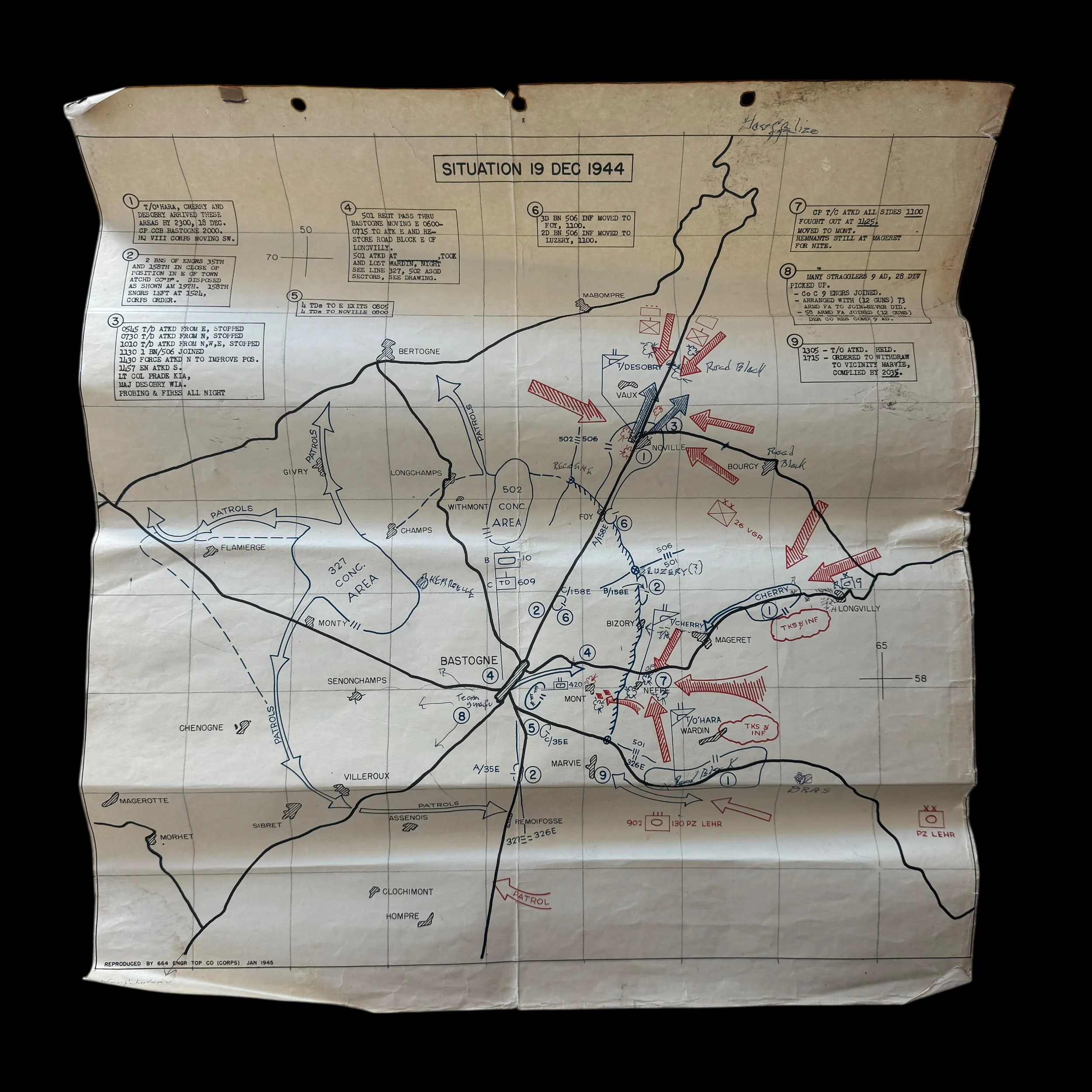
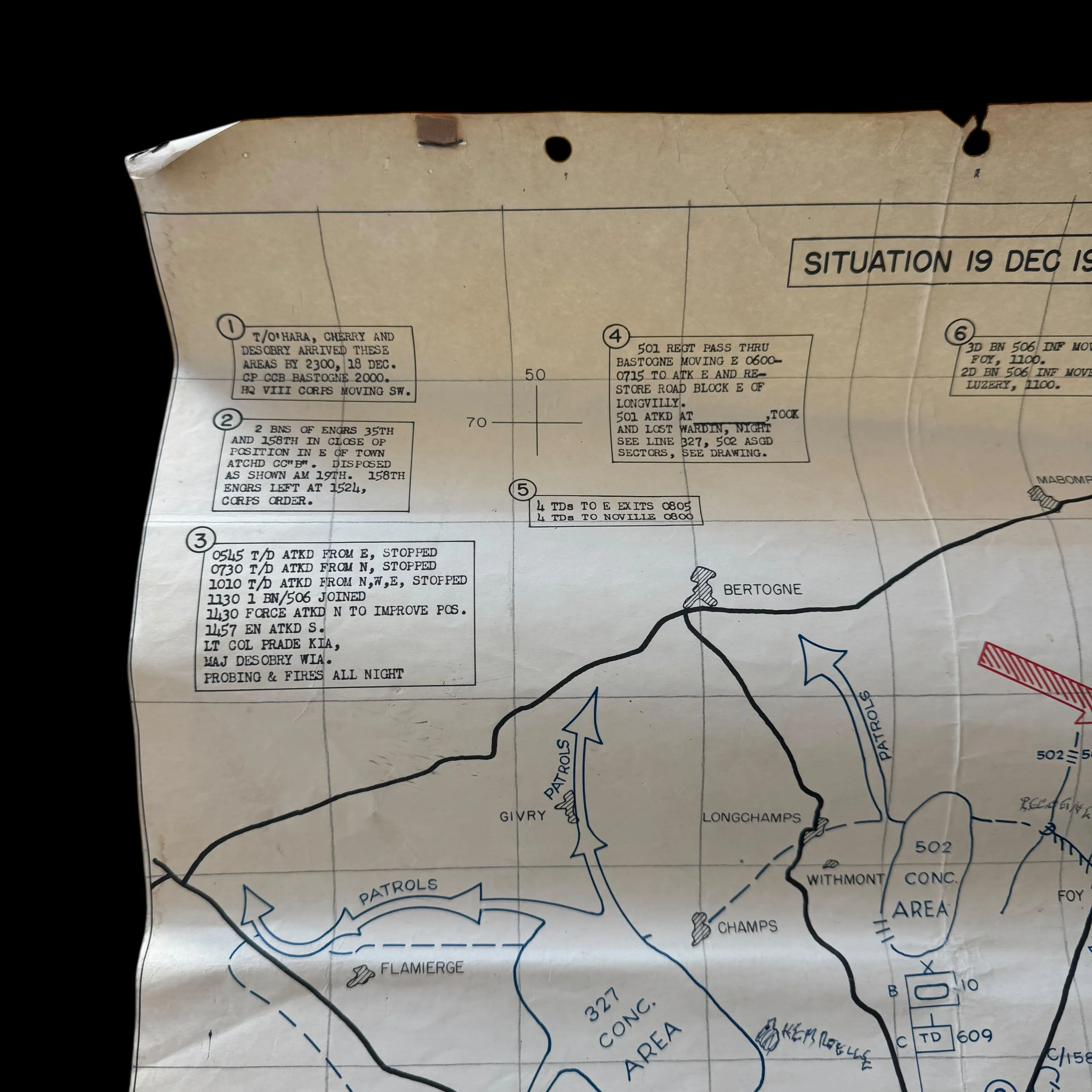
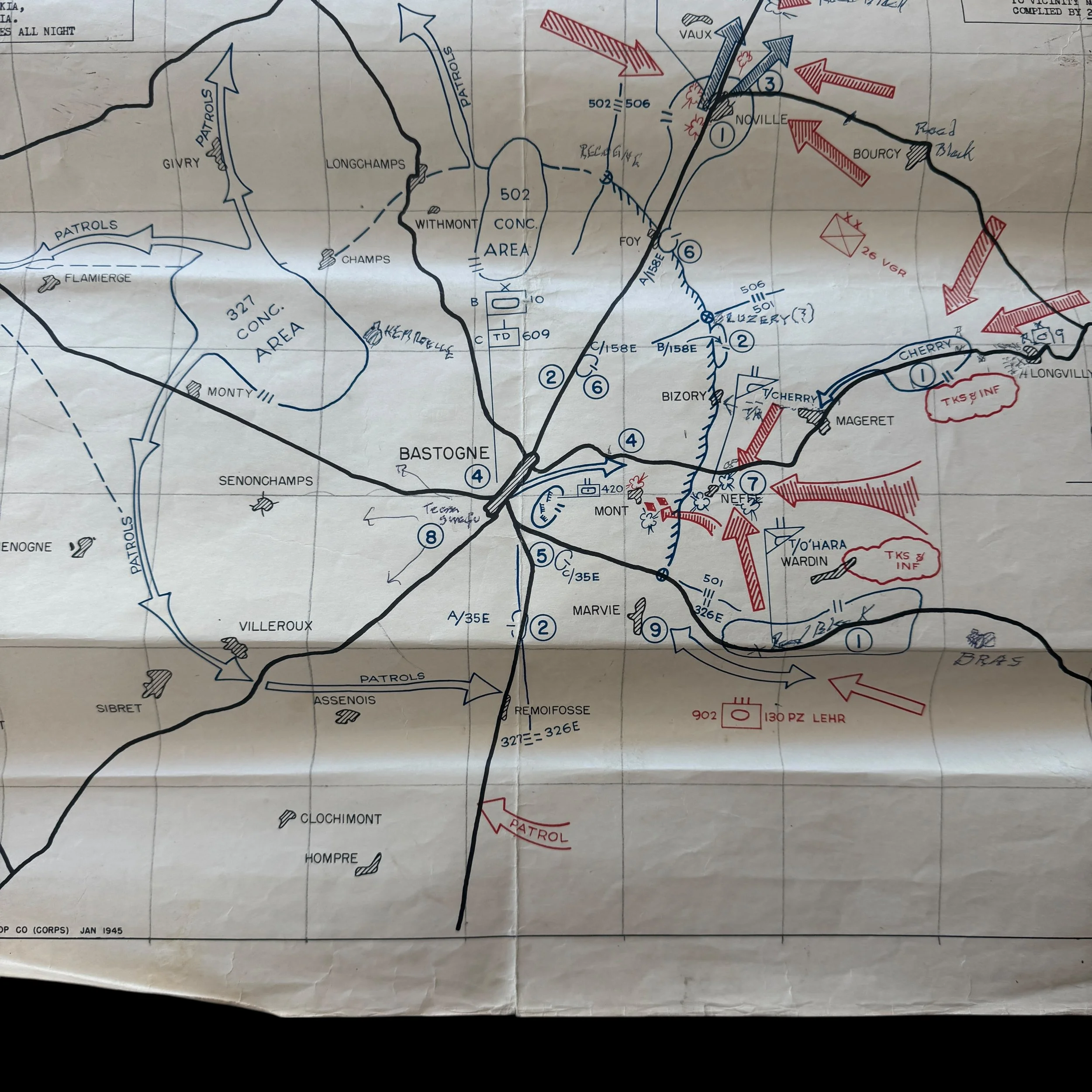
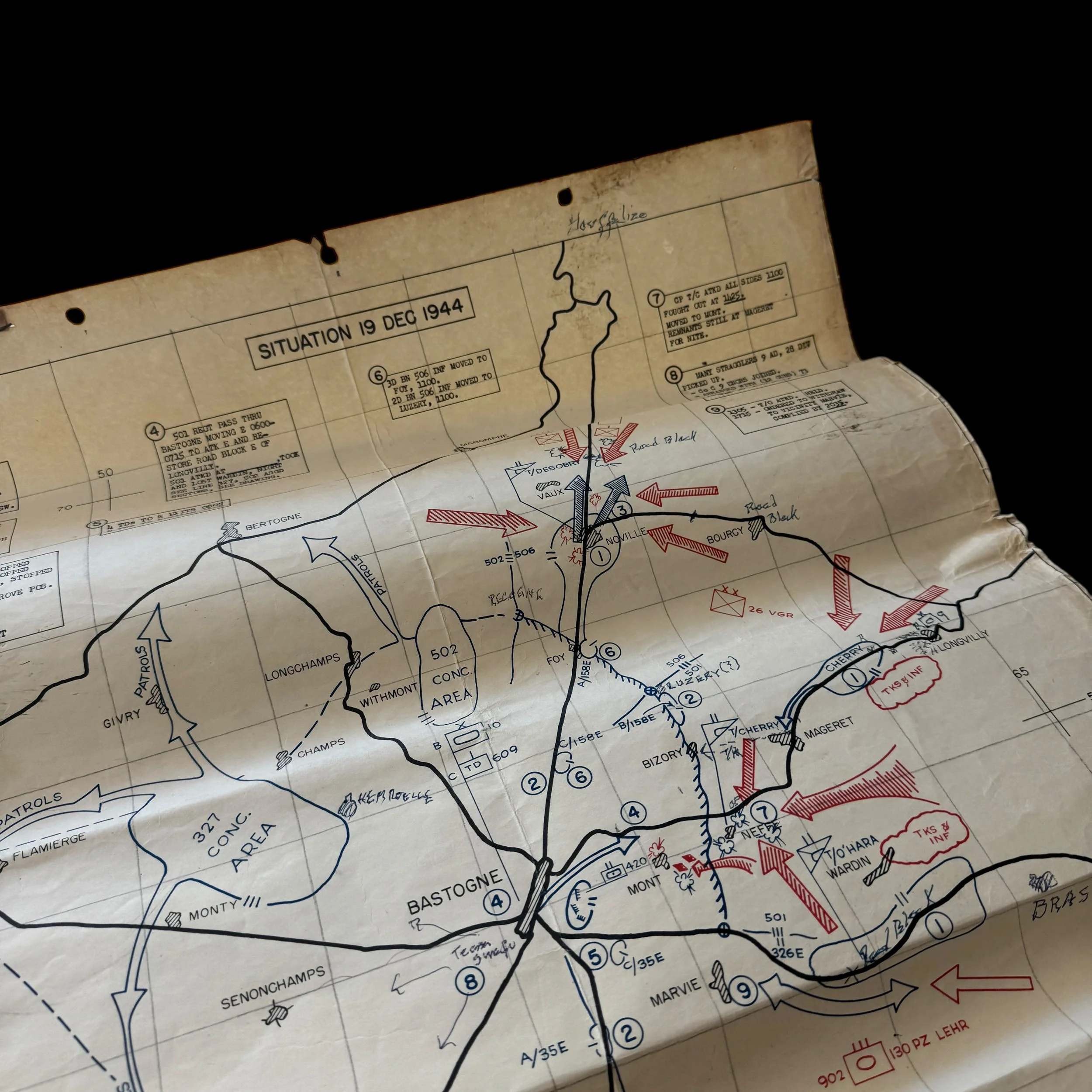
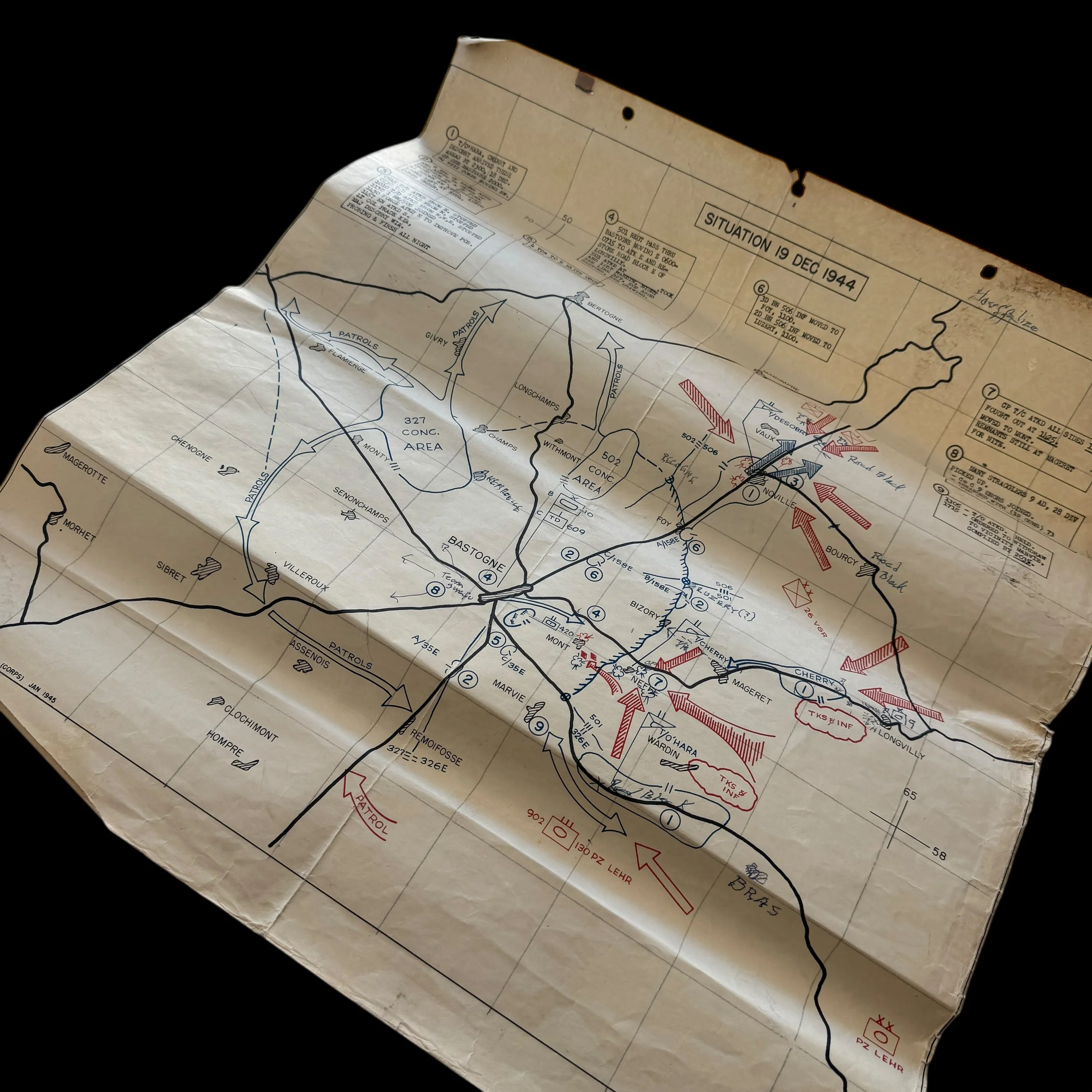
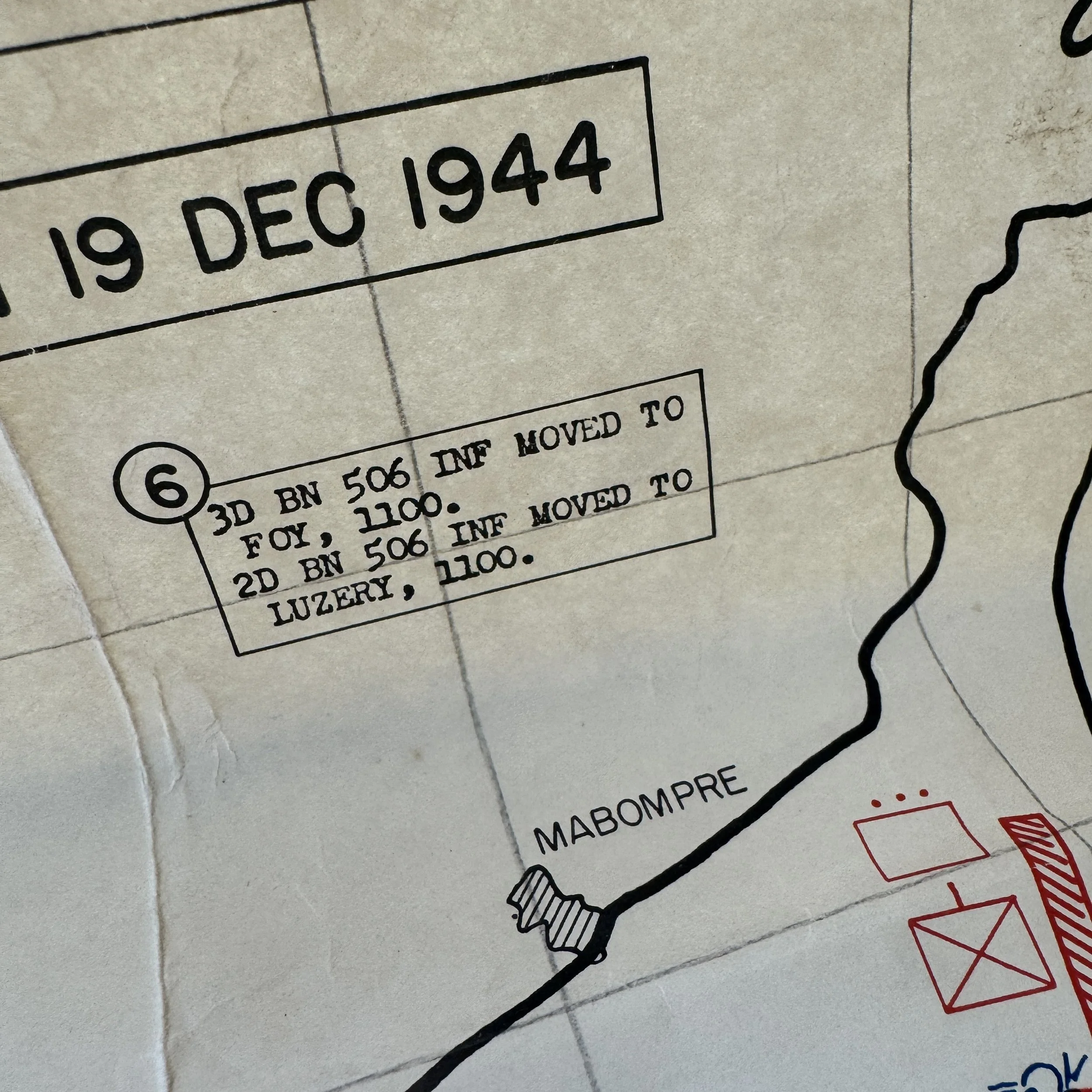
December 19th, 1944
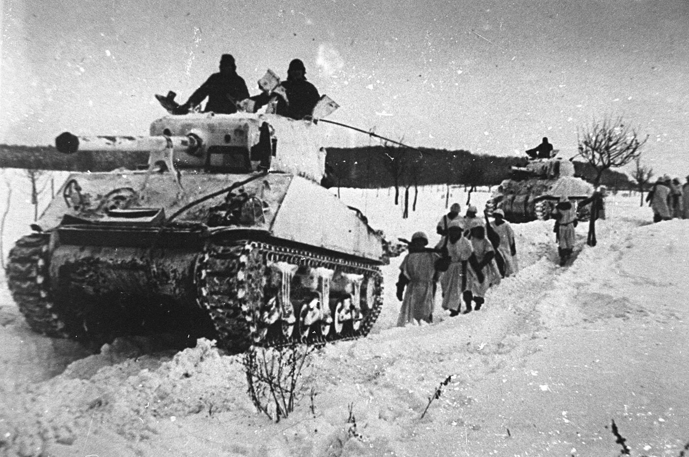
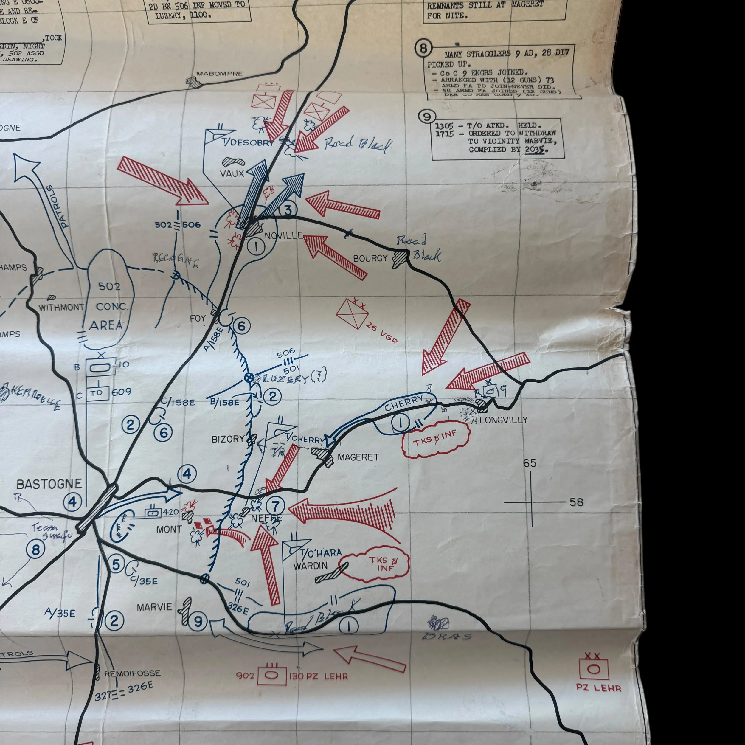
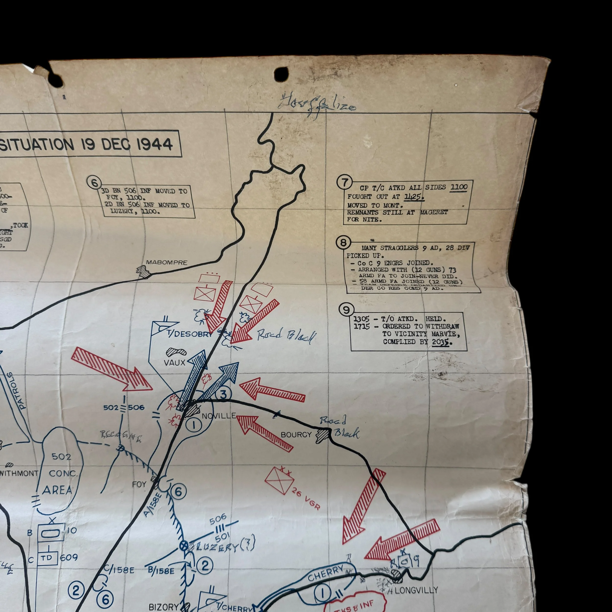
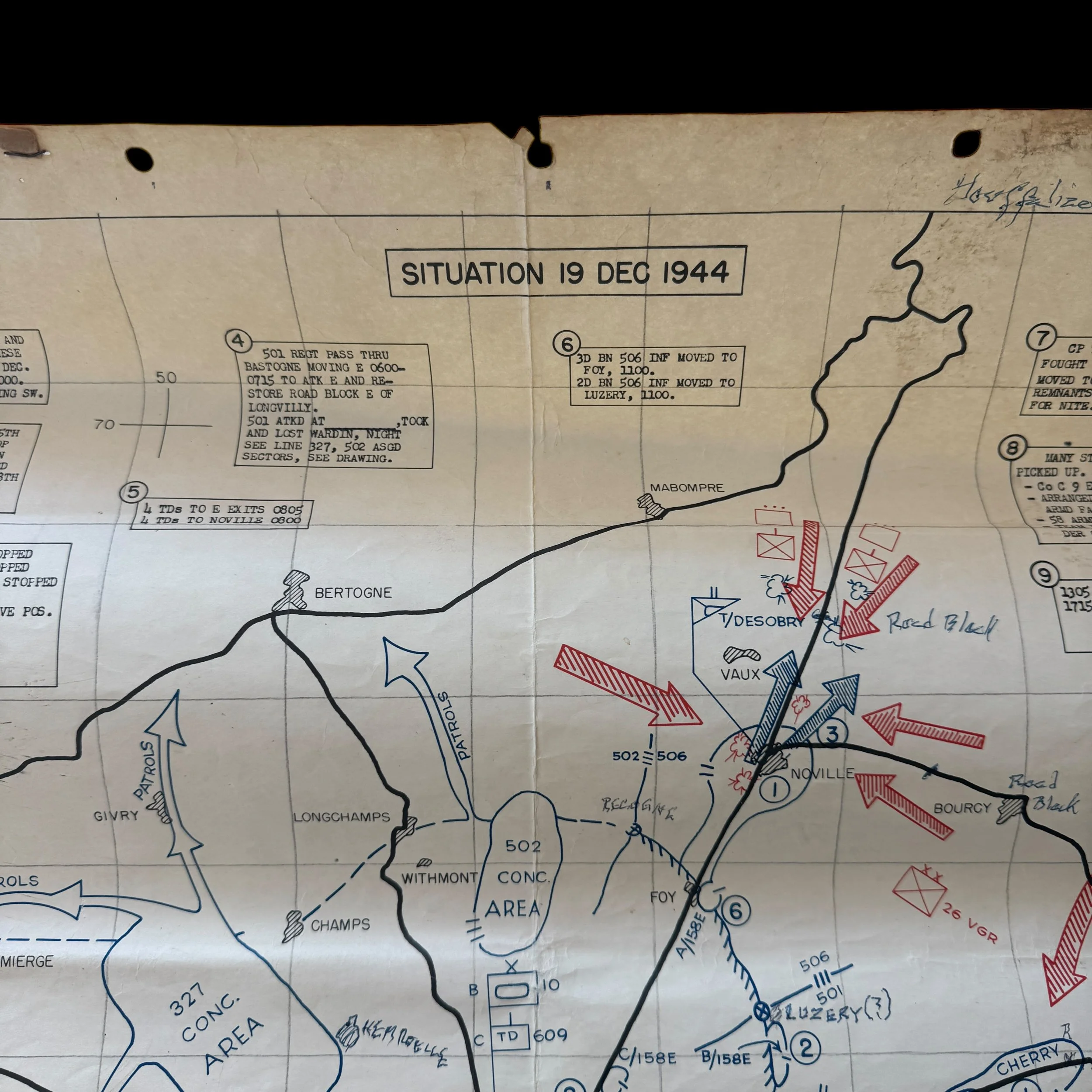
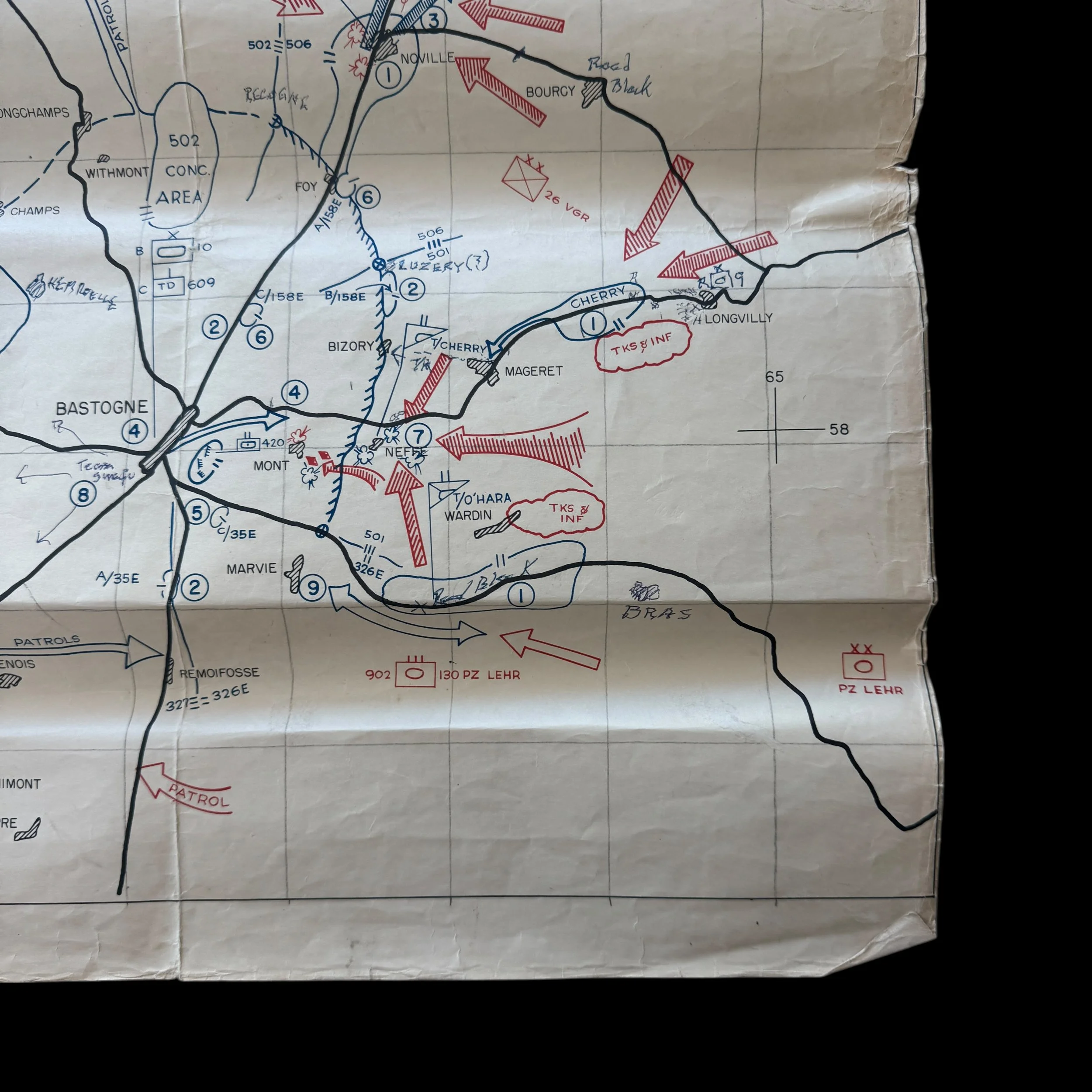
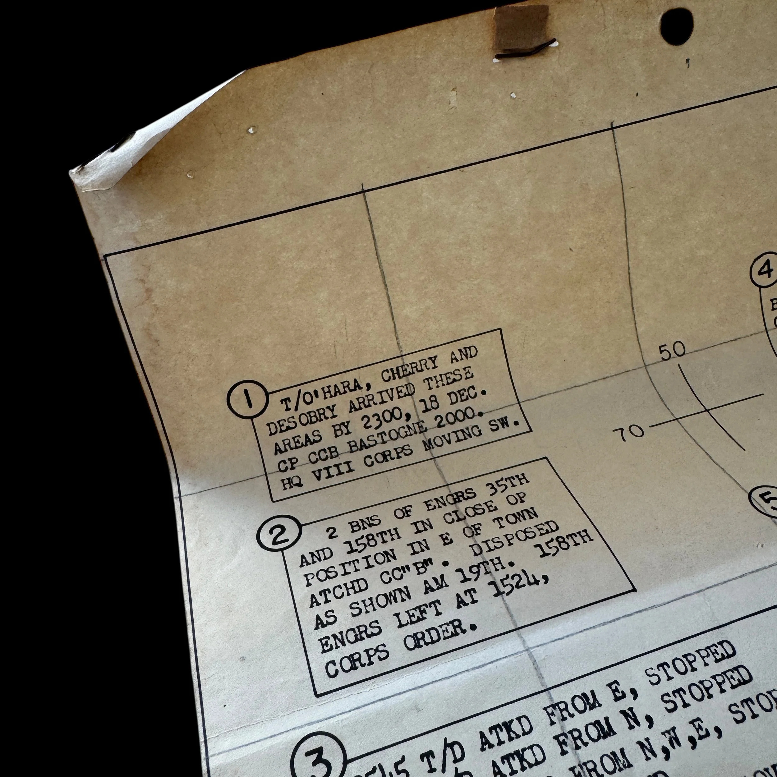
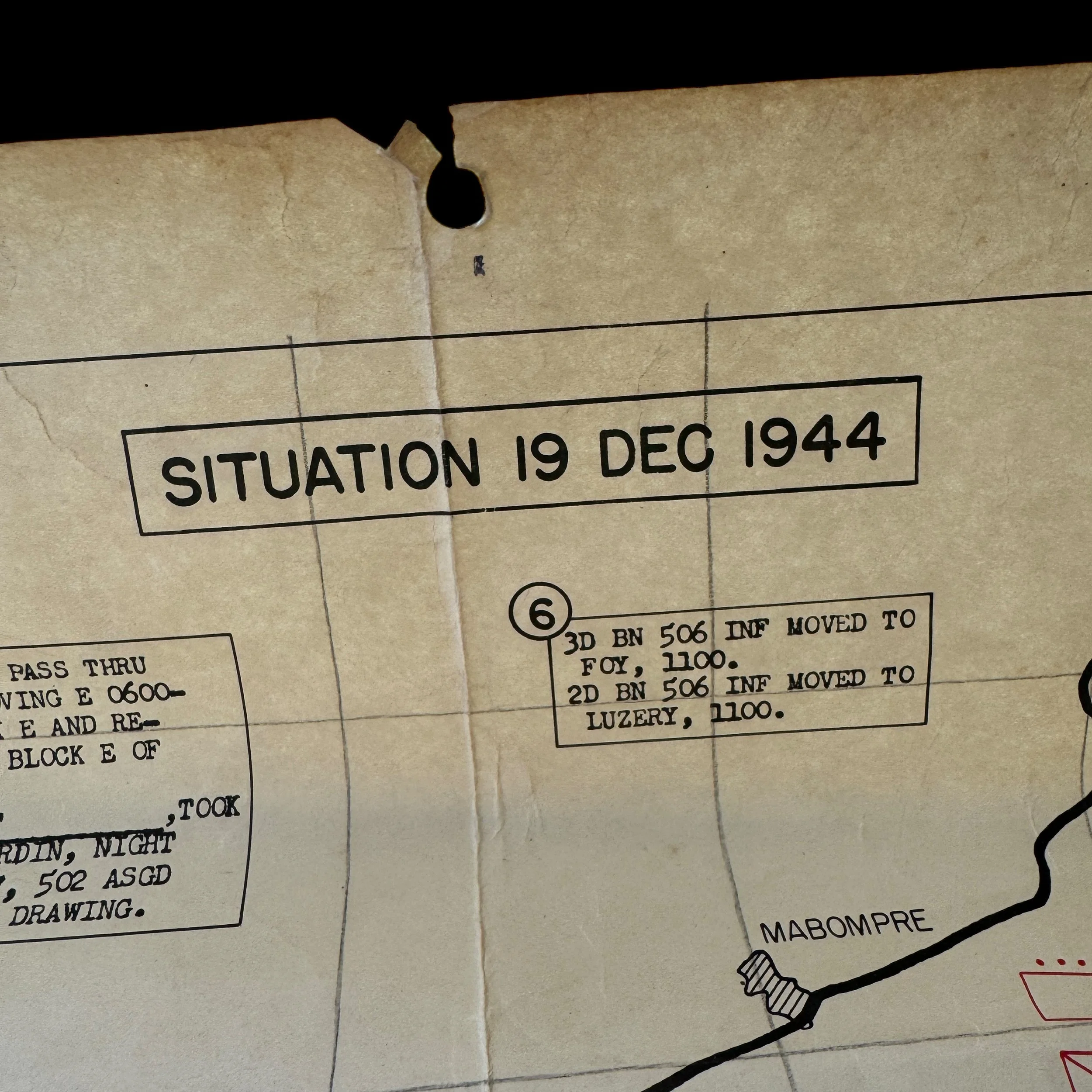
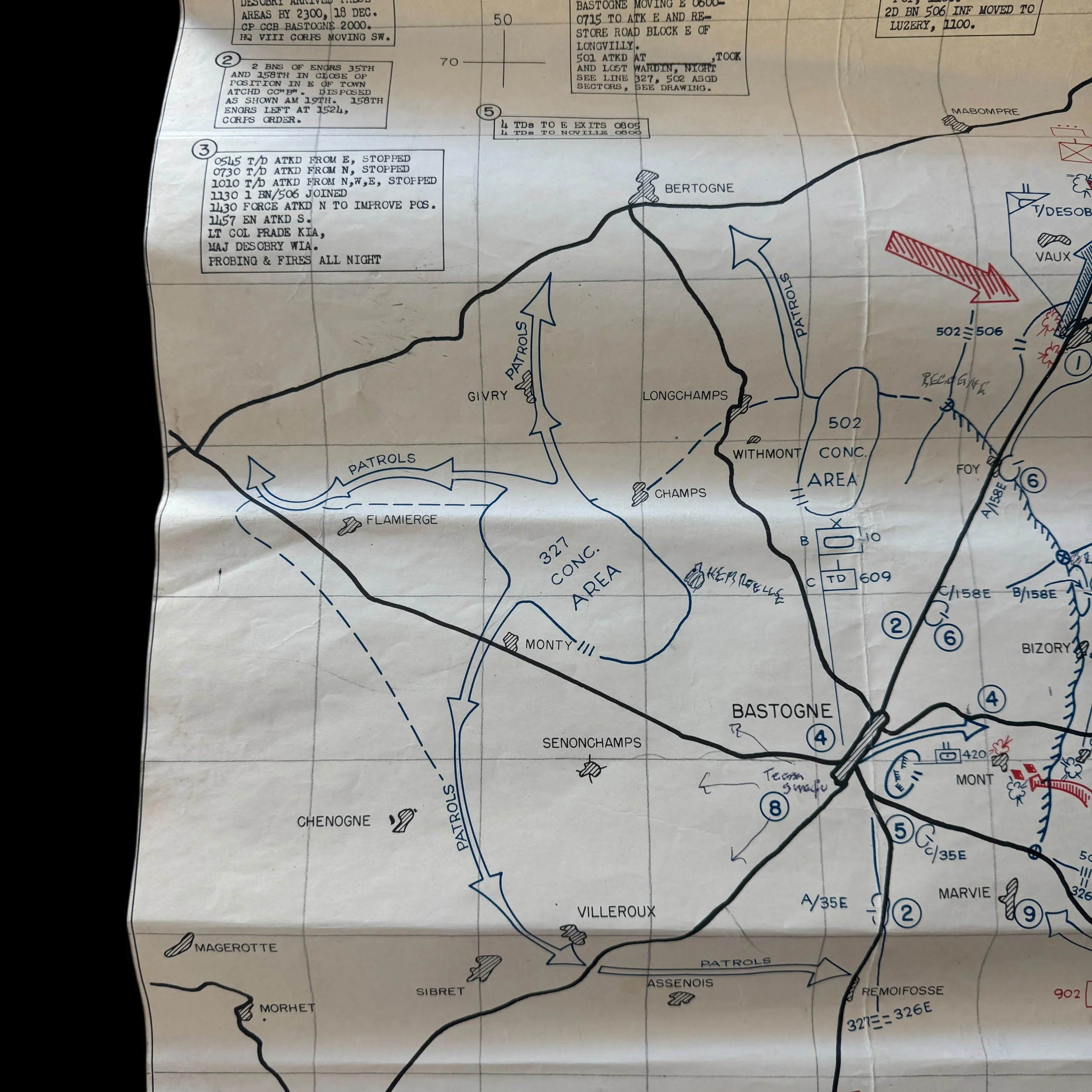
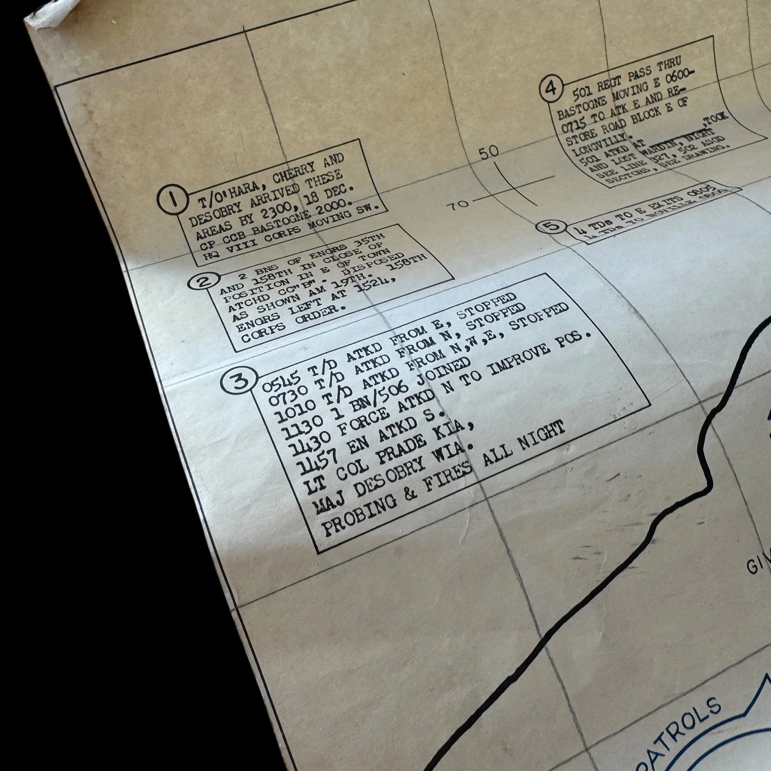
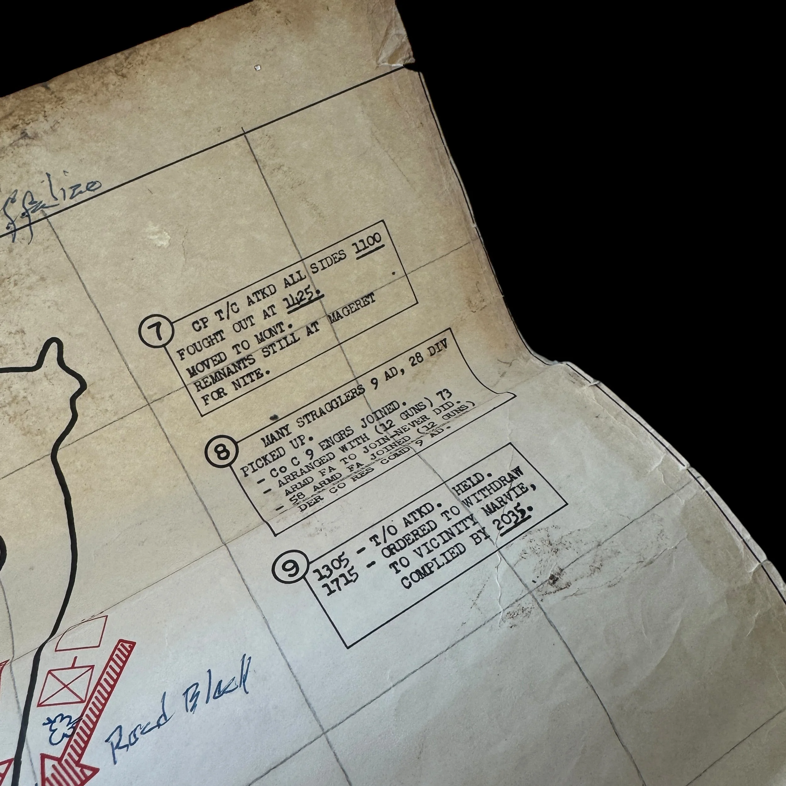
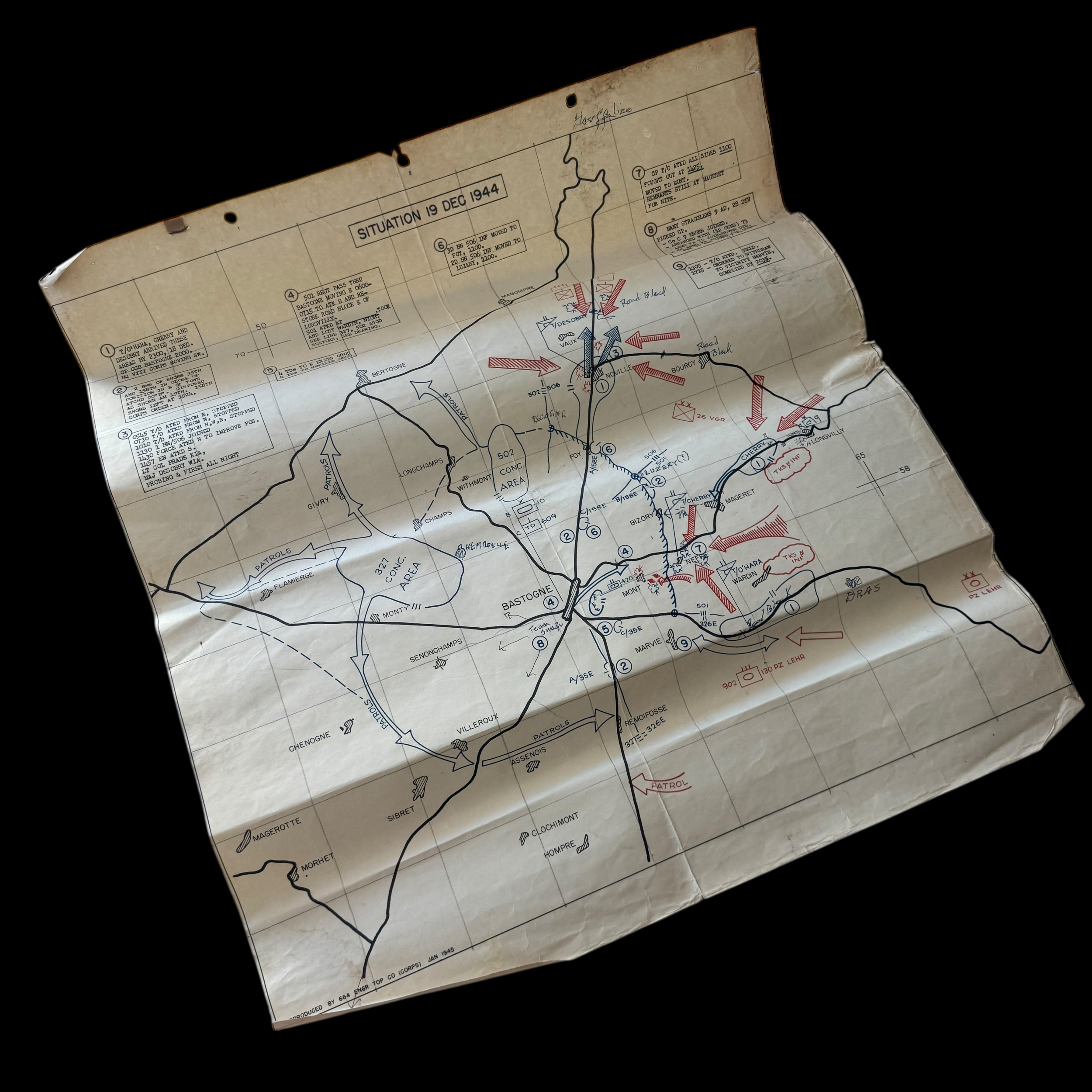
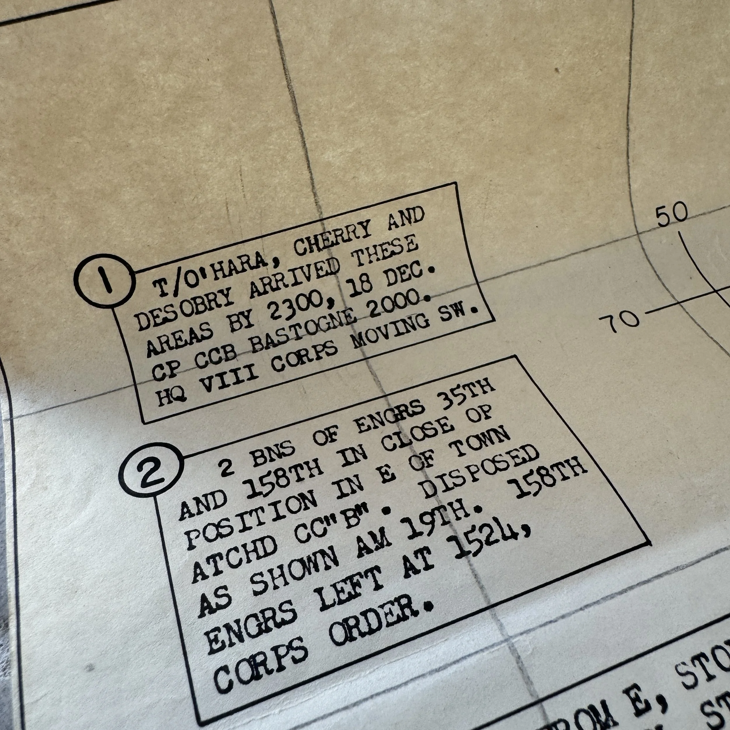
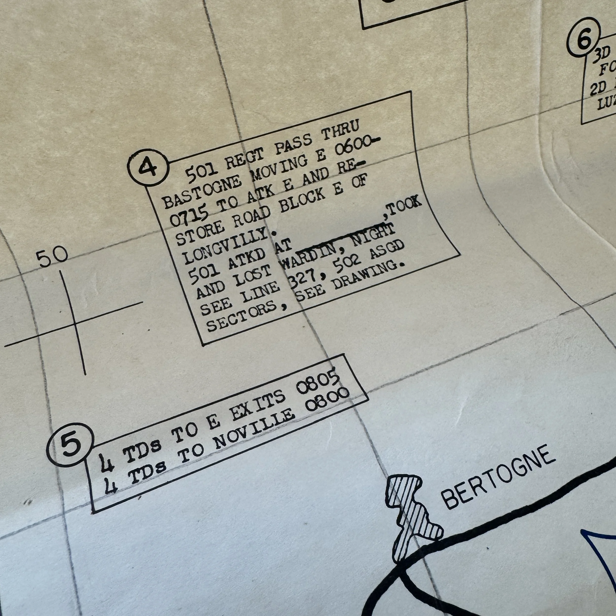
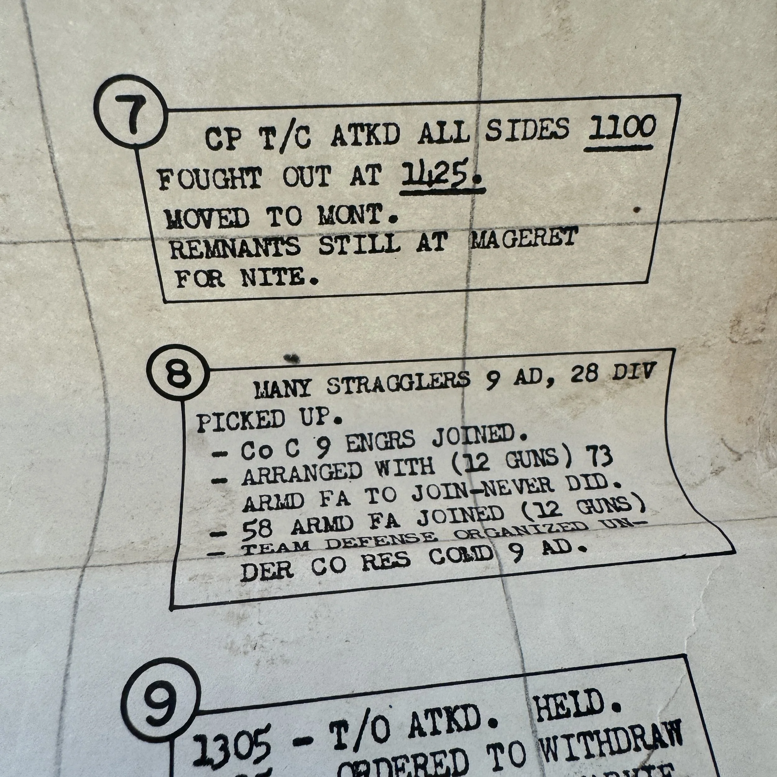
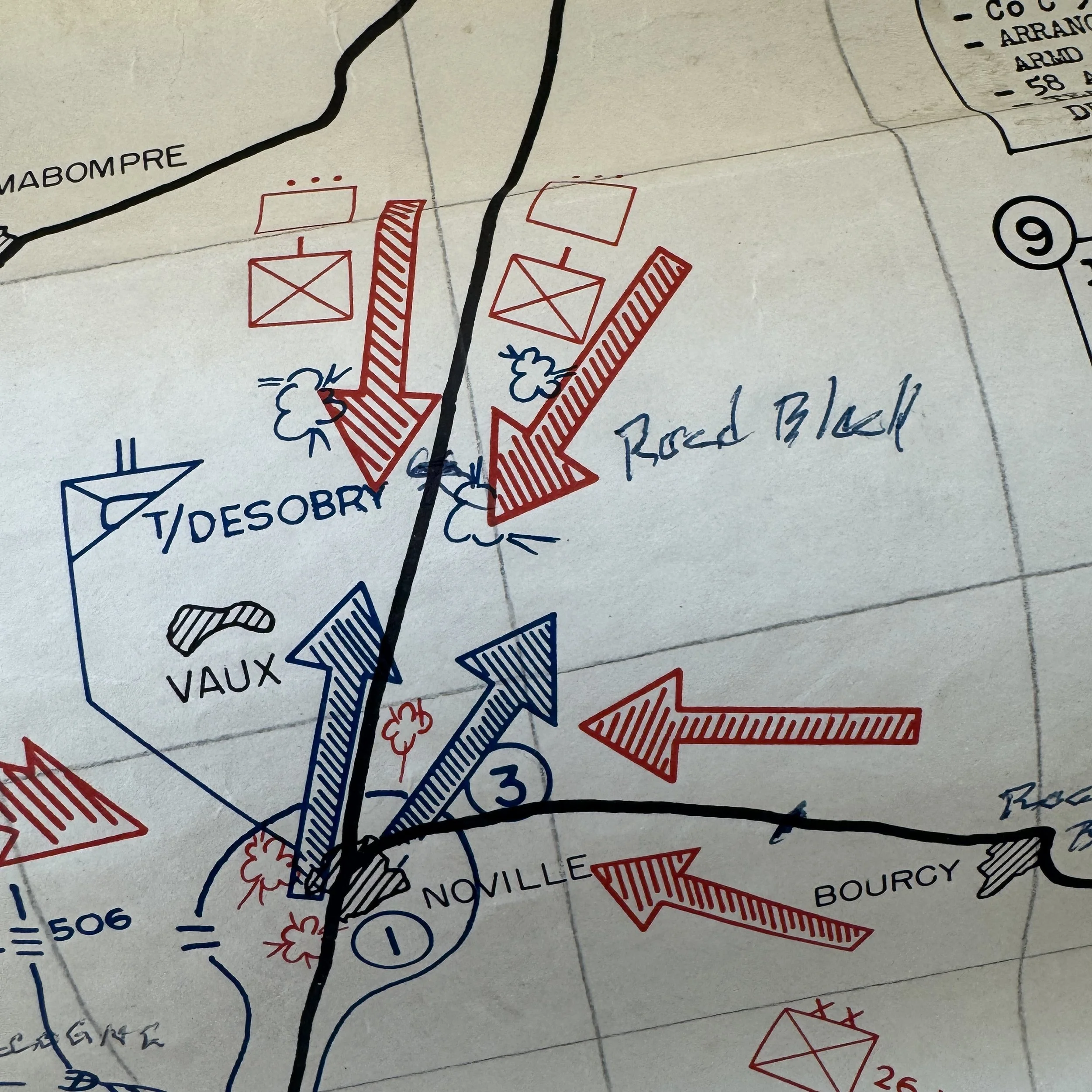
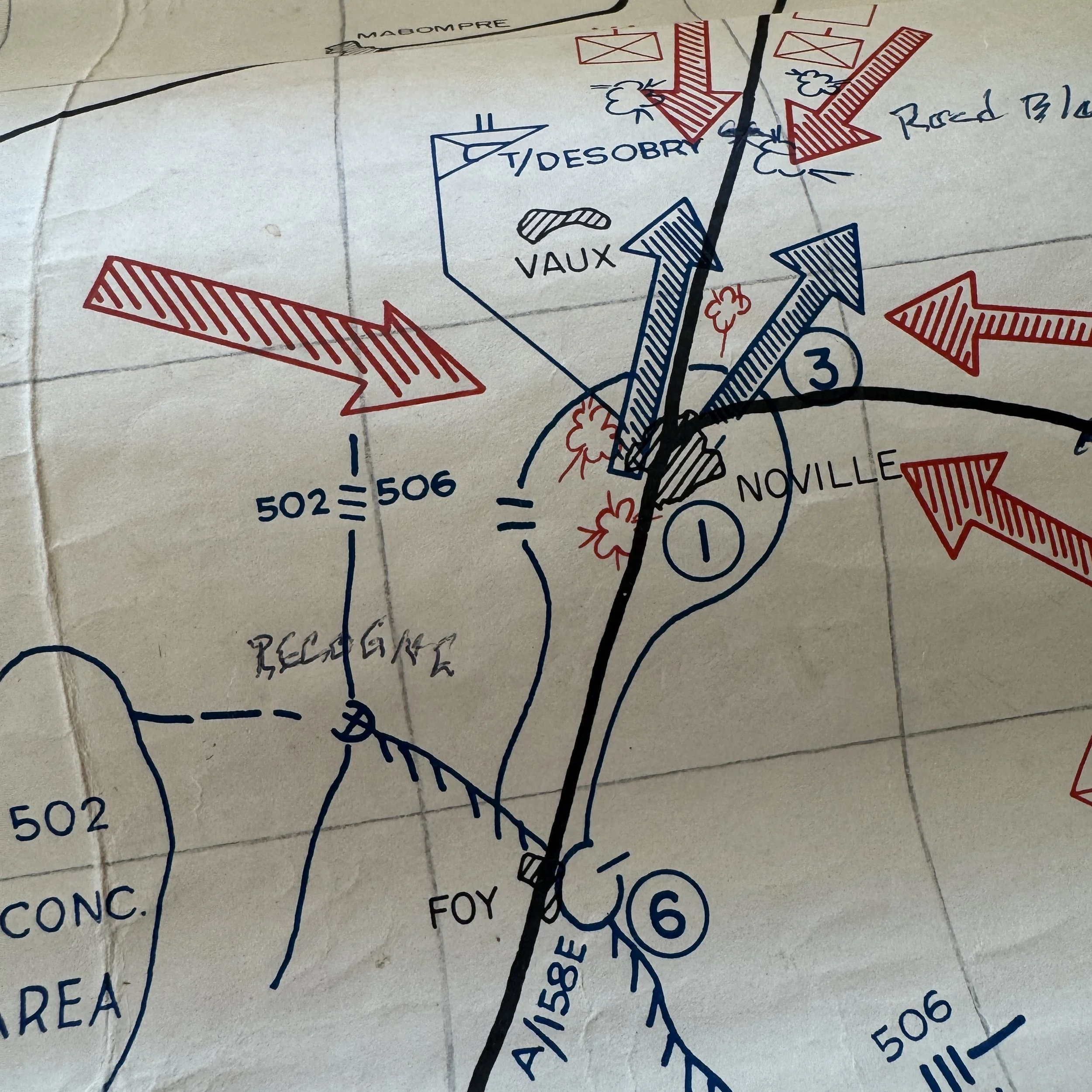
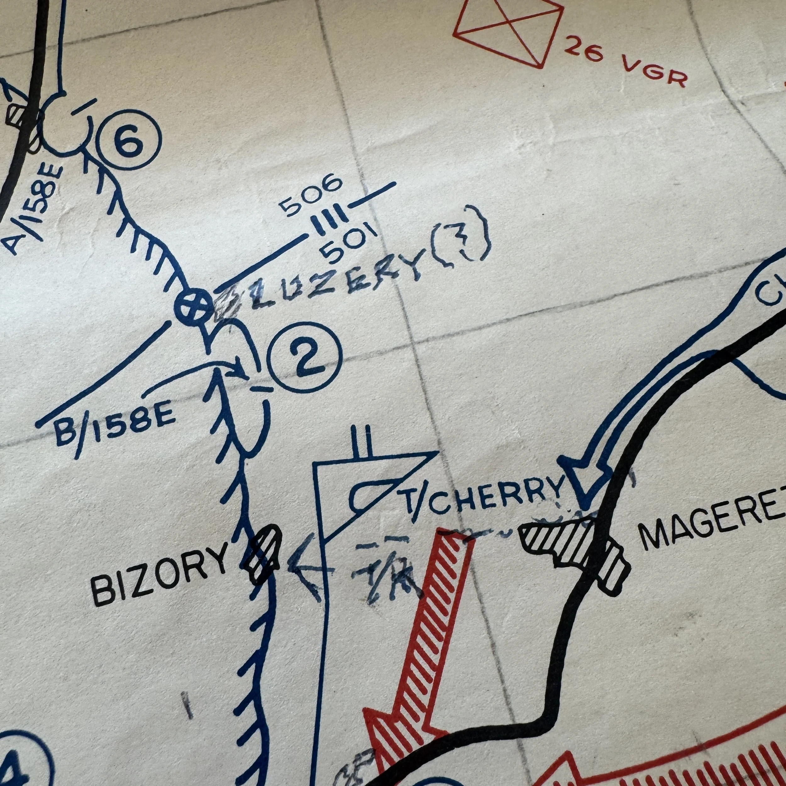
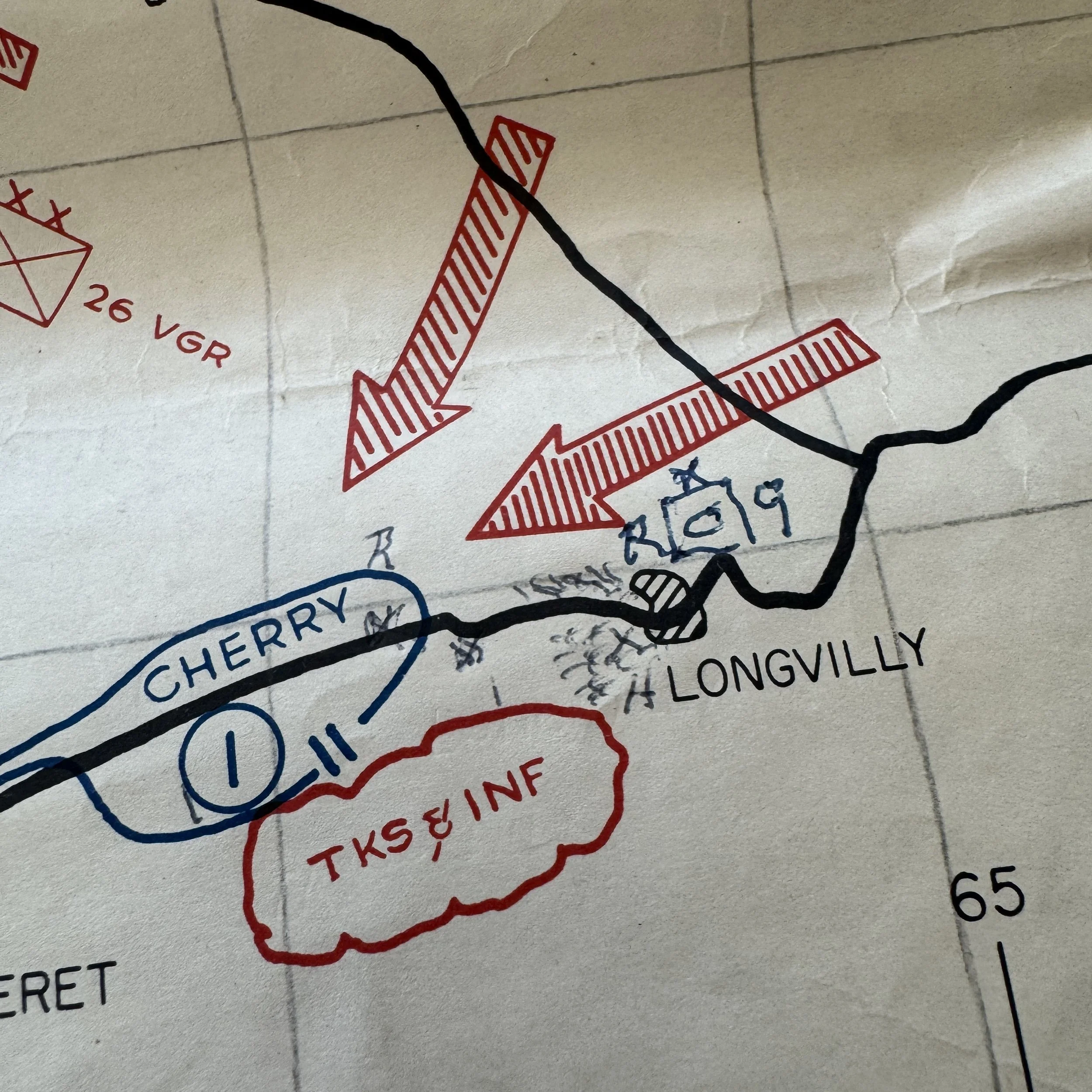
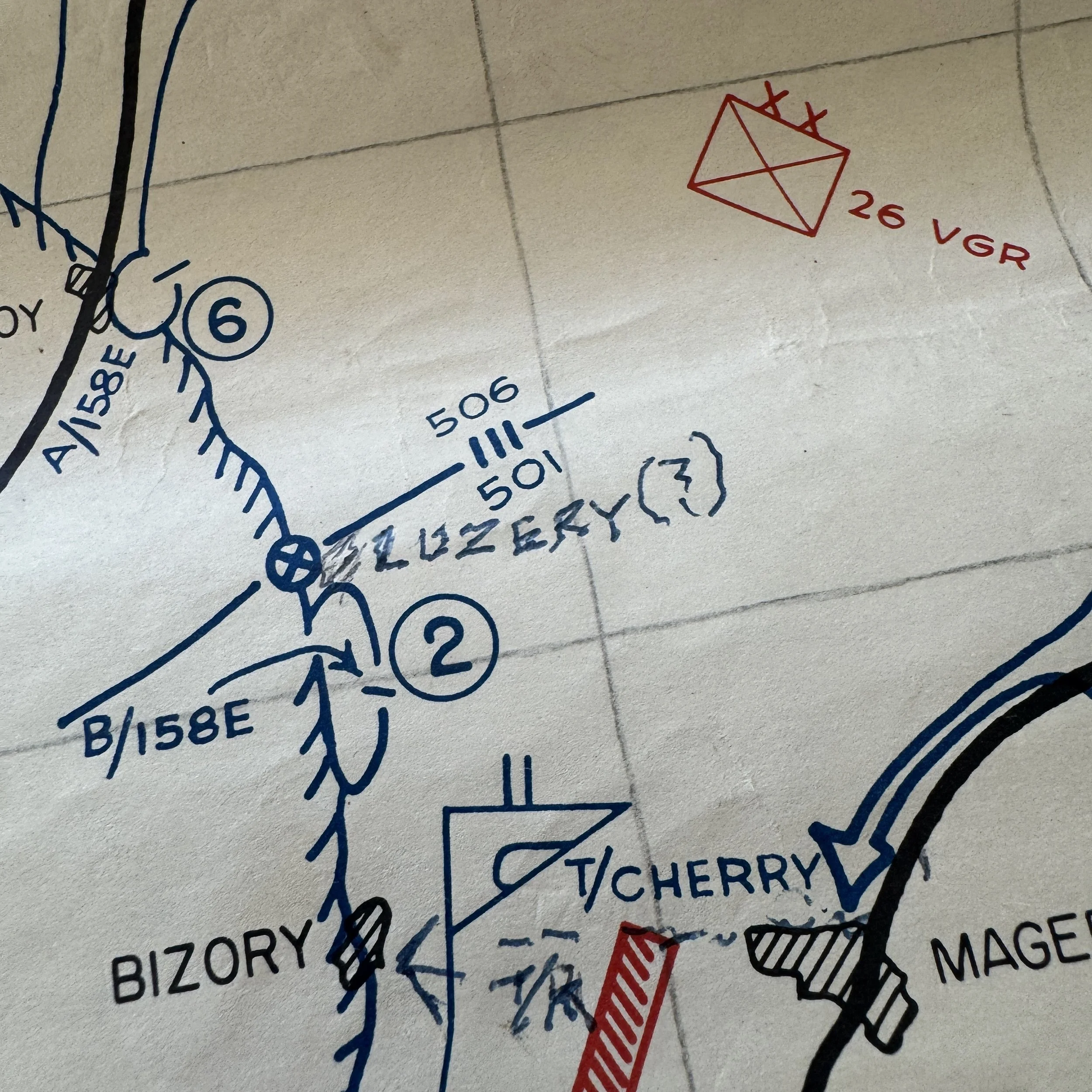
On December 19, 1944, the situation around Bastogne grew increasingly desperate as German armored columns pressed in from multiple directions in their attempt to seize the vital crossroads town. That morning, Combat Command B of the 10th Armored Division, under Colonel William L. Roberts, was ordered north by General George S. Patton’s Third Army to reinforce the collapsing lines around Bastogne. Arriving after a forced march through snow and freezing conditions, the 10th Armored swiftly deployed its task forces—Boone, O’Hara, and Cherry—into defensive positions surrounding key approaches at Noville, Longvilly, and Neffe. There they encountered the leading elements of the German 2nd Panzer and Panzer Lehr Divisions. The Americans fought fiercely to delay the enemy advance, trading ground for time while the 101st Airborne Division moved in to fortify the town itself. By nightfall, German armor was pressing hard against every route into Bastogne, yet the 10th Armored’s tanks and infantry, though outnumbered and under relentless artillery and small-arms fire, managed to hold long enough to prevent the enemy from encircling the town completely. Their stand on December 19 laid the foundation for Bastogne’s eventual defense, transforming the crossroads into the linchpin of the Allied resistance during the Battle of the Bulge.
This exceptionally rare and museum-grade World War II artifact is an original January 1945 Battle of the Bulge day-by-day combat situation map, printed by the 664th Engineer Topographic Corps, a unit attached to General George S. Patton’s Third Army. Created within weeks following the Battle of Bastogne, this field printed combat situation map represent an extraordinary feat of wartime cartography. To compile, design, and print such a detailed document amid the chaos of the Ardennes campaign demonstrates the precision and urgency of Patton’s engineers. Only a small batch of these Battle of the Bulge (Bastogne) situations maps were ever made, and even fewer have survived. They were printed in-theater in limited numbers for the highest-ranking commanders overseeing major infantry and armored divisions during one of the most pivotal engagements of the war.
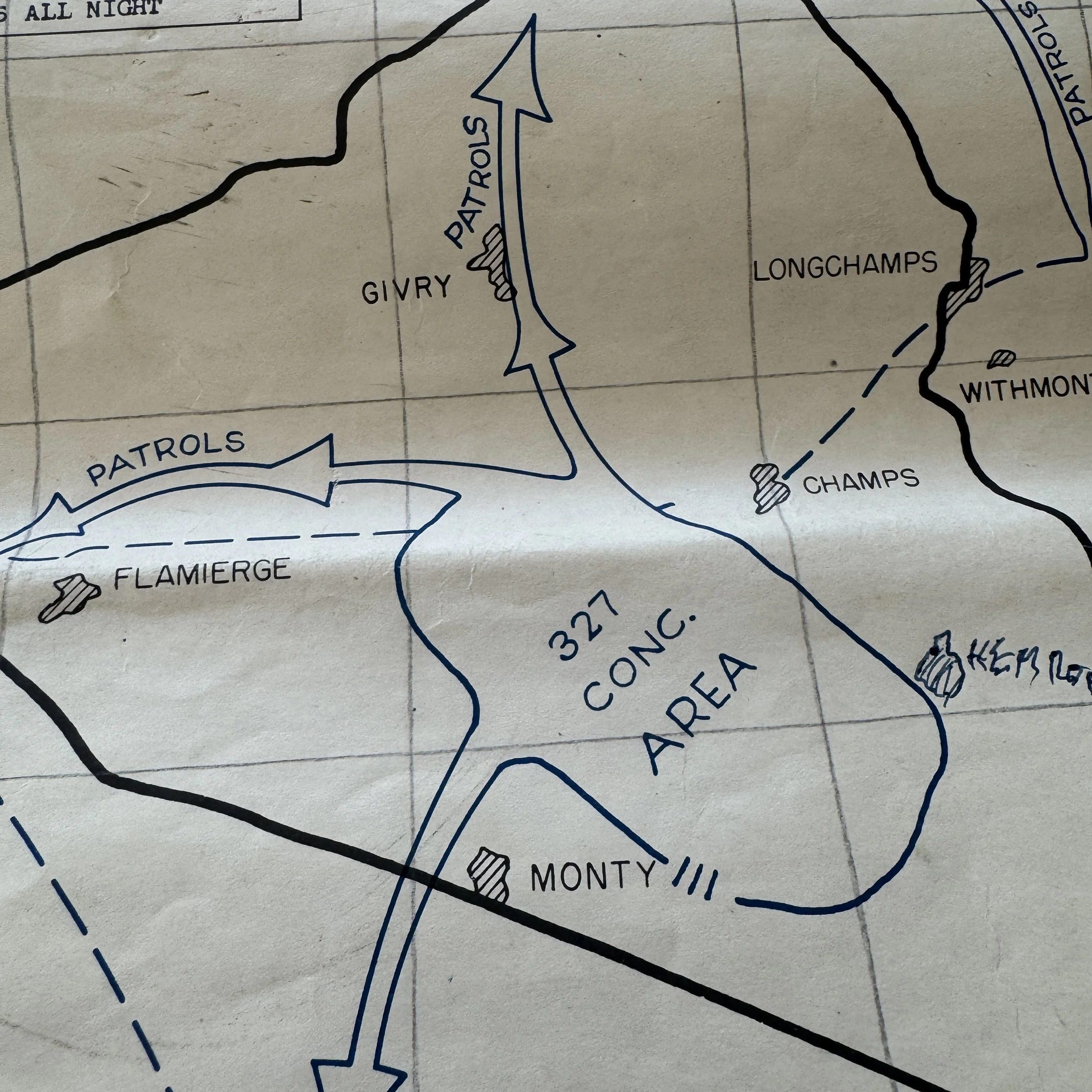
Meant to accompany the SECRET military intelligence Battle of the Bulge battle reports, this map itself captures the fierce day-by-day progression of the Battle of Bastogne, showcasing troop movements, front-line shifts, and critical engagements as they unfolded in the bitter winter of 1944–1945. Its intricate blend of technical military detail and battlefield illustration makes it one of the finest surviving examples of U.S. Army cartographic intelligence from the European Theater.
What elevates this particular map above all others is its direct provenance from the personal collection of Colonel Wade C. Gatchell, who served as the Commanding Officer of the Reserve Command, 10th Armored Division—the famed “Tiger Division.” The 10th Armored Division was resting south of Luxembourg when, on December 16, 1944, Germany launched the Ardennes Offensive. Within hours, the division was ordered north to reinforce the besieged crossroads town of Bastogne, a move that would cement its place in history.
The 10th Armored’s Combat Command B (CCB) was among the first American units to reach Bastogne. Under Colonel William L. Roberts, its tanks, tank destroyers, and infantry elements rushed into the surrounding villages of Noville, Longvilly, and Neffe, where they met the full weight of the advancing German panzer divisions. For days, they fought a desperate delaying action, buying the time needed for the 101st Airborne Division to arrive and establish a full defensive perimeter. The 10th Armored’s stand at these outlying positions, often overlooked in popular retellings, was instrumental in halting the German spearhead and ensuring Bastogne remained in American hands until Patton’s relief forces broke through.
Colonel Gatchell’s command played a key role in coordinating the division’s reserves and maintaining communication lines between the various combat commands, ensuring the division could sustain its defense under constant attack. This map, once in his possession, likely served as both a reference and a historical record of those intense operations.
In every sense, this artifact embodies the courage, precision, and resilience of the American armored forces during one of the most defining battles of World War II. It is not only a testament to the engineering skill of the 664th Topographic Corps but also a tangible link to the 10th Armored Division’s pivotal role in the defense of Bastogne, a moment when ordinary soldiers and officers alike became legends in the snows of the Ardennes.