EXTREMELY RARE! WWII 1944 Hand Drawn Battle of the Bulge 10th Armored Division Colonel Wade C. Gatchell Ardennes Combat Operations Situation Map
EXTREMELY RARE! WWII 1944 Hand Drawn Battle of the Bulge 10th Armored Division Colonel Wade C. Gatchell Ardennes Combat Operations Situation Map
Comes with a hand-signed C.O.A.
Size: 18 × 18 inches
Rarity: EXTREMELY RARE
Providence: From the direct collection of Colonel Wade C. Gatchell, who served as the Commanding Officer of the Reserve Command, 10th Armored Division (the famed “Tiger Division”)
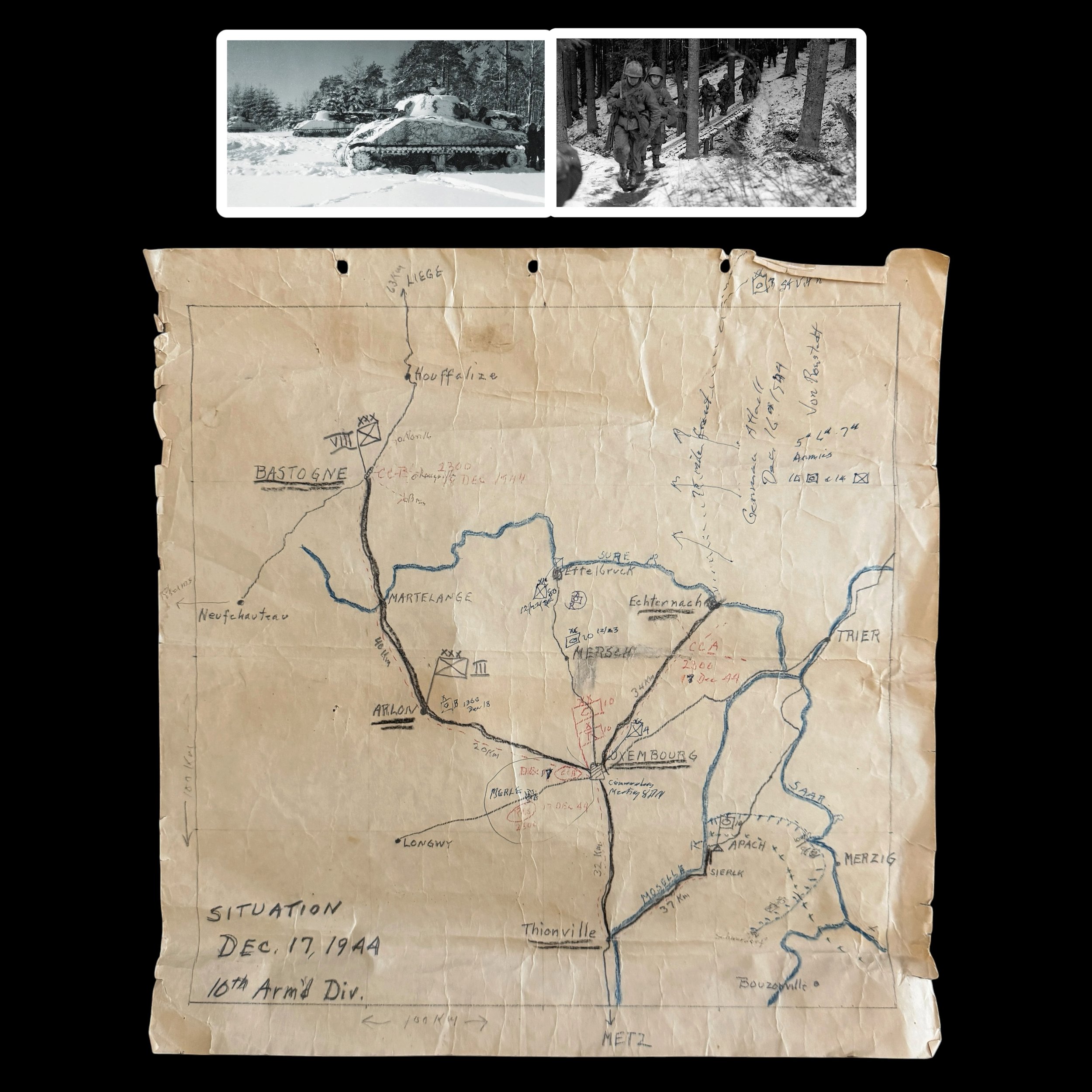
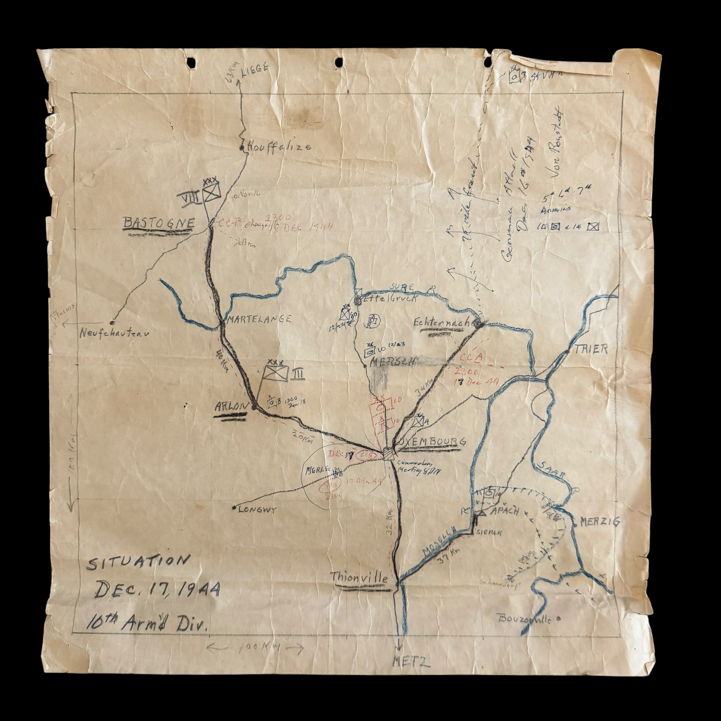
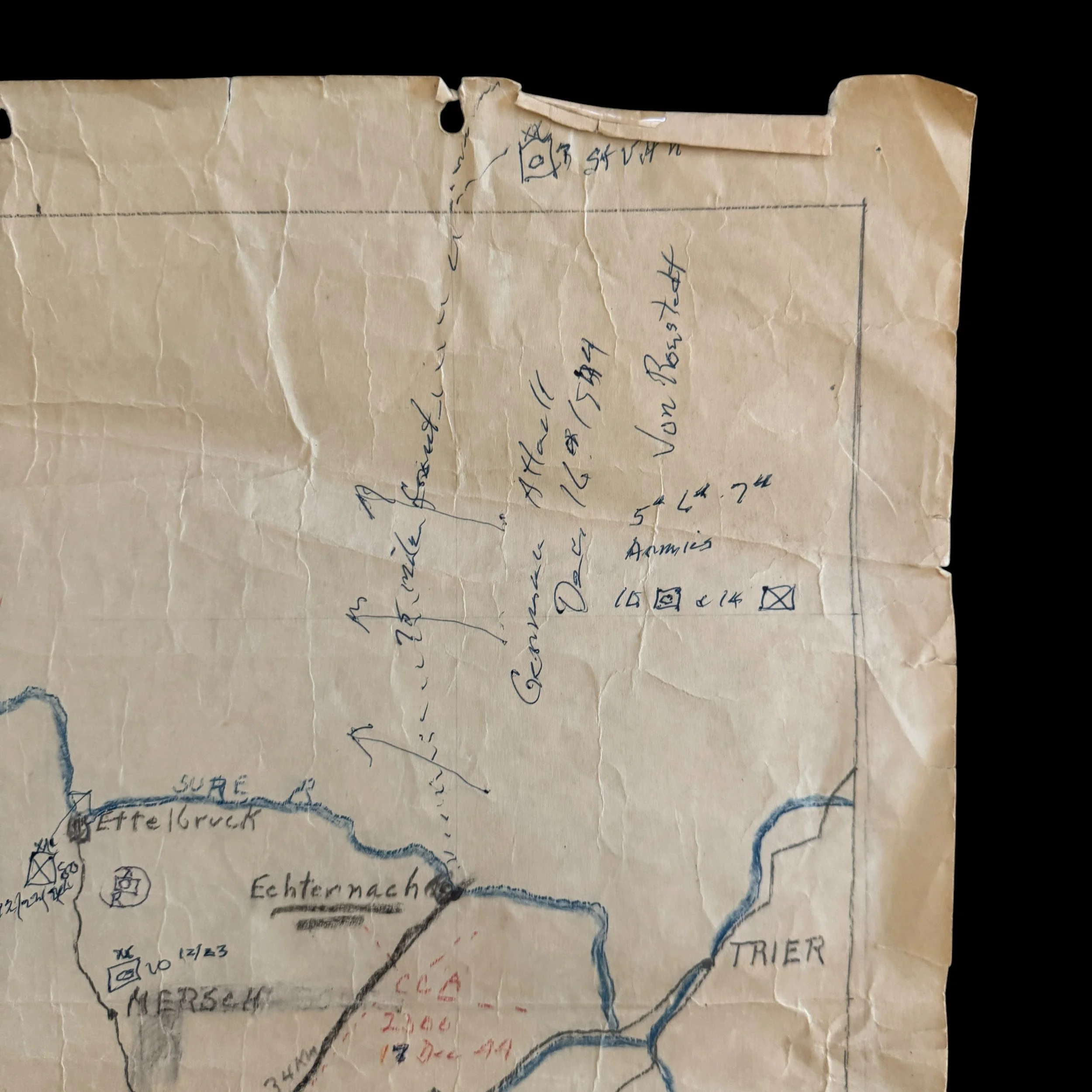
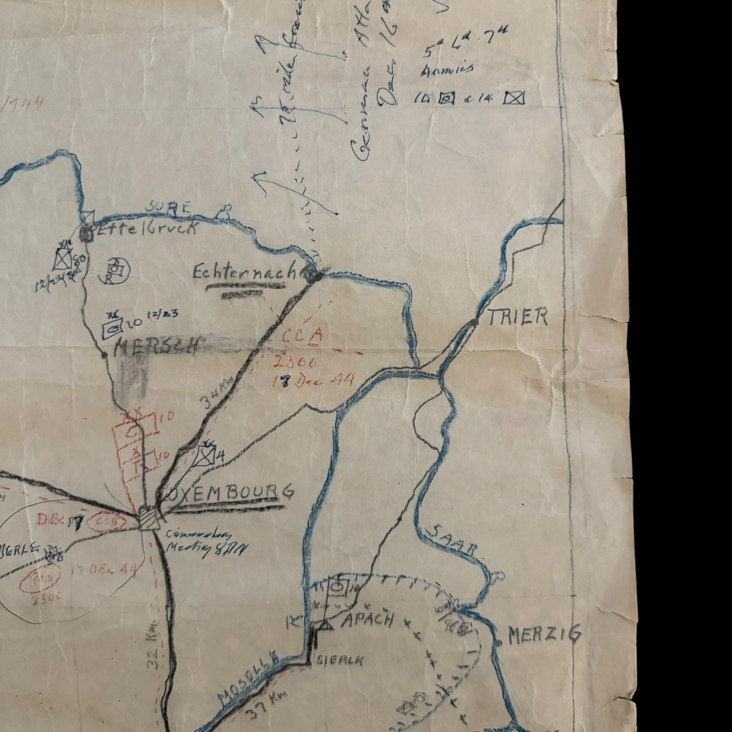
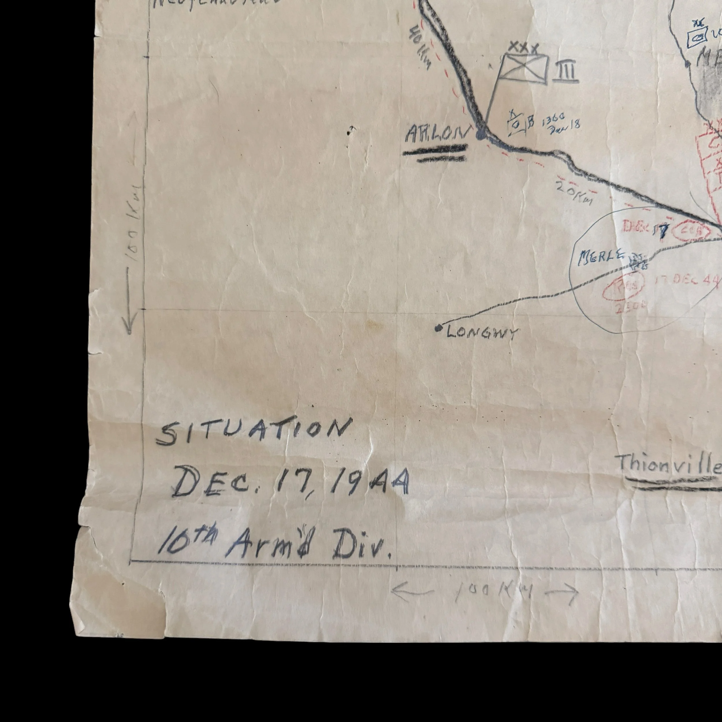
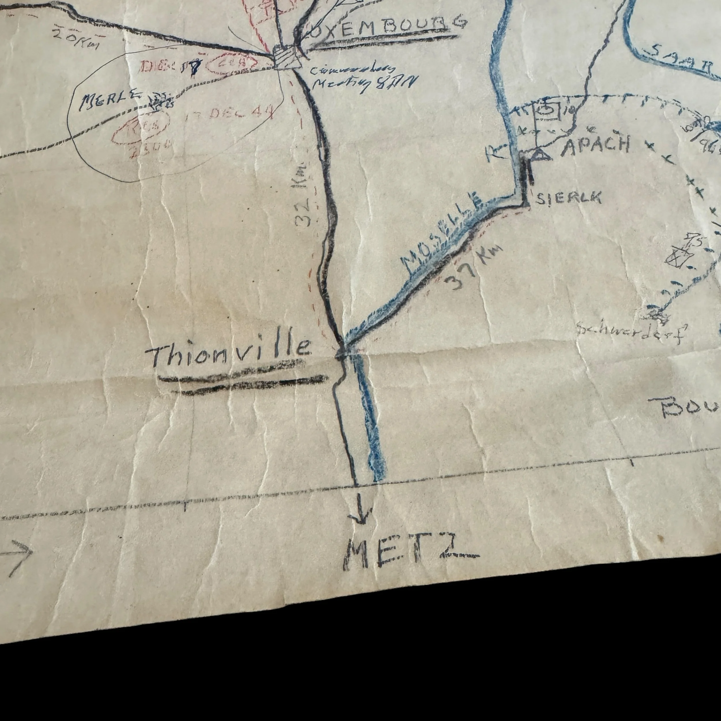
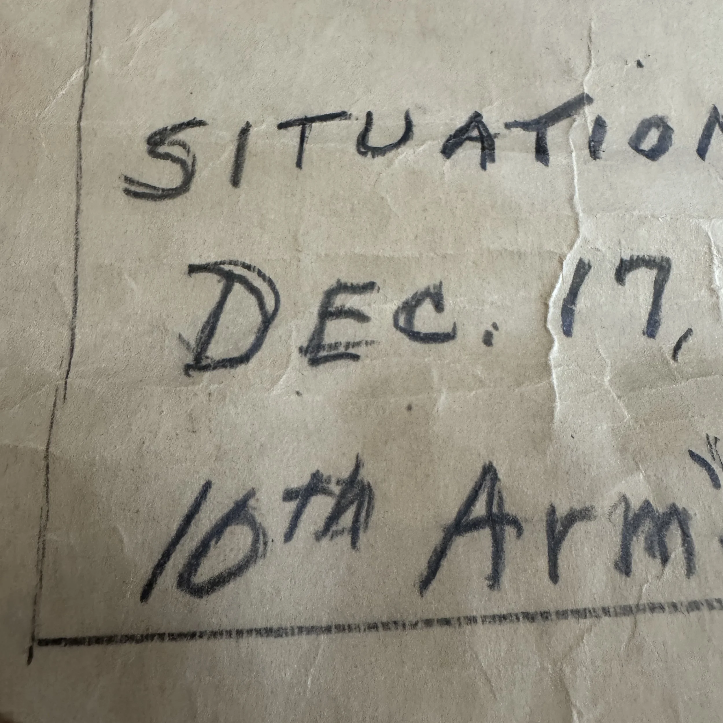
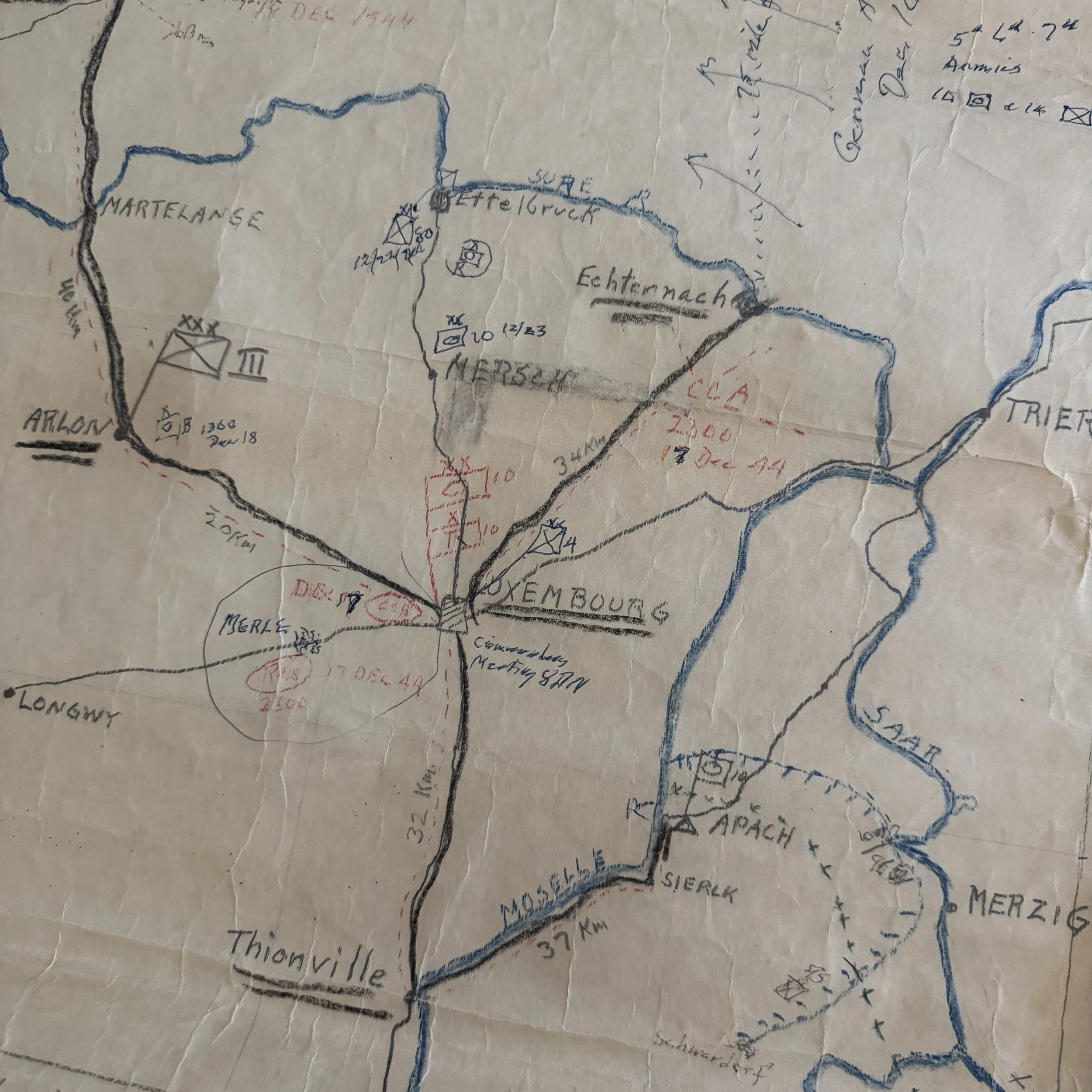
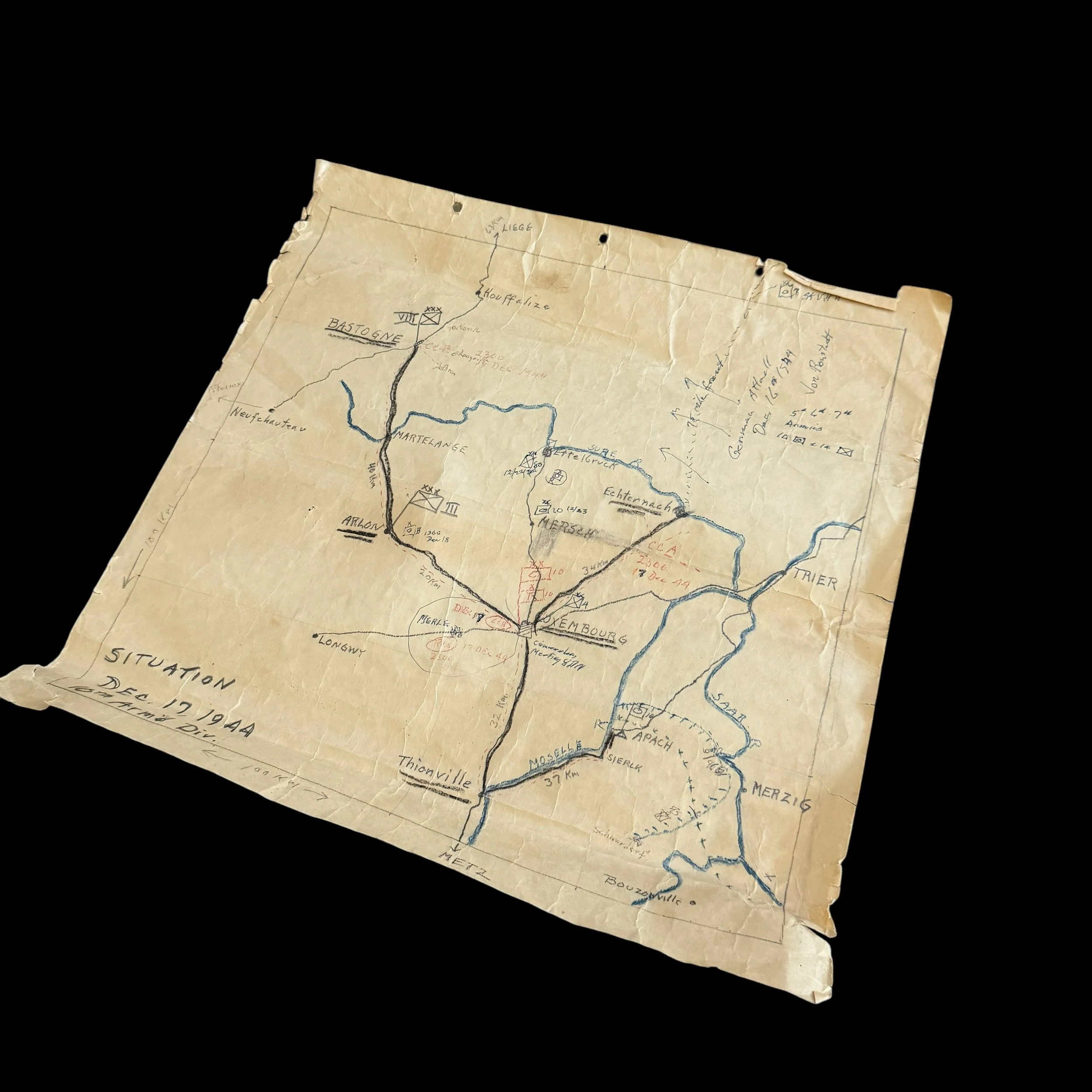
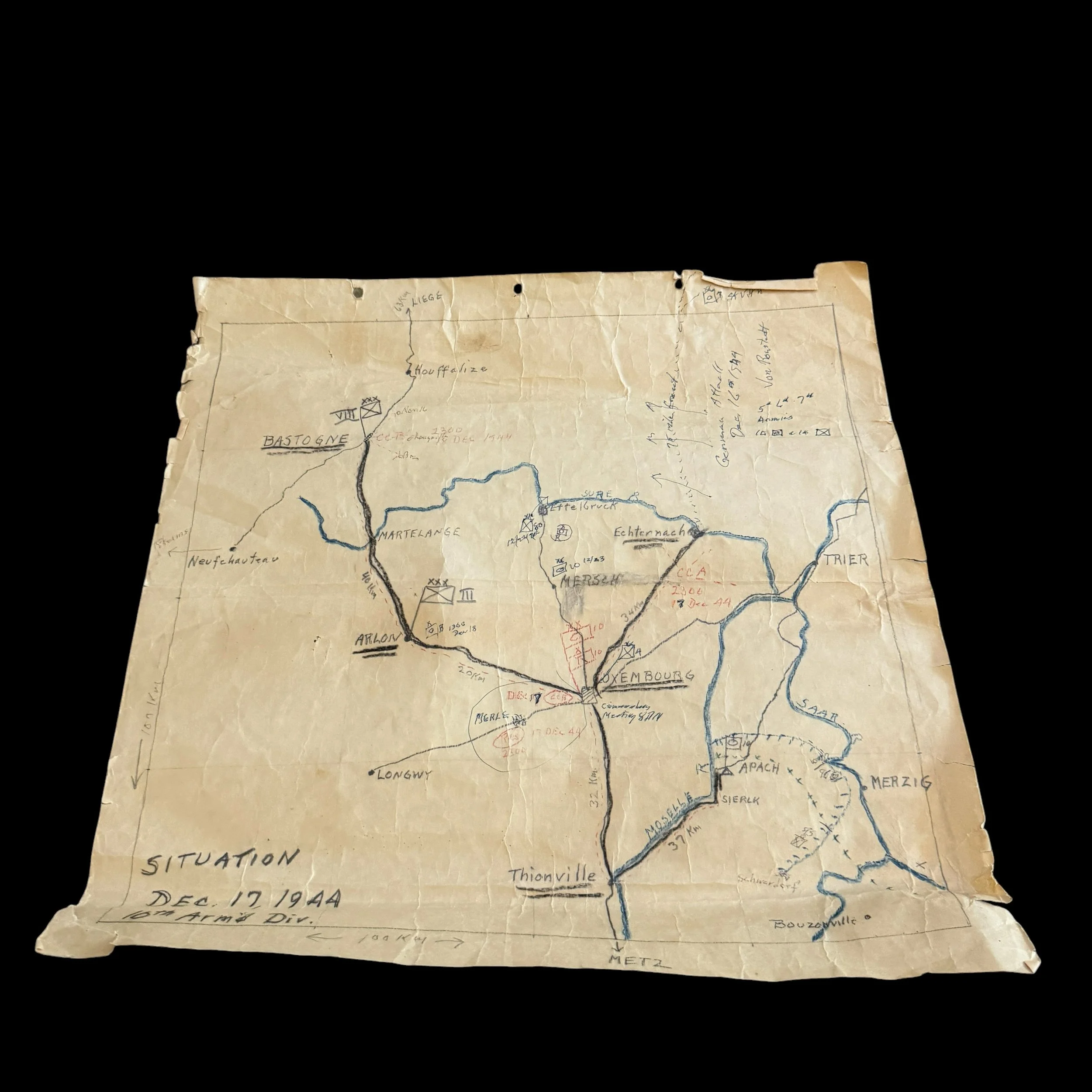
This extremely rare WWII Battle of the Bulge hand drawn combat operations map comes directly from the personal collection of Colonel Wade C. Gatchell, Commanding Officer of Reserve Command (CCR), 10th Armored Division—the famed "Tiger Division." This original 1944 10th Armored Division situation map captures the critical 24-hour turning point of the Battle of the Bulge. On December 16, 1944, Field Marshal Gerd von Rundstedt launched Wacht am Rhein, smashing through a thinly held 75-mile Allied front in the Ardennes. The 10th Armored Division, which had been resting and refitting in positions south of Luxembourg, was immediately thrust into the breach. General George S. Patton Jr. ordered the division to split its combat commands and sprint northward to stem the German tide.
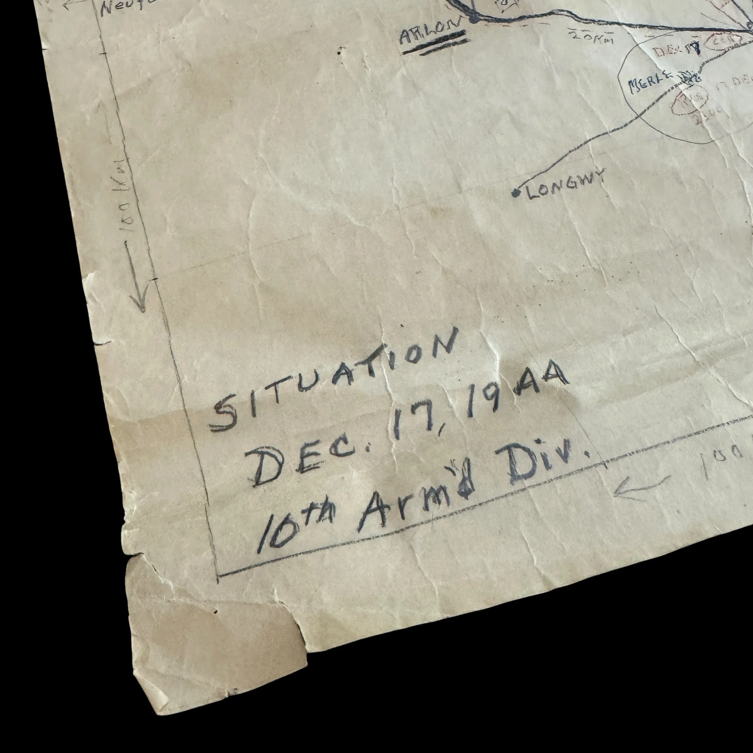
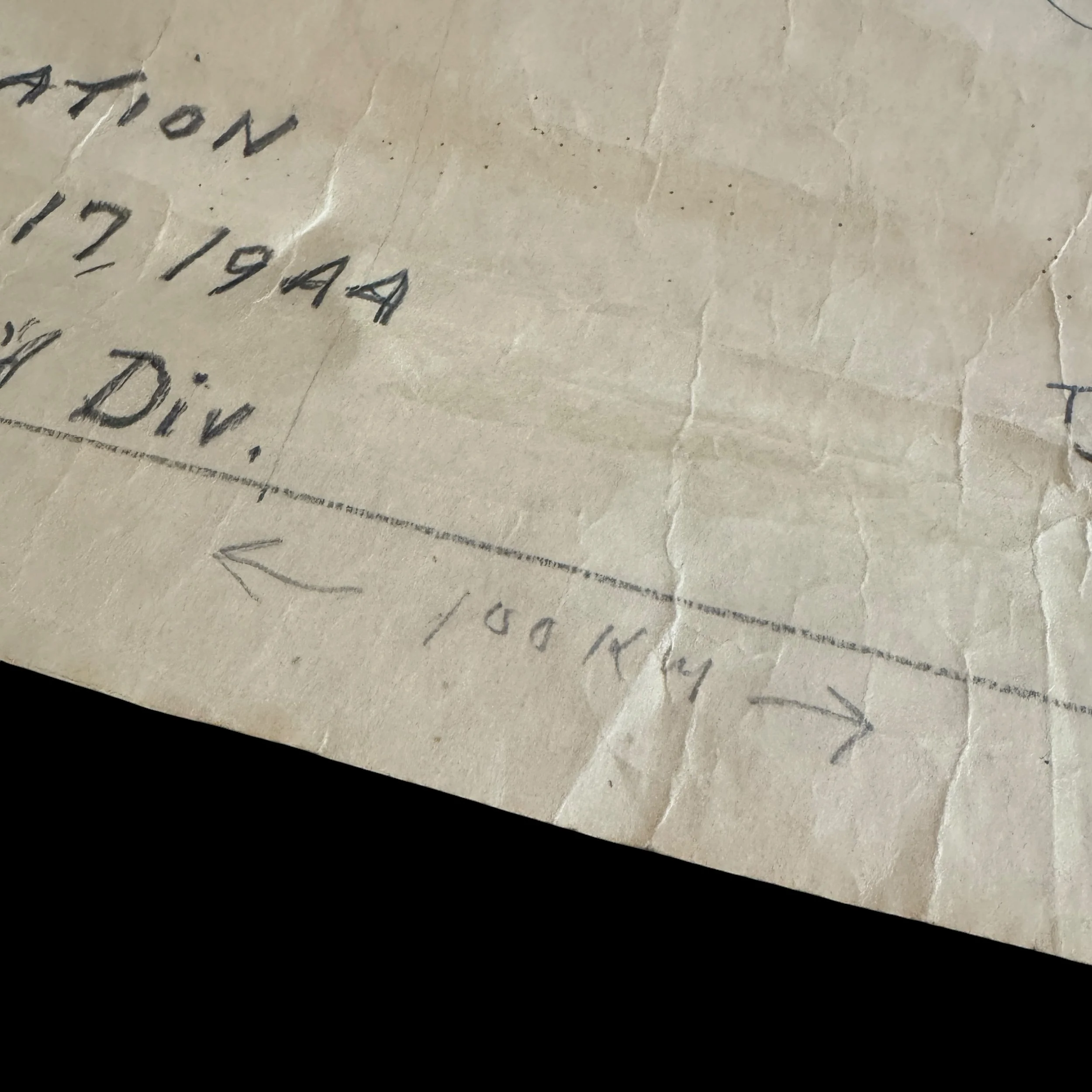
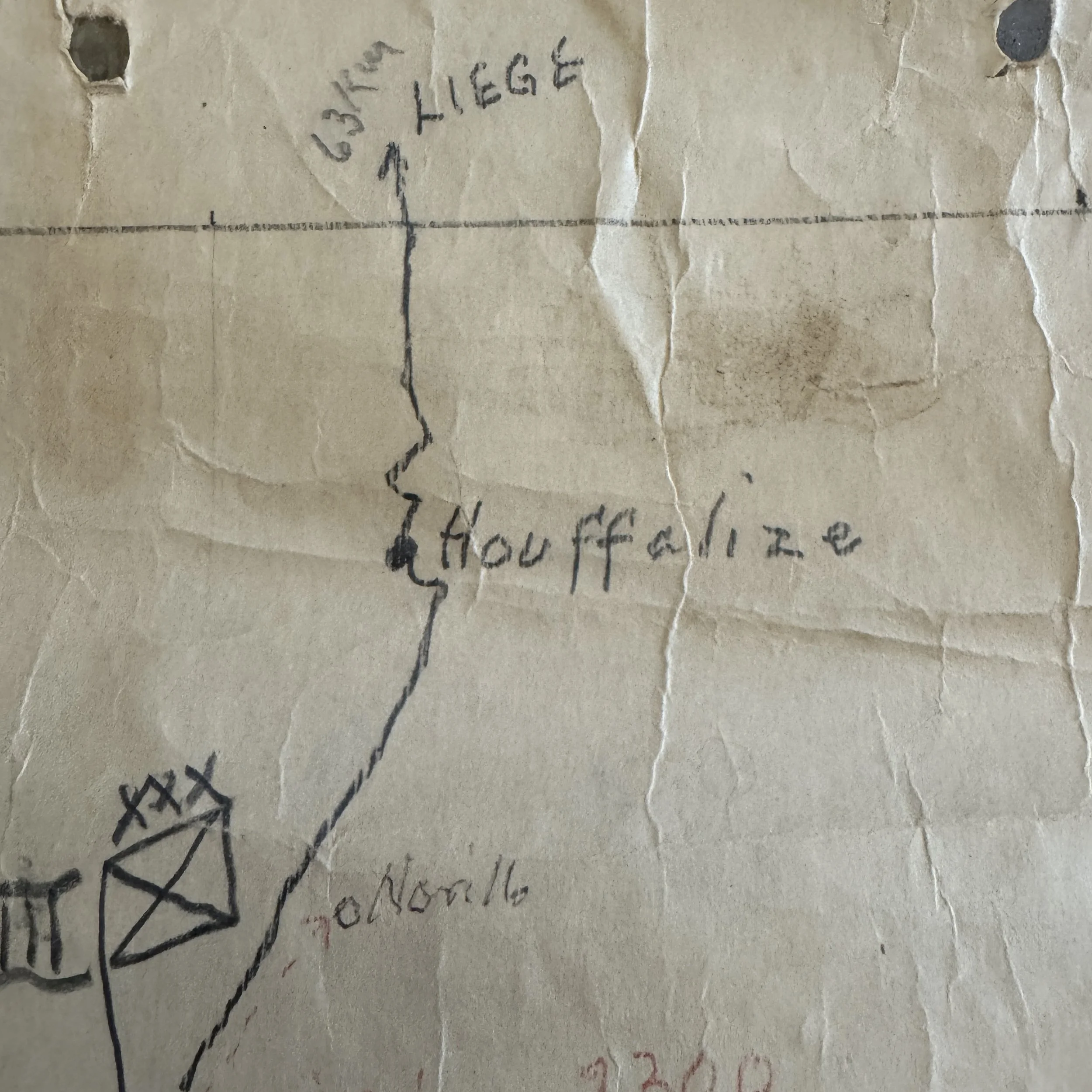
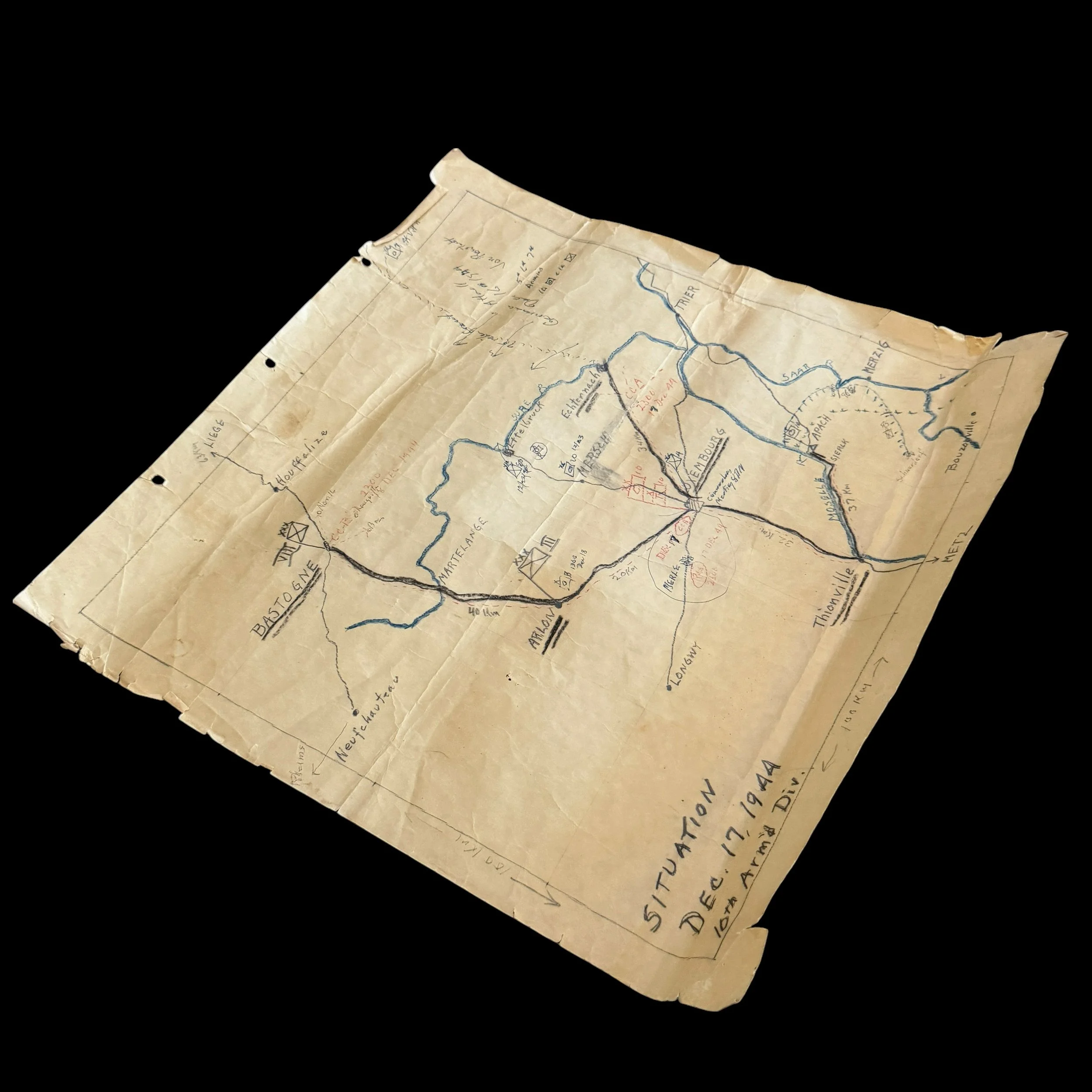
Drawn on field-grade paper exhibiting authentic age-toning, handling wear, prominent fold lines, and pinholes along the upper margin, the document represents a rare, primary G-3 operational situation map draft created at the height of battle.
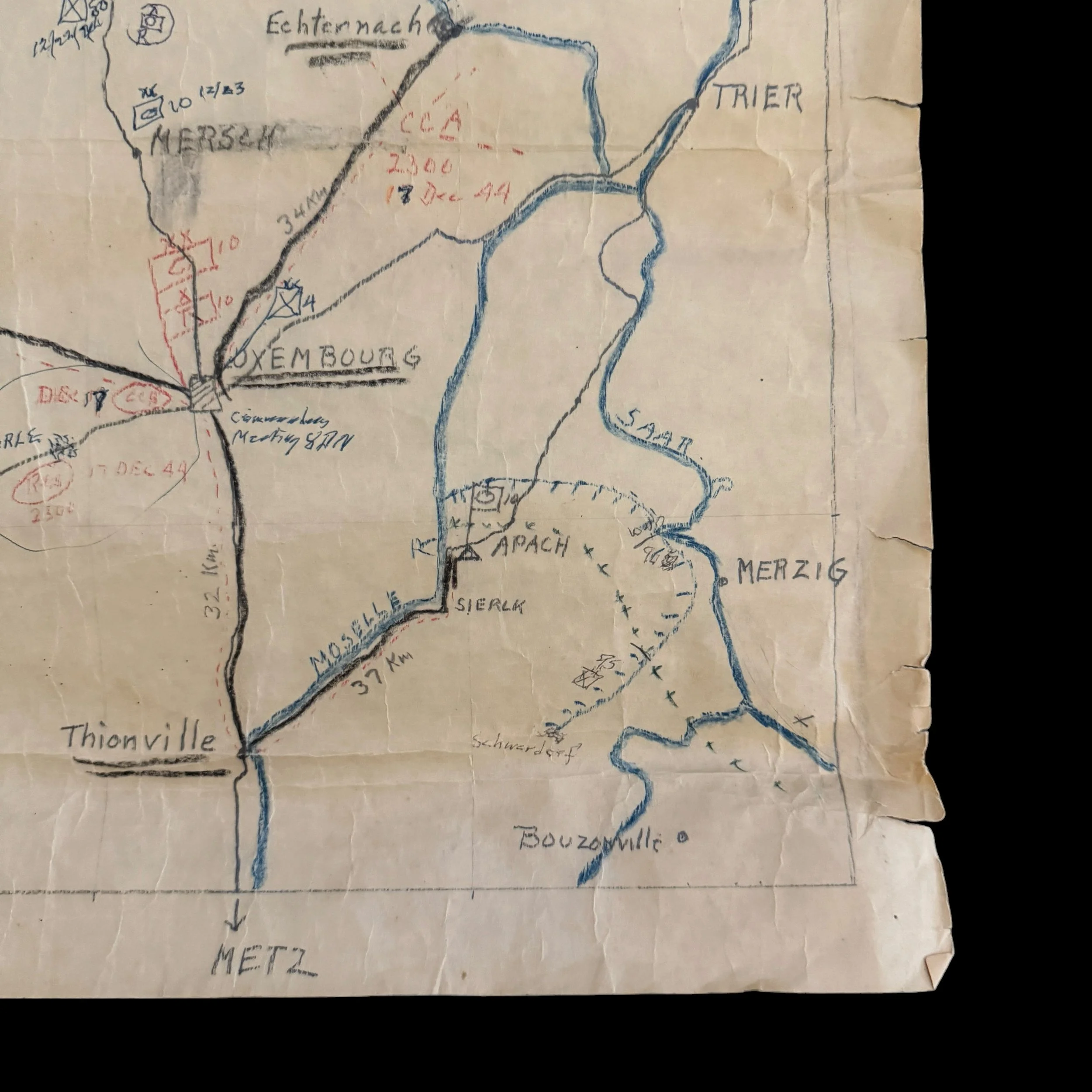
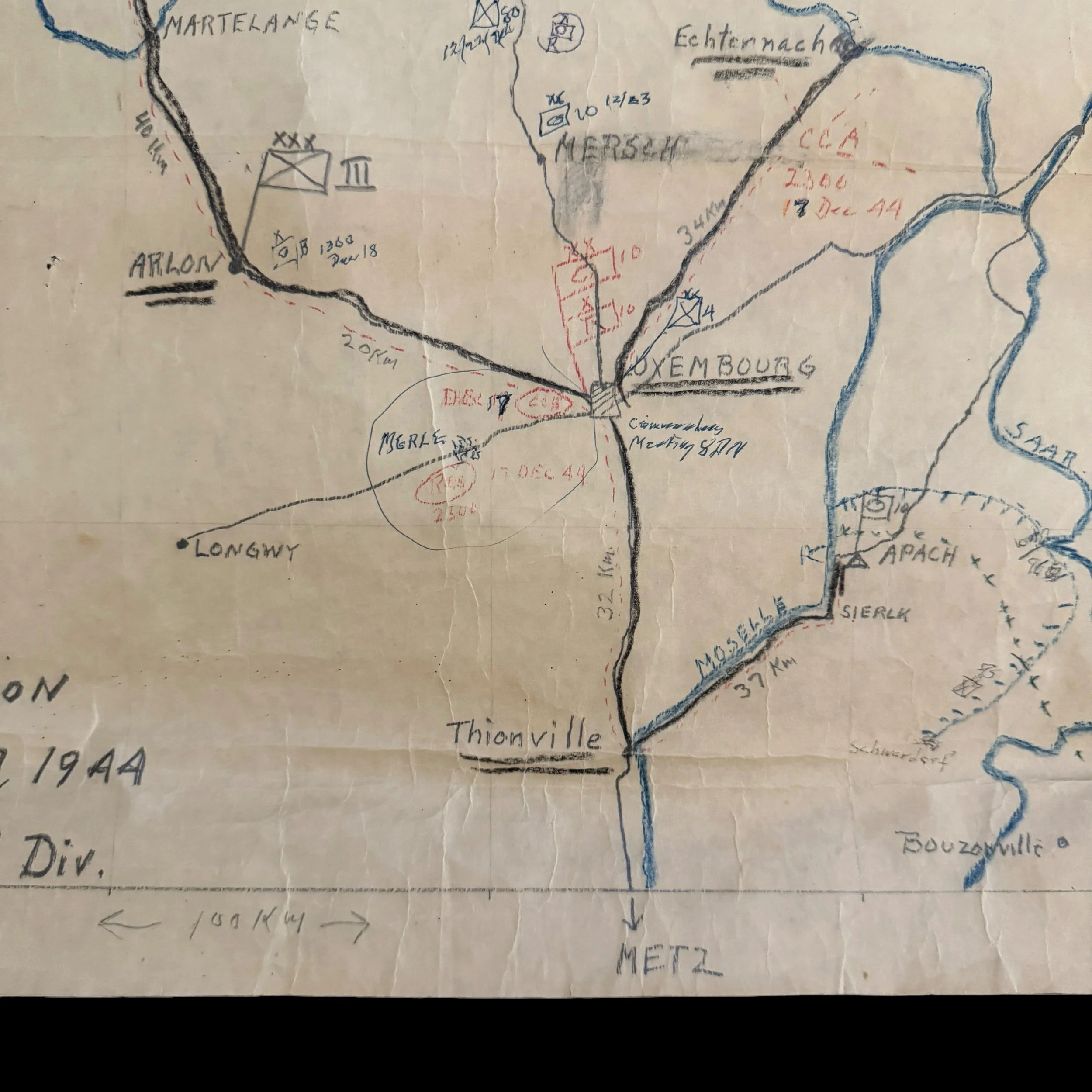
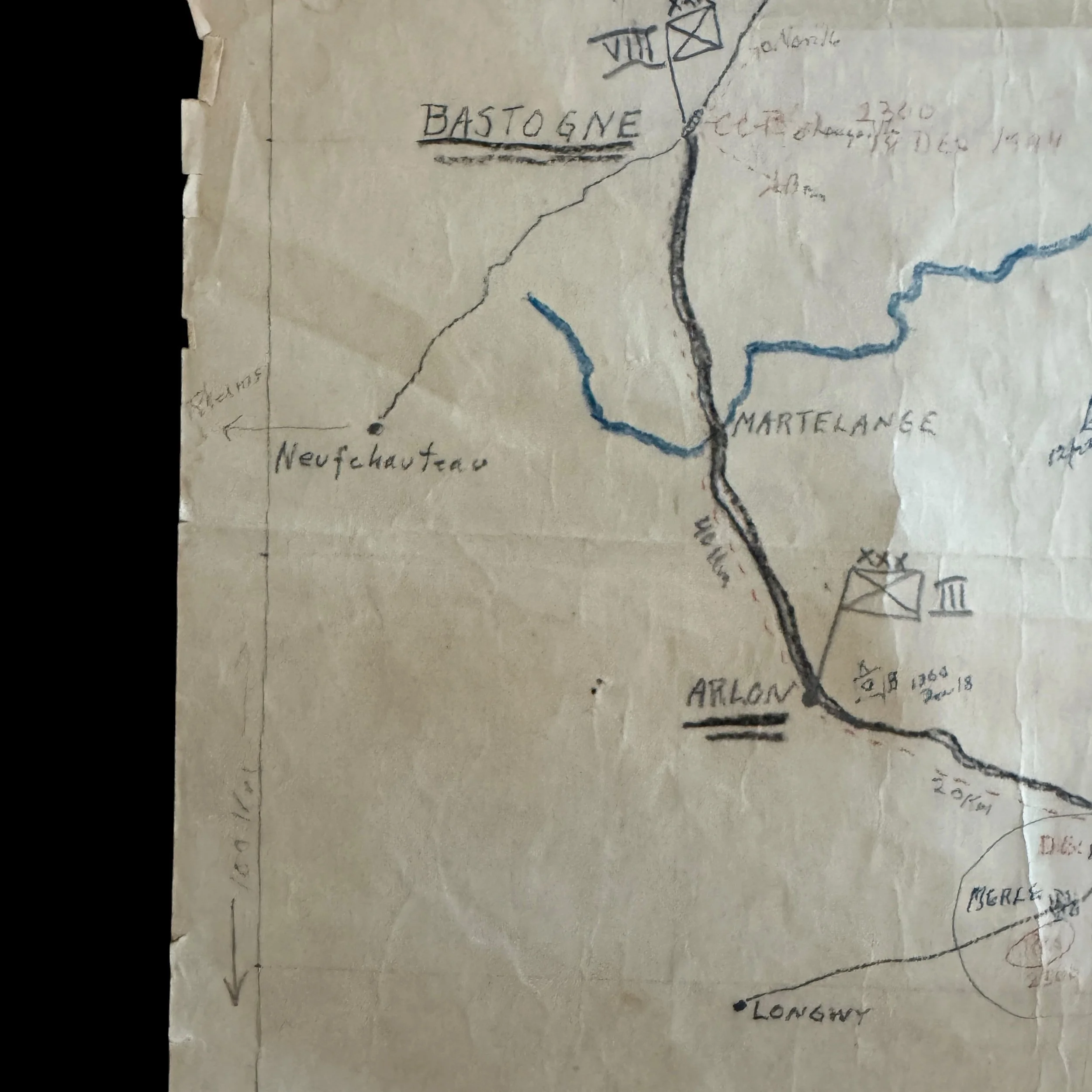
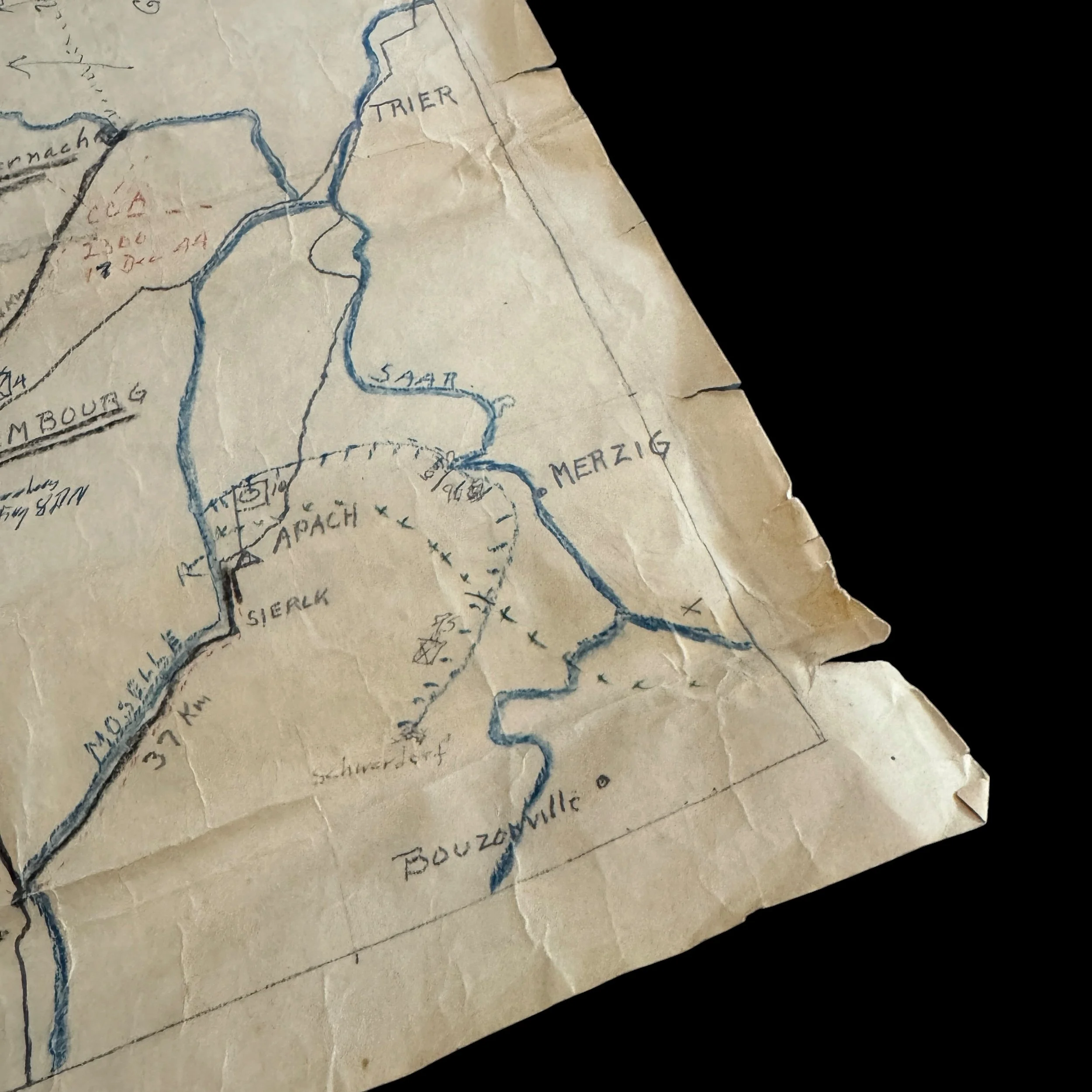
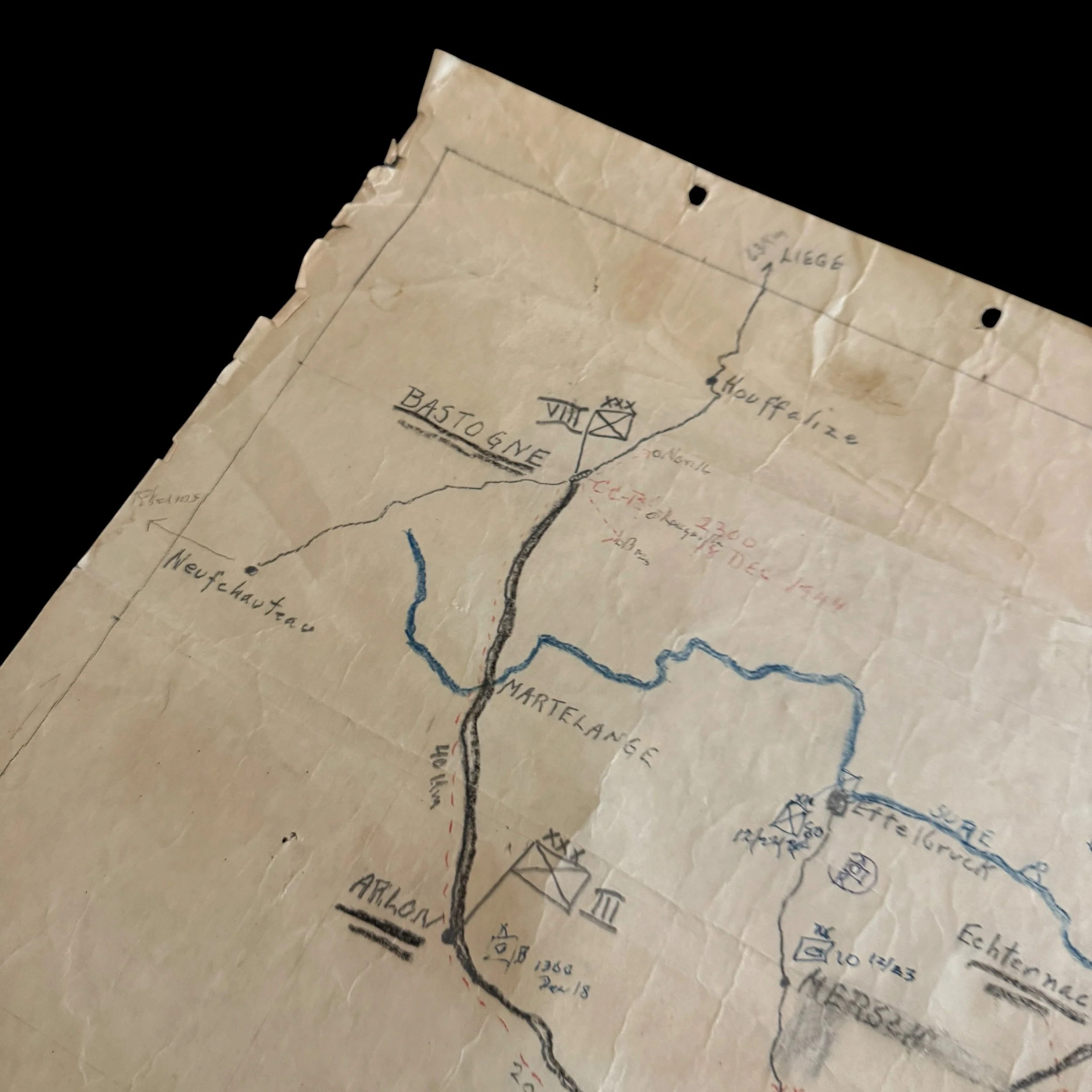
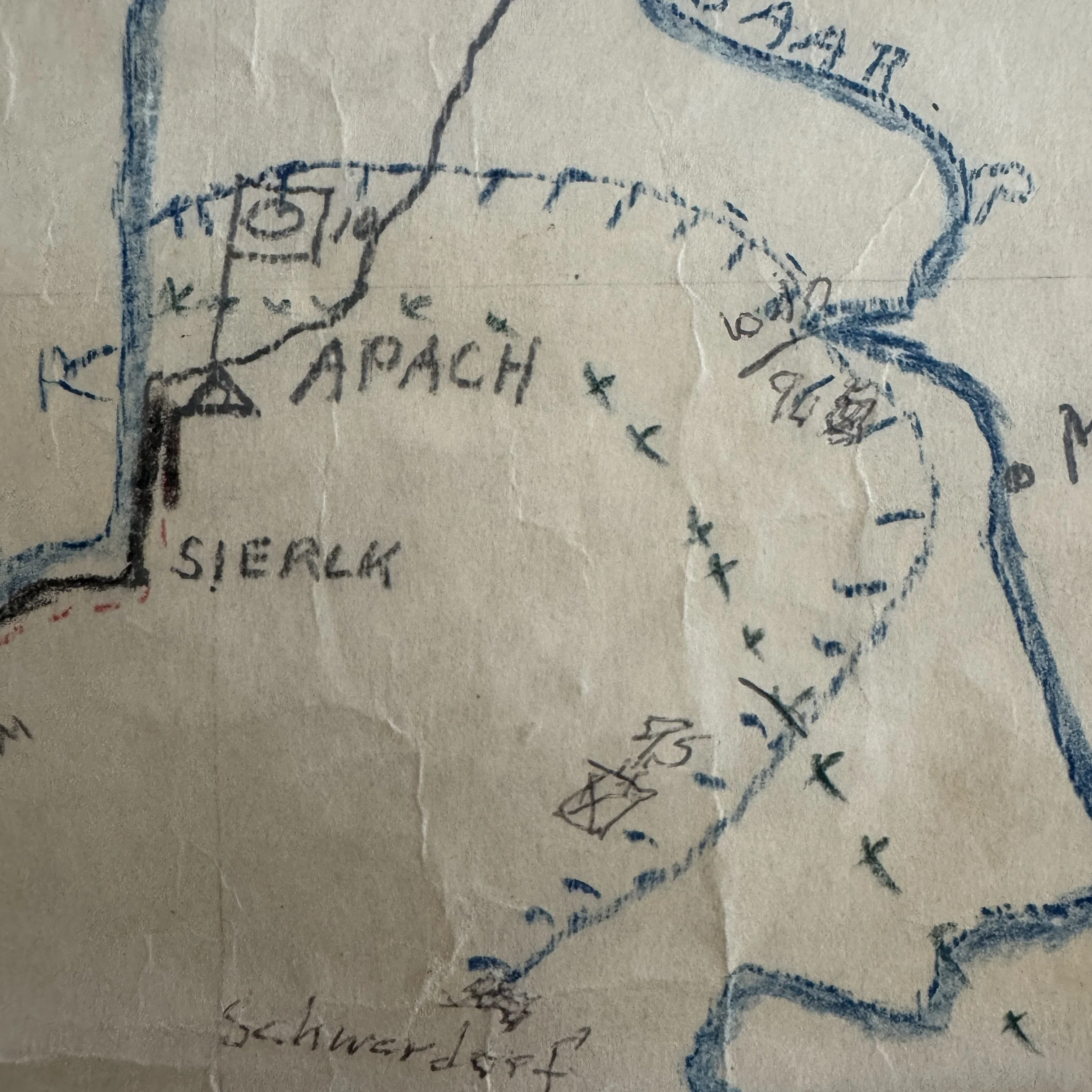
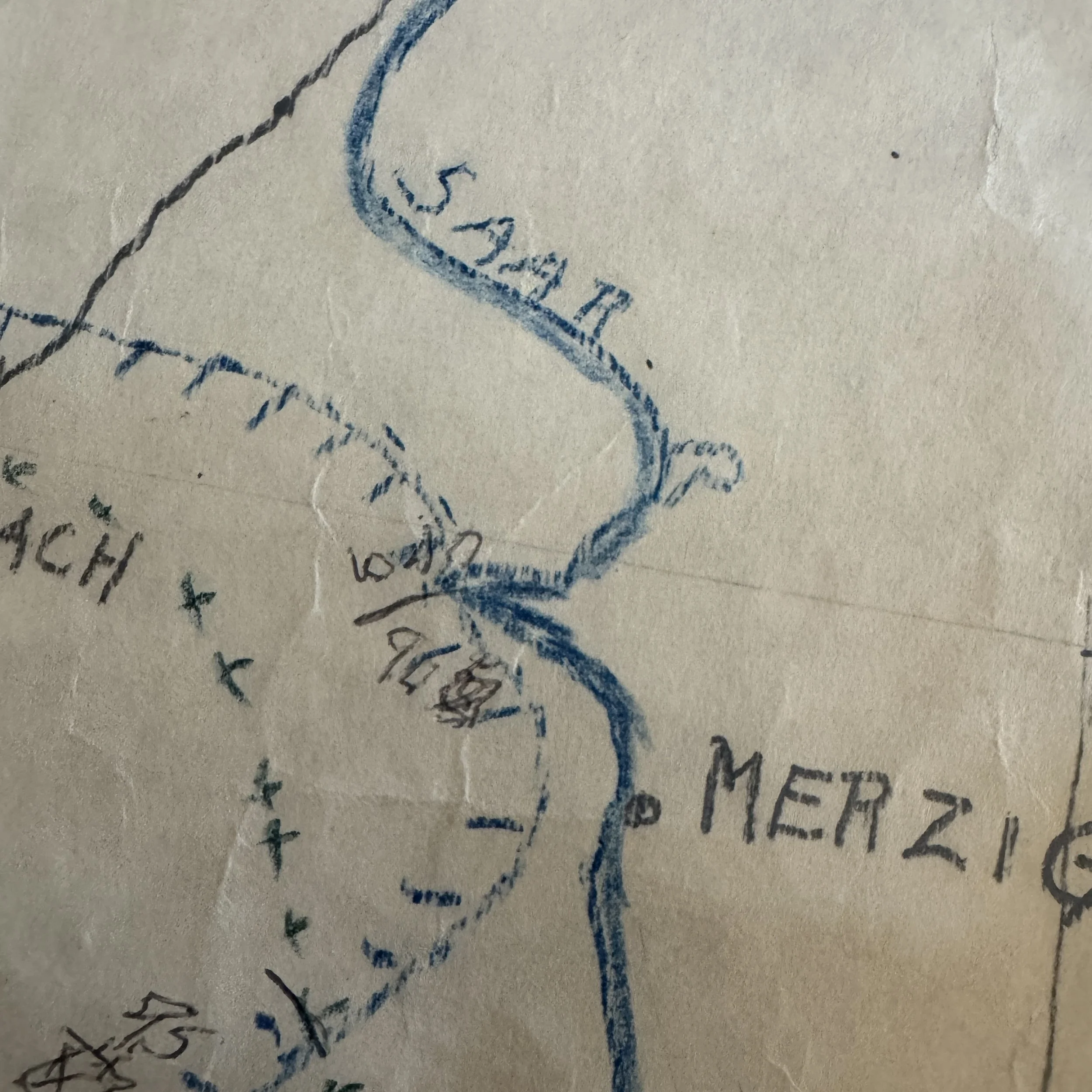
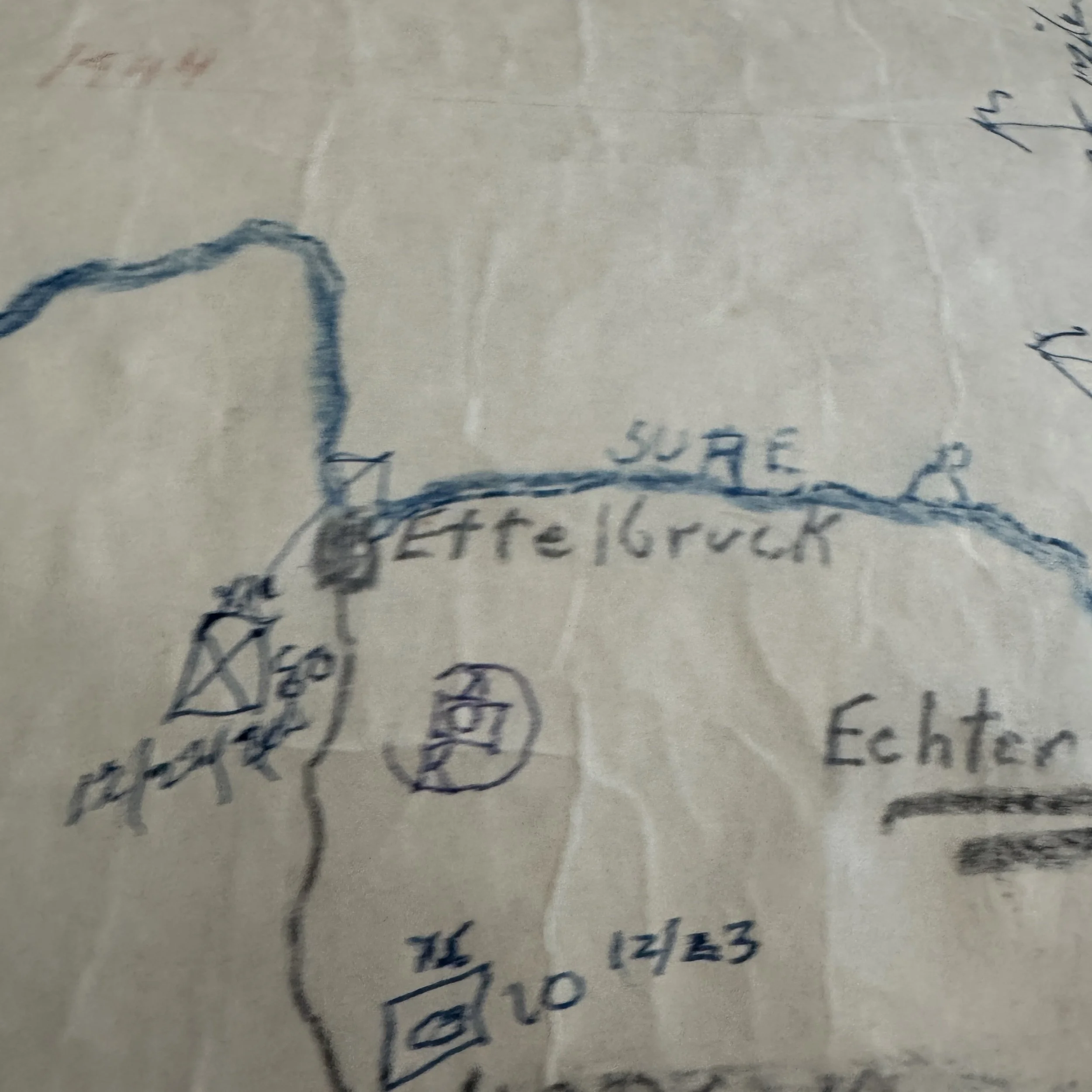
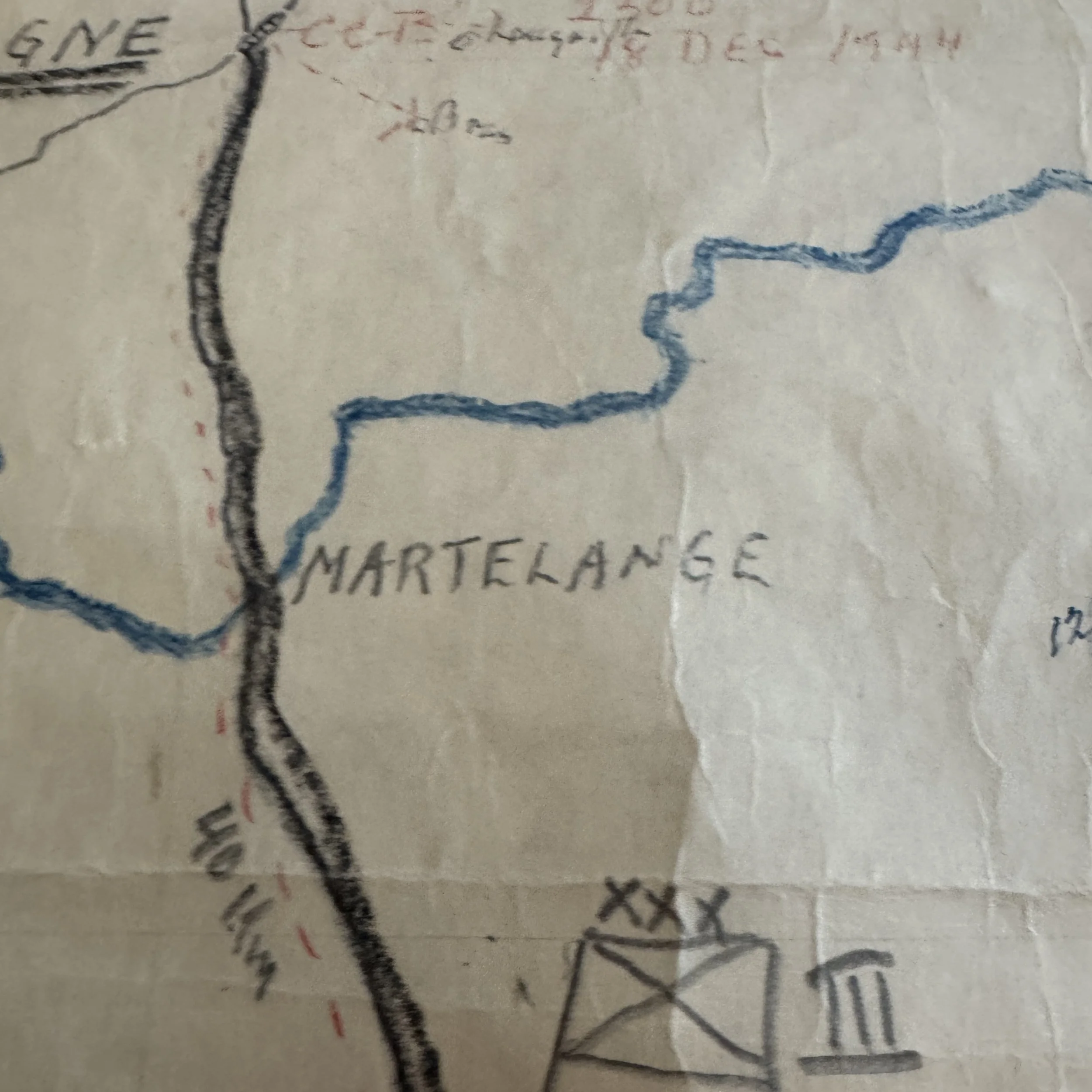
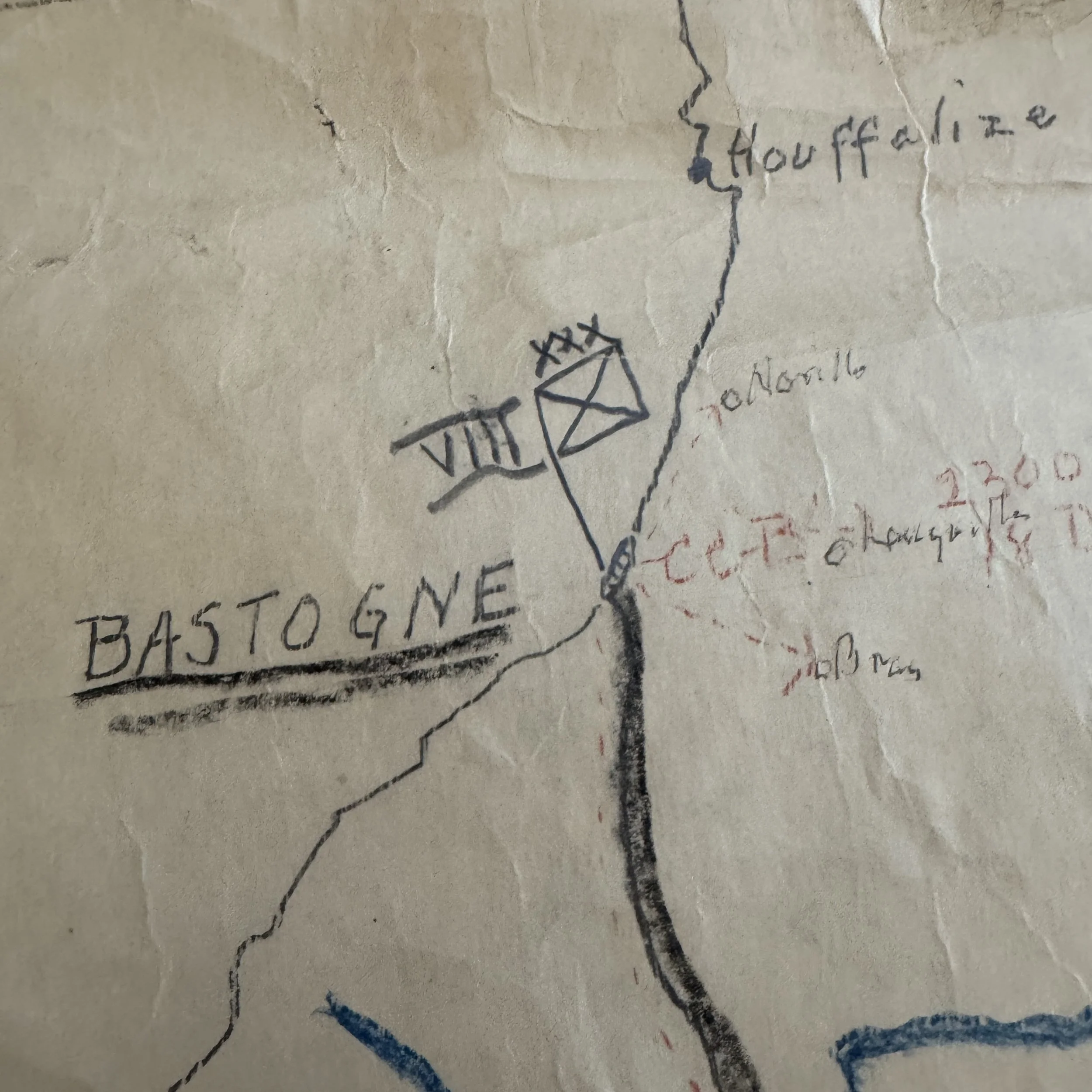
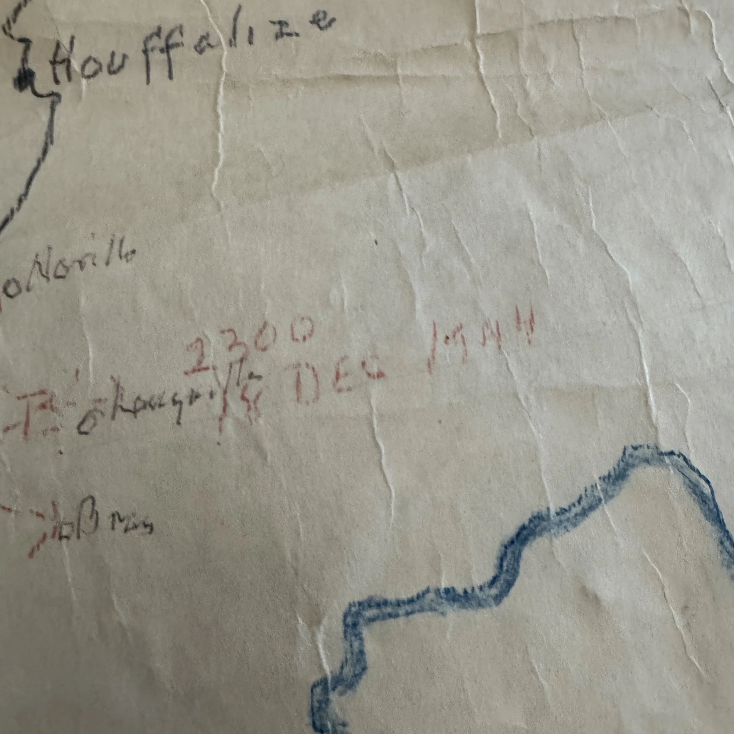
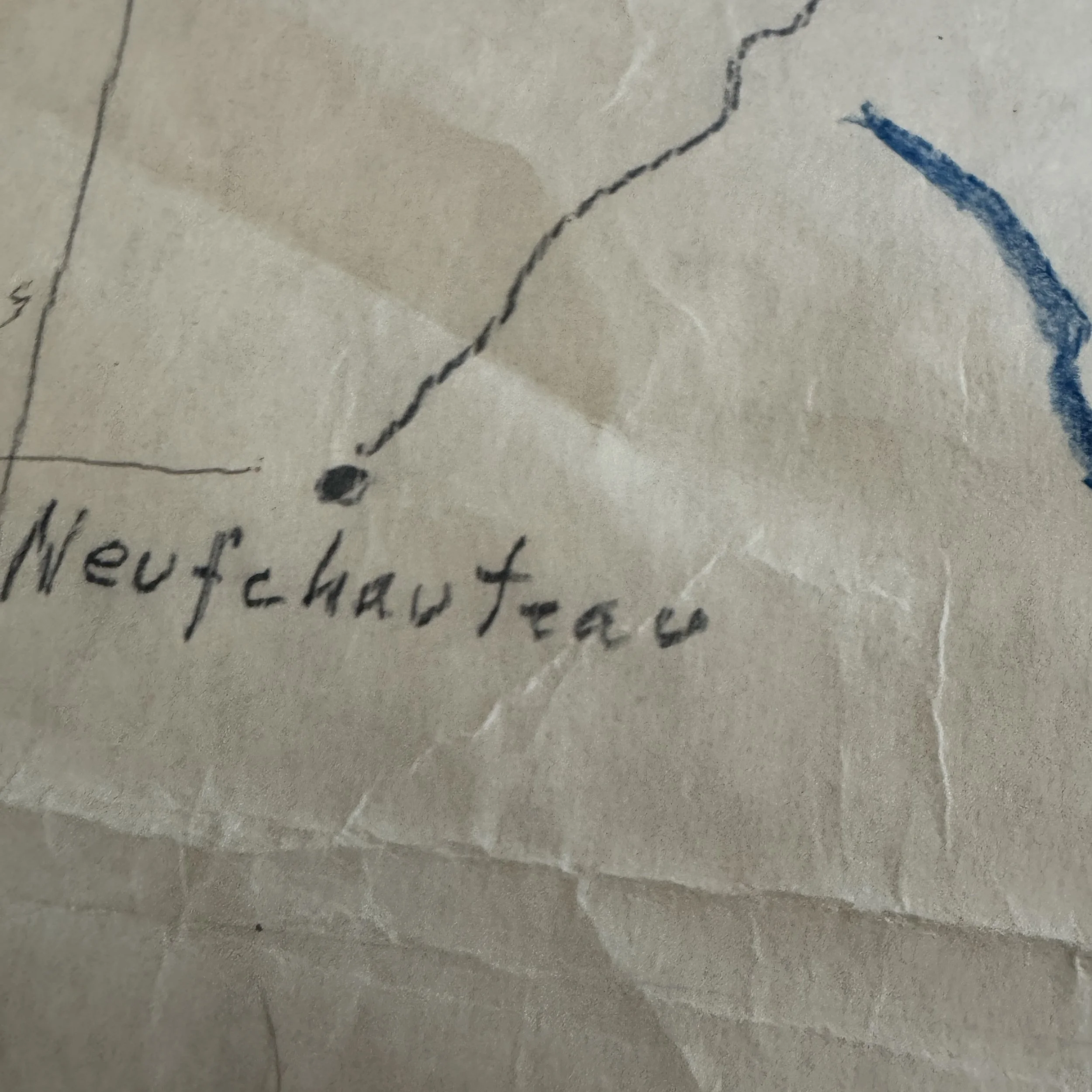
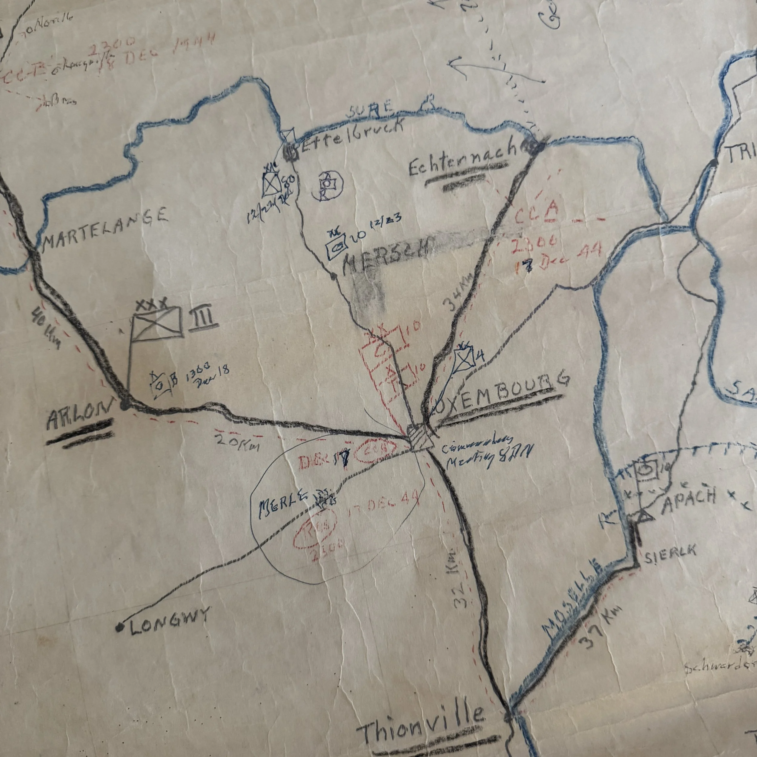
The artifact combines printed geographic reference grids with hand-drawn military symbols, road networks, exact kilometer measurements, and dynamic, multi-colored field annotations executed in graphite, blue colored pencil, and red grease pencil.
Unlike other maps used during battle, this document functioned as a live working surface inside a mobile command post. In mid-December 1944, G-3 operations officers and commanders like Colonel Gatchell relied on these hand-rendered situational overlays to visualize fluid battle lines, monitor rapidly moving units,and process intelligence reports coming over radio channels and field telephones.
The color coding served an indispensable operational purpose in the dim, chaotic environment of a wartime tactical headquarters:
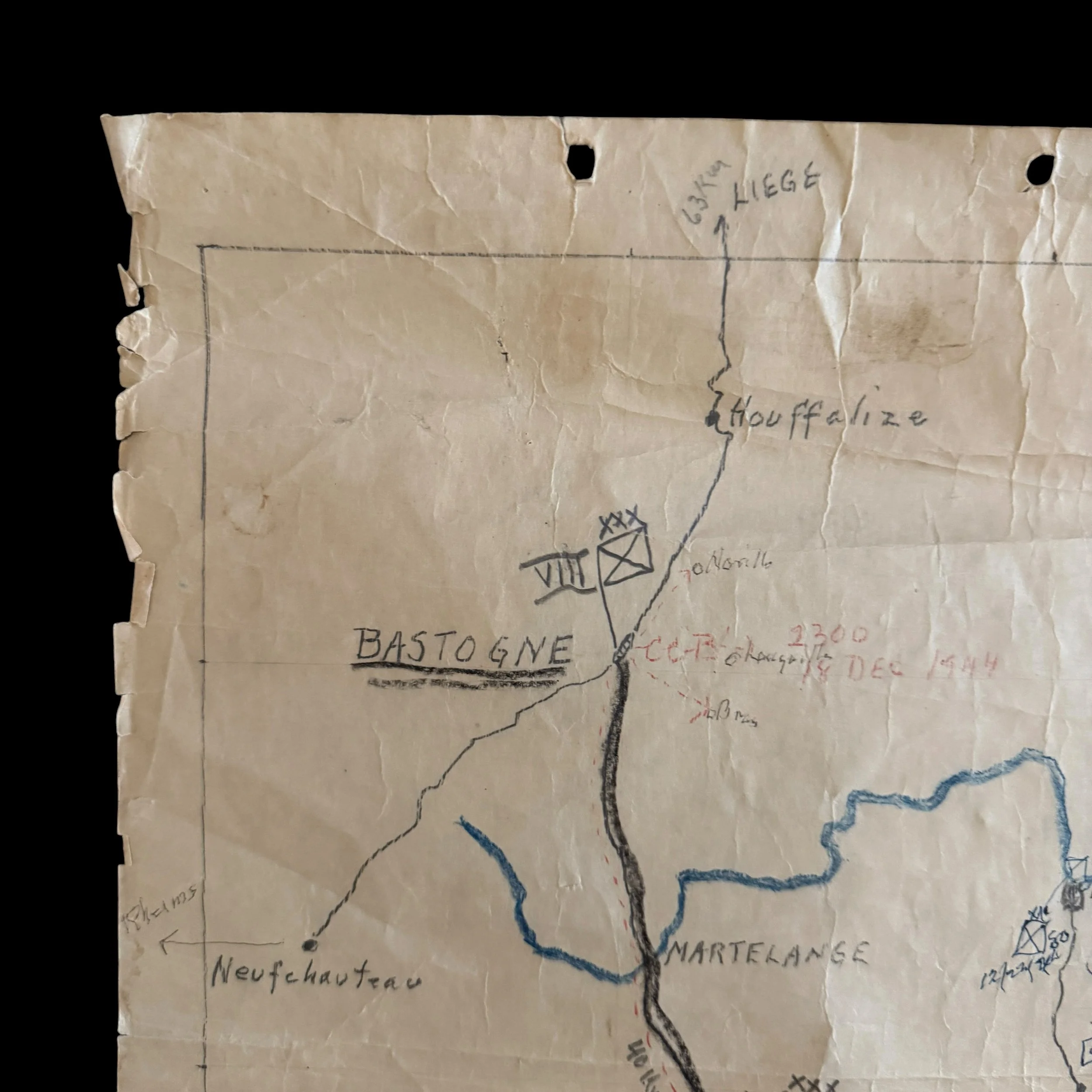
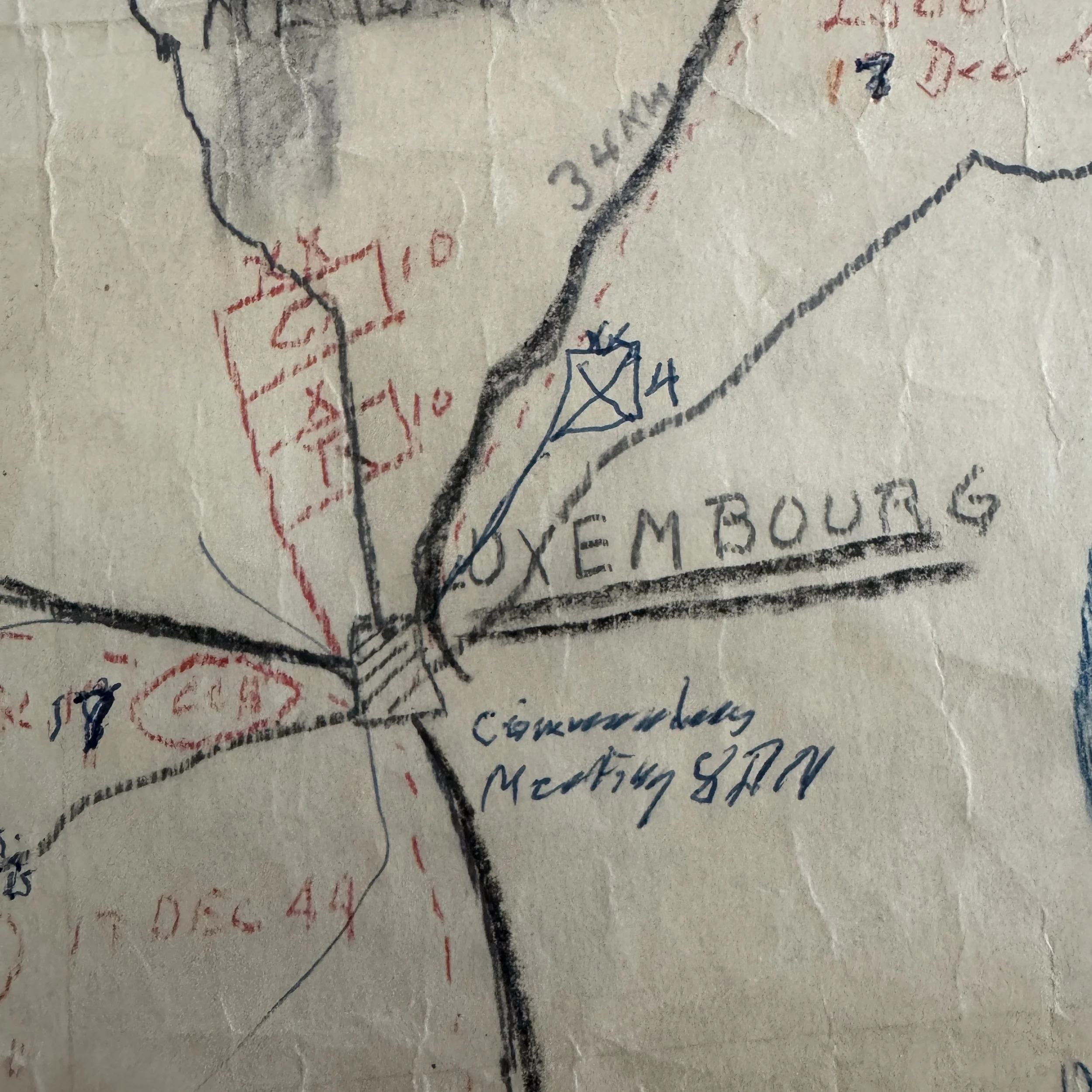
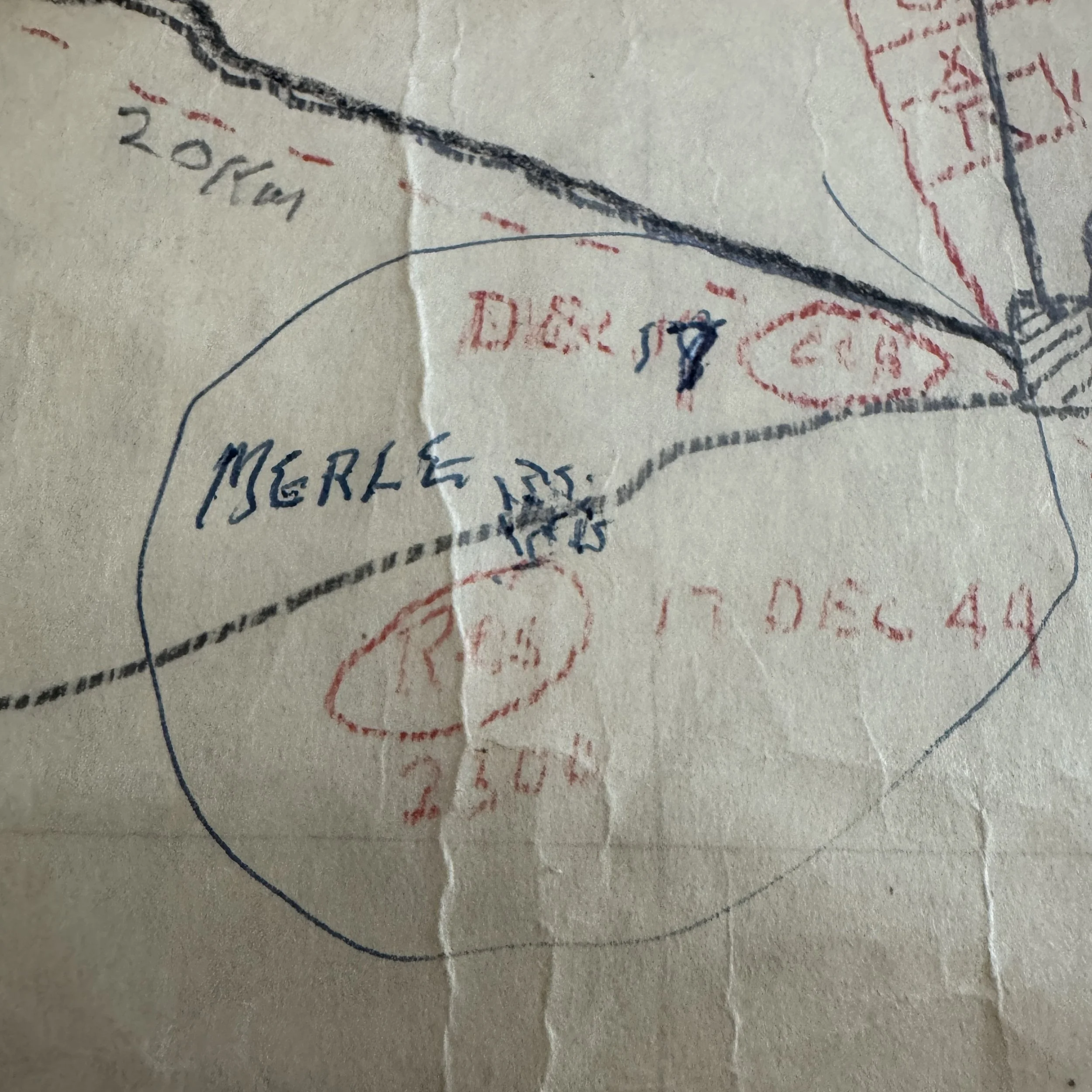
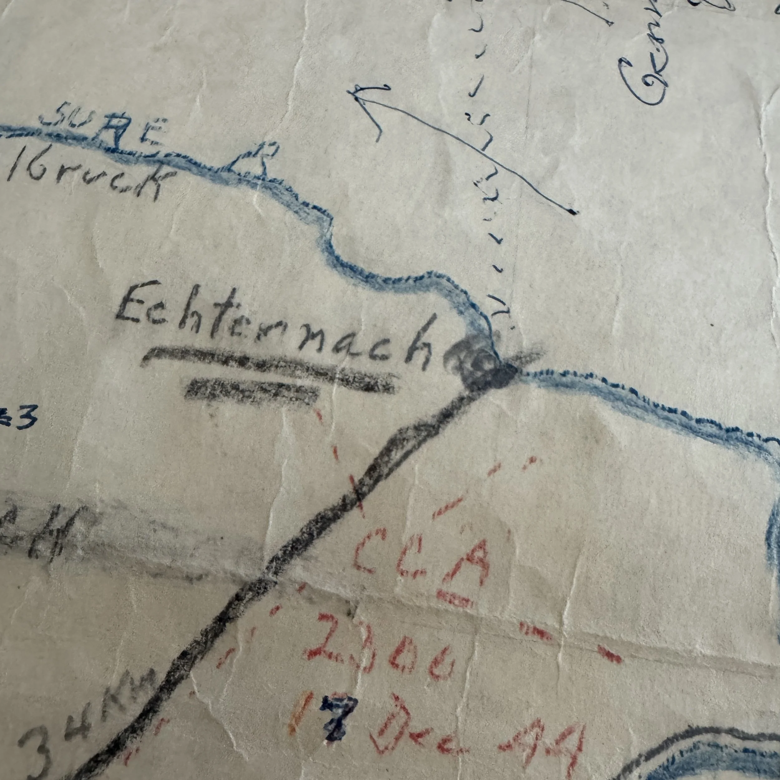
Red Grease Pencil: Denotes friendly armor dispositions, command posts, and high-priority movement orders—such as Colonel Gatchell’s Reserve Command staging near Merle (D&C 17 / CCR / Res 17 DEC 44 2300), Combat Command A (CCA 2300 17 Dec 44), and the urgent line of march for Combat Command B (CC-B 2300 DEC 17, 1944).Red allowed commanders to instantly identify fast-shifting friendly assets under low-light conditions.
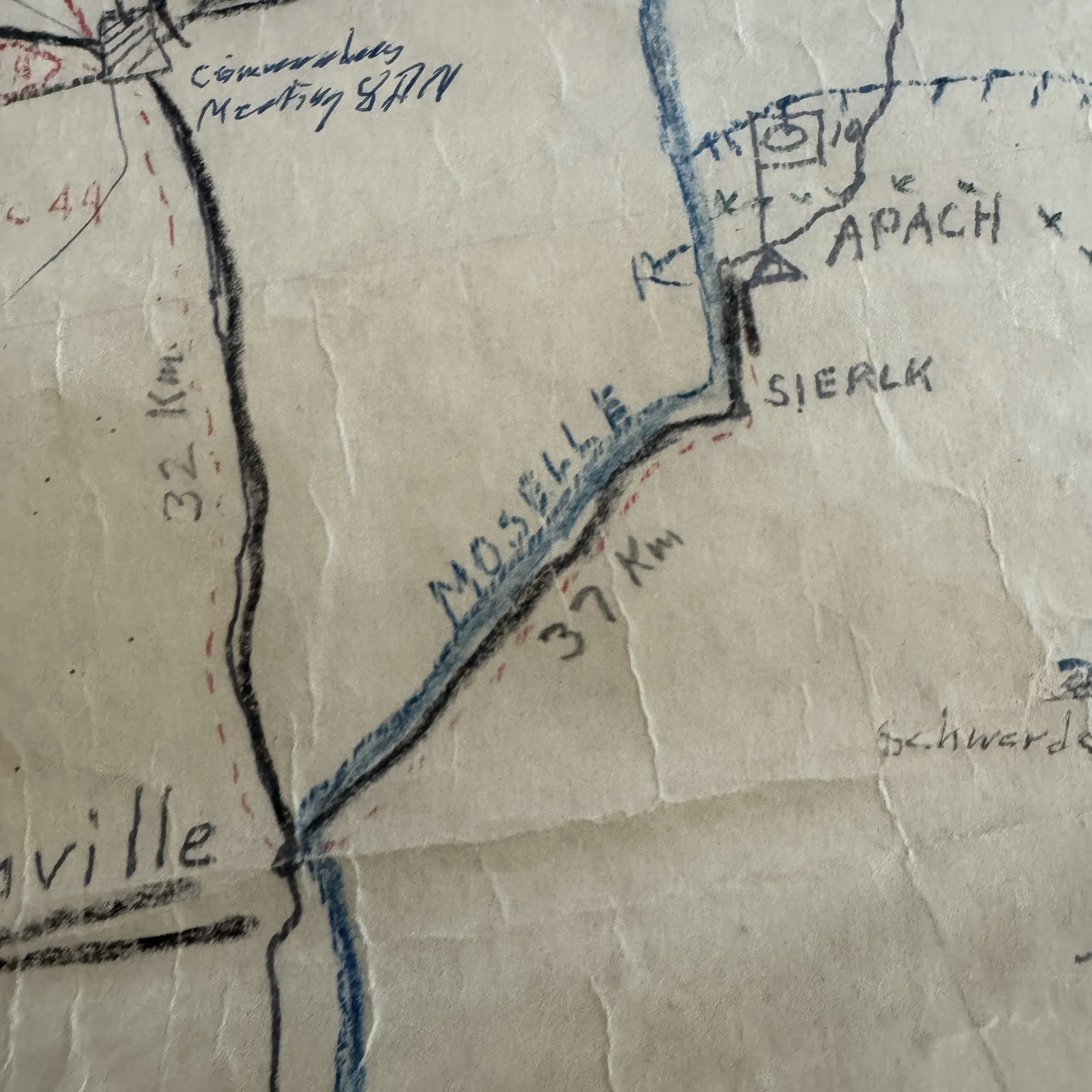
Graphite & Blue Pencil: Outlines natural obstacles, key river barriers (such as the Sure, Saar, and Moselle Rivers),essential highway networks, and fixed defensive positions like the Siegfried Line fortifications along the German border near Apach and Merzig.
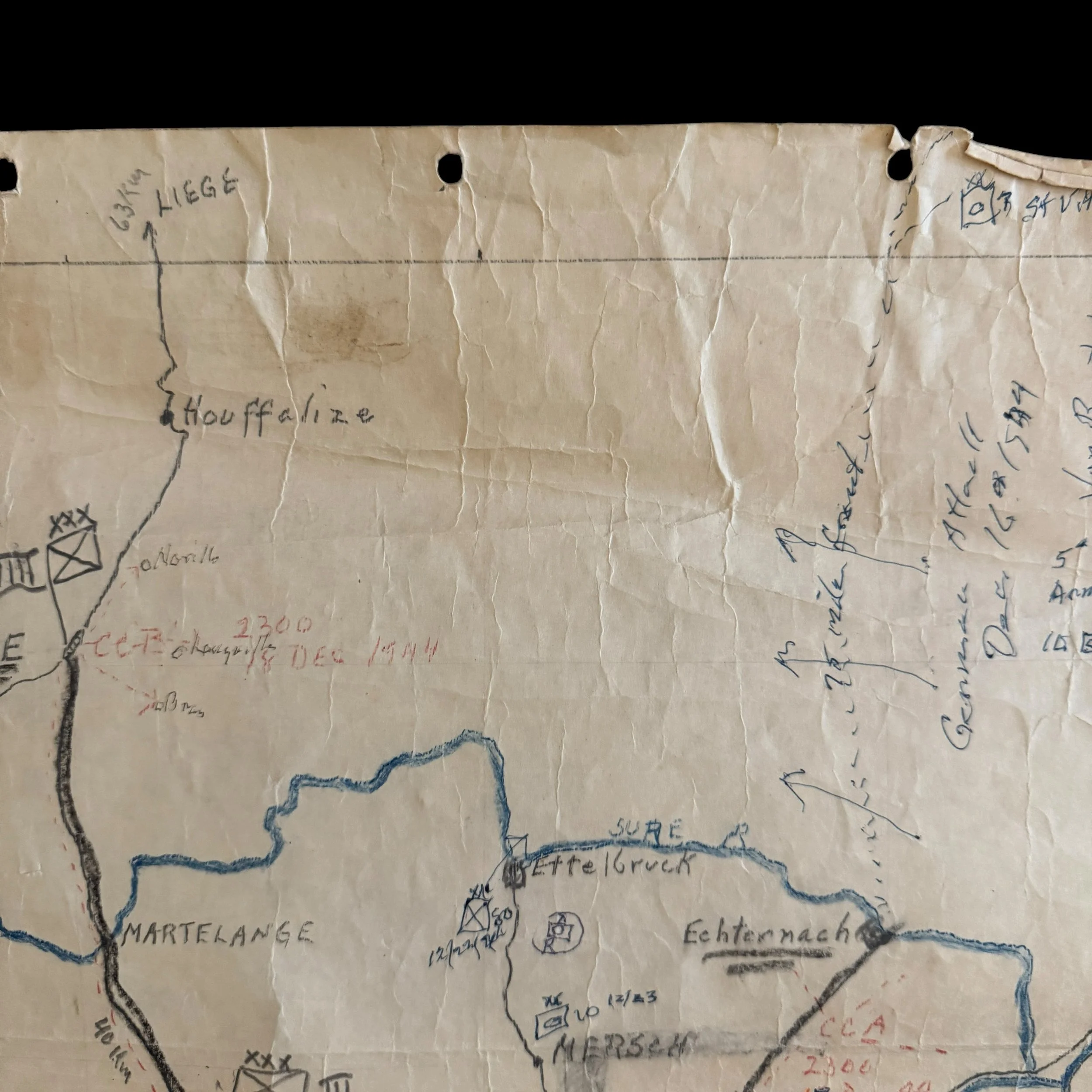
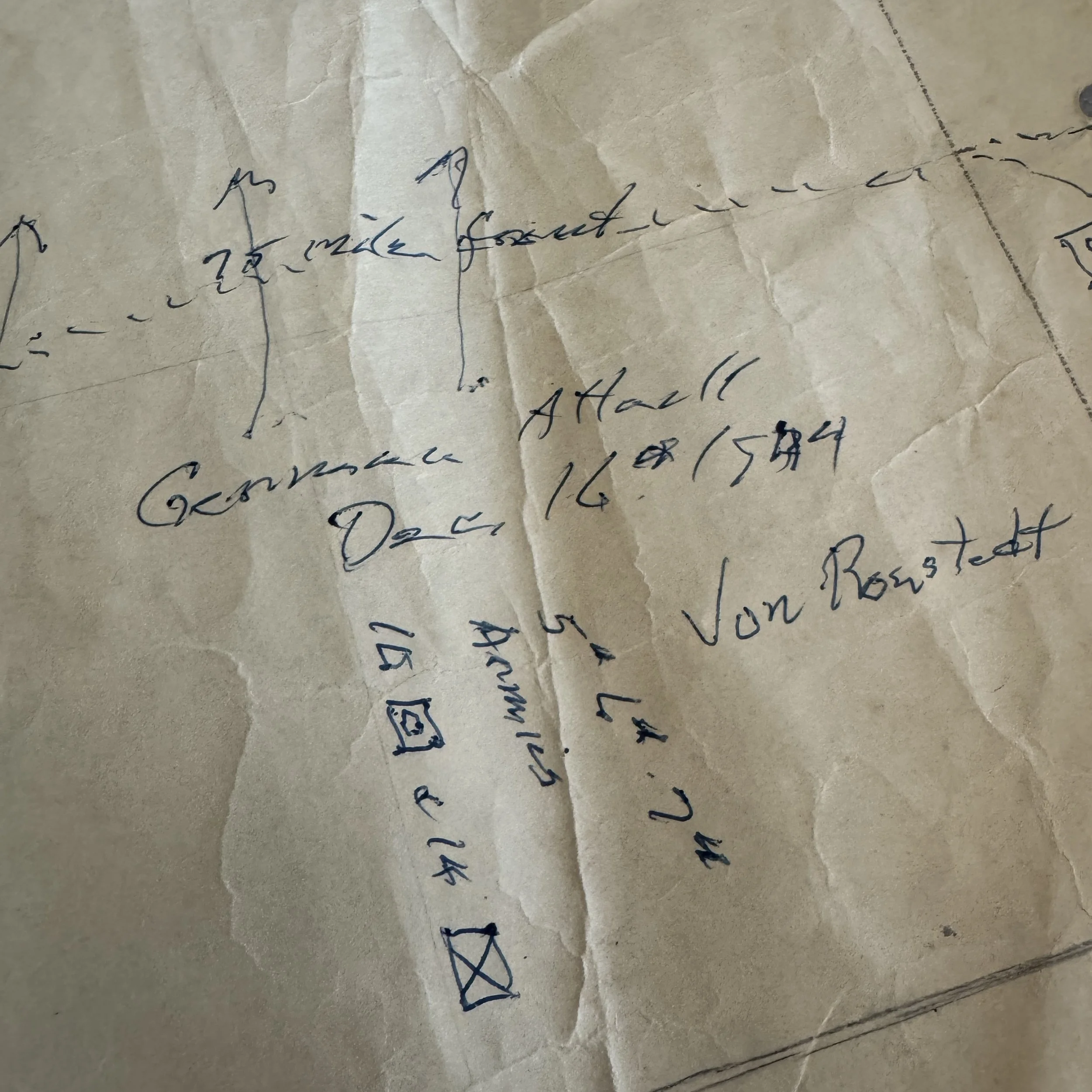
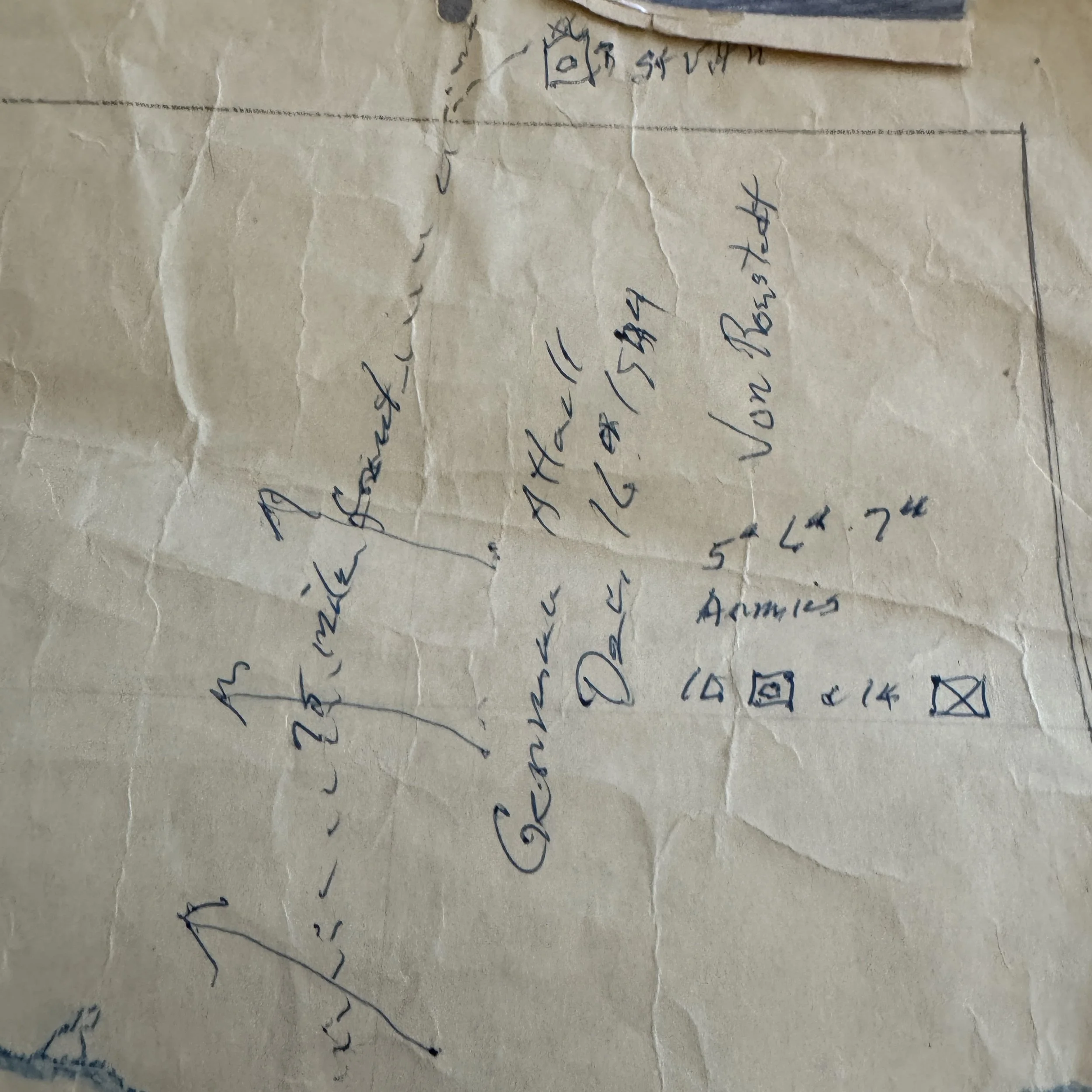
Scripted Intelligence Notes: The distinct handwriting tracing enemy corridors—annotated in German-style script as "Von Rundstedt" and "German Attack Dec 16th 1944"—highlights how intelligence staff plotted the direction and scale of enemy armor thrusts as frontline reports poured into headquarters.
Battle Operations: December 17, 1944 (2300 Hours)
The Race to Bastogne (CCB): Highlighted along the top-left road axis toward Bastogne (XXX / VIII), Combat Command B detached three armored task forces—Teams Desobry, Cherry, and O'Hara—to establish forward defensive screens east of the strategic crossroads. By arriving on the night of December 17–18, CCB delayed the advancing 2nd Panzer and 26th Volksgrenadier Divisions just long enough for the 101st Airborne Division to enter and fortify Bastogne.
Securing the Southern Shoulder (CCA): To the east, Combat Command A (CCA 2300 17 Dec 44) was deployed near Echternach alongside the 4th Infantry Division (XX / 4). Their stand prevented the German 7th Army from expanding the breach southward toward Luxembourg City, anchoring the southern pivot point of the entire Allied counteroffensive.
Reserve Command Staging (CCR): Positioned near Merle southwest of Luxembourg City, Colonel Gatchell’s Reserve Command (CCR / Res 17 DEC 44 2300) served as the mobile strategic reserve, ready to counter enemy breakthroughs or reinforce struggling frontline sectors along the Sure and Alzette Rivers.
Hand-drawn operational situation maps created in the field during active combat are among the rarest surviving paper artifacts of World War II. Most field overlay maps were routinely erased, redrawn, discarded, or destroyed to prevent vital intelligence from falling into enemy hands during rapid shifts in the front line.
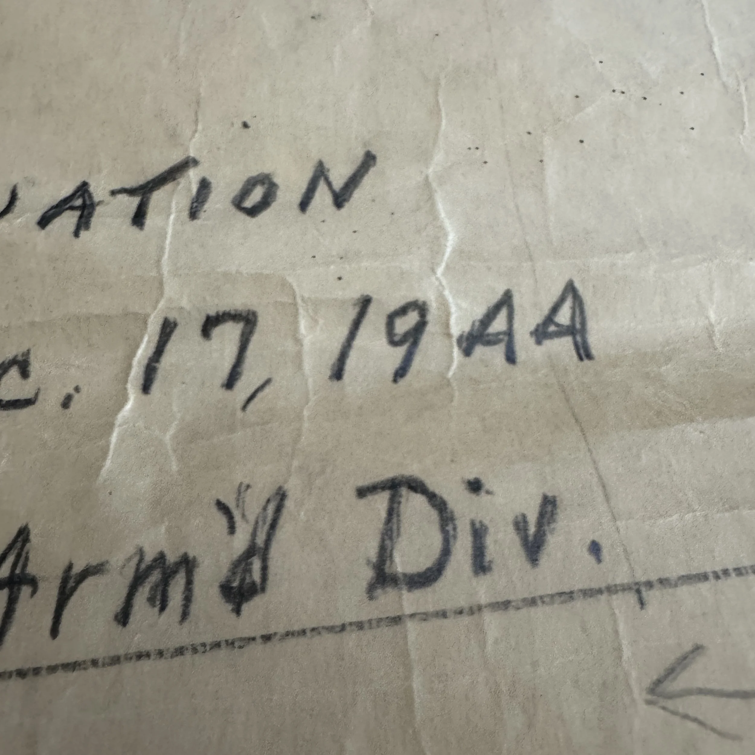
Because this map captures the exact operational picture at 2300 hours on December 17, 1944, the specific hours that decided the fate of Bastogne and the southern shoulder, it stands as an extraordinary primary document. preserved in the personal collection of a key combat commander, it provides a direct, unedited record of the quick decision-making, spatial logistics, and tactical clarity that halted the German assault in the Ardennes.