EXTREMELY RARE! WWII DECEMBER 23rd, 1944 Battle of the Bulge Bastogne Field Printed Day-By-Day Combat Situation Map (Colonel Wade C. Gatchell - 10th Armored Division)


EXTREMELY RARE! WWII DECEMBER 23rd, 1944 Battle of the Bulge Bastogne Field Printed Day-By-Day Combat Situation Map (Colonel Wade C. Gatchell - 10th Armored Division)
Comes with a hand-signed C.O.A.
Size: 18 × 20 inches
Rarity: EXTREMELY RARE
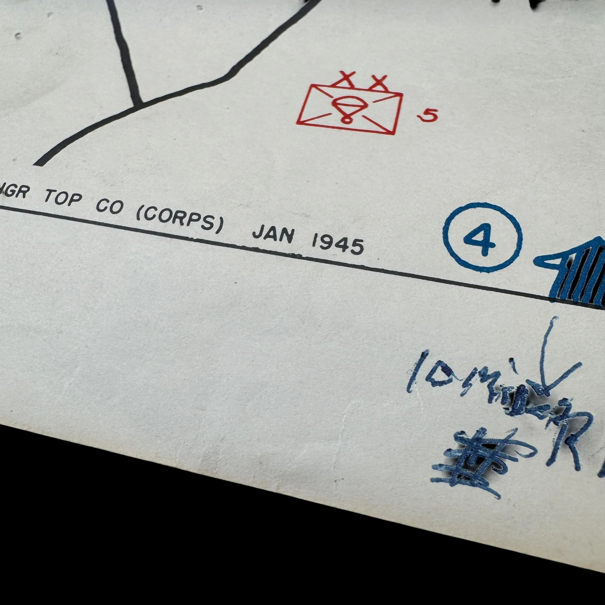
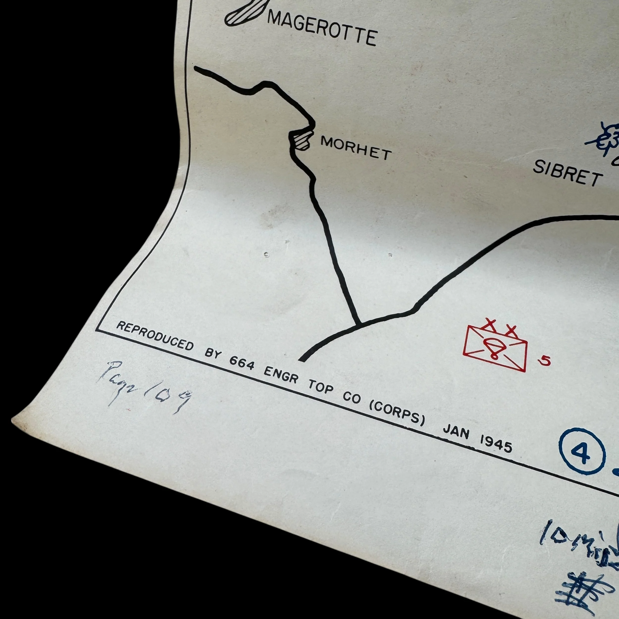
Dated: January 1945 - ETO Field Printed Only Within 5 Weeks Following the Battle of Bastogne
Created: 664th Engineer Topographic Corps, a unit attached to General George S. Patton’s Third Army
Providence: From the direct collection of Colonel Wade C. Gatchell, who served as the Commanding Officer of the Reserve Command, 10th Armored Division (the famed “Tiger Division”)
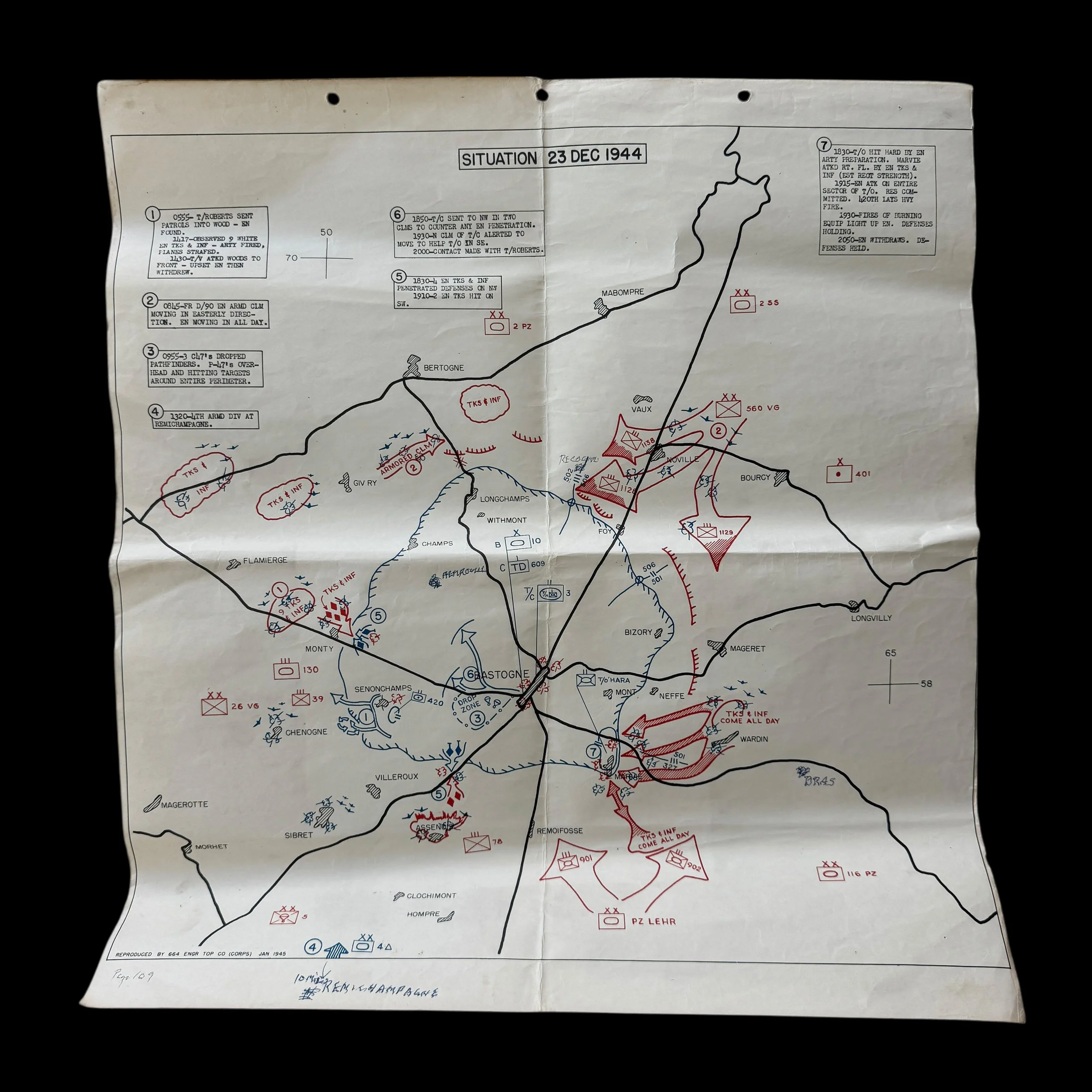
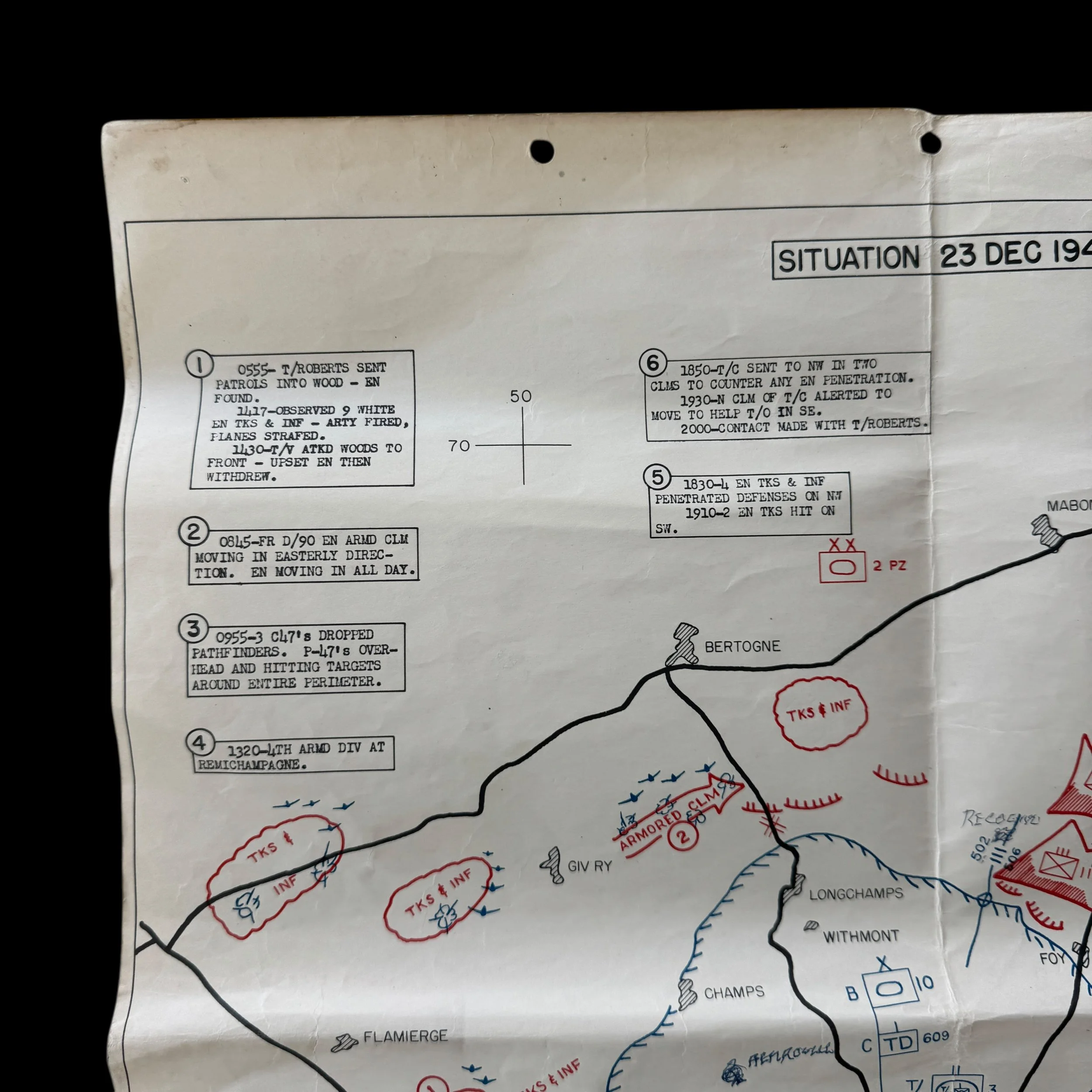
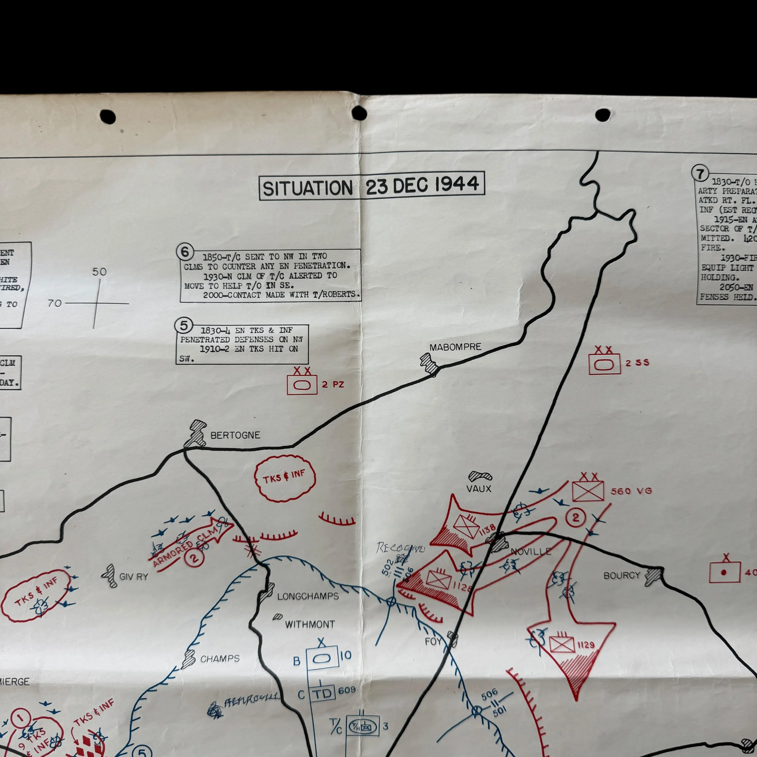
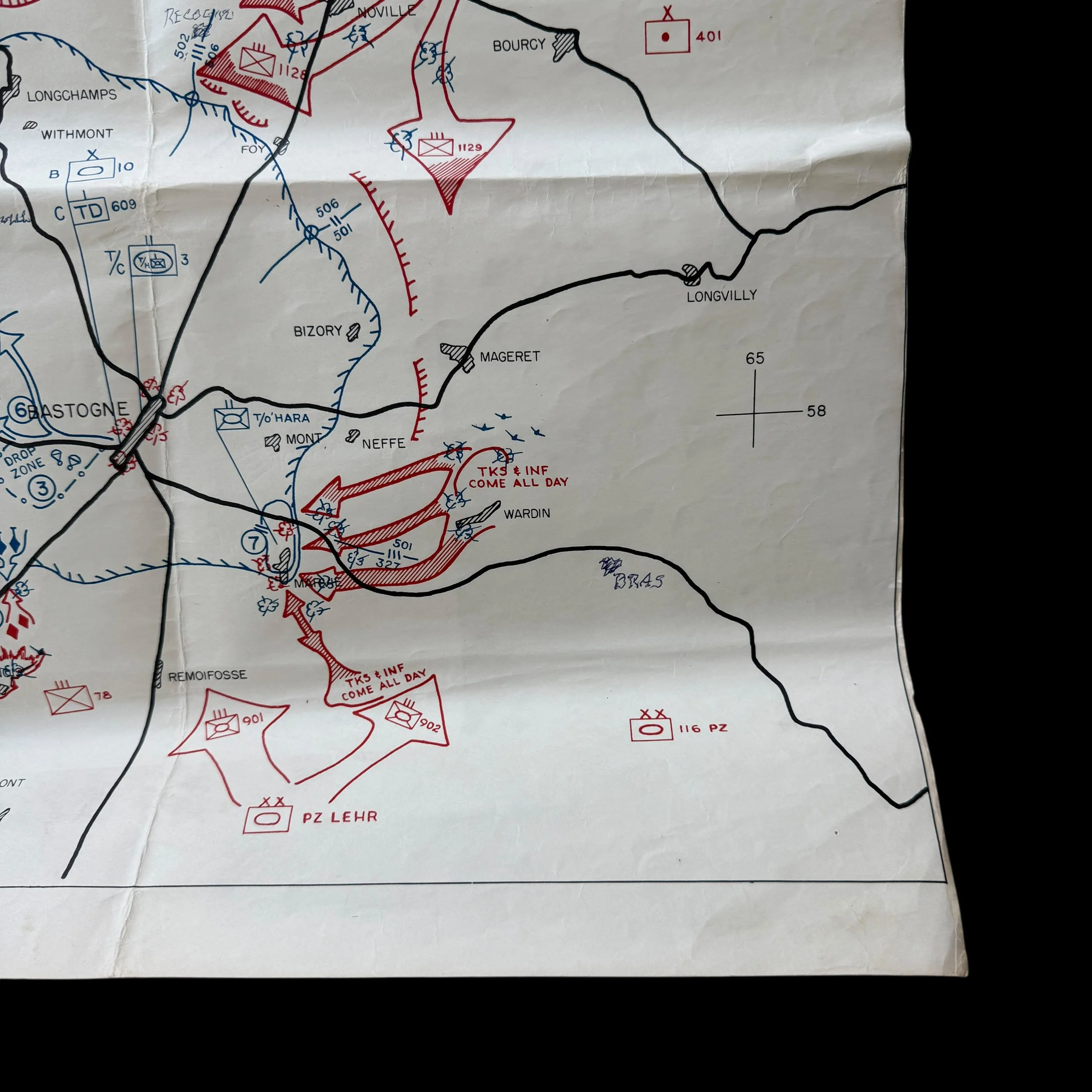
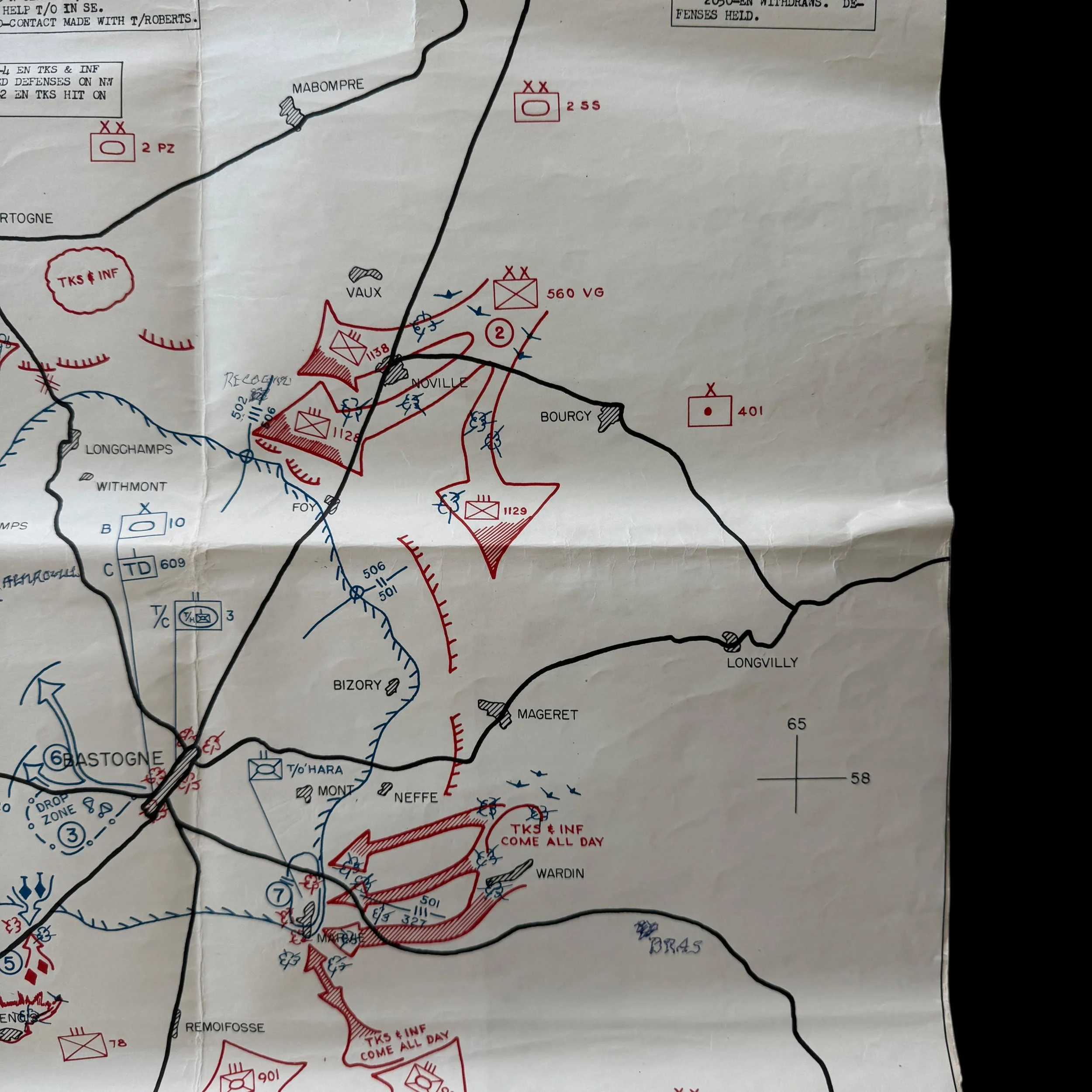
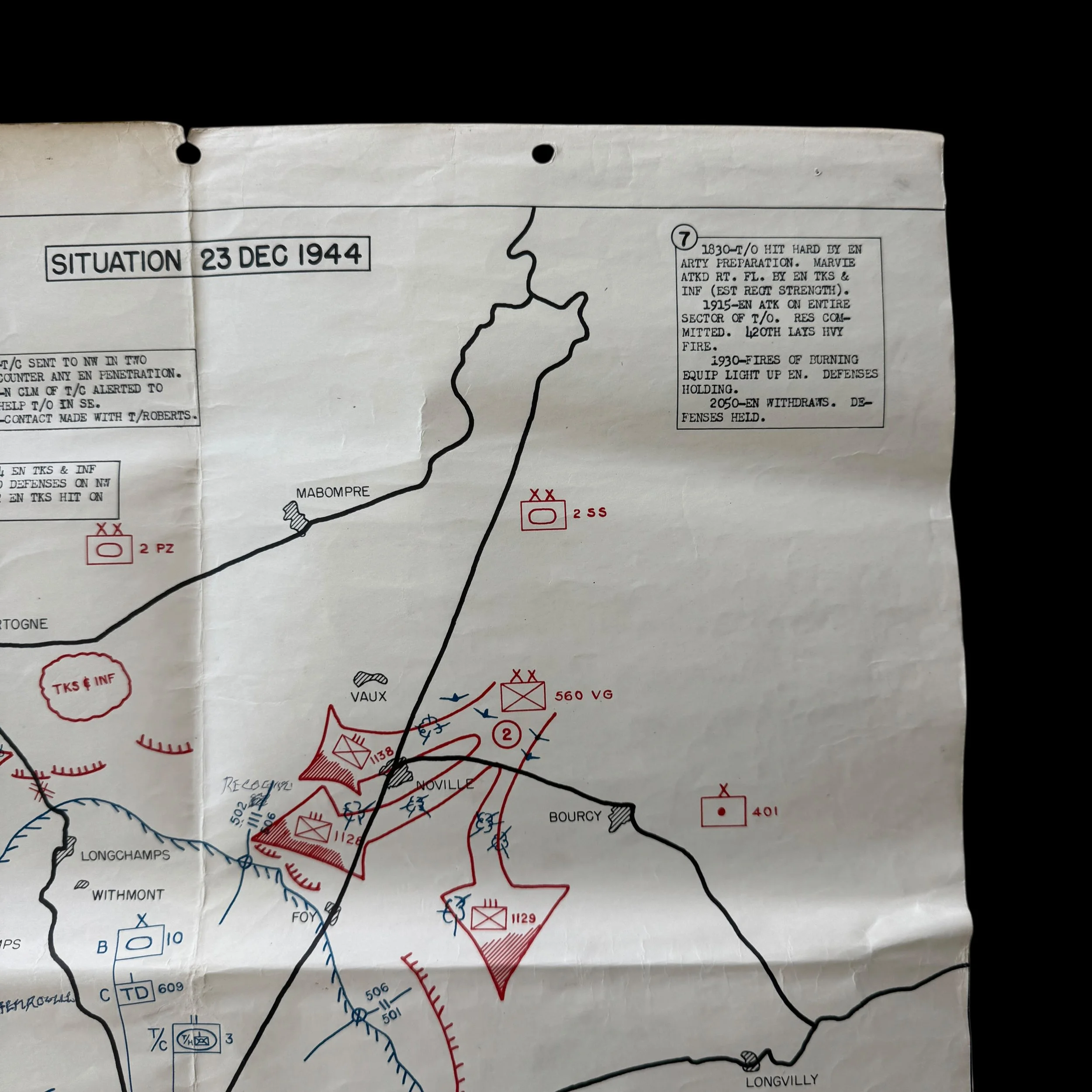
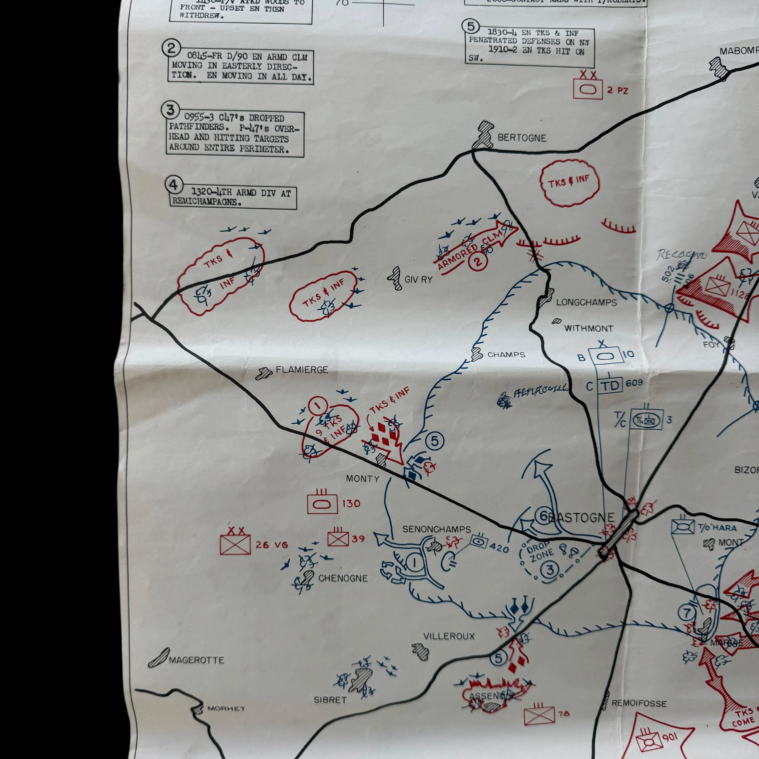
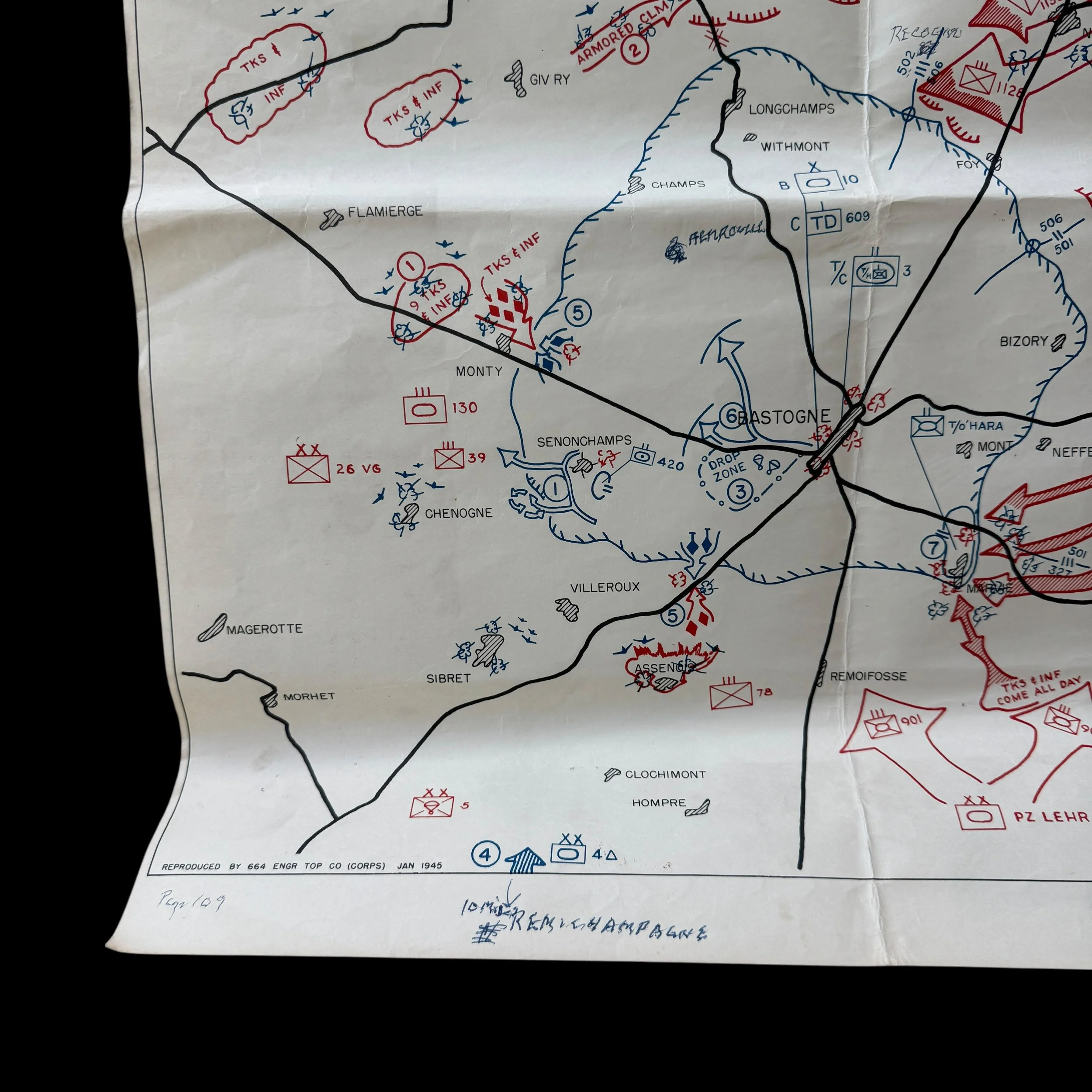
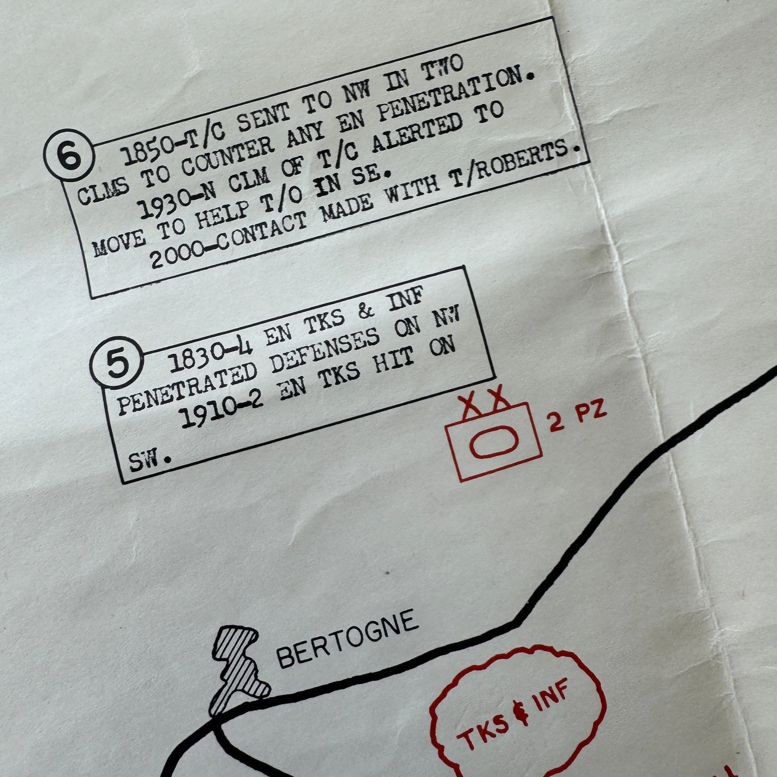
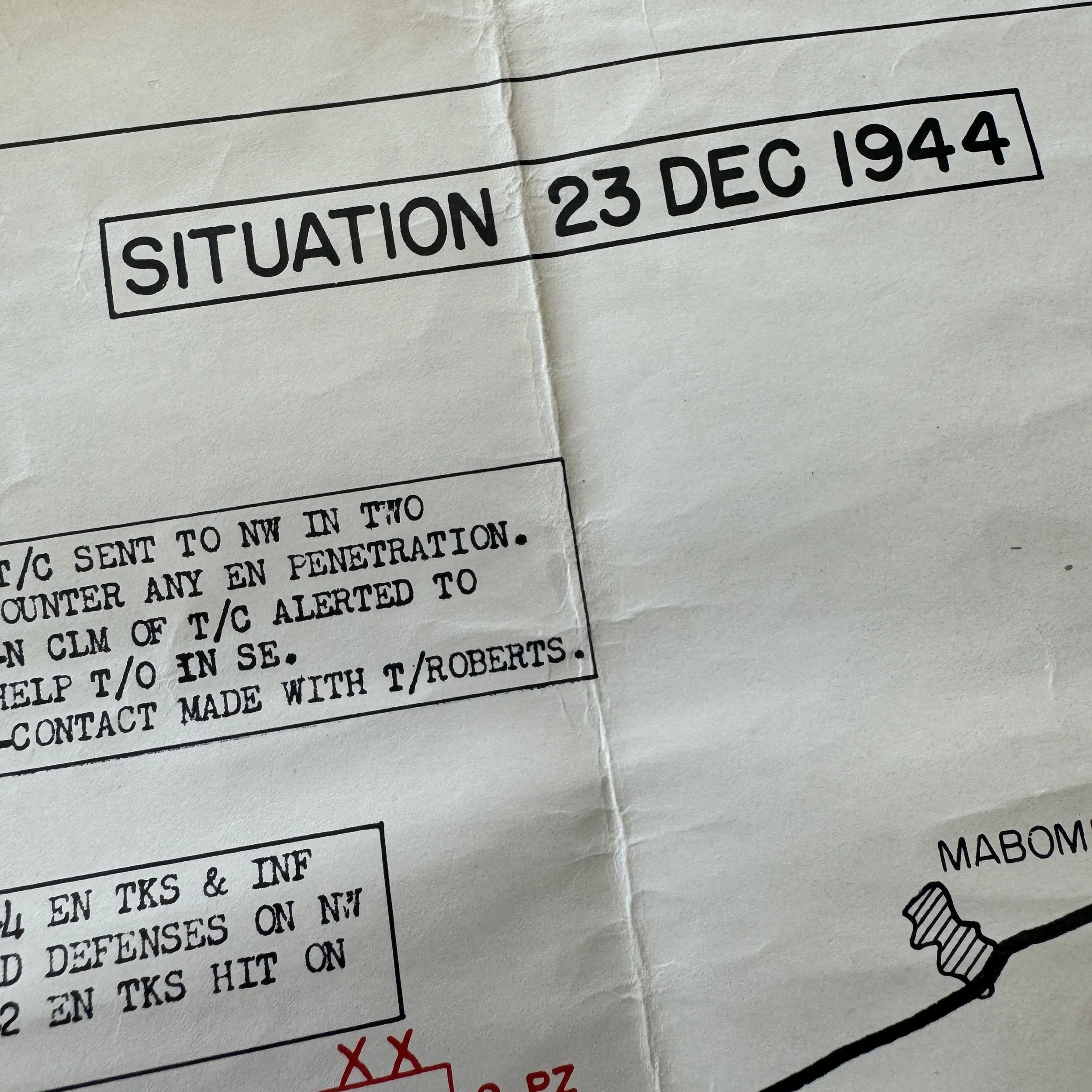
December 23rd, 1944
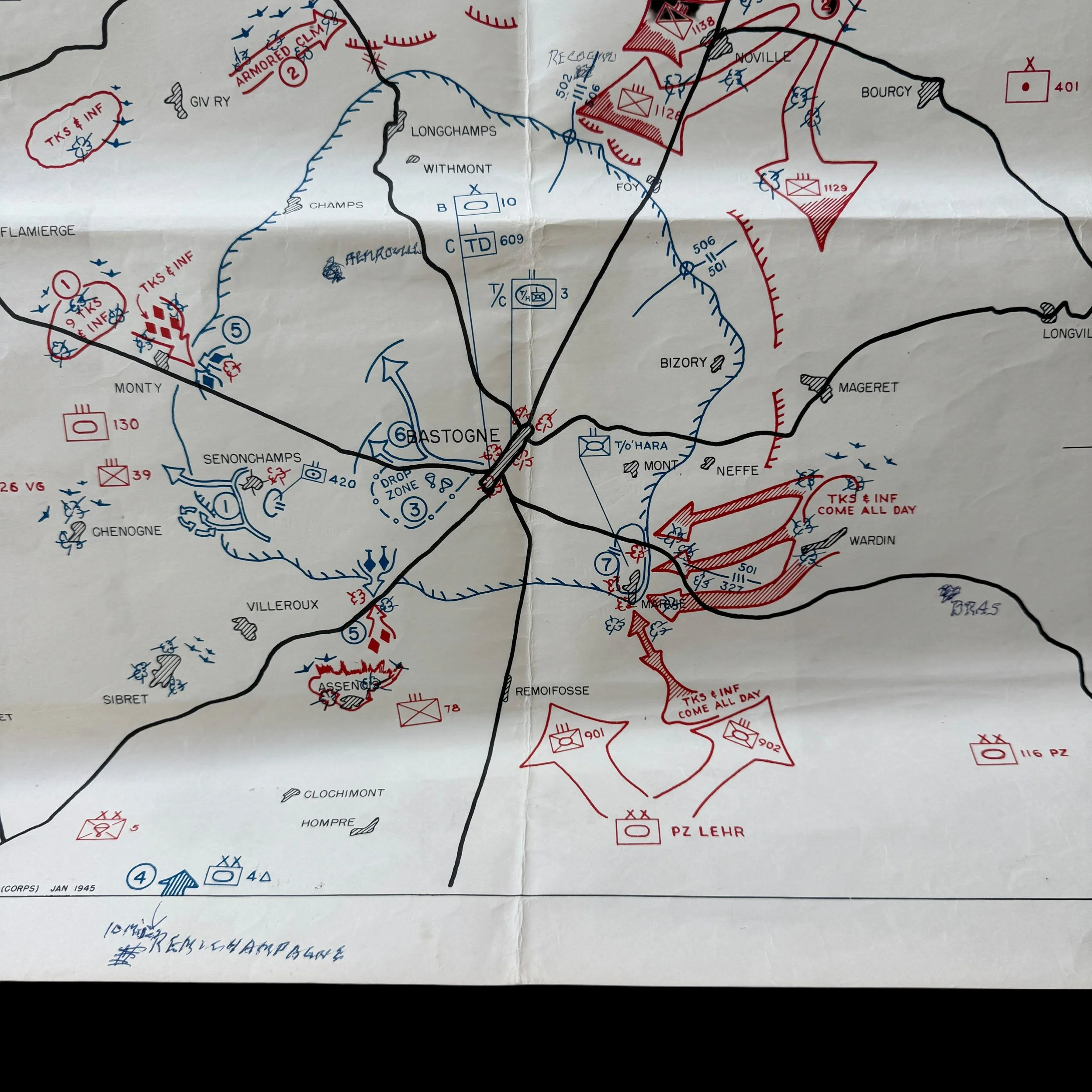
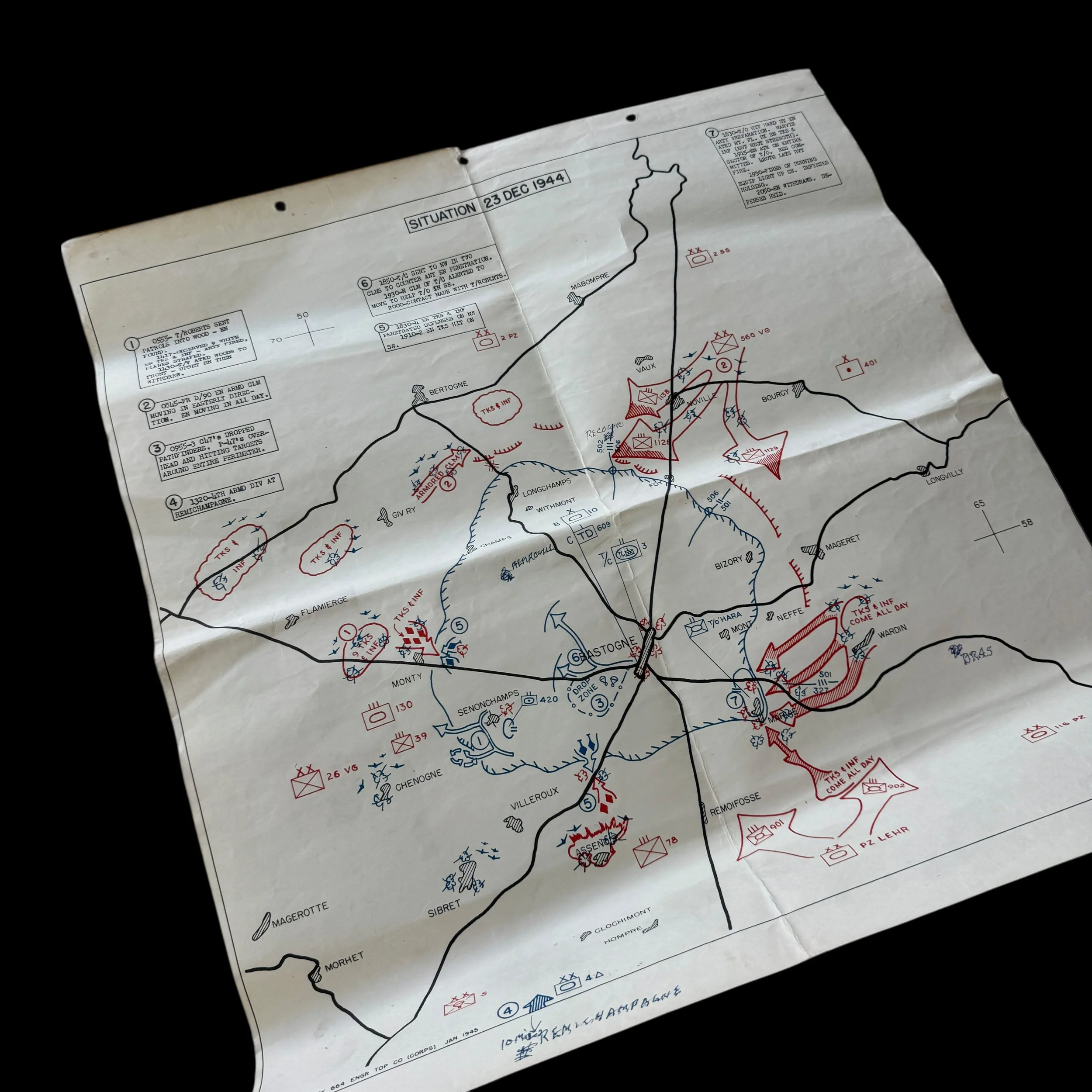
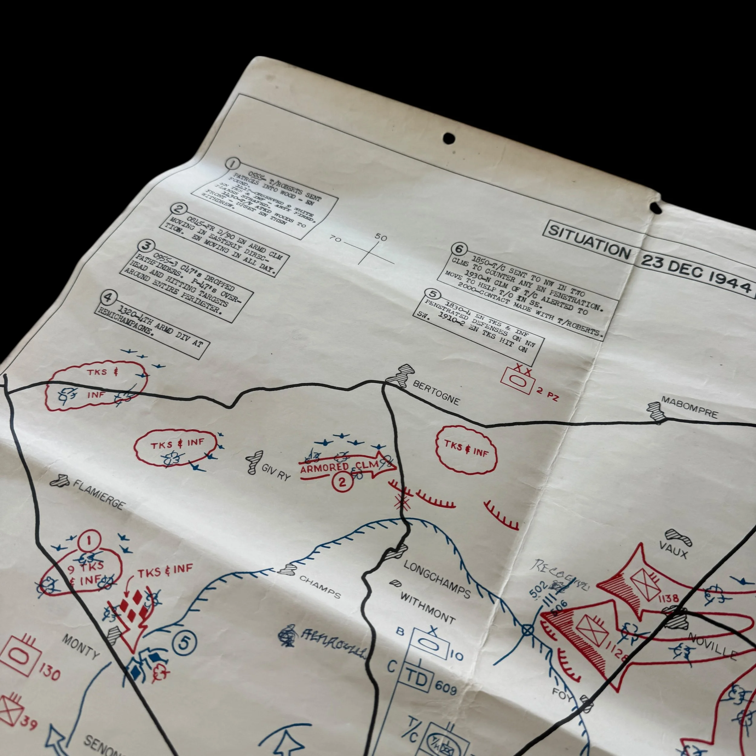
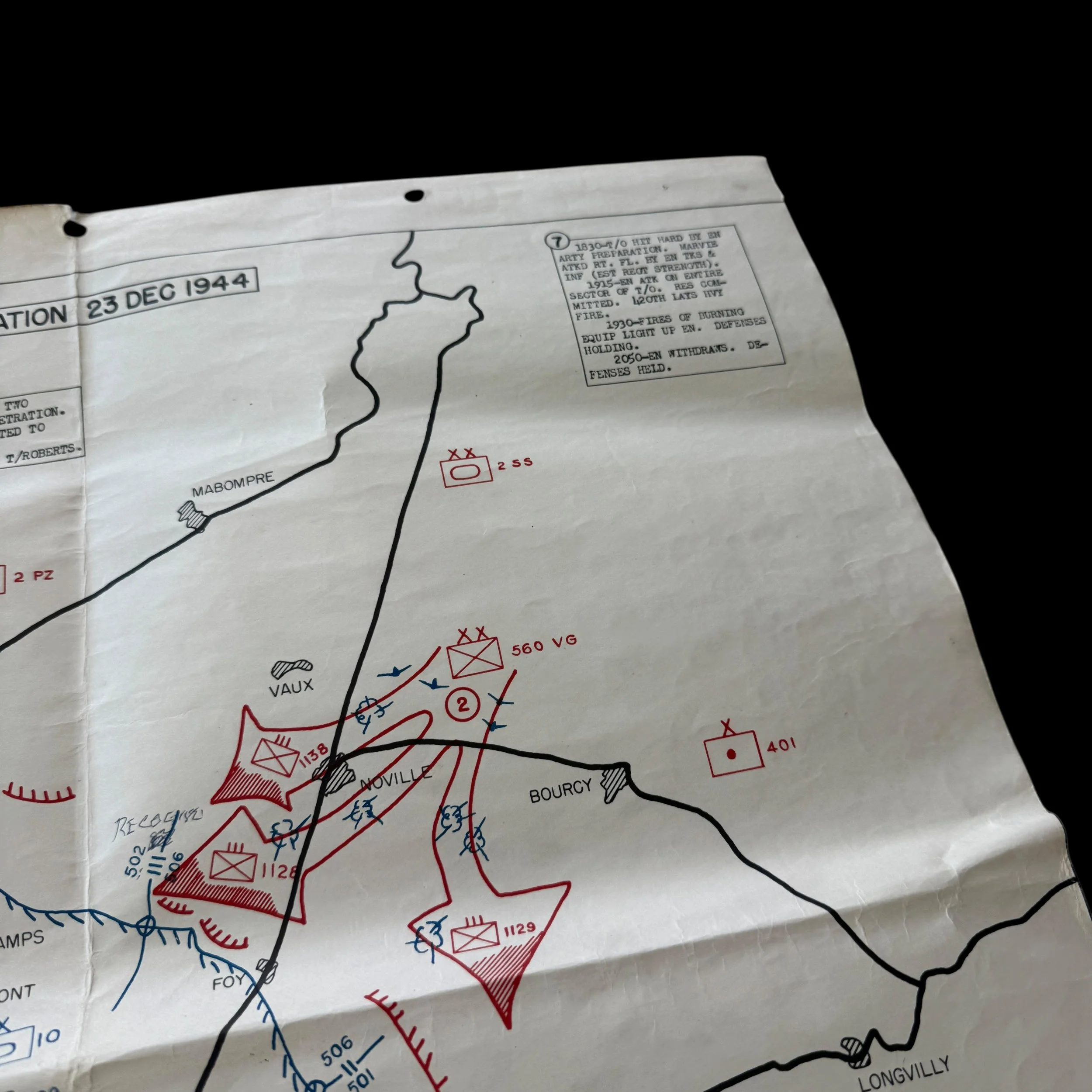
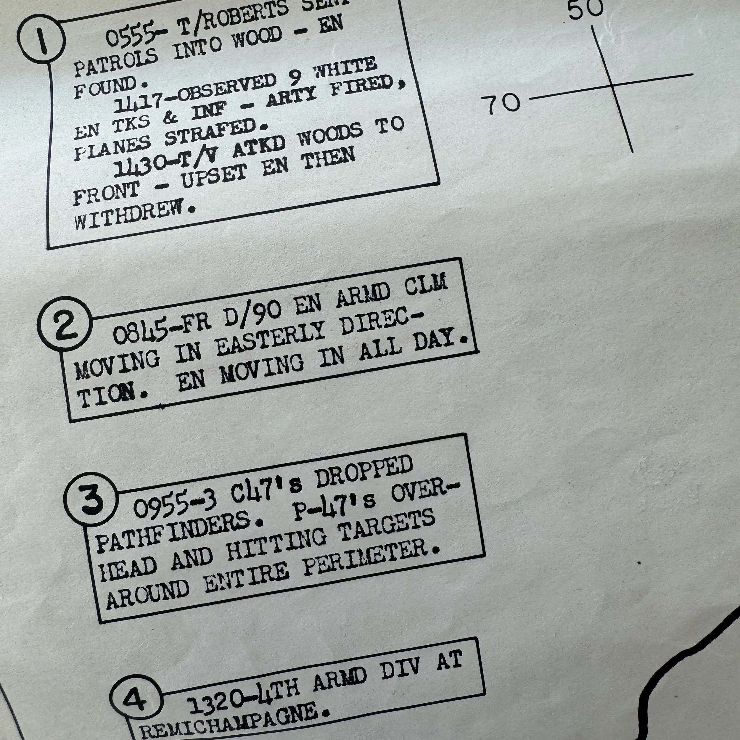
On December 23rd, 1944, a break in the weather finally brought a glimmer of hope to the besieged defenders of Bastogne. For the first time in days, the dense fog lifted and the skies cleared enough for Allied aircraft to take flight. C-47 transport planes from the IX Troop Carrier Command roared overhead, dropping desperately needed supplies—ammunition, food, medical equipment, and even Christmas mail—by parachute into the surrounded town. The soldiers of the 101st Airborne Division and the 10th Armored Division watched with relief as crates floated down across the snow-covered fields. Meanwhile, P-47 Thunderbolts of the 9th Air Force swept in to attack German tanks and artillery positions around Bastogne, breaking up several assaults and lifting the defenders’ spirits. On the ground, fierce fighting continued as German forces from the 26th Volksgrenadier Division and 15th Panzergrenadier Division pressed their attacks, particularly along the northern and eastern sectors. Despite exhaustion and mounting casualties, the Americans held their lines. December 23rd marked the beginning of a crucial shift in the Battle of Bastogne—the moment when Allied air power reconnected the isolated defenders with the larger war effort and reminded them that help was finally on the way.
This exceptionally rare and museum-grade World War II artifact is an original January 1945 Battle of the Bulge day-by-day combat situation map, printed by the 664th Engineer Topographic Corps, a unit attached to General George S. Patton’s Third Army. Created within weeks following the Battle of Bastogne, this field printed combat situation map represent an extraordinary feat of wartime cartography. To compile, design, and print such a detailed document amid the chaos of the Ardennes campaign demonstrates the precision and urgency of Patton’s engineers. Only a small batch of these Battle of the Bulge (Bastogne) situations maps were ever made, and even fewer have survived. They were printed in-theater in limited numbers for the highest-ranking commanders overseeing major infantry and armored divisions during one of the most pivotal engagements of the war.
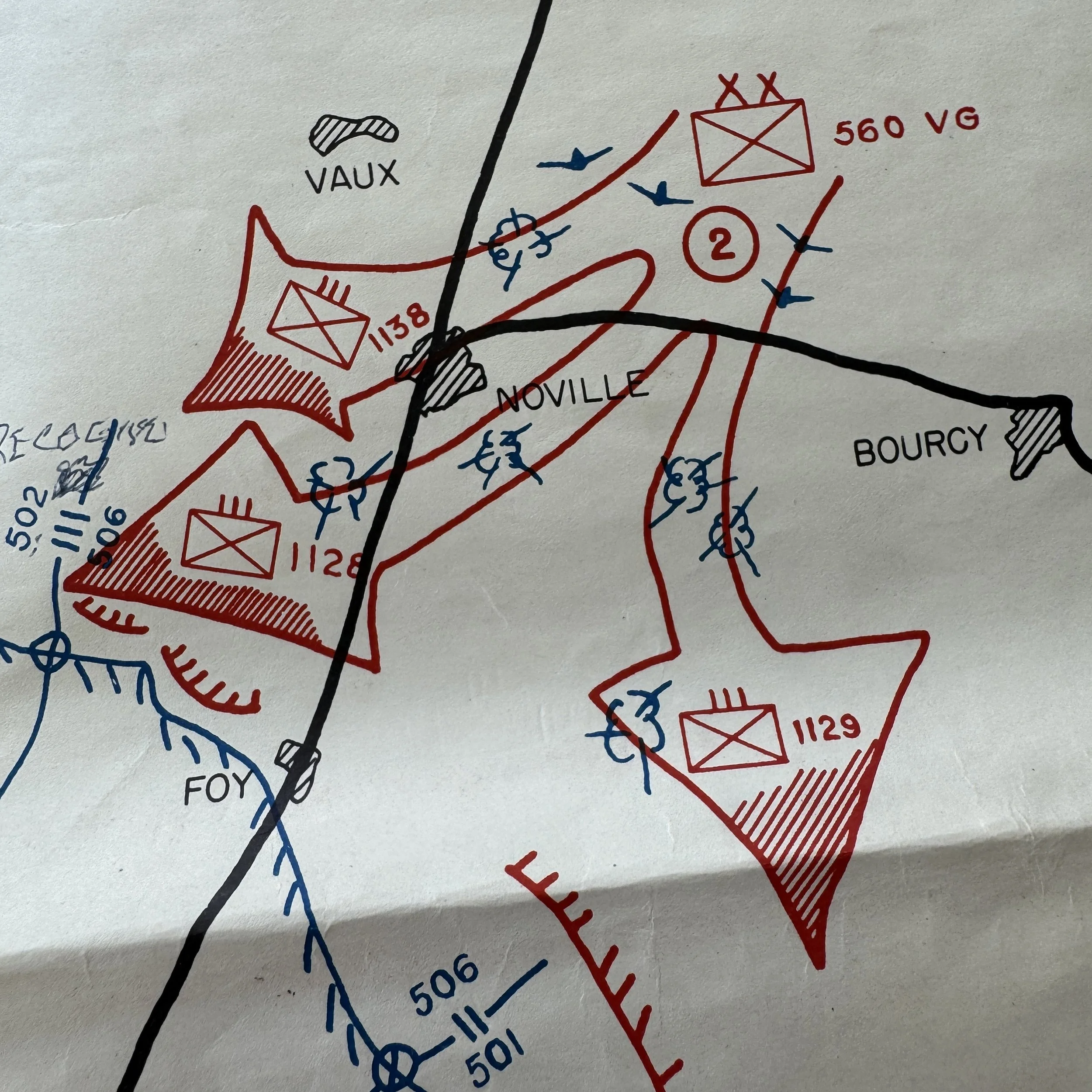
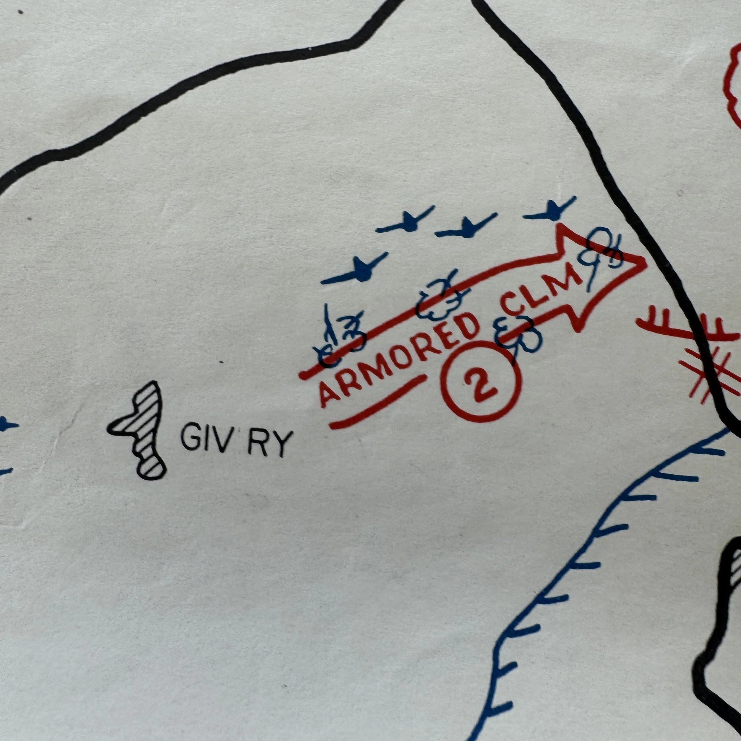
Meant to accompany the SECRET military intelligence Battle of the Bulge battle reports, this map itself captures the fierce day-by-day progression of the Battle of Bastogne, showcasing troop movements, front-line shifts, and critical engagements as they unfolded in the bitter winter of 1944–1945. Its intricate blend of technical military detail and battlefield illustration makes it one of the finest surviving examples of U.S. Army cartographic intelligence from the European Theater.
What elevates this particular map above all others is its direct provenance from the personal collection of Colonel Wade C. Gatchell, who served as the Commanding Officer of the Reserve Command, 10th Armored Division—the famed “Tiger Division.” The 10th Armored Division was resting south of Luxembourg when, on December 16, 1944, Germany launched the Ardennes Offensive. Within hours, the division was ordered north to reinforce the besieged crossroads town of Bastogne, a move that would cement its place in history.
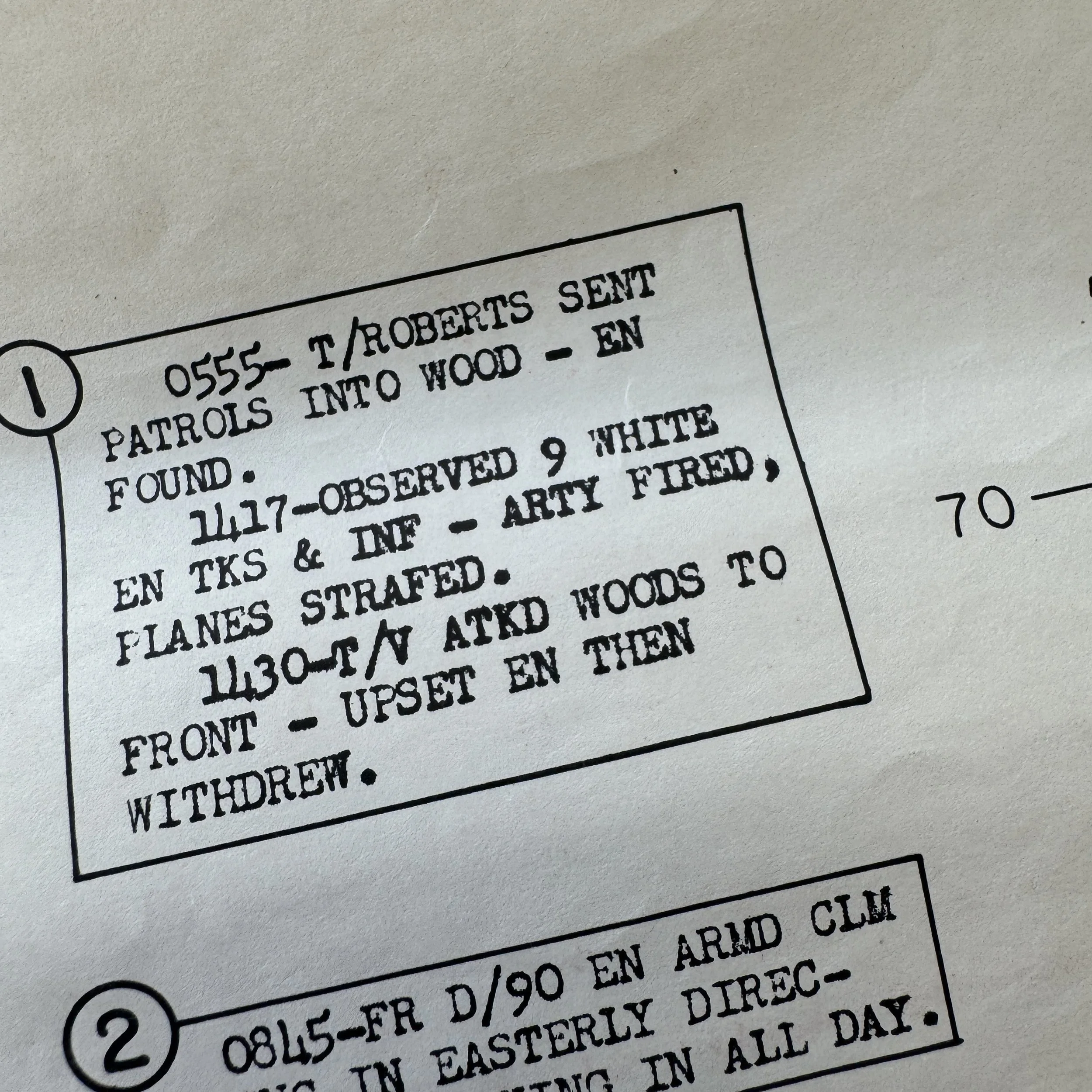
The 10th Armored’s Combat Command B (CCB) was among the first American units to reach Bastogne. Under Colonel William L. Roberts, its tanks, tank destroyers, and infantry elements rushed into the surrounding villages of Noville, Longvilly, and Neffe, where they met the full weight of the advancing German panzer divisions. For days, they fought a desperate delaying action, buying the time needed for the 101st Airborne Division to arrive and establish a full defensive perimeter. The 10th Armored’s stand at these outlying positions, often overlooked in popular retellings, was instrumental in halting the German spearhead and ensuring Bastogne remained in American hands until Patton’s relief forces broke through.
Colonel Gatchell’s command played a key role in coordinating the division’s reserves and maintaining communication lines between the various combat commands, ensuring the division could sustain its defense under constant attack. This map, once in his possession, likely served as both a reference and a historical record of those intense operations.
In every sense, this artifact embodies the courage, precision, and resilience of the American armored forces during one of the most defining battles of World War II. It is not only a testament to the engineering skill of the 664th Topographic Corps but also a tangible link to the 10th Armored Division’s pivotal role in the defense of Bastogne, a moment when ordinary soldiers and officers alike became legends in the snows of the Ardennes.