Okinawa Shima 3D Topographical Map of Submarine Operating Area


Okinawa Shima 3D Topographical Map of Submarine Operating Area
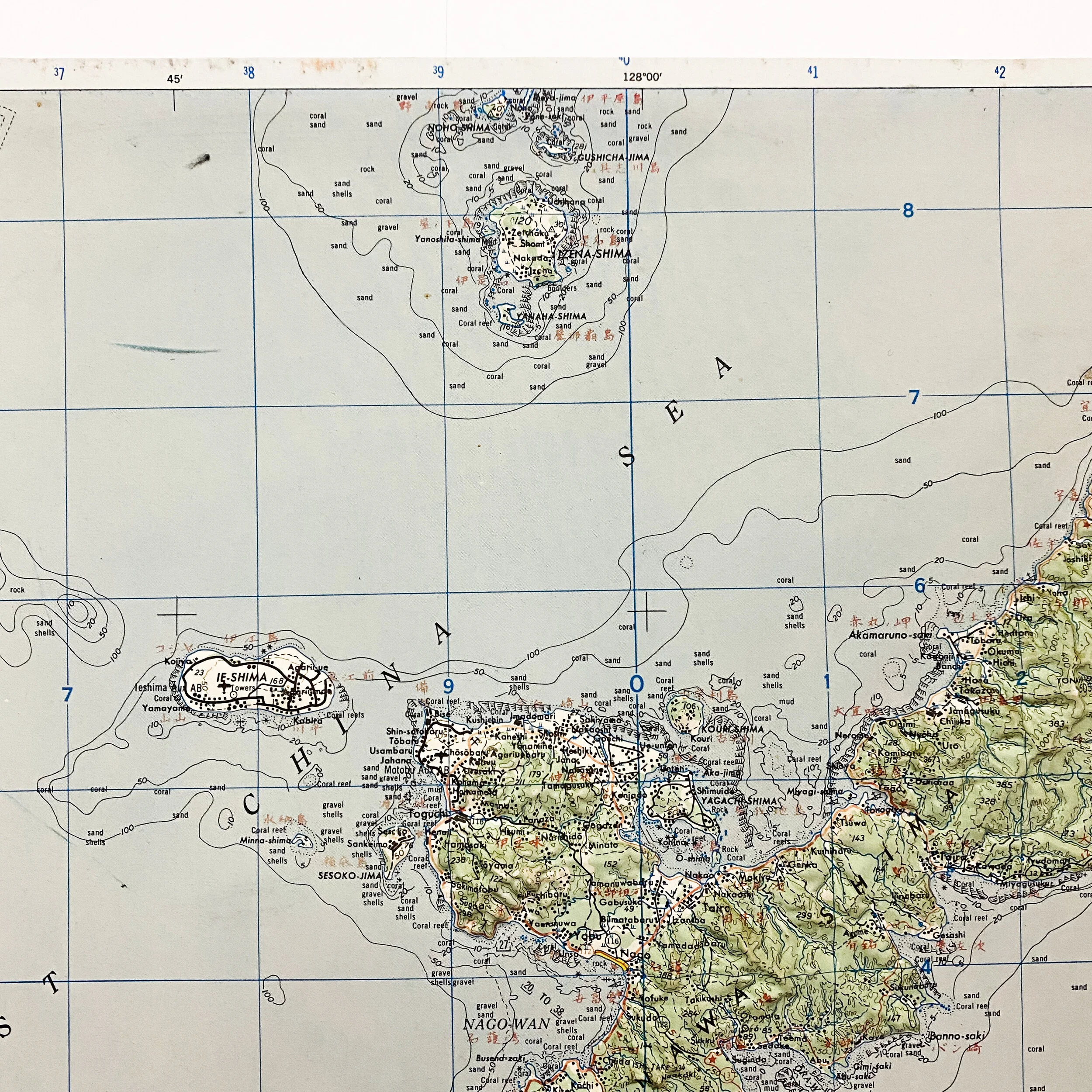
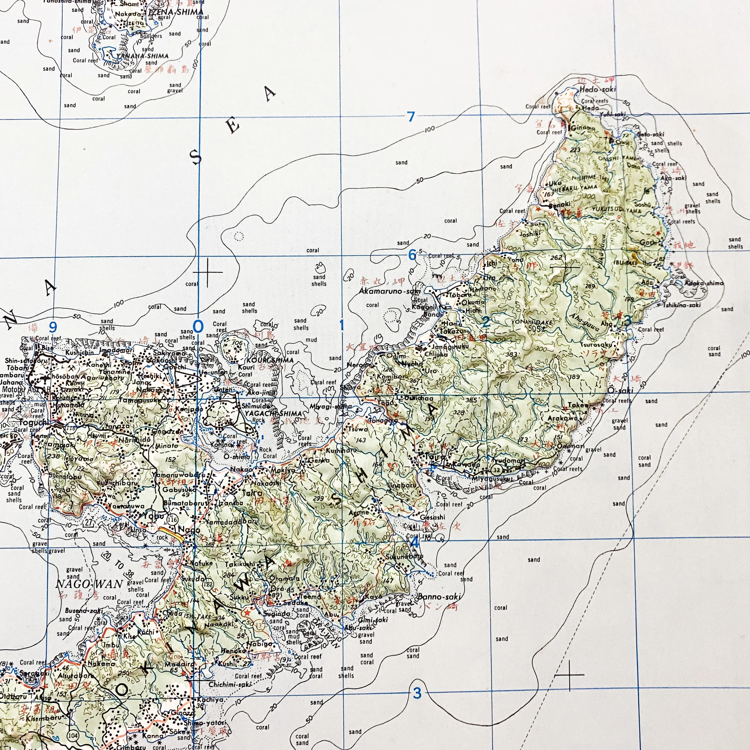
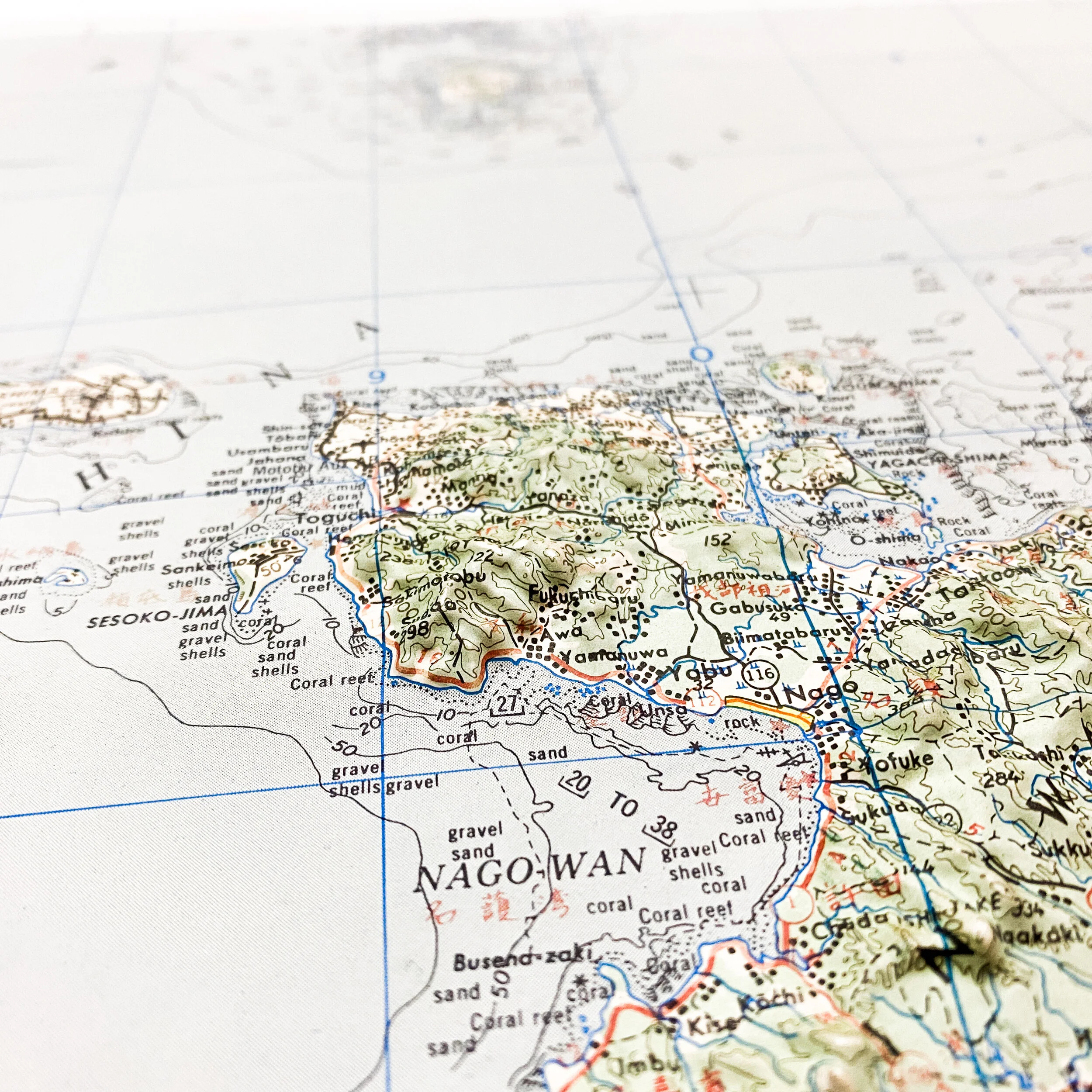
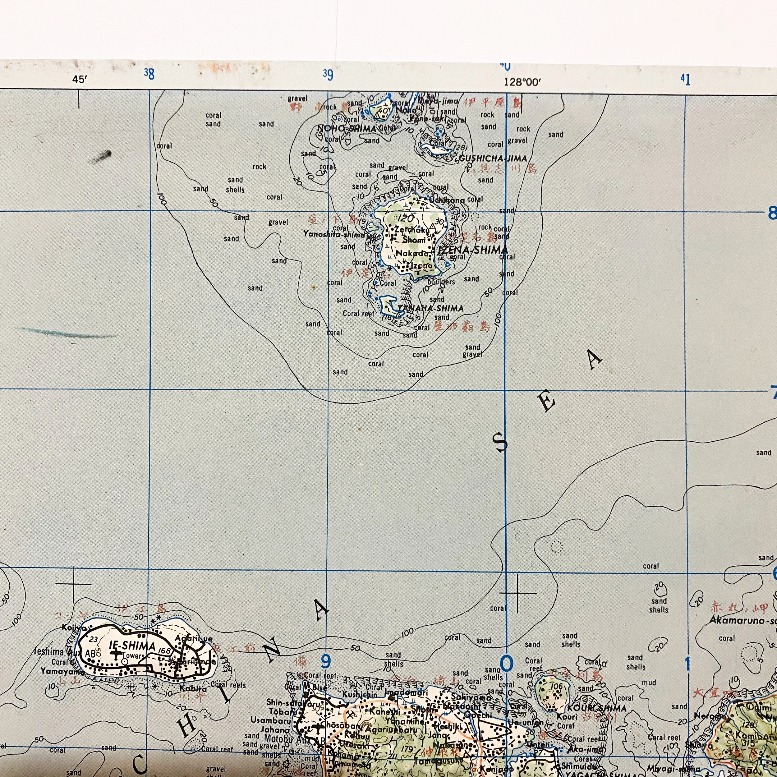
This original World War II 3-D topographical map of the Japanese occupied island of Okinawa shows locations of Japanese airfields, as well as various other positions on the island. This 3-D map appears to be one used in U.S. naval operations as it shows the shoreline of the island with the sections marked ‘areas outlined have been swept (1945) to death in fee indicated’ as well as ‘Submarine operating areas and Anti…’. This map appears to make been cut at some point and it is undetermined if the cuts were done during the war to make the map more manageable or post war as a bring back of a soldier. Areas in the mapper also marked with Japanese characters and kanji, making it one of the most interesting and unique maps in the collection. It is believed that this map would've been used by a naval ship or LST ship.
Invasion of Okinawa:
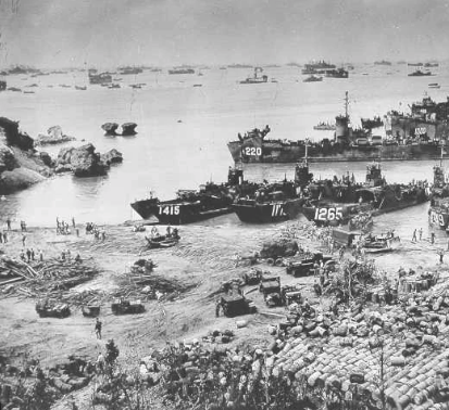
The Battle of Okinawa (Japanese: 沖縄戦, Hepburn: Okinawa-sen) (Okinawan: 沖縄戦, romanized: Uchinaa ikusa), codenamed Operation Iceberg, was a major battle of the Pacific War fought on the island of Okinawa by United States Marine and Army forces against the Imperial Japanese Army. The initial invasion of Okinawa on April 1, 1945, was the largest amphibious assault in the Pacific Theater of World War II. The 82-day battle lasted from April 1 until June 22, 1945. After a long campaign of island hopping, the Allies were planning to use Kadena Air Base on the large island of Okinawa as a base for Operation Downfall, the planned invasion of the Japanese home islands, 340 mi (550 km) away.The United States created the Tenth Army, a cross-branch force consisting of the 7th, 27th, 77th, and 96th infantry divisions of the US Army with the 1st, 2nd, and 6th divisions of the Marine Corps, to fight on the island. The Tenth was unique in that it had its own tactical air force (joint Army-Marine command), and was also supported by combined naval and amphibious forces.The battle has been referred to as the "typhoon of steel" in English, and tetsu no ame ("rain of steel") or tetsu no bōfū ("violent wind of steel") in Japanese. The nicknames refer to the ferocity of the fighting, the intensity of Japanese kamikaze attacks, and the sheer numbers of Allied ships and armored vehicles that assaulted the island. The battle was one of the bloodiest in the Pacific, with approximately 160,000 casualties on both sides: at least 75,000 Allied and 84,166–117,000 Japanese, including drafted Okinawans wearing Japanese uniforms. 149,425 Okinawans were killed, committed suicide or went missing, a significant proportion of the estimated pre-war 300,000 local population. In the naval operations surrounding the battle, both sides lost considerable numbers of ships and aircraft, including the Japanese battleship Yamato. After the battle, Okinawa provided a fleet anchorage, troop staging areas, and airfields in proximity to Japan in preparation for a planned invasion.